← Misc · March 2022
Death Valley, Vegas & Page
Horseshoe Bend at sunrise, Antelope Canyon at noon, and three clocks that never agreed.
Los Angeles ✈ Las Vegas → Pahrump → Death Valley → Las Vegas → Page, Arizona → Las Vegas ✈ Los Angeles
Roughly 1,100 miles by rental car · 4 states, plus the Navajo Nation · from 282 feet below sea level to the top of an 1,149-foot tower · one switch to daylight saving time, and two neighbors that disagree about it
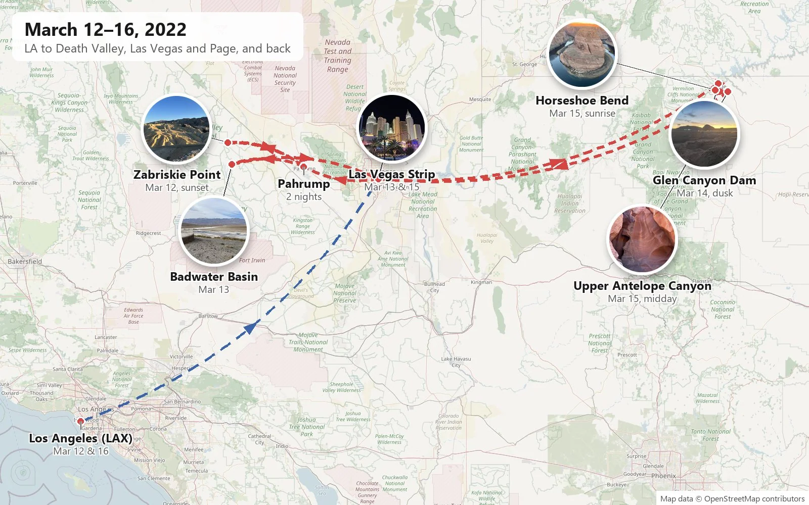
This was a short trip with a lot of geology in it. In five days in March 2022 we flew from Los Angeles to Las Vegas, picked up a rental car, and drove it to two of the most photographed landscapes in the American Southwest and back. I didn't have a driver's license yet, so a friend did all of the driving, and I did the looking out of the window. The first was Death Valley, the lowest, driest and hottest national park in the country, which in March is merely warm. The second was Page, Arizona, a small town on the edge of Lake Powell, which sits within a short drive of Horseshoe Bend and Antelope Canyon. In between, and at both ends, was Las Vegas, which turns out to be a very convenient place to start a desert road trip and a very strange place to finish one.
As with the other trip posts here, everything below is rebuilt from the camera roll: where and when each photo was taken, lined up in order. That record has gaps, and where it is silent I have kept quiet too. It also holds one small puzzle, which turned out to be the most interesting thing in the metadata. Every phone photo is stamped with its offset from universal time, and on this trip those offsets jump around in a way that no single clock on the wall would. Daylight saving time began in the middle of the trip. And the trip ended up in the one corner of the country where a ten-minute drive can move you an hour forward or back. On the road to Page the phone's clock changed several times, and at the time it was genuinely confusing. More on that in Page.
Day 1: Death Valley at sunset
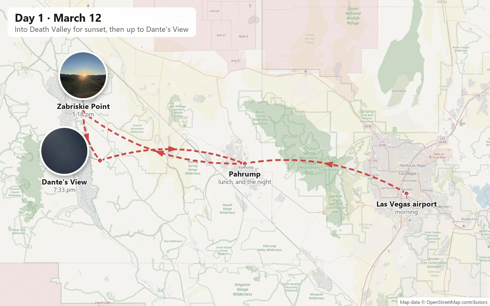
We landed in Las Vegas on the morning of Saturday, March 12th, and drove west over the Spring Mountains to Pahrump, a sprawling Nevada town of desert lots and wide roads that serves, among other things, as the closest real town to the eastern side of Death Valley. It was our base for the first night, at the Best Western Pahrump Oasis. Lunch, at 2:21 in the afternoon, was a bowl of curry and rice, and then we headed for the park.
Zabriskie Point
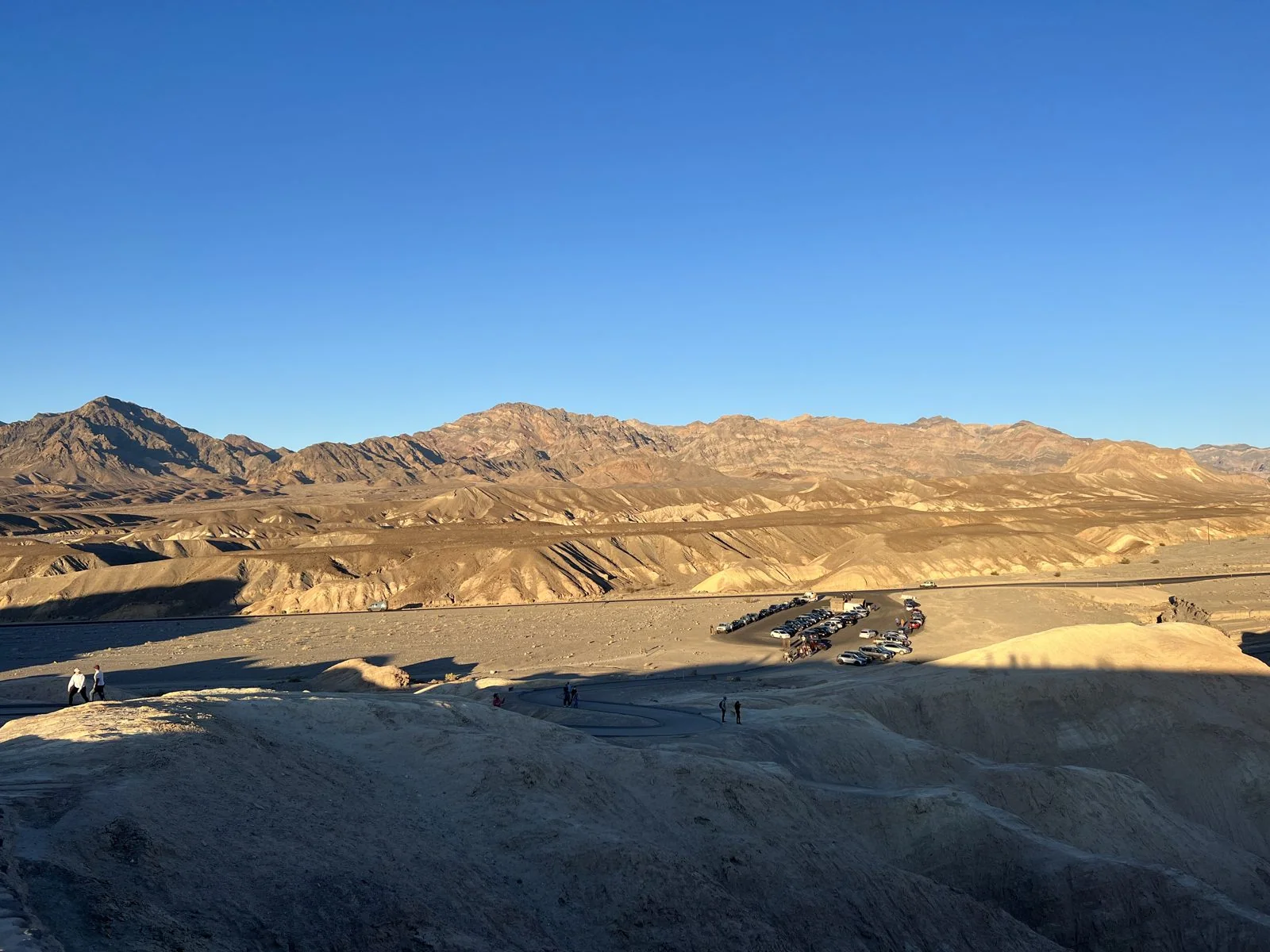
The road from Pahrump crosses into California and drops toward the valley, and the first stop on the way down, a little after five, was Zabriskie Point. A short paved walk leads up from the parking lot to a stone-walled overlook, and below it the ground falls away into badlands: a sea of bare, folded hills in pale gold and cream, without a plant on them, furrowed by gullies so regular they look combed. In the low evening sun every ridge had a bright side and a shadow side, and the whole landscape looked like crumpled paper.
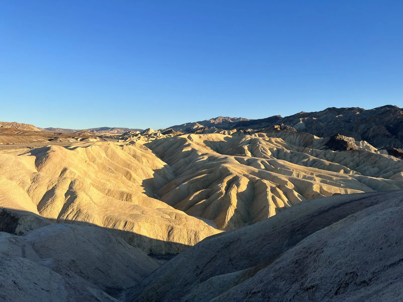
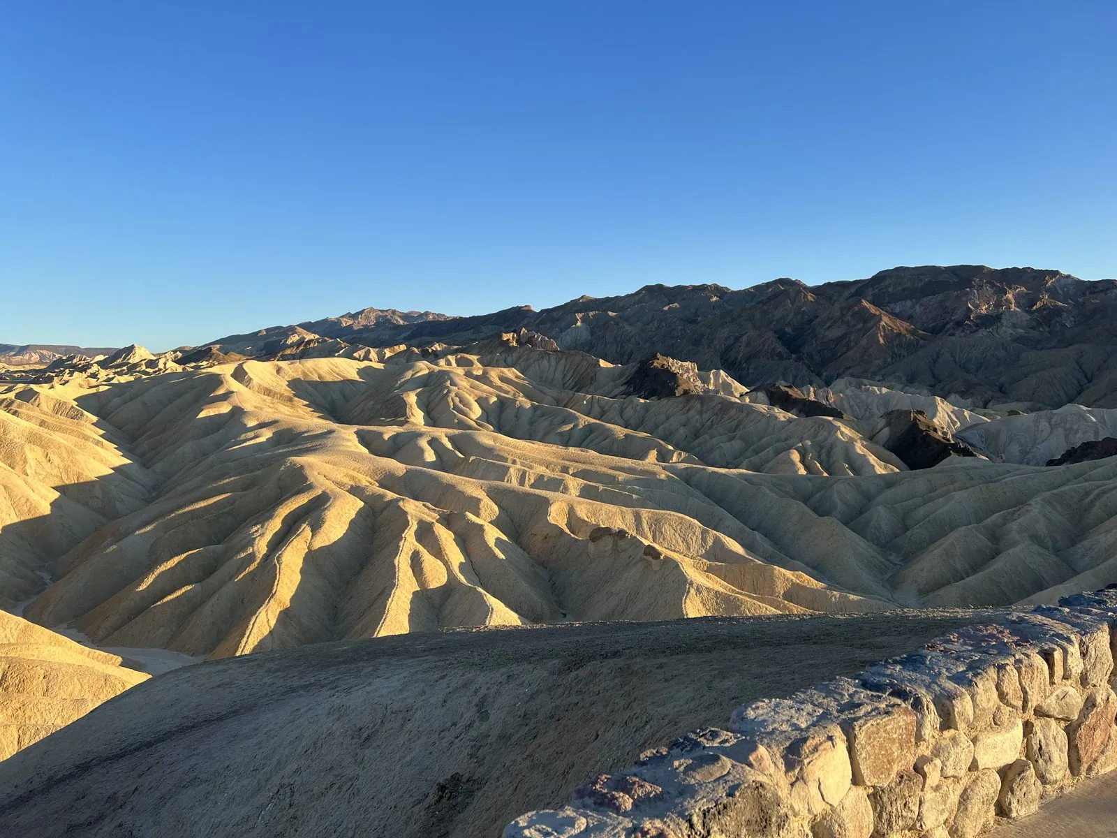
Those hills are old lake mud. A few million years ago this part of the valley held a lake, and the clay, silt and volcanic ash that settled on its bottom became the soft rock of what geologists call the Furnace Creek Formation. Then the land was tilted and lifted, the lake vanished, and the rare desert rain went to work on the rock. Because nothing grows here to hold it in place, every storm cuts the gullies a little deeper. The point itself is named after Christian Zabriskie, who ran the Pacific Coast Borax Company's operations here in the early twentieth century, when the valley's main business was digging up borax and hauling it out by mule team. It also lent its name to a 1970 Antonioni film, which is how many Europeans first heard of it.
Turn around and the view is different: across the mouth of the badlands to the valley floor and the bare brown mountains on the far side, with the parking lot a little cluster of cars far below. The light at this time of day makes the desert look soft, though nothing here is soft at all. By half past five the overlook wall was lined with people facing west, phones up, waiting.
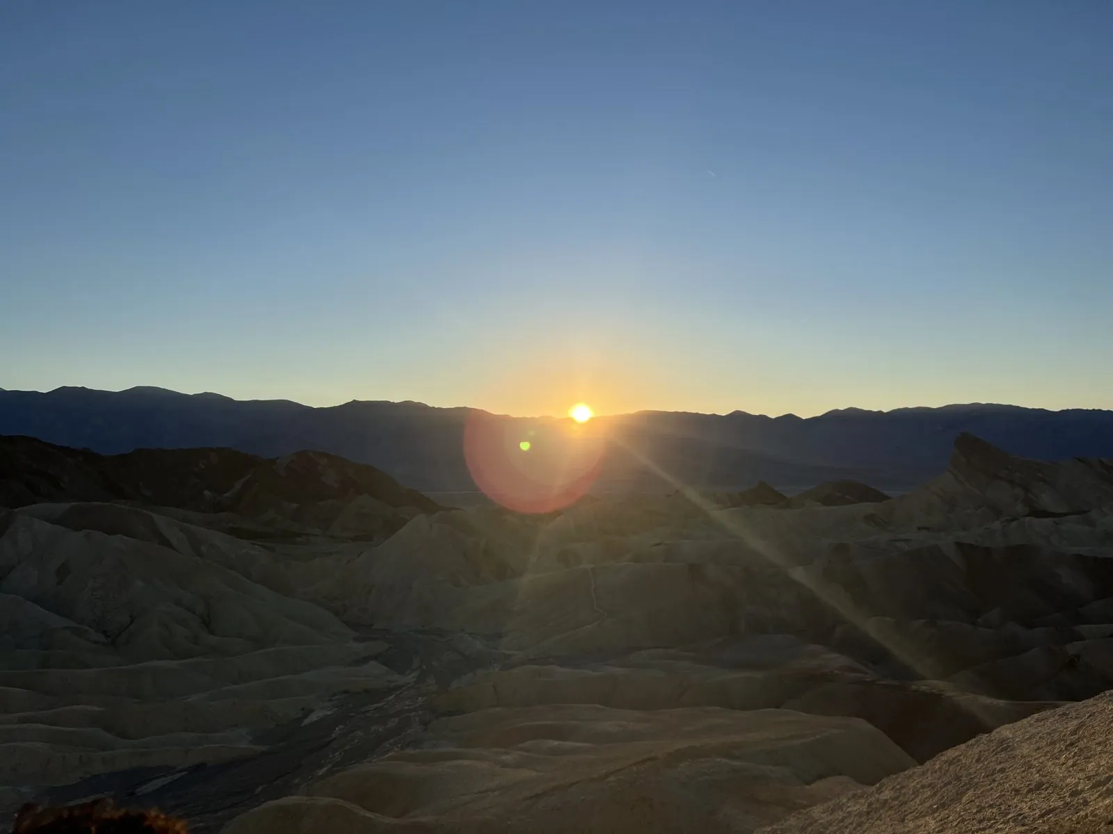
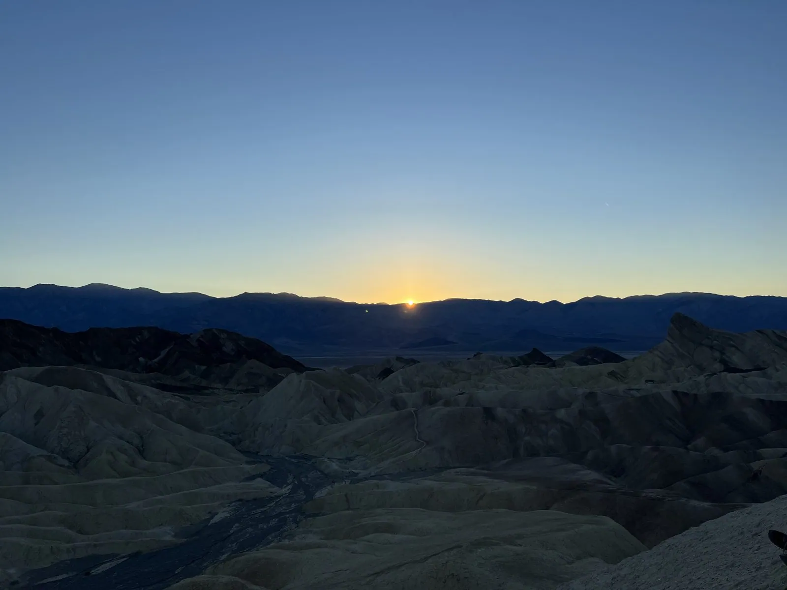
The sun went down behind the Panamint Range, the long wall of mountains on the west side of Death Valley, at about 5:31 by our clocks. The badlands went from gold to gray in a few minutes. For a moment the sun sat in a notch of the ridge line with a lens flare blooming beside it, and then there was just a band of yellow along the mountains and the cold blue of desert dusk above. In the desert, the temperature drops as fast as the light does.
Dante's View, after dark
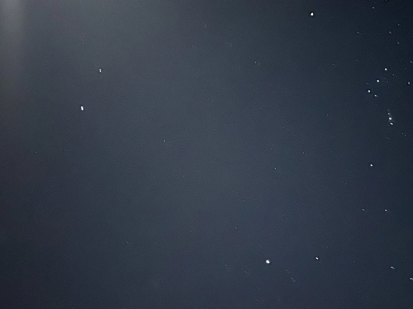
Then we drove up to Dante's View, at the end of a long, winding road that climbs the Black Mountains on the east side of the valley. The overlook stands at about 5,500 feet, and on a clear day you look almost straight down a mile of air to Badwater, the lowest point in North America, with the snow on Telescope Peak across the valley at eye level. We got there at 7:31, well after dark, so none of that was visible. What was visible was the sky.
Death Valley is an International Dark Sky Park, one of the darkest places in the lower 48, and on a moonless night the Milky Way is bright enough to throw a faint glow on the ground. This was not a moonless night. The moon was a few days past first quarter, and its glare washed out a corner of every frame. The phone did its best through the car window and then outside it, and the results are a scatter of small white dots on a navy background. They are not good pictures. But they record the hour and the cold, and in the dark at the edge of a drop you can't see, a scatter of white dots is more or less what it looks like anyway.
The drive back to Pahrump took most of the next two hours. Dinner, at 9:18, was a cup of instant noodles.
Day 2: the bottom of the valley
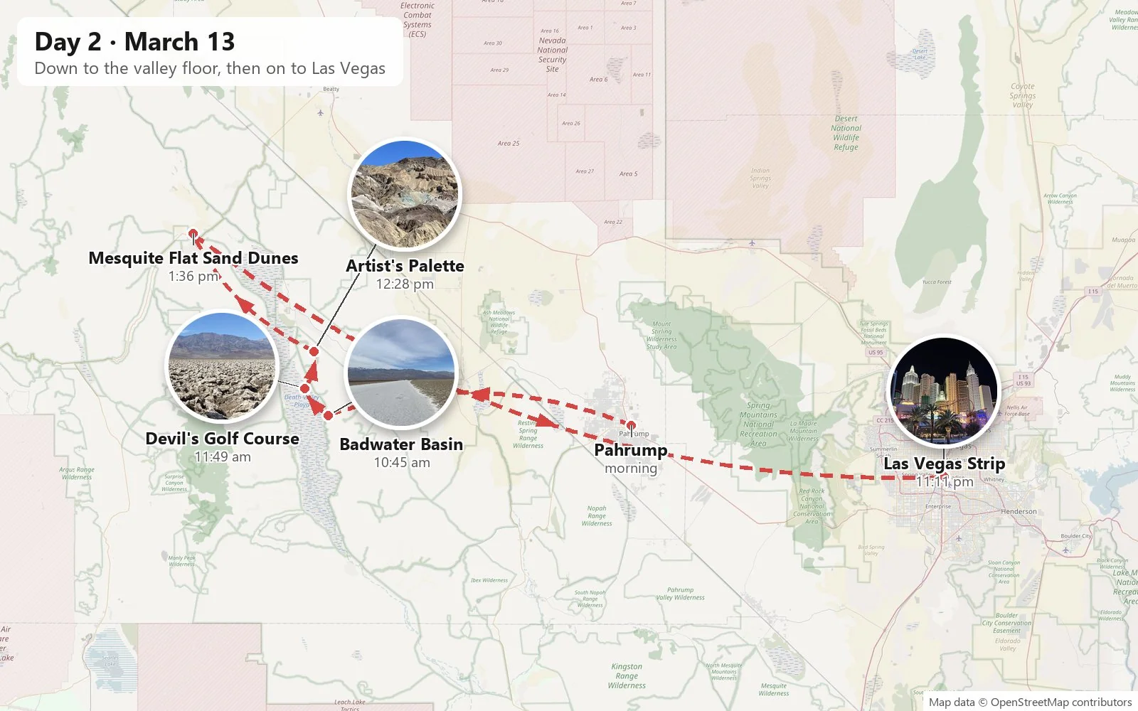
Sunday, March 13th, began with a small mystery in the metadata. Saturday's photos are stamped eight hours behind universal time; Sunday's breakfast, at 8:09, is stamped seven. Daylight saving time had started at two that morning, and the phone had quietly moved itself forward an hour while we slept. Keep that in mind: it will matter in Arizona.
Badwater Basin
By 10:45 we were at Badwater Basin, 282 feet below sea level and the lowest place in North America. High on the cliff above the parking lot is a small sign marking where sea level would be, which is a neat way of making you feel how deep in the hole you are. The view from the lot was nothing like the brochure: instead of a dry white plain, a shallow pool of water stretched out from the boardwalk, edged with reeds and salt crust, reflecting a sky full of high, thin cloud. Across the valley, the Panamint Range had a dusting of snow on its peaks.
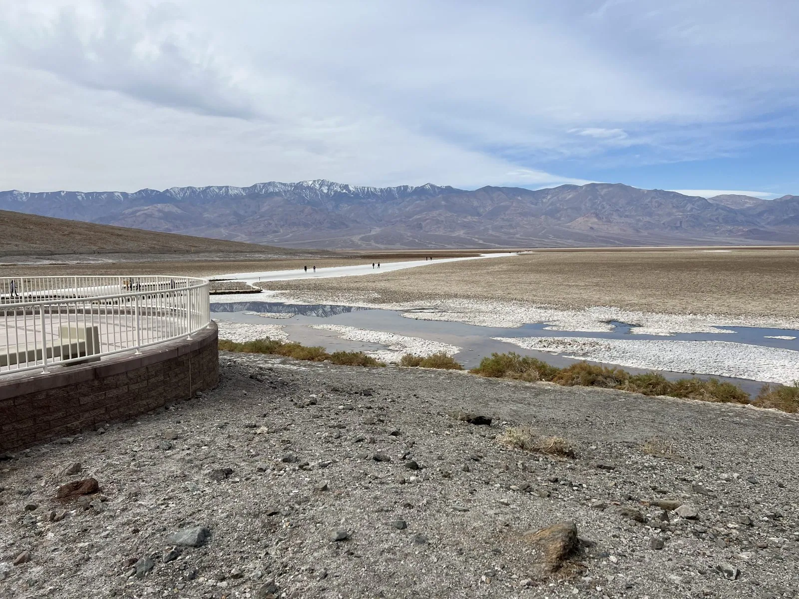
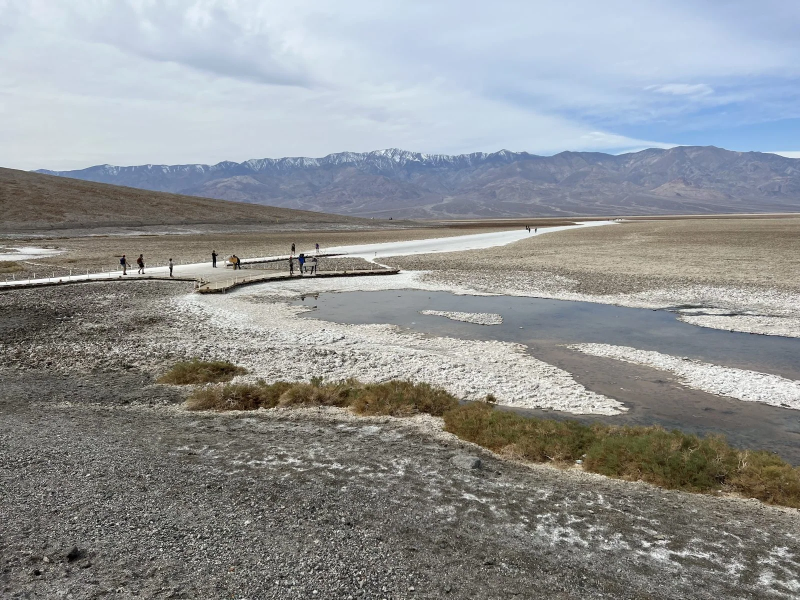
The water is why the place is called Badwater. The story goes that a surveyor's mule refused to drink from the pool, and the surveyor marked it on his map as "bad water". It isn't poisonous, just very salty: a small spring seeps up here, and the minerals it carries concentrate as it evaporates. Even so, the pool has its own residents. The Badwater snail, a tiny mollusk, lives in this spring and a few others nearby and nowhere else on Earth.
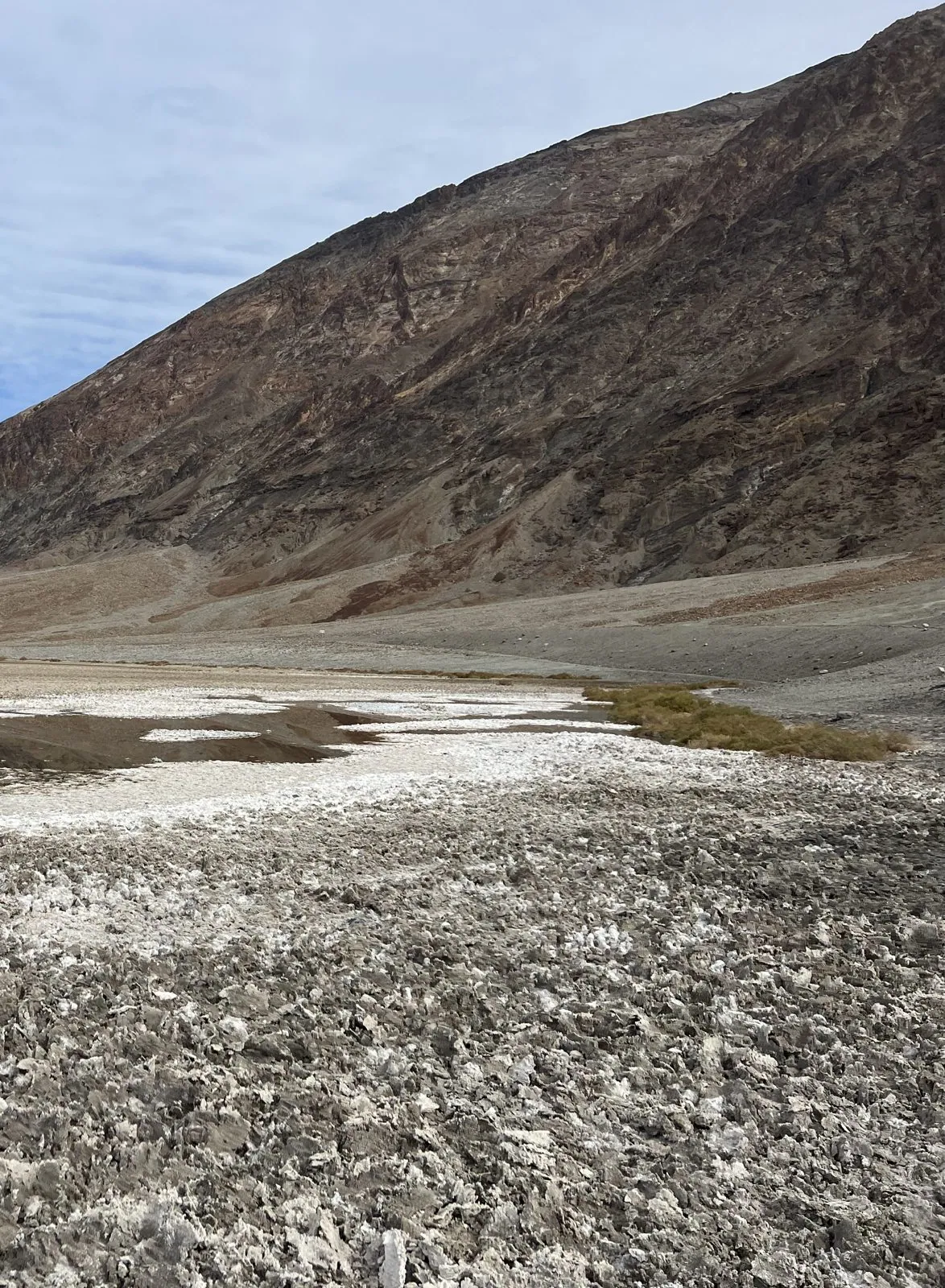
Behind the parking lot, the Black Mountains go straight up from the salt in one steep brown wall. That abruptness is the whole story of Death Valley in one view. The valley floor is a block of crust that has been sinking along faults for millions of years while the mountains on either side rose, and the sediments washing into the gap have never been able to fill it. Water that drains in has no way out, so it evaporates, and leaves its salt behind. Do that for long enough and you get a salt flat of some two hundred square miles.
A sign at the edge of the boardwalk explains the shapes in the crust: as the salt dries and recrystallizes, it pushes up into ridges that form polygons, like the cracks in drying mud but raised instead of sunken. Beyond the sign, the trail is simply a white strip of salt, packed smooth by thousands of feet, running straight out toward the middle of the valley. The farther you walk, the whiter, flatter and quieter it gets. The far mountains don't seem to get any closer, and the salt crunches faintly underfoot like old snow.
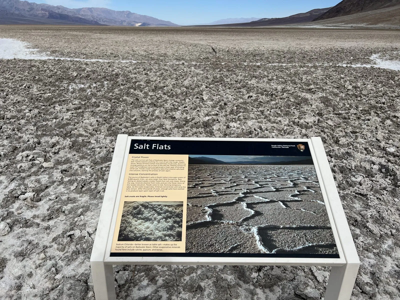
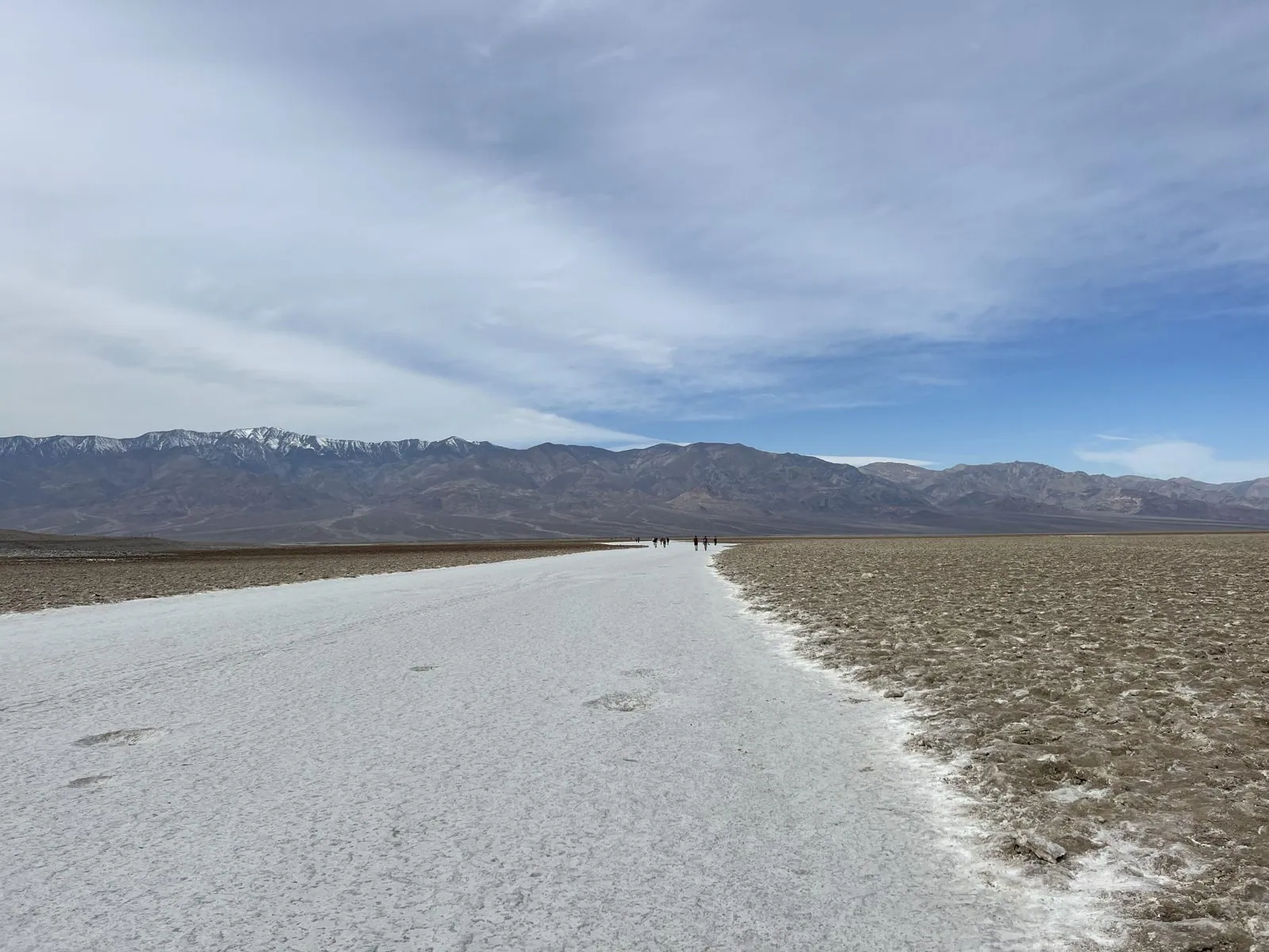
Devil's Golf Course
An hour later, a few miles up the valley, the same salt looks completely different. At Devil's Golf Course the crust has been broken up into a field of jagged, knee-high lumps of salt and mud, stretching to the mountains like a plowed field turned to stone. It got its name from a 1930s National Park Service guidebook, which observed that only the devil could play golf on such rough links. Wind and the occasional rain sculpt the salt into sharp spires and razor edges; it is the kind of ground you step on carefully, if at all. The park service says that on a quiet, hot day you can hear the crystals ping and crack as they expand in the heat.
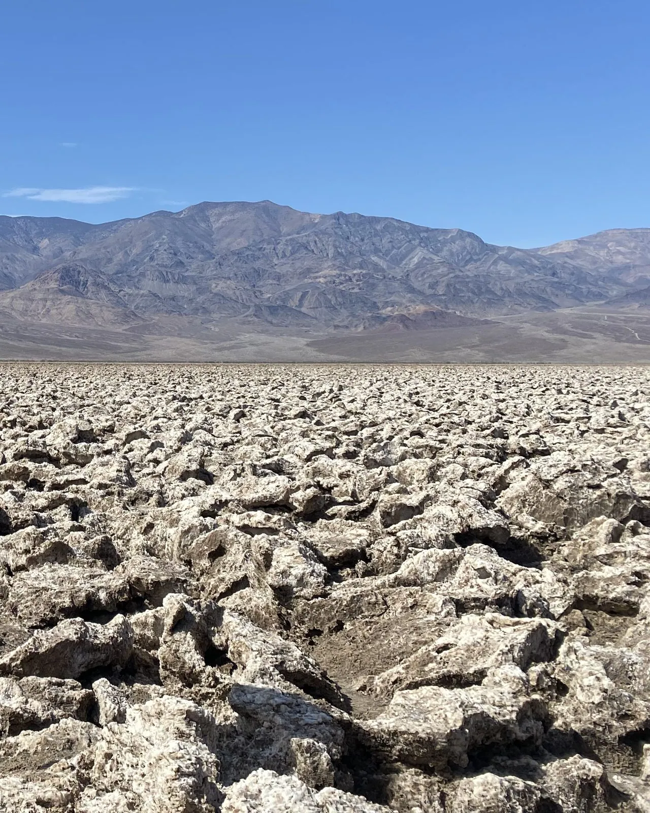
On the way north we turned off at Artist's Palette, where the hillside is streaked with pink, green and turquoise.
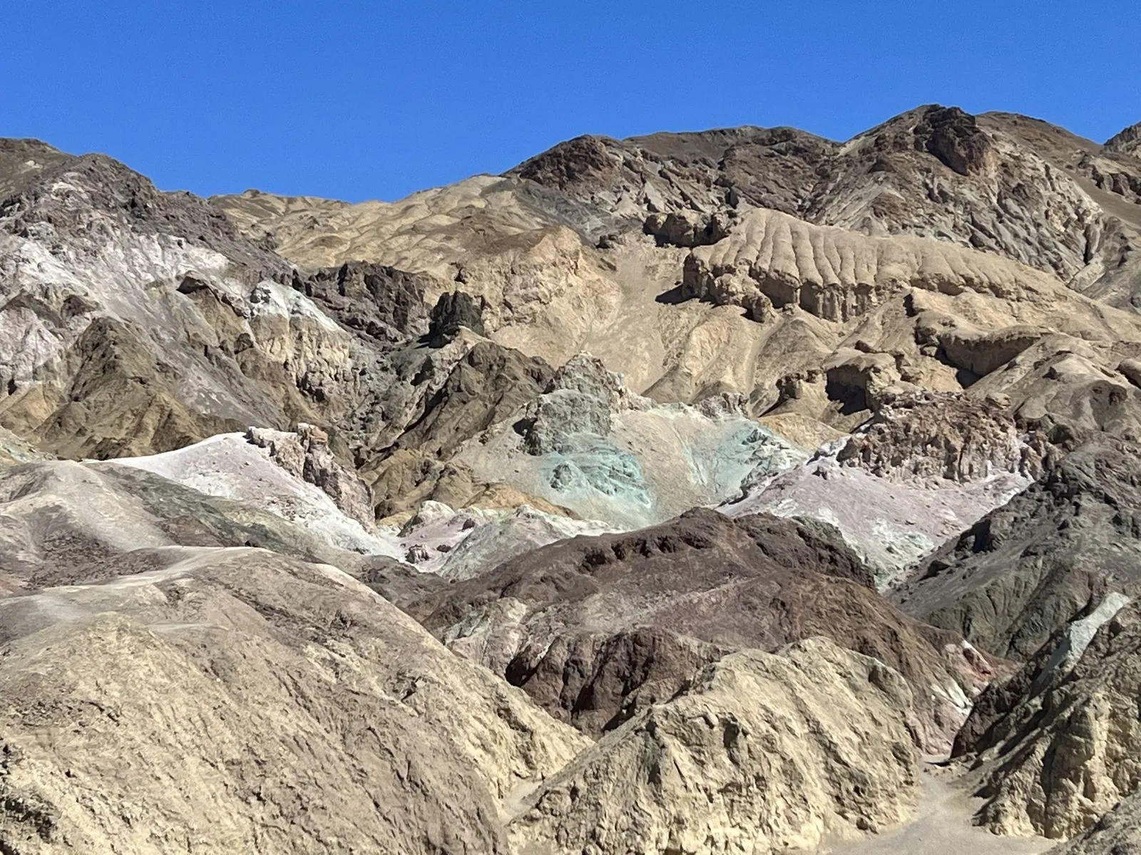
The last stop in the valley was the Mesquite Flat Sand Dunes near Stovepipe Wells, at 1:36 in the afternoon: smooth, rippled dunes with mesquite bushes holding onto the sand at their edges, the classic desert of the movies in the middle of a park that is mostly rock and salt. The only photo from there has people in it, so you'll have to imagine the dunes.
Las Vegas at night
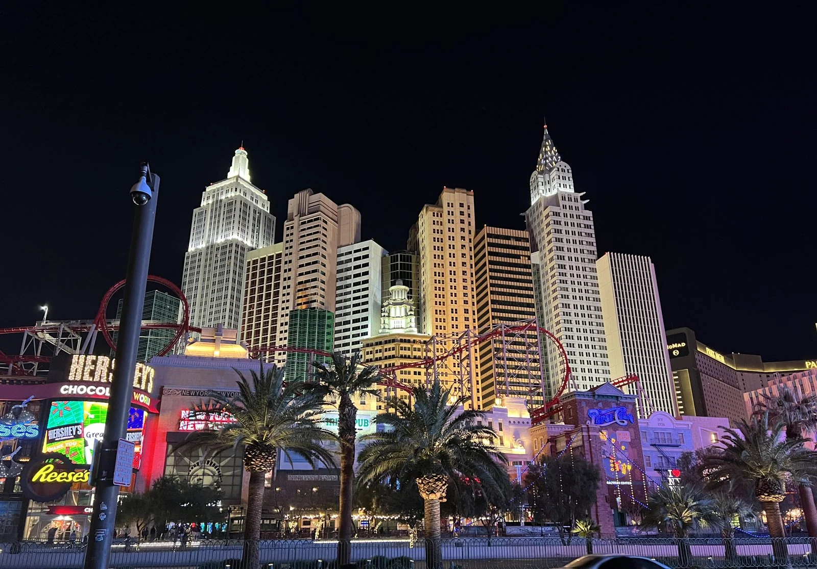
By a little after five we were coming up I-15 into Las Vegas, past the new football stadium and the gold towers of Mandalay Bay. Dinner was Chinese, with a whole roast duck, and then we went down the Strip to the MGM Grand to see David Copperfield. The next picture is at 11:11 that night, on the Strip, in front of New York-New York.
It is a fitting first Vegas photo, since nothing says "you are no longer in the desert" like a scaled-down Manhattan skyline lit up at midnight. The casino, which opened in 1997, is built as a cluster of towers modeled on the Empire State Building, the Chrysler Building and their neighbors, with a Statue of Liberty out front and a roller coaster looping around the whole thing. On the Strip at that hour there is no such thing as night: the palm trees are lit from below, the billboards are bright enough to read by, and the sidewalks are full.
Day 3: Las Vegas to Page
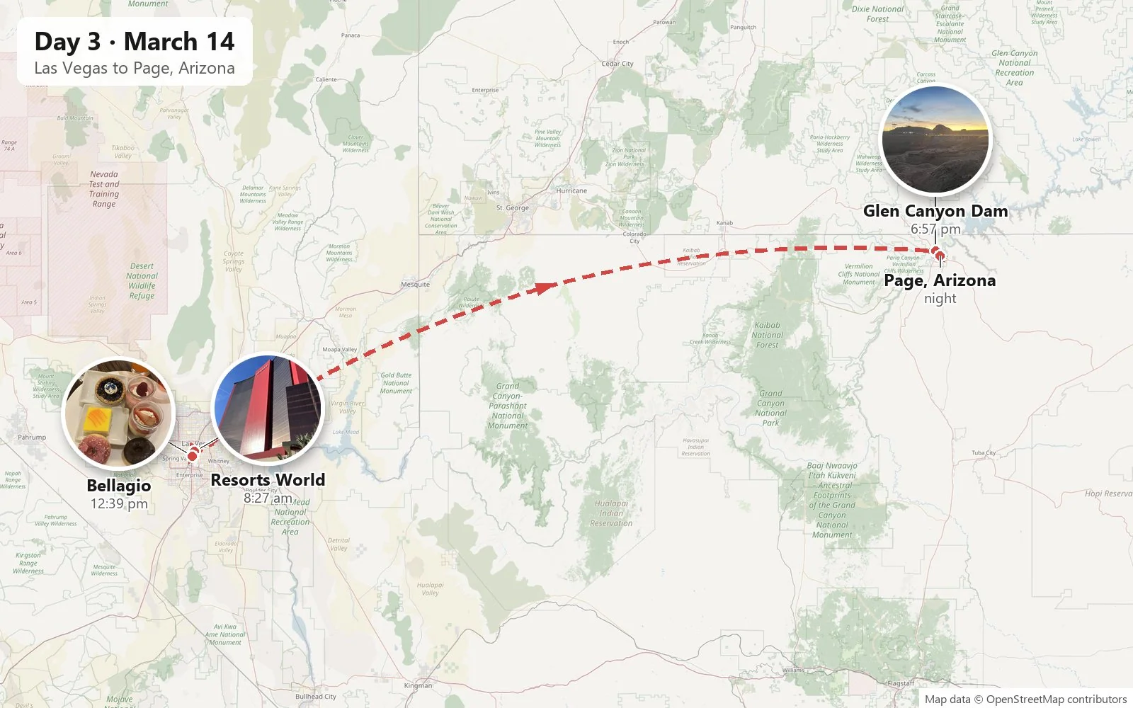
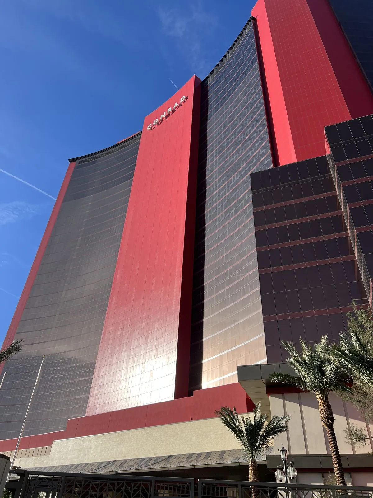
Monday was a day of two halves: a morning on the Strip, then a long drive east into Arizona. It started at 8:26 at the north end of the Strip, at Resorts World Las Vegas, where we had spent the night at the Las Vegas Hilton. The resort had opened the previous summer.
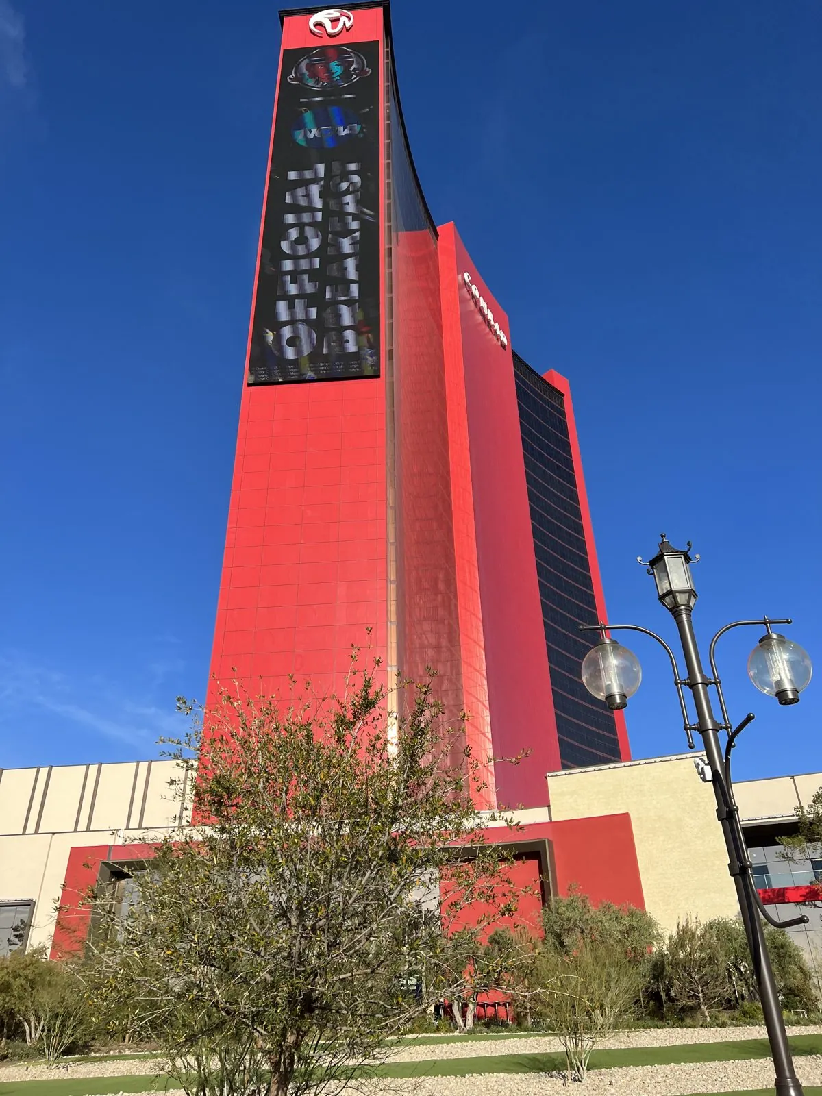
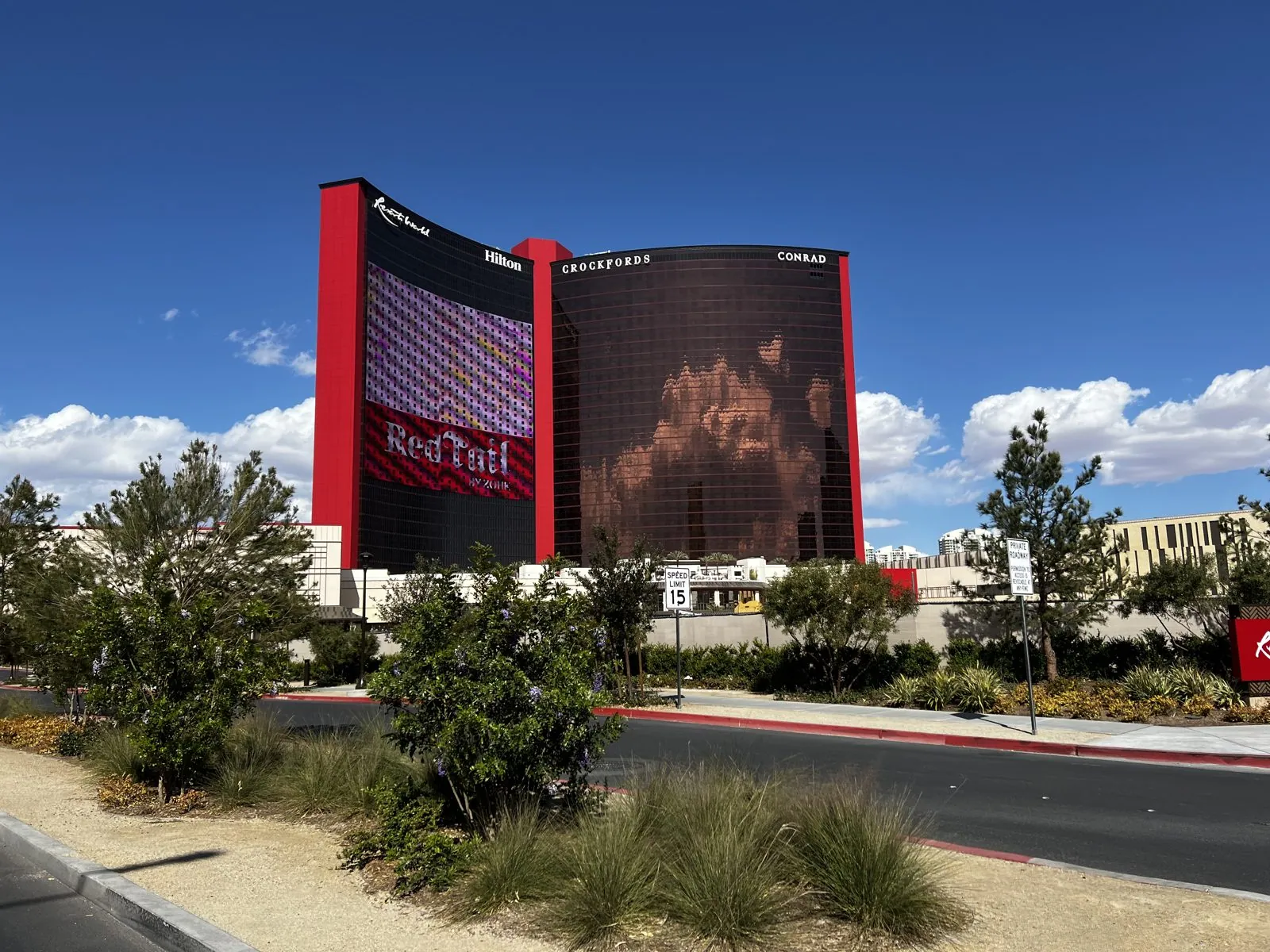
Resorts World was the first brand-new resort to open on the Strip in more than a decade, built on the site of the old Stardust, and it is impossible to miss: tall towers clad in glossy red panels and dark glass, with a giant LED pylon out front playing ads to the traffic. In the clear morning light, against a deep blue sky, the red looked almost unreal.
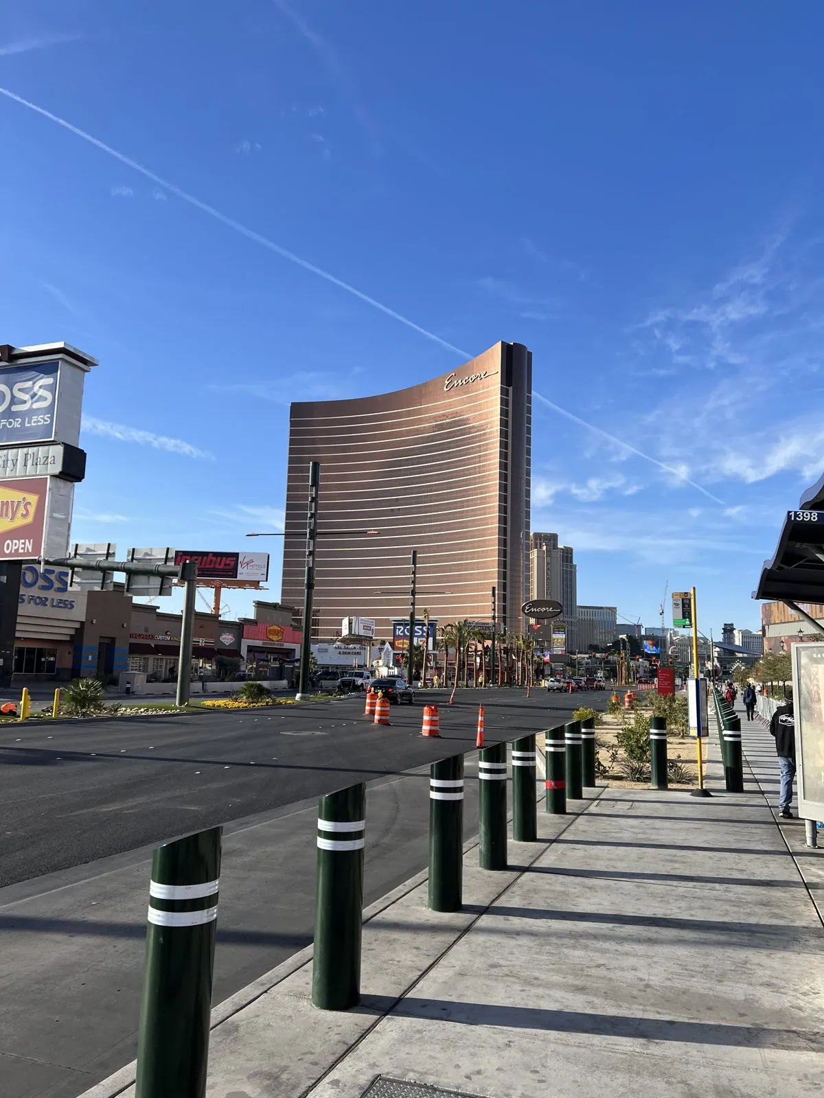
Looking south from the sidewalk, one of the curved bronze towers of the Wynn stood alone down the boulevard, catching the sun. At half past eight on a Monday the Strip is a different street from the night before: half empty, the sprinklers running, traffic cones out, and the desert light making everything look like a scale model of itself.
Lunch, around half past twelve, was the buffet at the Bellagio: a plate of sausages, mussels, noodles and roast carrots, then fruit, then a second plate entirely of small desserts, a blueberry tart, a mango square, panna cotta with raspberries, a pink doughnut and a chocolate one. A Vegas buffet is less a meal than a test of planning, and this one was handled with a clear strategy.


Glen Canyon Dam at dusk
Then came the long drive east, our friend at the wheel. Las Vegas to Page is about 275 miles: up I-15 through the Virgin River Gorge to St. George, Utah, where we stopped for gas, then back down into Arizona. The camera roll records almost none of it; the photos simply stop at the Bellagio and start again at Glen Canyon. The one exception, at 6:56 pm, is a blurred shot through the car window of the canyon walls, taken as we crossed the bridge beside the dam.
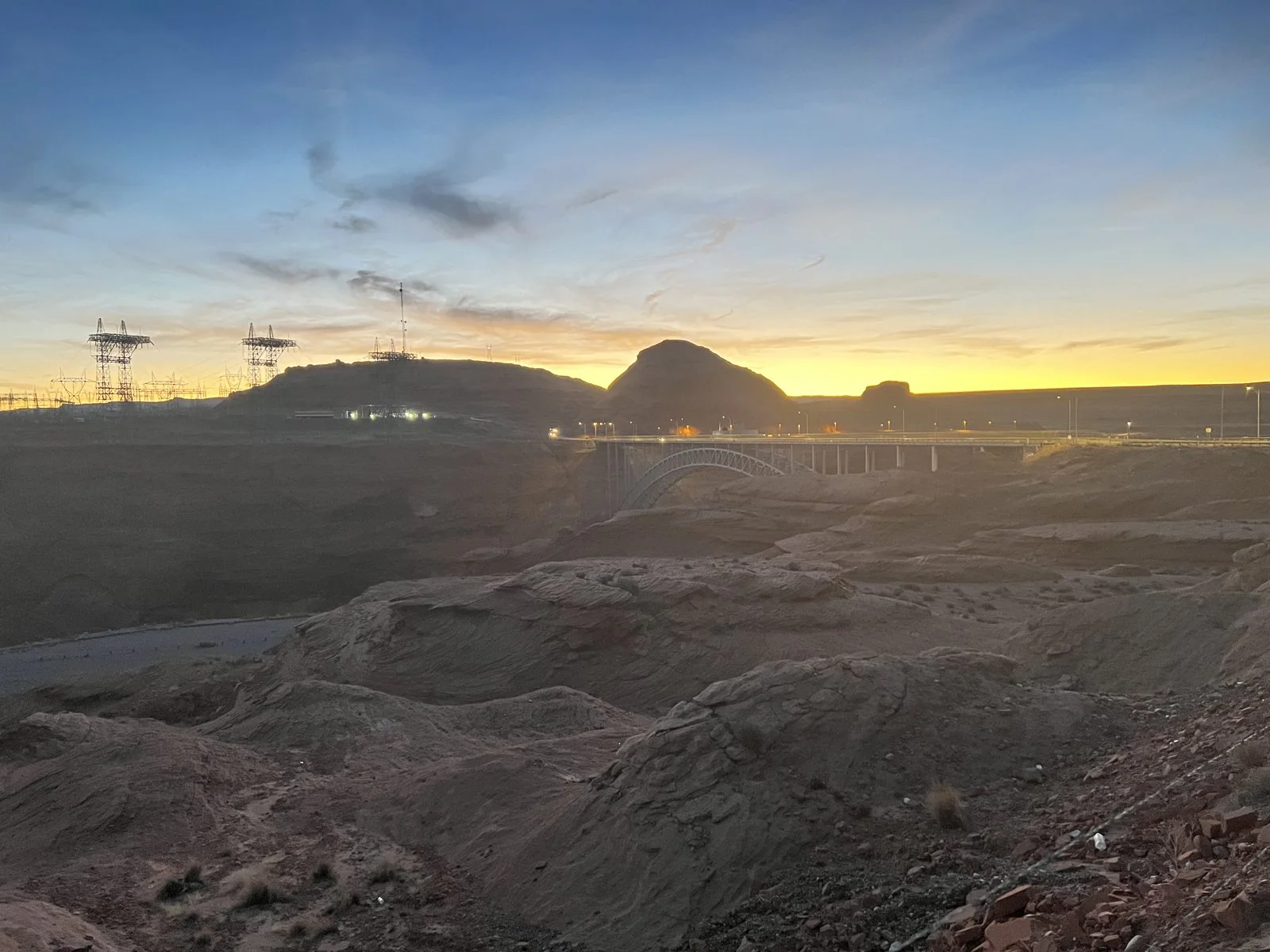
Glen Canyon Dam is a 710-foot wall of concrete across the Colorado River, finished in the 1960s. Behind it is Lake Powell, the second-largest reservoir in the country, which flooded nearly 200 miles of Glen Canyon. Page itself started life in 1957 as a camp for the people building the dam. We stopped on the rim just as the sun went down. The sky over the canyon turned yellow and orange along the horizon, the dam and the steel towers of its power lines went black against it, and the red rock below faded to brown and then to nothing.
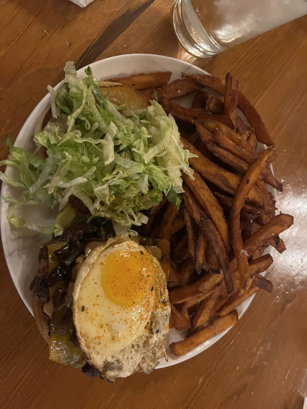
Dinner was at Sunset 89 in Page at 9:45: burgers and fries, and one plate with a fried egg on top of the whole thing, the way a truck stop would do it if a truck stop were trying to impress you.
An interlude on clocks
Now for the puzzle. The sunrise at Horseshoe Bend and the Antelope Canyon tour the next day both ran on a clock, and in this part of the world, which clock is a real question. Here is how it works.
Most of the United States moved its clocks forward on March 13th. Arizona doesn't. It is too hot in summer for anyone to want an extra hour of evening sun, and the state has stayed on standard time all year round since 1968. In winter, Arizona shares a clock with Colorado and Utah; in summer, with California and Nevada. Our route the day before went up through Utah, so the official clock moved an hour forward at the Utah line and back again when we came down into Arizona, and the phone kept flipping after that: on that one drive its clock changed several times, and by the time we reached Page none of us was sure what time it was.
But the Navajo Nation, the largest reservation in the country, covering the whole northeast corner of Arizona and spilling into Utah and New Mexico, does observe daylight saving time, so its clocks match New Mexico and Utah. From March to November it is an hour ahead of the rest of Arizona. And inside the Navajo Nation sits the Hopi Reservation, which doesn't observe it, making a hole in the middle of the hole. Page is not on Navajo land. Antelope Canyon, a few miles down the road, is. So the town and the canyon run an hour apart.
The phone knew all this, or tried to. That evening at the dam, the photos are stamped seven hours behind universal time, Arizona's clock. An hour later, a few miles away near the Utah line, the phone has switched to six, probably picking up a cell tower across the Utah line. Half an hour after that it is back on seven. By 10:44 that night, a screenshot of a map of the region had been scribbled over with "+0" and "+1" around the Navajo Nation, which is how you know that somebody in the car had noticed. The next morning a world-clock screenshot shows the phone saying 6:26 while the line for Los Angeles says 5:26, though Page and Los Angeles were on the same time that day. In other words, the phone was running an hour ahead of the town it was sitting in.
Day 4: Horseshoe Bend, Lake Powell and Antelope Canyon
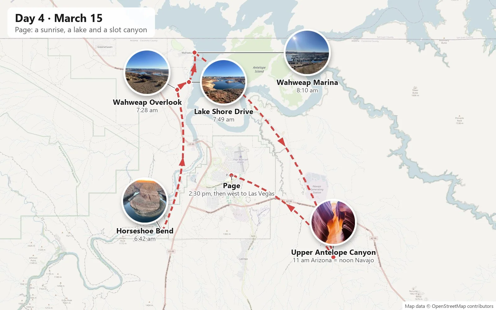
Tuesday, March 15th, after a night in Page, was the big day. In Page time, which was the right time for this part of the day, we were on the road by 6:29, in the blue light before dawn, and at the trailhead for Horseshoe Bend five minutes later.
Horseshoe Bend at sunrise
The trail starts with a big painted sign of the bend itself, standing alone in the red sand like a billboard for the view, in case anyone has driven out at dawn without knowing what they came for. From there a wide path of packed sand, edged with stones, runs about three-quarters of a mile over a low rise and down toward the rim. In the half-light the sand was a deep rusty orange, the brush was dark, and the sky was pale gold along the horizon fading to blue overhead. Ahead of us a line of other early risers was already walking toward the edge.
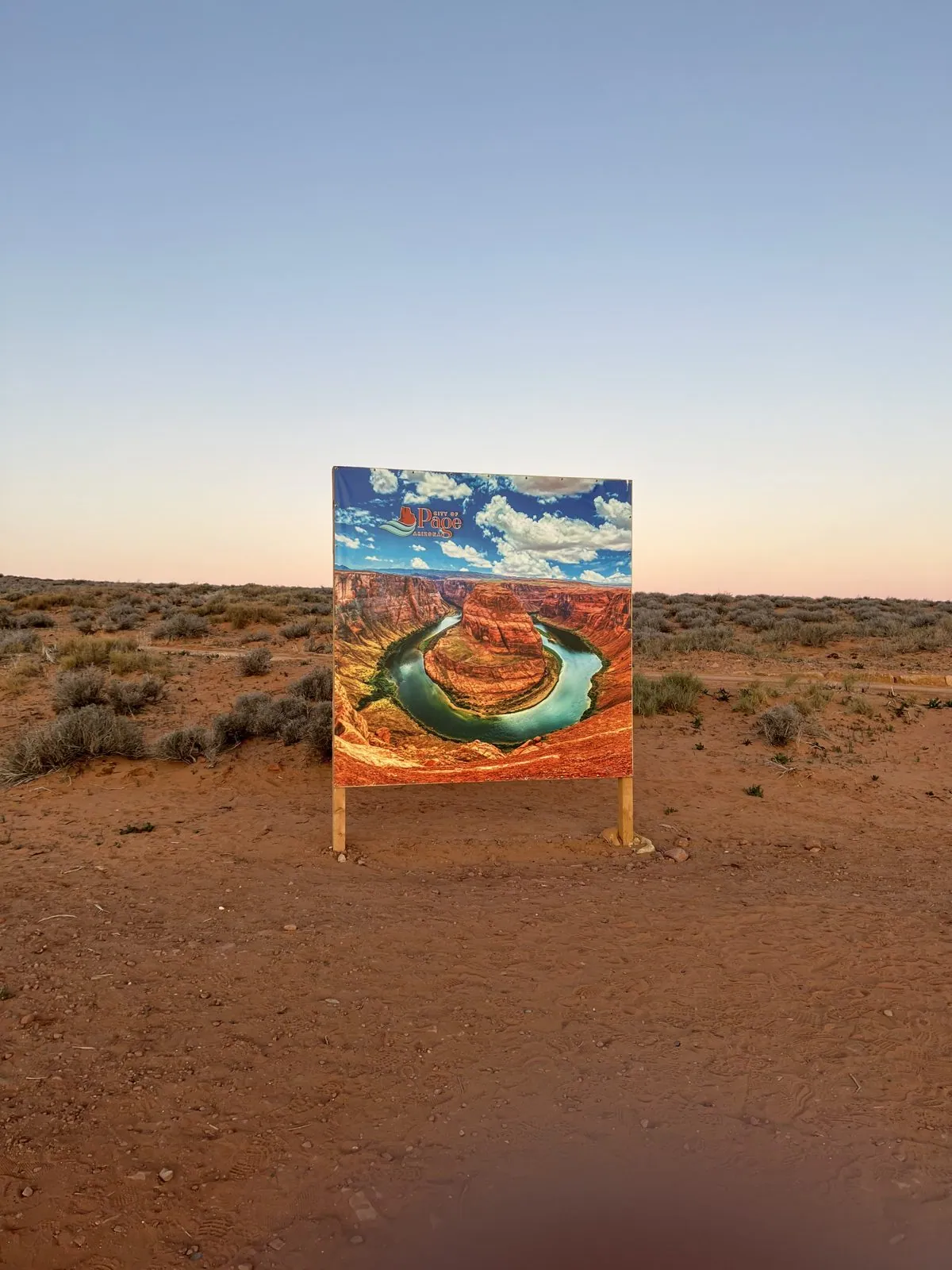
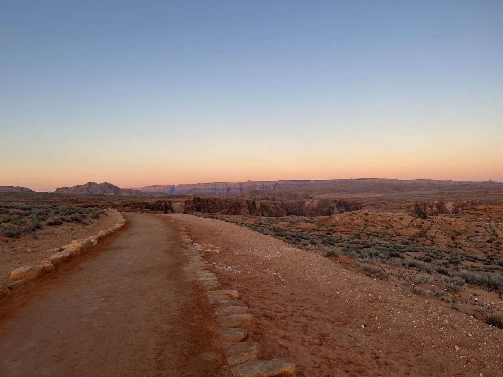
And then, without any warning, the ground ends. You walk up to the railing and look down a thousand feet of sheer sandstone to the Colorado River, which comes toward you, swings all the way around a huge dome of rock in a near-perfect circle, and leaves in almost the direction it came from. At that hour the river was in deep shadow, a smooth dark green-blue with no visible current. It is very quiet up there. The river is too far down to hear.
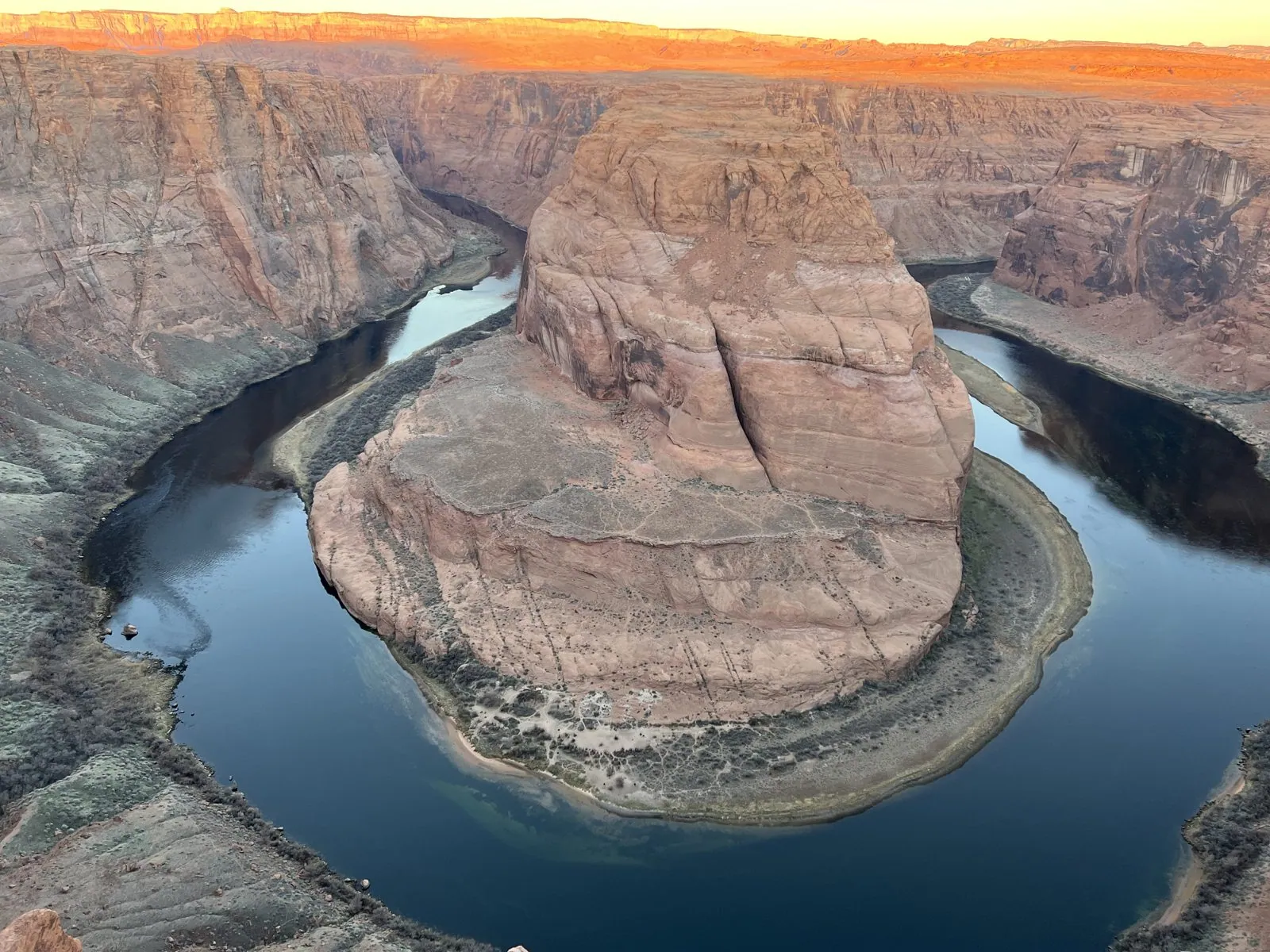
The overlook faces west, so at sunrise the sun comes up behind you. The first light didn't touch the river or the rock in the middle at all. It caught only the top of the far rim, a thin line of cliffs on the horizon that turned bright orange, almost fluorescent, while everything below it stayed cool and blue. Over the next few minutes the line of light crept down the far wall, and the pale sandstone of the dome went from gray to pink.
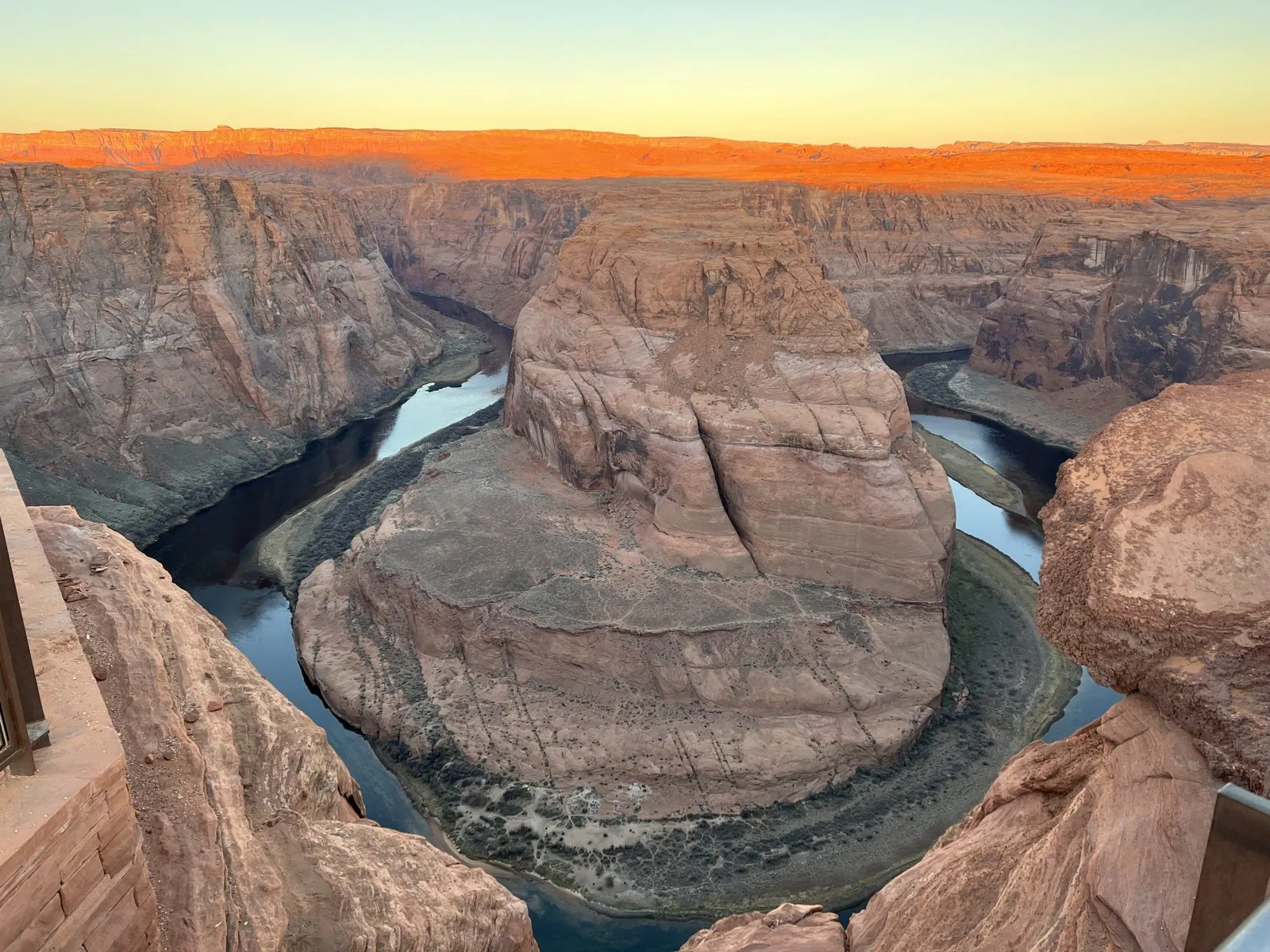
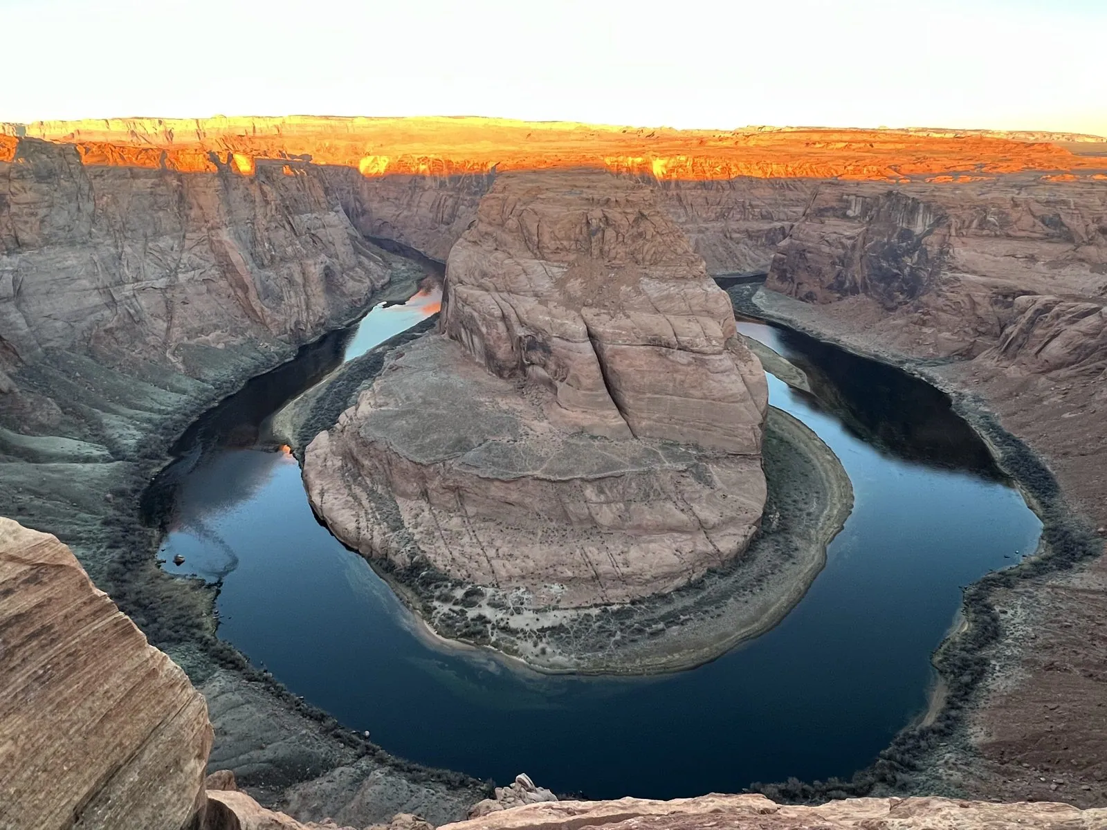
The bend is what geologists call an entrenched meander. Long ago, the river wandered in lazy loops across a flat plain, the way rivers do. Then the whole Colorado Plateau slowly rose, and the river cut down into the rock as the land came up, keeping its loops as it went, until each loop had become a canyon a thousand feet deep. The rock it cut is Navajo Sandstone, which formed from a field of sand dunes that covered this region roughly 190 million years ago; in the walls you can still see the slanting lines of the old dune faces. The water itself is unusually clear and cold, because it comes out of the bottom of Lake Powell, a few miles upstream, and leaves its silt behind in the reservoir.
Lake Powell from above
By 7:27 we were at the Wahweap Overlook, on a bluff just north of town, looking out over Lake Powell. It is a strange and beautiful view: deep blue water winding between benches and buttes of red and cream sandstone, a drowned landscape where the canyons have become bays and the mesas have become islands. With the sun still low in the east, the light came straight at us across the water, and the far shore was hazy and pale.
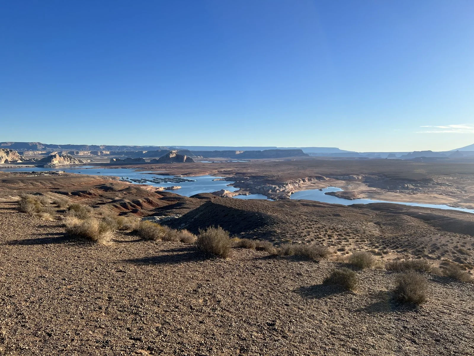
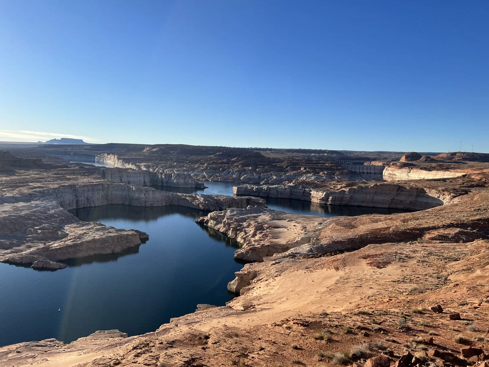
From there we drove slowly along Lake Shore Drive, stopping at pullouts above the water. Look closely at those photos and you'll see the most striking thing about the lake that spring: the pale band around every shoreline, like the ring left in a bathtub. That bleached rock is where the water used to be. After two decades of drought on the Colorado River, the lake was far below full, and around the very days we were there it dropped below 3,525 feet above sea level for the first time since it was filled. That level had been set as a warning line to protect the dam's ability to generate power. The view was gorgeous, and it was also a gauge.
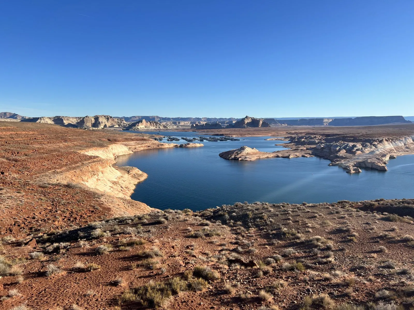
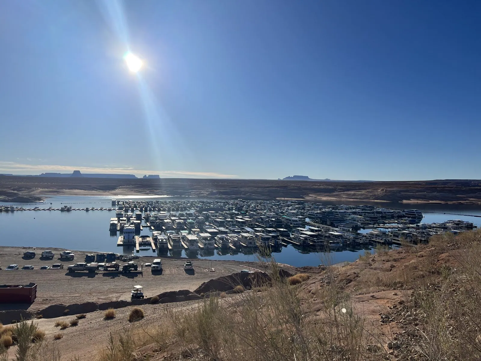
The last stop by the lake was above Wahweap Marina, where hundreds of houseboats sat in rows on their docks, white rectangles on blue water, waiting for summer. Renting a houseboat and disappearing up the side canyons of Lake Powell for a week is a classic Southwestern vacation. In March, at eight in the morning, the marina was perfectly still.
Into Upper Antelope Canyon
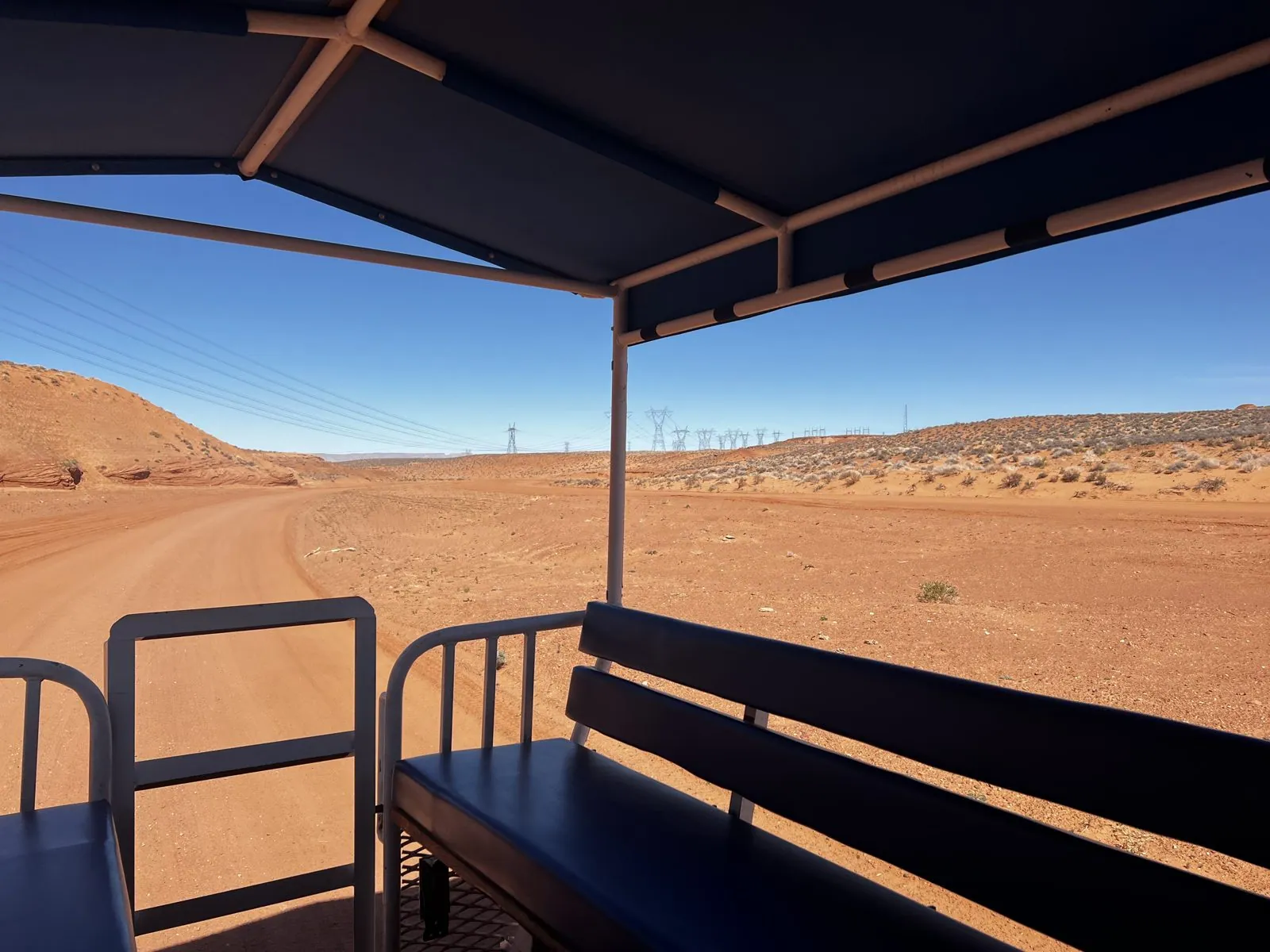
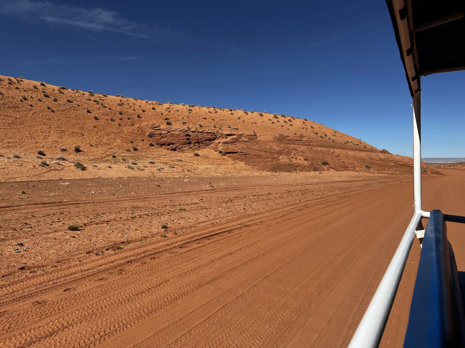
Then, at midday, the main event. Upper Antelope Canyon lies on Navajo land just east of Page, and you can only visit with a Navajo guide. The tour starts with a ride in an open-air truck: rows of padded benches under a canopy on the back of a pickup, which carried us out of town and then turned off the highway into the dry sandy bed of Antelope Creek. The wash is wide and flat, its sand a deep orange, and tire tracks run along it in every direction. The truck rolls and slides through it, the canopy rattling, the air dry and full of fine sand, between low banks of wind-carved sandstone. The first photo from the ride is stamped 12:08. That is Navajo time; by the clocks in Page it was 11:08.
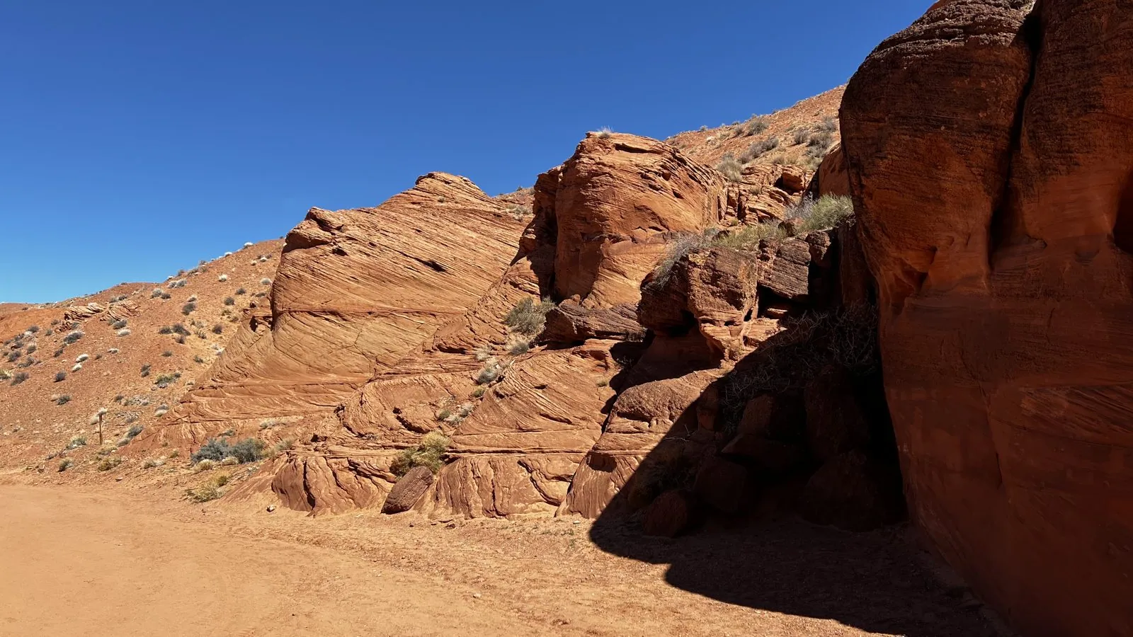
The truck stops where the wash runs up against a wall of rock. From the outside, the canyon is nothing: a great rounded bluff of red sandstone, carved into bulges and hollows by the wind, with a narrow dark crack at its base. You'd walk right past it. That crack is the entrance. Groups gather at the mouth and wait their turn, and then a guide leads each one in.
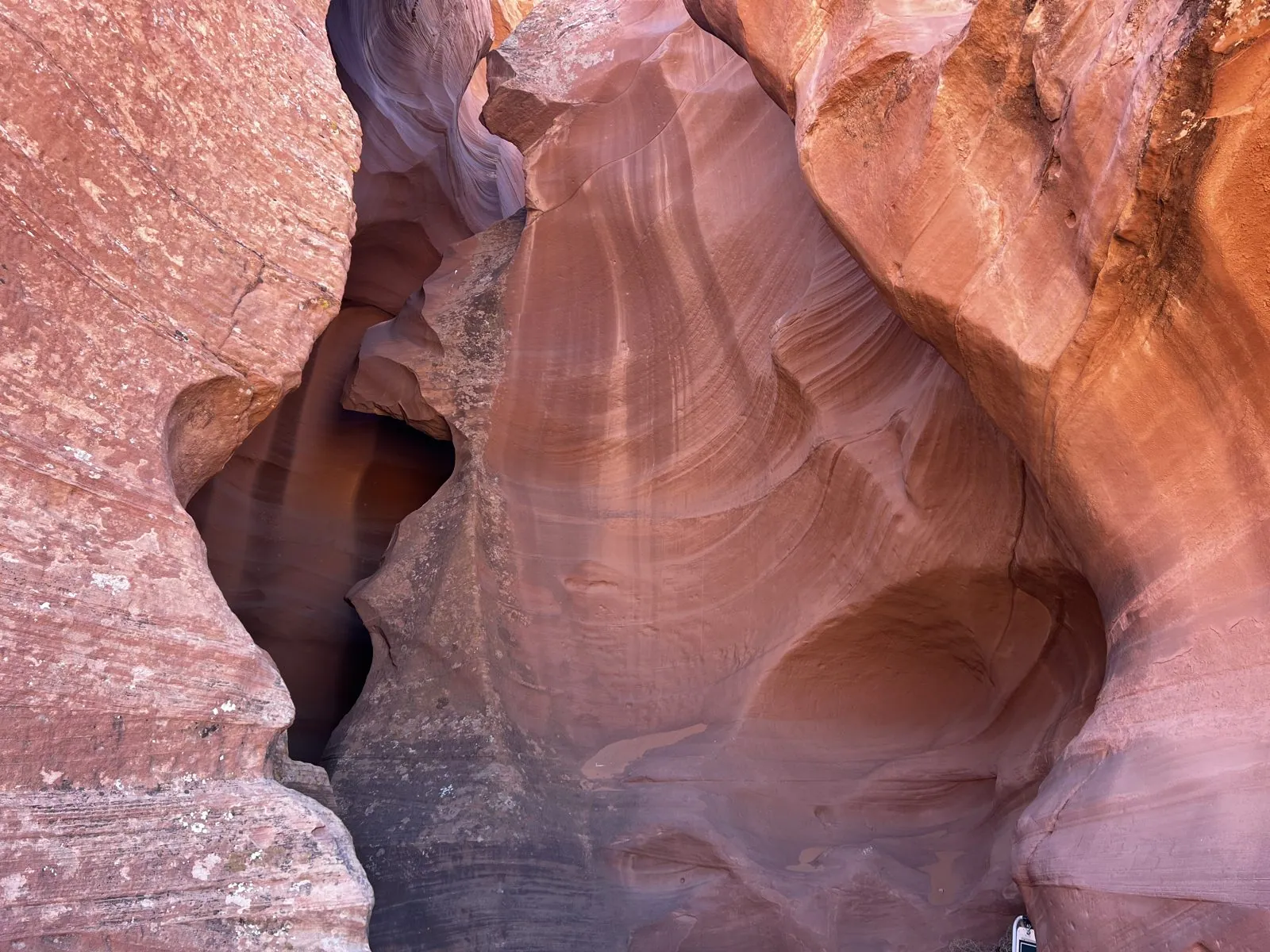
Step through, and the world changes. The canyon is a slot: a crack in the sandstone, perhaps a hundred feet deep and in places only an arm's length wide, which you walk along on a floor of soft sand. Its walls are not straight but flowing, swelling and curving and twisting around each other, carved into smooth hollows and sharp fins. The Navajo name for it means "the place where water runs through rocks", and that is exactly how it was made. For a few hours a year, flash floods from storms miles away come roaring down the wash, squeeze into this crack, and scour it out with sand. Between floods, the wind finishes the polishing. The result looks less like rock than like something poured, frozen in the middle of moving.
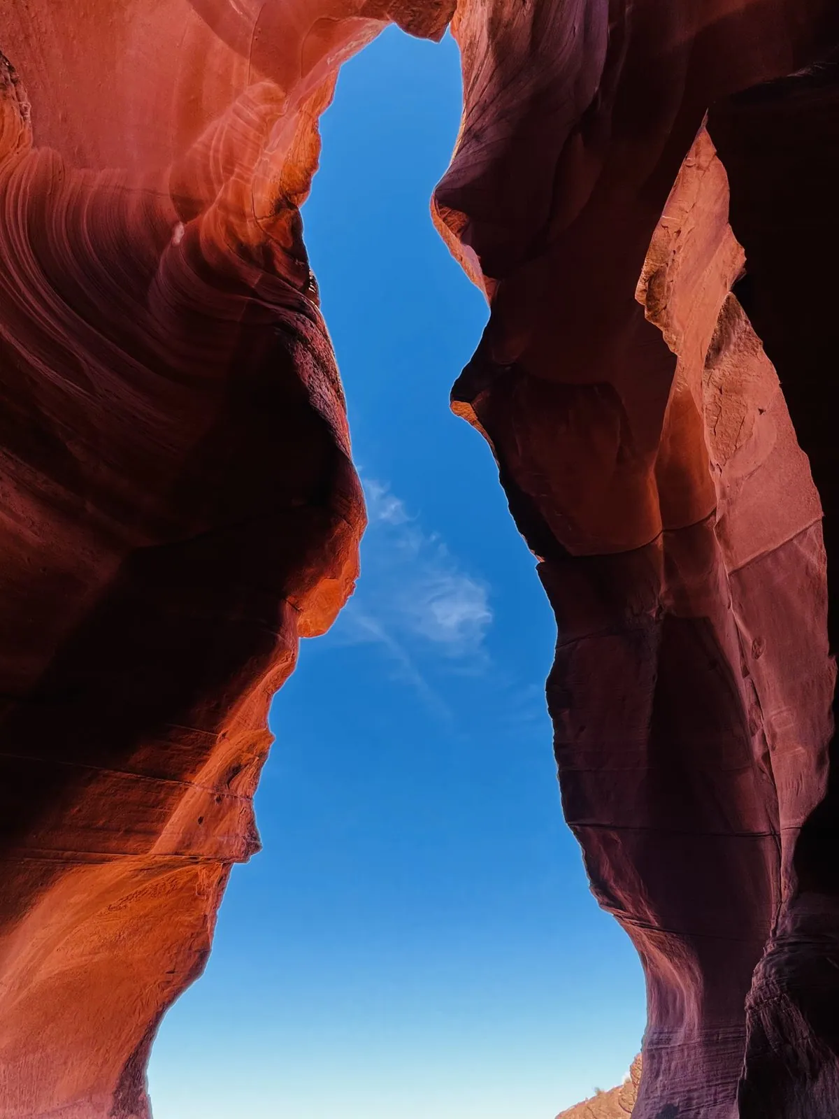
Look straight up and you see the sky as a crooked blue river at the top of the walls. That photo, oddly, is stamped in Arizona time while the ones around it are in Navajo time. Even deep in a slot canyon, the phone was still arguing with itself about what time it was.
Light and color
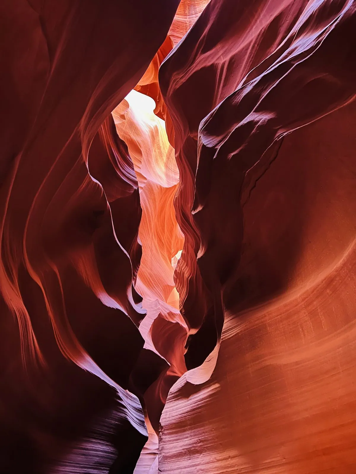
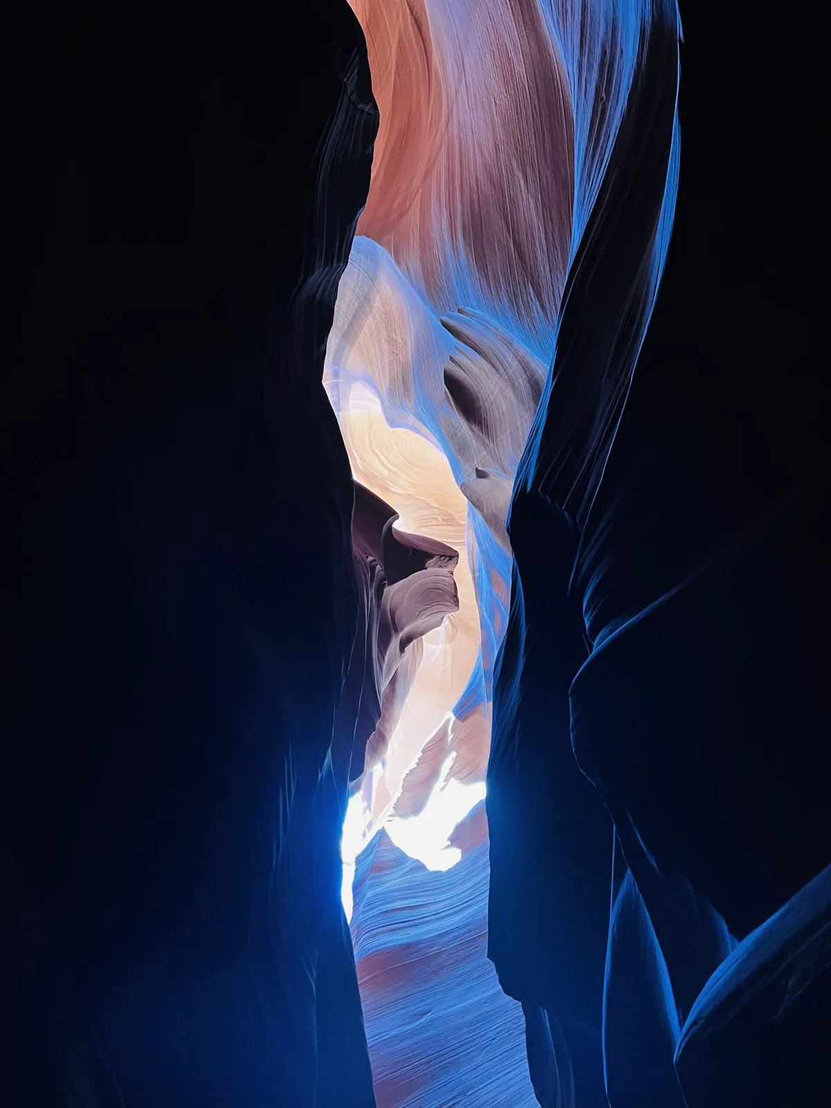
What makes Antelope Canyon famous is the light. Almost no direct sunlight reaches the floor. Instead it falls into the top of the slot and bounces from wall to wall on its way down, and each bounce picks up the color of the sandstone. So the light changes as you walk: near the openings it is a hot, glowing gold, a little deeper it turns orange and salmon, and in the darkest corners it becomes violet and even blue. None of these colors are filters. The rock is all roughly the same red; the color is in the light.
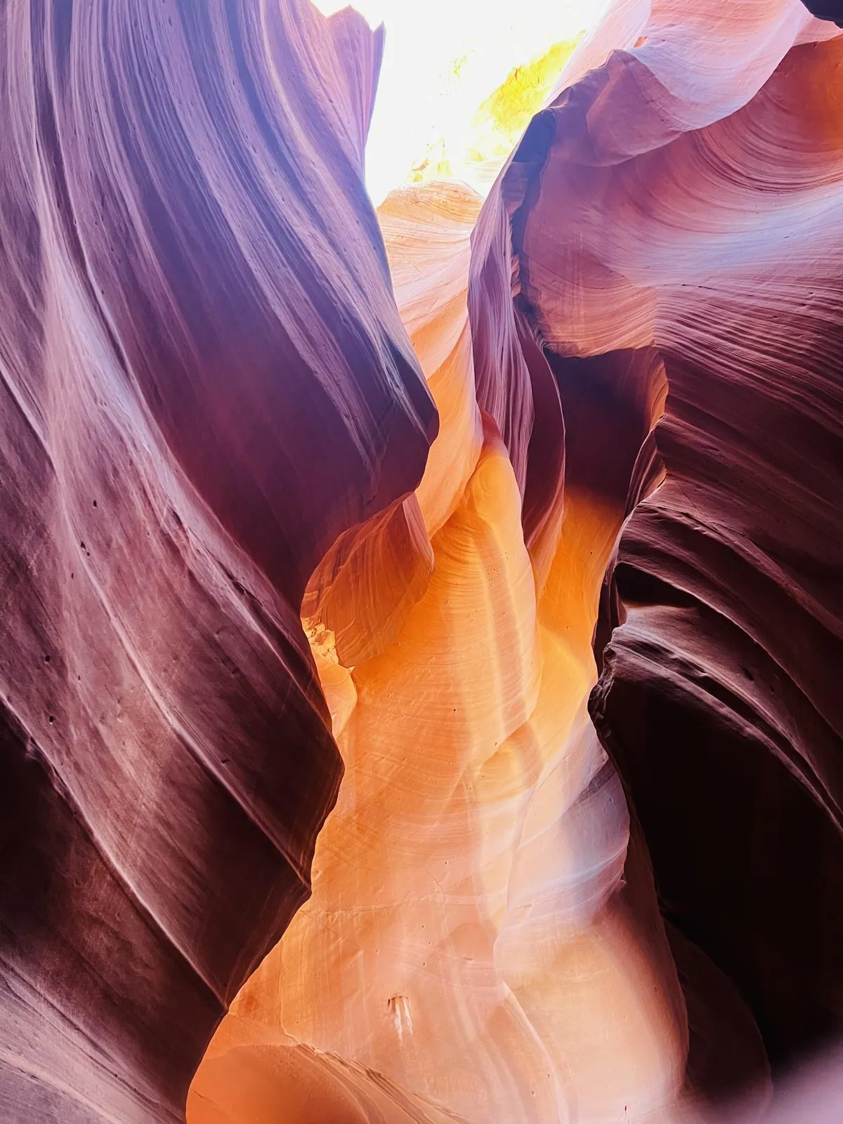
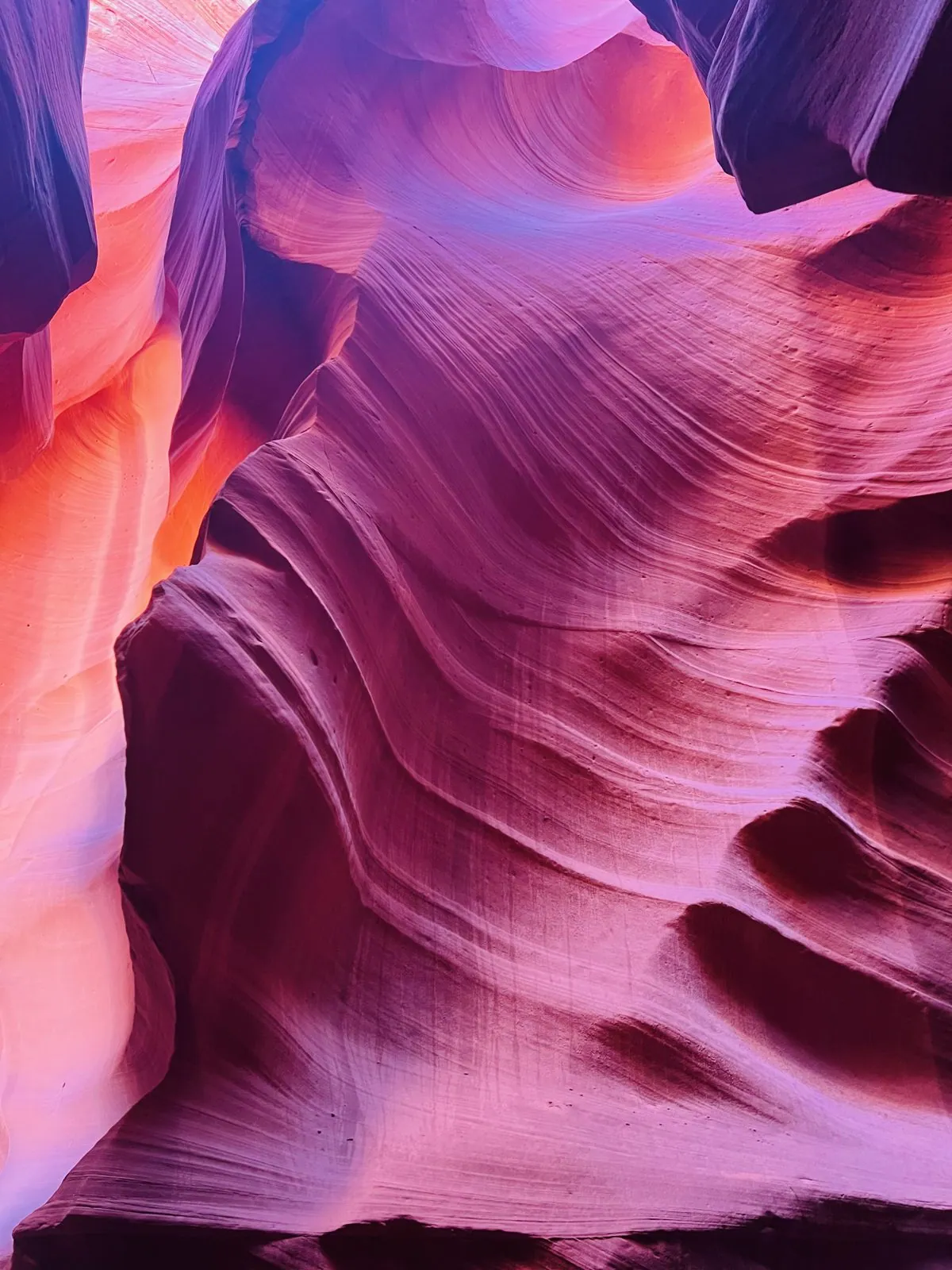
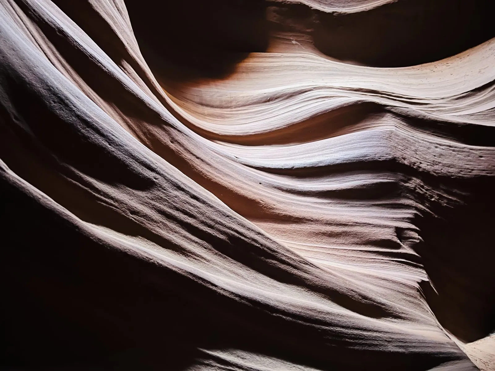
The walls themselves are covered in fine parallel lines, the layering of the ancient sand dunes that became the Navajo Sandstone. Because the floods carved across those layers at every angle, the lines sweep and curve with the walls, so the whole canyon looks like it has been brushed in one direction. Some of the overhangs look like waves about to break; others look like folds of fabric, or flames, or wood grain. Everyone sees something different. The guides have names for a few of the shapes, and they point them out as you go.
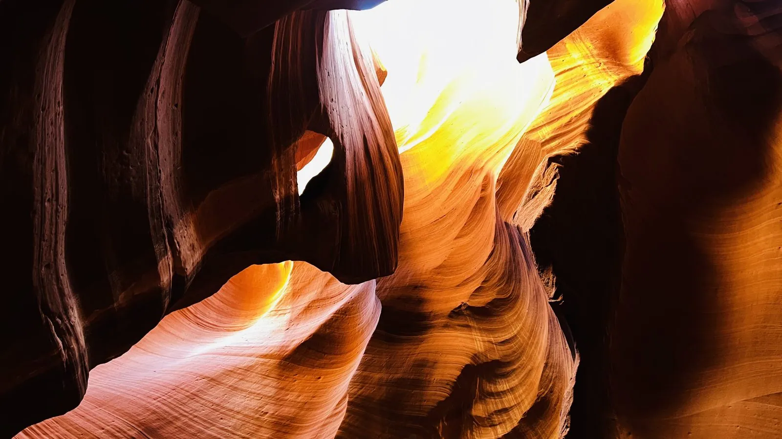
It is not a lonely place. On a typical day the tours run back to back, groups move along the sand in single file, and the Navajo guides are famous for knowing exactly which phone settings bring out the colors. But between groups there is a stillness to it, the cool, sheltered stillness of being underground, with the bright desert just a hundred feet above your head.
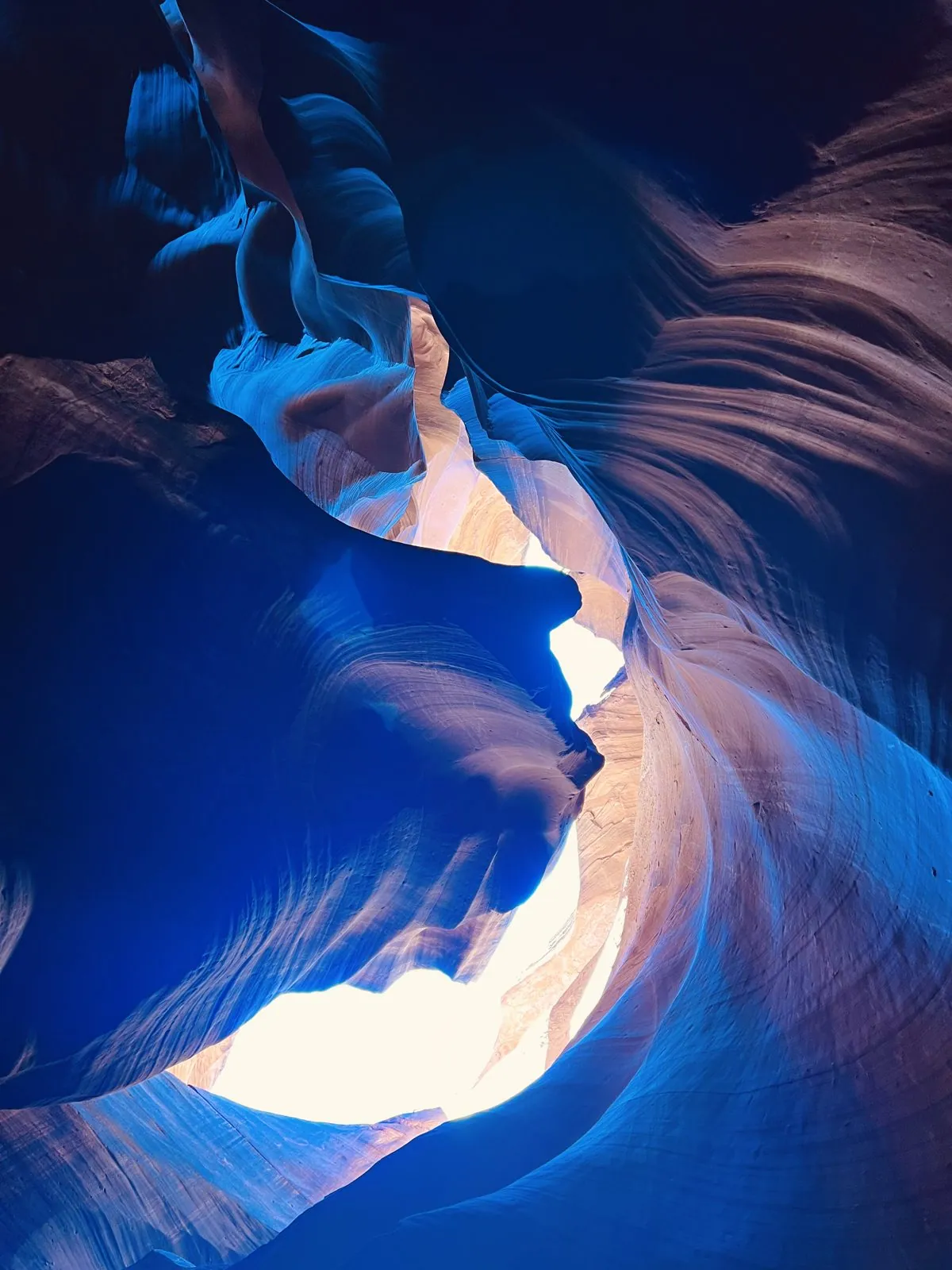
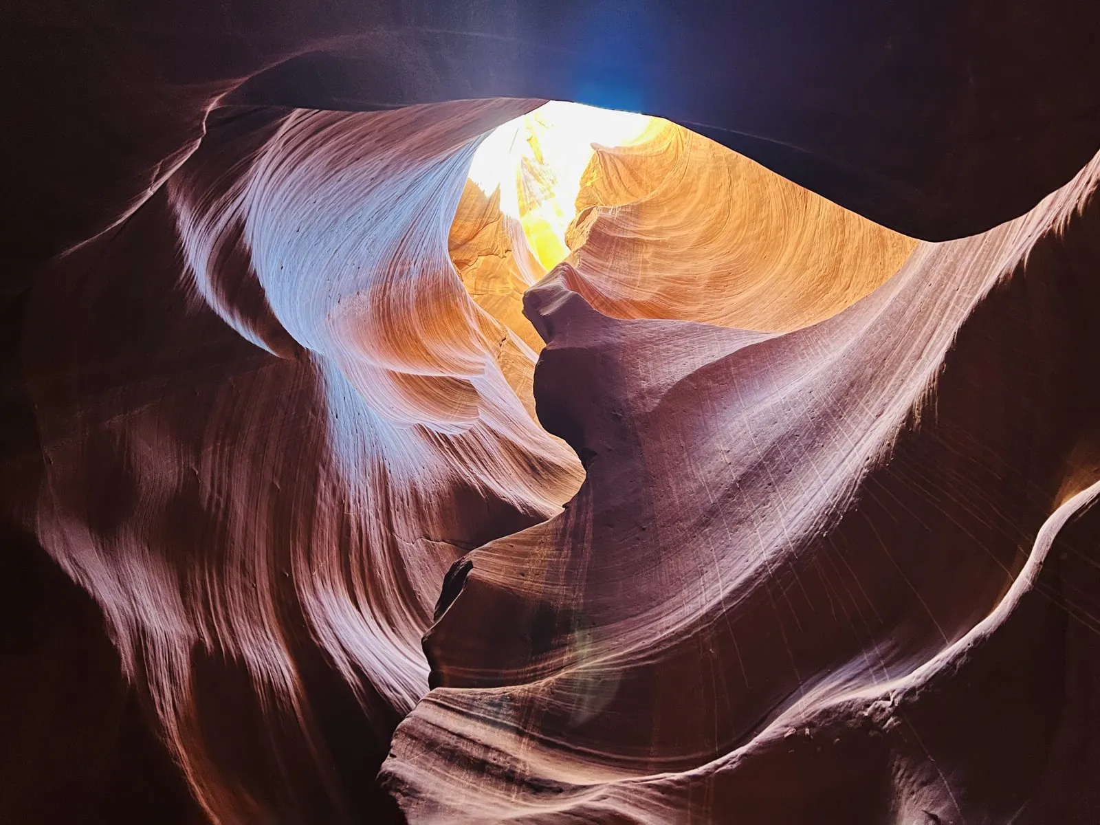
Deeper in, the canyon opens into small chambers and closes again, and the light comes in through skylights in the rock: here a narrow slit, there a ragged hole with a golden halo around it. The walls in these places curl up and over your head into shapes that would be hard to model on a computer, which is saying something.
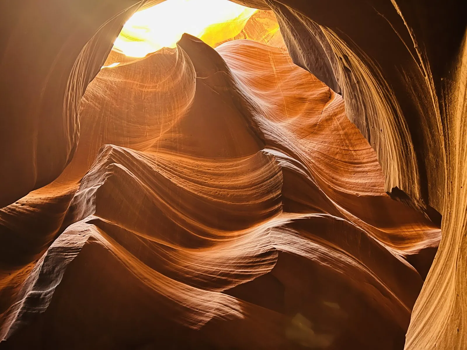
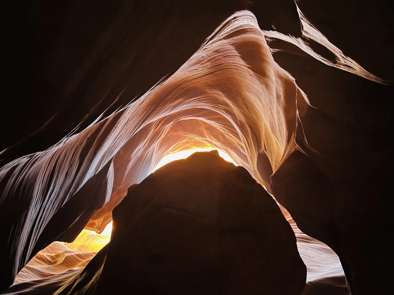
In one stretch, the walls are banded so strongly that they look like a stack of stone ribbons, white and lavender against black. This is the same layering as everywhere else, just cut at a different angle and lit from the side.
The beams
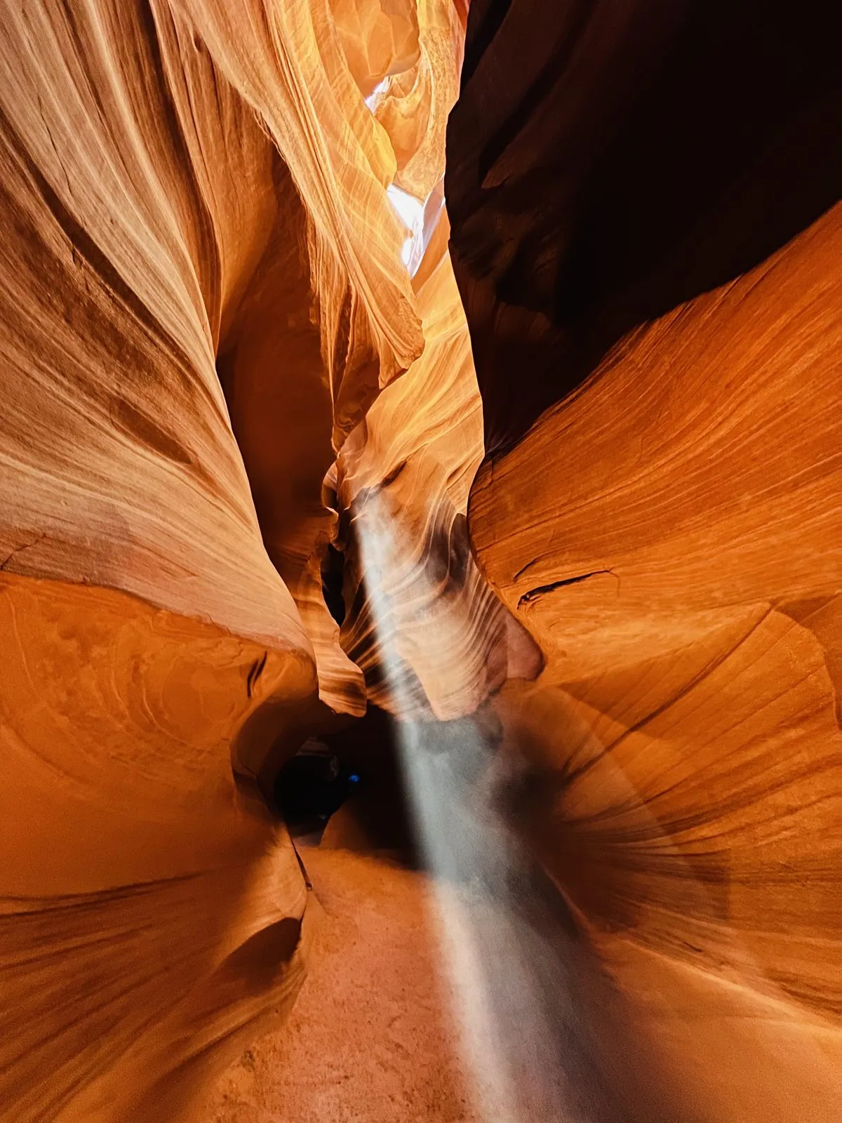
Then came the famous part. Around midday in spring and summer, the sun is high enough to shine straight down through a few gaps in the roof of the slot, all the way to the floor. In the dusty air of the canyon each of these shafts of sun shows up as a solid-looking beam of white light, standing on the sand like a column. The beams only appear for a couple of hours a day and only for part of the year. Mid-March is the very start of the season, and this is why the tours are timed by the clock so precisely, and why getting the clock wrong would matter.
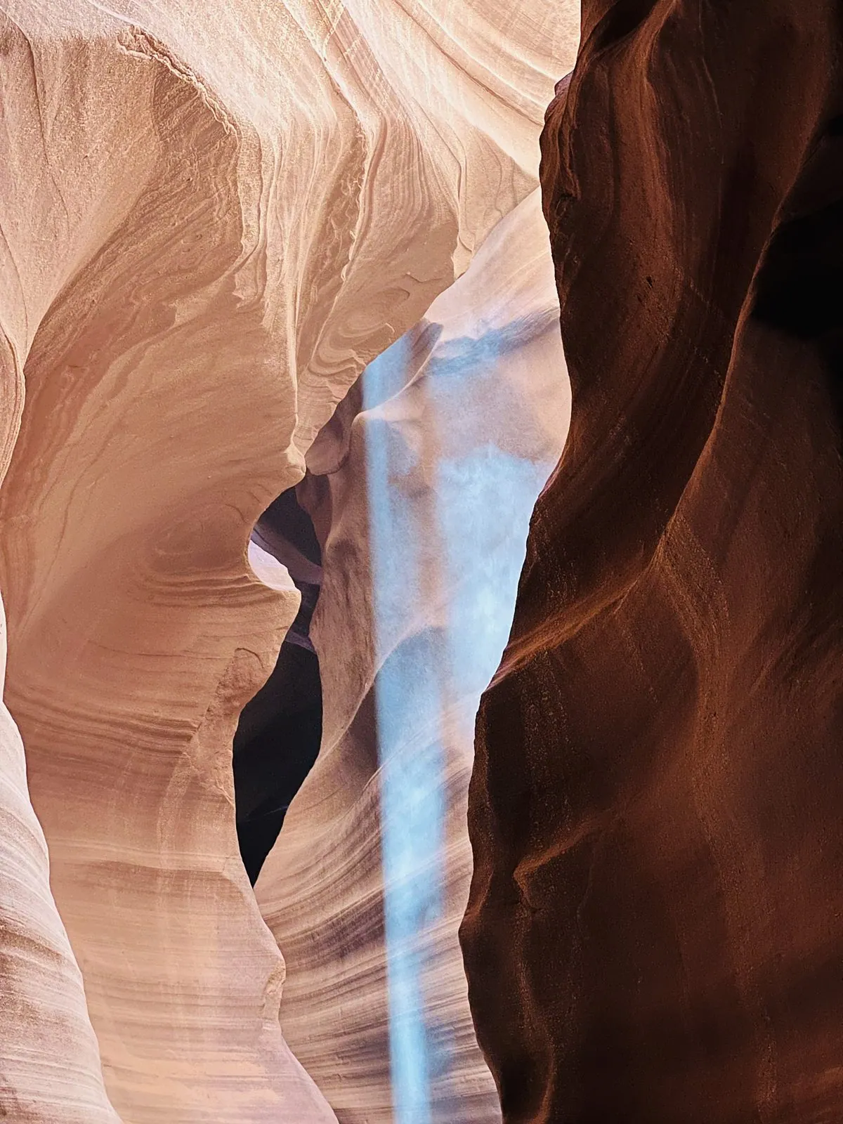
To make the beams really show, the guides throw sand into them. A handful of sand tossed up the wall falls through the shaft of light and hangs there for a few seconds as a glowing, sparkling cloud, then drifts down and piles up on the floor in a little white heap. It is a trick that has been done thousands of times a day for years, and it is still mesmerizing: for a moment the light itself looks like something you could pick up.
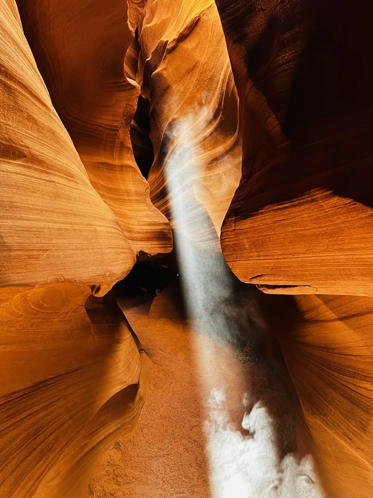
Toward the far end of the canyon the light changes again. The walls narrow, the slot gets taller, and the colors go from orange to a deep crimson, with bright pink edges where the sun catches the rim. In one last bend, the light from a single high opening turned the walls an icy blue, the deepest color of the day.
And then, at 1:24 Navajo time, we were out. Rather than walking back through the canyon, the route climbs out of the far end: a steep steel staircase, painted red, goes straight up from the slickrock, and a long covered catwalk leads back across the top of the bluff. After an hour in the shade, the sunlight on the open rock was blinding, the sky was an unbroken deep blue, and the sandstone around the stairs was the same wind-carved swirl as the walls below, only in plain daylight. It looked almost ordinary. It's hard to believe the canyon is down there.
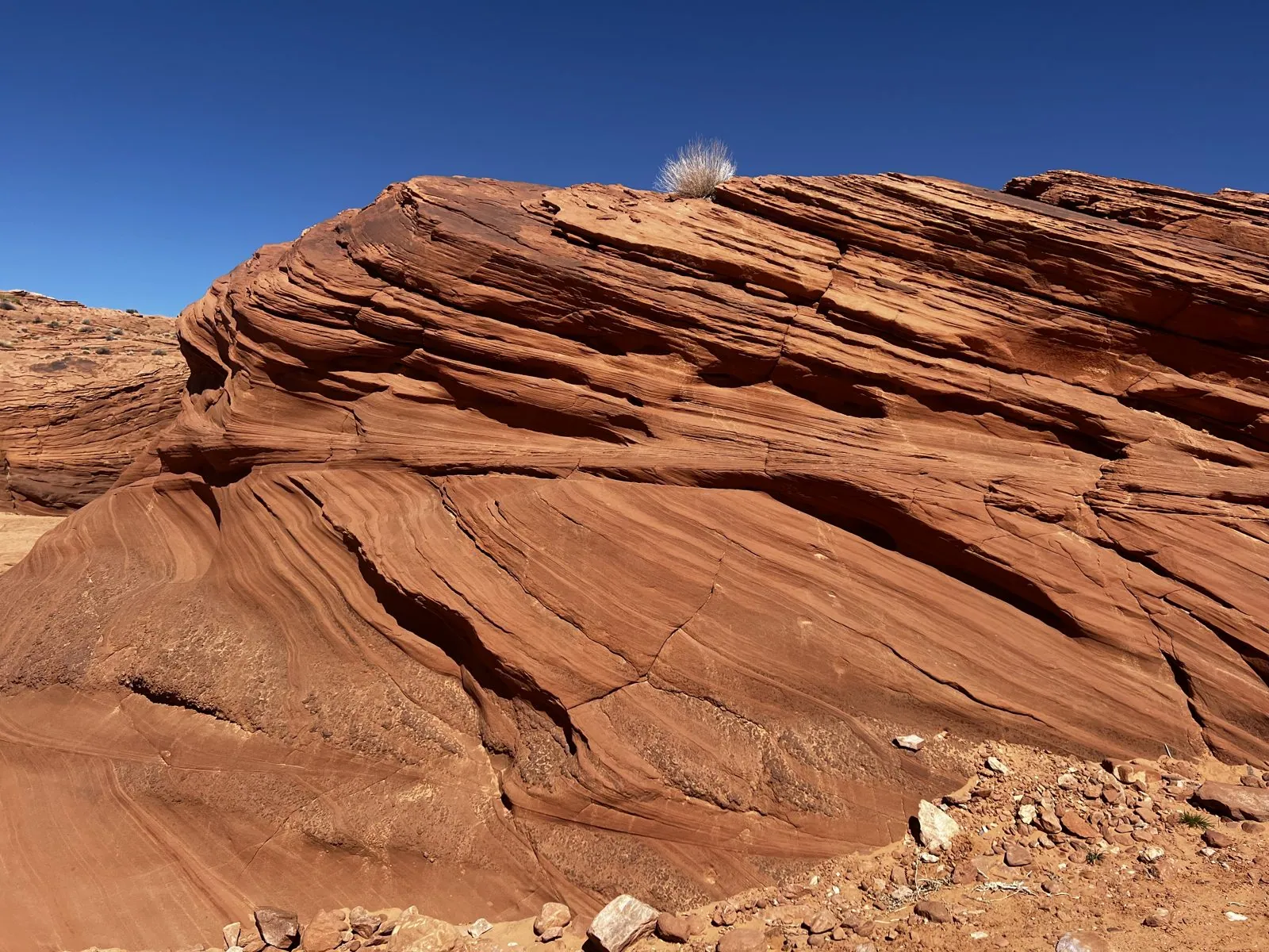
The stairs are a feat of their own: a narrow steel flight, set almost vertically against the rock, with a sheet-metal roof over each landing. From the bottom they seem to go straight into the sky. The catwalk, a long metal walkway along the rim, then carried us back over the sand toward the trucks.
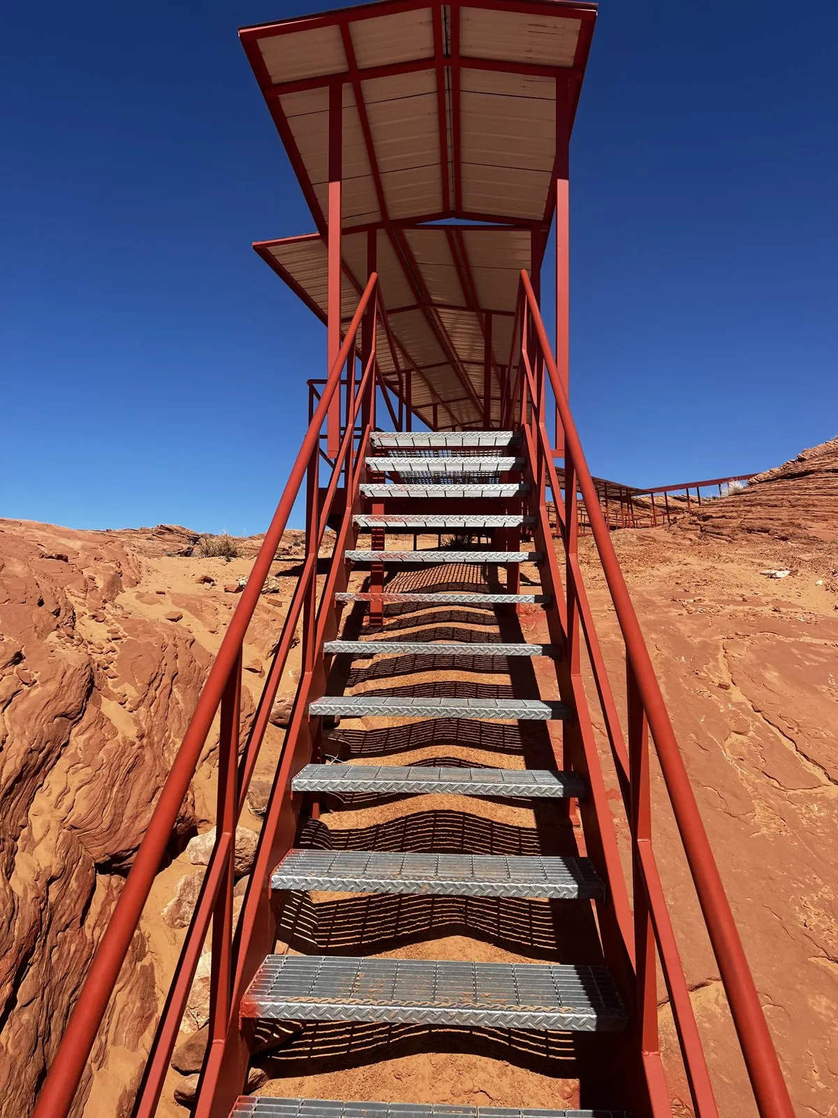
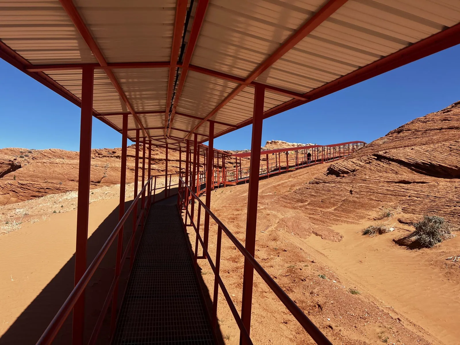
So, after all that, did the clocks cause any trouble? The photos say the tour truck left at 11:08 Arizona time, and the canyon visit ran from about 11:35 to 12:25, which is right in the middle of the window for the light beams. If there was any confusion on the morning, it doesn't show in the photos. By 2:38 pm, back in Page, the phone had settled on Arizona time again, and stayed there.
Back to Las Vegas
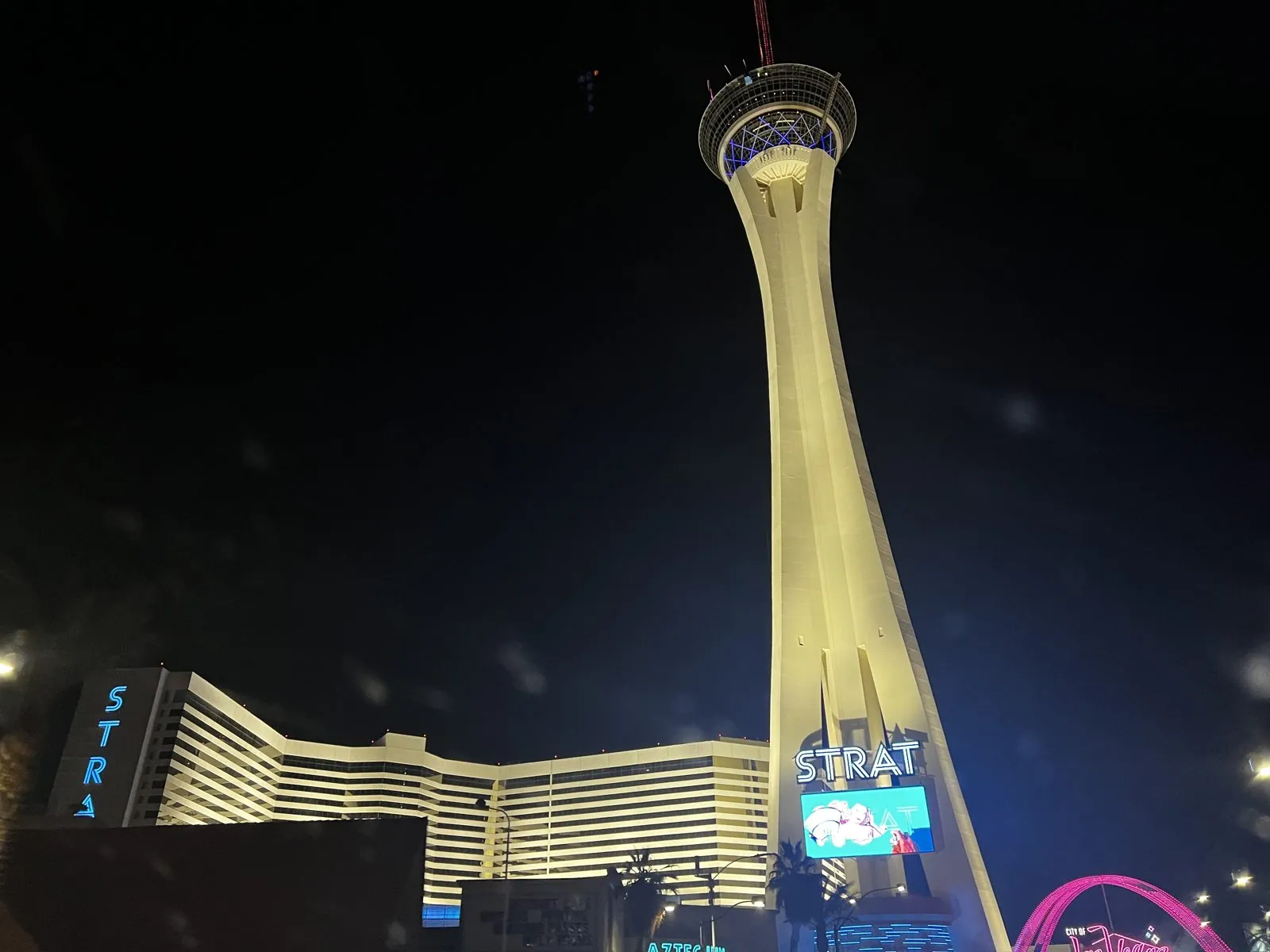
That afternoon we drove back to Las Vegas, the same 275 miles in reverse, and by 7:18 pm we were on the freeway into the city. At 7:37 the first thing in the windshield was The Strat, its tower lit up gold against the night, at the north end of the Strip.
The Strat, at night
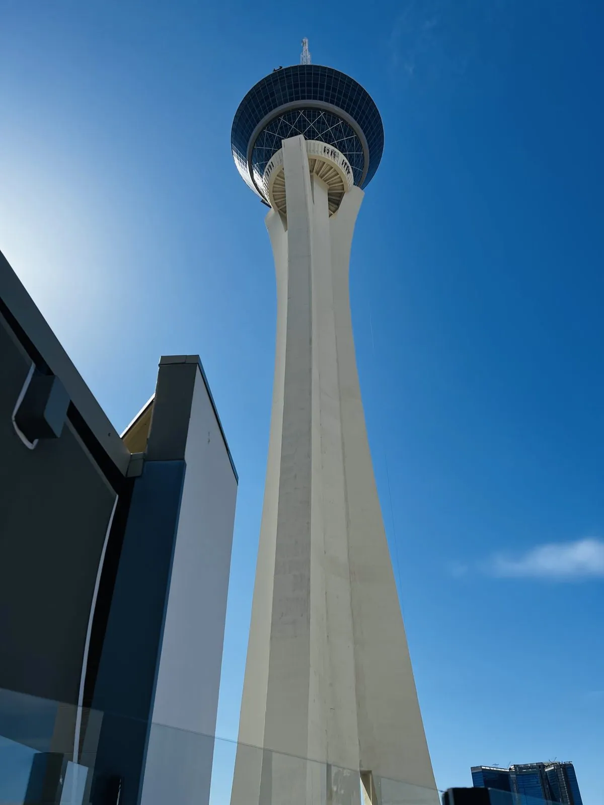
The Strat (originally the Stratosphere) is an 1,149-foot concrete tower with a pod of observation decks, restaurants and thrill rides on top. Opened in 1996, it is the tallest freestanding observation tower in the United States. From the road at night it is pure showbiz: a gold-lit shaft rising from a white hotel complex, the pod at the top glowing like a crown, with the neon of the old north Strip all around its base.
A little after nine we were at the top. From the observation deck, the city lies spread out underneath you in every direction, a vast flat grid of orange streetlights that runs all the way to the dark mountains on the horizon, perfectly straight roads ruled across it. The Strip is the brightest line on the grid, heading south from the foot of the tower toward the airport. At this height the city is completely silent. Up close it is all noise and flashing signs; from more than 800 feet up it is just a carpet of light, slowly twinkling.
At the edge of the deck, a giant yellow steel arm sticks out over the drop: one of the thrill rides that hang people off the side of the tower. We stuck to the railings.
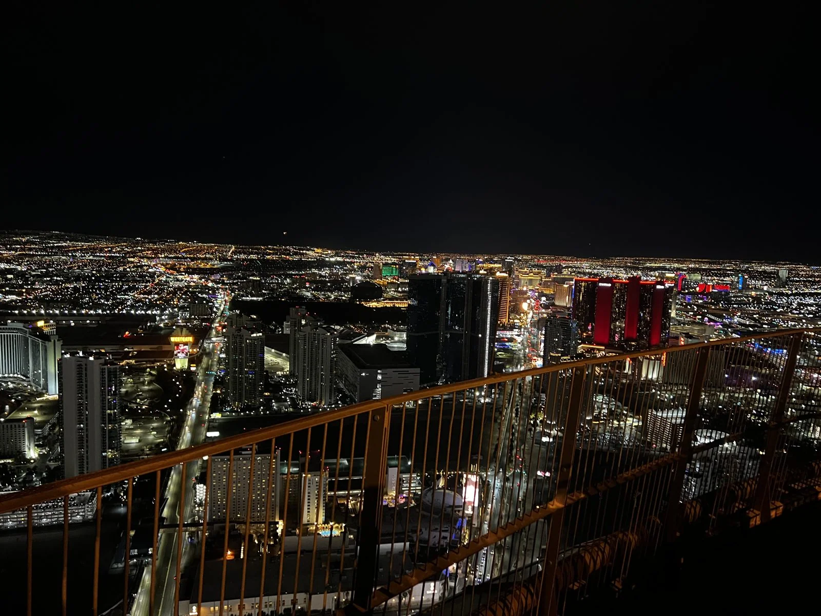
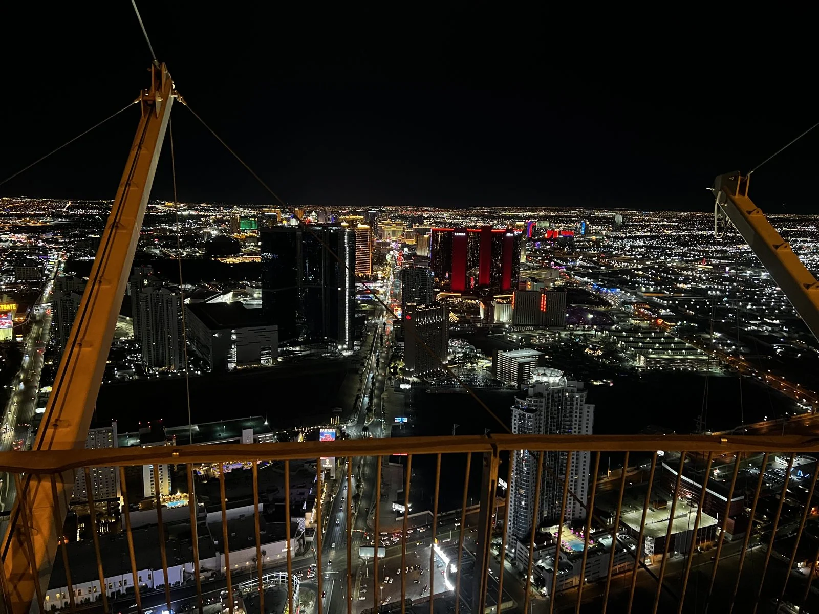
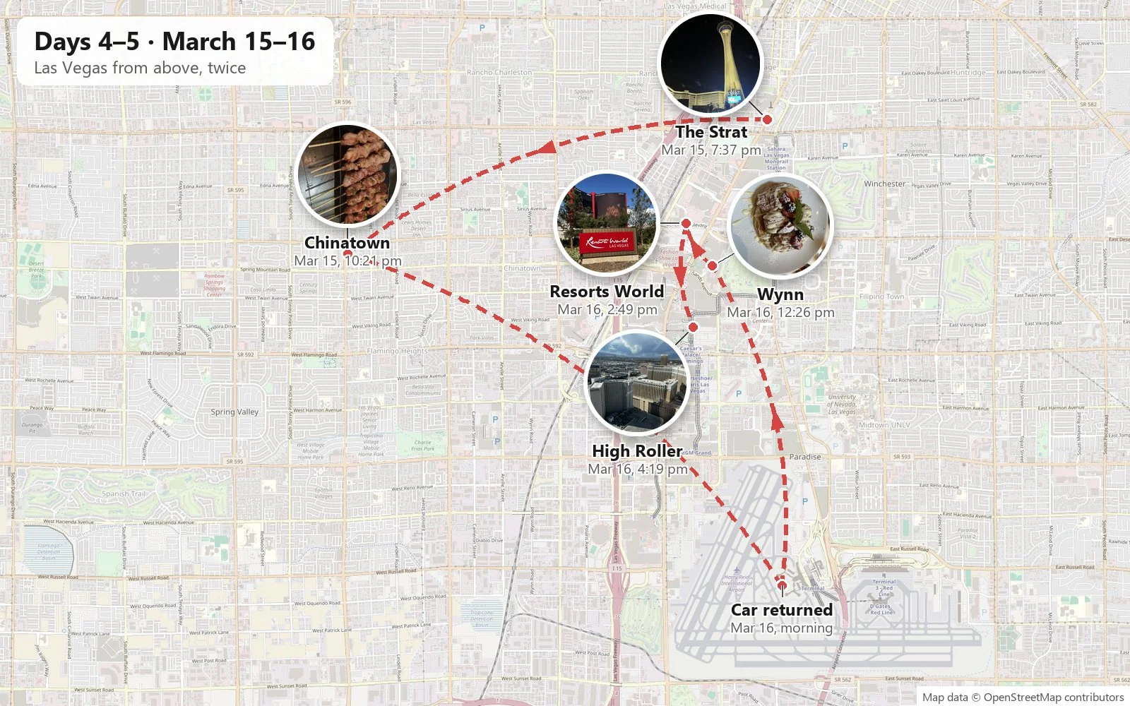
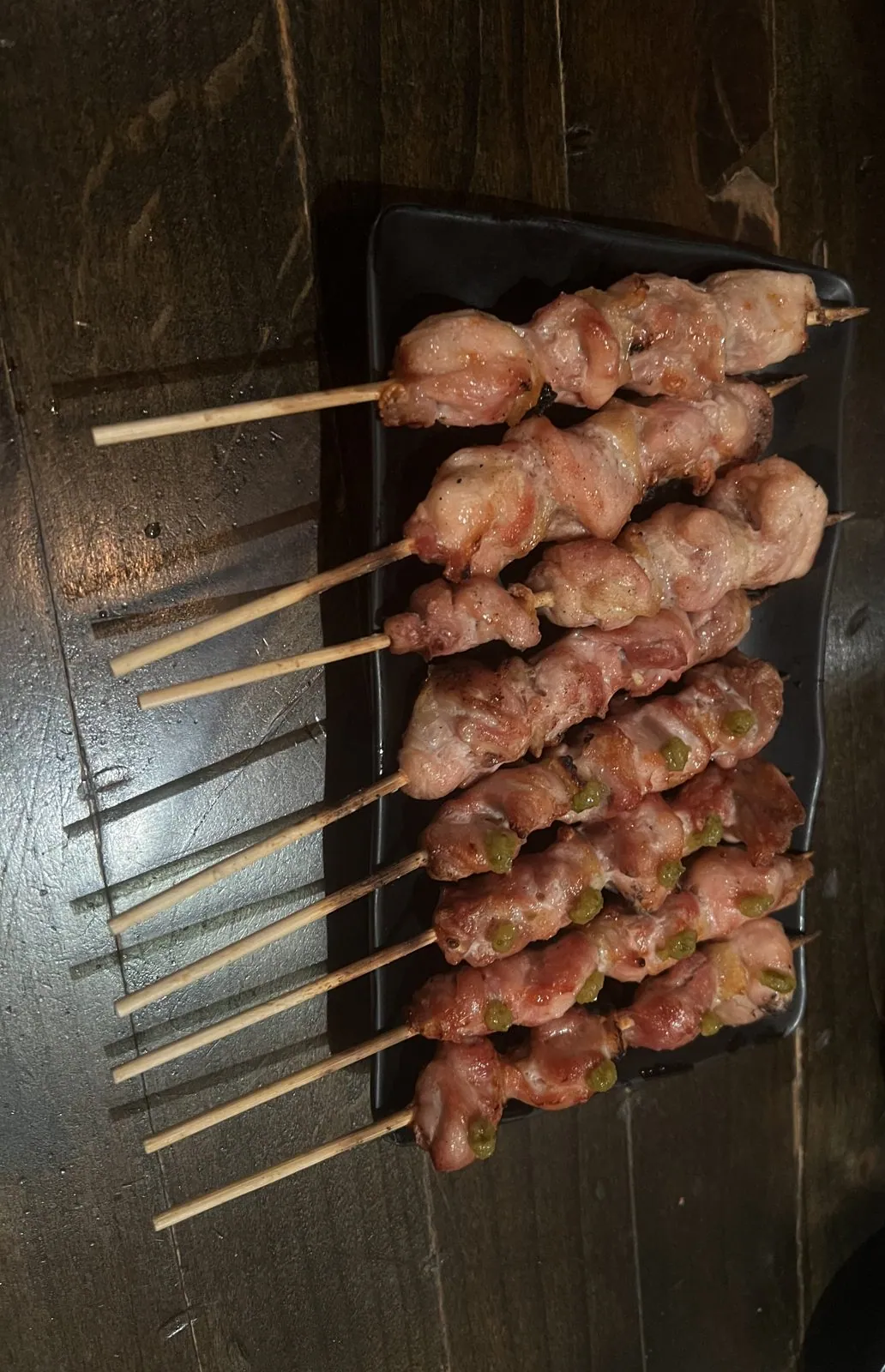
The day ended, at 10:21 pm, a few miles west in Las Vegas's Chinatown, at Hachi, a Japanese izakaya: skewers with a wedge of lemon, then a tray of chicken. Considering that the day had started at Horseshoe Bend before sunrise, this was a reasonable reward.
Day 5: the last day in Vegas
On the last morning, Wednesday, March 16th, we returned the car at the airport's rental car center at a quarter to nine. By mid-morning we were back at The Strat, where we had spent the night. By day, from its base, the tower is an entirely different object: a plain white concrete shaft that goes straight up into a deep blue sky, the pod at the top tiny and dark. You have to tilt your head all the way back to see it.
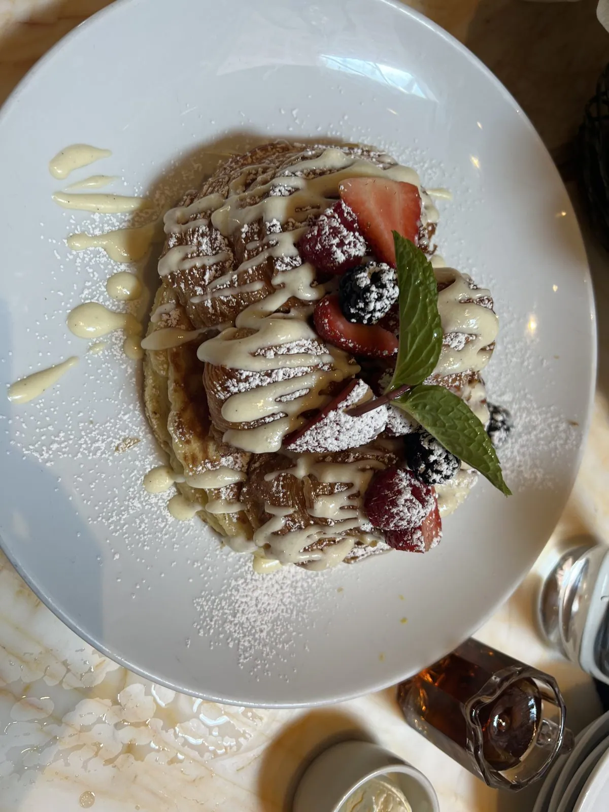
Brunch, at half past twelve, was at the Wynn, which Steve Wynn opened in 2005 on the site of the old Desert Inn. The restaurant was bright and busy, and the food was brunch done properly: strawberry smoothies with a whole strawberry on a stick, eggs Benedict, crisp potatoes, and a stack of pancakes buried in berries, mint and cream.

Resorts World, again
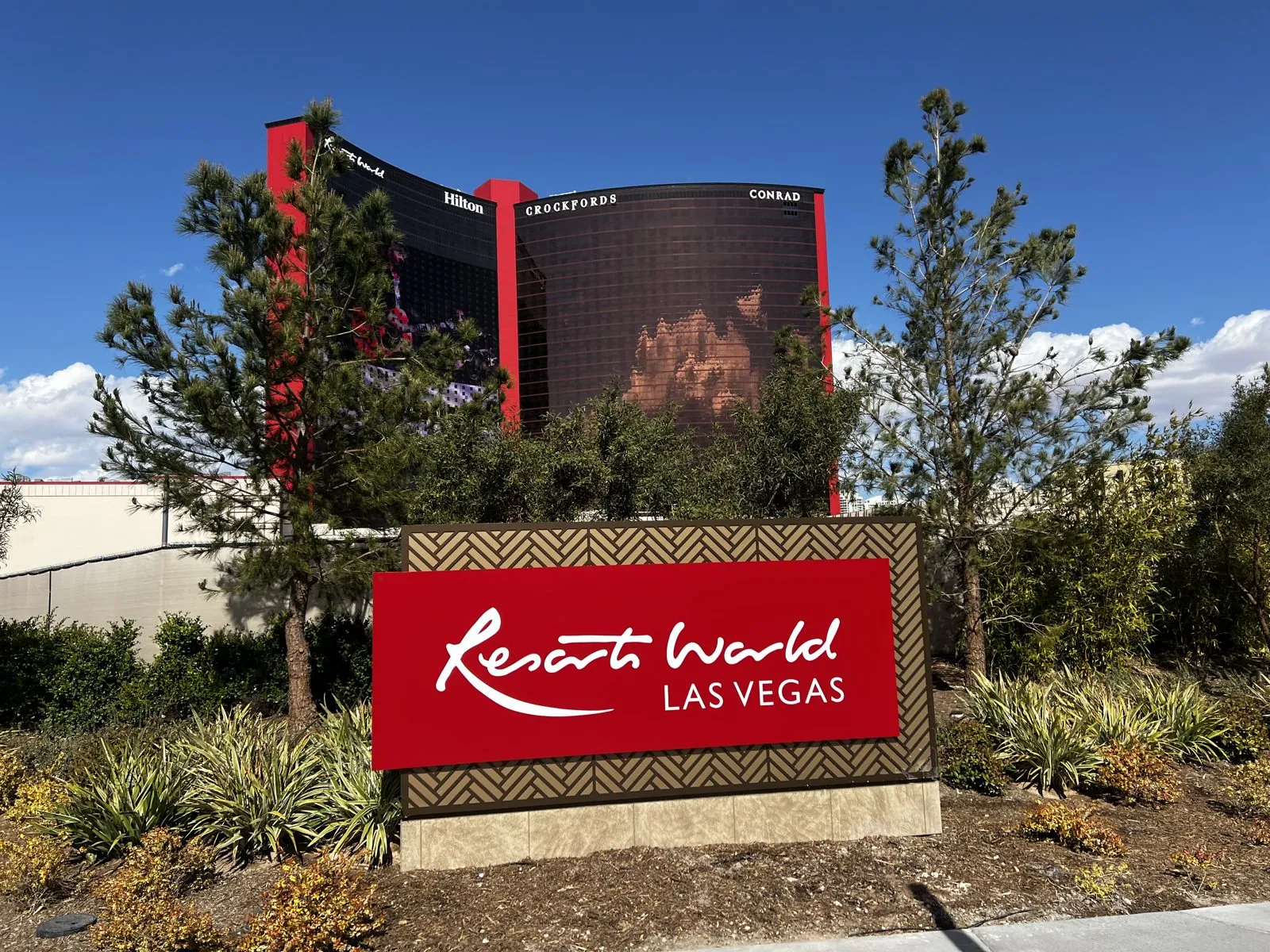
Mid-afternoon took us back to Resorts World, which had looked so dramatic two mornings earlier. In the afternoon light, with big white clouds rolling over from the west, the huge LED wall on the side of the tower was showing an animation of glowing orange shapes. The red sign at the entrance, in front of a garden of desert trees, is clearly designed to be photographed, and we obliged.
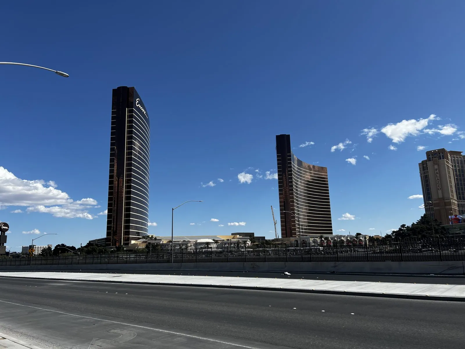
Across the street, the north end of the Strip showed what Las Vegas looks like between projects: tall towers in bronze and dark glass, separated by empty lots and long stretches of fence, with big desert clouds sailing over all of it. The Strip is always building something and always tearing something down, and this end of it has more gaps than most.
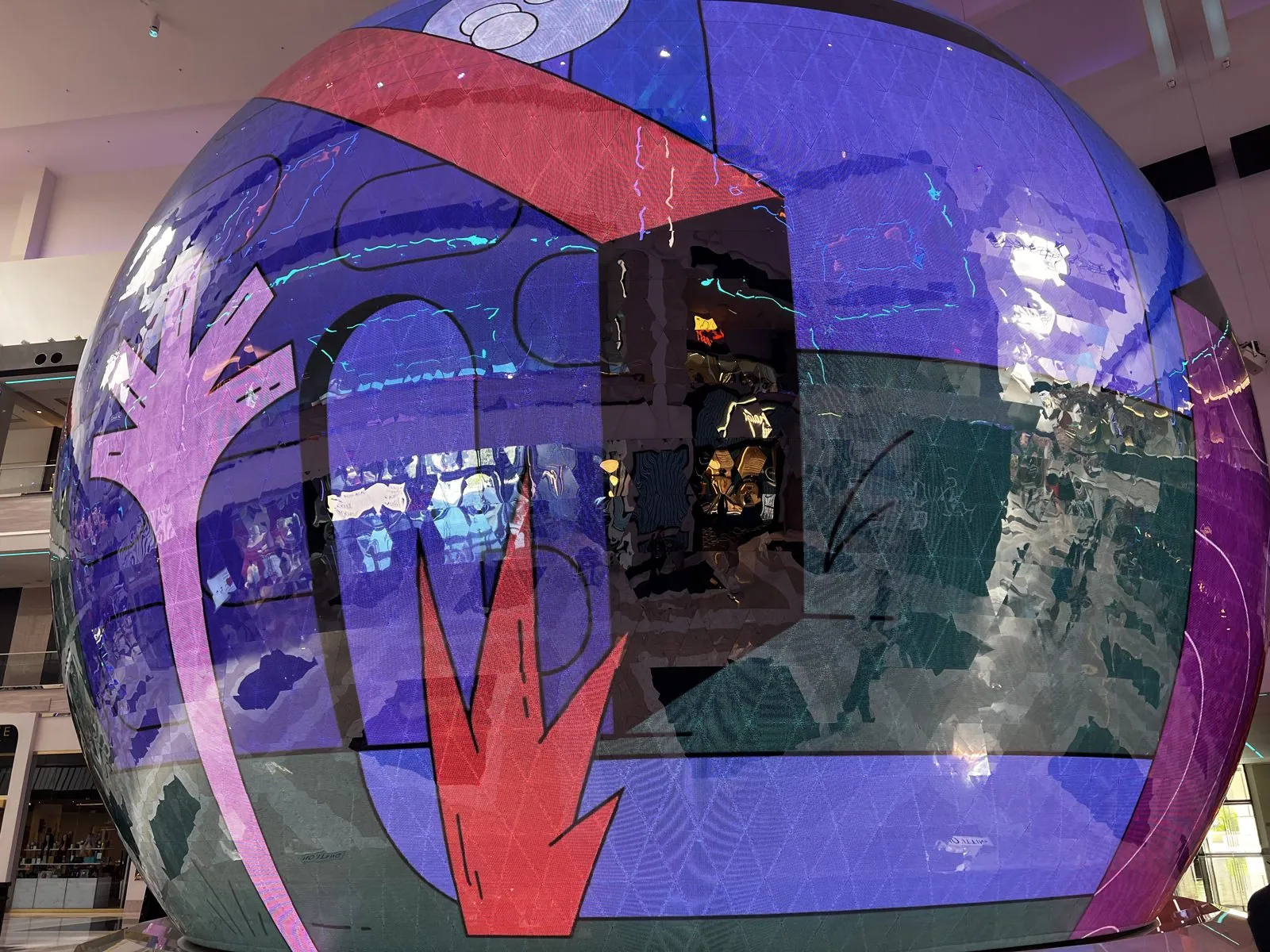
Inside, Resorts World is a newer kind of casino. The ceilings are high and coffered, lit with soft gold, and the carpet is a bold black-and-white zigzag instead of the traditional dizzying swirl. The centerpiece of the atrium is a giant glass sphere covered in a projected artwork, a glowing ball of purple, red and blue several times taller than a person. The slot machines, as everywhere else in town, are the same as always.

The High Roller
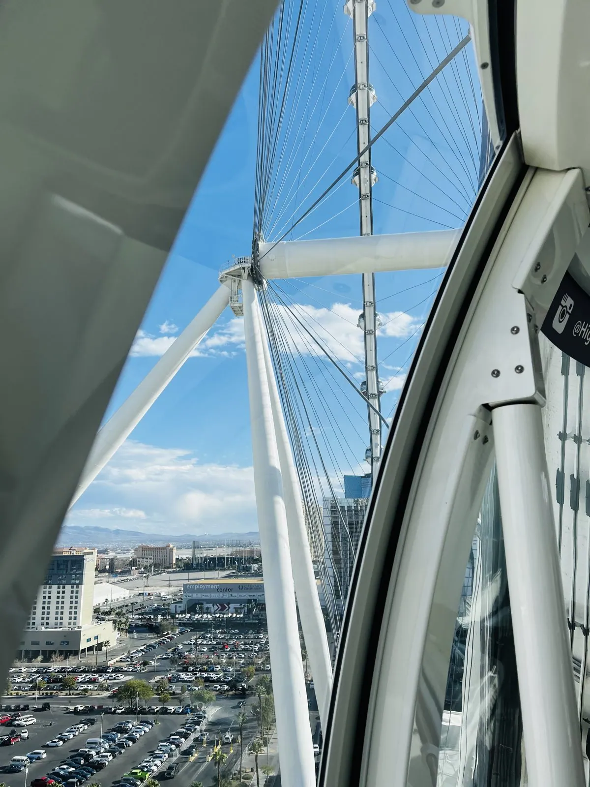
The last stop of the trip was the High Roller, the giant observation wheel behind the LINQ in the middle of the Strip. It is 550 feet tall and, when it opened in 2014, it was the tallest observation wheel in the world, a title it kept until Dubai built a bigger one in 2021. It turns so slowly that it never stops: you step into a glass cabin the size of a small room while it is moving, and one revolution takes about half an hour. We boarded at 4:19 pm, and the photos run until 4:40.
As the cabin rises, the wheel itself becomes part of the view. Looking up through the glass you see the huge white rim and its cables, like the spokes of an enormous bicycle wheel, with the other cabins hanging off it. Looking down, you see the parking lots and the LINQ promenade dropping away.
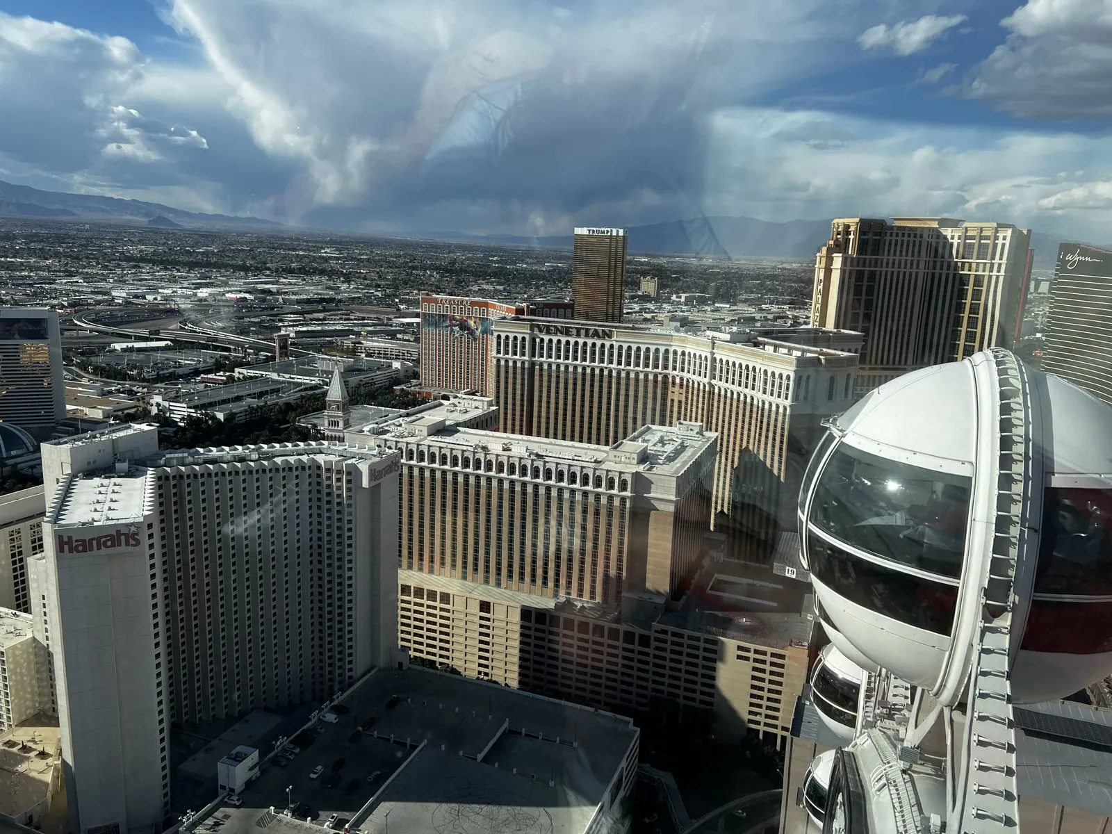
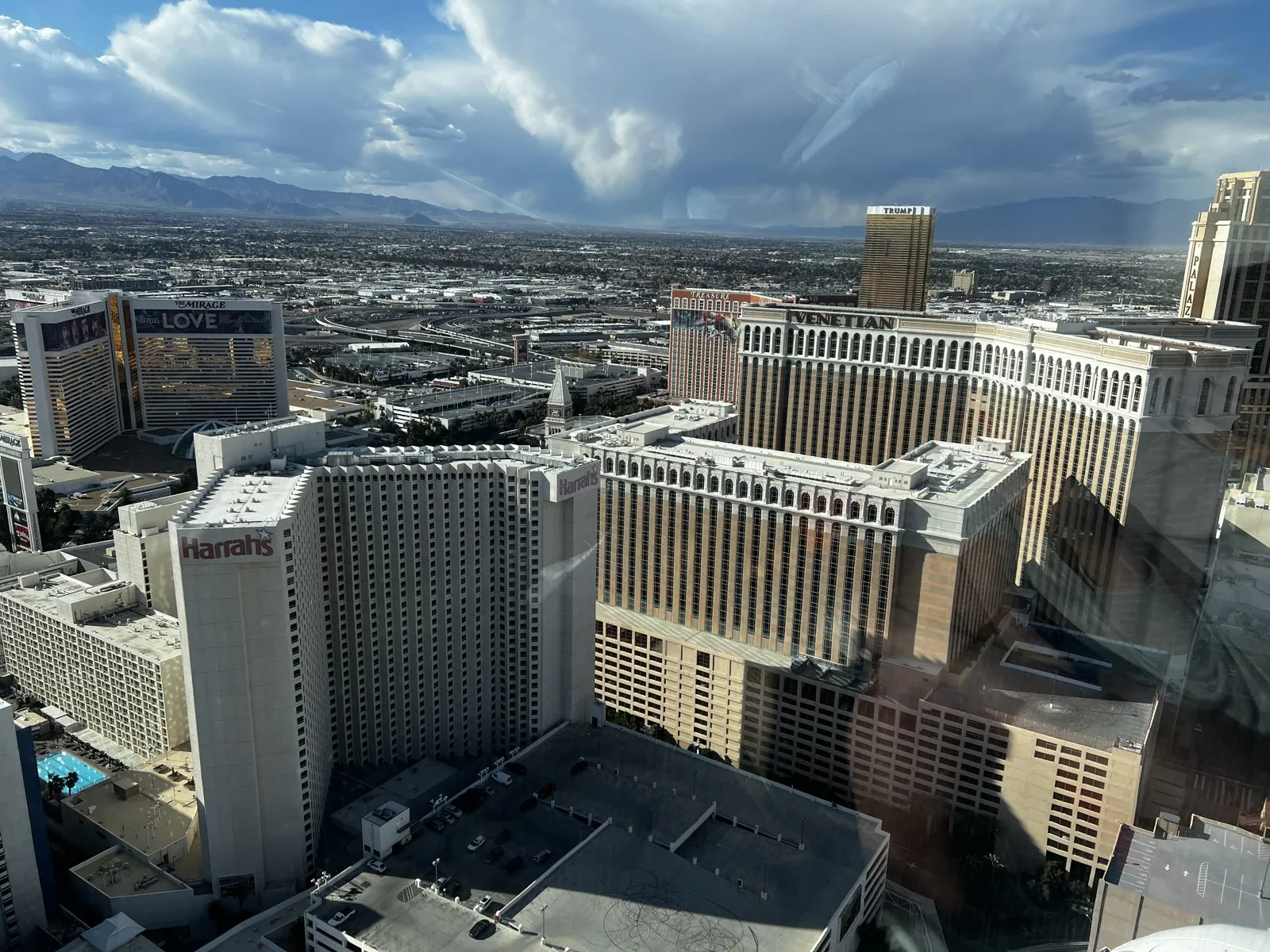
Near the top, the whole middle of the Strip lies below you. Directly underneath are Harrah's and, beyond it, the Venetian with its campanile; across the road is the pink-and-white bulk of the Flamingo, the oldest resort still operating on the Strip, with a garden and pools tucked into the middle of its towers. Farther south, the Bellagio's long curved front and the glass towers beyond it line up in the haze, and beyond them all, the mountains. That afternoon a squall was building over the mountains, with rain hanging below the cloud in long gray streaks, so the light changed every minute.
It is a good way to end a trip like this one. Four days earlier we had been looking down from Dante's View into the lowest valley on the continent, and the day before that from the rim of Horseshoe Bend. Here was one more view from above, of a city that only exists because of water brought across the desert, much of it from the same river that carved the bend. Las Vegas gets most of its water from Lake Mead, the reservoir behind Hoover Dam, a few hundred miles downstream of Lake Powell's bathtub ring.
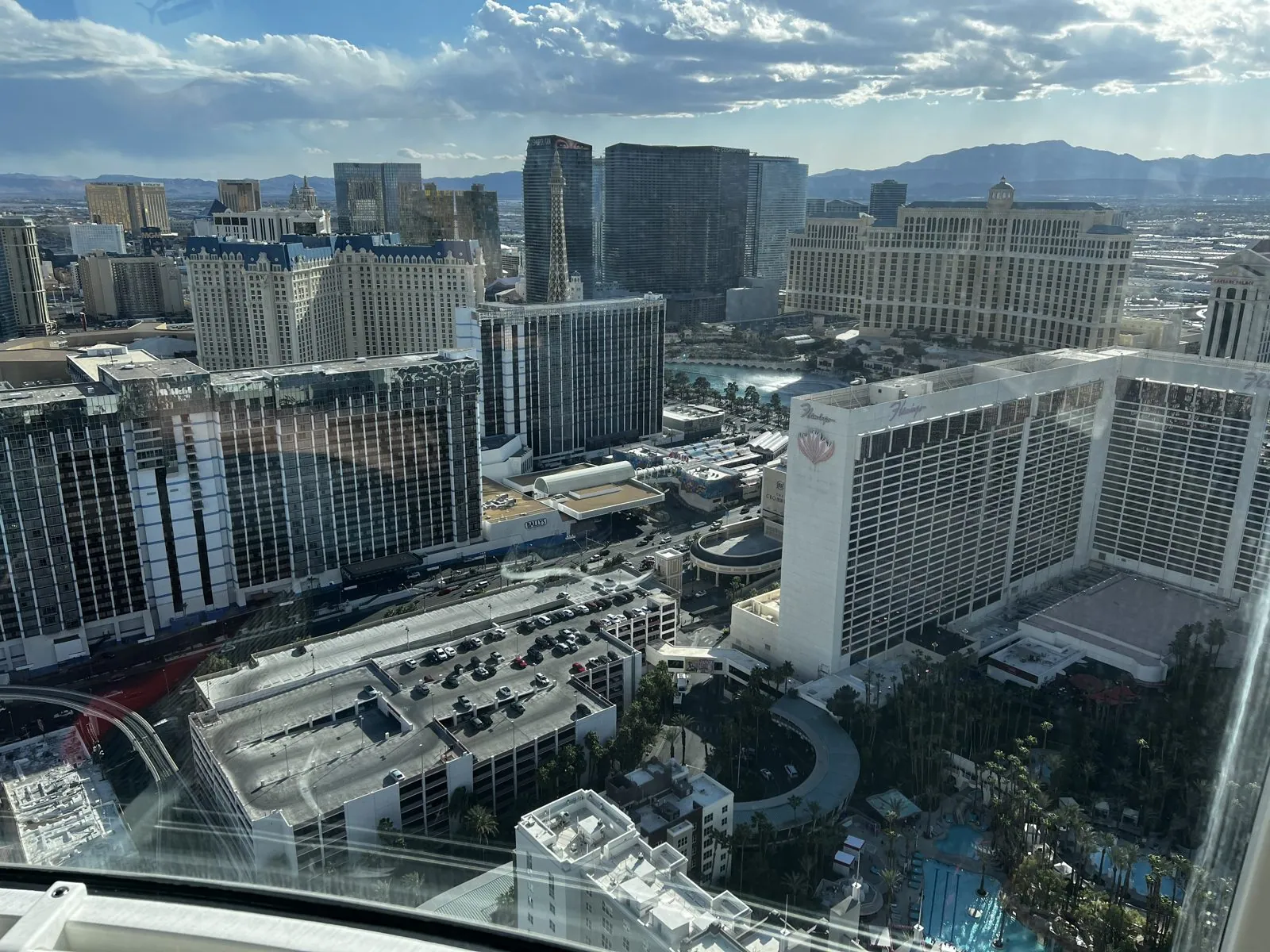
The cabin came back down to the platform at 4:40, and that is the last photo of the trip. That evening we flew home to Los Angeles.
Five days, three clocks
Looking back at it now, what stands out is how much the landscape changed for such a short trip. In five days we went from salt flats below sea level to a thousand-foot cliff, from the dry clay hills of an ancient lake to a reservoir that was running dry, and from a canyon too narrow to stretch your arms in to a city laid out flat to the horizon. Death Valley is a landscape made by the ground sinking; Glen Canyon and Horseshoe Bend, by the ground rising and a river cutting down to keep up; Antelope Canyon, by sudden floods that last a few hours a year. And Las Vegas, by people who decided that none of that would stop them.
And then there are the clocks. Most people never notice their phone changing time zones. On this trip the photos' clock jumped at least seven times in three days, and only one of those jumps was daylight saving. A few were real state lines; the rest were the phone flipping back and forth between Arizona time, Navajo time and Utah time, depending on which cell tower it happened to hear. The photos remember all of it, faithfully, to the second. It is a small reminder that "what time is it?" is not quite the simple question it seems, and that in a few corners of the country, the honest answer is "it depends which side of the road you're on".
Maps built from the trip's photo timestamps and locations; the driving distance is an estimate from the route. Photo locations have been removed from the published images. Day maps: map data © OpenStreetMap contributors; each stop is placed where its photo was taken, hotels and home are never marked, and the dashed lines show the order of stops, not the exact roads.
Likes and comments
React with an emoji or leave a comment. Signing in with GitHub is required.