← Misc · September 2026
From the Volcano to the Beach
Big Island lava glow, a Kona coffee farm, and a week on Oʻahu.
Kona → the Kaʻū coast → Kīlauea by night → Waikoloa → Hilo → Holualoa coffee country → Honolulu → Waikīkī and Ala Moana → the Capitol District → Pearl Harbor → East Oʻahu → Byodo-In → Kualoa → Haleʻiwa → a luau at Aloha Tower → Chinatown → home
Two islands · one inter-island hop · a rental car on each side · 47 photographs of the same red sky · one colony of parking-lot cats
There was no occasion for this one. No anniversary, no conference, no long-laid plan: we decided to go, and the whole trip was planned the day before we left. Easy come, easy go. It turned out to be a good way to see Hawaiʻi, which rewards showing up more than it rewards preparation, and which on our very first night handed us something no itinerary could have promised.
The trip has a simple shape. It starts with fire and ends with a city. The first half is the Island of Hawaiʻi, the Big Island, where the ground is young and black and in places still being made: we landed in Kona on Labor Day and that same night were standing on the rim of Kīlauea, watching the sky above the caldera glow like the inside of a furnace. The second half is Oʻahu, where nearly a million people live on an island you can drive around in a day, and where the view from Waikīkī is towers, surf and Diamond Head instead of lava fields.
As with the road-trip post, everything here is rebuilt from the camera roll: where and when each photo was taken, in order. Where the photos are silent, I've left the day quiet rather than invent something to fill it. Where a place has a story, I've added a little of it, because Hawaiʻi is a place where almost every name on the map means something.
Part I: The Big Island
Kona, and the long way to the volcano
We landed at Kona a little after one in the afternoon. Kona's airport sits on a lava flow, and the first thing you notice stepping off the plane is that the landscape is not green but black: rough, crumbled ʻaʻā lava running down to the sea on both sides of the highway, with tufts of pale fountain grass growing out of the cracks. It looks less like a tropical island than like a building site that nobody has finished. Geologically, that is roughly what it is.
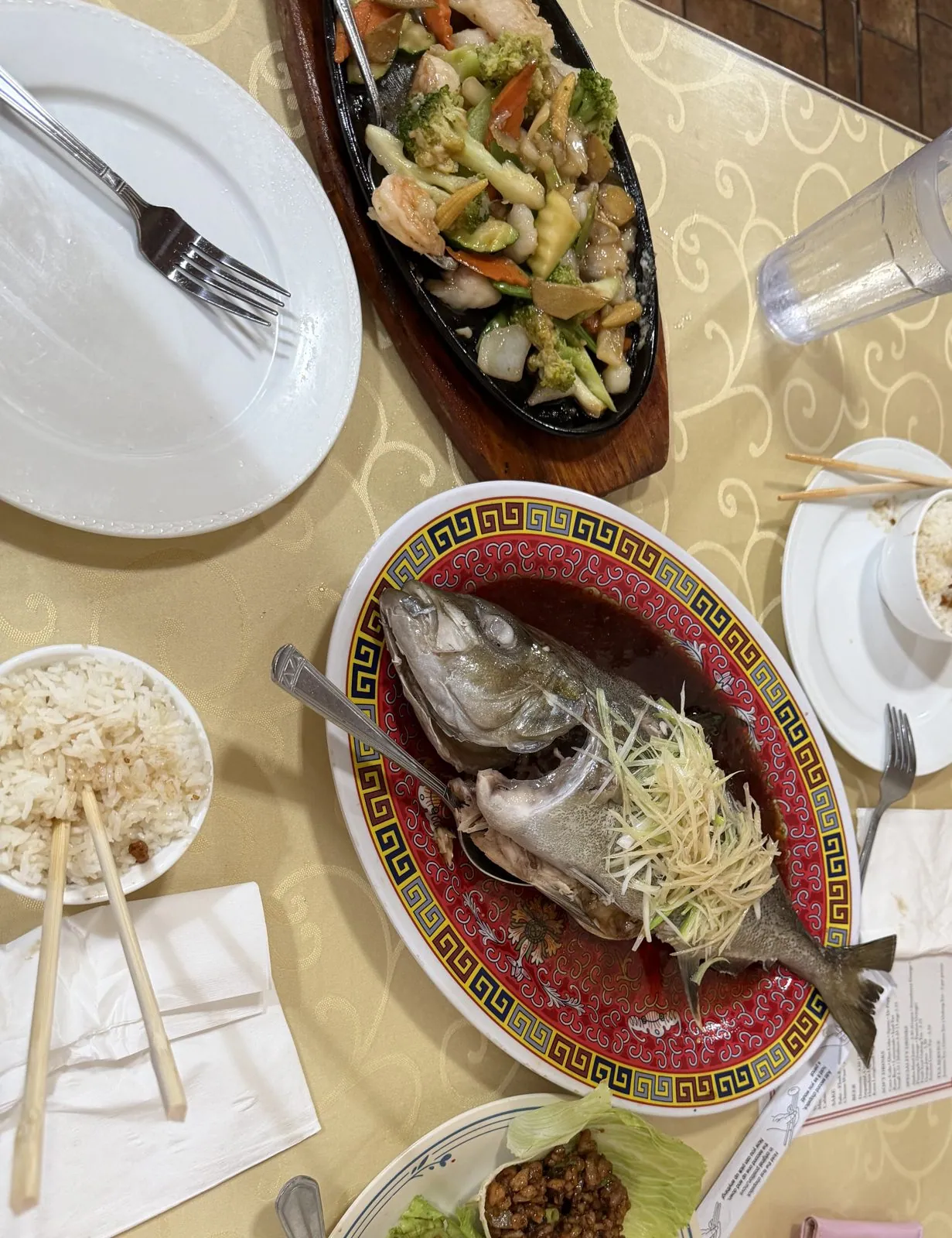
The first meal of the trip was a late Chinese lunch in Kailua-Kona: a whole steamed fish under a nest of ginger and scallion, a sizzling plate of vegetables, and lettuce wraps. It was the right fuel for what came next, which was a long drive.
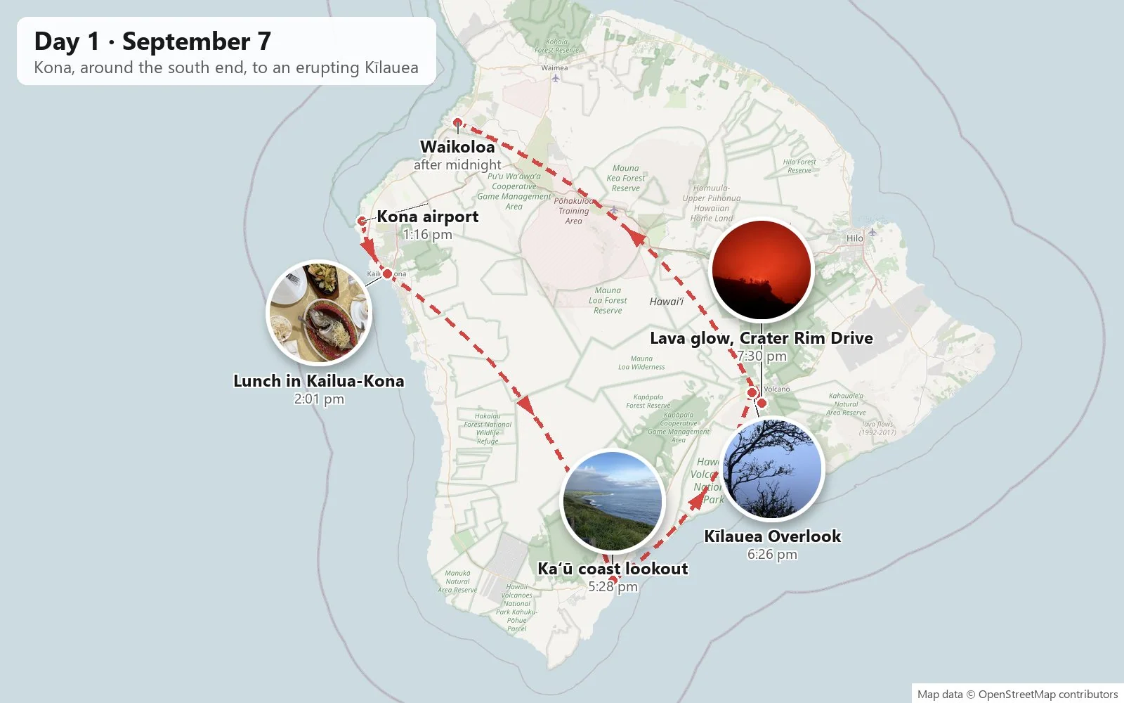
From Kona to the volcano you can go north and around through Hilo, or south and around through Kaʻū. We went south. The Māmalahoa Highway winds down the Kona coast, past coffee country, through the long dry emptiness of the southwest rift, and then swings east across the bottom of the island, the southernmost stretch of road in the United States. Ka Lae, South Point, is just off to the side, and the little town of Nāʻālehu calls itself the southernmost town in the country.
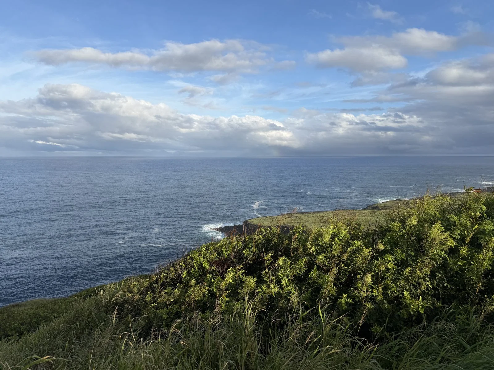
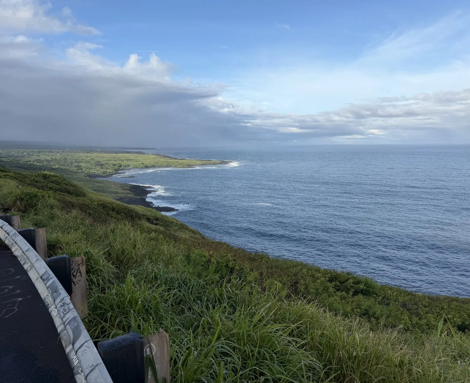
Just past Nāʻālehu, around half past five, the highway climbs to a lookout above the Kaʻū coast. The view is all green and blue: a grassy slope falling steeply to a ragged black shoreline, white surf working along it, and the coast running away to the east under a sky that was clearing after rain. Kaʻū is the least visited district of the island, and it shows. There is almost nothing built on that whole coastline.
Kīlauea at dusk
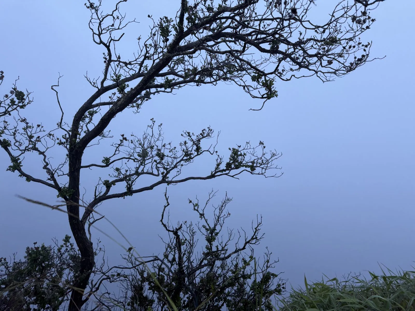
We reached Hawaiʻi Volcanoes National Park in the last of the daylight. At 6:26 we were at the Kīlauea Overlook, where the land just stops and the summit caldera opens below. In the blue dusk it was mostly mist. The one clear thing in the frame is a gnarled tree on the rim, its branches black against a pale blue sky, the kind of tree that looks like it was drawn by someone who had only heard trees described. It has the look of an ʻōhiʻa, the tough, twisted native tree that is among the first to grow on new lava, and whose red lehua blossoms in Hawaiian tradition are tied to Pele, the goddess of the volcano.
The summit is about four thousand feet above sea level, a different climate from the warm coast we had left that afternoon. And as the blue drained out of the sky, the clouds over the caldera started to turn a color clouds are not supposed to be.
The sky on fire
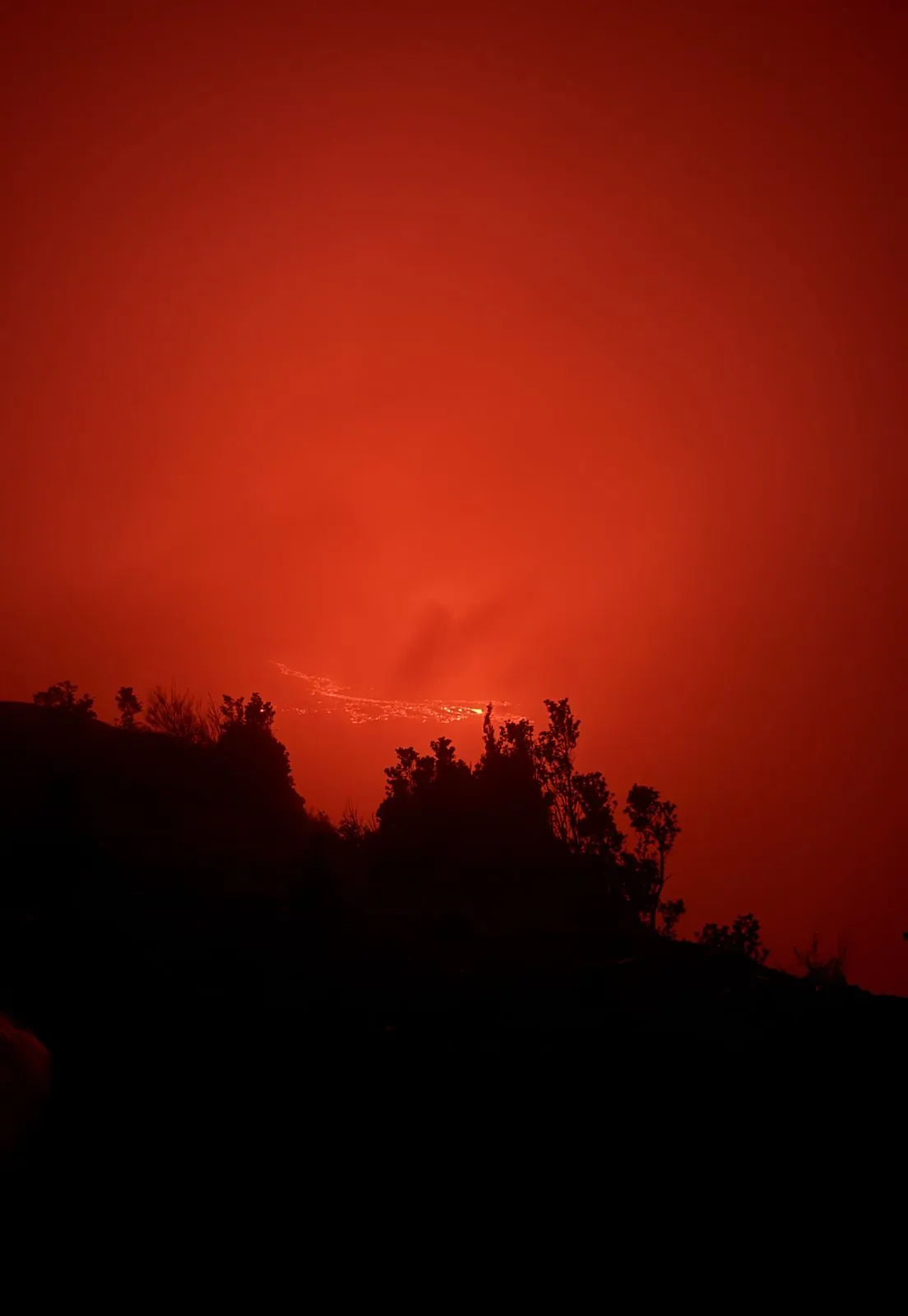
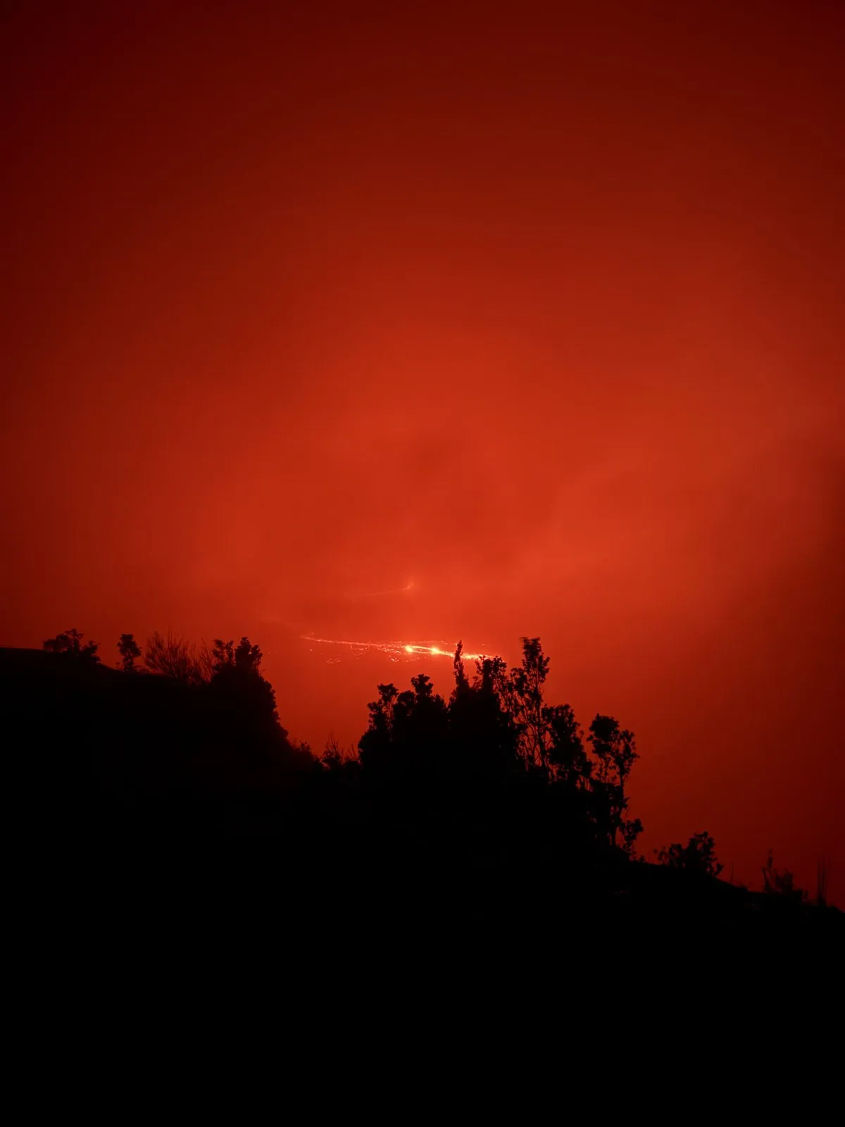
By 7:18 we had walked out along a closed stretch of the old Crater Rim Drive to Keanakākoʻi Overlook, on the rim, and the sky was red. Not sunset red: the sun was long gone. This was light coming up from below, from lava somewhere down in the crater, reflecting off the clouds and the volcanic haze until the whole sky over the caldera glowed orange-red, as if someone had left the door of a furnace open. The rim and the scrub along it were pure black silhouettes against it.
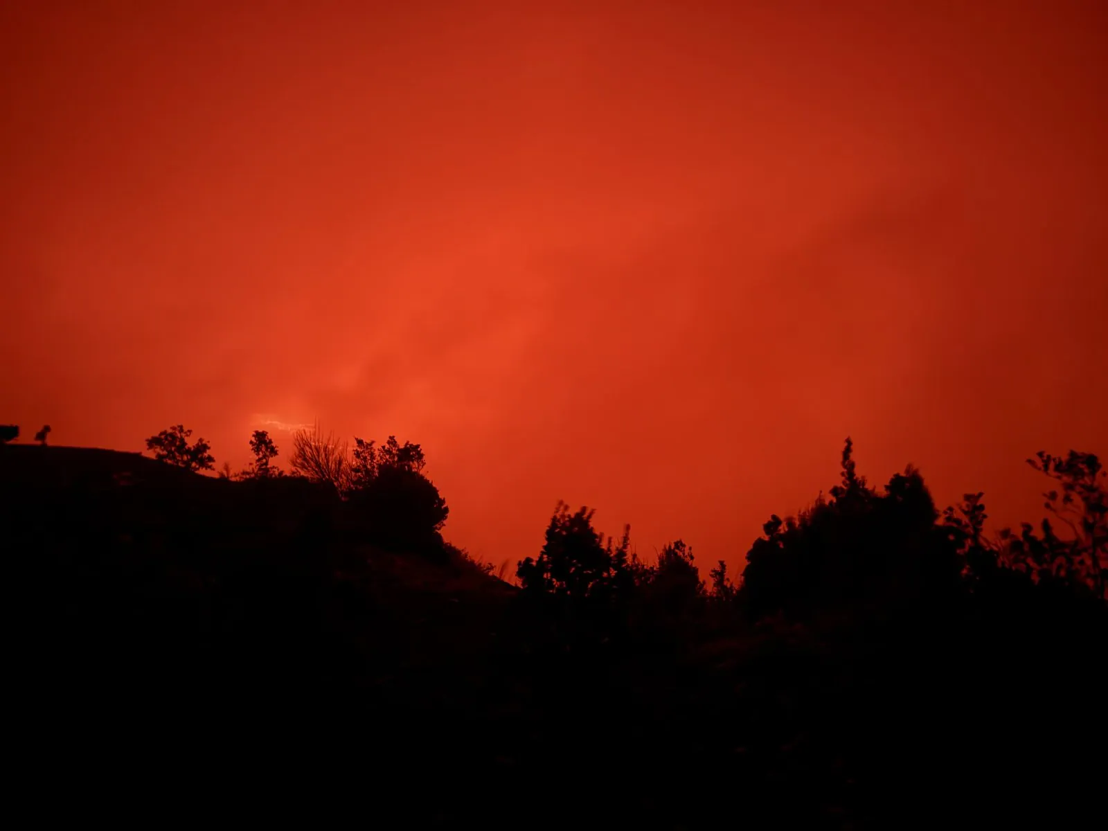
Kīlauea is one of the most active volcanoes on Earth, and its summit crater, Halemaʻumaʻu, is in Hawaiian tradition the home of Pele. In recent years it has been erupting on and off, sometimes for weeks at a time, sometimes in short, spectacular bursts. Just after we landed in Kona that afternoon, the Hawaiian Volcano Observatory had put out a notice: at about 12:45 pm Kīlauea had started up again, the first stirrings of episode 55 of the eruption in Halemaʻumaʻu, and the alert level had gone up to Watch. We had arrived on a night when it was very much on. Over the next hour the camera roll records forty-seven photographs of what is, technically, the same view. In my defense, the view kept changing.
It changes because the glow breathes. The haze thickens and the sky goes a deep dull crimson; it thins and the color brightens to orange. And at the bottom of the frame, just above the black line of the rim, there are threads of real light: thin bright lines and spatters of incandescent lava, far down in the crater, so bright they burn out the camera's sensor into little white-yellow streaks.
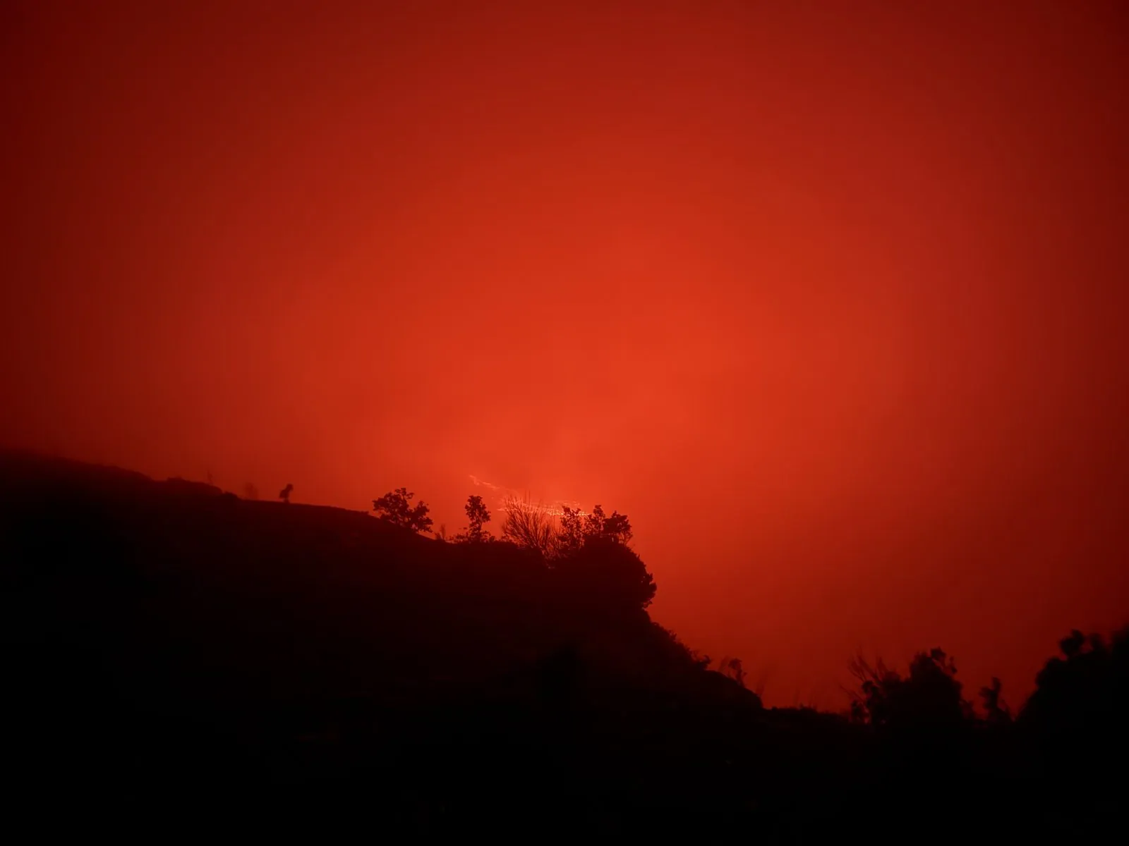
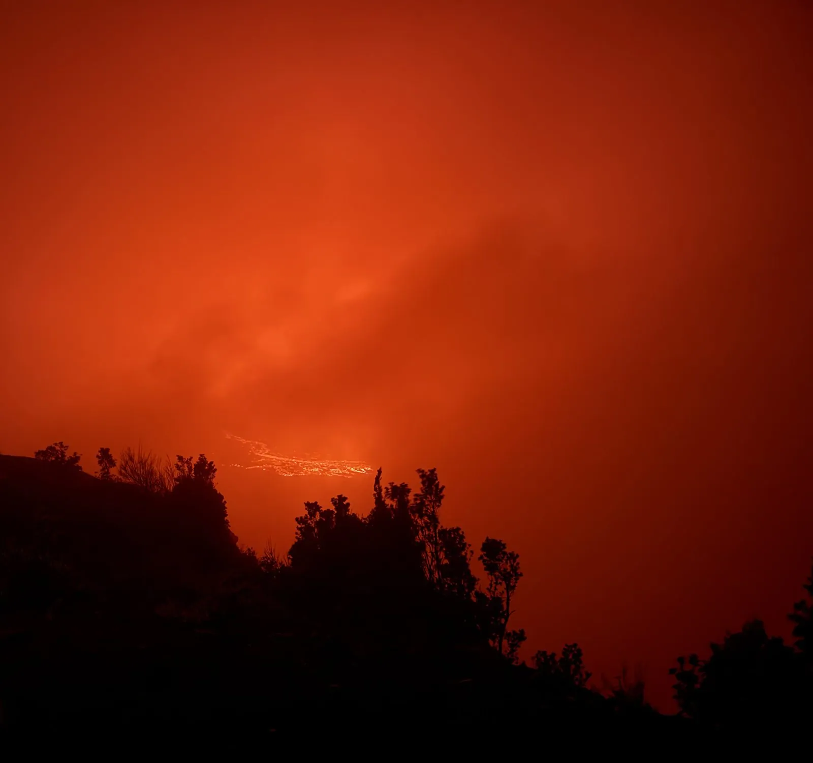
My wife filmed twenty seconds of it at 7:49: red haze moving over the crater, and below it a thin line of lava that comes and goes as the haze thickens and thins.
We were not alone. All along the rim, other people stood in the dark with their phones raised, small glowing rectangles held up against a glowing sky, all trying to catch the moment the color shifted again. There is something about standing on the edge of a crater full of molten rock, at night, that makes everyone take far too many pictures.
The last photo is from 8:15. Then came the long drive back in the dark: on to Hilo for a late takeout dinner of noodles and shrimp rolls, then over the saddle to the Kohala coast, arriving a little before midnight. My next photo is a view over the resort lagoons at Waikoloa, lit up and silent, at sixteen minutes past midnight. It was a long first day. Everything after it was going to feel a bit tame.
Waikoloa
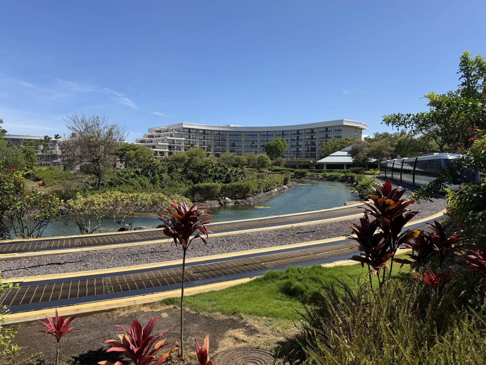
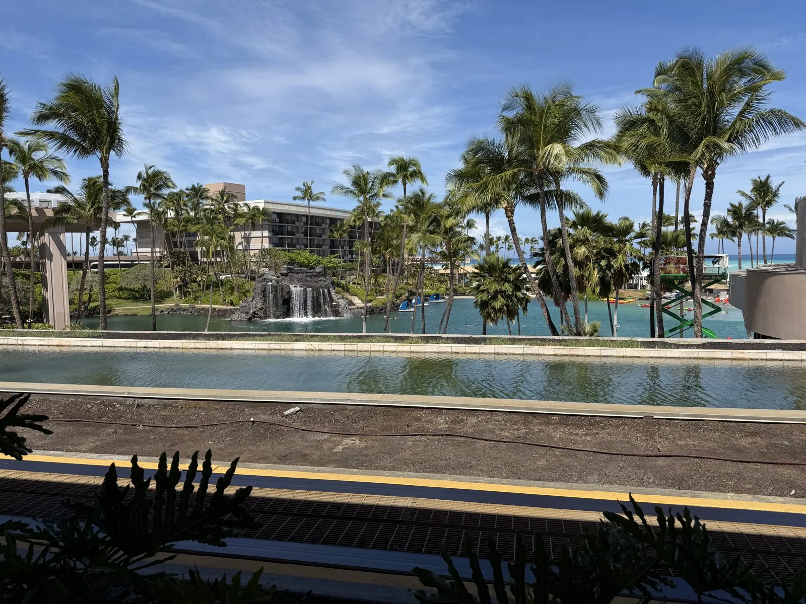
Our base for the Big Island was the Hilton Waikoloa Village, on the dry Kohala coast north of Kona. Daylight showed what we had arrived at in the dark: a resort large enough to need its own transport system. A tram glides along a track between the buildings, and boats run along a canal, past red ti plants and lagoons. There was also a pool with an artificial waterfall under the palms, and for a moment it was very hard to remember we had been standing on a volcano twelve hours earlier.
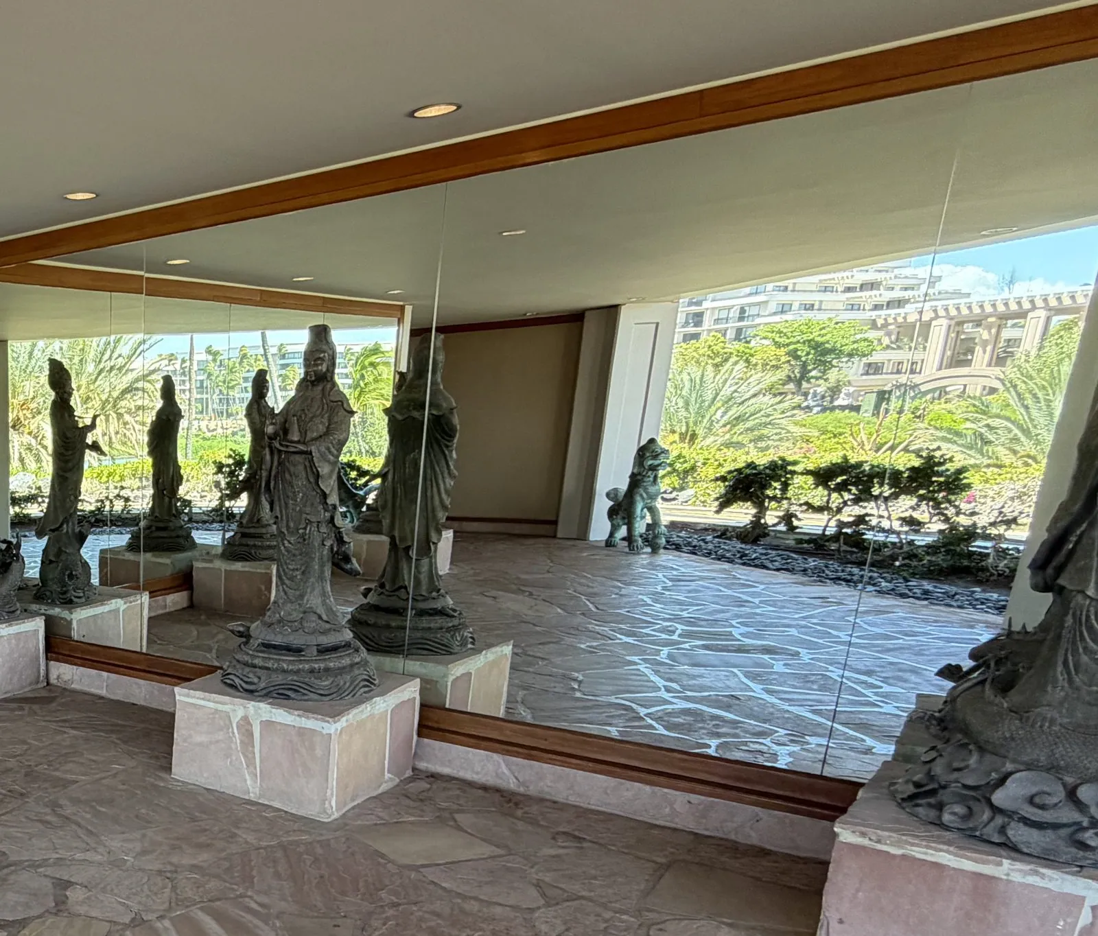
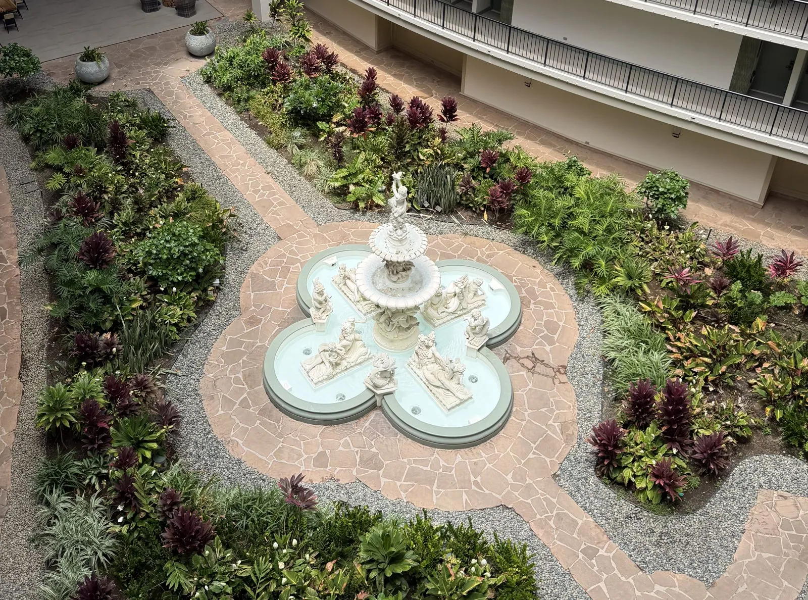
The walkways between the towers double as a gallery. In one open-air passage, a row of bronze statues of robed figures stands on stone plinths in front of a wall of mirrors, so the figures repeat into the distance, with the gardens and the sea showing through on the other side. And between the hotel wings there are quiet inner courtyards. From an upper walkway we looked straight down on one of them: a white fountain with sculpted figures, set in a cross of paths among red ti and ferns. It is a big, slightly theatrical place, and we liked it a lot. I would recommend it to anyone staying on this coast.
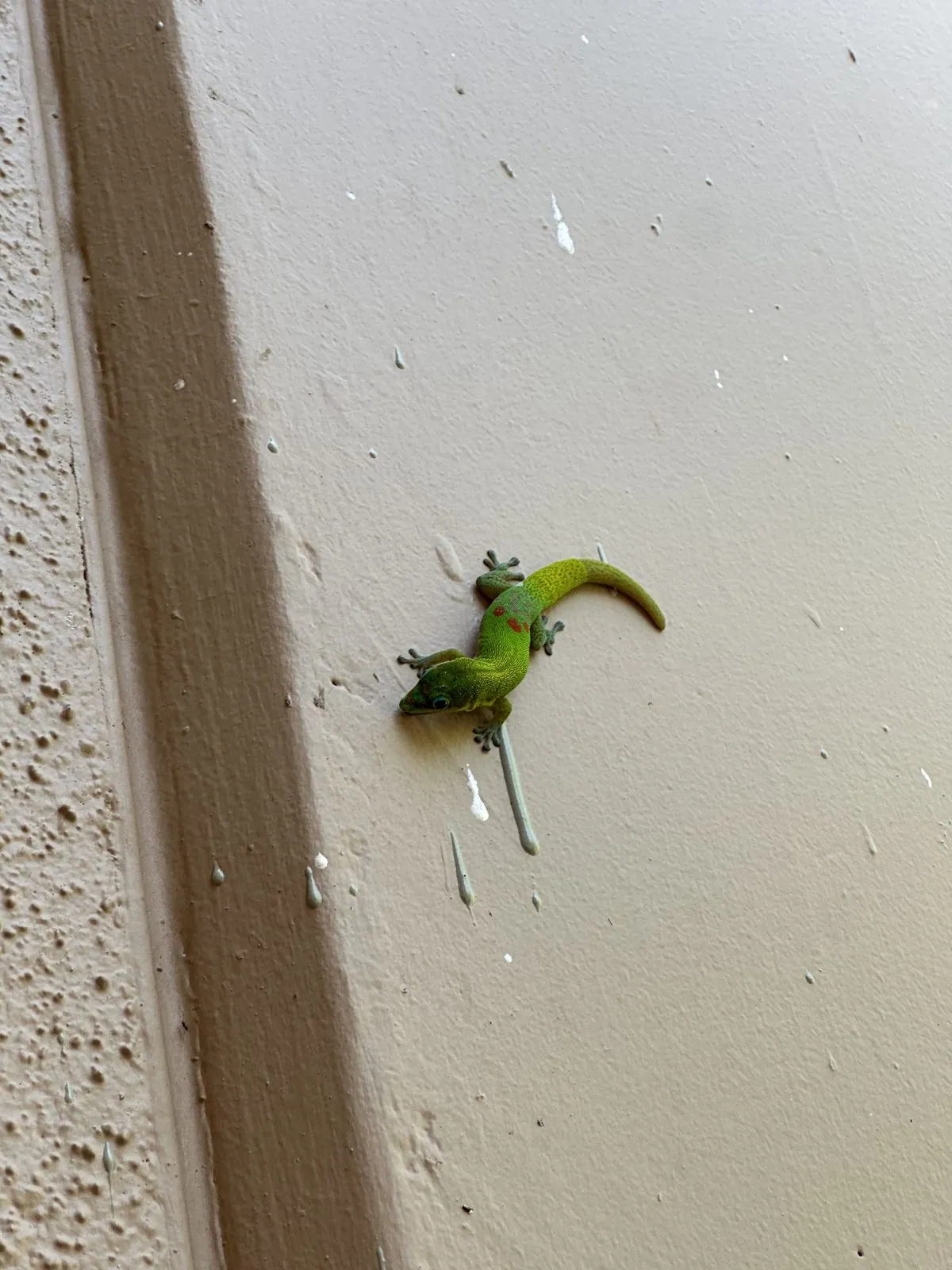
One morning a bright green gecko was sitting on our balcony wall.
Across the island to Hilo
Just before eleven we set off up Waikoloa Road, bound for the other side of the island. The Big Island has two climates that barely seem to belong to the same place. The Kohala coast is a desert of lava and dry grass. The Hilo side, an hour and a half away, catches the trade winds and their rain, and it is lush, green and wet. Hilo is often called one of the rainiest cities in the United States.
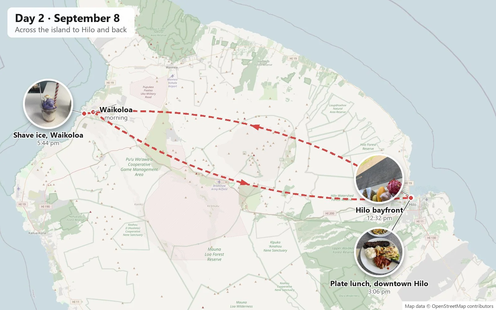
By half past twelve we were on the Hilo bayfront, near the Moʻoheau Bandstand, with a tropical fruit haul lined up along a bench: dragon fruit, a pineapple, mangoes, papaya, passion fruit, an avocado, and a large green pear-shaped thing we took for a fruit, which turned out to be a kind of squash. There were also two cacao pods, and inside one is a cluster of beans wrapped in sweet white pulp. The bayfront itself has a sad history worth knowing. Hilo Bay funnels tsunamis, and the waves of 1946 and 1960 destroyed the old waterfront district. Afterwards the city chose not to rebuild on the lowest ground, and the shoreline became the long strip of park and open lawn that is there today.
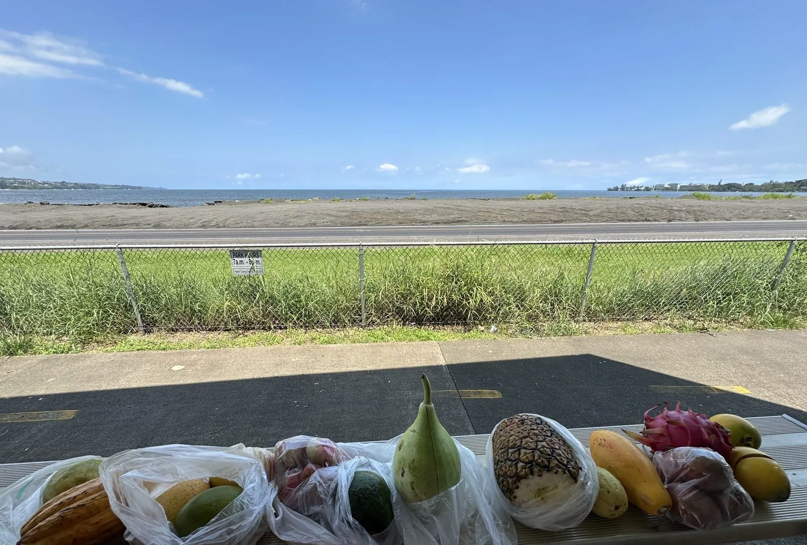
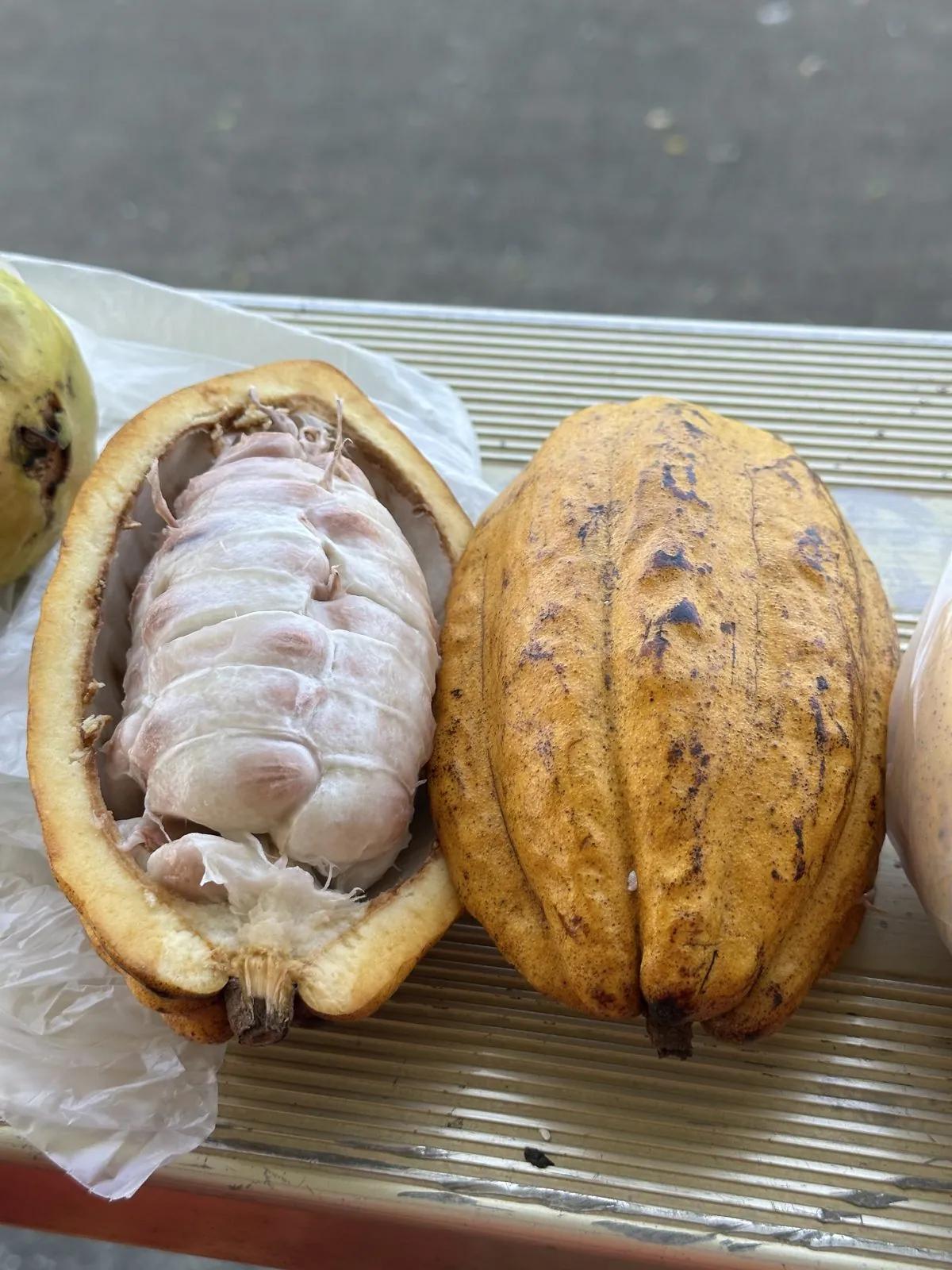
The next half hour is mostly a lot of photos of mango. A ripe Hawaiian mango eaten on a bench with the bay behind you is messy and perfect, and the pineapple came after it, cut into wedges. I will spare you the full sequence.
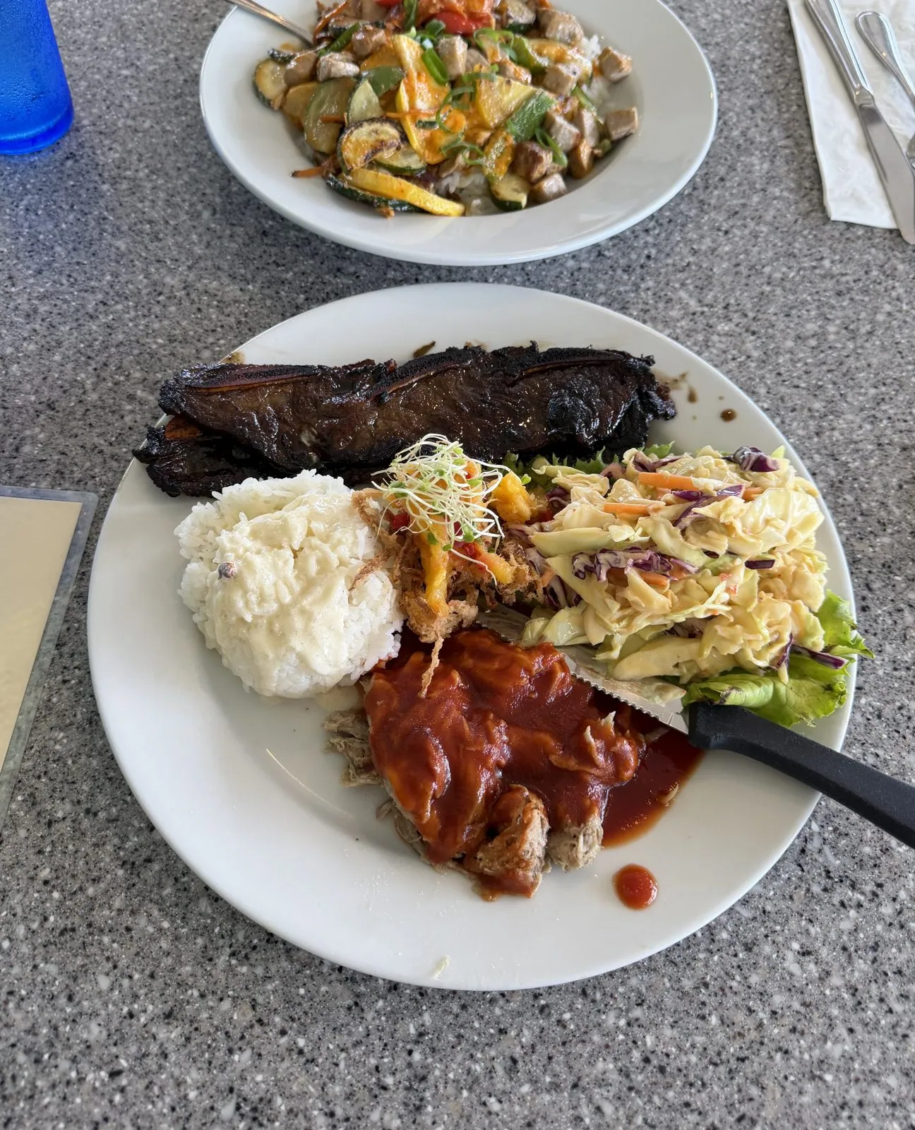
The early afternoon took us around Banyan Drive on the Waiākea peninsula, the road lined with enormous banyan trees, many of them planted from the 1930s onward by visiting celebrities: Babe Ruth and Amelia Earhart are among the names on the little plaques. Then came a late plate lunch in downtown Hilo, on Keawe Street. The plate lunch is Hawaiʻi's great working-class contribution to world cuisine: a scoop of rice, a salad, and whatever meat is on offer, all on one plate. Ours had a long glossy strip of short rib, chicken in red sauce, and salad.
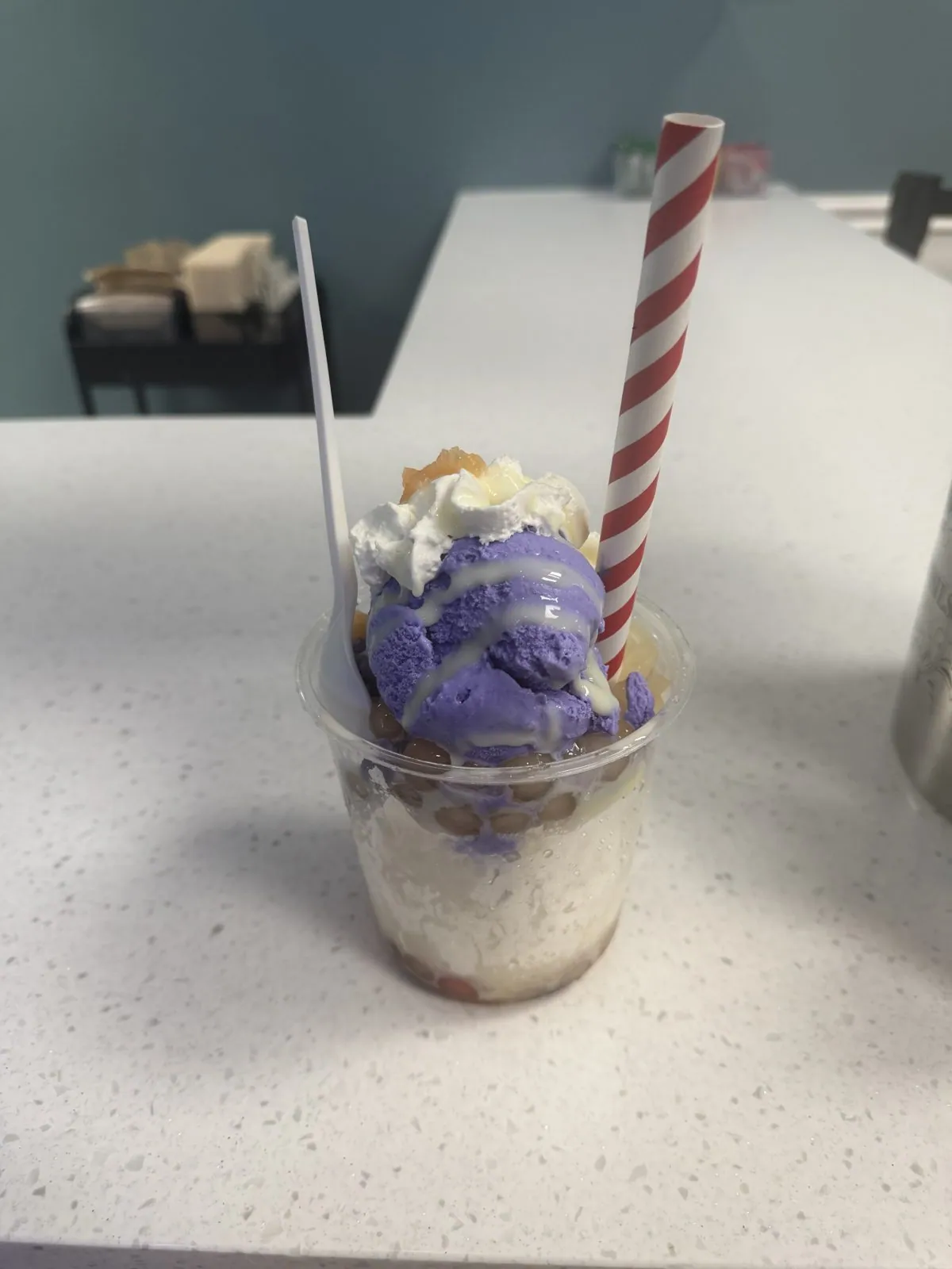
Back on the Kohala side by late afternoon, dessert was a cup of shave ice buried under a scoop of purple ube ice cream and a swirl of whipped cream, with a candy-striped straw. Hawaiian shave ice is not a snow cone. The ice is shaved so fine it is closer to fresh snow, and it soaks up the syrup instead of letting it pool at the bottom.
Kona coffee country
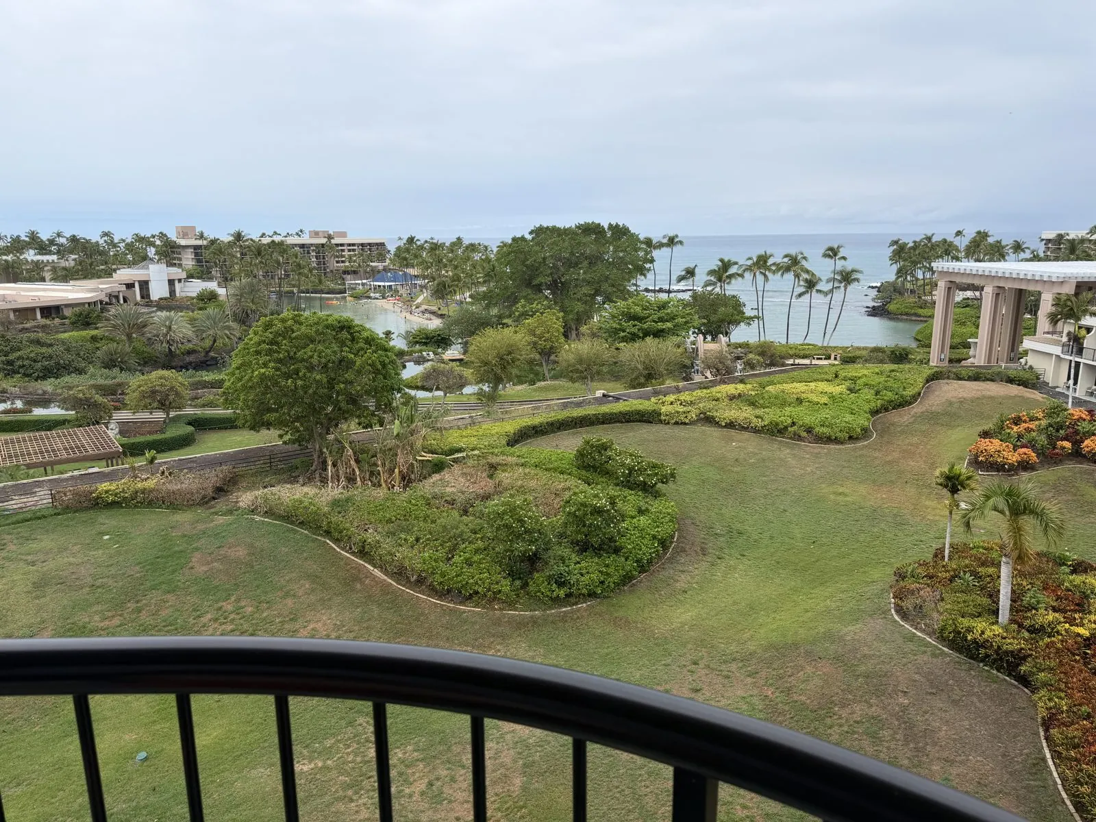
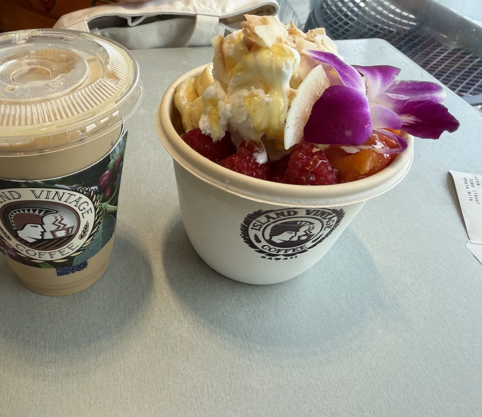
The third day began slowly, with a balcony view over green gardens and the ocean, a late morning on the resort grounds, and, at a quarter to one, iced coffee and an açaí bowl topped with fruit, toasted coconut and an orchid. Then we drove south, up into the hills above Kona, into coffee country.
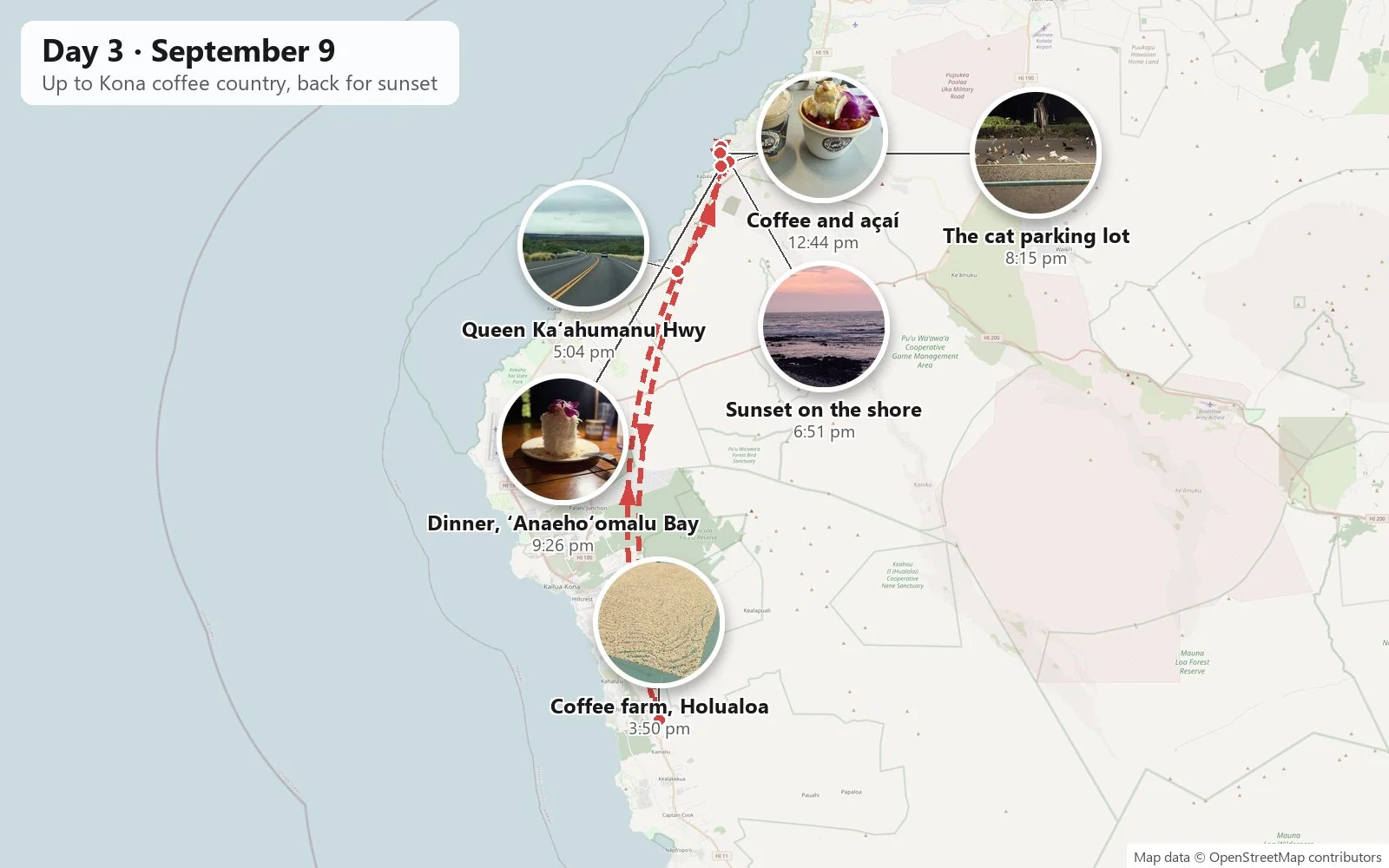
Breakfast views and a coffee stop are about as much as a slow morning needs.
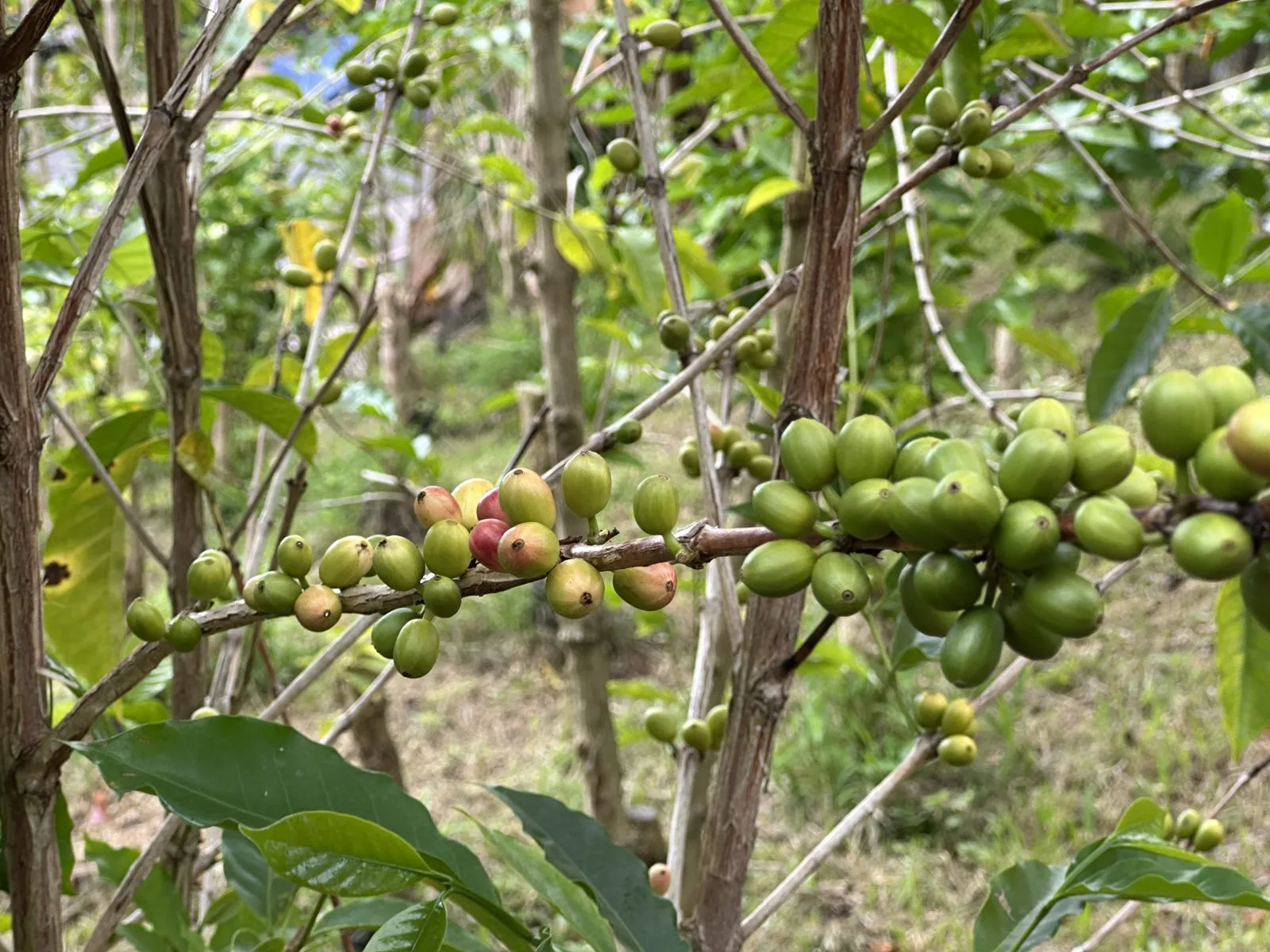
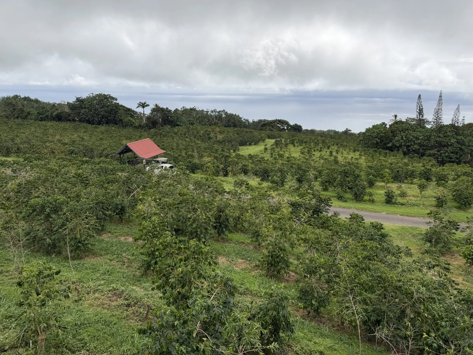
Kona coffee grows in a narrow belt on the slopes of Hualālai and Mauna Loa, a thousand or two feet above the sea, and it is one of very few coffees grown in the United States. The belt works because of a daily rhythm: sunny mornings, clouds rolling in over the slopes in the afternoon to shade the trees, and rich volcanic soil underneath. By the time we reached Holualoa, just before three, the afternoon clouds had arrived on schedule. The uplands were misty and gray-green, with a red-roofed farmhouse among the trees.
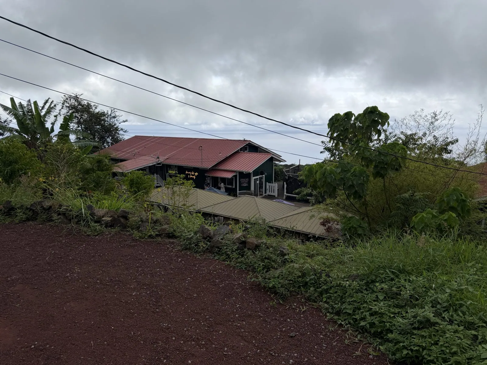
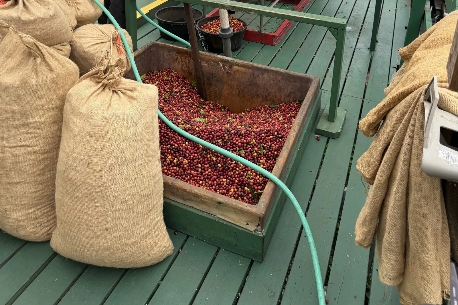
At Heavenly Hawaiian Kona Coffee Farms in Holualoa we saw how the beans are made, and it is far more involved than you would guess from a cup. Coffee starts as a fruit: a small red cherry. The cherries go into a pulper, which strips off the skin and fruit, and what is left are the beans in a papery husk called parchment. The farm's pulping deck was piled with burlap sacks, and a wooden box beside the machine was heaped with glossy red cherries waiting their turn.
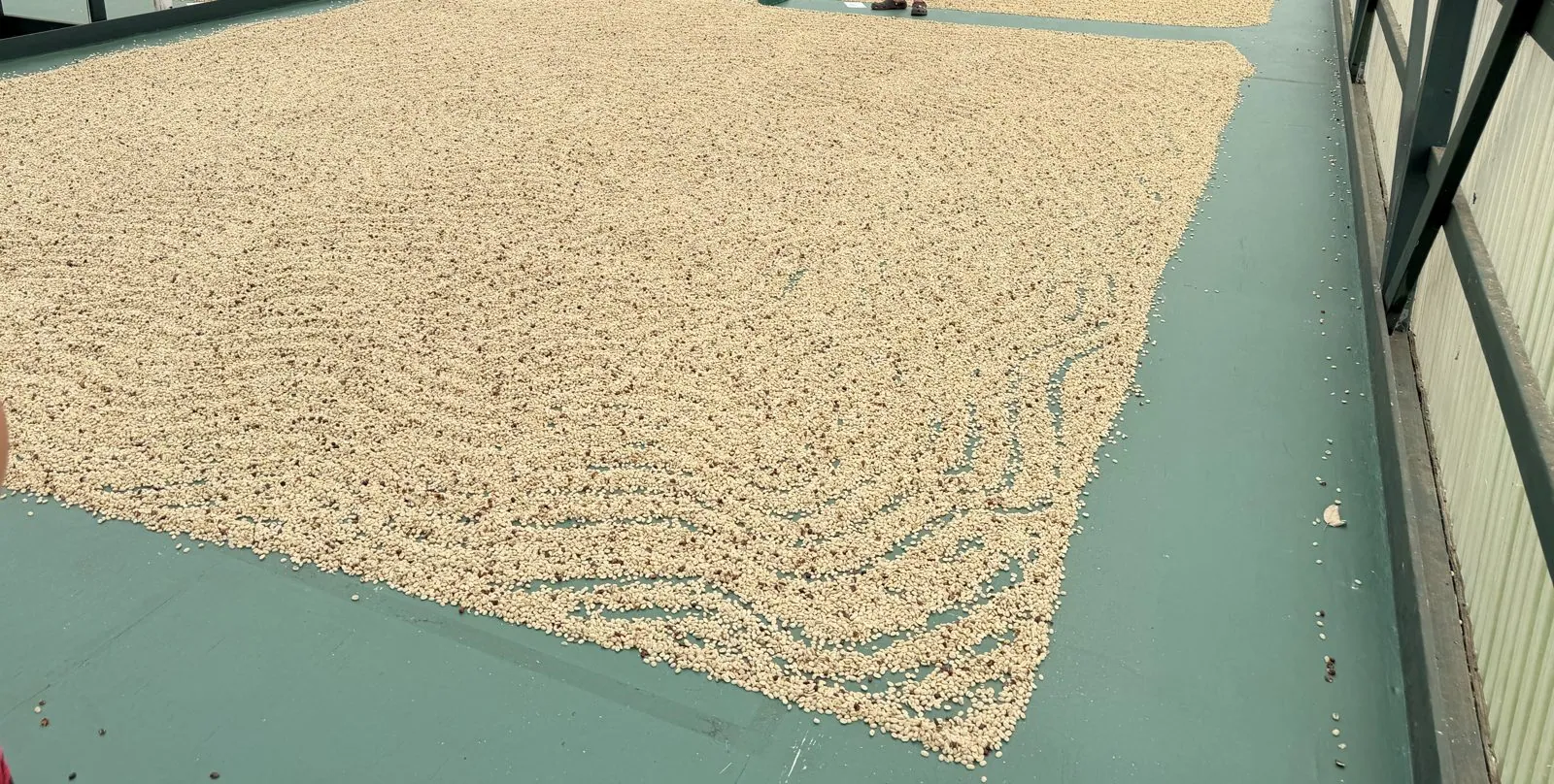
After pulping and washing, the parchment coffee is spread out to dry in the sun on a big wooden deck called a hoshidana, a Japanese word. Japanese immigrant families farmed much of Kona's coffee through the twentieth century, and the drying decks, with roofs on rails that can roll over them when it rains (which on a Kona afternoon is often), are their legacy. The farm's deck was covered in pale beans raked into long wave patterns, like a Zen garden made of coffee. Below it, the orchard rolled away down the hill.
Lava fields and a pebble heart
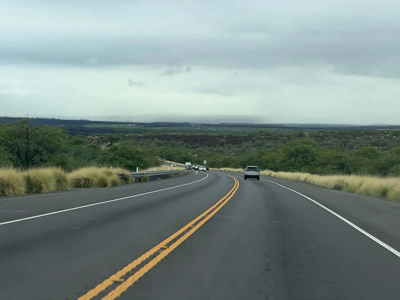
The drive back north on the Queen Kaʻahumanu Highway, named for the favorite wife of Kamehameha I, who went on to rule as regent and became one of the most powerful figures in Hawaiian history, runs for miles across old lava flows. At five in the afternoon the clouds were low and heavy over the mountains, and the road ran straight through a landscape of dark lava, pale grass and scrubby green trees, with rain hanging in gray curtains on the slopes ahead.
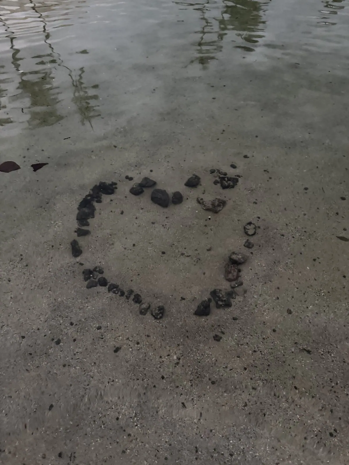
By six we were back on the shore at Waikoloa, with gold light breaking through under the clouds. Someone before us had made a heart out of black lava pebbles on the wet sand at the water's edge, and the gentle wash was slowly rearranging it. On this coast the beaches are made of two kinds of stone, white coral rubble and black lava, and the lava pebbles show up on the light sand like pepper. We had been in the water with snorkel masks, and were still wearing them pushed up on our foreheads when the sun started to go.
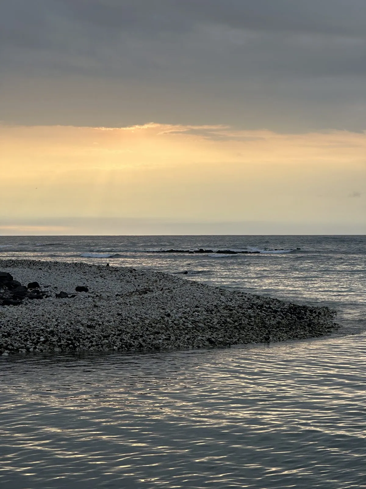
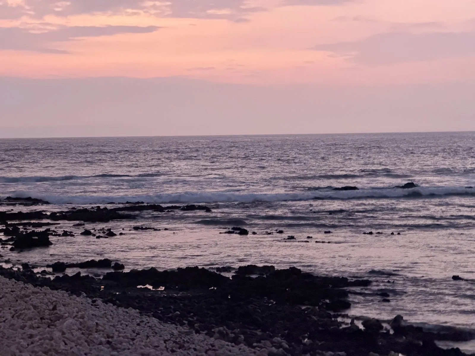
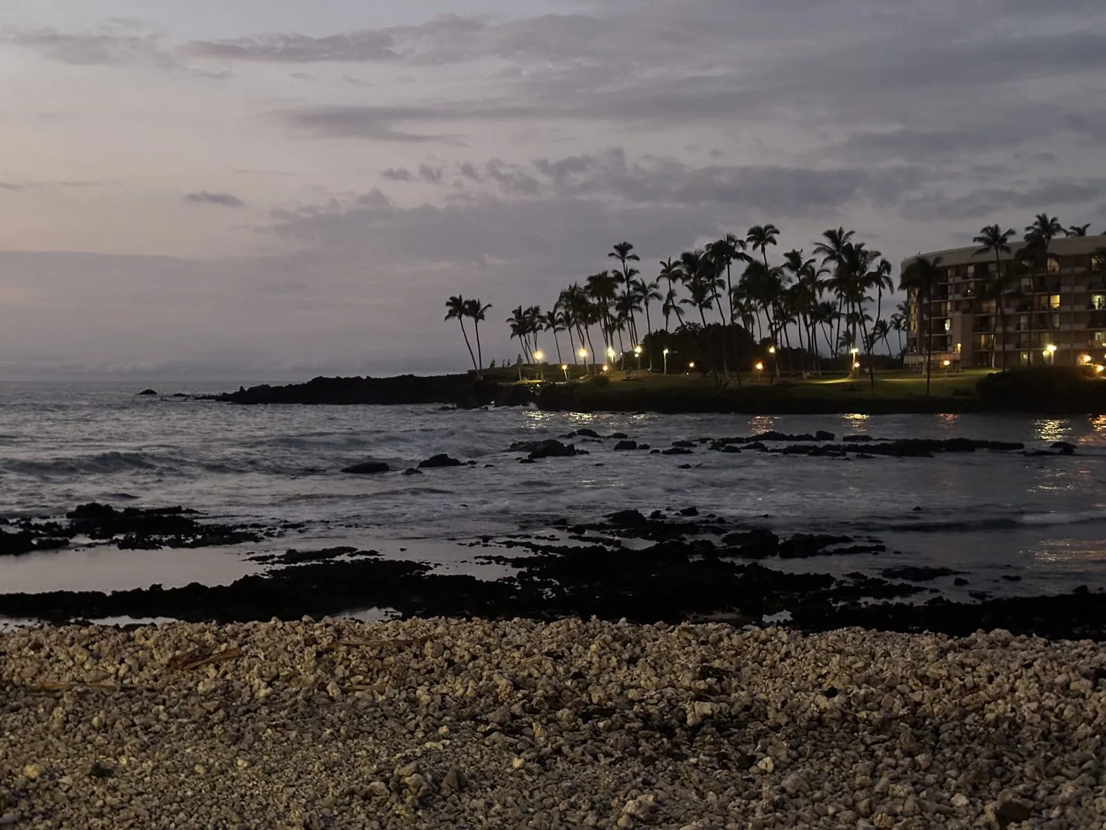
Then the sunset, which on the Kohala coast is something like a nightly event that people gather for. The clouds that had sat over the mountains all afternoon had broken up over the sea, and the sun went down behind them in a smear of orange and gray. Ten minutes later everything had gone pastel: a pink sky, lilac water, the surf breaking white over the black reef, and a beach of pale coral pebbles in the foreground.
The cats of Waikoloa
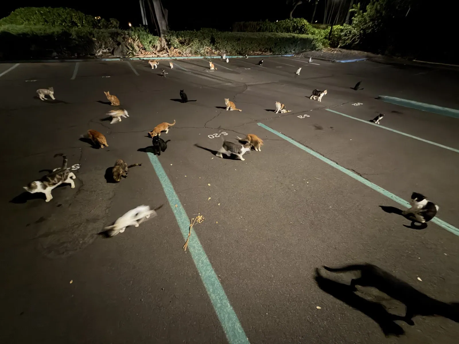
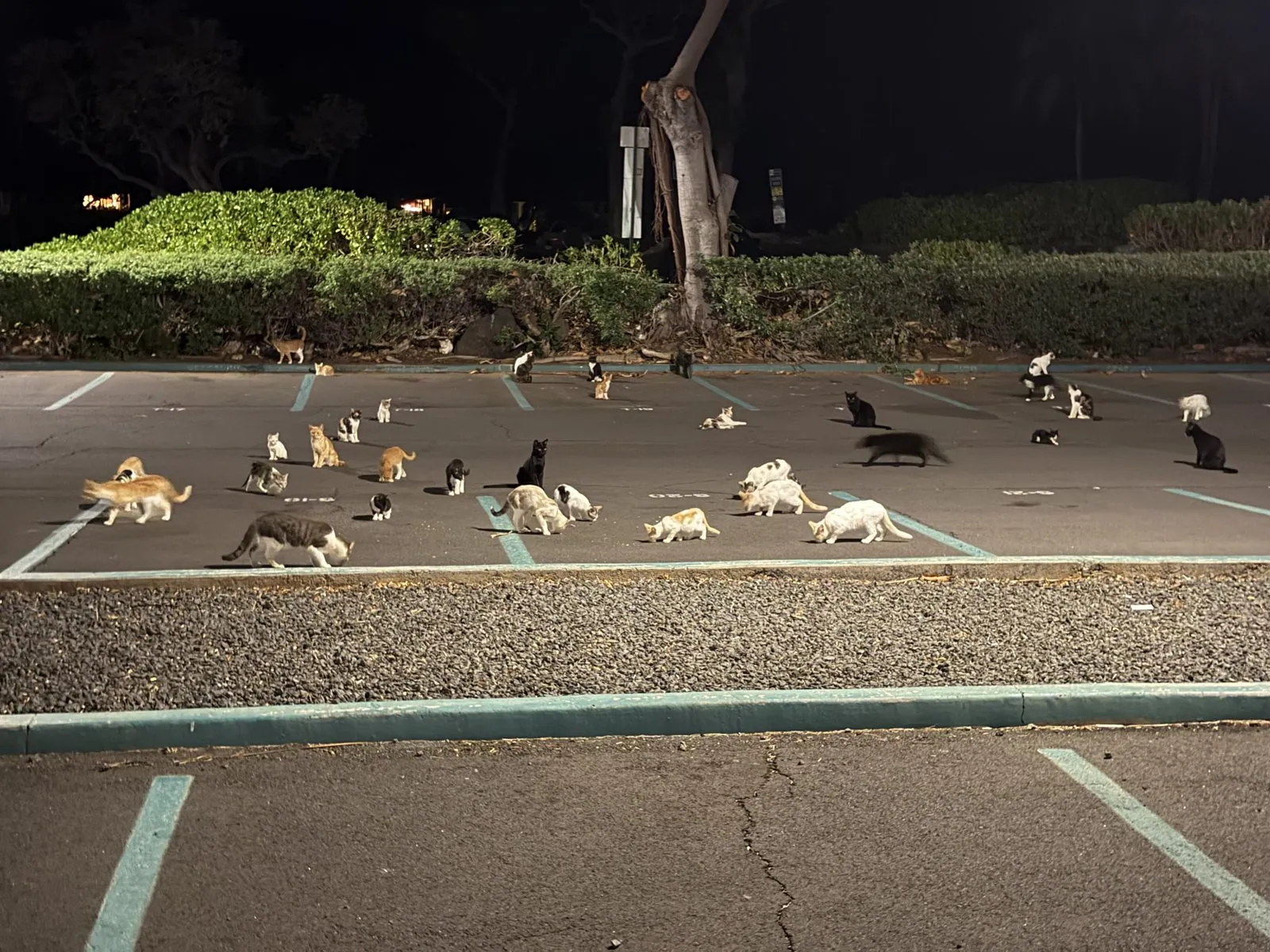
The strangest scene of the trip came after dark. In a parking lot just off Waikoloa Beach Drive, around eight, the lights revealed cats. Not one or two. Dozens of them, spread across the asphalt between the painted lines: tabbies, black-and-whites, gingers, calicos, some eating, some washing, some just sitting in the middle of a parking space as if they had paid for it. Feral cats are a fact of life in Hawaiʻi, and this was clearly a well- established colony with a regular dinner hour. When we came back past the same spot nearly two hours later, they were still there, peering out from under the hedge.
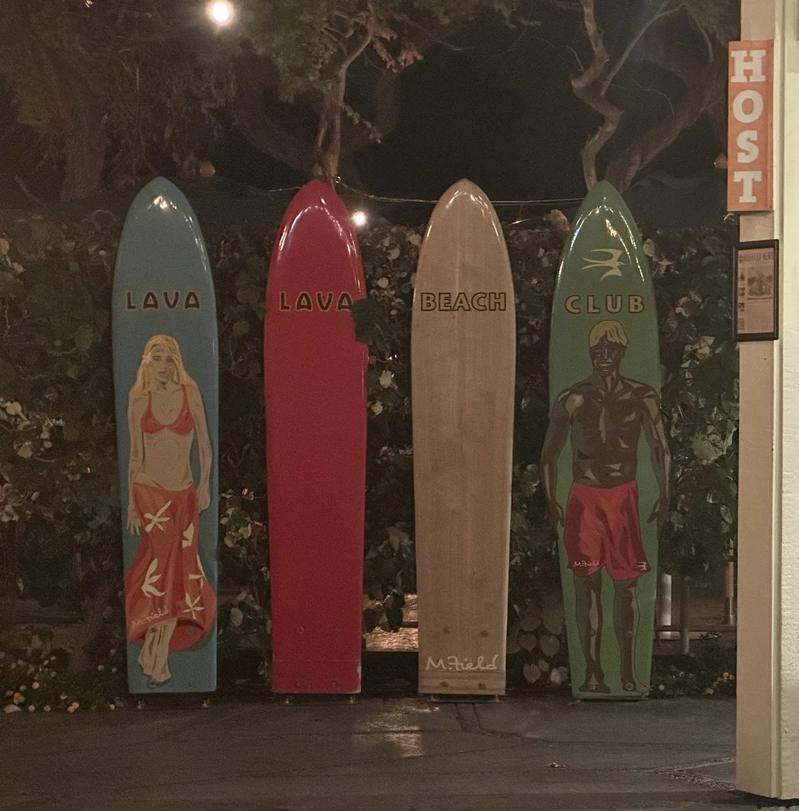
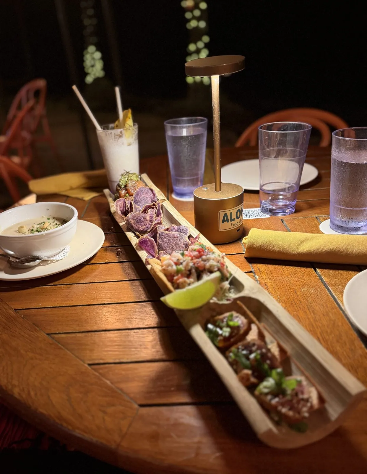
Dinner in between was at Lava Lava Beach Club on ʻAnaehoʻomalu Bay, a beach with old Hawaiian fishponds behind it. We ate by lamplight: ahi poke with purple taro chips and lime, served in a split-bamboo boat, a bowl of soup, and drinks with paper straws.
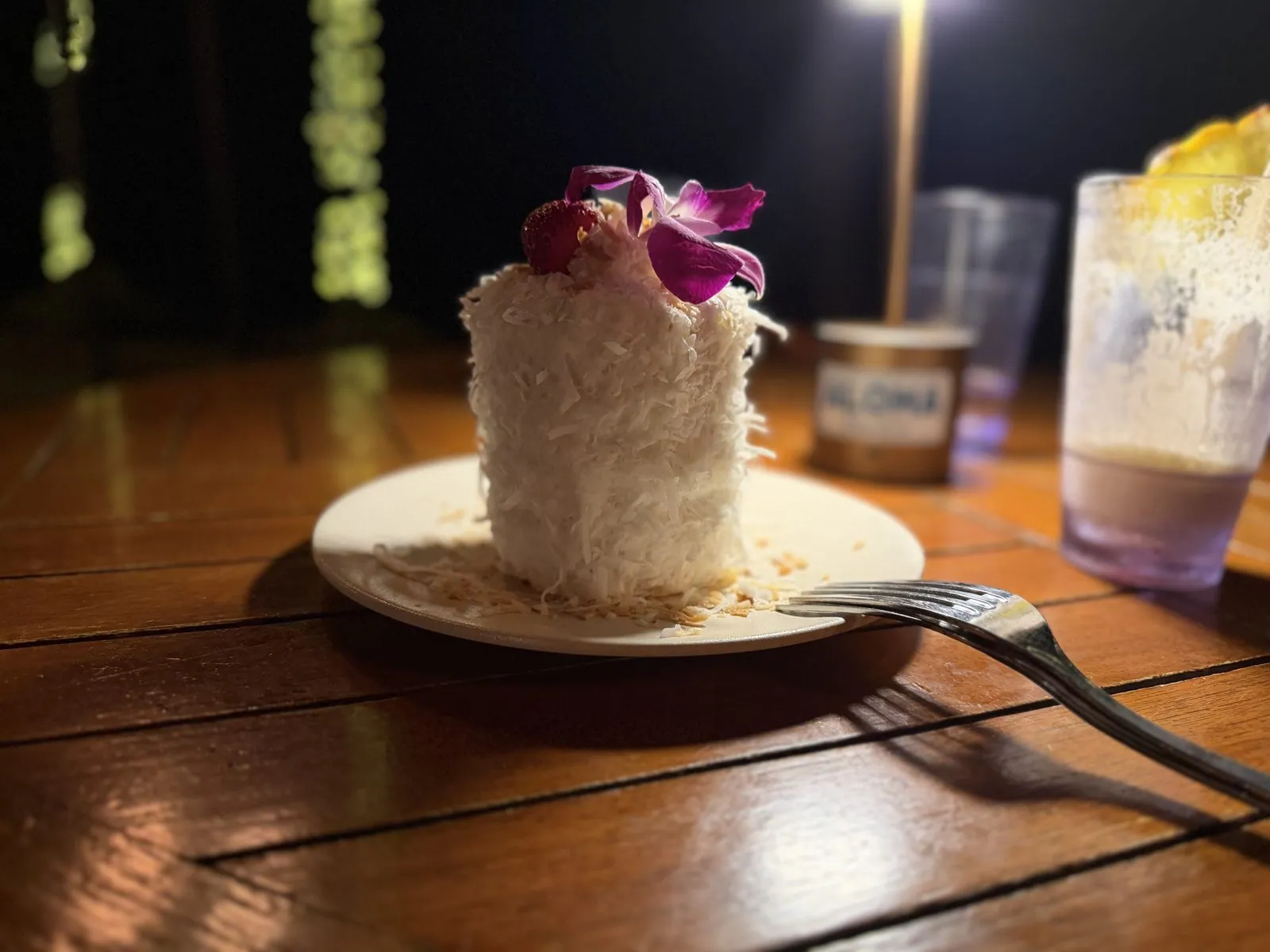
Dessert was a tall coconut cake shaggy with shredded coconut, topped with an orchid. Hawaiʻi puts an orchid on everything, and it never gets old.
Part II: Oʻahu
One short hop
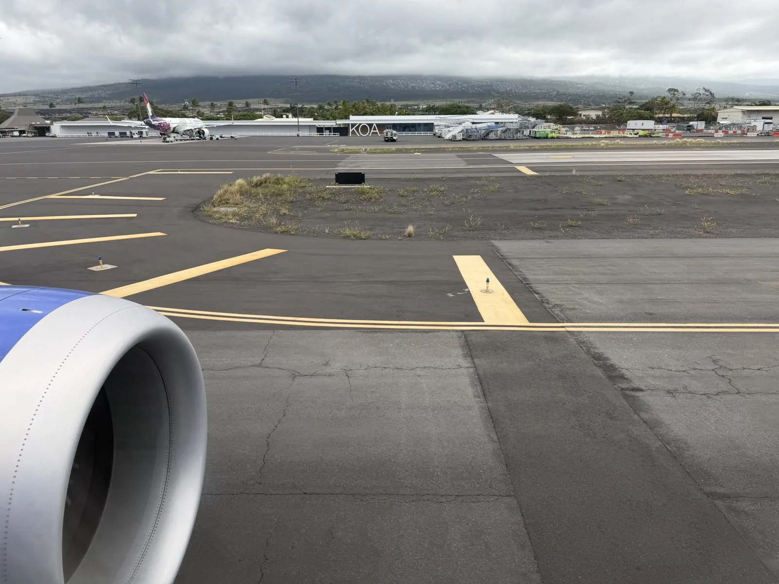
On the morning of September 10th we left the Big Island. The view from the plane window at Kona, just before noon, sums up the island in one frame: a jet engine, black-patched tarmac, and behind the terminal the long, cloud- capped slope of Hualālai. The flight to Honolulu takes under an hour, barely long enough for a cup of juice.
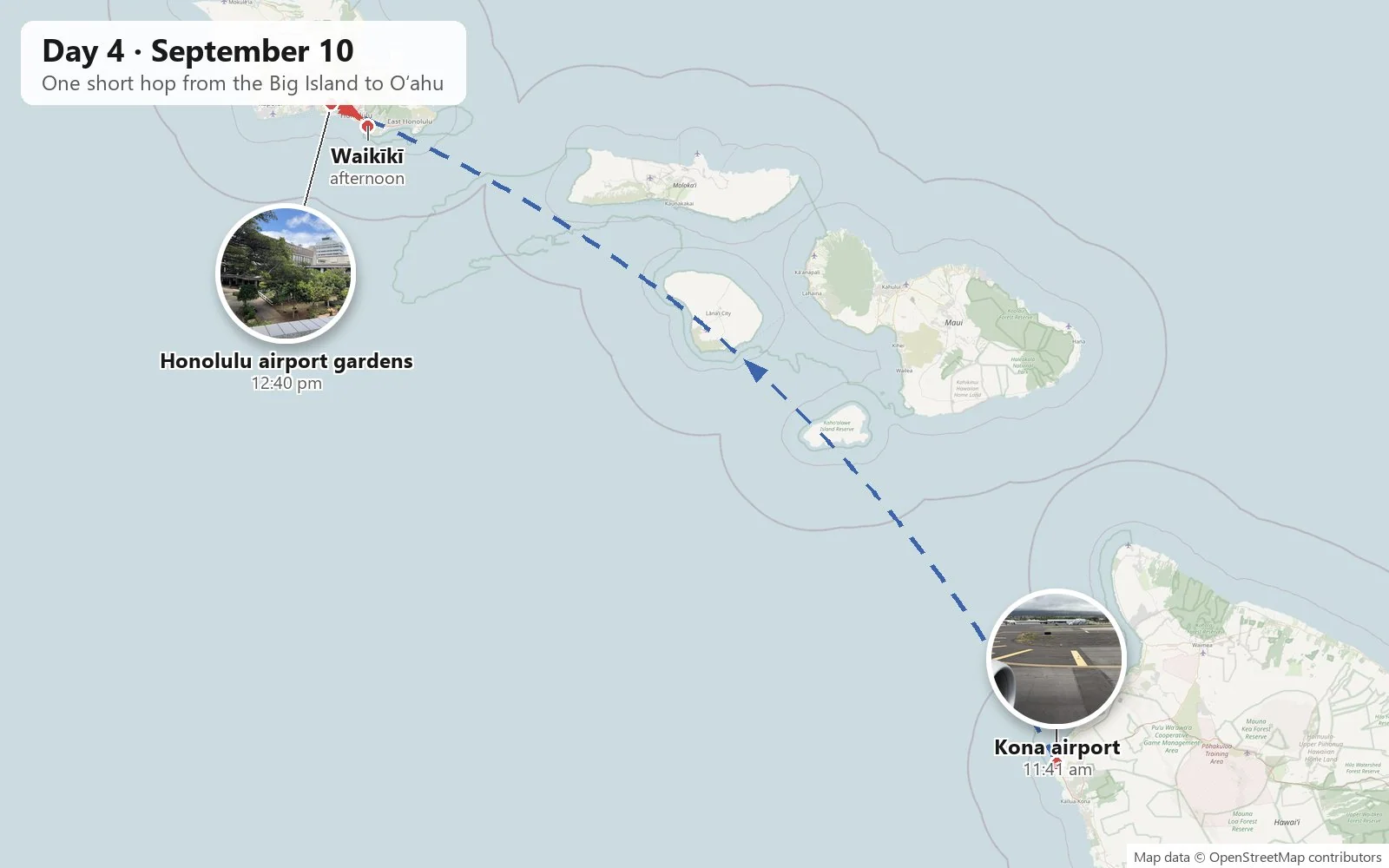
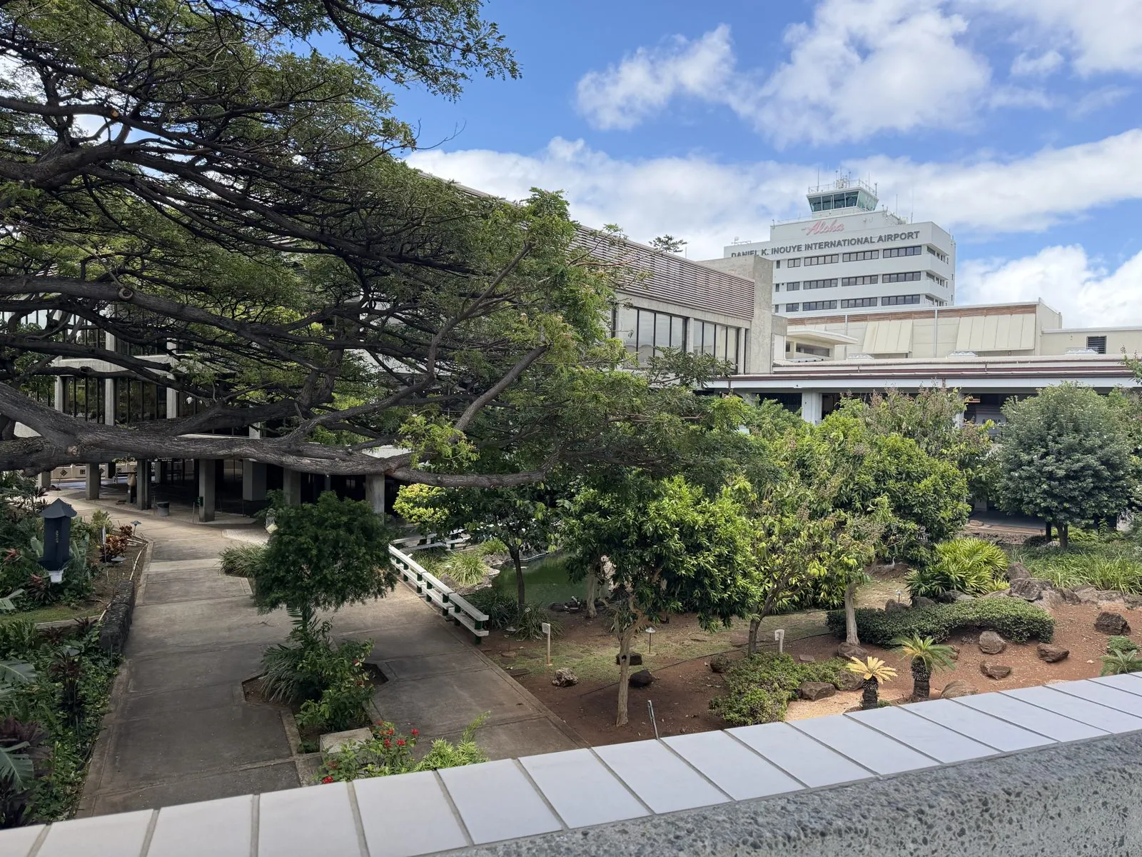
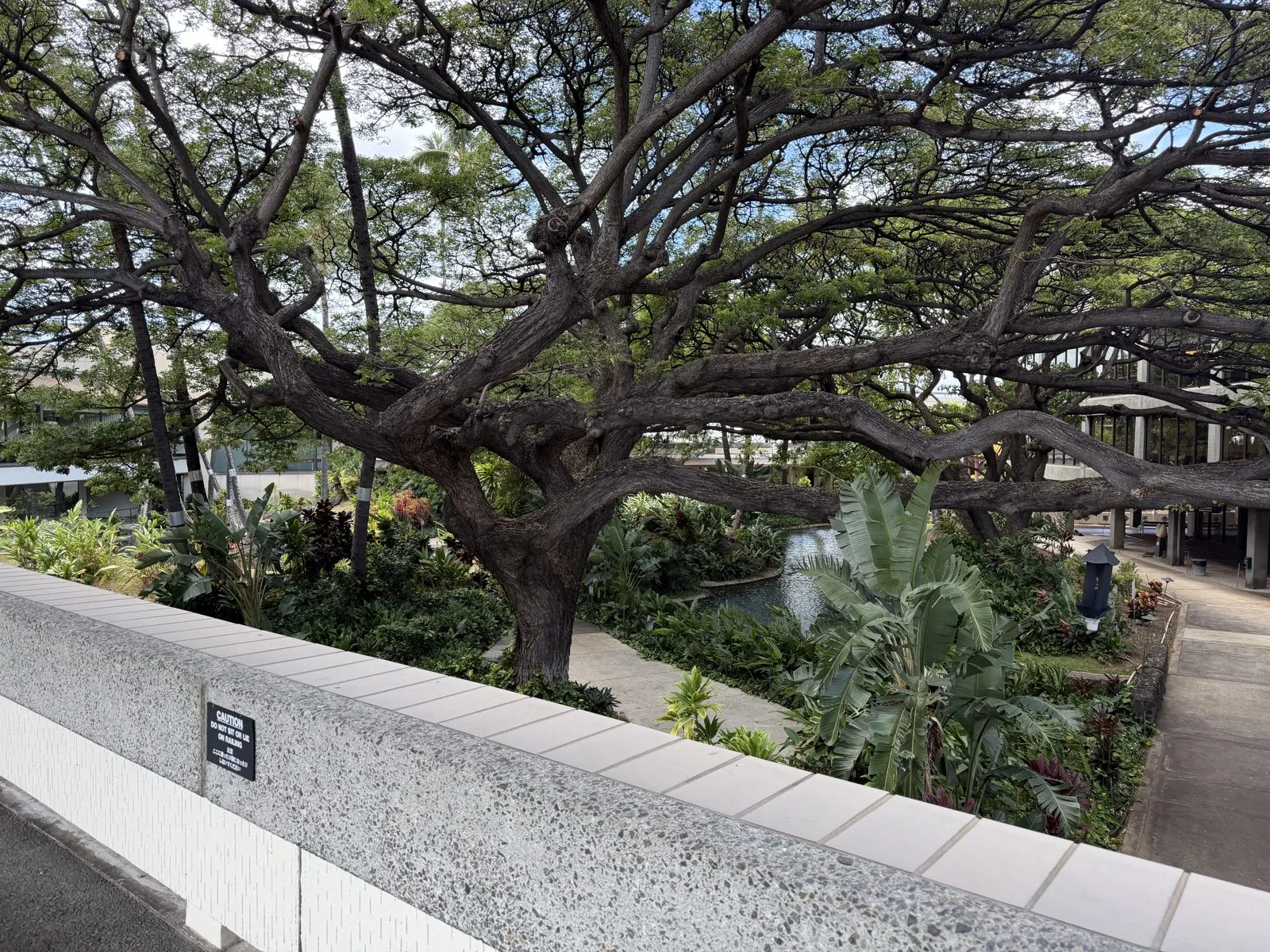
Honolulu's airport, officially Daniel K. Inouye International since 2017, has a secret that most travelers rush past: open-air gardens tucked between the terminals. Under huge spreading monkeypod trees there are paths, ponds, lava rock and tropical plants, and the old control tower with its "Honolulu International Airport" lettering rises over the trees. It is one of the few airports in the world where you can step out between flights into actual weather and actual birdsong.
Waikīkī from above
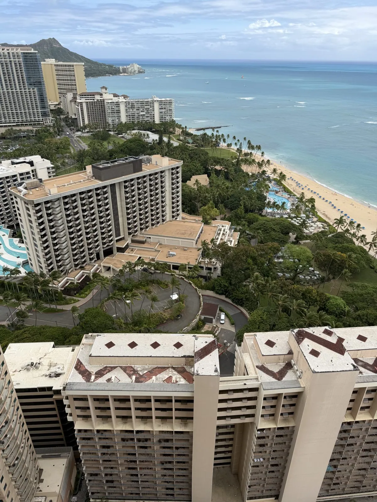
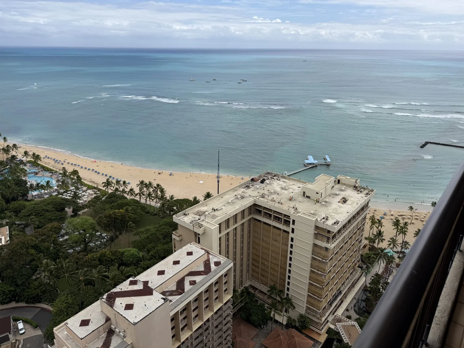
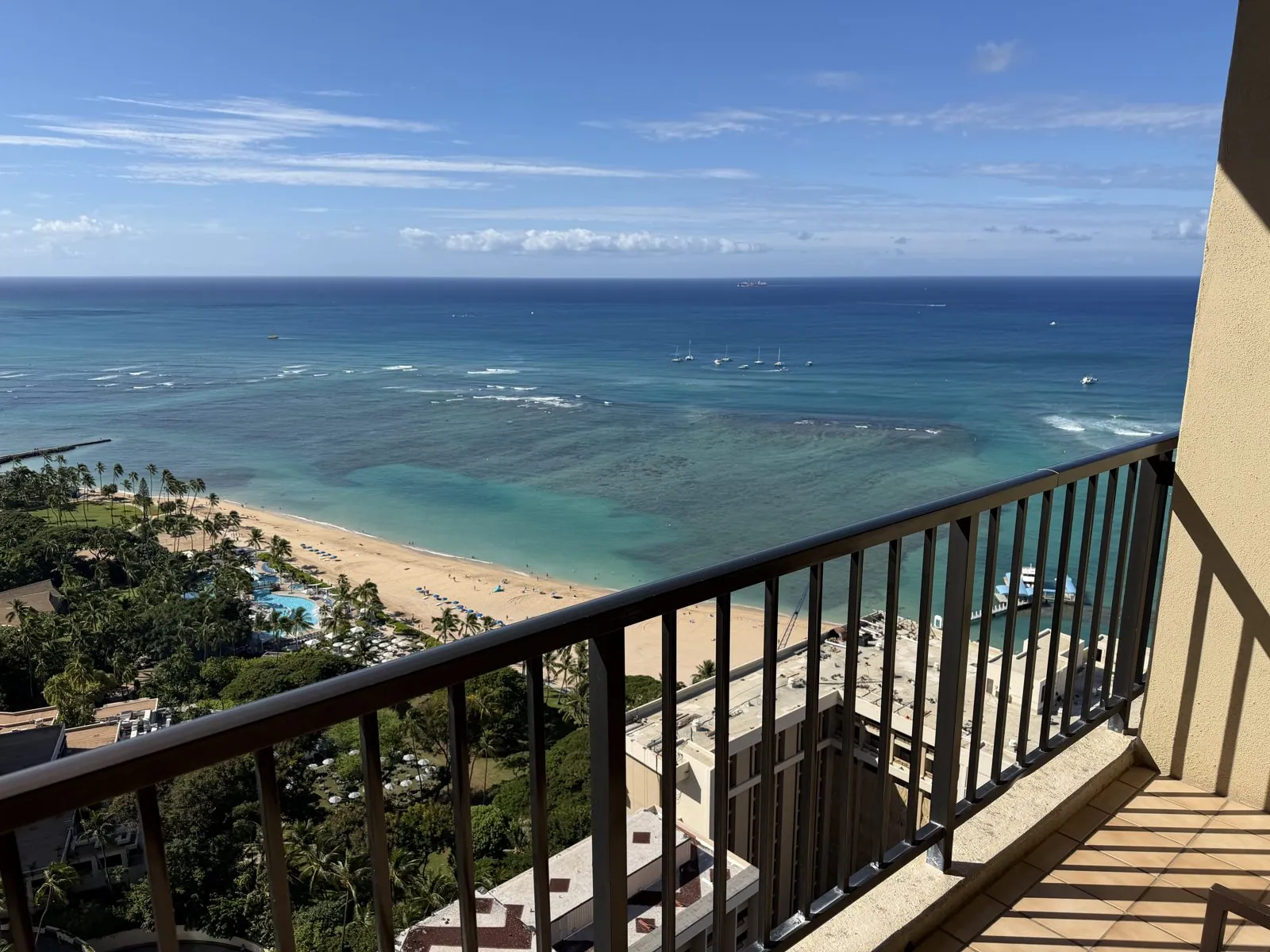
By early afternoon we were in Waikīkī, on a high floor of the Hilton Hawaiian Village, the first of five Waikīkī hotels in five nights (all of them are in the hotels post). From the top of a tower the whole famous view lays itself out: the crescent of the beach, the reef breaking white offshore with surfers waiting on it, the water in a dozen shades of turquoise and blue, the line of hotels along the sand, and at the far end, the long sloping profile of Diamond Head.
Diamond Head's Hawaiian name is Lēʻahi. It is a volcanic tuff cone, and the English name comes from nineteenth-century British sailors who found glittering calcite crystals on its slopes and decided they were diamonds. They were not. Waikīkī itself is a remade landscape too: until the 1920s it was a wetland of taro patches, fishponds and duck ponds, and it was drained by digging the Ala Wai Canal, which turned the whole district into dry land you could build towers on.
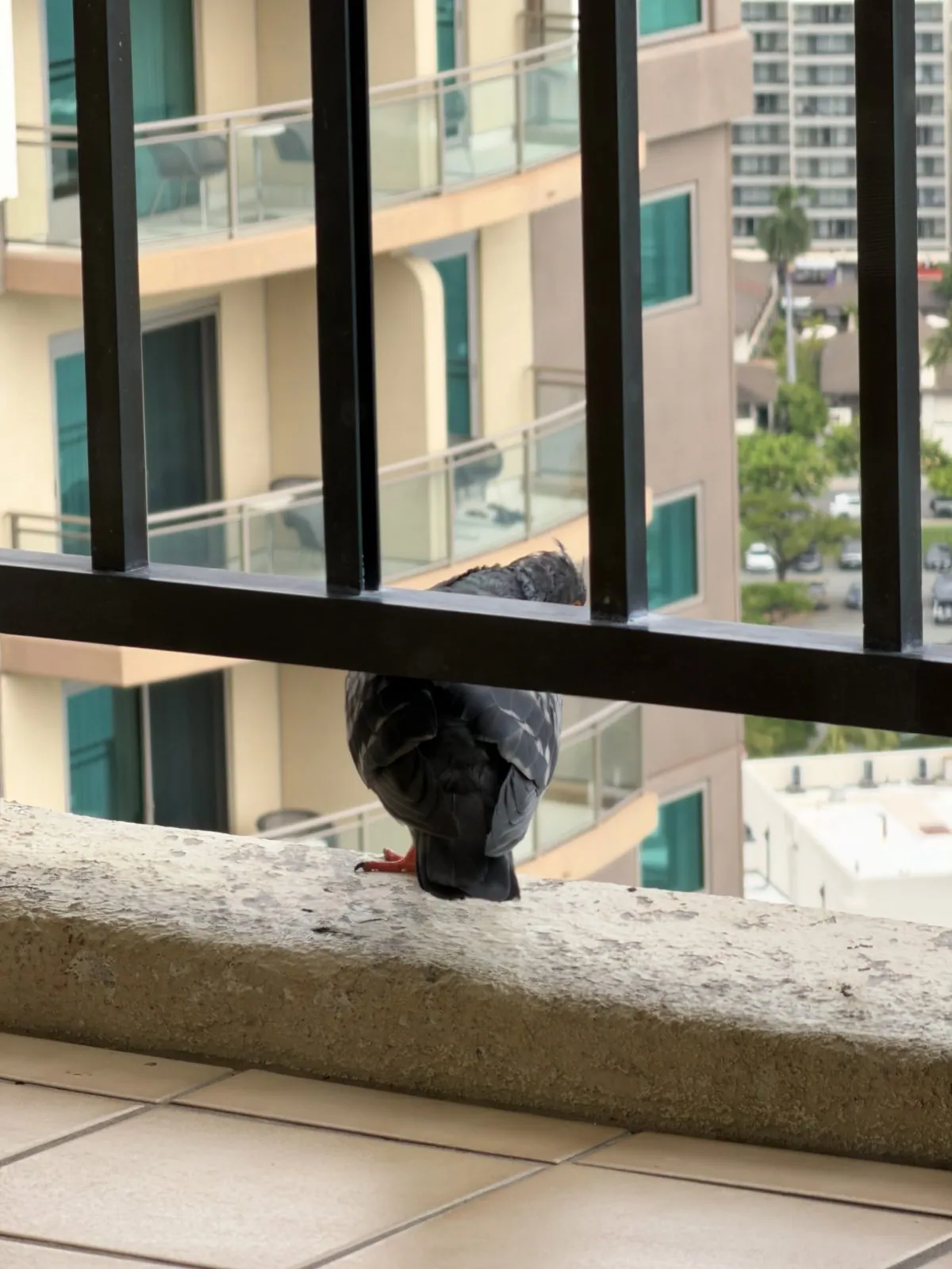
That afternoon we had a visitor. A pigeon landed on the balcony ledge, looked around at the long drop below it with total indifference, and then hopped down to inspect the tiles for crumbs. It was the most photographed pigeon in Honolulu for about ten minutes.
The lagoon at dusk
At seven we walked down to the Duke Kahanamoku Lagoon, a calm saltwater lagoon at the west end of Waikīkī, named for the Olympic swimmer who taught the world to surf. It was the blue hour. The water was perfectly flat and held the reflections of the palm trees and the lit windows of the towers, and along the horizon a thin band of pink sat over the line of palms.
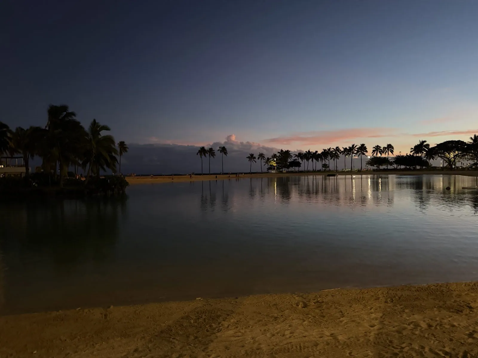
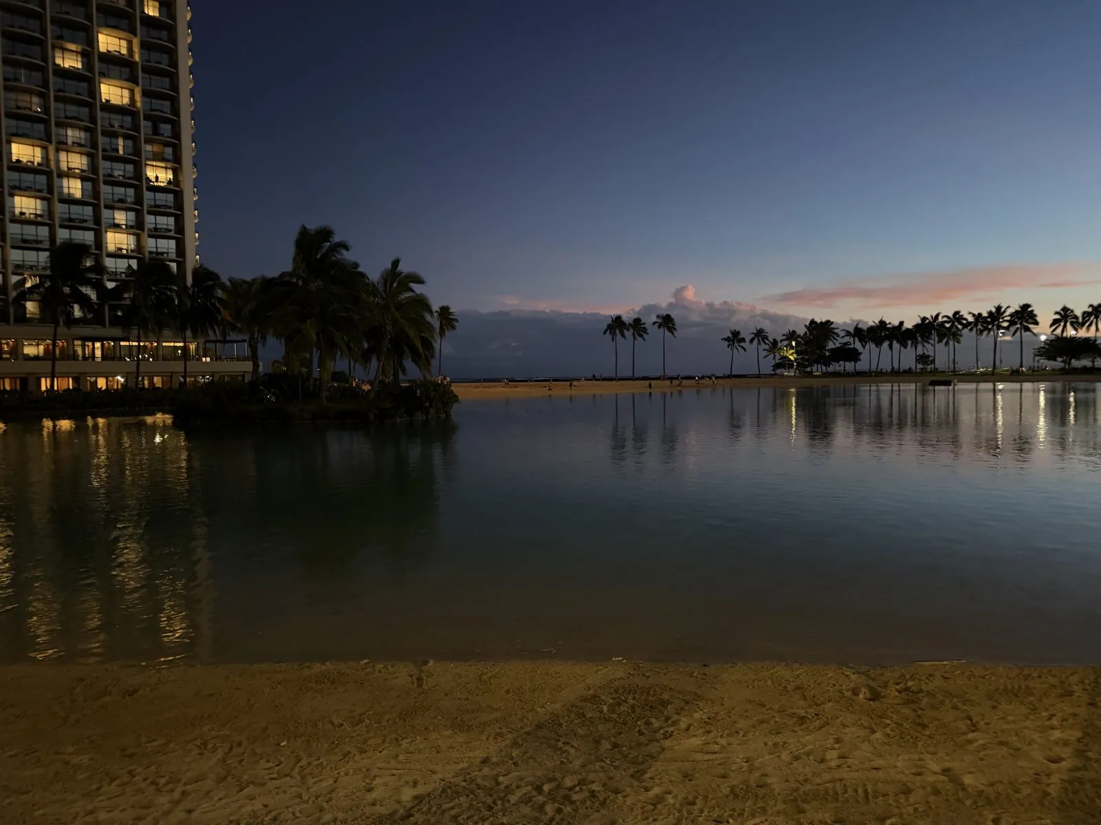
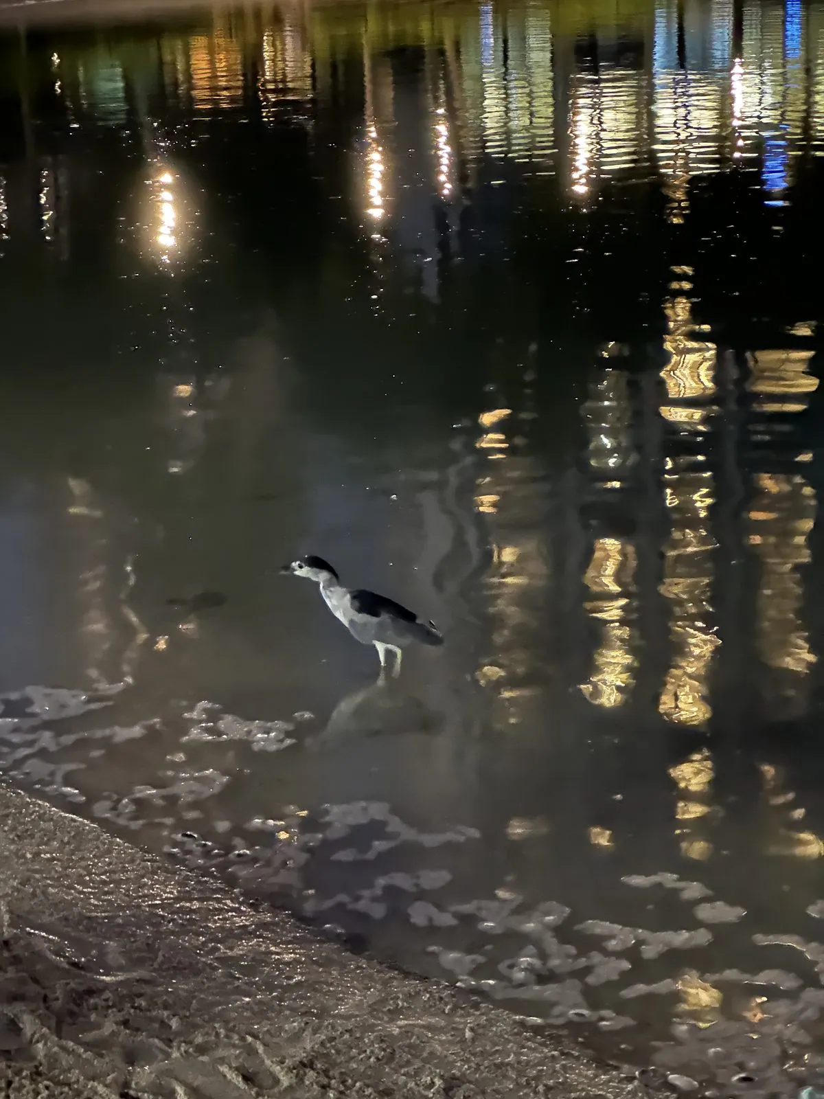
Nearby, on a lawn under the towers, a luau was already under way: long tables full of guests under the palms, and dancers starting up as the sun went down. We also had a Hawaiian hot dog piled with jalapeños from a stand near the lagoon, and at the water's edge a black-crowned night heron, the ʻaukuʻu, stood among the reflected lights.
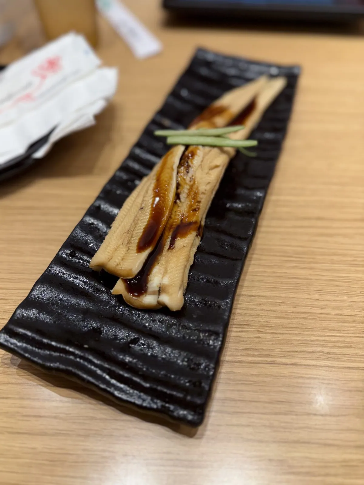
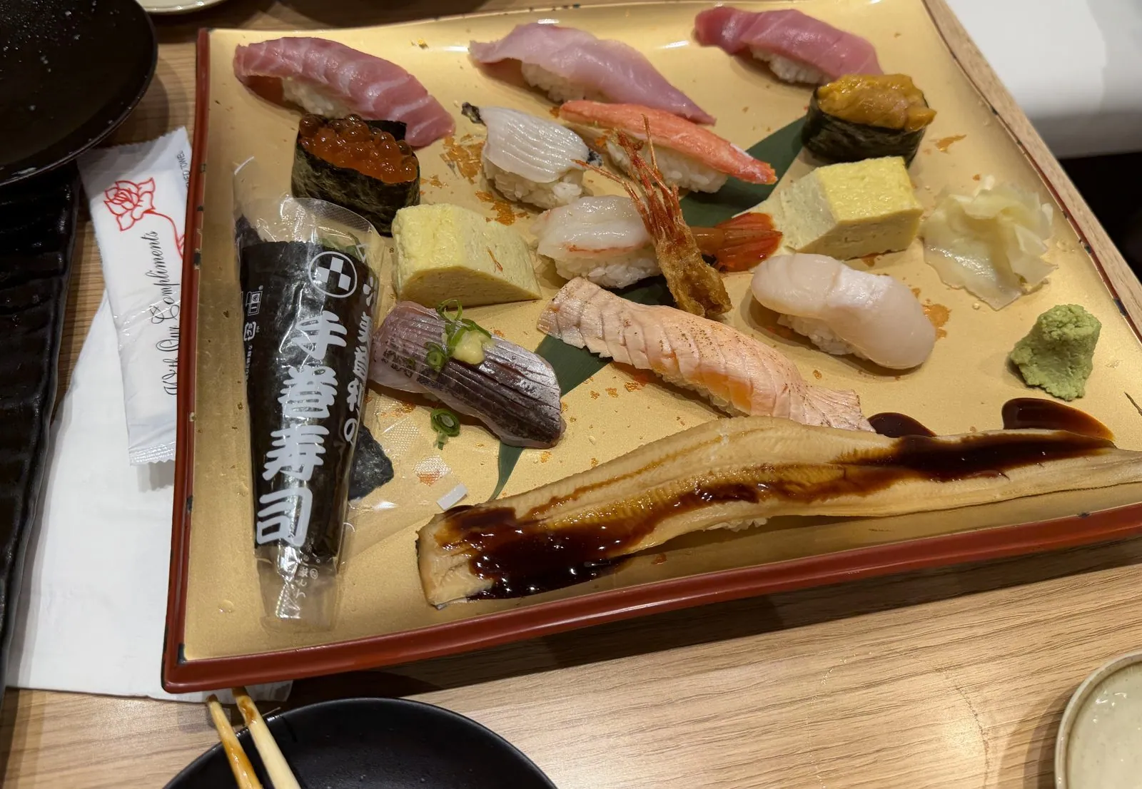
Dinner was Japanese, near the yacht harbor: a long piece of grilled unagi glazed with sauce on a black ridged plate, and a big platter of nigiri with tuna, salmon, scallop, shrimp, tamago and a hand roll. Japanese food is everywhere in Honolulu, a legacy of more than a century of Japanese immigration to the islands.
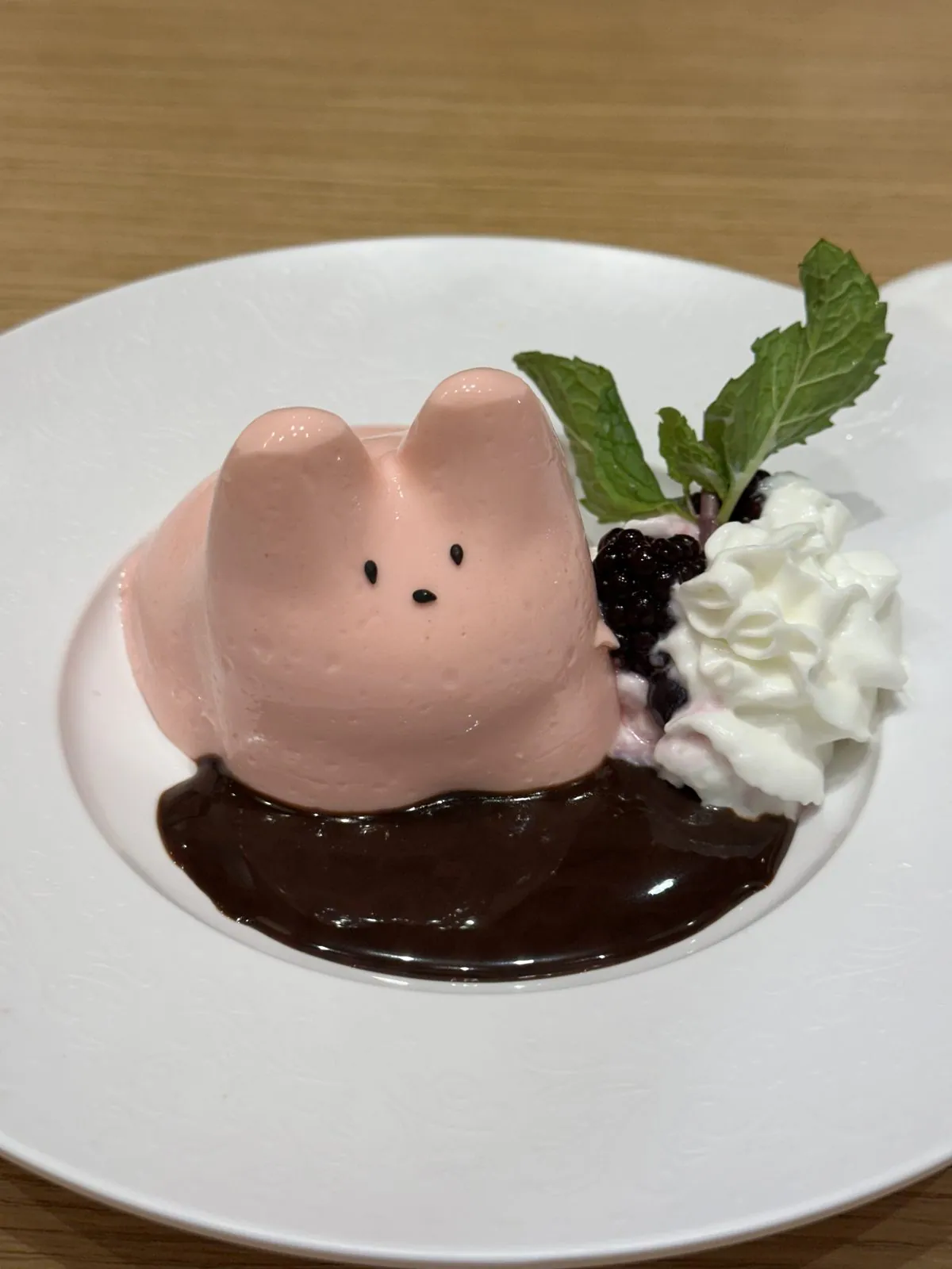
Dessert was a pink mousse in the shape of a rabbit, sitting in chocolate sauce.
Ala Moana
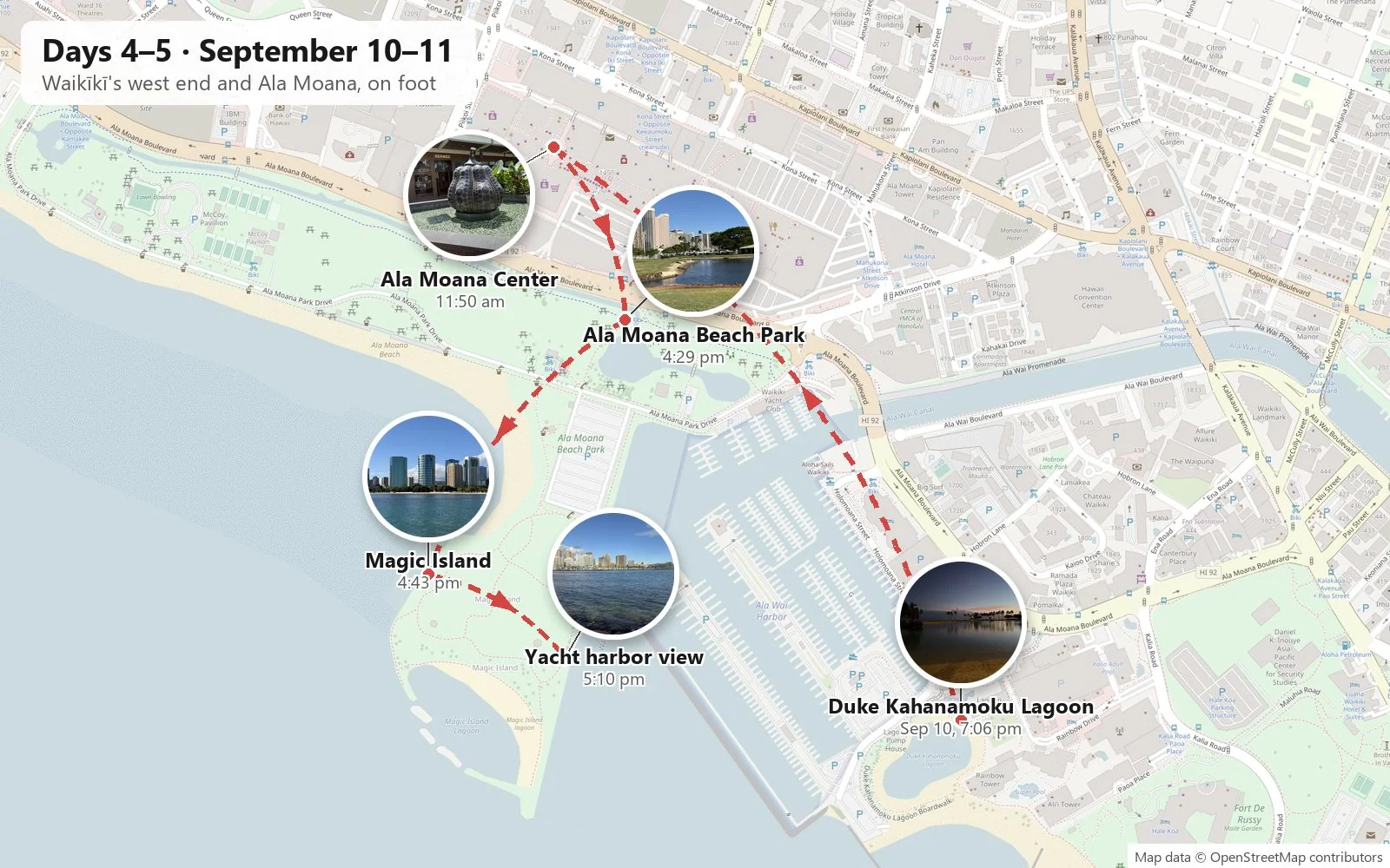
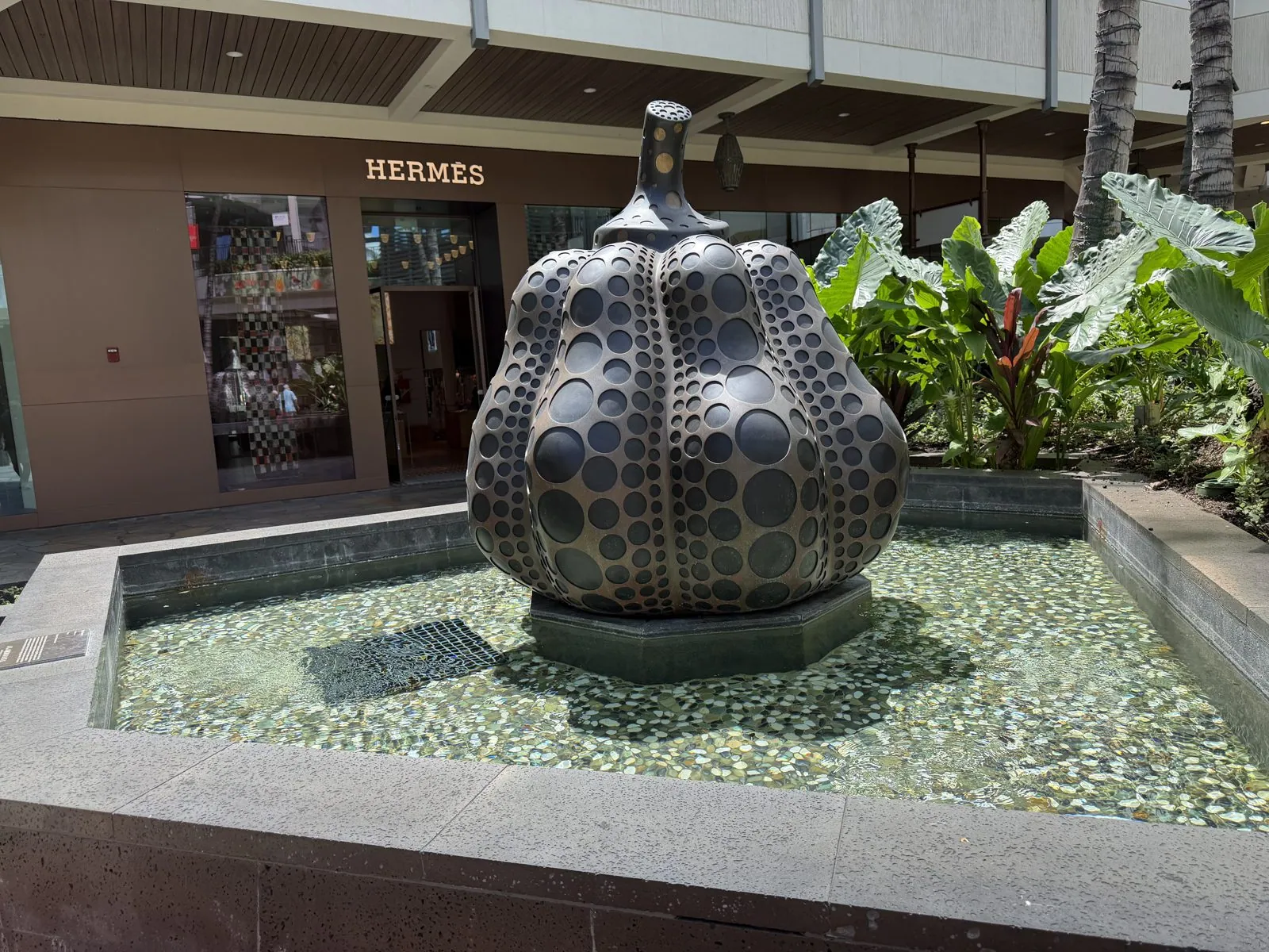
The next morning was clear and bright, with the reef glowing turquoise below and sailboats strung across the blue. We walked west along Ala Moana Boulevard toward Ala Moana Center, the enormous open-air shopping center that opened in 1959 and is still one of the largest of its kind in the world. Outside one of the shops a dark polka-dotted pumpkin sat in a shallow fountain, which is the kind of thing you do not expect to find next to a parking structure.
From high up, the reef off Waikīkī is a map of itself: dark patches of coral, pale channels of sand, and a white seam of surf along the outer edge.
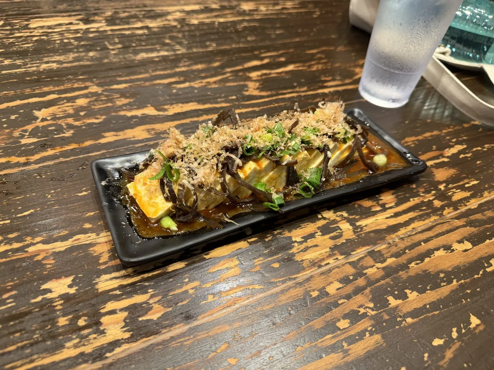
Lunch was agedashi tofu under a heap of bonito flakes that waved in the heat like they were alive, which is what bonito flakes do, and which is either charming or alarming depending on who you are.
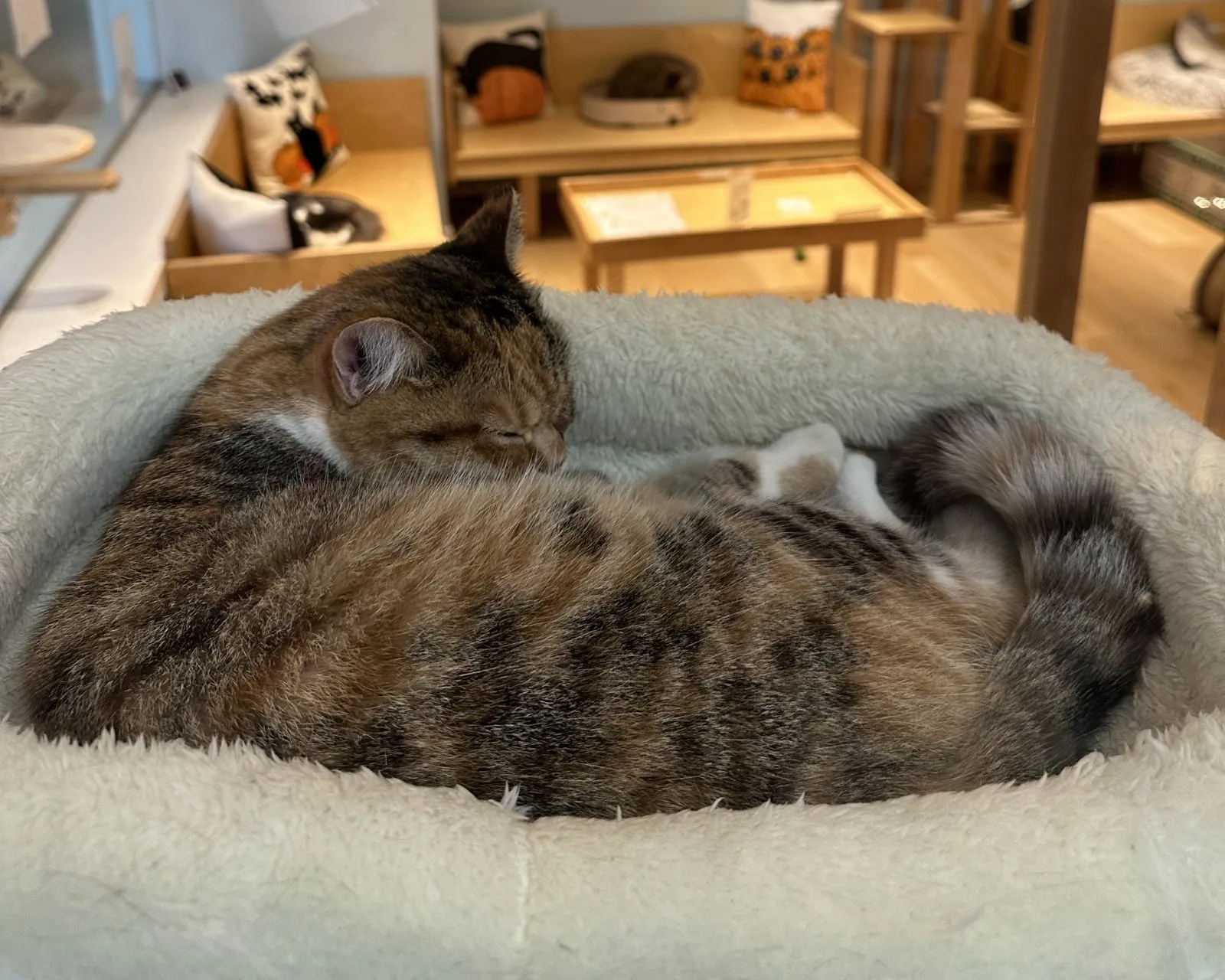
In the middle of the afternoon we spent a while at Cat Café MOFF, a cat café inside Ala Moana Center.
Then we crossed to Ala Moana Beach Park. This is where people who live in Honolulu go to the beach: a long, calm strip of sand protected by a reef, with big shade trees, picnic tables and a lagoon, and much less of Waikīkī's crush. At its east end is Magic Island, a peninsula that was built from landfill in the 1960s, intended for a resort that never happened. It became parkland instead, ringed by a calm swimming lagoon and a walk along the rocks.
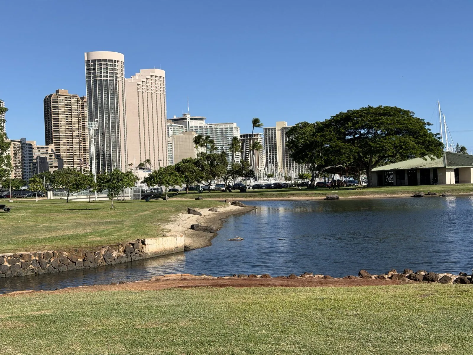
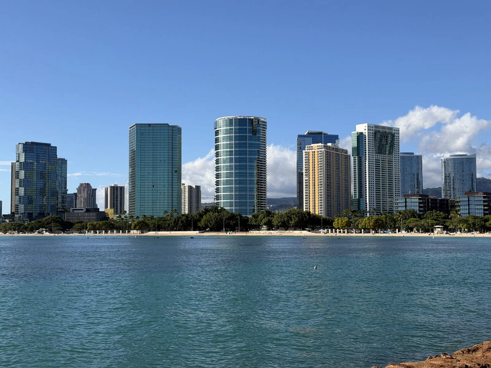
From the tip of Magic Island the views go both ways. To the west is the new skyline of Kakaʻako, glass towers lined up along the beach like a city that grew overnight, which it nearly did. To the east, across the mouth of the Ala Wai Yacht Harbor and its forest of masts, is Waikīkī, and behind it Diamond Head again. We sat on the grass for a while with music playing on a phone. The water in the channel was so clear you could see the rocks on the bottom.
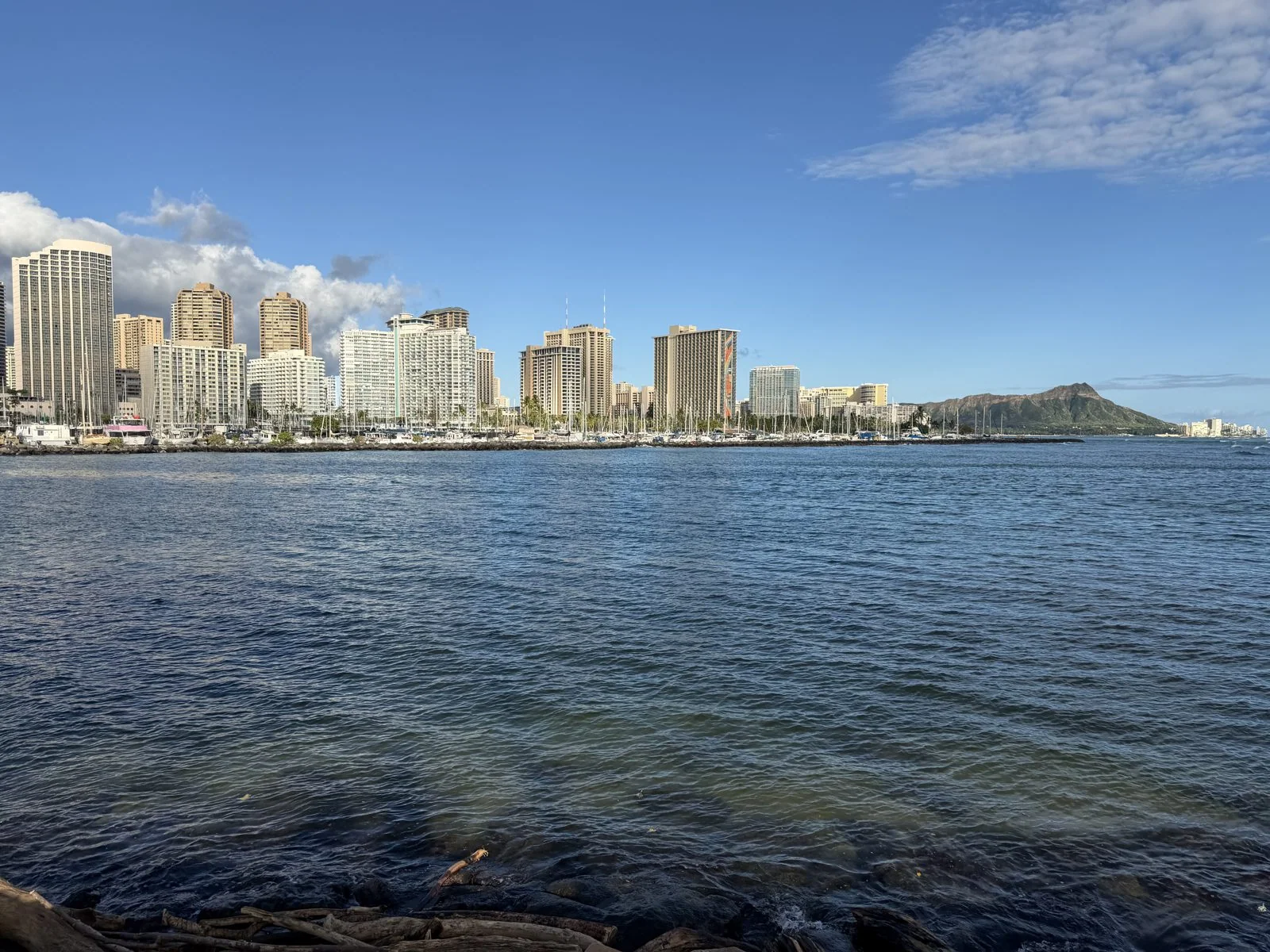
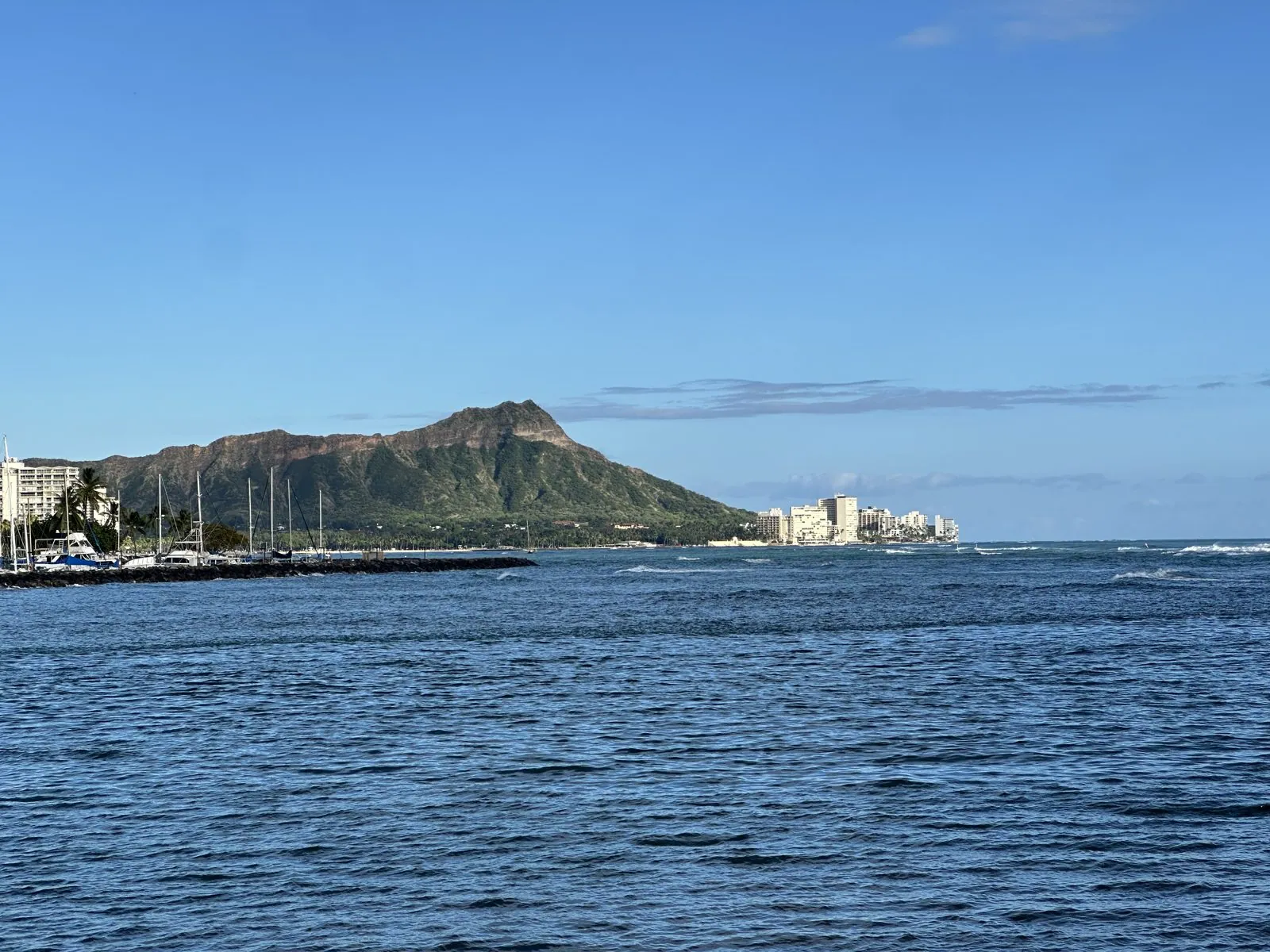
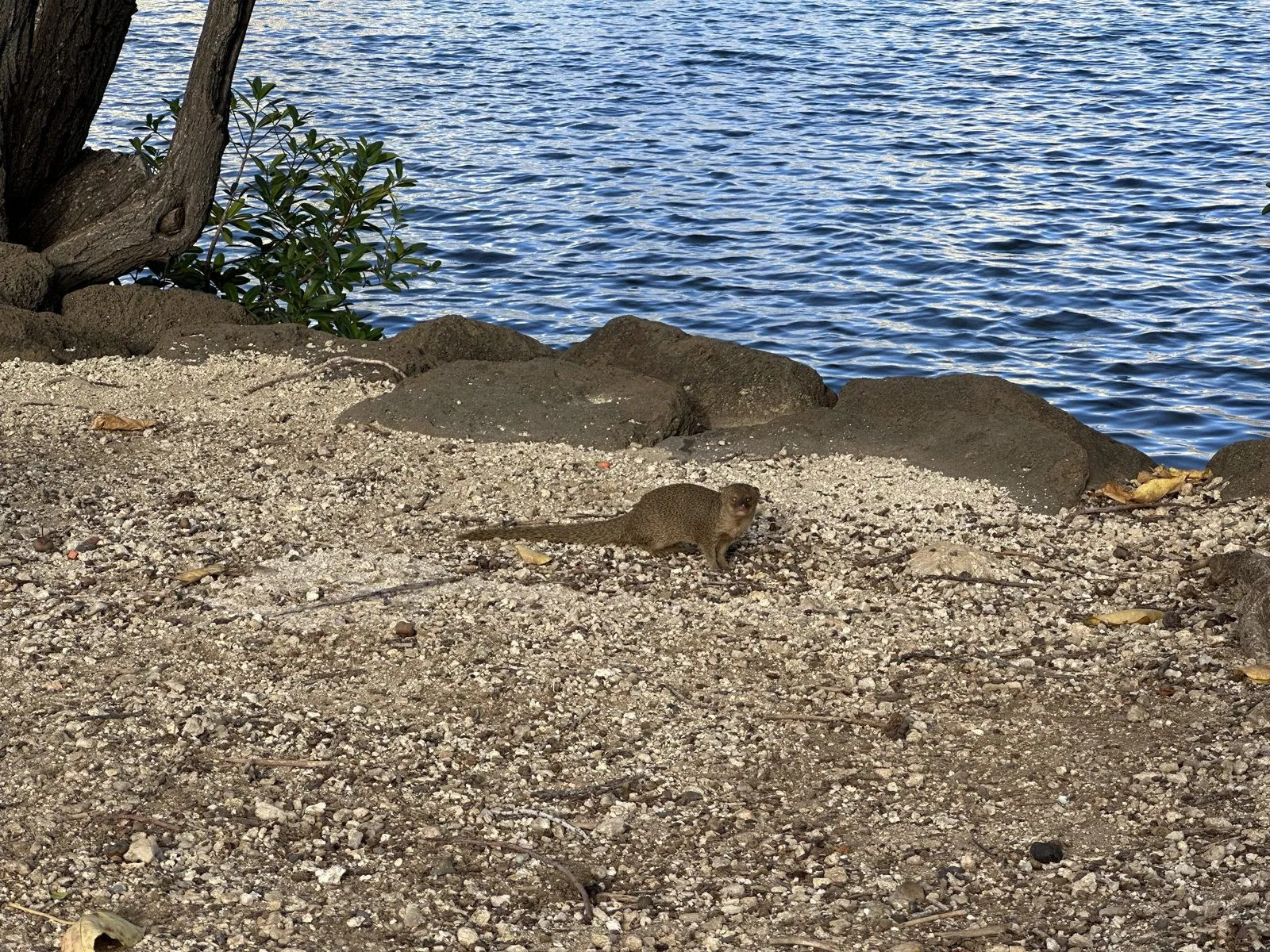
On the coral gravel by the water there was a small mongoose.
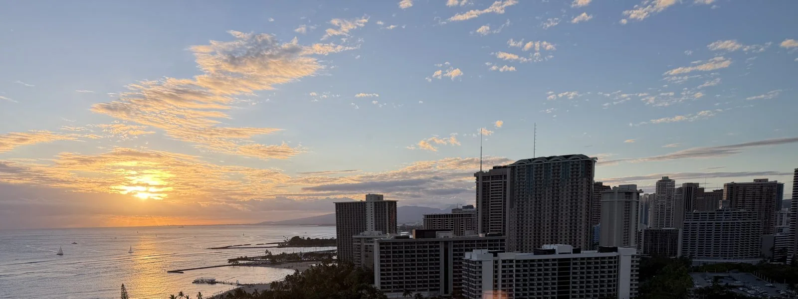
The sun went down that evening behind the towers at the west end of Waikīkī, a gold disc sinking into a sky full of small scattered clouds, with sailboats out on the water catching the last of the light. That night we were at Ka Laʻi, and at 7:45 the Hilton Hawaiian Village's Friday fireworks went off over the beach next door (more in the fireworks post).
The first half-minute of the fireworks, from the balcony: bursts over the beach, pink shells rising from the shore, and a lit dinner boat just offshore.
The Capitol District
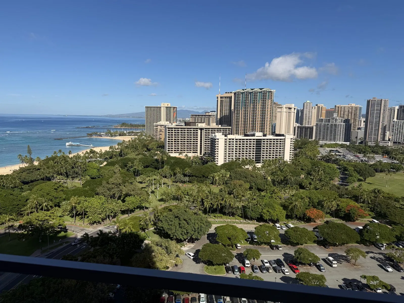
Saturday began with another view, this one over the green lawns and trees of Fort DeRussy, a slice of Army land that has been kept as open space in the middle of Waikīkī, with the ridges of the Koʻolau range behind the towers. In the afternoon we drove into downtown Honolulu.
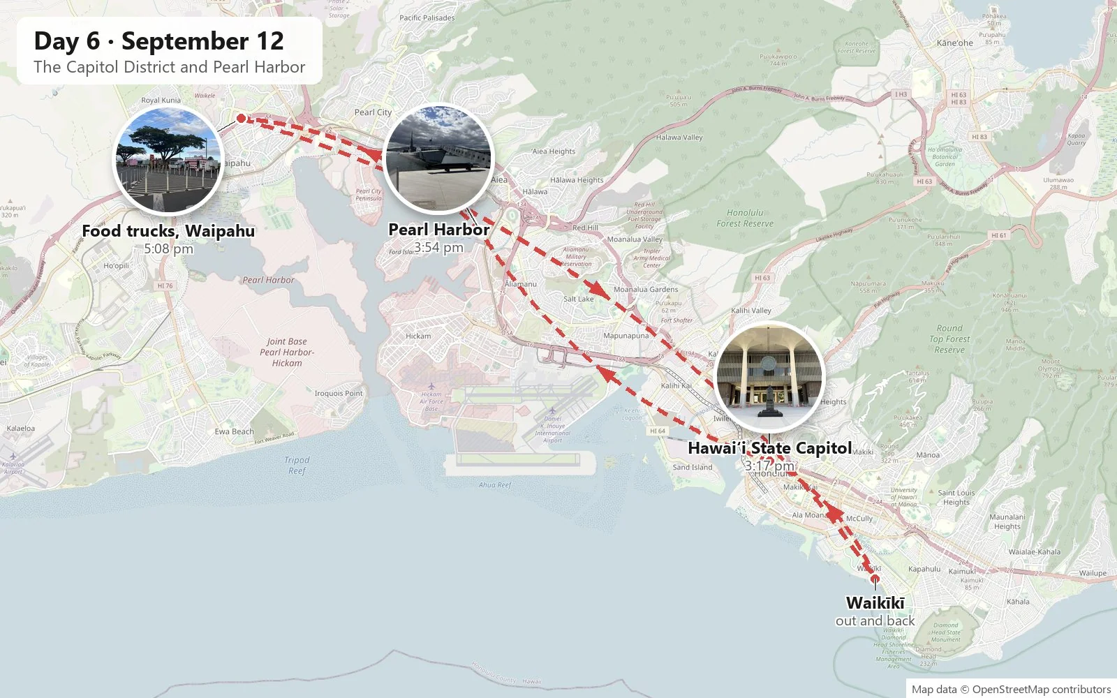
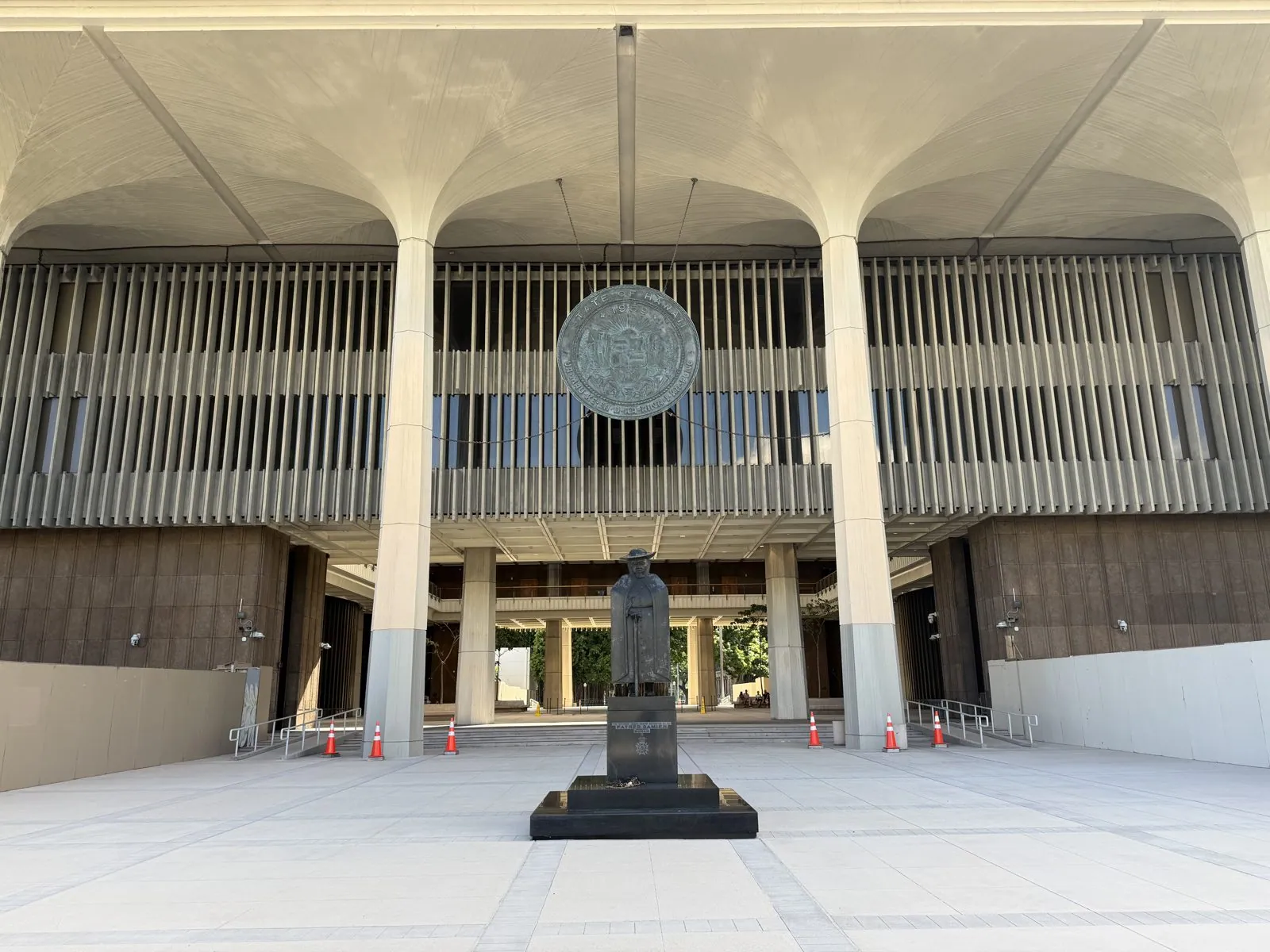
The Hawaiʻi State Capitol is one of the most unusual capitols in the country, and it is full of symbolism. Completed in 1969, a decade after statehood, it has no dome. Instead, the building is open to the sky in the middle, like the caldera of a volcano. The two legislative chambers are cone-shaped, like volcanoes, the forty tall columns around it are meant to suggest royal palms, and the whole building stands in a reflecting pool that represents the ocean surrounding the islands. A giant bronze state seal hangs over each entrance, with the motto Ua Mau ke Ea o ka ʻĀina i ka Pono, "the life of the land is perpetuated in righteousness."
In front of the Beretania Street entrance stands Father Damien, in a blocky, almost cubist bronze by the artist Marisol. Damien was the Belgian priest who went to live and work among the people exiled with leprosy to the Kalaupapa peninsula on Molokaʻi, caught the disease himself, and died there in 1889. He is now a saint, and one of Hawaiʻi's two representatives in the National Statuary Hall in Washington.
Pearl Harbor
Half an hour later we were at Pearl Harbor. We kept to the shore this time, walking the grounds around the visitor center rather than taking the boats out, and that turned out to be plenty. The visitor center sits on the shore of the harbor, looking across the water at Ford Island, where the battleships of the Pacific Fleet were moored on the morning of December 7, 1941. The attack that morning killed more than 2,400 Americans and brought the United States into the Second World War. It is a quiet place now, and the water is calm and gray-blue.
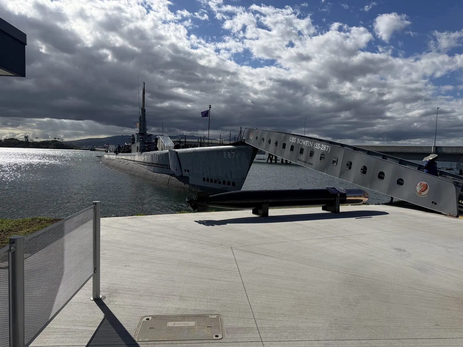
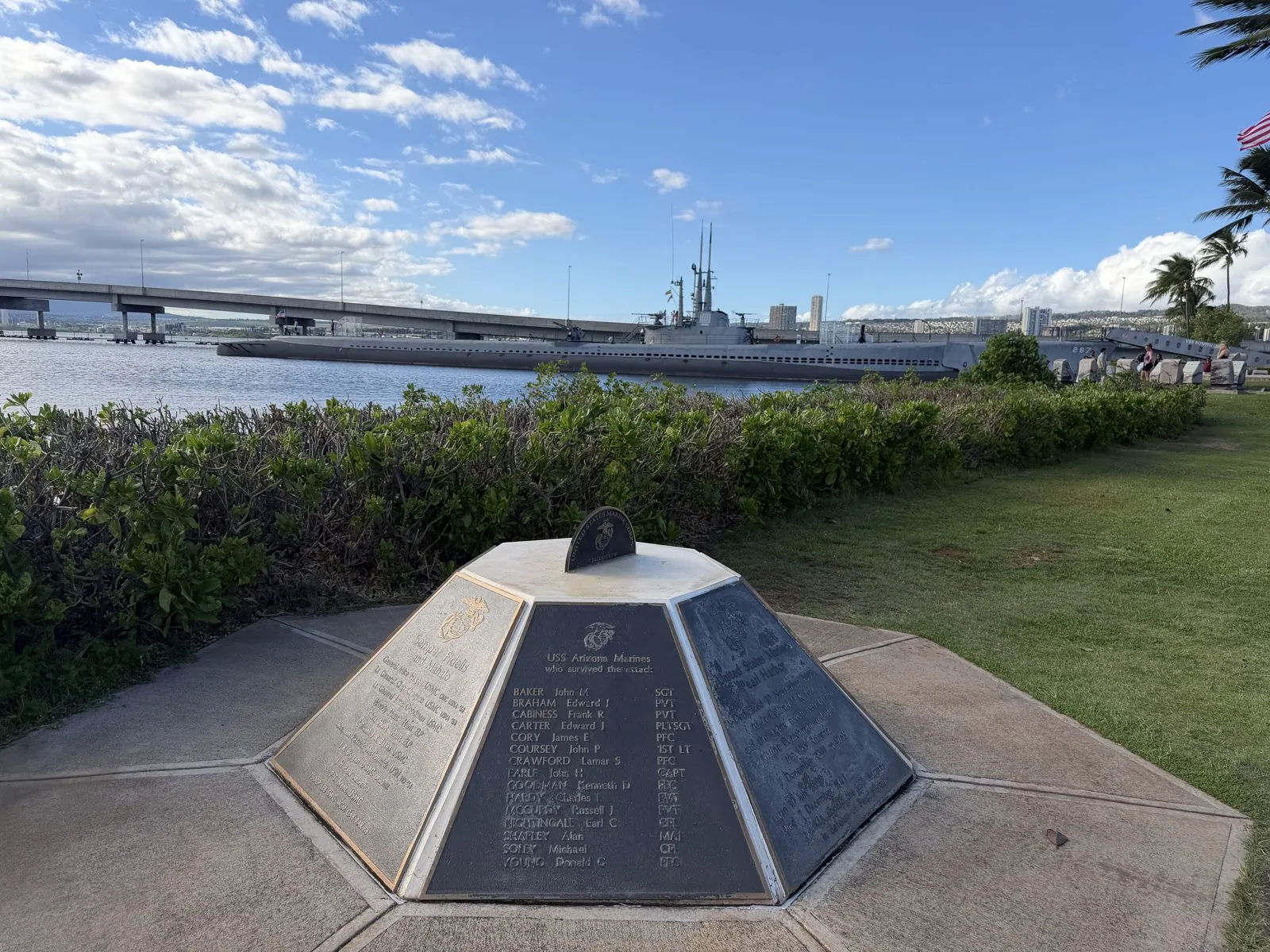
Moored on the shore by the visitor center is the submarine USS Bowfin. She was launched on December 7, 1942, exactly a year after the attack, and earned the nickname "the Pearl Harbor Avenger" for her war patrols in the Pacific. Her long gray hull lies low in the water beside the walkway.
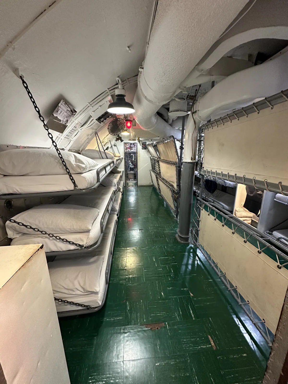
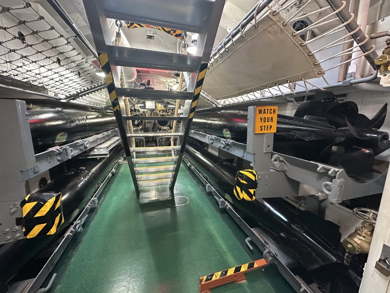
We went aboard. Inside, a submarine is one long steel corridor: bunks stacked three high along the passage, and in the torpedo room the spare torpedoes lie in racks right under the crew's bunks.
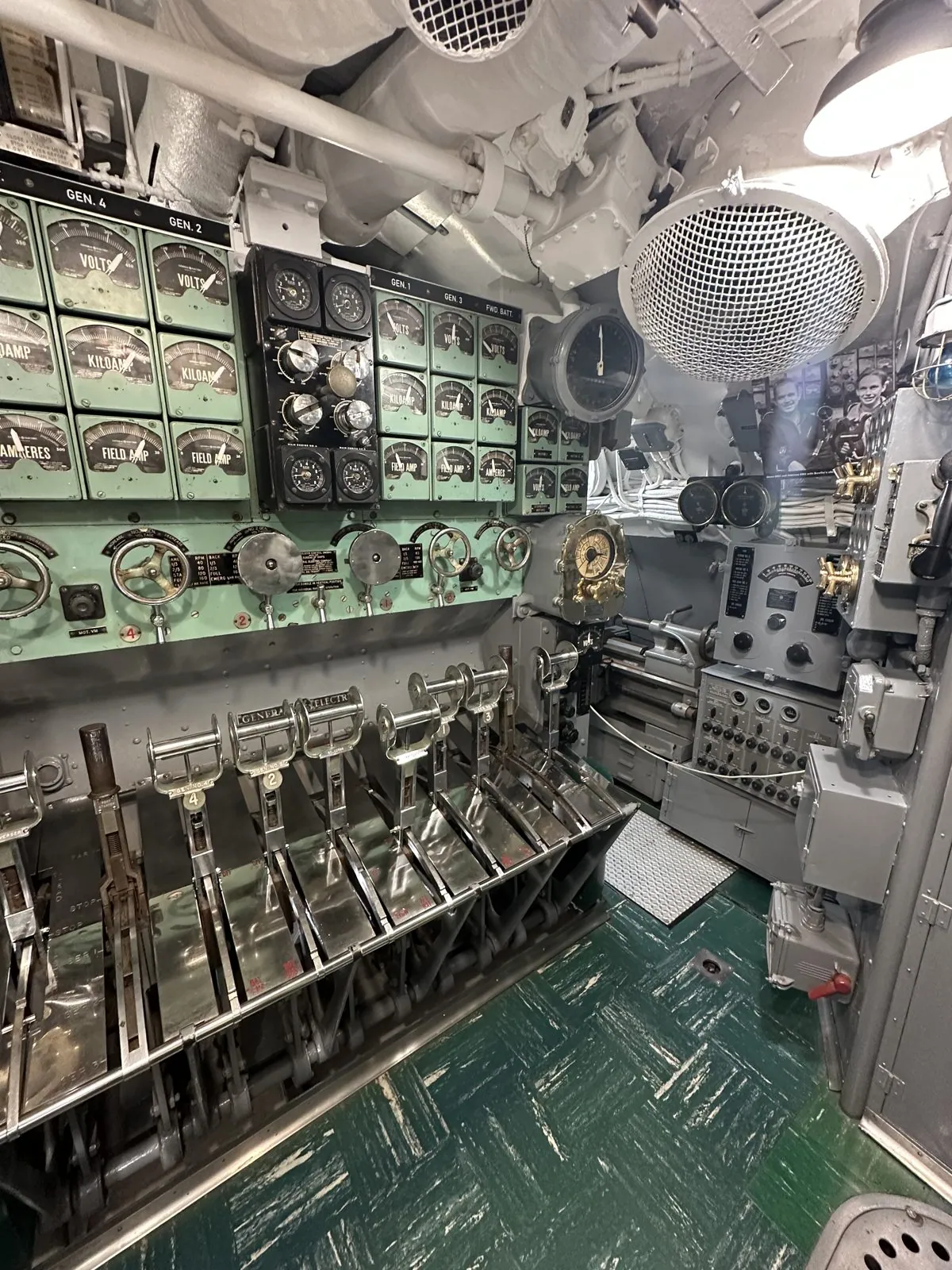
The maneuvering room is a wall of gauges, dials and levers.
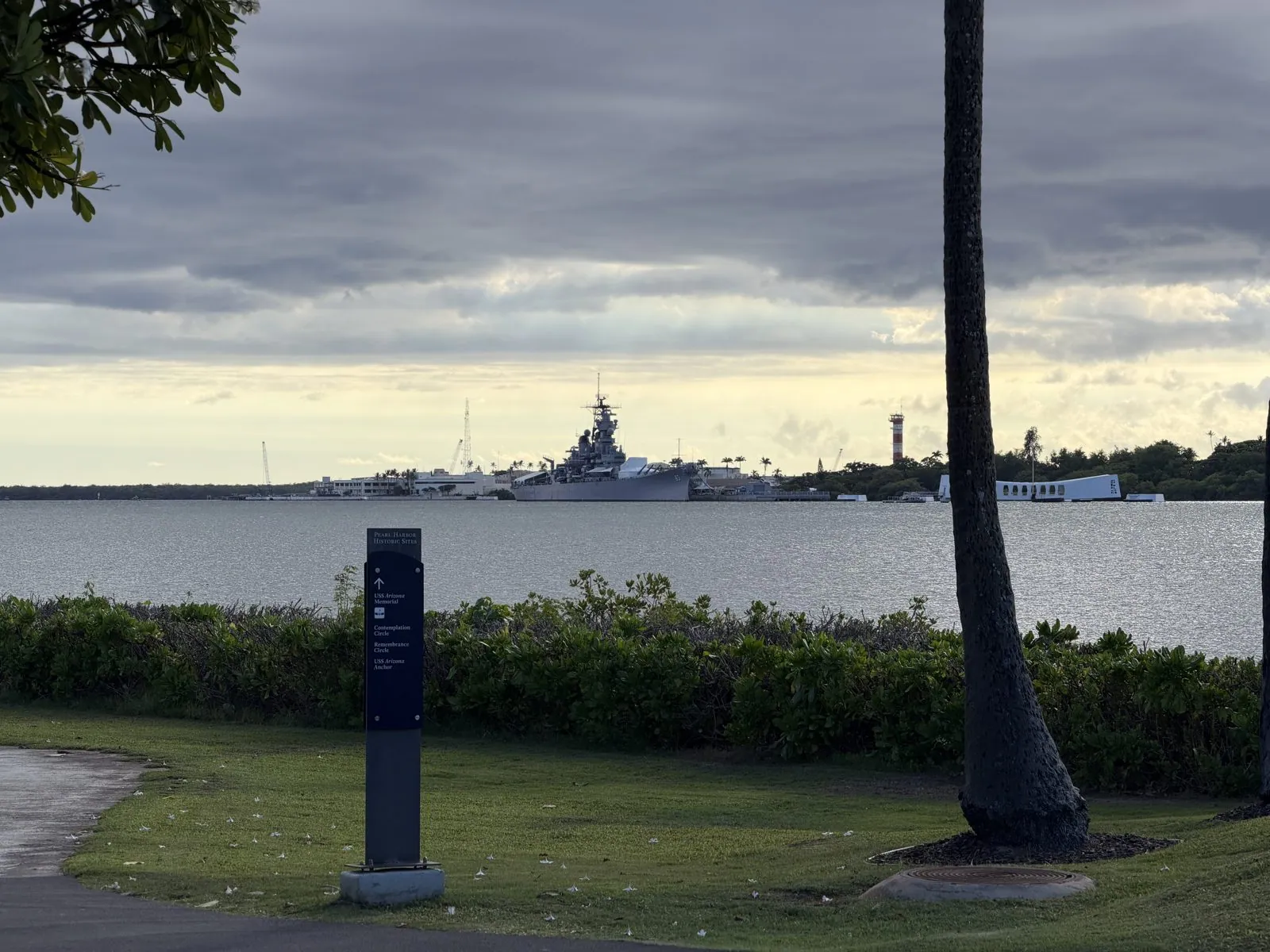
Across the harbor, on Ford Island, are the two ships that stand for the beginning and the end of America's war, and from the shore you see them the way the harbor itself does, at a distance across the water. The battleship USS Missouri, gray and enormous, her hull number 63 visible even from the far shore, is where Japan signed the formal surrender in Tokyo Bay in September 1945. She was moored here as a museum ship so that she would look over the USS Arizona Memorial, out in the harbor a short boat ride from the visitor center: the white structure that spans the sunken hull of the battleship Arizona, where more than 1,100 of her crew died on the morning of the attack and most of them still lie. Between them stands the red-and-white control tower of Ford Island's old airfield.
On the lawn by the shore, a low eight-sided marker honors the Marines who served aboard the Arizona. One of its bronze panels lists the Marines of the ship's detachment who survived the attack; another reads "Semper Fidelis and Mahalo." It is easy to walk past, and worth stopping for.
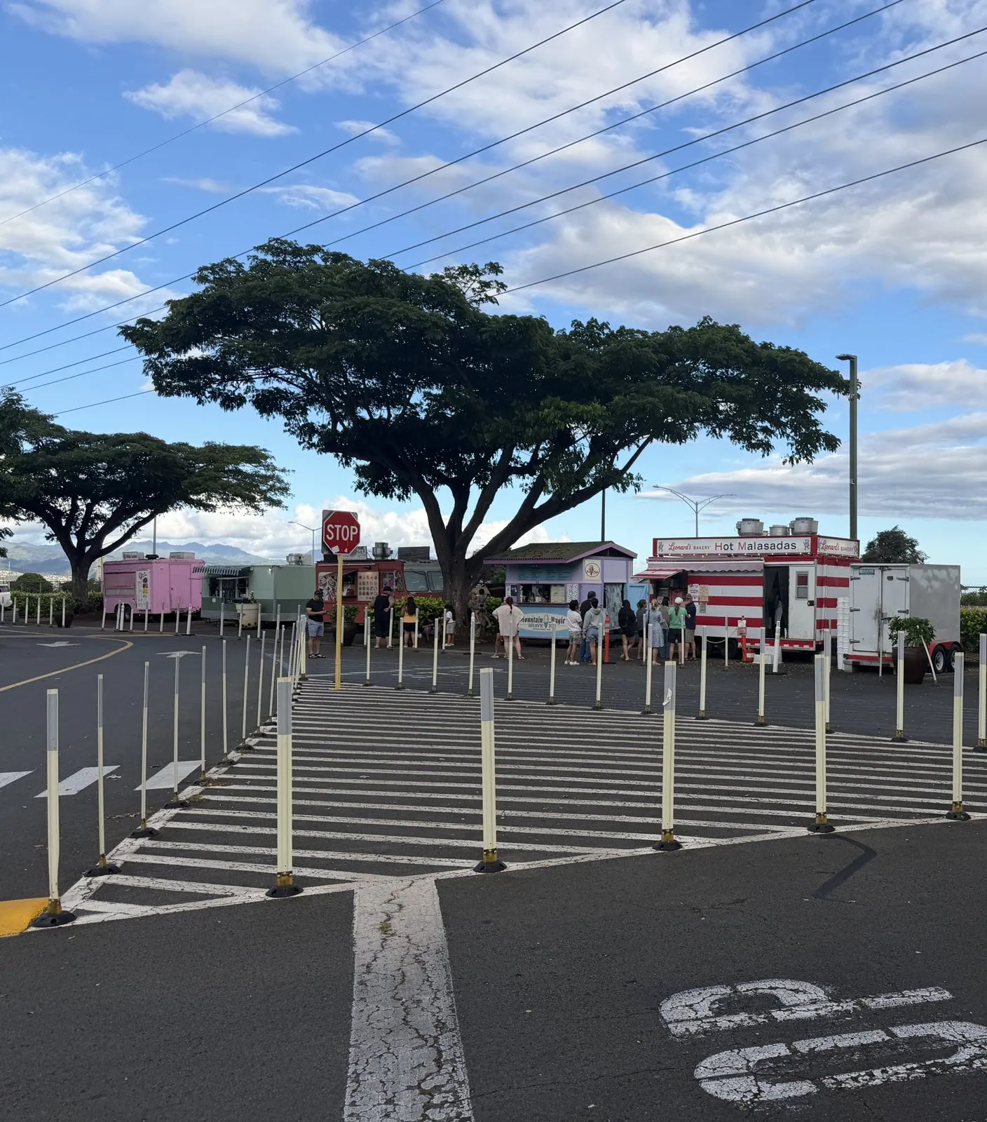
From Pearl Harbor we drove on to Waipahu, an old sugar-plantation town where the Oahu Sugar Company's mill ran for almost a century. In a lot under spreading monkeypod trees, a row of food trucks was serving the early-evening crowd, among them the red-and-white trailer of Leonard's, the Honolulu malasada bakery, where we got a box of malasadas, Portuguese doughnuts rolled in sugar.
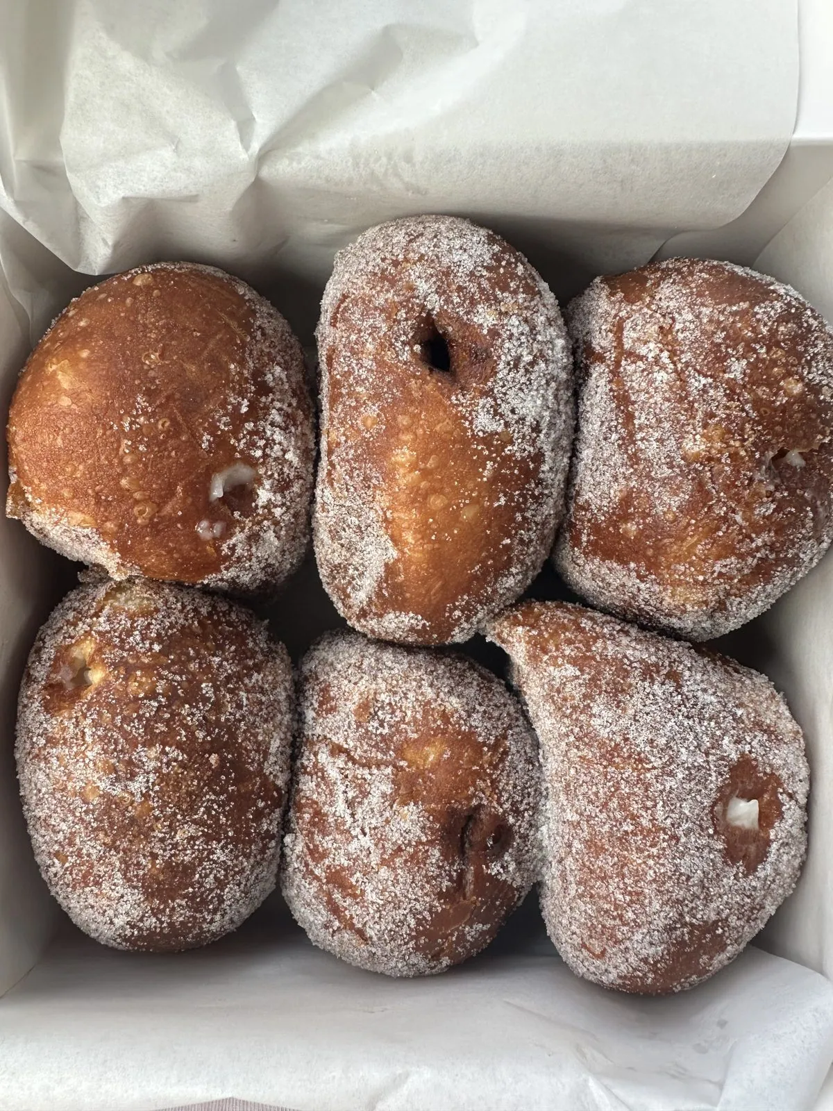
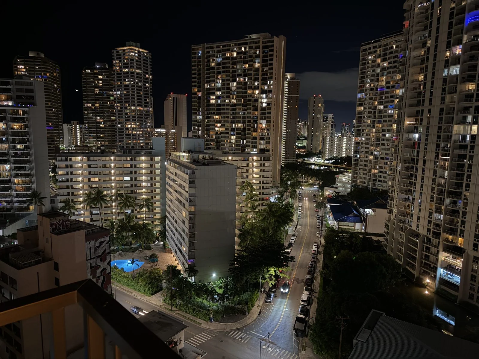
From there we kept going up to the North Shore, and at dusk we were at Ted's Bakery, which went unphotographed. That night, back in Waikīkī, the towers were lit up window by window, a vertical city of tiny yellow rooms, with the streets glowing far below.
Around the east end
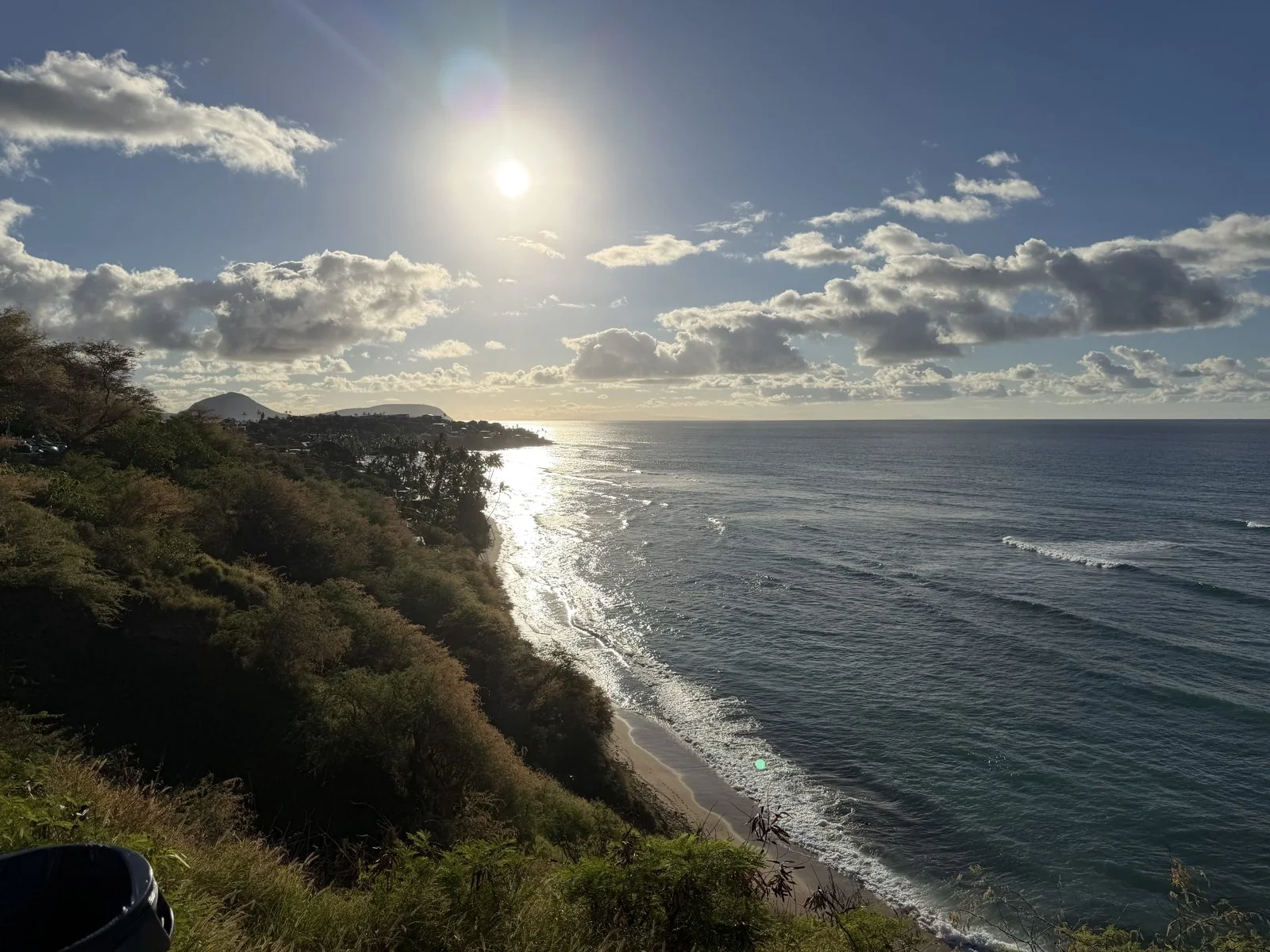
Sunday we left the driving to someone else. We had signed up for a day-long guided tour around the island, the kind where a bus collects you at dawn, a driver talks the whole way, and every famous view gets about ten minutes: out, look, photograph, back on the bus. It is not a way to know a place, but it is a very efficient way to see a lot of one. At 6:49 we were out in Waikīkī waiting for pickup, and by 7:23 the bus was on Diamond Head Road, which hugs the cliffs on the seaward side of the crater. The morning sun was low over the ocean, turning a long path of water to silver, and below the road the surf was rolling in along a narrow beach under the cliffs.
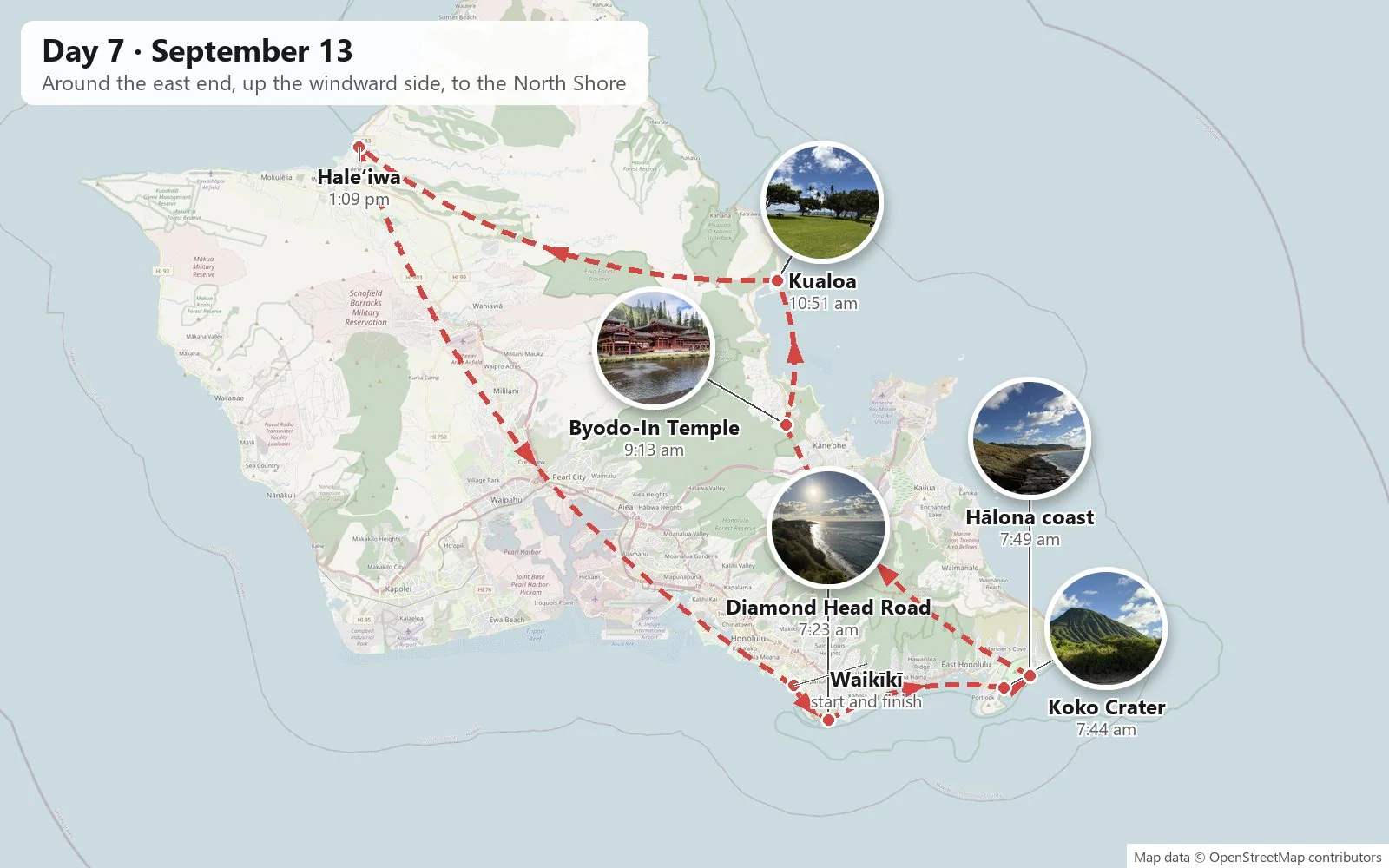
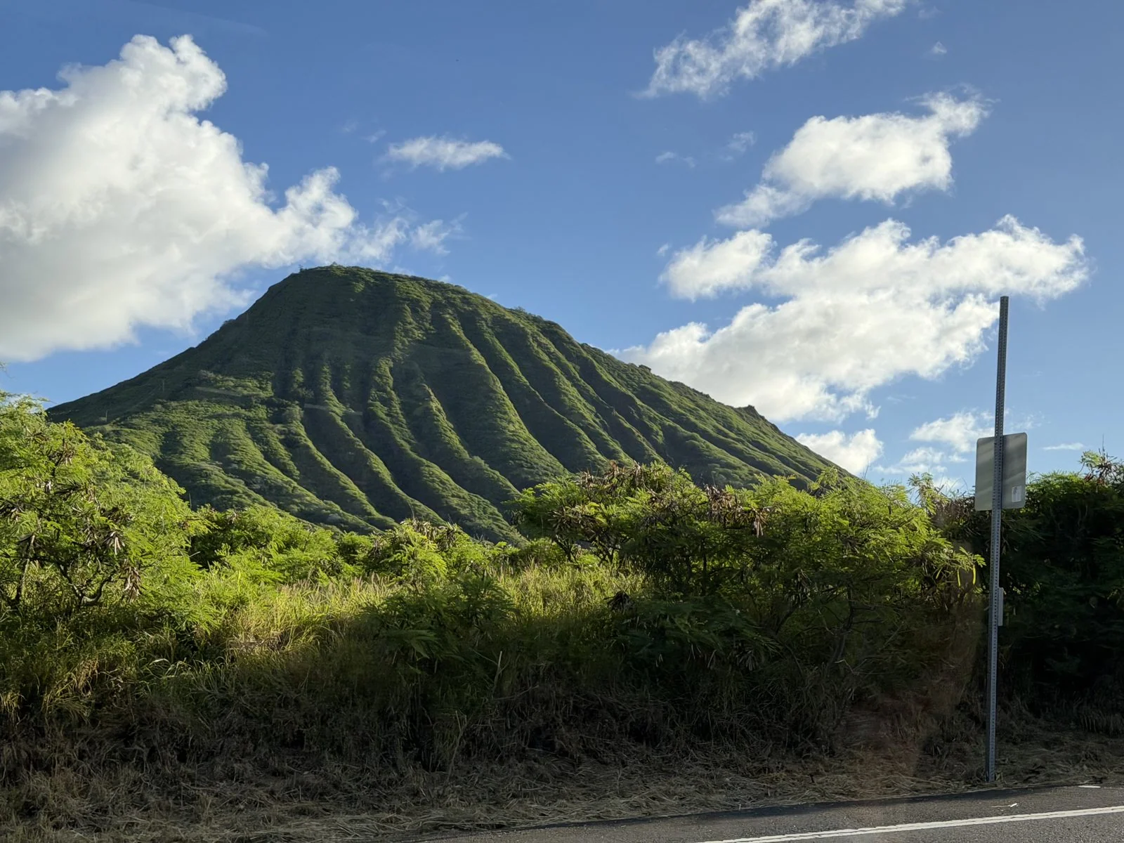
Past Hawaiʻi Kai the highway climbs around the eastern tip of the island, through a landscape that suddenly looks volcanic again. Here the volcanoes are young by Oʻahu standards. Koko Crater rises beside the road, a steep tuff cone whose sides are scored by deep parallel gullies, so that in the low morning light it looks ribbed, like a pleated green skirt.
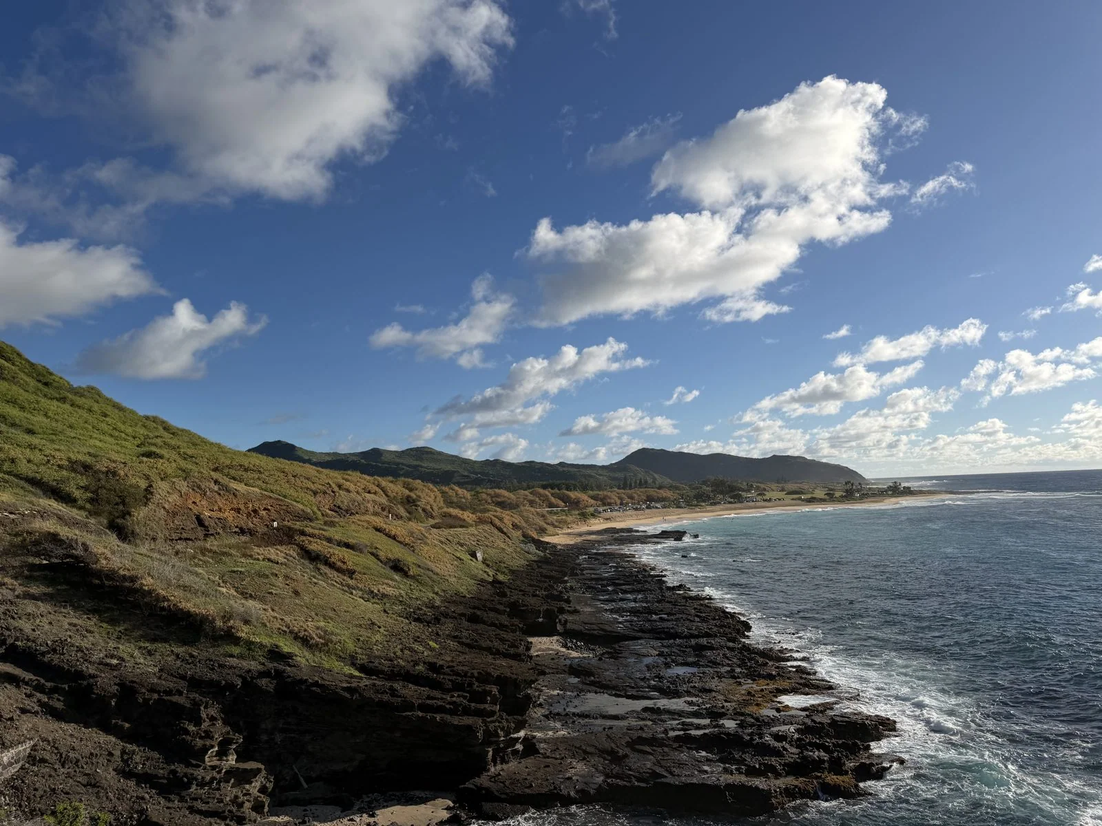
A few minutes on, near the Hālona Blowhole lookout, the coast turns to raw lava shelf: dark, layered rock with the surf crashing over it, a long sandy beach curving away beyond, and the cliffs of Makapuʻu in the distance. It is the windiest, wildest bit of the loop, and it comes just half an hour from Waikīkī. We had a few minutes at the lookout, long enough for the wind to rearrange everyone's hair, and then it was back on the bus.
Byodo-In Temple
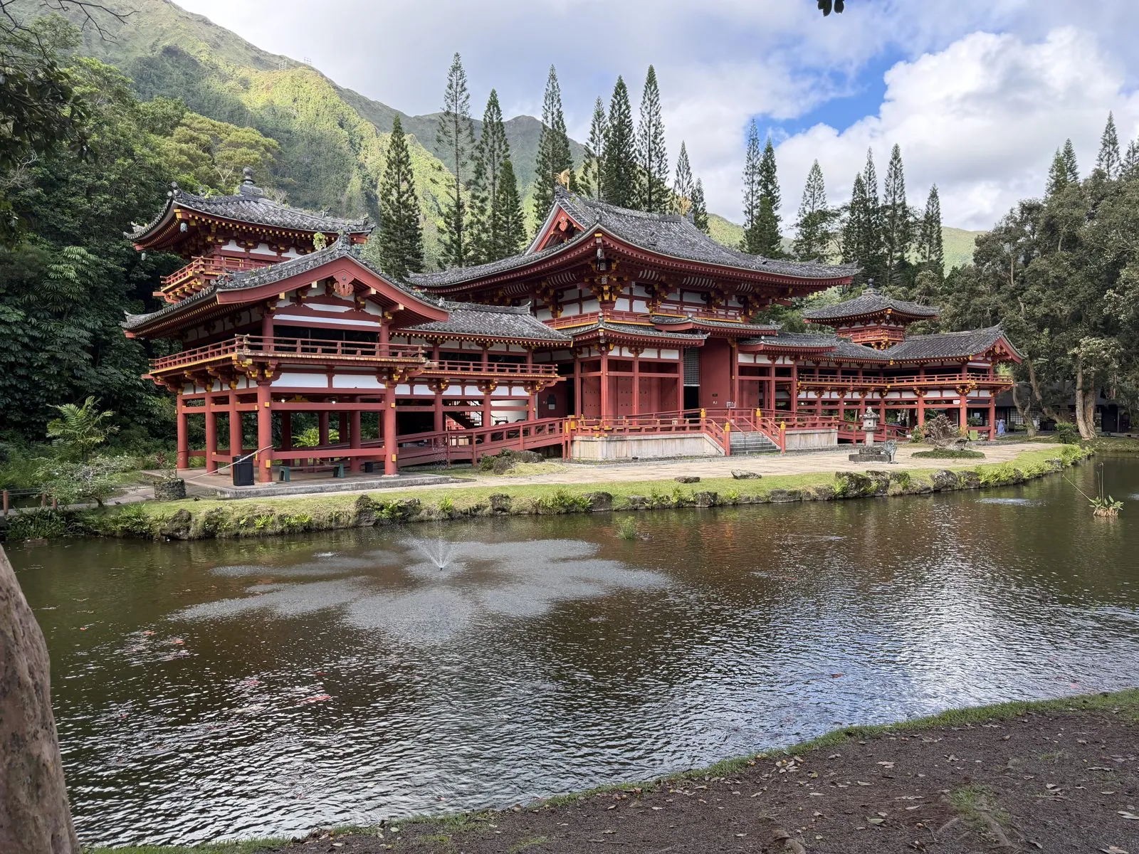
From there the bus went over to the windward side and up the coast to the Byodo-In Temple, in the Valley of the Temples at the foot of the Koʻolau cliffs. We got there at nine, and a line was already forming. This was a photo stop, not a visit, so what we came away with is the view from the edge of the pond. The temple was built in 1968 to mark the hundredth anniversary of the first Japanese immigrants to Hawaiʻi, and it is a replica, at smaller scale, of the Byōdō-in in Uji, near Kyoto, a Buddhist temple built in the eleventh century, whose Phoenix Hall appears on the Japanese ten-yen coin.
The setting is what makes it. The red-and-white hall with its upswept roofs sits on the edge of a large pond, with a fountain and koi, and behind it, close enough to fill the whole sky, rise the Koʻolau cliffs: sheer, green, fluted walls of rock, deeply grooved by rain, with clouds snagged along the top. It looks like a Japanese painting that someone set down in front of the wrong mountains, and somehow the mountains suit it better.
Kualoa, and the North Shore
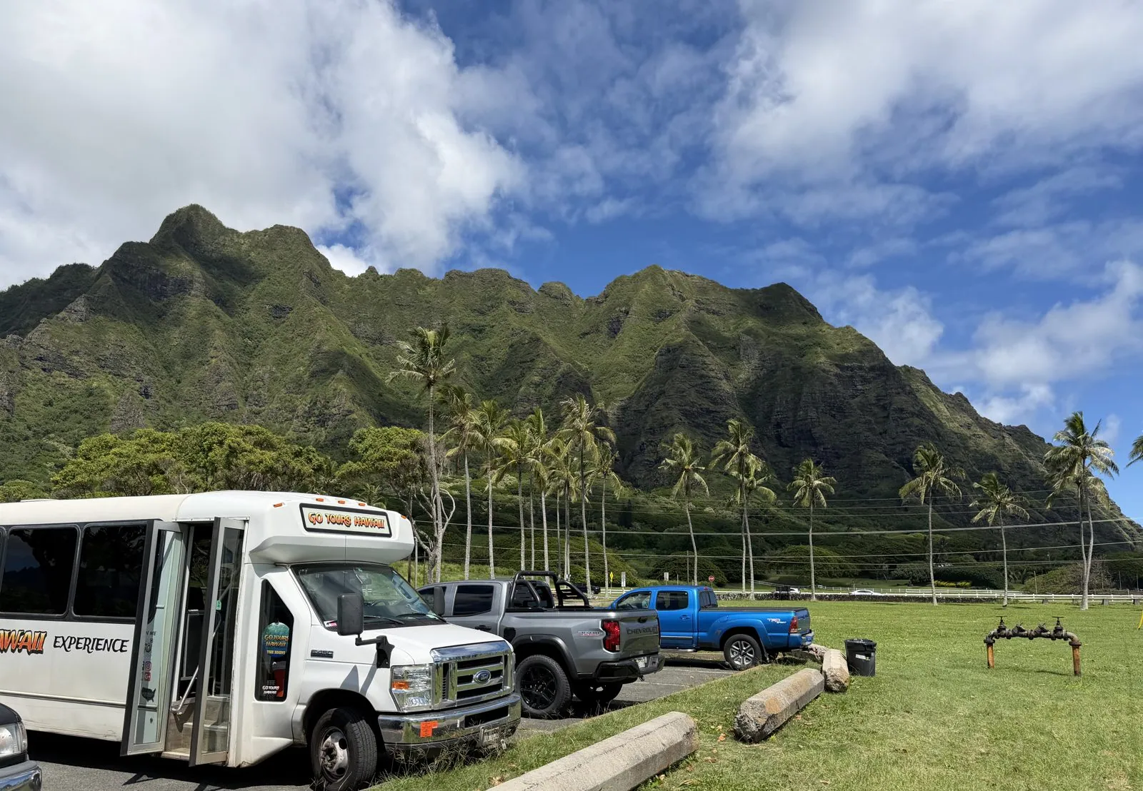
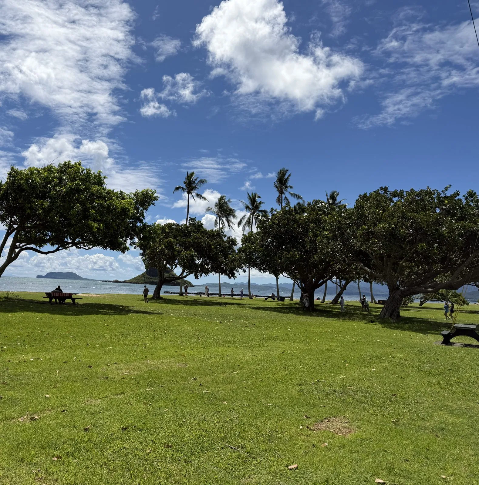
Further up the coast, at Kualoa, the Koʻolau range ends in a spectacular row of jagged peaks above the flat green land by the sea. Kualoa is one of the most sacred places on Oʻahu, and these ridges and the valleys behind them, now a working ranch, will look familiar to anyone who has seen Jurassic Park or any of the many films shot here since. We didn't go into the ranch; the tour pulled over for the view, and the white shuttle in the photo below is a reminder of how most people see Kualoa. In the beach park across the road, the lawn runs down to the water under wind-bent trees.
Just offshore sits Mokoliʻi, a small, steep, cone-shaped island. Its name means "little lizard": in Hawaiian legend it is the tail of a giant moʻo, a lizard spirit, slain by the goddess Hiʻiaka, sister of Pele. It felt like a fitting end to the Pele thread that began on the rim of Kīlauea.
By one o'clock the bus had come around to Haleʻiwa, the old plantation-era town that is now the capital of the North Shore. In winter this coast gets some of the biggest surf in the world, and Haleʻiwa fills with surfers and spectators. In September the sea is mostly calm, and the town is about shave ice, food trucks and surf shops. It was another short stop, and the camera roll has just one photo from there, of a parking lot, so I'll leave Haleʻiwa at that. The tour also made a brief stop at the Dole Plantation, in the pineapple country in the middle of the island, and then the bus took us back toward Honolulu.
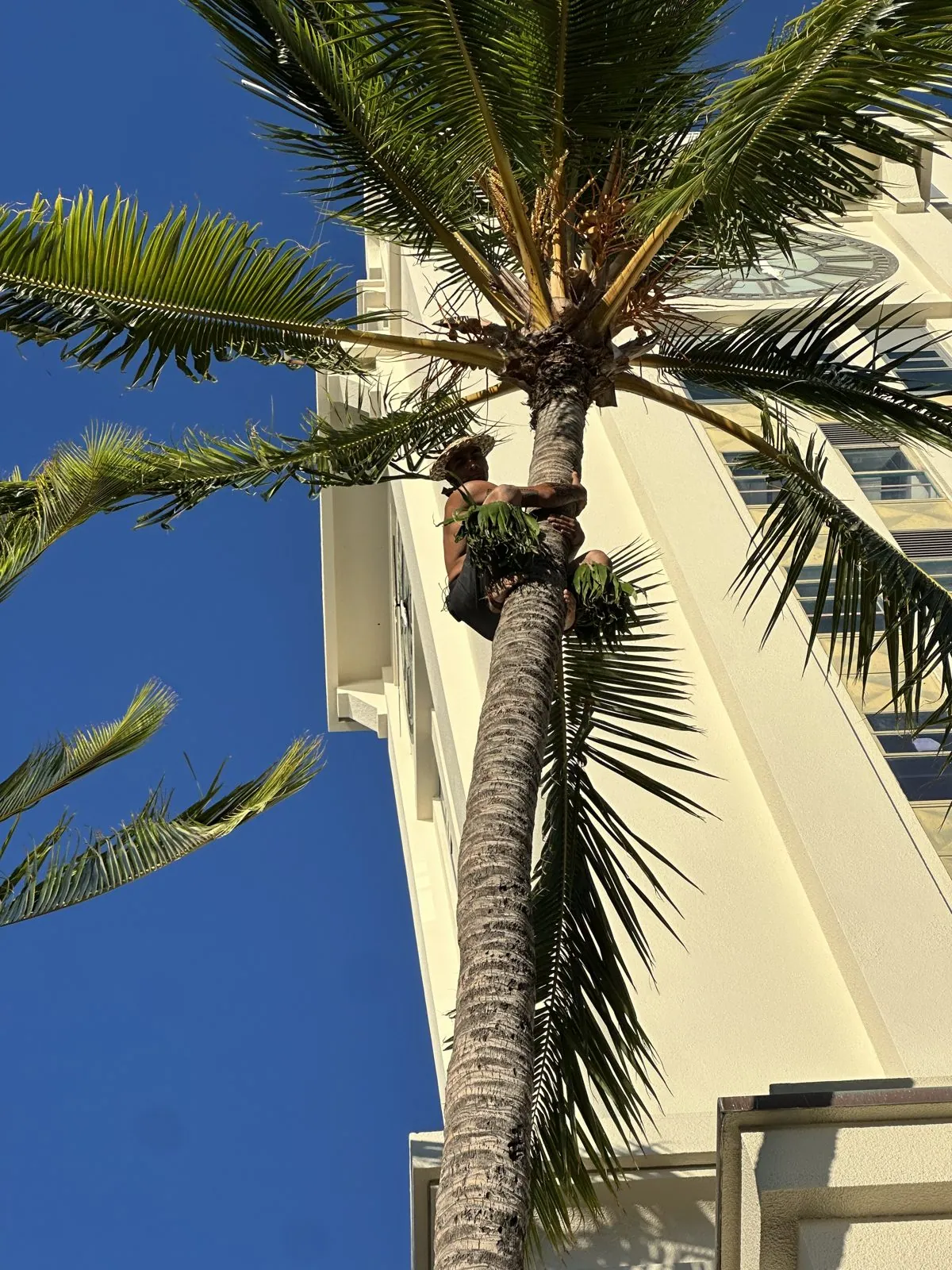
The tour ended with a luau down on the harbor by Aloha Tower. Before dinner a man climbed a tall coconut palm, straight up the trunk, and dinner was a buffet plate of kalua pork, noodles and poke.
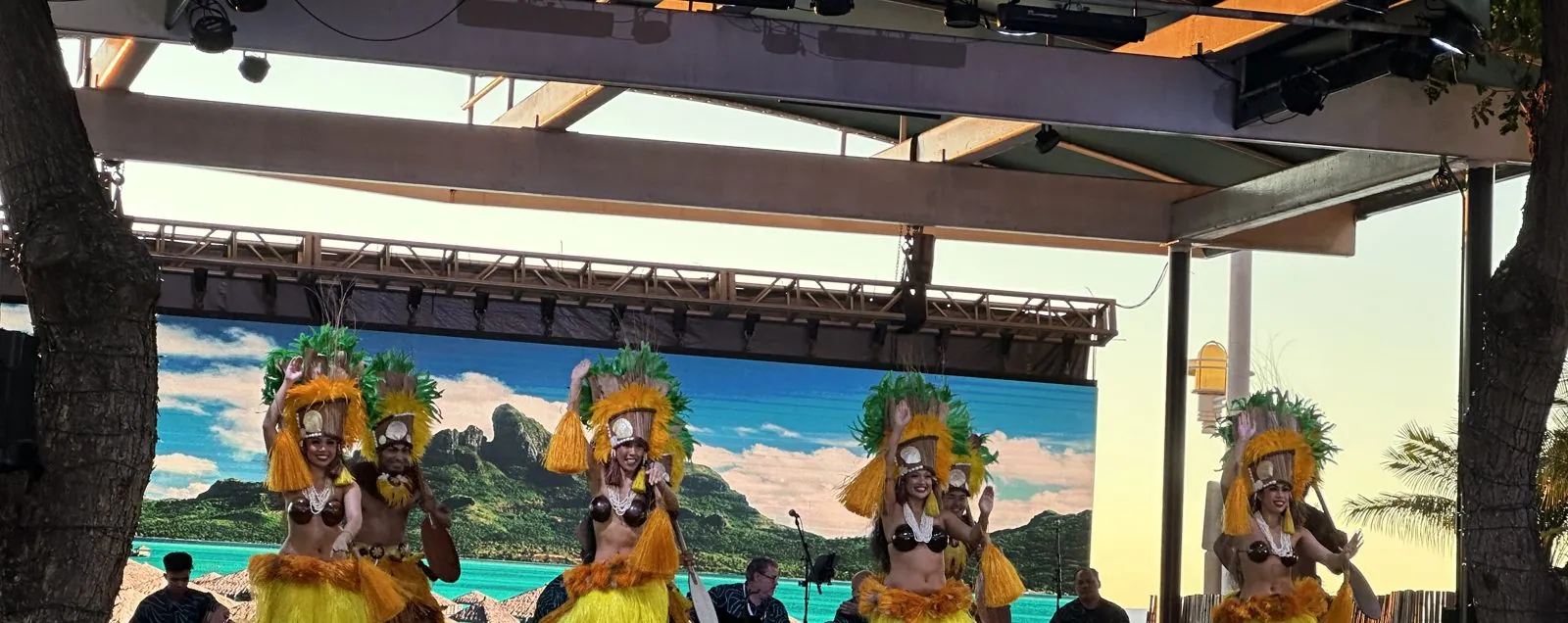
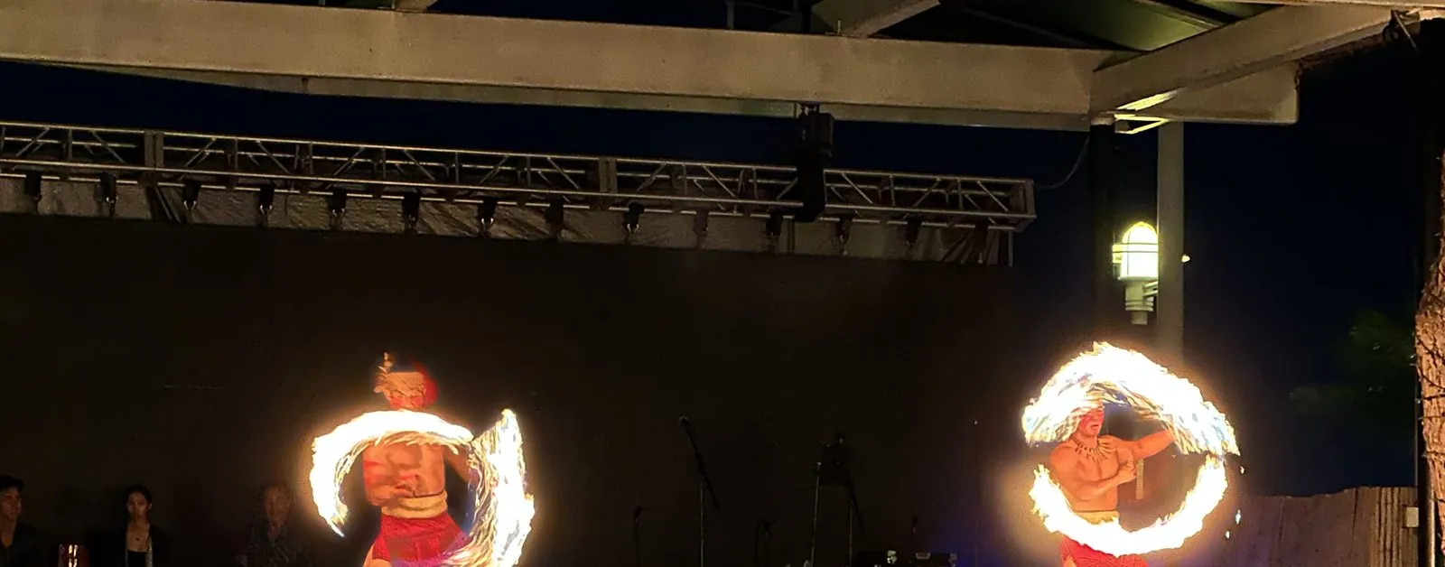
At sunset dancers in yellow took the stage, and after dark came the fire-knife dance, two spinning rings of flame.
Leaving
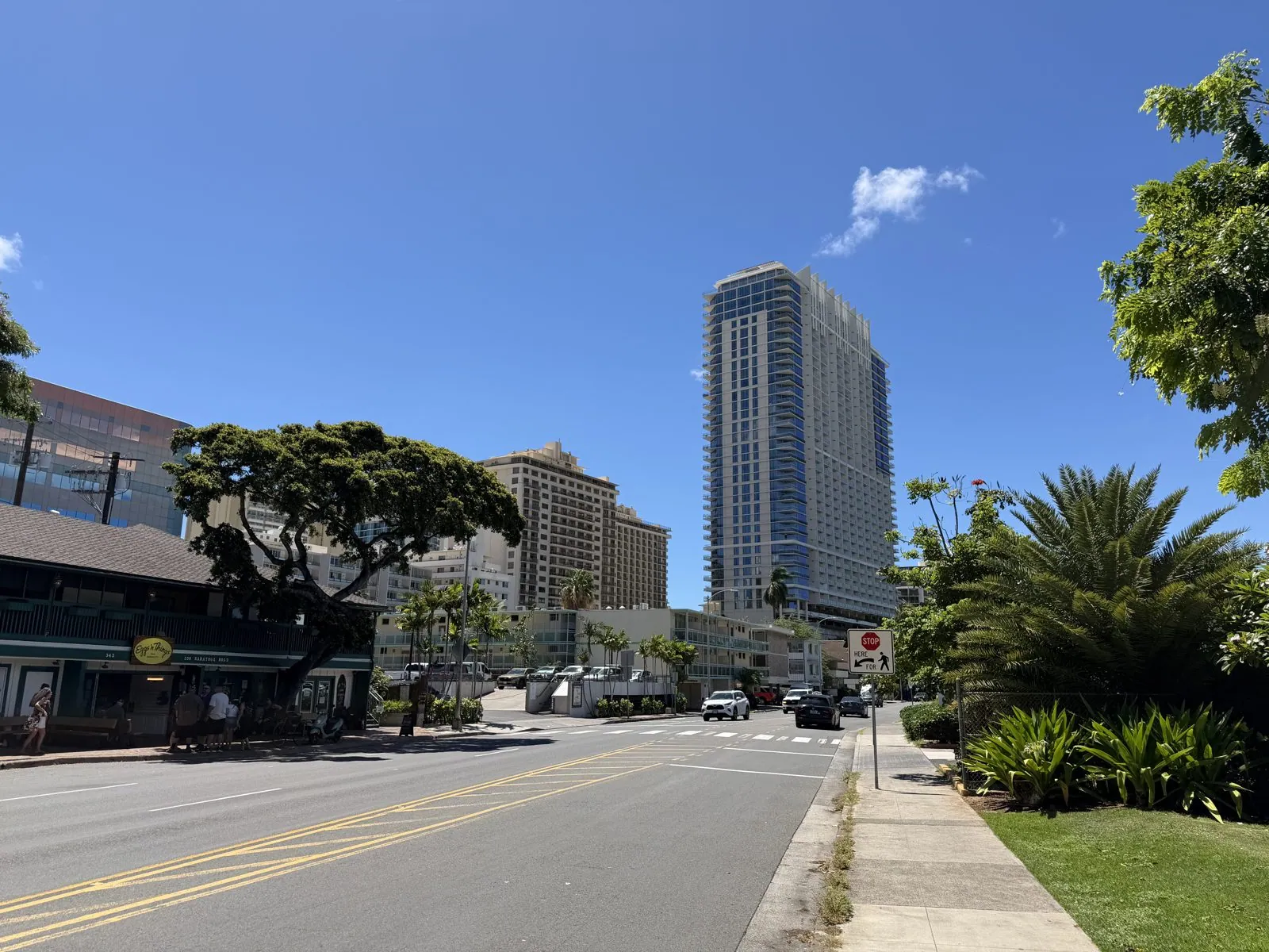
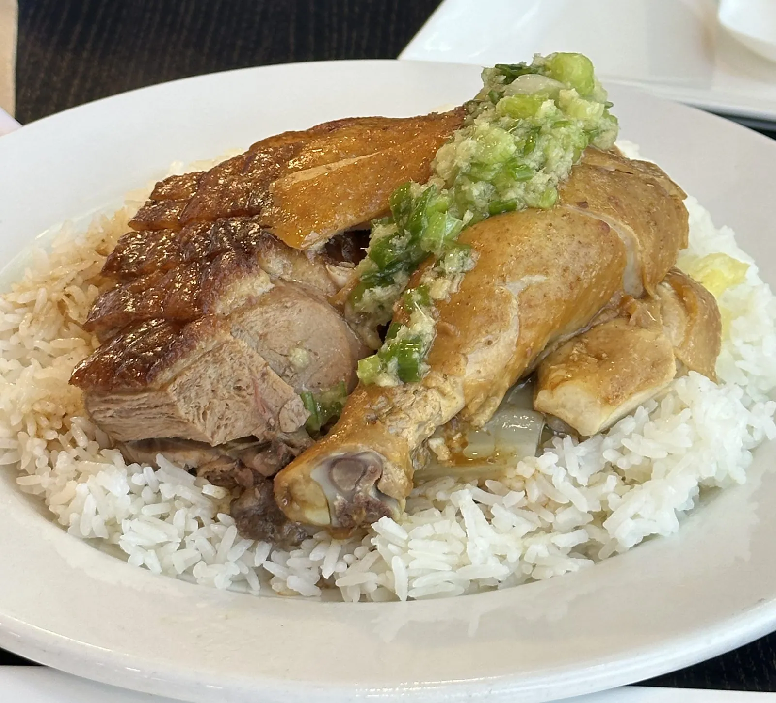
Monday was quiet: a late-morning walk on Saratoga Road in Waikīkī, banyan-shaded and bright, with the towers rising behind, and lunch in Chinatown, roast duck and chicken over rice under a heap of ginger and scallion.
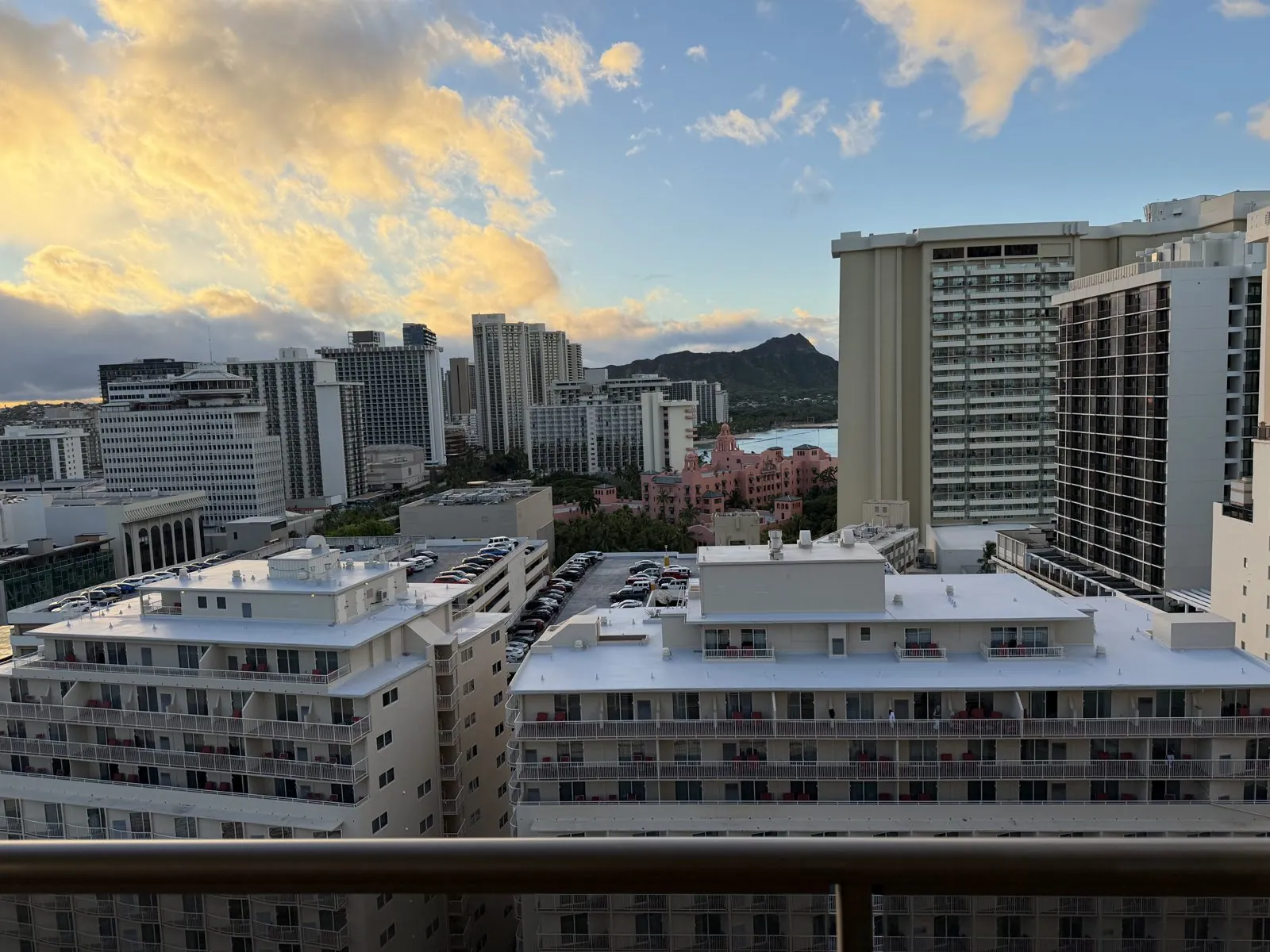
Then, early on Tuesday, the sky put on a farewell. At 6:36 the clouds over the Koʻolau mountains caught the sunrise and turned gold, while the city below was still in shadow, and over the rooftops we could see Diamond Head, with a pink building tucked among the towers below it.
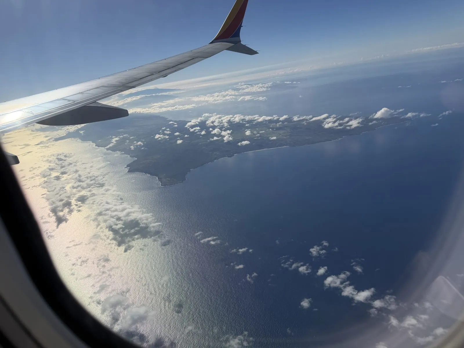
Two hours later we were in the air, heading east. Out of the window, past the wing, a long island lay in a deep blue sea, wrapped in its own little clouds, the islands sliding away behind us one by one.
Two islands
Nine days is not much for two islands, and the two halves of this trip could hardly be more different. The Big Island was raw and enormous and nearly empty: fresh lava, long dark roads, coffee farms in the clouds, and a sky lit red by a volcano. Oʻahu was a city with beaches, a deep and sometimes painful history, and very good sushi.
But they are the same story, told at different ages. Oʻahu is what the Big Island will become: its volcanoes went quiet long ago, the rain has carved its mountains into the fluted cliffs behind Byodo-In, and people have filled its lowlands with towers. The Big Island is what Oʻahu once was, still being built while we were there. Standing on the rim of Kīlauea, you watch land being made. In Waikīkī, you see what happens a few million years later. I would happily go back to either. Mostly, though, I want to see that red sky again.
Maps built from the trip's photo timestamps and locations. Photo locations have been removed from the published images. Day maps: map data © OpenStreetMap contributors; each stop is placed where its photo was taken, hotels and home are never marked, and the dashed lines show the order of stops, not the exact roads.
Some photos in this post are my wife's.
Likes and comments
React with an emoji or leave a comment. Signing in with GitHub is required.