← Misc · July–August 2024
The Hedgehog Who Went to Key West
SIGGRAPH 2024 in Denver, then New York to Key West, a city a day.
Los Angeles → Denver (SIGGRAPH 2024) → New York → New England → the Great Lakes → Chicago → Orlando → Key West → Los Angeles
2,541 miles driven · 13 states by car, plus Colorado and Georgia · 13 nights on the road, only two places twice · ten university campuses, mostly unplanned · one toy hedgehog as mascot
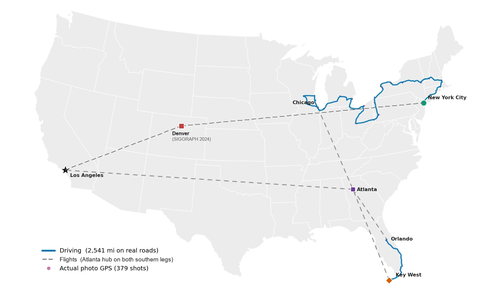
It started with a conference. SIGGRAPH 2024 was in Denver, and when it ended I didn't fly home. I flew to New York, where the other half of this story's "we" was already waiting. We picked up a rental car at JFK on the evening of August 1st and gave ourselves two weeks. We didn't set out to make it a race. But when the goal is the southernmost point of the continental United States and the starting line is New York, you end up sleeping in a different bed almost every night. Thirteen nights, and only twice did we get to unpack for a second day. The rest was a city a day: coffee in one state, dinner in another.
Everything below is reconstructed from the camera roll. A phone remembers where and when every photo was taken, and lined up in order, a few hundred pictures turn out to be a surprisingly honest diary. They record the detours we forgot, the hour we actually left a place, and how much of every day was spent looking up at buildings. Where the photos are silent, I've said so rather than fill the gap with a guess. Where a place has a story worth knowing, I've added a little of it, because half the fun of a trip like this is finding out afterwards what you were looking at.
A word on the shape of it. The trip falls naturally into a prologue and three acts. The prologue is a week at a conference in Denver. Act I is a long, looping drive from New York through New England, upstate New York, the Rust Belt and the Great Lakes to Chicago, with a detour into Wisconsin. Act II is a flight south and two days in the theme parks of Orlando. Act III is a drive to the very end of the road in Key West, followed by an improbable afternoon in Atlanta on the way home. Through all of it, a small toy hedgehog rode on the dashboard. He joined in Vermont, and he has his own section at the end.
Prologue: SIGGRAPH in Denver
The trip began, as many graphics people's summers do, at SIGGRAPH, the annual conference on computer graphics and interactive techniques. It is the place where the people who build rendering engines, animation tools and simulation software meet the people who make films and games with them, and for one week a year it takes over a convention center. In 2024 that convention center was in Denver.
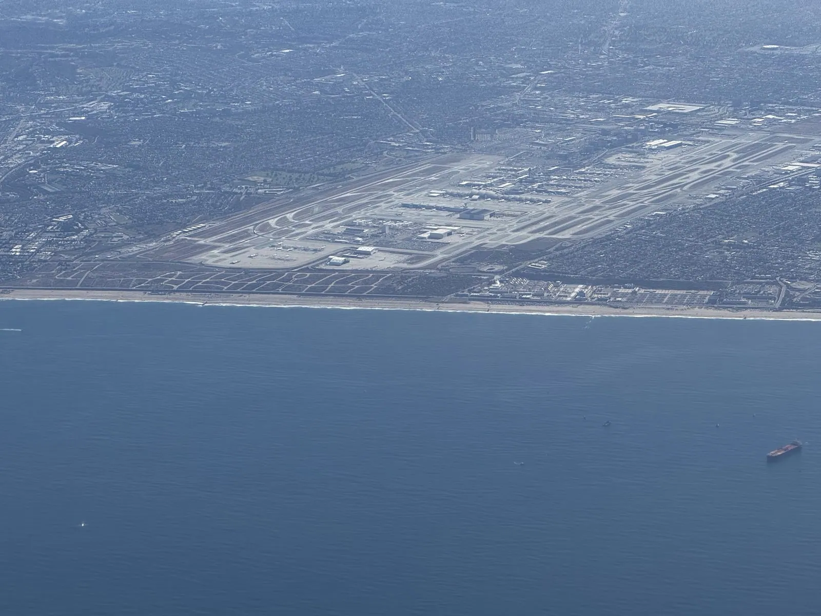
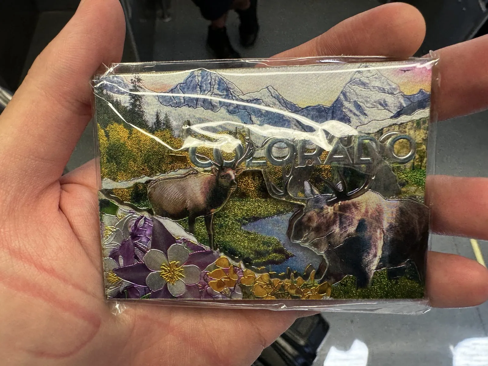
I left Los Angeles, alone, on the morning of July 28th. Taking off westbound, the plane banked out over Santa Monica Bay before turning east. For a minute the whole coastline was laid out below: the beach towns, the runways of LAX and the sun glinting off the water. The first souvenir of the trip was bought in Denver that same afternoon. It was a Colorado fridge magnet, all elk, mountains and wildflowers, and it turned out to be the first of many. That week I stayed at the Embassy Suites by the convention center (it's in the hotels post).
Four days at the convention center
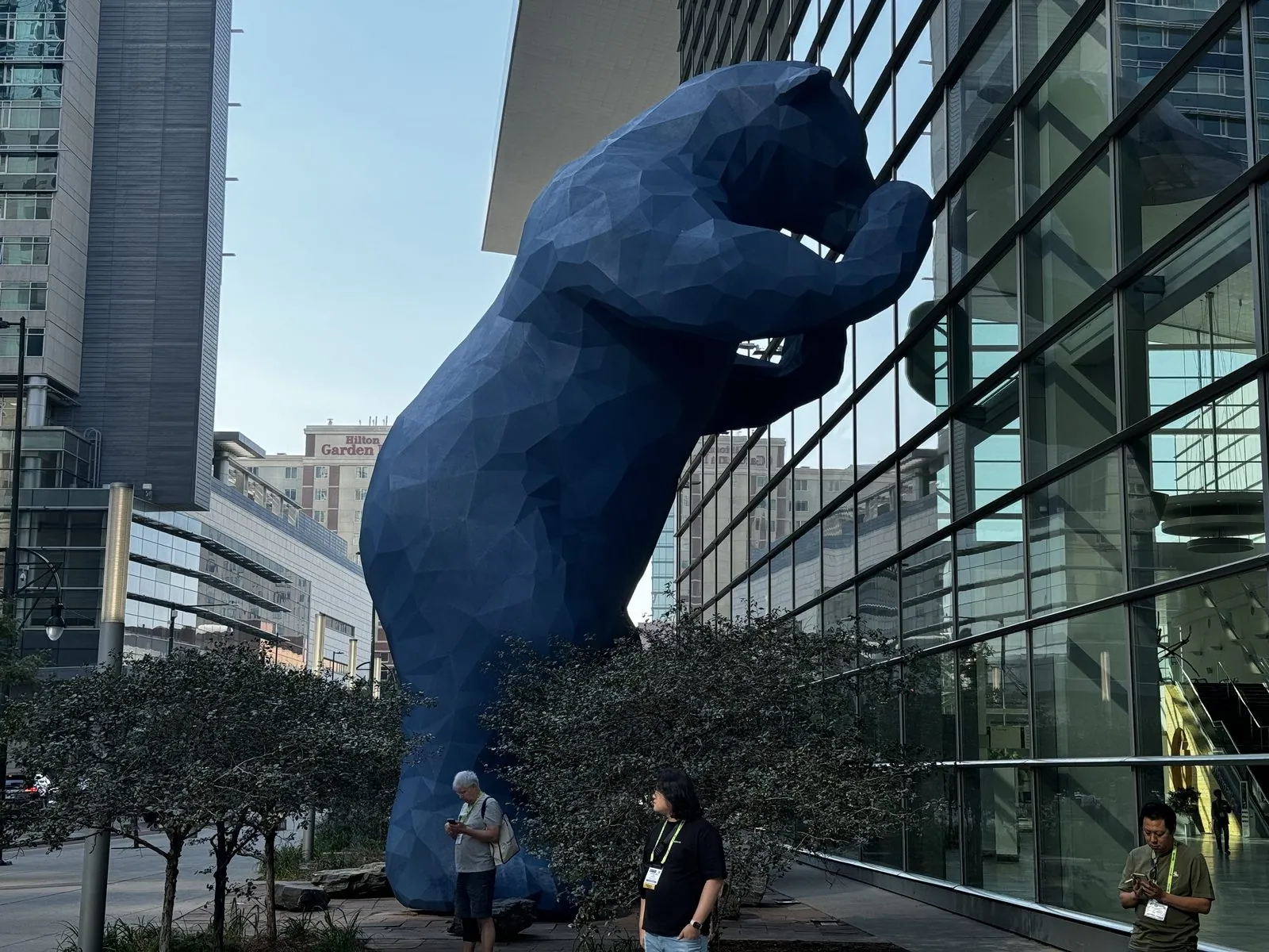
The conference opened that evening with a ritual. You file into a darkened hall the size of an aircraft hangar, thousands of people facing a wall of screens, the lights go down, and the screens fill with the year's best computer animation and visual effects, set to music loud enough to feel in your seat. Then the lights come up, and you spend the next four days doing the opposite: sitting in small rooms listening to people explain, equation by equation, how one tiny piece of it was done. The week at the Colorado Convention Center was all of that: talks, the exhibition floor, too many conversations to count, and a forty-foot blue bear peering in through the glass at all of it.

The bear is officially called I See What You Mean. Lawrence Argent made it in 2005, and it has become the building's unofficial mascot and arguably the city's. It stands on the sidewalk on 14th Street with its paws and nose pressed against the glass, like a curious tourist trying to see what all the people inside are doing. Argent said the idea came from a photo of a bear peering into a window. The joke works from both sides. From the outside he looks in; from the inside he looms behind the giant SIGGRAPH letters in the lobby, a vast blue silhouette against the downtown towers. That makes him the most photographed attendee of the week. Every morning a small crowd of badge-wearers stood at his feet with their phones up, and I was one of them.
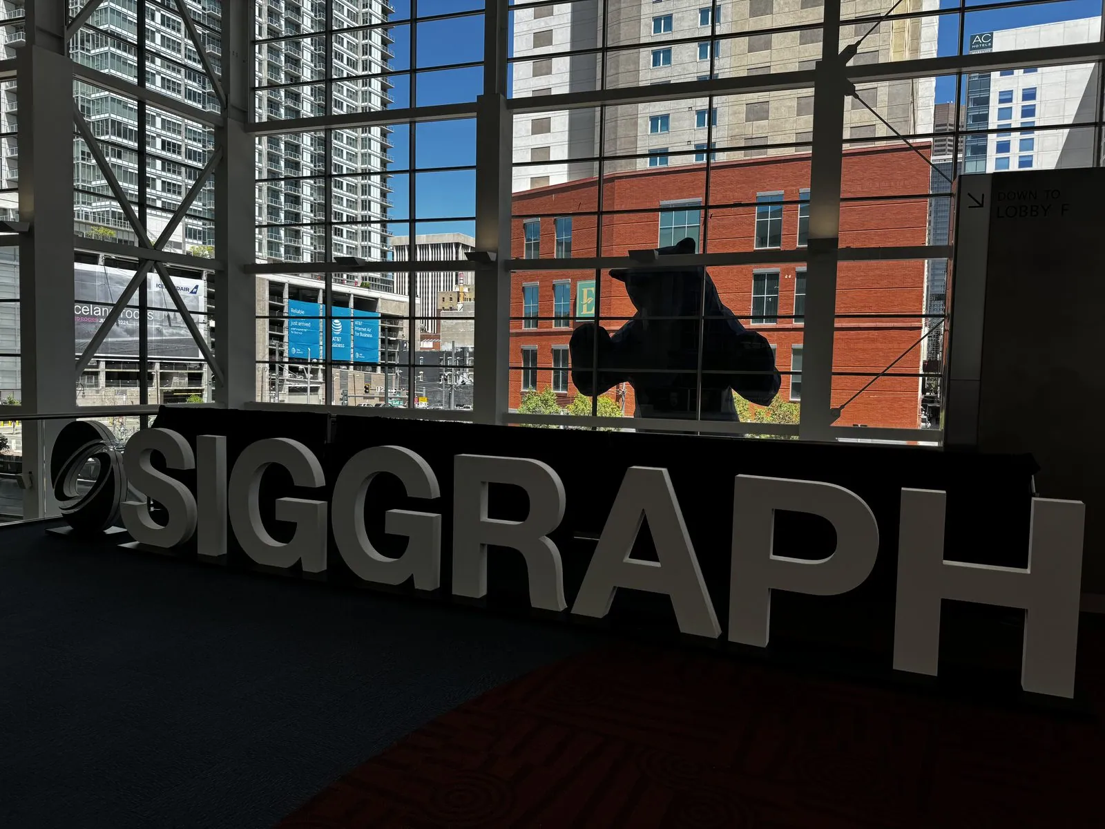
Denver takes a day to get used to. The city sits a mile up, and the air is thin and dry in a way you notice on the first flight of stairs and in the first hour without a water bottle. The sunlight is harder and whiter than at sea level, shadows are sharp-edged, and the sky has the deep, saturated blue of high places. Every afternoon that week, big cumulus clouds built up over the mountains and drifted east over the city, so the photos from the concourse windows all have the same look: glass towers, blue sky, and towering white clouds that seem close enough to touch.
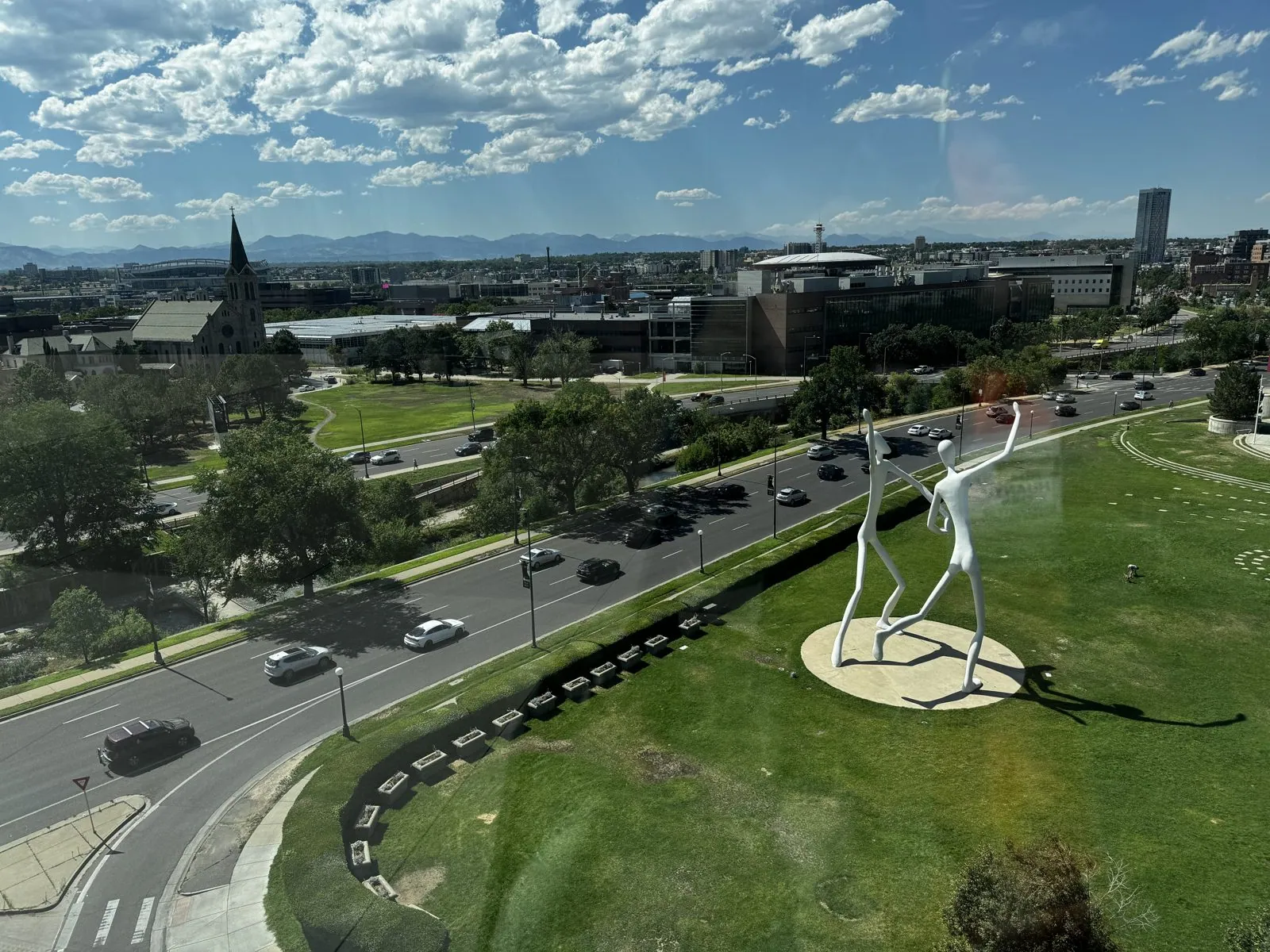
The upper concourse has its own view: west across the city to the faint line of the Front Range, with the tall white figures of Jonathan Borofsky's Dancers spinning on a lawn below. There are two of them, sixty feet tall, mid-step outside the Denver Performing Arts Complex, and from above they look like a pair of paper-doll cutouts somebody stood up in the grass. The concourse also has a rooftop terrace with a view straight into the downtown towers. It was the best place in the building to eat lunch, and every time I looked, it was empty.
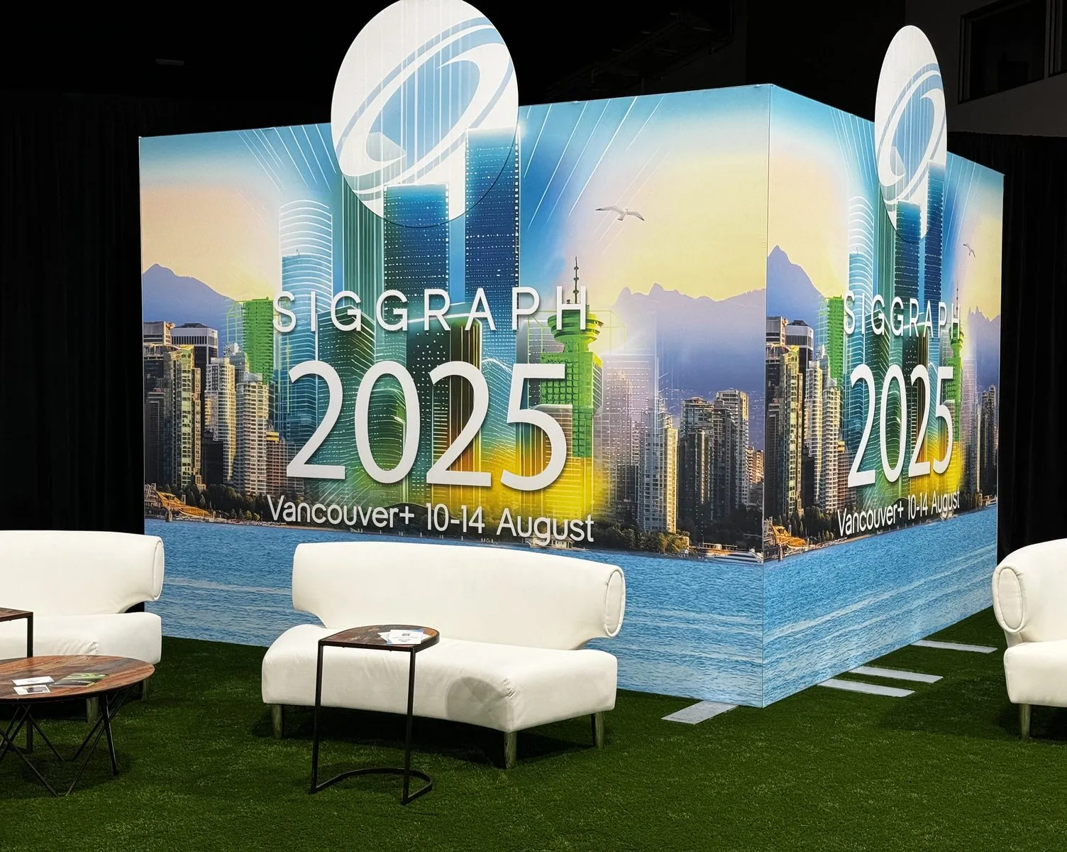
On the show floor, studios and labs set up booths, and research groups printed banners announcing how many papers they had gotten into the conference, the academic equivalent of a sports team hanging championship pennants. A camera company's booth was hung with glossy film posters, and people drifted between the stands with their badges swinging. That is SIGGRAPH's particular charm: the line between "a paper" and "a product" is very short, and the same aisle holds both. Next year's conference was already advertising itself on the show floor: SIGGRAPH 2025, Vancouver, August 10 to 14.
Conference food is its own genre. Lunches were whatever was fastest along the 16th Street Mall, the mile-long pedestrian street that runs through downtown: a bento box one day, a poke bowl the next, a bowl of ramen on the third, with bubble tea as a recurring character. One evening I went out to the southern suburbs for Chinese food, fortune cookies included; another ended at an Indian restaurant a few blocks from the convention center. None of this is remarkable, and all of it is in the camera roll, which tells you something about what a conference week actually consists of.
An evening walk through the Civic Center
The best evening was a walk. Just after eight, as the light went orange, I headed south out of downtown. The route passed the curved glass front of the Denver Justice Center and the U.S. Mint, where every coin with a small "D" on it is made. Then came the columns of the old Carnegie library of 1909, now the McNichols Building, and from there Civic Center Park opened up.
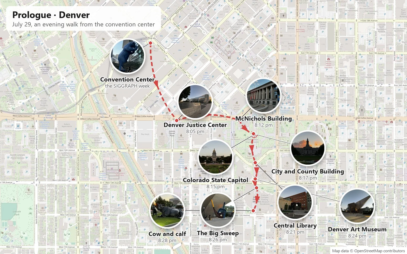
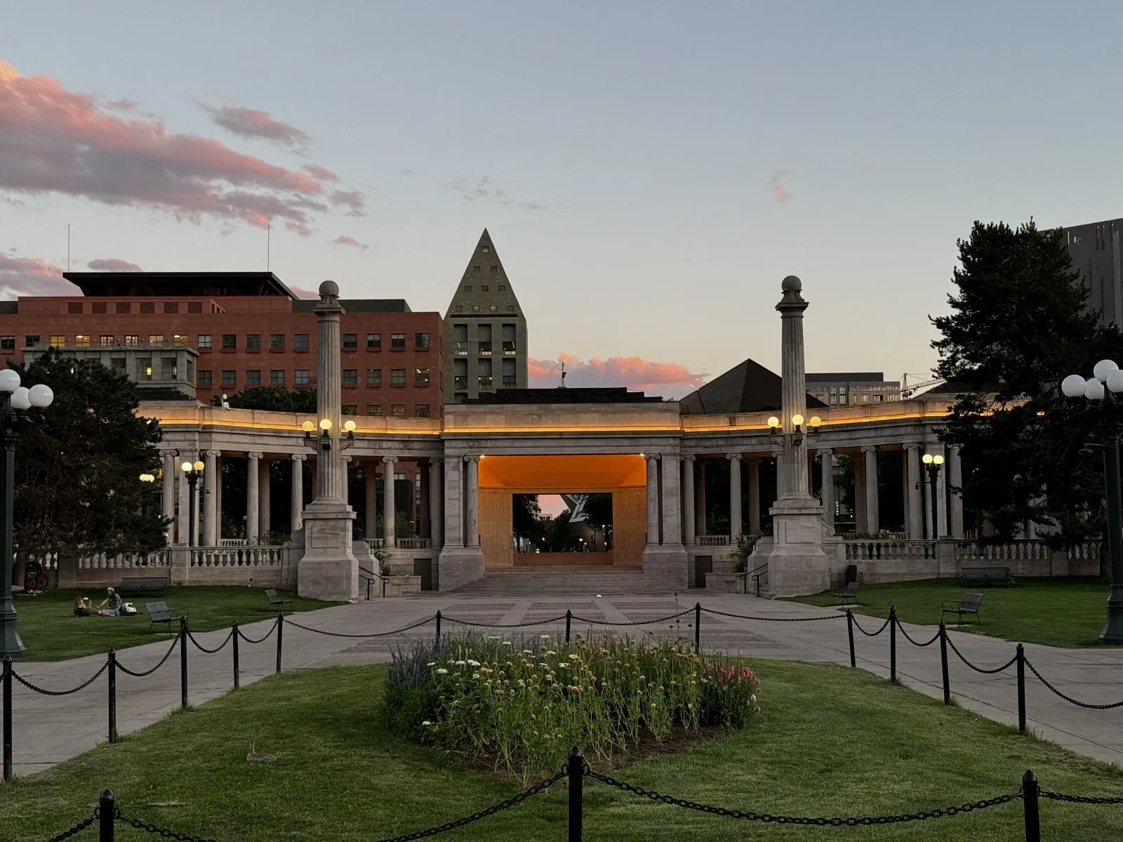
Civic Center Park is one of the purest examples anywhere of the City Beautiful movement, the early-twentieth-century idea that grand civic architecture and formal landscaping would make cities more orderly and their citizens more civic-minded. The layout is a long axis of lawns and flower beds. At one end is the gold-domed Colorado State Capitol; at the other, facing it, is the curved neoclassical arc of the City and County Building. Along the sides stand a Greek amphitheater and a curved colonnade, the Voorhies Memorial, which at dusk frames the downtown towers like a theater set. The Capitol's dome is covered in real gold leaf, a tribute to the gold rush that founded the city. One of its front steps is engraved as being exactly one mile above sea level, though surveys have moved the true mile mark a couple of times since.
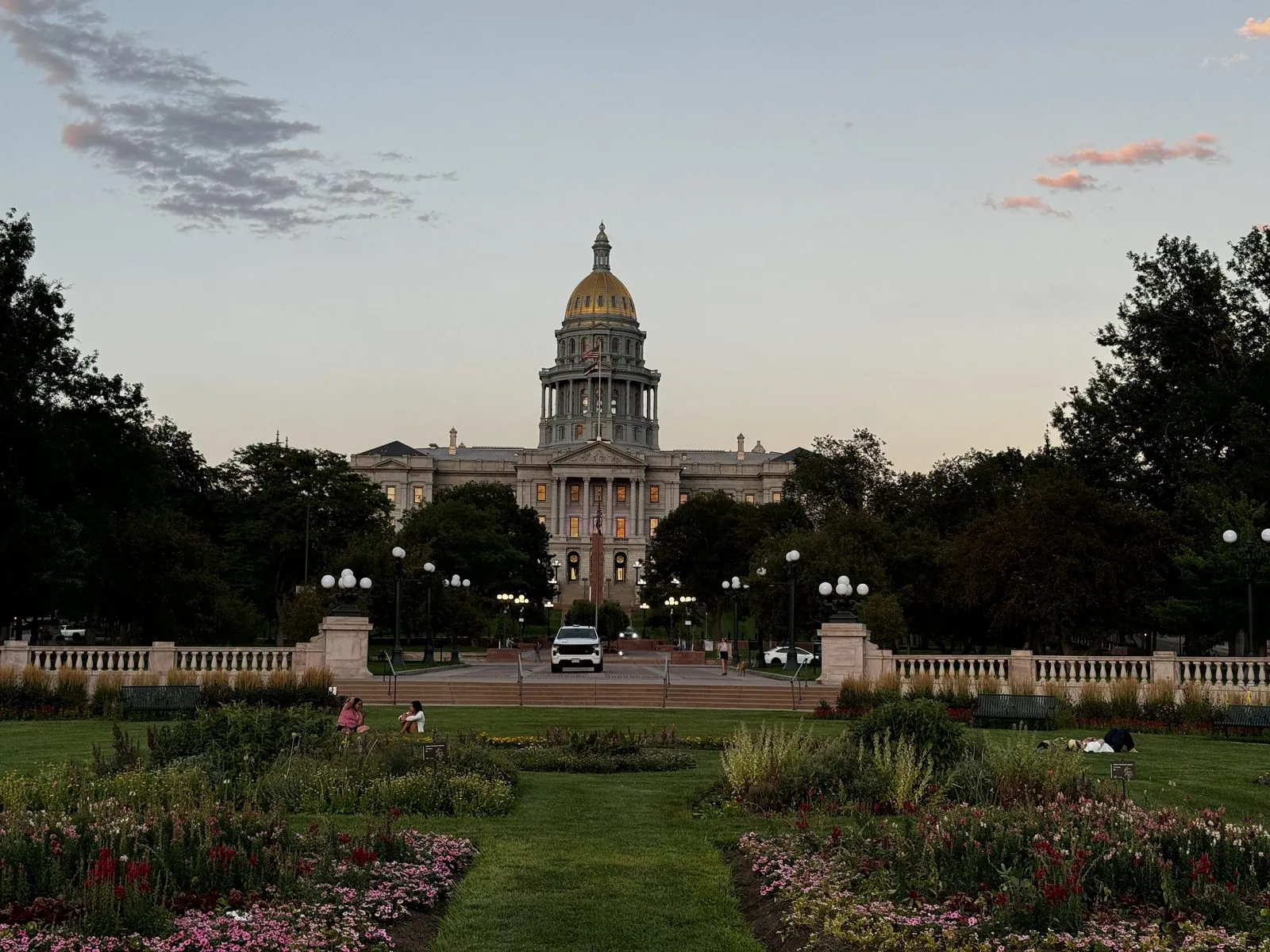
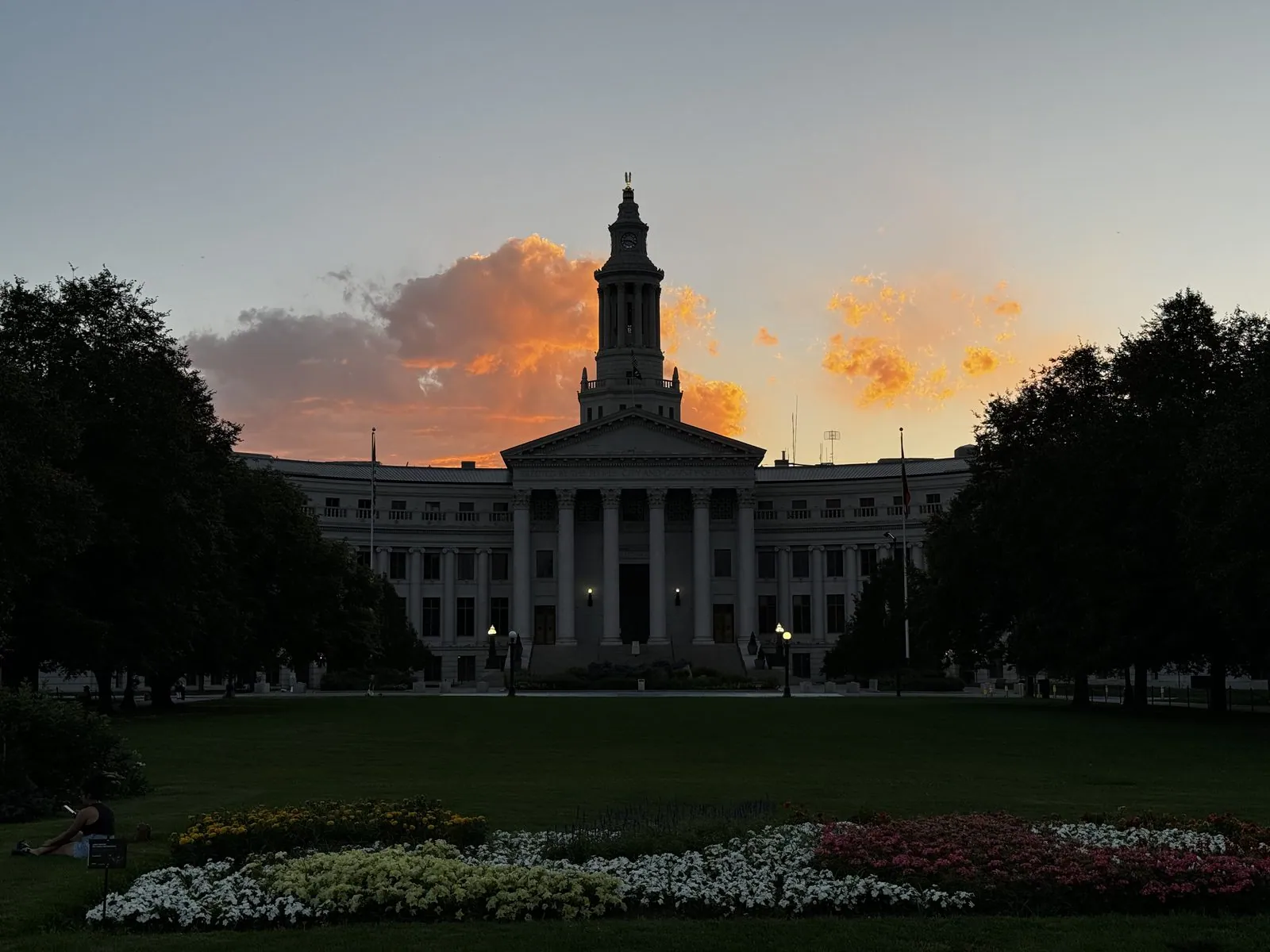
The sunset that evening was absurd. Low clouds behind the City and County Building's clock tower turned orange and then pink, and the building went dark against them, a perfect silhouette with a single lit window. Ten minutes later it was over, and the park's old globe lamps came on along the paths.
The cultural district
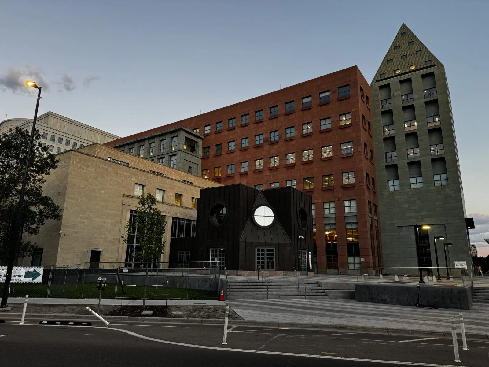
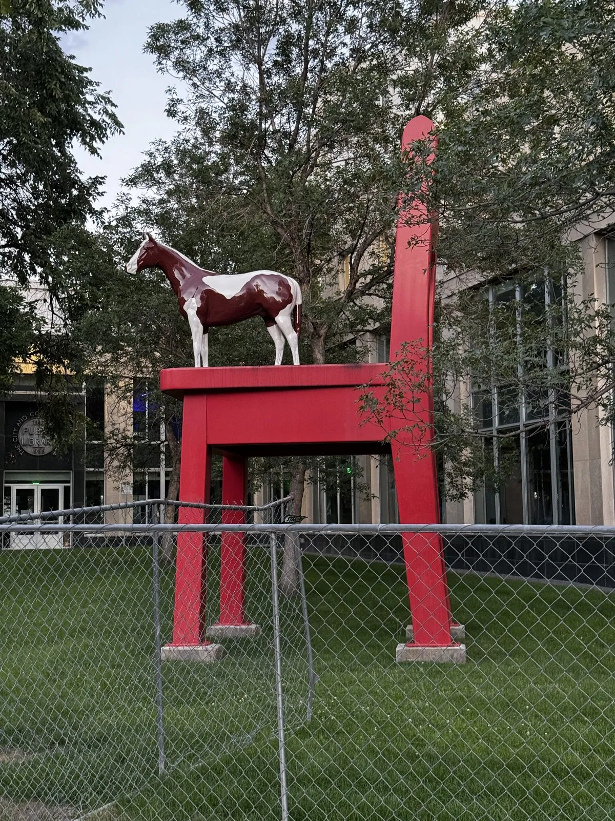
South of the park is Denver's cultural district, and it is a sculpture garden that happens to have buildings in it. The Central Library is two buildings in one: a 1950s modernist block and Michael Graves's 1995 addition, a stack of colored postmodern towers and pavilions that looks like a child's building blocks blown up to civic scale. Out front, behind a construction fence that summer, stood The Yearling by Donald Lipski, a painted pony on a giant red chair. It is a sculpture about reading: the chair is the kind you'd curl up in with a book, and the pony is the kind you'd read about. Across the plaza are a field of tall red columns and a huge dark curl of steel.
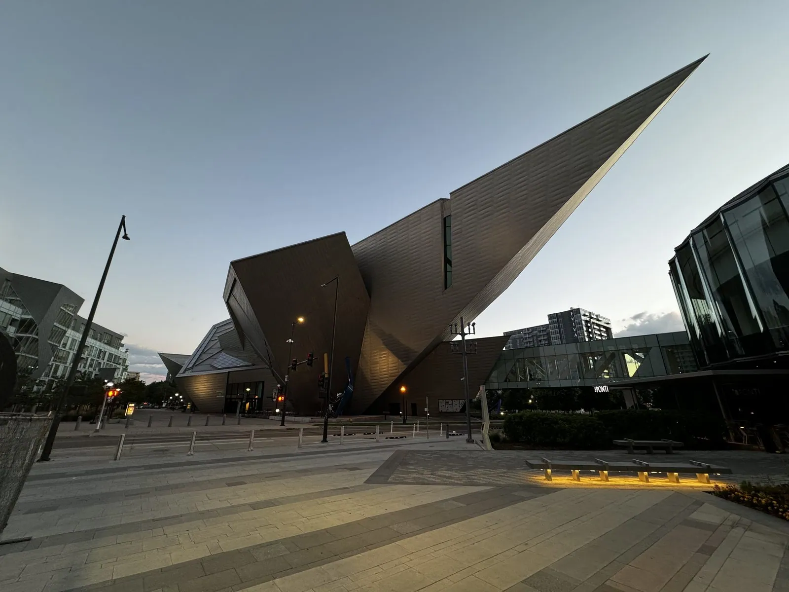
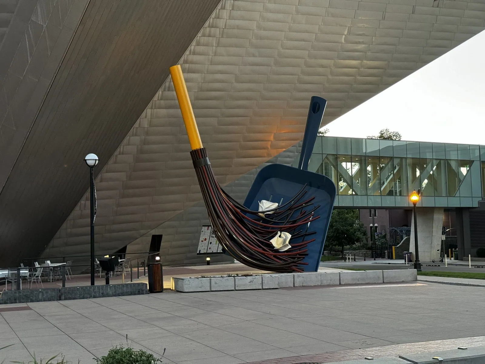
I ended at the Denver Art Museum. Its Hamilton Building, by Daniel Libeskind, opened in 2006 and looks like a titanium shard trying to take off. There is hardly a right angle on it; the walls lean, the roof points, and one wedge projects out over the street as if the building had been caught mid-explosion. Libeskind said he was inspired by the peaks of the Rockies, which you can just about believe at dusk, when the titanium turns the same gray-blue as the mountains. Its outdoor sculptures include The Big Sweep, a giant dustpan and broom by Claes Oldenburg and Coosje van Bruggen, who made a career of enlarging everyday objects until they become monuments.
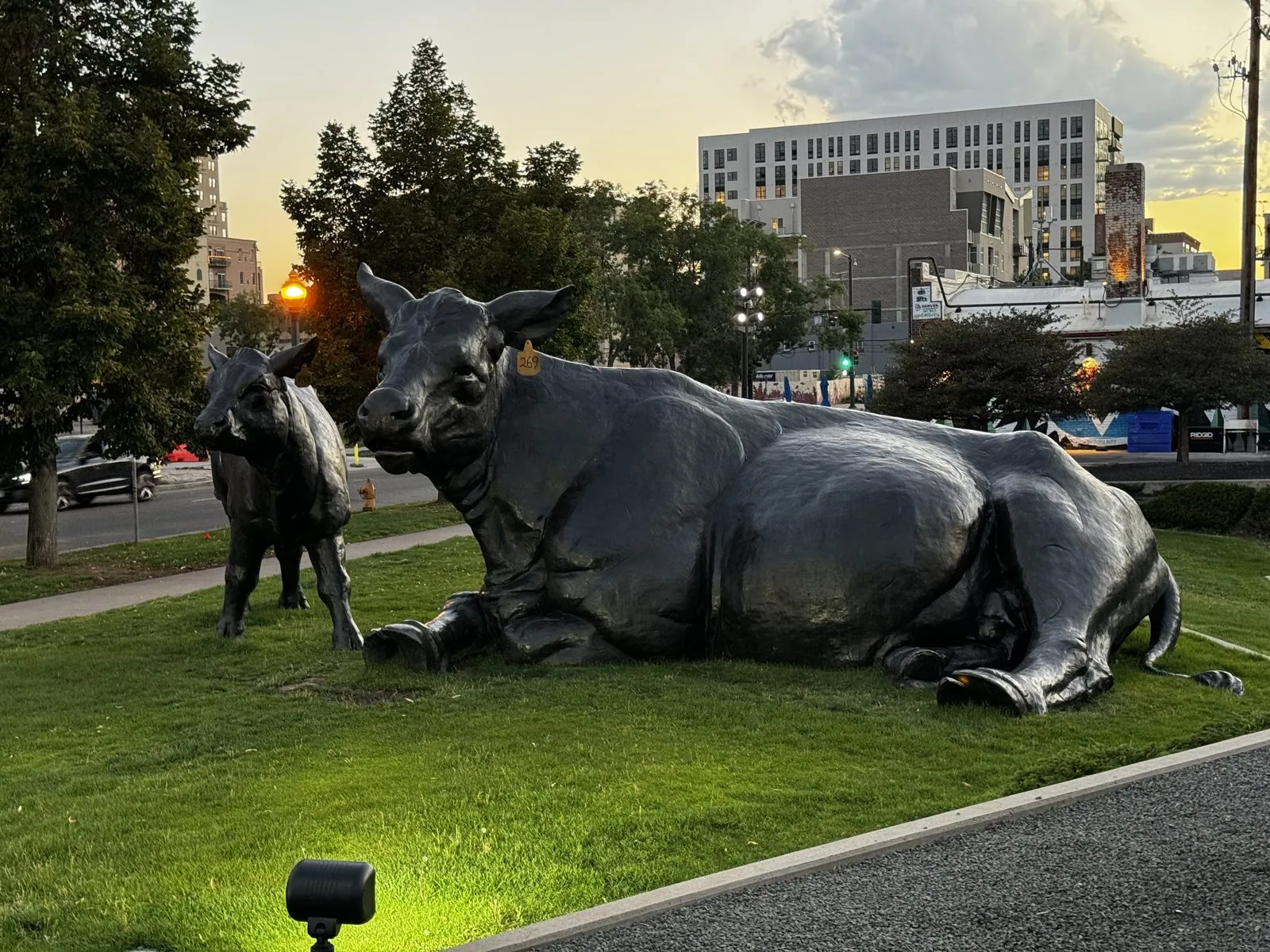
Nearby, a bronze cow lies in the grass with her calf, lit from below by a garden spotlight, looking far calmer than anything else in the neighborhood.
Even a hotel lobby next door turned out to be a small gallery: a horse built from what looks like driftwood, a bronze girl holding a bouquet, and a tabletop model of that same dustpan and broom. Denver, it seems, does not let a blank wall or an empty lawn go to waste.
Heading east
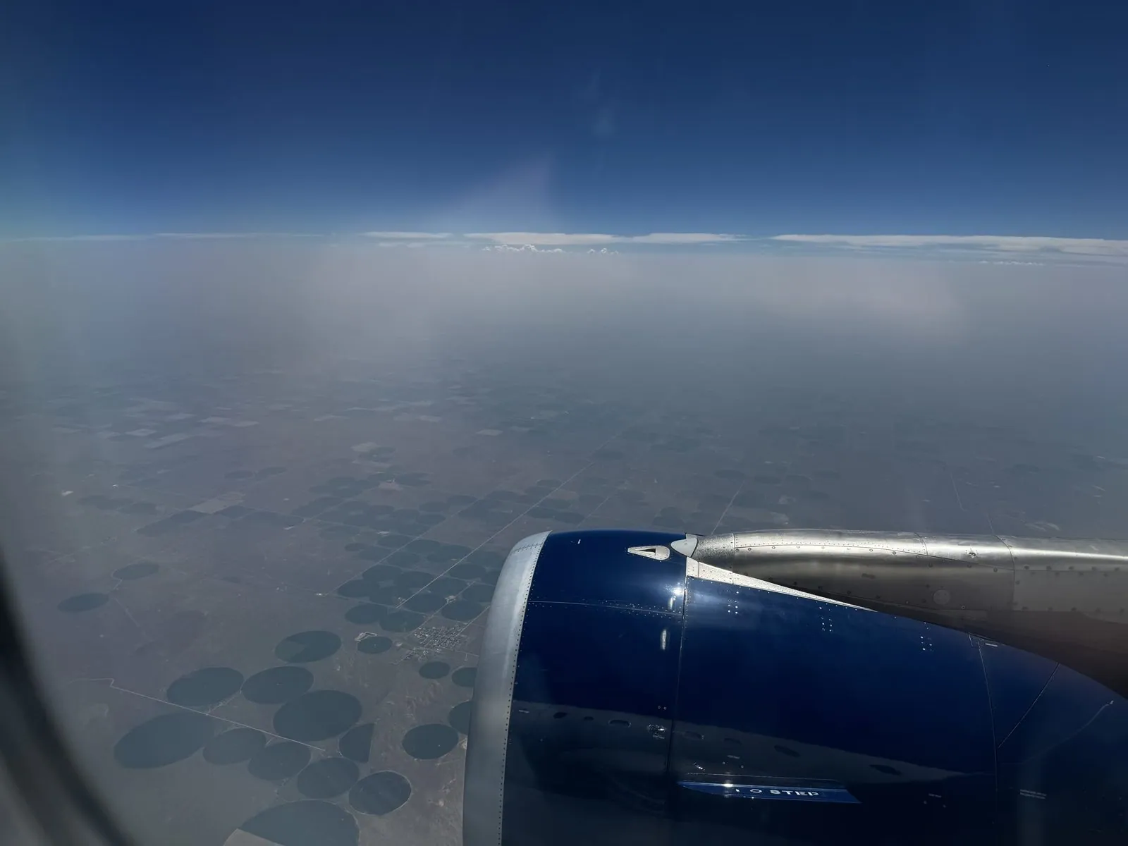
On August 1st the conference wound down, and I caught a flight east to New York, where the road trip, and the "we", began. Denver International was packed with people heading home. The flight crossed the Plains over a patchwork of green circles. That is center-pivot irrigation: a long sprinkler arm rotating around a well, painting a perfect disc of green on otherwise tan land, seen from cruising altitude. Thousands of them tile Kansas and Nebraska, and from the air they look like a punch card.
By evening a white Hyundai sedan was waiting for us in a parking lot at JFK. It would carry us a little over two thousand miles in nine days. We drove it to Flushing for Hunan food and bubble tea, and then out of the city that same night, to the Connecticut shore and a Hampton Inn in Milford.
If you have never started a road trip from a rental lot at JFK, picture it like this. A few minutes ago you were in a crowded terminal; now you are in a car you don't know, adjusting mirrors in a parking lot that smells of jet fuel and hot asphalt, with New York City between you and everywhere you want to go. The car still has that rental smell. The phone is propped up with the map open. Somewhere ahead are two weeks and a few thousand miles, and none of it feels real yet. It starts to feel real a few hours later, when the city falls behind and the road starts to lead somewhere.
Act I: New York to Chicago, the long way
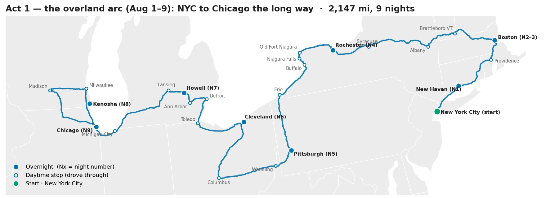
The plan for Act I, to the extent there was one, was to drive the long way round from New York to Chicago. Instead of heading straight west across Pennsylvania, we would go north into New England, cut across upstate New York to Niagara, and then work west along the Great Lakes. It is more than twice the distance of the direct route, which was the point.
New Haven and Providence
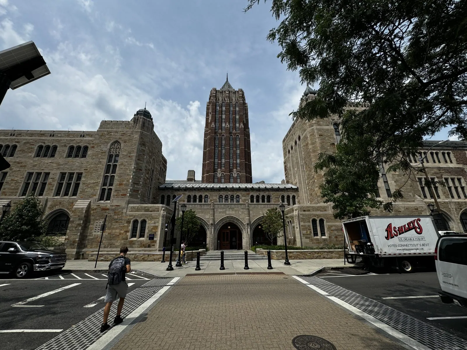
The first stop was New Haven, at midday, for a walk through Yale. Yale's look, the dark stone, leaded windows, towers and archways that make it look older than Oxford, is largely the work of one architect, James Gamble Rogers. In the 1920s and 30s he built much of the campus in an intensely detailed Collegiate Gothic, and he went to great lengths to make it look ancient. Workers reportedly splashed acid on the stone to age it, broke and reset some of the window glass, and set the masonry slightly irregular. We walked past the Sterling Memorial Library, which is essentially a cathedral dedicated to books, and the tower of the Humanities Quadrangle. A twisted white sculpture on Broadway was the only thing in sight that looked like it belonged to this century.
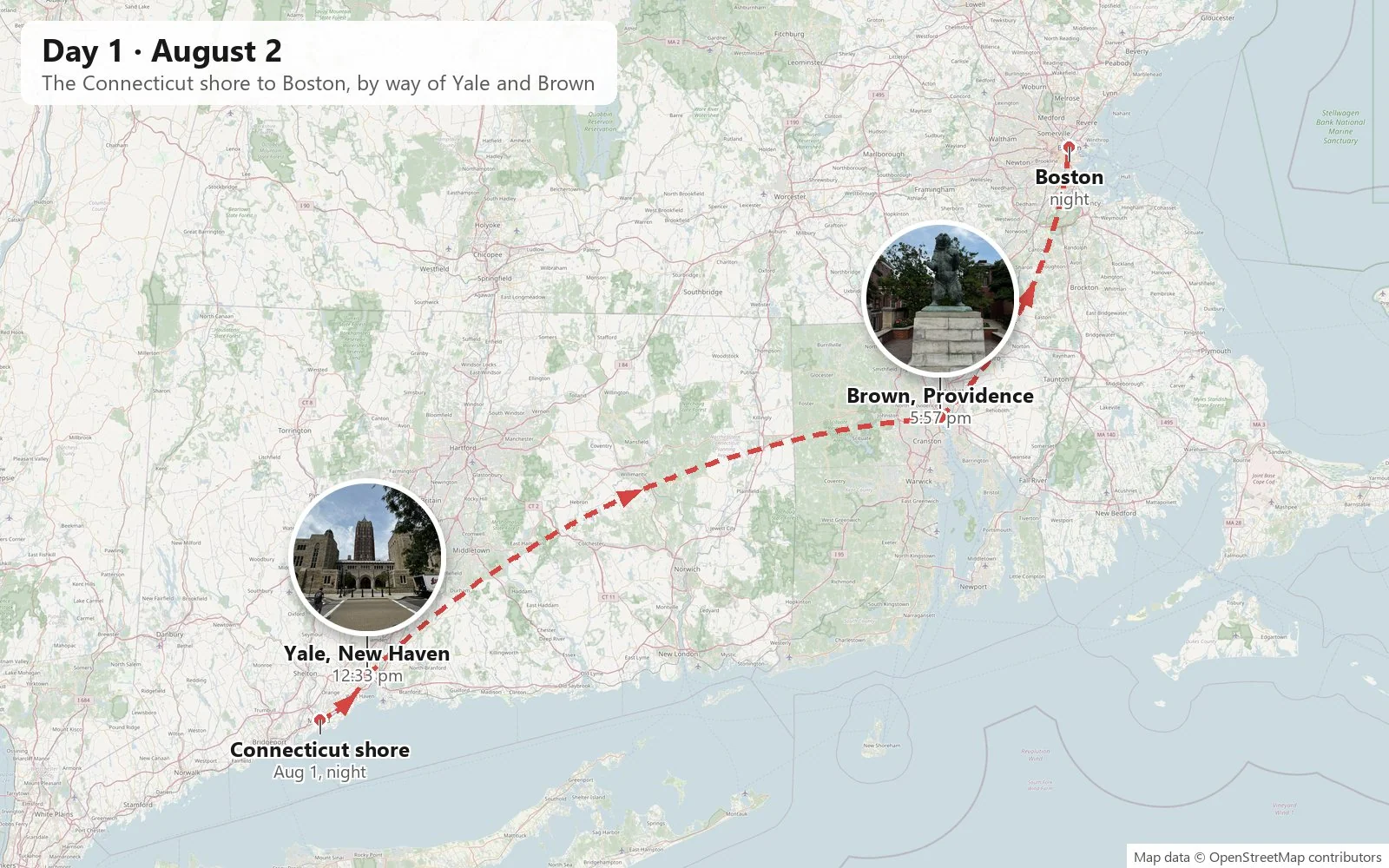
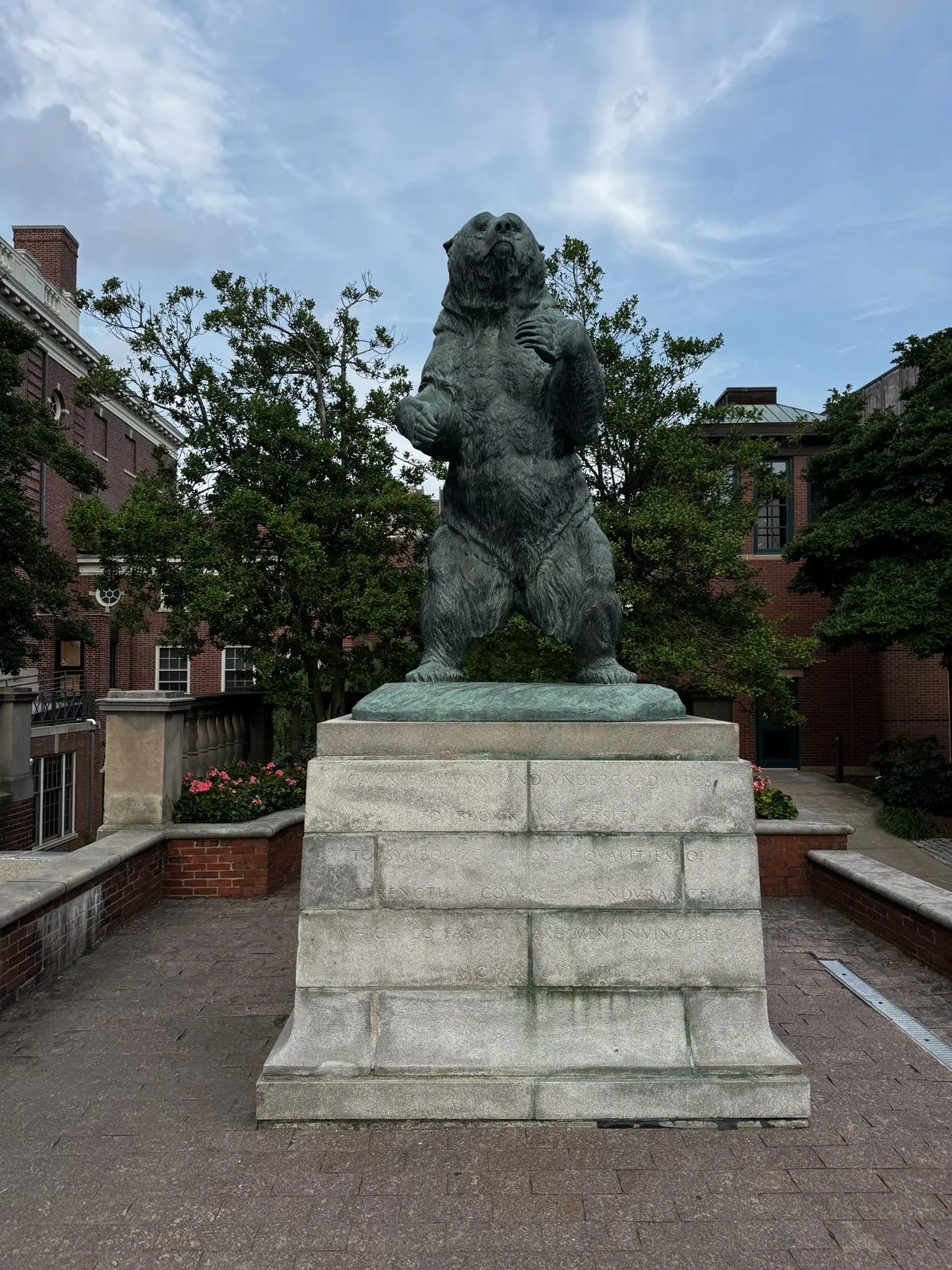
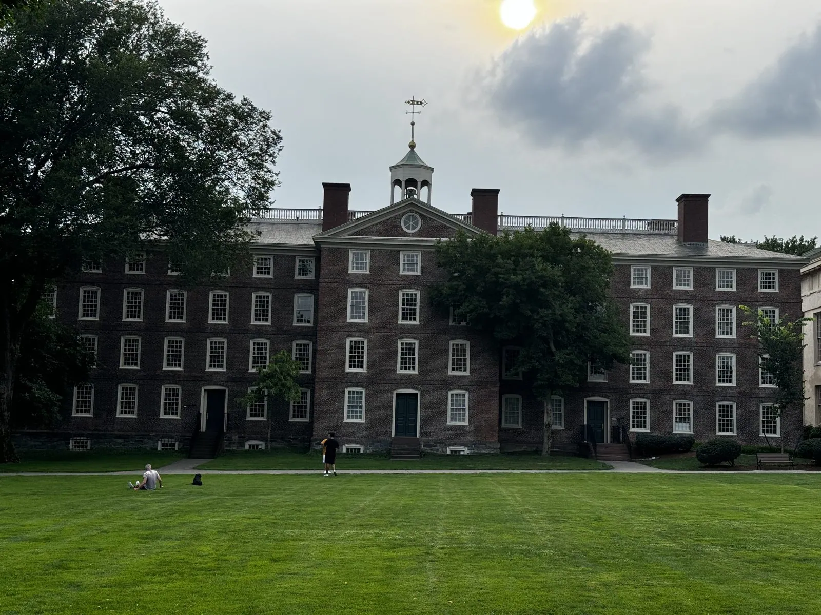
From New Haven, I-95 runs east along the Connecticut shore, the sky that day a flat silver over the trees. You reach Providence the way most people do, on the elevated highway, with the downtown towers rising ahead and the hill of the old city behind them. By late afternoon we were climbing College Hill for a walk on Brown's campus. Brown has the opposite personality from Yale: red brick instead of gray stone, Georgian instead of Gothic, and a main green that feels like a New England town common. We came in through Faunce Arch onto the Main Green. On one side stands University Hall, built in 1770 and the oldest building on campus; during the Revolutionary War it served as a barracks and hospital for American and French troops. Sayles Hall is nearby. On Waterman Street, the bronze Brown Bear stands on his hind legs on a granite plinth, looking more alarmed than fearsome. We had boba on campus and stayed in Providence for hotpot before the drive to Boston.
Boston and the Freedom Trail
Then came two nights outside Boston, at a Hilton Garden Inn in Tewksbury, our first real breather. That full day started in Cambridge, with a walk around Harvard, a gelato, and a drive through MIT, past the labs and startups of Kendall Square, with the Boston skyline lined up across the Charles. From there the day became the Freedom Trail.
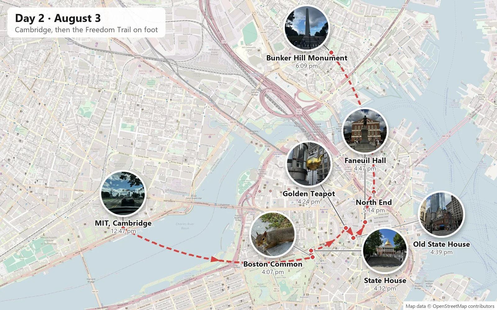
The Freedom Trail is a two-and-a-half-mile line of red brick set into the sidewalks of Boston, connecting sixteen sites from the city's colonial and revolutionary history. It was the idea of a local journalist in 1951. It is the simplest possible piece of tourism infrastructure, a line on the ground that you follow, and it works brilliantly, because Boston's history is so densely packed that you rarely walk five minutes without hitting the next stop.
Walking it is a particular pleasure. You look down to find the red line, then up to find the building, then down again, and the city comes at you in layers: a graveyard from the 1600s beside a glass office tower, a colonial meeting house at the foot of a skyscraper, a brass plaque about a riot outside a coffee shop. That Saturday the sky was enormous and blue, piled with white cumulus, and the trail was crowded with people walking it from end to end.
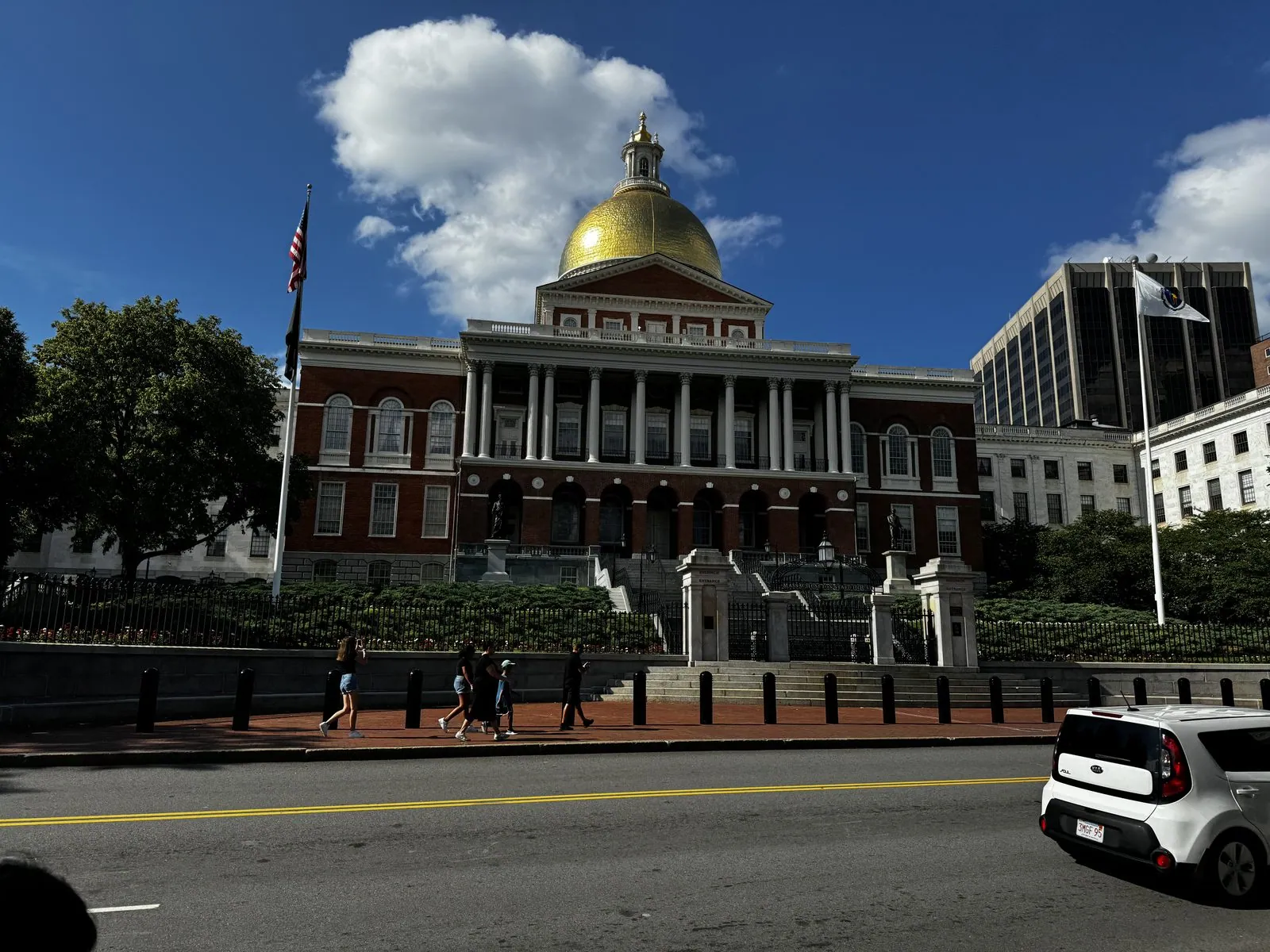
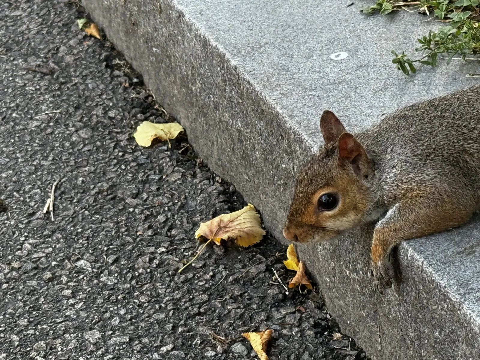
It begins on Boston Common, the oldest public park in the country, where the squirrels were extremely tame. One sprawled on a granite curb like a cat on a warm day and watched us photograph it; another sat up in the grass a few feet away to see whether we had food. Just above the Common is the Massachusetts State House, designed by Charles Bulfinch and finished in 1798. Its dome was originally wood, then sheathed in copper by Paul Revere's company, and finally gilded. During the Second World War it was painted gray so it wouldn't catch the moonlight for enemy bombers.
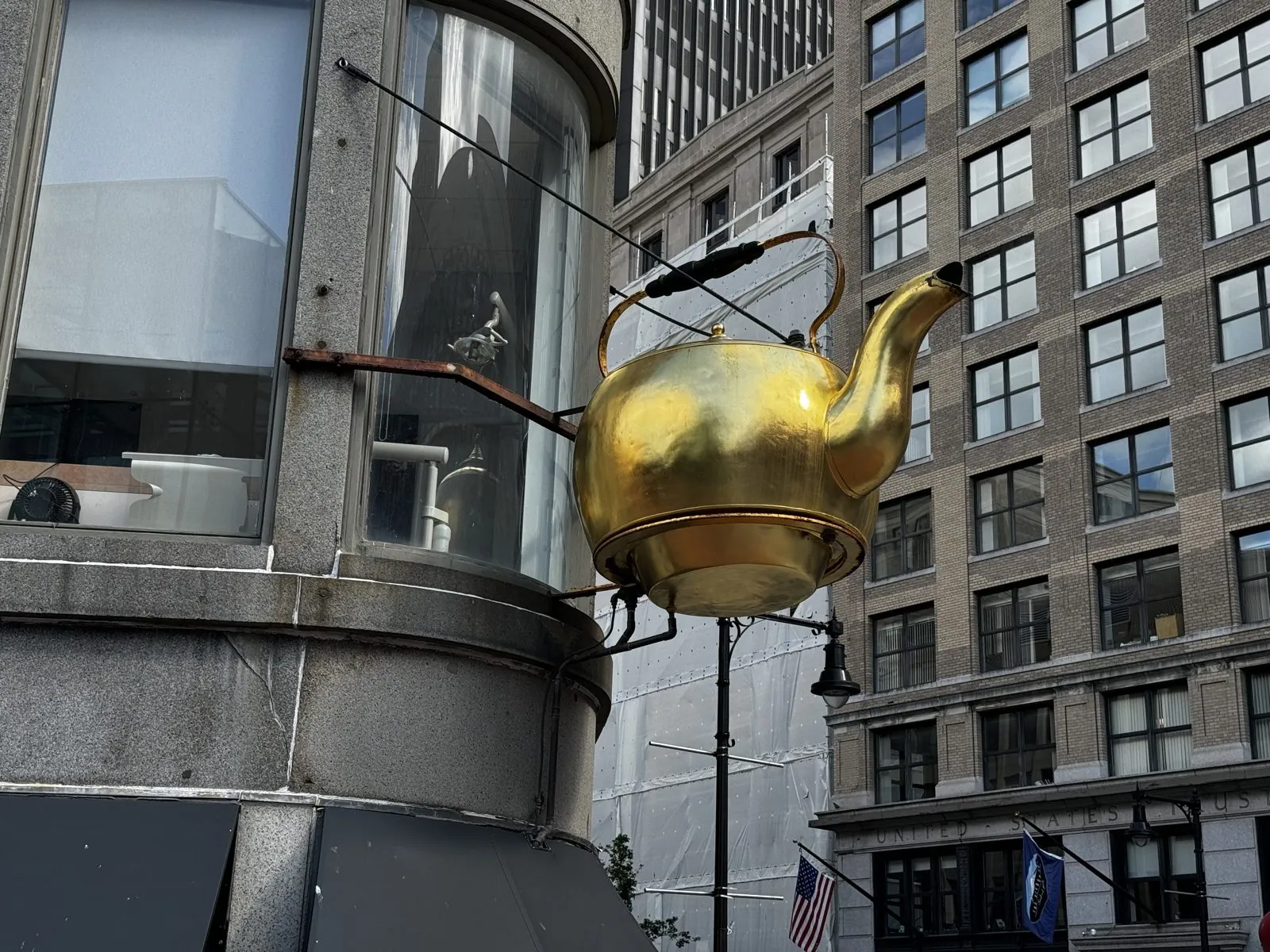
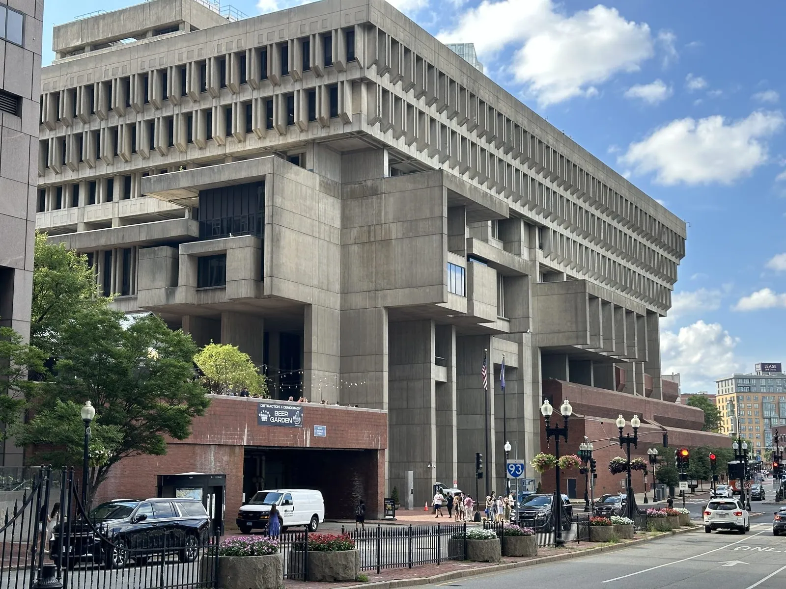
From there the trail runs downhill past King's Chapel, a squat granite church from the 1750s. Then comes the Golden Teapot, a giant gilded kettle hanging over a street corner near Government Center. It was made in 1873 as a sign for the Oriental Tea Company, is said to hold over two hundred gallons, and still steams occasionally. Across the plaza is City Hall, a concrete monolith from 1968 that is either a masterpiece of brutalism or the ugliest building in America, depending on whom you ask. Bostonians have been asking for over fifty years.
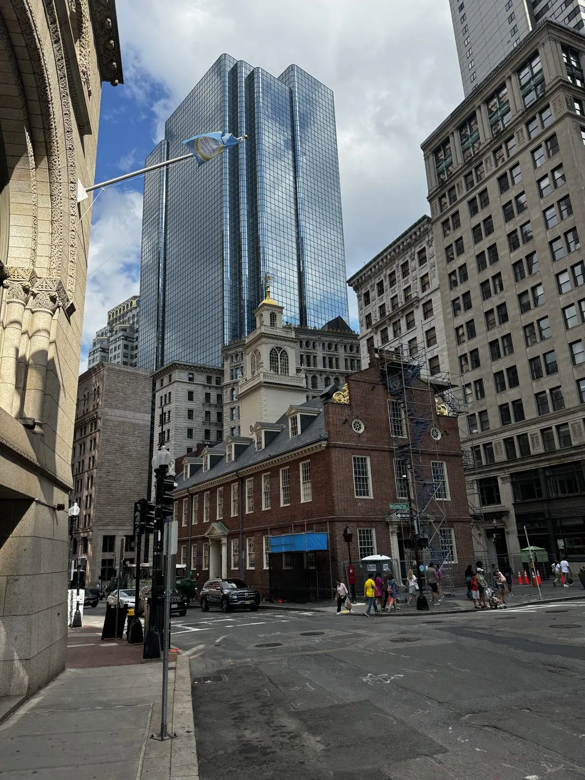
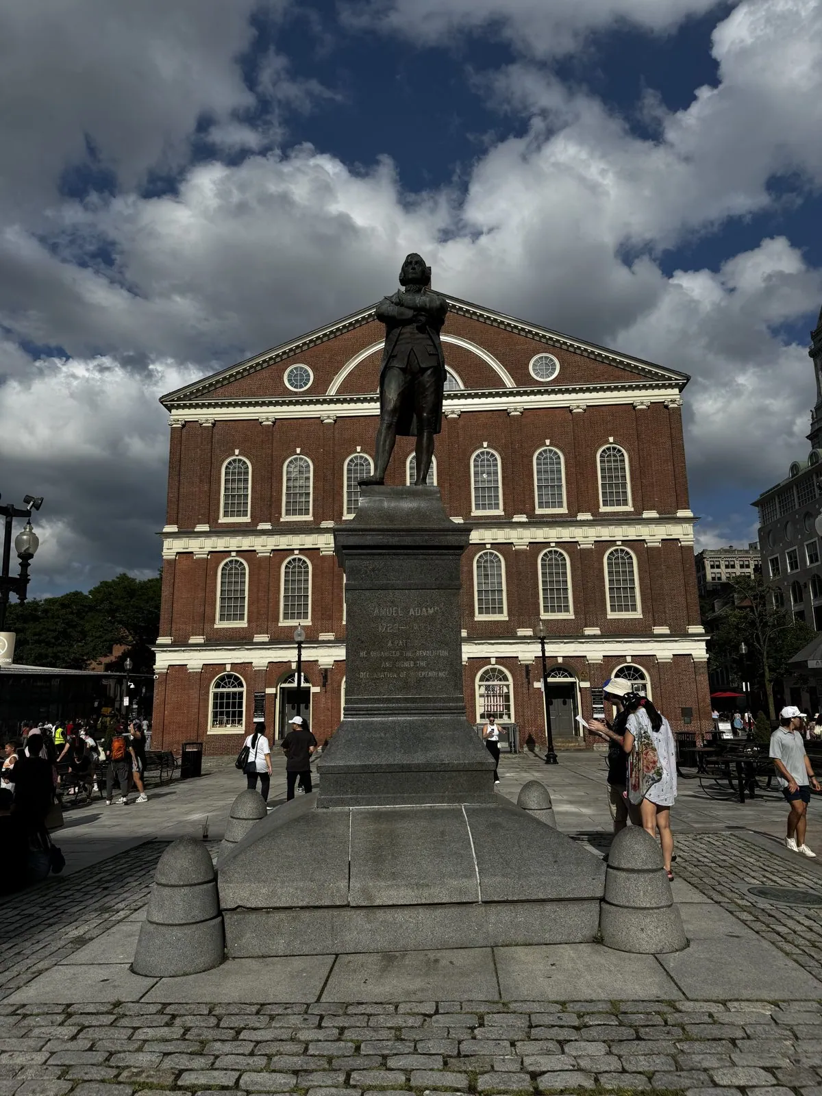
The Old State House is the best visual joke on the trail. It is a small brick building from 1713 with a pretty tower and the lion and unicorn of the British crown still on its roof, and it now stands in a canyon of glass towers that make it look like a dollhouse. The Declaration of Independence was read to Bostonians from its balcony in July 1776, and the Boston Massacre happened in the street right in front of it. Next comes Faneuil Hall, a market building from 1742 known as the Cradle of Liberty for the protest meetings held in it, with a statue of Samuel Adams standing out front, arms folded, looking as if he is about to object to something.
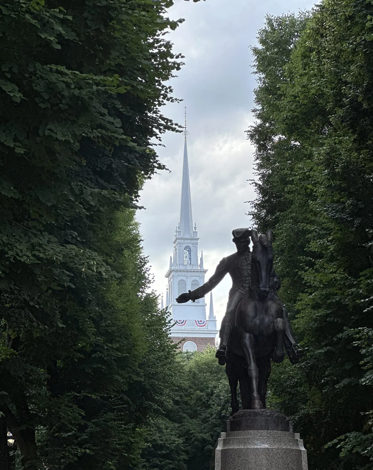
By five o'clock we were in the North End, Boston's old Italian neighborhood, where Hanover Street was as crowded as you'd expect on a summer Saturday. There, Paul Revere rides in bronze down a tree-lined mall, with the white steeple of the Old North Church rising behind him.
The trail finishes, as it does, across the river in Charlestown at the Bunker Hill Monument. It is a 221-foot granite obelisk commemorating the battle of June 1775, the first major battle of the Revolution. The battle was actually fought mostly on Breed's Hill, where the monument stands, not on Bunker Hill next door, but the name stuck to everything anyway.
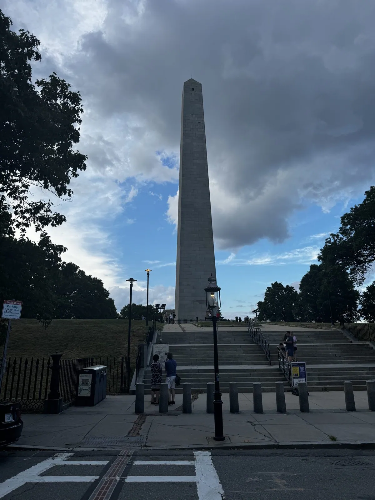
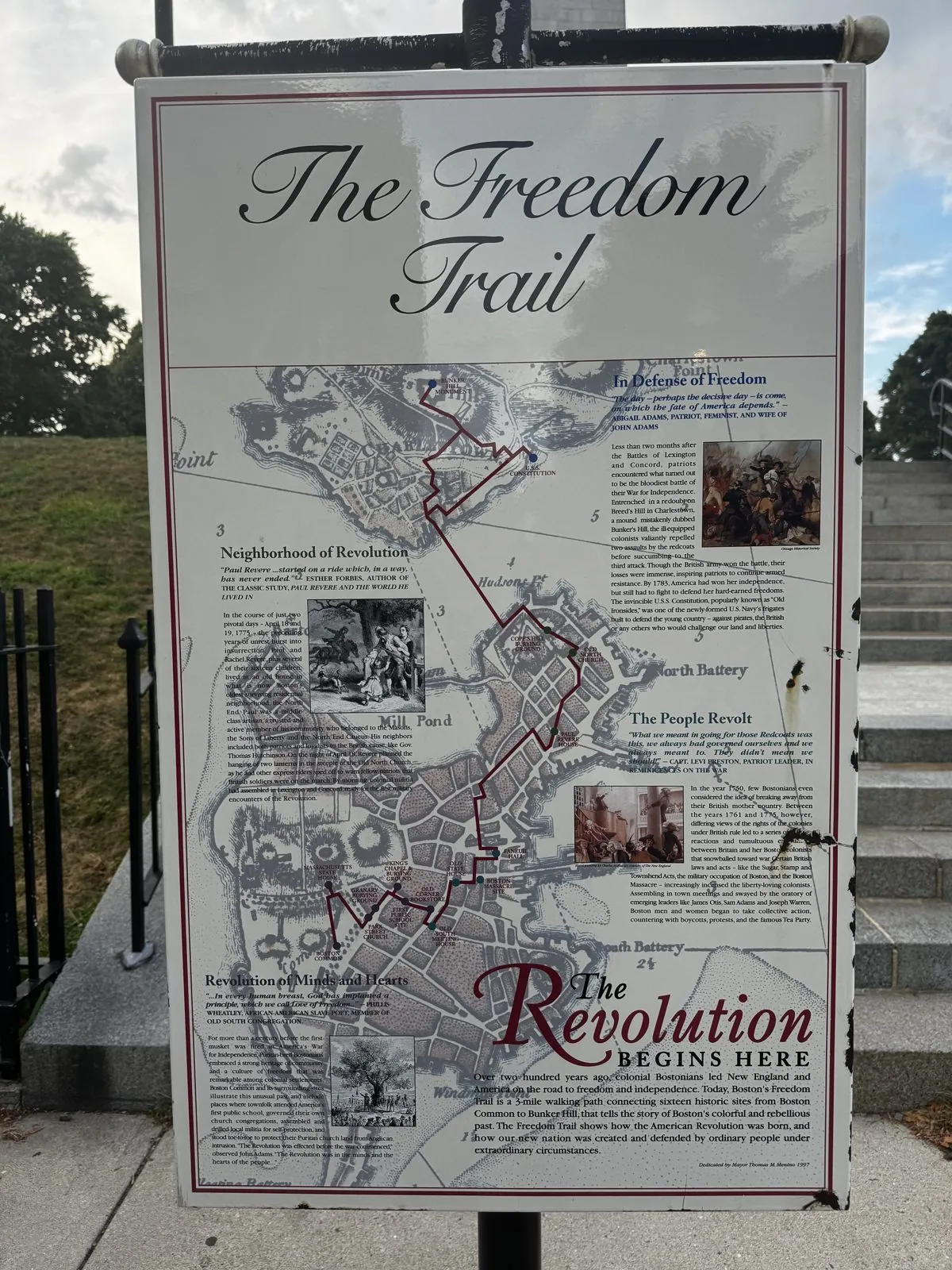
We reached it at six in the evening. At its foot, the trail's last sign reads "The Revolution Begins Here", which feels like a strange thing to read at the end of it.
Vermont, briefly, and the birth of a mascot
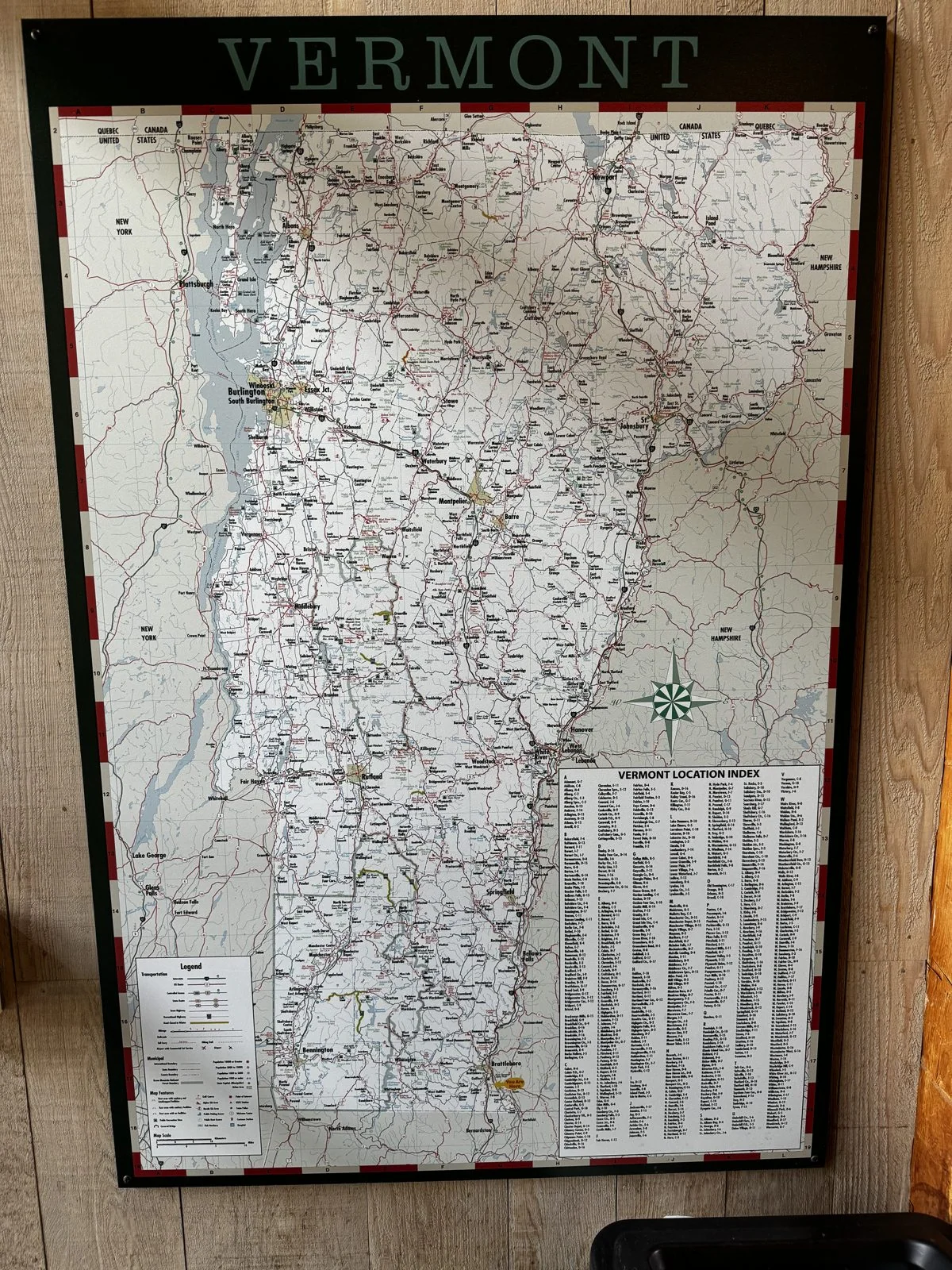
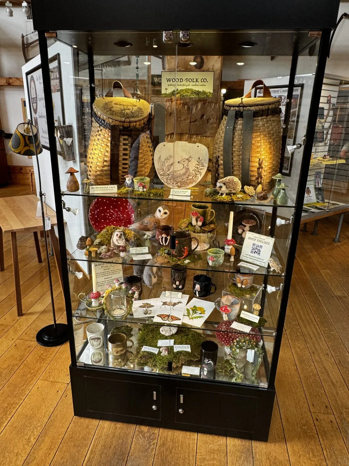
Then the arc bent west. Leaving Boston, we cut northwest to clip the bottom corner of Vermont on I-91. At the Vermont welcome center in Guilford, just outside Brattleboro, a timber building with a giant wall map of the state, we made the most consequential purchase of the trip. In a glass case of local crafts and souvenirs, among the baskets, carvings and stuffed animals, sat a small toy hedgehog. (More on him later. There is a lot of him later.)
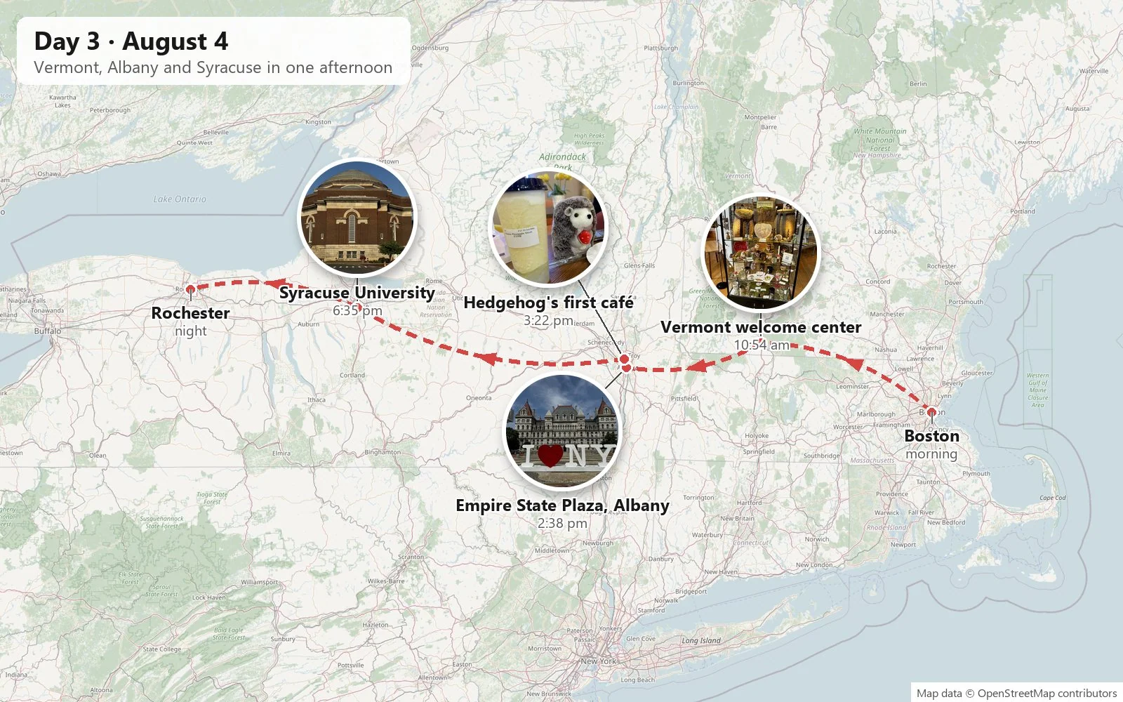
From there it was one of those days that looks unreasonable written down: Brattleboro → Albany → Syracuse → Rochester, more than three hundred miles with three real stops. It is the kind of day you only plan when you have never driven it before.
Albany
Albany was the surprise. New York's state capital is not on most people's list of places to see, and it should be, if only for Empire State Plaza. The plaza was the pet project of Governor Nelson Rockefeller. It was built between 1965 and 1976 after, the story goes, a visiting princess was driven through Albany's run-down center and Rockefeller was embarrassed. He cleared some forty blocks of the old city and replaced them with a 1960s fever dream in white marble. A row of four identical office towers lines one side of a long reflecting pool. At the end rises the Corning Tower, for decades the tallest building in New York State outside New York City. And in the middle sits The Egg, a performing arts center shaped like a flying saucer balanced on its edge.
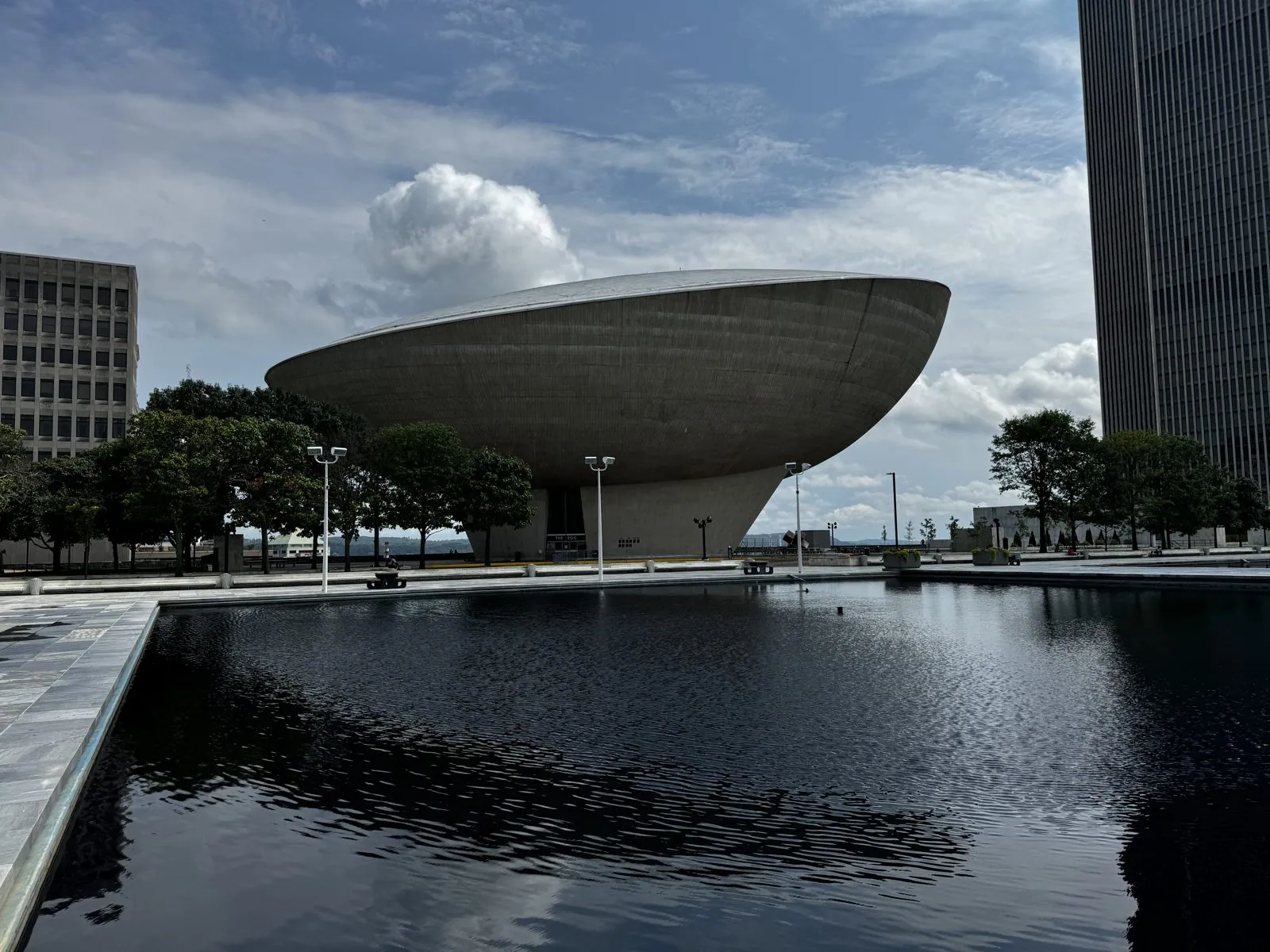
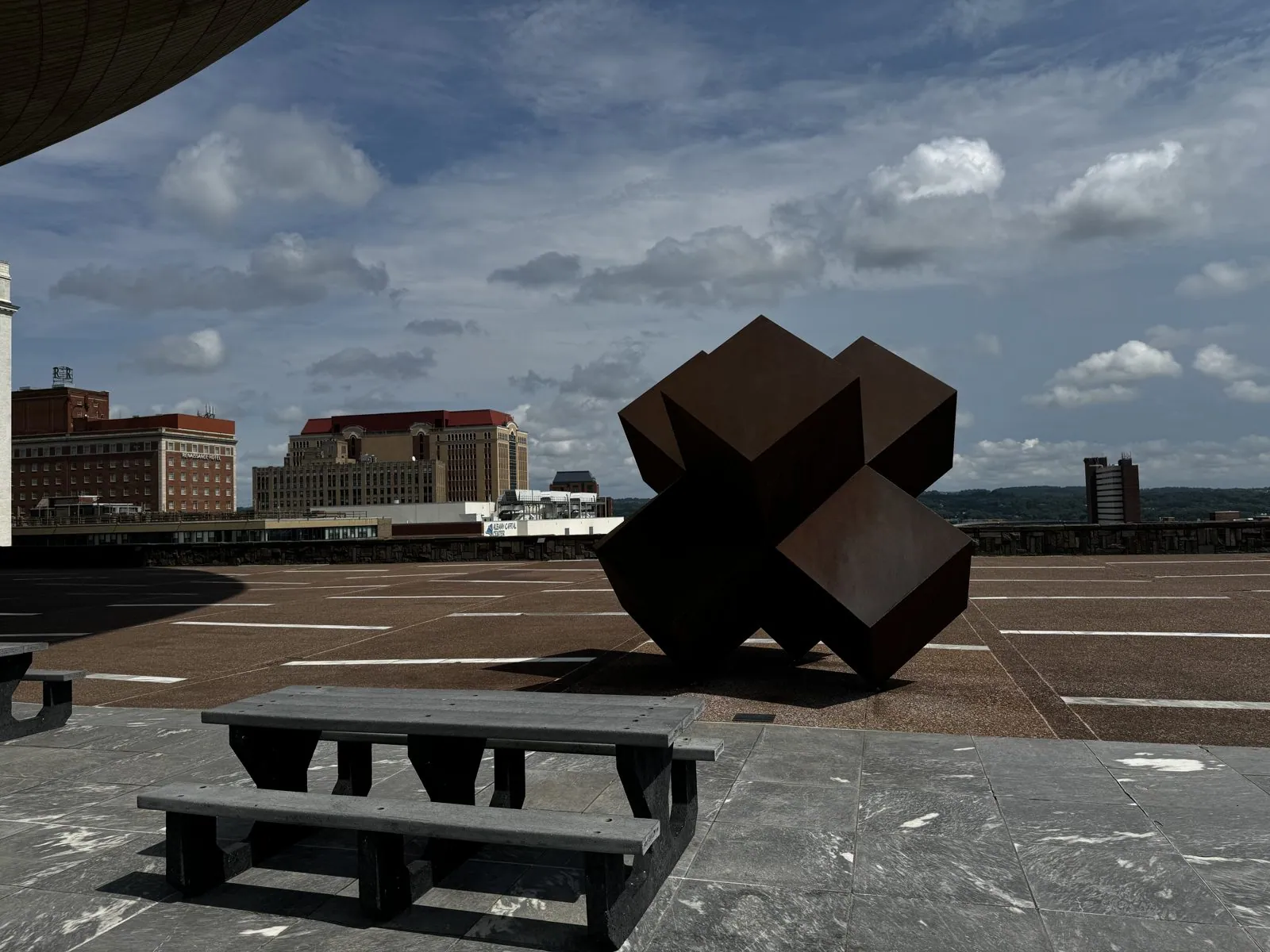
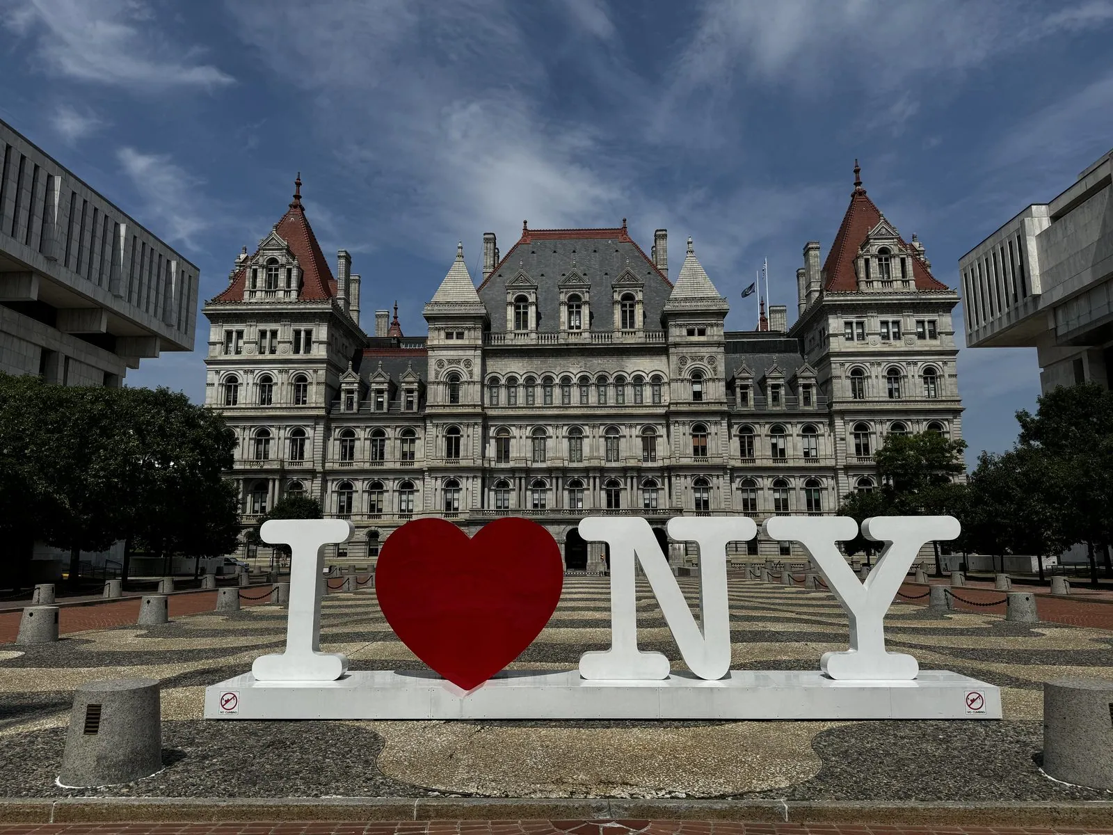
Walking across it on a Sunday afternoon, you feel like the last person on Earth. The plaza is enormous, a quarter-mile of white marble and stone with almost no one on it. The towers are reflected upside down in the long black pools, and the wind carries the faint sound of the highway below. Clouds drift over the towers, and their shadows slide across the marble. There are no shops, no cafés, no street noise, just geometry, sky and the occasional state employee crossing to a car. It is strange, cold and completely compelling. The plaza is also an open-air museum: Rockefeller filled it with modern art, and sculptures sit around it like chess pieces, including a rusted steel cluster of interlocking cubes on the terrace. At the north end, the old New York State Capitol looks like it was airlifted in from the Loire Valley. It took over thirty years and five architects to build, finishing in 1899, and was one of the most expensive government buildings of its age. A giant "I ❤ NY" sign stands in front of it, for anyone who missed the point. From the plaza's edge you can look down over the highway interchange to the Hudson.
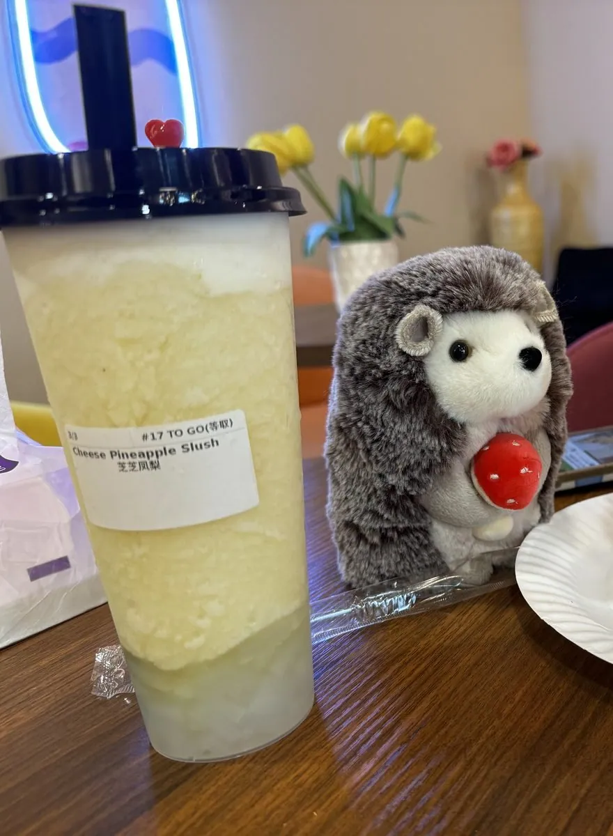
The hedgehog's first official outing was a café just north of the city, where he sat for his portrait next to a pineapple slush. This set a pattern. From then on, whenever there was a drink or a dessert on a table, the hedgehog was placed next to it and photographed. By the end of the trip he had an extensive portfolio.
Syracuse at golden hour
The day ended with a golden-hour walk across Syracuse University, which sits on a hill above the city, known simply as the Hill. In twenty minutes we passed a whole architecture textbook. The Hall of Languages (1873) was the university's first building, a pale stone Second Empire pile with mansard roofs. Crouse College (1889) is a dark Romanesque castle of red stone with a bell tower. Hendricks Chapel, domed and red-brick with a white portico, is the spiritual center of the campus. The red-brick turrets of the Tolley Building and the little Holden Observatory, from 1887, round out the set.
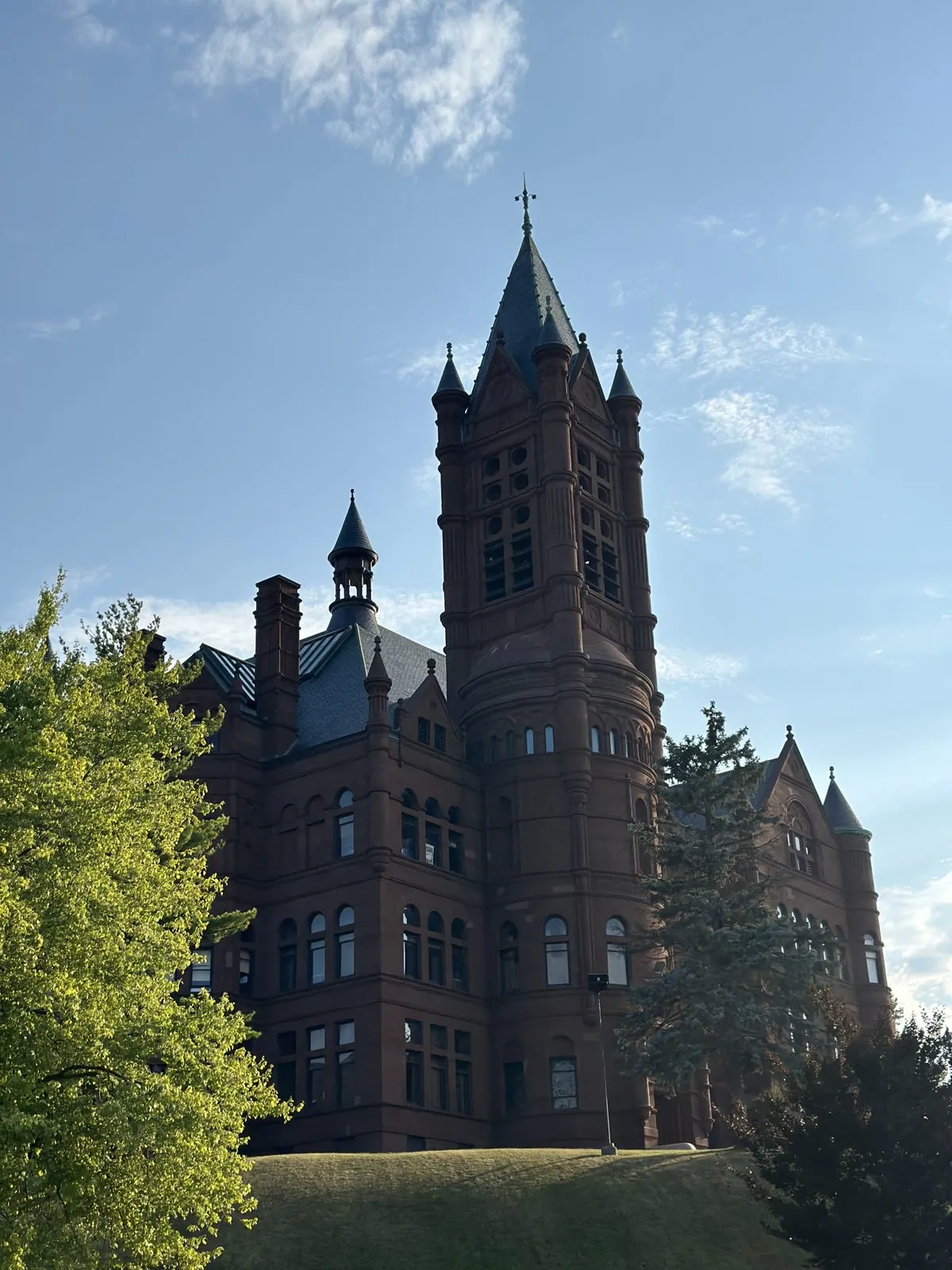
Every one of them was lit warm and low by the setting sun, with the city spread out below and the long shadows of the trees reaching across the lawns. It was the most beautiful light of the trip so far, and the campus was almost empty, students still away for the summer.
Golden hour on a hilltop campus in late summer has a sound as well as a look: sprinklers ticking on the lawns, crickets starting up in the hedges, and almost no voices. The stone is warm to the touch when you lean on a wall. You walk slowly because there is nowhere to be, and because you know the light will be gone in twenty minutes.
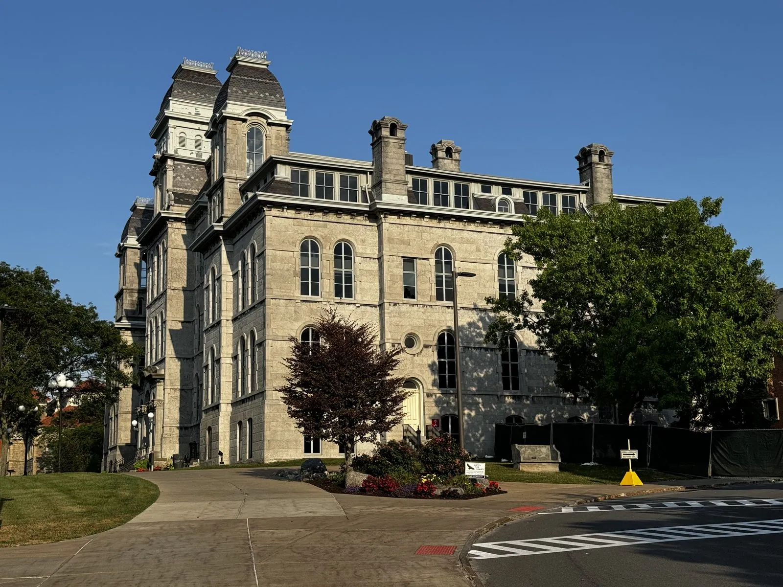
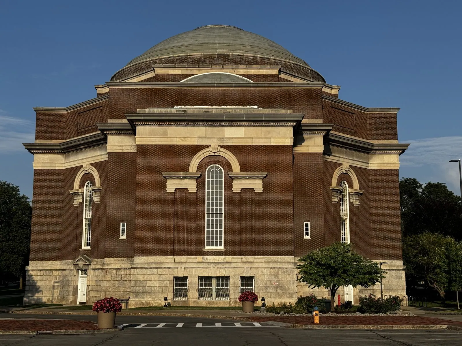
Downtown, the Soldiers' and Sailors' Monument in Clinton Square, where the Erie Canal once ran through the middle of the city, was the last thing we saw before the night's drive to a Hampton Inn in Henrietta, just south of Rochester.
Lake Ontario, and Niagara
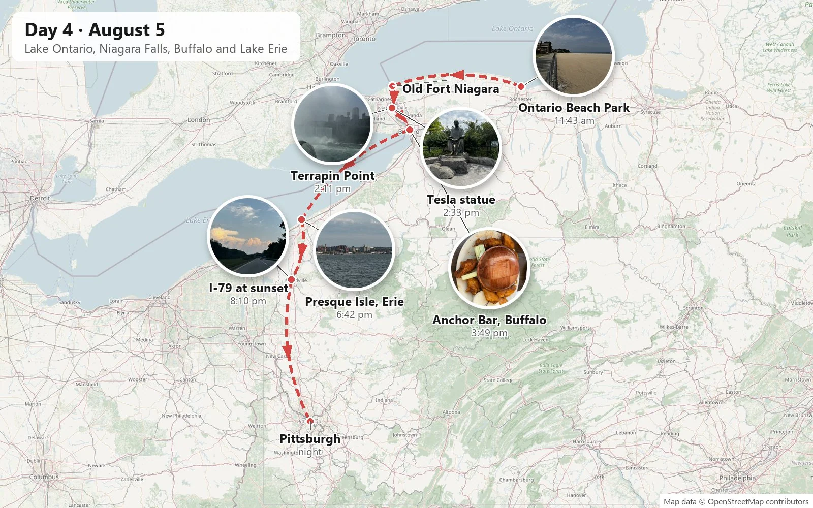
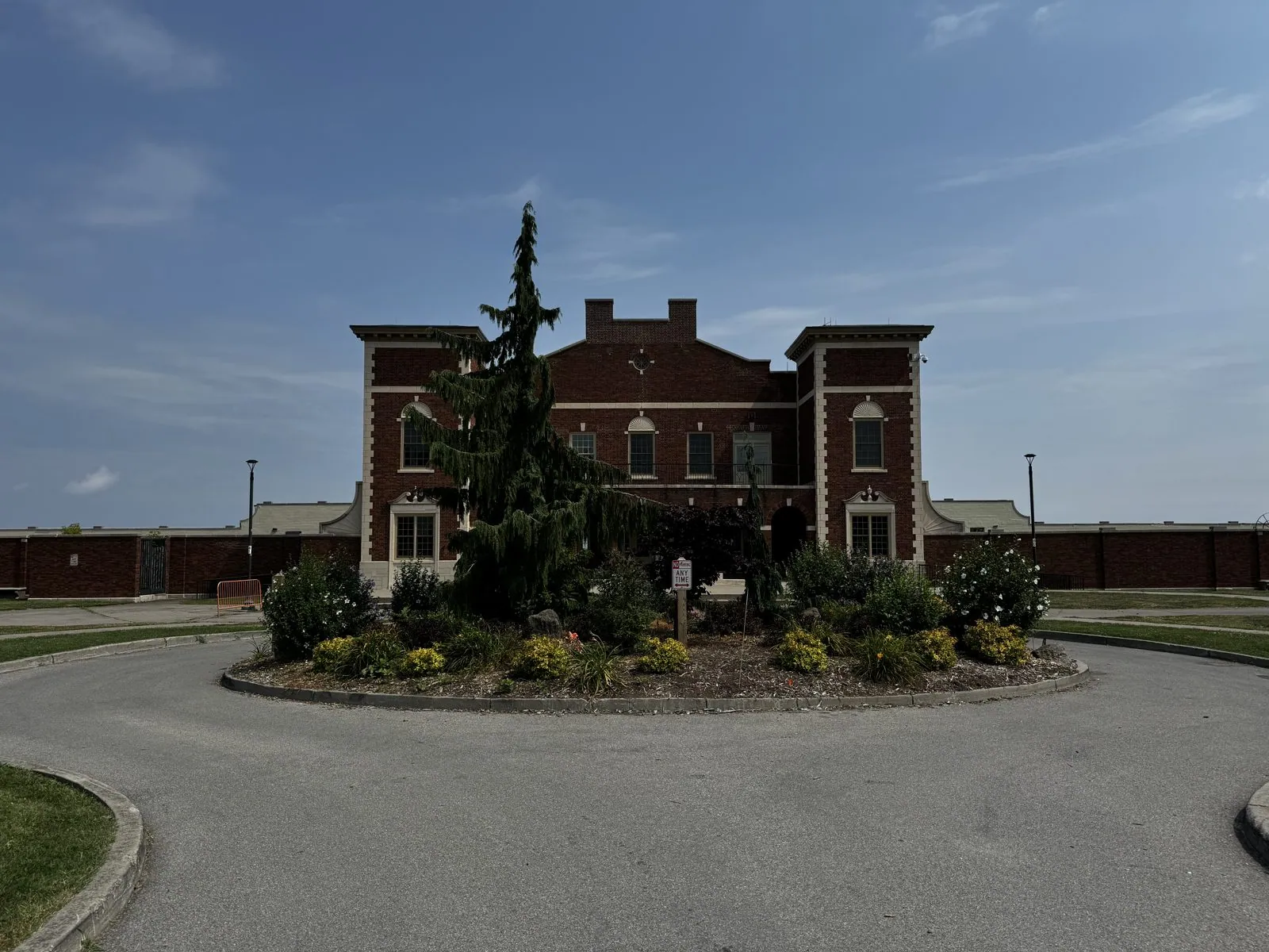
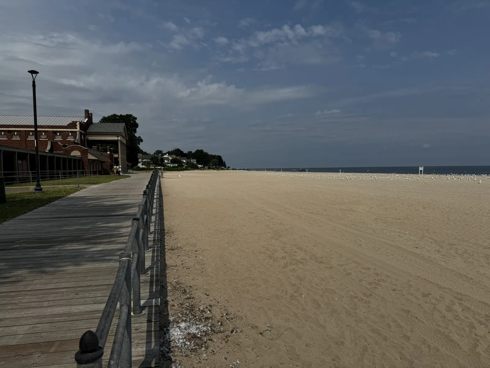
The next morning started on the sand at Rochester's Ontario Beach Park: a boardwalk, a red-brick building in a little roundabout garden, and a wide beach with almost nobody on it, Lake Ontario flat and pale to the horizon. If you didn't know it was a lake you'd never guess; there is no far shore. It was the first of the Great Lakes of the trip, and over the next four days we would see all of them but Superior.
Next was the first jaw-drop of the trip, Niagara Falls, by way of Old Fort Niagara, where the Niagara River meets Lake Ontario. The fort's oldest building, the stone "French Castle", dates from 1726. The fort was held in turn by the French, the British and the Americans, and changed hands more than once, which tells you how much this stretch of river was worth.
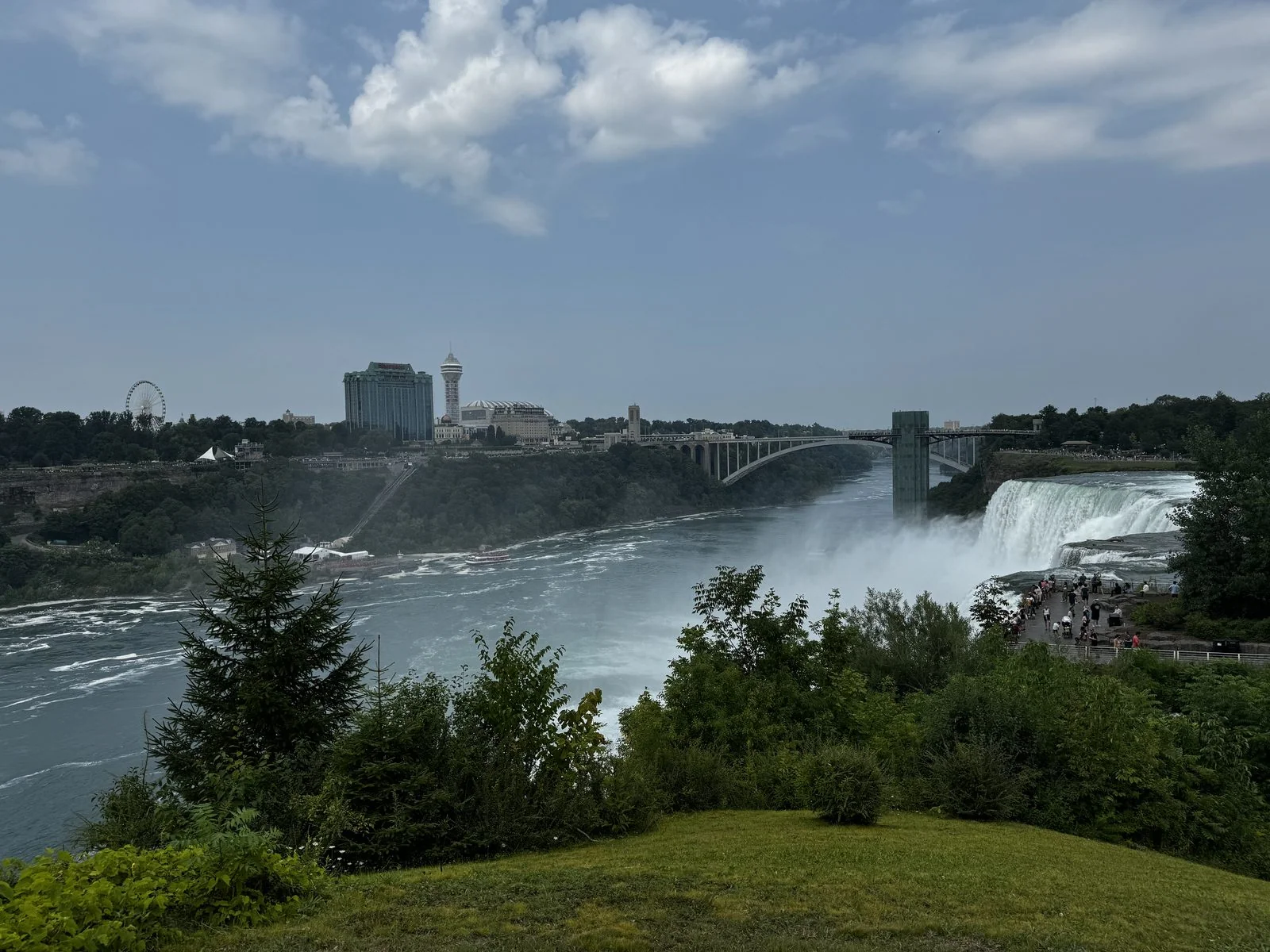
At the falls themselves, we walked Goat Island out to Terrapin Point, close enough to the Horseshoe Falls to get wet. Most of the Horseshoe is technically in Canada, but Terrapin Point puts you right at its American edge, where the river pours over the lip a few feet from the railing with a sound you feel in your chest. The mist rises so high that the Canadian skyline on the far bank comes and goes behind it, and the sun turns it into shifting columns of light. Far below, a tour boat full of people in ponchos nosed into the spray. The boats have been running into the mist at the foot of the falls since 1846.
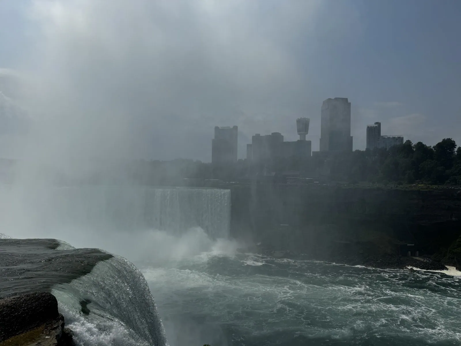
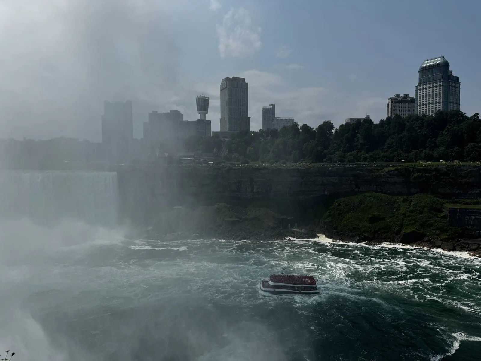
Standing there, you hear Niagara before you understand it. The roar is low and constant, more felt than heard, and it never stops. The water near the edge is not white but a startling glassy green, moving so fast and so smoothly that it looks solid until it tips over the lip and shatters. The mist drifts over the railing in waves. One moment the sun is warm on your face, the next you are wet, and a few seconds later the mist lifts again. Your glasses fog, your phone screen is beaded with droplets, and everyone around you is laughing at the same thing.
From the other side of the island, the American Falls and the Rainbow Bridge line up with the Skylon Tower in Canada beyond. It is a view that looks exactly like a postcard, because it is on most of them.
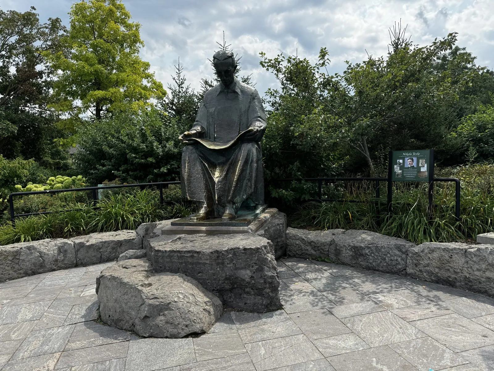
On the way out, we said hello to the statue of Nikola Tesla on Goat Island. He sits on a rock, reading, in a little garden, looking calm for a man who spent his life fighting about electricity. The statue was a gift from Yugoslavia in 1976, and it is here for a reason. In 1895 the Adams Power Plant at Niagara became the first large hydroelectric plant to use Tesla's alternating-current system. It sent power to Buffalo, twenty miles away, and in doing so more or less settled the "war of the currents" against Edison's direct current. Every outlet in your house is, in a sense, descended from this river.
Buffalo, Erie and a sky on fire
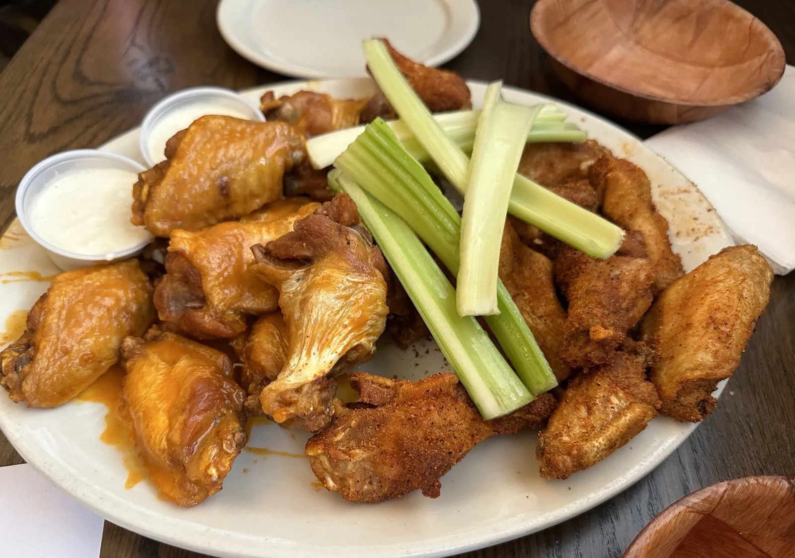
Buffalo was next, for wings at the Anchor Bar, which is credited with inventing them in 1964. The story, which may even be true, is that the owner, Teressa Bellissimo, was faced with a delivery of chicken wings, then a cheap cut usually thrown into stock, and deep-fried them, tossed them in hot sauce and butter, and served them with celery and blue cheese from the bar's kitchen. They arrived exactly as the legend requires: a heaping platter, celery sticks standing up in the middle, cups of blue cheese on the side.
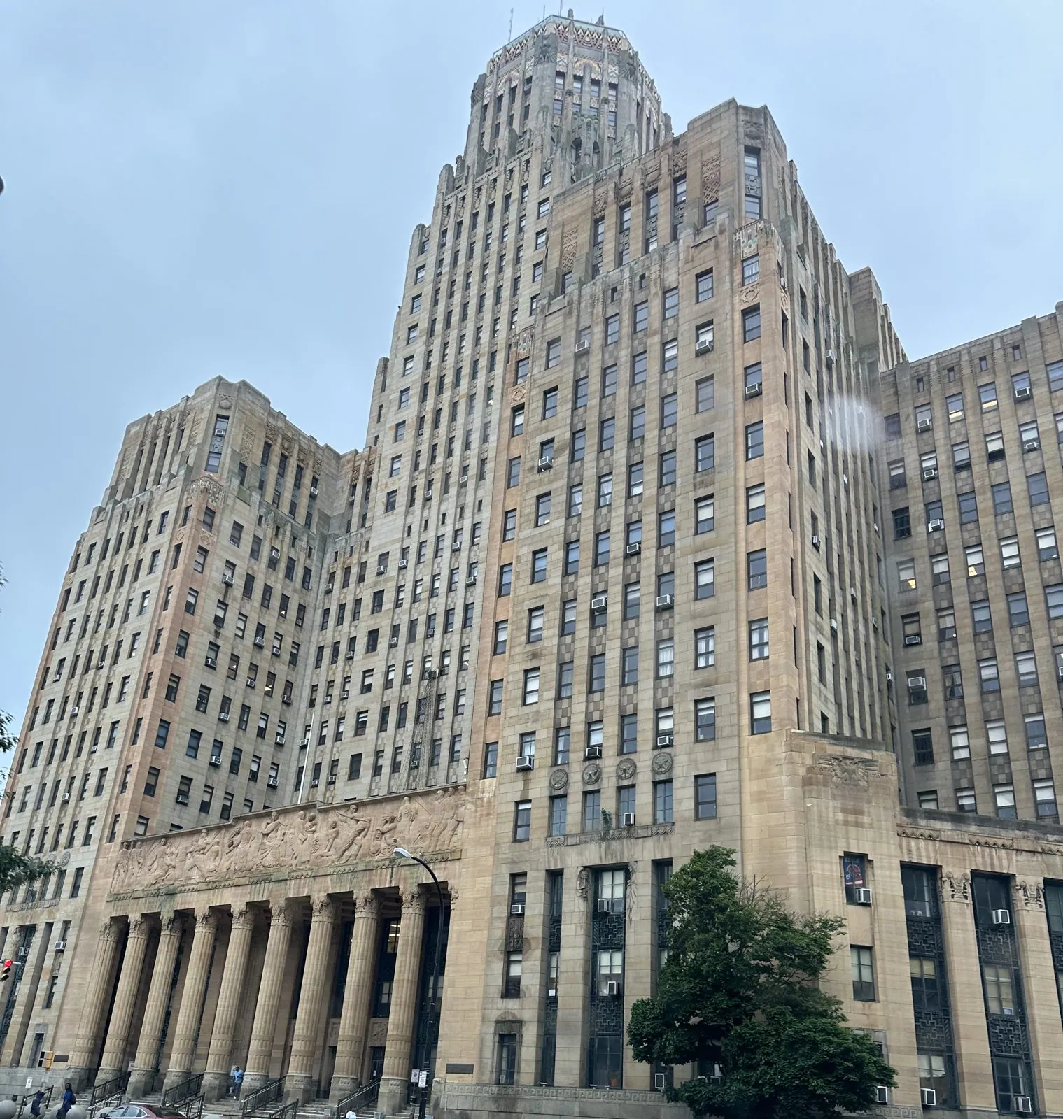
On Niagara Square, Buffalo's Art Deco City Hall faces the McKinley Monument obelisk. Downtown, a sign painted on the side of a building on Main Street asks visitors to "Keep Buffalo a Secret", a wink from a city that has long been the punchline of weather jokes. The sky was gray when we walked Niagara Square, and it was raining by the time we drove out; the last photos of downtown are taken through a windshield beaded with rain.
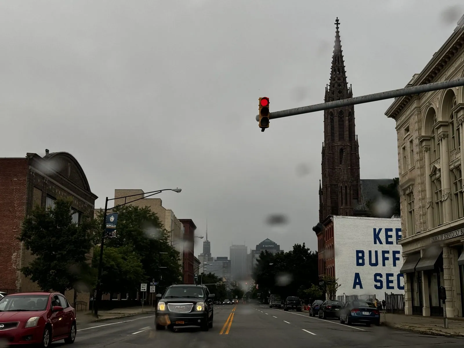
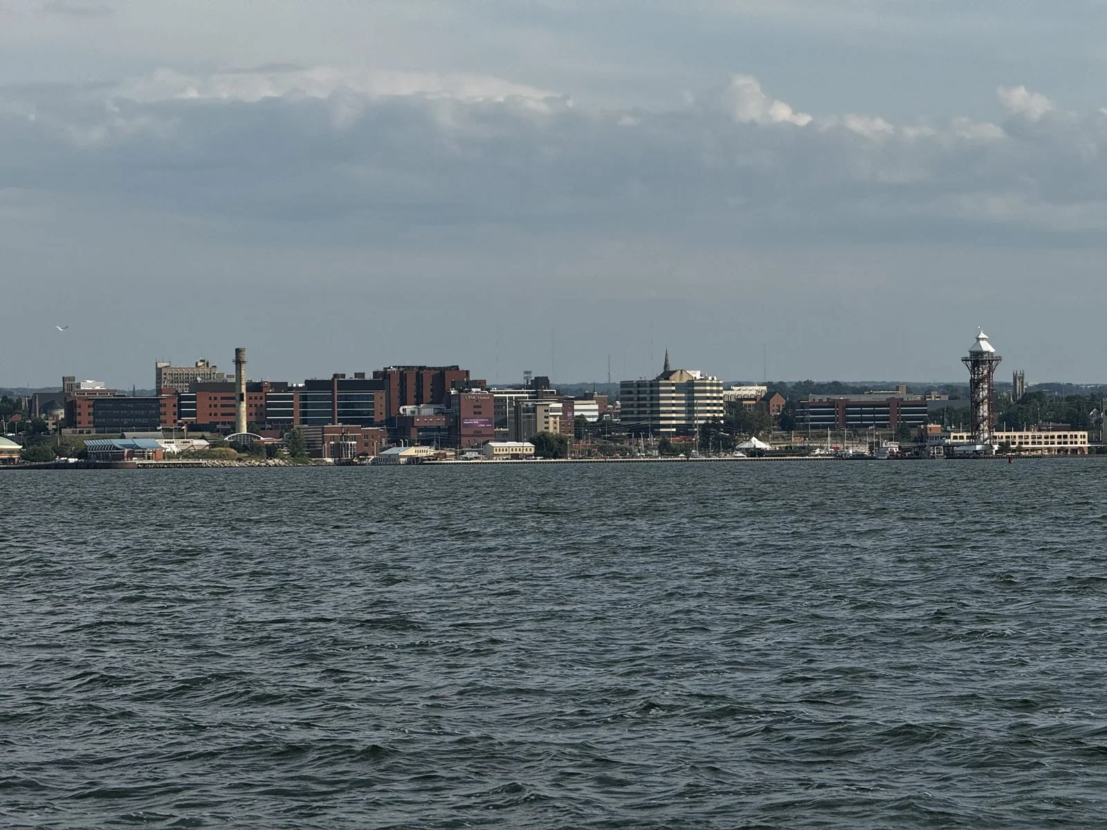
By the time we reached the beach at Presque Isle in Erie, Pennsylvania, it had cleared enough to look back across the bay at the city. Presque Isle ("almost an island" in French) is a sandy peninsula that curls seven miles out into Lake Erie and wraps around a natural harbor. That harbor is where Oliver Hazard Perry's fleet was built in 1813, before the Battle of Lake Erie. From the beach, the city across the water looks like a model railway town, with the Bicentennial Tower sticking up on the waterfront.
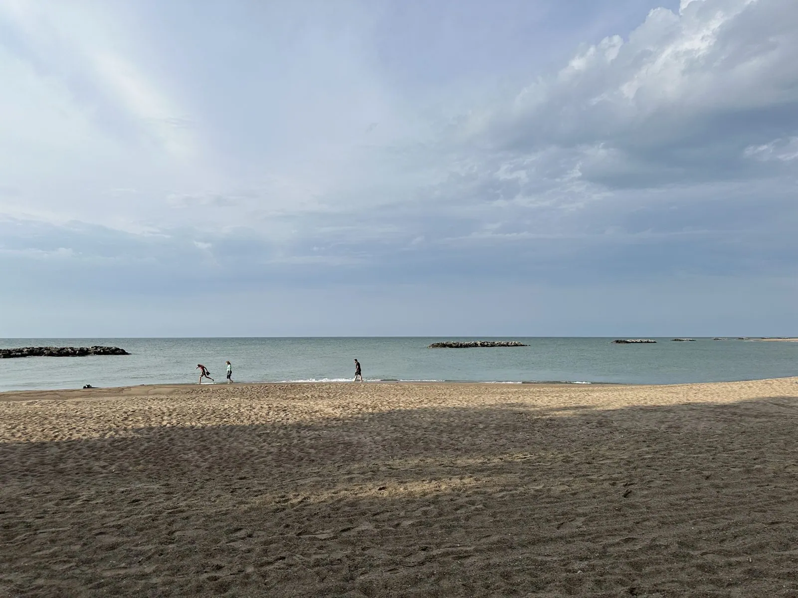
Presque Isle's beaches face the open lake, and on a windy afternoon after rain they look like the ocean: dark sand, a line of foam, small waves breaking one after another, and a horizon with nothing on it. The water is fresh, though, and it smells of nothing at all, which is the giveaway.
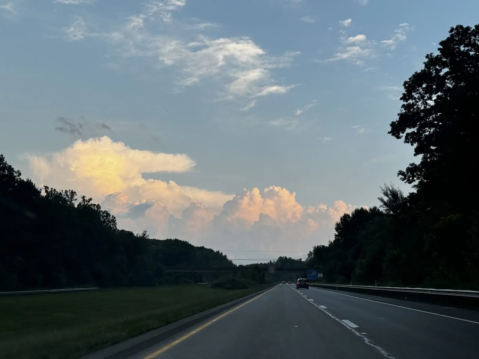
Then came a long run south on I-79 toward Pittsburgh while the sky put on a show. The storms that had soaked Buffalo had moved east, and as the sun went down in the west it lit them from the side: towering anvil clouds turned gold and then salmon-pink above the dark Pennsylvania woods. We photographed them through the windshield again and again, past Meadville and on into the dusk, because each one looked better than the last.
There is a particular feeling to a long interstate drive at the end of a full day. The radio is low, nobody has said anything for twenty minutes, and the road unspools ahead in long, gentle curves through the trees. The light goes from gold to pink to blue, and the cloud towers change color every time you glance out the side window. The mile markers count down to the next city. You are tired, and it is one of the best hours of the trip.
Pittsburgh
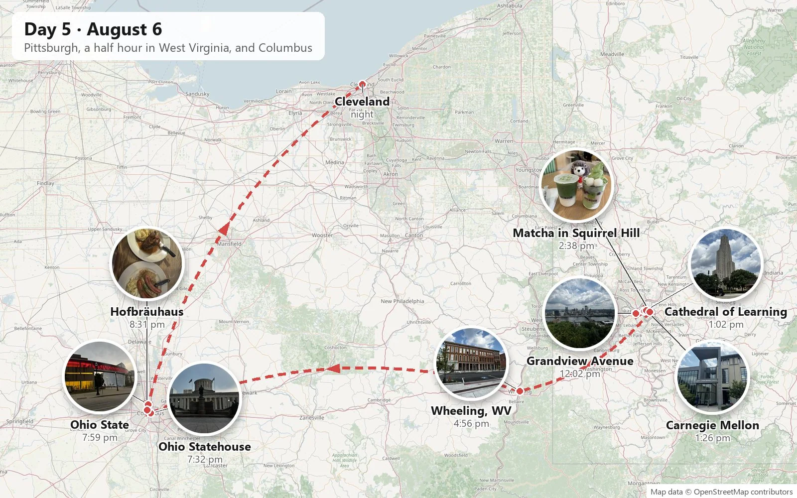
The Rust Belt was its own chapter. We had spent the night at a Hampton Inn in Green Tree, just outside Pittsburgh, and in the city we went up Mount Washington, to Grandview Avenue and the top of the Monongahela Incline, for the view of the three rivers. Downtown sits on its wedge of land where the Allegheny and the Monongahela meet to form the Ohio, stitched to everything else by bridges. Pittsburgh is said to have more bridges than any other city in the world. From up here you can see why it was built where it was: whoever held the Point held the gateway to the whole Ohio valley, which is why the French and the British fought over it in the 1750s.
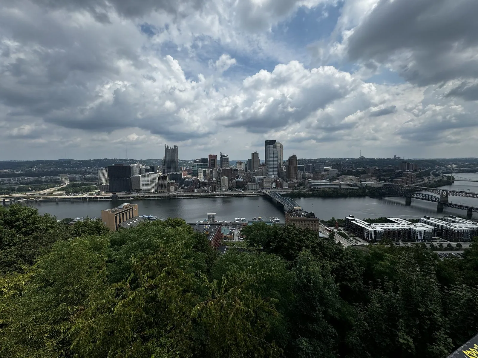
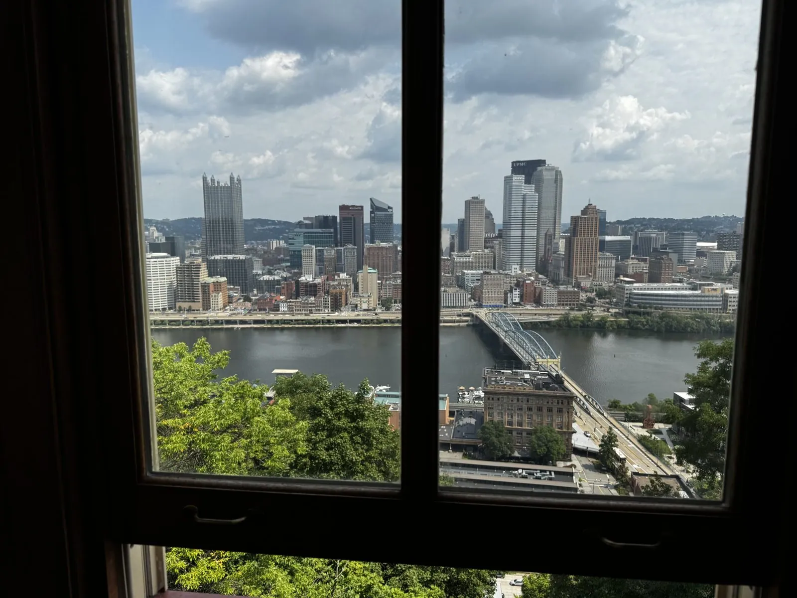
Grandview Avenue runs along the very edge of the bluff, with a string of overlooks cantilevered out over the drop. You walk from one to the next, and at each one the city shifts slightly: here the stadiums on the North Shore, there the fountain at the Point, then the glass spires of PPG Place glinting like a crystal castle. That day the sky was full of bright, fast-moving clouds, and their shadows swept across downtown so the city flickered between light and shade as you watched.
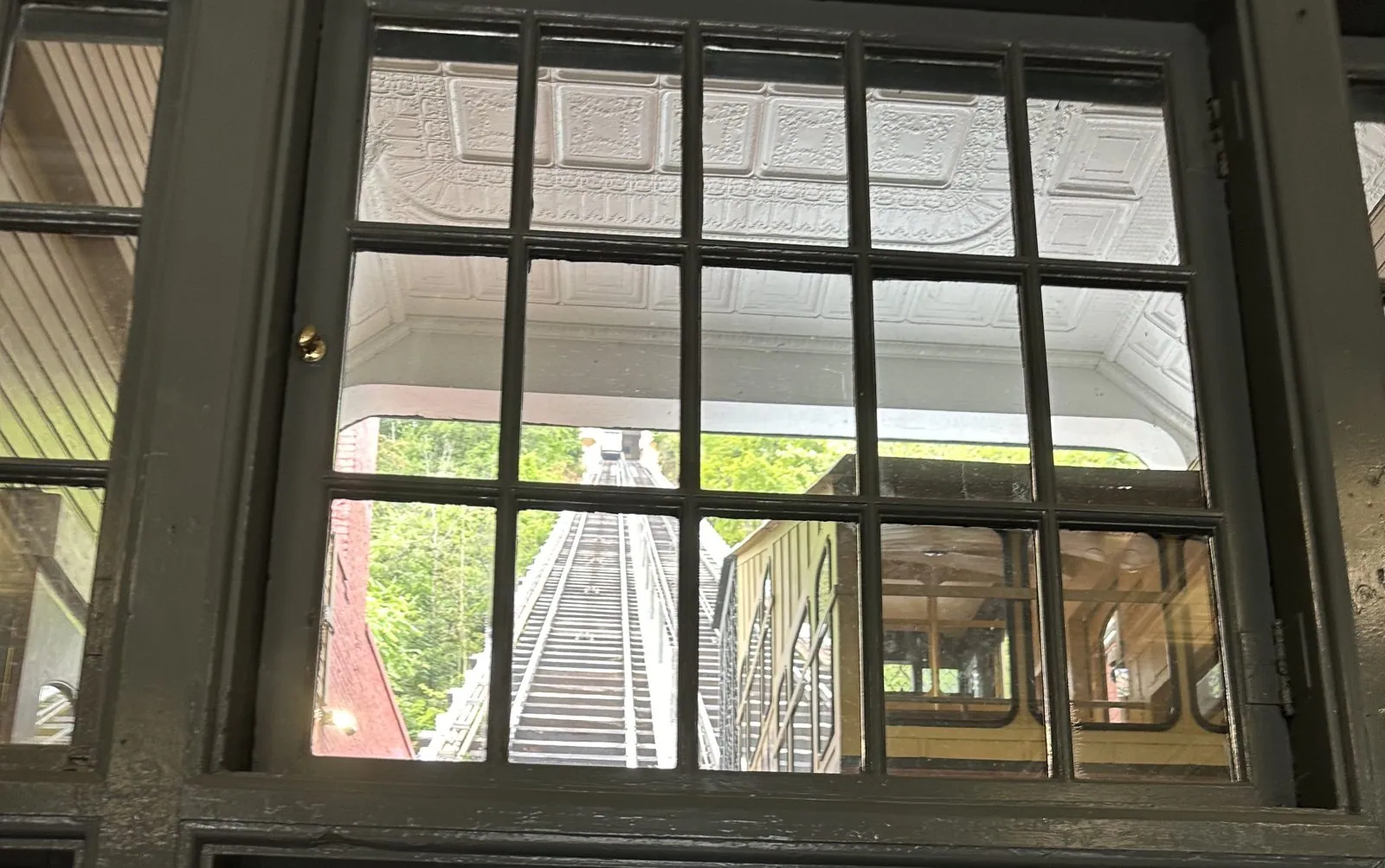
The Monongahela Incline has been hauling people up and down this slope since 1870, and it is the oldest continuously operating funicular in the country. It was built for the steelworkers who lived on top of the hill and worked in the mills along the river, back when the city's air was so thick with smoke that streetlights burned at noon. Its upper station has a bay window where people line up just to stand and look at a city that is now, in the clear air, unrecognizable from those days.
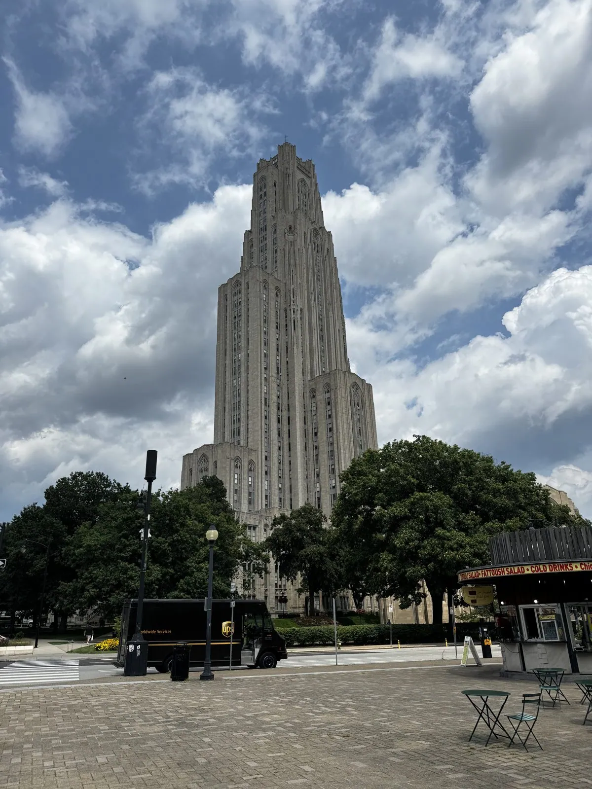
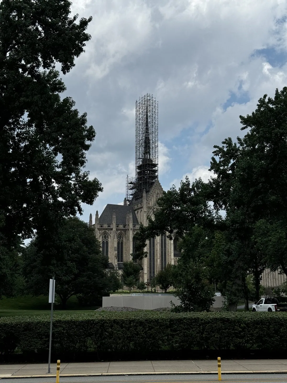
Then we crossed town to Oakland, Pittsburgh's university district. The Cathedral of Learning at Pitt is forty-two stories and 535 feet of limestone Gothic, the tallest educational building in the Western Hemisphere. It is a university building that looks like a church that kept growing. Inside, its Nationality Rooms are classrooms each designed in the style of a different country, built by the city's immigrant communities. Next to it, Heinz Memorial Chapel's spire was wrapped in scaffolding.
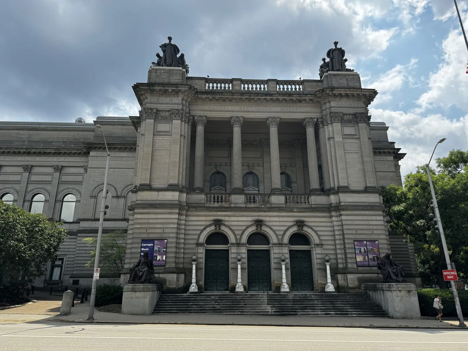
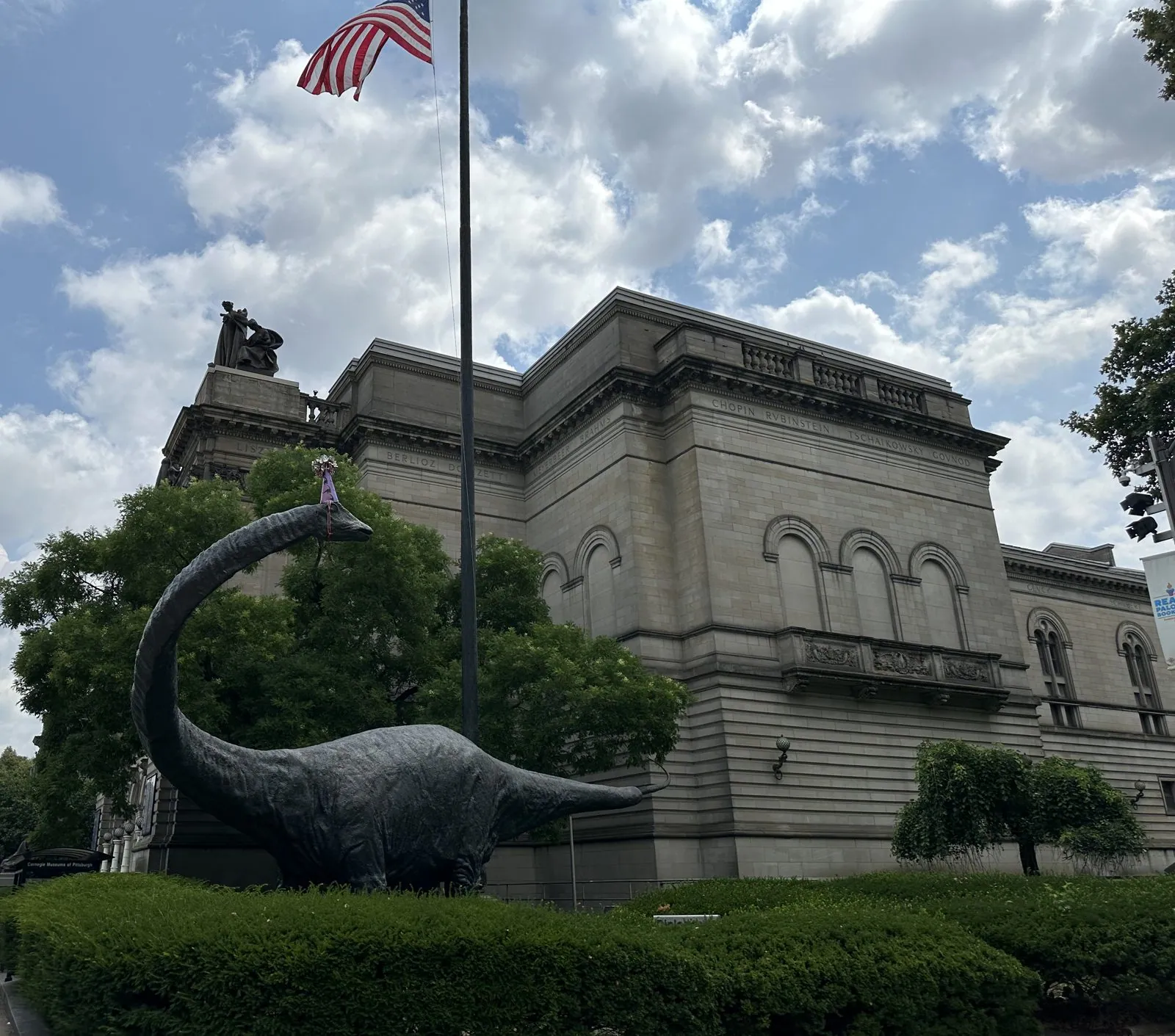
Across Forbes Avenue stands the Carnegie Museum and Music Hall, a Beaux-Arts palace that Andrew Carnegie gave the city in 1895. Outside it, a life-size bronze Diplodocus, Dippy, grazes on the lawn by Forbes Avenue.
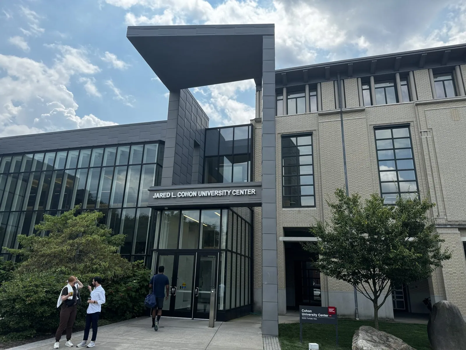
A few blocks on is the Soldiers and Sailors Memorial, and then Carnegie Mellon, whose glassy Cohon University Center was quiet in the August heat. Carnegie's money built a remarkable share of this neighborhood; Pittsburgh's steel paid for it.
The afternoon ended with a matcha break for the hedgehog in Squirrel Hill: an iced matcha and a soft-serve sundae, both bright green, with the hedgehog between them looking pleased.

Wheeling and Columbus
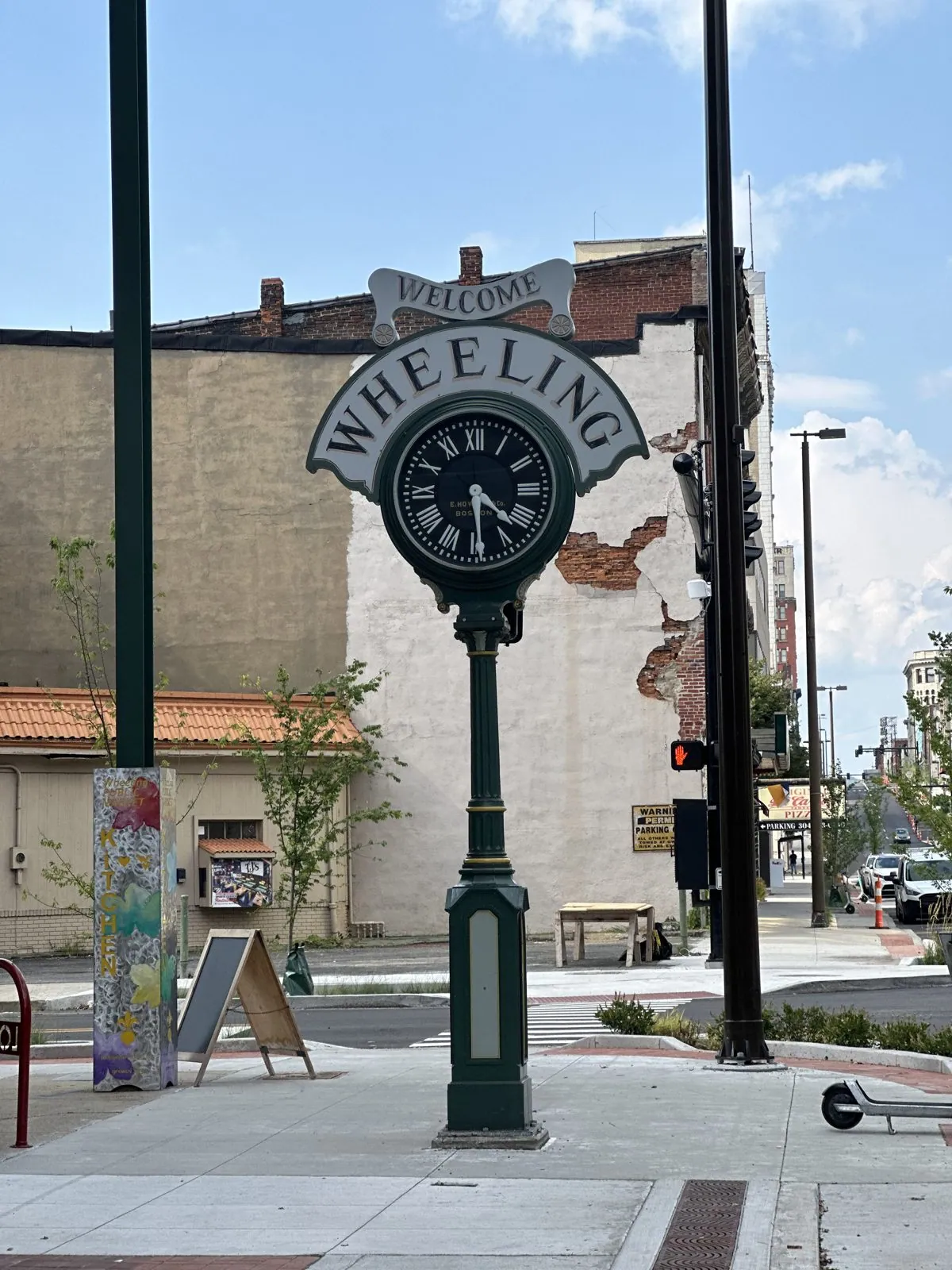
Then came Wheeling, West Virginia, which deserves more than a footnote, because it is the purest example of what this trip was. It was the only place we stopped in West Virginia. We didn't plan it as a destination; it just happened to sit on the road between Pittsburgh and Columbus, where I-70 crosses the narrow northern panhandle of the state, a sliver of West Virginia barely fifteen miles wide squeezed between Pennsylvania and Ohio. You could cross the whole state here in a quarter of an hour without stopping. We stopped.
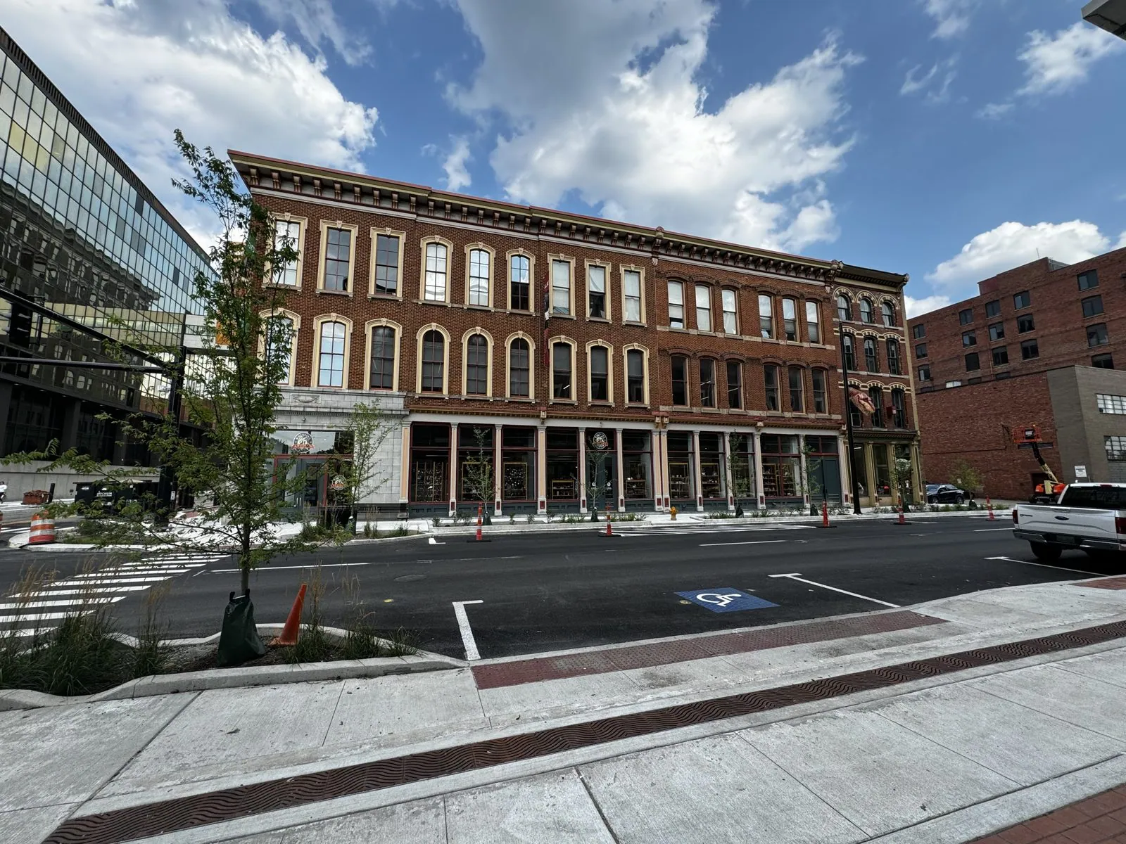
It was worth it. Wheeling sits on the Ohio River where the old National Road, the country's first federally built highway, crossed it, and in the nineteenth century it was a rich and important city, a gateway to the West where travelers left the road for the river. Its suspension bridge was the longest in the world when it opened in 1849. Downtown still has the bones of that wealth: whole blocks of handsome Victorian brick with arched windows, heavy cornices and cast-iron storefronts, built for a city three times the size. On the afternoon we came through, Main Street had just been rebuilt, with fresh sidewalks, new trees in their planters, and orange traffic cones still standing in the road. Half an hour, a walk around the block, and one fridge magnet later, West Virginia was on the fridge, and we were back on I-70 heading west. That is the cursory road trip in a nutshell: you don't get to know a place, but you do get to say hello to it, and sometimes that is enough.
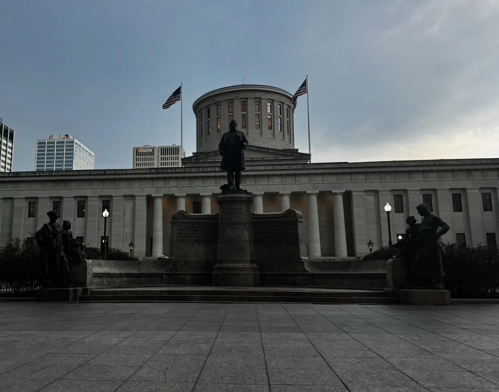
By dusk we were in Columbus, Ohio's capital. We walked past the Ohio Statehouse under a heavy gray sky. It is a capitol with a flat-topped drum where the dome should be: the building took over twenty years to finish, the money and the arguments ran out, and the dome was never built. Purists consider it one of the finest Greek Revival buildings in the country for exactly that reason. William McKinley, Ohio's governor before he was president, stands on a plinth out front.
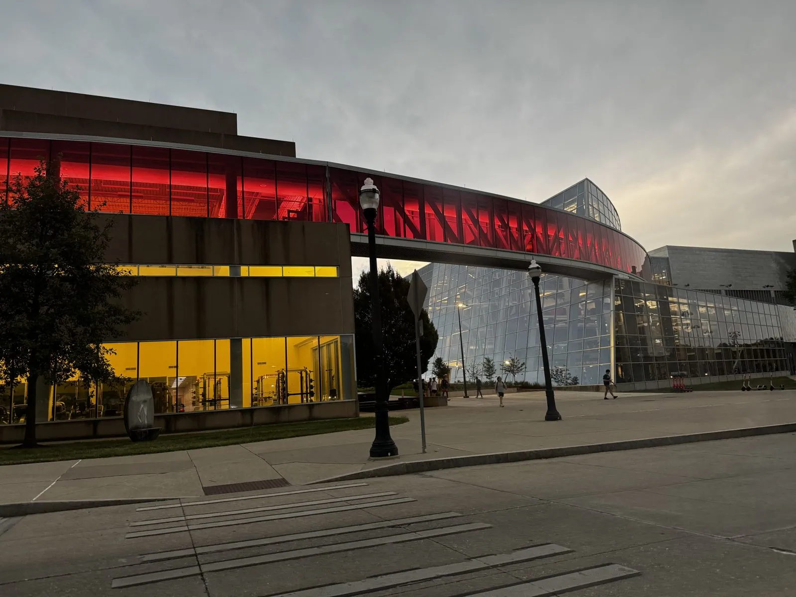
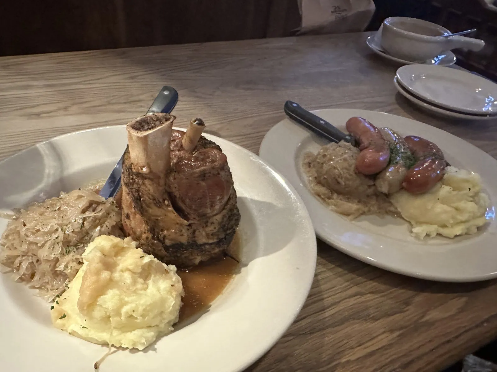
Then we took a stroll up Neil Avenue onto the Ohio State campus as the lights came on, ten minutes of lit windows and empty paths at one of the largest universities in the country. Dinner was at the Hofbräuhaus, a branch of Munich's famous beer hall: sausages, sauerkraut, mashed potatoes and a pork knuckle, about as far from Denver ramen as a week can get. After that came a night drive to the Embassy Suites in Beachwood, just outside Cleveland. Which brings us back to the hedgehog.
Cleveland, and the hedgehog's first escape
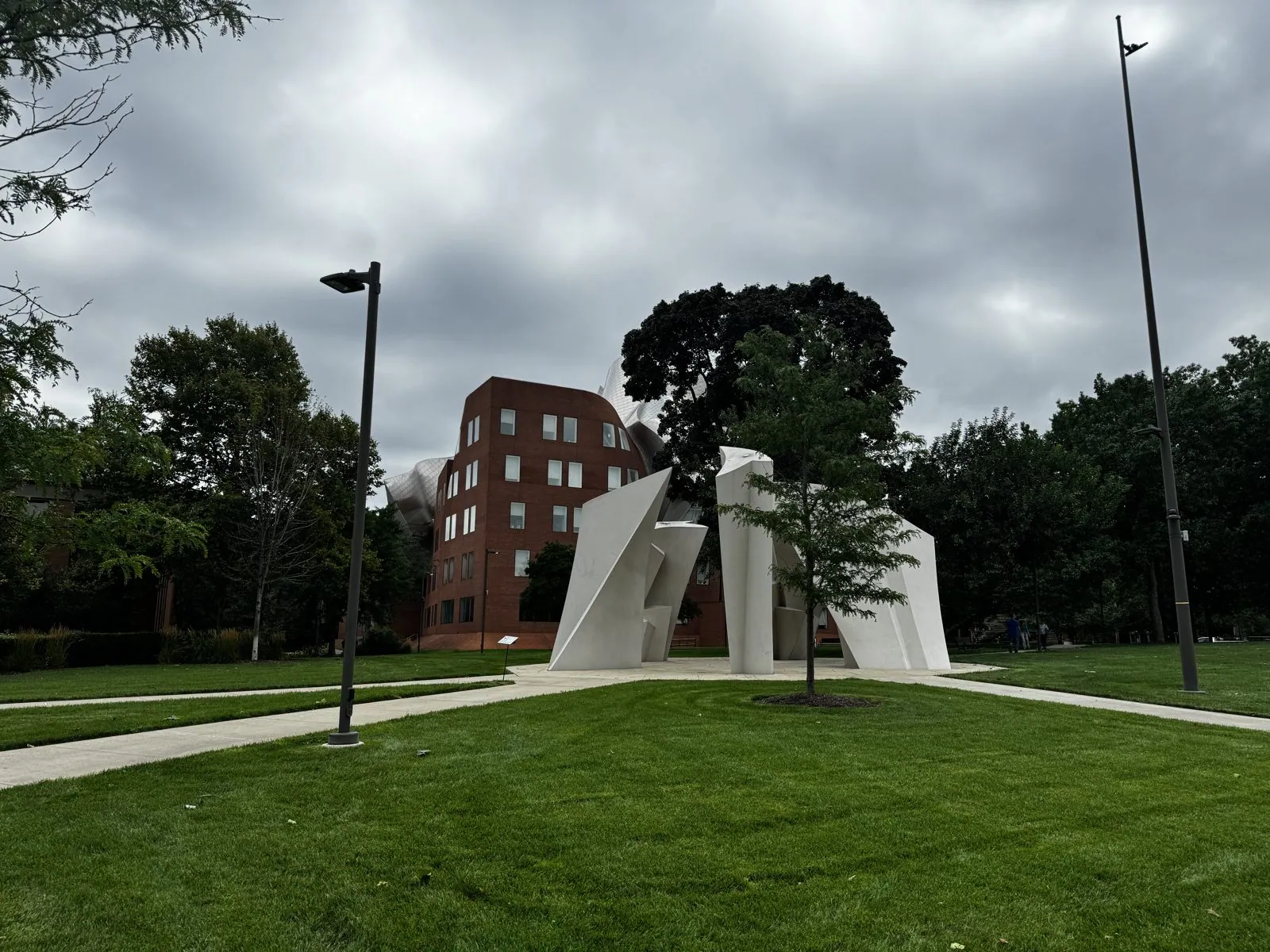
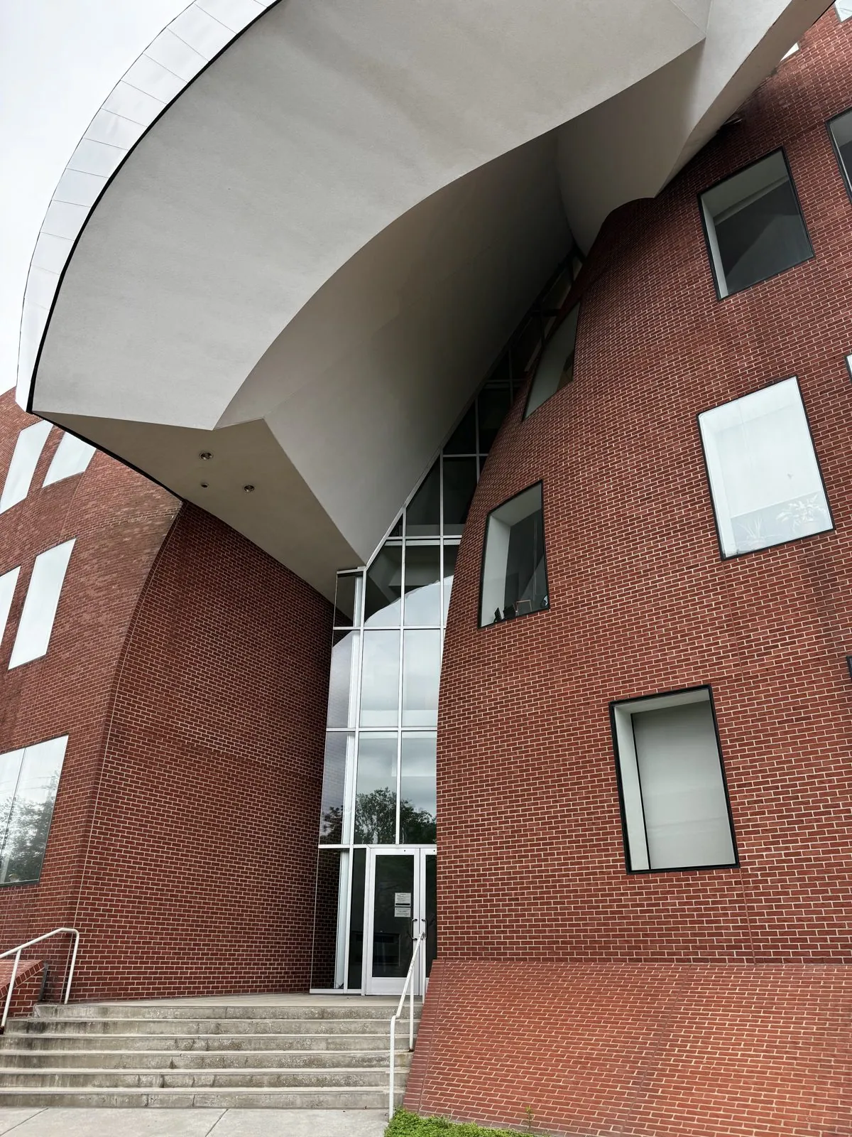
We checked out the next morning and walked around Case Western Reserve. There was a white abstract sculpture on the lawn and, behind it, Frank Gehry's Peter B. Lewis Building, home of the business school. Its brick walls bulge and lean, and great sheets of stainless steel pour off the roof like a building that is melting from the top down. Up close it is even stranger: the brick curves inward over the entrance, the windows are set at slightly wrong angles, and the steel overhangs look like the folds of a giant napkin.
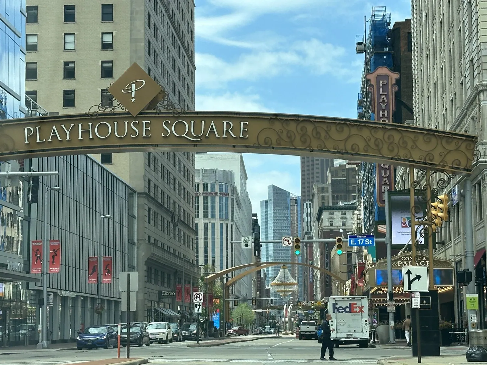
Next door, in University Circle, we spent about an hour inside the Cleveland History Center and the Cleveland Museum of Art. Then we went downtown, under the Playhouse Square arch, and into the Arcade, an 1890 shopping arcade with a glass roof.
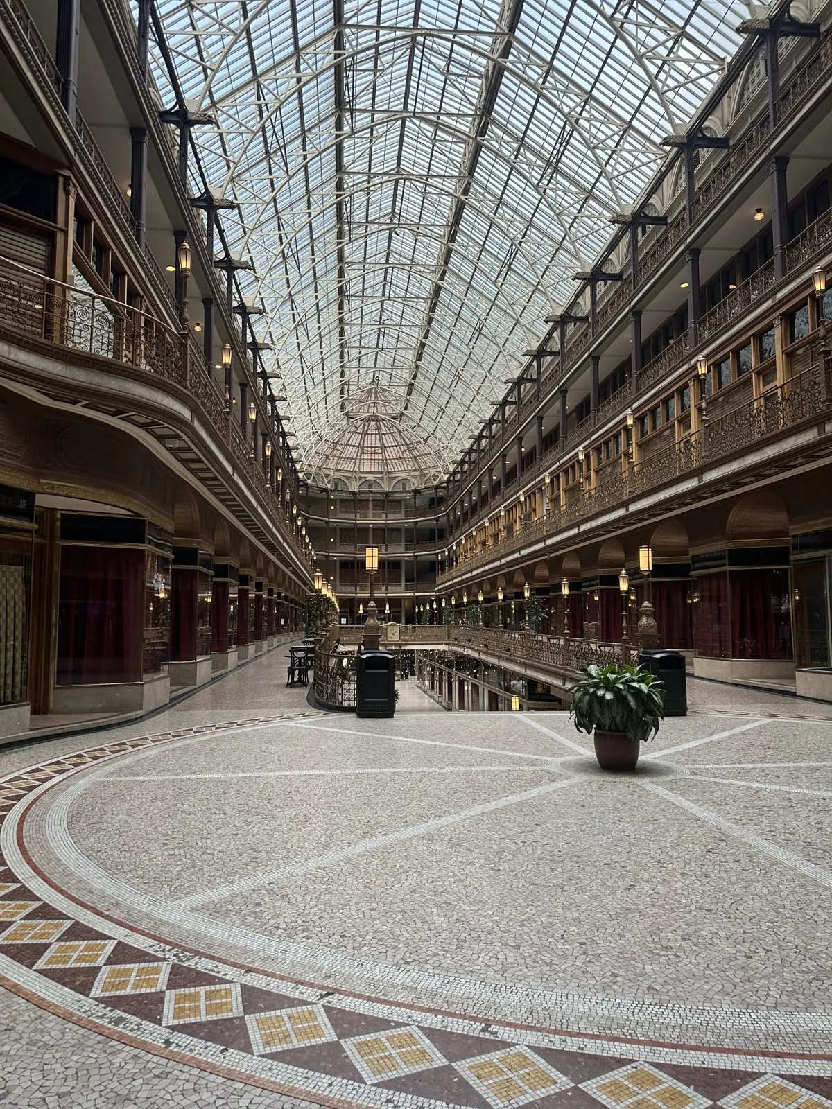
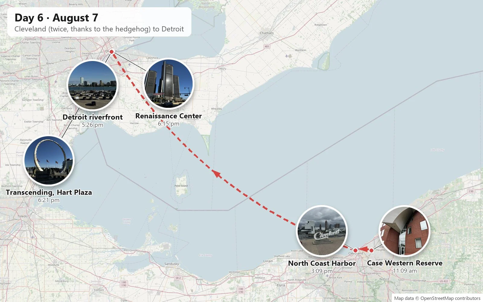
Somewhere along the way we realized the hedgehog wasn't with us. He was still in Beachwood, where we had started the morning. So my wife stayed in the Arcade while I drove back, retrieved one (1) toy hedgehog, and came back to pick her up as if nothing had happened. That is why we were still in Cleveland at three in the afternoon.
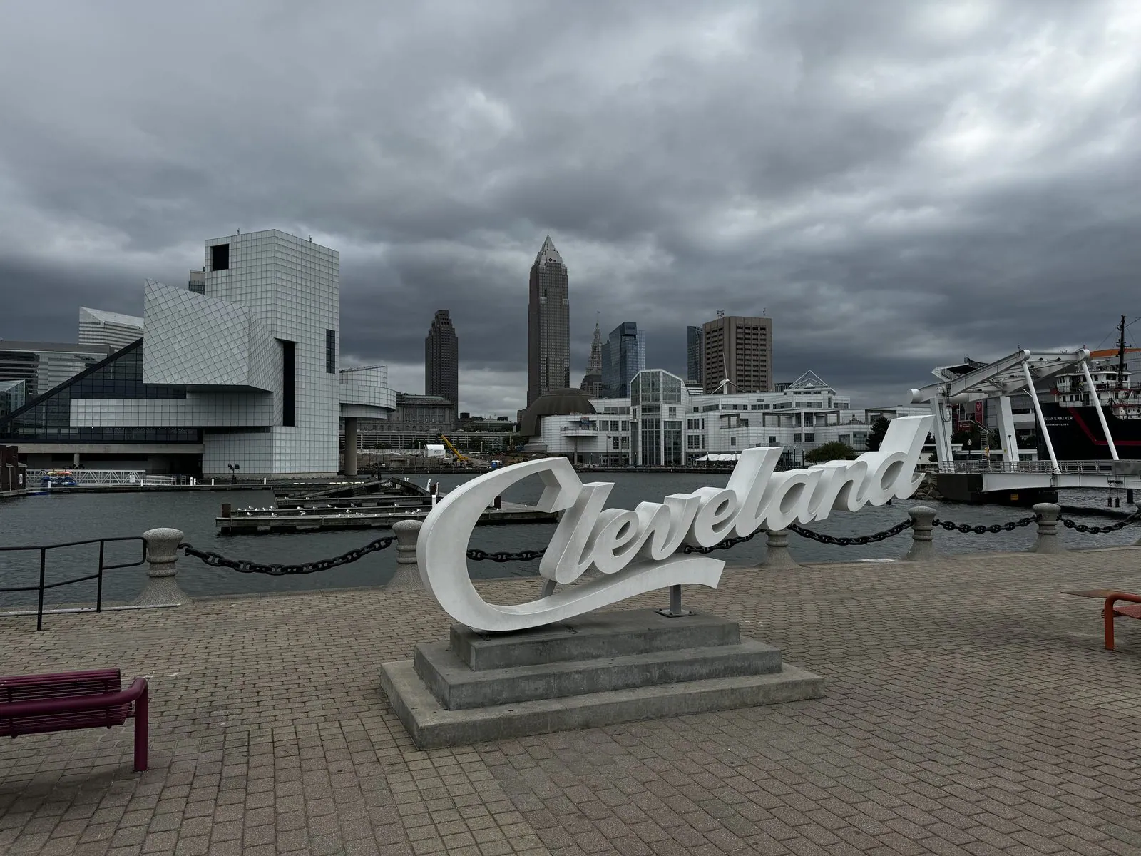
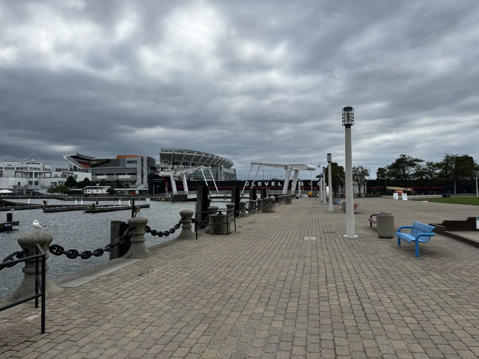
Then we went down to the lakefront at North Coast Harbor together. The "Cleveland" script sign sits in front of the white geometry of the Rock & Roll Hall of Fame, I. M. Pei's glass pyramid and tilted boxes, which opened in 1995 and is a clear cousin of his pyramid at the Louvre. Along the harbor walk, the Browns' stadium sits right on the lake, and Key Tower, the tallest building in Ohio, rises over downtown. We didn't tour the Hall of Fame, but we did get a magnet from its gift shop. The sky over all of it was a solid ceiling of dark cloud, clearly thinking about a storm.
Detroit
By the time we reached Detroit the storm had blown off and the sky was a clean, hard blue. From the riverfront you look straight across the water at Canada: the skyline of Windsor, Ontario, which from Detroit is due south. It is a fact that wins bar bets. The Detroit River bends here so that, for a stretch, Canada lies south of the United States.
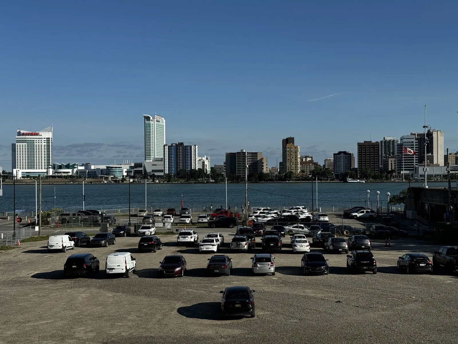
Detroit's riverfront in the early evening is wide, quiet and full of light. The river is broad and fast, the color of slate, and freighters pass slowly between the two countries. Across it, Windsor's towers catch the sun, and gulls wheel over the water. Behind you, the downtown towers stand in long shadows, many of them grand buildings from the 1920s, when this was one of the richest cities in the world.
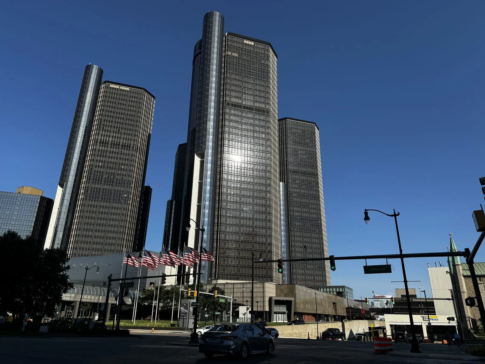
Downtown is dominated by the Renaissance Center, a cluster of dark glass cylinders that is very much a 1970s idea of the future. It was designed by John Portman and opened in 1977, built with the hope that a gleaming new complex would pull the city back from its long decline. It has been General Motors' headquarters since 1996. It still looks like a set from a science-fiction film, and in the evening sun its towers turned almost black against the sky.
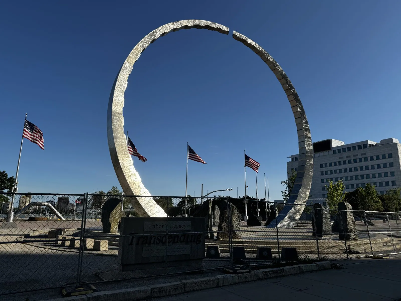
At Hart Plaza, by the river, stands Transcending, the Michigan Labor Legacy Landmark: a giant steel ring, sixty-three feet tall, broken at the top. It honors the labor movement that was born in this city's auto plants. The ring is left open on purpose, because the work is unfinished. It stands amid flags on a plaza that, on a Wednesday evening in August, was almost empty.
Lansing and Michigan City
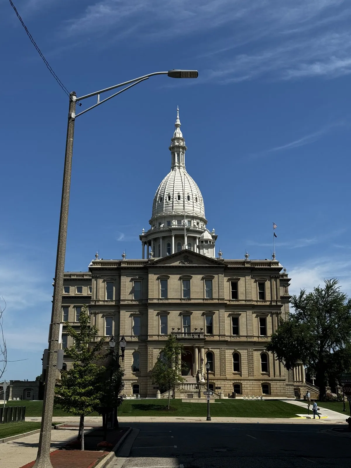
We spent that night at a Hampton Inn in Howell, between Detroit and Lansing. From there the Great Lakes reeled us in. In Lansing at midday, the Michigan State Capitol looked small and perfect under a big sky streaked with cirrus. It has a Colorado connection: its architect, Elijah E. Myers, also designed the Colorado State Capitol we had walked past in Denver ten days earlier, and the family resemblance between the two is obvious once you know to look. Myers designed more state capitols than any other architect, and it shows in the formula: a dome on a drum, a portico and two wings.
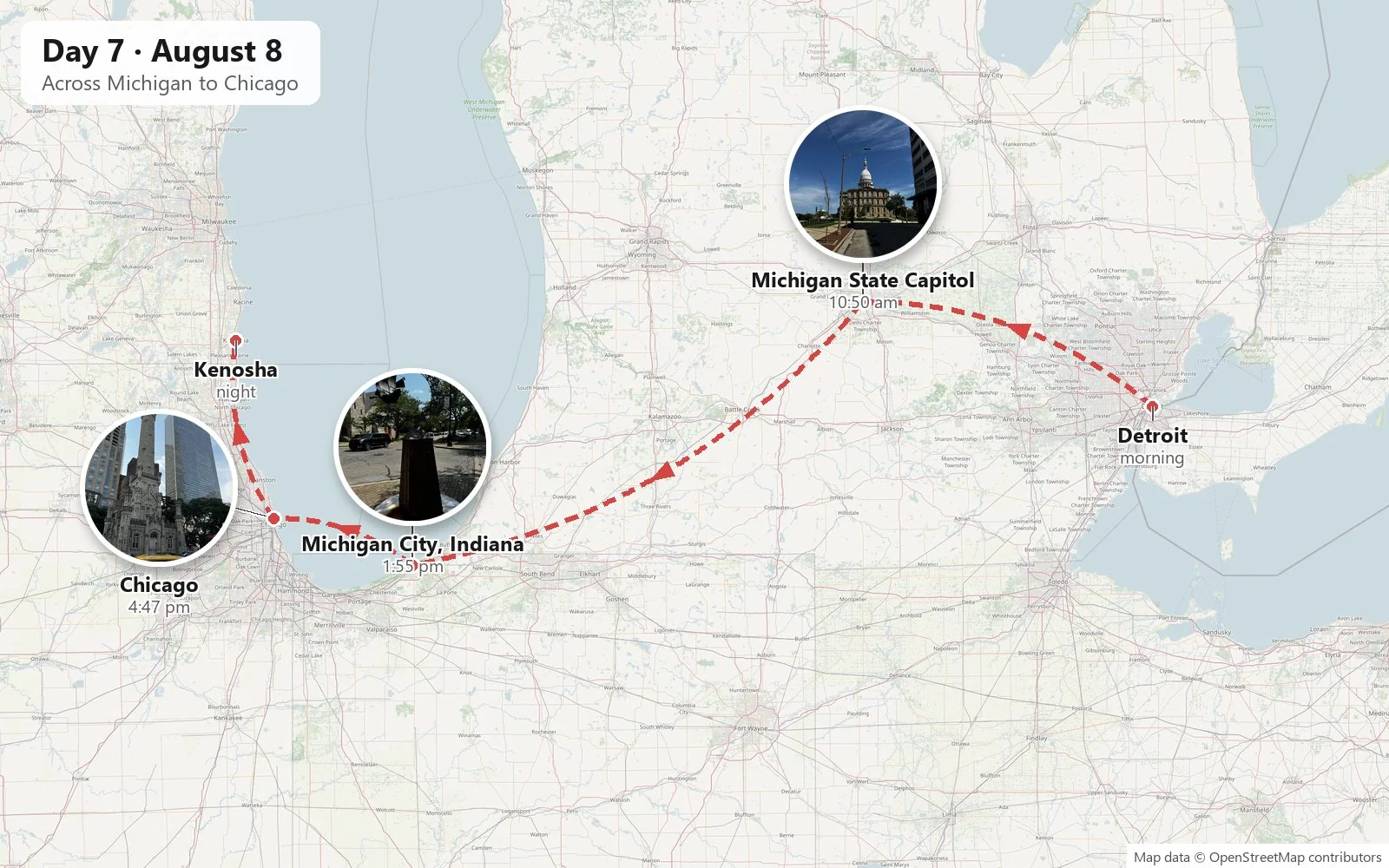
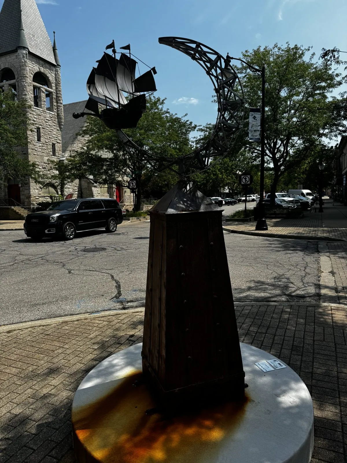
After that we stopped in Michigan City, Indiana, on the southern shore of Lake Michigan, where Franklin Street is lined with public sculptures: painted metal flowers, abstract forms, and a dark pedestal topped with a sailing ship, standing beside a red-brick church steeple.
Chicago, the first evening
And then came Chicago, which we liked so much that we photographed it in three separate sessions: arriving in the late afternoon, a night on the way back, and a whole morning downtown. We came in up South Michigan Avenue, through the old Motor Row and Printer's Row, with the skyline building ahead of us block by block and Grant Park opening up on the right.
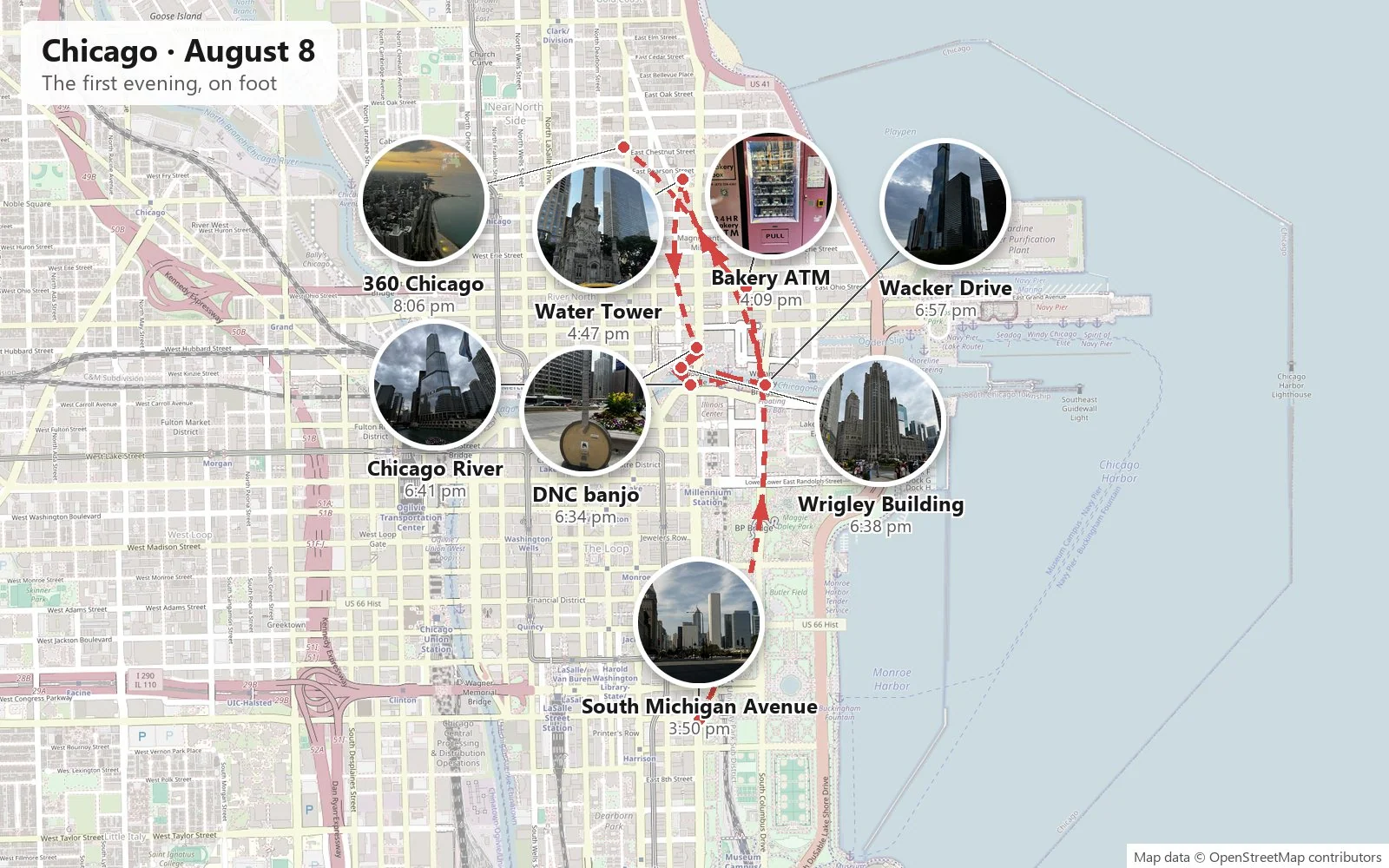
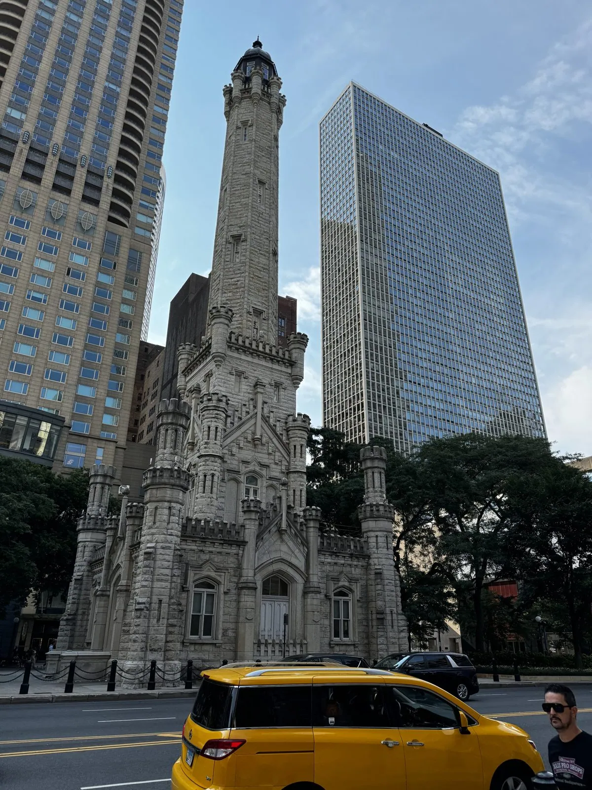
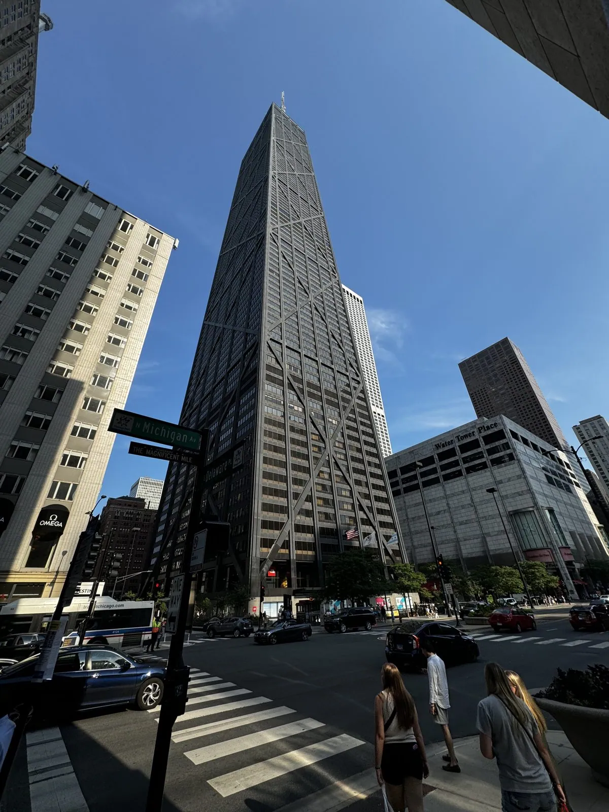
Chicago announces itself. You come up the avenue and the buildings get taller and closer together until you are walking in a canyon: limestone on one side, glass on the other. The scale of the place is the first thing you feel. The sidewalks are wide, the buildings are huge, and everything is solid and confident in a way that newer cities aren't. We spent the first evening on foot. The Magnificent Mile, the stretch of Michigan Avenue north of the river, has the old Water Tower of 1869, which survived the Great Fire of 1871. It sits like a little limestone sandcastle among the skyscrapers, the only public building in the burned district left standing. Nearby is the tapering black X-braced Hancock tower.
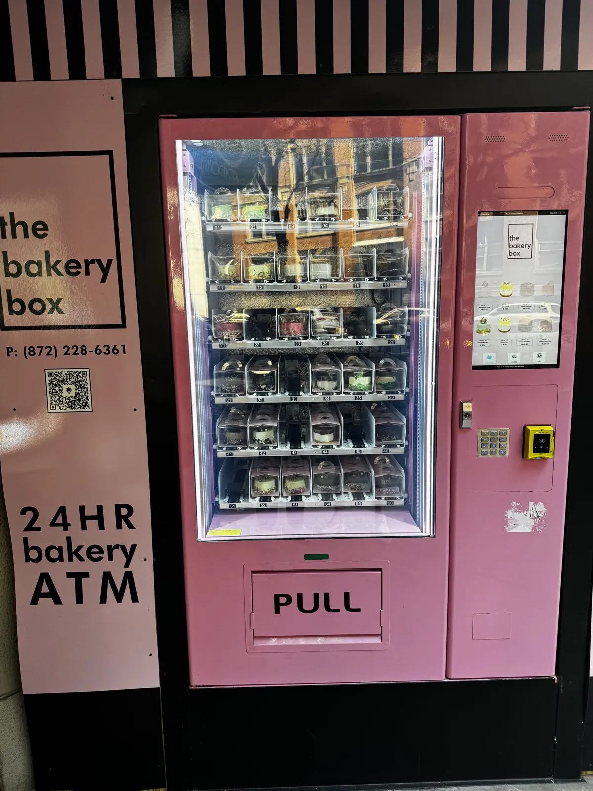
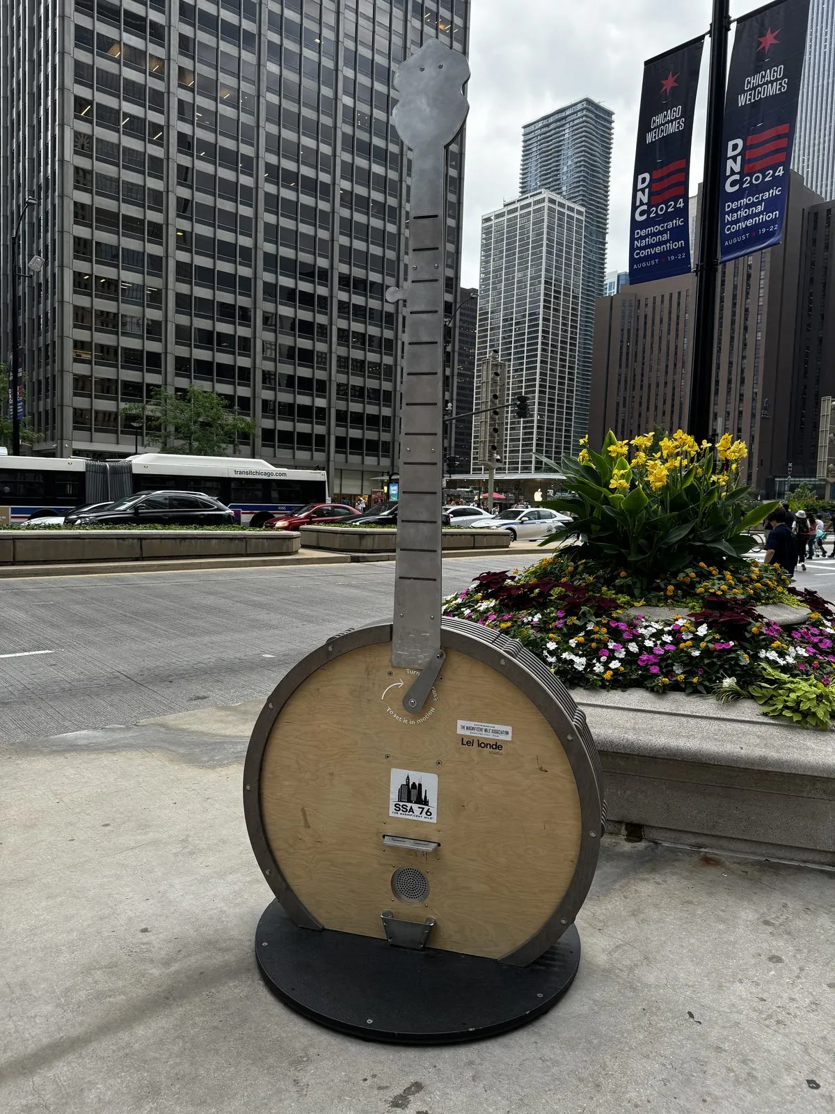
The avenue also has a 24-hour "bakery ATM" that vends cakes through a pink glass door, and, all along it, giant guitar and banjo sculptures under banners reading "Chicago Welcomes DNC 2024". The Democratic National Convention was eleven days away, and the city was already dressed for it.
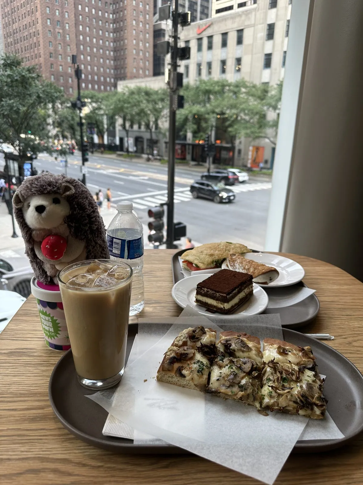
On the same avenue, the hedgehog posed with an iced latte and a slice of tiramisu by the window of the Starbucks Reserve Roastery.
At the river, the Wrigley Building and Tribune Tower face each other across Michigan Avenue like two wedding cakes. The Wrigley is white terra-cotta with a clock tower modeled on the Giralda in Seville. The Tribune is Gothic, with a crown of flying buttresses, and it won one of the most famous architecture competitions ever held, in 1922. Its walls are studded with fragments of famous buildings from around the world, from the Great Wall to the Parthenon, brought back by the newspaper's correspondents.
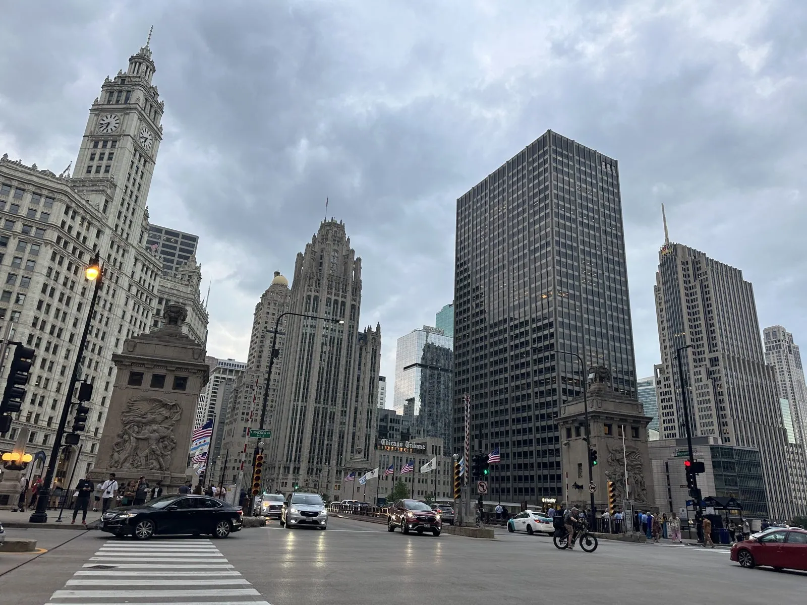
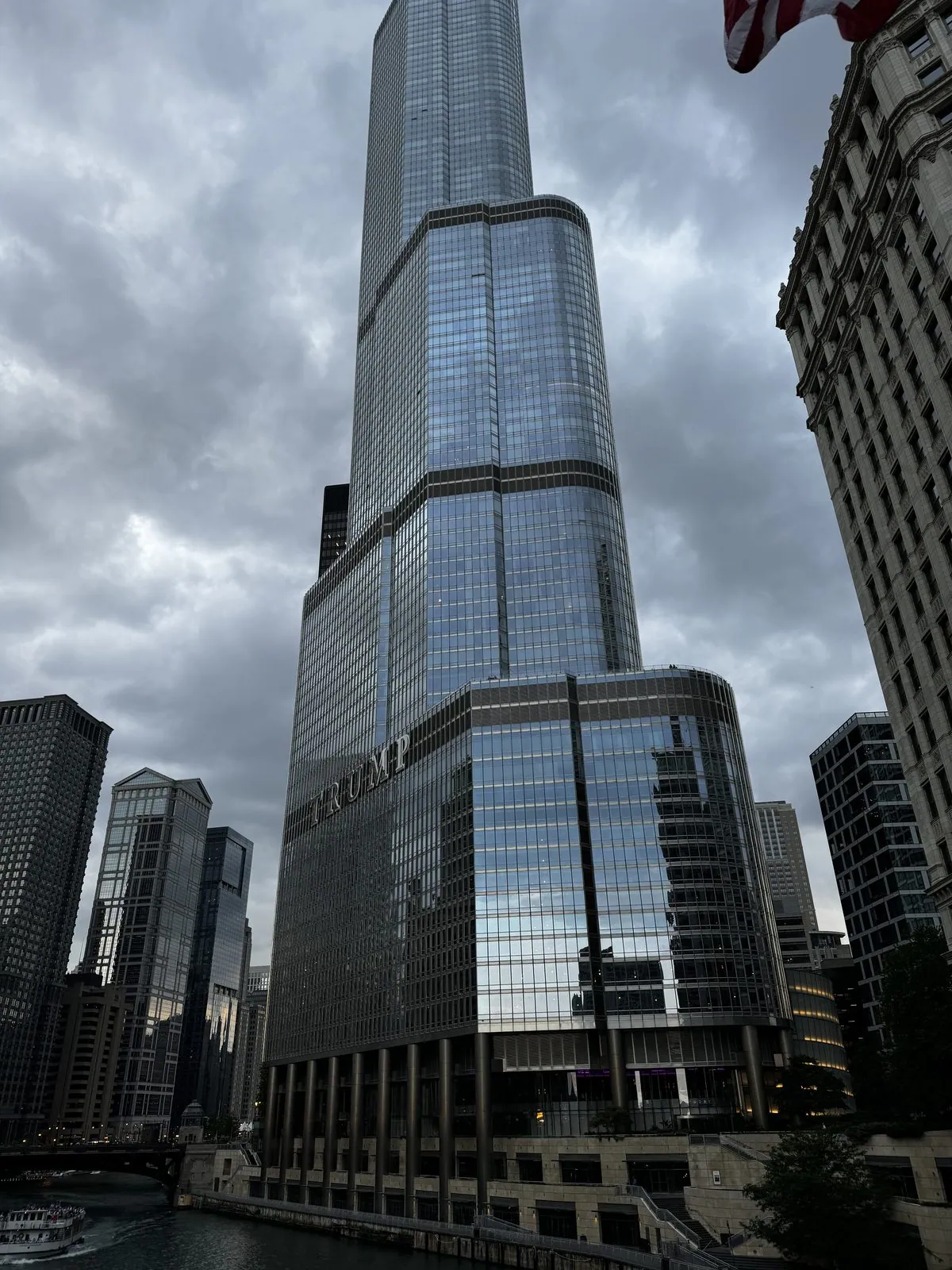
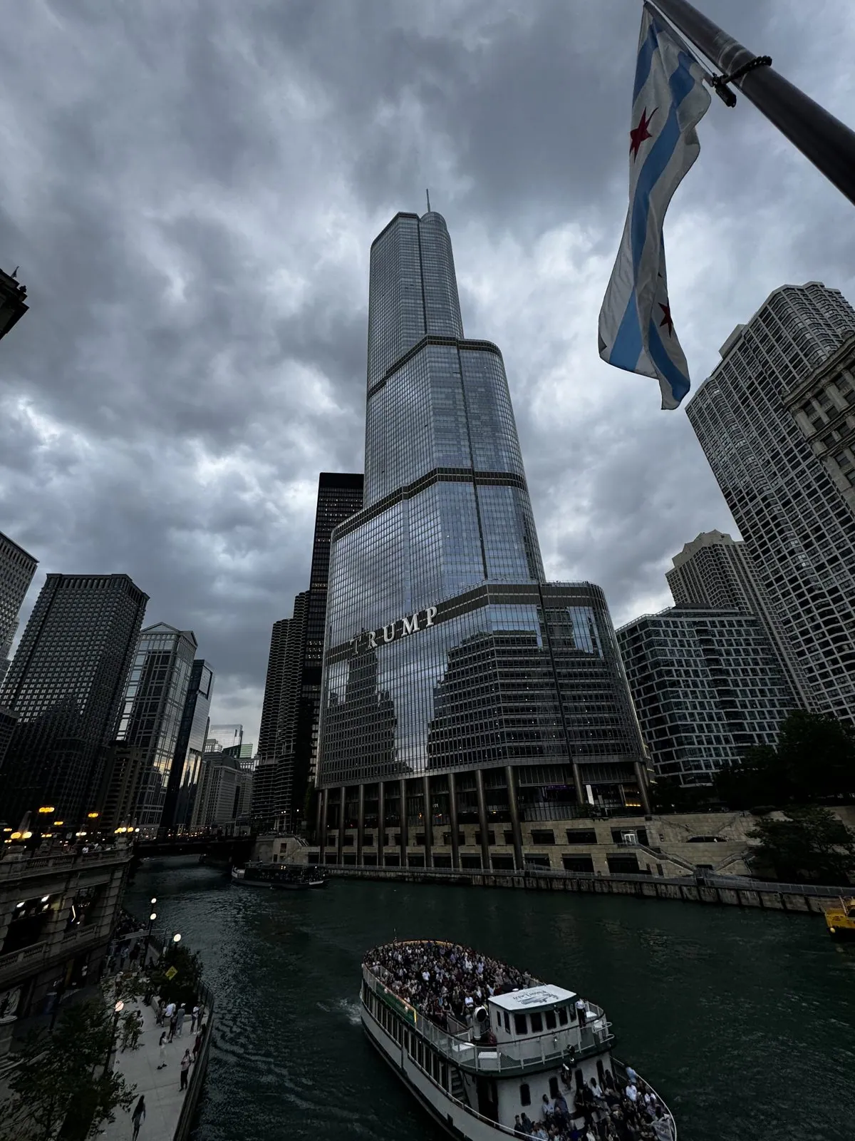
The Michigan Avenue bridge is where all of Chicago seems to converge on a summer evening. Crowds line the railings, the bridge houses at its corners are carved with scenes from the city's history, and the river opens up in both directions between walls of towers. Below the bridge, the river was a traffic jam of architecture-tour boats, each packed with people looking up. The river itself is a feat of engineering: in 1900 the city reversed its flow, so that it carries sewage away from Lake Michigan, the drinking-water supply, instead of into it. We followed it east along Wacker Drive past the glass tower that steps back in tiers to line up with the heights of its neighbors, and past the wavy blue-glass St. Regis by Jeanne Gang, then the third-tallest building in the city.
Then we went up the Hancock to the 360 Chicago observation deck, a thousand feet up on the ninety-fourth floor. The building was designed by Bruce Graham and the structural engineer Fazlur Khan of Skidmore, Owings & Merrill. The X-braces on its outside are not decoration: they make the whole facade into a stiff tube, which let them build a hundred stories with far less steel than usual. That idea was a turning point in how supertall buildings are made.
The museum floor glows with neon maps of the city's neighborhoods, and one window carries the slogan "My Block, My Hood, My City" in big black letters over the view.
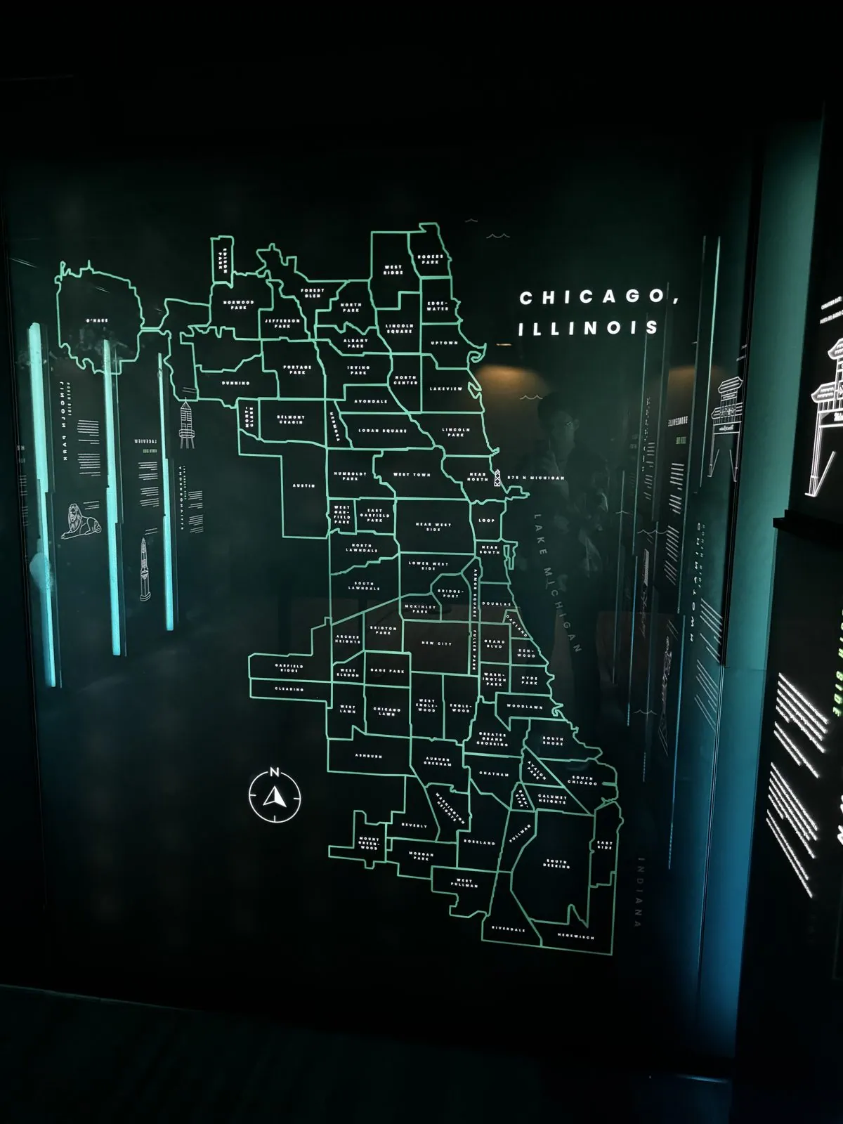
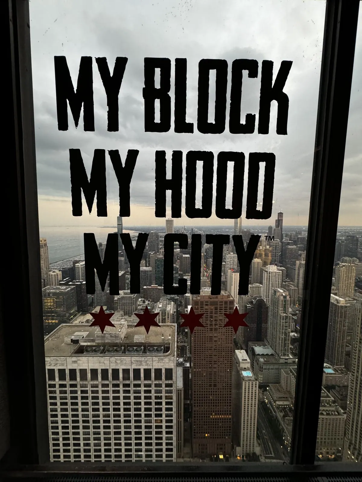
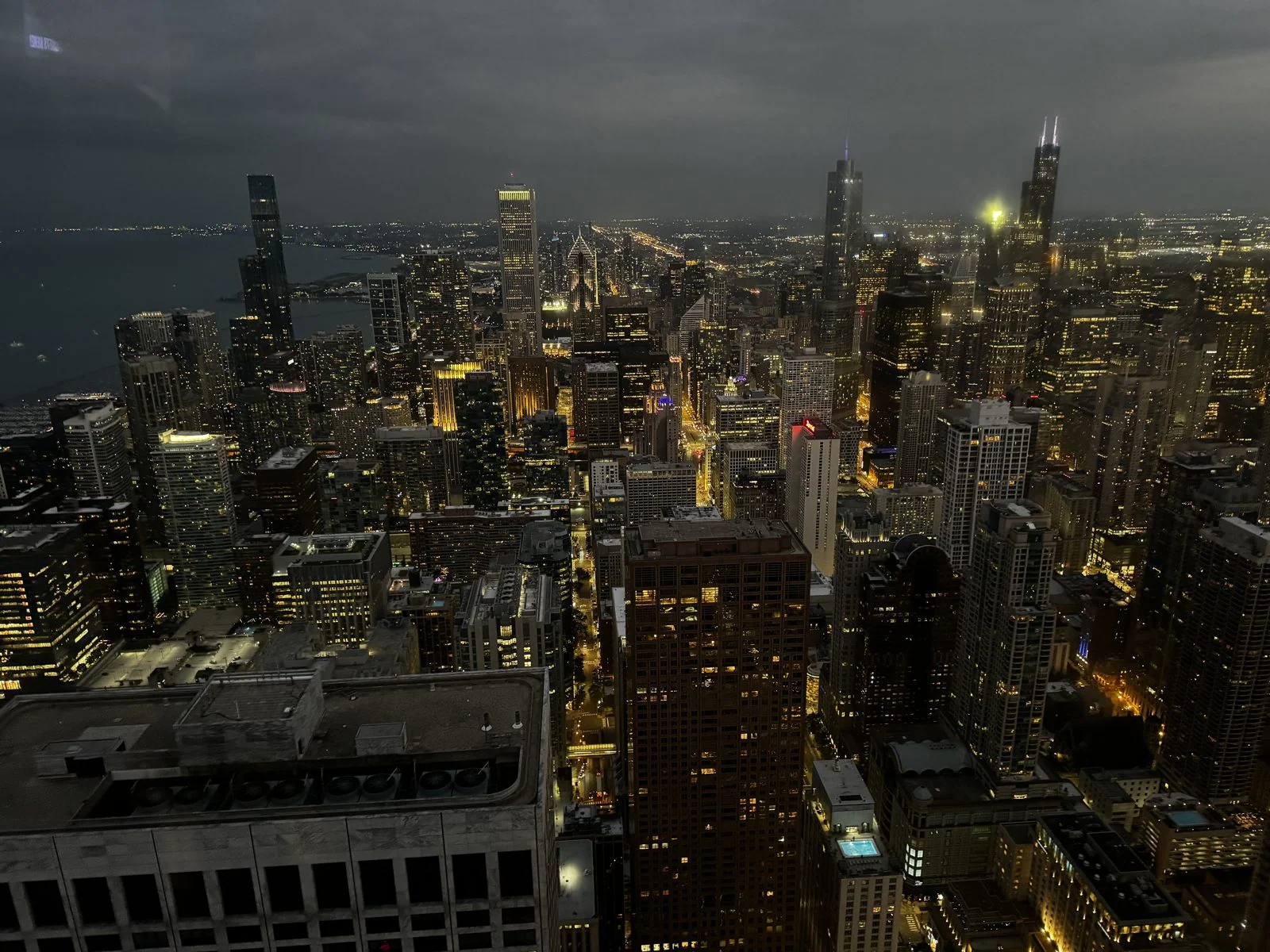
We watched dusk fall from the top. The lakeshore curves north in a perfect arc, Lake Shore Drive tracing it, and Navy Pier pokes out into the lake.
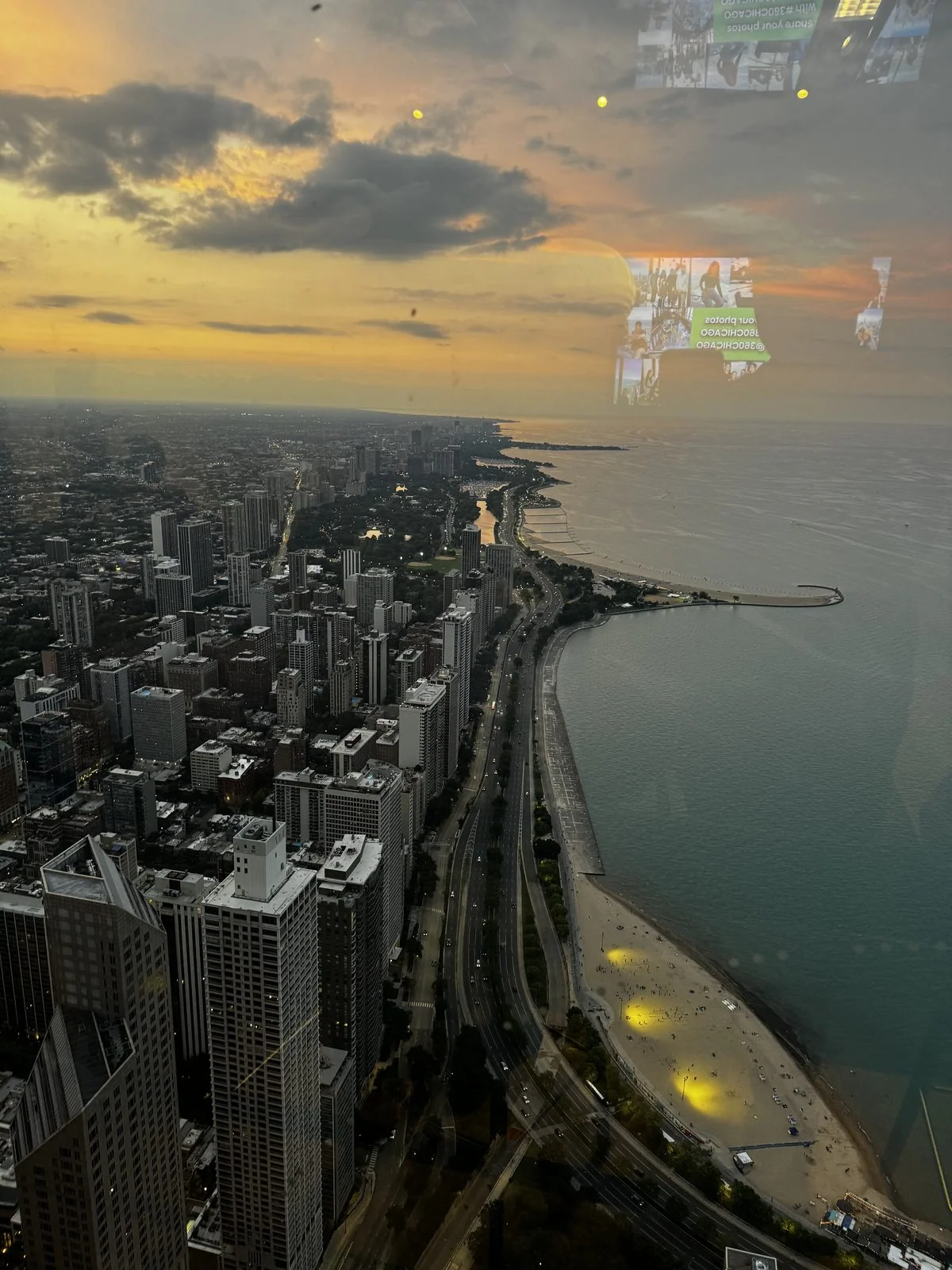
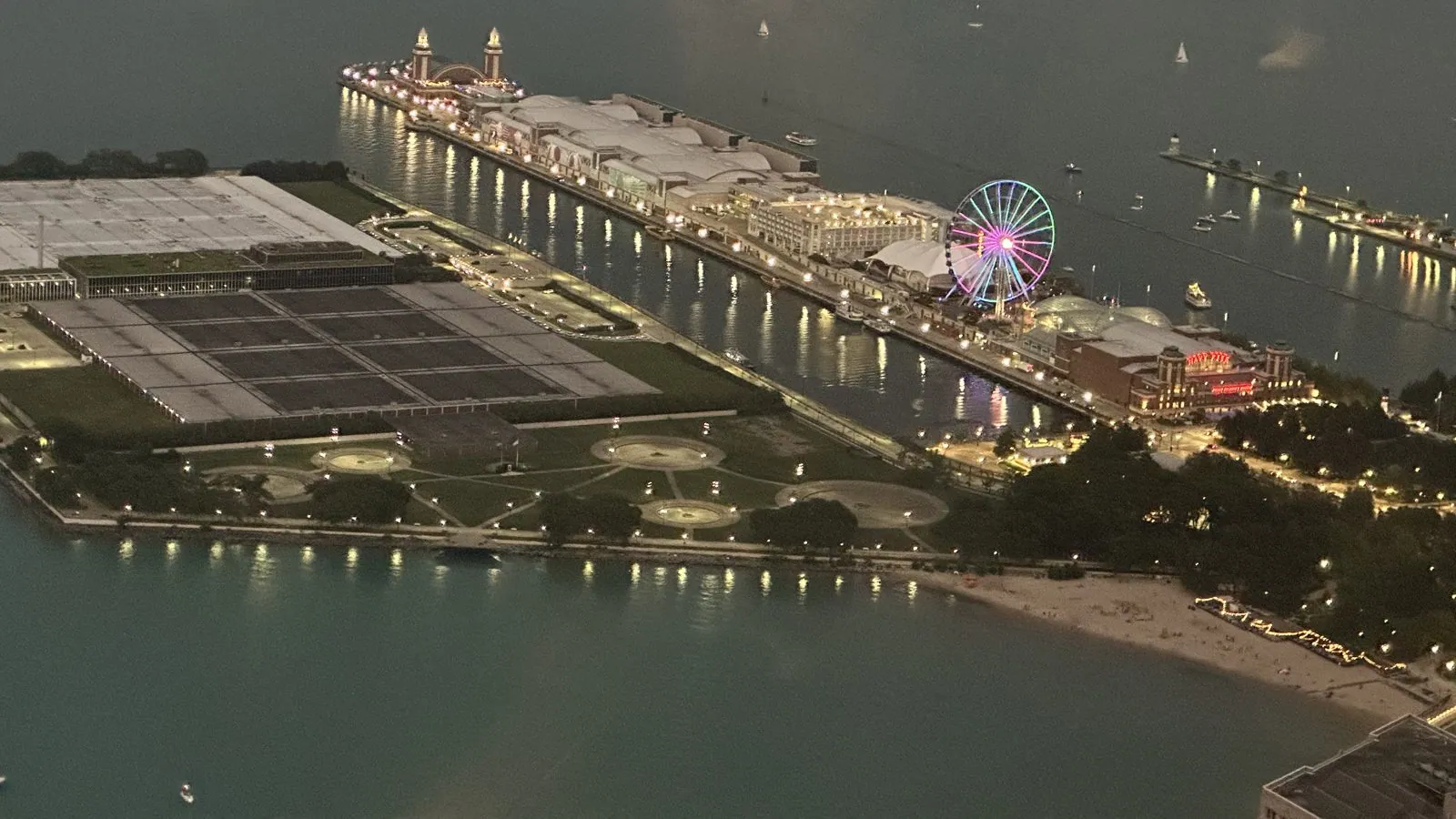
Westward, the grid of the city switched on, light by light, all the way to the horizon. Chicago is famously flat, and from up here it is obvious: the grid simply keeps going until it dissolves into the haze.
Wisconsin, and back
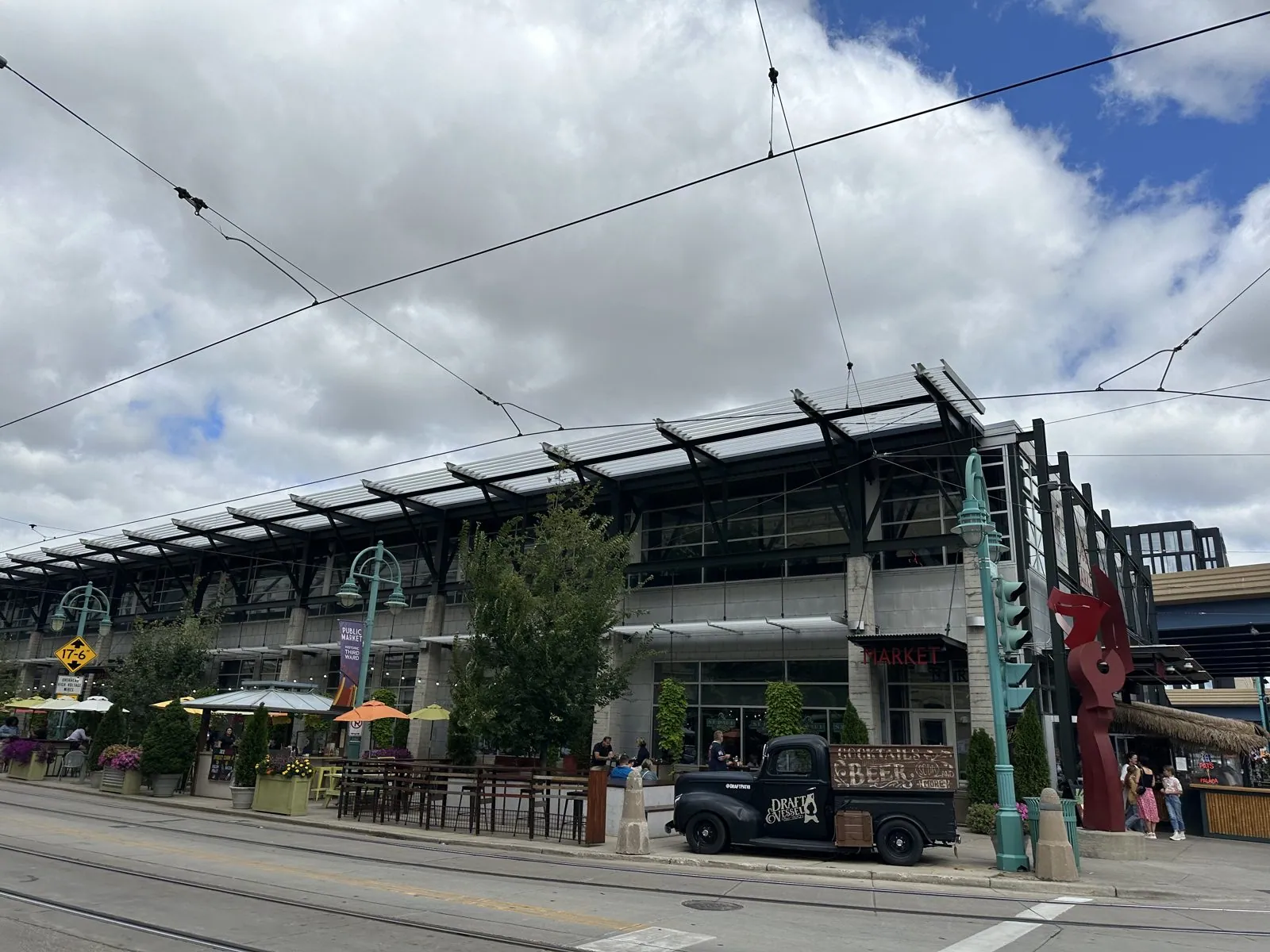
That night we slept just over the Wisconsin line, at a Hampton Inn in Kenosha. The next day we looped north to Milwaukee, where a modern streetcar runs downtown under its overhead wires and where we stocked up on cheese.
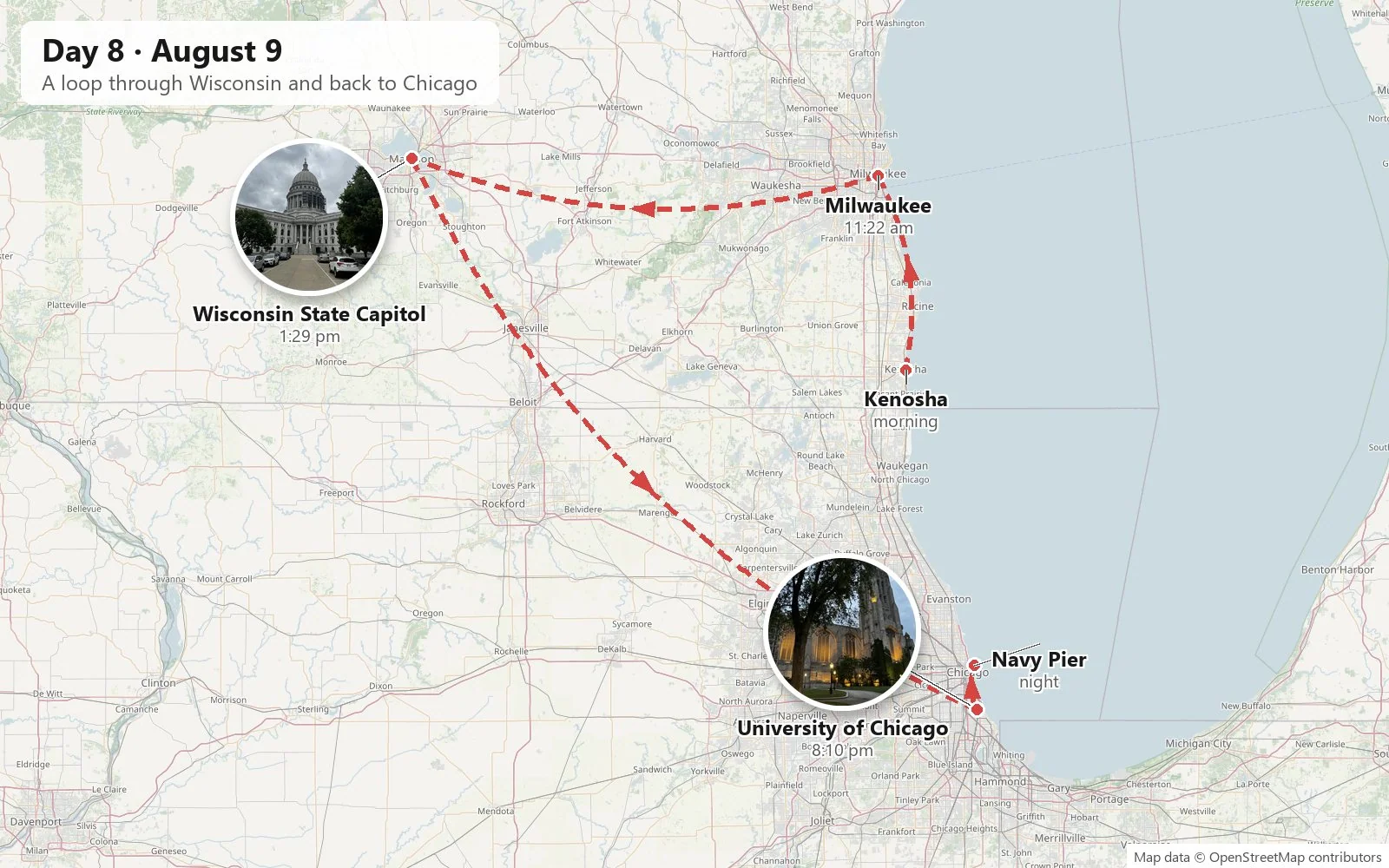
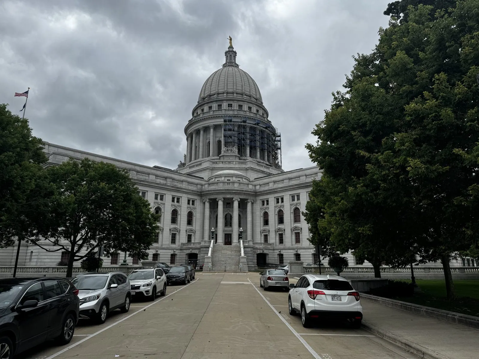
From there we went on to Madison. Madison sits on a narrow isthmus between two lakes, Mendota and Monona. Its white granite capitol stands at the top of the isthmus, and the city has long limited the height of buildings around it so that every street seems to aim at its dome.
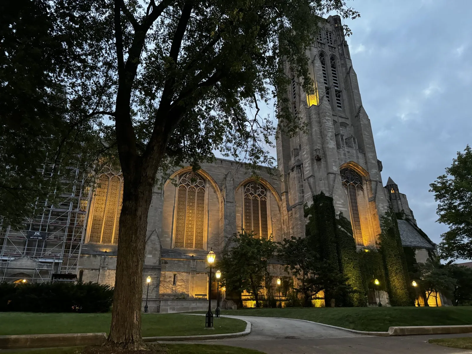
Back in Chicago we found Hunan food in Chinatown, and we got to Hyde Park in time to see a Gothic chapel lit up at dusk on the University of Chicago campus, its stone glowing gold from floodlights in the trees. That night we slept at Sable at Navy Pier (it's in the hotels post). The window that night looked back across the harbor at the whole lit-up skyline. In the morning, the same window showed white cruise boats tied up below and the lake turned a ridiculous shade of blue.
Chicago, the last morning
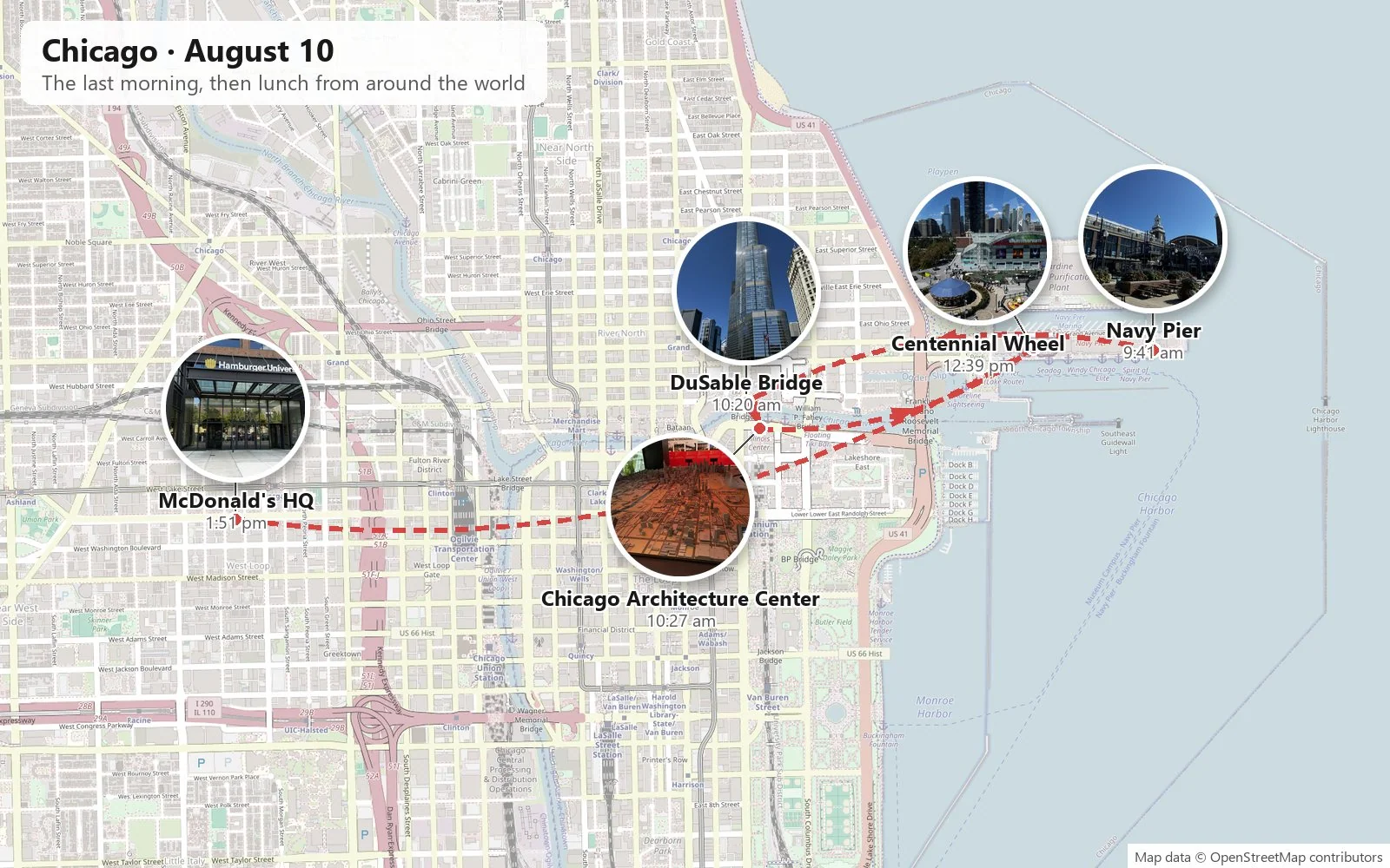
The last morning was the best weather of the trip. Navy Pier was built in 1916 as a shipping pier and has been, over the years, a naval training center, a university campus, and finally an amusement pier. At nine in the morning it was nearly empty. From its end, the whole skyline stands in a row across the water, from Lake Point Tower to the towers of the Loop.
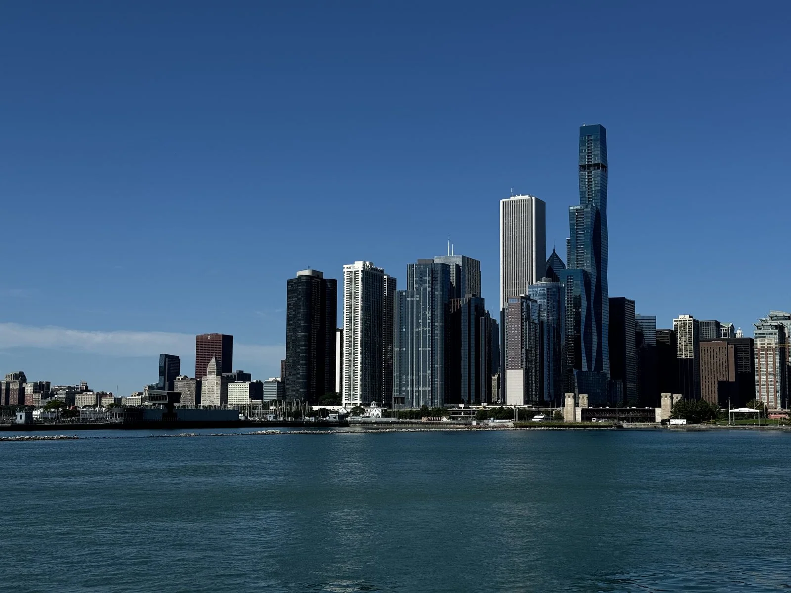
Mornings on the lake are a different city from evenings downtown. The air is cool and clean, the water glitters, joggers and cyclists stream along the lakefront path, and the skyline looks freshly washed, every window catching the low sun from the east.
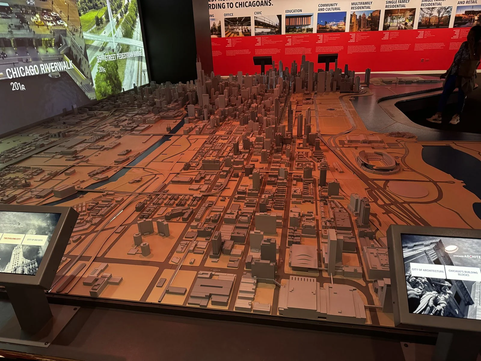
We walked back through Streeterville and down to the river, where the boats were already lining up, and spent an hour at the Chicago Architecture Center. Its scale model of downtown, with a film playing on a big screen behind it, is worth the trip on its own. It contains thousands of buildings, and you can stand over it and find the street you just walked down.
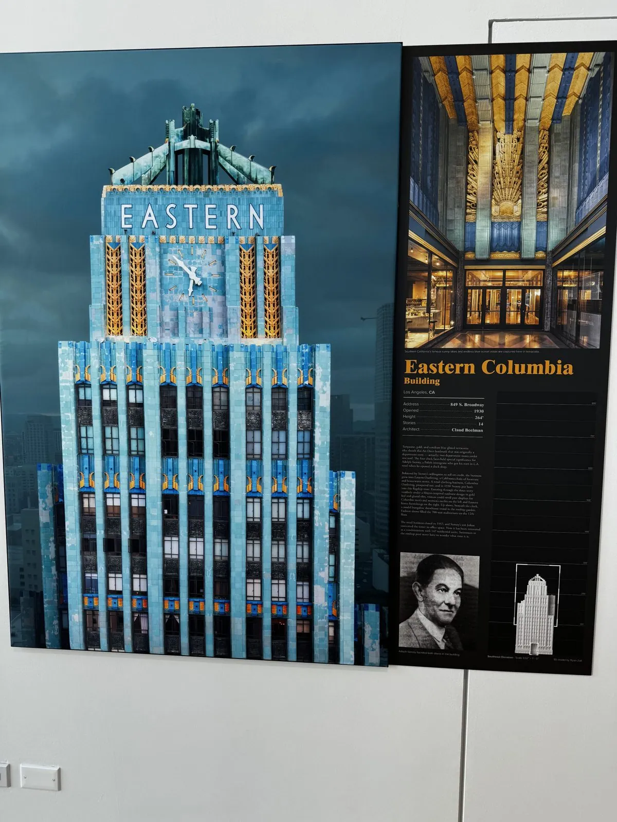
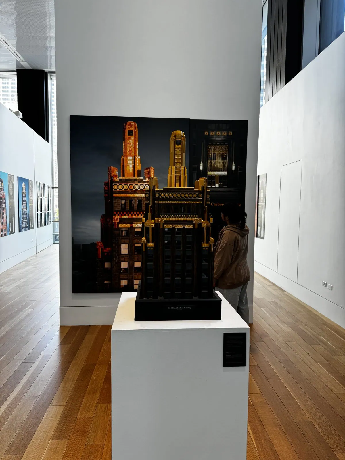
Upstairs, a gallery of skyscraper portraits included a nod to home: Los Angeles's Eastern Columbia Building, the turquoise-and-gold Art Deco tower on Broadway, built in 1930 as a clothing store and now lofts. There was also a black-and-gold model of the Carbide & Carbon Building on Michigan Avenue. It was designed in 1929 by the sons of Daniel Burnham, and legend says it was meant to look like a champagne bottle, with dark green terra-cotta for the glass and gold leaf for the foil at the top.
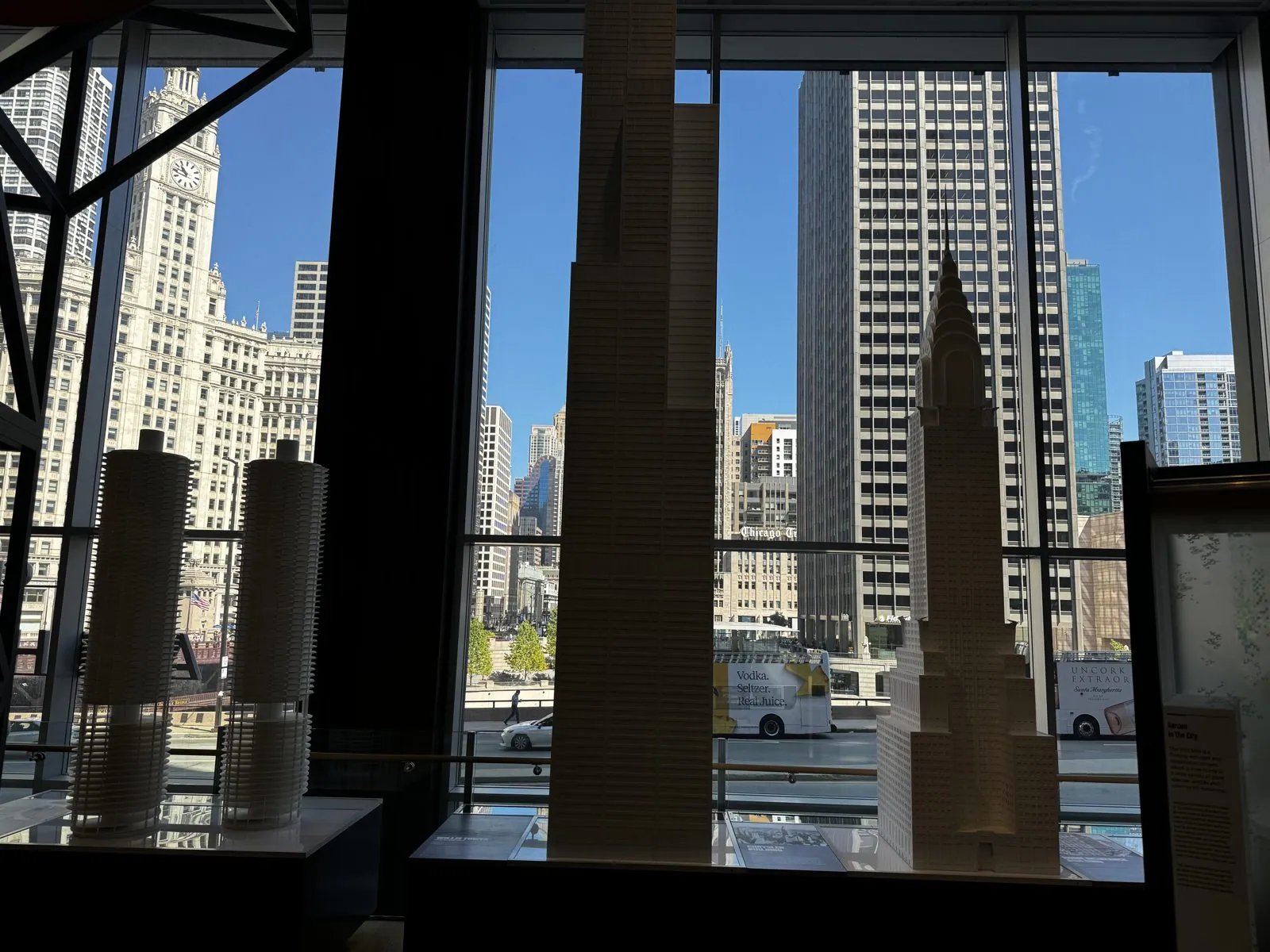
Finally, a row of white models of the world's tallest towers stood in front of a window that looks straight out at the real Wrigley Building, as if the models and the city were having a conversation.
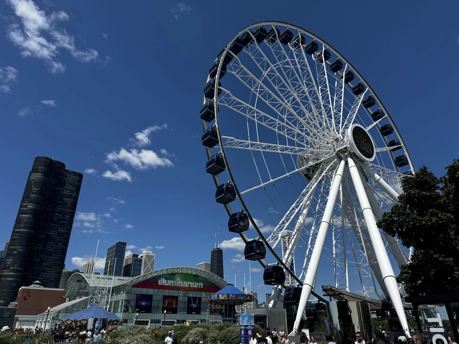
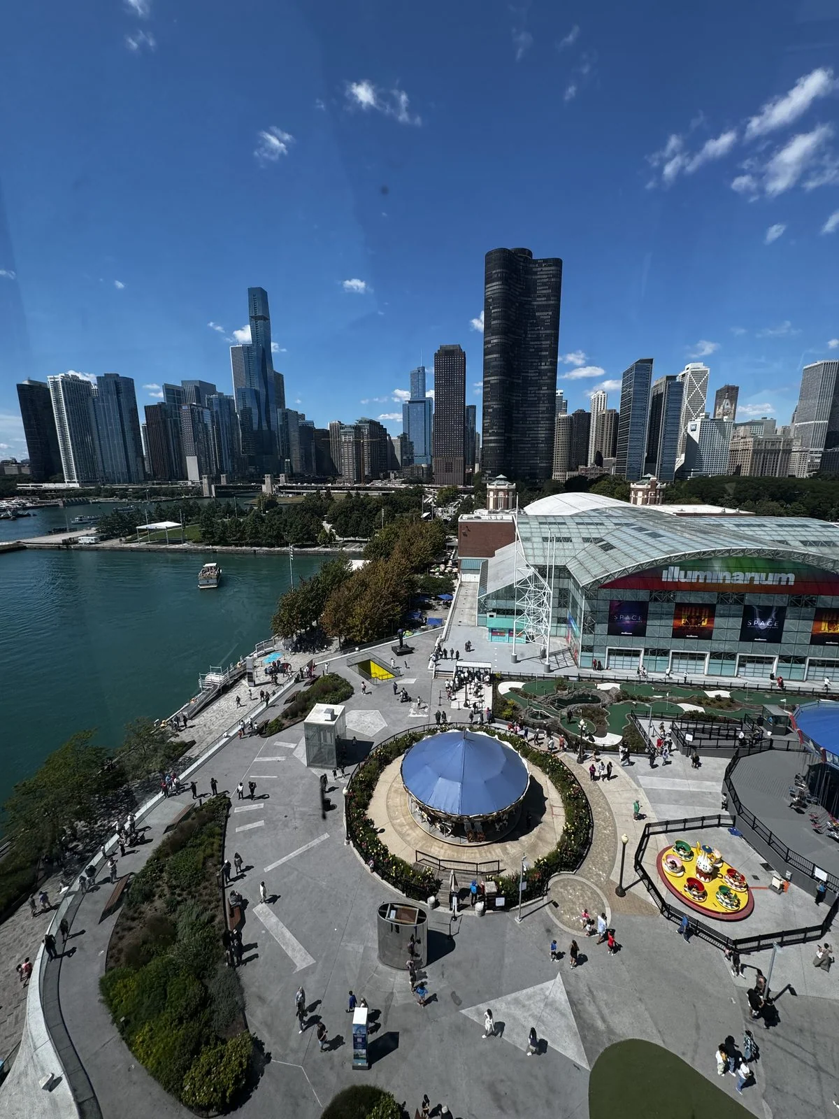
Back at the pier, we rode the Centennial Wheel at Navy Pier, two hundred feet up. Below were the carousel and the pier's long roofs; to one side stood Lake Point Tower, the only skyscraper east of Lake Shore Drive; and the whole skyline fit in a single frame. The original Ferris wheel was invented for Chicago's 1893 World's Fair as the city's answer to the Eiffel Tower, so a Ferris wheel here is a kind of homecoming.
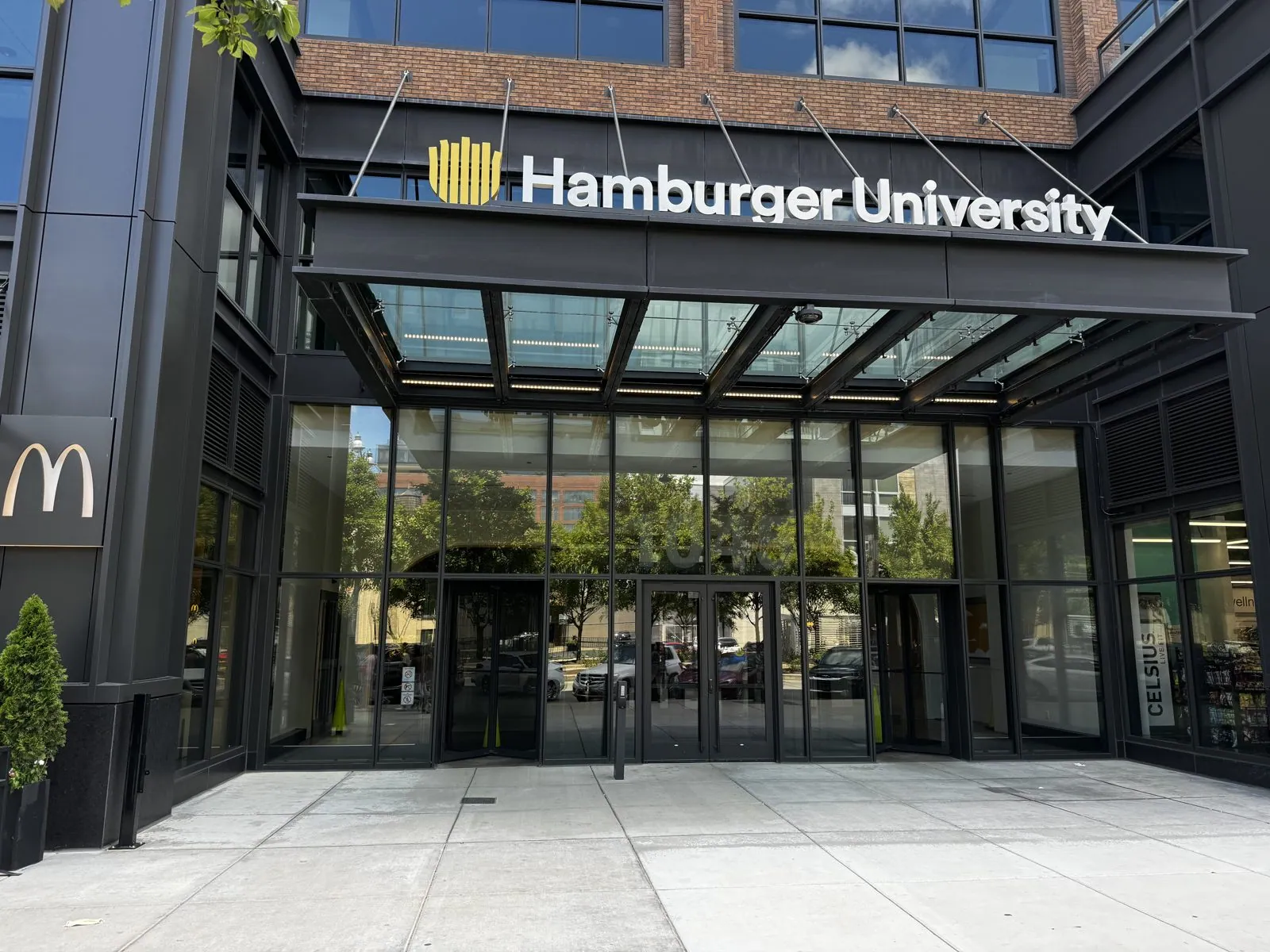
And finally, lunch, at McDonald's headquarters in the West Loop. The company moved its head office here in 2018, into the old meatpacking district of Fulton Market, now a neighborhood of tech offices and restaurants. The building houses Hamburger University, the company's training center for managers, founded in 1961 in a restaurant basement, and yes, it really is called that. But the reason to come is on the ground floor. The McDonald's there serves a rotating selection of items from its menus around the world, alongside the usual American ones. You can't get them anywhere else in the country, and for one lunch you can order across continents from the same counter. I ordered from the Hong Kong menu and from a European country's menu, which is as close as this trip came to leaving the United States. It was a fittingly strange last meal for the city where the modern McDonald's began: Ray Kroc's first franchise opened in Des Plaines, just outside Chicago, in 1955. If the trip had a capital, it was Chicago.
Act II: The teleport
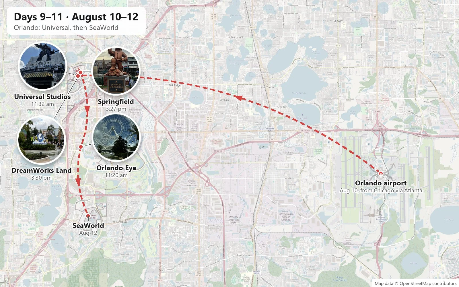
Here's where we cheated, and I'd do it again. The middle of the country is vast, our vacation days were not, and we wanted to end somewhere warm and improbable. So we turned in the car and flew from Chicago to Orlando, connecting through Atlanta without leaving the terminal, and stayed two nights in Orlando, doing the exact opposite of a road trip: standing in one place, riding things, and having a wonderful time.
Stepping out of the airport in Orlando after Chicago is like walking into a sauna fully dressed. The air in August is hot, thick and wet, the sky is a hazy white-blue, and by midday the clouds start to pile up into towers that will become thunderstorms by three o'clock. Everything is green and growing, the palms rattle in a warm wind, and every building is air-conditioned to the temperature of a refrigerator, so your sunglasses fog up every time you walk outside.
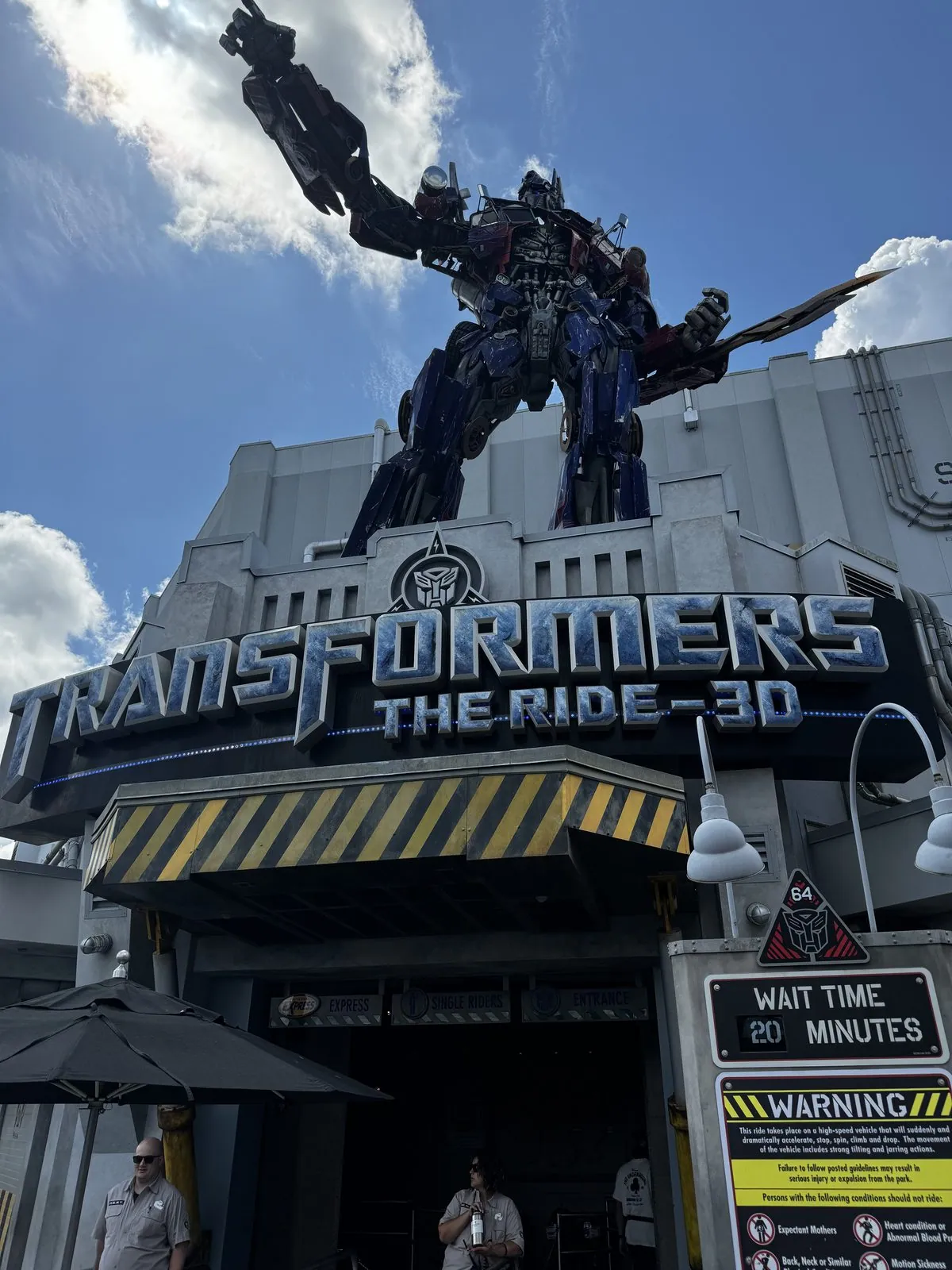
The first day was Universal Studios. Optimus Prime towers over the entrance to Transformers: The Ride 3D, which had a twenty-minute wait, practically nothing for August.
Across the park's central lagoon, the Simpsons' Springfield is built as a walk-through version of the cartoon town, and it is funnier than it has any right to be. Jebediah Springfield, the town's founder, stands on his plinth in his coonskin hat. Chief Wiggum holds a donut beside his squad car. The Lard Lad Donuts statue looms over the street, and a wall-sized mural shows what seems like every character the show has ever had, hundreds of yellow faces in a crowd. We ate at Krusty Burger, had a drink at Flaming Moe's, and came out of the Kwik-E-Mart with souvenirs.
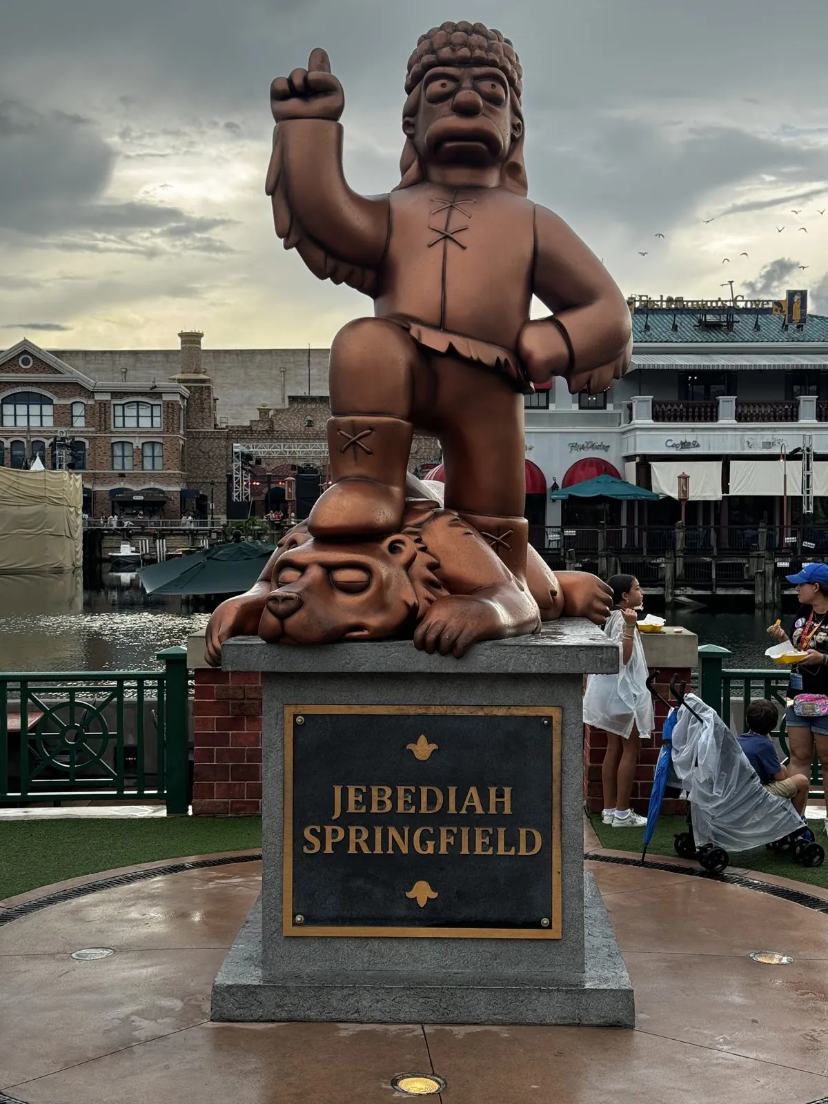
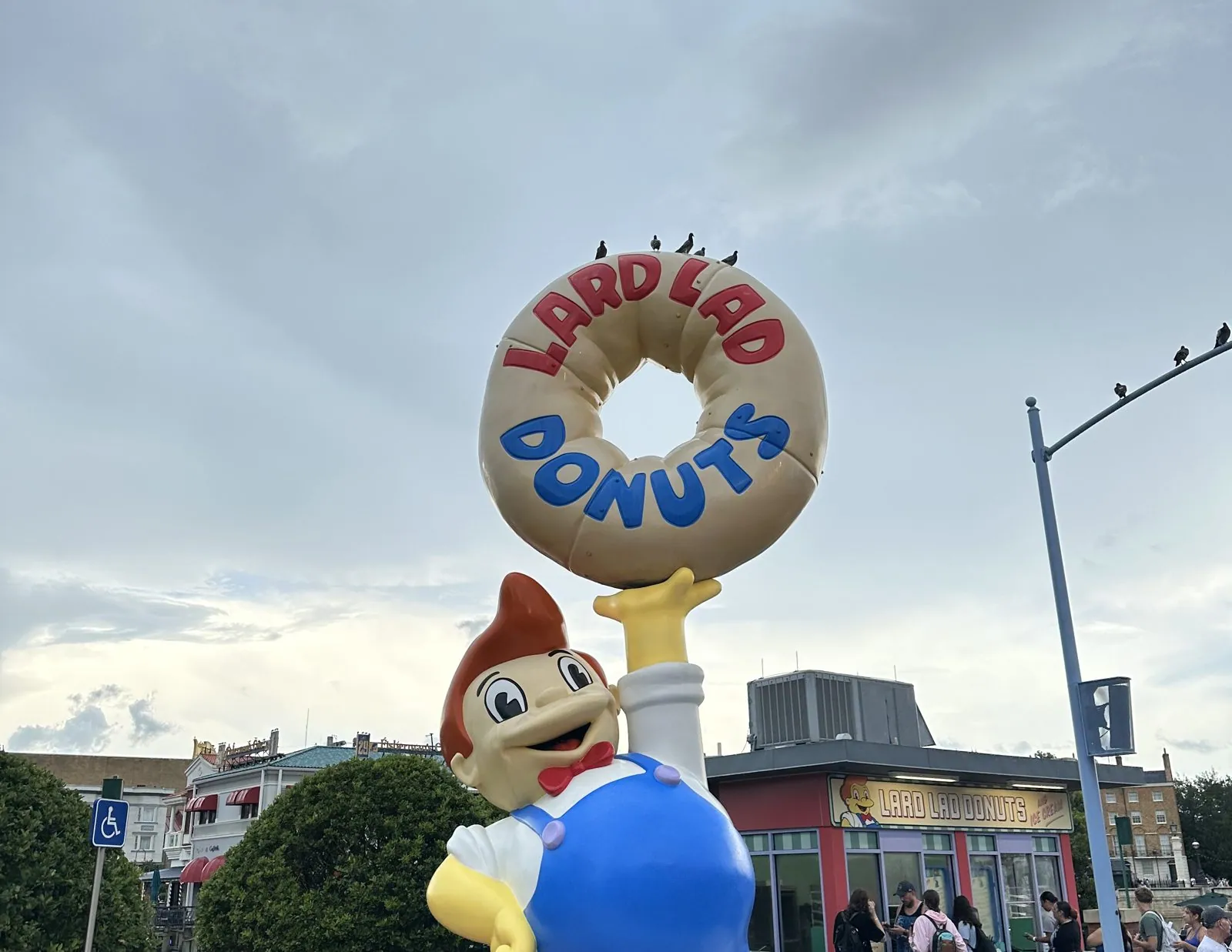
In the afternoon came the classic Florida summer rain shower, the kind that empties the paths in thirty seconds and is gone in twenty minutes. It left the pavement shining and the air even thicker than before. After it passed, we wandered into the new DreamWorks Land, which had opened only that summer, and right next to it the E.T. Adventure, one of the last rides still running from the park's opening day in 1990, under a sky that couldn't decide.
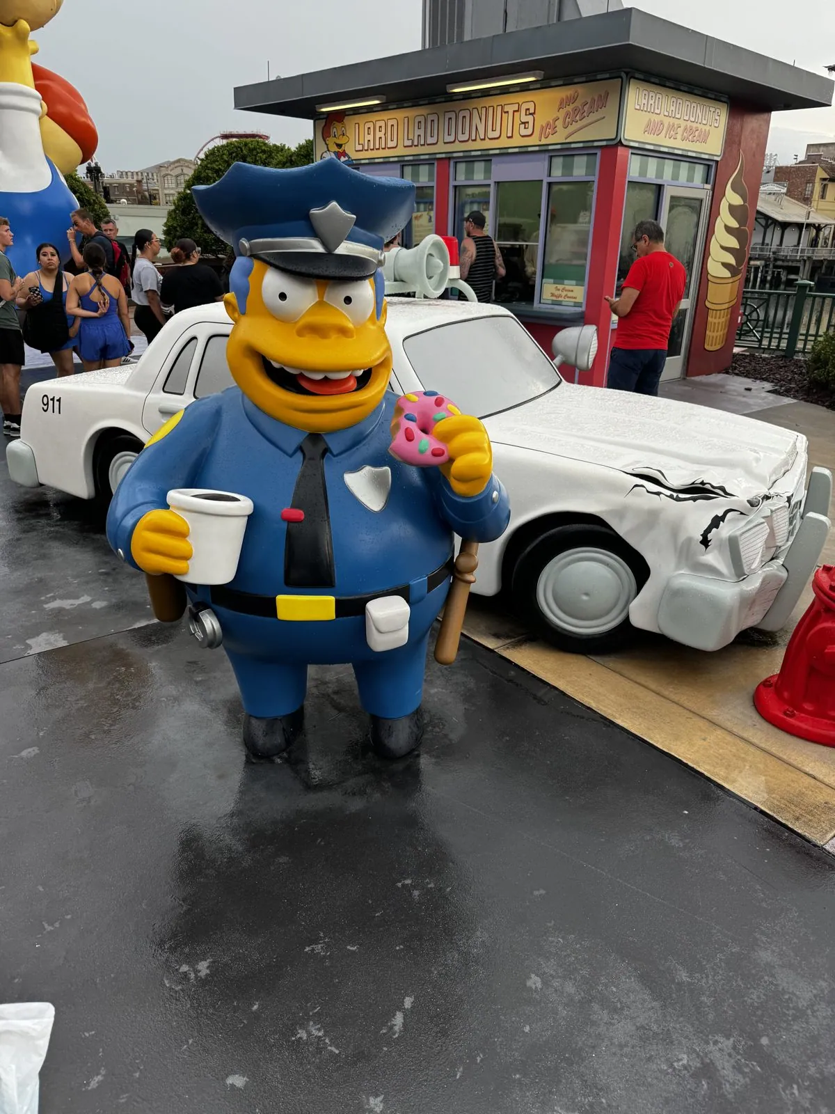
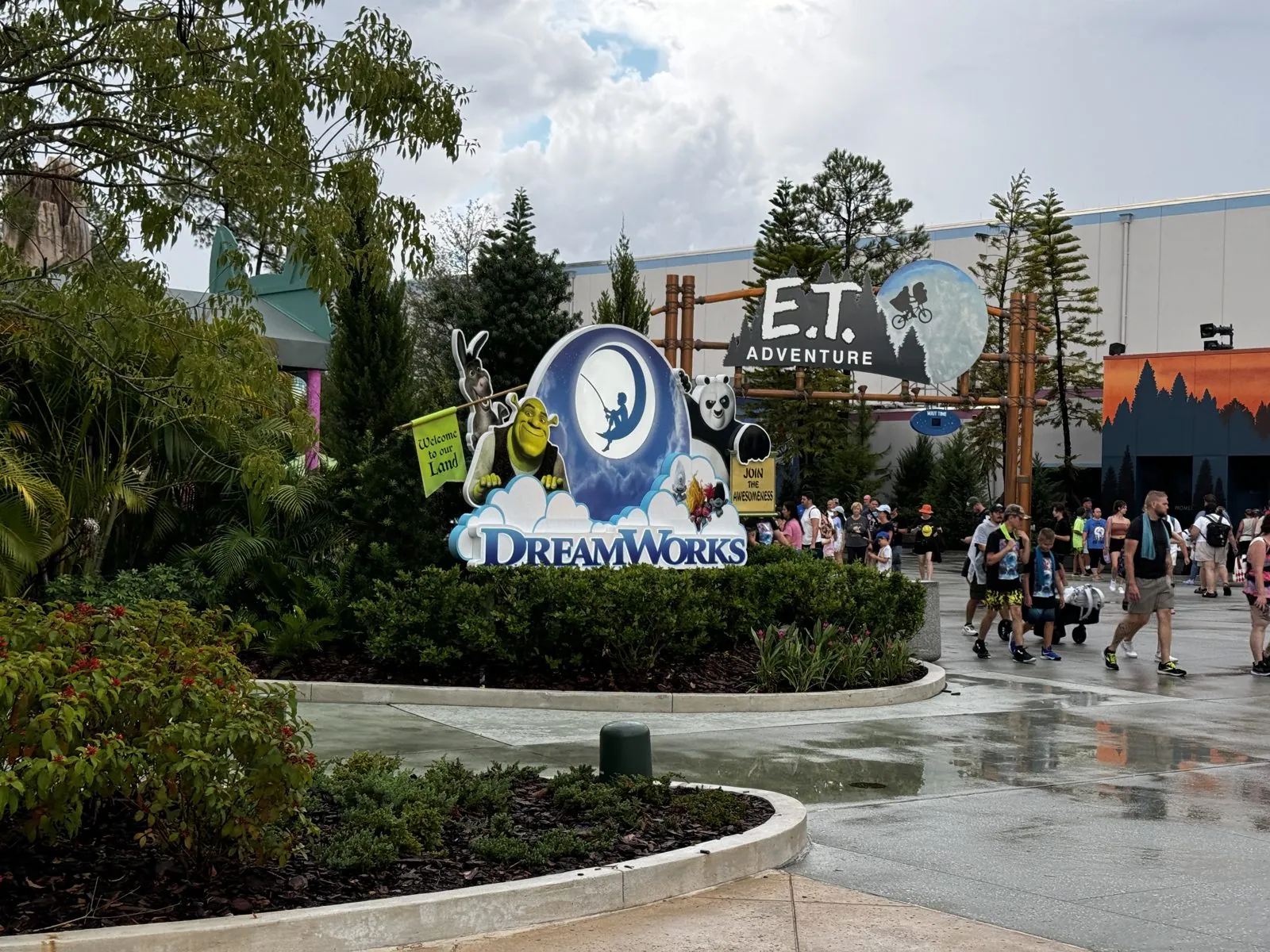
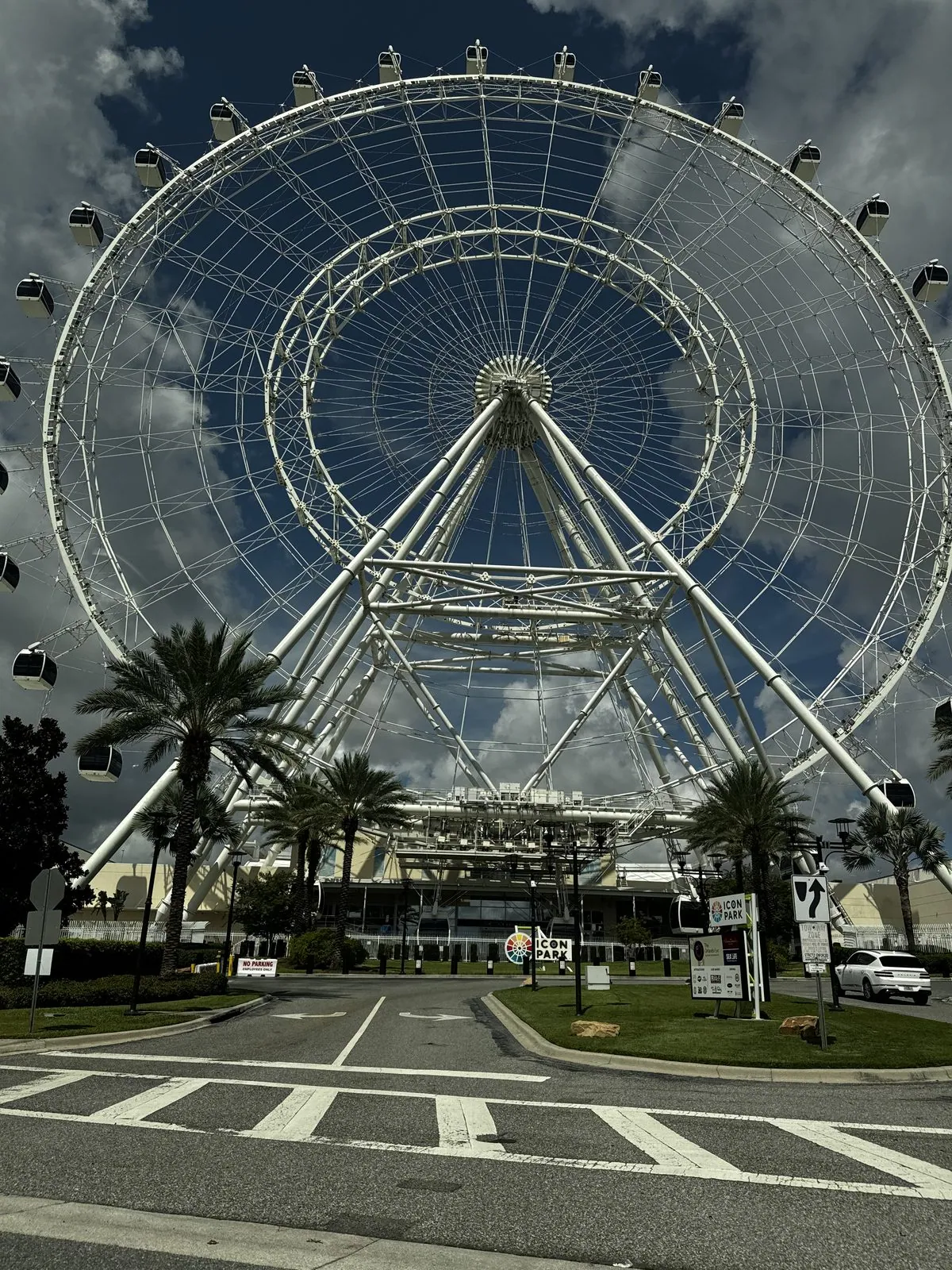
The second day was SeaWorld, by way of the Orlando Eye on International Drive in the morning. It is a four-hundred-foot observation wheel, its big white rim framed by palm trees against storm clouds building up for the afternoon. My camera roll is nearly silent about SeaWorld itself, which says something about how busy the day was; my wife's has a handful of videos from the afternoon.
Act III: The end of the road
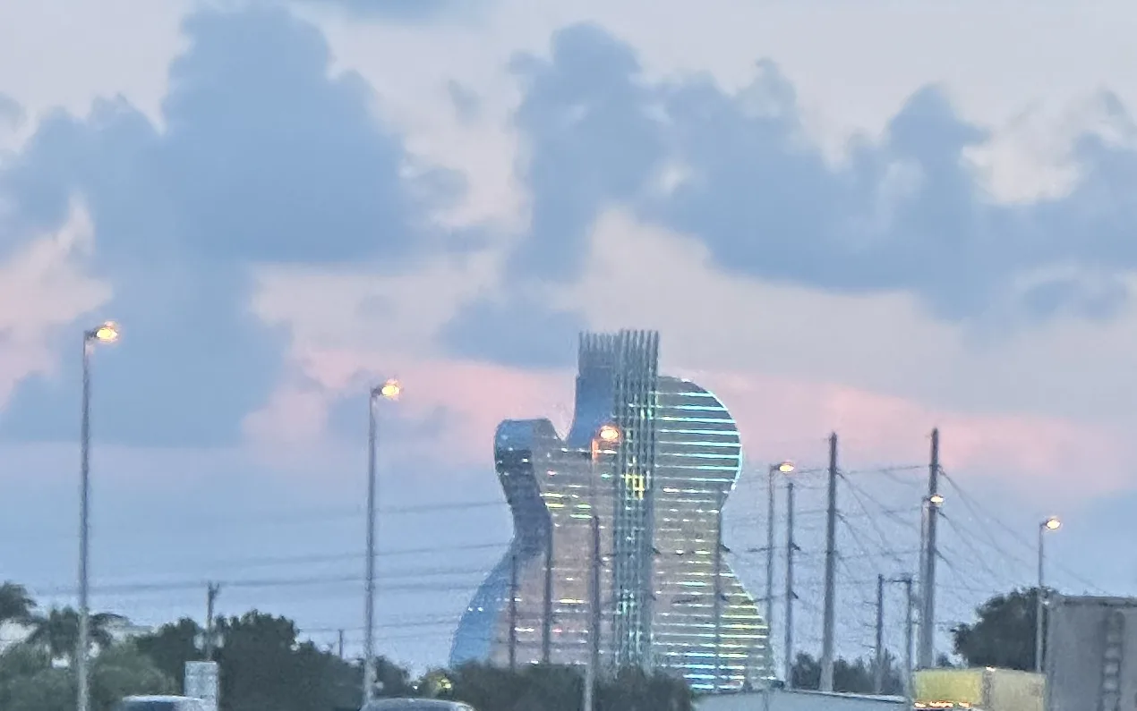
After SeaWorld we drove south into the humidity. Around eight, near Hollywood, the Seminole Hard Rock's Guitar Hotel appeared beside the highway, its glass lit in stripes against a pink sky. We spent the night near Fort Lauderdale.
The next morning took us through Miami Beach and across the causeway to downtown Miami, where a statue of Simón Bolívar stands in the heat. Then we went out onto the Overseas Highway.
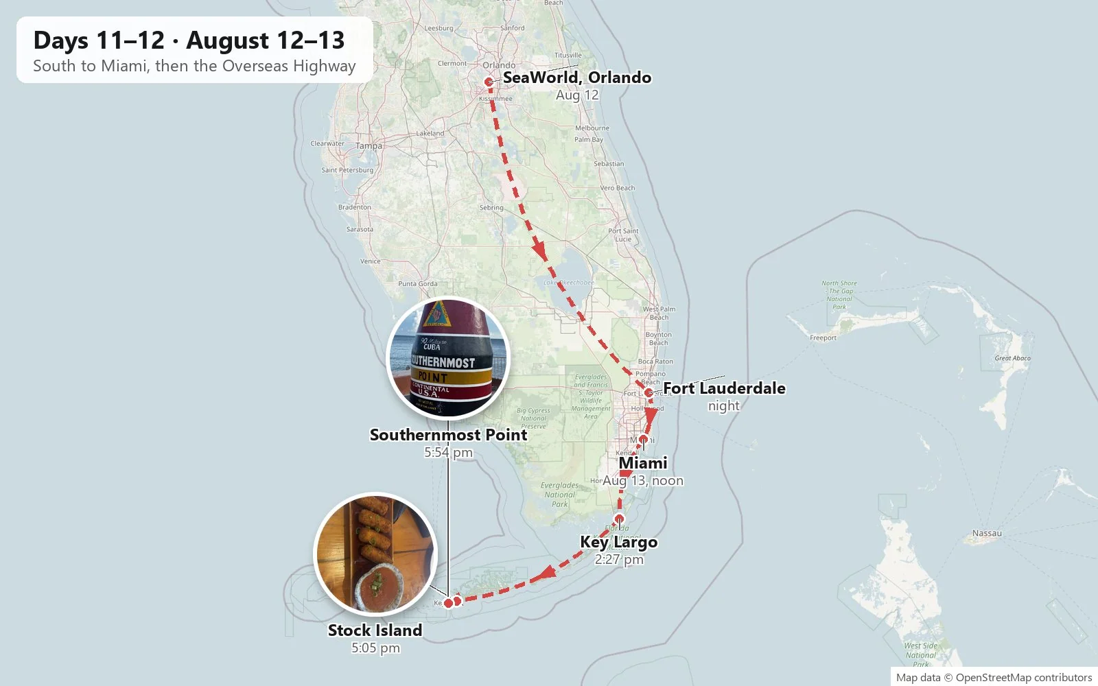
The Overseas Highway is the ribbon of US-1 that island-hops for 113 miles across the ocean, through Key Largo and down the chain of the Florida Keys to Key West. It has forty-two bridges, the longest of them the Seven Mile Bridge. Much of it is built on the bones of Henry Flagler's Overseas Railroad, an extravagant engineering project finished in 1912 that was wrecked by the Labor Day hurricane of 1935. The state bought what was left and turned the railbed into a road. For long stretches there is water on both sides and nothing else: the Gulf and Florida Bay on the right, the Atlantic on the left, both the same unreal turquoise, with the old railway bridges running alongside, rusting and broken.
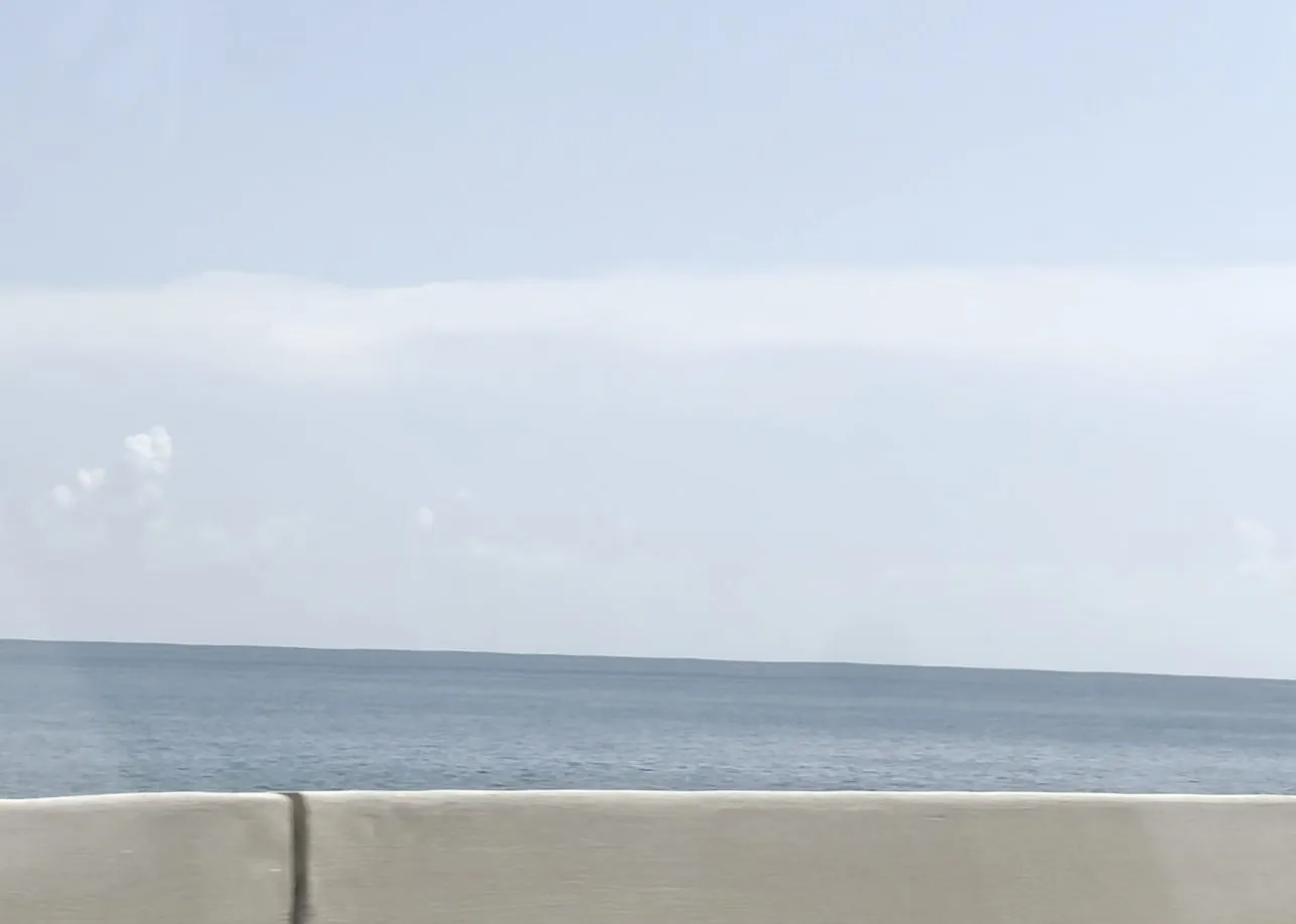
Driving it is like nothing else on the trip. After Key Largo the land narrows until the islands are just wide enough for the road, a few palm trees and a bait shop, and then even that falls away and you are on a bridge with nothing but water to the horizon on either side. The color of the water changes with the depth and the light: pale jade over the sandbanks, deep blue in the channels, almost white where the sun hits it. Clouds float low and flat-bottomed over the sea, each one casting its own patch of shadow on the water. If ever a road called for the windows down, it is this one: the air smells of salt and warm asphalt. The mile markers count down from over a hundred toward zero, and zero is Key West.
Key West
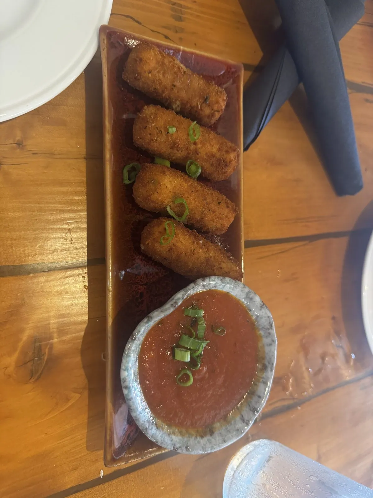
We stopped for croquetas on Stock Island just before the last bridge, a plate of golden fried rolls with a cup of sauce, and reached the end of the road at six in the evening. We had started near the top of the East Coast and driven, more or less, to the bottom of it.
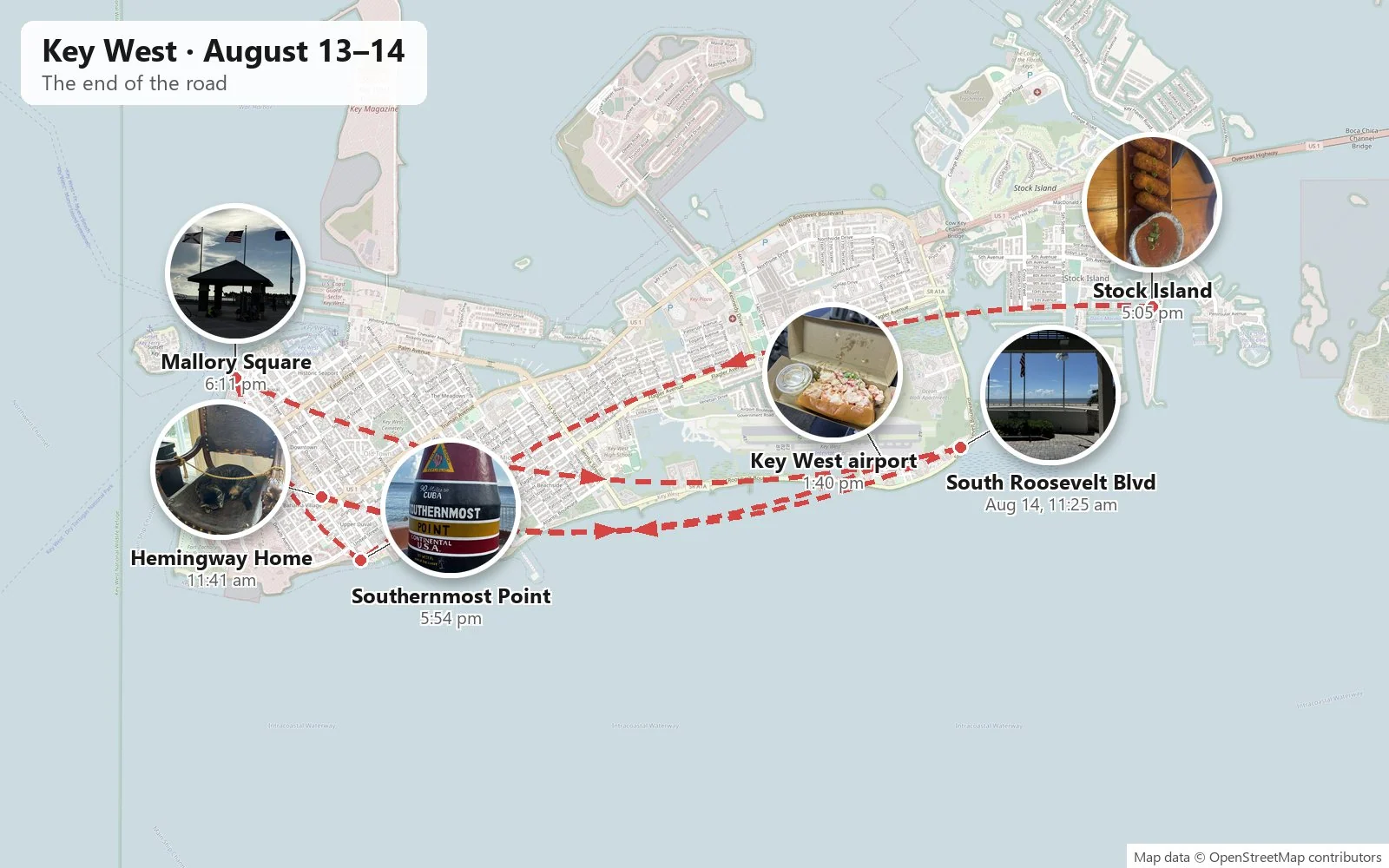
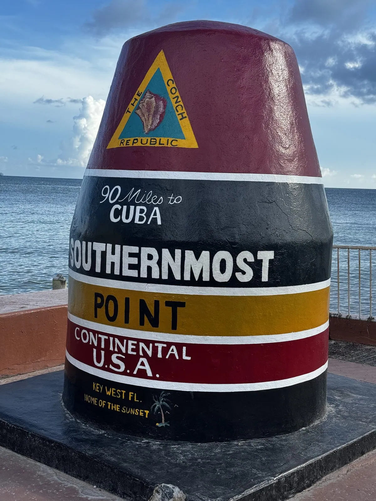
There's a buoy there, striped red, black and yellow and painted "90 miles to Cuba", that marks the southernmost point of the continental U.S. It isn't actually a buoy, and it isn't technically the southernmost point: that is a little further along, on a navy base you aren't allowed into. It is a giant concrete marker the city put up in 1983 after people kept stealing the signs. None of that matters. We took the photo. Everyone takes the photo. The line to do it can run half an hour.
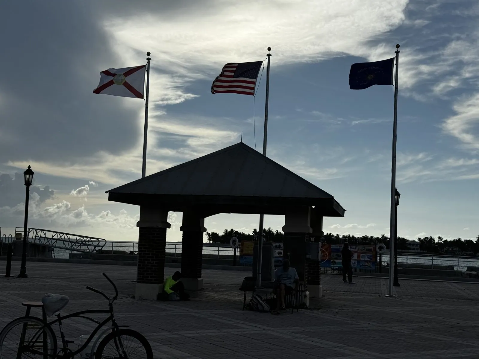
Key West itself feels like a small town that happens to be on the edge of the world. The streets are lined with wooden houses with tin roofs and wide porches, shaded by huge trees; chickens wander freely across the sidewalks; and bicycles outnumber cars. The heat softens toward evening, the light turns golden, and the whole town starts drifting toward the water. Then we went on to Mallory Square on the harbor, Key West's traditional sunset spot, where every evening a crowd gathers with street performers to applaud the sun going down. The flags were snapping in the wind, and the sky over the Gulf was going gray and gold.
The last morning was a slow one. We drove along the beach on South Roosevelt Boulevard and then went to the Ernest Hemingway Home, a Spanish Colonial house where Hemingway lived through most of the 1930s and wrote some of his best-known work. It is, functionally, a cat sanctuary with a famous author's furniture in it. Around sixty cats live there, many of them six-toed descendants of a polydactyl cat named Snow White that a ship's captain gave Hemingway.
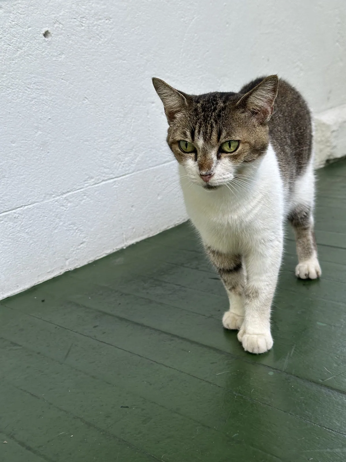
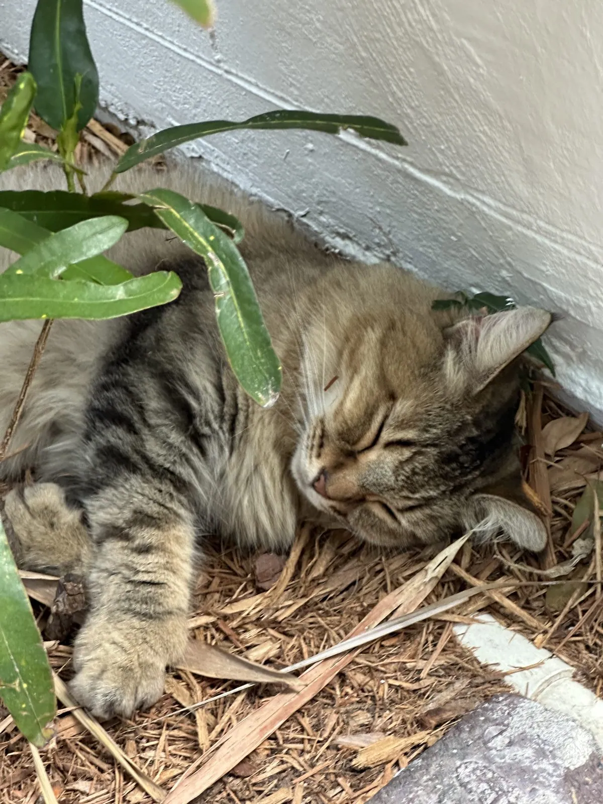
Inside, the house is cool and dim after the glare of the street, with high ceilings, tall windows and dark carved Spanish furniture. Out the windows the garden is a tangle of palms and tropical plants, and somewhere beyond it is the brick wall Hemingway built around the property to keep out curious visitors. Now the visitors are let in, and it is the cats who seem to be in charge.
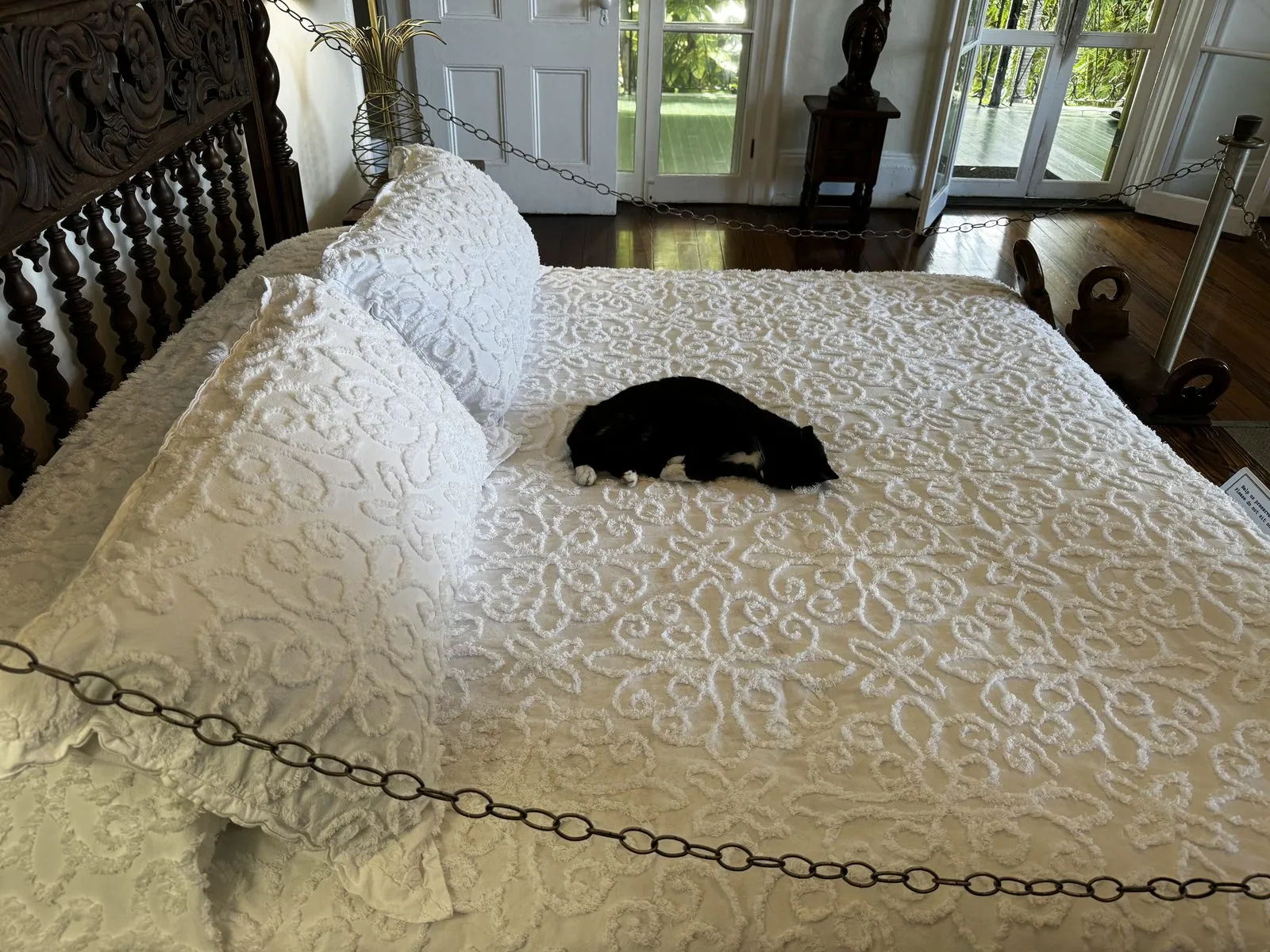
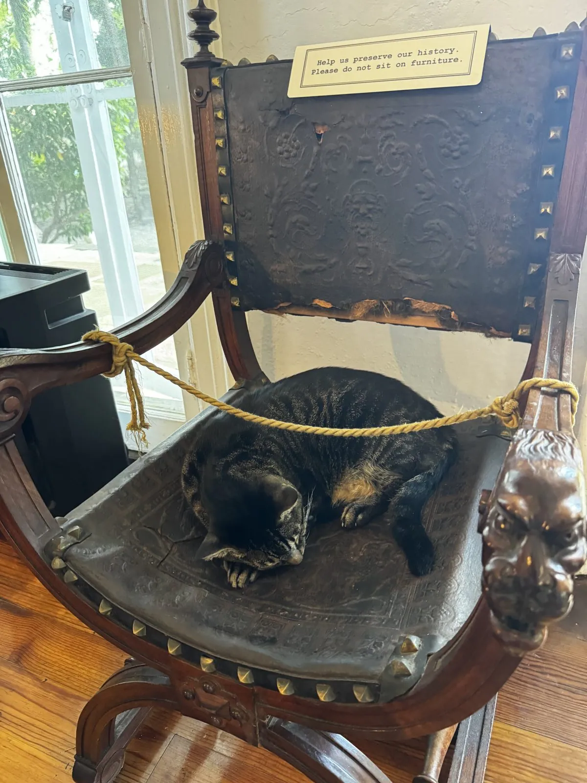
The cats sleep wherever they like, which is mostly on the exhibits. One was curled up on Hemingway's own white bedspread behind a velvet rope. Another was asleep in a carved wooden chair, roped off, beneath a sign politely asking visitors not to sit on the furniture. The sign is clearly meant for humans only.
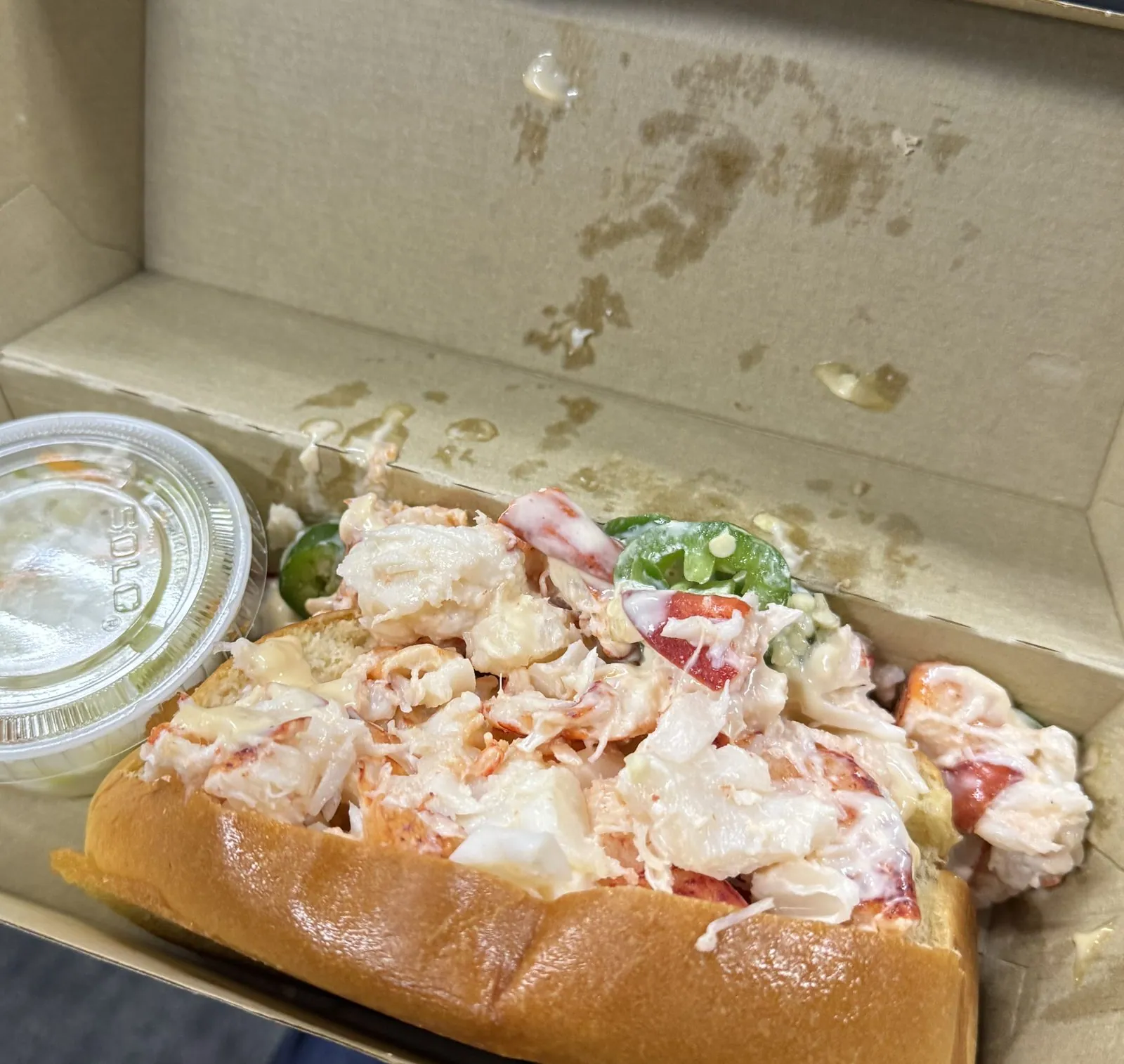
Lunch was a lobster roll at the airport, eaten from a cardboard box, which is a perfectly good way to leave Key West.
An afternoon in Atlanta
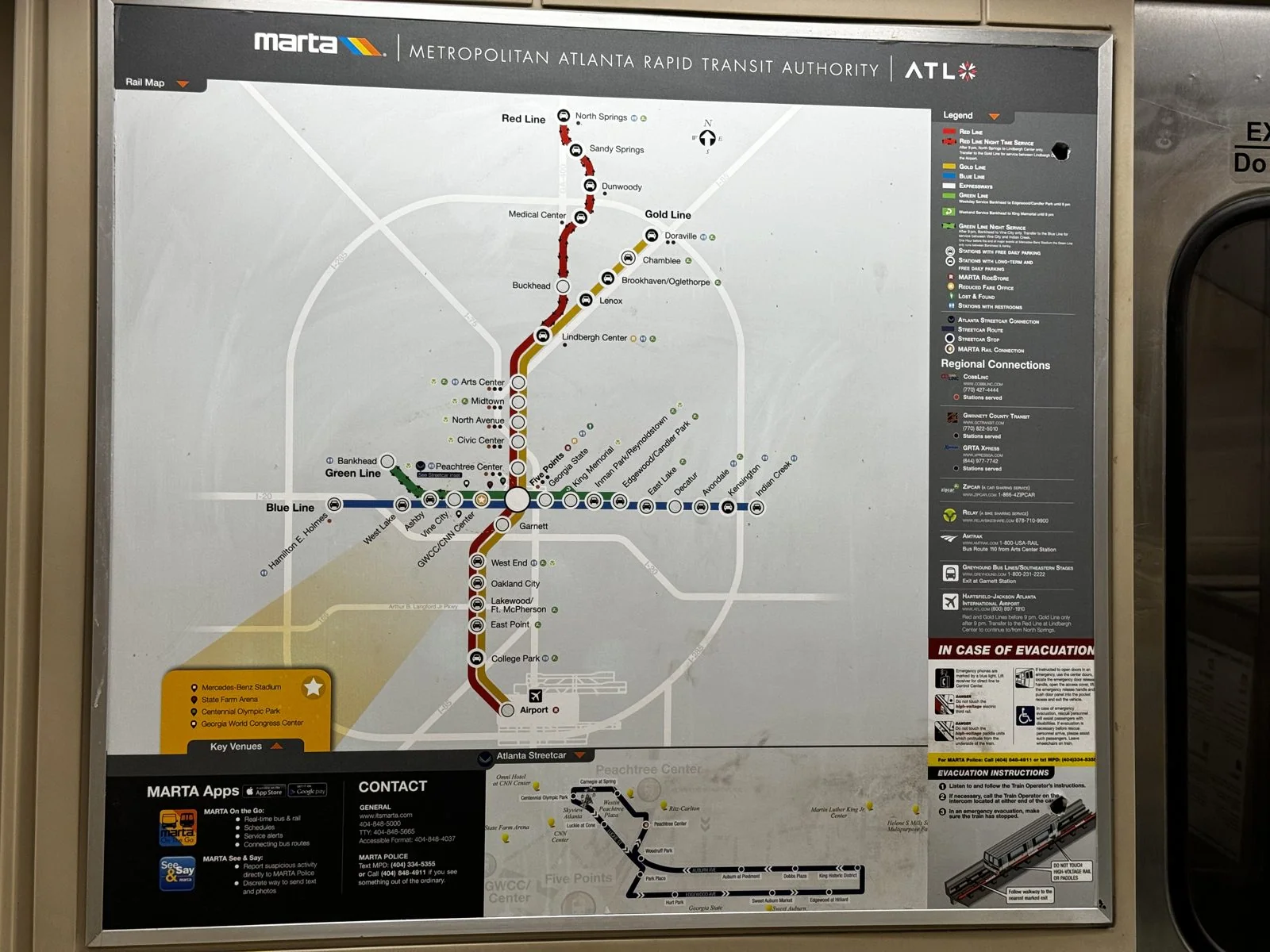
Getting home had one last surprise. We connected through Atlanta again, but this layover ran long enough to do something slightly unhinged. Atlanta's airport, one of the busiest in the world, has its own MARTA station, and the train runs to downtown in about twenty minutes. So we rode MARTA into the city and wandered around Five Points, the historic center where the city's first streets met.
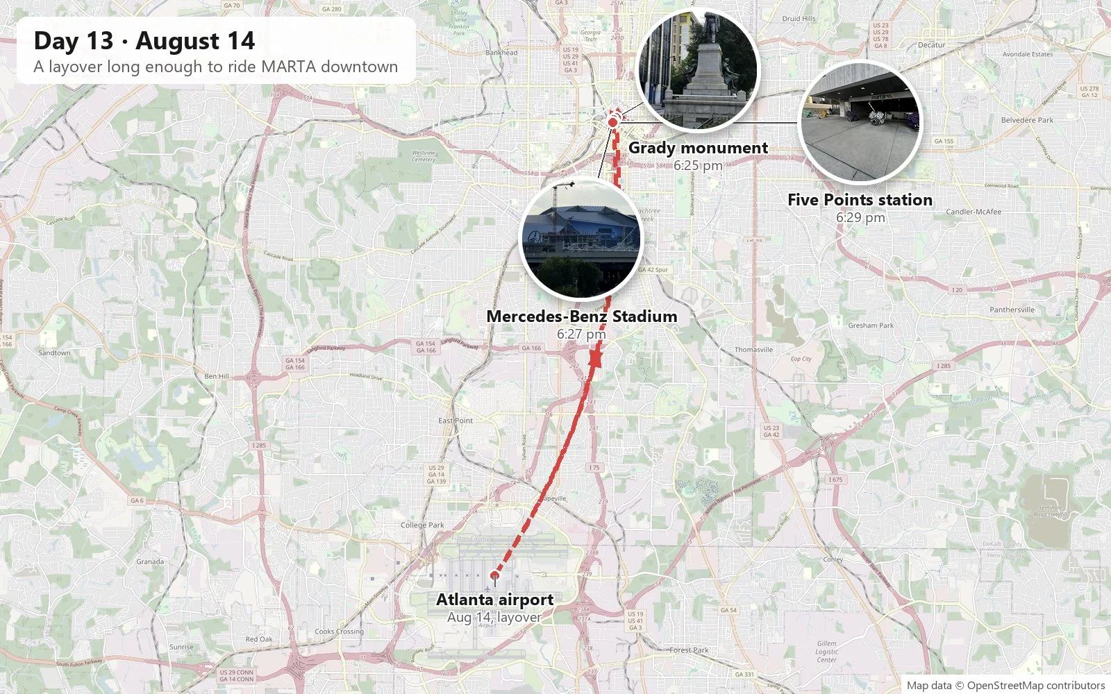
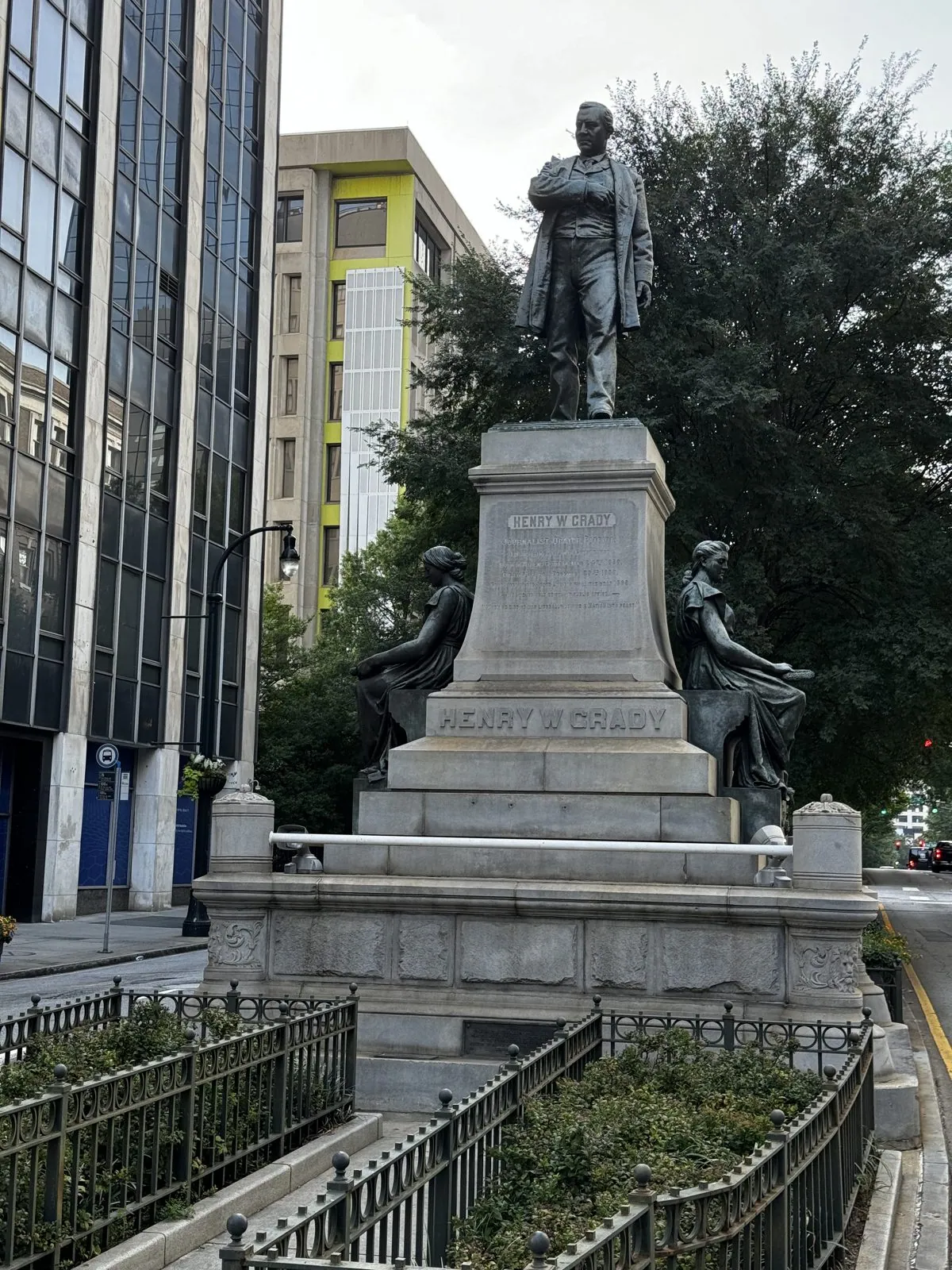
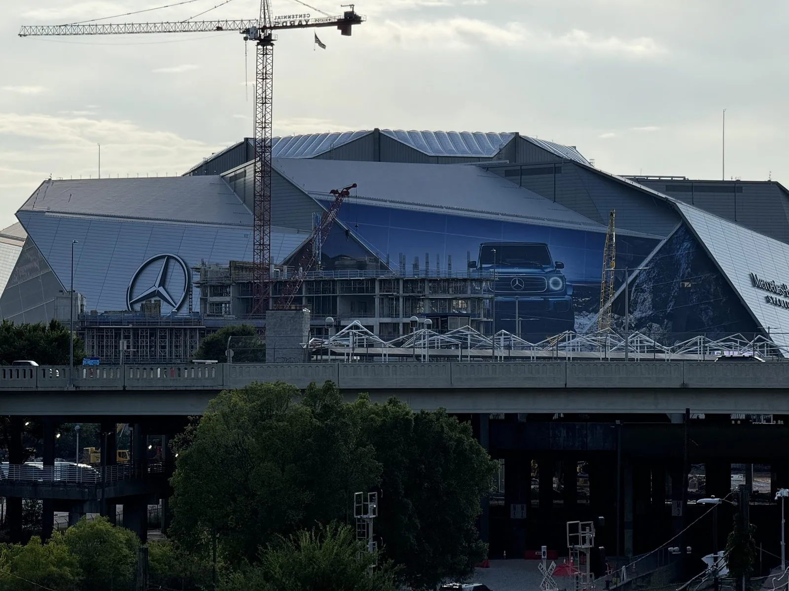
Coming up out of a MARTA station into downtown Atlanta at six in the evening is a strange experience after an airport. Half an hour ago you were in a terminal full of people; now you are standing in a quiet canyon of office towers in the slanting late sun, with streetcar wires overhead, construction fences along the curbs, and the whole city to yourself. It feels like getting away with something. We passed the Henry W. Grady monument, a statue from 1891 of the newspaper editor who promoted the idea of a "New South" after the Civil War. From there we walked past downtown's towers to an overpass and the folded steel-and-glass petals of Mercedes-Benz Stadium, with construction cranes still working around it. The stadium's roof opens like a camera aperture, eight triangular panels sliding outward at once.
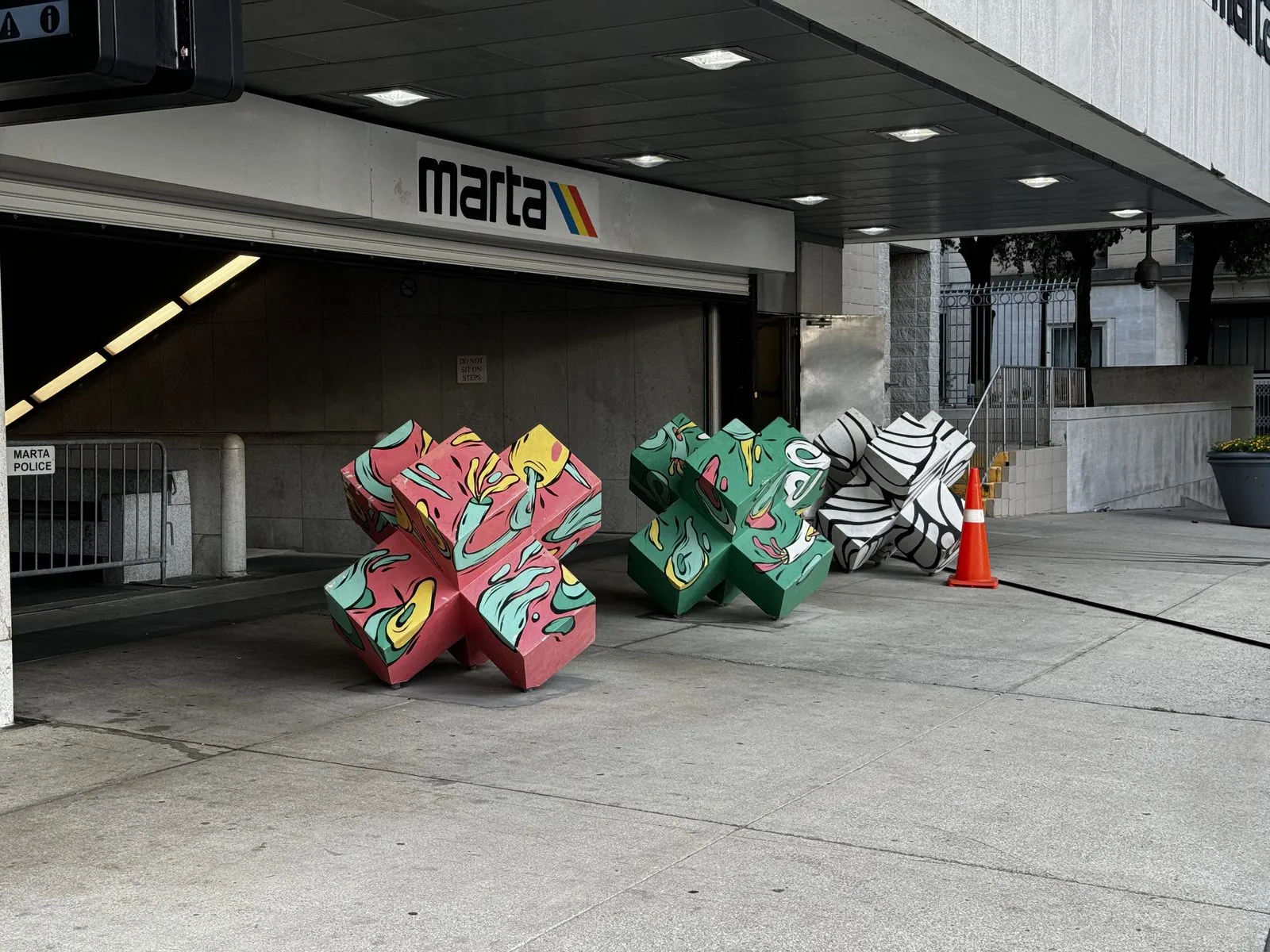
The station entrance at Five Points is decorated with giant painted X-shaped sculptures, which is as good a way as any to mark a spot. Then we rode back in time for the flight home to Los Angeles.
The hedgehog, and the magnets
Every trip needs a mascot, and ours chose himself in Vermont. The hedgehog rode along for two weeks: he posed with a slush in Albany and a matcha sundae in Pittsburgh, was left behind in Cleveland and rescued, and made it all the way home. His story doesn't end there, which is the sad and funny part: months later, on Halloween 2024, he came with us to the San Diego Zoo, and this time we lost him for good. So we did the only reasonable thing. We bought another one, the exact same toy, and pretended nothing had happened.
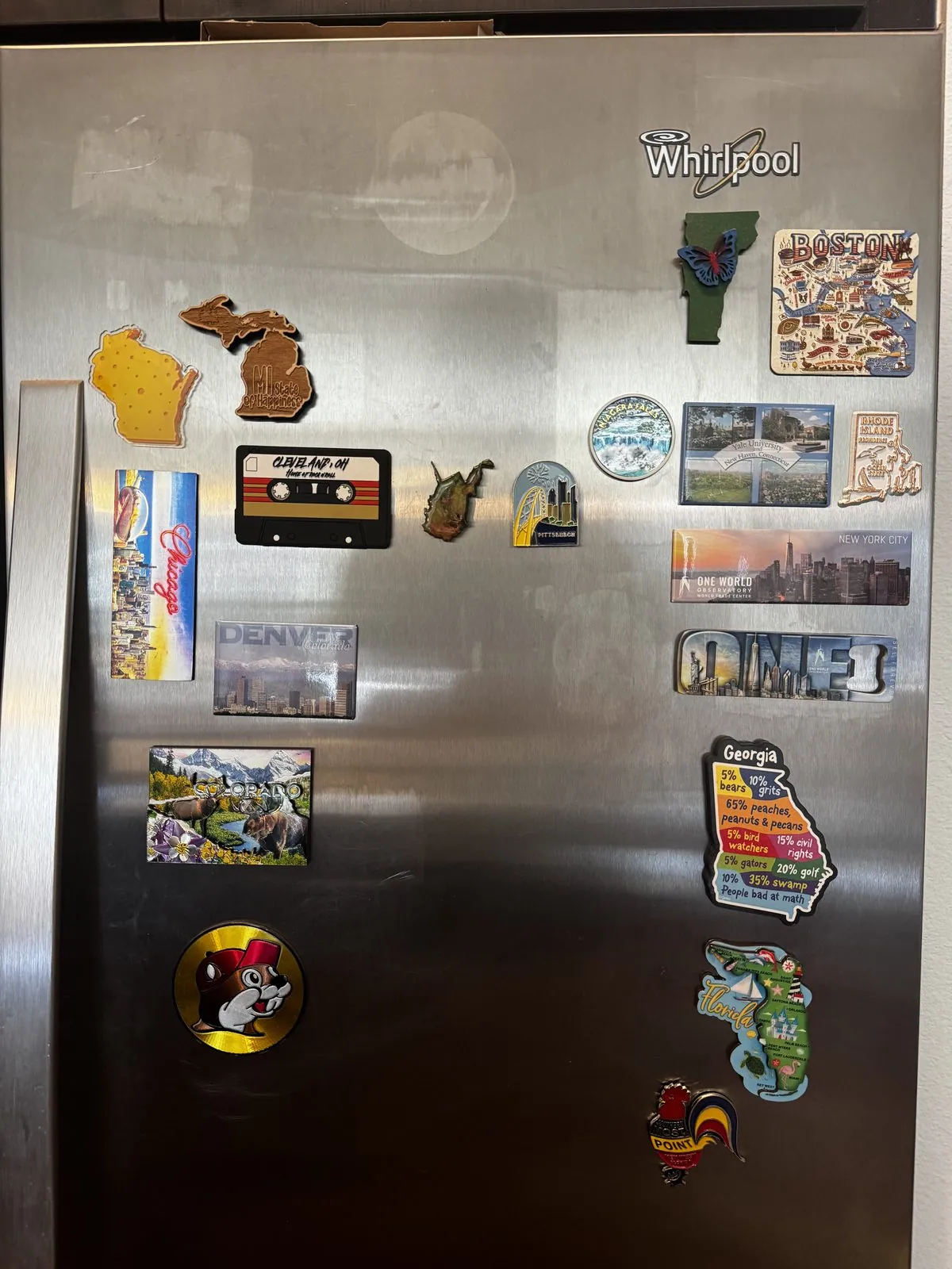
The other souvenir was quieter. At stop after stop we picked up a fridge magnet: cheap, tacky, perfect. They're all on our refrigerator now, a cluttered map of the whole loop that we walk past every morning. There's Vermont, West Virginia from that half-hour in Wheeling, the mitten of Michigan, the shape of Wisconsin, a cassette tape, a little family of Simpsons, and many more, in no particular order, which is how memory works anyway.
Was it worth the hurry?
A city a day is not the way to know a place. It is the way to meet a lot of them. We got a handshake with two dozen towns and a real conversation with maybe three. But the handshakes add up to more than you'd think.
Without ever planning it, we toured ten campuses: Yale, Brown, Harvard, MIT, Syracuse, Pitt, Carnegie Mellon, Ohio State, Case Western and the University of Chicago. Apparently a week at SIGGRAPH doesn't switch that part of the brain off. Seen back to back, they make a little history of American campus architecture. Brown's colonial brick and Syracuse's Victorian stone come first, then Yale's and Pitt's twentieth-century Gothic, and finally Gehry's melting brick and the glass of Carnegie Mellon's student center.
We also saw a remarkable number of state capitols without meaning to: Colorado, Massachusetts, New York, Ohio, Michigan and Wisconsin. That says something about how American cities like to put their best building at the end of the main street. Line them up and you can see a whole national argument about what government should look like. There is Bulfinch's restrained gold dome in Boston, and Albany's French château. Columbus has its domeless Greek temple. Lansing and Denver are Myers's twins, and Madison is a white granite crown on its isthmus. Every one of them was built to say "this place matters", and every one of them, in its own way, does.
The Great Lakes were the other surprise. We saw four of the five in four days: Ontario at Rochester, Erie at Presque Isle and Cleveland, Huron's waters passing Detroit in the river, and Michigan at Michigan City, Chicago and Milwaukee. They are so big that the eye refuses to treat them as lakes. They have beaches, horizons, lighthouses and storms. They also explain the whole region: why the cities are where they are, why the mills were built, and why, when the mills closed, the cities turned back to the water.
Still, some states we saw for an afternoon, and West Virginia we saw for half an hour. People sometimes ask whether that even counts.
I think it does. A few hours in a place is not the same as knowing it, but it is very far from never having been there at all. Before this trip, Wheeling was a name on a map. Now it is a particular street of red-brick storefronts on a bright afternoon, a cone in the road, and a magnet on the fridge. Syracuse is a hill of stone buildings in golden light. Cleveland is a dark sky over a white museum and the moment we realized the hedgehog was missing. None of these is a deep acquaintance, but each one is real, and each one is mine. The difference between "I passed through once" and "I've never been" turns out to be much bigger than the difference between "I passed through once" and "I know it well".
I would happily go back to any of these places for a slower, deeper trip: a week in Chicago, a summer weekend in Vermont doing nothing at all, a proper day at Niagara. I hope I do. But nobody is promised a second chance, and the regret I would least like to have is not "I only had a few hours there". It is "I had the chance, and I didn't go". A hurried visit is enough to rule that one out. The slow trips can come later, if they come at all. The brief ones are the ones you can actually take, and they add up.
And there's something to be said for the blur itself. A trip like this is mostly the in-between: rain on the windshield in Buffalo, the anvil clouds on I-79, a rest stop that sells hedgehogs. By the end we had set foot in fifteen states, thirteen of them by car, and every one of them is now a place rather than a word. Two weeks, one summer, the eastern half of the country out the windshield, and a toy hedgehog on the dashboard. No regrets.
Maps built from the trip's photo timestamps and locations; driving distance is real road mileage. Photo locations have been removed from the published images. Day maps: map data © OpenStreetMap contributors; each stop is placed where its photo was taken, hotels and home are never marked, and the dashed lines show the order of stops, not the exact roads.
Some photos in this post are my wife's.
Likes and comments
React with an emoji or leave a comment. Signing in with GitHub is required.