← Misc · May 2022
Two Road Trips on a Brand-New License
Bay Area campuses and Highway 1, then snow in Yellowstone and the Tetons, all in one May.
Part one: Los Angeles → Berkeley → San Francisco → Stanford → Silicon Valley → Capitola → Highway 1 → Santa Barbara → Los Angeles
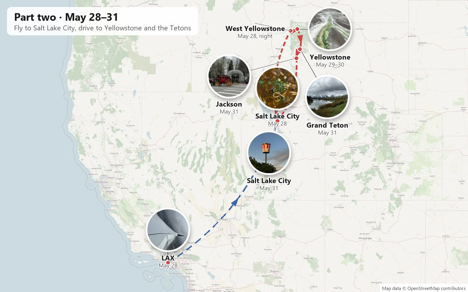
Part two: Los Angeles ✈ Salt Lake City → West Yellowstone → Yellowstone → Grand Teton → Jackson → Salt Lake City
two groups of friends · one new driver at the wheel · five states · two national parks · snow on Memorial Day
On May 11, 2022, I got my driver's license. A license is a small plastic card, but it changes what a map is. Places that used to need someone else's car, or a bus schedule, or a flight, become places you can simply drive to. In Southern California, where nearly everything is a drive away, that is a very big change.
I was, to put it mildly, excited about driving. Six days after I got my license, I was on the road, and I did two road trips that month, each with a different group of friends, with me doing the driving on both. The first was a rental-car loop from Los Angeles up through the Central Valley to the Bay Area. We spent a week among campuses, cable cars and tech headquarters, then came home down the coast on Highway 1. The second, three days later, started with a flight to Salt Lake City and a long drive north into Yellowstone. There a late-May snowstorm was waiting for us.
As with my other trip posts, everything below is reconstructed from the camera roll: the phone's timestamps and locations, lined up in order. Where the photos are silent (there are none at all from May 26 and 27, the two days between the trips), I've left the gap rather than fill it with a guess.
Part one: Bay Area campuses and the coast
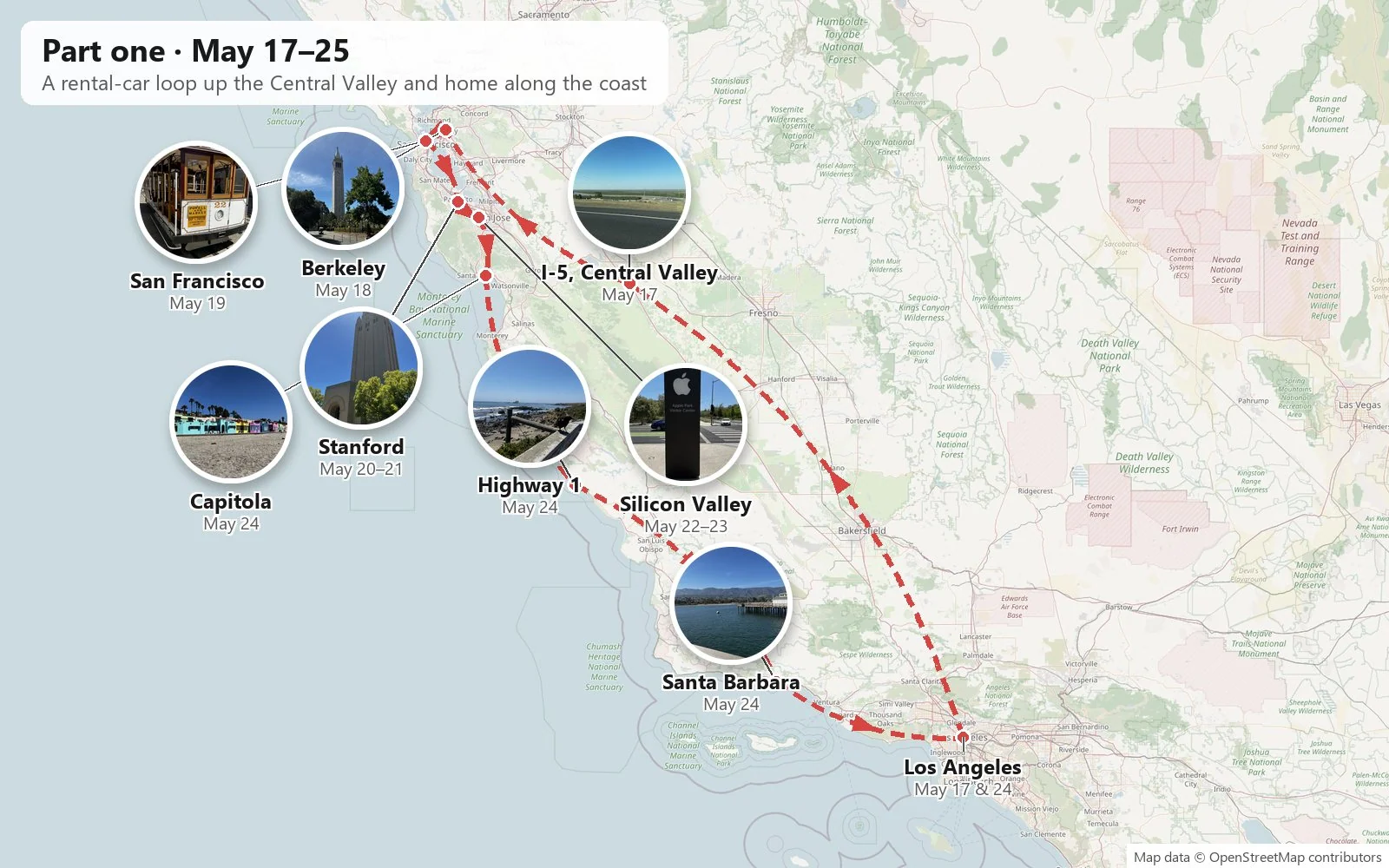
Up the Central Valley
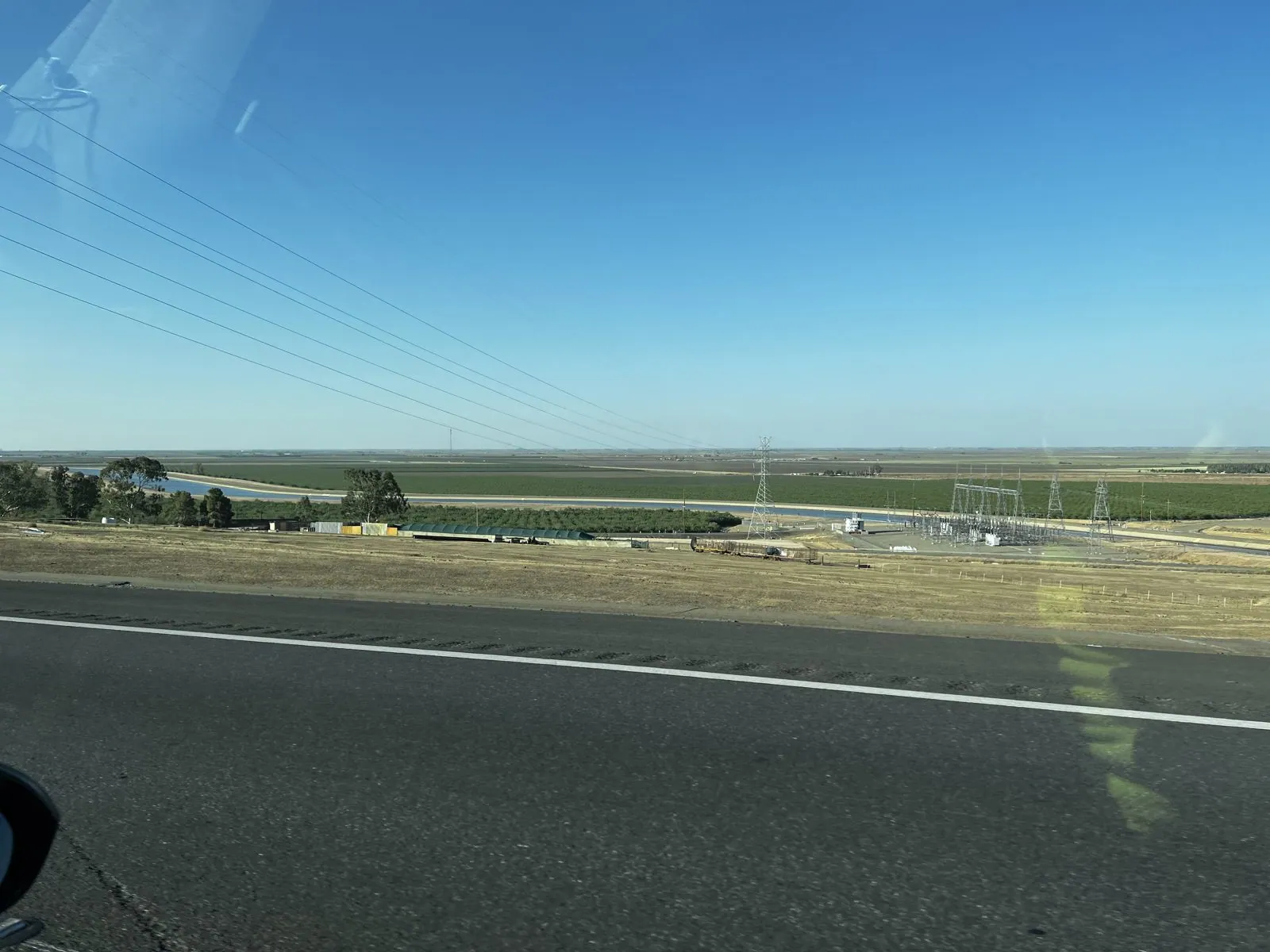
The car was a gray rental sedan, picked up in Los Angeles at a quarter past ten on the morning of Tuesday, May 17. The camera roll opens with the slow, careful walk-around that every new renter learns to do: every scratch and dent photographed, the odometer, the trunk. Then the road. The quickest way from Los Angeles to the Bay Area is Interstate 5, which runs almost ruler-straight up the west side of the Central Valley for some two hundred miles.
It is not a scenic road in the postcard sense. It is something better for a new driver: long, flat, wide and honest, with the Coast Ranges a faint brown line to the west and nothing but orchards and fields to the east. The valley grows a huge share of America's fruit, nuts and vegetables, and from the freeway you see it as endless rows of almond and pistachio trees flicking past like the teeth of a comb. By half past six we were in Merced County with the evening sun still high, and by nine we had reached the East Bay and stopped for the night at the SureStay Plus in Richmond.
Berkeley: Bear Territory
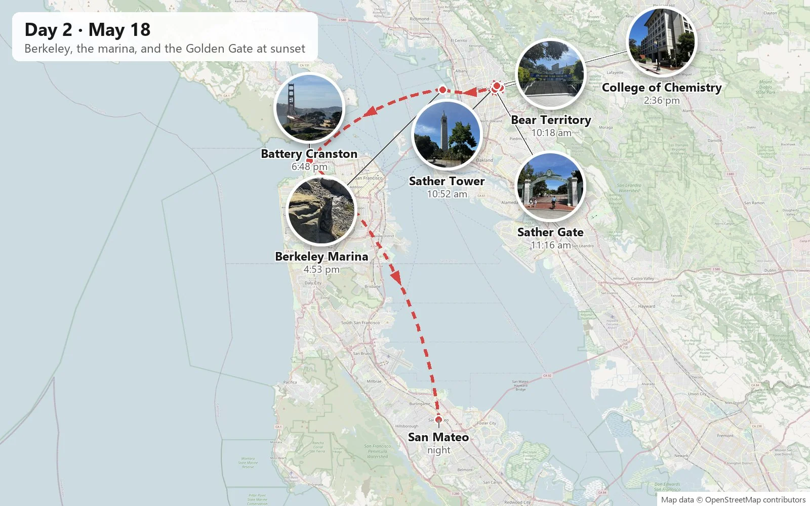
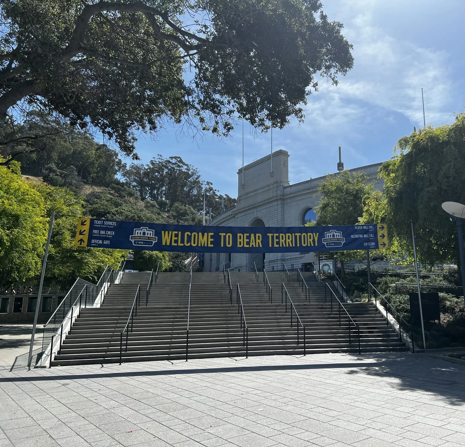
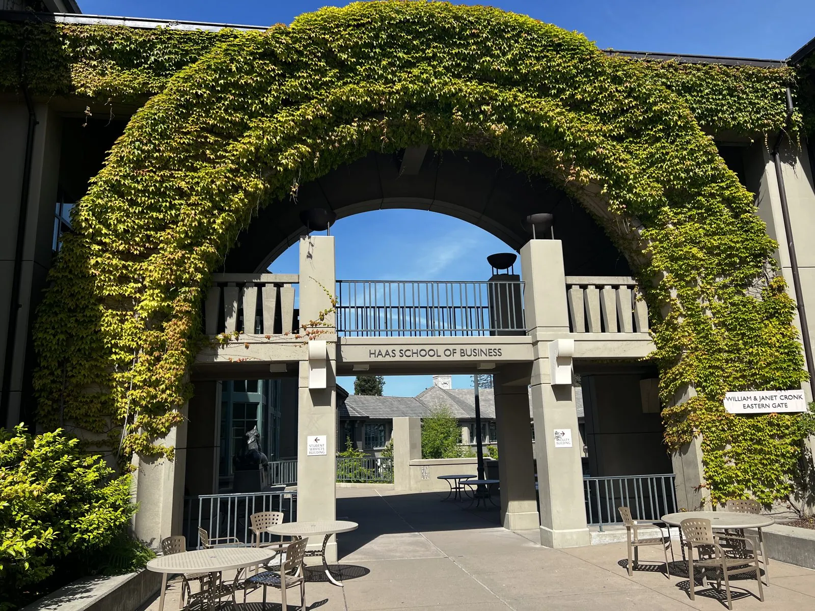
The next morning we parked by the football stadium and walked onto the campus of the University of California, Berkeley. The first thing to greet us was a long blue-and-gold banner over the stadium steps: "Welcome to Bear Territory". Cal's mascot is the golden bear, and the campus takes it seriously. Just around the corner, under a great ivy-covered arch, is the courtyard of the Haas School of Business, as green and shaded as a cloister. For a visitor from USC, the banner reads like a friendly warning.
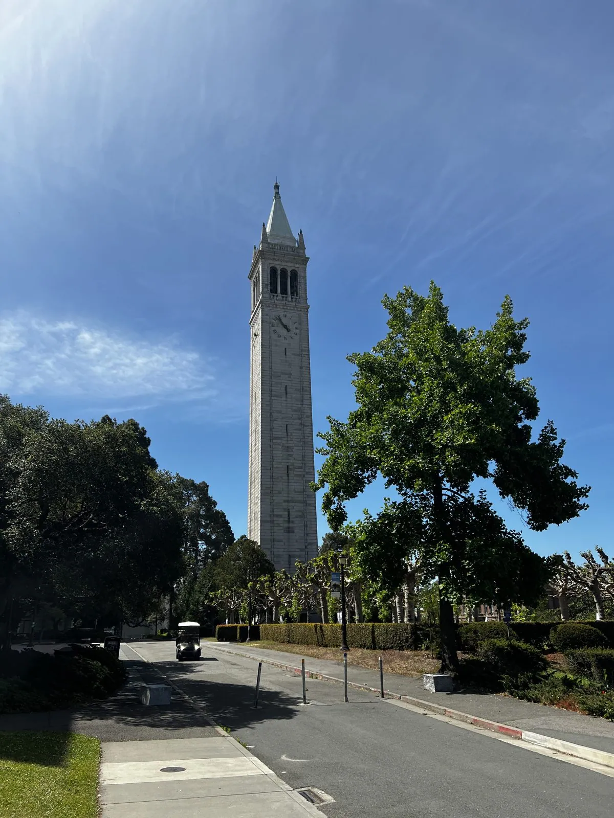
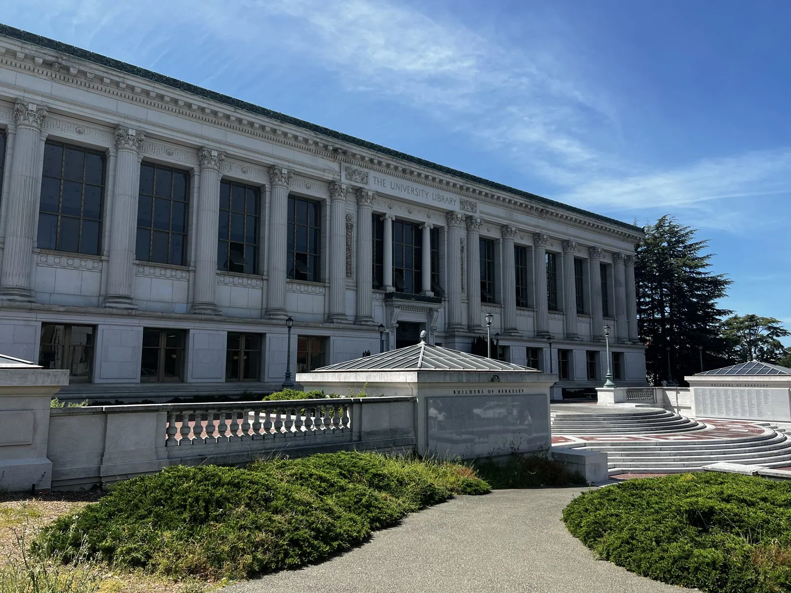
You can see Berkeley's landmark from almost anywhere on campus. Sather Tower, universally called the Campanile, is a 307-foot granite bell tower finished in 1914, modeled loosely on the campanile in St Mark's Square in Venice. It holds a carillon of sixty-one bells that is played by hand several times a day, and its upper floors famously store fossils from the university's paleontology collection, dinosaur bones and all, because the tower is cool, dry and very hard to break into. Beside it stands Doe Library, a long Beaux-Arts palace of white granite completed in 1911, with a row of tall arched windows along its north reading room.
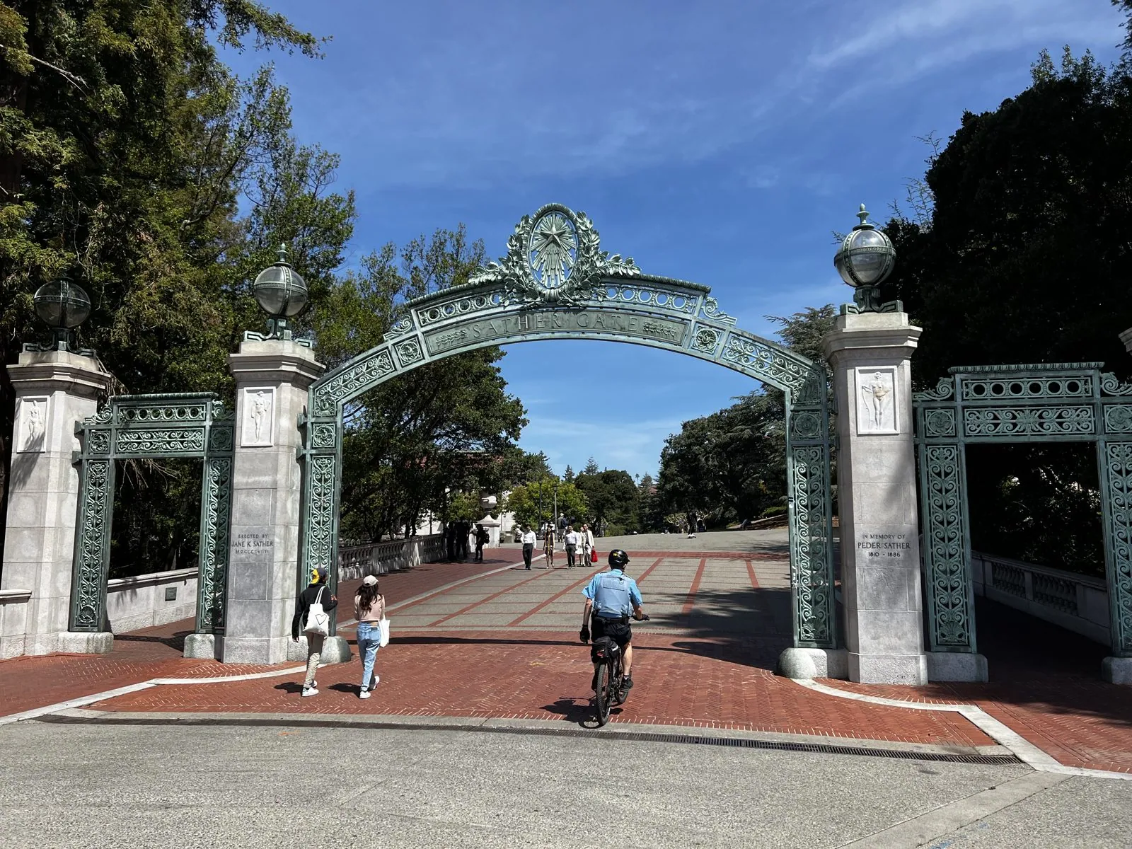
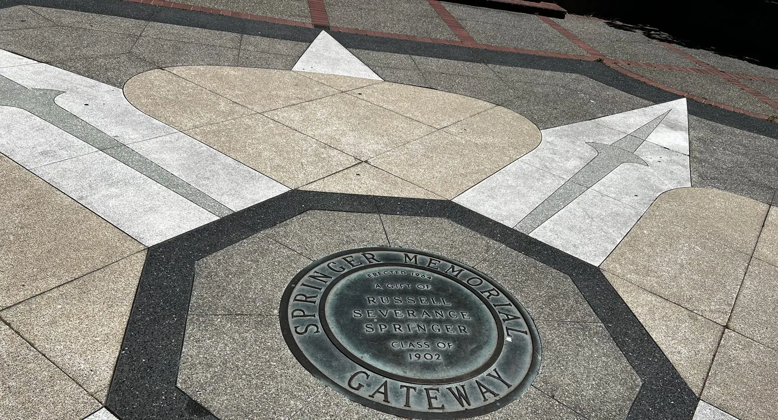
The walk ended at the south edge of campus at Sather Gate, a 1910 bronze-and-granite arch that for decades was the official boundary of the university. Students handed out flyers and made speeches just outside it, on city land, where campus rules didn't apply. In 1964 that strip of sidewalk and the plaza in front of Sproul Hall became the stage of the Free Speech Movement, the sit-ins and speeches that set the tone for a decade of student protest across the country. In the pavement nearby, a bronze medallion marks the Springer Memorial Gateway, the gift of a member of the class of 1902.
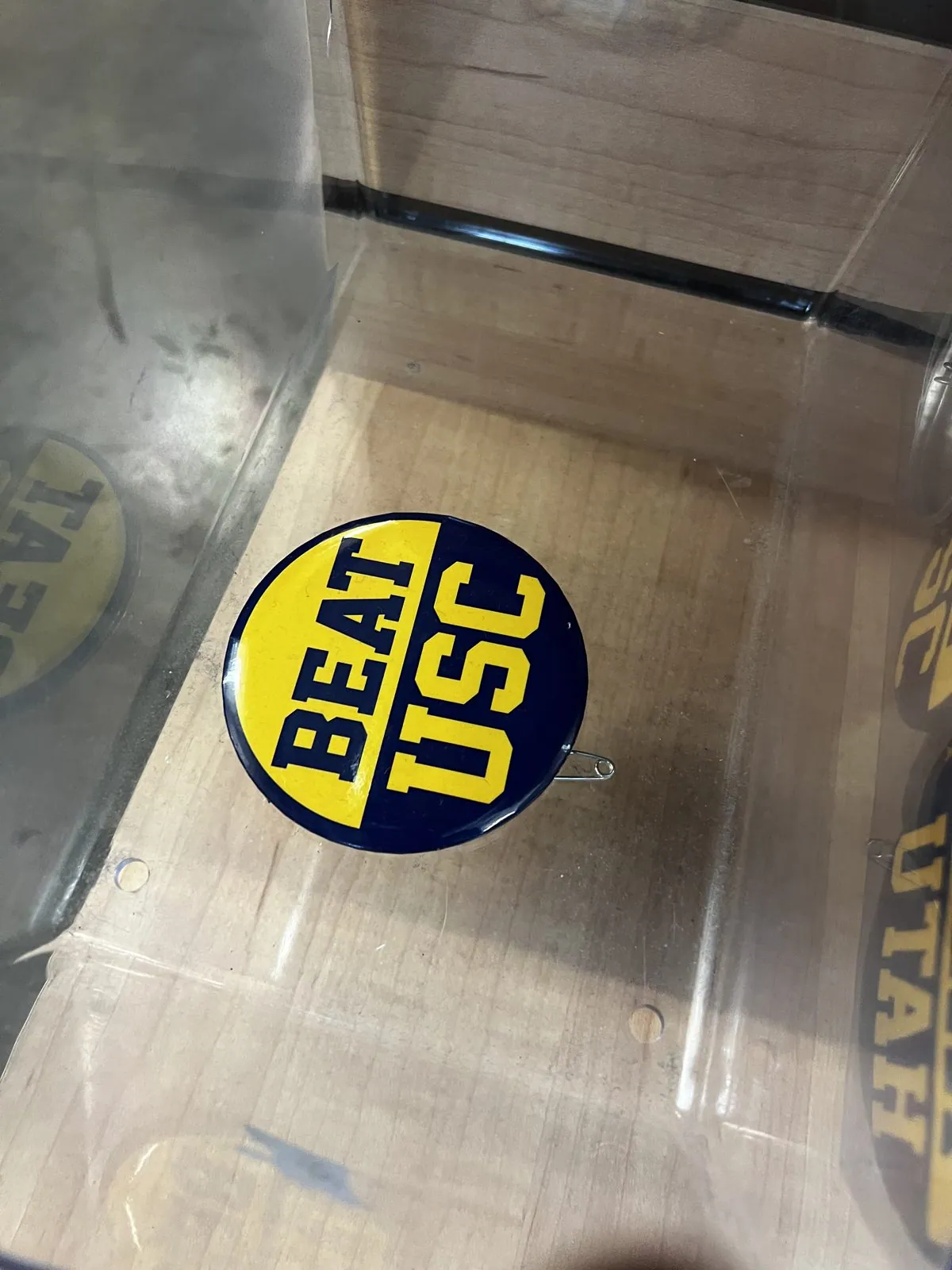
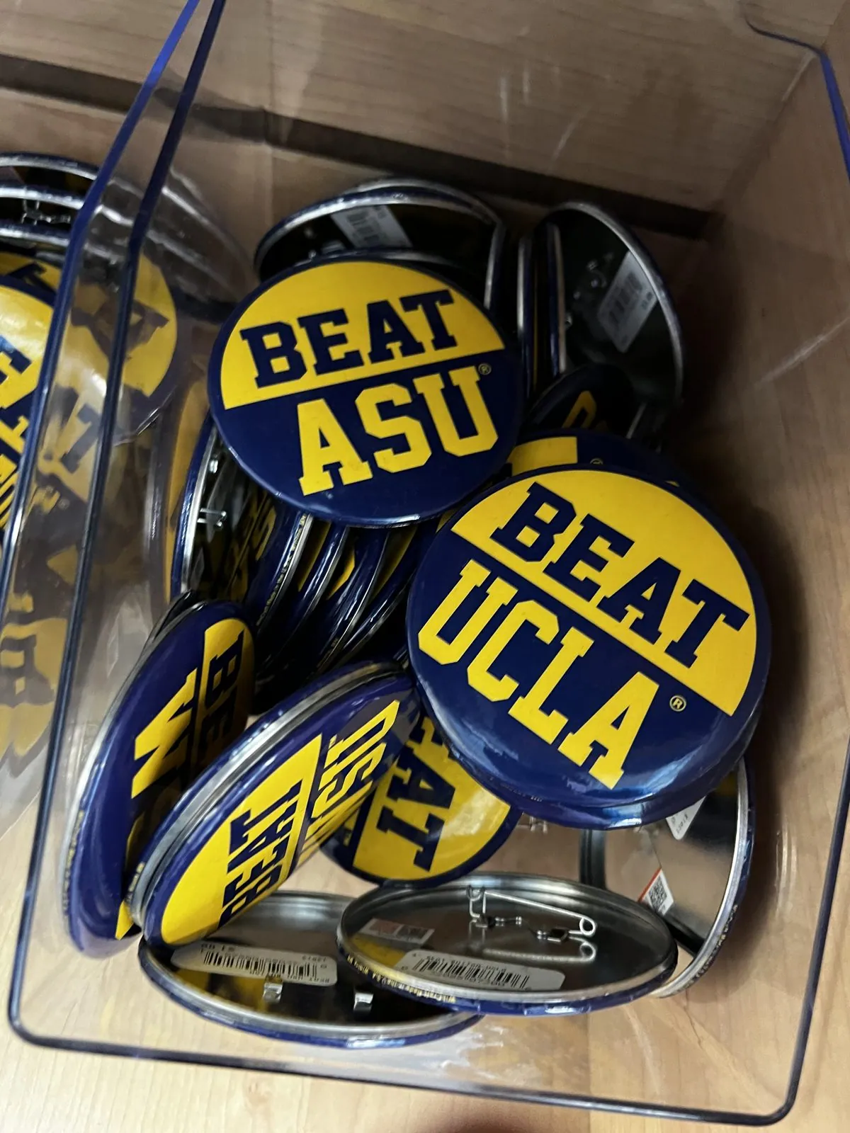
In the student store off Sproul Plaza, a plastic bin by the register held a pile of pin-back buttons in Cal's blue and gold. "BEAT ASU." "BEAT UCLA." And, sitting right on top as if it had been waiting for me, "BEAT USC". There is no rivalry quite like the one between two branches of the same family, and Berkeley and UCLA have been at it for a century; USC, the private school across town from UCLA, is on the list too. The buttons got photographed.
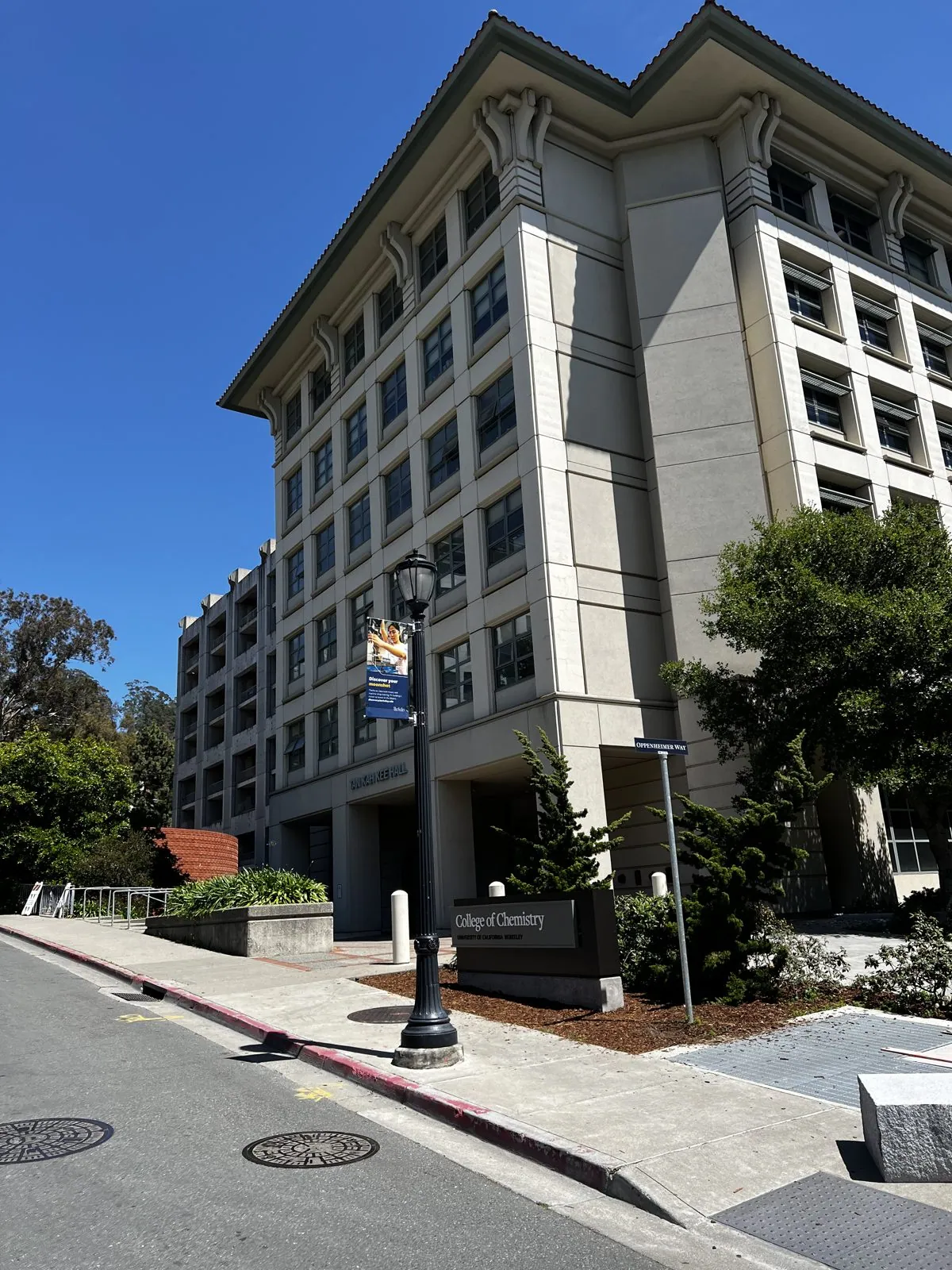
After lunch downtown (a bowl of beef pho, then gelato), we walked back up to the northeast corner of campus for the College of Chemistry. For a chemistry nerd, Berkeley is holy ground. Glenn Seaborg and his colleagues here discovered or co-discovered a long run of elements, from plutonium onward, and two of them are named for the place itself: berkelium (element 97) and californium (98). By that night a navy hoodie had come home with us, printed like a square from the periodic table: Bk, Berkelium, 97.
The Berkeley Marina
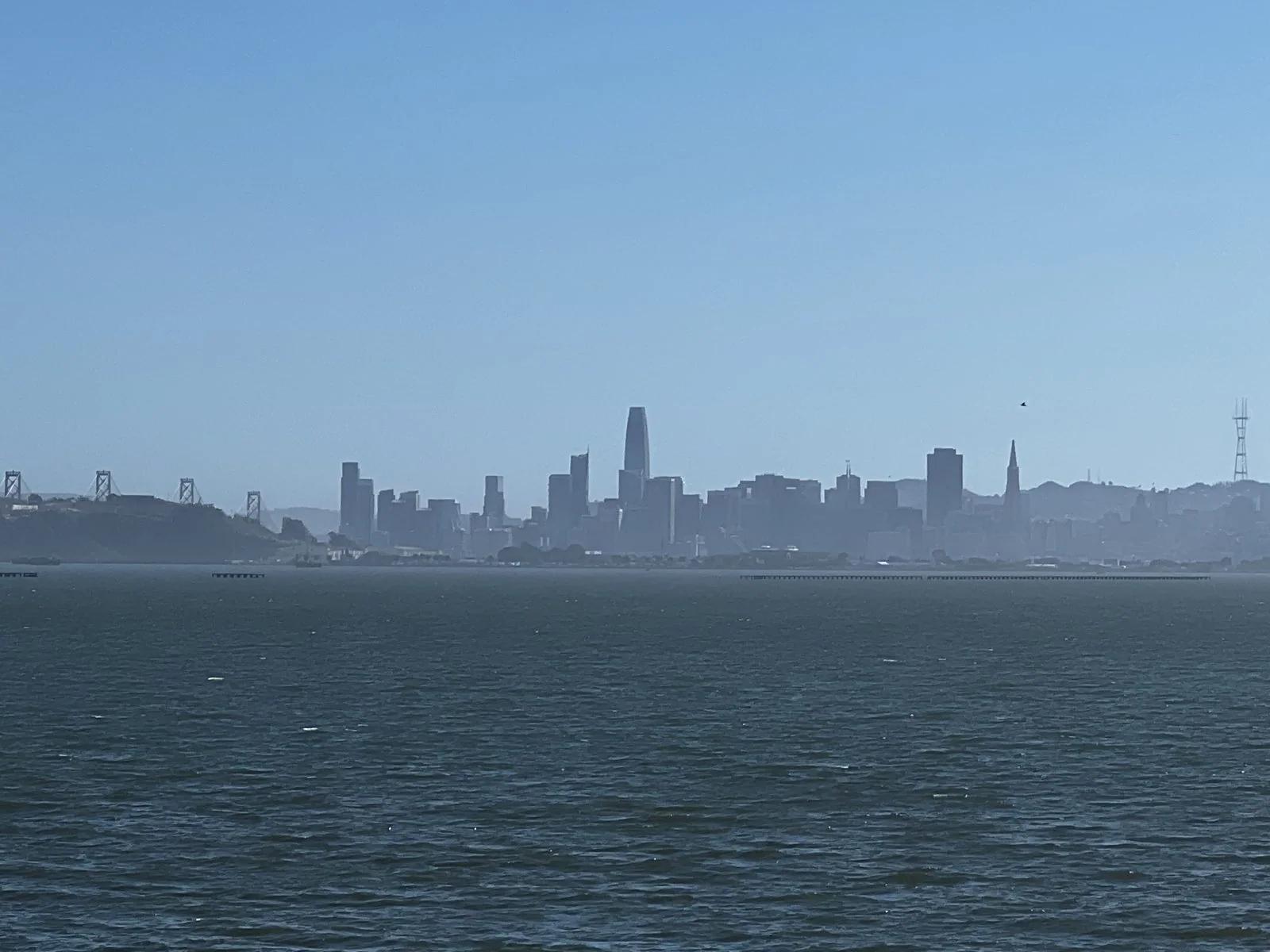
In the afternoon we drove down to the water. The Berkeley Marina sits at the end of University Avenue on land reclaimed from the bay, and from the shoreline park you get one of the best views in the region: the whole San Francisco skyline laid out across the water, with Salesforce Tower poking up in the middle and the Bay Bridge running off to the left. The afternoon was clear and the bay was a hard, glittering blue.
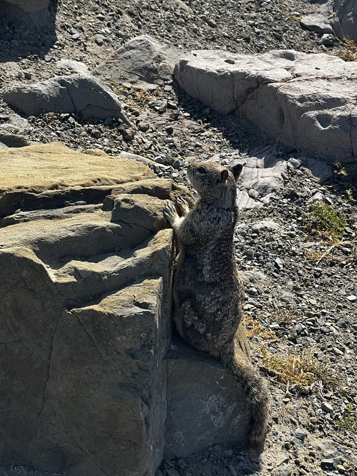
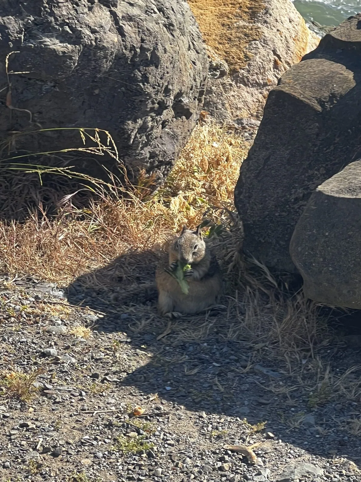
The rocks along the shore had residents. A California ground squirrel stood up against a sun-warmed boulder, completely uninterested in us, gazing out at the bay like a retired sailor. A few minutes later one popped up between the rocks with something in its paws, ate it in a hurry, and vanished again. We ate too: a takeout box of rice noodle rolls, eaten in the car by the water, with the marina's forest of masts bobbing just beyond the windshield.
The Golden Gate at golden hour
Then across the Bay Bridge and through the city to the Presidio, the old army post at the northern tip of San Francisco. Just after half past six we were on the Coastal Trail at Battery Cranston, one of the concrete gun emplacements built in the 1890s to guard the strait. The guns are long gone, and what's left is one of the finest viewpoints in the city. The Golden Gate Bridge fills the frame, close enough that you can make out the rivets, with the green-gold Marin Headlands rising on the other side.
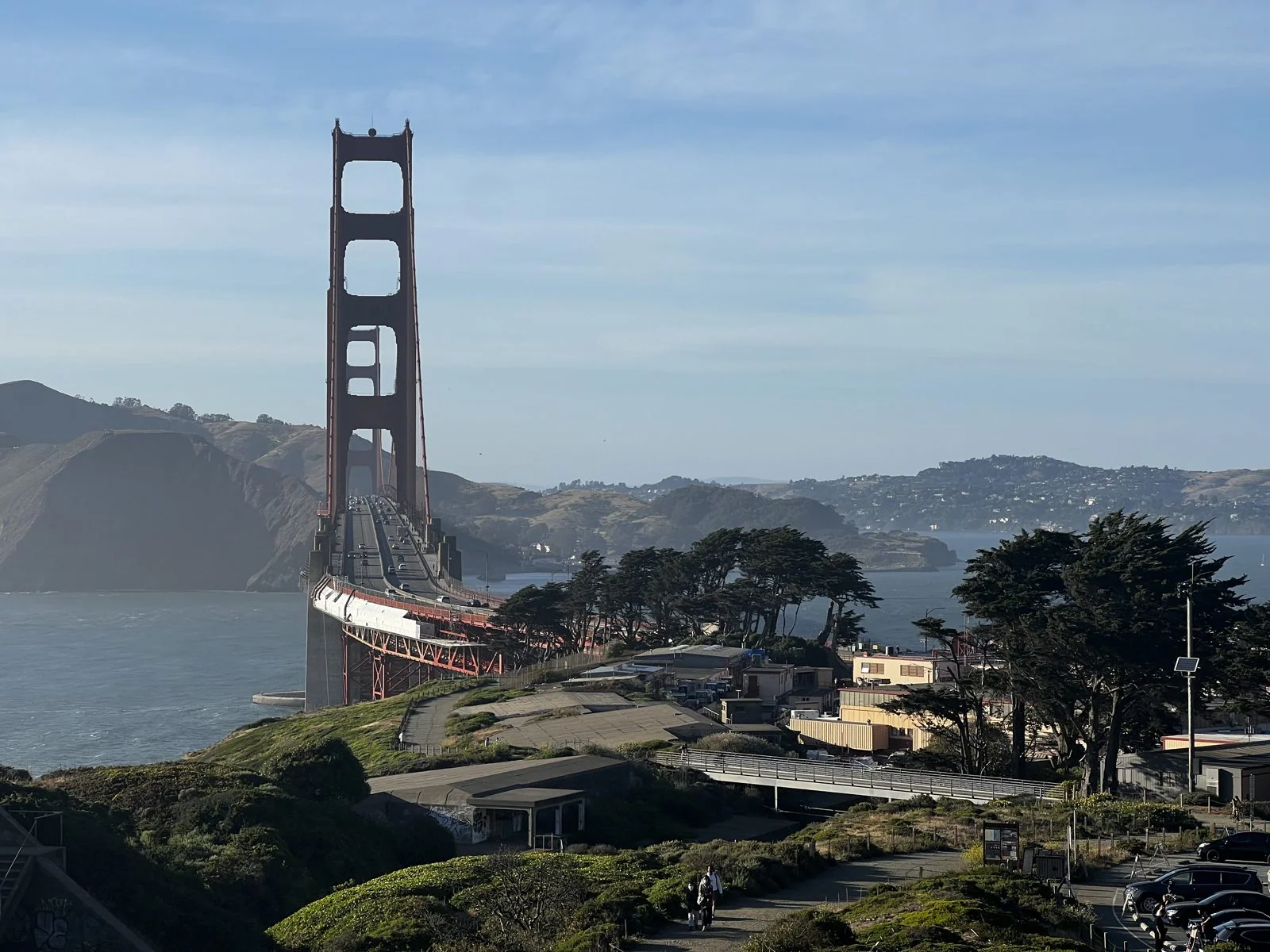
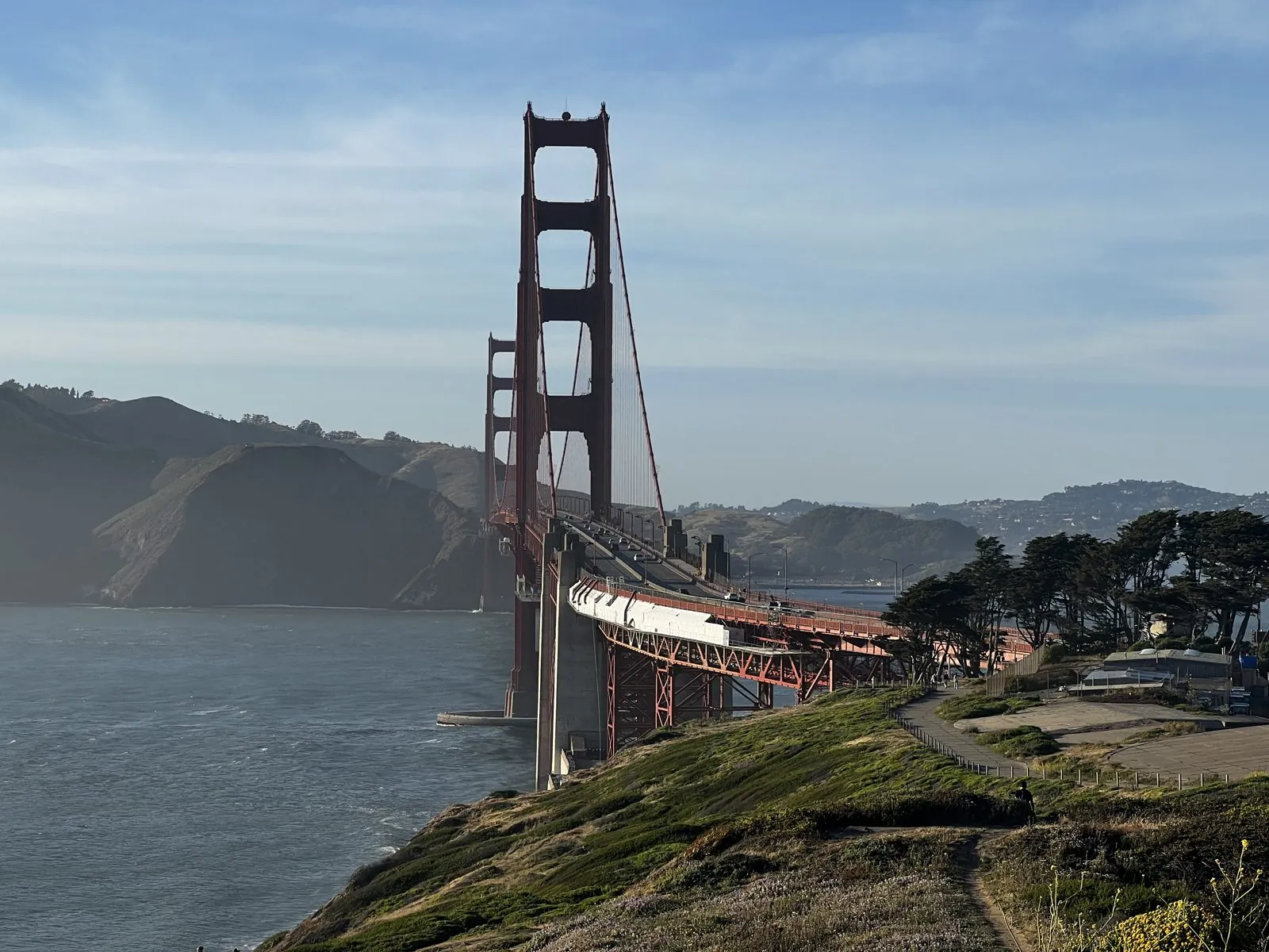
The bridge opened in 1937, and for almost three decades its main span was the longest in the world. Its color was never supposed to be permanent. "International orange" was the primer, and the consulting architect, Irving Morrow, argued to keep it because it stood out in the fog and matched the warm hills. It looks different every few minutes. In flat noon light it's brick red. At seven in the evening, with the sun low over the Pacific, it goes the color of embers.
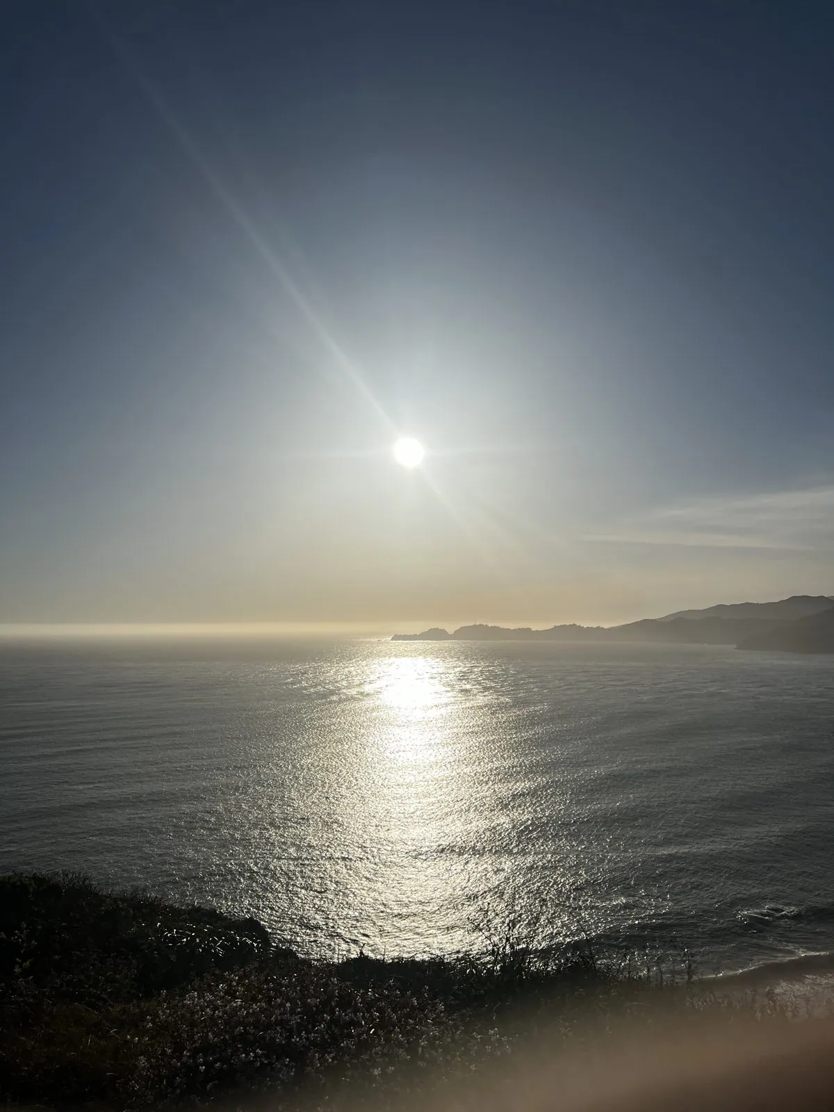
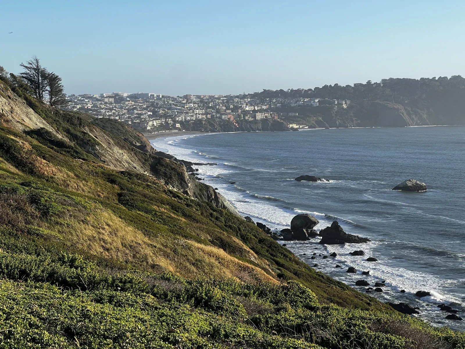
Turn around and you're looking west, straight out through the Golden Gate to the open ocean. The sun was setting into a hazy sky over the water, laying a long silver path across the waves toward the cliffs. Walk a little further along the trail and the coast opens up southward, the bluffs dropping steeply to the surf at Baker Beach, with the houses of Sea Cliff stacked along the ridge.
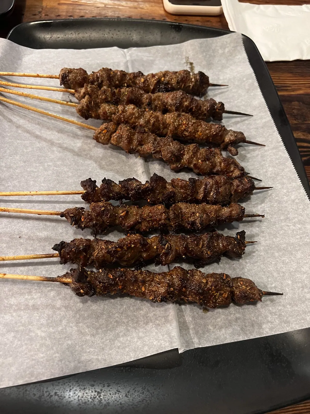
Dinner, just before nine, was in the Richmond District, the foggy western neighborhood that has become one of San Francisco's two Chinatowns. We had lamb skewers crusted with cumin and chili, spicy dumplings, a bubbling tray of fish and tofu, and grilled oysters under a blanket of garlic and scallion. Then down the Peninsula to San Mateo, to the Best Western at Coyote Point, which was home for two nights.
San Francisco by cable car
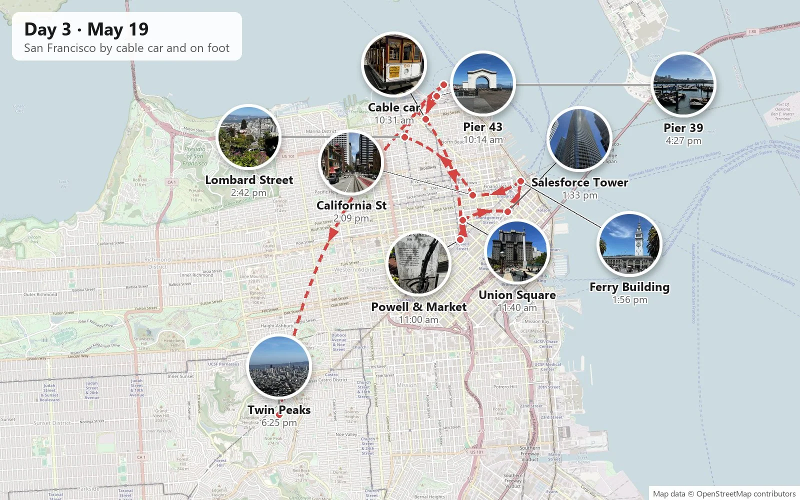
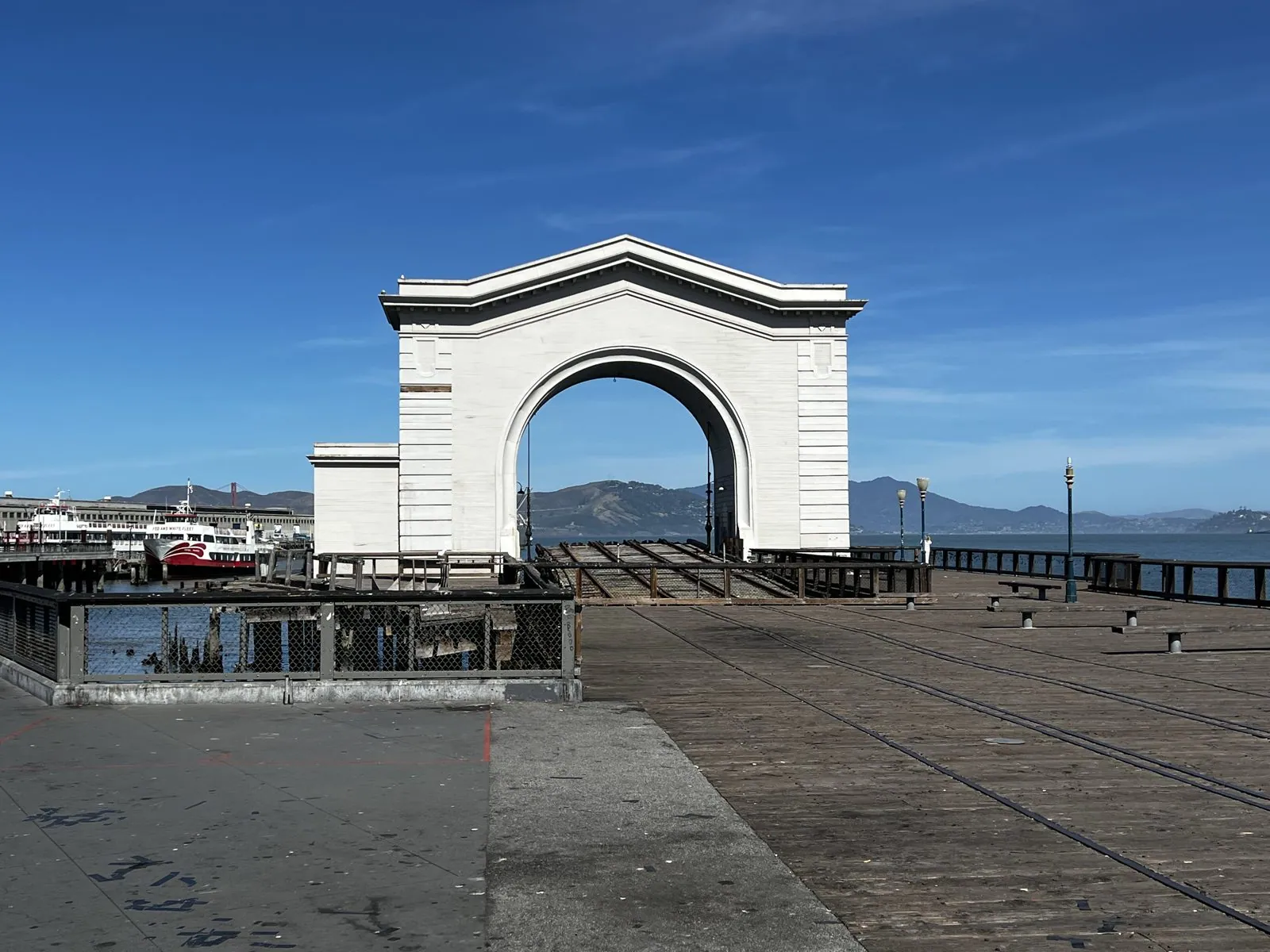
The next day was San Francisco, done properly. We started at Fisherman's Wharf just after ten. The white Pier 43 arch stands at the water's edge with Alcatraz framed in the bay behind it. It is a relic of the old ferry slips, from the days when the railroads ran freight cars onto barges here, and it is now a very good place to stand and look at Alcatraz.
A few blocks inland, at Taylor and Bay, cable car number 22 was waiting at the end of the Powell–Mason line. San Francisco's cable cars are the last manually operated system of their kind in the world. There's no motor on the car at all: a steel cable runs continuously in a slot under the street, pulled by engines in a powerhouse on Mason Street, and the gripman on board clamps onto it to go and lets go to stop. You can hear it humming under the road the whole way.
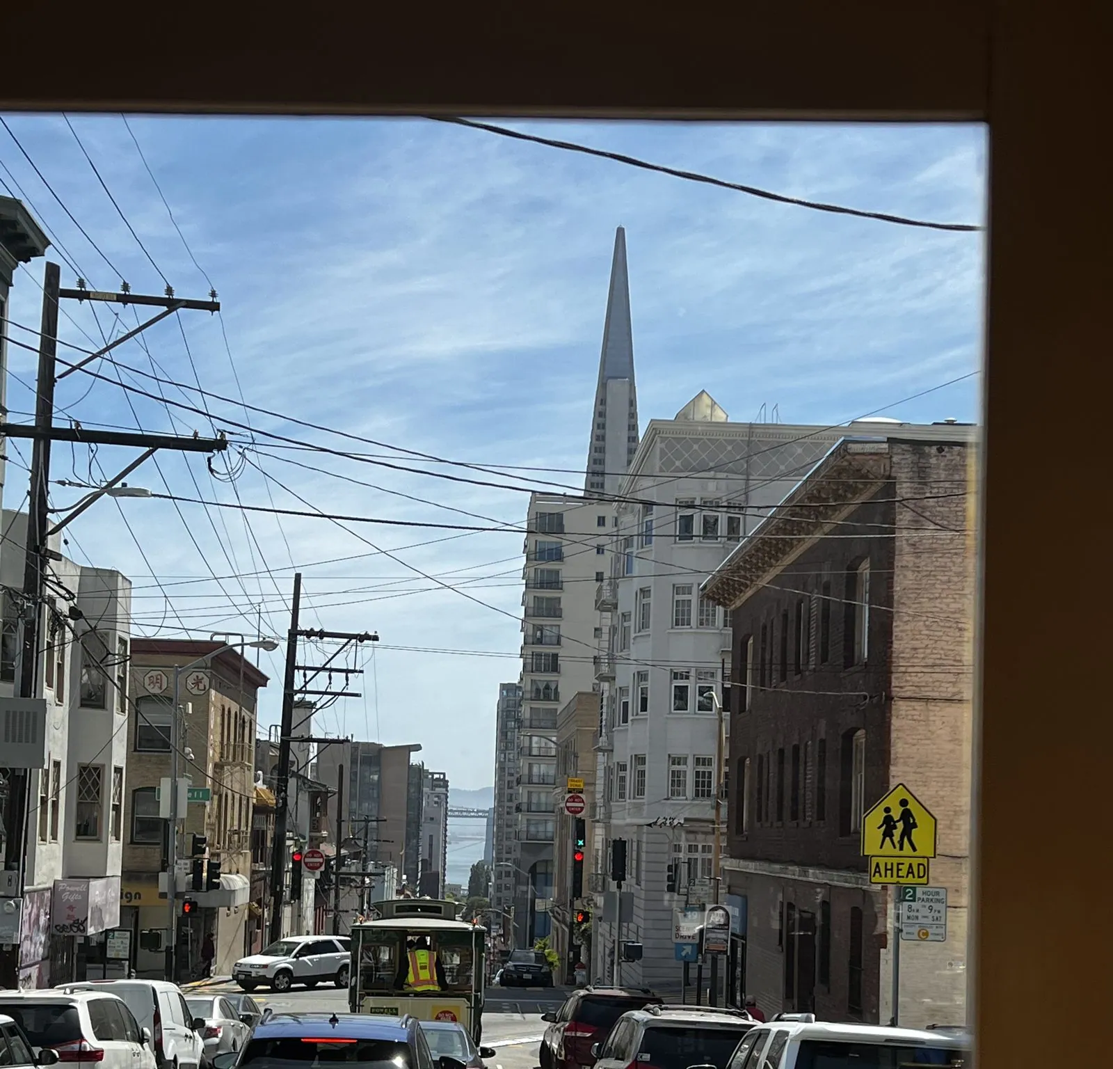
Riding one up and over Nob Hill is exactly as good as the postcards promise. The car tilts, the bell clangs, and through the open frame of the windows the city appears in steep slices: a canyon of Victorian bay windows with the Transamerica Pyramid at the end of it, then the crossing with California Street and its own cable tracks running down to the bay.
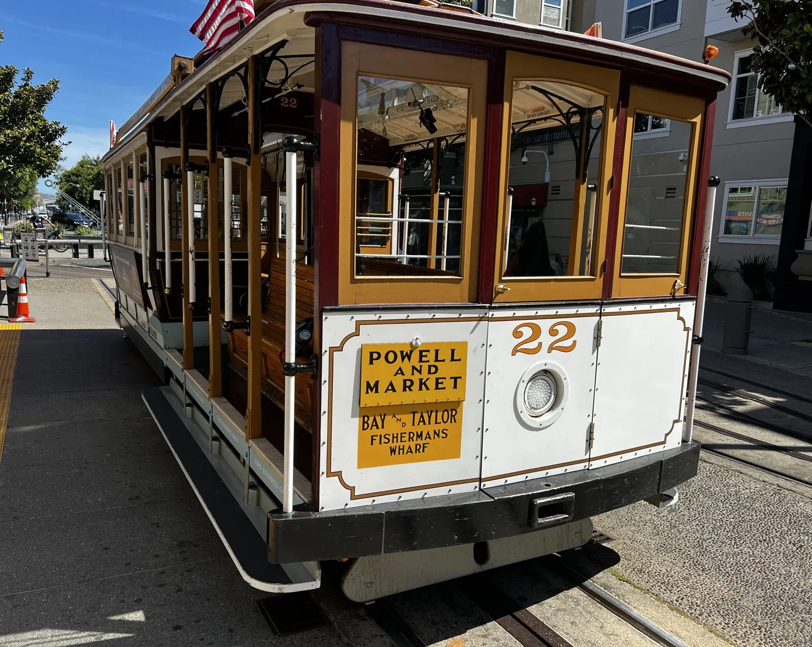
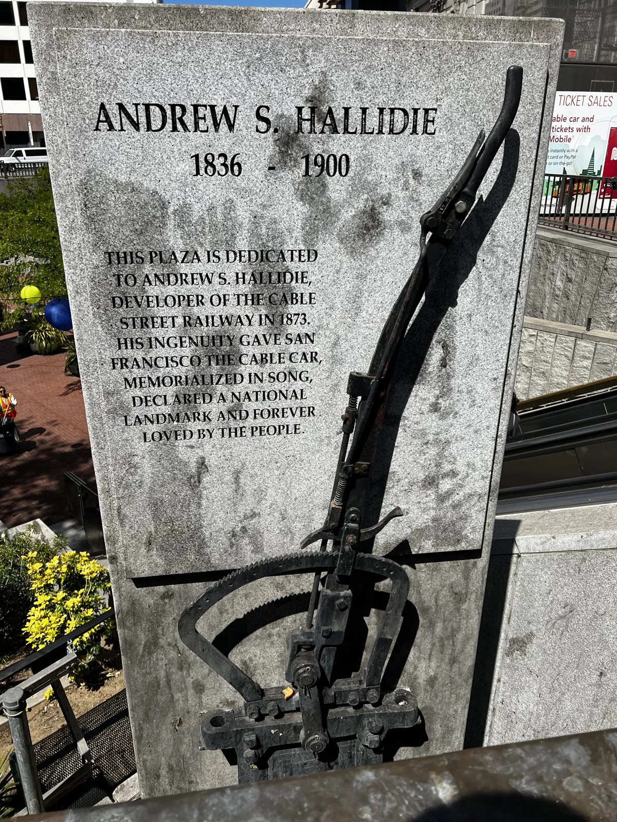
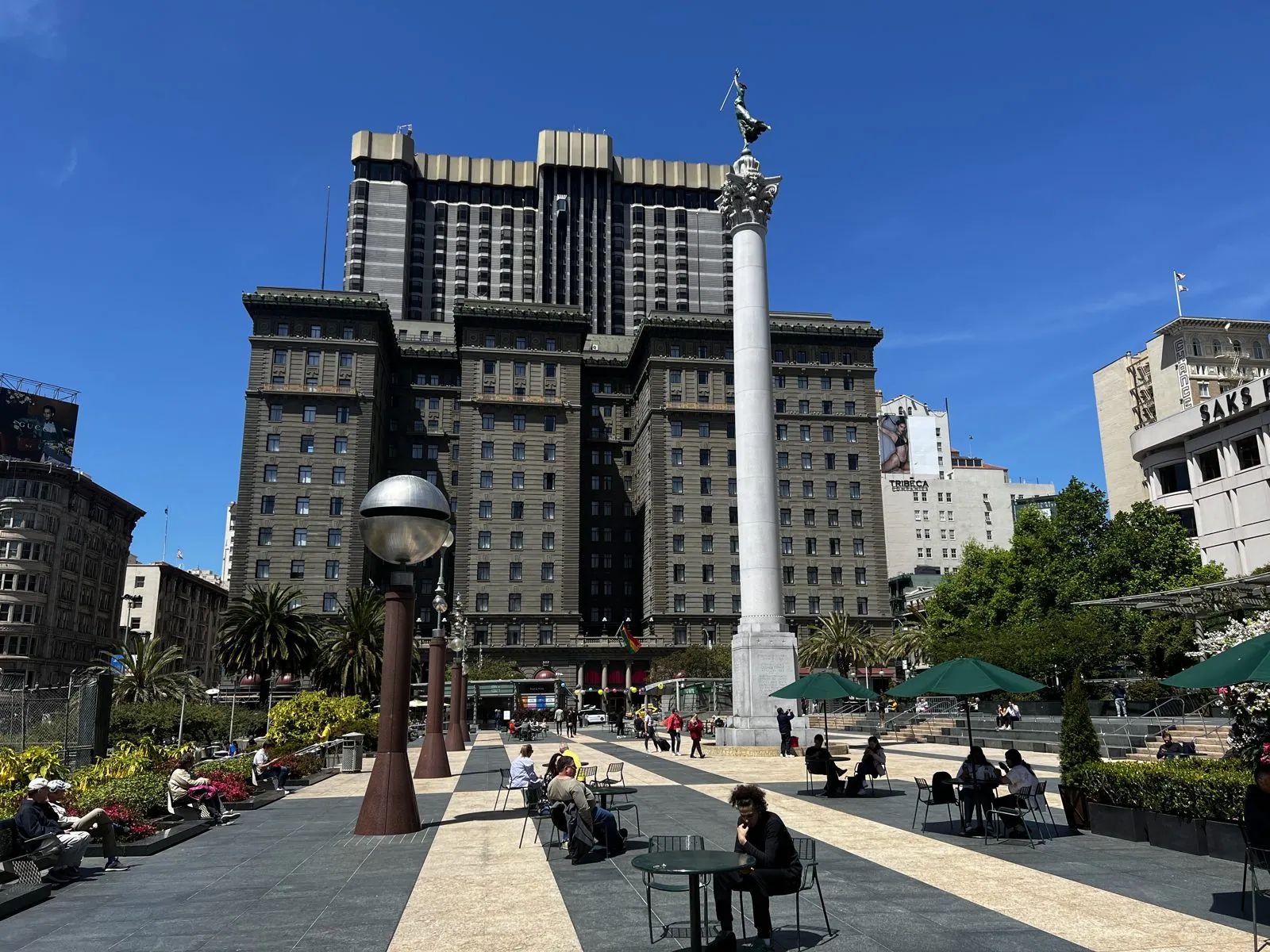
The line ends at Powell and Market, where the cars are turned around by hand on a wooden turntable, and where a stone plaque on Hallidie Plaza honors the man who started it all. Andrew Hallidie was a wire-rope manufacturer who, the story goes, watched a team of horses slip on a wet hill and get dragged down it with their streetcar. In 1873 he ran the first cable car up Clay Street. A few blocks north is Union Square, with the Dewey Monument rising out of the middle: a tall column topped by a bronze Victory, put up in 1903 to celebrate the US Navy's win at Manila Bay.
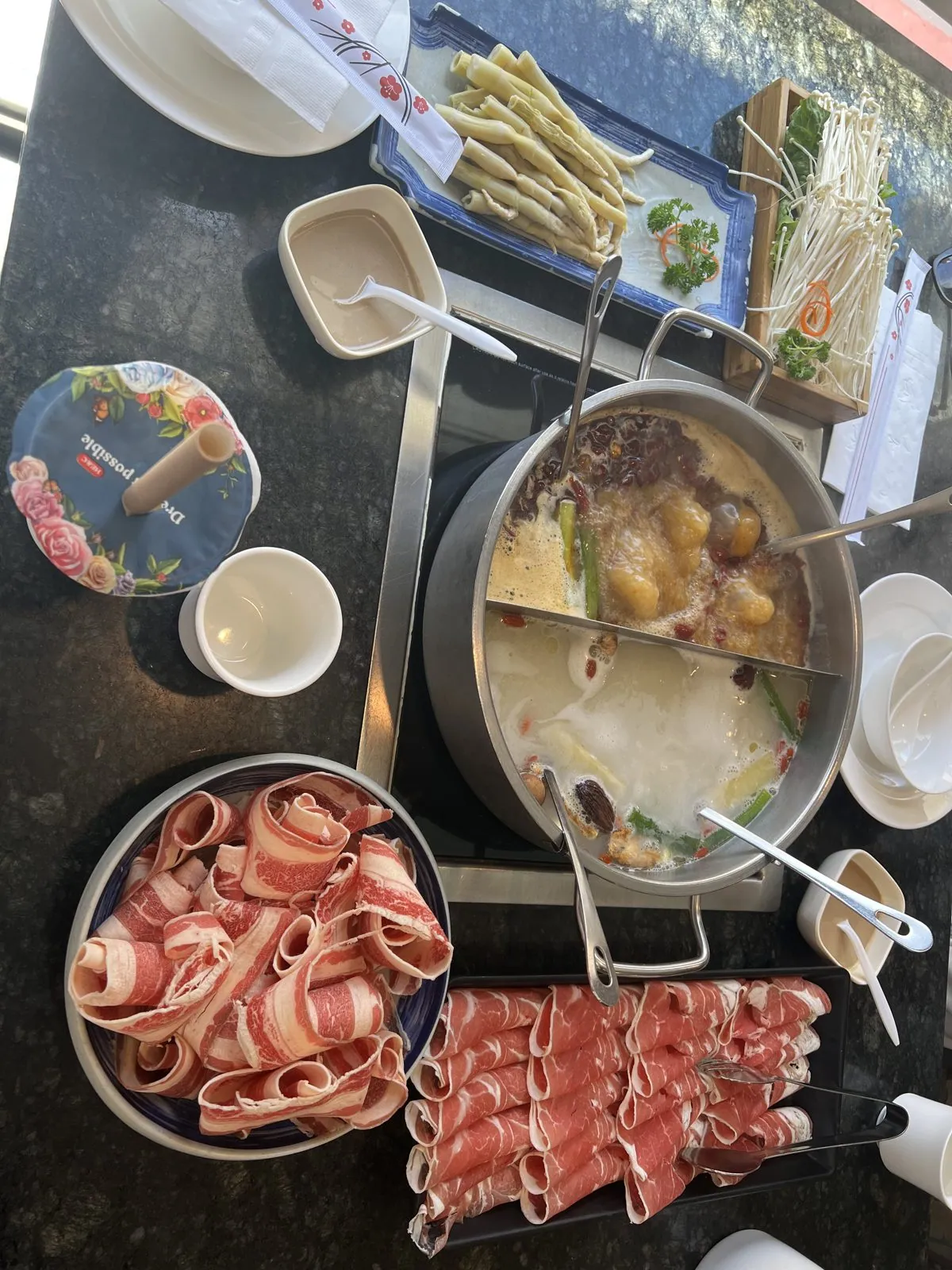
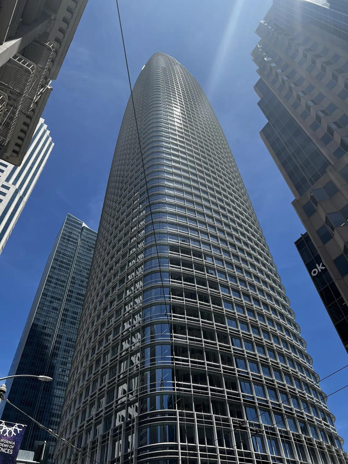
Lunch was hot pot a block off Geary: a split pot, one side mild and milky, the other dark with spices, and platters of thinly rolled beef and lamb. Afterwards we walked east through the Financial District. In the space of fifteen minutes the city goes from the vaulted glass roof of the Crocker Galleria to the new towers south of Market. The biggest is Salesforce Tower, finished in 2018 and, at 1,070 feet, the tallest building in San Francisco. Craning your neck at the bottom of it, the glass curves up and away like the hull of a ship.
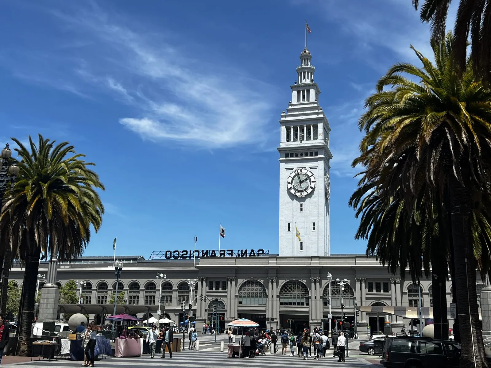
At the foot of Market Street stands the Ferry Building, finished in 1898 with a clock tower modeled on the Giralda in Seville. Before the bridges opened in the 1930s, nearly everyone arriving in San Francisco from the east came through it, tens of thousands of commuters a day. For decades afterwards it was walled off from the city by an elevated freeway. The 1989 earthquake damaged the freeway, it was torn down, and the waterfront got its front door back.
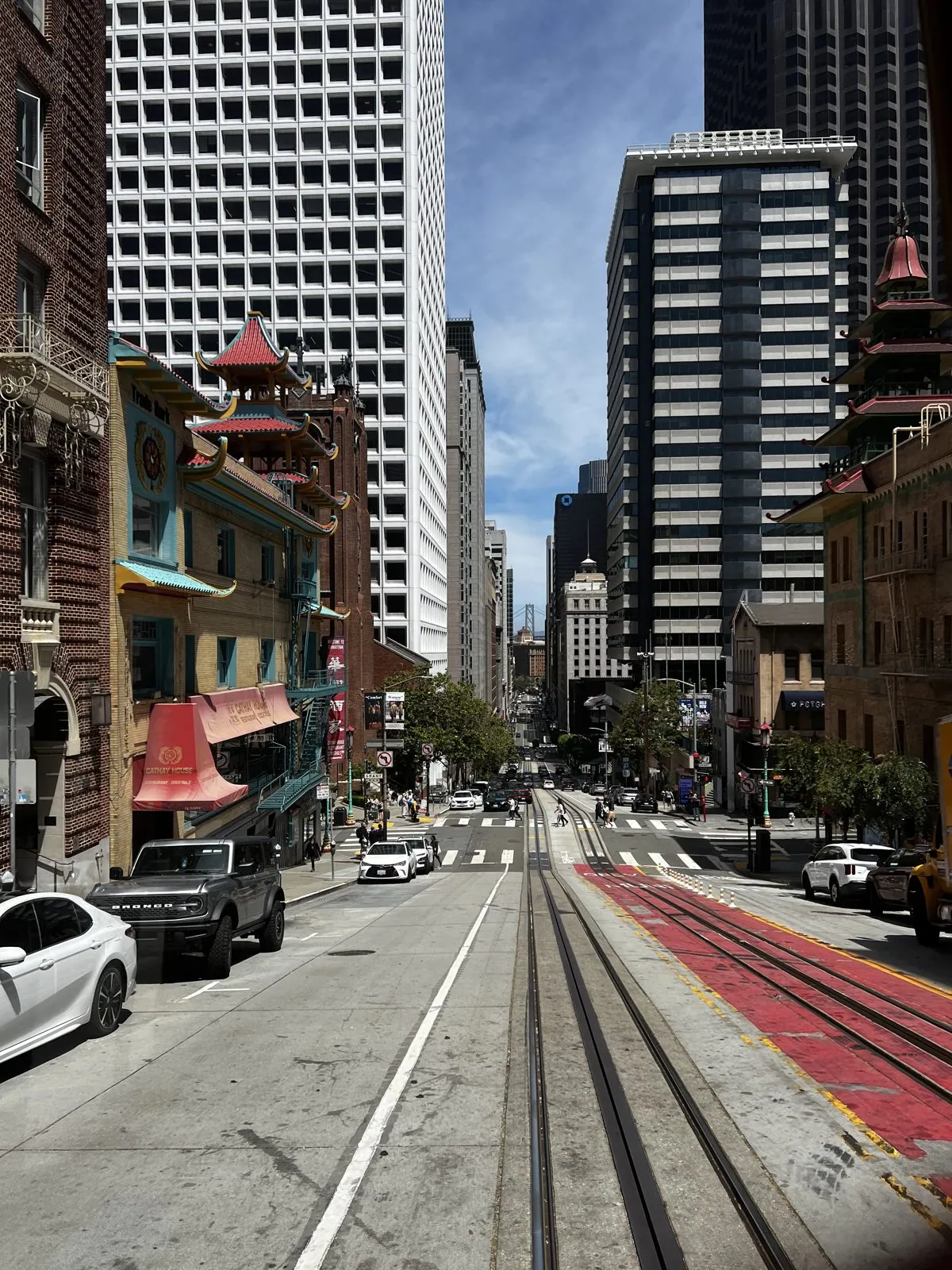
Then a second cable car, this time the California Street line, which climbs straight up over Nob Hill through the edge of Chinatown. From the back of the car you look down the hill at pagoda-roofed buildings with their painted balconies, red and green against the towers of the Financial District, and the tracks running straight down to the bay. Old St. Mary's, the city's first cathedral, slides past on the corner.
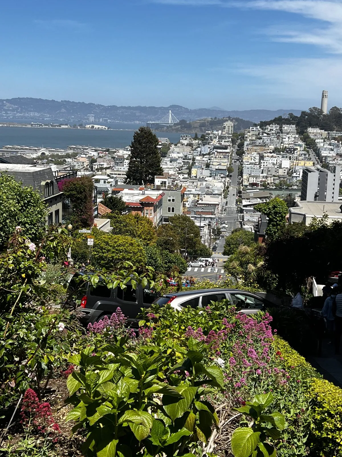
The afternoon's obligatory stop was Lombard Street, the "crookedest street in the world", with eight hairpin turns packed into one steep block of Russian Hill. It was built that way in 1922 because the hill was too steep for cars to go straight down. Today its brick switchbacks are lined with hydrangeas and lovingly kept flower beds, and the residents share them with a steady procession of tourists. From the top, the view runs over the rooftops of North Beach to Coit Tower and the bay.
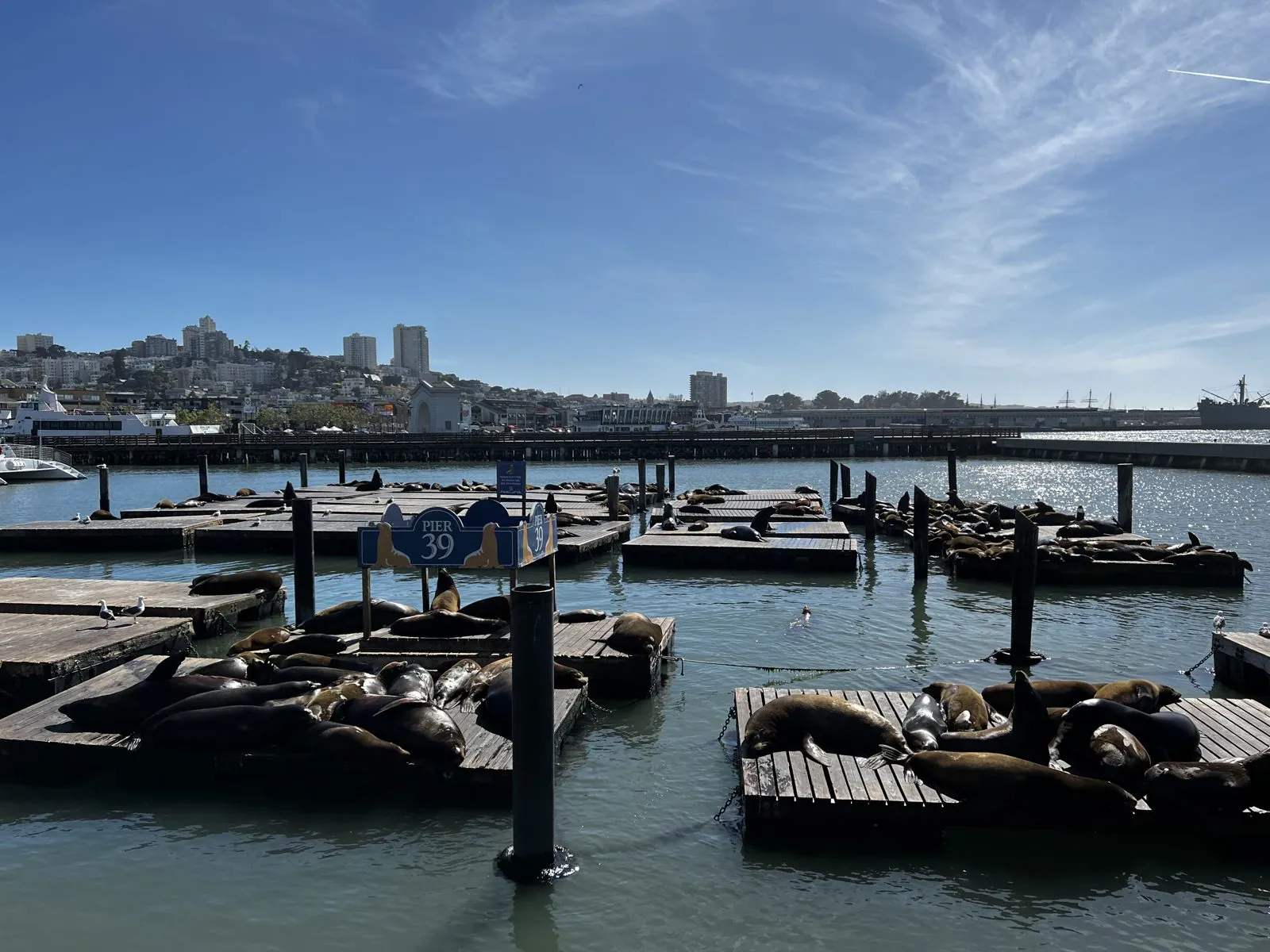
Back at the wharf, ice cream came first, then the main event. Since late 1989, a few months after the Loma Prieta earthquake, California sea lions have taken over the floating docks at Pier 39. Nobody quite knows why they chose it, but the marina gave up and let them have it. On a sunny afternoon they lie in great piles on the docks, barking, shoving and occasionally flopping into the water, a few hundred feet from a souvenir shop.
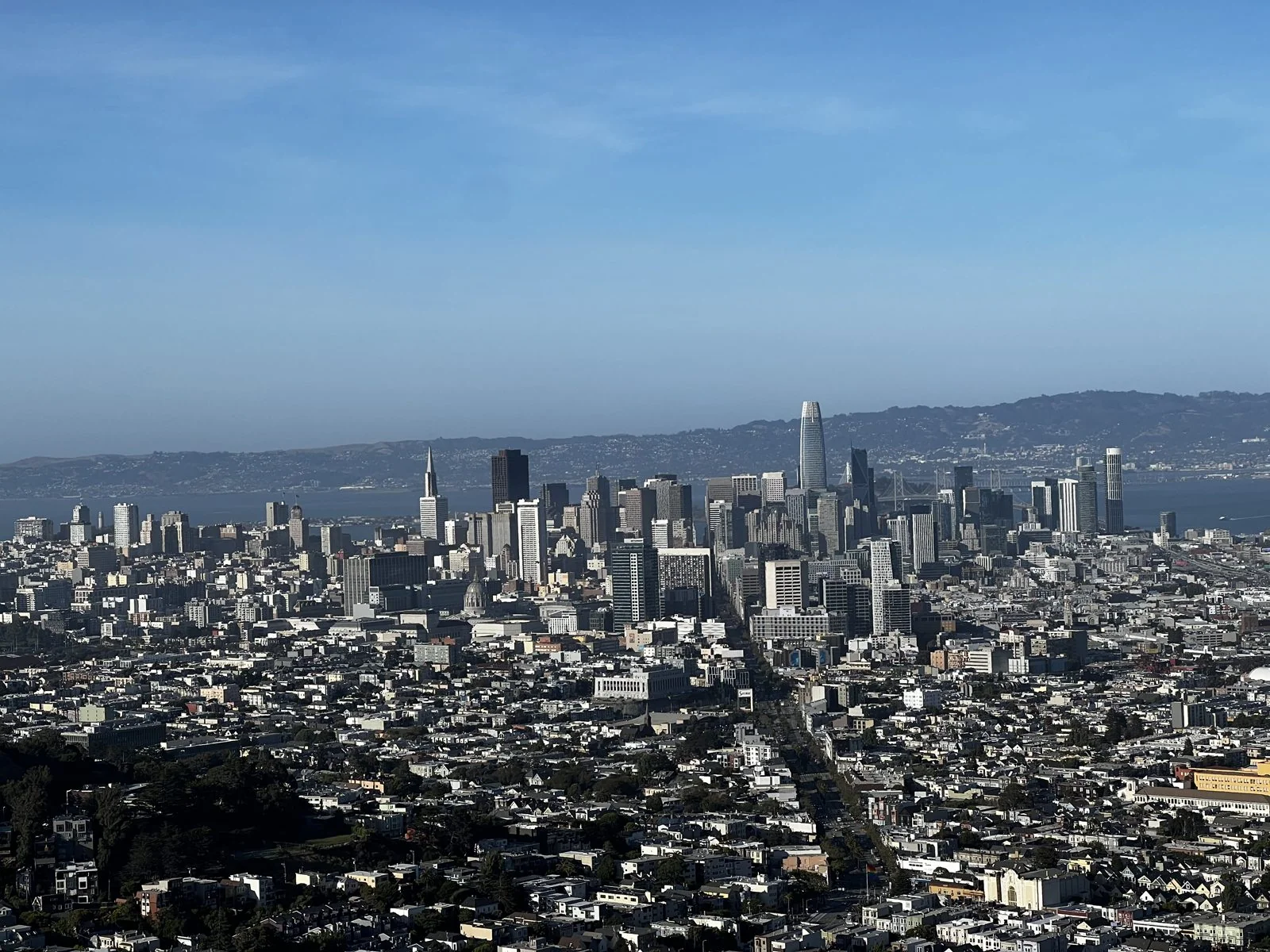
We ended the day the way you should end a day in San Francisco: on top of it. Twin Peaks rises about 900 feet near the geographic center of the city, and from the overlook at half past six the whole place is spread out at your feet. The grid of Market Street runs straight to the bay, downtown bristles in the middle, and the Bay Bridge and the East Bay hills sit beyond. From up here you can trace the entire day.
Golden Gate Park from the top of a wheel
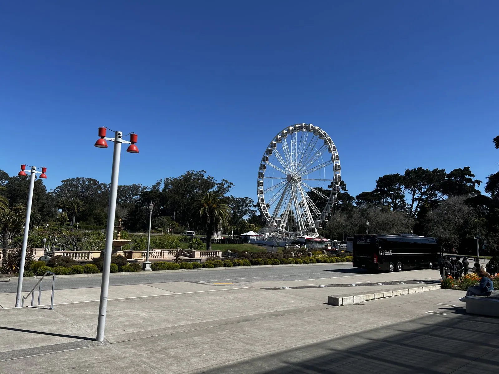
Friday started in Golden Gate Park, at the Music Concourse, the sunken plaza between the park's two big museums. Towering over it was the SkyStar observation wheel, put up in 2020 for the park's 150th anniversary and meant to be temporary. On one side of the concourse is the California Academy of Sciences, and we went there first.
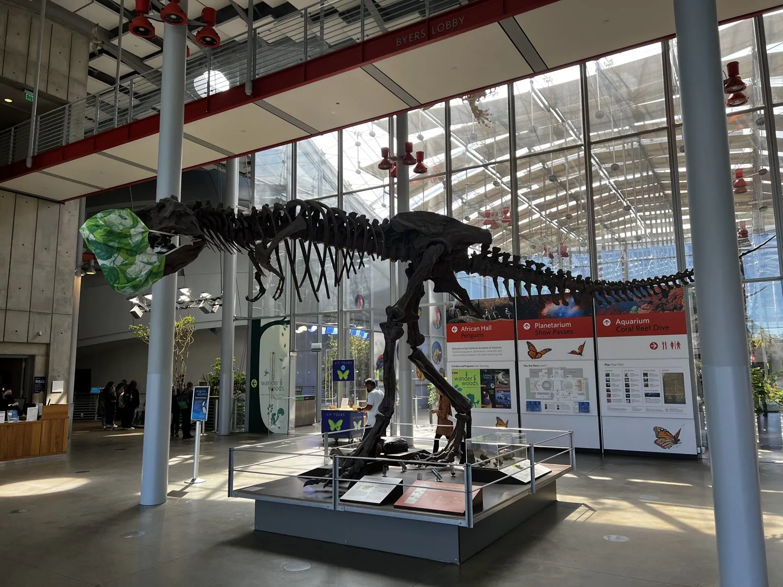
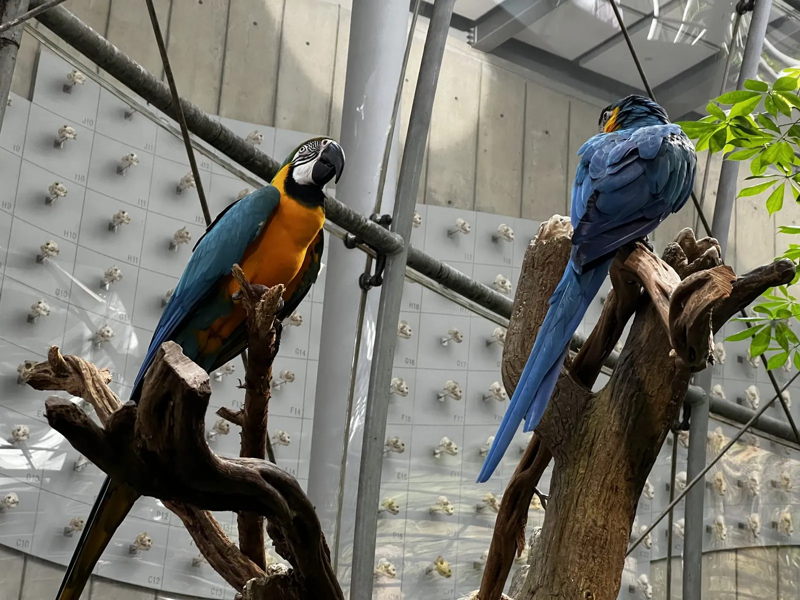
The Academy's lobby is ruled by a cast of a Tyrannosaurus rex skeleton, mid-stride under the glass roof. The building's centerpiece is a four-story rainforest under a glass dome, warm and humid, with a spiral ramp climbing up through the canopy. Two blue-and-gold macaws sat on a branch near the top, splendidly unbothered, and a black-and-red butterfly landed on the boardwalk at our feet.
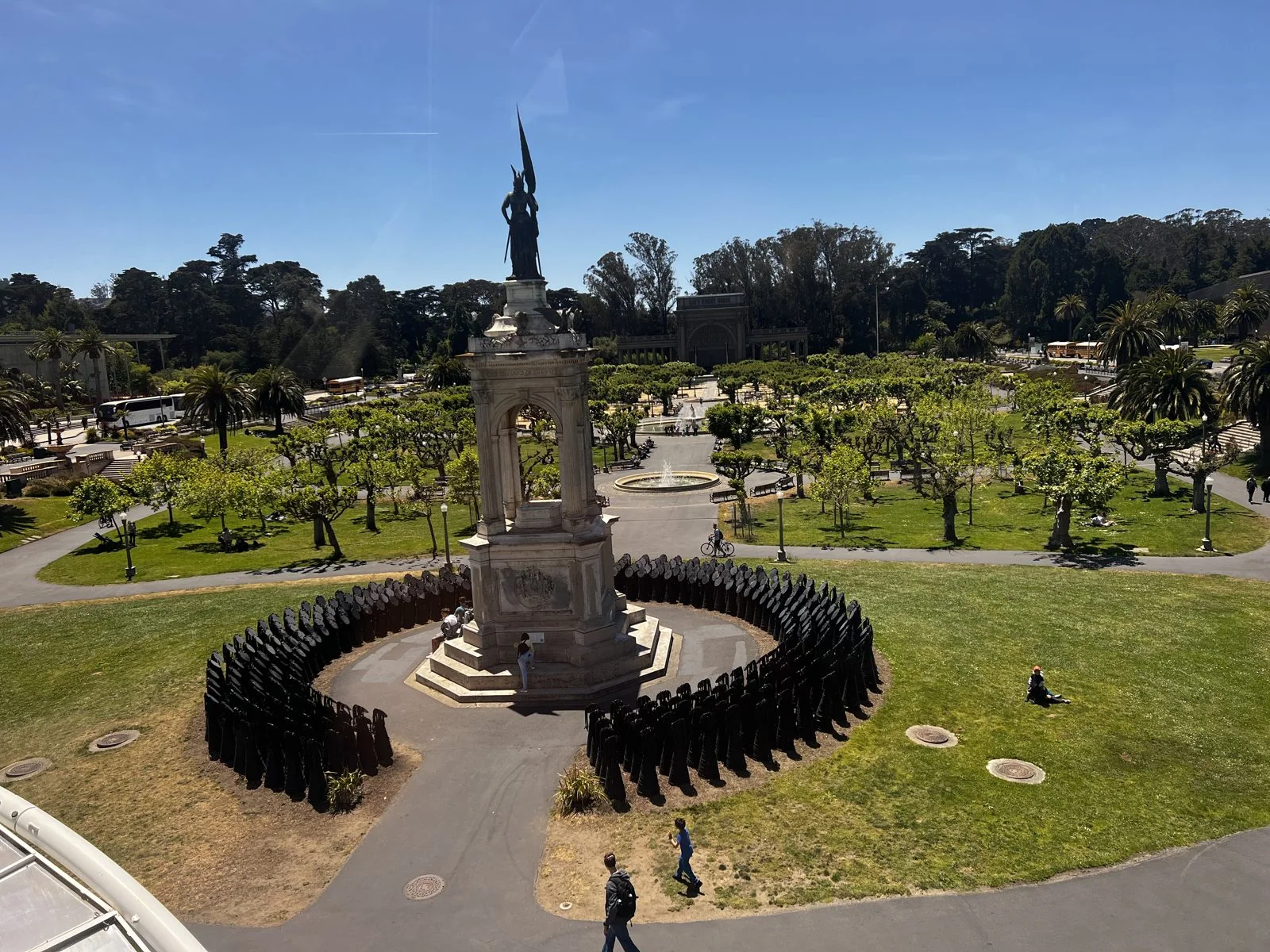
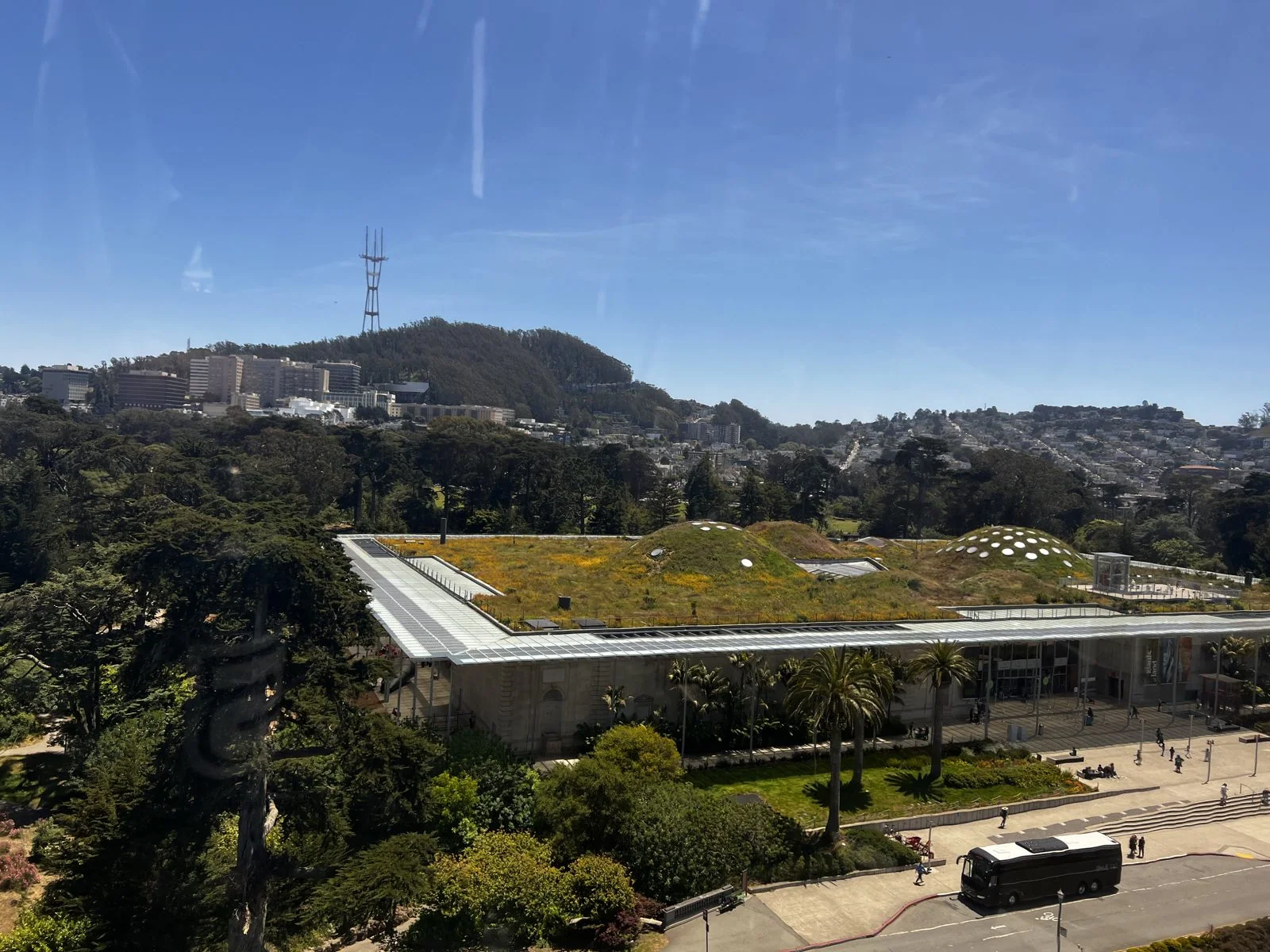
After lunch we rode the wheel. From the top of SkyStar, the concourse turns into a diagram. Directly below is the Francis Scott Key monument of 1888. Its statue of Key was pulled down in 2020, and since 2021 the monument has been ringed by Dana King's Monumental Reckoning: 350 dark sculpted figures, one for each of the first enslaved Africans brought to Virginia in 1619. Beyond it the Academy's roof reveals its secret: it is alive, two and a half acres of native plants on rolling green humps, designed by Renzo Piano to keep the building cool. Across the concourse, the de Young Museum's twisted copper tower rises out of the trees. On the skyline, Sutro Tower stands over everything like a giant red-and-white trident.
Stanford
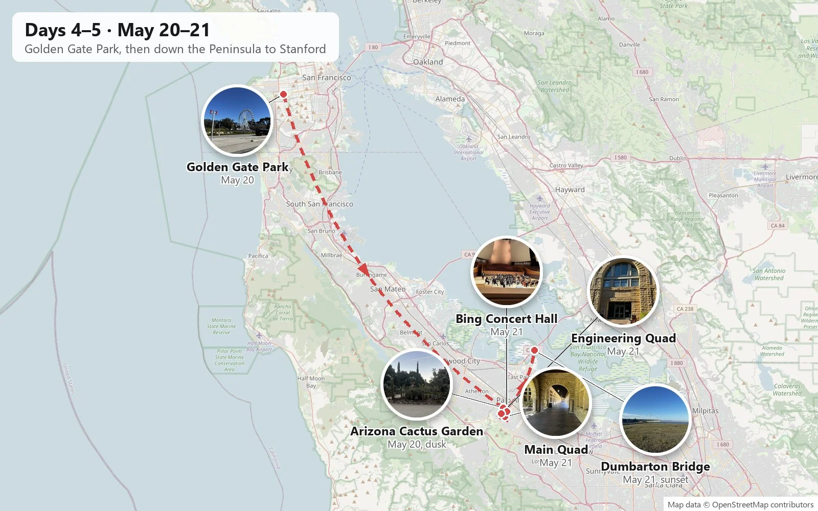
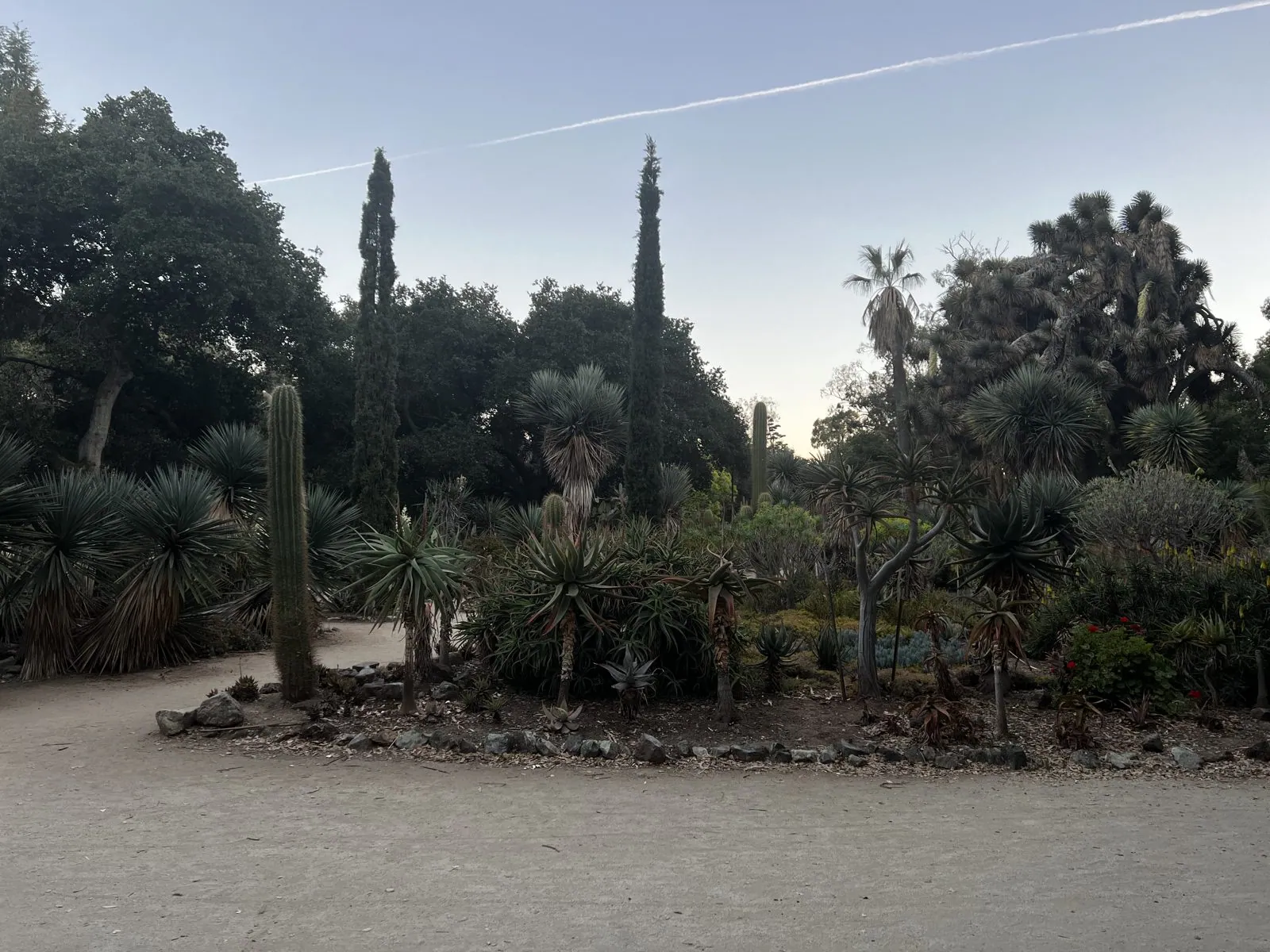
That afternoon we drove down the Peninsula to Redwood City. After bubble tea and a Japanese set dinner in Palo Alto, we got to Stanford at dusk. The first stop was a strange and lovely one: the Arizona Cactus Garden, laid out in the early 1880s for Jane and Leland Stanford beside what was supposed to become their mansion. The mansion was never built. The garden survived, half-forgotten for decades, and was restored in the 1990s. In the blue light after sunset it's a landscape from another planet: columnar cacti, spiky agaves and fat barrel cacti along sandy paths, with the oaks of the Arboretum all around.
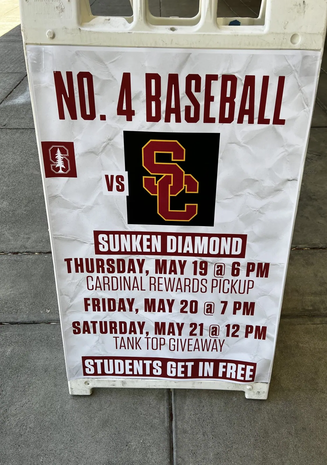
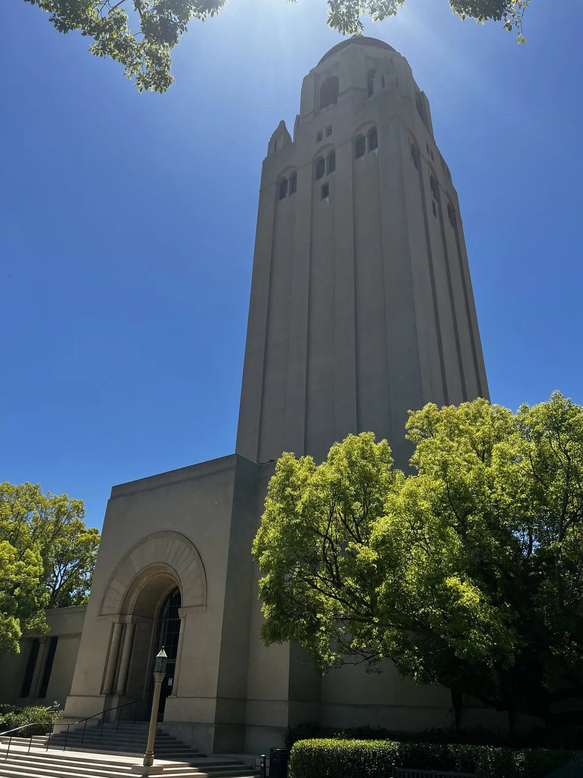
Saturday was the full campus day. Near the bookstore an A-frame sign announced the weekend's big series: No. 4 Stanford against USC at Sunken Diamond, Thursday, Friday and Saturday at noon, students free. It seems USC was following me up the state. Then came the landmarks. Hoover Tower is 285 feet of sandstone-colored concrete with a red-tiled dome, built in 1941 for the university's fiftieth anniversary to house Herbert Hoover's huge collection of documents on war and revolution.
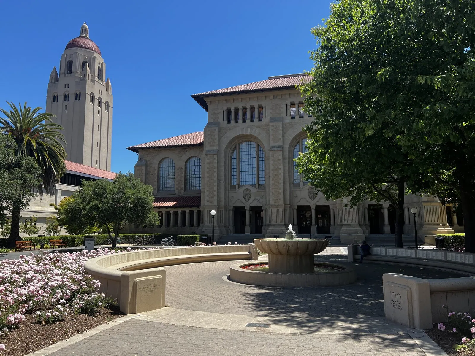
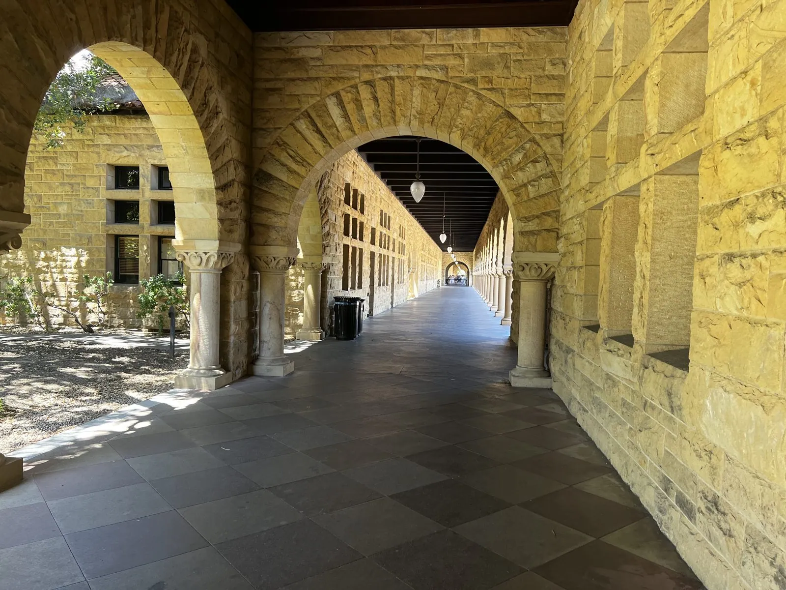
The heart of the campus is the Main Quad. Frederick Law Olmsted, of Central Park fame, did the site plan, and the buildings, by the Boston firm of Shepley, Rutan and Coolidge, mix Romanesque arches with Spanish mission red tile. The result is the most recognizable campus look in the West: long arcades of rough-cut buff sandstone, deep shade under the arches, and dazzling sun on the courtyard. Seen from the side, Hoover Tower rises behind the quad like a bell tower that wandered over from somewhere else.
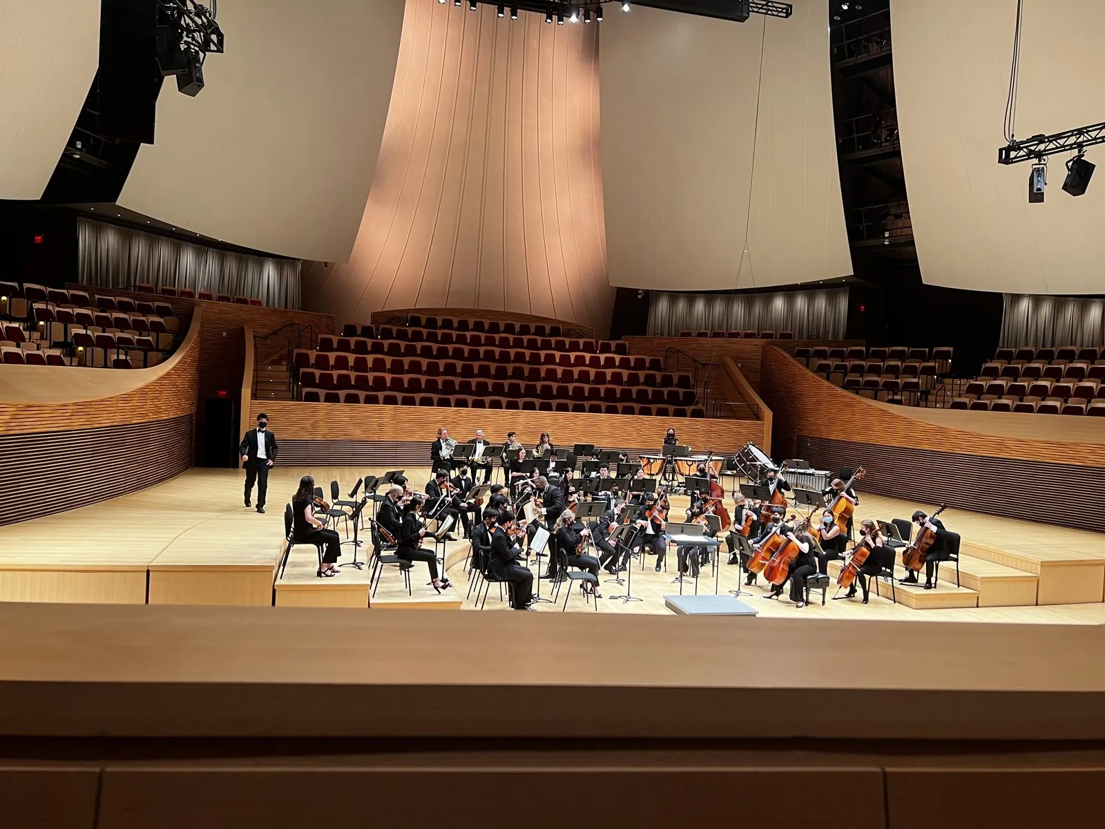
After lunch in a campus dining hall, we went to an afternoon concert at Bing Concert Hall: the Stanford Philharmonia's spring concert. Bing is Stanford's 2013 concert hall, a "vineyard" design in which terraced seating wraps all the way around the stage, with billowing sail-like panels overhead to shape the sound.
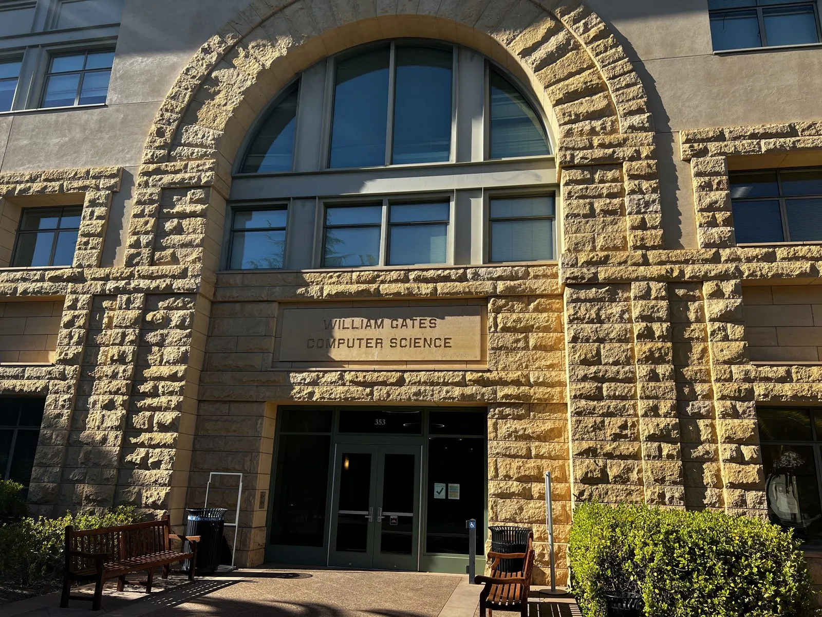
The day ended, appropriately for a computer graphics student, at the Engineering Quad. The Gates Computer Science Building wears its sandstone like the rest of the campus. It is a modern building in the old style, its name carved over a great arched window, and it holds one of the most famous computer science departments in the world. Google's founders were graduate students in this building in the 1990s when they wrote the first version of their search engine.
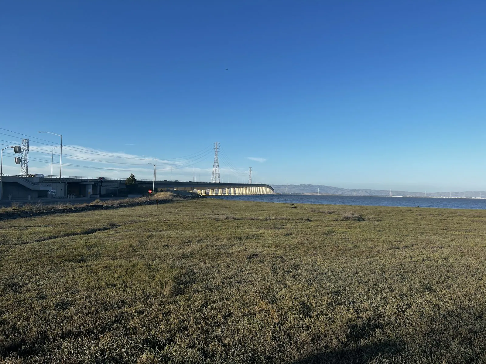
At seven in the evening we drove out to the bay shore at the Dumbarton Bridge, where the Bayfront Expressway runs along the edge of the Don Edwards San Francisco Bay National Wildlife Refuge. It is a flat, quiet, enormous landscape of tidal marsh and old salt-evaporation ponds. The low sun lit up the dry grass, the long bridge ran off toward the East Bay hills, and a line of power pylons marched across the water. Silicon Valley is ten minutes away, and you would never know it. That night, like the one before, we stayed at the Holiday Inn Express in Redwood City.
Silicon Valley, one logo at a time
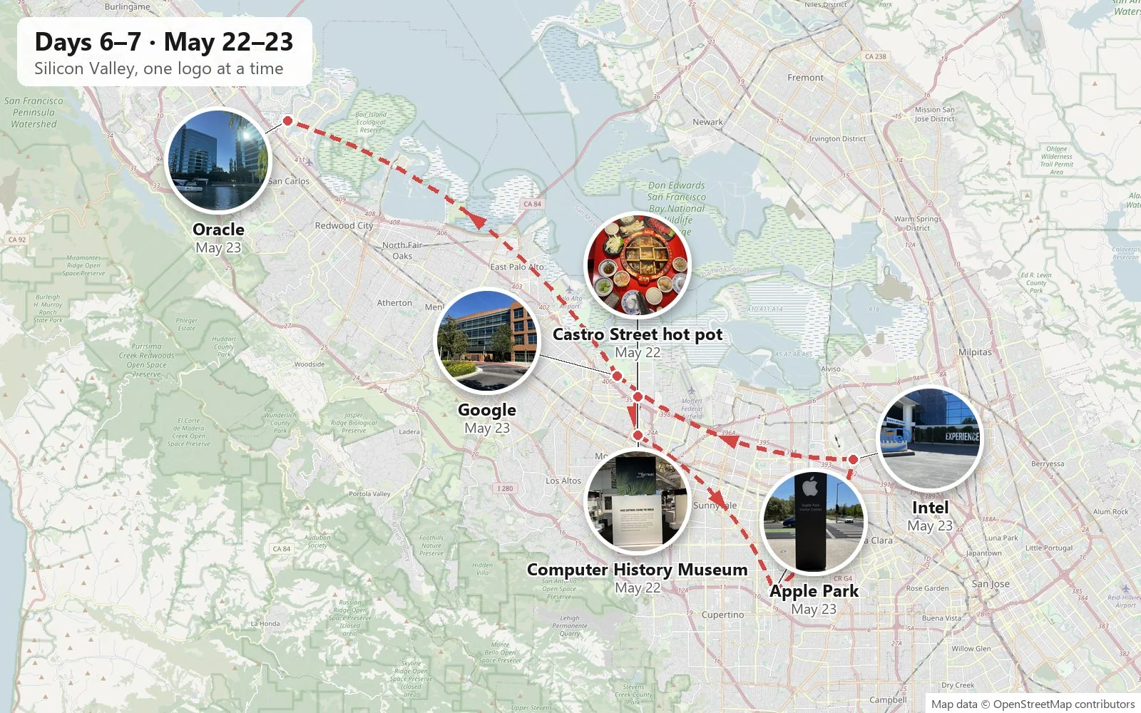
Sunday began at the Computer History Museum in Mountain View, which holds the largest collection of computing artifacts in the world. Its newest permanent exhibit, Make Software: Change the World!, tells the story through the software itself rather than the machines: the programs behind everything from MP3s and photo editing to car crash simulations and Wikipedia. One wall is a long, bright collage of a city street at night, every screen and sign in it running on code.
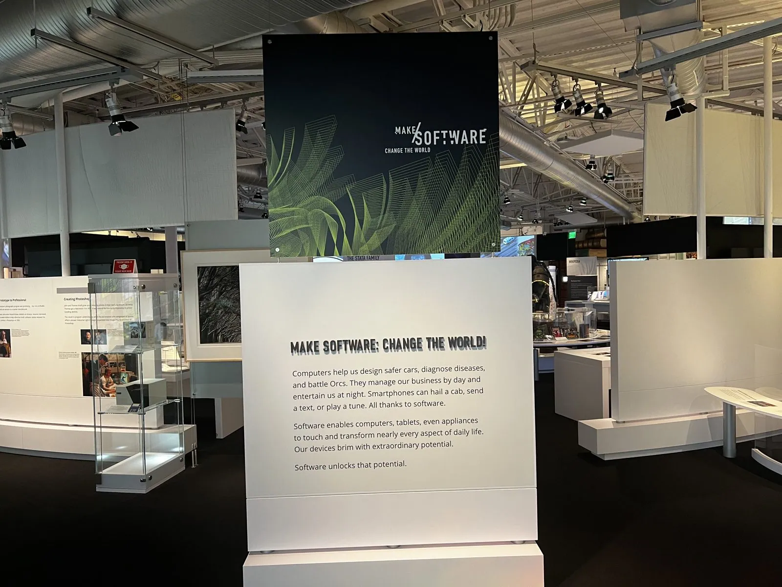
We had lunch in the museum café. In the afternoon we drove down to San Jose's Little Saigon and spent a couple of hours singing in a karaoke room, then came back up to Mountain View.
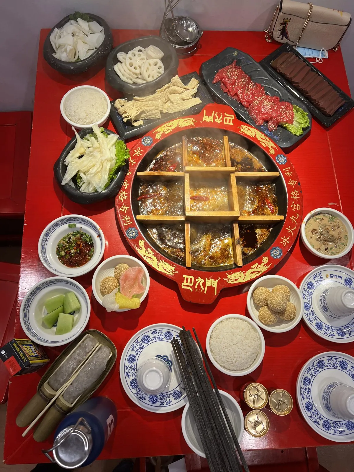
That evening's dinner on Castro Street in Mountain View deserves its own photo. Chongqing-style nine-grid hot pot divides one big pot of chili-red broth into nine square compartments with a wooden grid. The idea is that the center square, sitting right over the flame, is hottest, the corners are coolest, and you choose a square for each ingredient depending on how long it should cook. Around it went platters of sliced beef and lamb, vegetables, and in the middle of the table a fat golden koi carved out of fried dough.
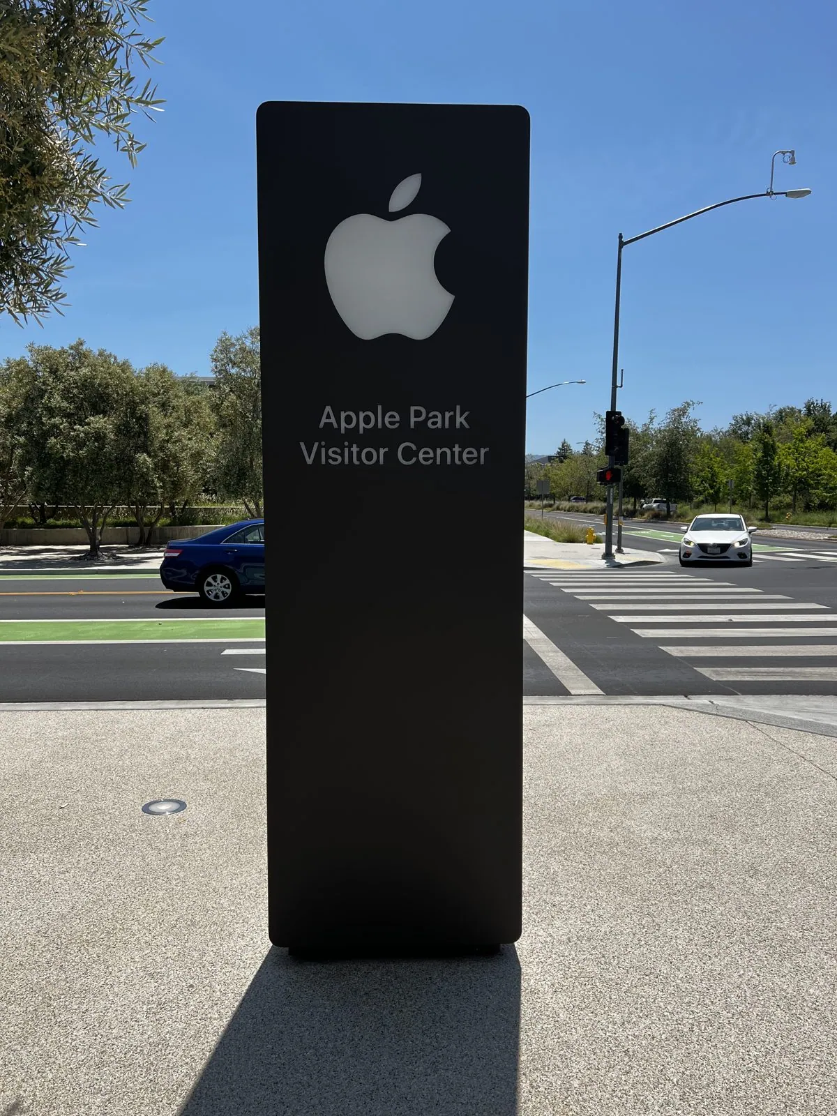
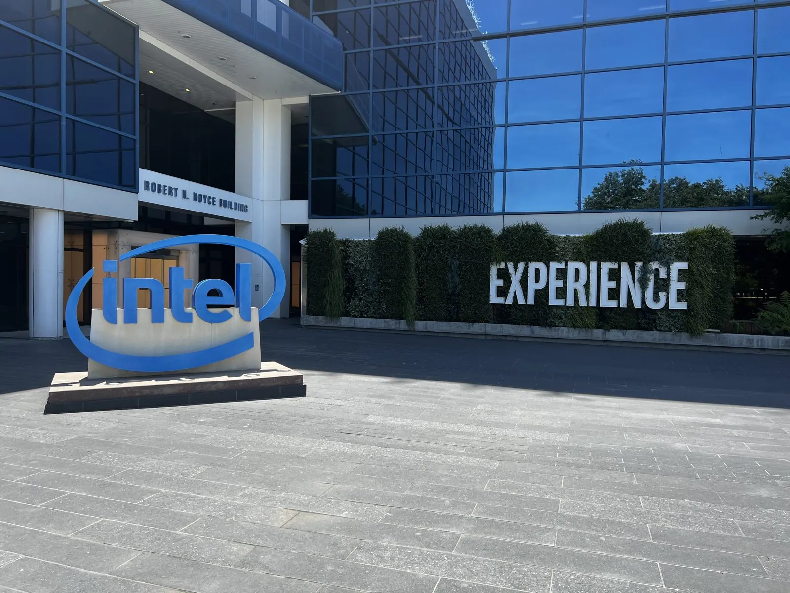
Monday was the tour we'd been half-joking about all week: the headquarters. None of these places let you in, of course; you go to stand outside and look. At Apple Park in Cupertino, the visitor center is a pavilion of glass and stone under a long, thin roof, across the road from the famous ring-shaped main building, which you can only glimpse through the trees. Half an hour up the road in Santa Clara is Intel, in the Robert Noyce Building. It is named for the co-founder who co-invented the integrated circuit, and its plaza has the blue logo standing on the pavement like a sculpture.
Then Google in Mountain View, at its trio of numbered brick-and-glass buildings, 1900, 1950 and 2000, linked by skybridges around a garden. Last came Oracle at Redwood Shores, the most dramatic of them: a cluster of cylindrical blue-glass towers on the edge of an artificial lagoon, said to be meant to echo the cylinder that is the standard symbol for a database. Moored on the lagoon was a reminder of Larry Ellison's other hobby. USA 17 is the giant wing-sailed trimaran with which his team won the America's Cup in 2010.
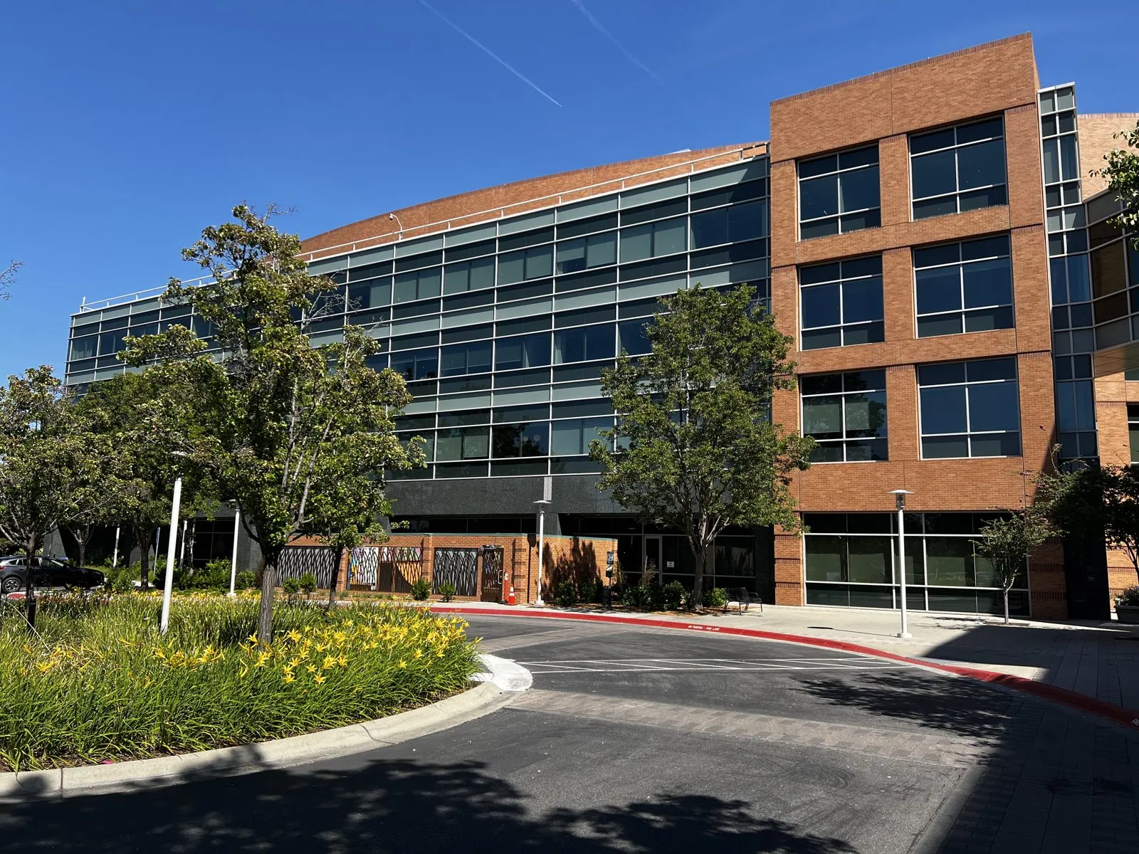
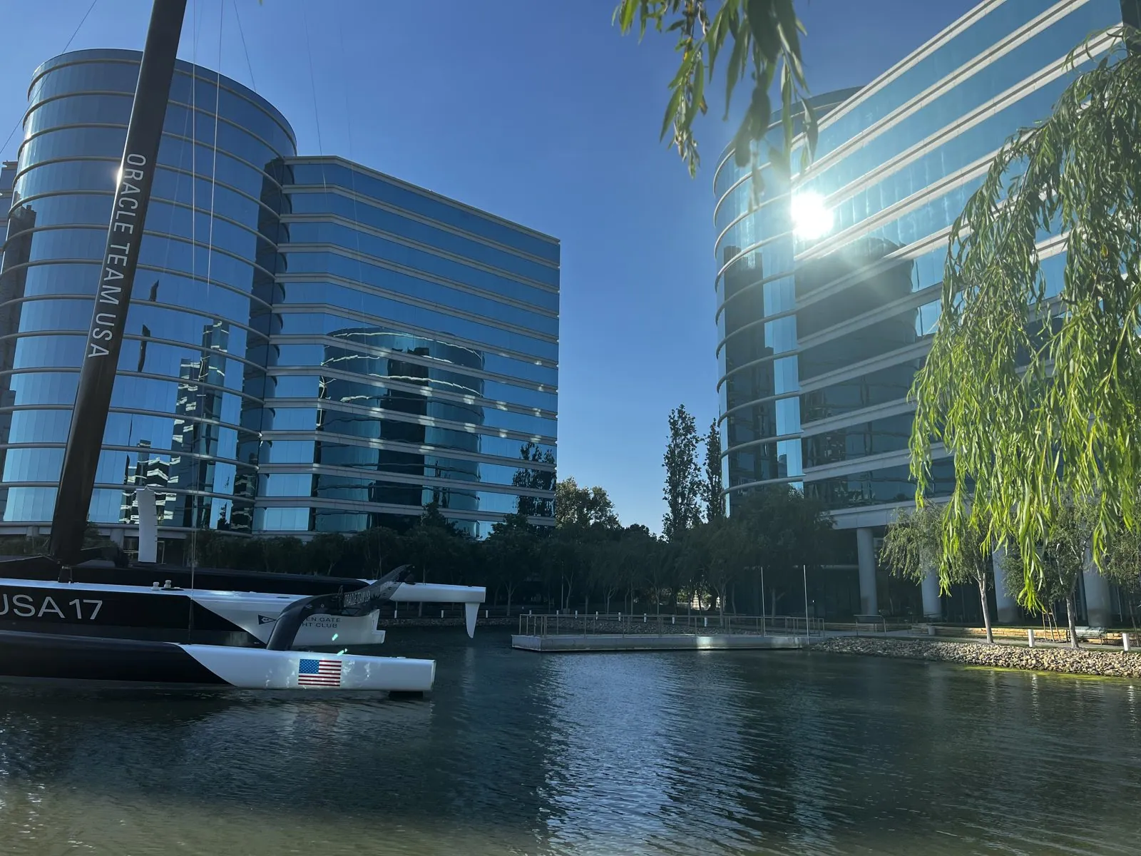
Four companies, four very different ideas of what a headquarters should look like, all within about twenty miles of each other. We spent the night at the Wyndham Garden in San Jose, and the next morning we turned south, toward the coast.
Capitola and Highway 1
The last day was the longest drive of the trip, and the most beautiful. It started at ten thirty in Capitola, a little beach town on the north shore of Monterey Bay that claims to be the oldest seaside resort on the West Coast. Its signature is the Venetian Court, a row of stucco apartments built in 1924 right on the sand. Each one is painted a different color: pink, mint, lemon, sky blue, coral. From the beach they look like a box of pastel chalk somebody tipped out along the shore.
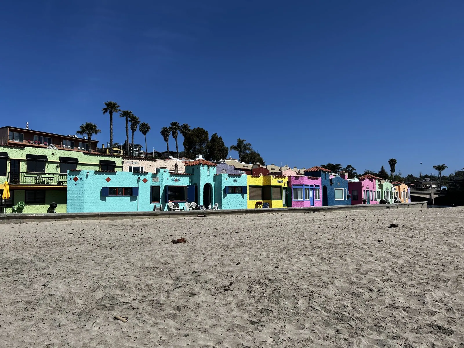
Behind the beachfront, the colors continue down narrow walkways between the buildings: lavender, aquamarine, red and saffron walls, flower pots on the steps, the sea glinting at the end of each alley. The old wooden Capitola Wharf runs out into the bay under a wrought-iron arch, and on a Tuesday morning in May the beach already had umbrellas and pop-up tents.
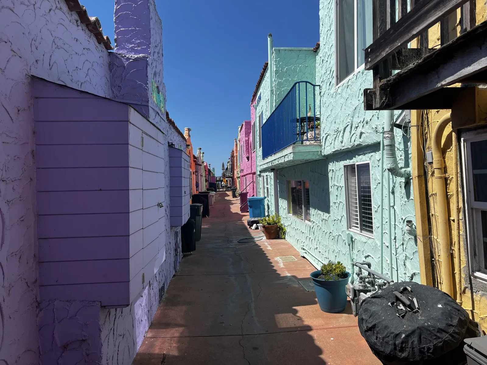
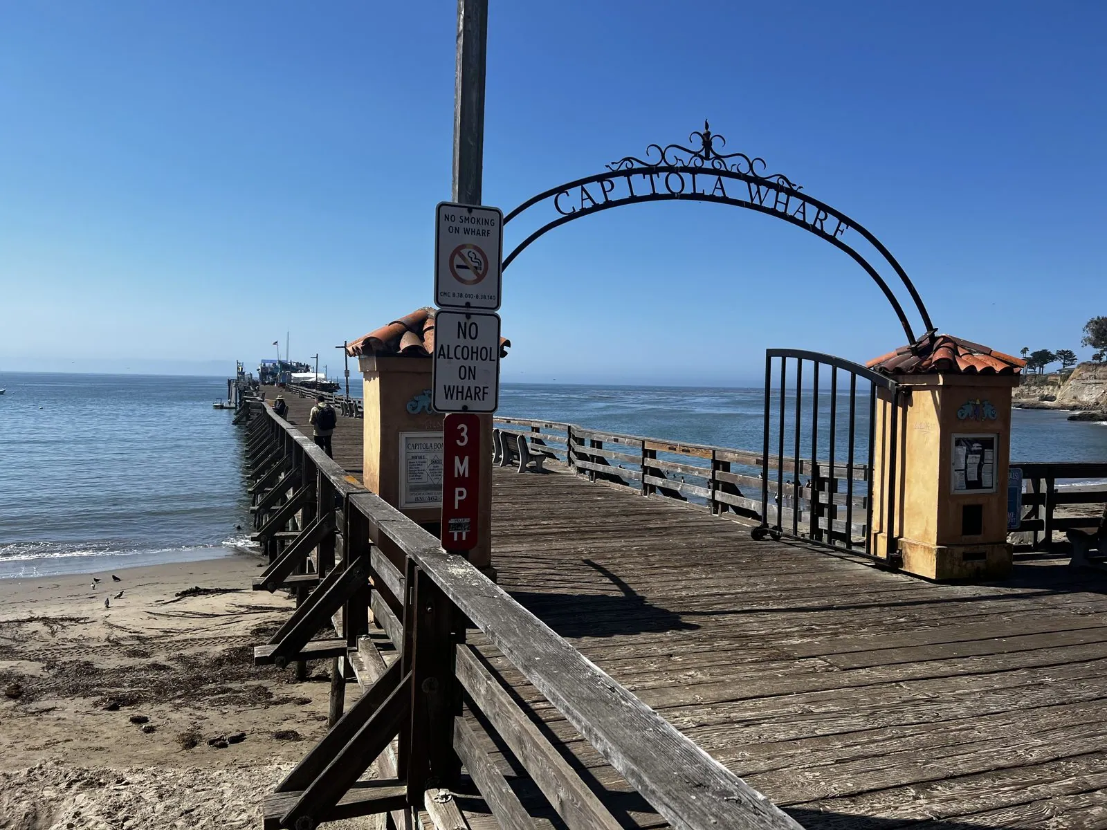
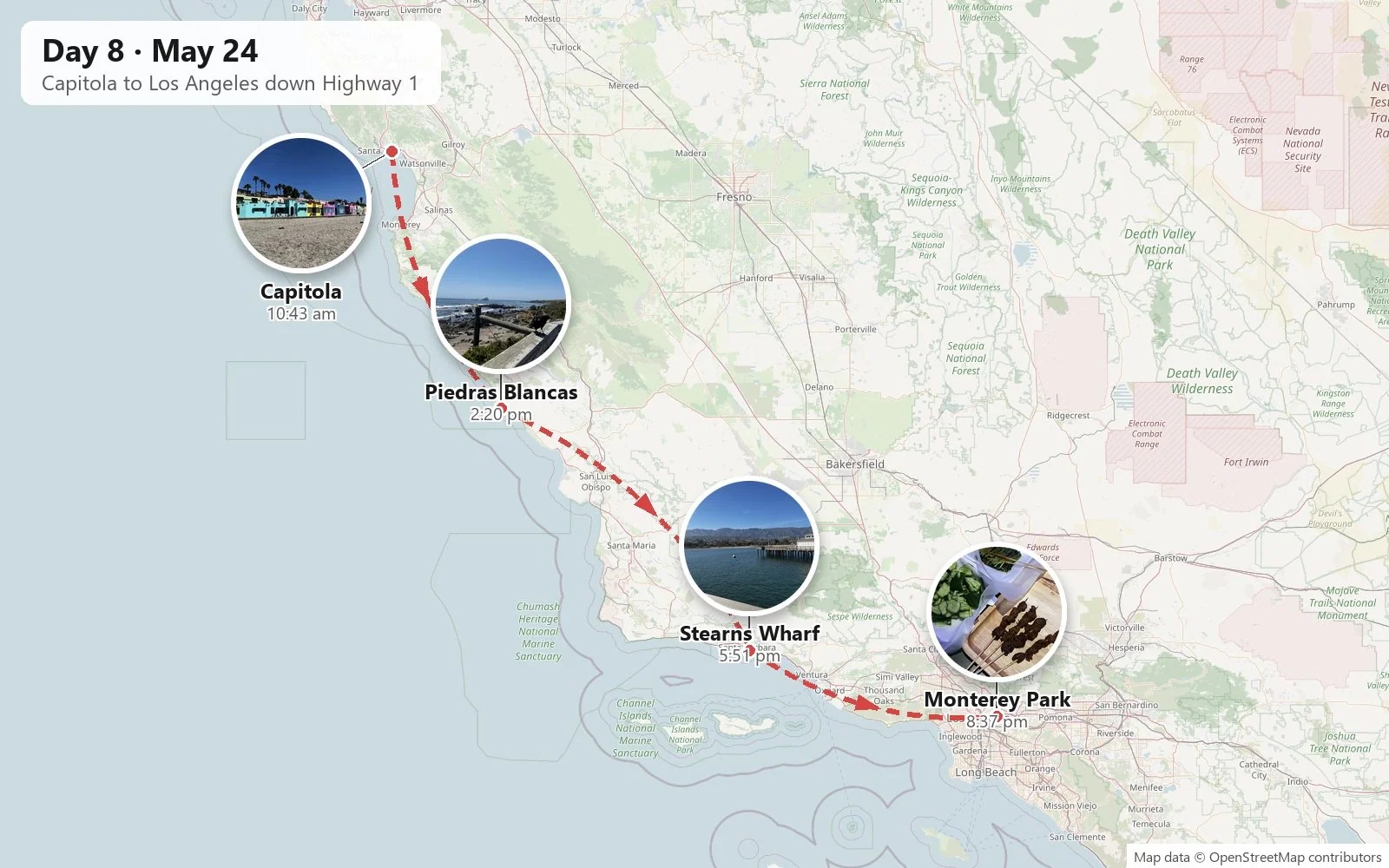
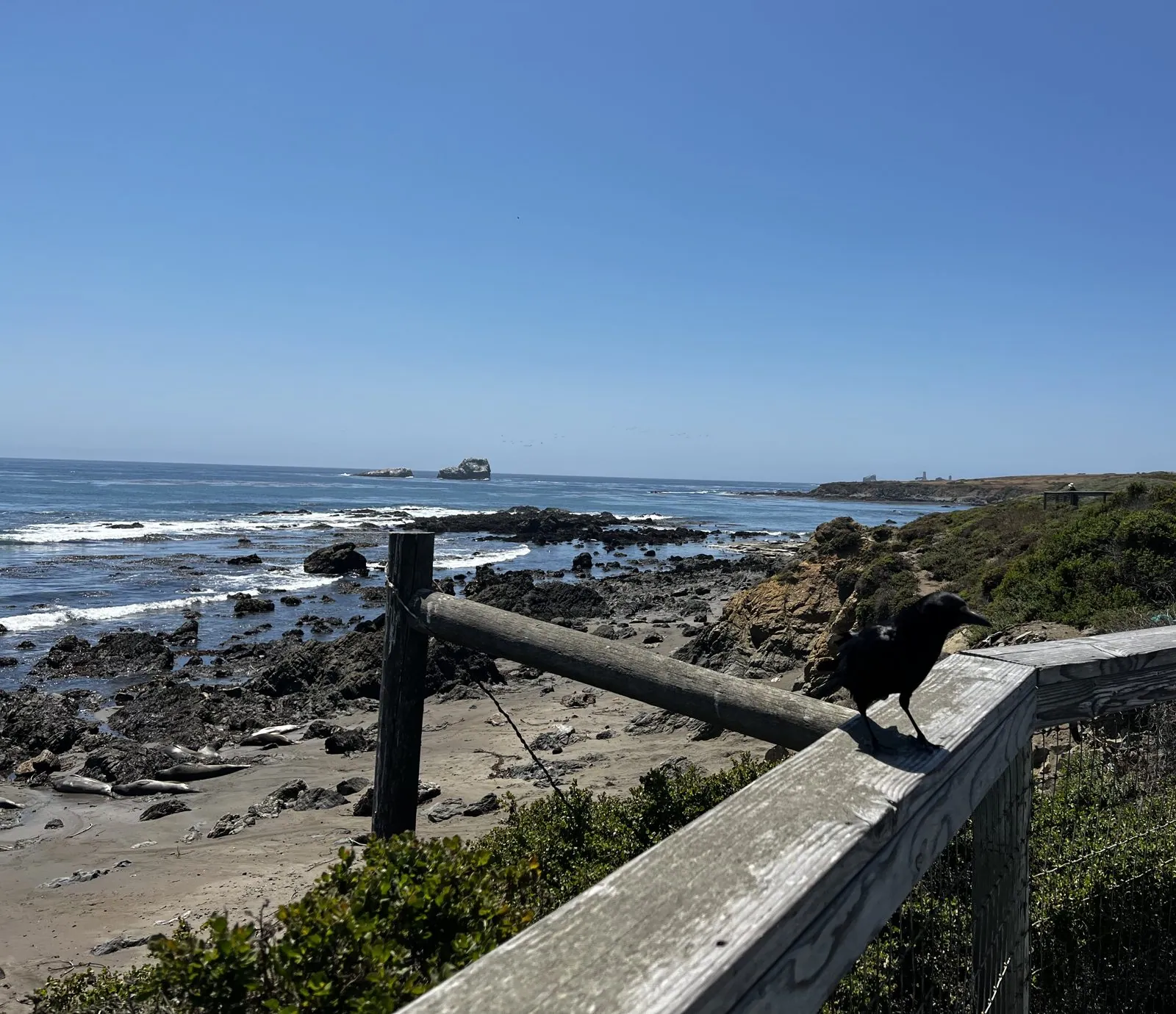
From there, Highway 1 south, and that Tuesday afternoon, May 24, we drove it all the way through Big Sur. It is one of the great drives of the world: the road clinging to the side of the Santa Lucia Mountains a few hundred feet above the surf, bridge after bridge across steep canyons. For a driver on a brand-new license, it is also an education in hairpins. By twenty past two we had come down out of the mountains to the flat coastal terrace at Piedras Blancas, north of San Simeon, where a boardwalk overlooks the rocky beach where northern elephant seals haul out by the thousand. A raven sat on the railing as if it ran the place.
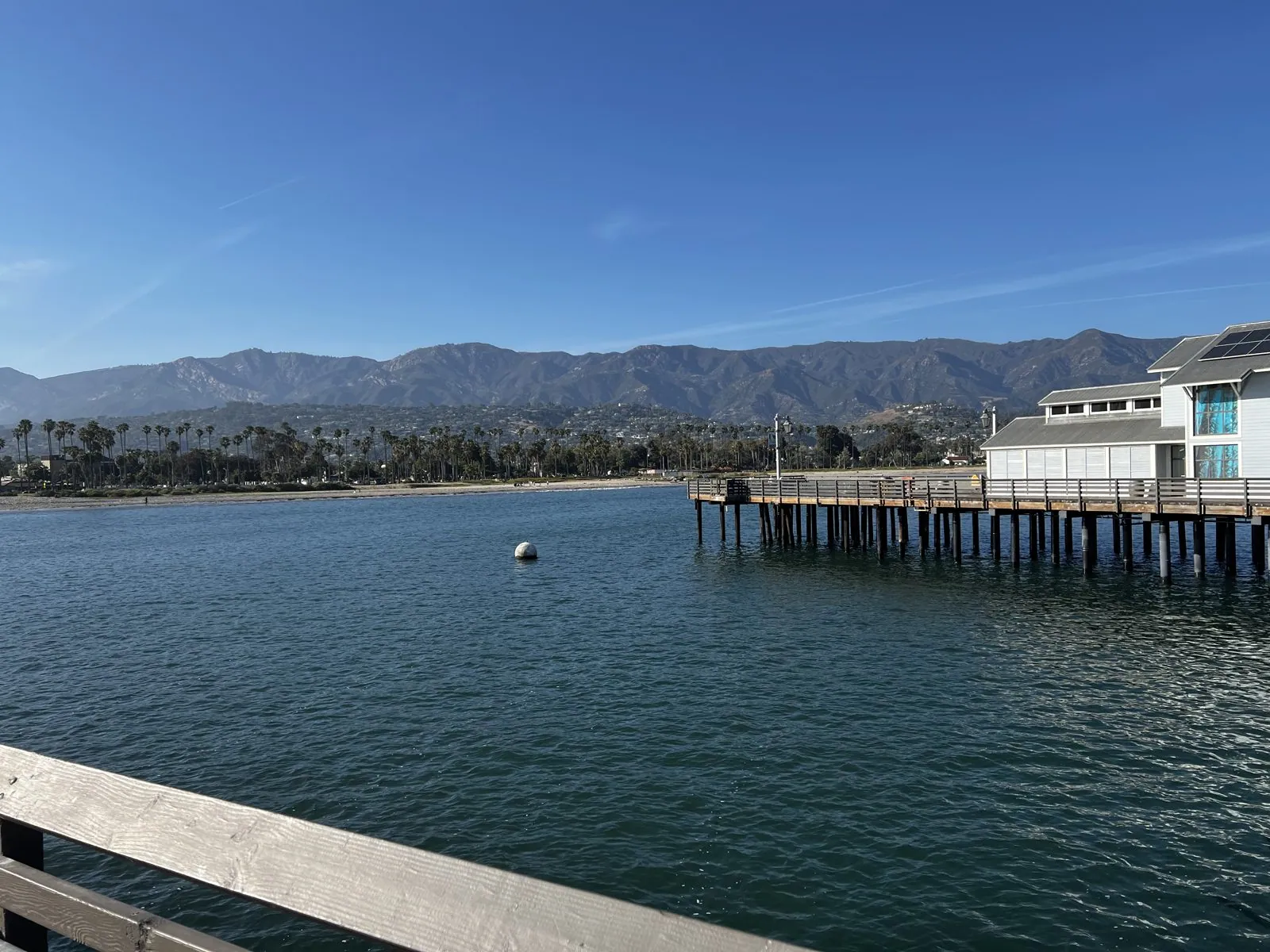
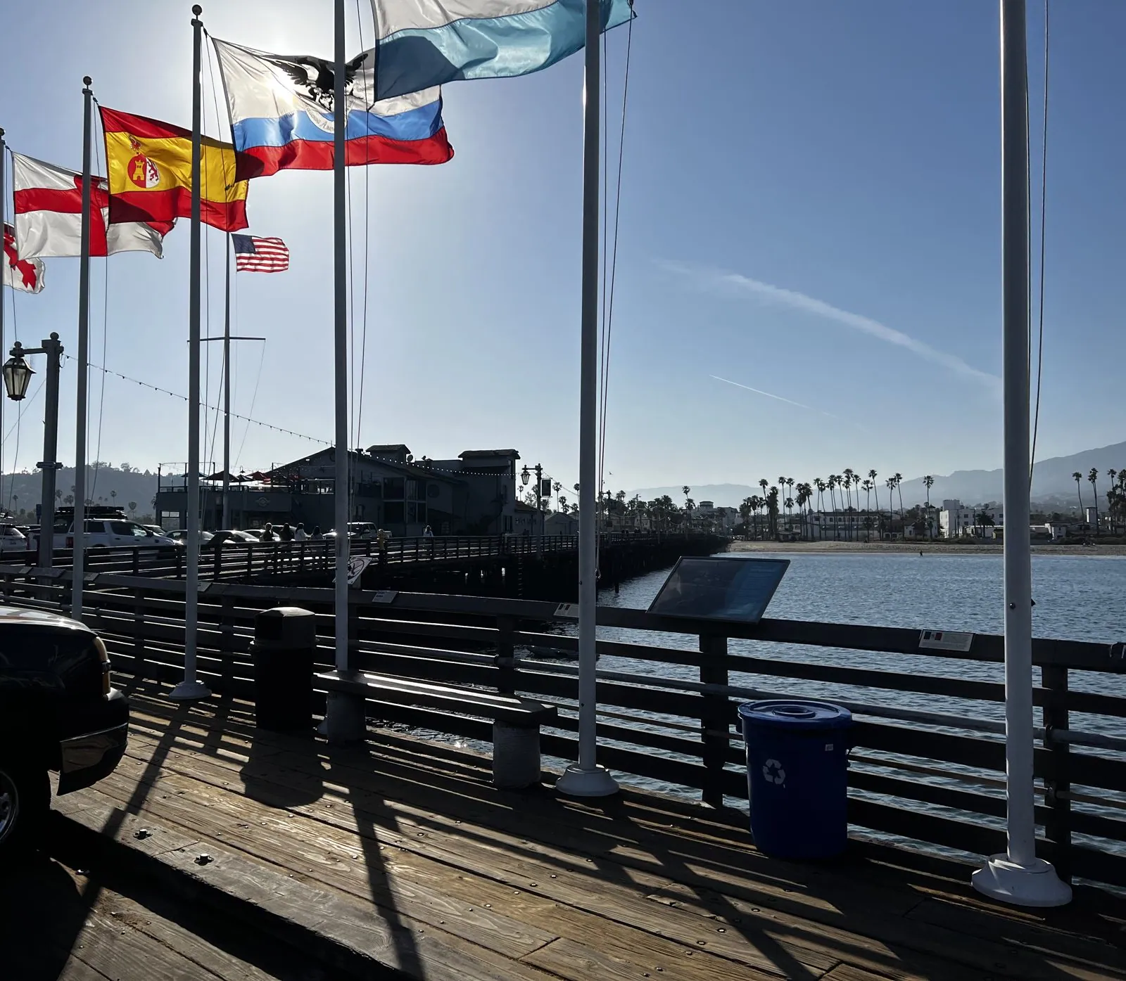
By a quarter to six we were in Santa Barbara, on Stearns Wharf. Built in 1872, it is the oldest working wharf in California. The wind off the channel was strong enough to make the flags along the pier snap straight out, and the view back toward land is the one Santa Barbara is famous for: the harbor, the palm-lined waterfront, and the Santa Ynez Mountains rising steeply right behind the town.
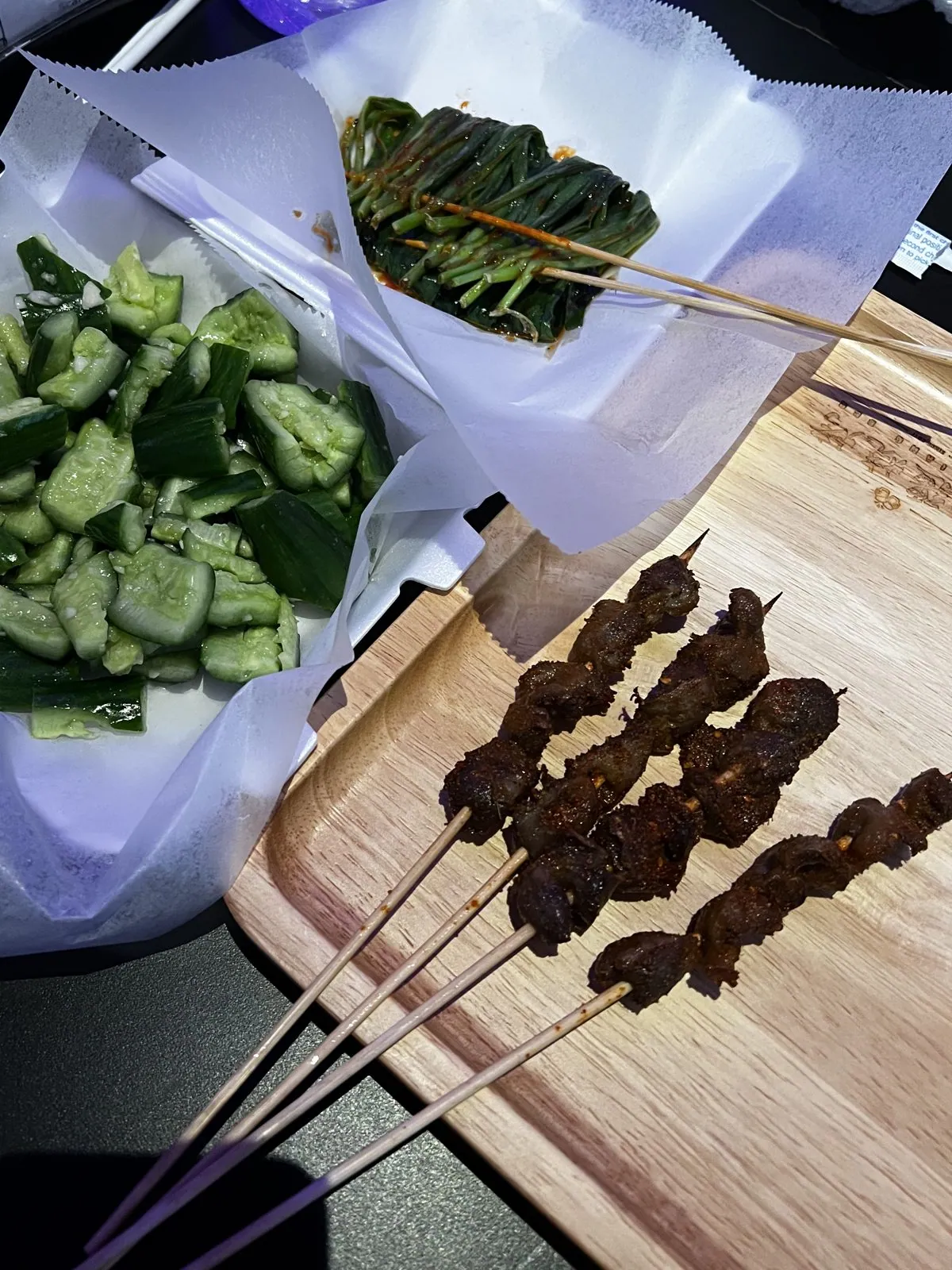
The trip ended where it should have, at a dinner table. We were back in the Los Angeles area by evening, and dinner was at a Xinjiang barbecue place in Monterey Park in the San Gabriel Valley: cumin lamb skewers again, bookending the week with the meal it began with in San Francisco, plus a plate of smashed cucumbers. The next morning, at 9:38, the camera roll shows the same gray sedan back in the garage and the same slow walk-around, this time for the return.
Part two: Yellowstone and the Tetons in the snow
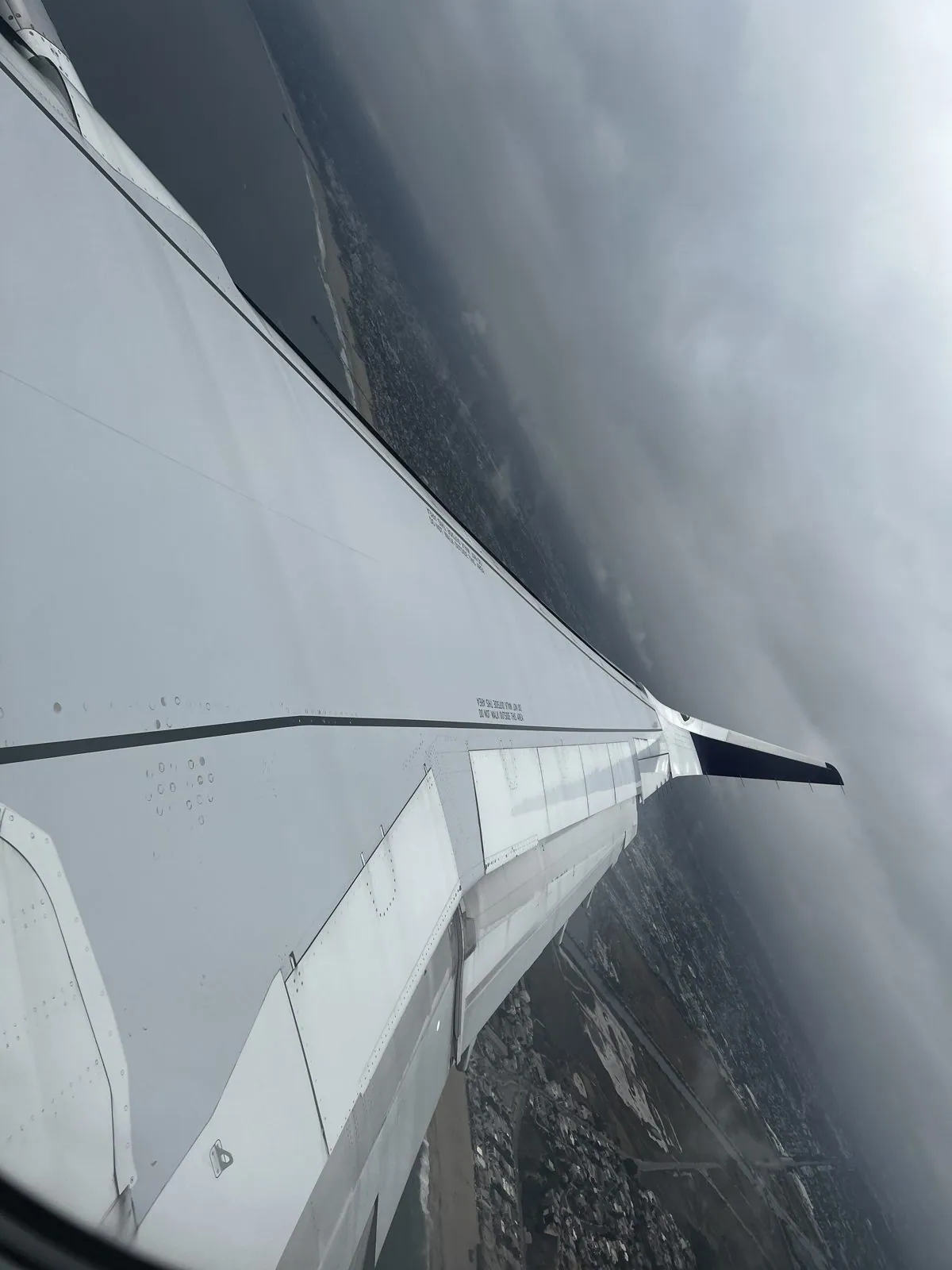
Three days later I was in the air. The second trip was with a different and much bigger group of friends, big enough to fill a long table at dinner. The plan was the classic Memorial Day weekend loop: fly into Salt Lake City, drive north to Yellowstone, come back down through the Tetons. At 9:40 on Saturday morning the plane banked over the Los Angeles basin into a gray overcast, and I took a photo of the wing, the way everybody does.
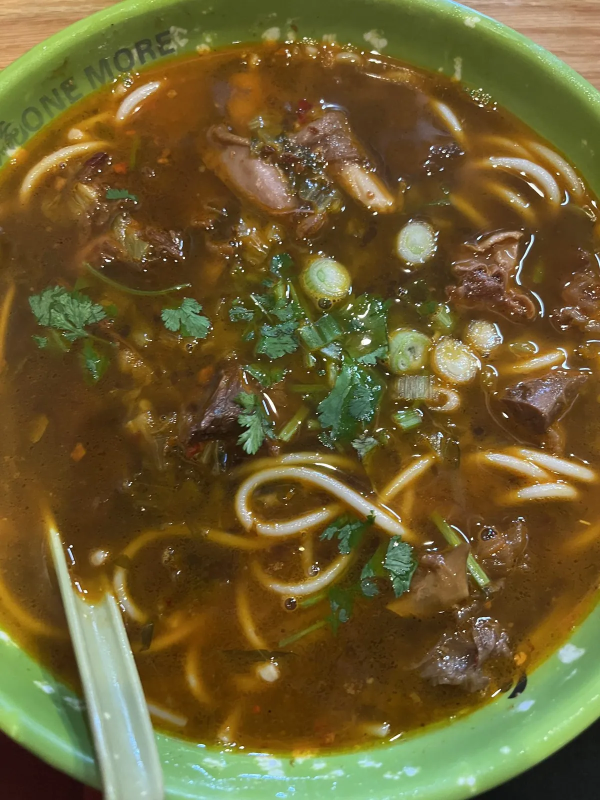
In Salt Lake City, the first order of business was lunch: braised beef noodle soup in South Salt Lake, at a shopping plaza with a Chinese pagoda gate, under storm clouds piling up over the Wasatch. Then the drive, more than four hours north through Idaho and the longest stretch of the whole trip, to West Yellowstone, Montana, the little town at the park's west gate. We arrived late and hungry and ate barbecue at a long table, trays of brisket, cornbread and beans, a little after ten at night.
Bison on the Madison
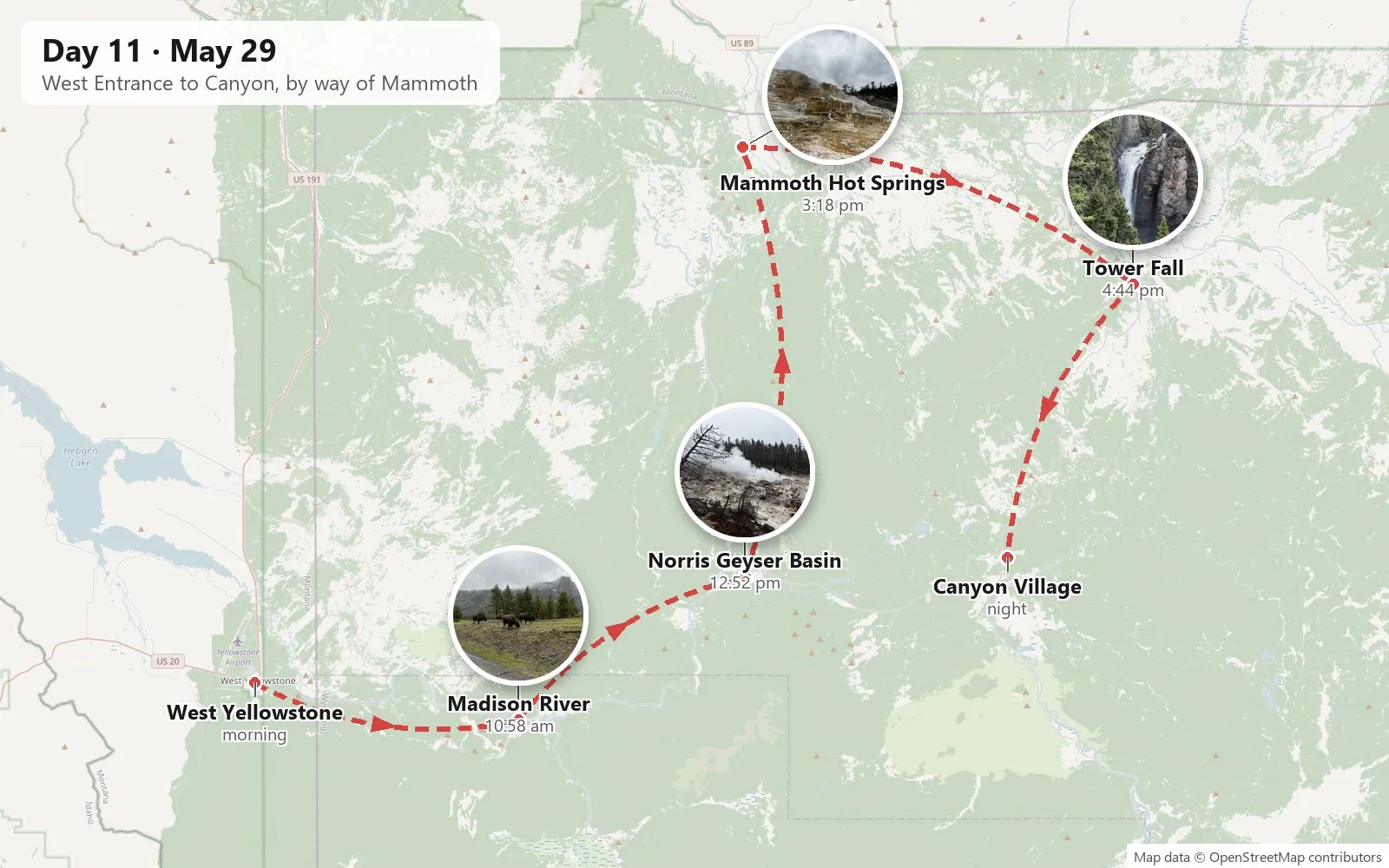
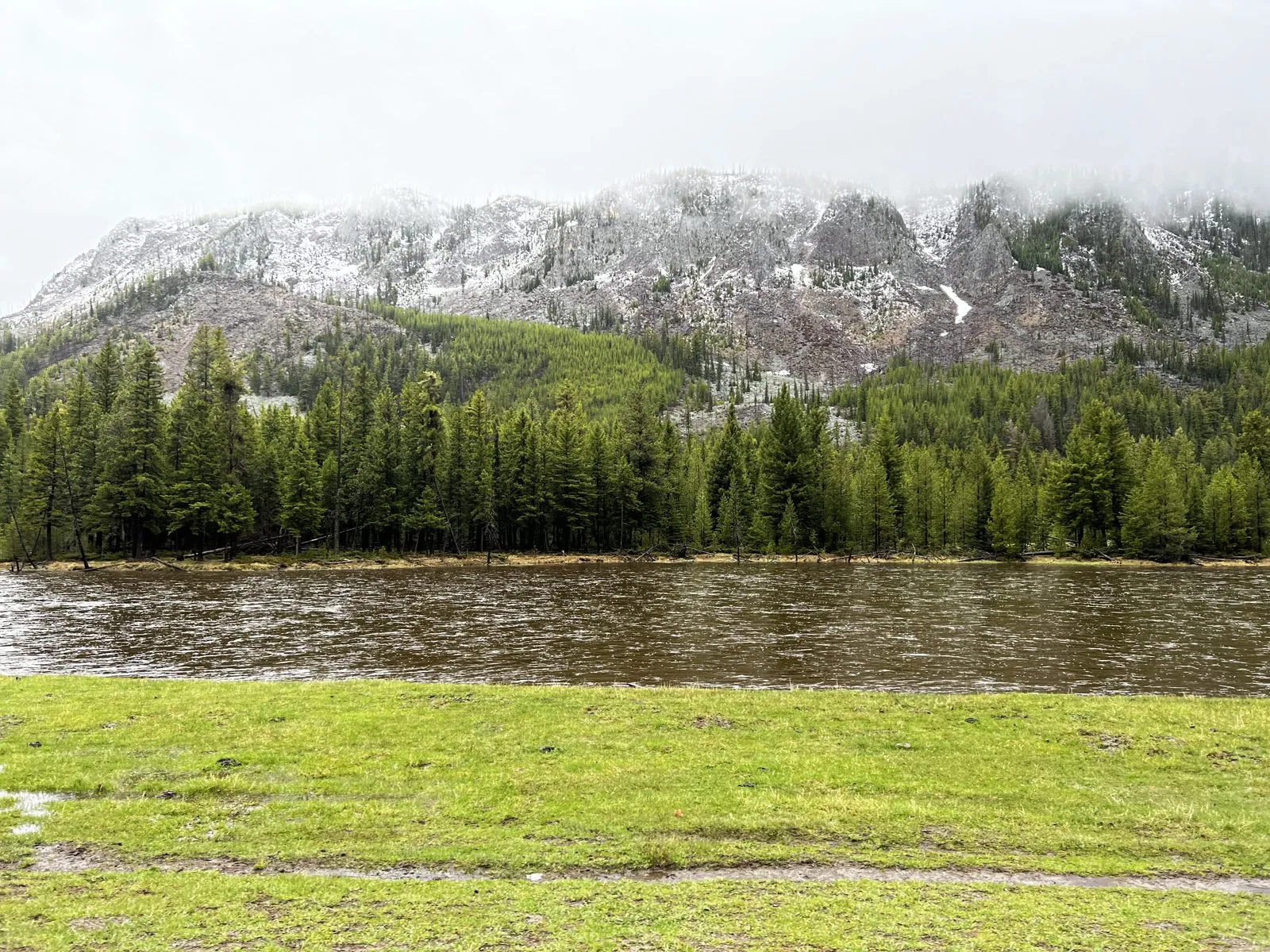
Sunday morning we drove through the West Entrance into Yellowstone, the world's first national park, established in 1872. The road follows the Madison River east through a broad valley, and it was immediately clear that this would not be a sunny weekend. The ridges above the river were dusted white with fresh snow, low cloud hung in the pines, and the grass along the water was wet and vivid green.
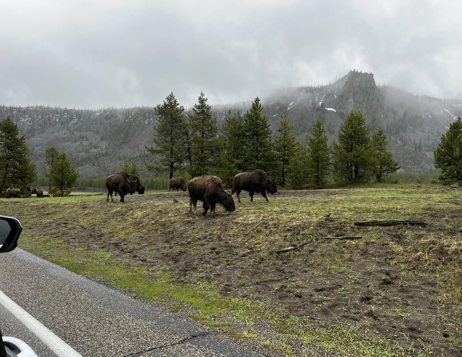
Then the first bison. Yellowstone is the only place in the United States where bison have lived continuously since prehistoric times. By 1902 poaching had brought the wild herd down to about two dozen animals, and today there are several thousand. Three of them were grazing calmly at the roadside, shaggy and enormous, completely indifferent to the line of cars that had stopped to stare. The rule is to stay at least twenty-five yards away, and from inside a car that's easy. They are much bigger than you expect, and they move like weather.
Norris Geyser Basin in the fog
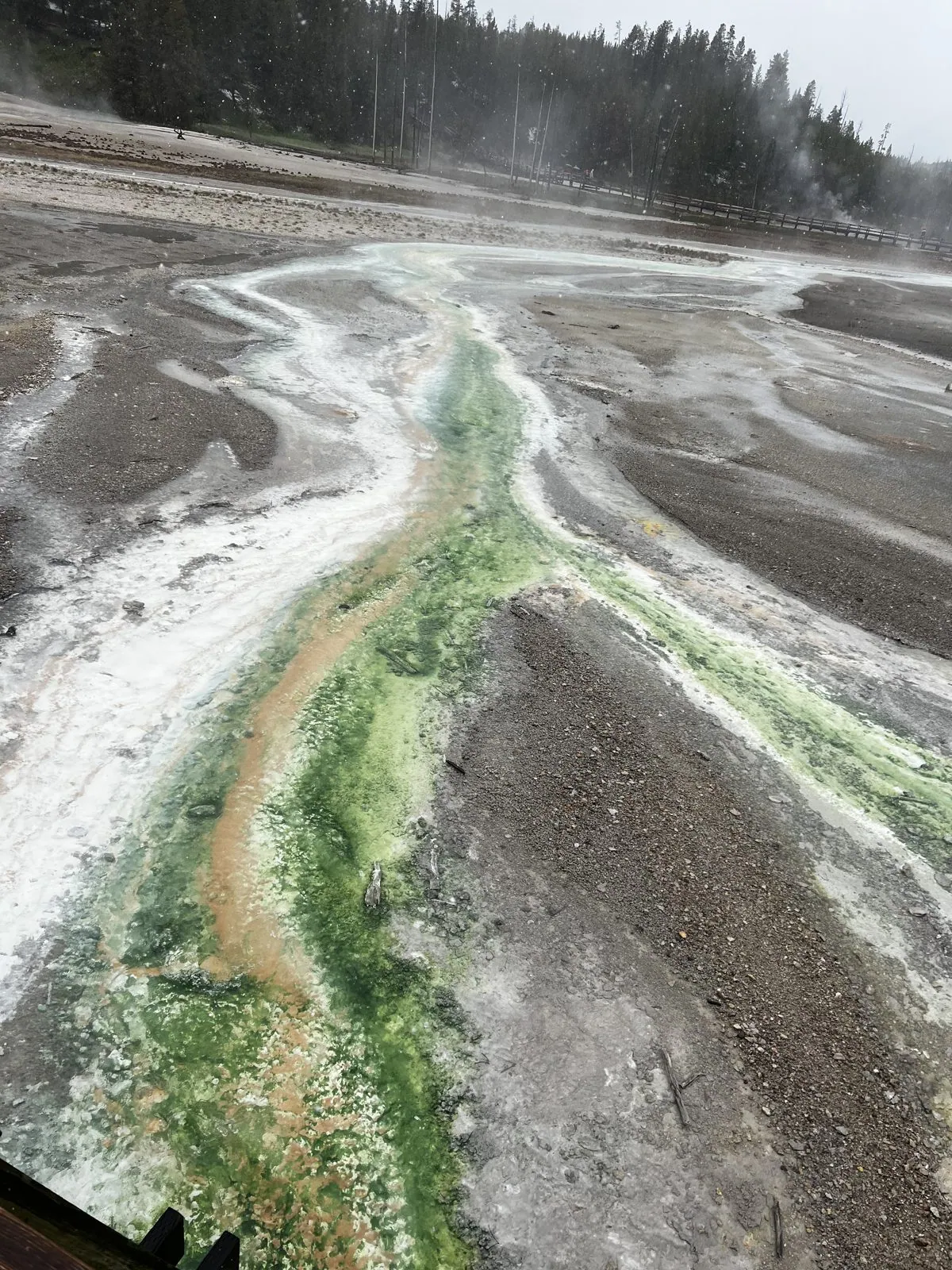
Our first thermal area was Norris Geyser Basin, the hottest and most acidic in the park. It is also among the most changeable: new vents open, old ones die, and the ground can heat up enough in a single season to close a trail. That day it was wrapped in drizzle and fog, so the whole basin steamed like a pot about to boil. The colors still came through. Runoff channels from Pinwheel Geyser ran across the gray sinter in streaks of bright green and rusty orange. Those are mats of heat-loving microbes, each color a different organism living at a different temperature.
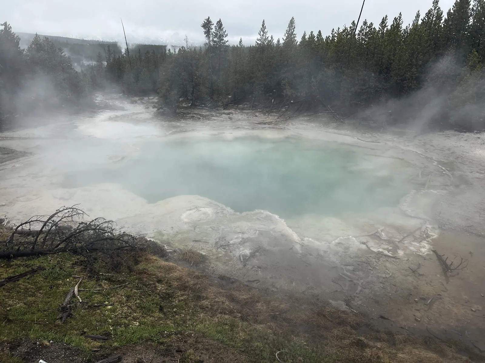
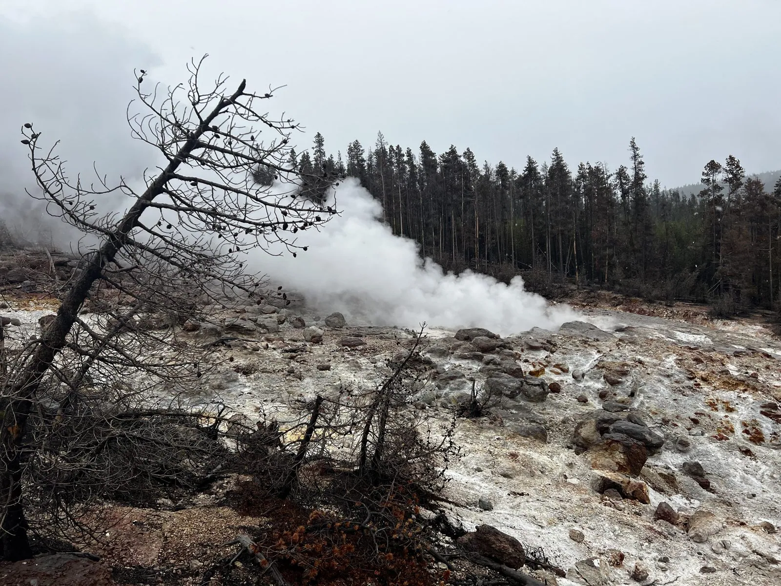
Below the boardwalk lies Steamboat Geyser, the tallest active geyser in the world. Its major eruptions can throw water more than three hundred feet into the air. They are completely unpredictable. For years it would go silent for a decade at a time, but starting in 2018 it woke up and erupted dozens of times a year. We didn't see a major eruption. But it was steaming hard, a white plume pouring off the hillside past the dead, bleached trunks of trees the heat had long ago killed.
Mammoth Hot Springs
North of Norris the road climbs and then drops toward the Montana line and Mammoth Hot Springs. Here the hot water rises through limestone instead of volcanic rock, dissolves it, and redeposits it on the surface as travertine, up to two tons a day. The result is a hillside that grows as you watch, built of stepped terraces like a frozen waterfall. At the foot of the hill stands Liberty Cap, a 37-foot cone left by a hot spring that has been dormant for centuries. It was named in 1871 for its resemblance to the caps worn in the French Revolution.
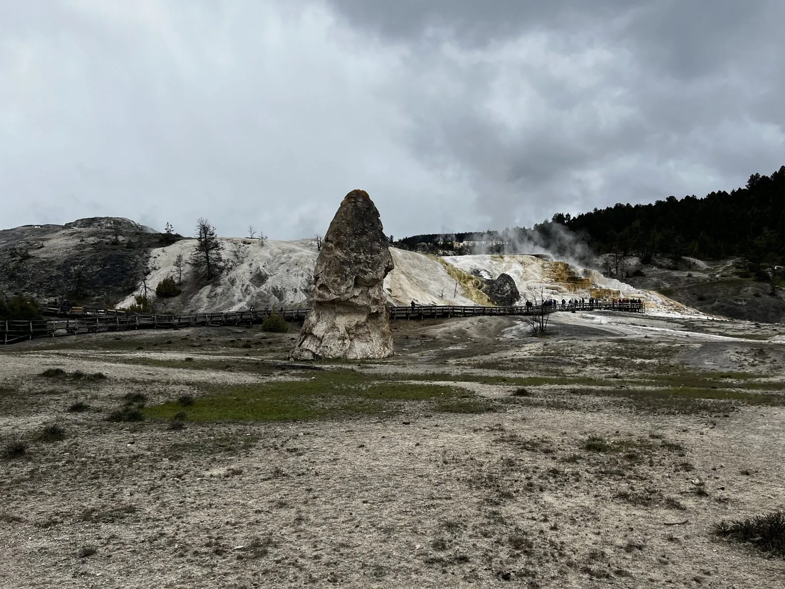
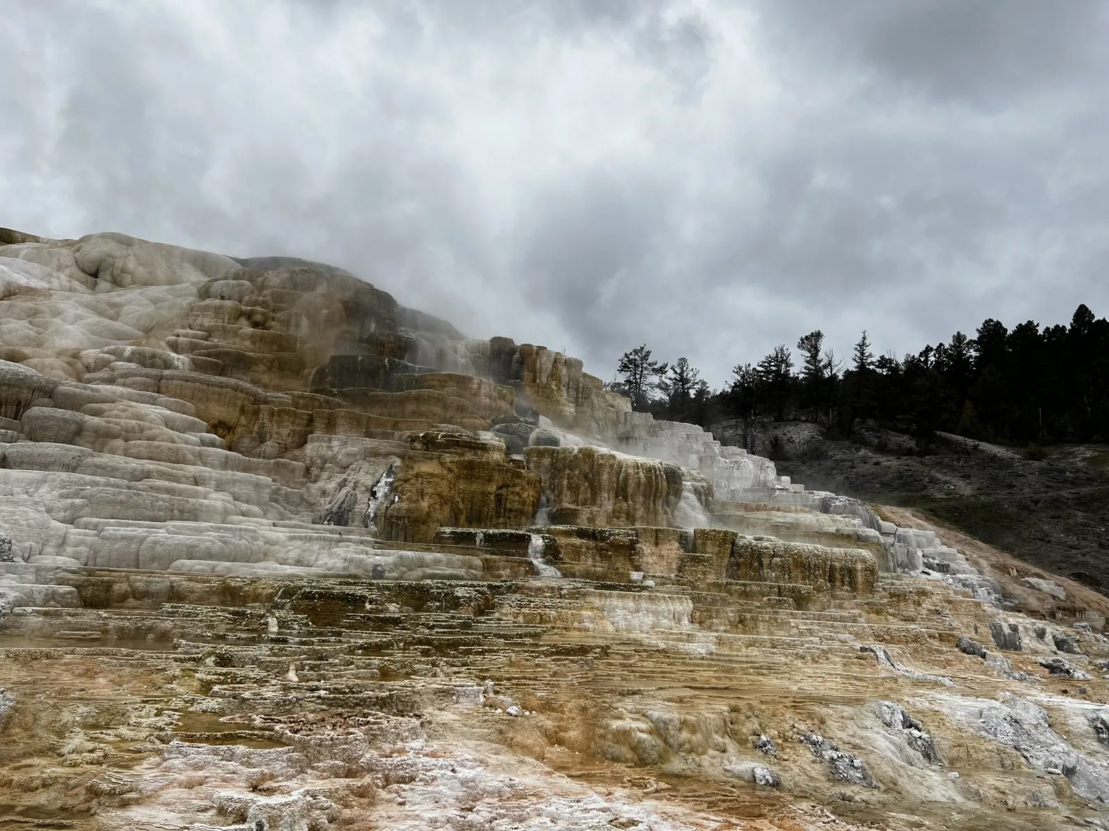
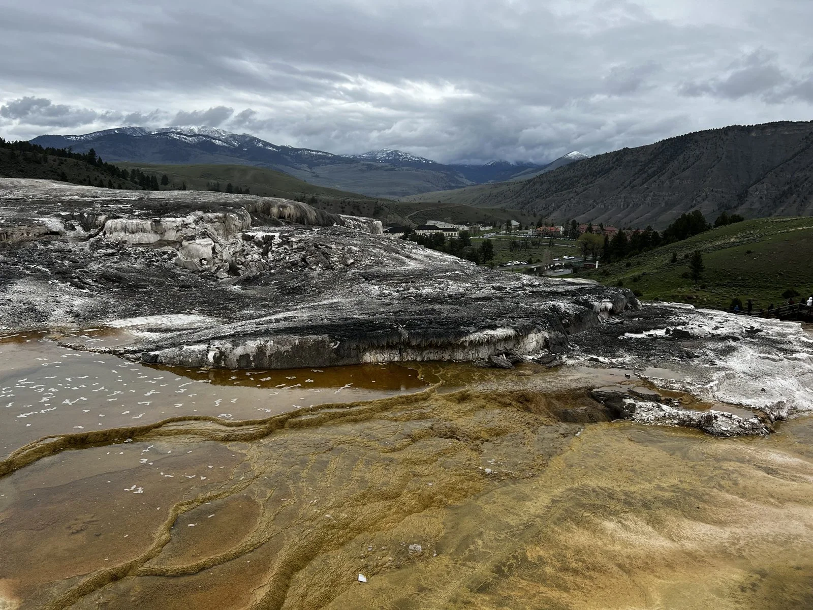
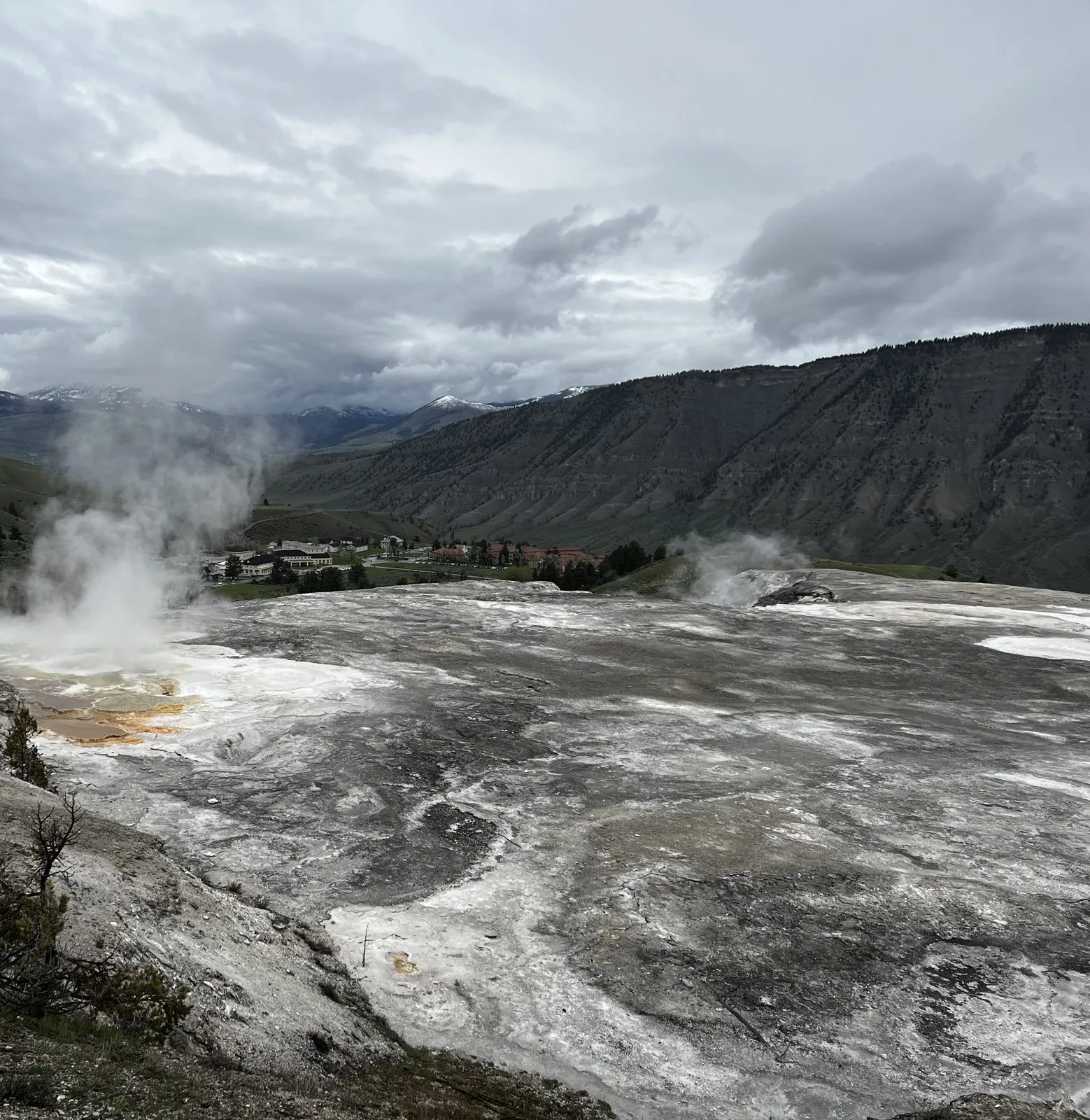
From the upper terraces, the whole valley opens out. Below sits the village of Mammoth, once the army's Fort Yellowstone. The cavalry ran the park for thirty years before there was a National Park Service. Beyond it, the long flat-topped wall of Mount Everts and the snowy peaks to the north. Up close the terraces are a painter's palette: pools of orange, brown and cream, wet and shining, with steam drifting across them. At New Blue Spring the white crust is so fresh it looks like snow, and in places it was hard to tell which was which.
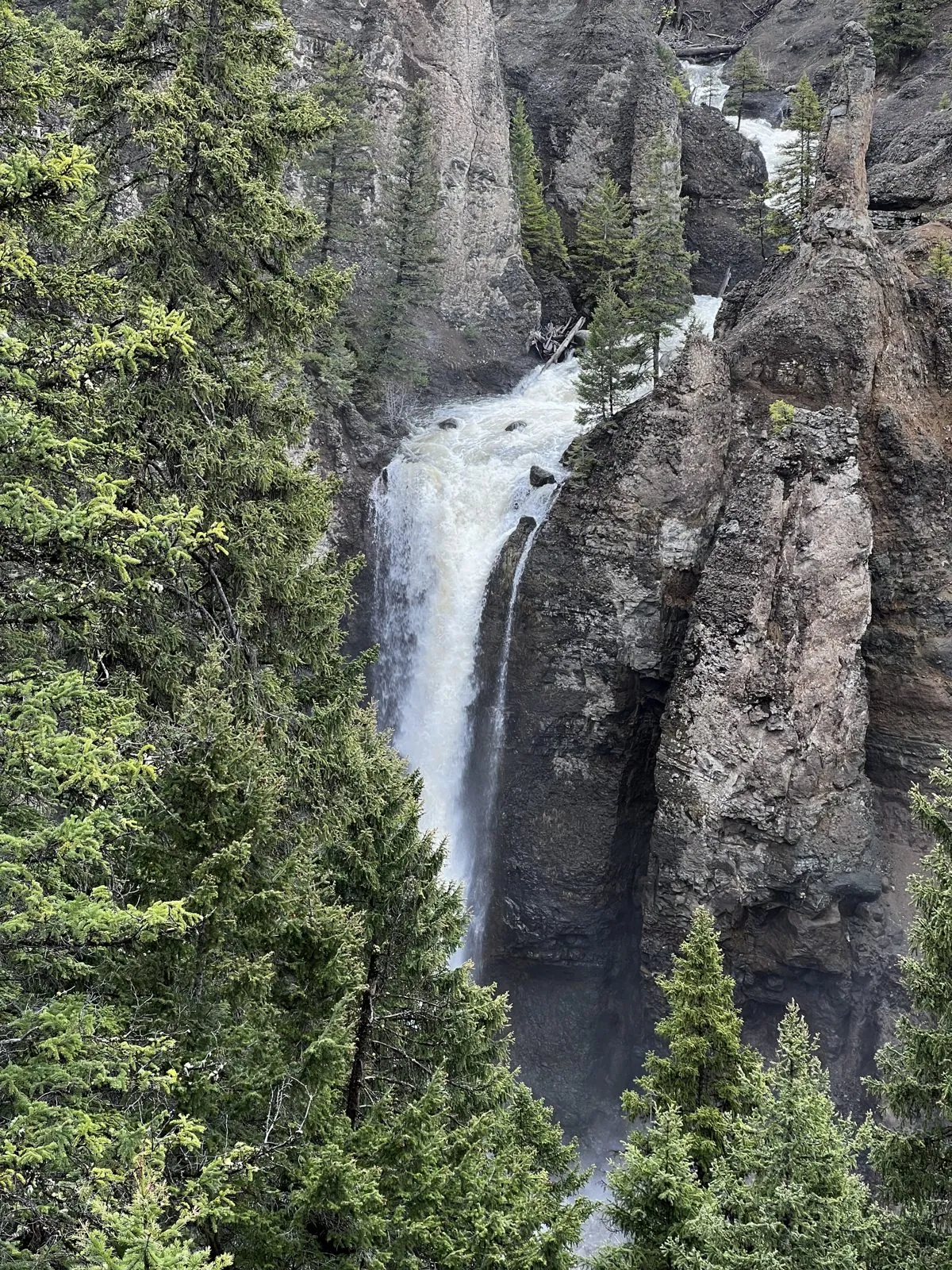
The last stop of the day was Tower Fall, where Tower Creek drops 132 feet between eroded volcanic pinnacles into the canyon of the Yellowstone River. It's a scene that has hardly changed since Thomas Moran sketched it on the 1871 survey; his paintings helped convince Congress to create the park the next year. Then we drove south over Dunraven Pass to Canyon Village for a cafeteria dinner, and settled in for the night.
Memorial Day snow
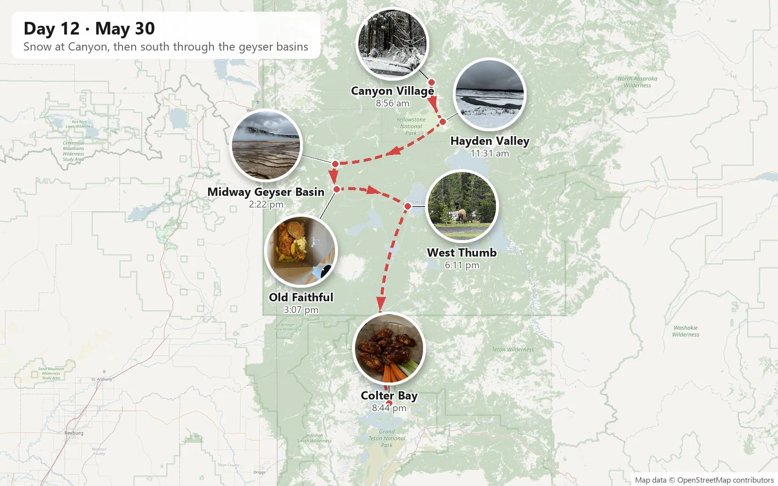
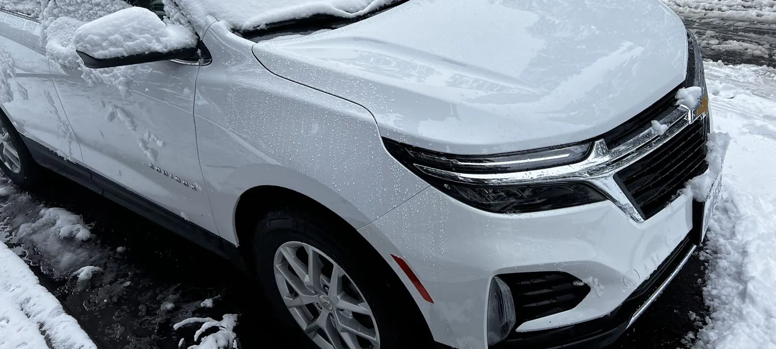
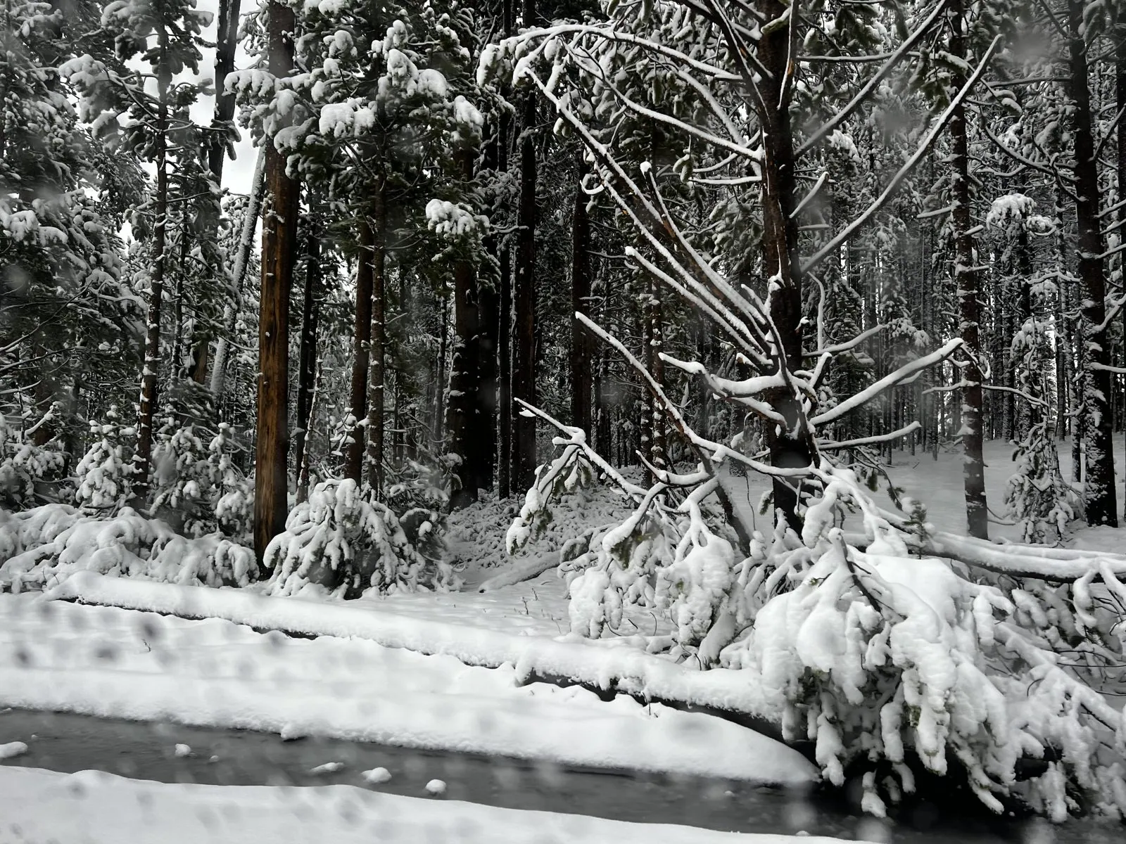
We woke up on Memorial Day to a different park. It had snowed overnight at Canyon Village, which sits close to eight thousand feet up: not a dusting, but proper, branch-bending, car-burying snow. At ten to nine the white SUV was wearing a thick white blanket, and the pines along the road sagged under it. In late May, in a park where the snow is supposed to be gone from the valleys, it was magical and slightly absurd.
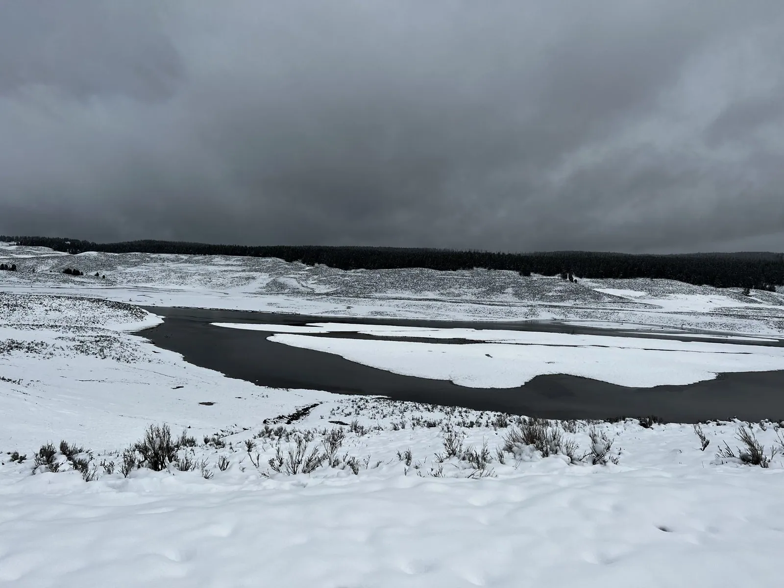
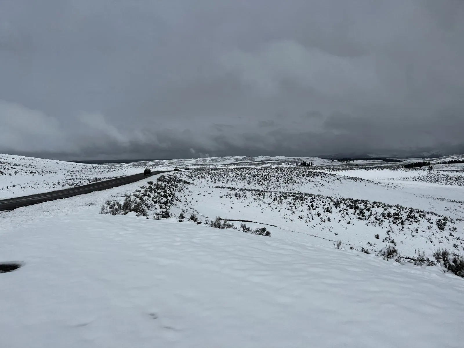
After breakfast we headed south through Hayden Valley, the broad open valley of the Yellowstone River between Canyon and the lake. Usually it's a green sweep of grass full of bison. That morning it was entirely white under a sky like dark slate. The river curled through the snow in black loops, and the road was a thin gray line drawn across it. It looked more like the Arctic than the start of summer, and it was a very different kind of driving from the dry freeways of Los Angeles.
Midway Geyser Basin and Old Faithful
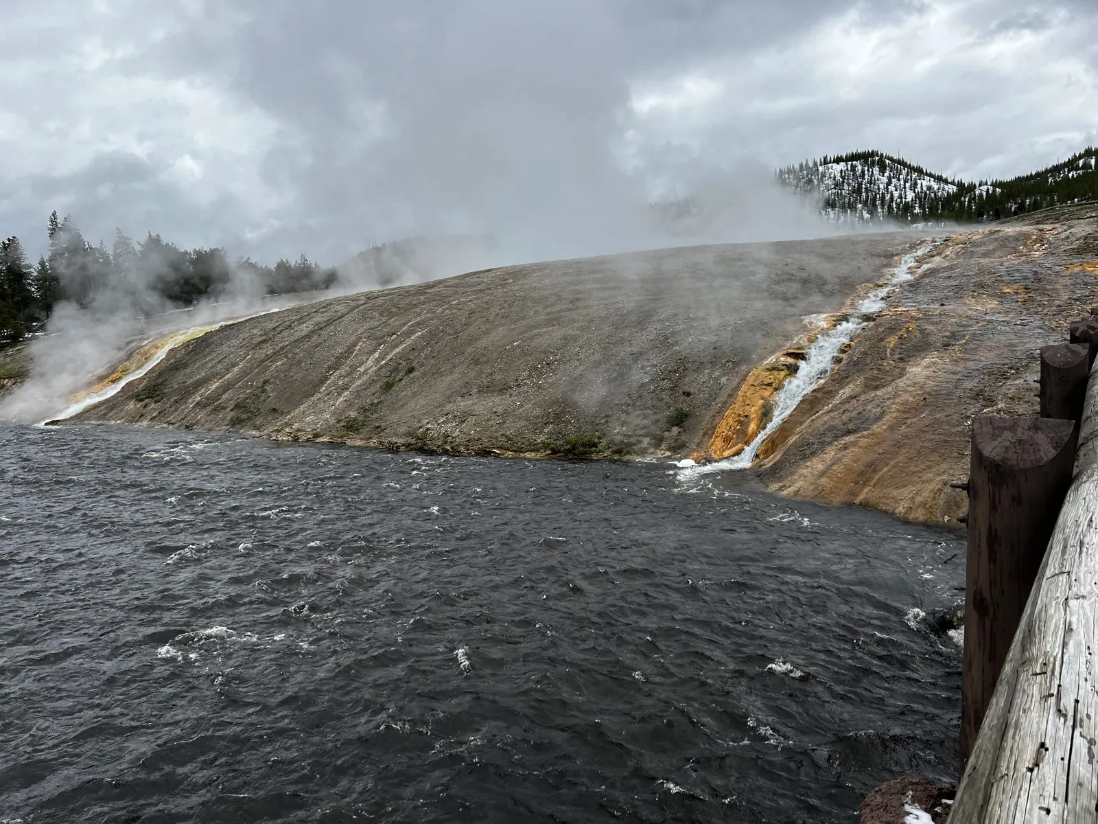
By two in the afternoon we were at Midway Geyser Basin, on the Firehole River. From the footbridge you see a hillside of orange and brown streaked mineral crust with a curtain of steaming runoff pouring off it straight into the river. That's the overflow of Excelsior Geyser Crater, thousands of gallons of hot water a minute. The air was cold enough that everything steamed twice as hard as usual.
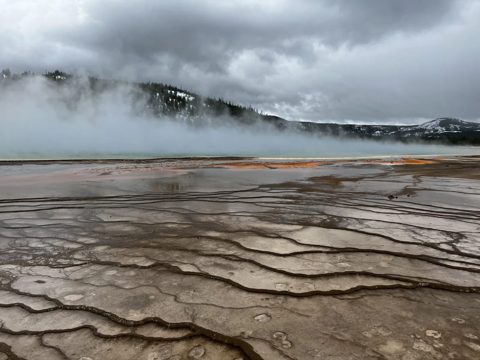
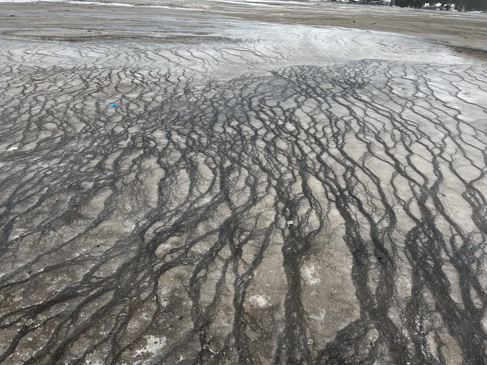
Up the boardwalk is Grand Prismatic Spring, the largest hot spring in the United States, some 370 feet across, famous for rings of color from deep blue in the center through green and yellow to orange at the edge. On a warm summer day, seen from above, it looks like an enormous eye. On a cold, damp afternoon after a snowstorm you mostly see steam. A thick white wall of it rose from the spring and blew across the boardwalk, with only a band of orange at the bottom and the snowy hills appearing and vanishing behind. Underfoot, the runoff had laid down beautiful patterns: thin, branching ribbons of mineral, like the veins of a leaf.
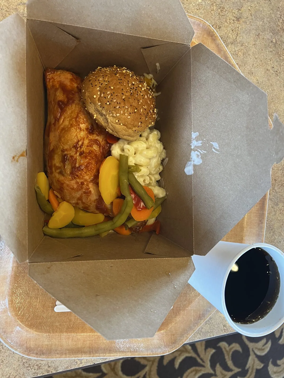
Lunch came in a box at the Old Faithful lodge, at three in the afternoon. Old Faithful is not the biggest geyser in the park, but it is the most dependable, erupting roughly every hour and a half, which is why it has a lodge, an inn, a visitor center and rows of benches in a semicircle around it. By half past four the benches were full, a crowd in winter jackets waiting for the show.
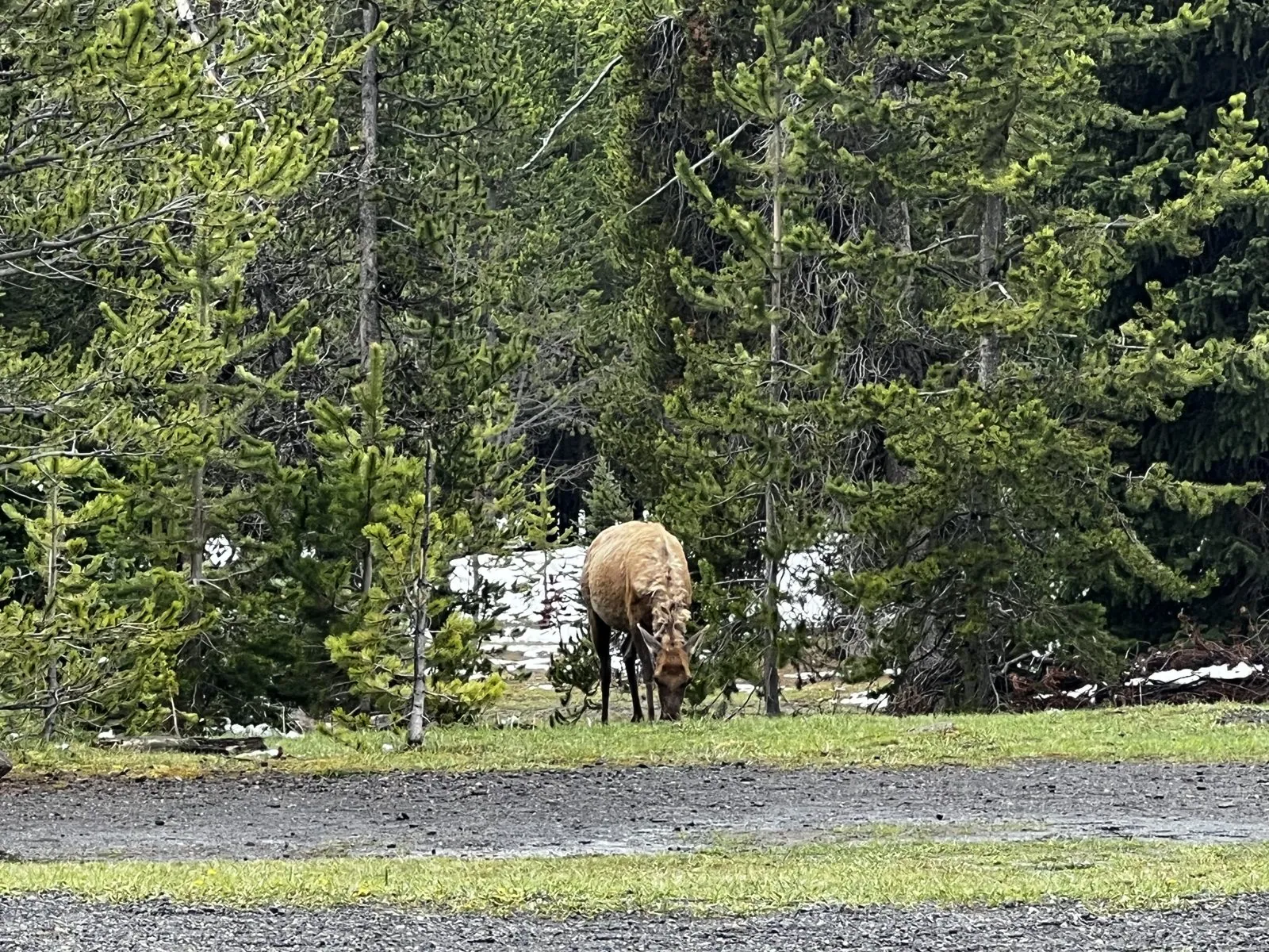
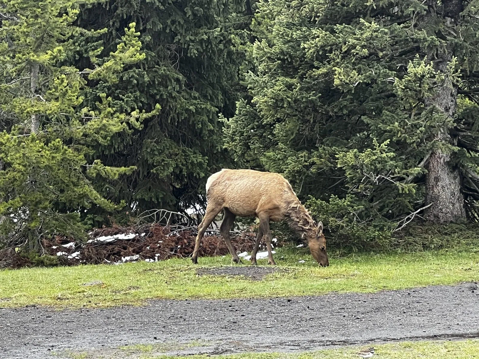
From there we drove east over the Continental Divide to West Thumb, the geyser basin on the shore of Yellowstone Lake, and found elk. Two cows were grazing at the edge of the woods by the parking lot around six, patient and unhurried, snow still lying in patches between the trees. Elk are everywhere in Yellowstone, but seeing them this close, chewing, flicking their ears and occasionally looking up at you, never gets old.
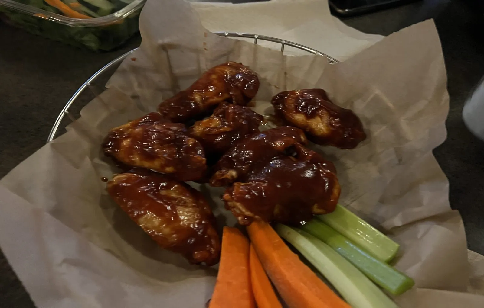
Then we headed south out of Yellowstone, past the southern tip of Lewis Lake and down the Lewis River canyon into Grand Teton National Park. Dinner, at a quarter to nine, was pizza and wings at Colter Bay on the shore of Jackson Lake, and a cabin for the night.
The Tetons were somewhere across the lake in the dark. We'd see them in the morning, or at least part of them.
Grand Teton
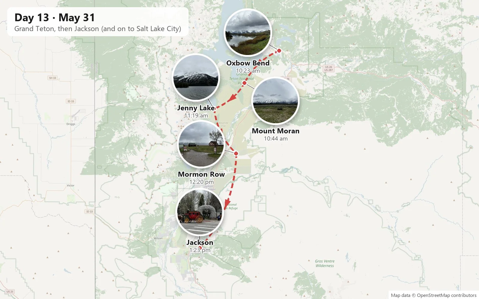
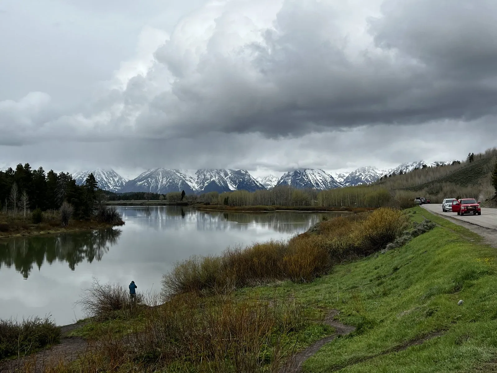
The last morning belonged to Grand Teton National Park. The Tetons are one of the most dramatic mountain fronts in North America. There are no foothills: the range rises straight up out of the flat valley of Jackson Hole along a fault, nearly seven thousand feet in one go. The first stop was Oxbow Bend, a slow loop of the Snake River where, on a still morning, the water mirrors the mountains. That morning the sky was heavy, the peaks were half wrapped in cloud, and the snow line came most of the way down.
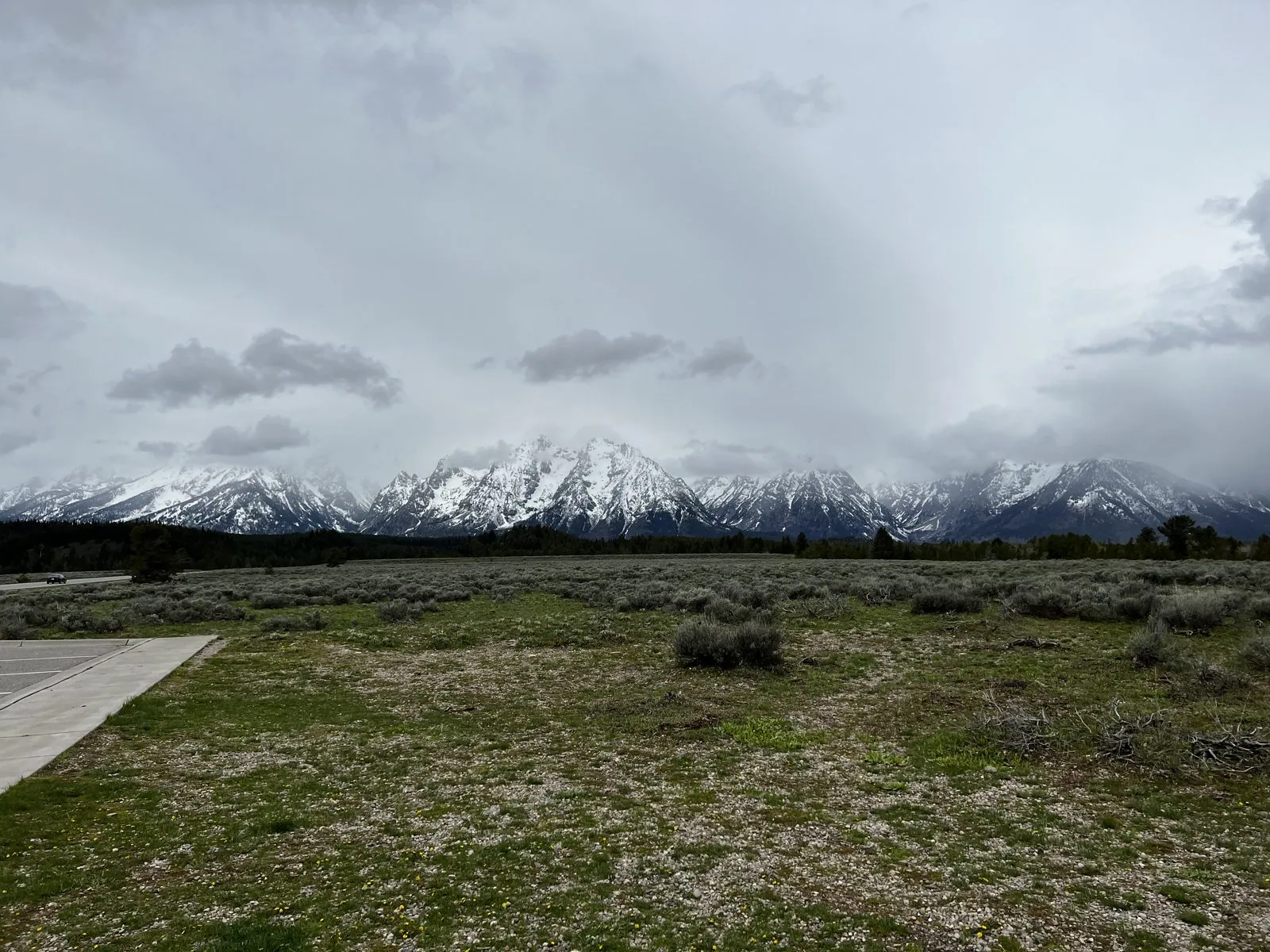
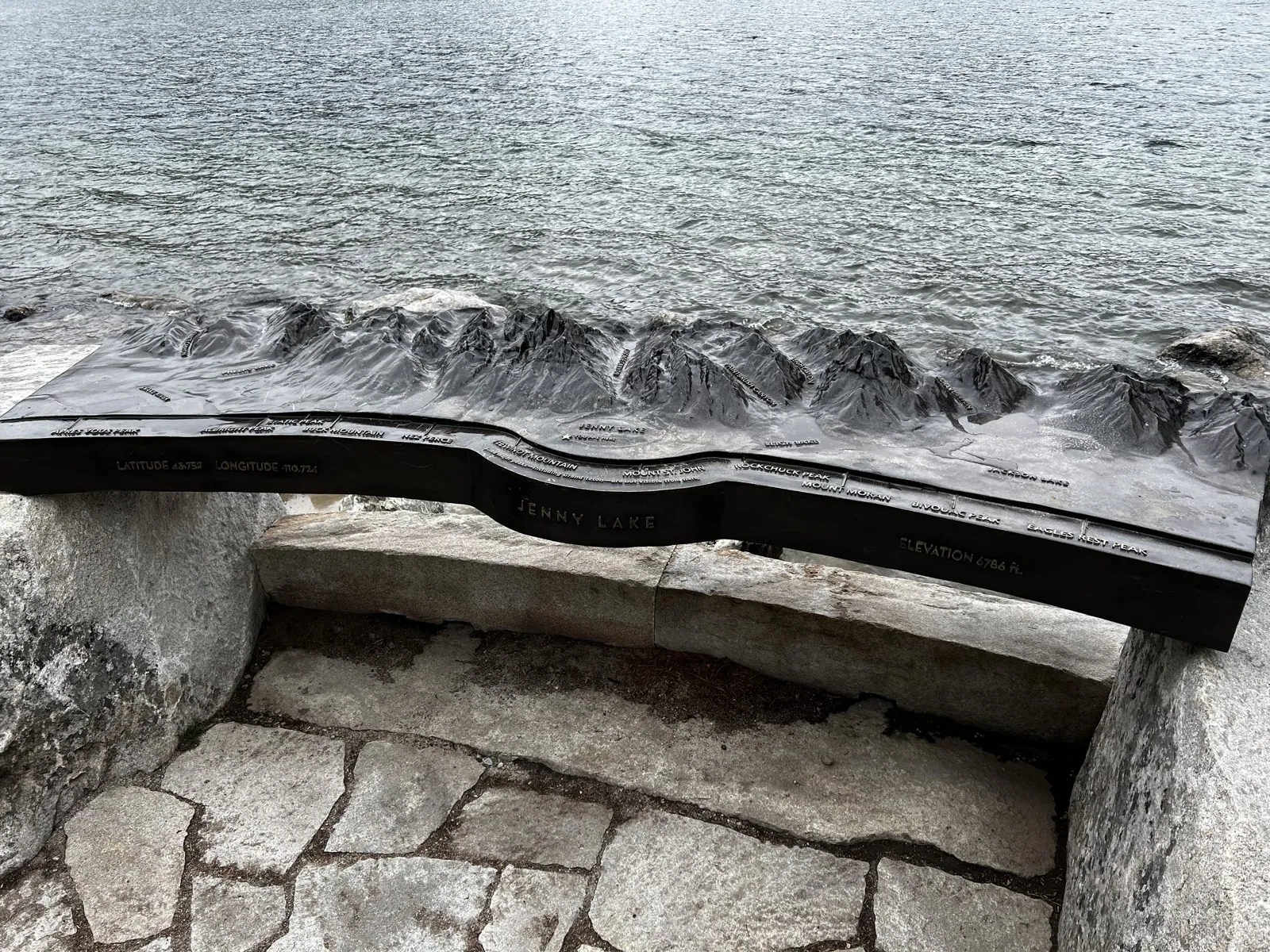
Twenty minutes south, from the turnout named for it, Mount Moran stood above the sagebrush flats, 12,605 feet, its broad face streaked white. Moran is named for the same Thomas Moran whose paintings of Yellowstone we'd seen at Tower Fall the day before. Further down the road is Jenny Lake, a glacial lake tucked right at the foot of the peaks. A bronze relief map of the range by the shore lets you trace the canyons with your fingers, and the real thing rises right behind it.
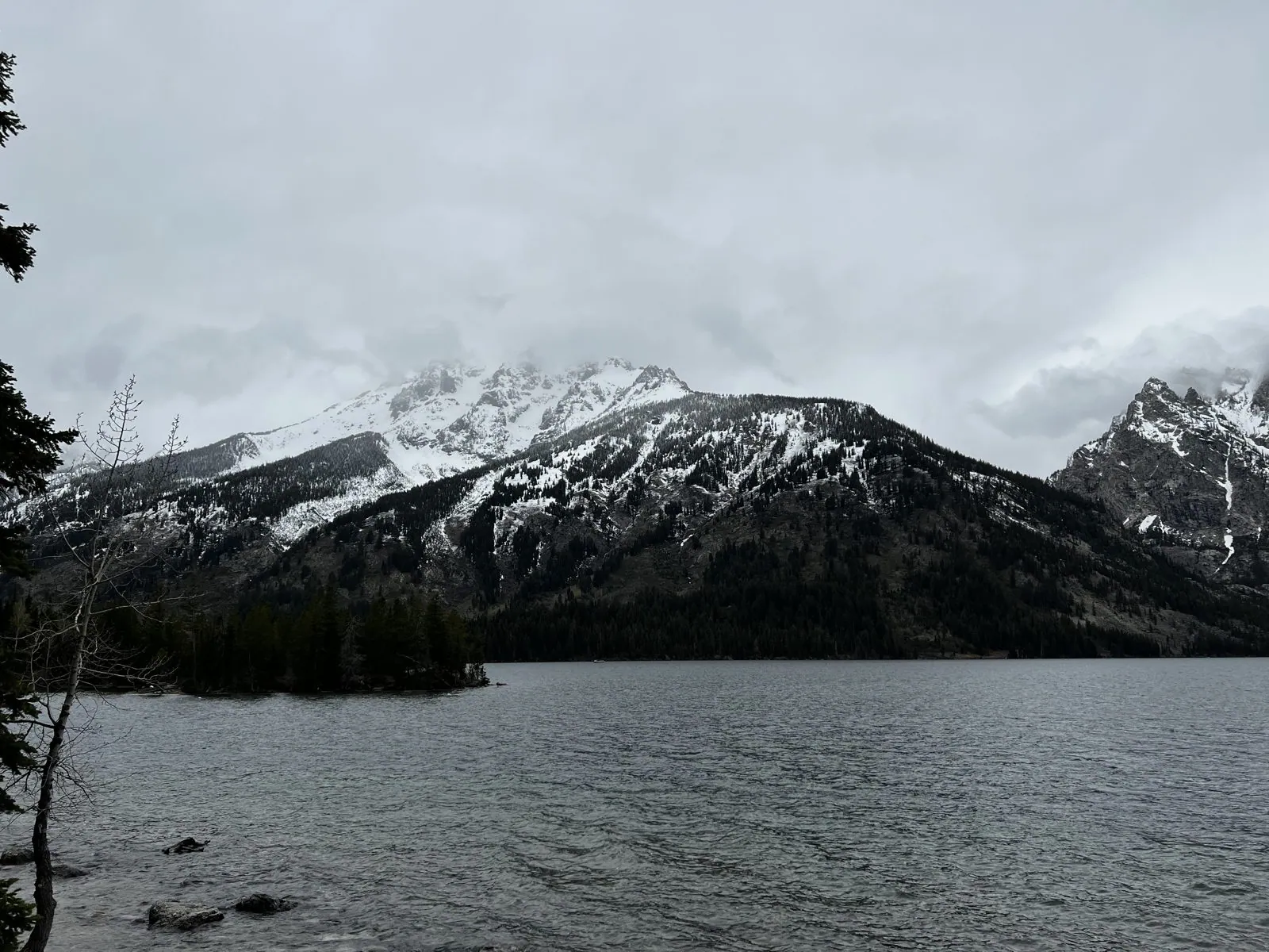
The relief map is bronze, worn smooth along the ridgelines where thousands of visitors have run their hands across the peaks. Behind it, the lake was choppy and cold, and the cloud kept shifting just enough to show a summit and then hide it again.
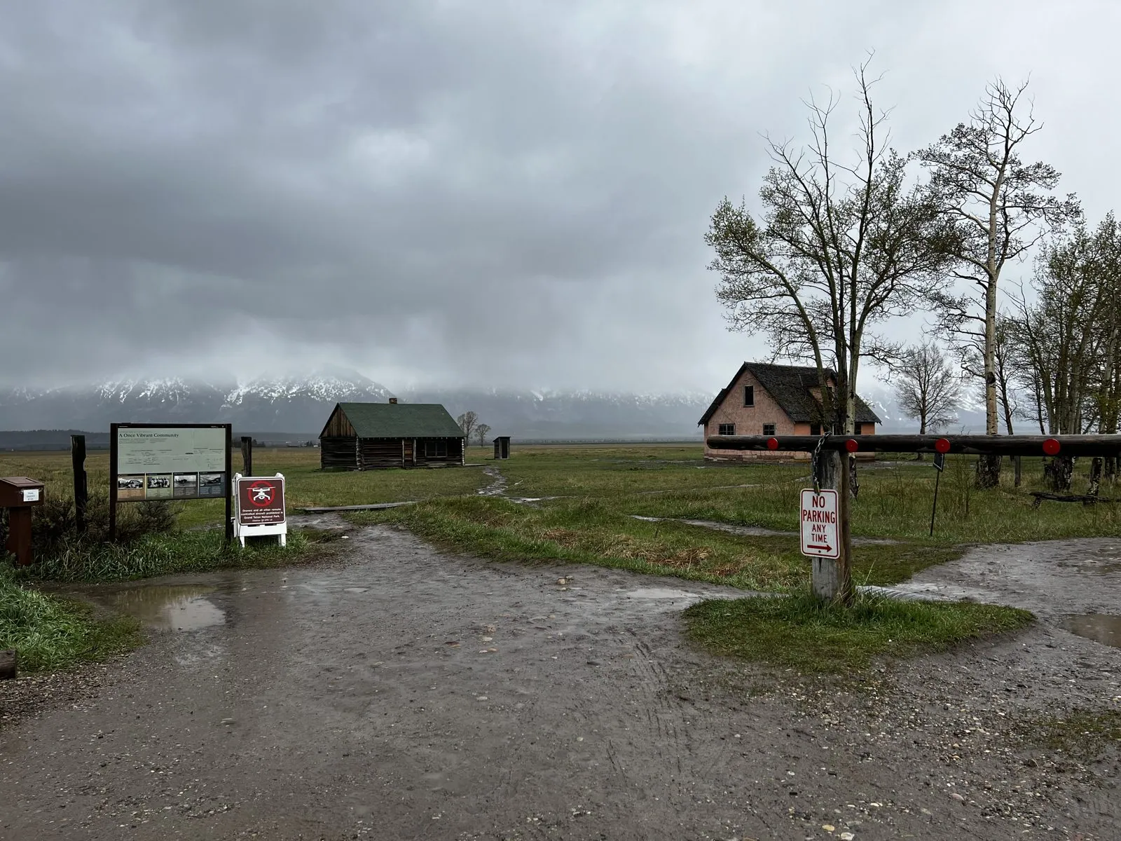
Then Mormon Row, the remains of a farming settlement founded in the 1890s by Mormon homesteaders who dug irrigation ditches by hand to farm this high, dry valley. Their barns, including the Moulton barns, among the most photographed buildings in the West, still stand in the sagebrush with the Tetons behind them. That day the mountains were entirely lost in cloud, so the barns stood alone on a wet, muddy plain under a gray sky. It is a different picture from the postcard, and a more honest one about what homesteading here must have been like.
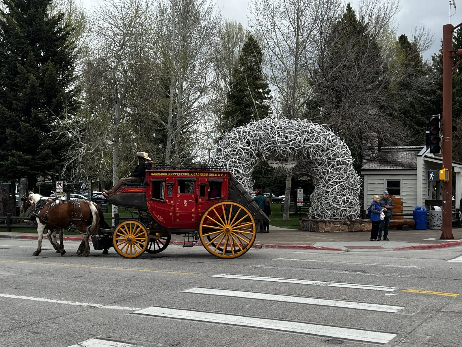
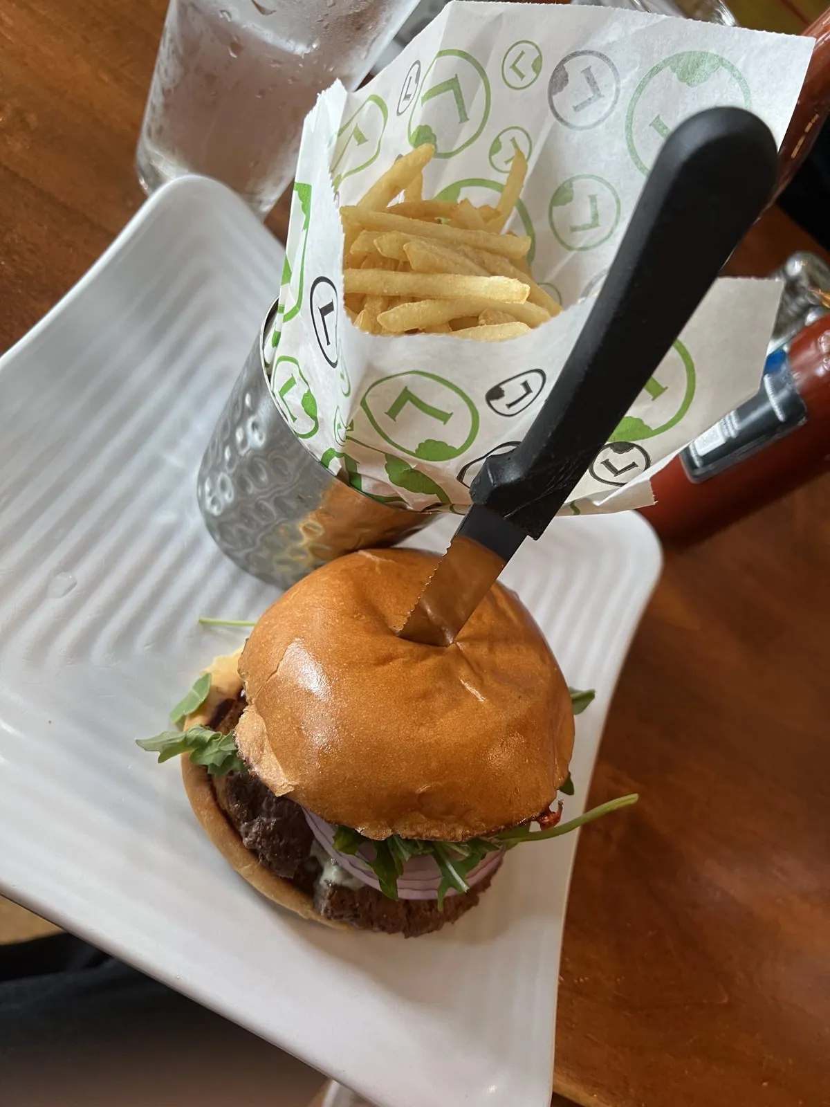
The trip's last stop in Wyoming was the town of Jackson. Its Town Square has an arch of interlocking elk antlers at each corner. The antlers are shed naturally every winter by the elk on the National Elk Refuge just outside town and collected by local Boy Scouts. As we crossed the square, a red stagecoach pulled by two horses rolled past the arch, carrying passengers around the block, a scene so on-the-nose that it looks staged. Lunch was burgers and onion rings.
Back to Salt Lake City, and the first KFC
From Jackson it's a long afternoon's drive back to Salt Lake City, and by eight in the evening we were back in the city. The last photos of the trip are an unexpected footnote to American food history. On State Street at 3900 South stands a giant red-and-white bucket on a pole, and beneath it a bronze statue of two men. This is the site of Harman's Café, where in 1952 a restaurateur named Pete Harman became the very first franchisee of a traveling salesman called Harland Sanders. The name "Kentucky Fried Chicken" was coined here, in Utah, and so, by most accounts, was the bucket.
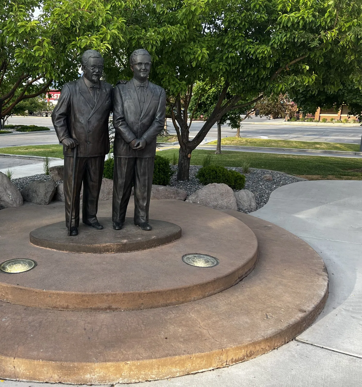
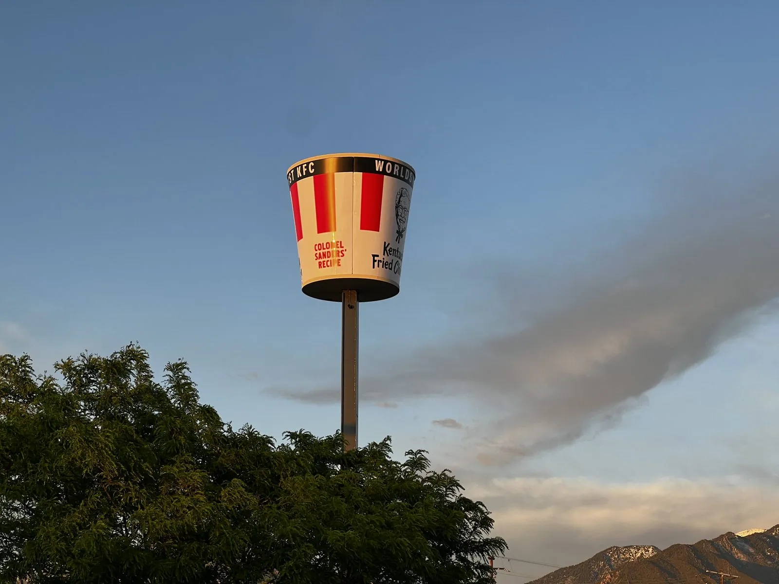
It is a funny place to end a trip that began in geyser basins, but it fits a month of firsts: a new license, the first long drives, and, to finish, the first KFC. All that was left was to return the car in Salt Lake City and fly back to Los Angeles.
Looking back
Somewhere on these roads (this copy of the photo has lost its date and place), someone took a picture through the car window of a flat green field, a wire fence and a gray sky, with a faint rainbow arching over the grass. It is washed out, and you have to squint to see the rainbow. But it is exactly what a road trip mostly is: not the landmarks, but the hours in between them, out the window.
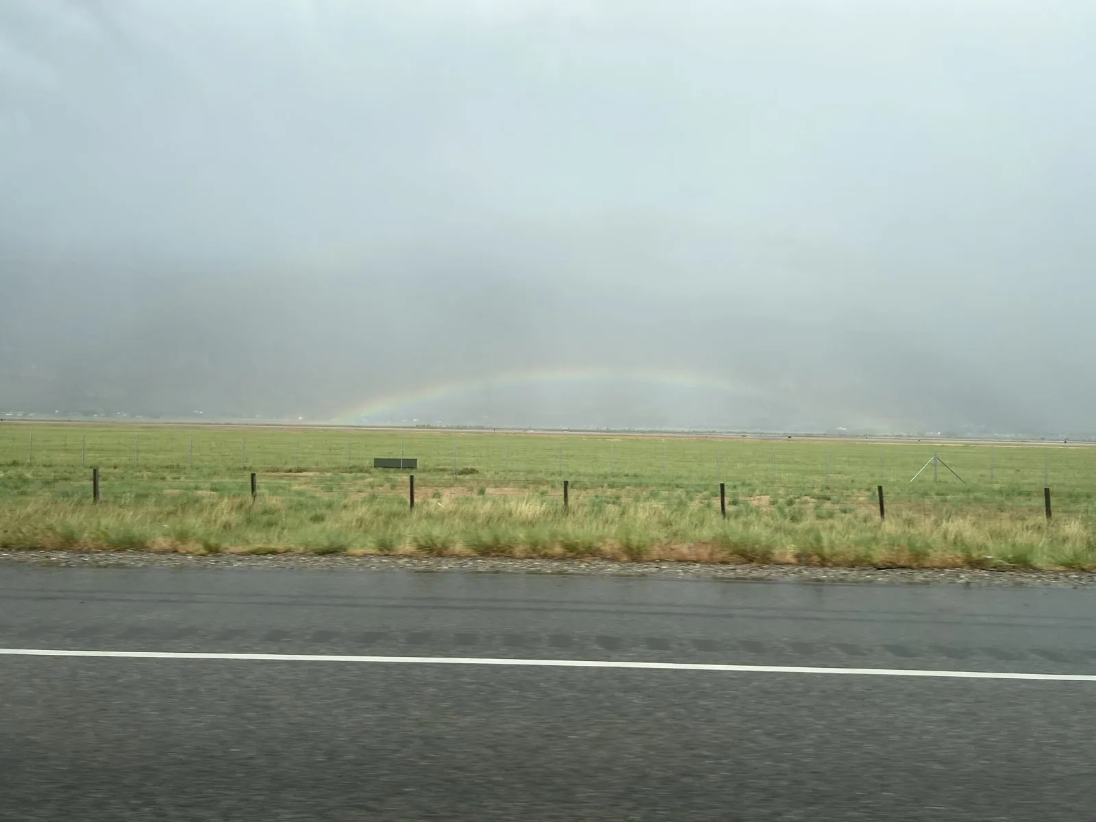
Two trips, two groups of friends, two very different Californias and Wests. In the first, campuses, cable cars, hot pot and the sun going down behind the Golden Gate. In the second, bison, steam, and snow on Memorial Day. What joins them is the thing I was most excited about that spring: the driver's seat. By the end of May I had driven up the length of the Central Valley, down Highway 1 through Big Sur, and across a snow-covered Hayden Valley. The license was new. The roads were the point.
Maps built from the trip's photo timestamps and locations. Photo locations have been removed from the published images. Day maps: map data © OpenStreetMap contributors; each stop is placed where its photo was taken, hotels and home are never marked, and the dashed lines show the order of stops, not the exact roads.
Likes and comments
React with an emoji or leave a comment. Signing in with GitHub is required.