← Misc · July 2023
Independence Break in the Texas Triangle
Five Texas cities in four days over the Fourth of July, in a car far too red for us.
Los Angeles → Austin → San Antonio → Austin → Fort Worth → Dallas → Richardson → Houston → IAH
roughly 750 miles driven · four nights in three cities · one tray of brisket and one table of dim sum · one bright red Dodge Charger · one space shuttle named Independence, visited on Independence Day
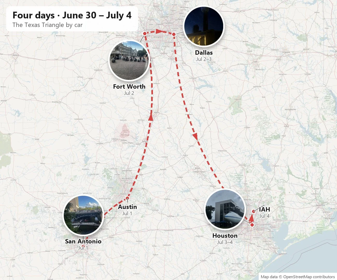
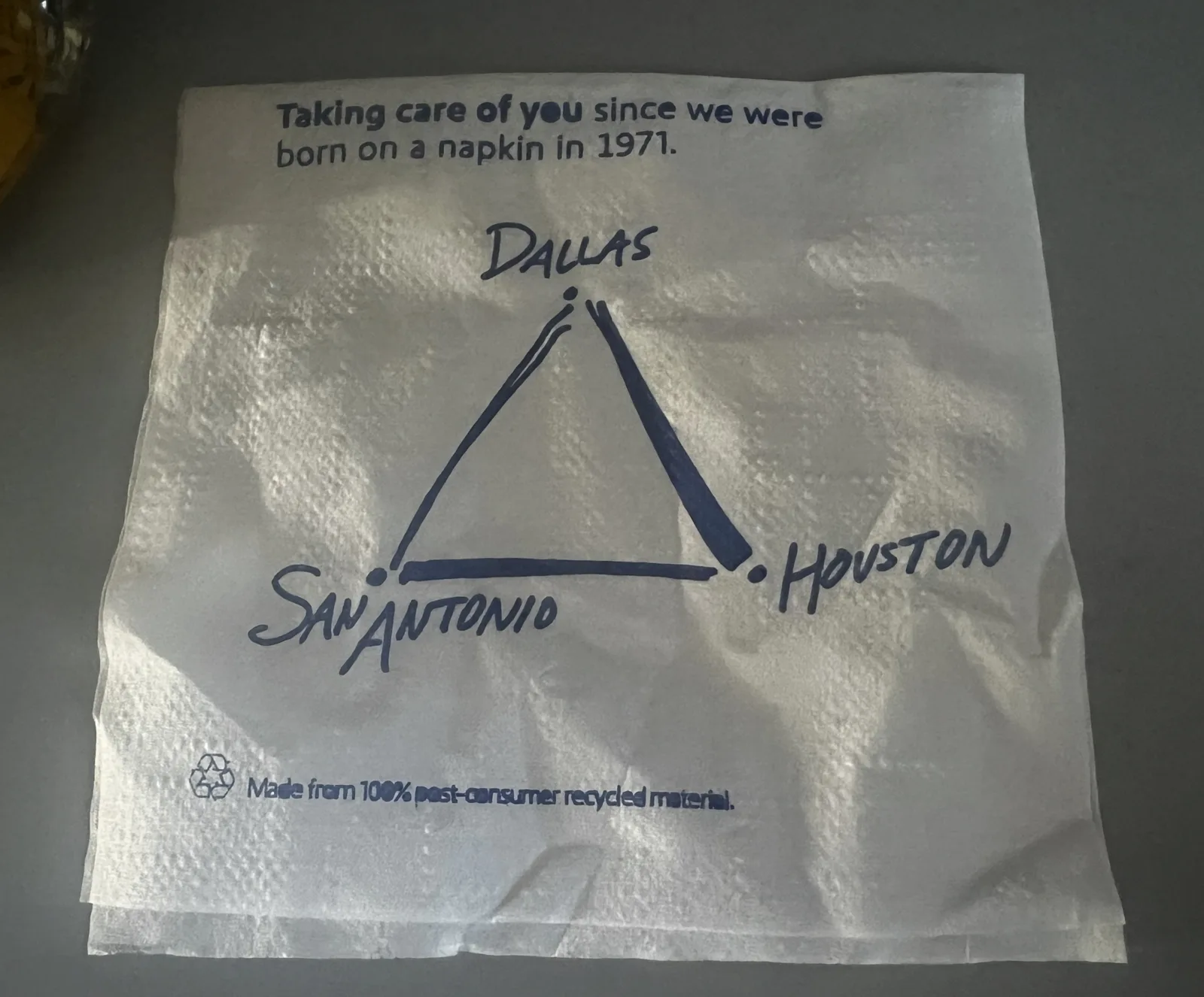
Geographers have a name for the part of Texas where most Texans live: the Texas Triangle. Its corners are Dallas–Fort Worth in the north, Houston in the southeast and San Antonio in the southwest, with Austin sitting on the western edge between them. Three interstates trace its sides: I-35 up the west, I-45 down the east, and I-10 along the bottom. It is a triangle you can drive around in a long weekend, if you don't mind a lot of highway, and the Fourth of July in 2023 gave us exactly one long weekend.
So we flew into Austin on a Friday night, rented a car, and drove the triangle in four days, ending at Houston's airport on the evening of the Fourth. As with my other trip posts, everything here is reconstructed from the camera roll: where each photo was taken and when. Where the phone recorded nothing, I've left the gap alone rather than fill it with a guess. And where a place has a story worth knowing, I've added a little of it.
Prologue: a late flight and a red car
The trip began at LAX a little after eight on a Friday evening, June 30th, at a gate full of people starting the same long weekend. Los Angeles to Austin is a short flight that eats two time zones, so it was nearly one in the morning, Central Time, when the lights of the northwest Austin suburbs slid under the wing. Austin's baggage claim at 1:27 a.m. was as crowded as a Saturday afternoon. Nobody, it seems, wanted to waste a minute of the holiday.
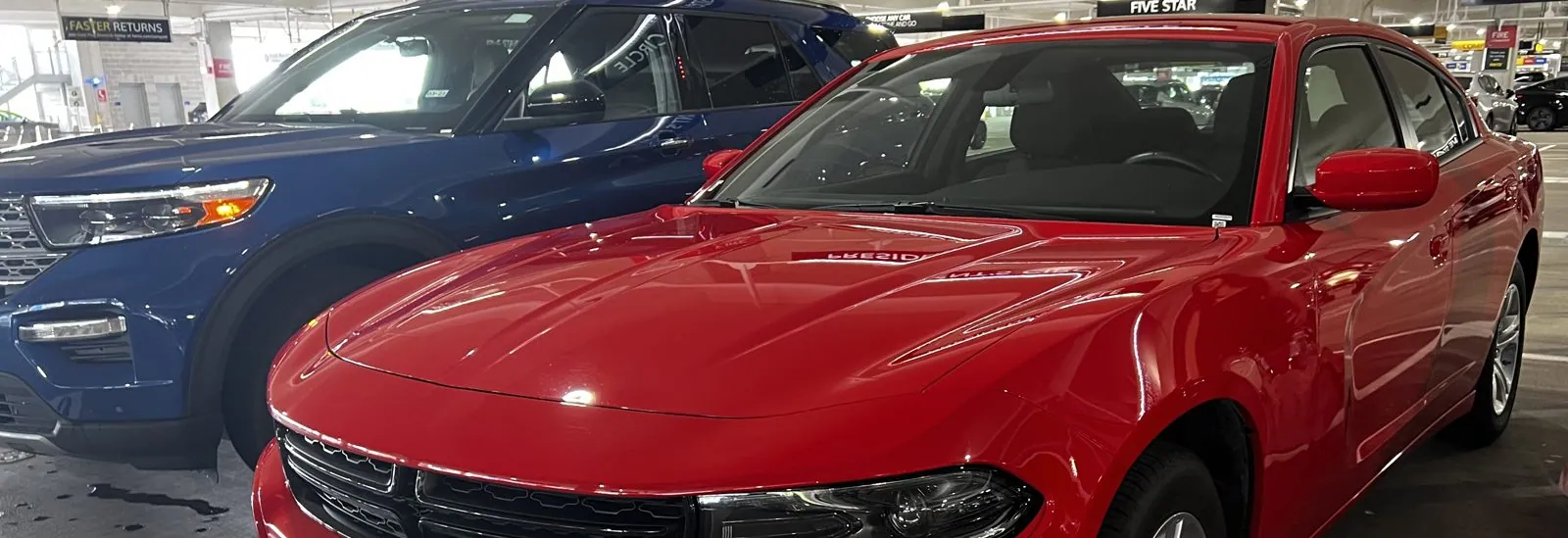
We slept near the airport and came back the next day to the rental garage, where the car waiting for us was a Dodge Charger in a shade of red that can only be described as "loud". It looked like the right car for Texas, and it got photographed from every angle before it moved an inch.
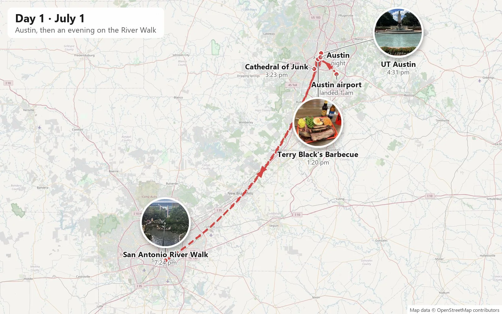
Day 1: Austin, then San Antonio
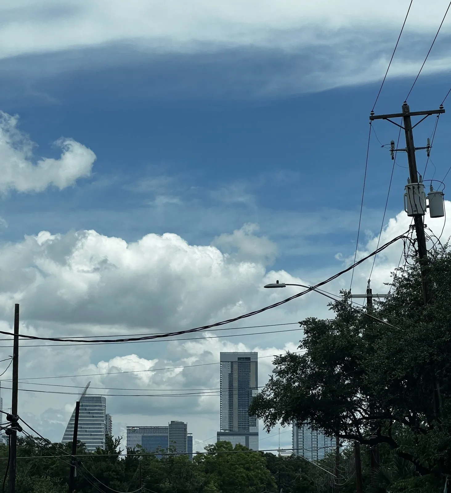
Austin in July feels like walking into a warm bath. That first afternoon the sky was the classic Central Texas summer sky: deep blue, stacked with big, flat-bottomed cumulus clouds, the kind that build all afternoon in the heat and humidity, so that by mid-afternoon the whole sky looks like a fleet of white ships riding at anchor.
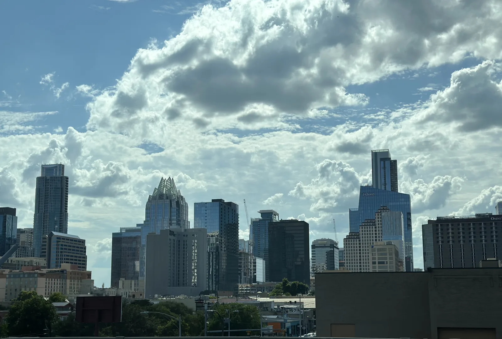
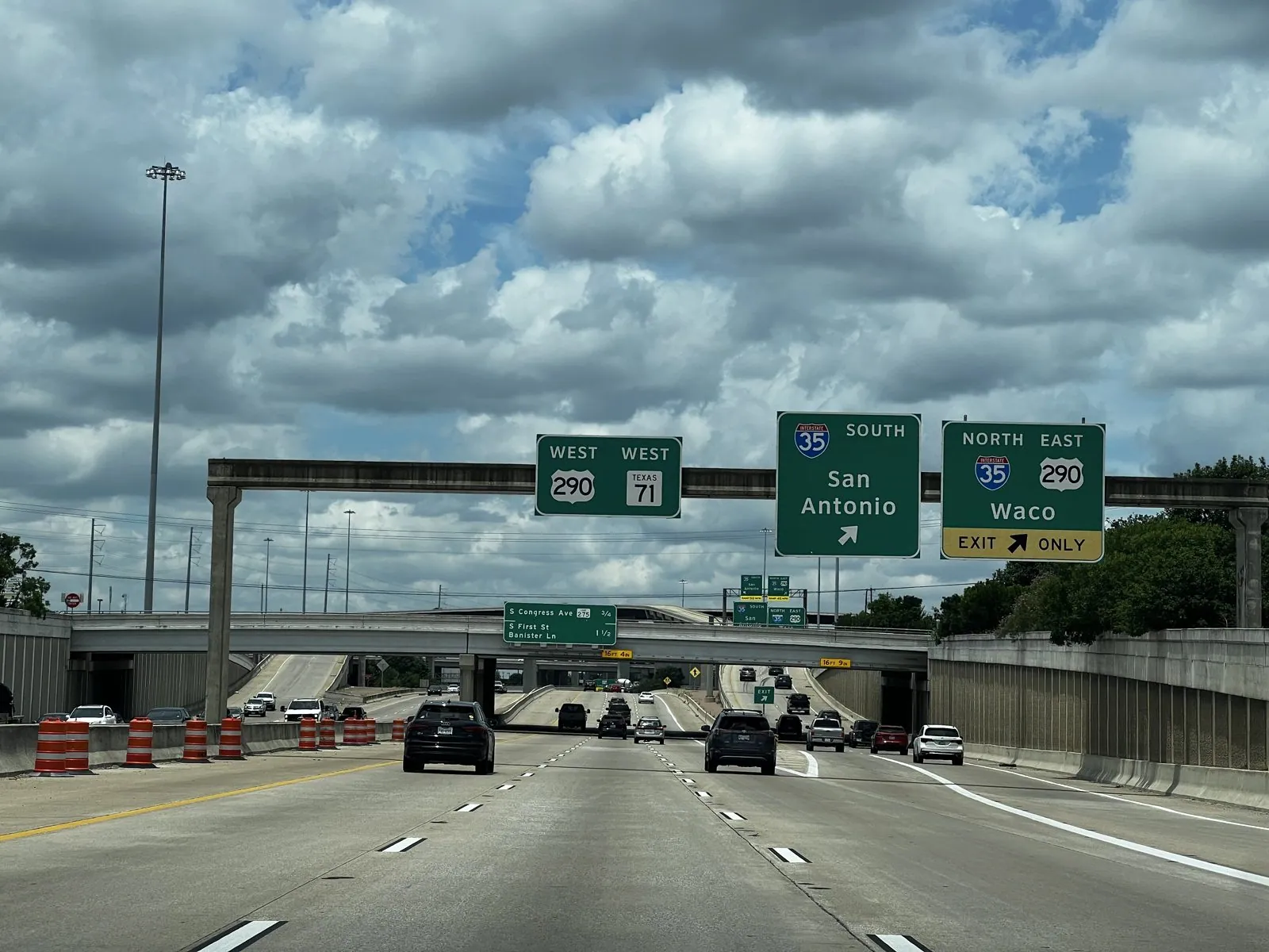
We came in from the airport on TX-71, under the big green signs for I-35, which points one way to San Antonio and the other to Waco. Then we turned up South First Street, where the downtown towers rise ahead through a tangle of power lines and live oaks, the clouds sitting on top of them like a second skyline.
Lunch, Texas style
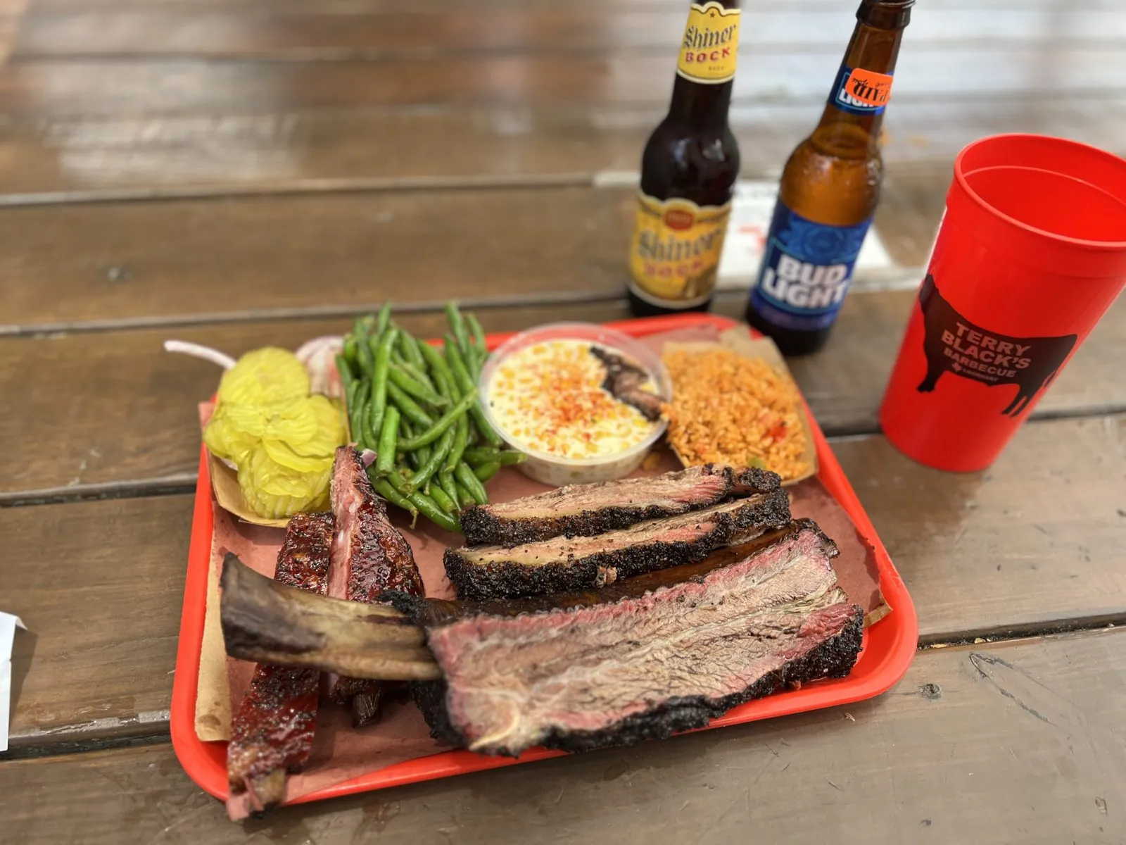
The first proper stop was lunch, and in Austin there is really only one category of lunch to begin with. Terry Black's Barbecue on Barton Springs Road is run by a branch of the Black family, whose barbecue in Lockhart, half an hour south, goes back to 1932. Central Texas barbecue is about as simple as cooking gets: beef, salt, pepper, post-oak smoke and a great many hours. You order at a counter by the pound, and it comes on butcher paper on a plastic tray.
Ours had slices of brisket with a black, peppery bark and a pink smoke ring, a beef rib with a bone the size of a small club, a couple of pork ribs, green beans, mac and cheese, rice and a pile of pickle chips, along with a Shiner Bock (brewed in a small Texas town of the same name since 1913) and a Bud Light for balance. It came to a wooden table under the trees, and it looked exactly like the first meal in Texas should look.
The Cathedral of Junk
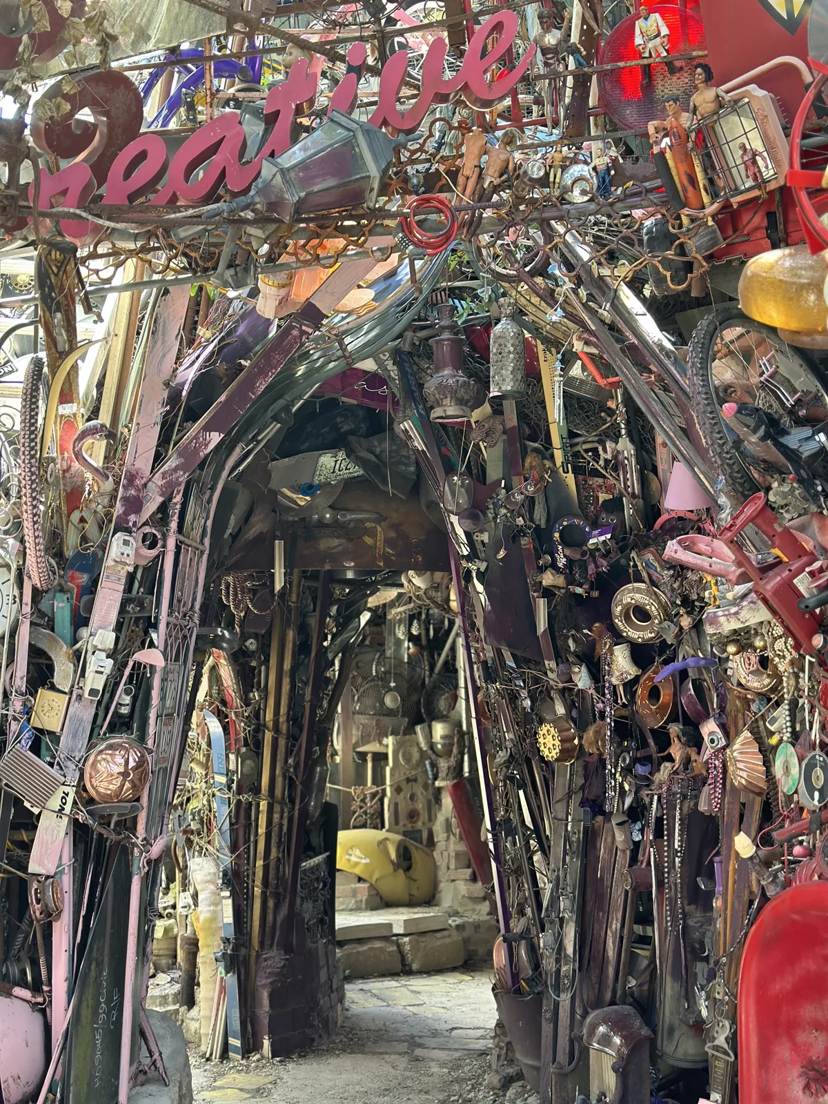
After lunch we went looking for the weirdest thing in a city whose unofficial motto is "Keep Austin Weird". In a backyard in a quiet South Austin neighborhood stands the Cathedral of Junk. Vince Hannemann started building it in 1988 and has been adding to it ever since. It is a multi-story structure of bicycle frames, hubcaps, old televisions, toys, bottles and anything else that could be wired together, with rooms, stairs and towers you can climb through.
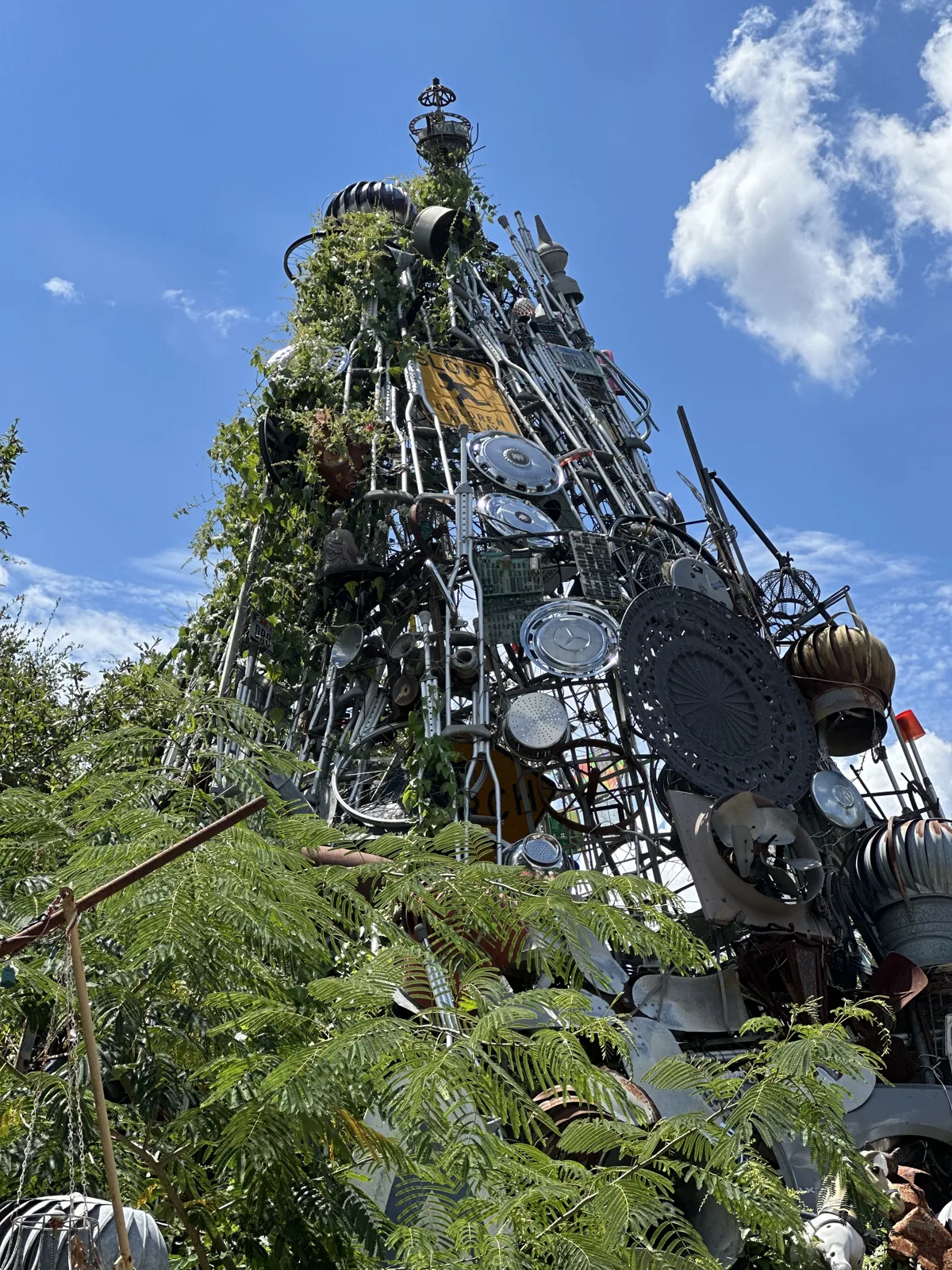
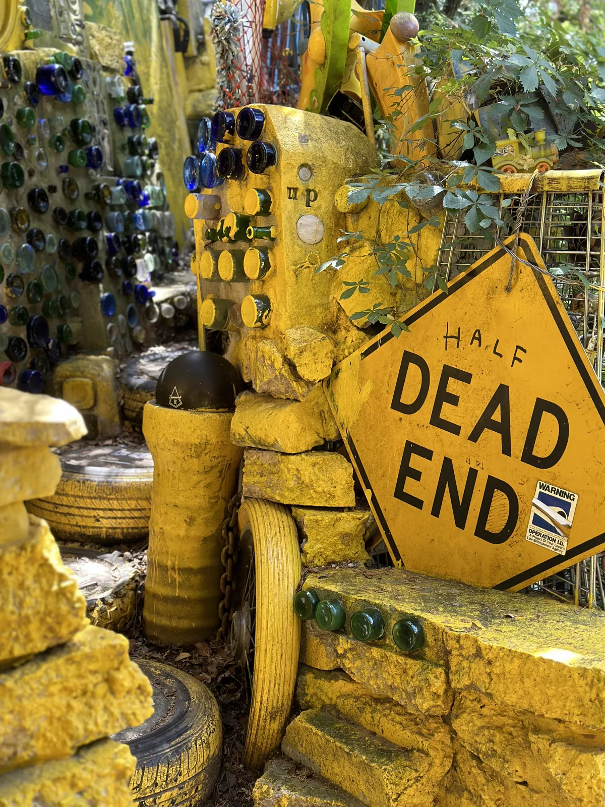
My camera roll only has a short video from there; my wife's has thirty-odd photos, taken as we climbed through it: a spire of welded scrap rising out of the greenery against that same blue sky, a corner painted yellow around a "Half Dead End" road sign, and an arched tunnel of bicycle parts.
The Tower
Late in the afternoon we drove up to the University of Texas. UT has one of the most recognizable landmarks of any American campus: the 307-foot Main Building tower, finished in 1937 to a design by Paul Cret. You can see it from much of central Austin, and after a big win its top is lit burnt orange.
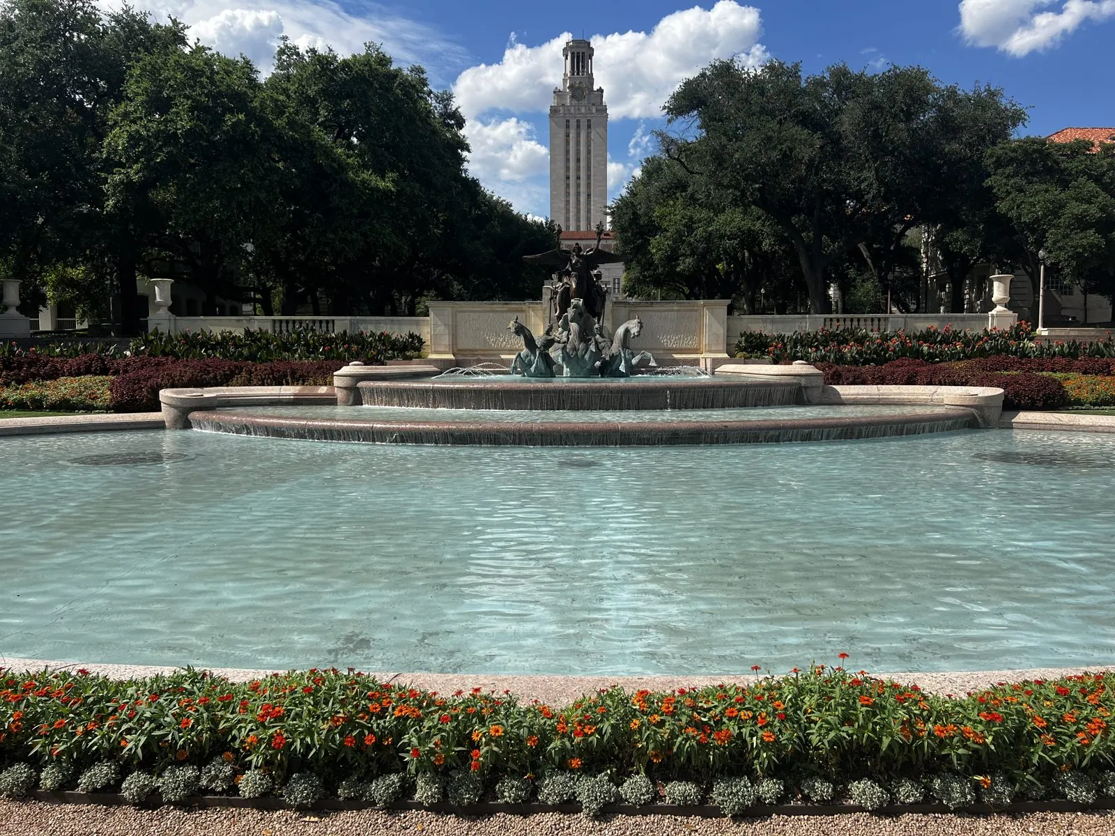
We came at it the classic way, from the south. A wide boulevard runs straight toward it, ending at the Littlefield Fountain, a 1933 war memorial by the sculptor Pompeo Coppini, with bronze sea horses charging out of the water. Behind the fountain, terraces climb toward the tower under old live oaks. The pool was the color of a swimming pool on a postcard, and the beds around it were full of orange flowers.
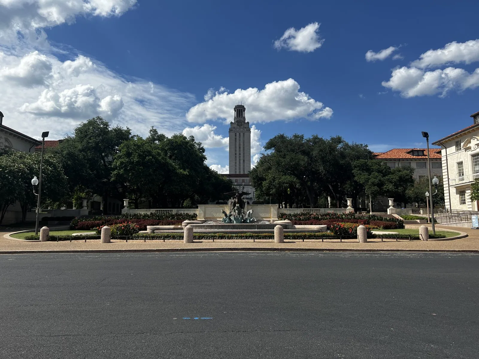
The fountain was finished in 1933 and the tower four years later, and from the edge of the pool they line up perfectly: the bronze figures in the foreground, the pale tower rising directly behind them, and the dark live oaks framing both.
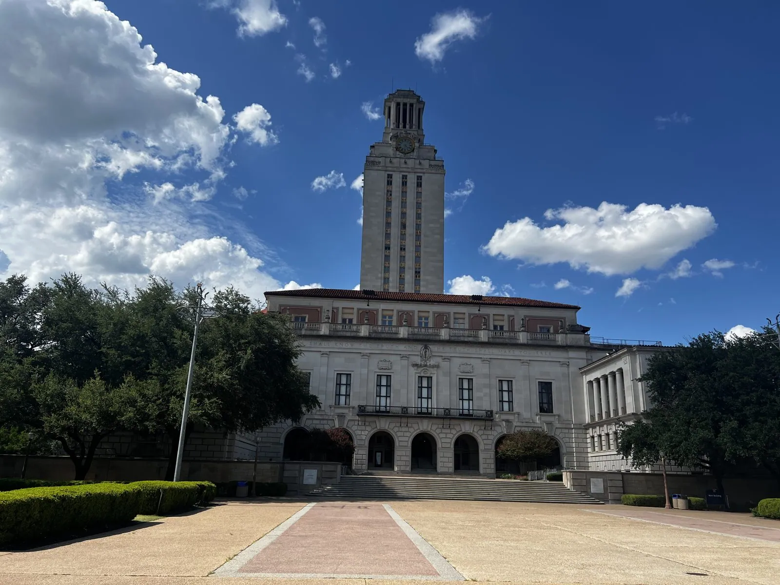
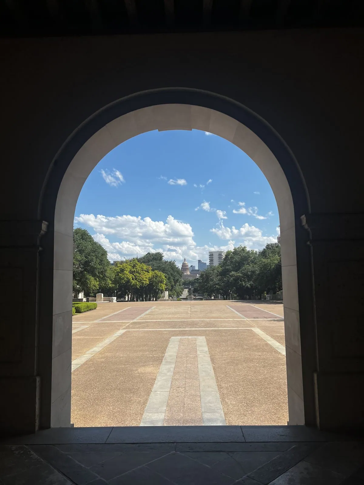
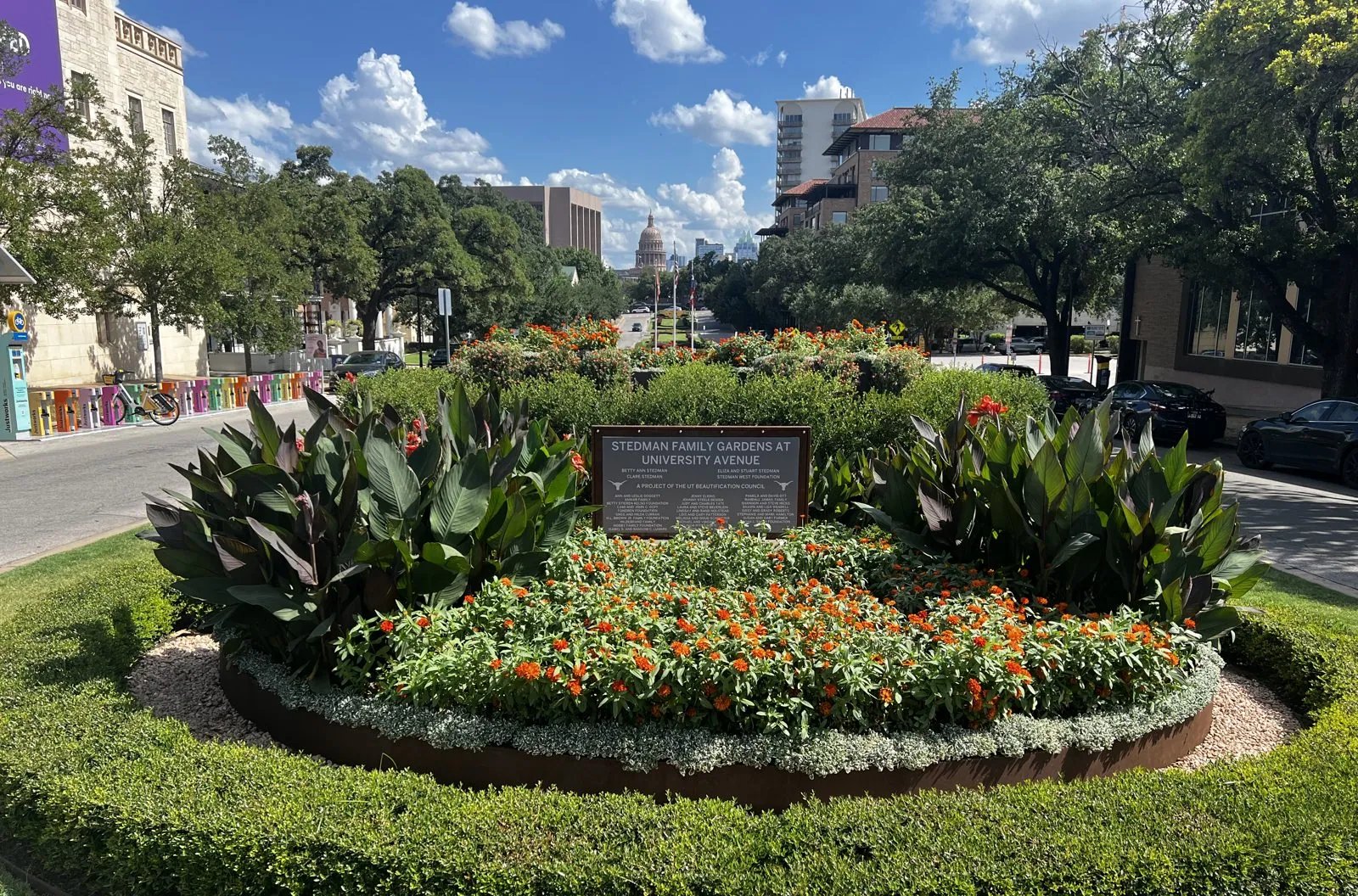
Up close, the tower stands on top of the Main Building like a chess piece on a pedestal. On a Saturday afternoon in summer, the South Mall in front of it was empty: wide pale paving, a long strip of brick down the middle, the trees throwing hard black shadows, and not a soul on it. From the shade of the building's arcade, one arch framed the whole view back down the mall: the paving, the trees, the clouds, and downtown in the distance. Out on University Avenue, the street lines up on the dome of the Texas Capitol, finished in 1888 in red granite and, as Texans like to point out, taller than the one in Washington.
The River Walk at dusk
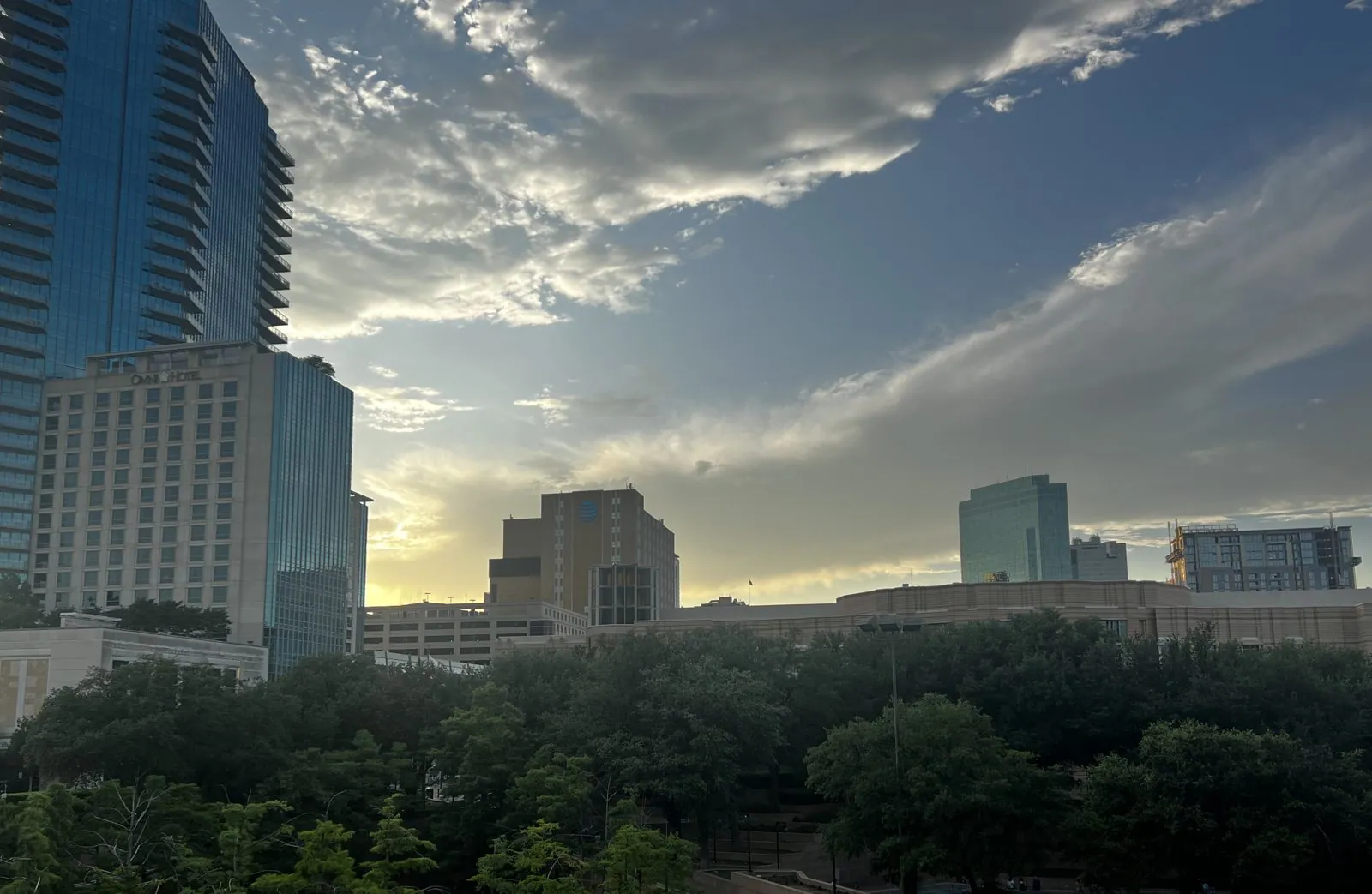
Then we got back on I-35 and drove eighty miles south to San Antonio, arriving a little after six. San Antonio is the oldest of the triangle's big cities: it was founded around a Spanish mission in 1718, and the Alamo is a few blocks from the river. From a terrace above the river, the skyline was backlit by the evening sun: a big slab of a hotel, an old Gothic office tower, a church spire, and a sky streaked with thin cloud.
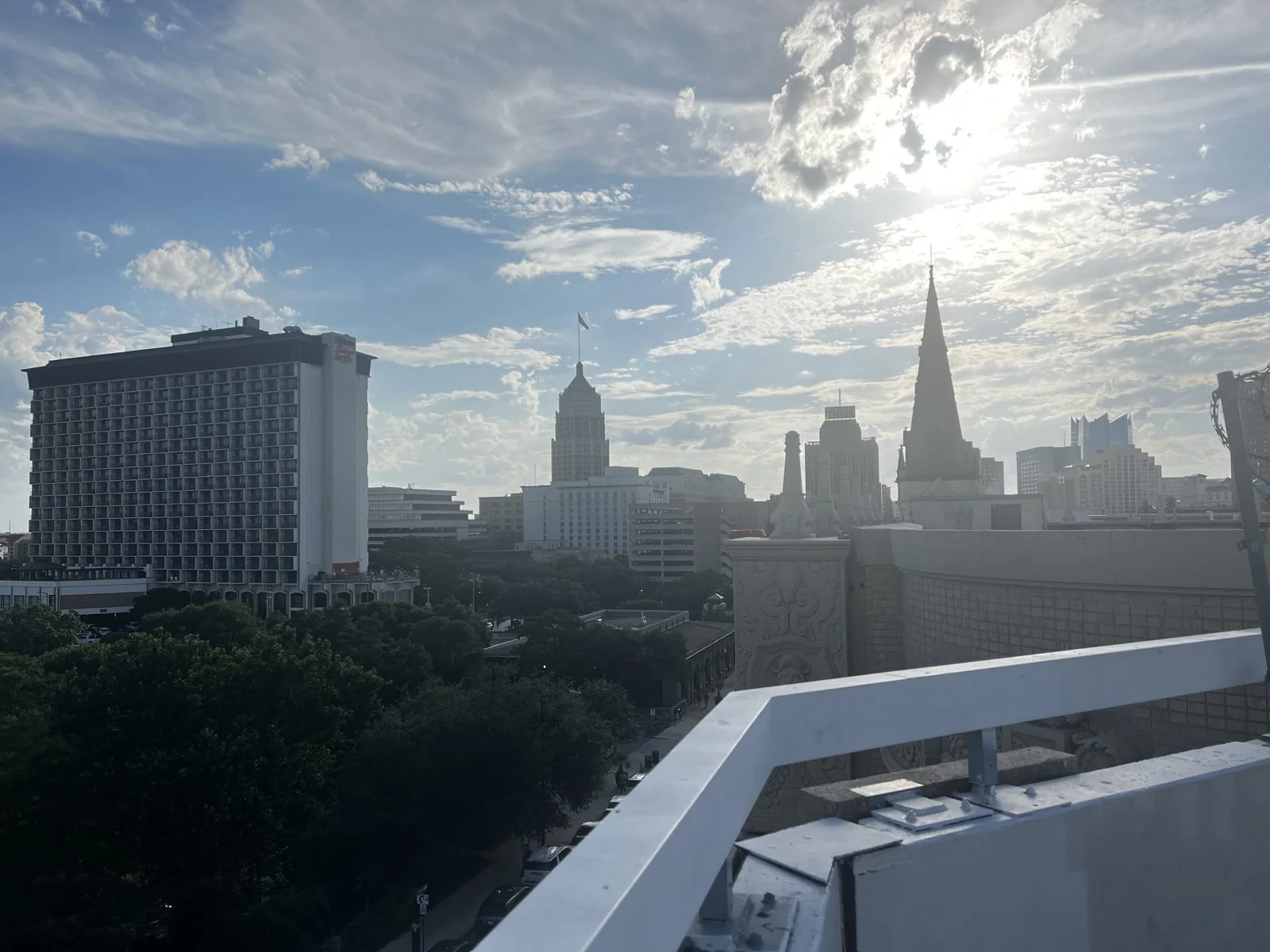
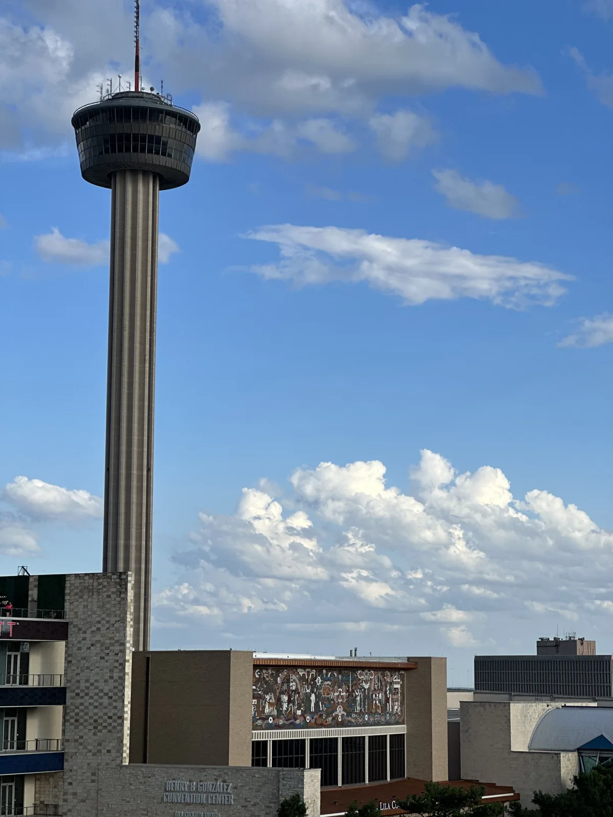
The River Walk is the city's great trick. A century ago the San Antonio River was a flood-prone ditch that the city wanted to pave over. An architect named Robert Hugman proposed instead to turn the bend downtown into a sunken garden of paths, bridges and shops one story below the street, and in 1939–41 the Works Progress Administration built it. More branches were added for the 1968 World's Fair and later, and one of them, a short loop of river dug in the 1980s, runs right into a shopping mall, so the tour boats float past the food court.
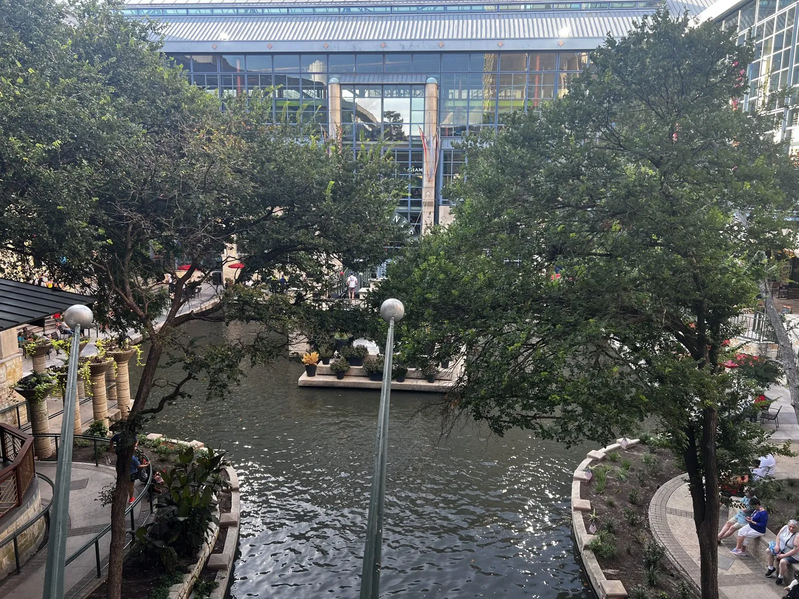
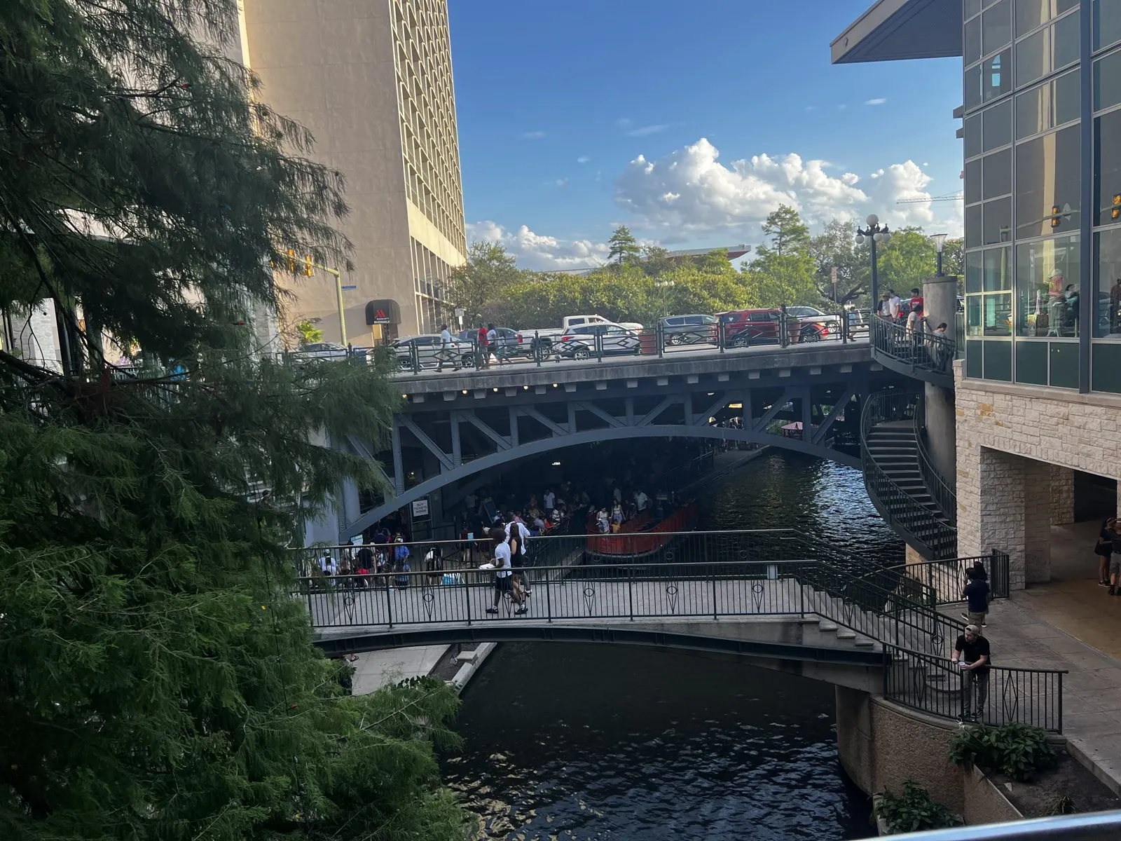
Down at water level it is a different city: shaded by trees, lined with restaurant patios and umbrellas, and on a holiday Saturday crowded with people strolling in both directions. The flat, open tour barges kept sliding by, packed with passengers. Footbridges arch overhead, and people lean on the railings to watch the boats, while the people in the boats look up and watch them back.
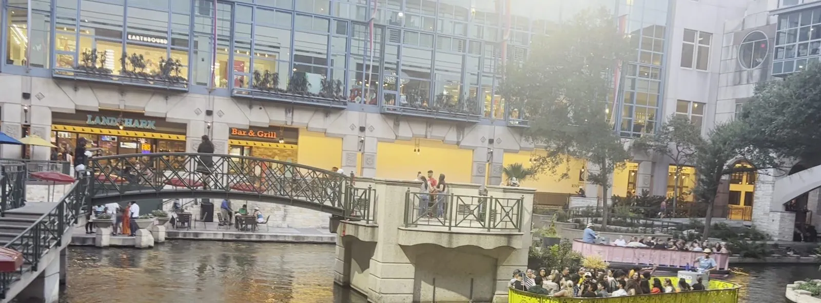
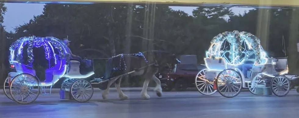
We stayed on the river until after half past eight, when the light went soft and gold and then gray. Back up at street level, the city had another surprise: a line of horse-drawn carriages shaped like Cinderella's pumpkin coach, outlined in blue and white and pink LED lights, clopping down the avenue in the dusk.
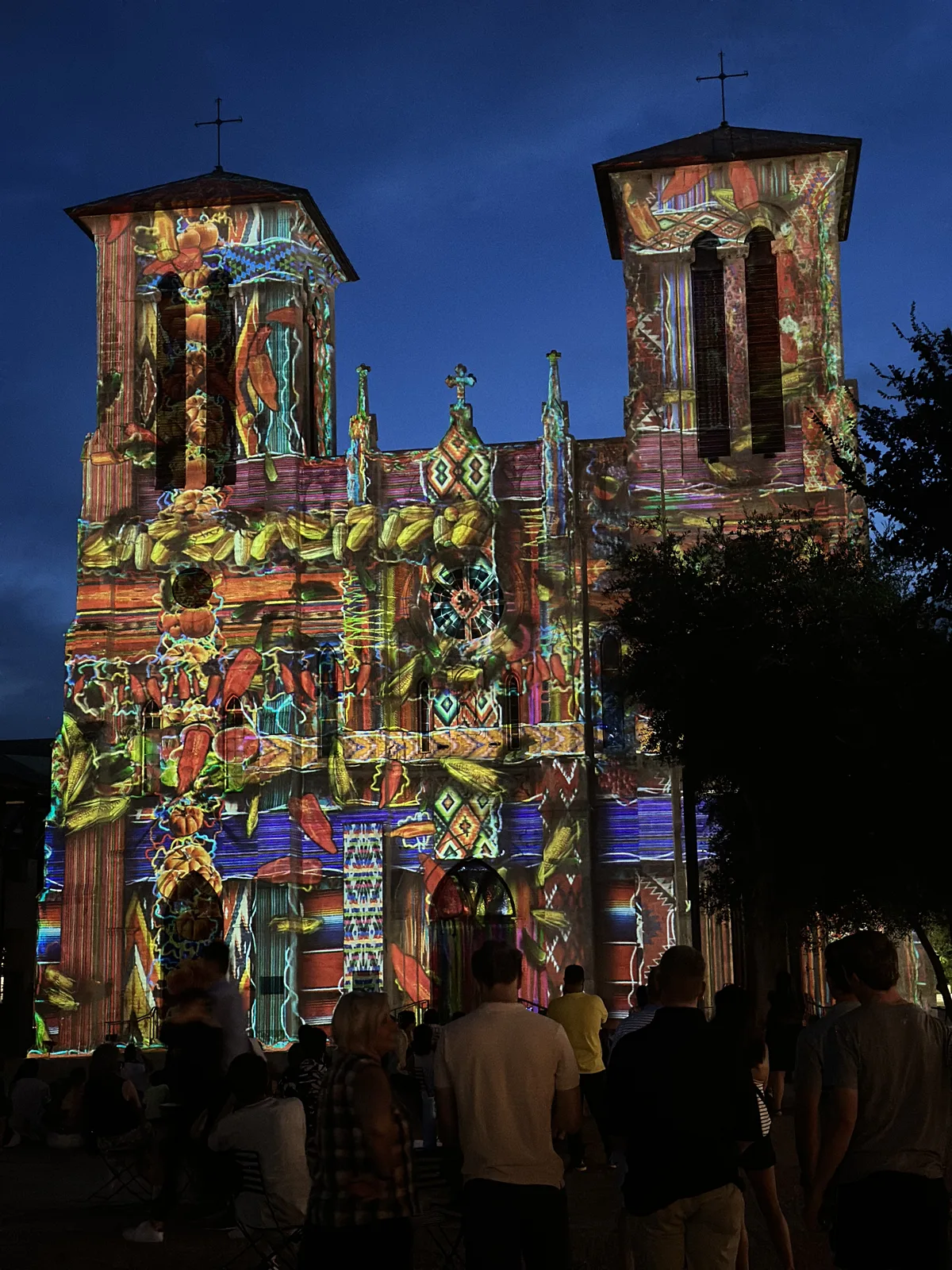
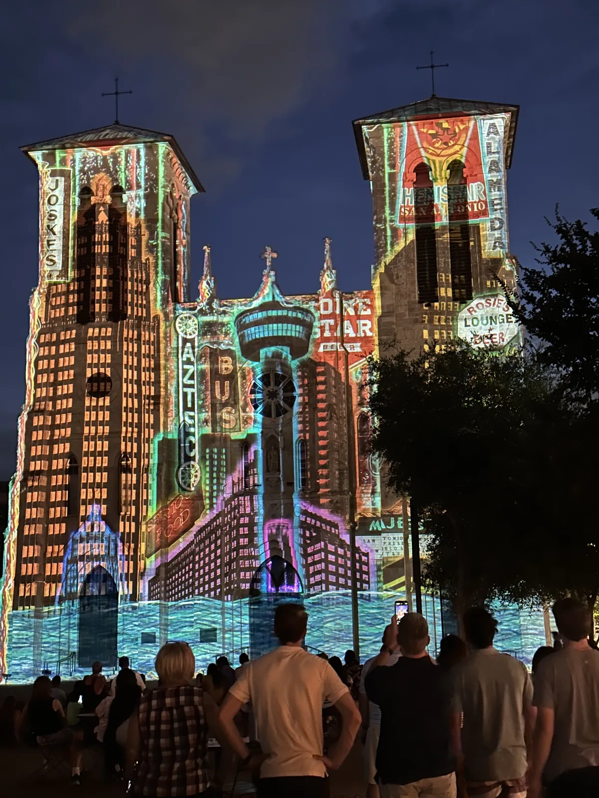
Before leaving, we walked up to Main Plaza. After dark the front of San Fernando Cathedral becomes a screen for a light show, San Antonio | The Saga, and from ten past nine we watched its stone towers change color and pattern again and again, with a crowd standing in the square.
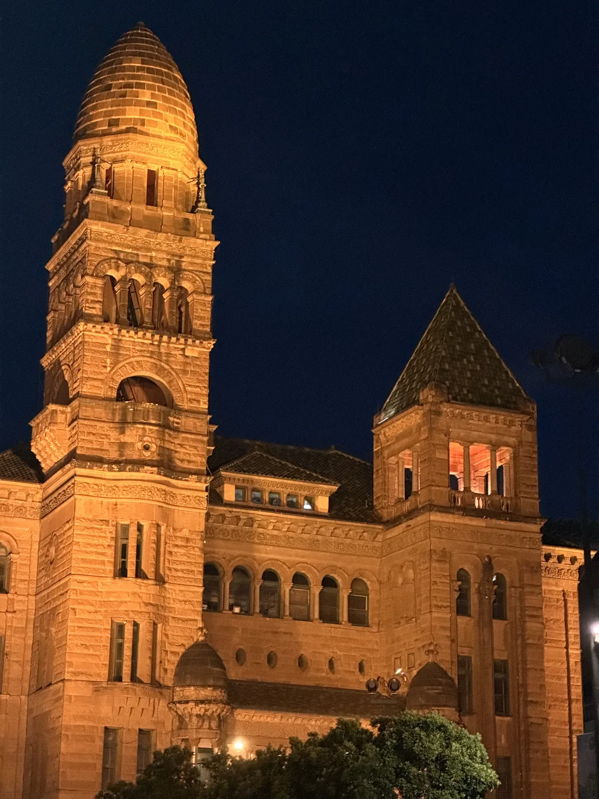
Across the plaza, the red sandstone Bexar County Courthouse glowed under floodlights. We stayed downtown until almost half past nine. Then, that same night, it was eighty miles back up I-35 to Austin, the red Charger finally getting to stretch its legs.
Day 2: Fort Worth, then Dallas
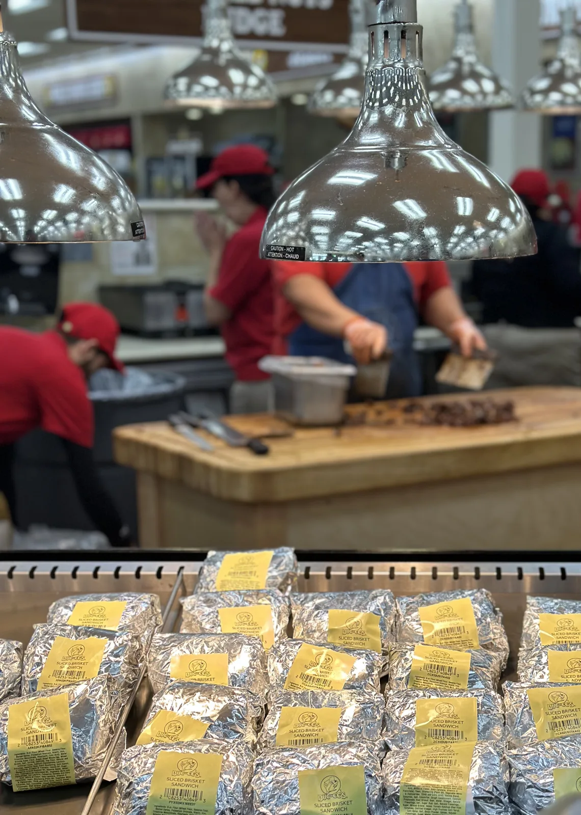
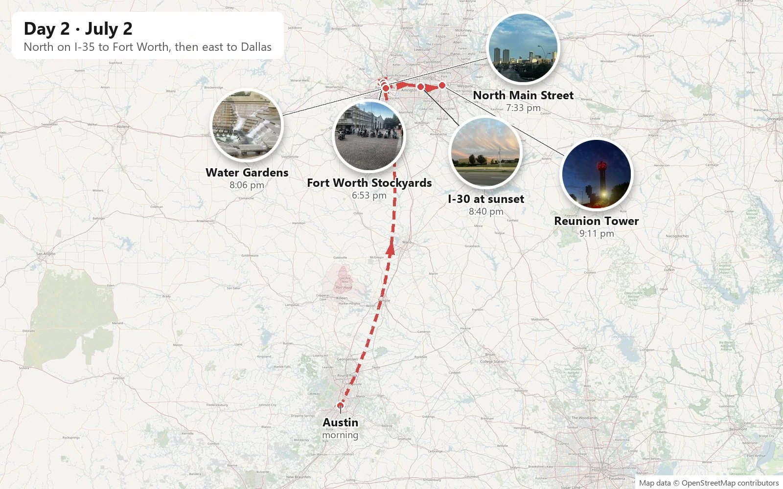
The second day began with a slow morning at the Four Seasons in Austin, and we didn't leave the city until after two. Then came the long side of the triangle: almost two hundred miles up I-35 from Austin to Fort Worth, past Waco and the long flat farmland of the Blackland Prairie. The phone stayed in a pocket for most of it. Near Temple we stopped at Buc-ee's, the Texas gas-station chain, where men in red shirts were carving brisket at a counter behind stacks of foil-wrapped brisket sandwiches. We reached the Fort Worth Stockyards at about six in the evening.
Cowtown
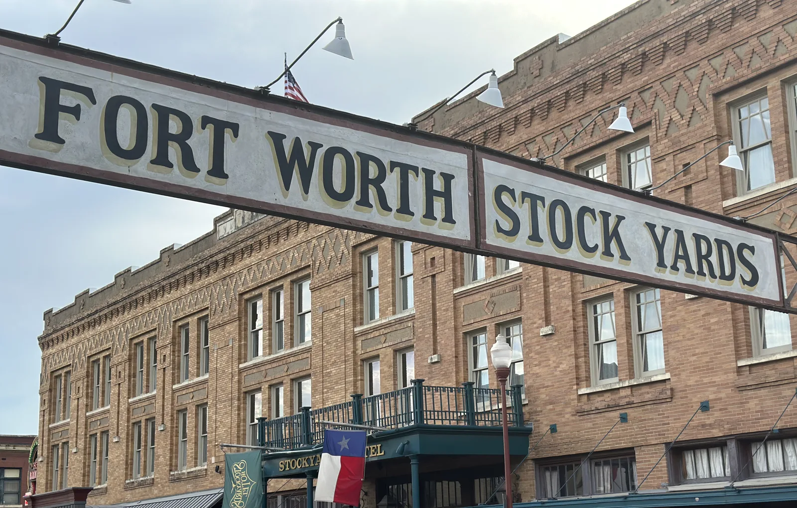
Fort Worth calls itself "Cowtown" and "where the West begins", and the Stockyards are why. After the Civil War, cattle drives up the Chisholm Trail passed through here on their way to the railheads in Kansas. Once the railroad came to Fort Worth, the city became the place where Texas cattle were bought, sold and shipped, and in the early 1900s the big meatpackers Swift and Armour built plants beside the pens. The packing plants are long gone, but the district has kept its brick streets, its Mission-style buildings and its wooden cattle pens. The longhorns are still driven down Exchange Avenue twice a day, though not at seven in the evening.
What we found instead was a different kind of herd: a row of big touring motorcycles lined up across the brick paving of Rodeo Plaza, the riders standing around them in the long evening light, and a white stucco building behind them wrapped in scaffolding, with a little crowd of onlookers along the curb.
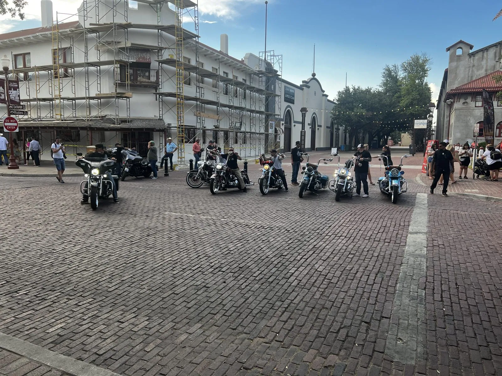
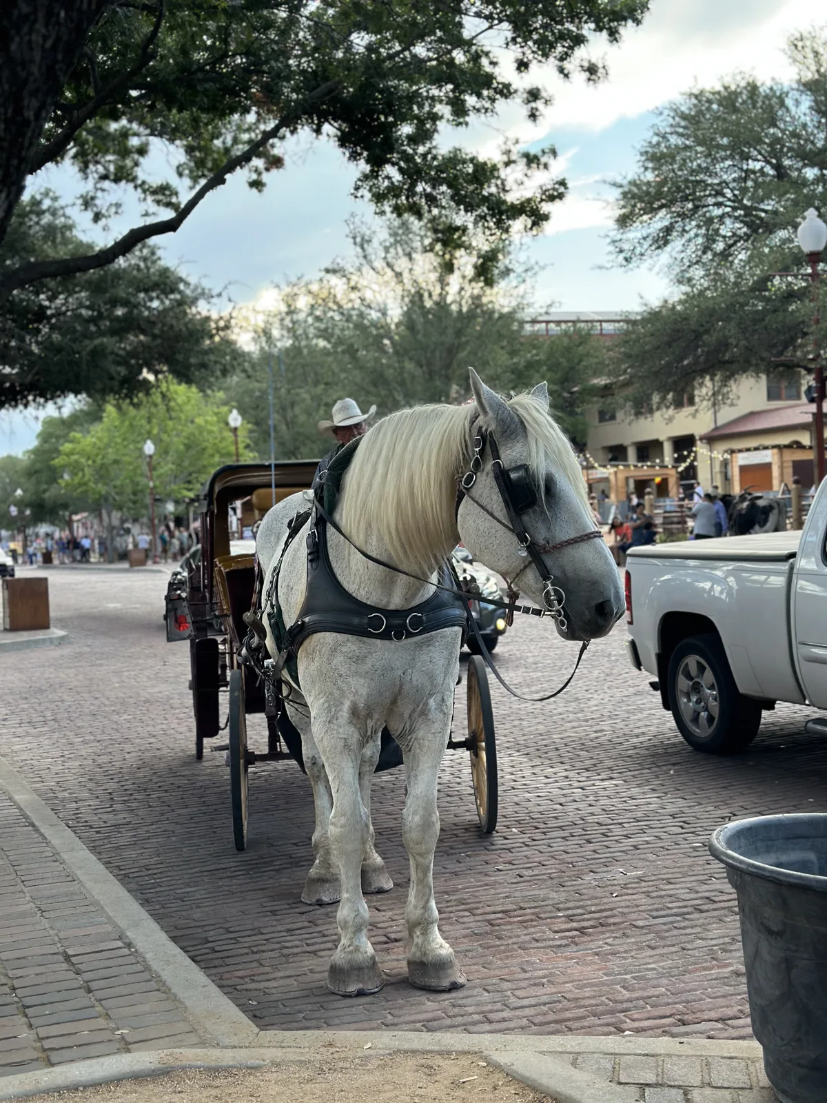
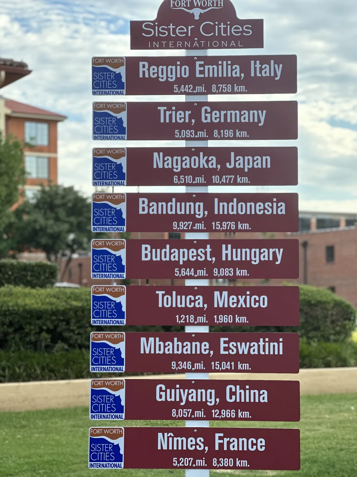
We had well over an hour there: Western-wear shops, horse carriages waiting on the brick streets, the arch over Exchange Avenue, a signpost pointing to Fort Worth's sister cities from Italy to China, and pens of sheep and goats.
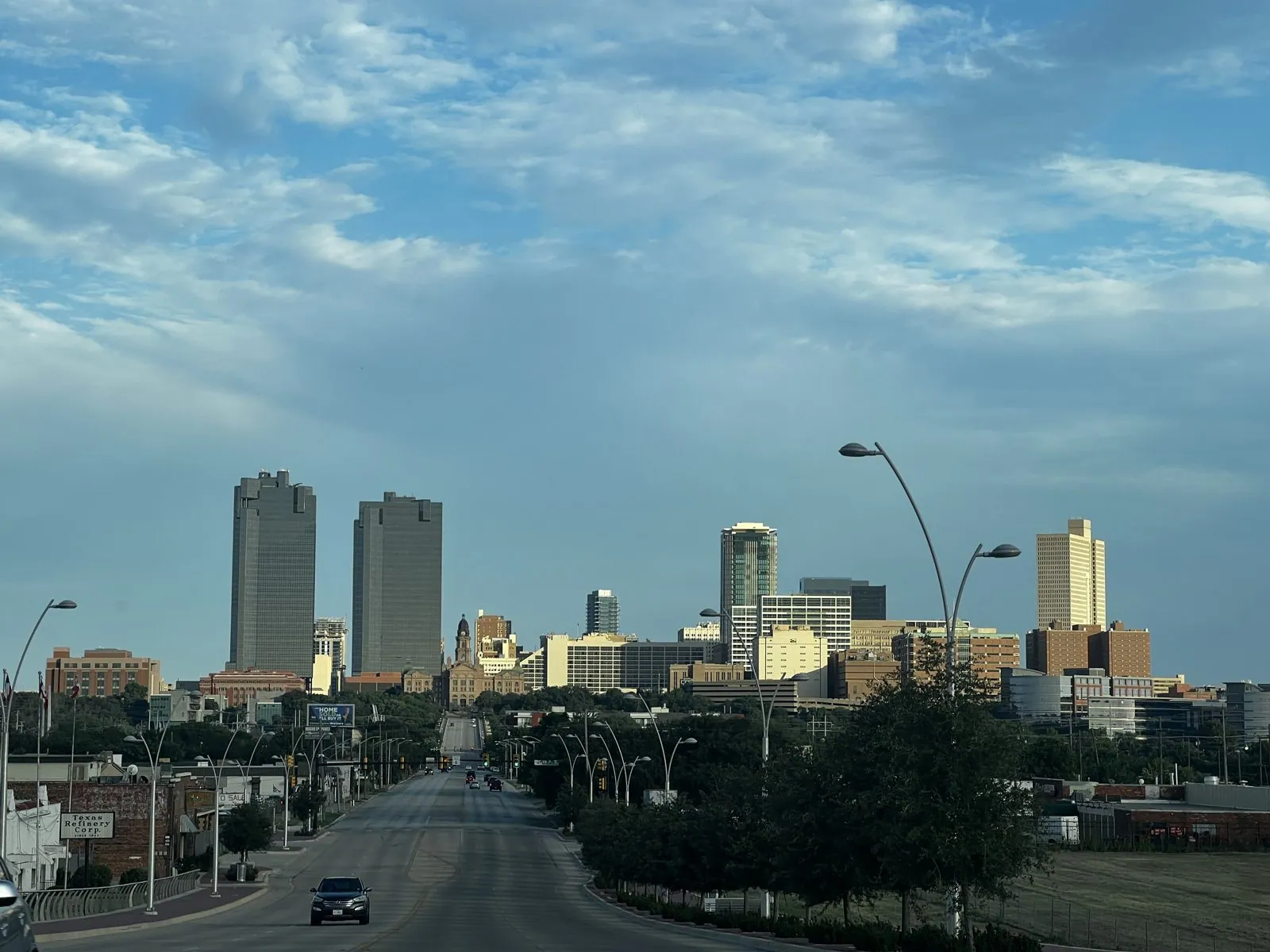
From the Stockyards, North Main Street runs dead straight downhill toward downtown, and from the top of the rise the whole skyline lines up at the end of it: a pair of dark twin towers, a cluster of smaller ones, and street lamps curving over the empty road. In the low evening light it looked like a model of a city someone had set down on the prairie.
The Water Gardens
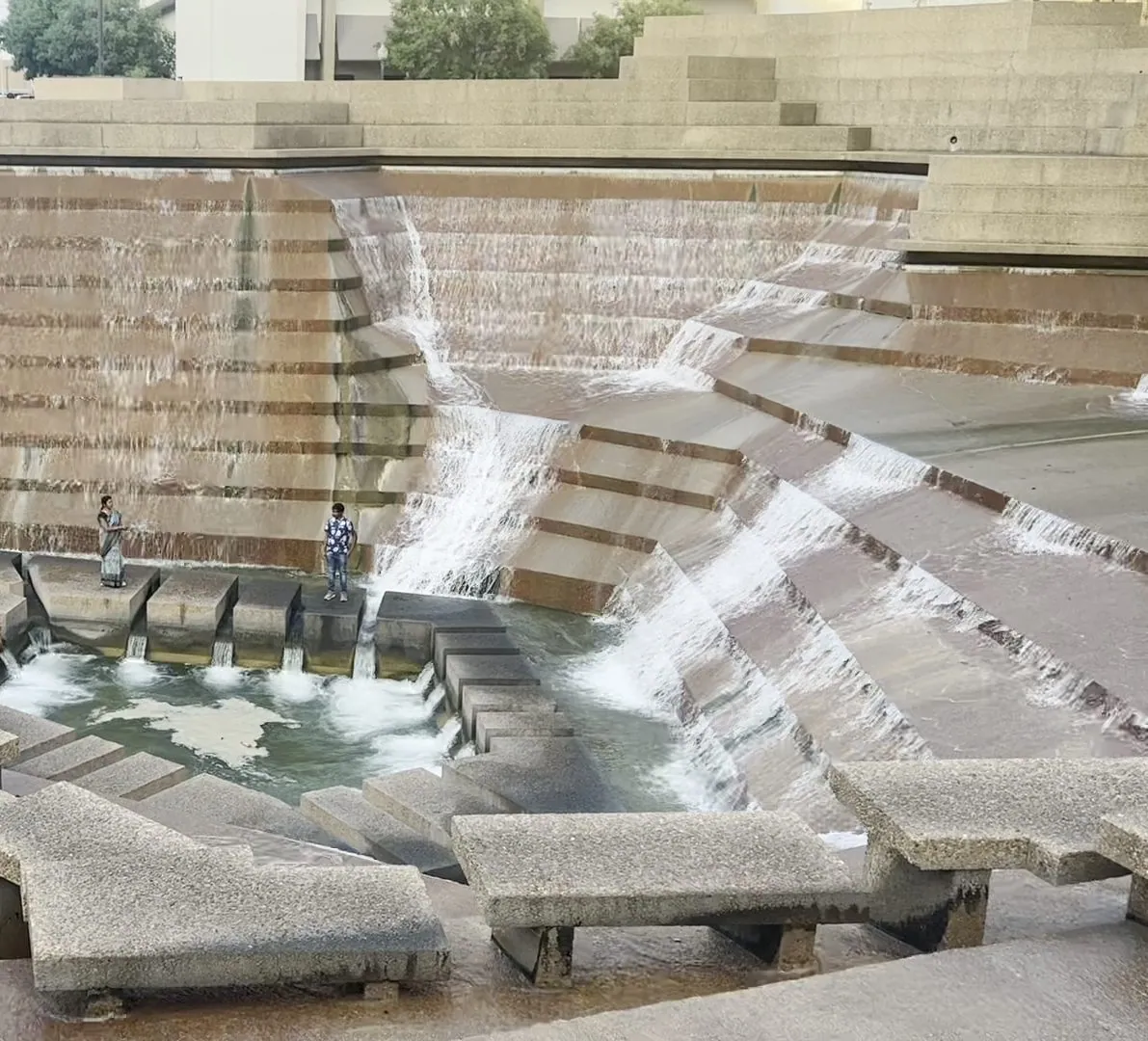
Downtown, we went to the Fort Worth Water Gardens, which may be the strangest public park in Texas. Philip Johnson and John Burgee designed it in 1974 as a sunken landscape of concrete terraces and pools. There is a quiet pool, sunk deep among cypress trees, and an aerated pool that sends up a fine mist. The star is the Active Pool, where water pours down a steep amphitheater of jagged concrete steps into a small square basin at the bottom, and you can walk down the stepping stones right into the middle of it. It looks like the future as imagined in the 1970s, and Hollywood thought so too: it was a set for the film Logan's Run.
At eight in the evening there were people picking their way down the steps toward the basin. The design is as much about sound as sight: down in the pit, the roar of falling water bounces off the concrete walls and the city outside disappears.
East on I-30, and Reunion Tower
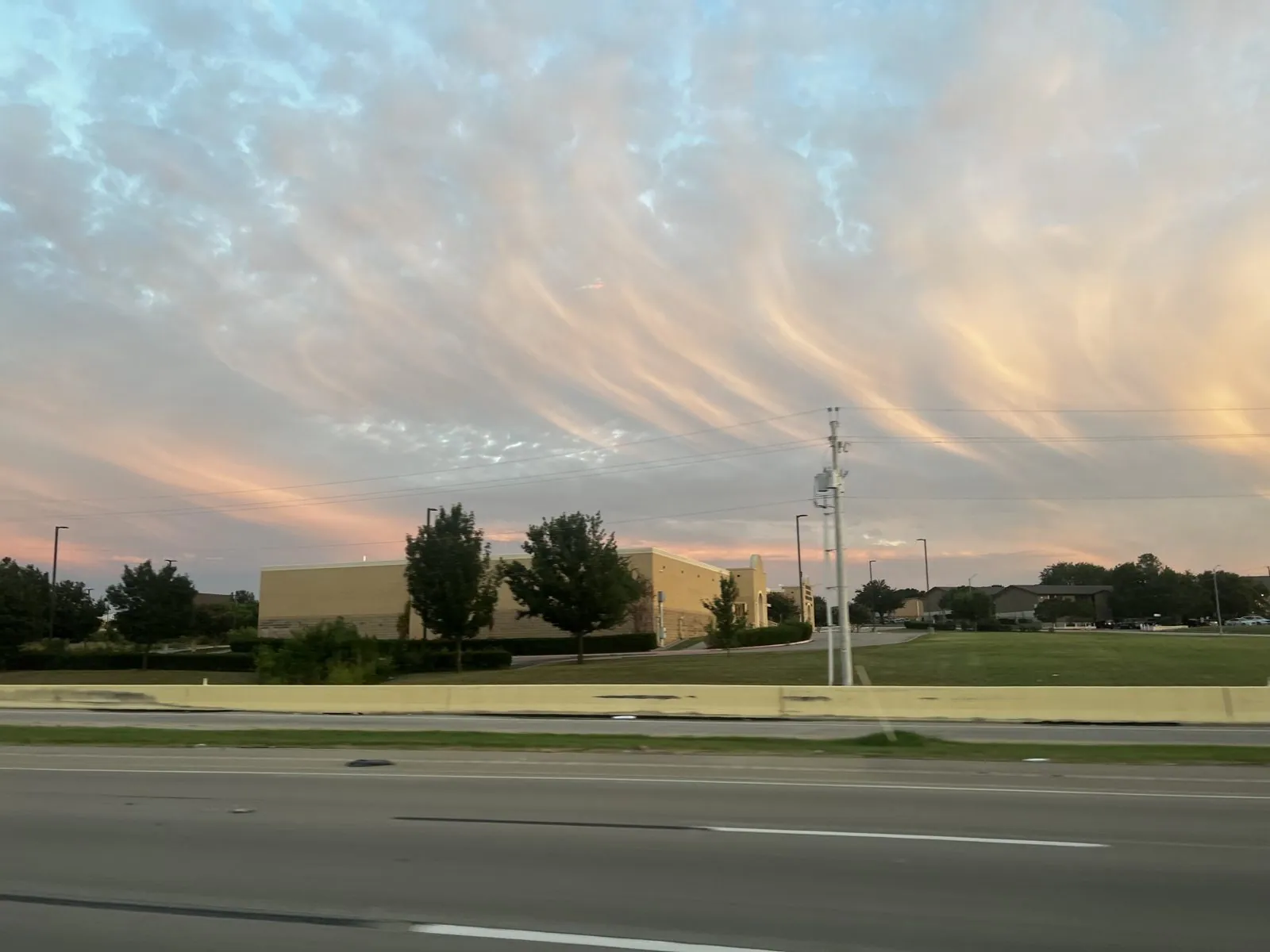
Fort Worth and Dallas are only thirty-odd miles apart, joined by I-30, and the space between them has filled in so completely that you never really leave town. Halfway across, in Arlington, we passed Six Flags Over Texas, which opened in 1961 and was the first of the Six Flags parks; the name refers to the six nations whose flags have flown over Texas. Then the sky put on a show. The sun had set behind us, and thin, streaky clouds overhead turned peach, pink and lavender, combed into long parallel waves as if someone had dragged a brush through them.
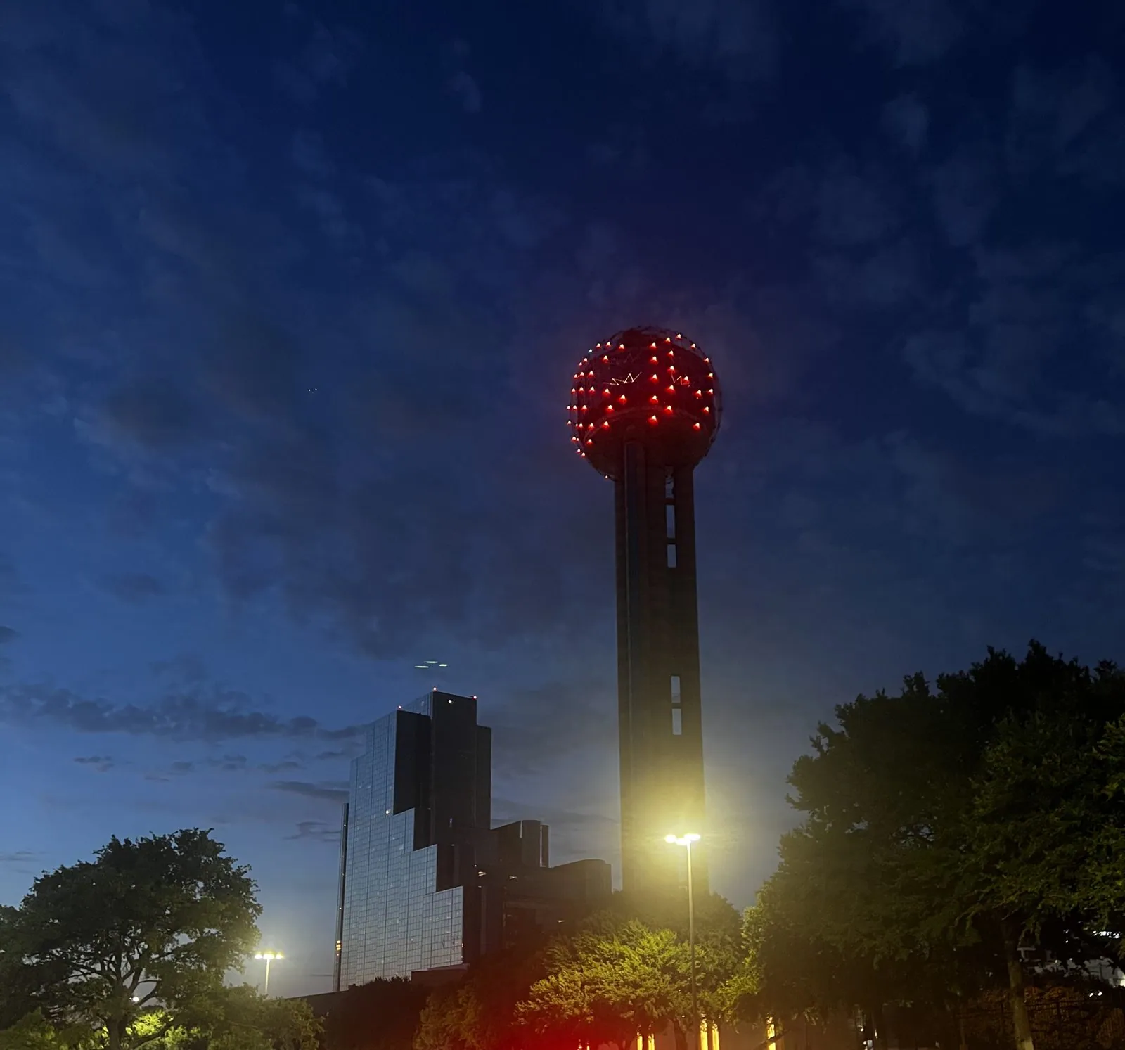
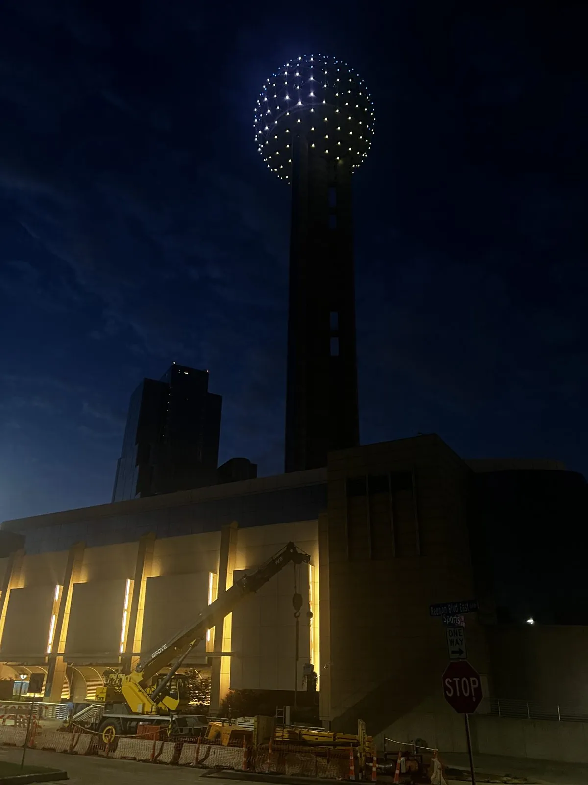
We pulled into Dallas just after nine, and the first thing we saw was Reunion Tower. It is the city's signature: a 561-foot concrete shaft topped by a geodesic ball, opened in 1978, which is covered in a lattice of 259 LED lights that run animated light shows after dark. That night the ball glowed solid red. A few minutes later it switched to white and blue. Two days before the Fourth, that seems unlikely to be a coincidence.
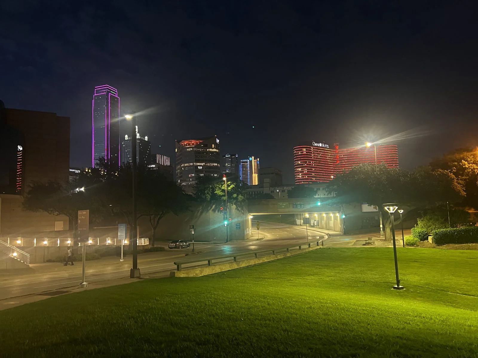
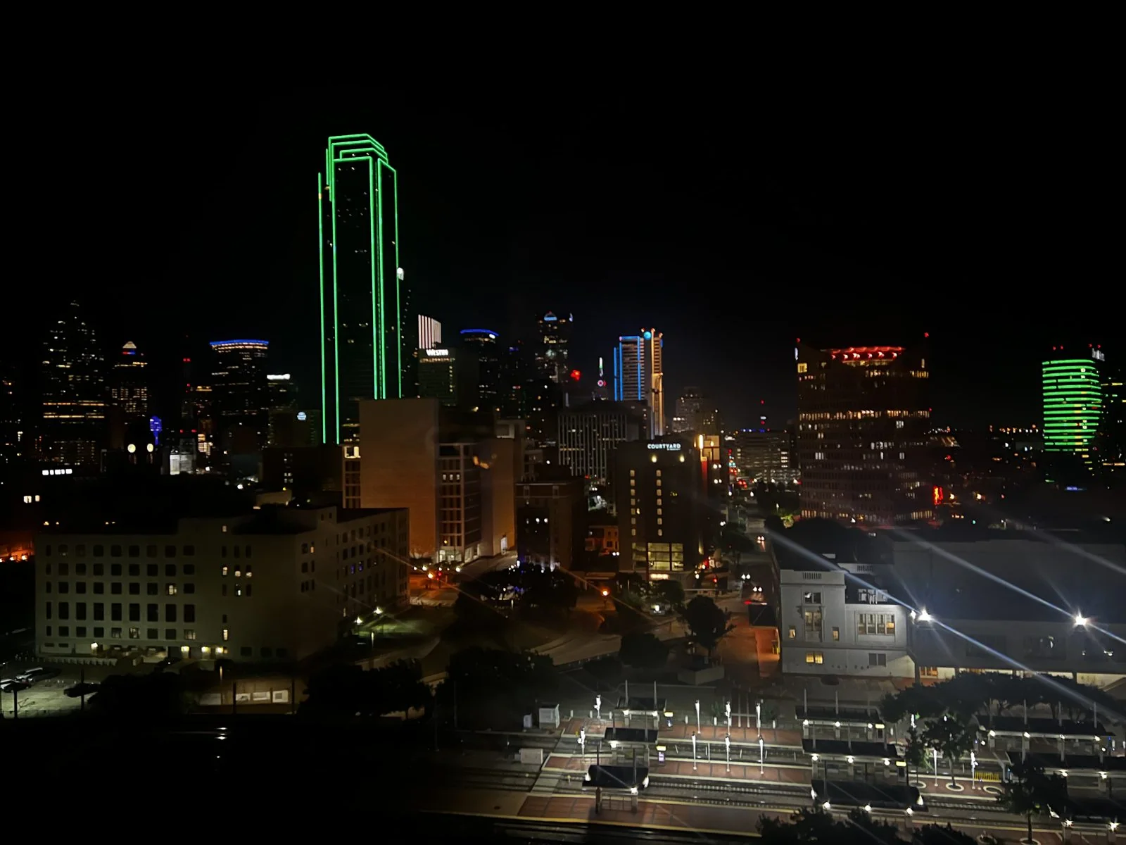
The downtown skyline at night is Dallas showing off. Many of its towers are outlined in colored light: one in pink, another with a whole facade glowing red, and above all of them the Bank of America Plaza, at 72 stories the tallest building in the city, traced in brilliant green along every edge, like a drawing of a skyscraper rather than a skyscraper. From our room at the Hyatt Regency, right next to Reunion Tower, we could see it all, with the rail lines and the dark streets of the West End below.
Day 3: Dallas by day, and south to Houston
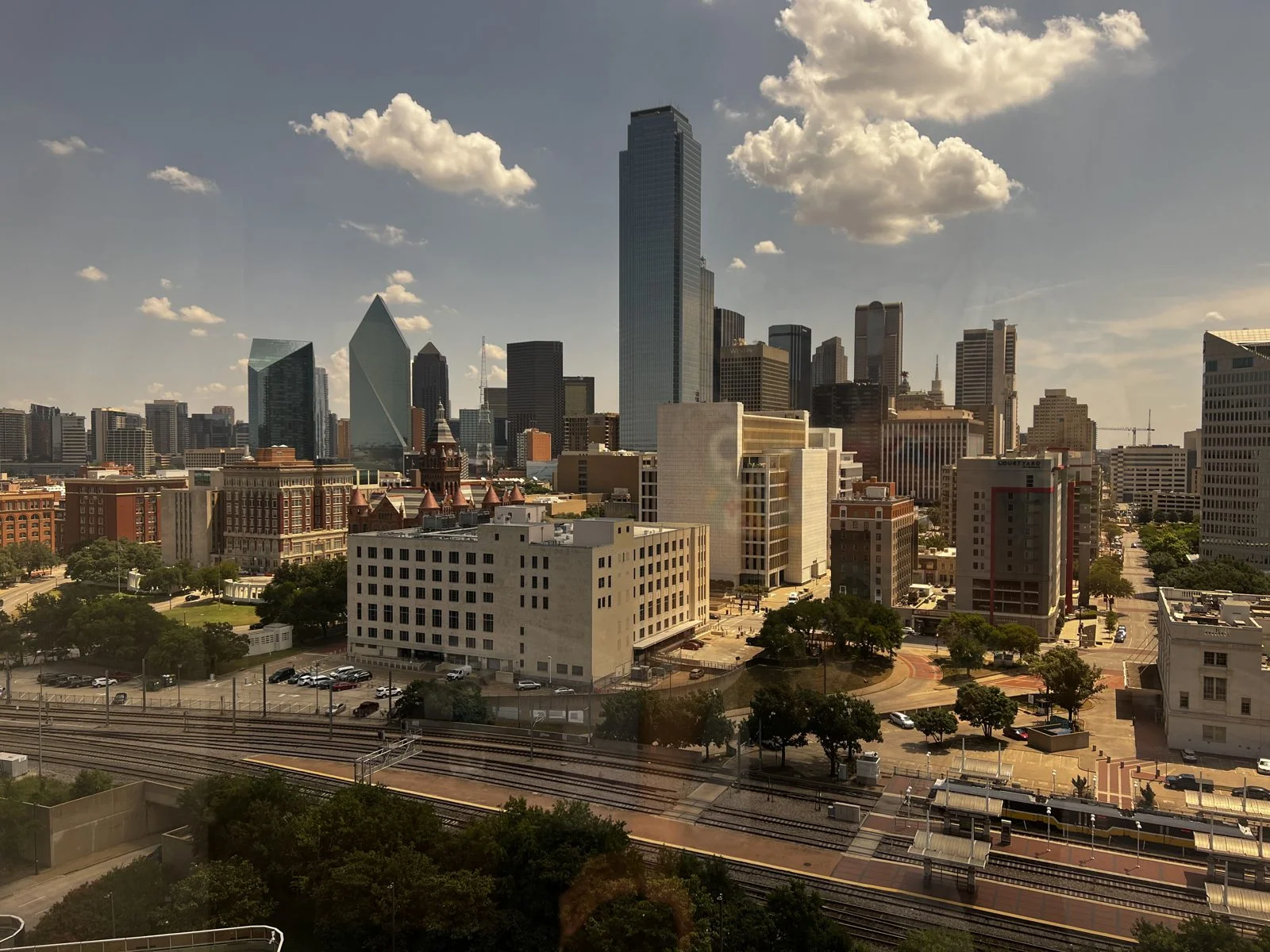
In daylight the same view was all glass and sky: the Bank of America Plaza a plain silver-blue slab now, the stepped pyramid of Fountain Place beside it, and the old brick of the West End in the foreground. Big white clouds were drifting over the city again, as they had every day of the trip.
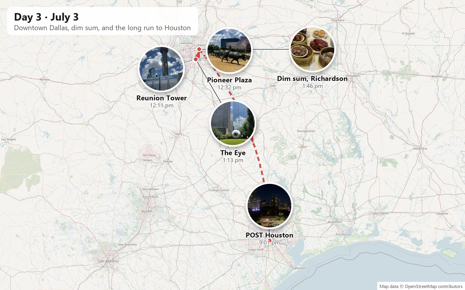
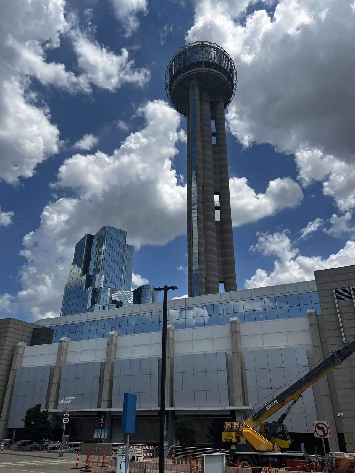
By noon we were back at the foot of Reunion Tower, which by day turns out to be an unexpectedly elegant object: a slim cylinder of concrete with a cage of white struts around the ball, rising out of a construction site with a yellow crane parked at its base.
A cattle drive downtown
A few blocks east, in the middle of the city, is a cattle drive. Pioneer Plaza holds 49 bronze longhorn steers and three cowboys on horseback, by the sculptor Robert Summers, installed in the 1990s. The steers are larger than life and spread out across a hillside of dry grass, coming down a slope, splashing through a little stream and climbing out the other side, as if they had been driven up the Shawnee Trail and just kept going straight through downtown.
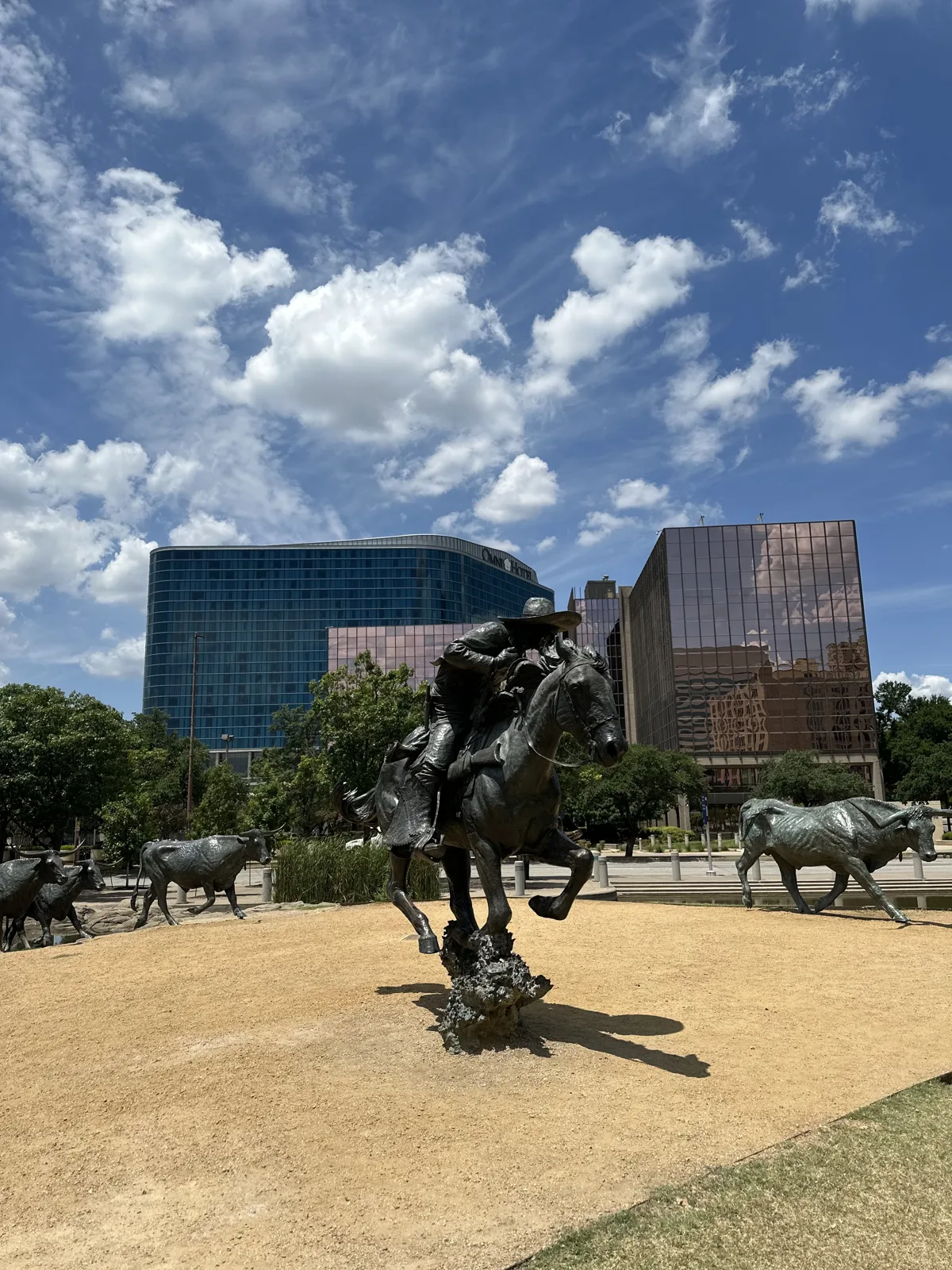
It is supposedly the largest bronze monument of its kind in the world. Behind them, the mirrored glass of the office towers reflects the clouds, and the effect is pleasantly absurd: a herd from the 1850s in front of a wall of mirrored glass from the 1980s.
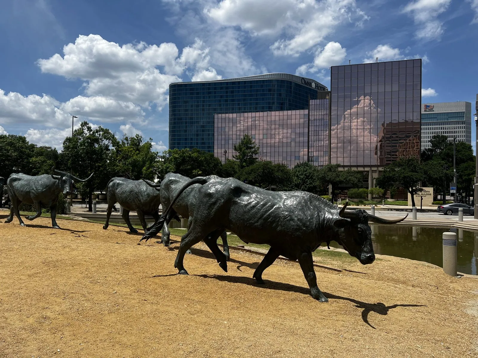
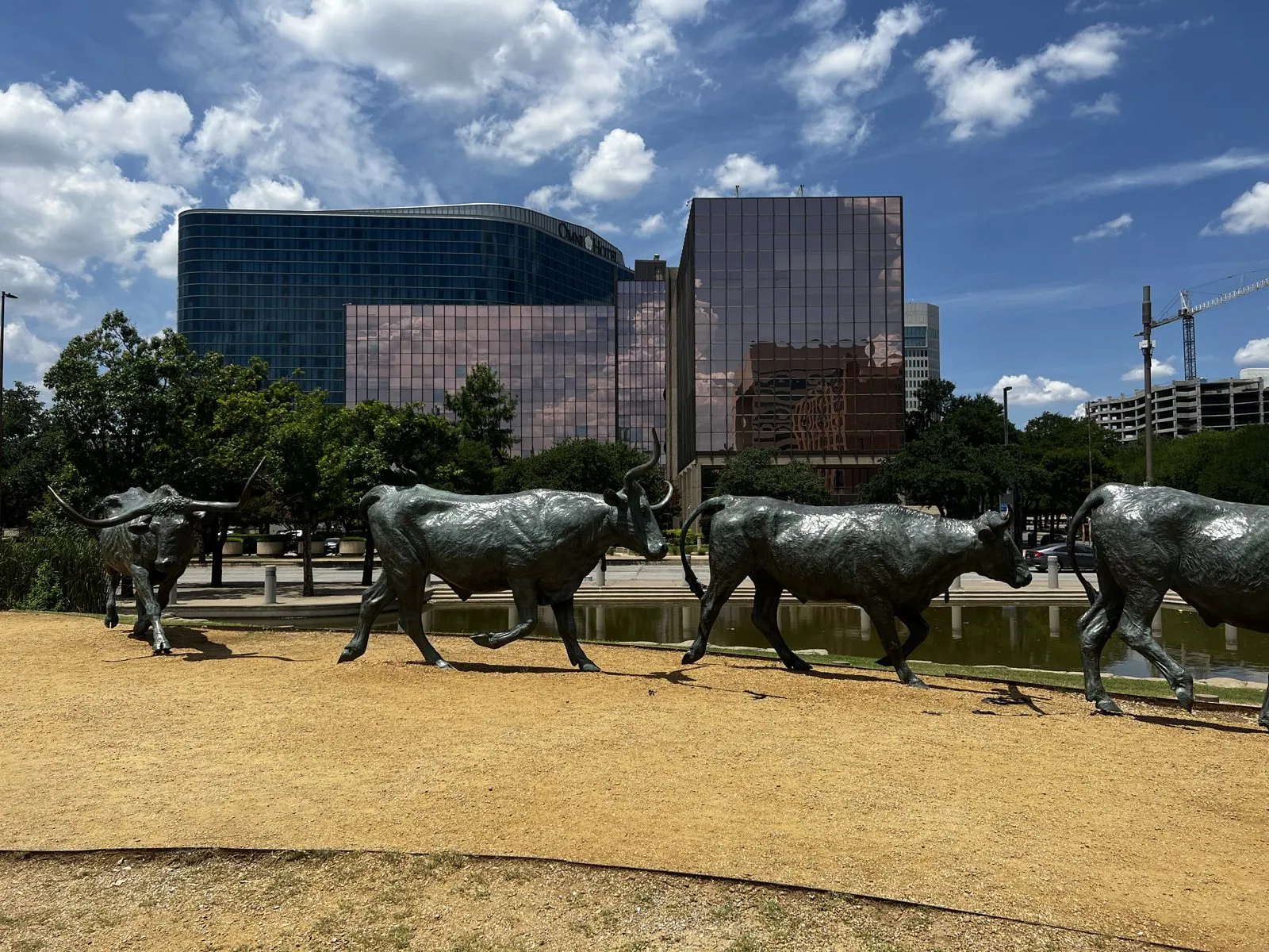
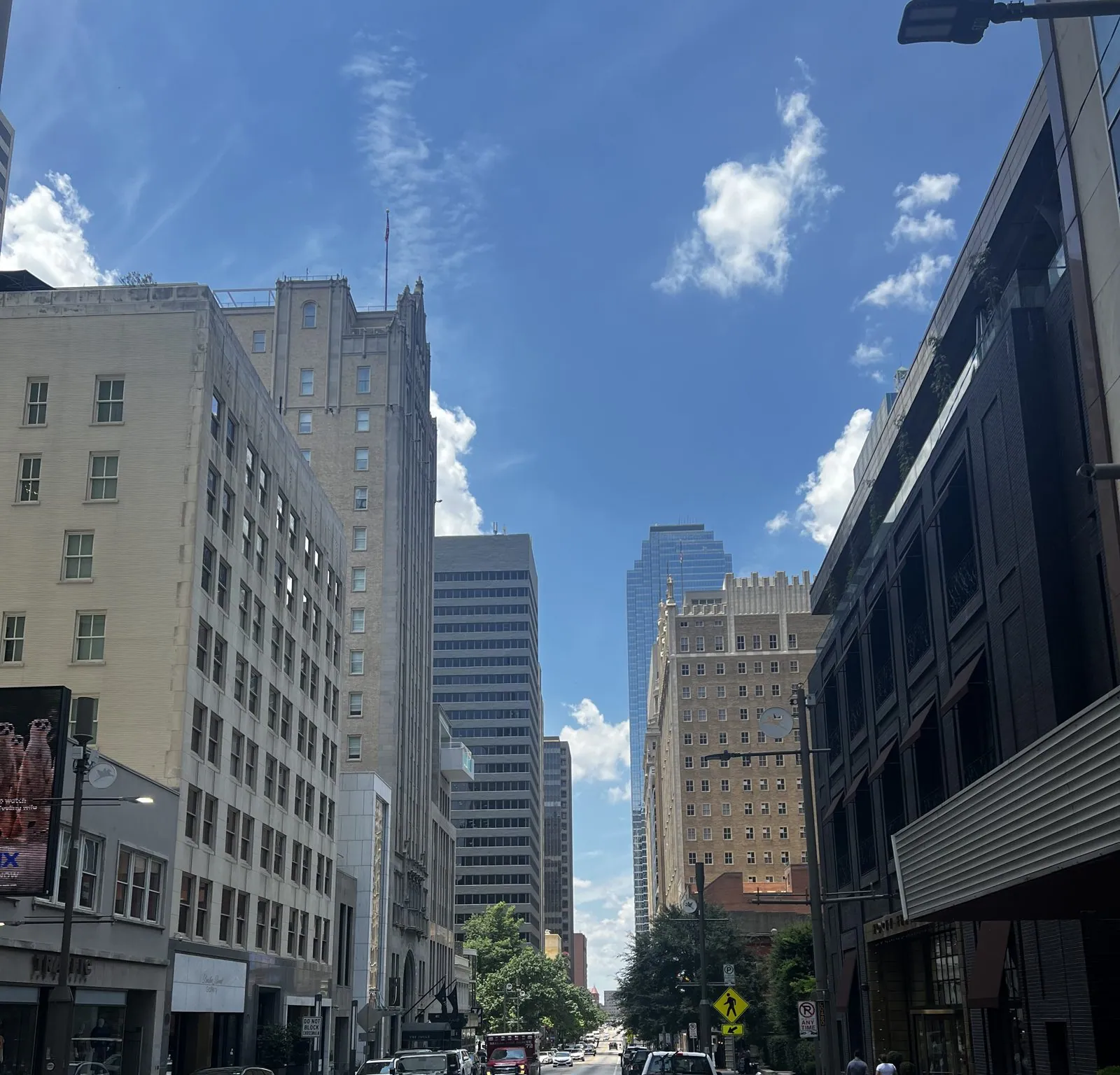
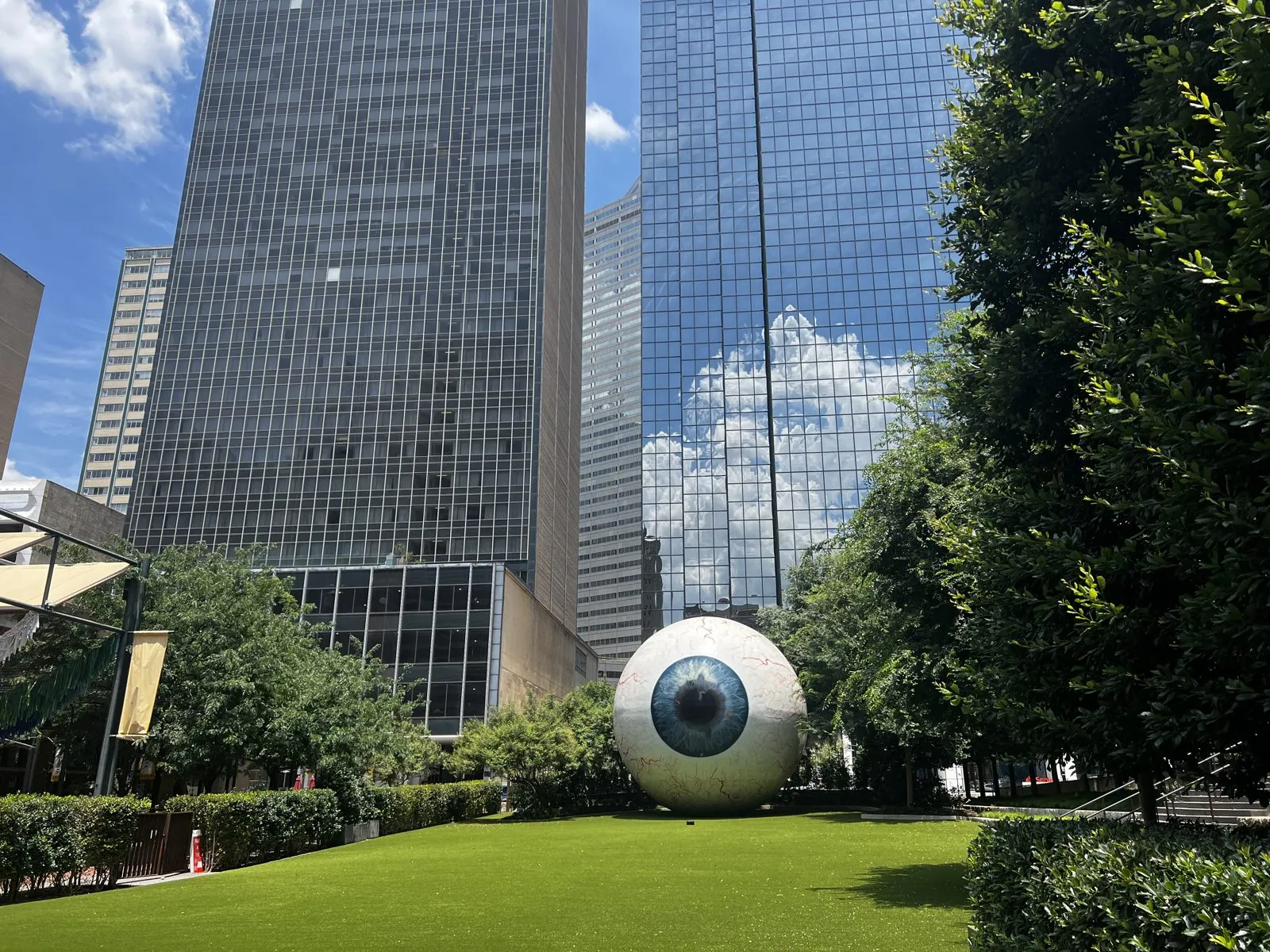
The grass under the steers was baked to the color of straw. Half an hour later we were among the streets north of the plaza, which in downtown Dallas are narrow canyons between old brick office buildings and new glass. Off Main Street, in a garden lawn between two black-glass towers, we found the city's most unsettling piece of public art: Eye, by Tony Tasset, a thirty-foot fiberglass eyeball, complete with red veins, lying in the grass and staring straight at you. It is impossible to stand in front of it without feeling watched, which is presumably the point.
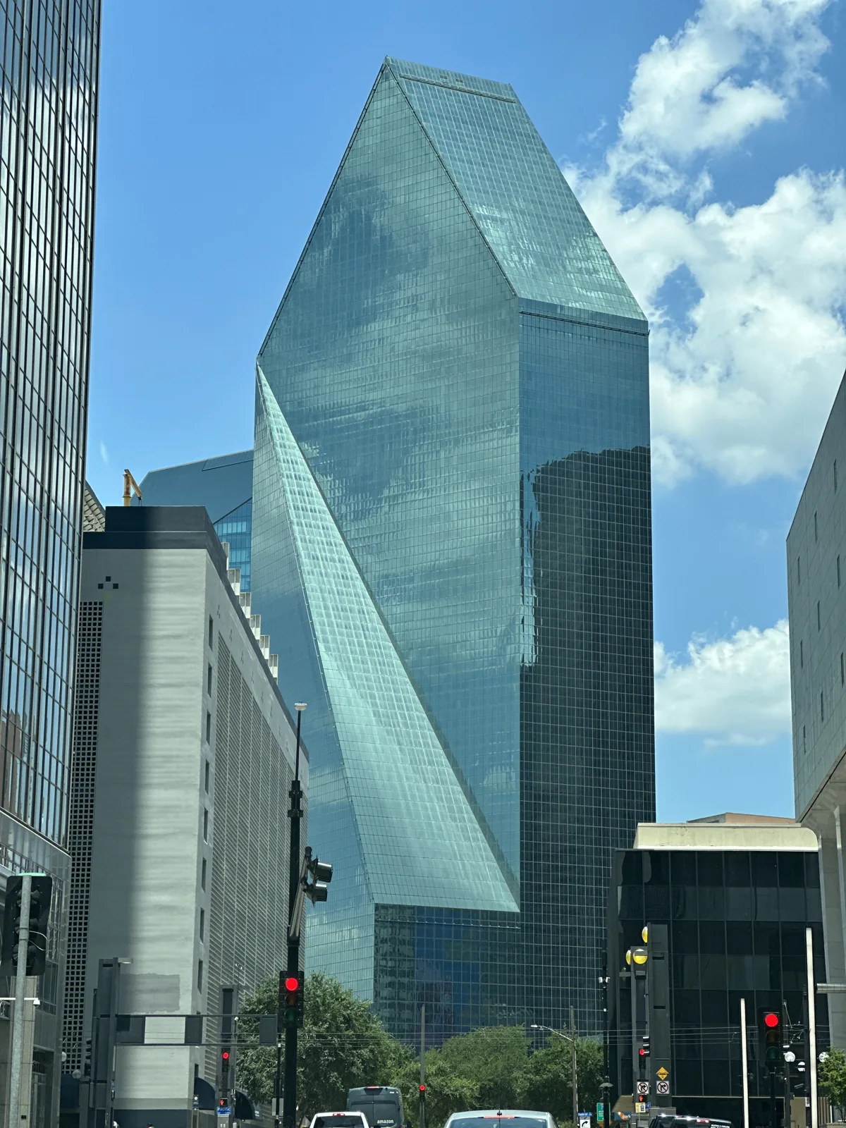
A few minutes later we were at the foot of Fountain Place, the tower we had seen from the window, which up close is a single block of green glass cut into sharp facets.
Dim sum in Richardson
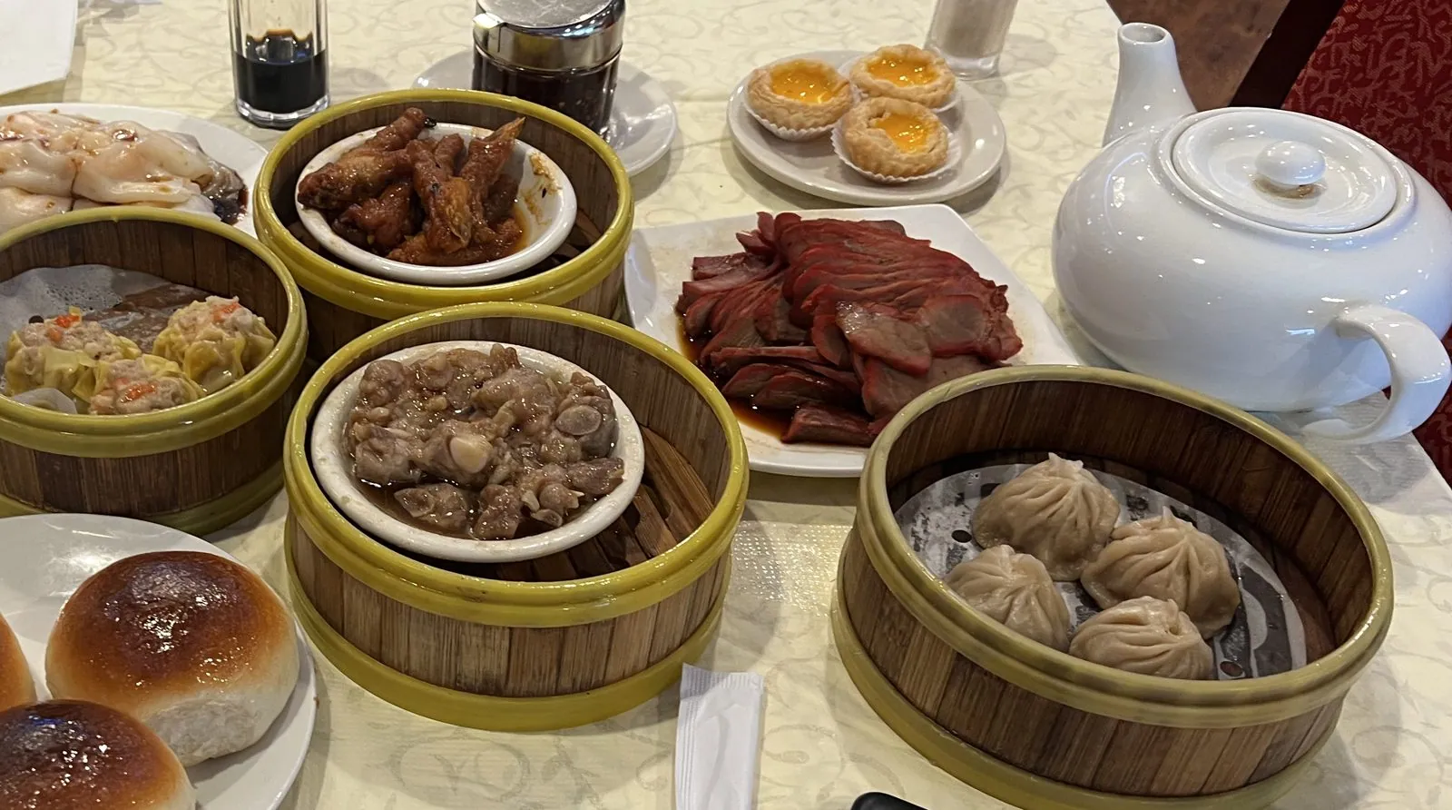
Before heading south, we drove fifteen minutes north to Richardson, a suburb with one of the larger Chinese communities in North Texas, for dim sum at Kirin Court. After a weekend of barbecue, the table filled up with bamboo steamers: soup dumplings with their little twisted tops, shumai, steamed spare ribs, chicken feet in a dark glossy sauce, a plate of char siu, baked barbecue-pork buns, rice-noodle rolls, a trio of egg tarts, and a big white pot of tea in the middle of it all.
Houston after dark
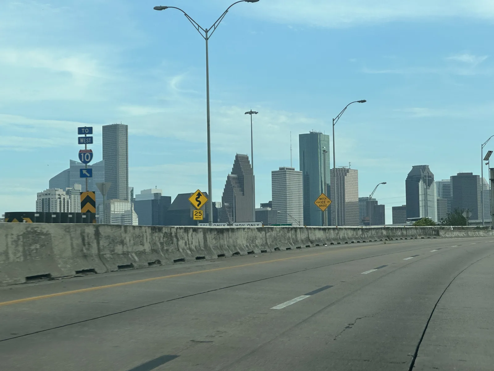
Then came the longest drive of the trip: about four hours down I-45 from Dallas to Houston, through the pine woods of East Texas, mostly in the heat of the afternoon, and again almost no photos. We reached Houston a little before seven, with the skyline coming up ahead on I-45 in the evening light, and after dark we went to an old post office.
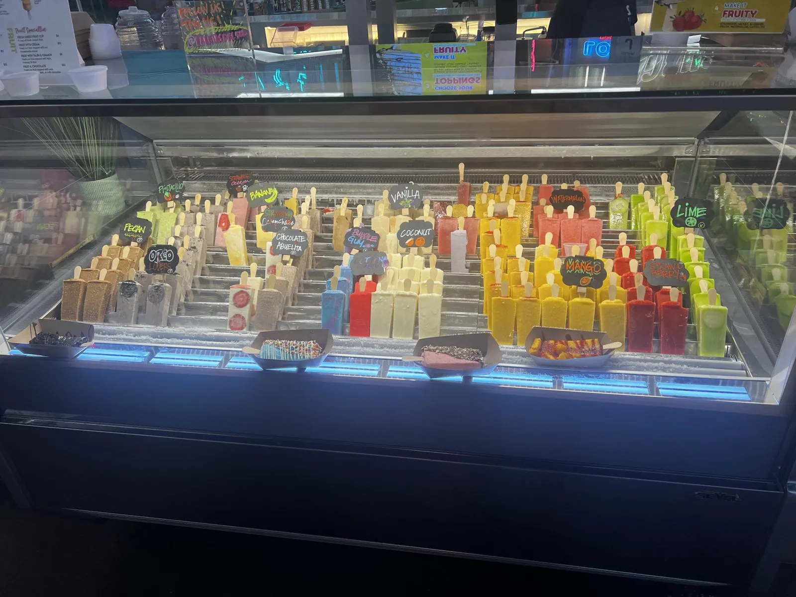
POST Houston is what happens when a city decides not to tear down a giant concrete box. It was the city's main post office, built in 1962 and later named for Barbara Jordan, a sprawling mail-sorting building next to the rail lines on the edge of downtown. After the mail moved out, it was reborn in 2021, redesigned by the architecture firm OMA as a food hall, a concert venue and, on top, a huge rooftop park and farm. Downstairs in the market there was a glass freezer case of paletas, Mexican ice pops, in rows of every color: lime, coconut, chocolate and many more, all neatly labeled on little chalkboard signs.
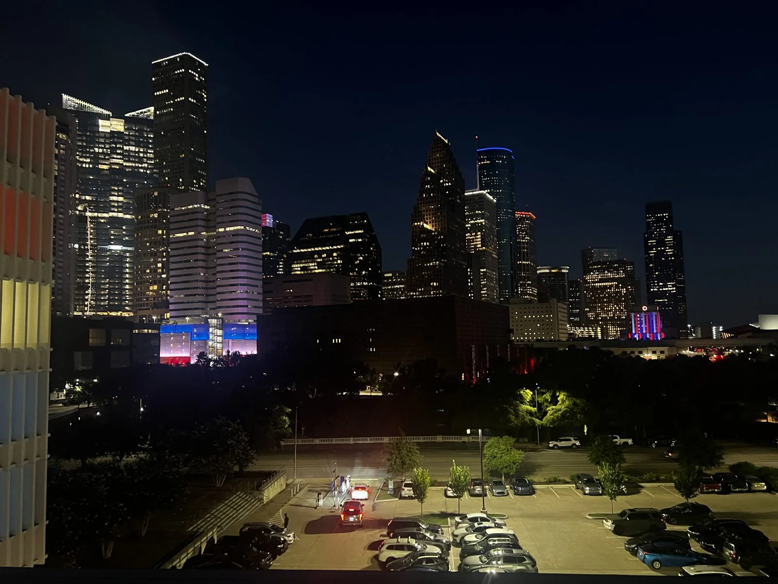
Up on the roof, the building's long facade glowed red behind a screen of vertical fins. It was a Houston July night, and the rooftop was dotted with people sitting at tables in the dark. Beyond the garden beds, the whole Houston skyline was lit up across the freeway.
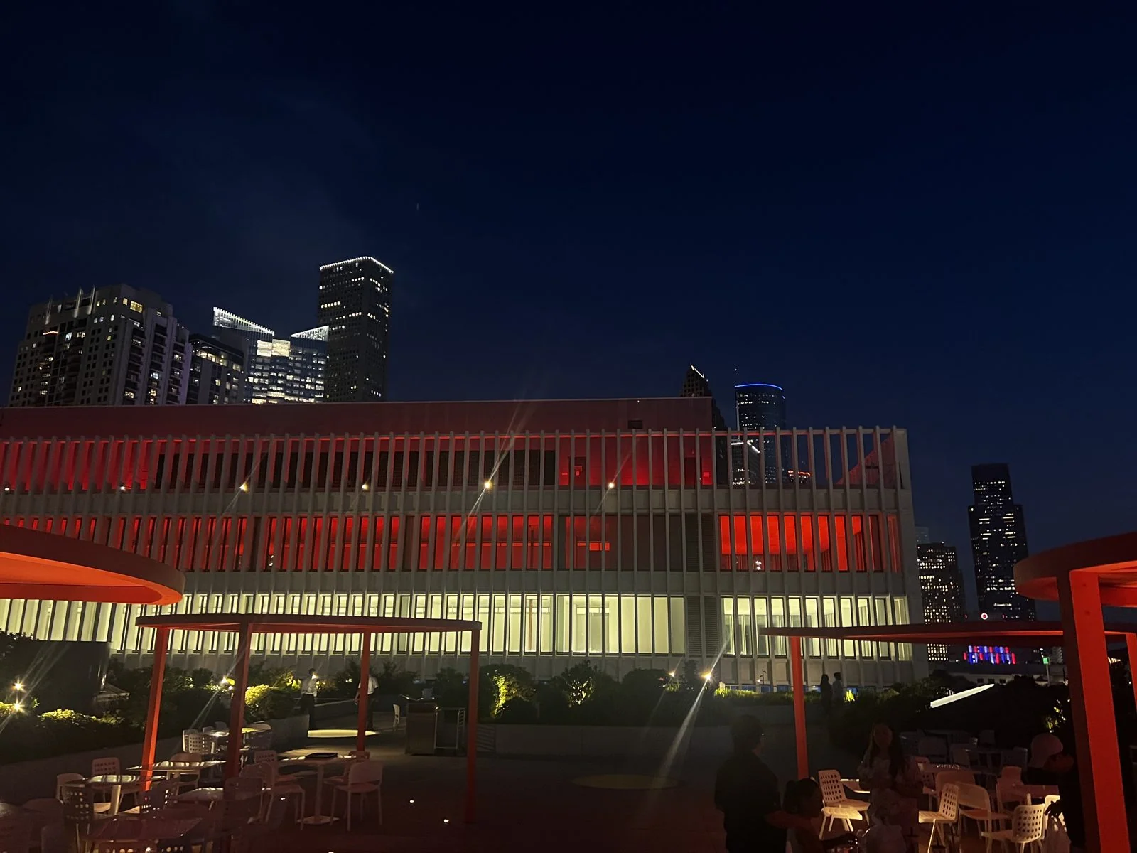
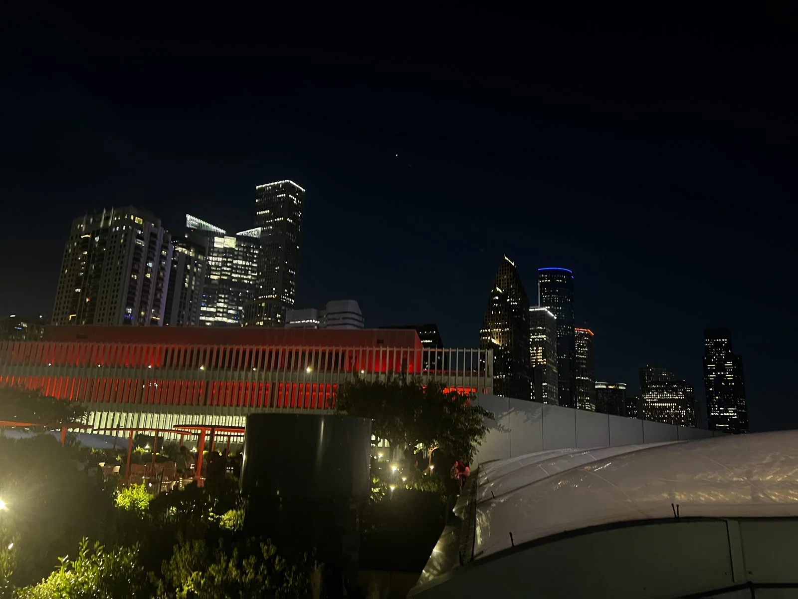
Houston's skyline is the biggest of the four cities, and from up here it is one long wall of light: glass towers glowing white, gold and violet, and among them the stepped and peaked tops of the skyscrapers that oil money built. It was the night of July 3rd, and the city felt like it was waiting for the next day. We spent the night downtown, at the Hyatt Place.
Day 4: Independence Day
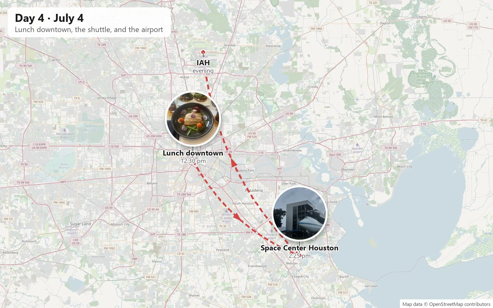
The Fourth of July began with a long lunch downtown, near Discovery Green, at Xochi, a restaurant devoted to the cooking of Oaxaca from the Houston chef Hugo Ortega. A small wooden card on the table explained the name: xochitl is the Nahuatl word for flower.
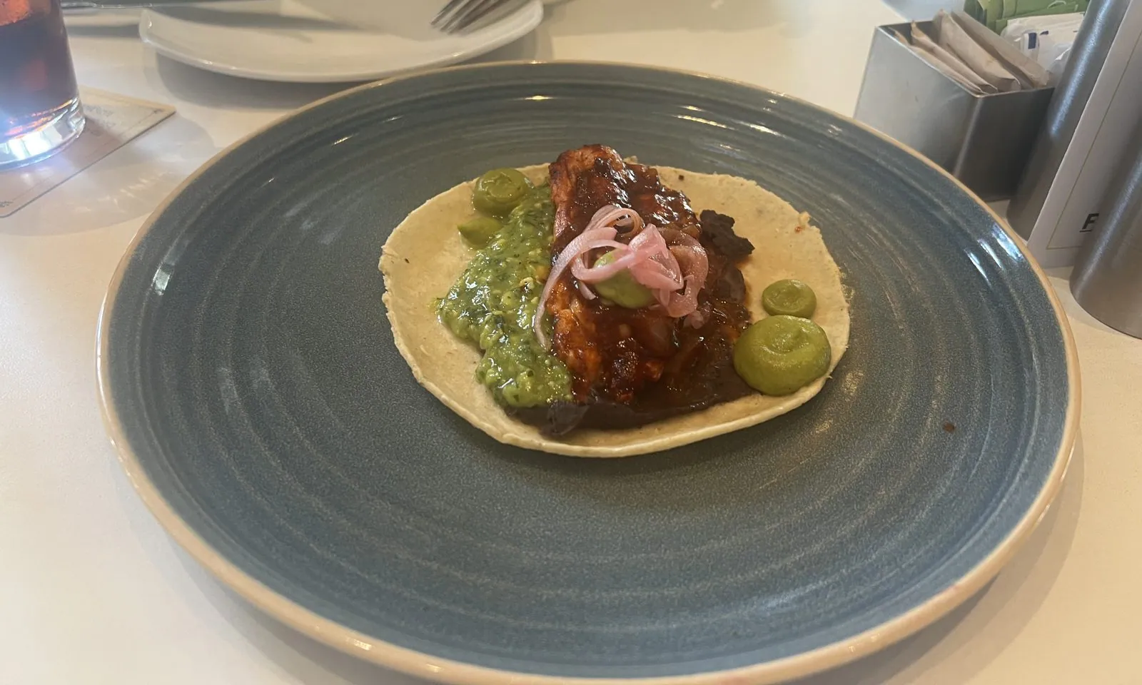
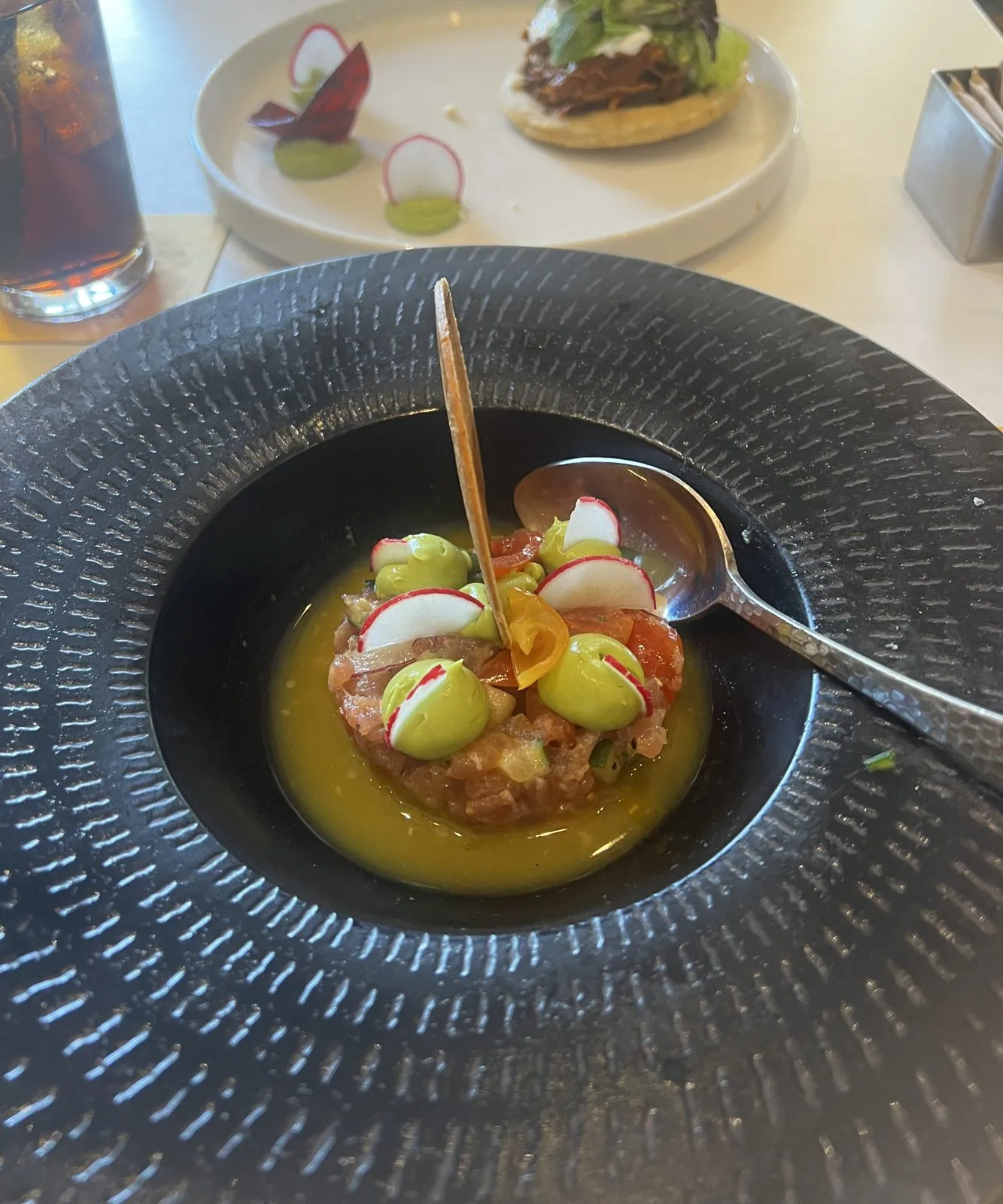
The food was the kind that is a little too pretty to eat. A tortilla came topped with dark, glossy braised meat, green salsa and pink pickled onion on a big blue-gray plate. A black bowl held something diced, raw and red in a yellow broth, dotted with avocado and slivers of radish.
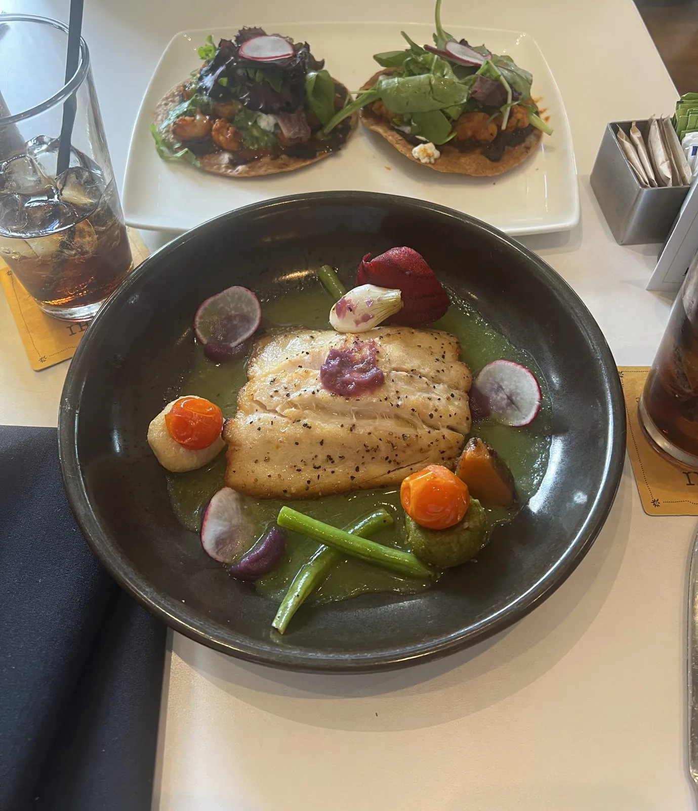
Then came a fillet of fish in a bright green sauce with radishes, carrots and green beans, with a pair of little tostadas piled with greens alongside. Last came the most theatrical plate: something long, orange-red and glazed, which looked for all the world like a whole roasted sweet potato, laid on a gray plate and ringed with dots of nearly black sauce like a clock face.
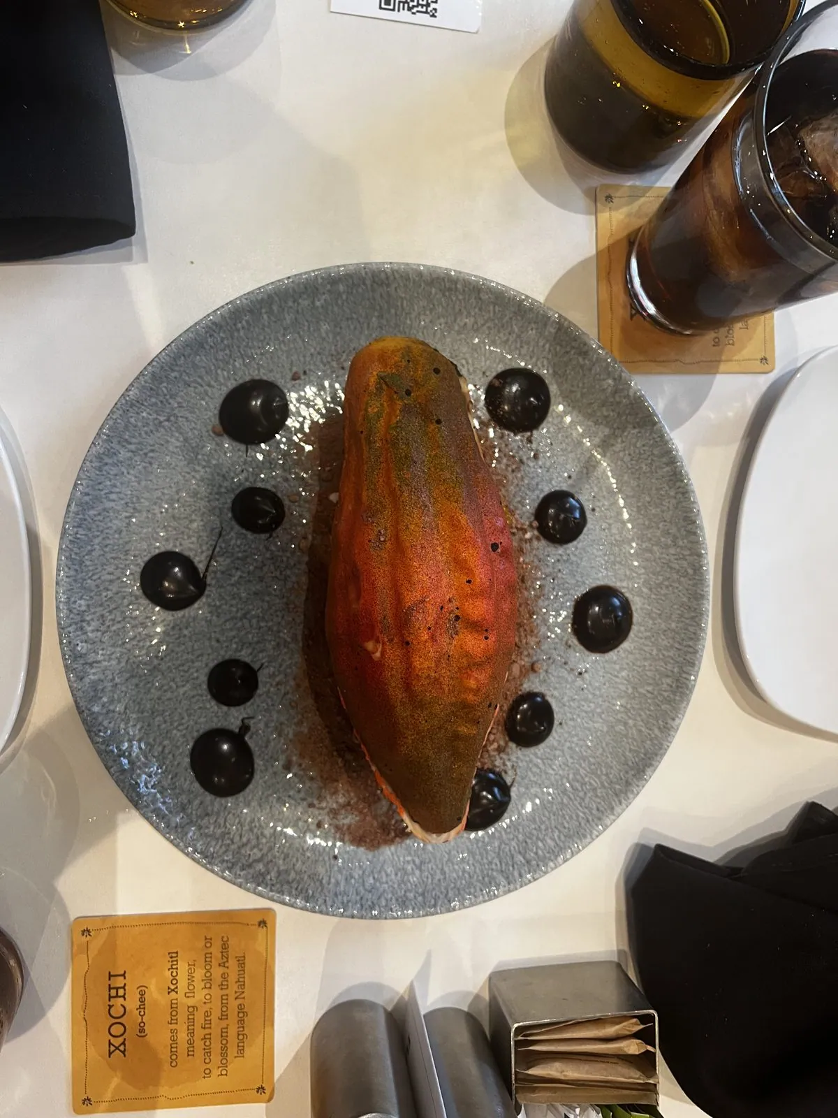
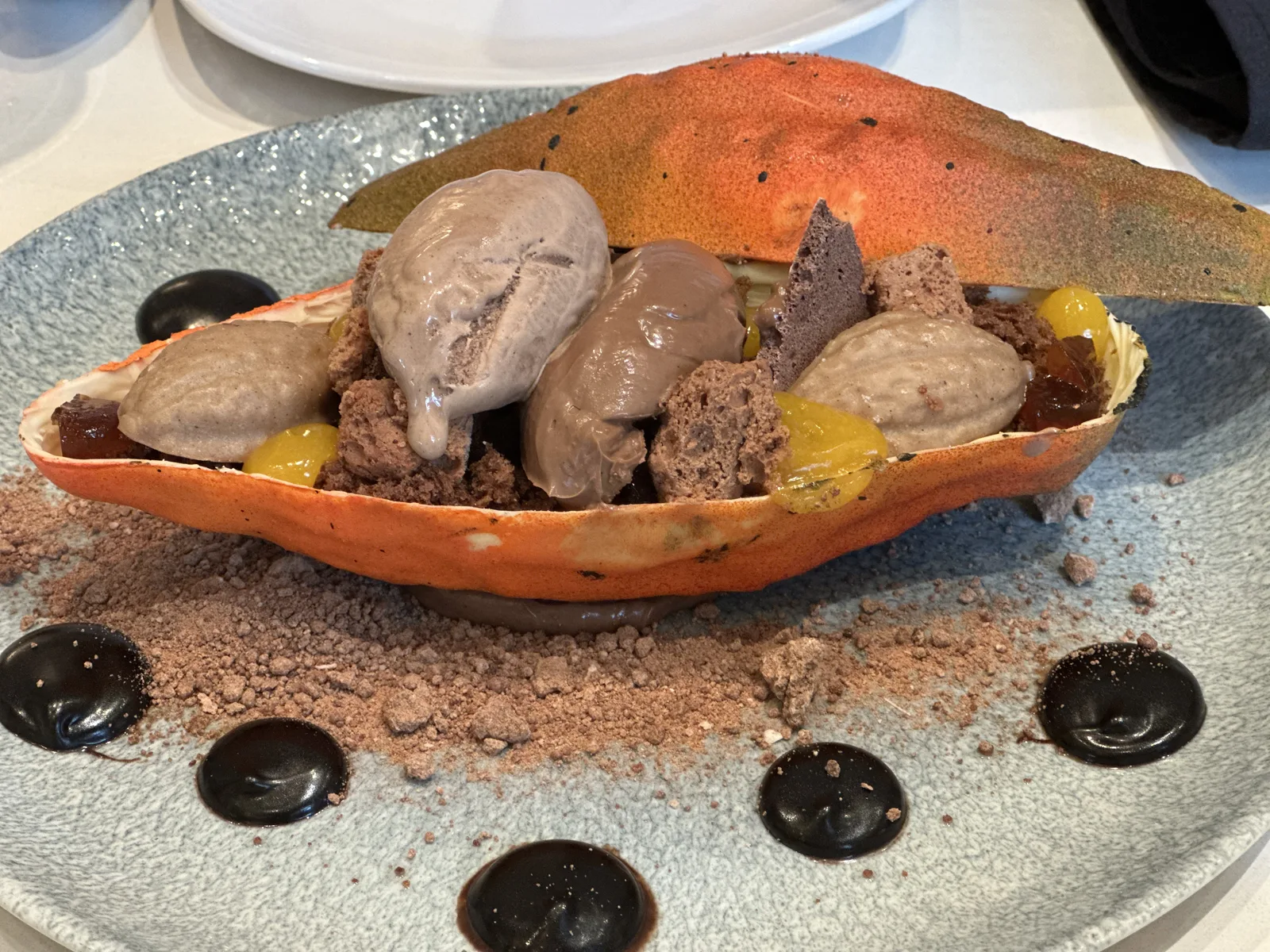
Cut open, it turned out to be dessert: the orange skin was a shell, filled with scoops of a pale-brown cream, crumbs and small orange cubes.
Independence, on Independence Day
After lunch we drove half an hour southeast to Clear Lake and Space Center Houston, the visitor center of NASA's Johnson Space Center. Johnson is the home of Mission Control and of the astronaut corps, which is why the first words radioed back from the Moon in 1969 began with "Houston". It was a gray, muggy afternoon, and clouds were piling up over the Gulf.
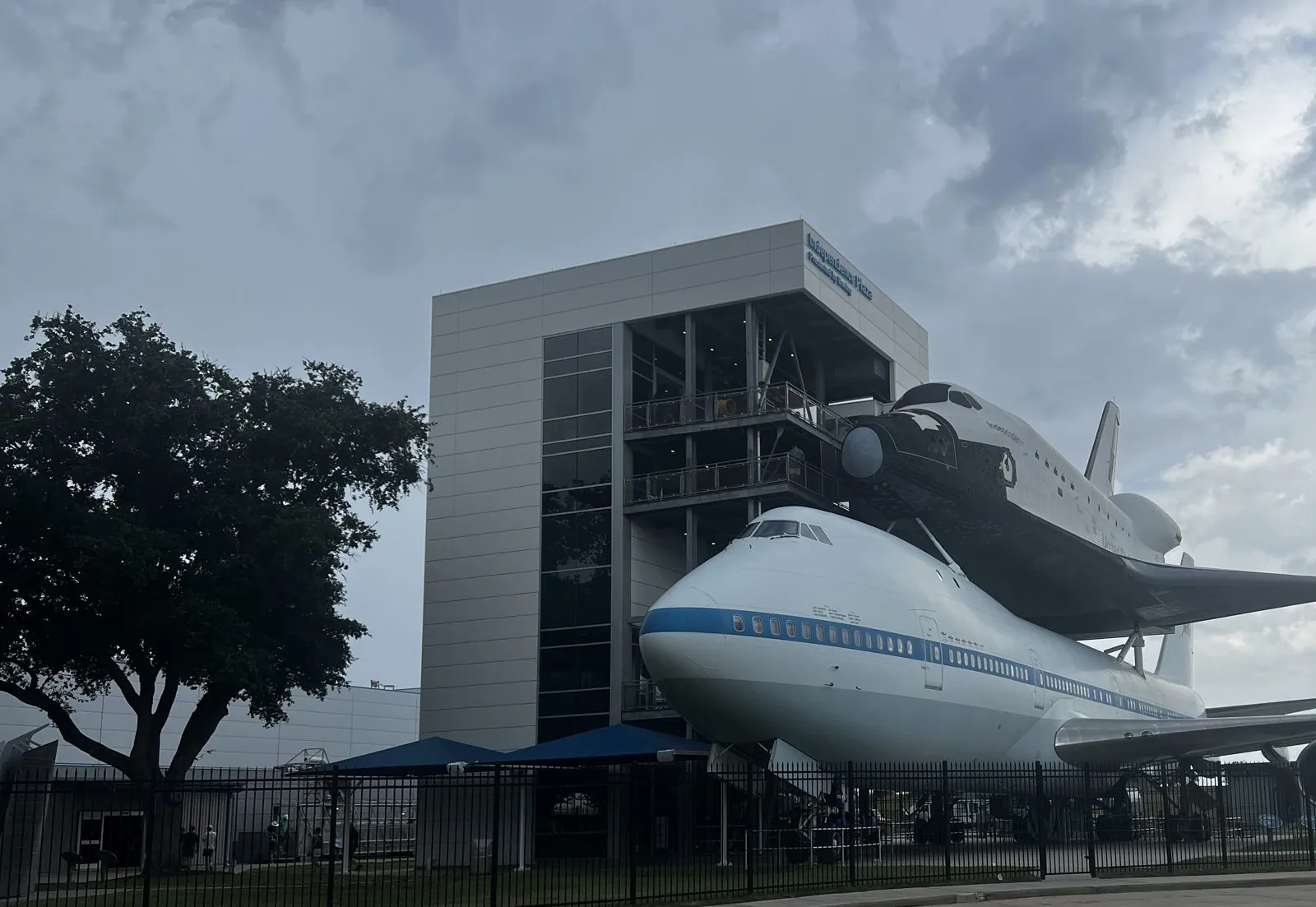
You see it from the parking lot: a full-size Boeing 747 parked beside a tall steel tower, with a space shuttle riding piggyback on its back. The 747 is the real thing, NASA 905, one of the two Shuttle Carrier Aircraft that ferried the orbiters across the country, and the plane that carried Enterprise aloft for its first glide tests in 1977. The shuttle on top is a high-fidelity replica, and its name is Independence. We hadn't planned it, but there are worse ways to spend the Fourth of July than standing under a space shuttle called Independence. The exhibit, called Independence Plaza, opened in 2016, and you can climb the tower and walk through both the plane and the shuttle.
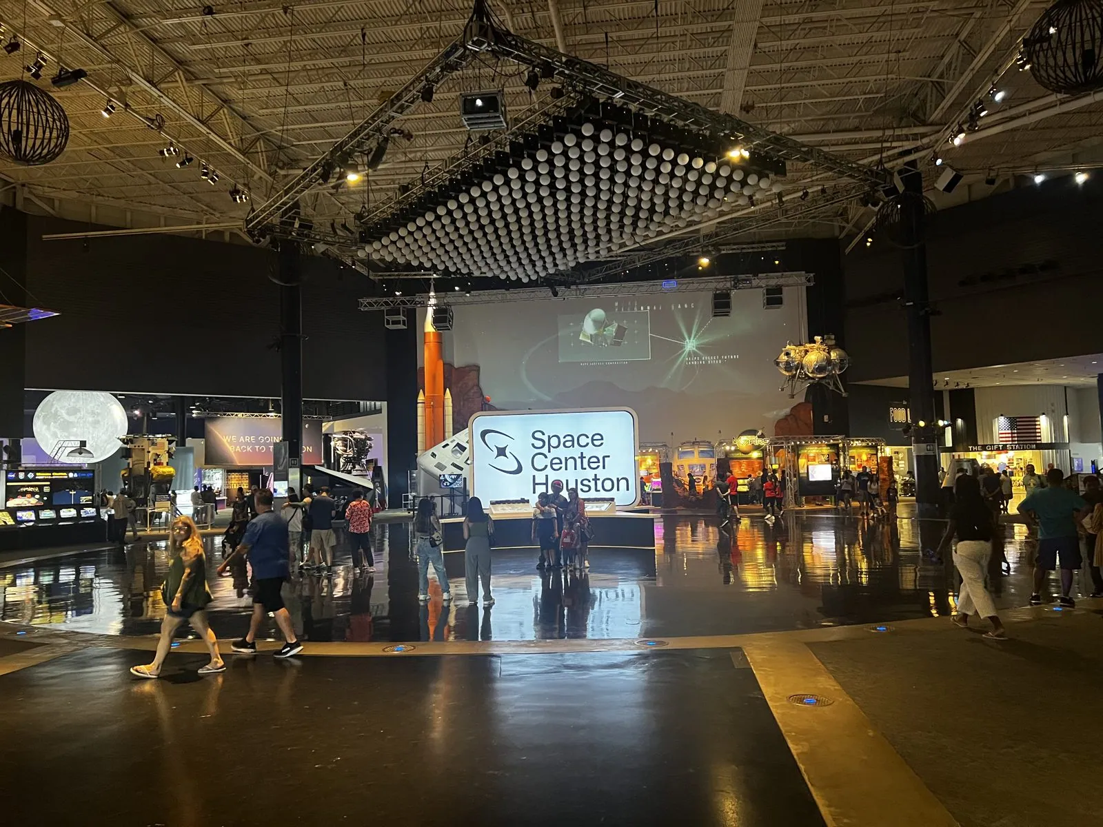
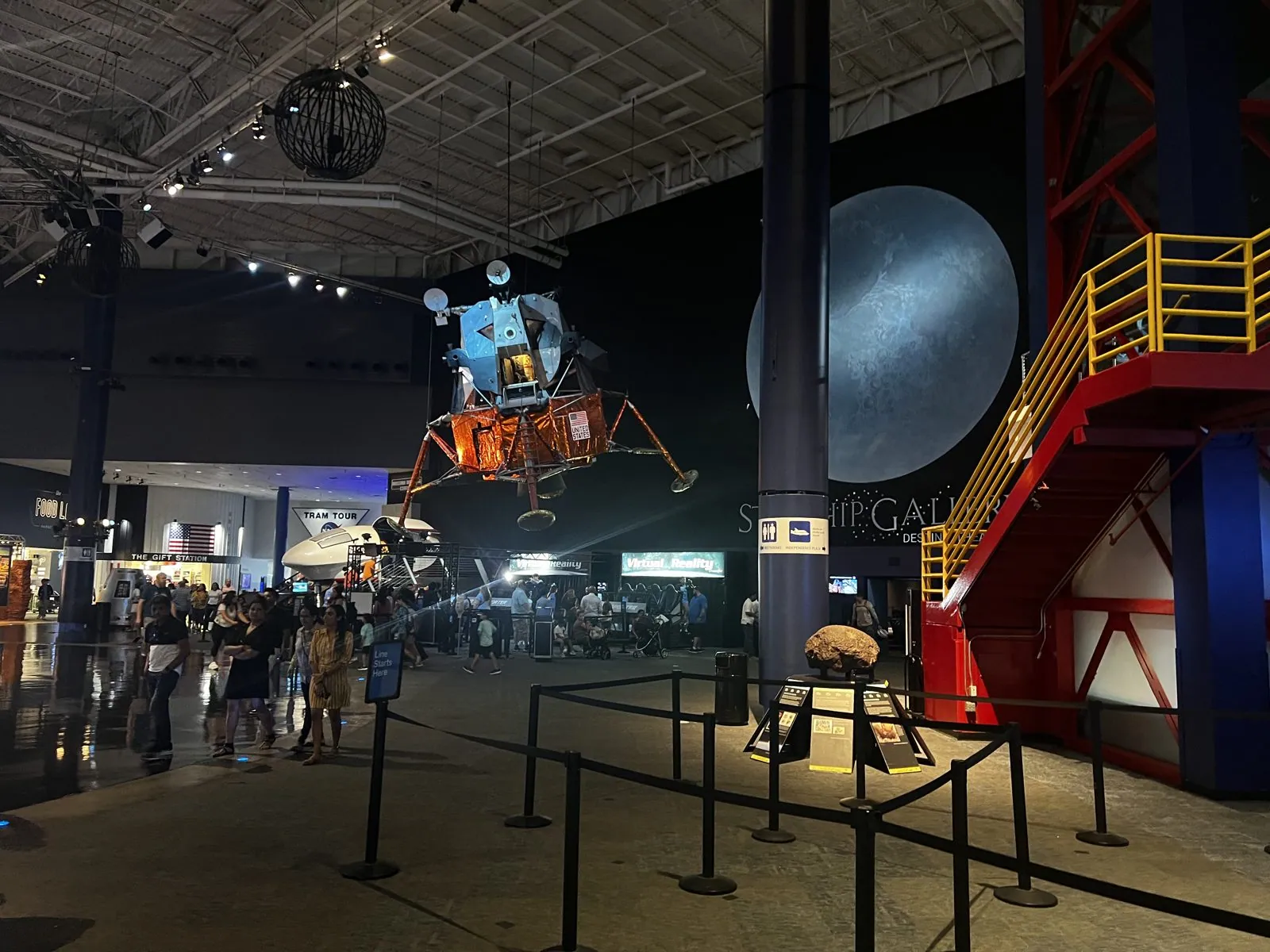
Inside, the main hall is a big dark hangar of a room, its ceiling hung with a grid of lights, the floor polished so that everything is reflected twice. It was crowded with holiday families. In one corner hung a full-size Apollo lunar module, the spidery gold-foil lander that set twelve astronauts down on the Moon, its landing legs splayed over the crowd. A sign beyond it pointed to the Starship Gallery. Next to it, a red steel gantry climbed toward the ceiling.
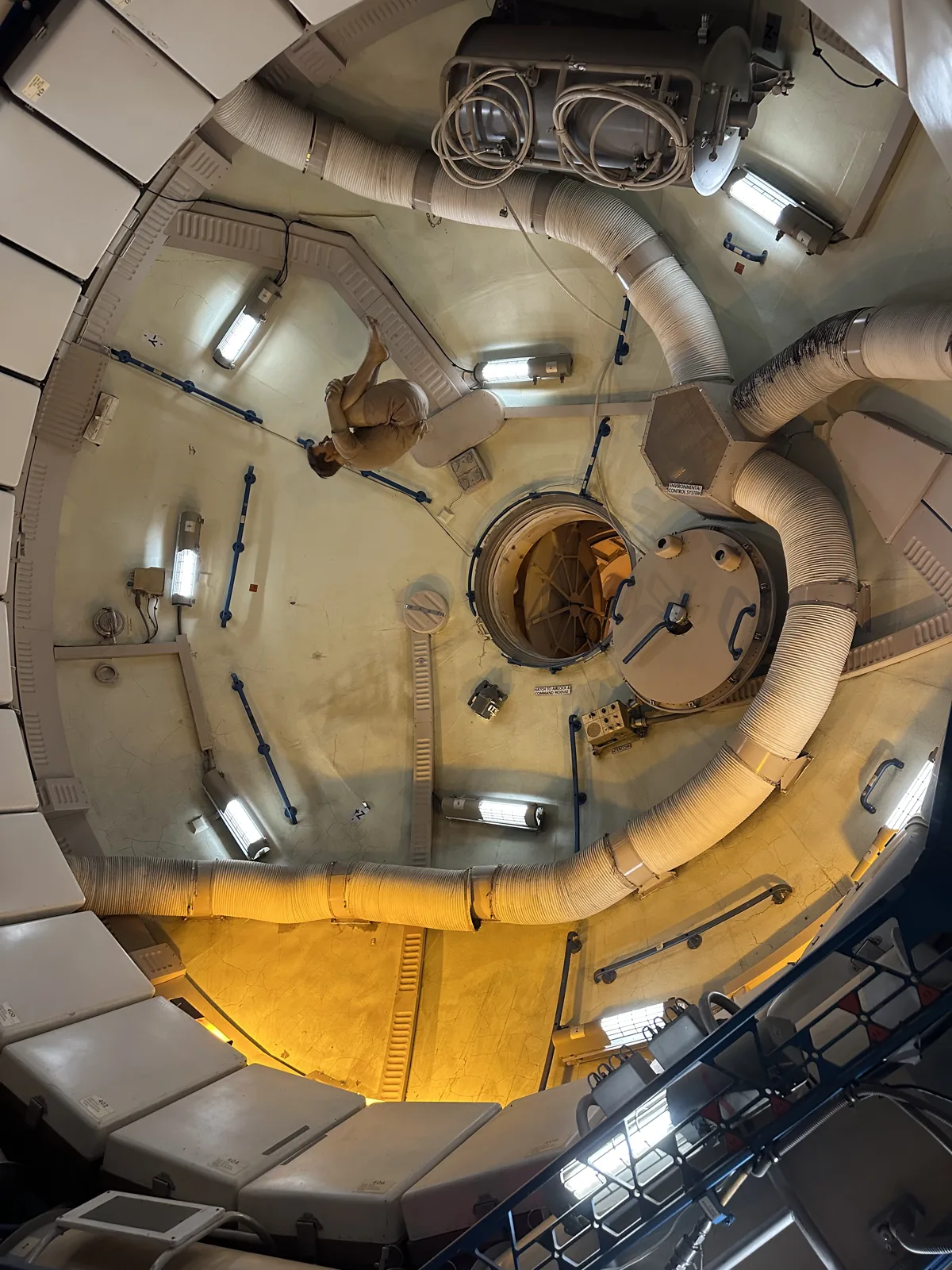
Some of the spacecraft mock-ups you can walk into. From inside one, looking up, the round cabin was lined with padded panels, ducts and handrails.
And that, as far as my camera roll is concerned, was the trip. The last trace of it is a short video from the road outside the terminals at George Bush Intercontinental, IAH, at a quarter past eight on the evening of the Fourth, with the light fading over the airport.
Four days, five cities
The Texas Triangle is not, on paper, a romantic road trip. It is mostly interstate: I-35 north through the prairie, I-30 across the Metroplex, I-45 south through the pines. The cities at its corners are big, hot and spread out, and you spend a lot of time looking at them through a windshield.
But the four cities turned out to be four completely different characters, each with its own idea of what Texas is. Austin is a university town with a capitol at one end of its main street and a cathedral of junk in a backyard. San Antonio is old, Spanish and built around water, a city that solved its flooding river by turning it into its living room. Fort Worth still dresses like the cattle town it was, and Dallas, half an hour away, dresses like the bank it became, with a herd of bronze longhorns walking past the glass. Houston is the biggest and the least concerned with how it looks, a city that turns its old post office into a rooftop park and keeps a space shuttle out by the bay.
And then there is the sky. Almost every photo from this trip taken outdoors in daylight has the same sky in it: deep blue, enormous, piled with white clouds. That is the real Texas landmark, and it followed us all the way around the triangle. Four days, five cities, about 750 miles in a car too red for its own good, and a shuttle called Independence on Independence Day. Not a bad long weekend.
Maps built from the trip's photo timestamps and locations; the driving distance is an estimate. Photo locations have been removed from the published images; a few pictures are stills from short videos. Day maps: map data © OpenStreetMap contributors; each stop is placed where its photo was taken, hotels and home are never marked, and the dashed lines show the order of stops, not the exact roads.
Some photos in this post are my wife's.
Likes and comments
React with an emoji or leave a comment. Signing in with GitHub is required.