← Misc · September 2022 and June 2026
Yosemite, Four Years Apart
A hazy Labor Day weekend in 2022, a June weekend in 2026, and the same few viewpoints in between.
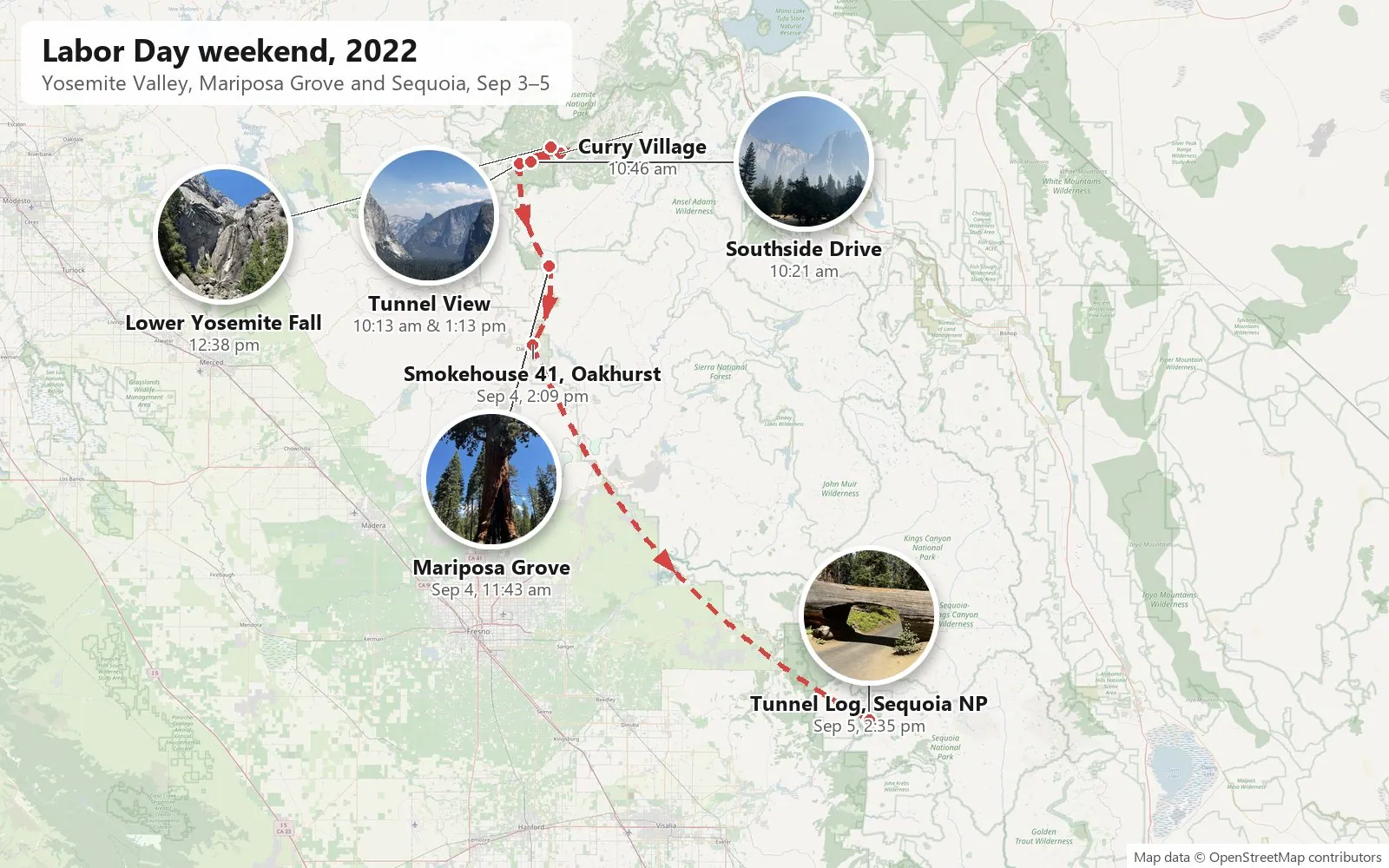
2022: Tunnel View → Southside Drive and the Merced River → Curry Village → Lower Yosemite Fall → Tunnel View again → Mariposa Grove → Oakhurst → the Tunnel Log in Sequoia National Park
2026: Tunnel View → Bridalveil Fall → Lower Yosemite Fall → Glacier Point → Fish Camp → Mariposa Grove → Turlock
One Tunnel View in haze and one in clear air · one waterfall almost dry, and the same one roaring · one Grizzly Giant, twice · one black bear · one ground squirrel
This post is two visits to the same park. The first was the Labor Day weekend of 2022, with my wife: Yosemite Valley, the Mariposa Grove, and on the last day a detour south into Sequoia National Park. The second was my own trip, a weekend in early June 2026: the waterfalls, Glacier Point and the giant sequoias. Nearly four years and two very different seasons separate them.
As with the other posts here, everything below is reconstructed from the camera roll: what was photographed, where, and at what minute. Neither visit was long, and neither camera roll is big, but a few spots turn up on both of them. Where that happens, I've put the two years side by side.
September 2022: Labor Day weekend
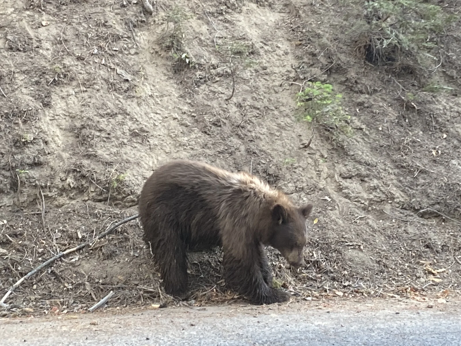
We drove up from Los Angeles on Friday, September 2, and pulled into Yosemite West, where we had rented a house, a little after six in the evening. Of the drive itself, my wife's phone has only a few shots through the windshield. The first thing to greet us, at 6:07, was a black bear, nosing along the bank at the edge of the road among the houses.
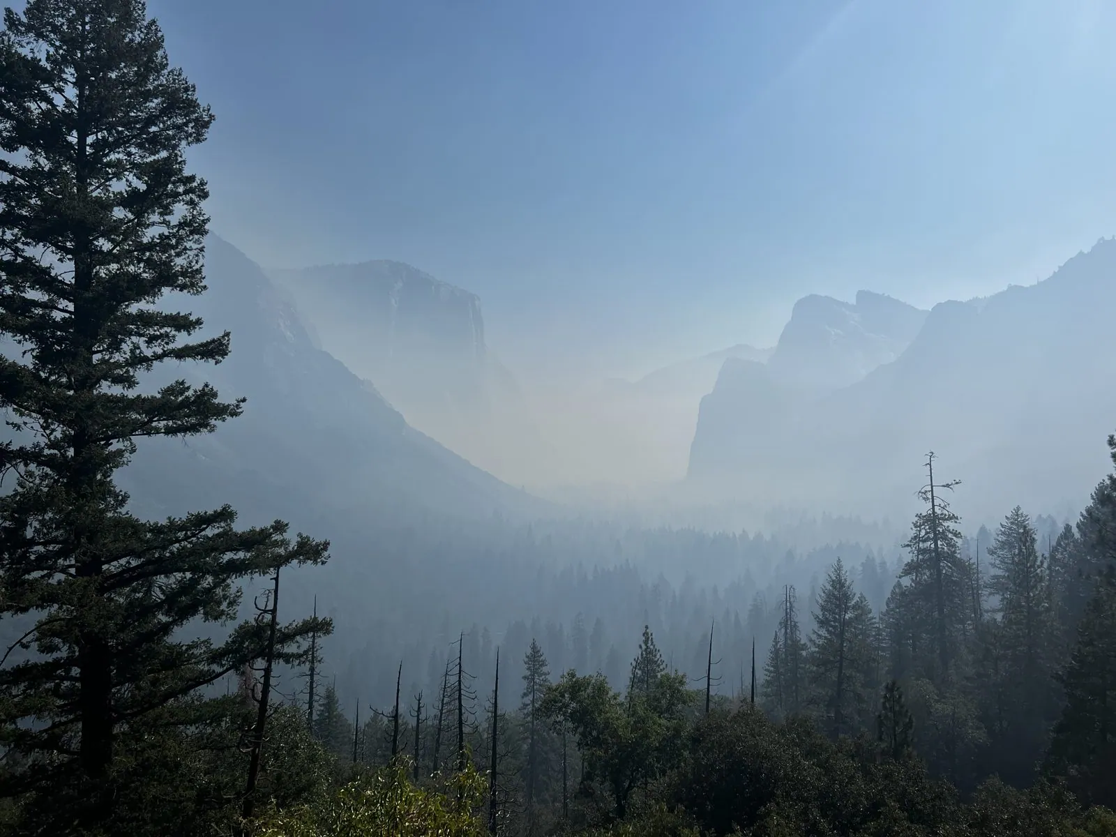
Tunnel View in the haze
The first photo of Saturday was taken at 10:13 in the morning at Tunnel View, the overlook on the Wawona Road where it comes out of the tunnel and the whole valley opens up at once. Or it would have, on another morning. That morning the valley was full of haze. The granite walls on either side were pale shapes, the far end of the valley was gone completely, and only the pines in the foreground had any color in them. Next to the railing stands an interpretive sign titled "A Varied View", about how the view here changes.
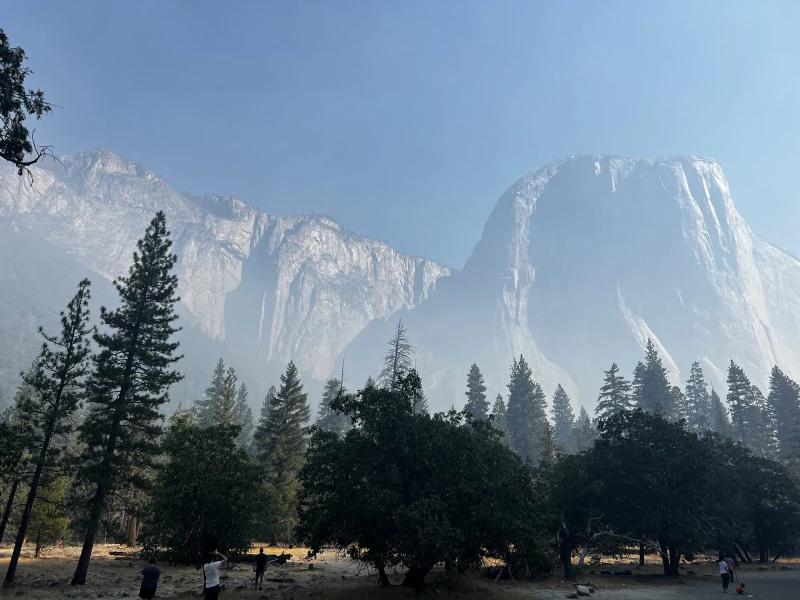
Southside Drive and the Merced River
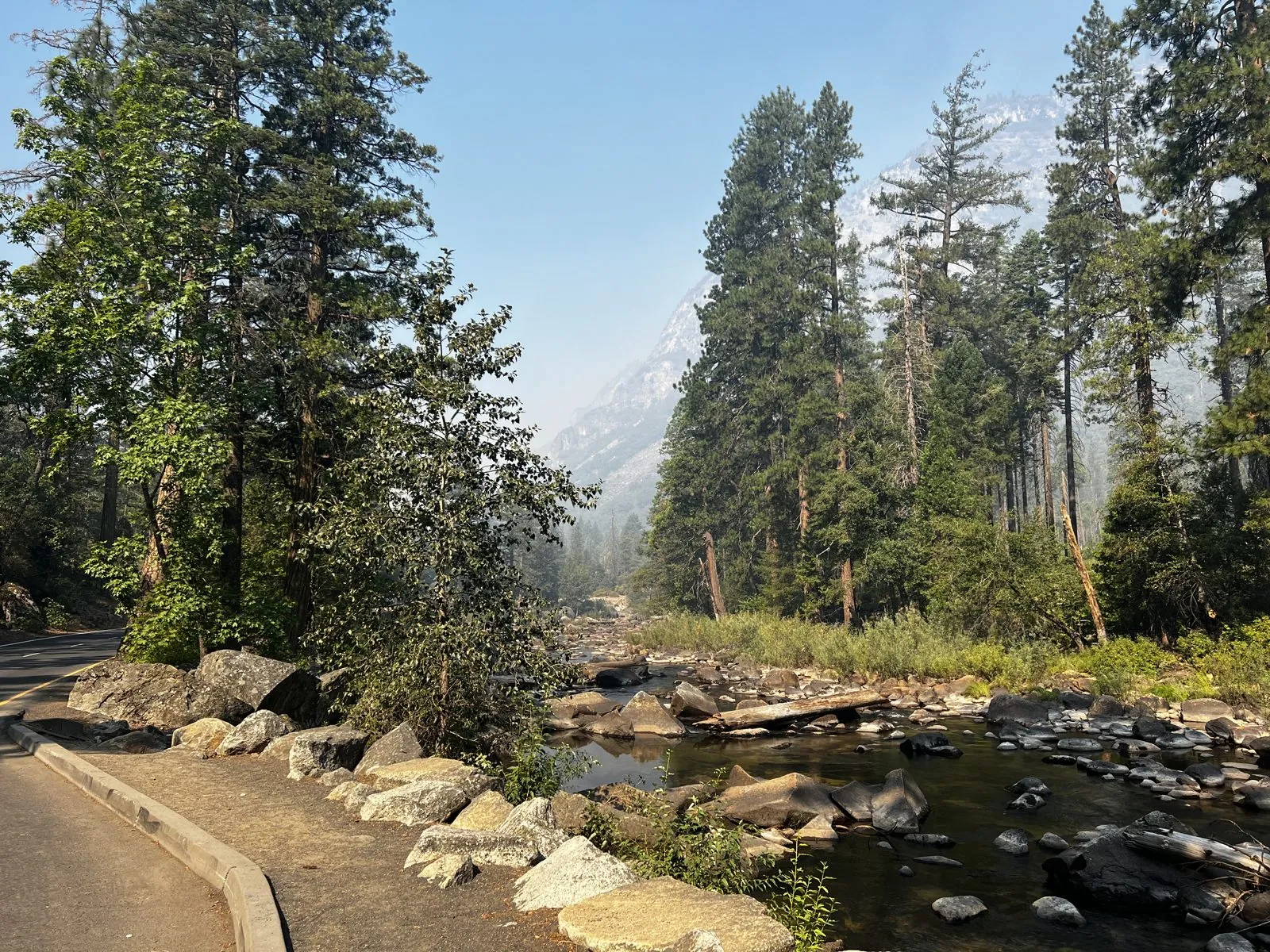
From there we drove down into the valley and along Southside Drive. At 10:21, looking across a meadow, El Capitan was a pale wall in the haze, lit from the side, with a row of dark trees in front of it. A few minutes later we stopped by the Merced River. In early September it was low and slow: shallow, clear water running between boulders and gravel bars, with pines on both banks and the haze hanging in the trees behind.
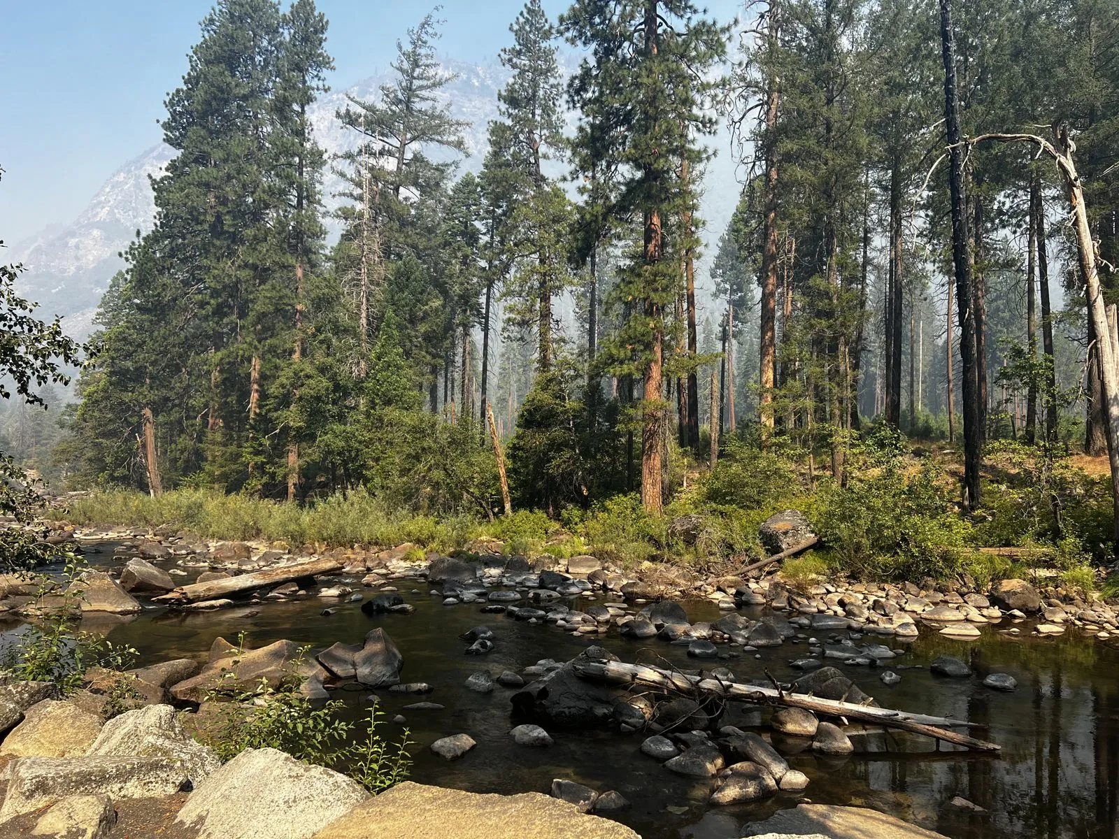
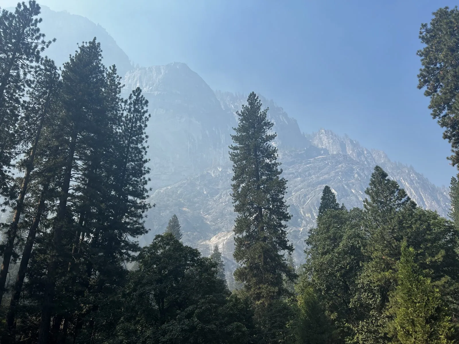
A path runs along the river there, lined with a low curb of stones. At 10:46 we were at the east end of the valley near Curry Village, where the photo is of tall pines and the cliffs above them, still soft in the haze.
Lower Yosemite Fall, almost dry
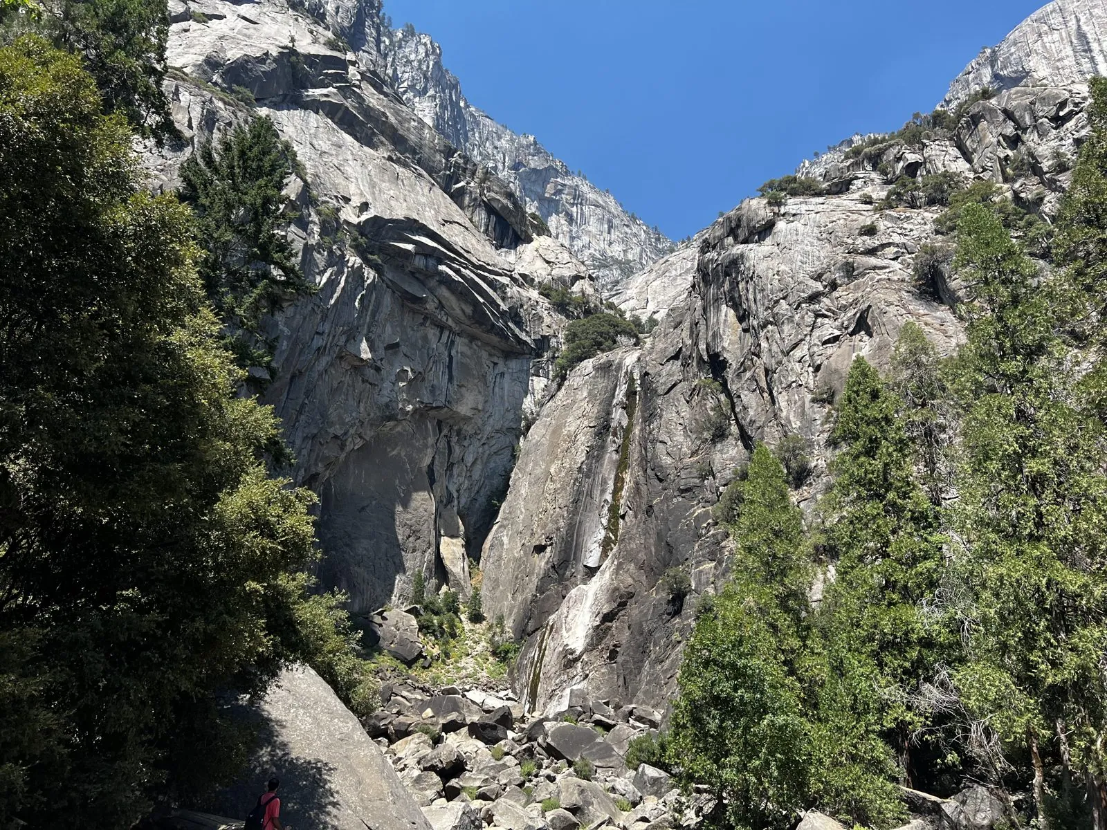
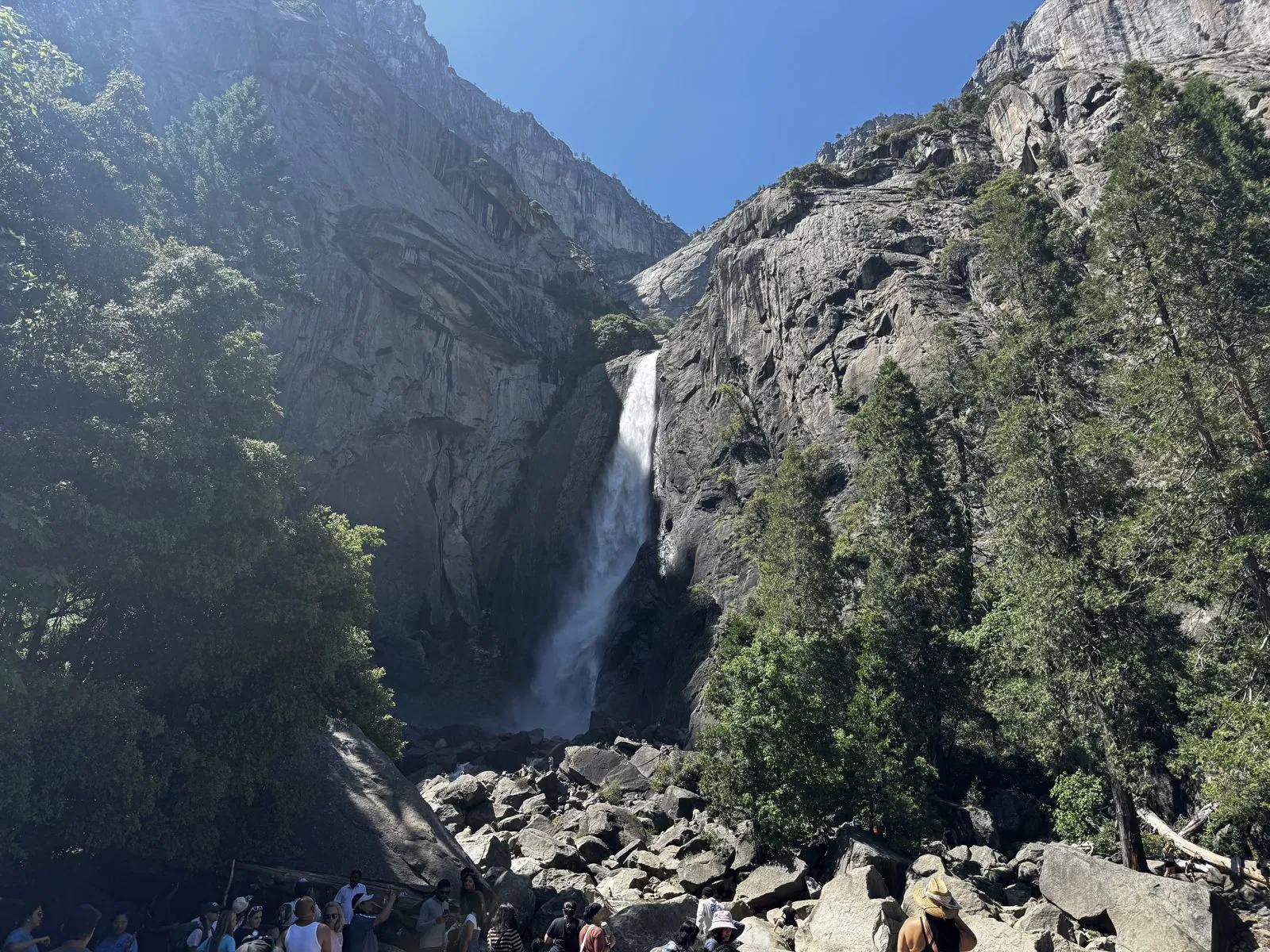
At 12:38 we reached the vista point for Lower Yosemite Fall. In early September there was almost nothing falling. The photo shows a notch in the granite, a pile of boulders below it, and on the rock face only a few thin, dark streaks where water runs in other seasons. By then the haze had thinned and the sky above the notch was a clean blue.
Tunnel View again
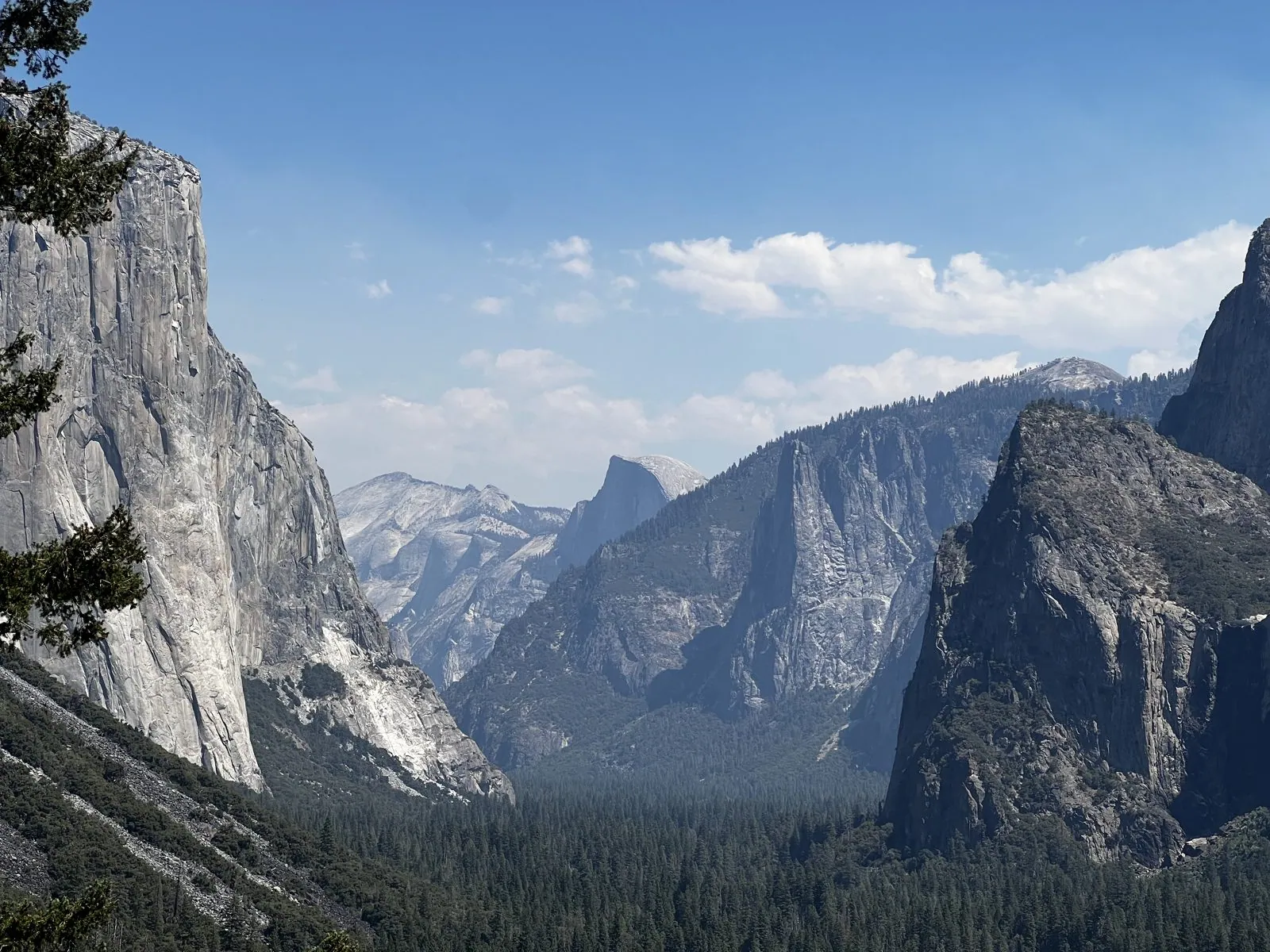
We went back to Tunnel View in the early afternoon, and at 1:13 the photo from almost exactly the same spot as the morning's looks like a different place. The haze was gone. El Capitan stood sharp and white on the left, Half Dome sat at the far end of the valley, the cliffs above Bridalveil Fall rose on the right, and there were white clouds over all of it. Three hours apart, from the same overlook.
The Mariposa Grove
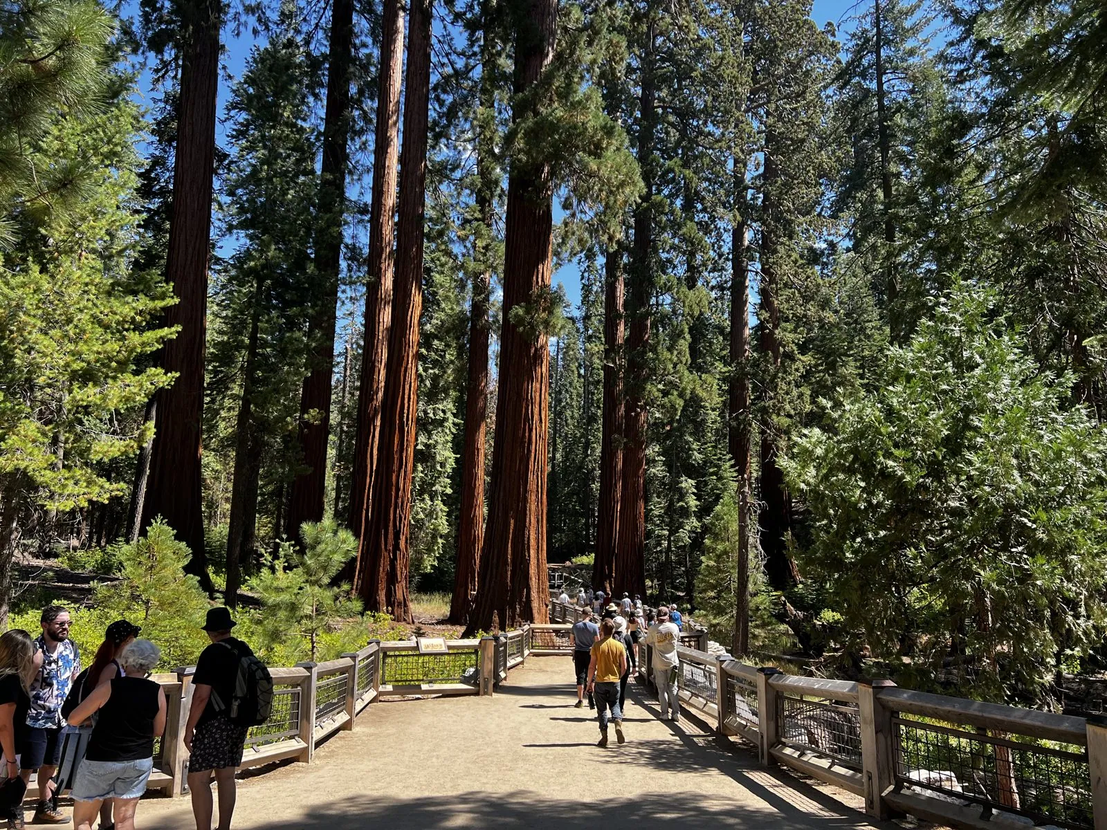
Sunday morning was the Mariposa Grove of giant sequoias, near the park's south entrance. By 11:43 we were on the boardwalk at the grove arrival area, with the red trunks of the sequoias rising on both sides and plenty of other people walking in with us.
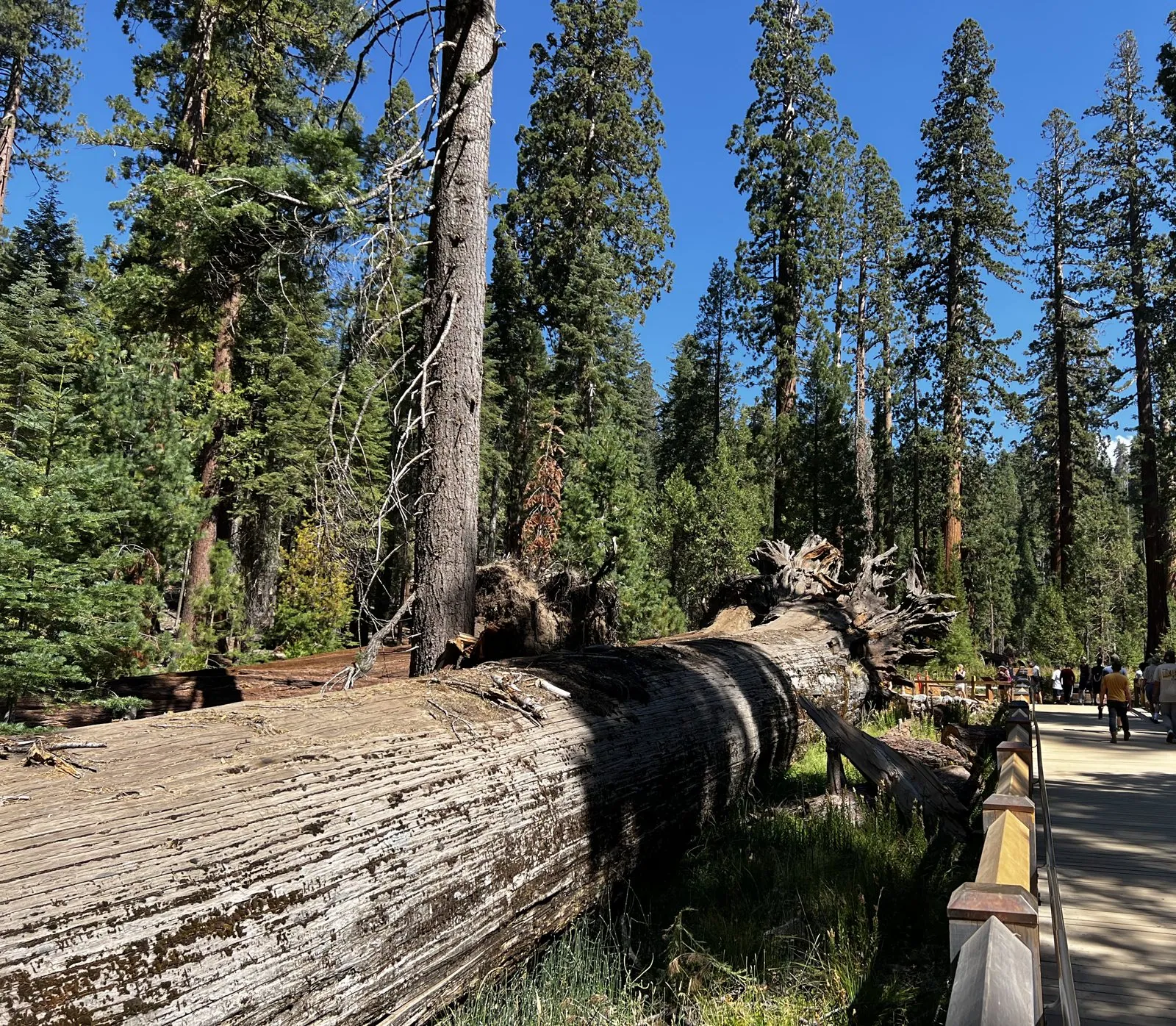
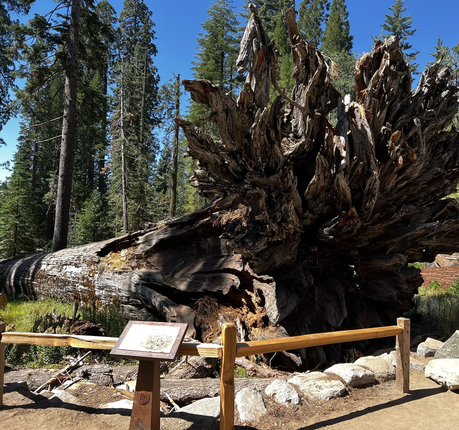
A little further along the Big Trees Loop, a sequoia lay on its side next to the path, its trunk gray and furrowed. A few minutes later, beside an interpretive sign, another one lay with its whole root plate standing on end, a tangle of roots taller than the fence in front of it.
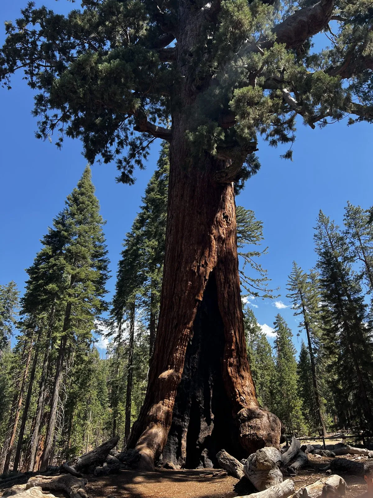
Just after noon we were at the Grizzly Giant: a massive trunk that leans a little, with a fire-blackened hollow at its base and, high up, branches as thick as ordinary trees that bend out sideways. In the photos the people at its base are tiny.
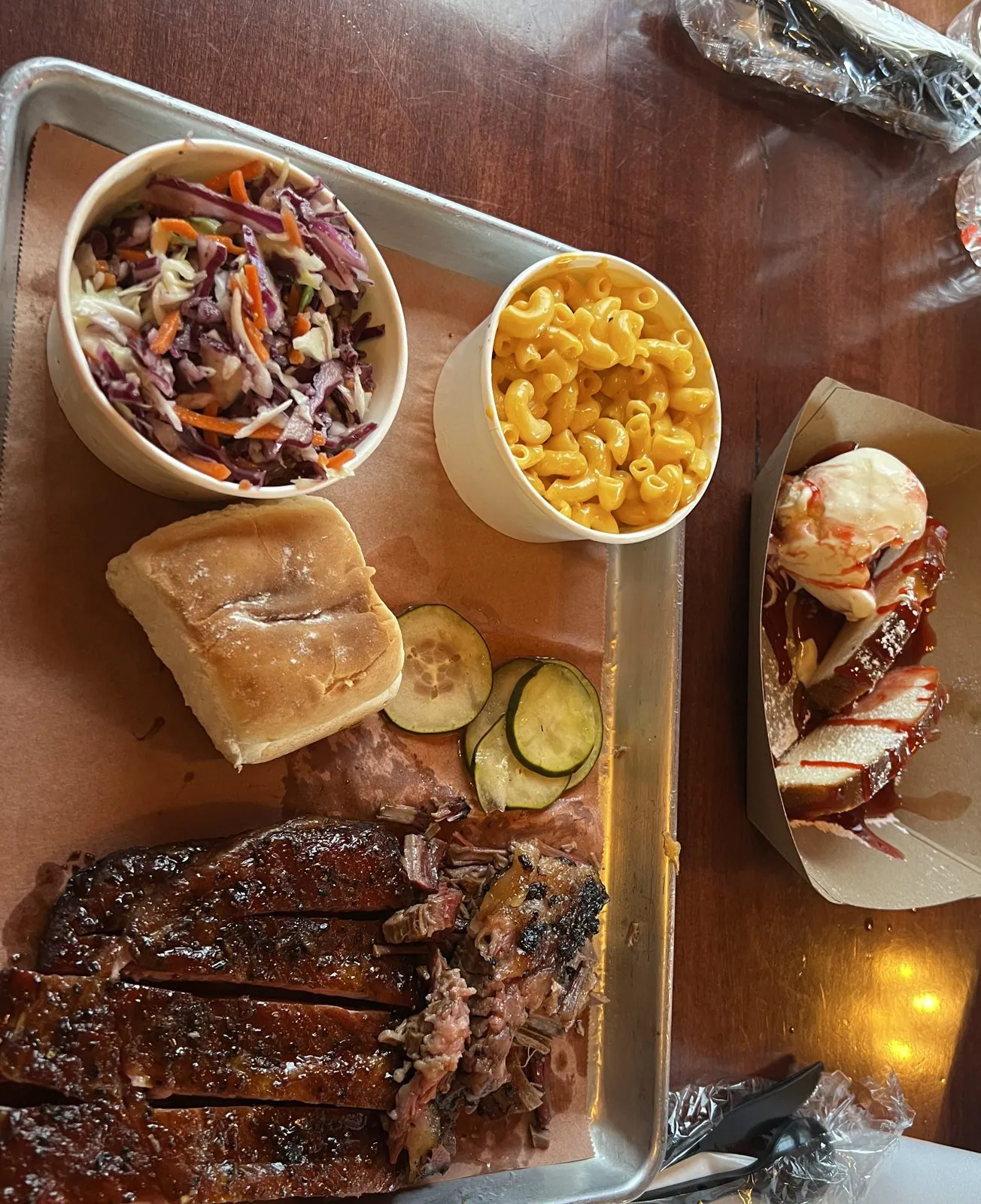
Lunch was at 2:09 at Smokehouse 41 in Oakhurst, a barbecue place on Highway 41 below the park: a tray of ribs with coleslaw, mac and cheese, pickles and a roll, and a paper boat of sauced meat on the side.
Sequoia National Park: the Tunnel Log
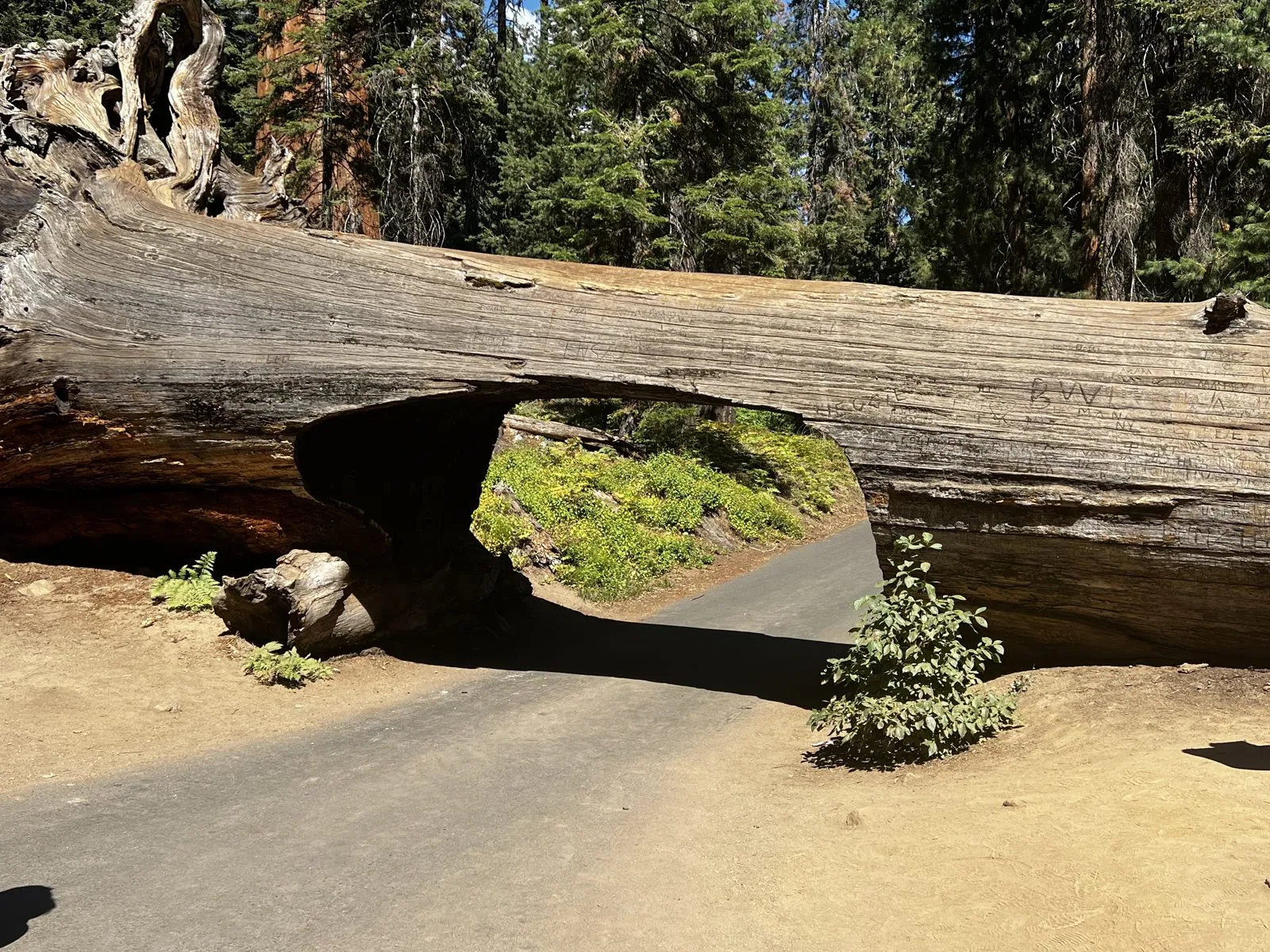
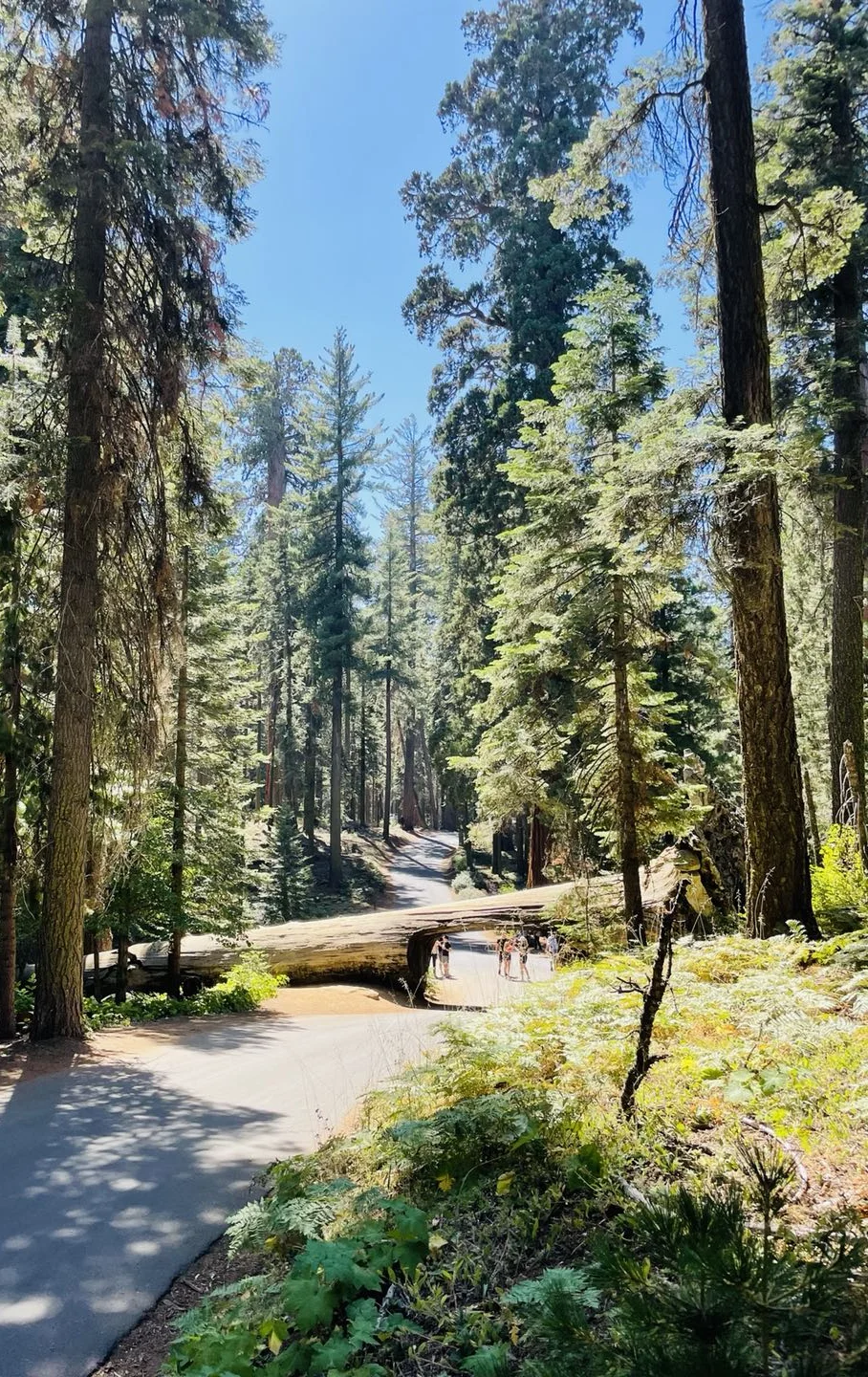
On Monday, Labor Day itself, we drove south to Sequoia National Park. The park has only one stop in my camera roll, at 2:33 in the afternoon on Crescent Meadow Road: the Tunnel Log, a fallen sequoia lying across the road with a passage cut through it, wide enough for a car. Up close it is mostly a wall of gray wood with a rectangle of green forest showing through the hole.
After that, the camera roll goes quiet for the drive home.
June 2026: waterfalls, Glacier Point and the big trees
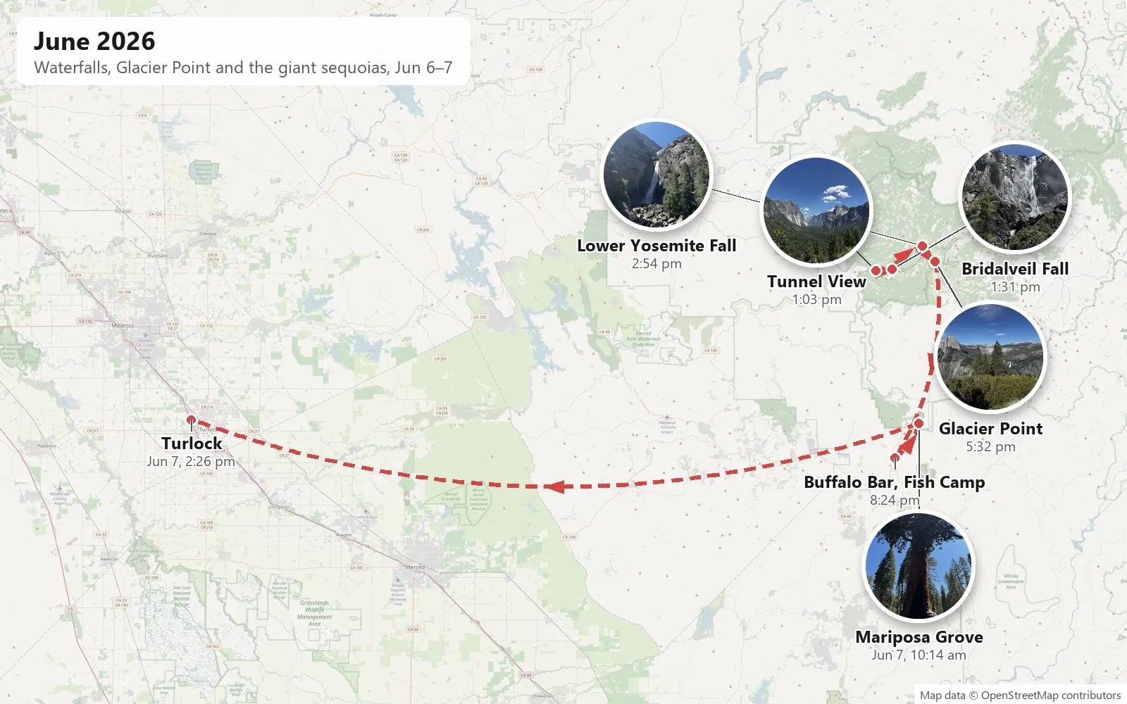
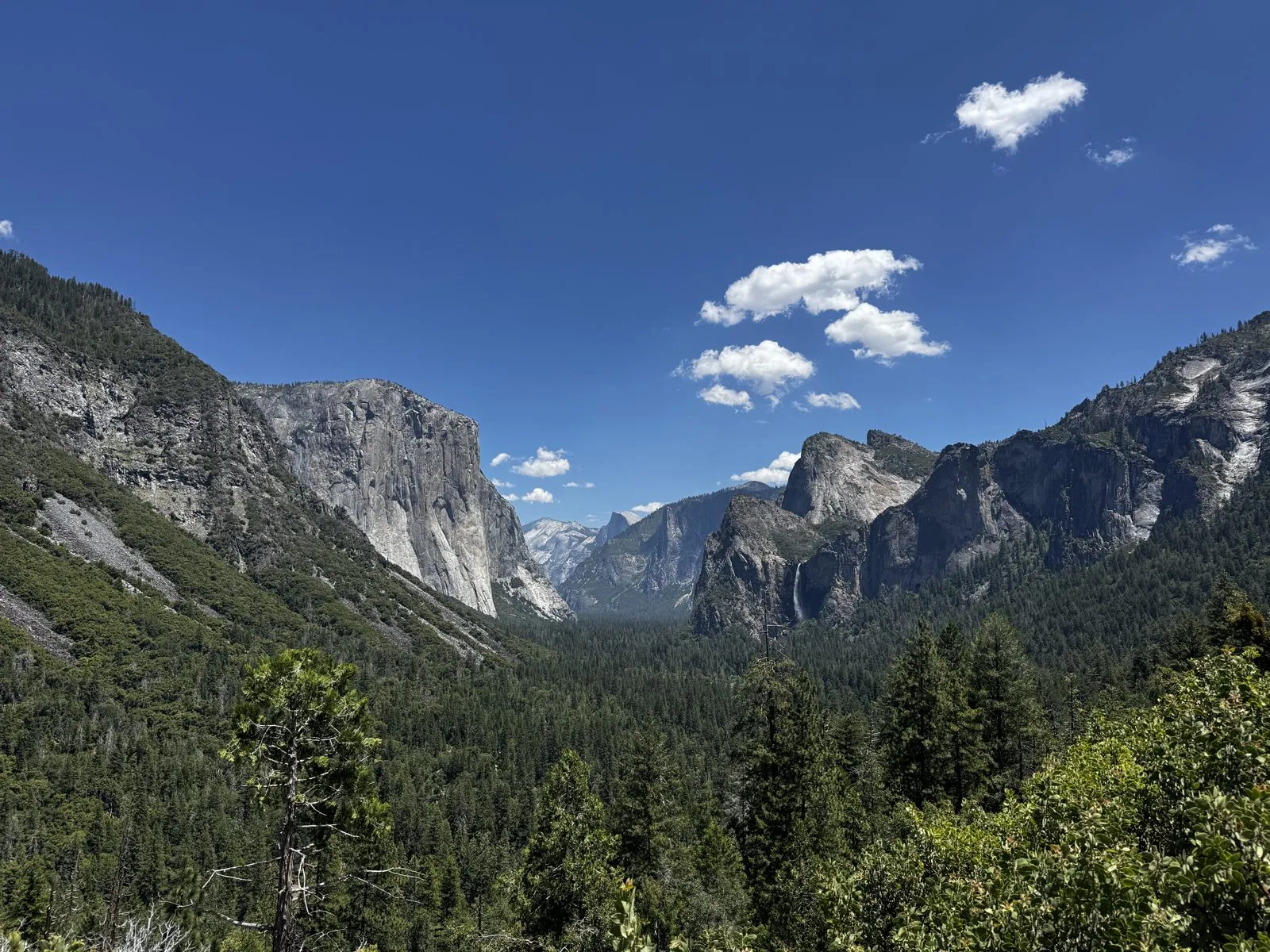
Nearly four years later, on Saturday, June 6, 2026, I was back on the Wawona Road, and my first photo was taken at 1:03 in the afternoon at the same overlook as before.
Tunnel View in June
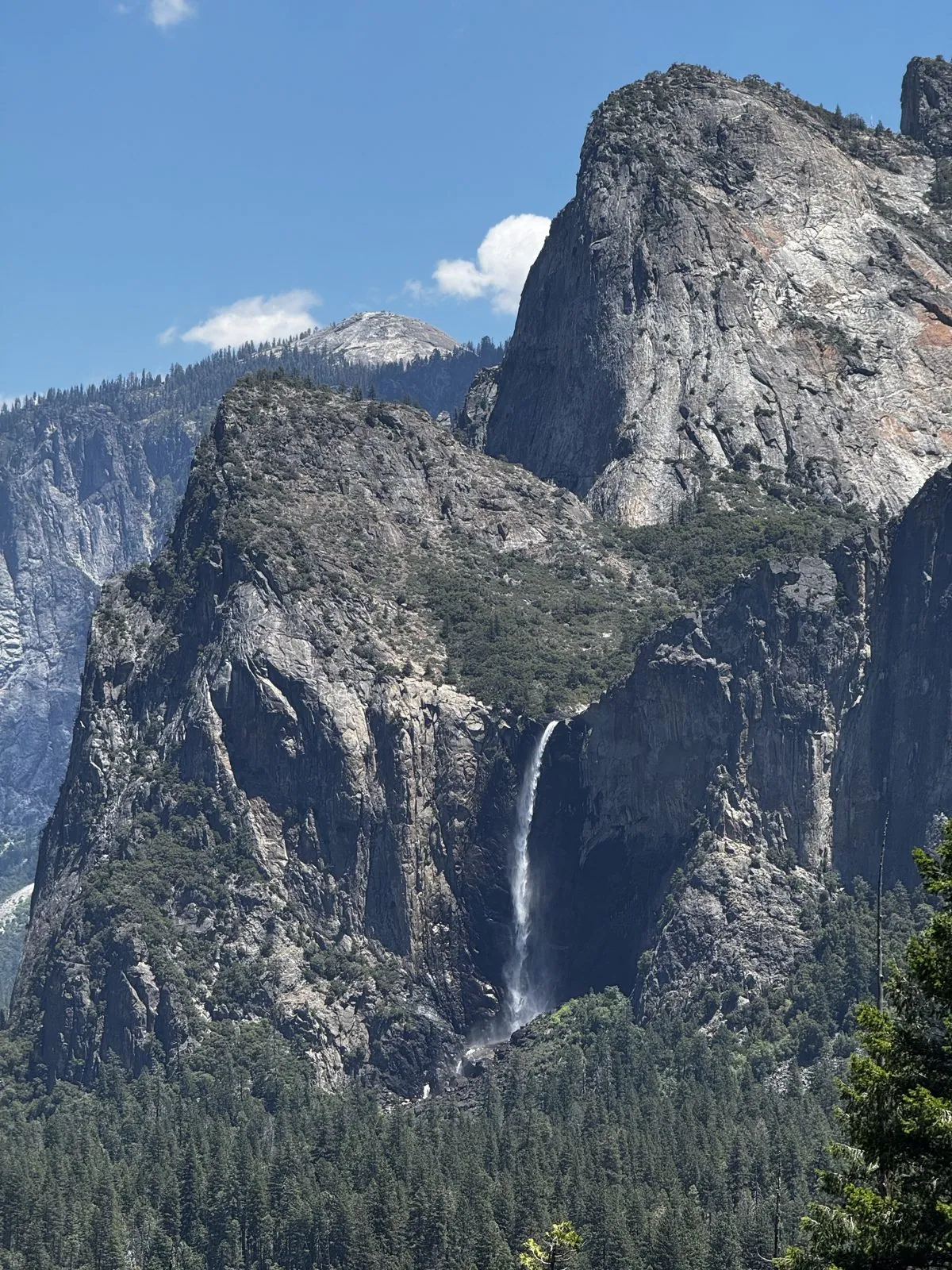
This time the air was clear from the start, the sky a deep blue with a few small, bright clouds. The view is the same one as in the afternoon of 2022: El Capitan on the left, Half Dome at the end of the valley, and the cliffs on the right. The 2022 photo cuts those cliffs off at the edge of the frame, so it can't settle the question for September. In June, though, there was a long white ribbon of water on them, Bridalveil Fall, visible even from the overlook.
Zoomed in from the overlook, the fall drops from a notch high in the cliff and disappears into the trees.
Bridalveil Fall
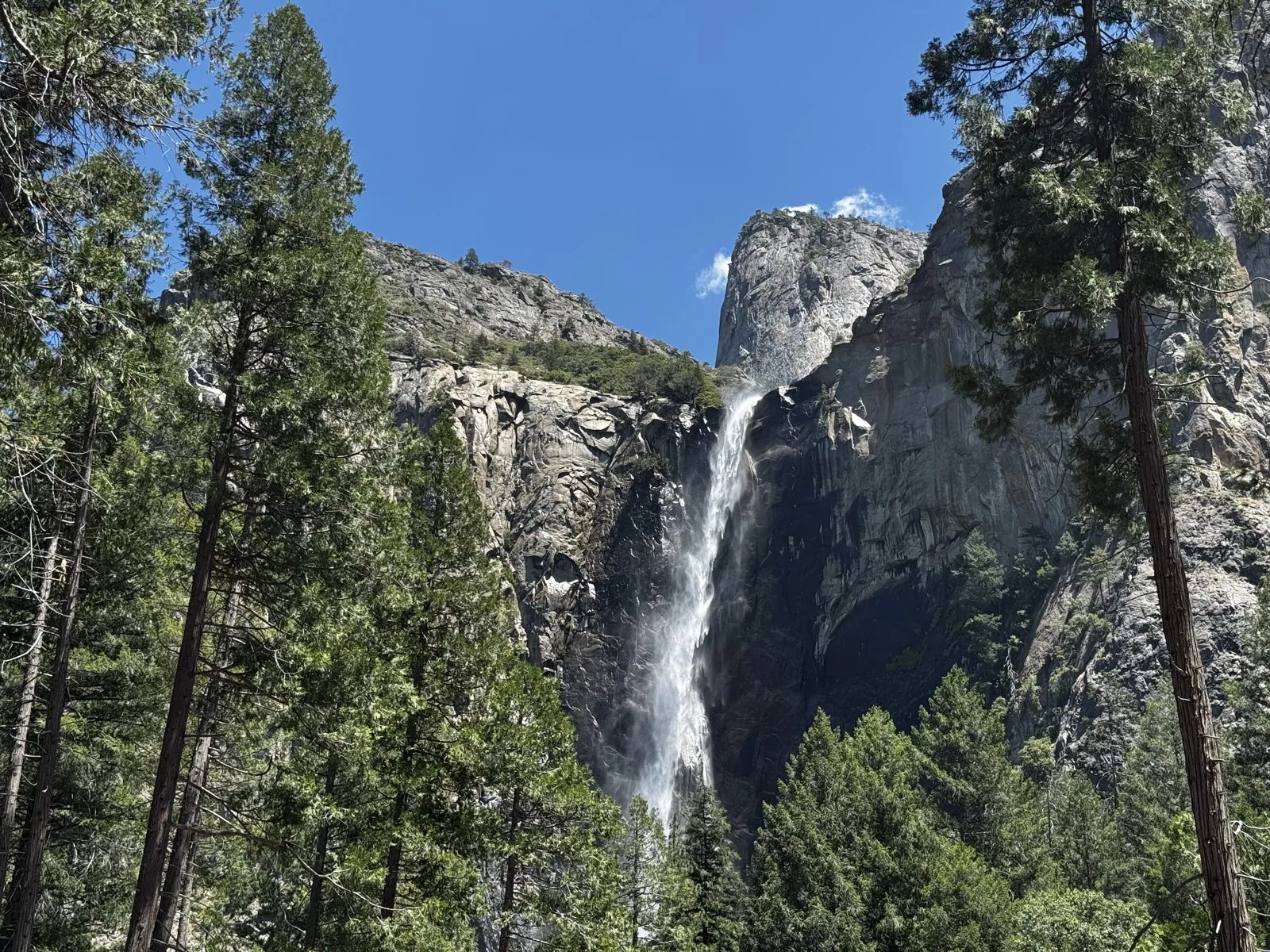
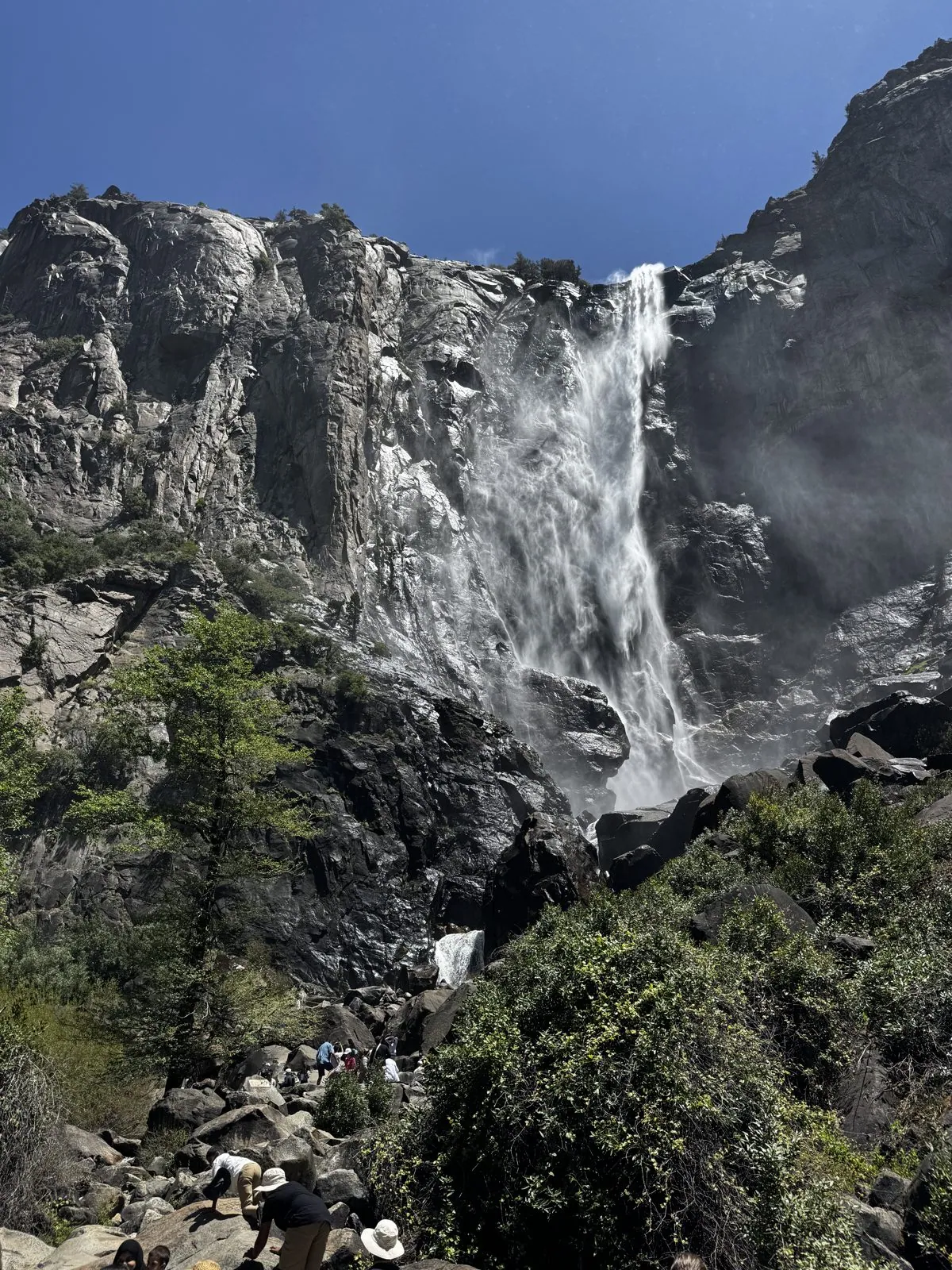
So that was the first stop. From the parking area at 1:25 the fall showed between the pines, a white stripe down a gray wall. A short trail leads from there toward its foot. At 1:34 the fall filled the frame, and the wind was blowing its spray sideways across the cliff and down over the boulder field below. People were scrambling around on the boulders in the mist, and I went up close enough to get soaked by it.
Yosemite Falls, in full flow
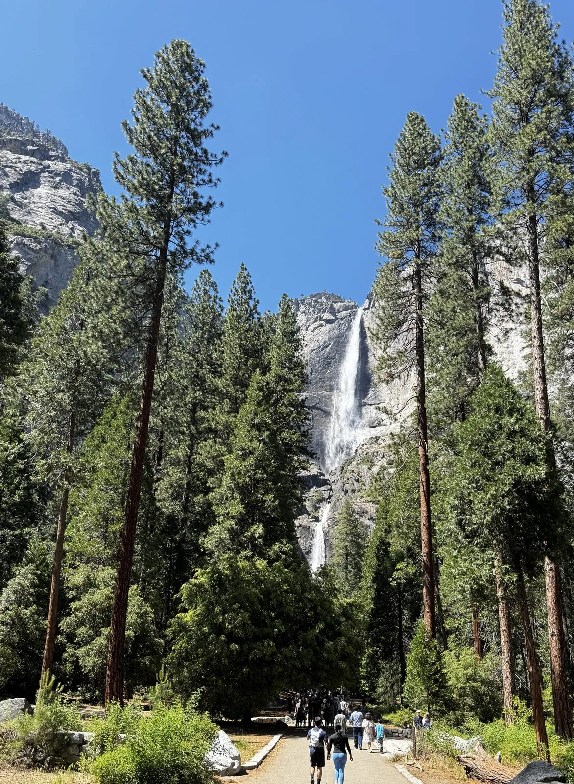
At 2:54 I was on the Lower Yosemite Fall Trail, the paved path that leads from the valley floor toward the falls. It runs straight between tall pines, and at the end of it, framed by the trees, both Upper and Lower Yosemite Fall were running, one above the other, white against the granite.
At 3:09 I took a photo from the vista point for Lower Yosemite Fall, within a few yards of where the 2022 photo was taken. It is the same notch in the cliff, the same boulder field and the same pines on the right. In September 2022 the rock had a few dark streaks on it. In June 2026 there was a full waterfall pouring through the notch into a cloud of spray, and the viewing area below was packed with people.
Glacier Point
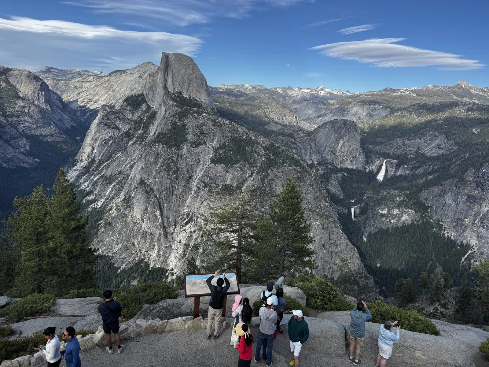
Late in the afternoon I was up at Glacier Point, the overlook on the south rim, high above the valley floor. My first photo there is from 5:32. From up there Half Dome is straight across, its sheer face to the side, with the high country and its last patches of snow behind it.
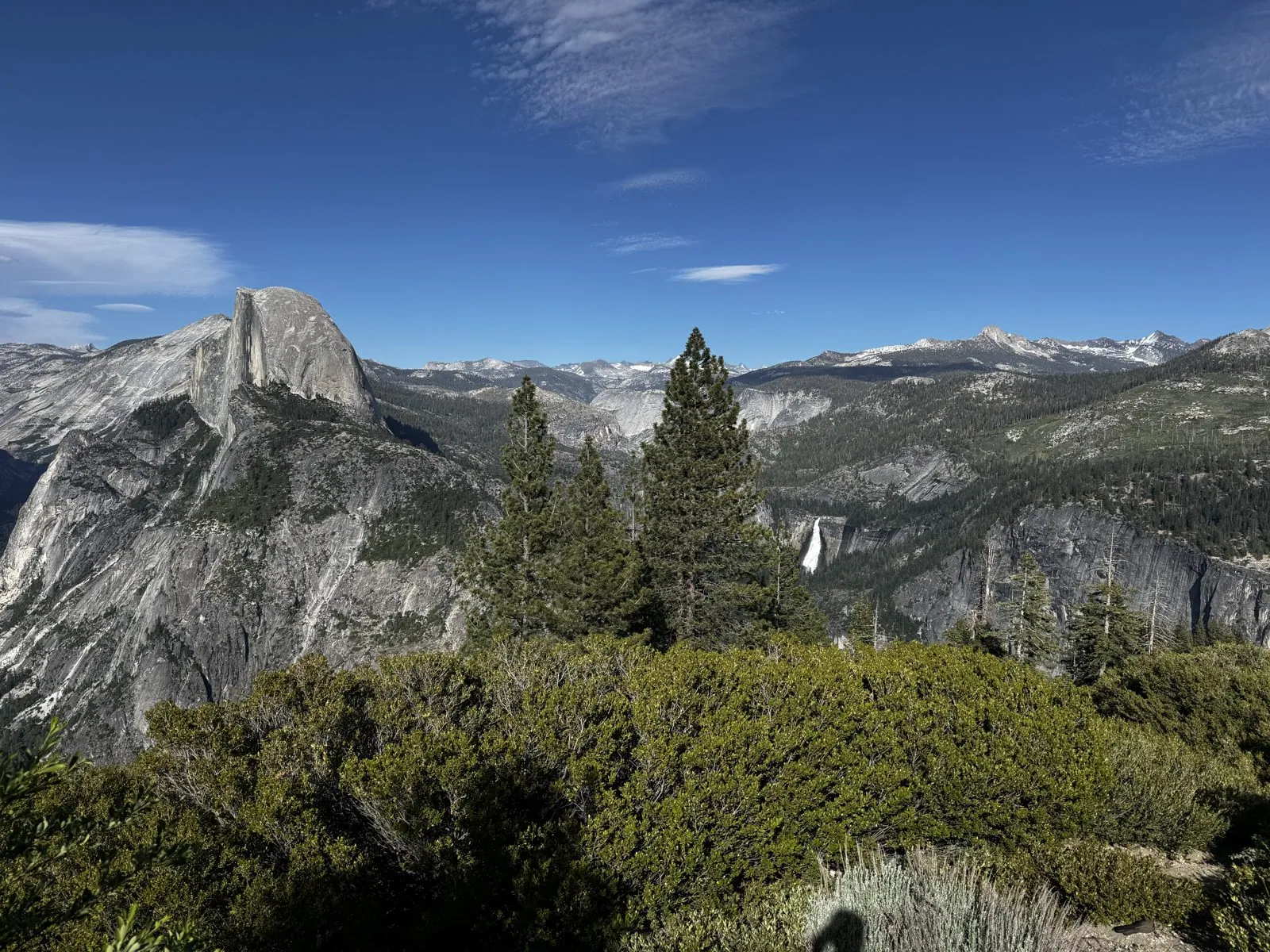
Below and to the right of it, two more waterfalls showed as white threads on the rock: Nevada Fall and, below it, Vernal Fall, the two steps of the Merced River on its way down into the valley.
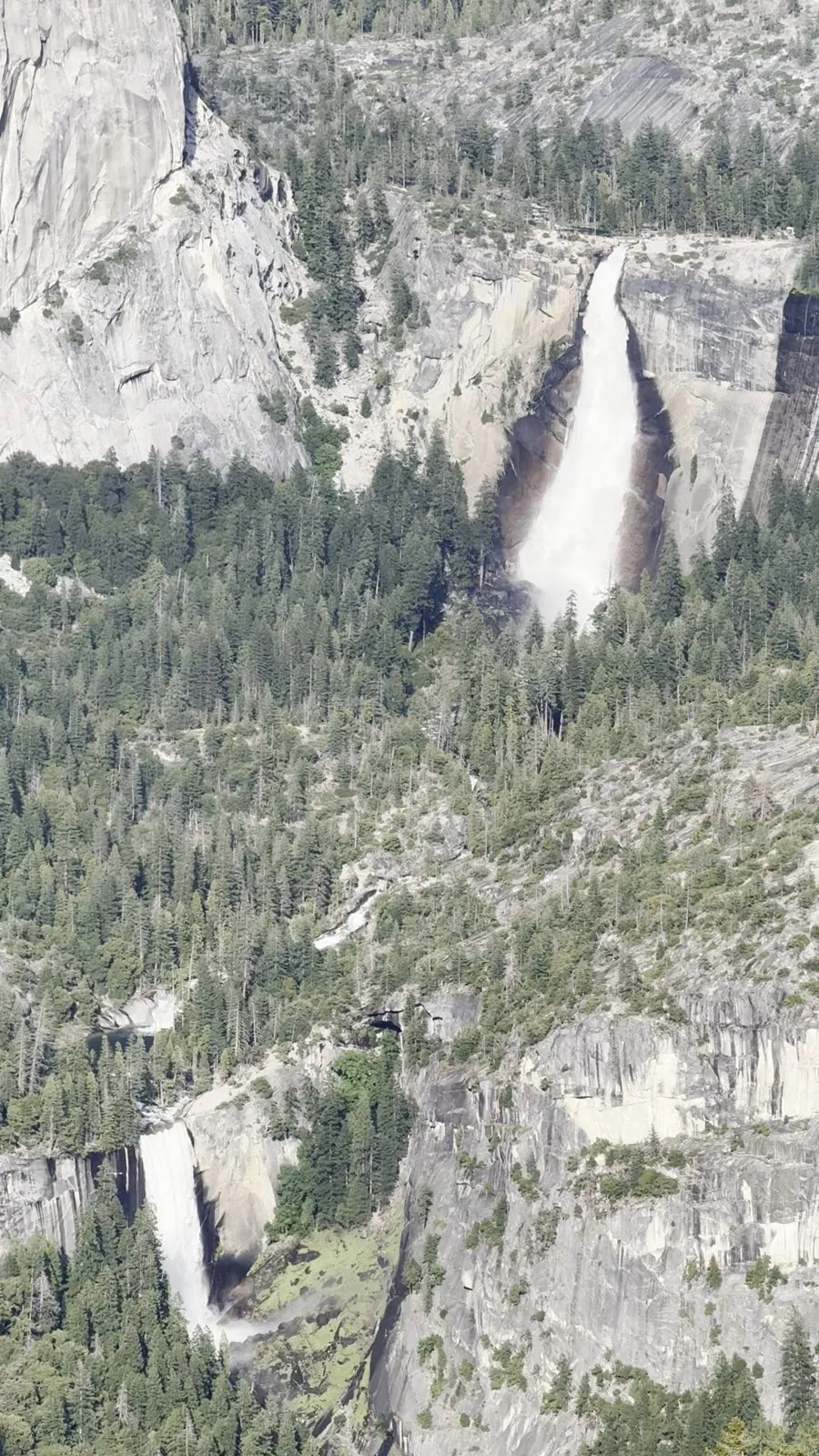
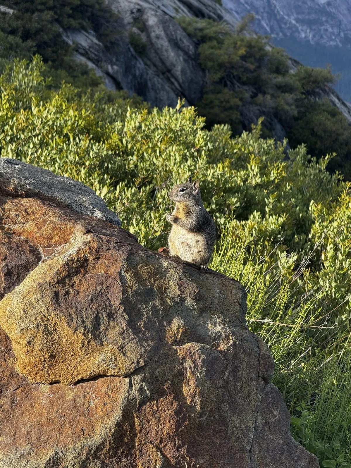
Glacier Point also had a ground squirrel, sitting upright on a lichen-covered rock at the edge of the overlook. It held its pose long enough for a photo and a short video. At 6:11 the main viewing area was busy: people lined up at the railing and around the interpretive signs, with Half Dome and both falls behind them.
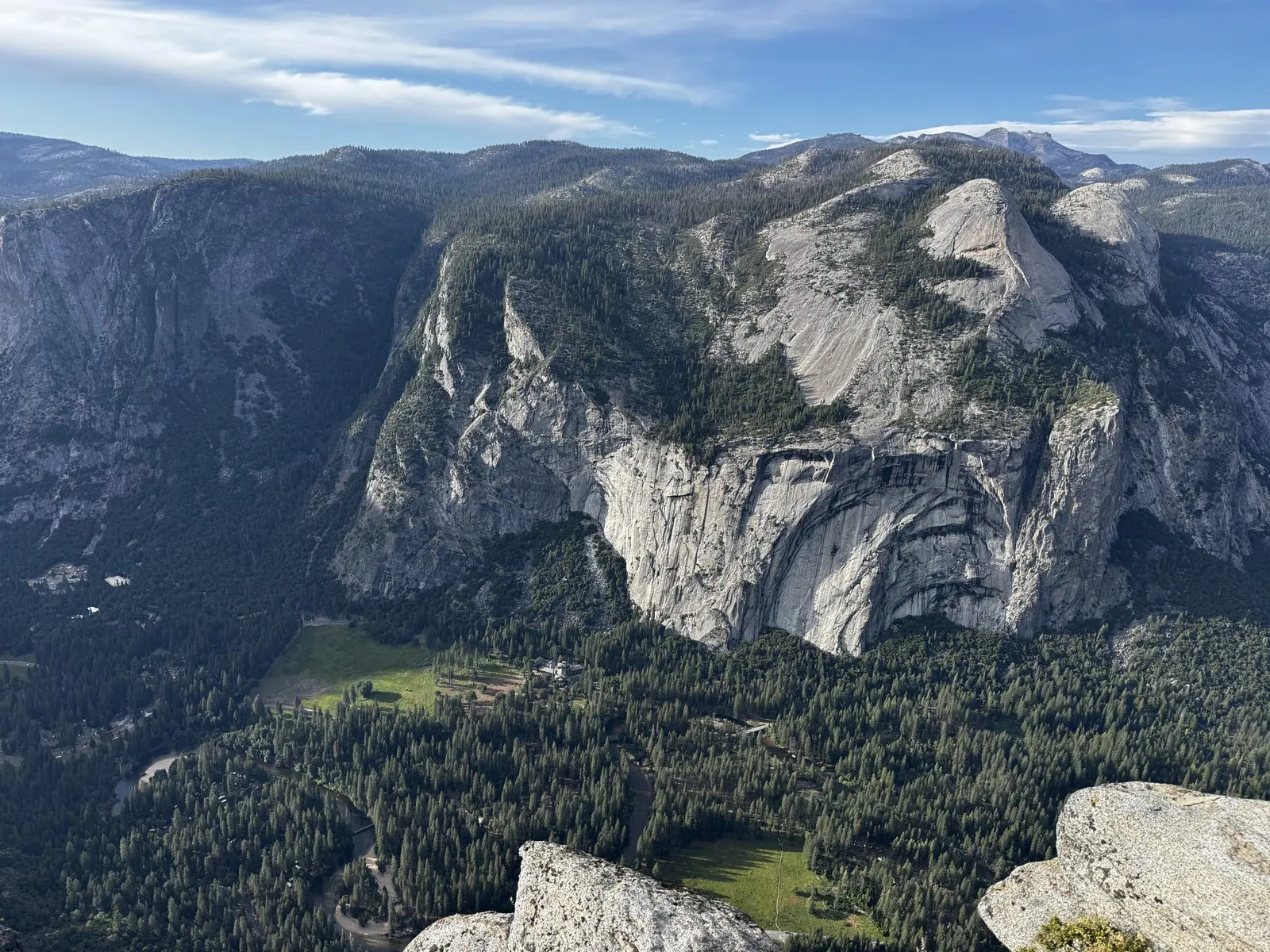
The last photo from up there, at 6:23, looks the other way: straight down into Yosemite Valley, with the north wall of the valley opposite, its domes and cliffs in the low sun, and the green floor of the valley far below.
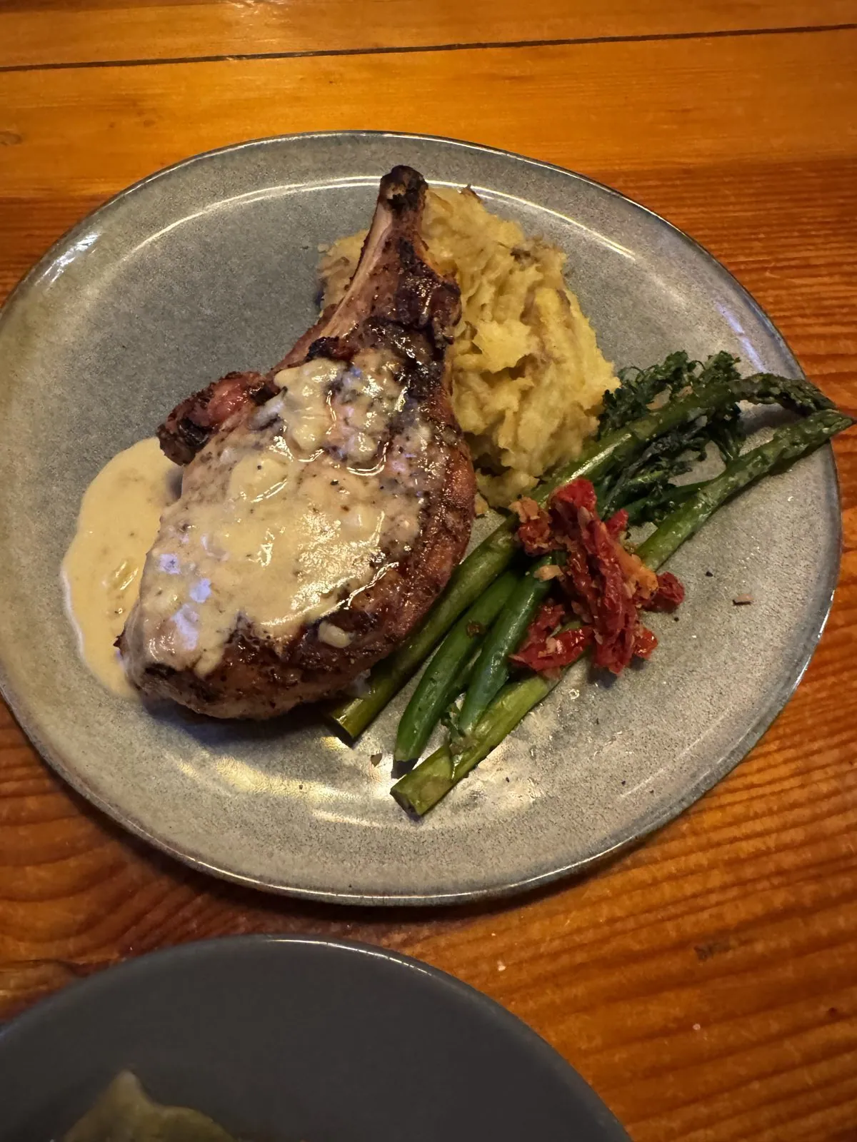
Dinner was at 8:24 at the Buffalo Bar in Fish Camp, just outside the south entrance: a bone-in pork chop with mashed potatoes, asparagus and sun-dried tomatoes.
The Mariposa Grove, again
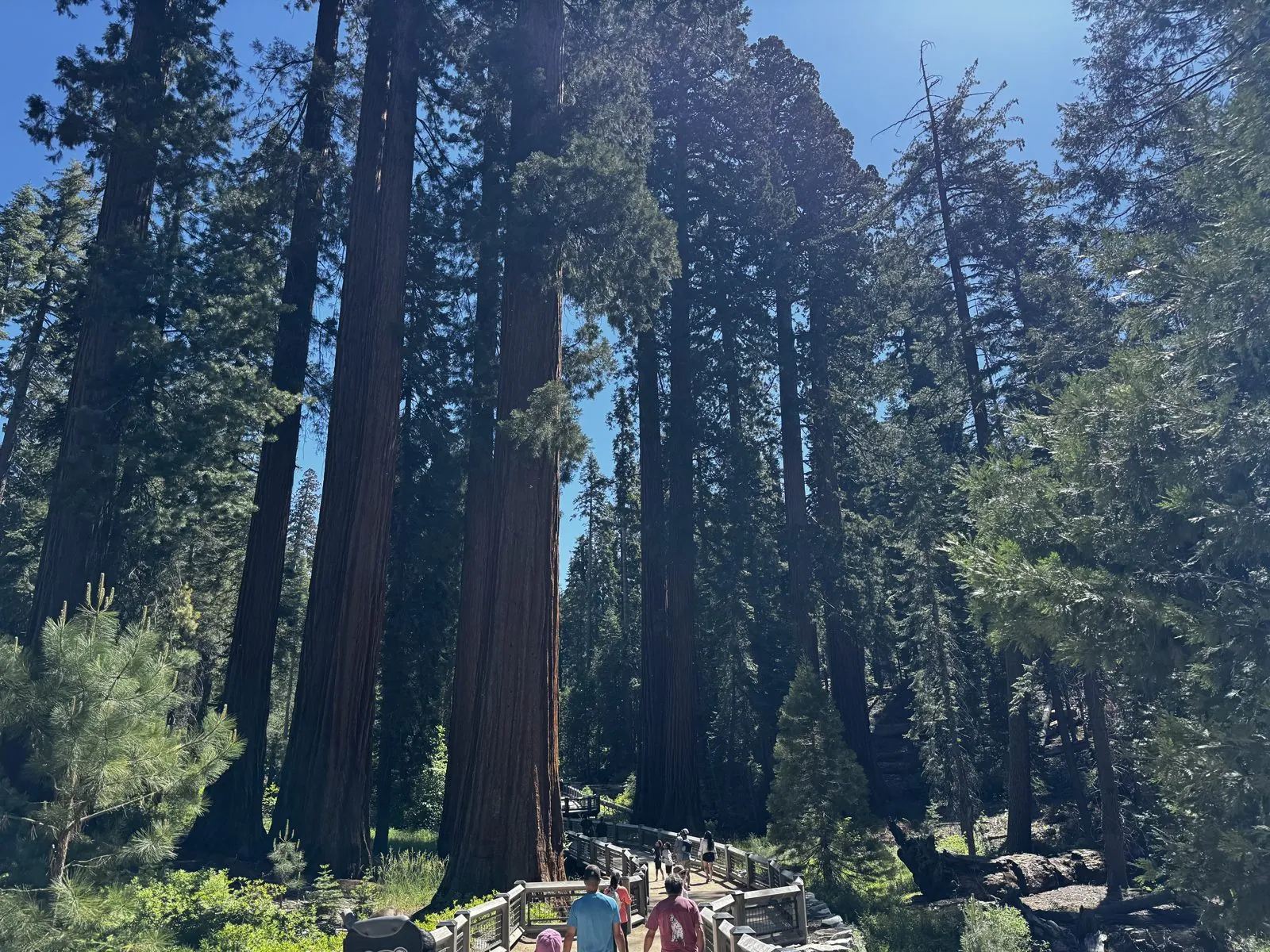
Sunday morning was the Mariposa Grove, just as it had been in 2022. My first photo, at 10:14, was taken a few feet from the first photos of 2022, at the boardwalk by the grove arrival area. The sequoias were the same. The light was different: lower, earlier in the day, with the trunks partly in shade.
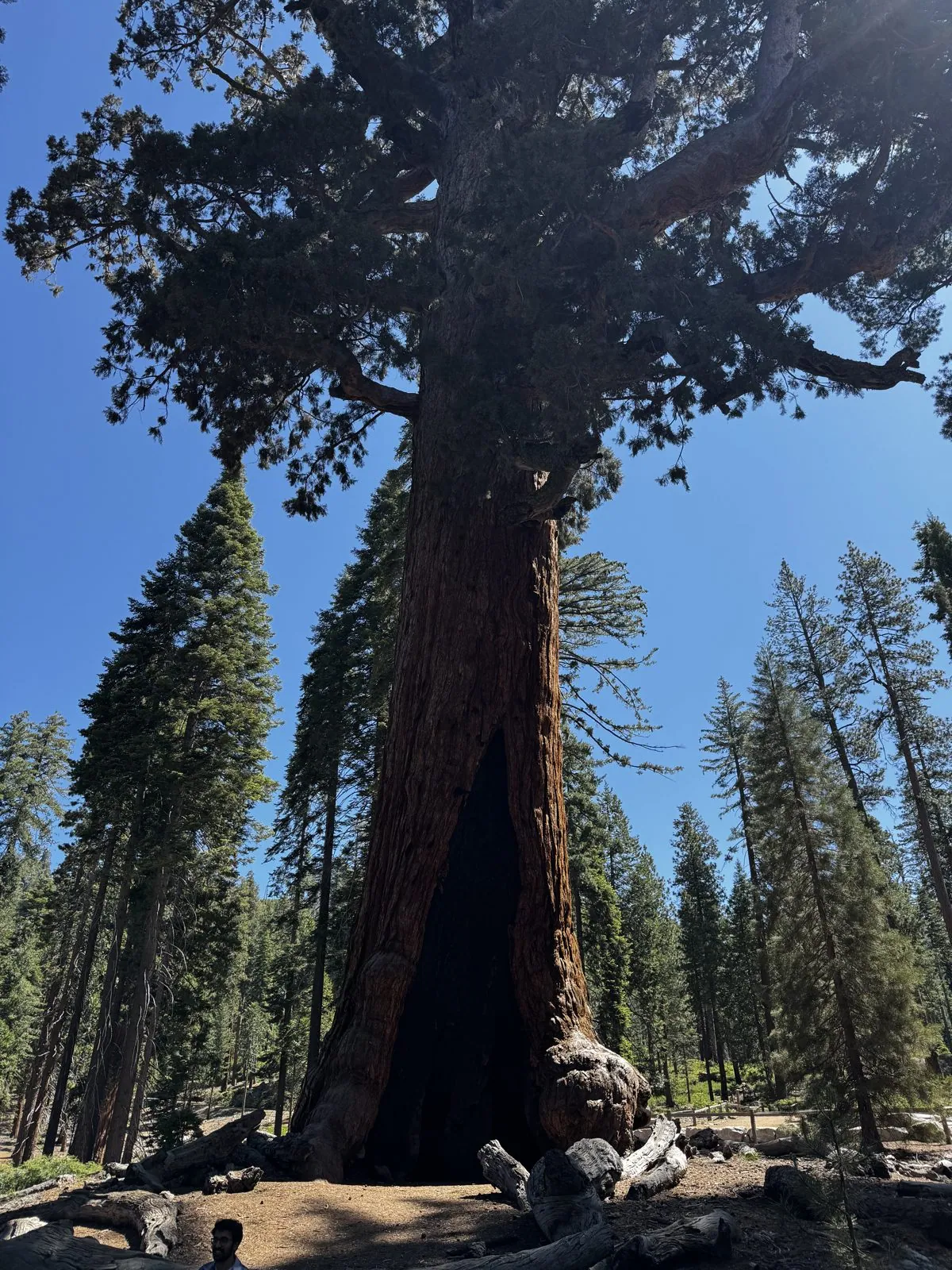
Then the Grizzly Giant again, at 10:43. The two photos were taken from nearly the same angle and nearly four years apart, and the tree looks just the same: the lean, the hollow at the base, the great crooked limbs.
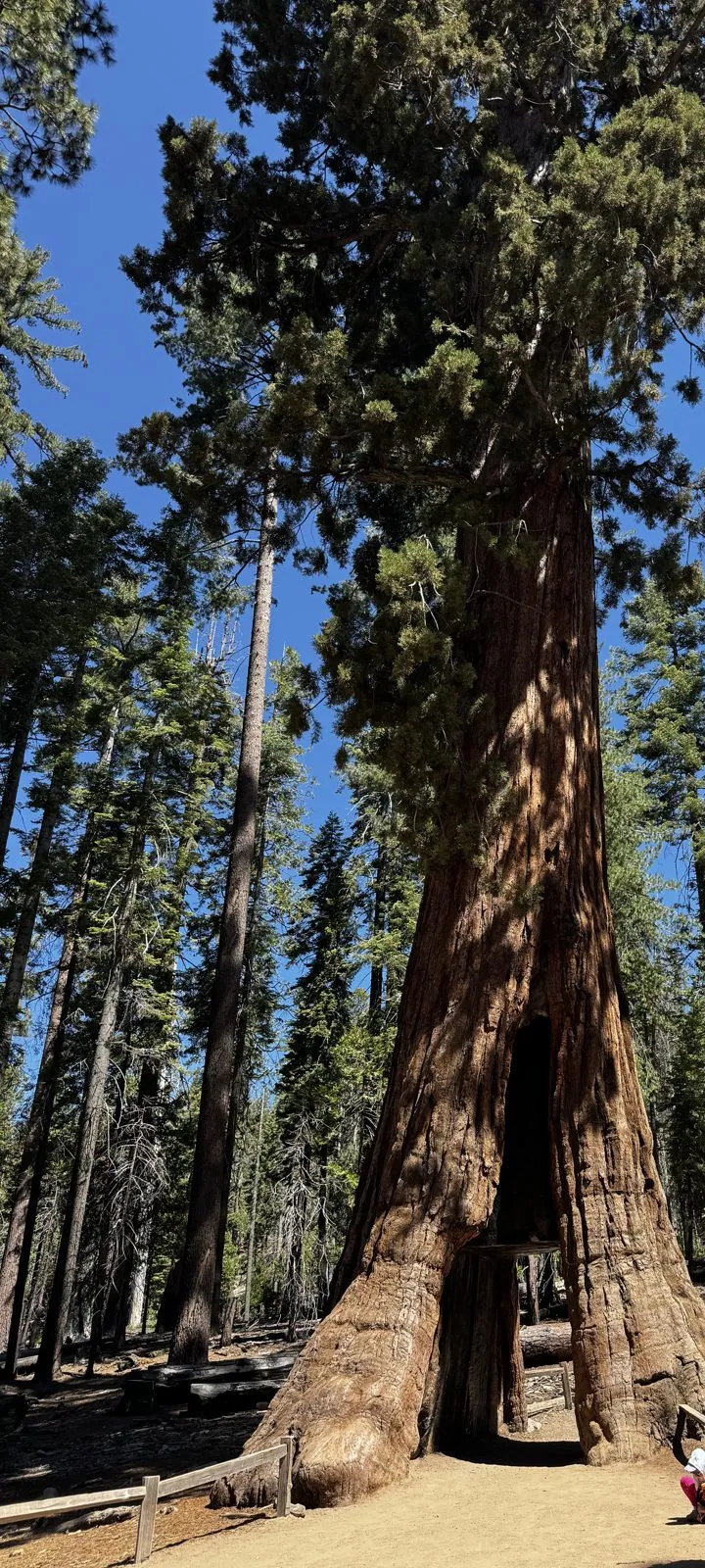
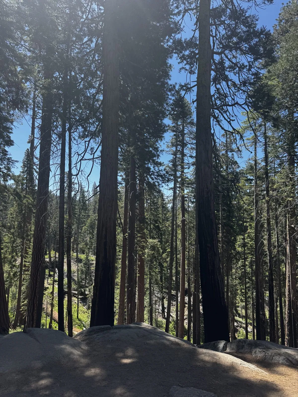
A little further on, at 10:54, was a tree I had not photographed in 2022: a living sequoia with a tunnel cut straight through the base of its trunk, wide enough for people to walk through. It is very likely the California Tunnel Tree. My last photo in the grove, at 11:10, is of the forest itself: tall, straight trunks in the sun along the trail, with nothing in particular to label.
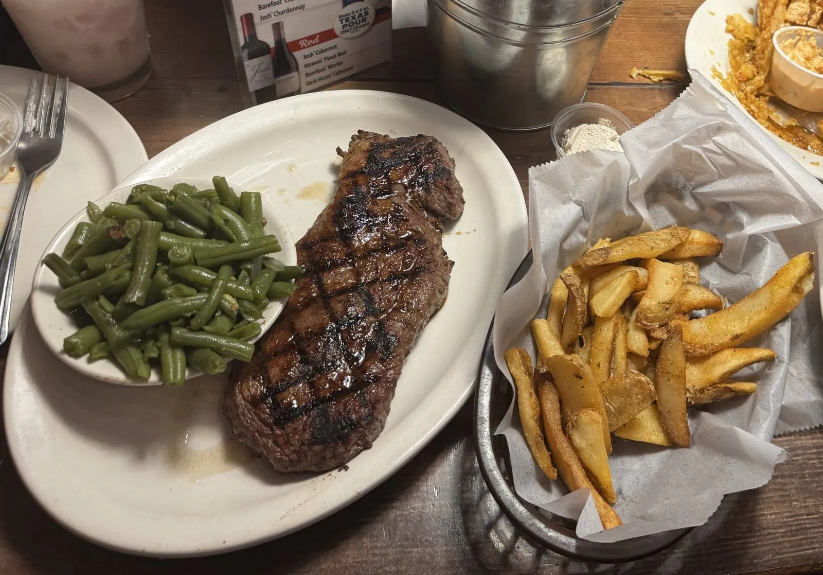
After the grove I left the mountains. The last photos of the weekend are from a late lunch at 2:26 at Texas Roadhouse in Turlock, in the Central Valley: a steak with green beans and fries.
Two visits, side by side
Put the two camera rolls together and the difference is mostly water. On Labor Day weekend in 2022 the valley was hazy in the morning, the Merced ran low between the rocks, and Lower Yosemite Fall was a few dark streaks on a dry cliff. On the first weekend of June 2026 the air was clear, Bridalveil was throwing spray across its boulder field, Yosemite Falls was running top to bottom, and from Glacier Point you could see Nevada and Vernal Falls too. The trees did not change at all. The Grizzly Giant in 2026 looks exactly like the Grizzly Giant in 2022, and the boardwalk at the grove still leads in under the same red trunks.
The 2022 trip had things the 2026 one did not: the morning-and-afternoon pair at Tunnel View, and the Tunnel Log in Sequoia on the way home. The 2026 one had Bridalveil up close and the view from Glacier Point. Both started at the same overlook on the Wawona Road.
Some photos in this post are my wife's.
Maps built from the trips' photo timestamps and locations. Photo locations have been removed from the published images. Map data © OpenStreetMap contributors; each stop is placed where its photo was taken, lodging and home are never marked, and the dashed lines show the order of stops, not the exact roads.
Likes and comments
React with an emoji or leave a comment. Signing in with GitHub is required.