← Misc · September 2025
Fishponds, a Crater and the Milky Way
A long weekend on Hawaiʻi Island, from the Kona coast to 9,200 feet on Mauna Kea.
Kona → Waikoloa → across the Saddle to Hilo → the Kohala Coast → a sunset boat off Keauhou → the Kalahuipuaʻa fishponds → Kīlauea Iki → Mauna Kea → Kona
One rental car · both sides of the island in a day, twice · sea level to 9,200 feet in an afternoon · one active volcano, one sacred mountain · about thirty photographs of the Milky Way
This was a short one: four days on Hawaiʻi Island, the one everybody calls the Big Island, in the middle of September. We flew into Kona on a Thursday morning and flew out again on Sunday afternoon, with a rental car in between and an island bigger than all the other Hawaiian islands put together.
As with the other trips on this page, everything below is rebuilt from the camera roll, which remembers where and when every photo was taken. It turns out to be a good diary. It is honest about how much of the weekend was spent eating, and it records the one day, Saturday, when the island showed us almost everything it has: ancient fishponds in the morning, a volcanic crater in the afternoon, a sunset above the clouds, and then the Milky Way.
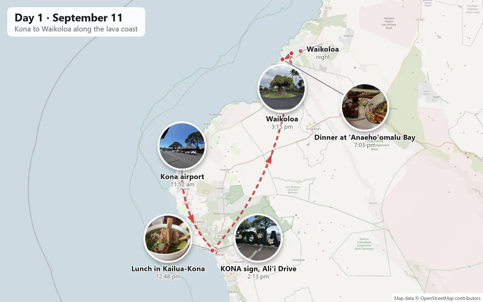
Day 1: Kona and the lava coast
Arriving in Kona
We landed just before noon. The Kona airport is one of the nicest places in the country to arrive, because it barely has a building. The terminals are a row of low open-air pavilions under steep, peaked roofs, the kind of architecture that looks borrowed from a traditional hale, with big monkeypod trees spreading over the curb. You walk off the plane and straight into the warm air. There's no jet bridge and no long corridor, just sun, a breeze and the smell of hot asphalt and flowers. Within twenty minutes we had a rental car and were heading south into town.
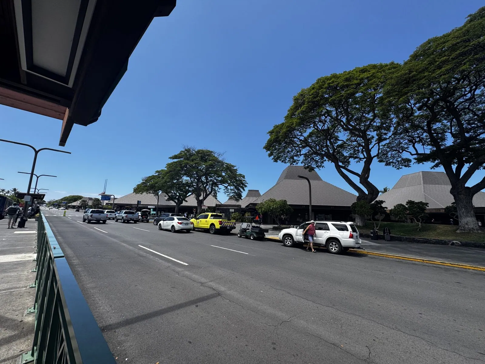
The land around the airport is a surprise if you expect Hawaiʻi to be green. This side of the island sits in the rain shadow of its big volcanoes, and most of what you see from the road is lava: rough black fields of it, some old enough to have grown a fuzz of golden grass, some still bare. The airport itself is built on a lava flow from Hualālai, the volcano that rises behind Kailua-Kona. The green arrives with the towns, the gardens and the trees people have planted.
Lunch in Kailua-Kona
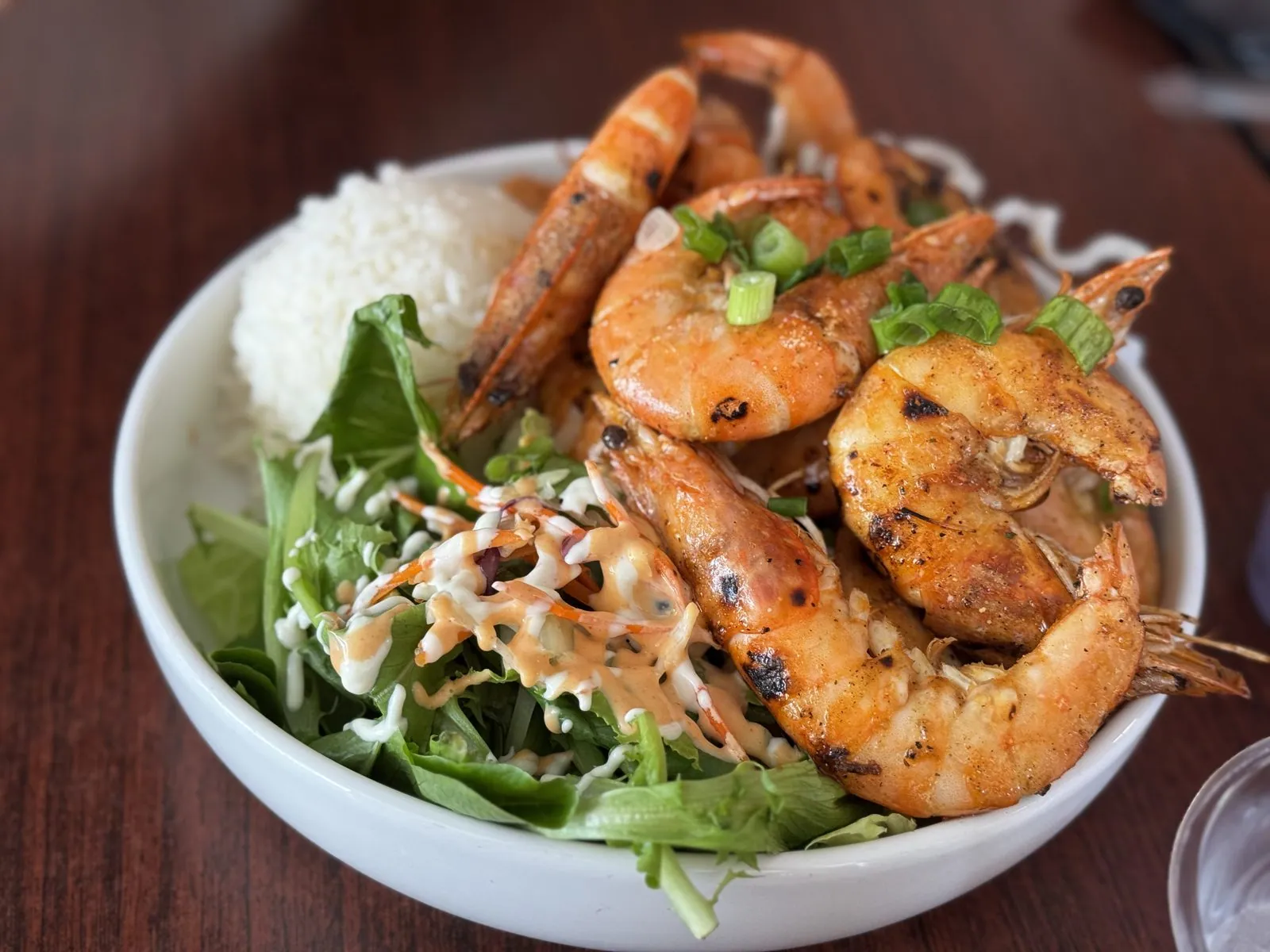
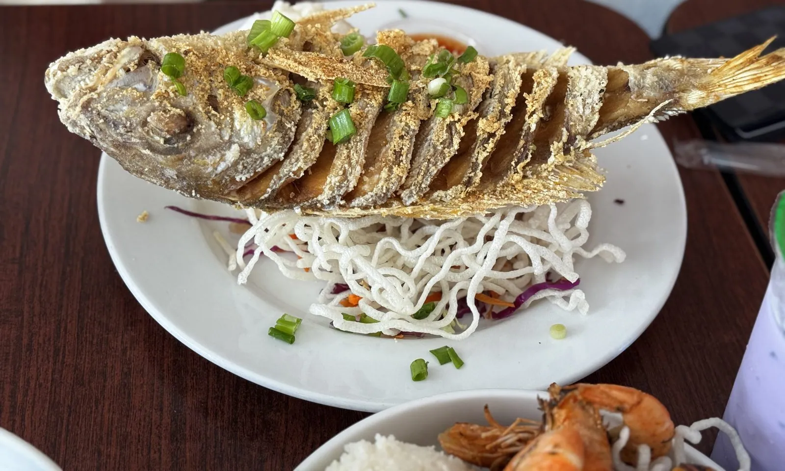
First stop: lunch, in a small shopping center in Kailua-Kona. The table filled up quickly. There was a tall ube drink topped with a dome of purple ube ice cream, a bowl of grilled garlic shrimp on rice and salad, a whole fried fish scored into crispy slices and set on a nest of fried noodles, and a bowl of pho with an absolutely enormous beef rib standing up out of the broth like a mast. Ube, the purple yam, is everywhere in Hawaiʻi, a legacy of the islands' large Filipino community, and it turns everything it touches a slightly unreal shade of lavender.
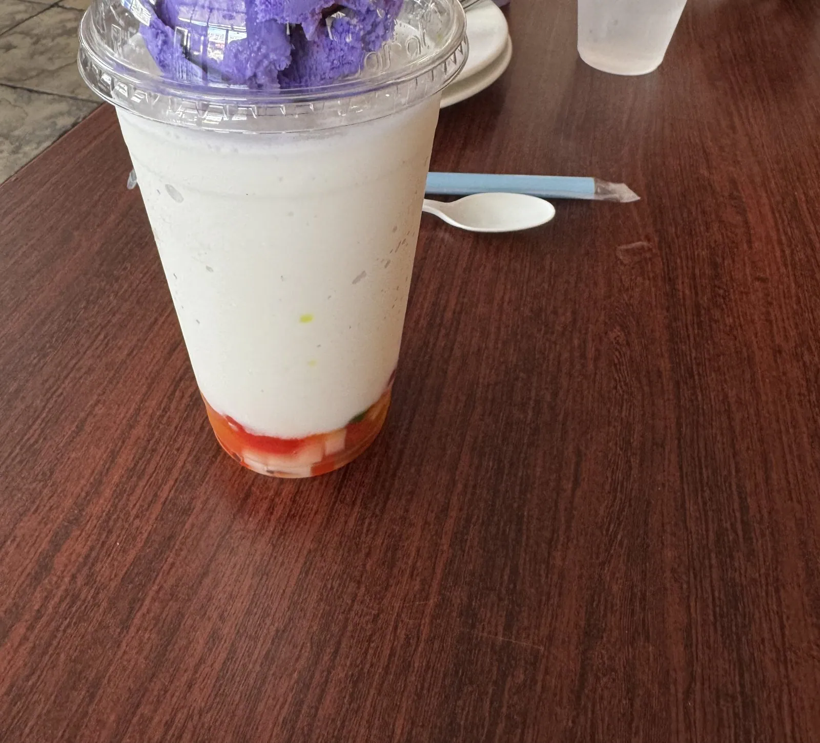
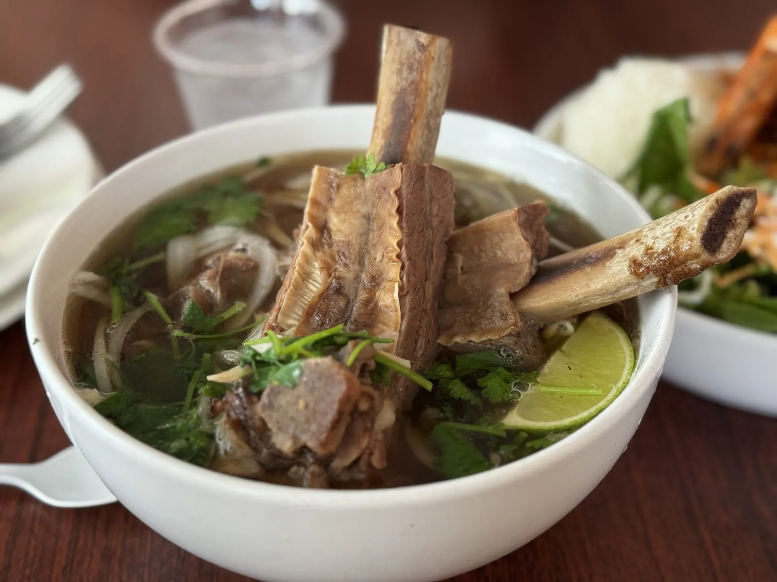
The garlic shrimp deserves a word. Garlic shrimp is the island cousin of the famous shrimp trucks of Oʻahu's North Shore: shell-on shrimp cooked hard in butter and a frankly irresponsible amount of garlic, served with a scoop of rice. Here it came grilled, with char marks, a creamy dressing and a salad underneath. The fried fish was the showpiece, though, cut so that every slice crisped up separately and the whole thing looked like a golden accordion.
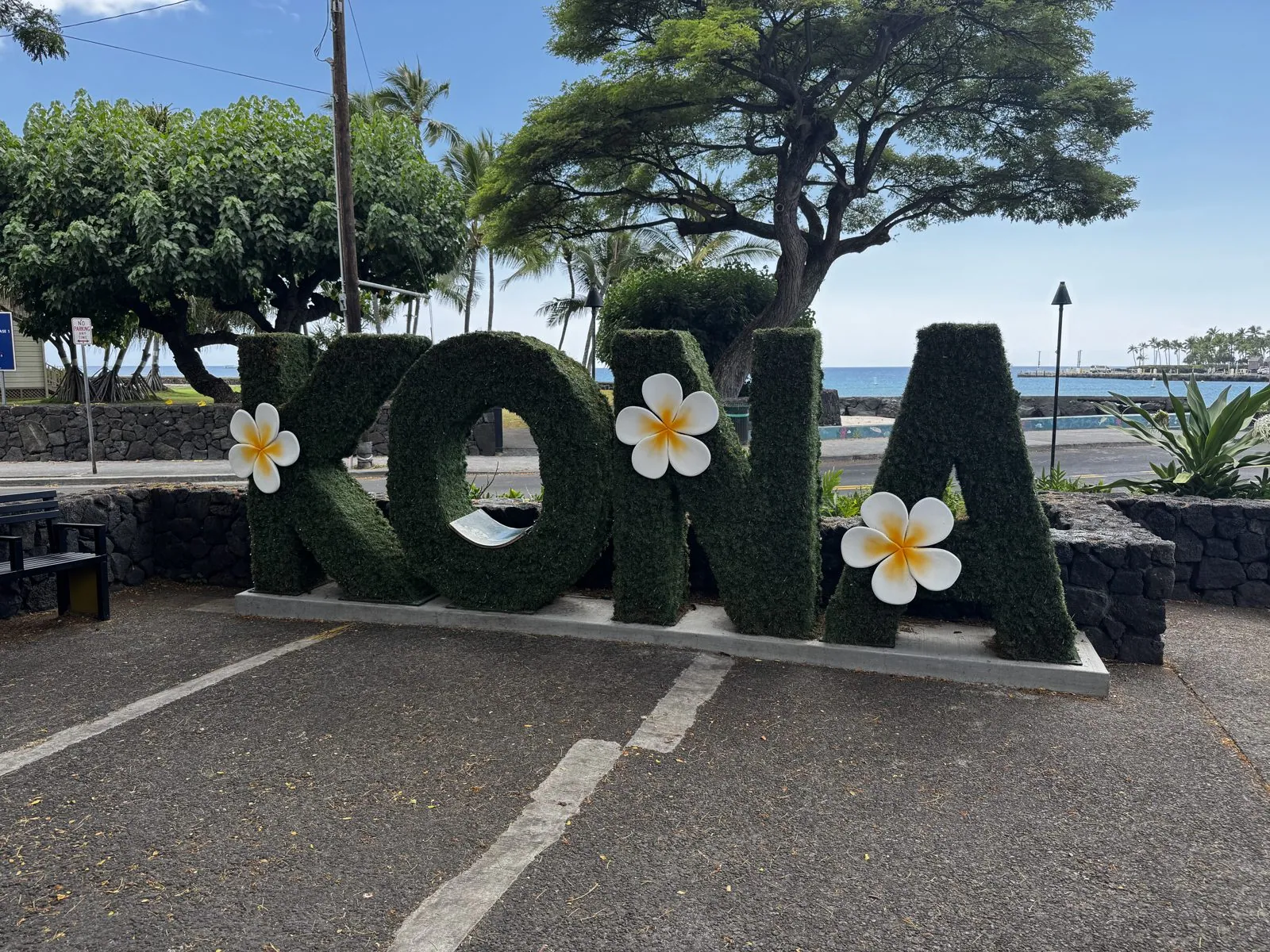
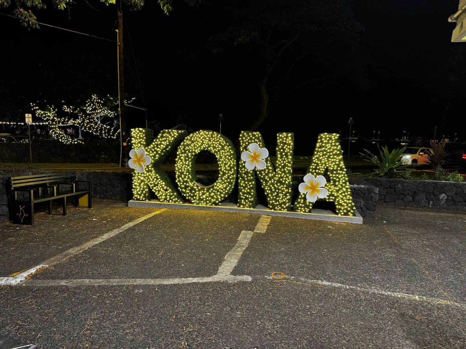
After lunch we walked down to the waterfront on Aliʻi Drive, the old seafront road of Kailua-Kona. A century and a half ago this was a royal retreat: Hawaiian aliʻi kept homes along this shore, and Huliheʻe Palace, a summer palace of the Hawaiian royal family, still stands on the bay. Today the road is lined with shops, restaurants and the seawall, and at one end someone has planted the town's name in giant green topiary letters, decorated with oversized plumeria flowers. Behind them is the blue of Kailua Bay. It is the most photographed hedge on the island, and we did our part.
Up the coast to Waikoloa
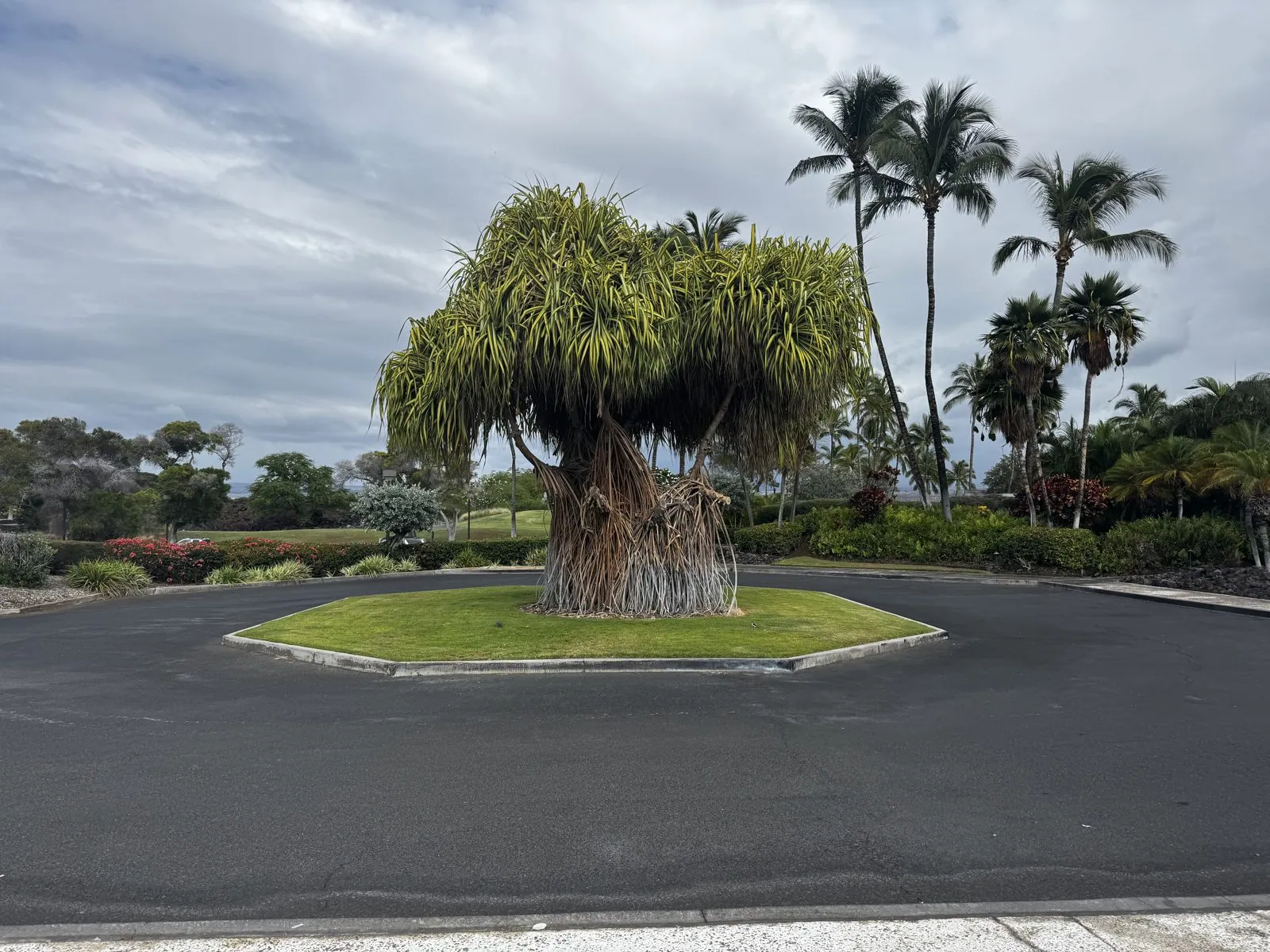
From Kona the highway runs north for half an hour through nothing but lava. It is one of the strangest drives in the United States. The road is a thin gray line through black and brown flows that poured down from Hualālai and Mauna Loa, and people have spelled out messages along the shoulders in white coral stones on the dark rock. Then, suddenly, there is a turnoff, a ribbon of irrigated green, and you are in Waikoloa, where a resort community has been built into the lava, all lawns, palms and golf courses, with the black rock showing at every edge.
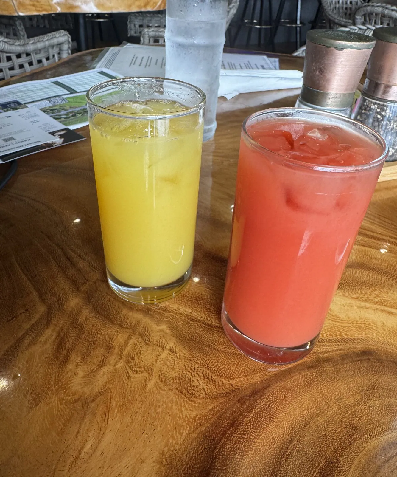
The first afternoon was slow. There was a stop for fresh juice, one orange and one pink, at a table made from a single slab of polished wood, while the sky over the mountains filled with cloud. Most of the island's weather happens in the afternoon, when the sea breeze pushes moist air up the slopes and it condenses into a line of cloud halfway up the volcanoes. From the coast you can watch it build hour by hour, while the beach stays in sun.
Dinner at ʻAnaehoʻomalu Bay
Dinner was at Lava Lava Beach Club, right on the sand at ʻAnaehoʻomalu Bay. The bay is a long curve of salt-and-pepper sand, with old Hawaiian fishponds just behind the beach, and the restaurant is an open-air room with string lights, palm trunks and a view of the water going dark. We got there just after seven, as the last light faded behind the palms. By the time the food came, the room was lit only by the string lights and candles on the tables. We spent that first night at Kings' Land, a Hilton Grand Vacations resort in Waikoloa.
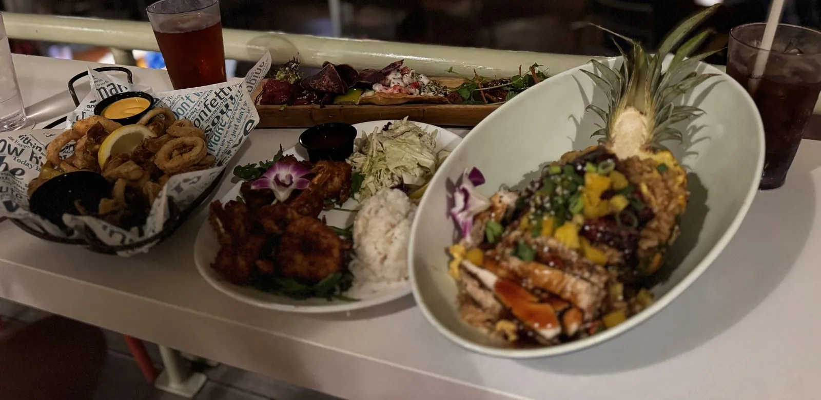
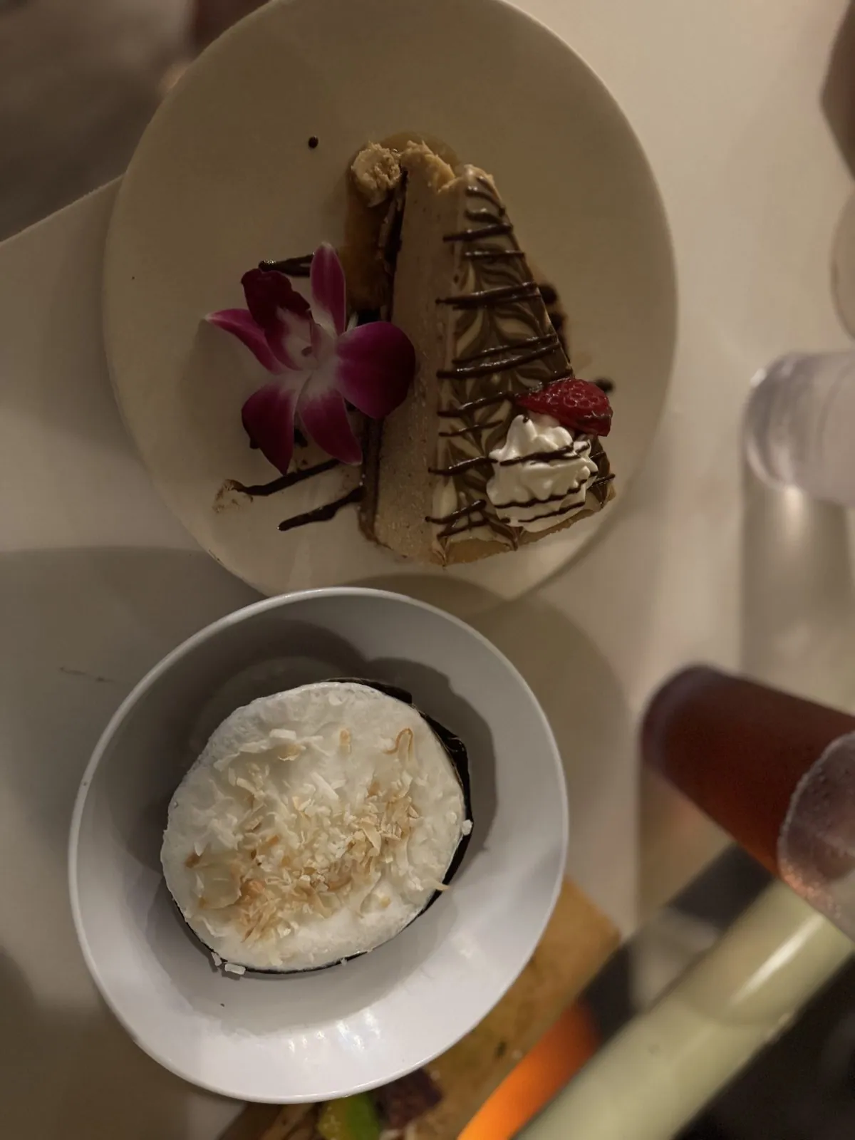
The main event came in a hollowed-out half pineapple, with grilled meat, mango and sauce piled into the shell. Next to it were coconut shrimp with rice and a purple orchid, and a basket of fried calamari. Then came dessert: a slice of pie with chocolate drizzle and another orchid, and a dome covered in toasted coconut flakes. On the islands, orchids are the garnish of choice. By the end of the weekend we had collected quite a few.
Day 2: Across the island and back
Over the Saddle
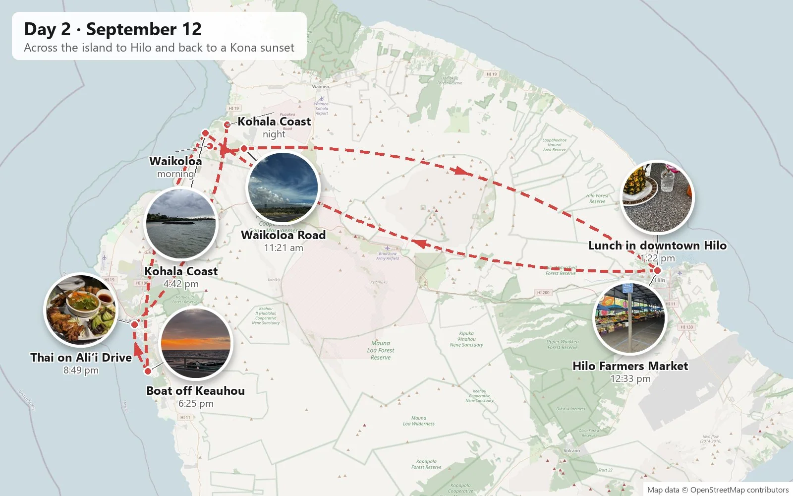
Friday was a crossing. The Big Island has two very different sides: Kona in the west, dry, sunny and built on lava, and Hilo in the east, one of the rainiest cities in the United States. Between them stand two huge volcanoes, Mauna Kea to the north and Mauna Loa to the south, and the road between them crosses the high plateau known as the Saddle. We left Waikoloa late in the morning and climbed Waikoloa Road under a sky full of enormous cumulus clouds.
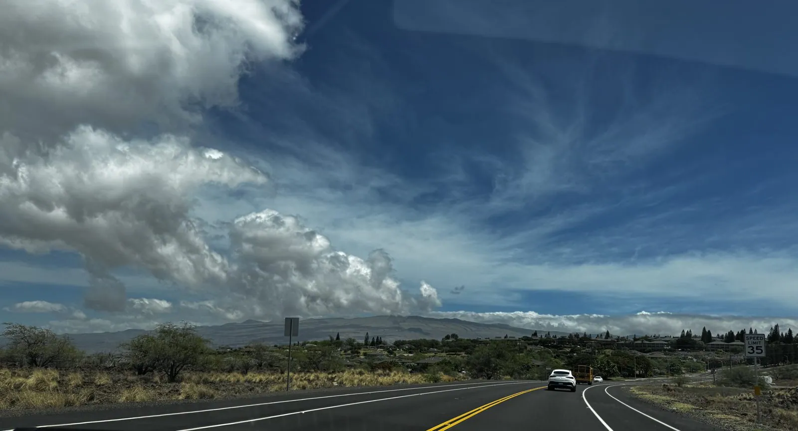
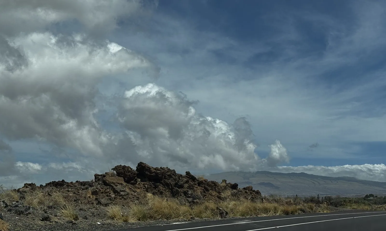
The landscape up there feels nothing like the postcards. It is open, high and empty, all dry grass, scrub and lava under a very big sky, more like the American West than the tropics. The clouds were the show: towers of white cumulus over the slopes, and above them high, feathery cirrus pulled into streaks by the wind. In about an hour the road crests the Saddle and drops down the windward side, the air turns damp, and the trees close in, green and dripping. By half past twelve we were in Hilo.
Hilo
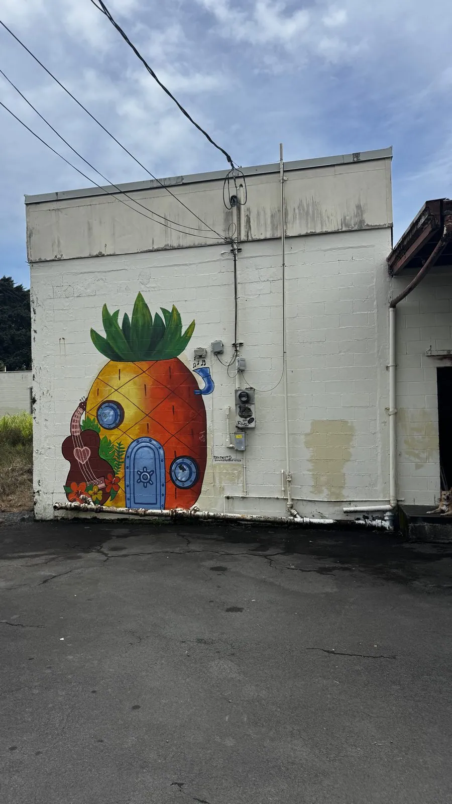
Hilo is the island's old town and its county seat, and it feels completely different from Kona. It is low, wooden and a little weathered, with a waterfront that was rebuilt as parks after tsunamis in 1946 and 1960 destroyed the old bayfront. The downtown has kept its early-twentieth-century storefronts, and a lot of murals. The first photo in Hilo is of a white concrete building with a familiar pineapple house painted on its wall, complete with porthole windows and a little blue door. If you know, you know.
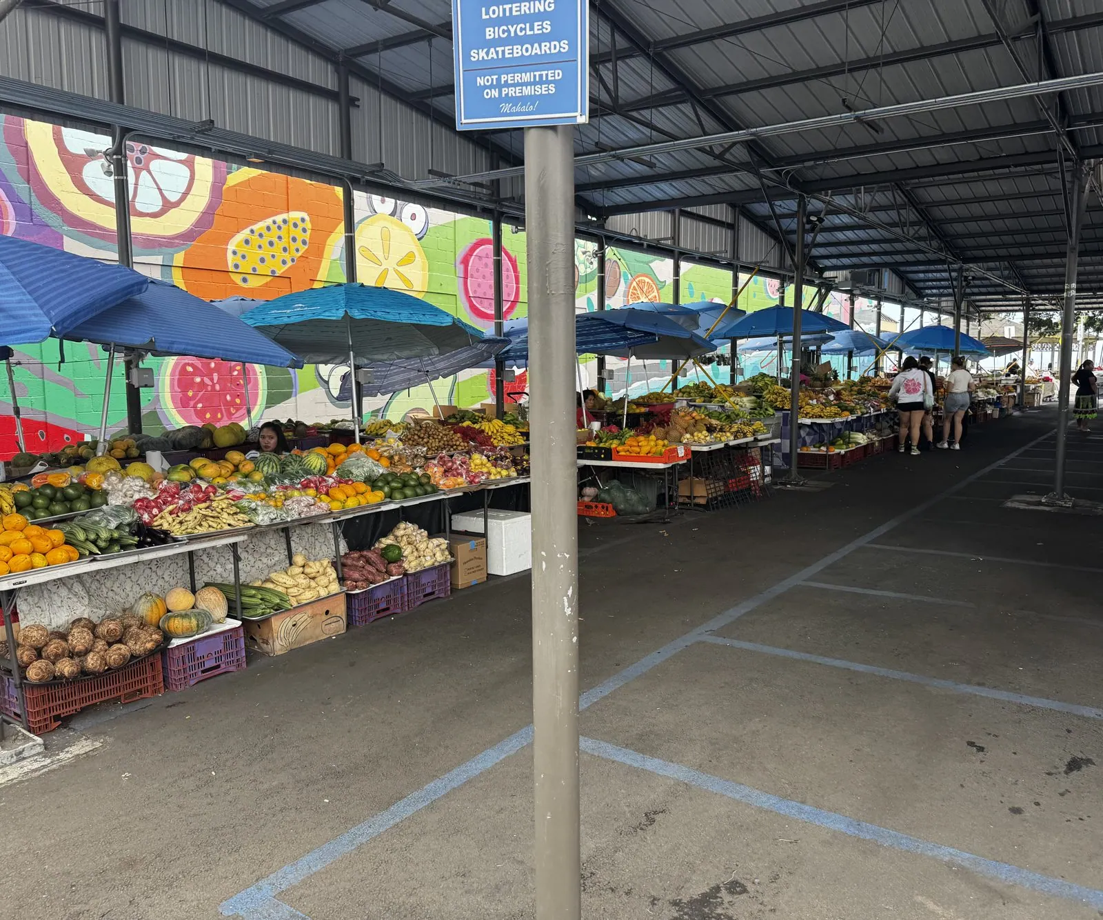
Then came the Hilo Farmers Market, a long, covered market hall on the corner of downtown, with murals of giant sliced fruit painted along the back wall and stalls piled high underneath. There were mountains of papaya, bananas in every size, pineapples, avocados, dragon fruit, rambutan, sweet potatoes and plenty of things we couldn't name. Hilo's rain is good for something: the wet windward side is where much of the island's fruit grows.
We did not leave empty-handed. We bought far more fruit than two days could reasonably use, and all of it was really good: rambutan, the hairy red cousin of the lychee, sweet and translucent inside its spiky shell, and papaya so cheap it felt like a mistake.
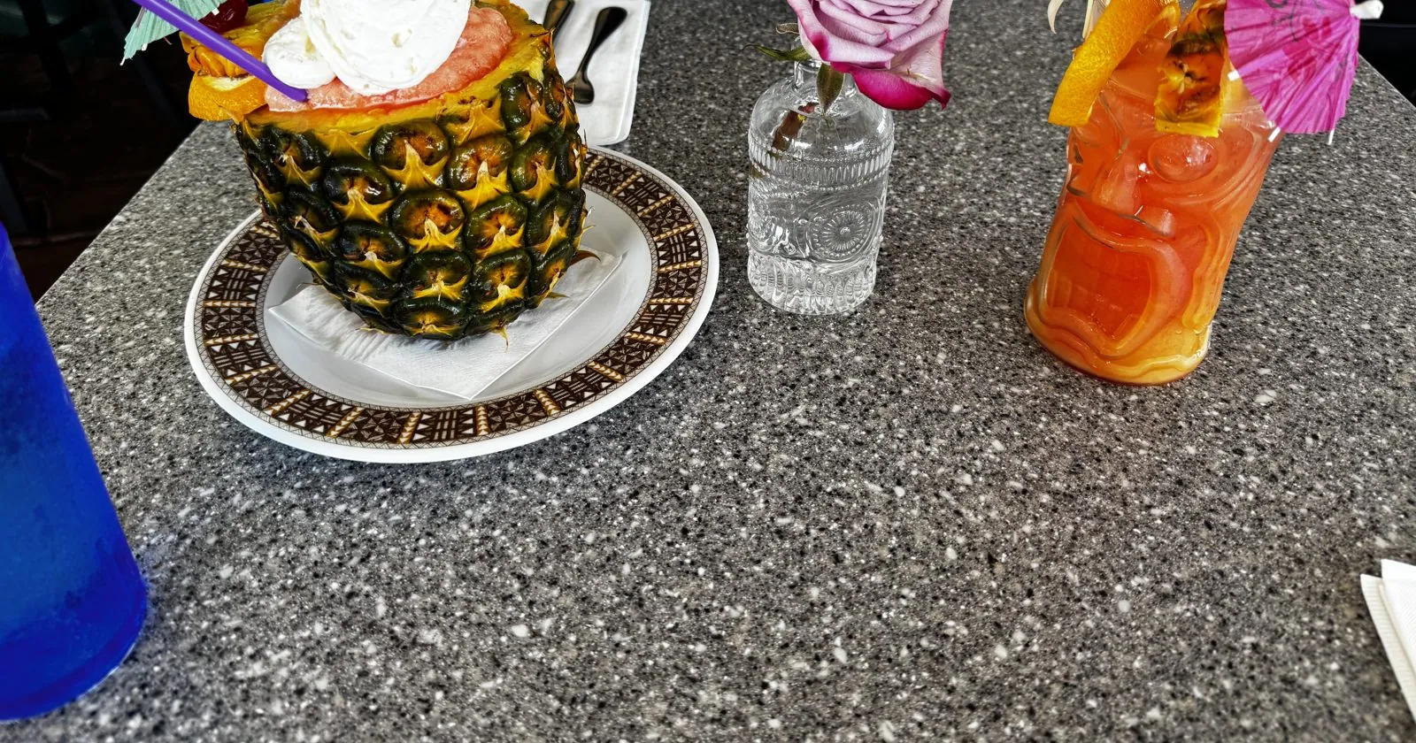
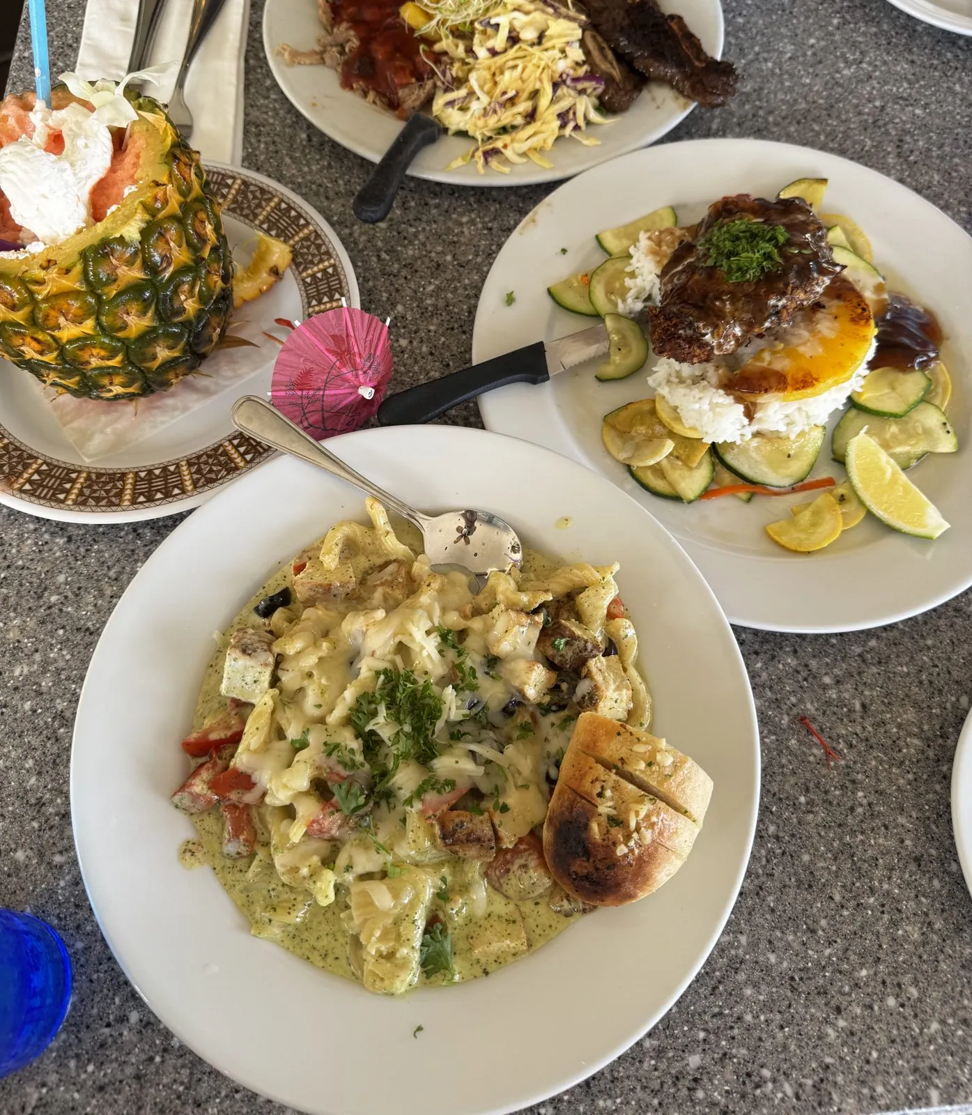
Lunch was a few blocks away, downtown on Keawe Street, and it was the most tropical meal of the trip. The drinks came in a hollowed-out pineapple, topped with whipped cream, cocktail umbrellas and a straw, next to a tall glass of something orange and fruity with its own umbrella. A single rose stood in a vase on the table. For food there was a creamy pasta and a loco moco: rice topped with a hamburger patty, brown gravy and a fried egg. It was in the right place. The loco moco is generally credited to Hilo, where it was invented in the late 1940s as a cheap, filling plate for hungry teenagers.
Back to the Kohala Coast
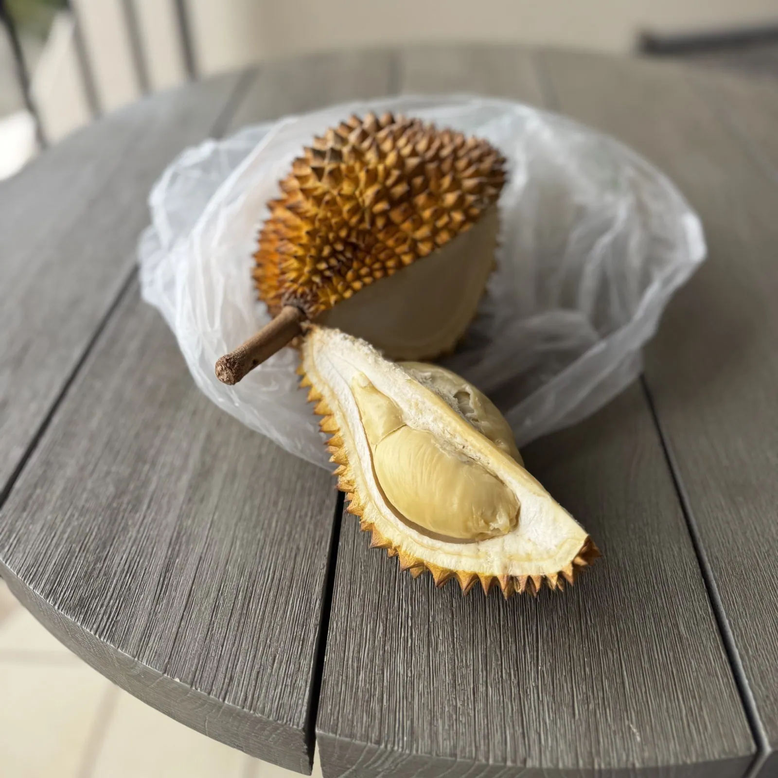
Then we drove straight back across the island. By four we were on the Kohala Coast, north of Waikoloa, where we spent the second night at the Mauna Lani resort. The afternoon snack was a whole fresh durian, cracked open on an outdoor table. Durian is famous for its smell, which some people describe as heaven and others as a gas leak, and infamous enough that many hotels and public transit systems in Southeast Asia ban it outright. It does grow in Hawaiʻi, in small numbers, mostly on the wet side of this island. This one was eaten outside, which seemed only fair to everyone else.
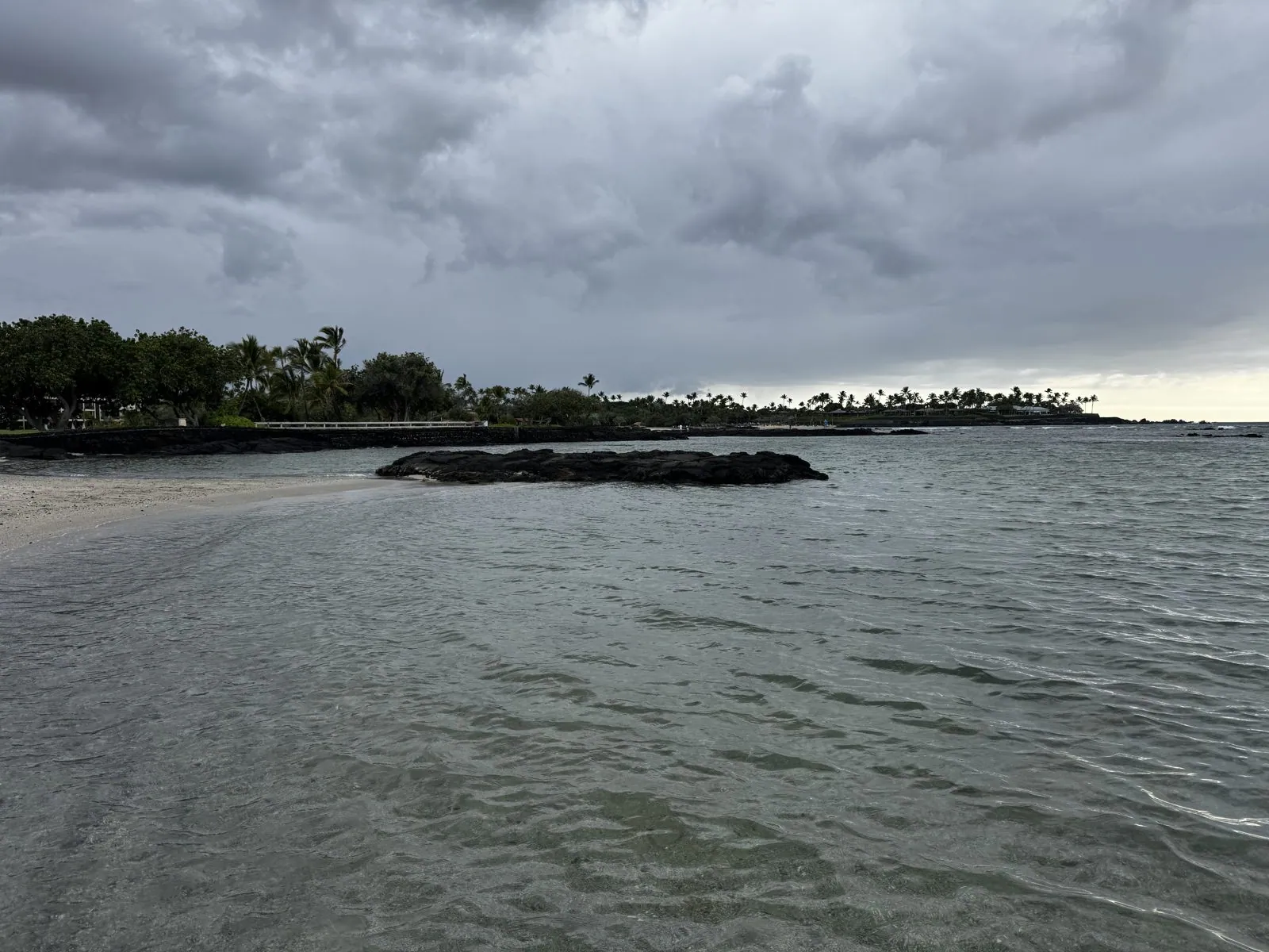
The weather had turned. At a quarter to five the sky over the coast was a heavy gray ceiling, and the shallow lagoon by the beach was calm and the color of pewter, with a low reef of black lava sitting in it like a sleeping animal. It is a good reminder that even the dry side of the island has its moods. The clouds that build over the mountains every afternoon sometimes spill down to the coast, and for an hour or so everything goes soft and quiet.
A sunset boat off Keauhou
Then we drove south again, past Kona, for the evening's plan: a boat out of Keauhou, south of Kailua-Kona. It was almost certainly the manta-ray night snorkel. By 6:25 we were in wetsuits on the deck of a boat heading out from the coast, and the sky was doing something remarkable. The gray ceiling hadn't gone anywhere, but it ended a little above the horizon, and the sun slipped into the gap between cloud and sea. The result was a single blazing band of orange, with a sailboat silhouetted against it and the rest of the sky still gray.
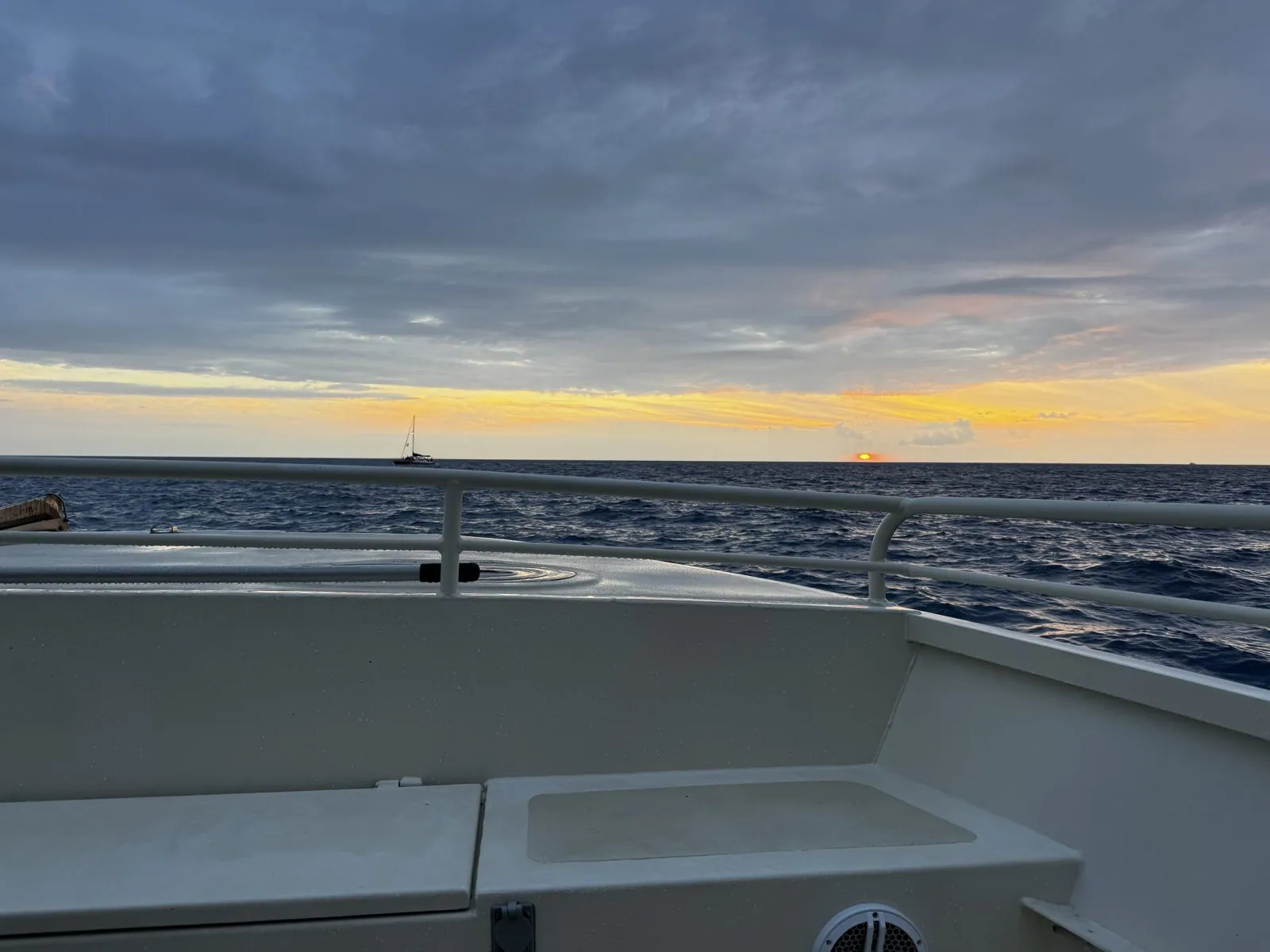
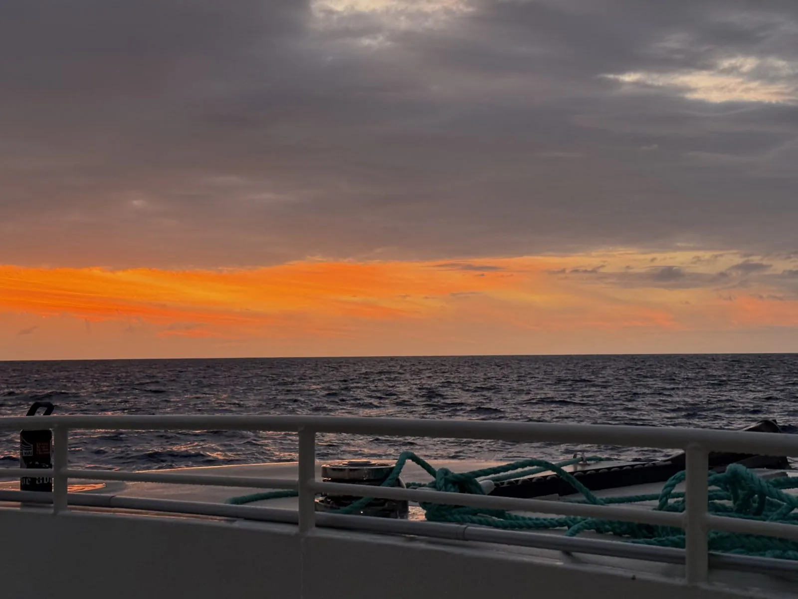
For a few minutes the orange stripe grew brighter and redder. The photos stop at 6:44, which on a boat, at dusk, in a wetsuit, usually means the phone has gone somewhere dry. What happened next is not in the camera roll.
It is easy enough to guess, though. The Kona coast is one of the most reliable places in the world to see reef manta rays at night, and the boats out of Keauhou head for a spot just off the coast where they gather after dark. The trick is light: the boats shine lights into the water, the lights draw plankton, and the plankton draws the mantas, which glide up out of the dark with their mouths wide open and loop and somersault through the beam, sometimes just below the snorkelers floating at the surface.
Thai food and a glowing sign
Dinner was late, on Aliʻi Drive in Kailua-Kona, at a Thai restaurant with metal tables: a sampler plate of curry, fried chicken wings and a beef salad with cucumbers, then a plate of drunken noodles with beef and green beans, and finally a warm bowl of taro and coconut tapioca, purple swirled through white. After a boat at sunset, there is nothing better than hot food. Walking back to the car, we passed the KONA topiary again. At night it is wrapped in thousands of tiny white lights, glowing against the dark parking lot like a giant hedge-shaped lantern.
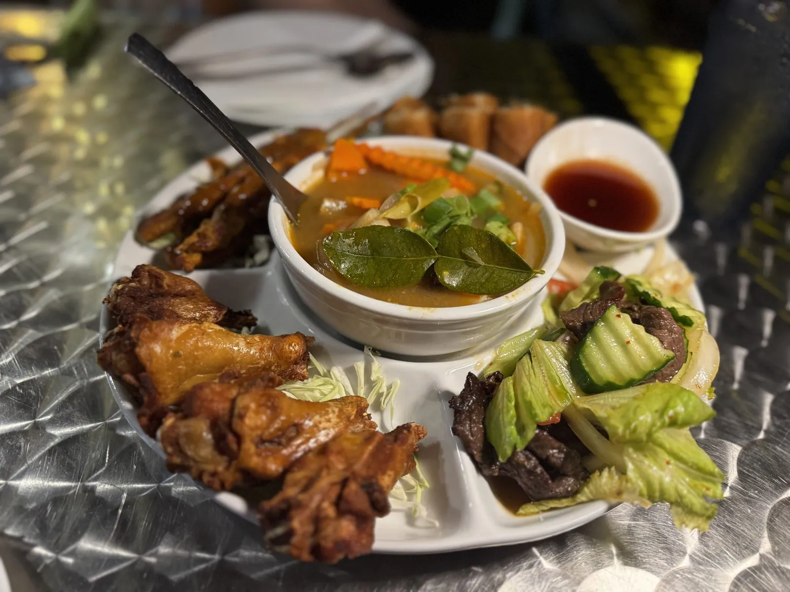
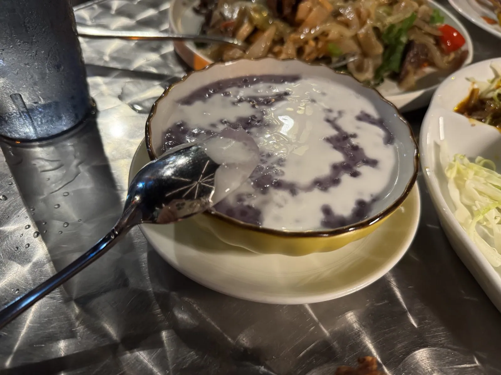
It is a cheerful sight: a small town's name, spelled out in lights, at nine at night, with the sea invisible behind it but very much audible. The sign had changed completely in seven hours, from green and plumeria in the afternoon sun to a glittering outline in the dark. Then it was another drive north, back up the lava coast to the Kohala Coast.
A few bags of fruit and snacks from town came back with us for later. Saturday would need an early start.
Day 3: Fishponds, a crater and the Milky Way
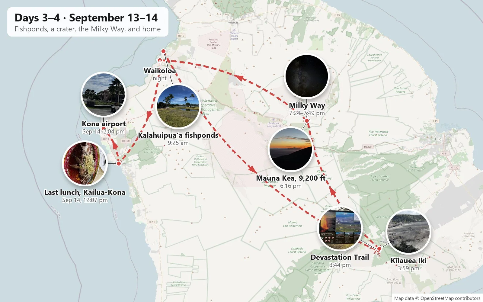
Saturday was the day this trip is really about. Looking at the map afterwards, it is a slightly absurd loop: a morning walk at sea level on the northwest coast, a drive all the way across the island to the volcano in the southeast, then up to 9,200 feet on Mauna Kea for sunset and the stars, and back down to the coast at nine at night. Four very different landscapes, one long day.
Mauna Lani
Before the shore, the hotel itself, because it was the most beautiful building of the trip. The Mauna Lani is built around a huge open-air atrium. The guest floors step back on both sides like terraces, and the space between them, open to the sky, is filled with a garden: tall palms, ferns and a wooden walkway running down the middle toward the lobby. In the morning, looking down from one of the upper walkways, it felt less like a hotel corridor than like standing on the rim of a small green canyon.
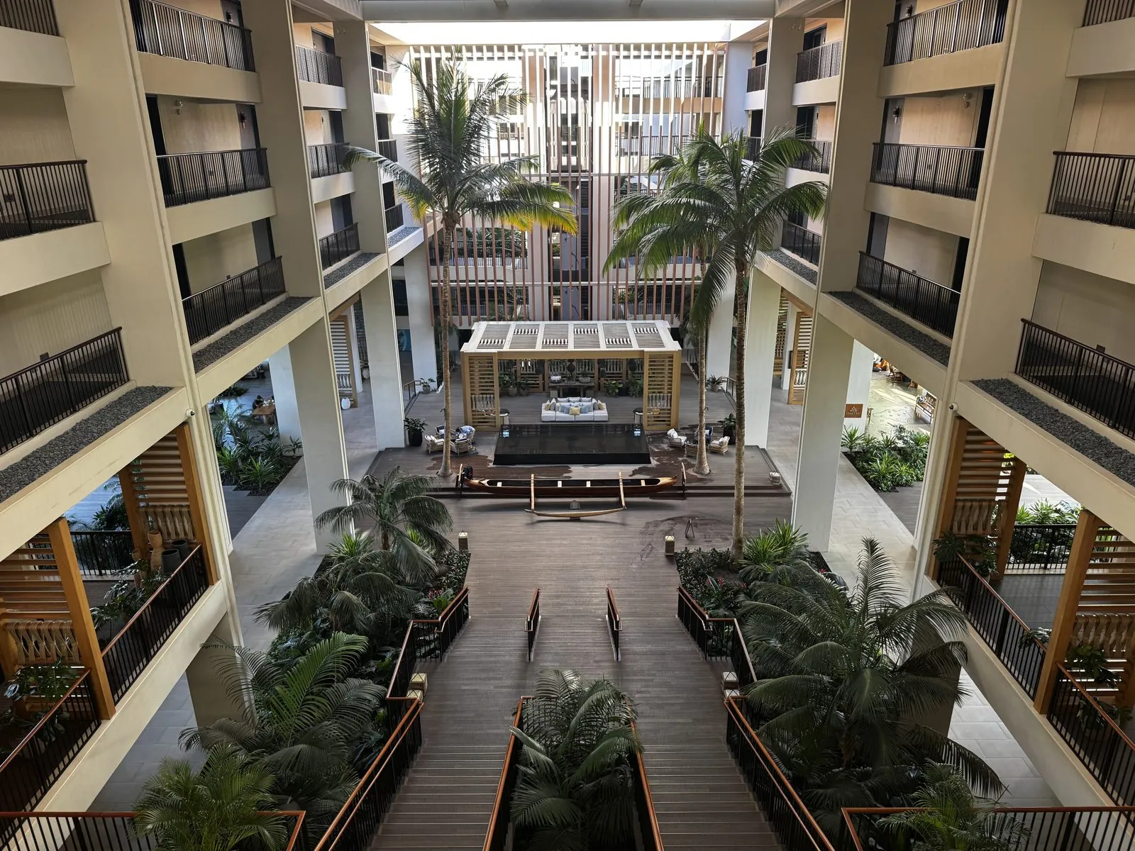
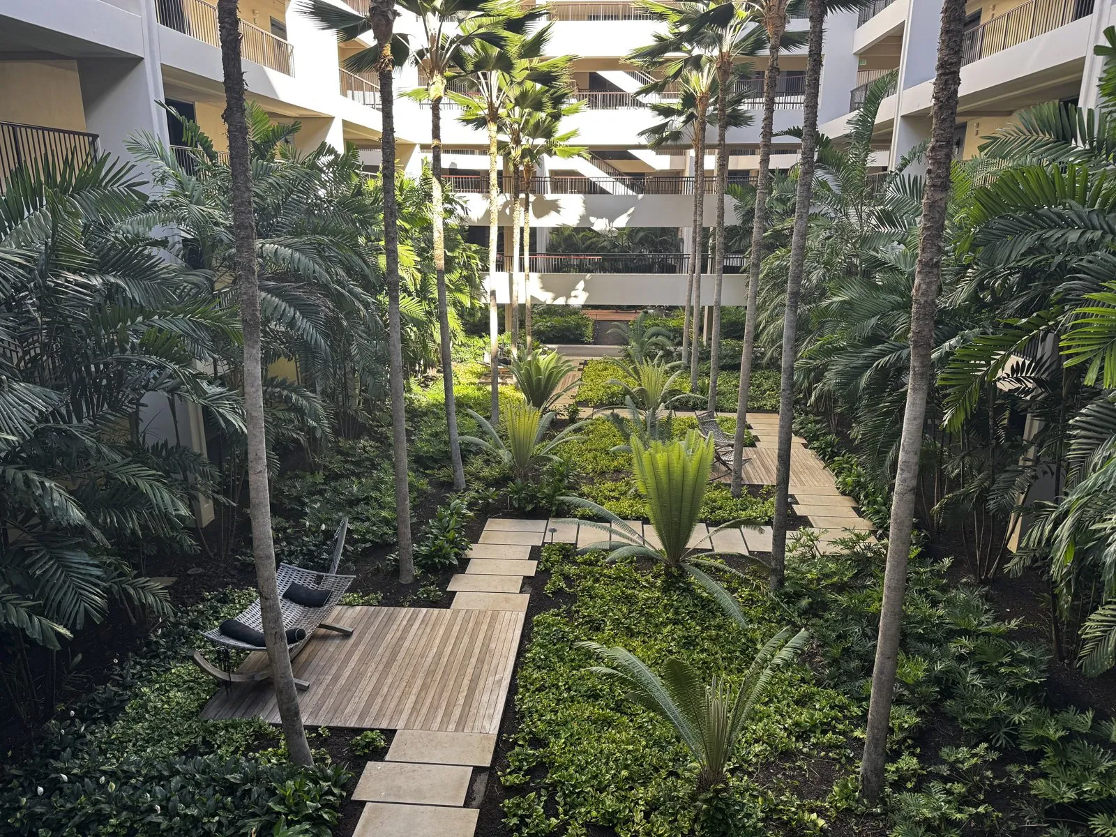
Down at the bottom, the garden is thick enough to get lost in for a minute, with stepping-stone paths between the palm trunks. Everything else is wood: slatted screens, lattice pavilions and dark plank floors, so the whole building feels shaded and open to the breeze.
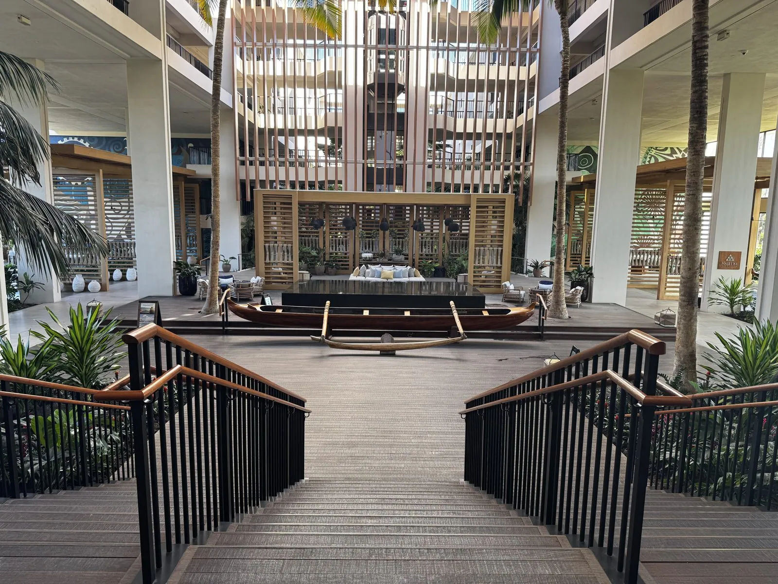
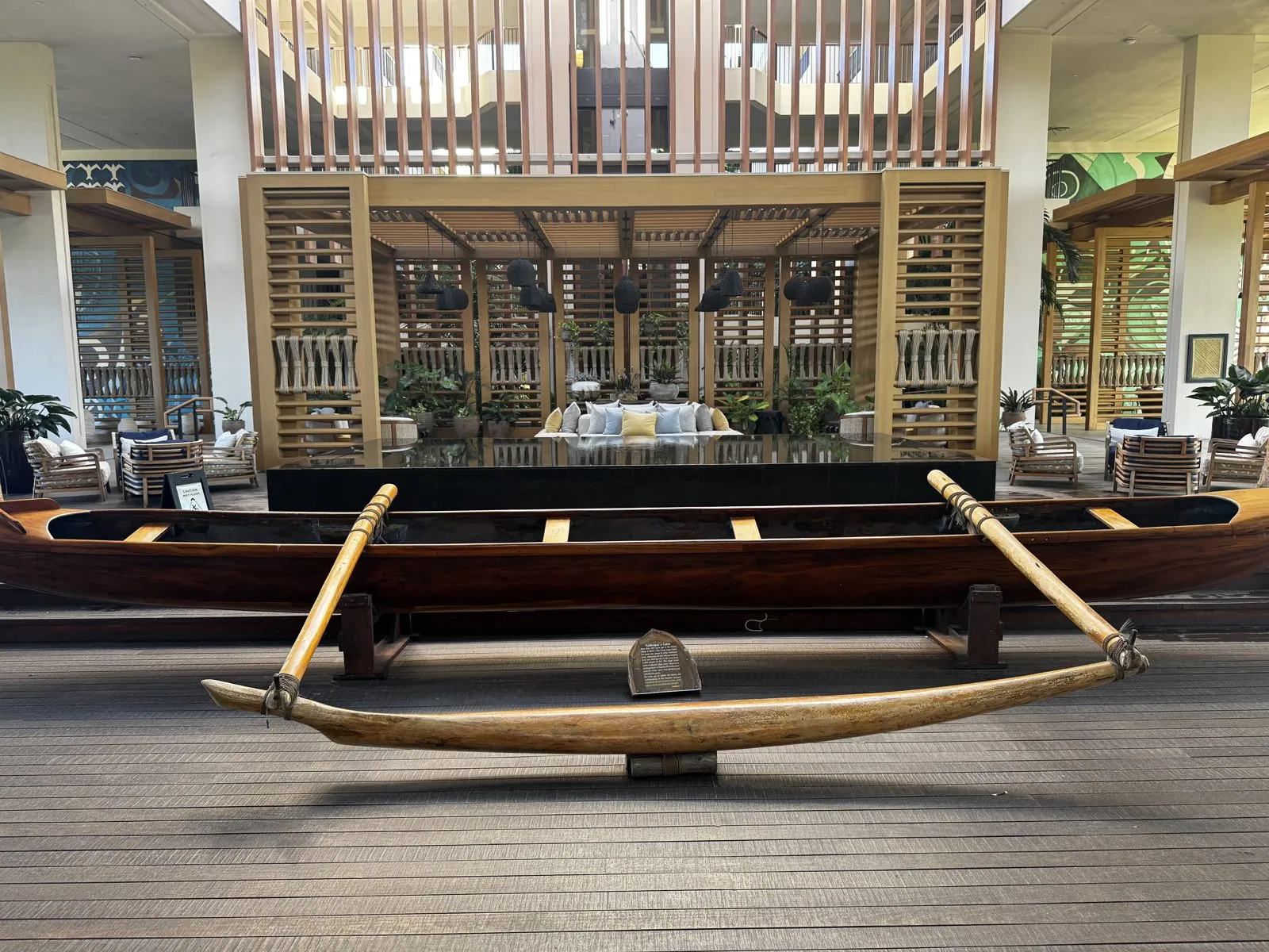
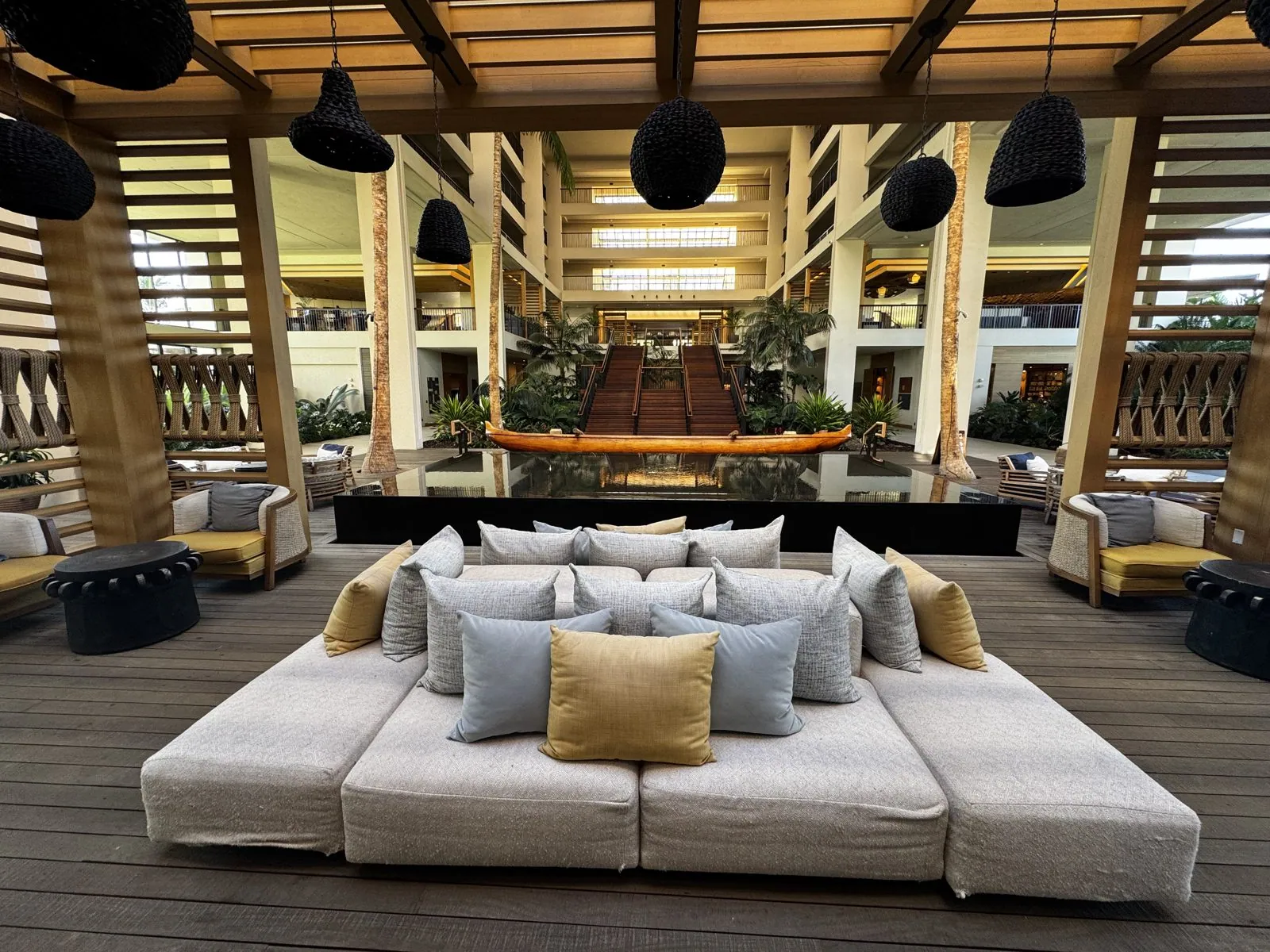
In the middle of the lobby sits an old outrigger canoe. Its plaque says it was carved from koa with traditional tools more than a hundred years ago, in the fishing village of Miloliʻi: an ʻōpelu canoe for four paddlers, 28 feet long, able to carry up to 2,000 pounds of fish. Behind it, under hanging woven lamps, are low sofas facing the garden. I liked the design very much, and I would happily recommend the place to anyone visiting this coast.
Morning on the shore
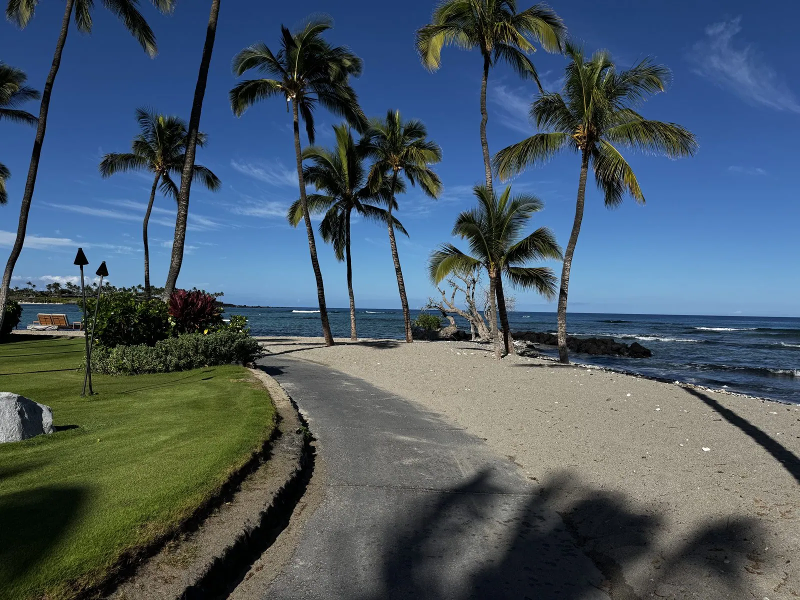
The morning was the clearest of the trip. The gray of the day before had gone, and at a quarter to nine the sky was a deep, saturated blue with a few puffy clouds, and the light was strong enough to make the palms throw sharp shadows across the paths. We walked the shoreline path along the beach, where lawns run down to a strip of sand and then black lava rock and the sea. Under Hawaiian law the shoreline is public, and paths like this one let anybody walk along it.
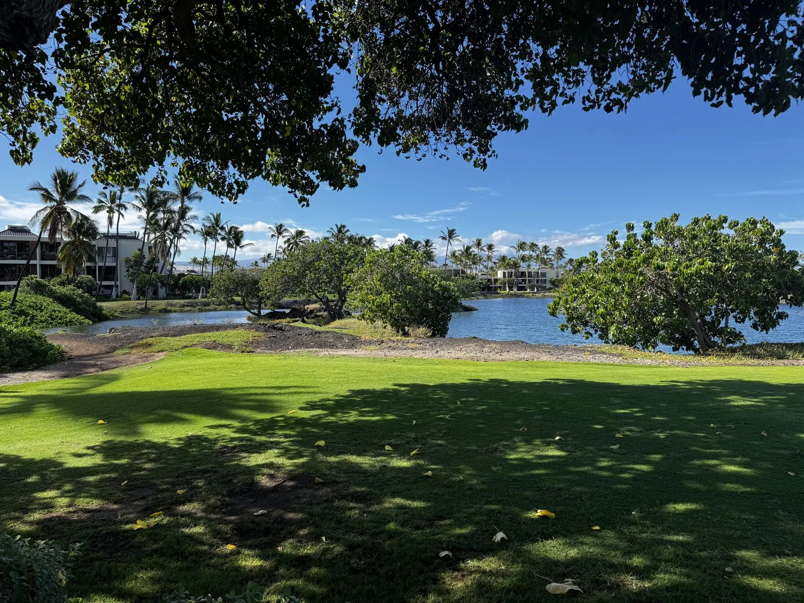
The fishponds of Kalahuipuaʻa
Just behind the shore is the reason to come to this stretch of coast: the Kalahuipuaʻa fishponds, a cluster of ancient Hawaiian fishponds now protected as a historic park with a walking trail. A bronze plaque at the edge of the largest pond, Na Loko Iʻa O Kalahuipuaʻa, shows the shape of the system: several ponds, some open and some enclosed, threaded through the lava a few steps from the ocean. They are still fed the way they always were, by fresh water seeping up through the porous lava from the mountains and mixing with seawater.
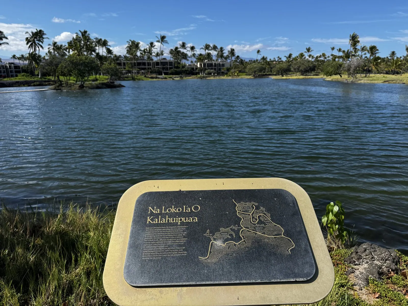
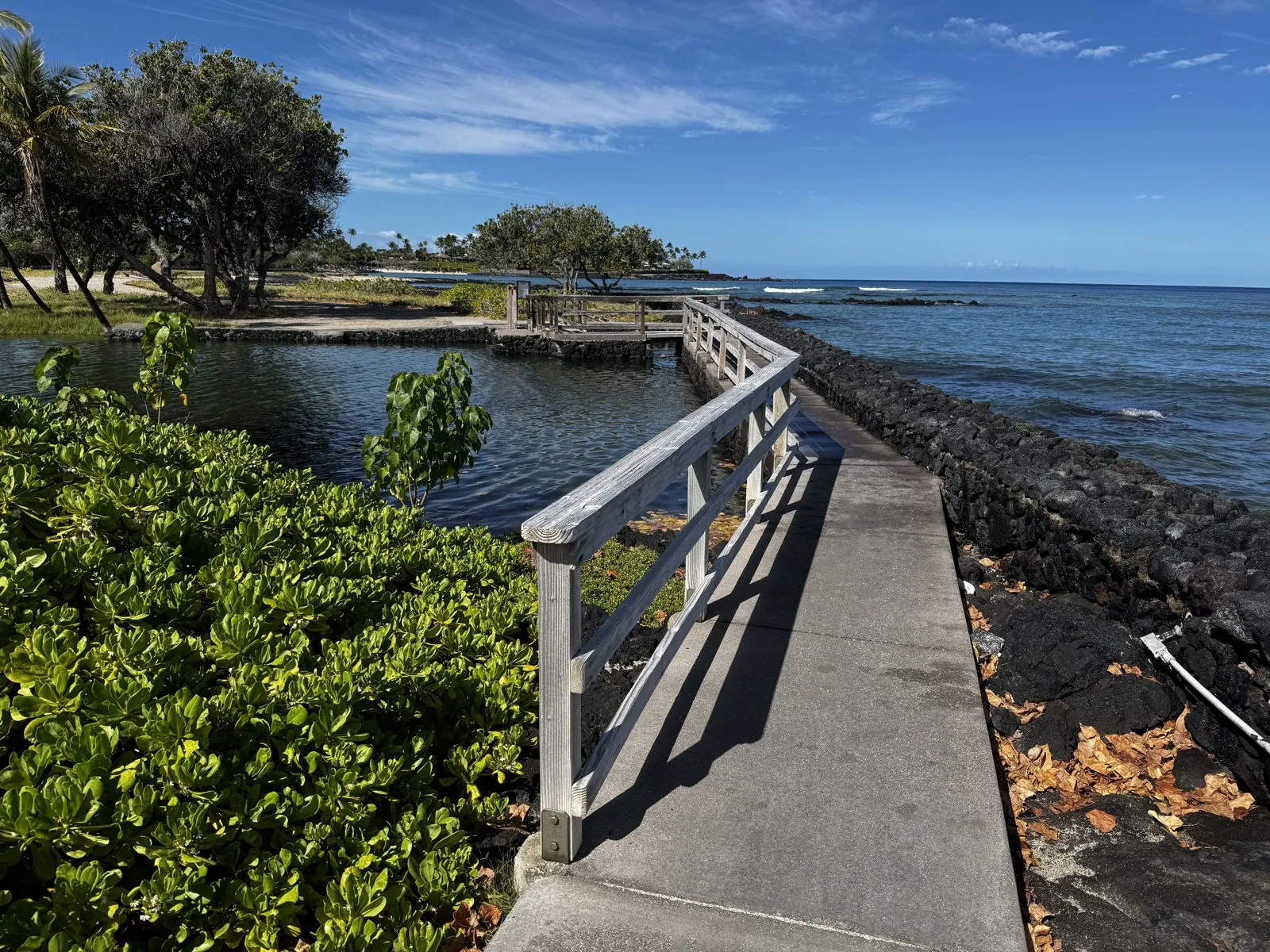
Hawaiian fishponds, loko iʻa, were one of the great engineering achievements of old Hawaiʻi: aquaculture practiced at scale centuries before Europeans arrived. The ponds were connected to the sea through mākāhā, sluice gates made of wooden slats. Young fish could swim in through the gaps, feed and grow in the rich brackish water, and then find themselves too big to swim back out. The ponds raised mullet and milkfish, and in Hawaiian tradition the best of the harvest went to the aliʻi, the chiefs. A boardwalk crosses the wall between one pond and the ocean, so you stand with still water on one side and surf on the other.
Further along, the trail passes a small A-frame hale with a thatched roof, set in a field of tall grass beside a shallow pond. Kalahuipuaʻa was once a fishing village, and the people who tended the ponds lived beside them in houses much like it. Around it, the grass grows straight out of the lava, and the shallow ponds hold perfect reflections of the palms and clouds.
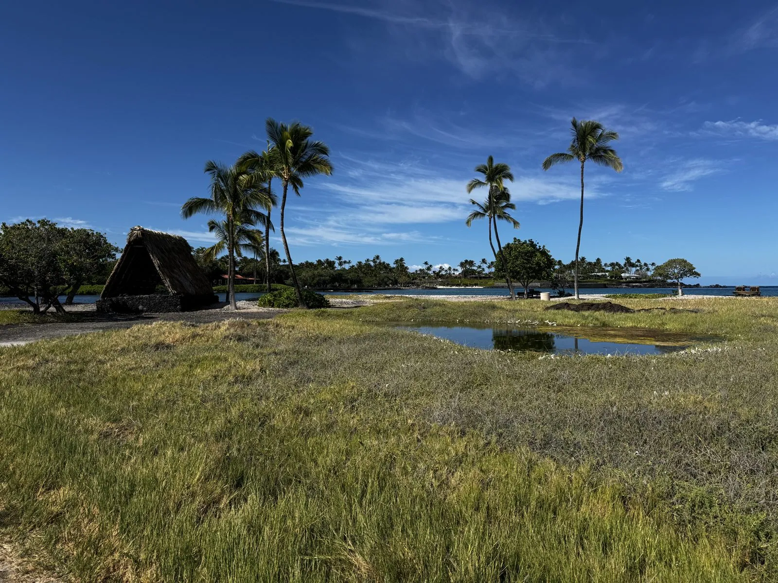
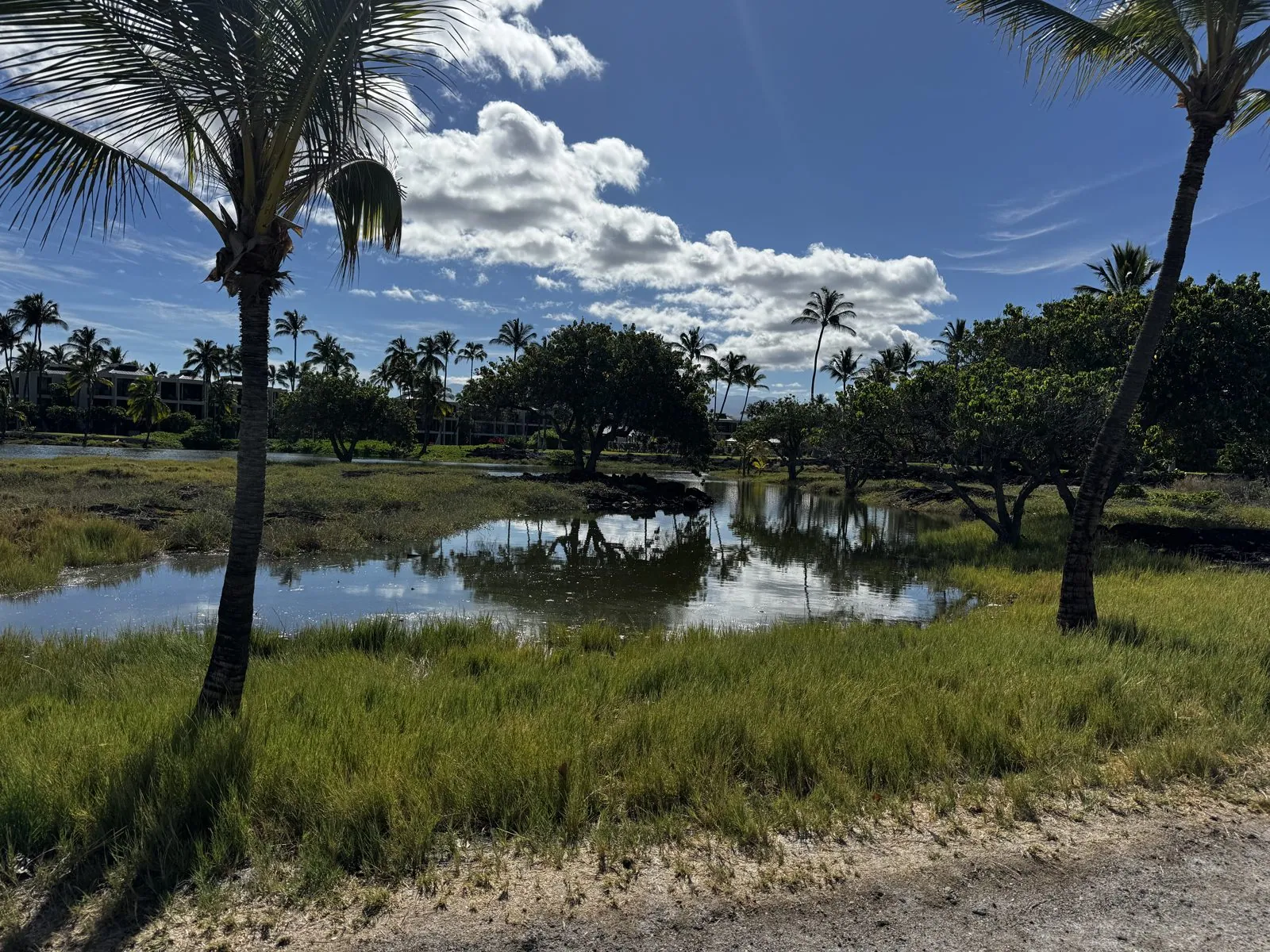
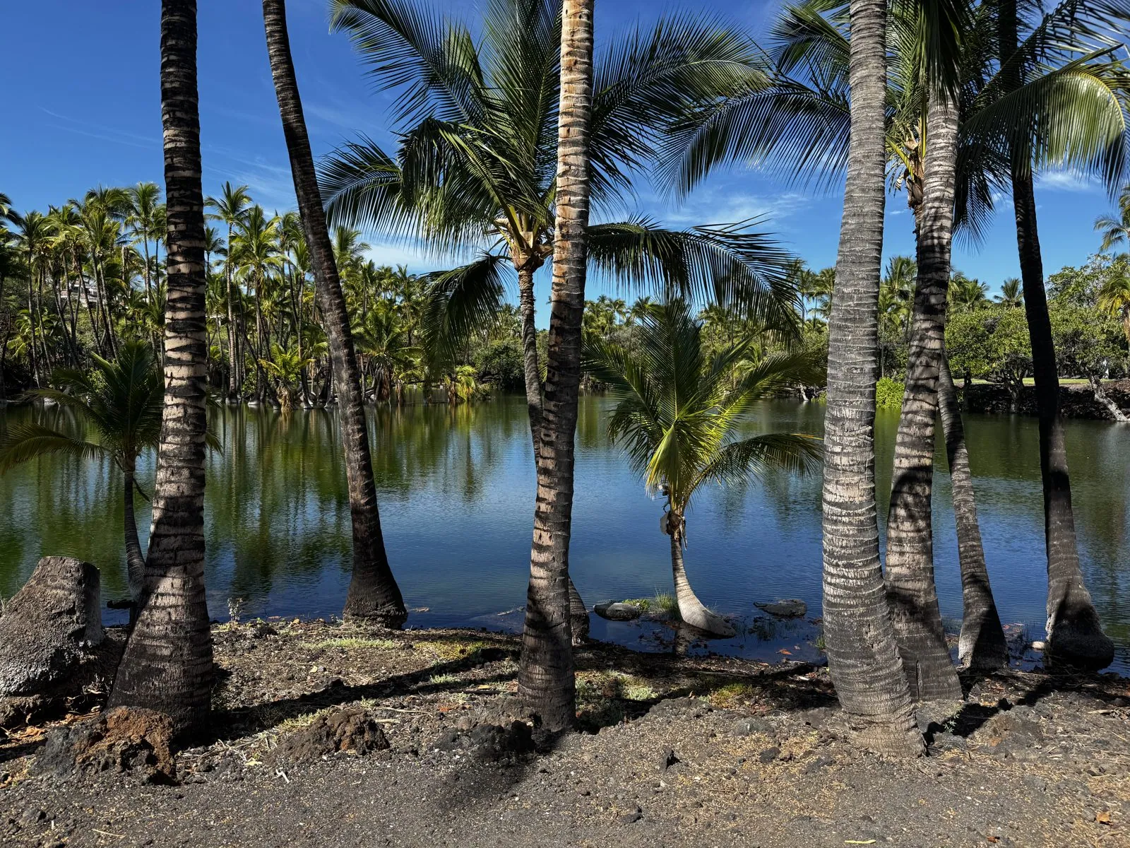
The ponds are ringed by black lava, and the contrast is the thing you remember. The water is calm and dark blue, the rock around it is rough and black, and the grass and palms are an almost fluorescent green. In one pond the lava edge breaks up into little bays and points, and the reflections of the white clouds sit in the water like floating islands. Some of the smaller ponds are so still they look like holes cut into the sky.
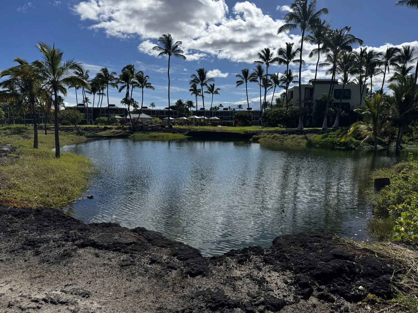
The path loops between the ponds under coconut palms, past the biggest pond, where a single palm has grown out sideways from the bank and lies almost flat over the water, its crown reaching up again at the end. A few white water birds stood in the shallows that morning. It is a strange and wonderful thing to find a place like this a few minutes' walk from the resort lawns: a working landscape from centuries ago, still holding water, still holding fish.
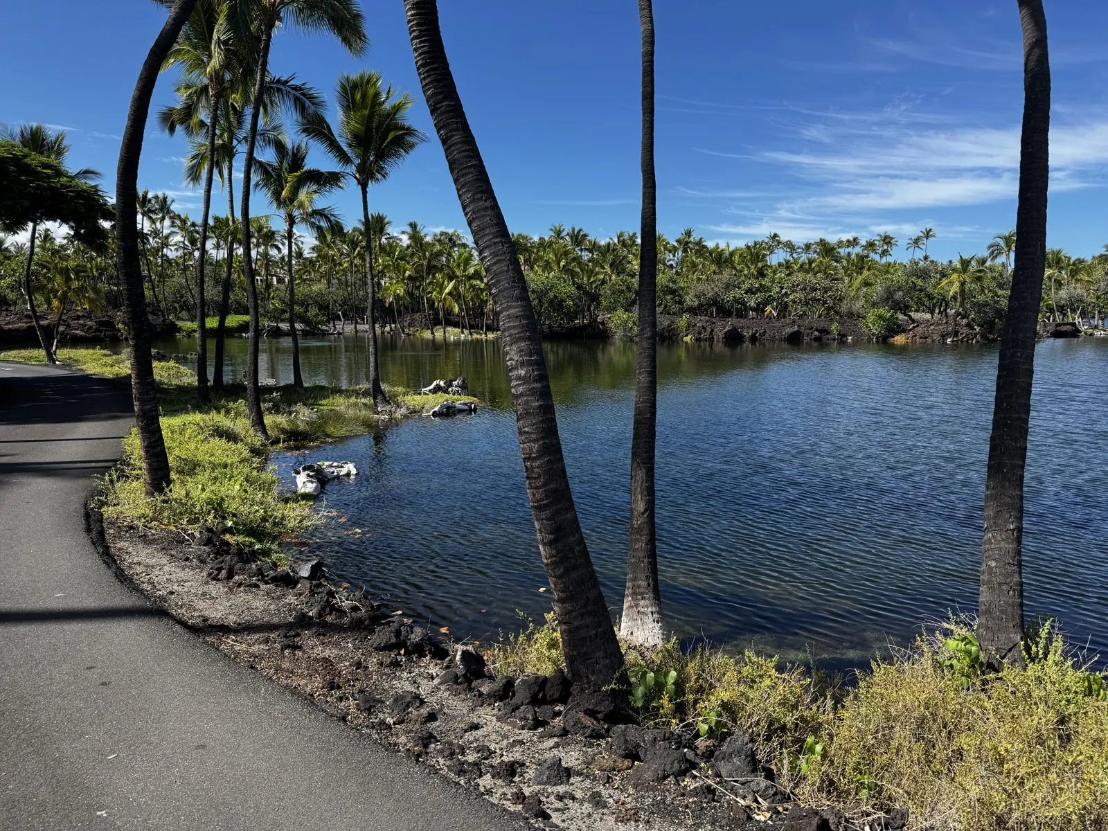
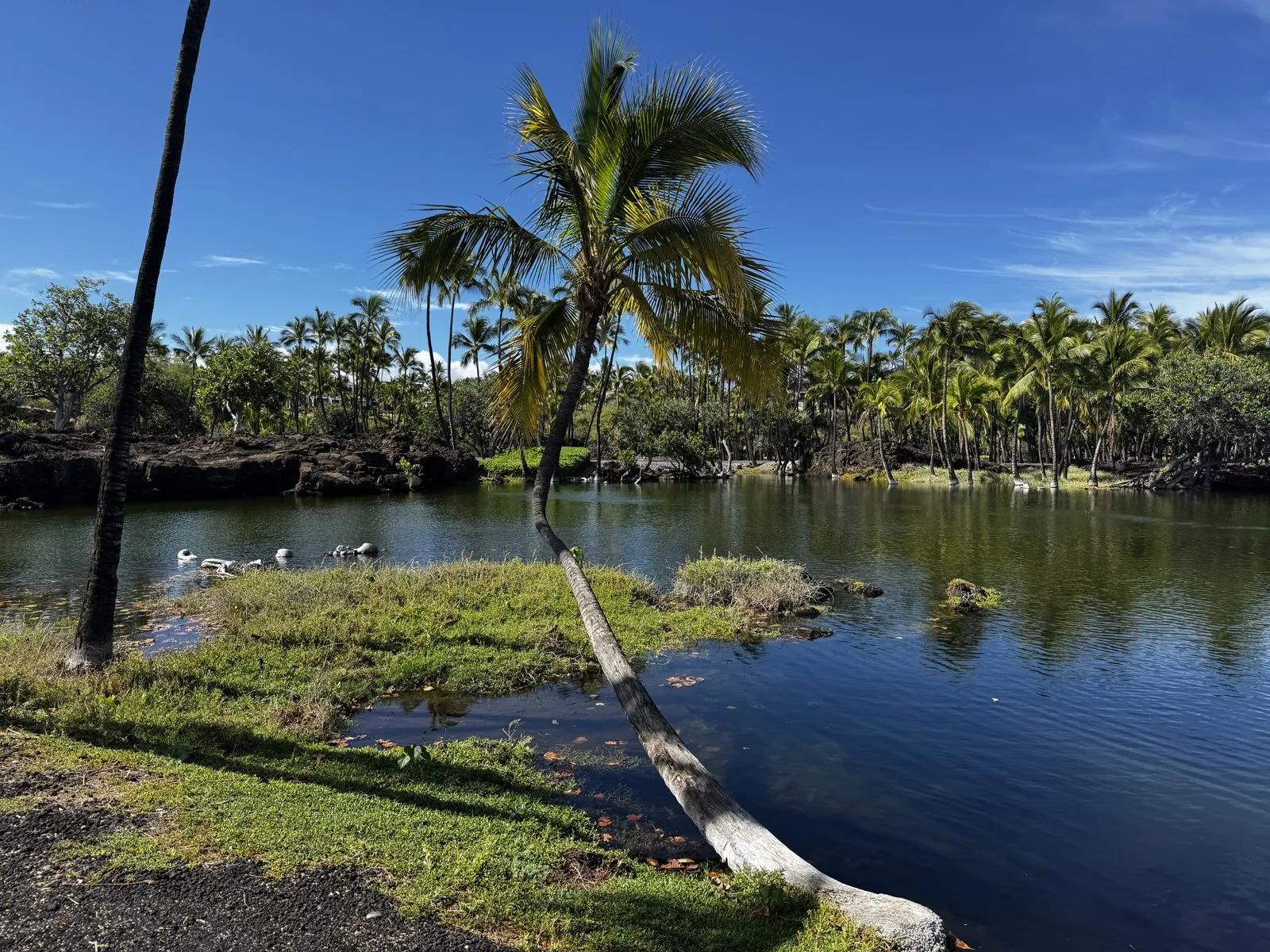
By a quarter to ten we were at the far end of the trail, where a grove of palms stands right at the water's edge on a bank of black rock. The trunks lean in every direction, and the pond behind them is so still that the grove appears twice. Then we walked back, had a picnic lunch of rotisserie chicken from a grocery store, and got ready for the long drive.
To the volcano
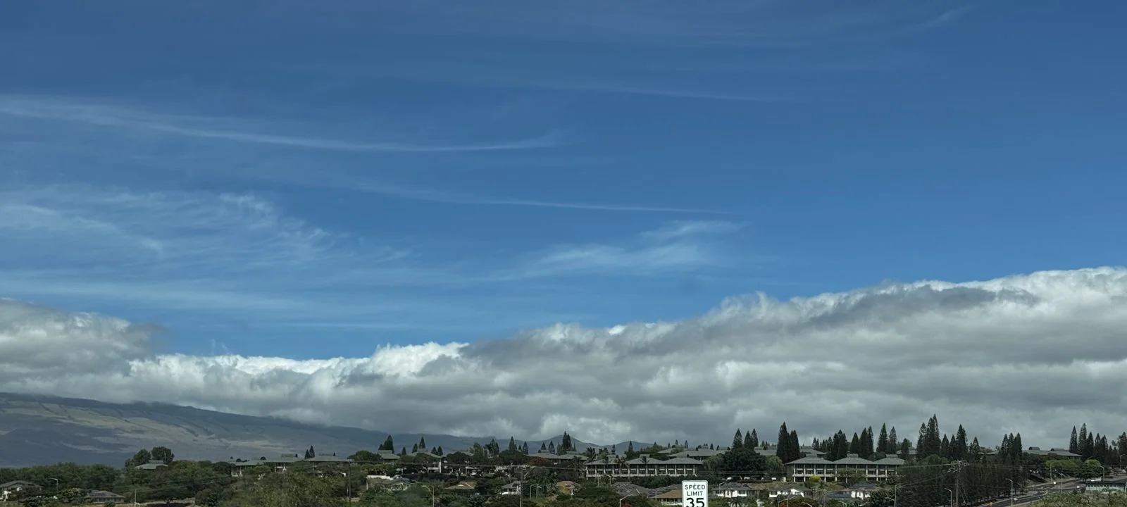
At two we were back on Waikoloa Road, climbing inland. Mauna Kea was ahead of us, its upper slopes hidden by a long, flat band of cloud, the usual afternoon cloud cap, like a scarf around its neck. The route to the volcano runs across the Saddle again and then down the windward side and south, through Hilo and up into the rainforest around Kīlauea. It took us about two hours, from sun and lava to mist and ferns.
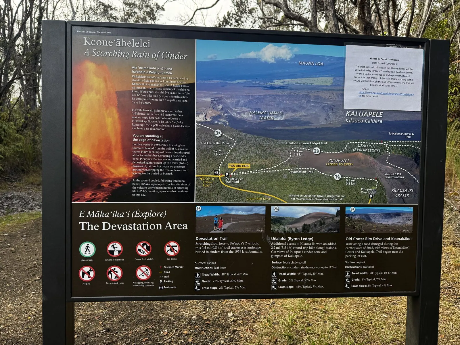
We reached Hawaiʻi Volcanoes National Park at a quarter to four, at the trailhead for the Devastation Trail. The sign at the start tells the story in its title: Keoneʻāhelelei, "a scorching rain of cinder". In 1959, the crater next door, Kīlauea Iki, erupted, and its lava fountains shot up to about 1,900 feet, the highest ever measured in Hawaiʻi. The wind carried the falling cinder and pumice southwest, and it buried the forest here under a blanket of black, killing the trees and leaving a field of bare trunks sticking out of the cinders.
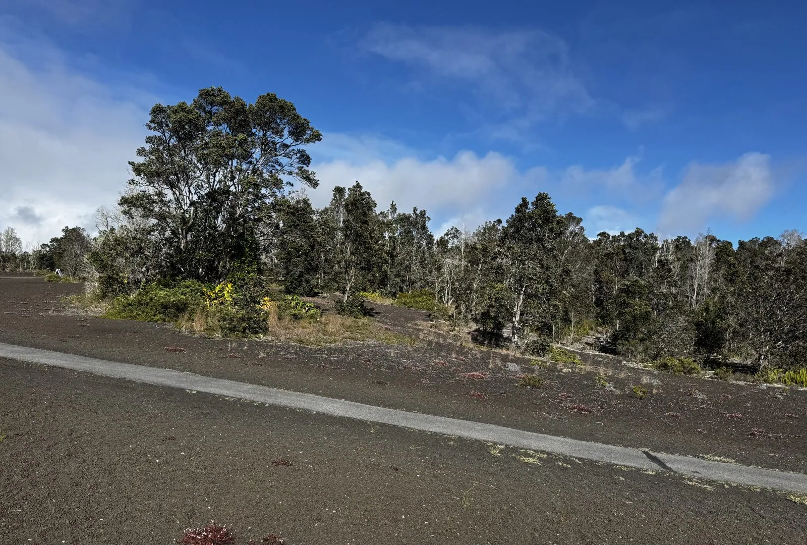
Sixty-six years later, the forest is coming back. The trail is a paved path across a field of dark cinder, and the edges are already green: ʻōhiʻa trees, the hardy native tree that is usually the first to colonize new lava, shrubs and ferns, with the bleached trunks of the old dead forest still standing among them. Red-tipped seedlings poke up through the cinder. It is the most literal walk through ecological succession you will ever take, with a clear before and after.
Kīlauea Iki
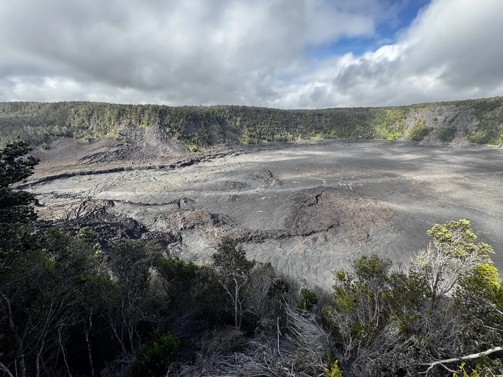
Then the trees opened, and there was Kīlauea Iki, "little Kīlauea", the pit crater just east of the main caldera. It is about a mile long and four hundred feet deep, with steep walls covered in rainforest, and a flat gray floor. That floor is the top of the lava lake that filled the crater in 1959. Lava from the fountain poured into the crater and pooled, more than four hundred feet deep, and it took decades for the lake to cool and solidify all the way through.
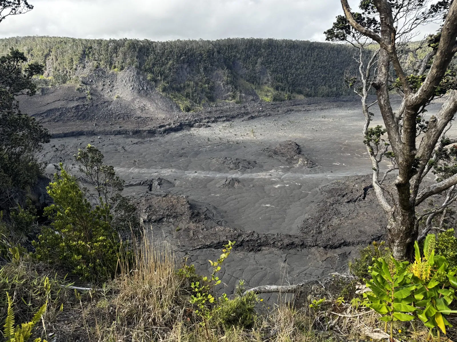
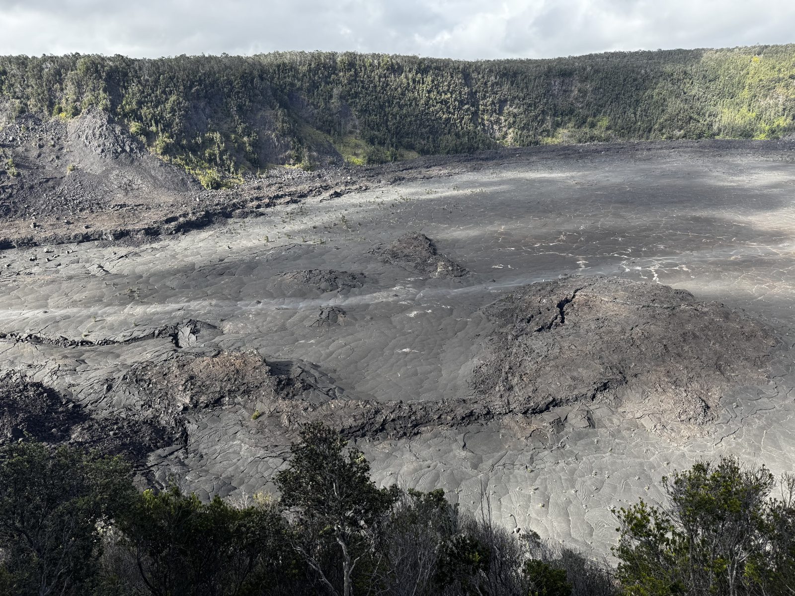
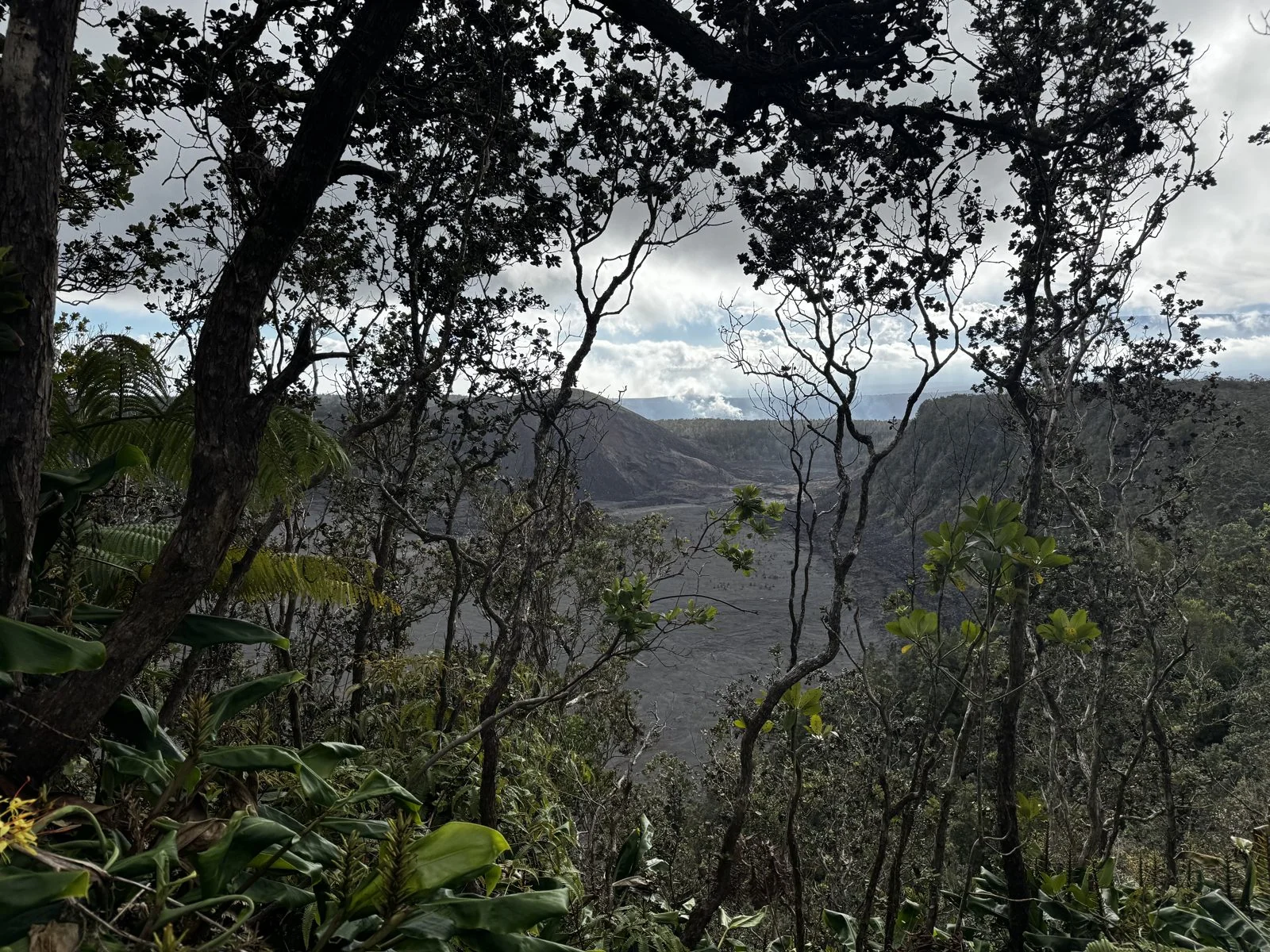
From the rim you can see how it set. The surface is cracked into plates and ridged where the crust buckled as it cooled and the lake beneath it drained and shifted. A long, faint line across it marks the trail that crosses the floor. The walls around it are completely green, ʻōhiʻa and tree ferns all the way down. The contrast, living forest around a gray floor of rock that was liquid within living memory, is like nothing else.
The clouds were moving fast over the crater that afternoon, and their shadows slid across the floor, so the gray lava kept changing from silver to charcoal. From the rim it looked enormous and absolutely silent. We walked on along the Crater Rim Trail through the forest to the Steam Vents, where groundwater seeping down onto hot rock rises again as steam from cracks in the ground.
Of the volcano's famous glow there was little to none that day, just smoke and vog drifting over the caldera.
By half past four we were back at the car, because we had another appointment. The sun sets at around half past six in mid-September, and Mauna Kea was the better part of two hours away.
Sunset above the clouds
We made it with almost no time to spare. At 6:16 we were at the Mauna Kea Visitor Information Station, the Onizuka Center, at about 9,200 feet on the mountain's south slope. This was as high as we went: the summit was closed that day, and our 2WD rental car wasn't allowed above the Visitor Station anyway, since the summit road requires four-wheel drive. Below us, filling the whole western horizon, was the cloud layer, the same clouds that had capped the mountain in the afternoon, now seen from above, flat and white like a frozen sea. The sky above was clear. The sun was going down behind it in a band of gold.
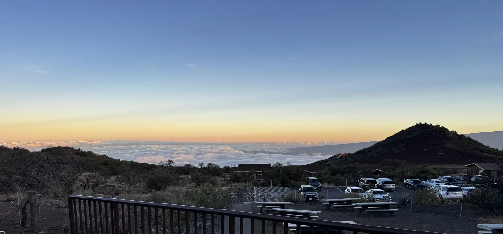
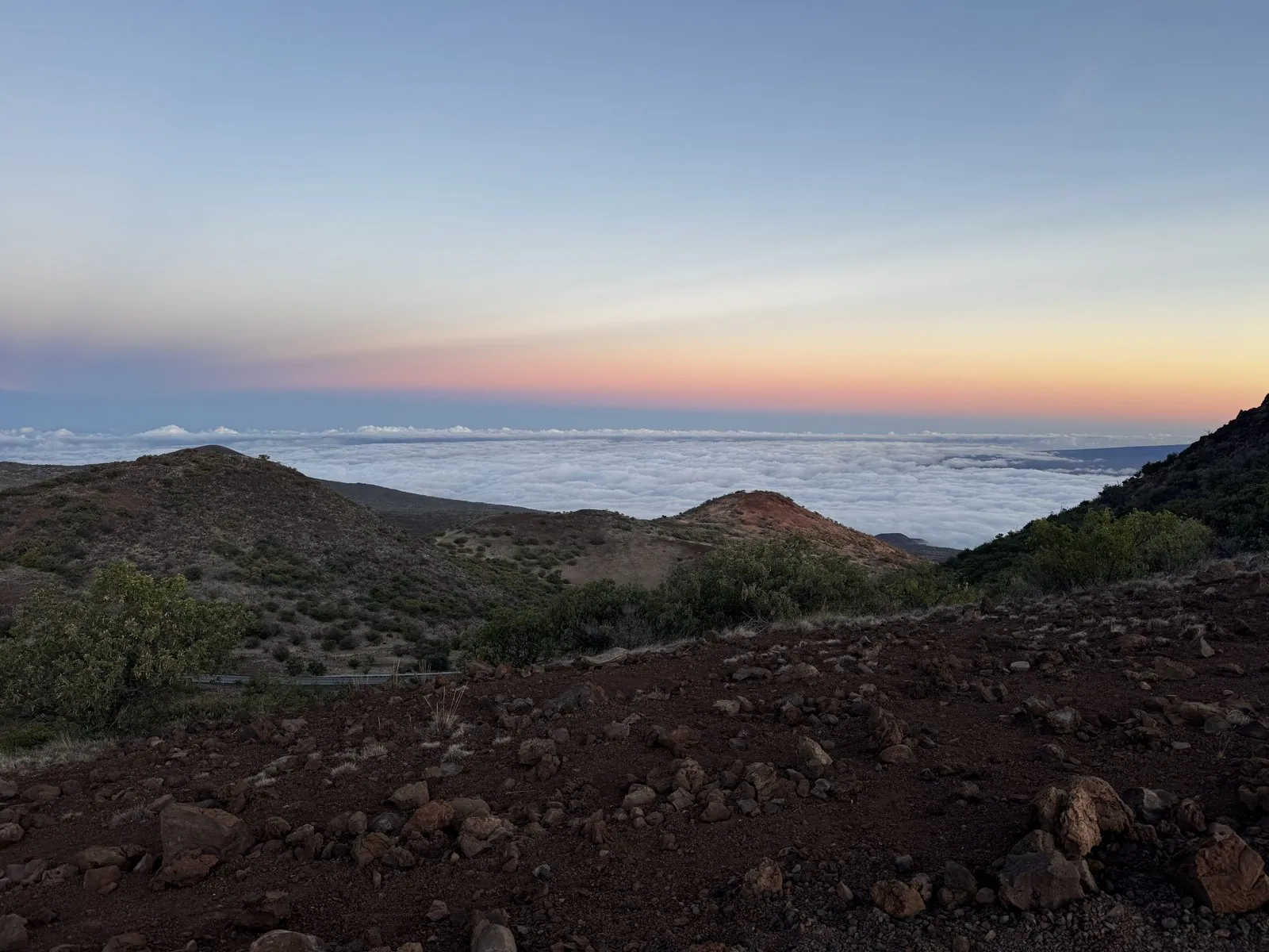
Mauna Kea deserves to be introduced properly. Measured from its base on the sea floor, it is the tallest mountain on Earth, more than 33,000 feet, though only 13,803 of them stand above the sea. To Native Hawaiians it is far more than a mountain. It is sacred, a place where the sky father Wākea and the earth mother Papahānaumoku meet, the home of the snow goddess Poliʻahu, and a burial place for honored ancestors. Its summit is also home to some of the world's great telescopes, and the long and painful dispute over building more of them is part of the mountain's story too. Visitors are asked to come with respect, and it is easy to see why.
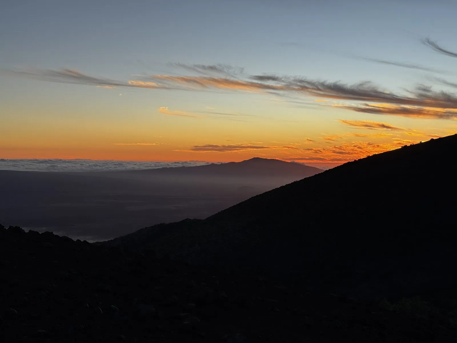
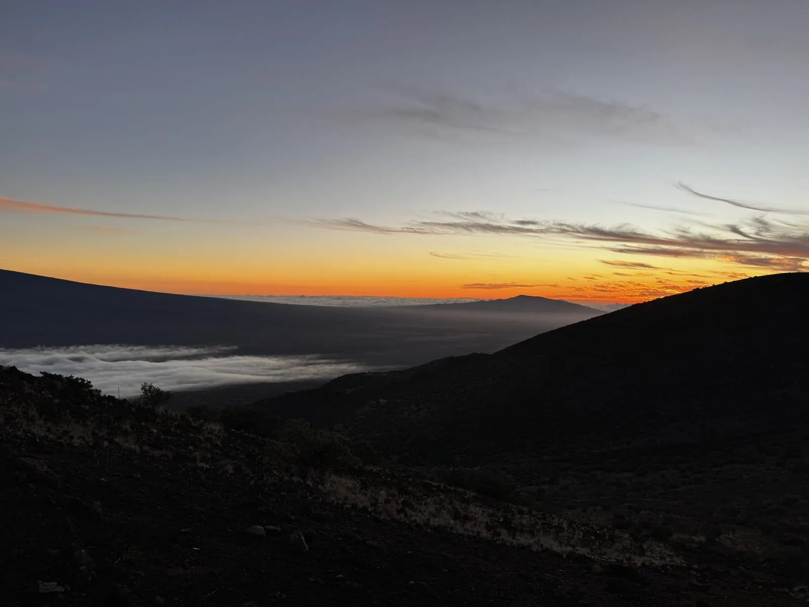
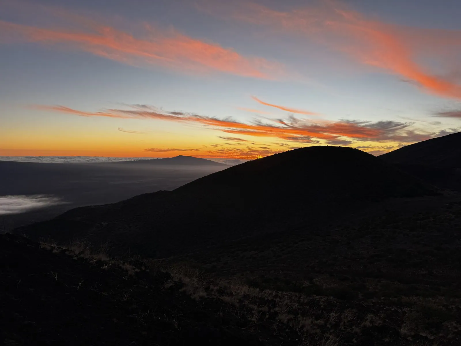
Next to the station is a small cinder cone, Puʻukalepeamoa, with a trail up to an overlook, and as the sun went down it filled with people watching. To the west, the sun sank behind the long, low silhouette of Hualālai on the far side of the island, and the sky lit up in layers: deep orange at the horizon, then gold, then pale blue, with thin streaks of cloud catching fire overhead. Below, the cloud sea turned from white to gray.
Turning around is just as good. Behind the overlook, the mountain rises in slopes of red and brown cinder, dotted with little cones, each one a vent from an old eruption. In the last light the reds deepened, and the access road wound up the slope toward the summit, a thin gray line we would not be driving. The color of those slopes is the color of the iron in the cinder, oxidized to rust.
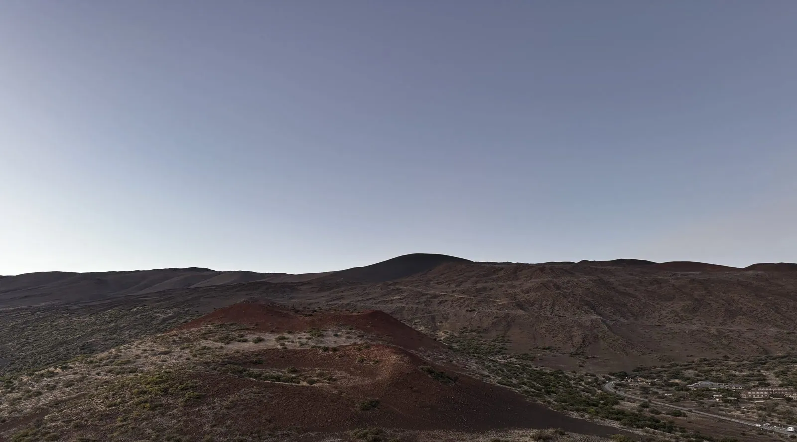
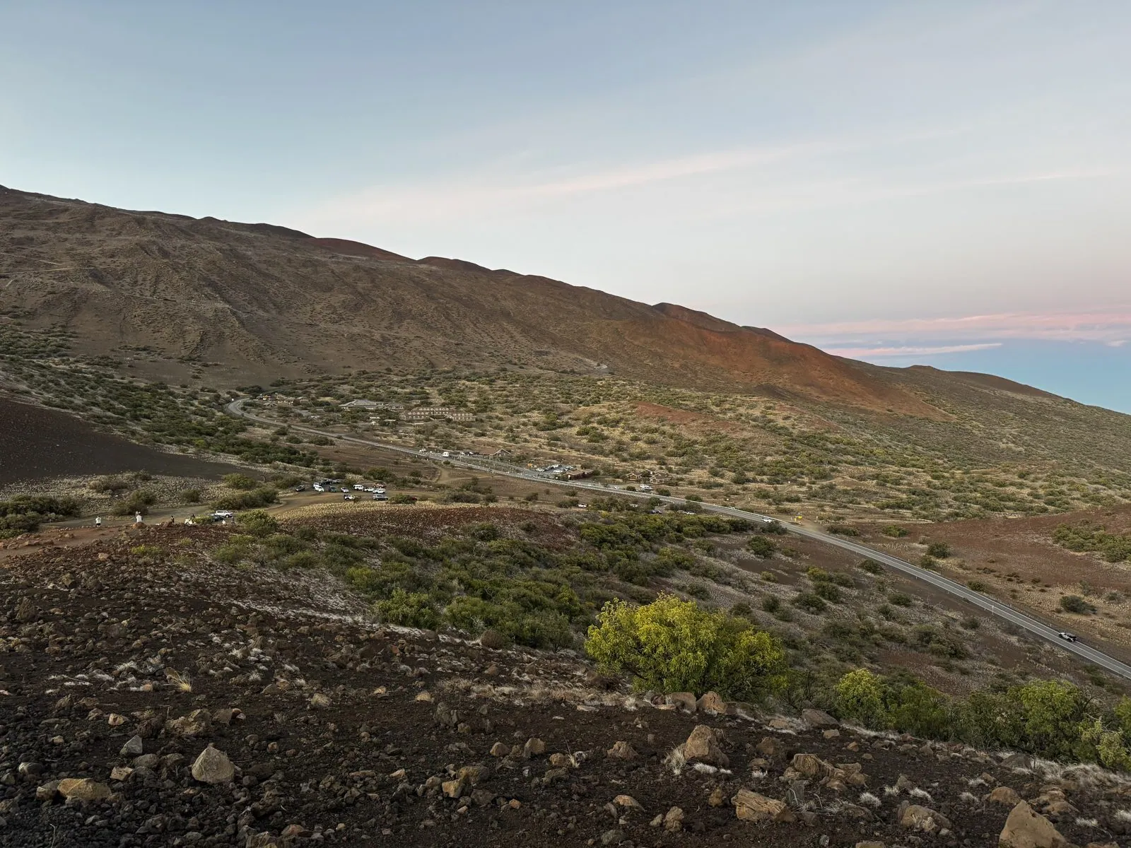
And then, at 6:34, the sky gave one last show. The high streaks of cloud, which had been gold, went a vivid salmon pink, all at once, as if somebody had turned up the saturation. The cone in front of us was black against them, and the cloud sea below was in shadow. It lasted about three minutes. Then the color drained out of the sky. At this altitude the temperature falls fast once the sun is gone, and night comes quickly in the tropics.
The Milky Way
We waited for the dark. Mauna Kea is one of the best places on the planet to look at the sky, which is why the observatories are here. Its summit stands above about forty percent of the atmosphere and most of its water vapor, the clouds form a lid below that blocks the lights of the towns, and the county has rules to keep outdoor lighting on the island dim and amber for the astronomers' sake. By 7:24 the stars were out, and by half past seven the Milky Way was arching straight overhead.
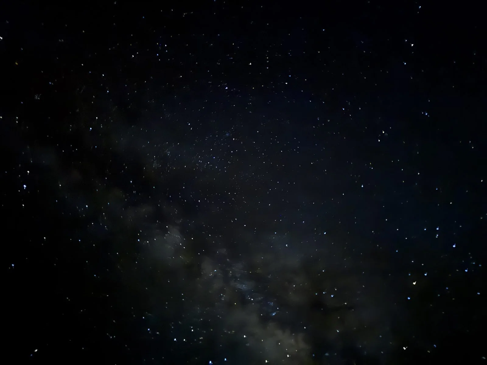
If you have only seen the Milky Way from a city, it is hard to describe the real thing. It isn't faint. It is a great pale river of light across the whole sky, lumpy and uneven, with dark lanes of dust running down its middle like a split in the current. There are so many stars around it that the familiar constellations are hard to find, lost in the crowd. In September the brightest part, toward the center of the galaxy in Sagittarius, is still up in the south after dark.
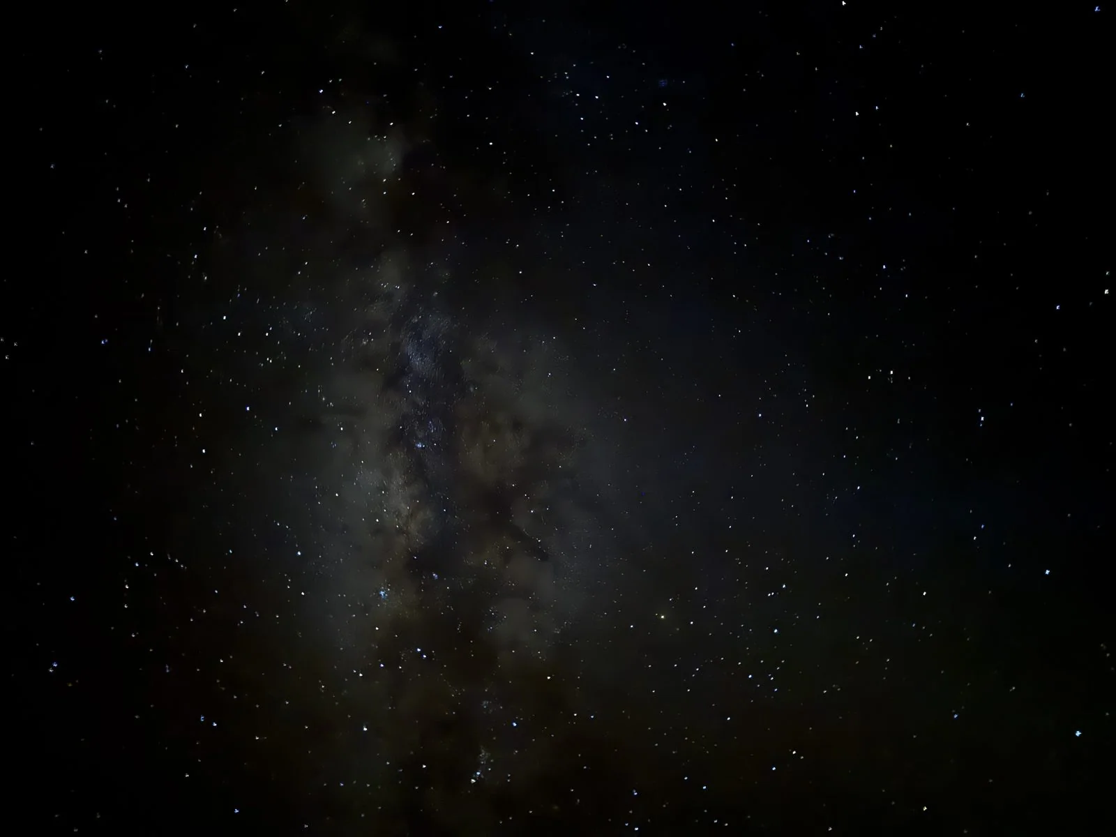
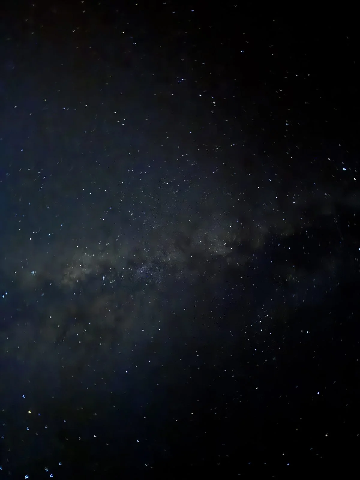
These were all taken with a phone, held up to the sky in night mode, which is a small miracle in itself. The camera roll holds about thirty of them in twenty-five minutes, from 7:24 to 7:49, each one a long exposure and each one slightly different, as if taking enough of them might somehow capture the whole thing. None of them does, of course. But they are a decent record of the moment, and of how dark the sky gets at 9,200 feet above the Pacific.
Then it was time to go. The drive down the mountain in the dark is slow, low gears and no lights except your own, and then it is the long road back across the Saddle and down to the coast. We pulled into Waikoloa just after nine, about twelve hours after the morning walk at the fishponds. Sea level, a crater, the clouds from above and the galaxy overhead, all in one day. The last night was in a Hilton Grand Vacations condo in Waikoloa.
Day 4: Kona, and home
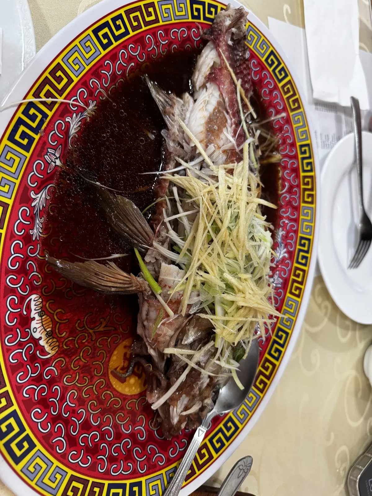
Sunday was for going home, slowly. There was one more lunch in Kailua-Kona, at a Chinese restaurant: a whole steamed fish under a pile of slivered ginger and scallion in soy sauce, on a red-and-gold plate. After three days of fried fish, grilled shrimp and pineapple boats, it was the perfect quiet ending. By two we were at the airport.
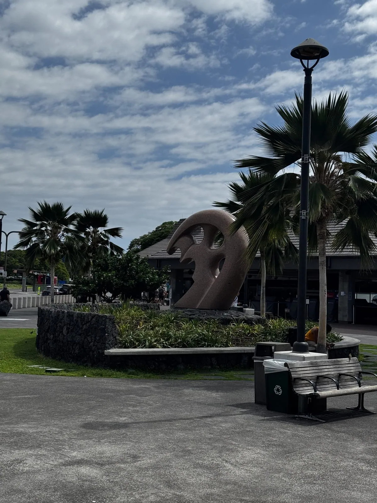
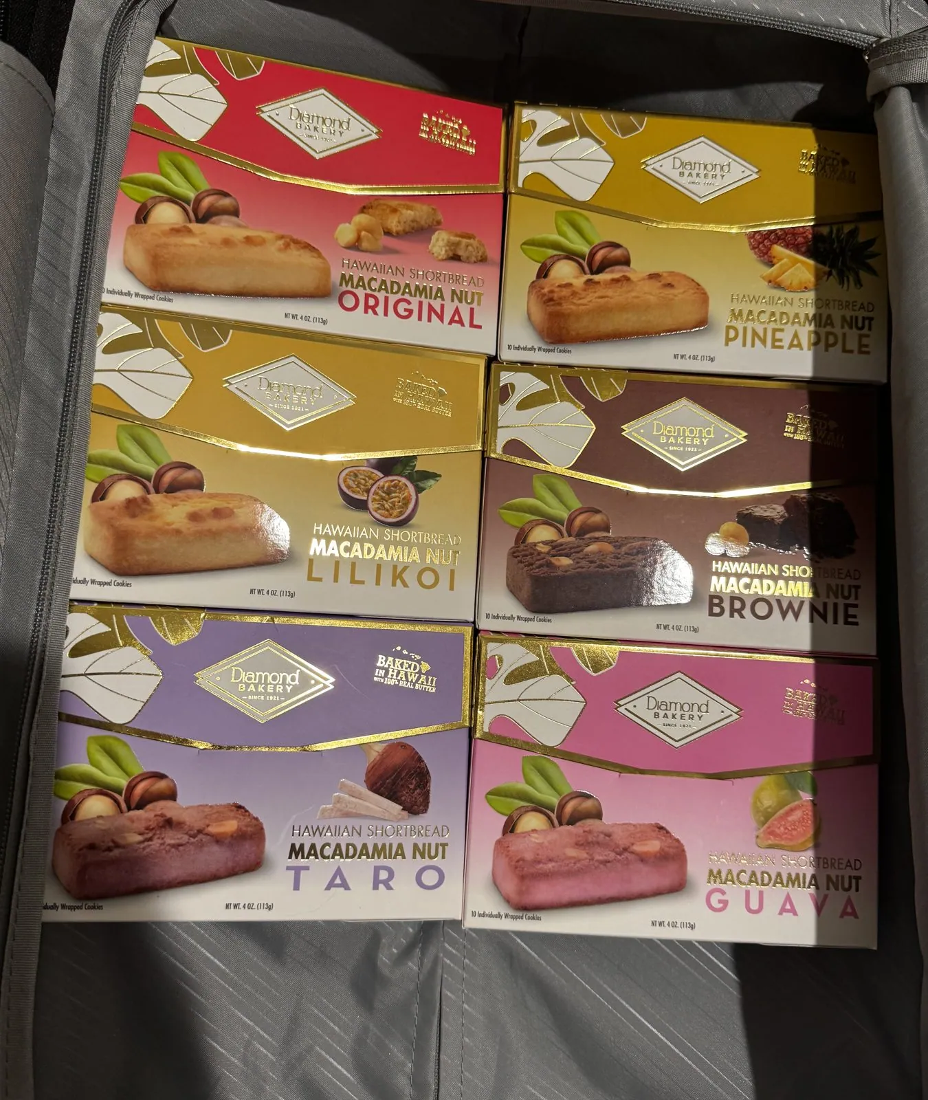
The Kona airport is as good to leave as it is to arrive at. You wait outside, more or less, among palms and lawns and lava-stone walls, and the last thing we photographed on the island was a big curling sculpture by the departure area, shaped like a breaking wave. We flew out that afternoon and were home well after midnight. The souvenirs came out of the suitcase at three in the morning: six boxes of Hawaiian macadamia shortbread, in original, pineapple, lilikoʻi, brownie, taro and guava.
Looking back
Four days is not enough for the Big Island. It is an island of five volcanoes and, by the usual count, most of the world's climate zones, and we spent most of our time driving between them. But the driving was part of it. Crossing the Saddle twice in two days, you see the whole island in cross-section: the lava coast, the high grassland, the rainforest, and back again. And Saturday was the kind of day you only get on an island like this, one that moves from ancient fishponds to a frozen lava lake to a sacred mountain above the clouds before dinner.
A short trip forces choices. A year later I came back, for longer, and saw Kīlauea glowing red at night; that trip is here. But this first visit left its own set of pictures: a gray crater floor through ʻōhiʻa branches, a stripe of orange above a sea of clouds, and the Milky Way overhead.
Maps built from the trip's photo timestamps and locations. Photo locations have been removed from the published images. Day maps: map data © OpenStreetMap contributors; each stop is placed where its photo was taken, hotels and home are never marked (overnight stops are shown only as the name of the area), and the dashed lines show the order of stops, not the exact roads.
Likes and comments
React with an emoji or leave a comment. Signing in with GitHub is required.