← Misc · July 2026
Fireworks for the 250th
Independence weekend on the East Coast, celebrating the US's 250th birthday in Philadelphia and D.C.
Philadelphia → Washington, D.C. → Baltimore → Wilmington → Philadelphia
Pennsylvania, D.C., Maryland, Delaware and two brief visits to New Jersey · one fireworks show over the Potomac · one harbor seen from 27 floors up · two cheesesteaks, one at each end · three fridge magnets, none from New Jersey
The way home: one line of thunderstorms, a six-hour delay, a missed connection, and seven states in one day (Maryland → Delaware → New Jersey → Pennsylvania → Illinois → Arizona → California)
On July 4th, 1776, a room full of delegates in Philadelphia adopted the Declaration of Independence. On July 4th, 2026, the country turned two hundred and fifty, and it seemed like the kind of birthday you should show up for in person. So a friend and I spent the long weekend on the East Coast, in the two cities that have the best claim to the occasion: Philadelphia, where it was signed, and Washington, where the country puts on its biggest show for it.
As with the other trips on this page, the maps and times below come from the camera roll. It is a short trip and a short roll, a few dozen photos over four days, and whole afternoons went unphotographed. What the camera did record, in great detail, is two things: one night of fireworks over the Potomac, and one hour above Baltimore's Inner Harbor.
Philadelphia
The trip started with an overnight flight from California, landing at PHL on the morning of Friday, July 3rd. I arrived with a migraine, which is not the ideal way to meet a city, so the first stop was not a landmark. I picked up a rental car, drove to a quiet spot by a bridge, and sat there until the headache let go.
Once it did, I crossed the bridge into New Jersey on a small mission. On every trip I try to bring home a fridge magnet (the 2024 road trip covered most of a fridge door with them), and New Jersey, just across the Delaware River, looked like an easy one to collect. It was not. I came back to Philadelphia empty-handed, and New Jersey remains, magnetically speaking, unvisited.
The rest of the afternoon was quieter: a bookstore, a chair and a laptop, which is a perfectly good way to spend a few hours in a city while you wait for someone. In the evening I drove to 30th Street Station, Philadelphia's grand 1930s rail station with its rows of giant stone columns, to pick up a friend coming in by train. From here on, "we" is the two of us.
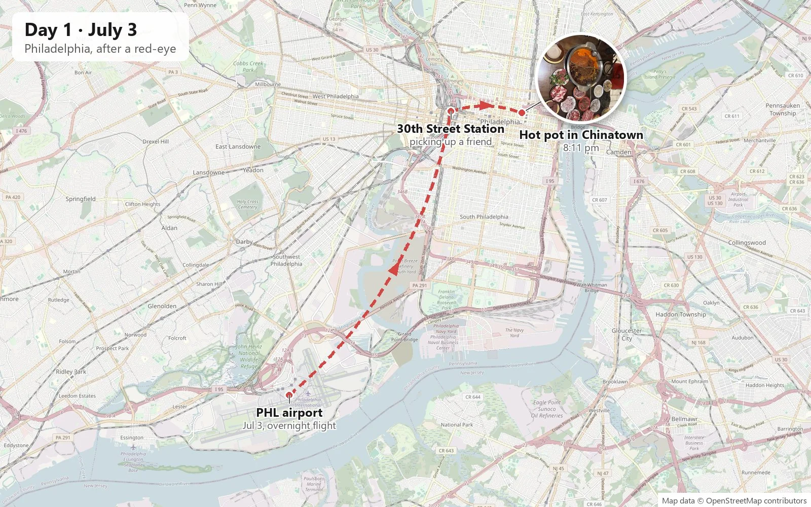
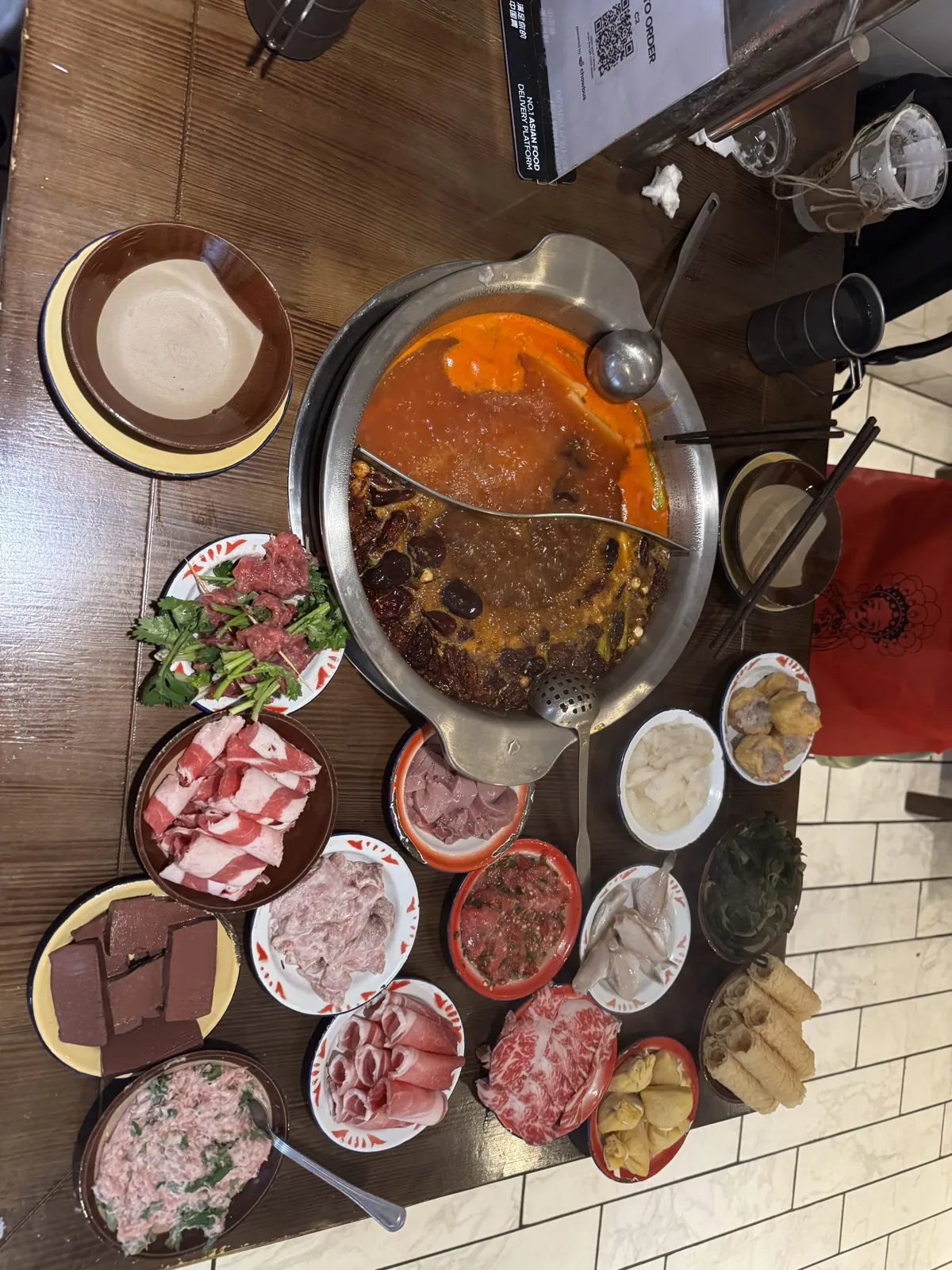
Dinner was in Philadelphia's Chinatown, a compact grid of restaurants and bakeries a few blocks north of City Hall and the convention center.
Hot pot in Chinatown
It was hot pot, the do-it-yourself Chinese meal where a pot of broth simmers in the middle of the table and everyone cooks their own food in it. Ours was the classic split pot: one side a deep red Sichuan broth, slick with chili oil and studded with dried peppers, the other side mild. Around it, the table disappeared under small plates: curls of thinly sliced beef and lamb, marbled pink and white; a plate of greens; slabs of something dark and wobbly; and a basket of fried golden rolls for dipping. The point of hot pot is that it is slow. You drop a slice of meat in, wait ten seconds, fish it out, and do it again, for an hour or two. It is a meal built for conversation, and the heat of the broth on a July evening is part of the deal.
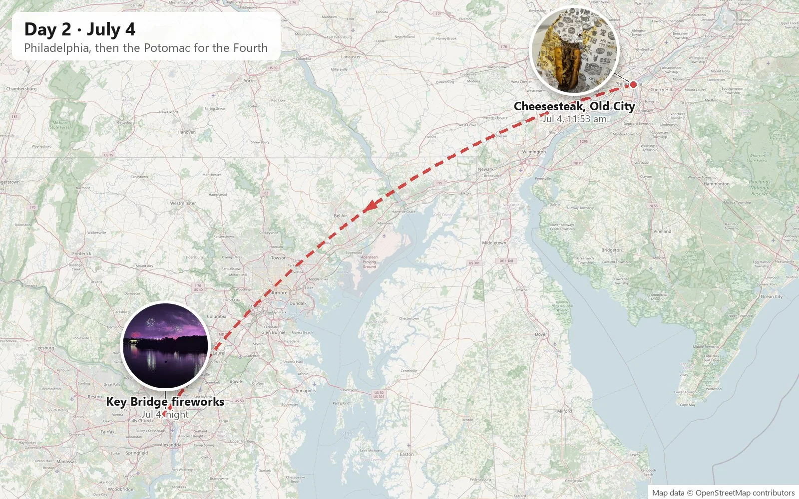
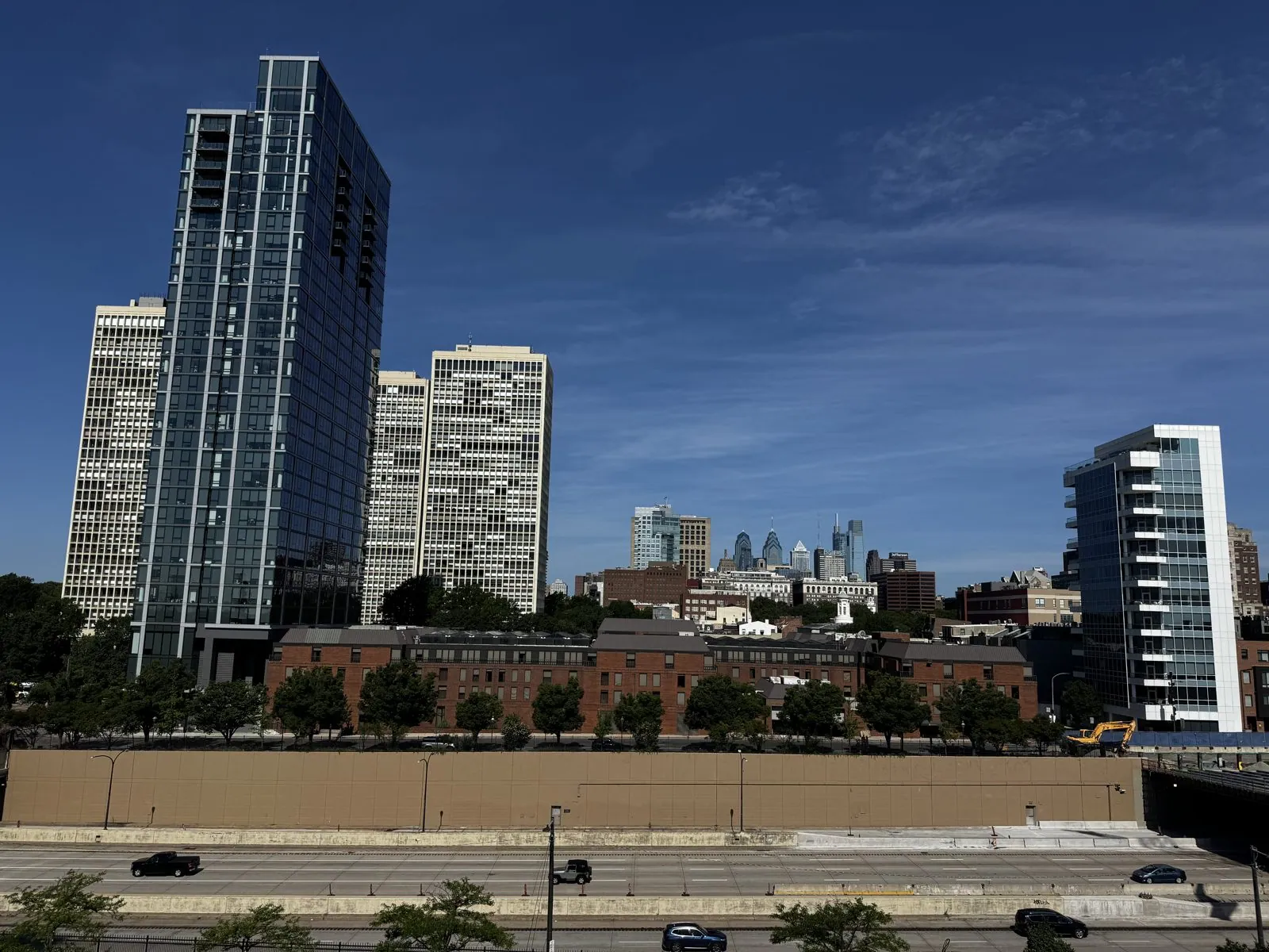
Independence Day morning
The morning of the Fourth was clear and very blue. From a high window at the Hilton at Penn's Landing, the view looked down over I-95, running in its trench along the Delaware waterfront, to a set of tall white concrete towers with gridded windows. These are the Society Hill Towers, designed by I. M. Pei and finished in 1964, three thirty-one-story apartment blocks dropped into one of the oldest neighborhoods in the country as part of its mid-century renewal. Pei also designed the rows of modern brick townhouses at their feet, so that the new towers would sit down politely among the eighteenth-century houses around them. Beyond them, small in the haze, rose the glass spires of the downtown skyline. Keep Pei in mind; he comes back later in the trip.
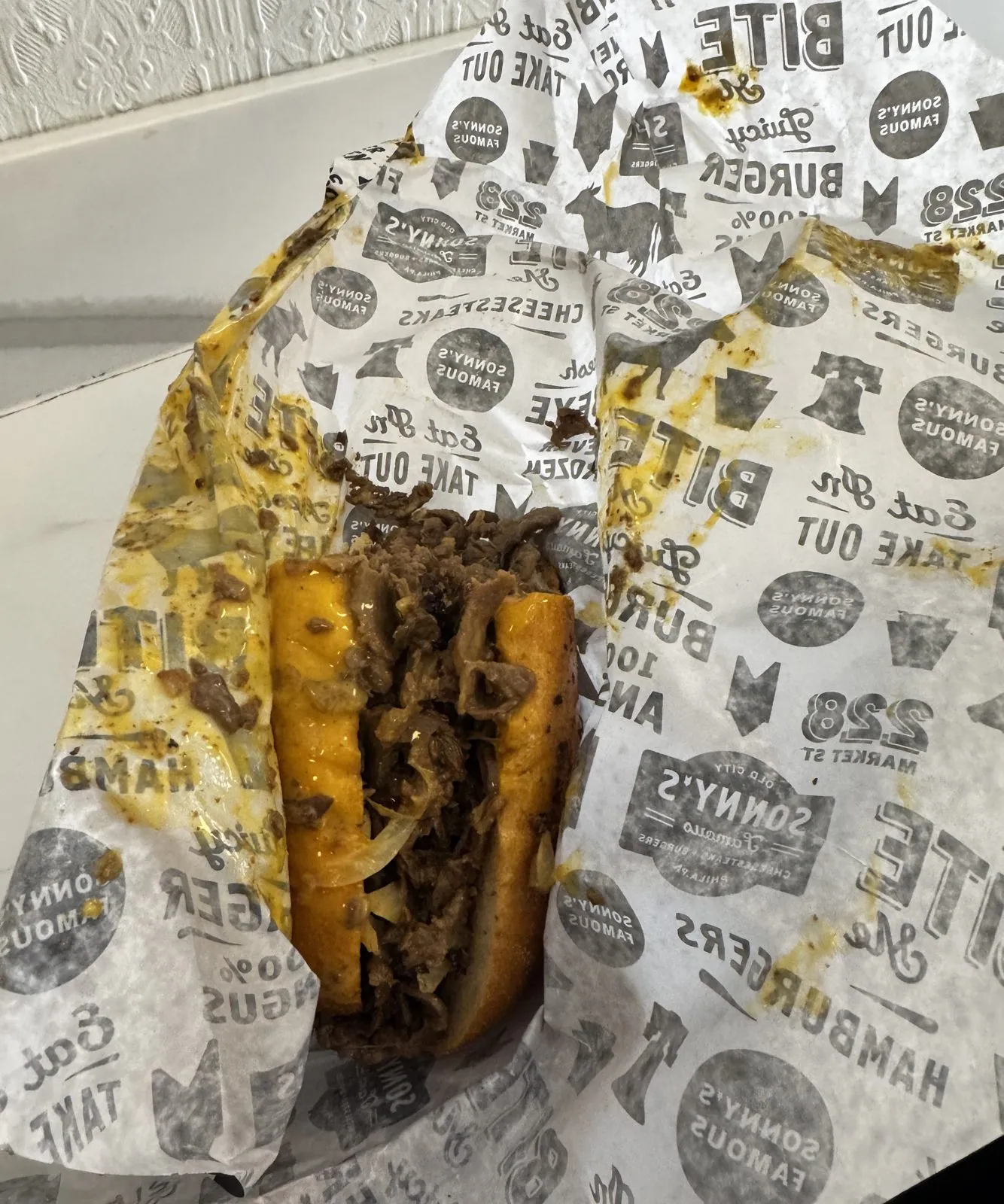
Old City, the neighborhood around Independence Hall, is where the Declaration was adopted and the Constitution written, and on a 250th Fourth of July it was the obvious place to be. We went to the Museum of the American Revolution, though there are no photos of it. The camera's contribution to Old City that day is not a monument but lunch. Just before noon we had a cheesesteak from Sonny's, on Market Street a few blocks from Independence Hall: chopped ribeye piled into a long roll with fried onions, the whole thing soaked in melted cheese and wrapped in printed paper that it had thoroughly soaked through. The cheesesteak is Philadelphia's civic sandwich, invented here in the 1930s and argued about ever since. On America's birthday, in the city where the country was born, it felt like the patriotic choice.
Washington: the Fourth on the Key Bridge
By night we were in Washington, on the Francis Scott Key Bridge. It is a fitting place to spend the Fourth. The bridge crosses the Potomac from Georgetown to Rosslyn, Virginia, and it is named for the man who wrote "The Star-Spangled Banner", who lived in Georgetown near where the bridge now lands. (It is not the Key Bridge in Baltimore that collapsed in 2024; that was a different bridge named for the same man.) Opened in 1923, it is a long run of concrete arches, with a green-painted railing along a sidewalk that, on most nights, has a few joggers on it.
Waiting on the bridge
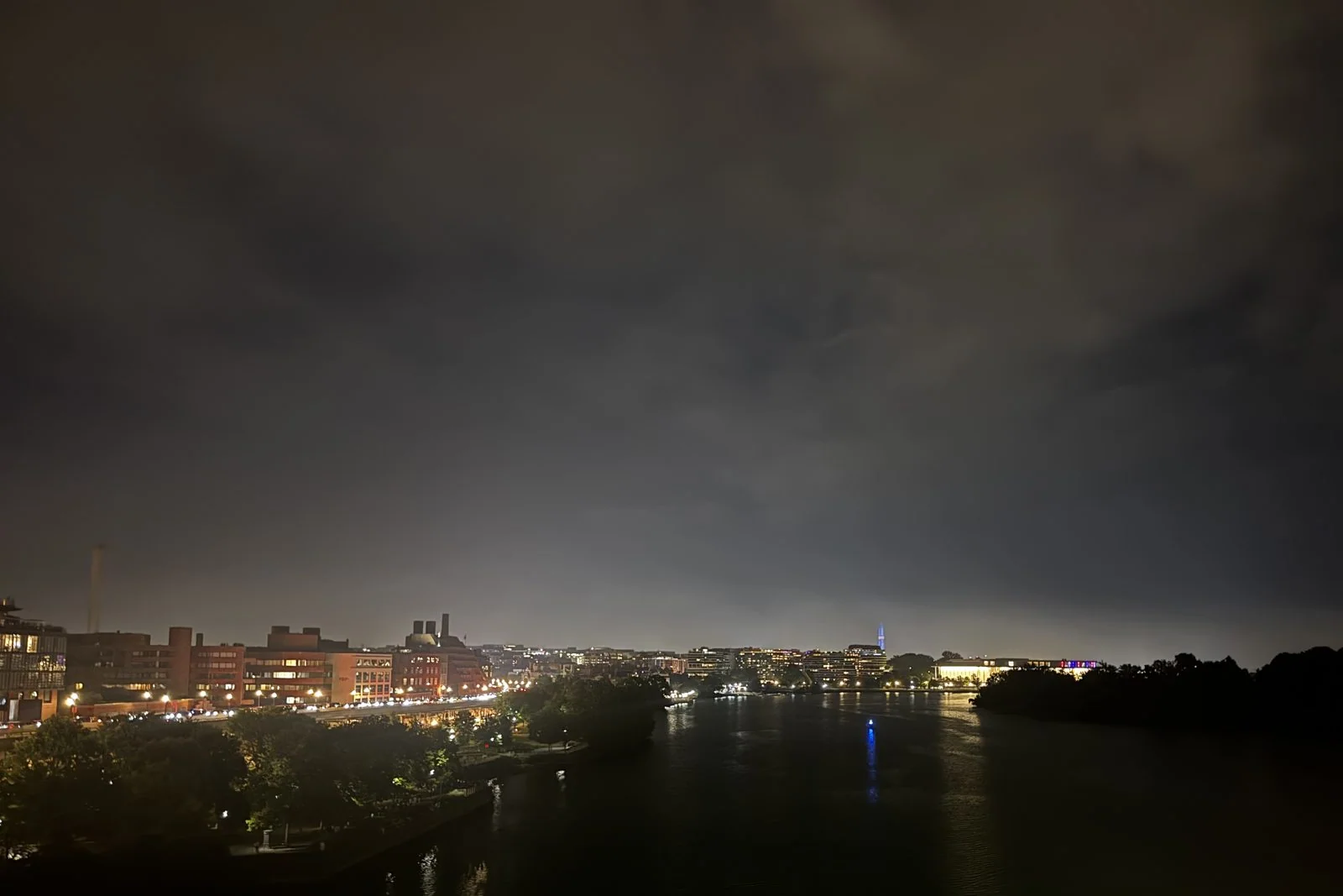
On this night it had thousands of people on it. Looking downstream, the view from the railing is one of the best in the city. On the left bank, the lights of Georgetown's waterfront step down to the river. Further along, the long, low white box of the Kennedy Center glows at the water's edge, and beyond that the Washington Monument stands up on its own, a thin pale needle on the skyline. On the right is the dark mass of Theodore Roosevelt Island, a wooded island in the middle of the river with no lights at all. The sky that night was low and heavy, a ceiling of cloud lit orange from underneath by the city, with the dark river below.
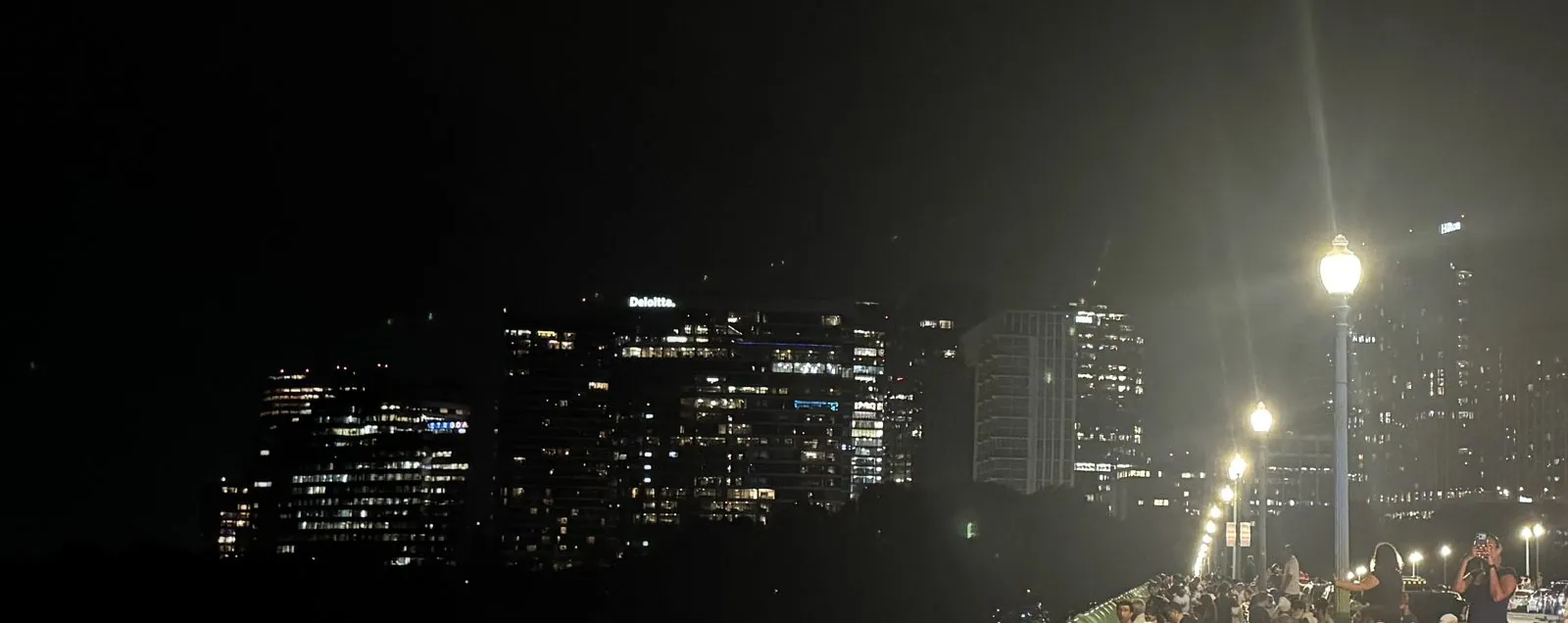
The show was the big one, the National Mall fireworks, launched a couple of miles downstream, and the Key Bridge is one of the classic places to watch them from: high above the water, with nothing between you and the show except a river and an island. Everyone else knew this too. The sidewalk was packed several deep along the railing, and the far end of the bridge, toward the office towers of Rosslyn, was a long line of people under the streetlamps, some in stars-and-stripes shirts, most of them holding phones and looking downstream, waiting.
The show
And then it started. From the bridge, the shells rose from behind Roosevelt Island and burst above its treeline, so the whole show seemed to come out of the dark woods. The Kennedy Center stayed lit at the bottom left of every frame, and the Washington Monument stood a little above it, a fixed point while the sky changed around it. Each burst arrived twice: once in the air, and once a moment later on the river, stretched into long, wobbling columns of color on the black water. The sound came a beat behind the light, a deep thud you feel in the bridge railing more than hear, and then the crackle.
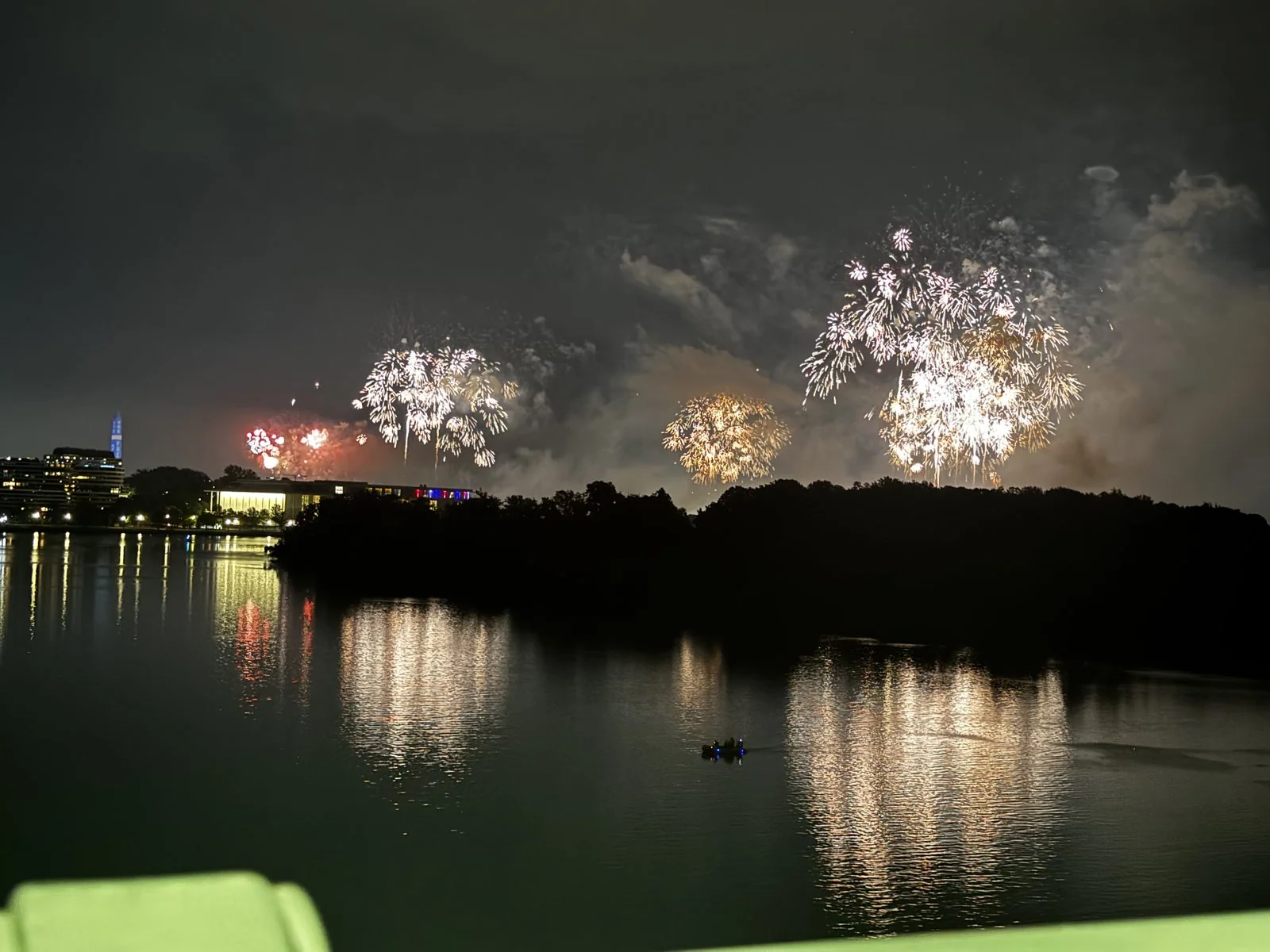
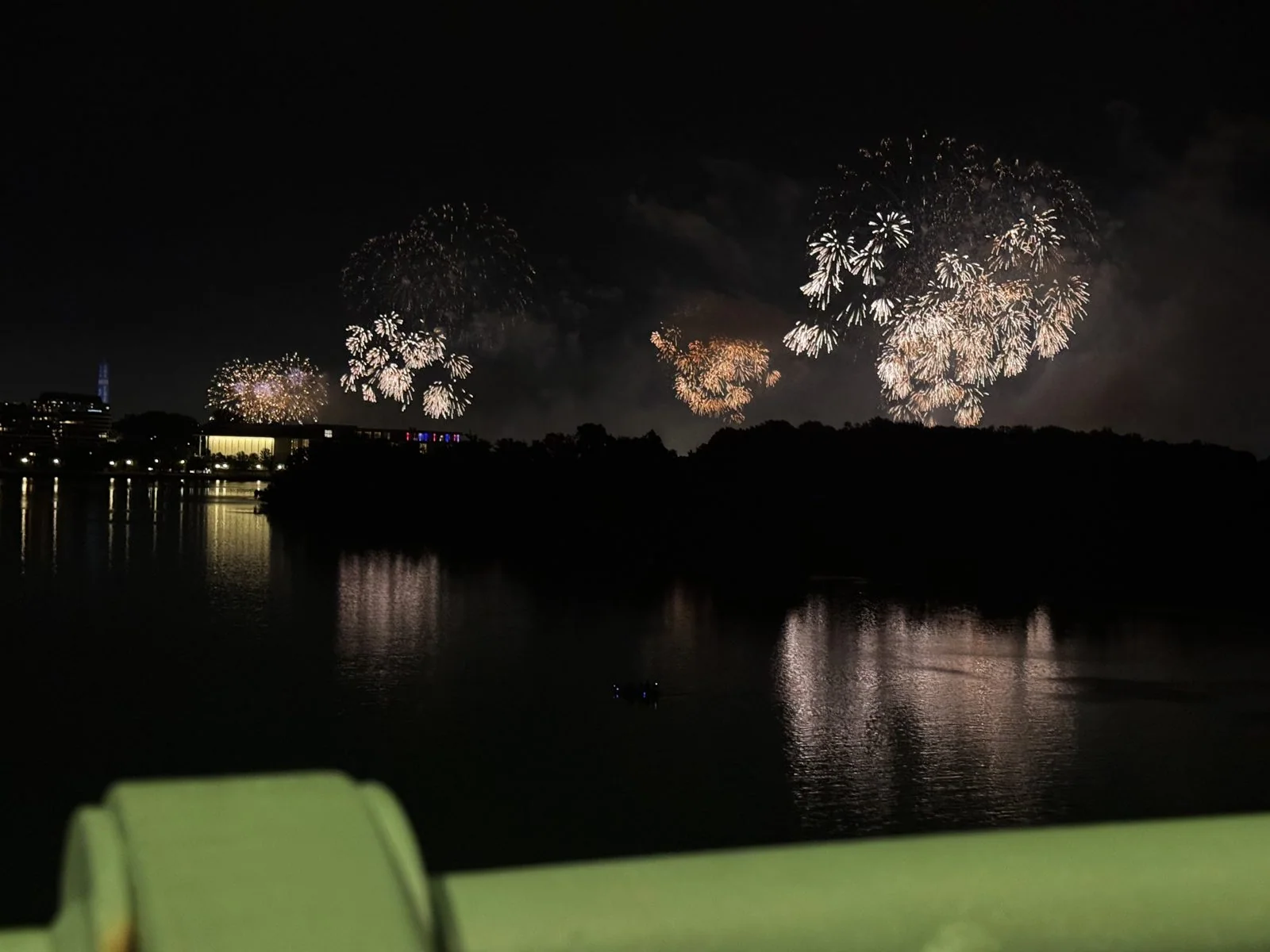
The colors came in waves. There was a run of pure red, big round peonies that turned the smoke pink and laid streaks of crimson across the water. Then came white and silver, and then a long sequence of gold: crackling "willows" whose sparks hang in the air and droop slowly toward the ground like the branches of the tree they're named after. A small boat sat in the middle of the river through all of it, a single tiny light on the water, directly beneath the show.
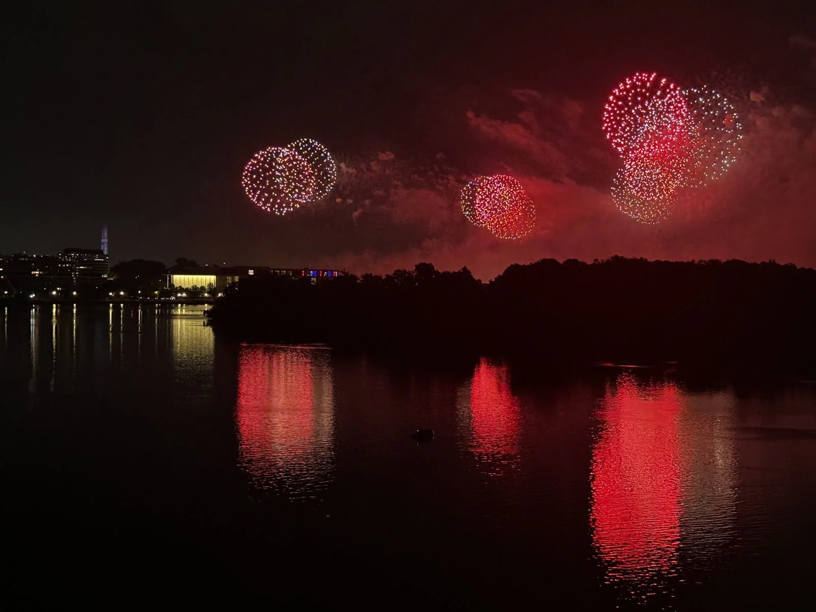
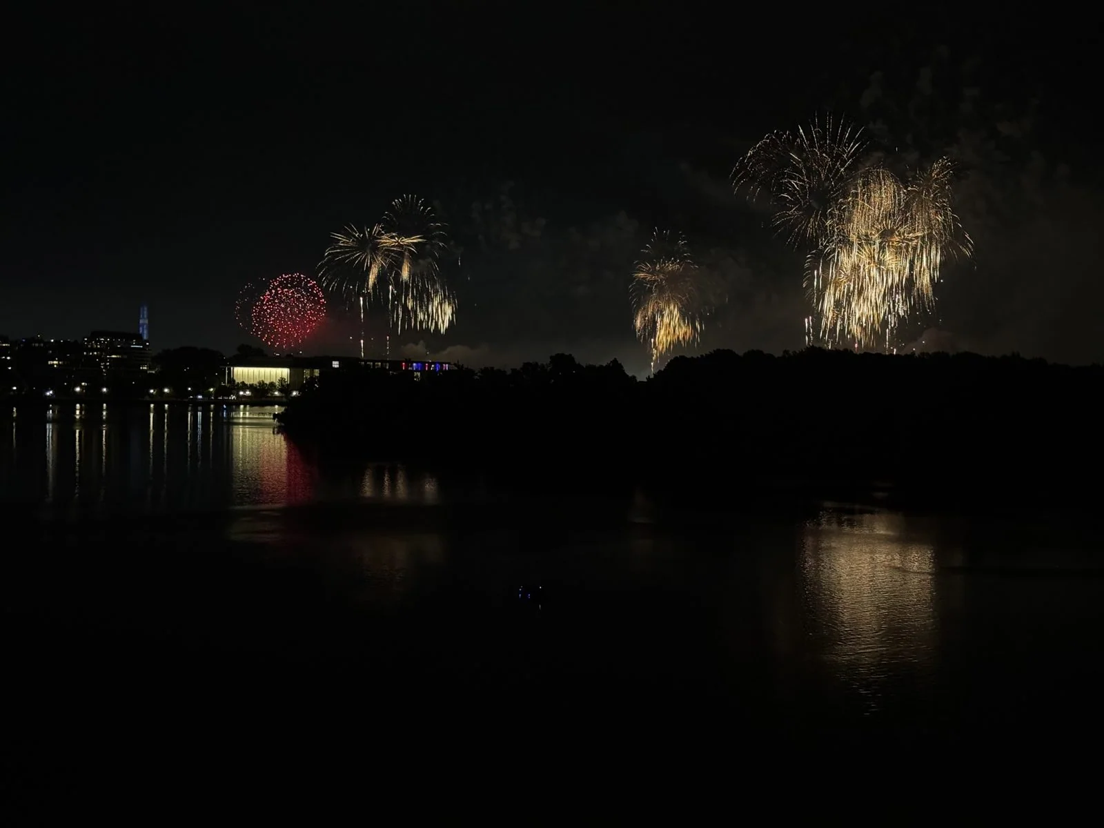
There is something especially satisfying about fireworks over water. On land, half the show is lost behind buildings and trees; over a river, you get it twice, and the reflections soften everything, so that even the sharpest burst turns into a slow brushstroke on the surface. The smoke matters too. As the show went on, it built up in drifting banks above the island, and each new burst lit it from inside, so the clouds of smoke themselves glowed pink, violet and white.
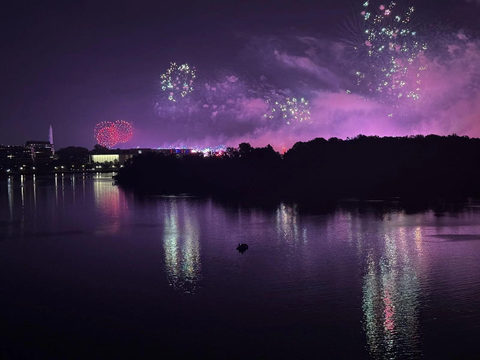
At one point the whole sky went purple. The smoke caught the light and held it, the river below turned the same color, and the green and red bursts on top looked almost like an afterthought. It is the photo of the night, and it was taken on a phone, leaning on a crowded railing, which says a great deal about modern phones and even more about how good that spot is.
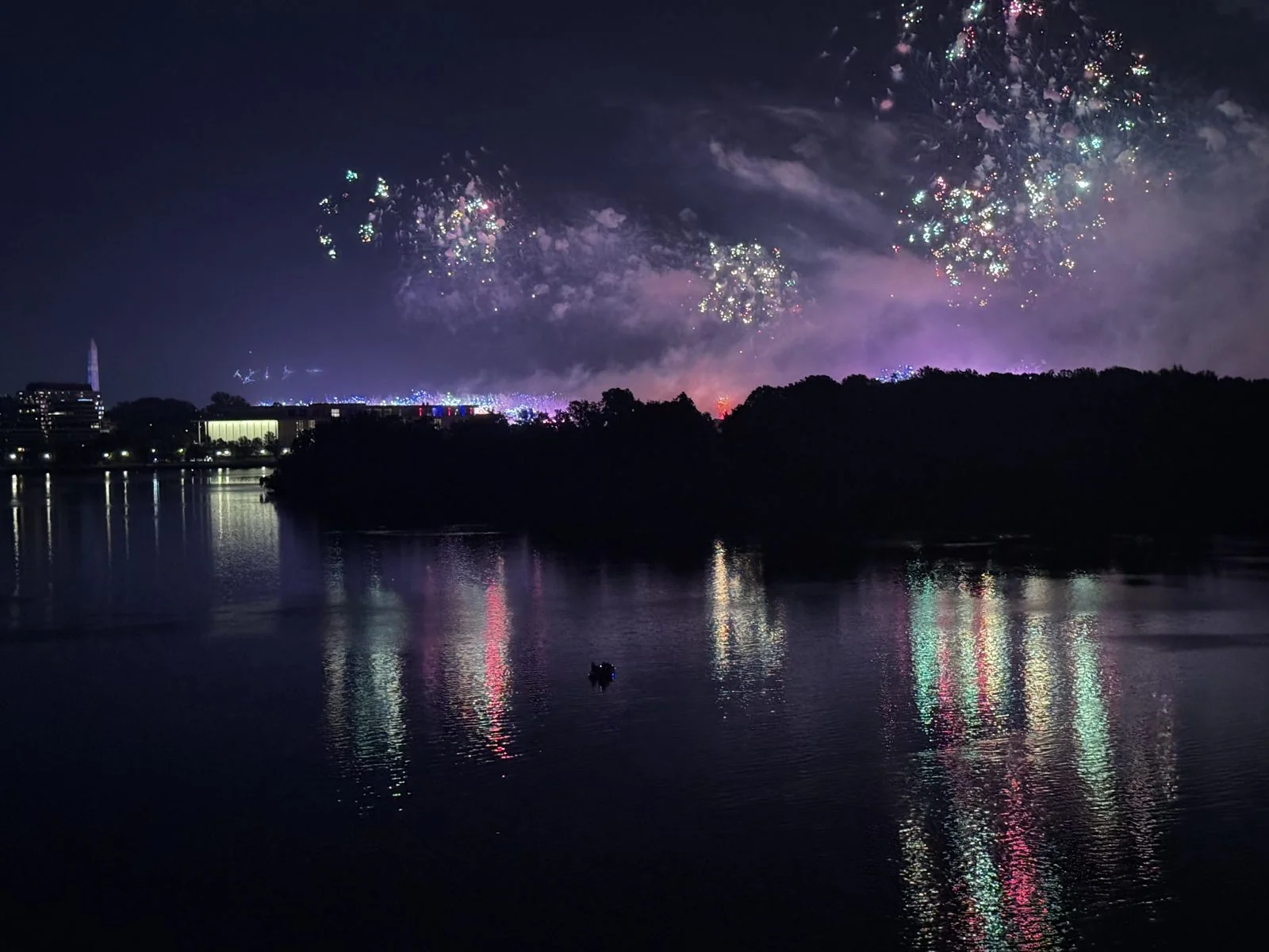
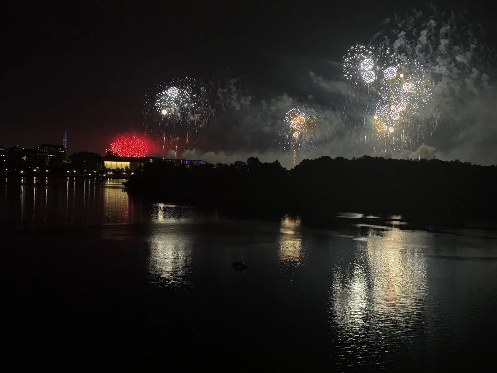
The finale did what finales do. The pace picked up until the bursts overlapped, blue on silver on gold, the smoke so thick that the later shells exploded inside it and lit it up like lightning inside a cloud. The very last frames in the camera roll are almost all blue: one great sapphire chrysanthemum hanging over the island, its reflection running down the river toward the bridge, and the city lights along the Georgetown bank looking suddenly very small and very yellow. Two hundred and fifty years, marked in the sky over the Potomac.
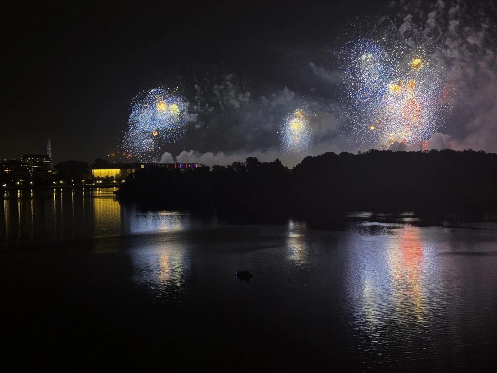
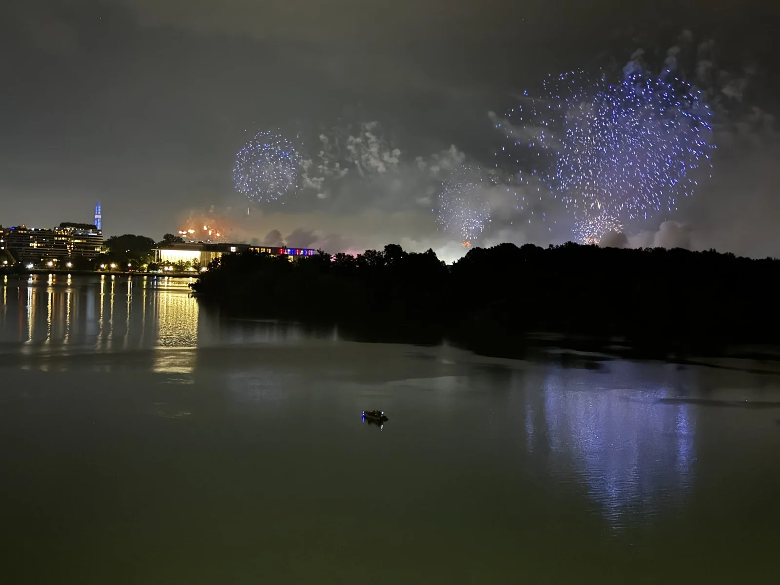
The last half-minute, from the same spot on the bridge: the finale going up white behind Roosevelt Island and reflected in the river.
After a show like that, a bridge full of people has only one way to go, which is off, slowly, all at once. The photos stop there, and the night ended at the Canopy by Hilton in North Bethesda.
Baltimore: the harbor, from the water and from the top
The next day, Sunday the 5th, we drove up to Baltimore, an hour northeast, arriving a little before one in the afternoon. The plan was the Inner Harbor, Baltimore's downtown waterfront, followed by the long drive north up I-95 to the airport in Philadelphia.
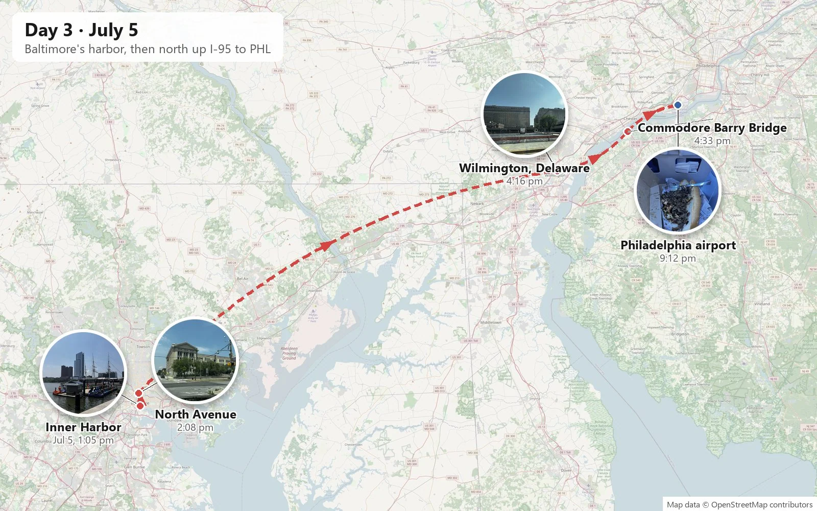
The Inner Harbor is a famous comeback story. For most of its history it was a working port, lined with wharves, warehouses and factories. By the 1960s it was mostly derelict. The city spent the next two decades rebuilding it as a public waterfront, with a brick promenade running all the way around the water, a convention center, an aquarium, museum ships, and in 1980 the Harborplace pavilions, festival markets that cities all over the world went on to copy. Today it is the template for the downtown waterfront: you can walk the whole basin on brick, and you are never more than a few steps from the water.
Along the promenade
It was a hot, hazy summer Sunday, the kind of day when the water is the color of strong tea and the sky fades from blue overhead to white at the horizon.
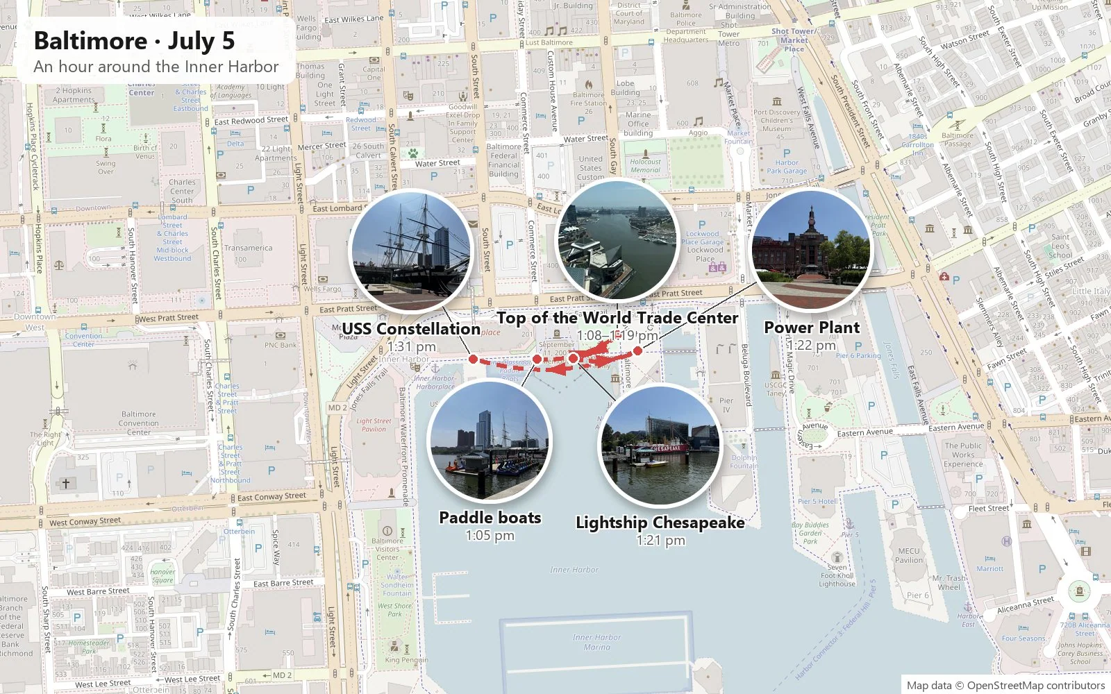
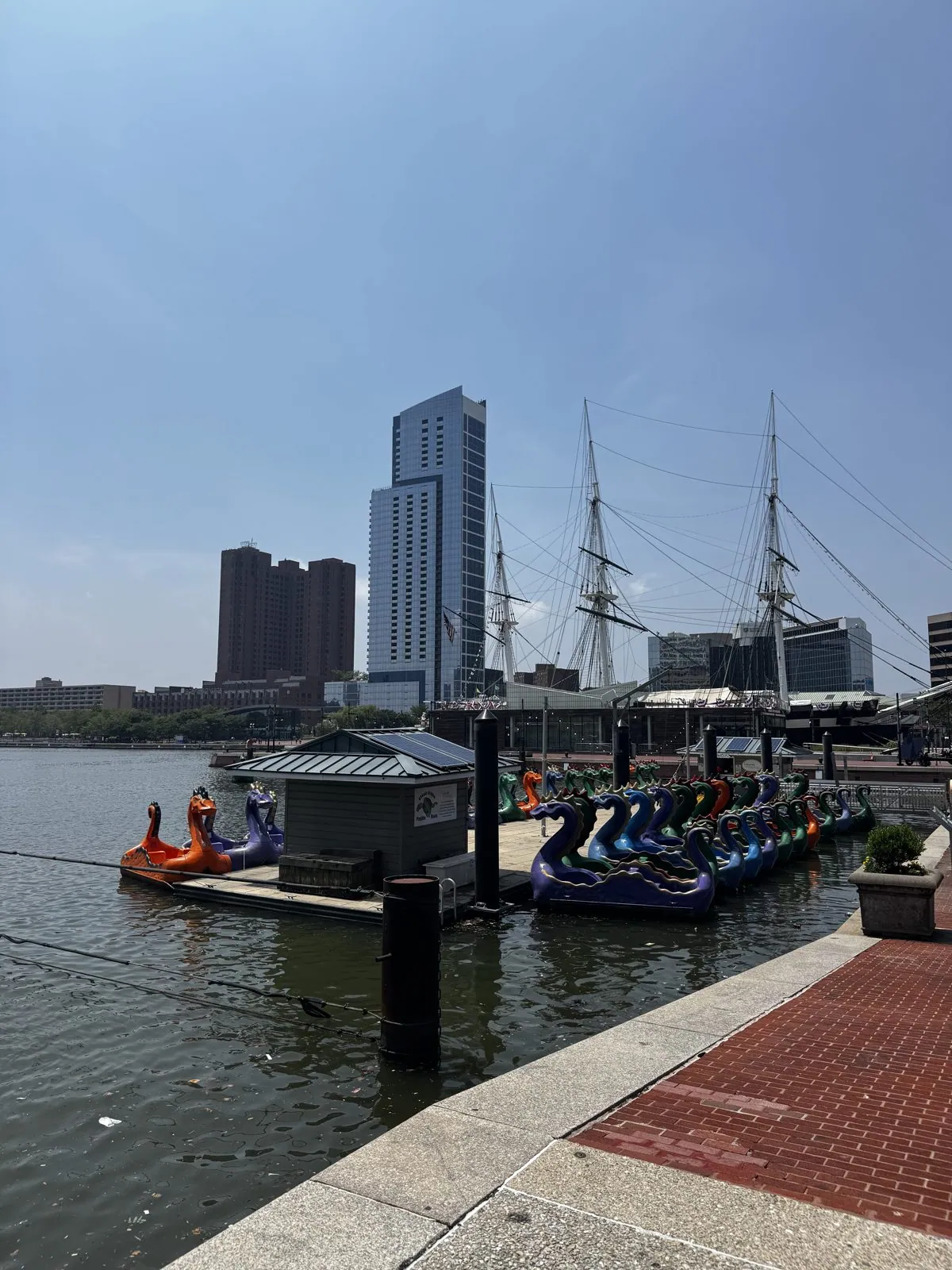
We started on the west side of the basin, where a dock of the harbor's famous paddle boats was moored: a flotilla of fiberglass dragons and sea serpents in orange, purple, green and blue, waiting for families to pedal them out into the harbor. Behind them rose the three masts of a tall ship and the glass towers of Harbor East.
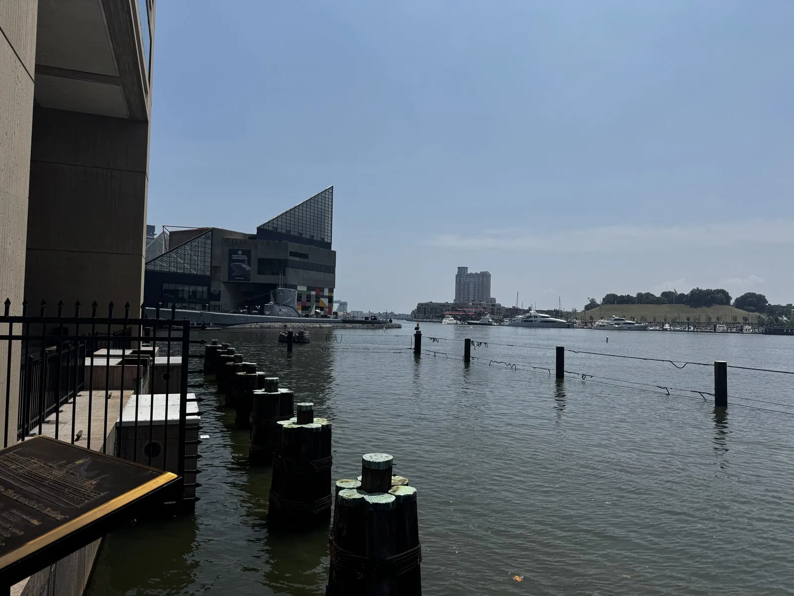
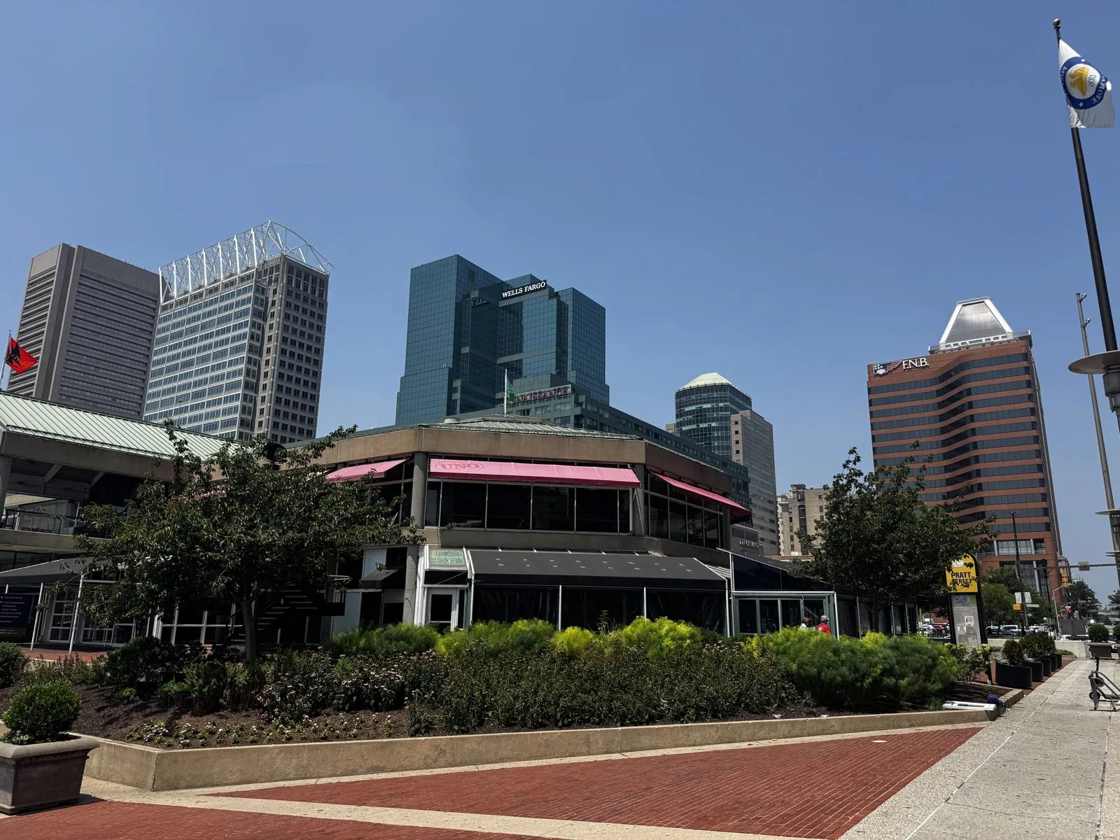
From the edge of the promenade, the water stretches east past a line of old pilings toward the angular glass roof of the National Aquarium, with the green slope of Federal Hill on the far side of the basin. Behind us, on Pratt Street, was the downtown skyline: office towers in brick, glass and stone, one with an open white steel crown, another with a pale pyramid on top, all of them crowding down toward the water as if to get a better look.
The Top of the World
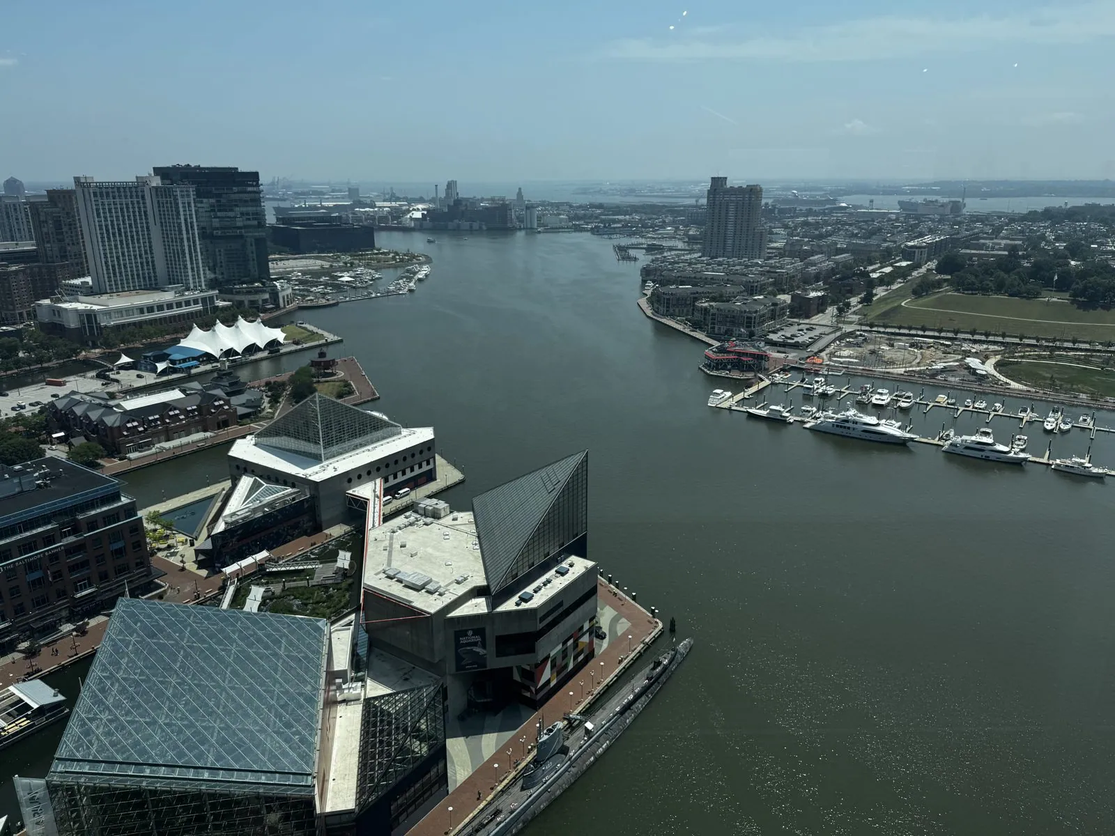
Then we went up. On the edge of the harbor stands the World Trade Center, a slim, pale tower finished in 1977 to a design by I. M. Pei's firm, the second Pei building of the weekend after the Society Hill Towers in Philadelphia. Its plan is a regular pentagon, which makes it the tallest pentagonal building in the world, and it stands right at the water's edge, on a pier, so that its point faces the harbor. Near the top, on the 27th floor, is an observation level called the Top of the World, with glass on all sides. For about ten minutes the camera did nothing but turn slowly in a circle.
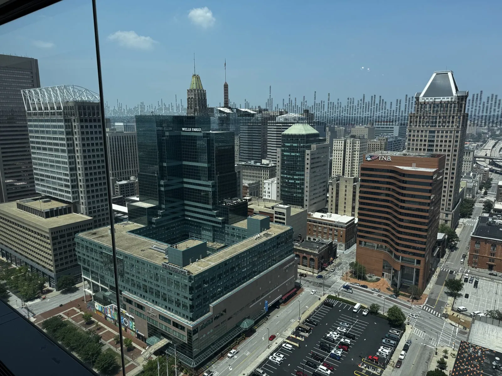
The view north is downtown Baltimore laid out like a model: towers in every material the twentieth century could think of, a tower with a green copper roof poking up from among the glass, parking lots, the grid of streets running away toward the hills, and the long slab of the convention center in the distance. It is a city that looks bigger from up here than it does from the ground.
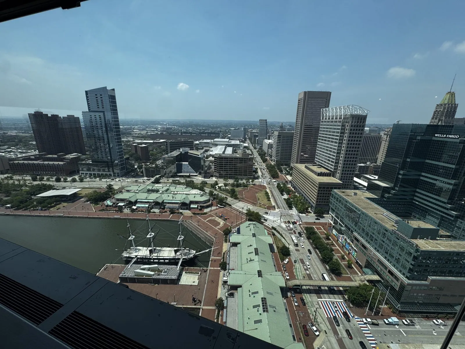
Straight down to the west, the harbor's corner looks like a diagram. The USS Constellation sits at her pier, her three masts reduced to sticks from this height, beside the green-roofed Harborplace pavilions, the curve of the brick promenade, and a skywalk running across Pratt Street. Turn to the south and the whole basin opens up: the long promenade, marinas full of white boats, the tour-boat docks, and the green hump of Federal Hill. That hill has been a lookout over the harbor since the city was young. During the Civil War, Union troops fortified it and pointed their guns at the city, to keep a deeply divided Baltimore in line.
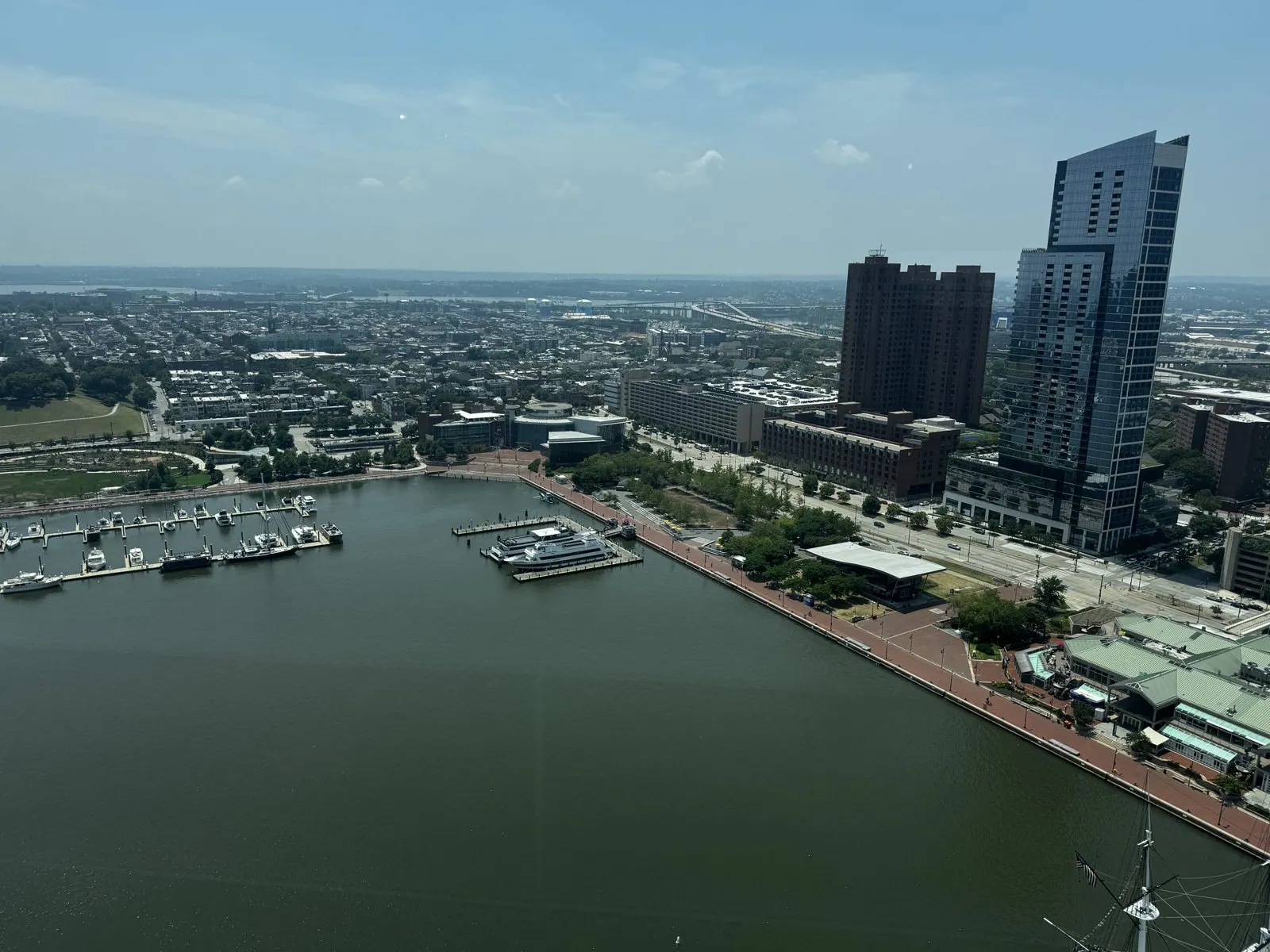
The best view is east, along the harbor toward the open water. The National Aquarium sits on its two piers directly below, its glass pyramid, which holds a rooftop rainforest, looking like a cut gem from above. Moored alongside it is a long gray shape that turns out to be a submarine: the USS Torsk, a Second World War boat credited with sinking the last Japanese warships of the war, in August 1945. Further out are the white tented roof of the Pier Six Pavilion, a concert venue, and the little red round house of the Seven Foot Knoll Lighthouse, an 1850s lighthouse that once stood on stilts out in the bay and was moved here to retire. Beyond them, the harbor narrows and runs out past the old industrial waterfront toward the Chesapeake.
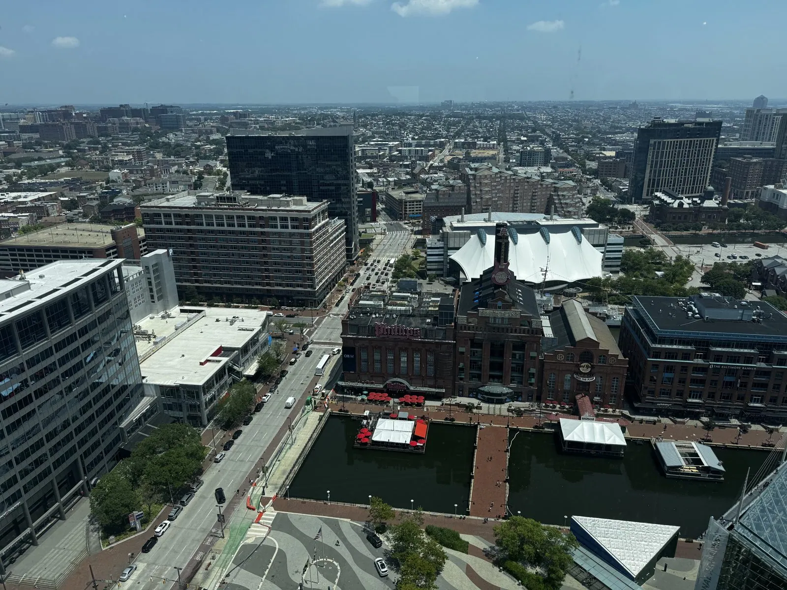
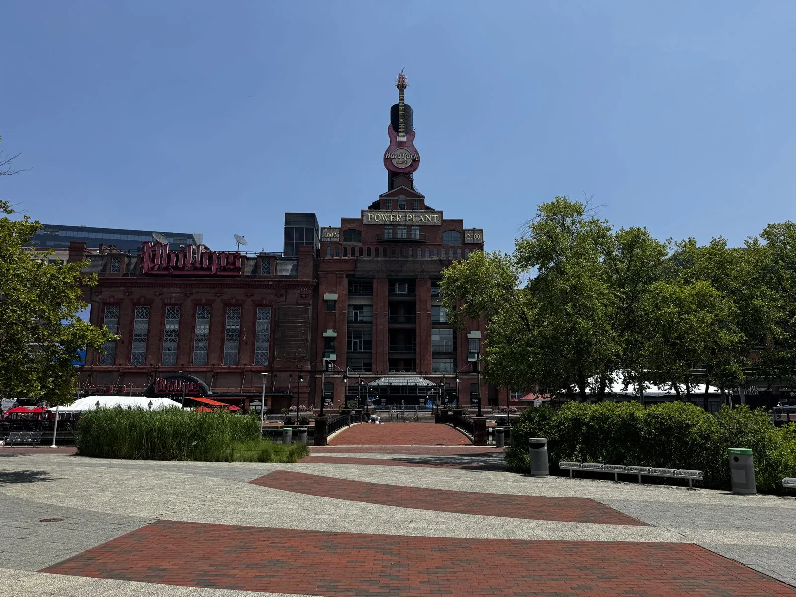
Directly northeast is the Power Plant, a big red-brick building with a tall chimney-tower, built around the turn of the twentieth century to generate electricity for the city's streetcars. Long since retired from that job, it now houses restaurants, and its tower carries a giant guitar. From the top of the World Trade Center you can see the whole idea of the Inner Harbor in one turn of the head: almost everything down there was built for ships, freight or industry, and almost all of it has been given a second life.
Back on the ground
Back down on the brick, we walked east along the promenade toward the Power Plant. It was early afternoon and blazing, and the promenade was nearly empty. Moored along the way is the lightship Chesapeake, a bright red ship with her name painted in huge white letters down the side. She was built in 1930 as a floating lighthouse: lightships were anchored at dangerous spots where a lighthouse couldn't be built, with a beacon on the mast and a crew living aboard, and she spent years marking the entrance to the Chesapeake Bay. That weekend she was dressed in red, white and blue bunting for the Fourth.
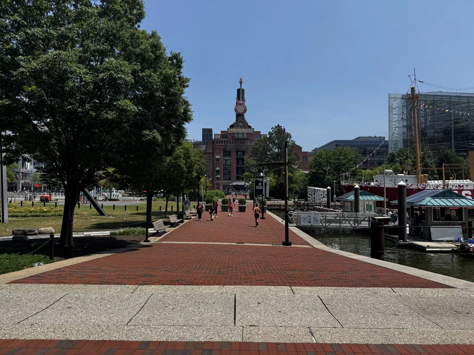
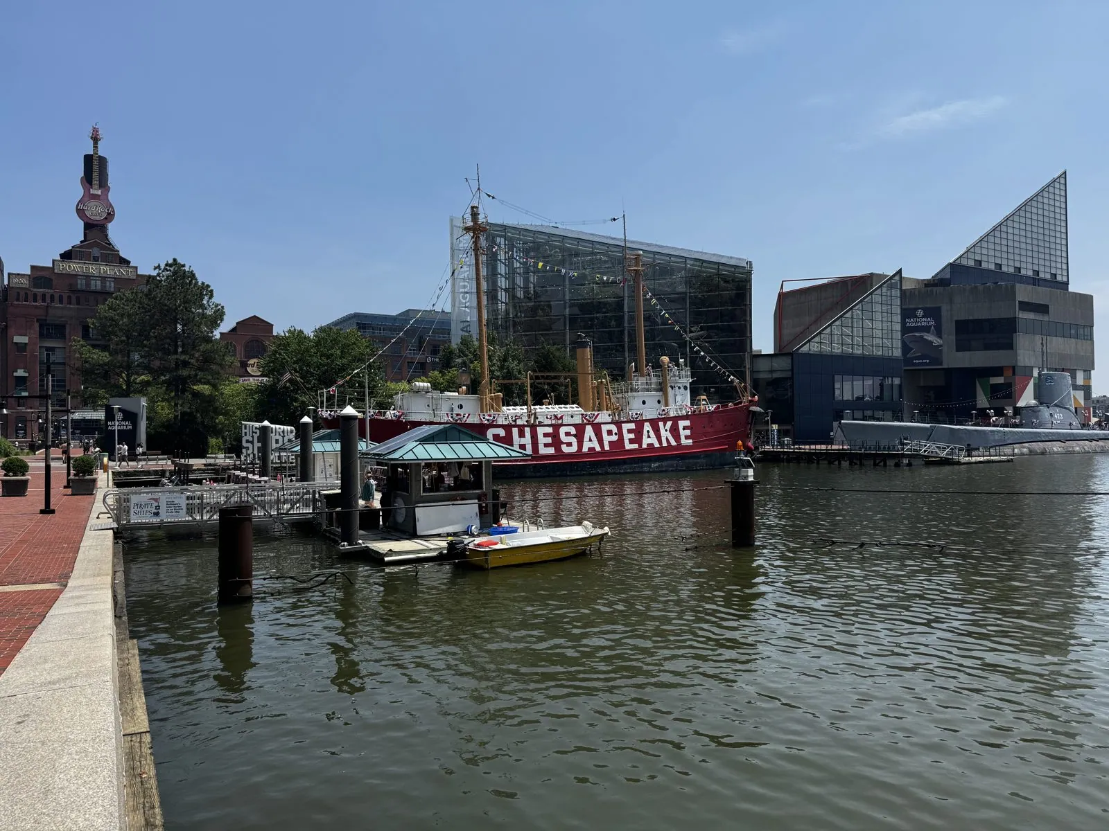
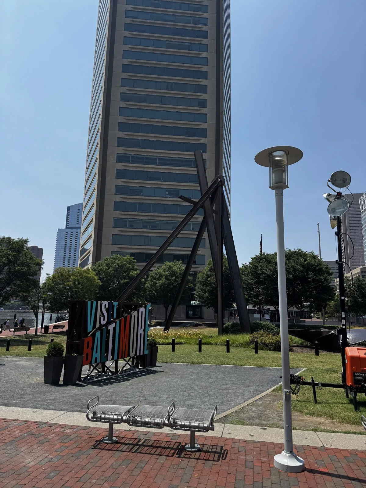
From ground level the Power Plant is even more of a character: three stories of arched brick windows, the word "POWER PLANT" in stone near the top, and that guitar on the tower, which from up close turns out to be enormous. Walking back toward the World Trade Center, you get to see it from the bottom: a smooth five-sided shaft of pale stone and dark glass rising straight out of the harbor plaza, with a tangle of black steel sculpture and a bright "Visit Baltimore" sign at its foot.
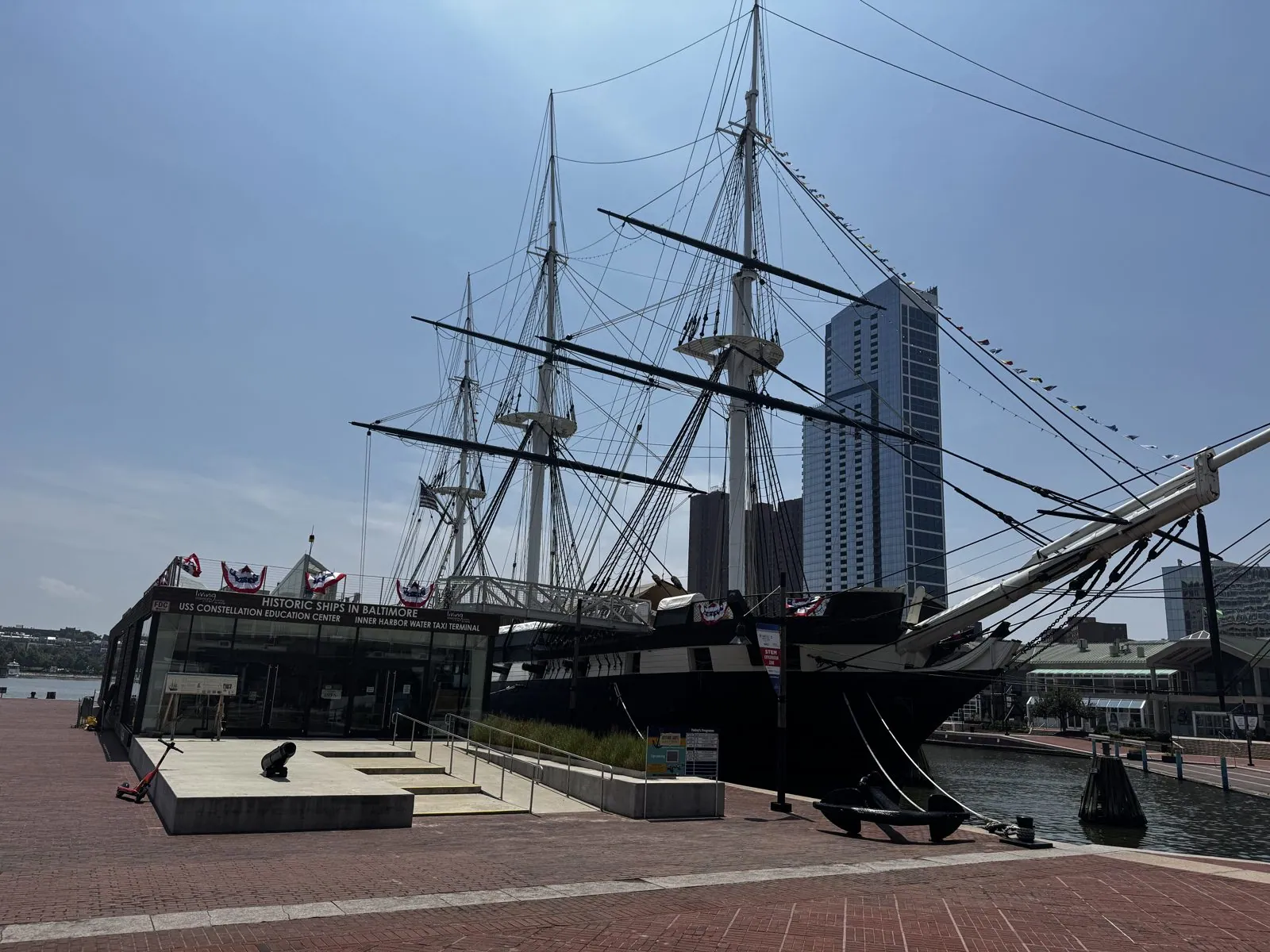
The last stop was the USS Constellation, the tall ship whose masts we had been seeing all afternoon. Launched in 1854, she was the last all-sail warship built for the U.S. Navy, just before steam took over. Before the Civil War she served off the coast of Africa, hunting slave ships, and captured several. Up close she is all black hull and rigging, with her bowsprit reaching out over the promenade, a heavy anchor laid on the bricks, and her visitor center draped in patriotic bunting. On a weekend about the country's two hundred and fiftieth birthday, it was a good place to finish: a ship launched when the country was not yet eighty, and still afloat. Baltimore also came through where New Jersey had not: I left with two fridge magnets.
North on I-95
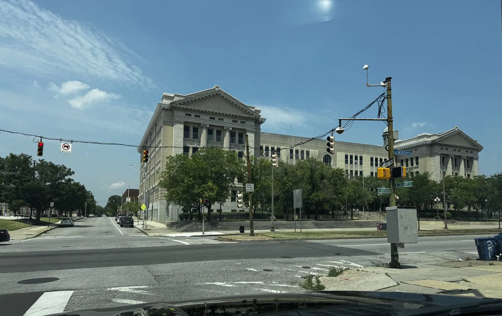
On the way out of Baltimore, around two, the route passed along North Avenue, where a huge neoclassical building takes up the corner of a block: two temple-fronted pavilions with pediments and columns, joined by a long wing, in pale stone, set back behind a lawn and a wide flight of steps. It is one of those buildings that make you wonder what a city was expecting of itself when it built them.
Then came I-95, the great spine of the East Coast, which runs from Florida to Maine through nearly every city on this trip. In the middle of the afternoon it carried us into Delaware and through downtown Wilmington, a short sequence of brick office blocks and parking lots seen through a car window. On a 250th anniversary weekend, Delaware deserves a mention. On December 7th, 1787, it became the first state to ratify the Constitution, which is why it still calls itself the First State. It also gave me a fridge magnet.
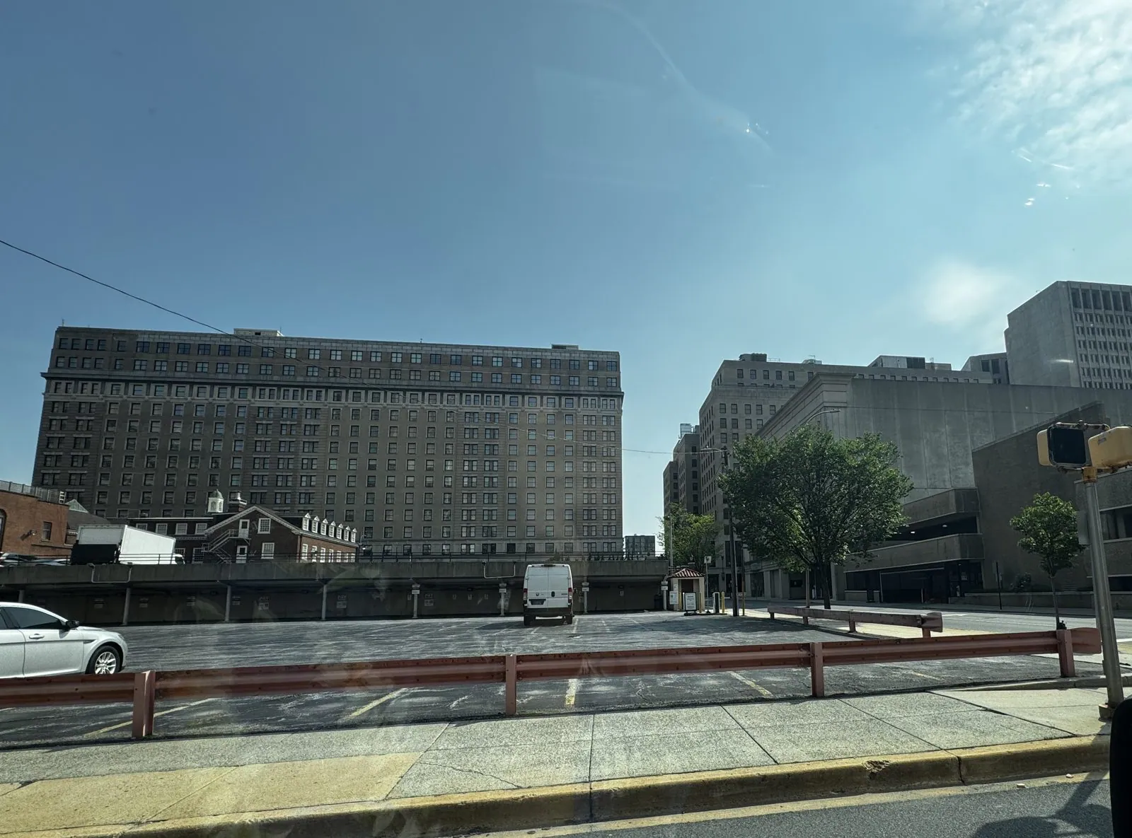
A little later, the road swung up onto the Commodore Barry Bridge and across the Delaware River into New Jersey. It is a big steel cantilever bridge, opened in 1974 between Chester, Pennsylvania, and Bridgeport, New Jersey, and its main span is the longest of any cantilever bridge in the country. Its namesake fits the weekend too: John Barry was a Philadelphia ship captain who fought in the Revolution and is often called the father of the American Navy. It was also my second visit to New Jersey in three days, and once again I left without a magnet.
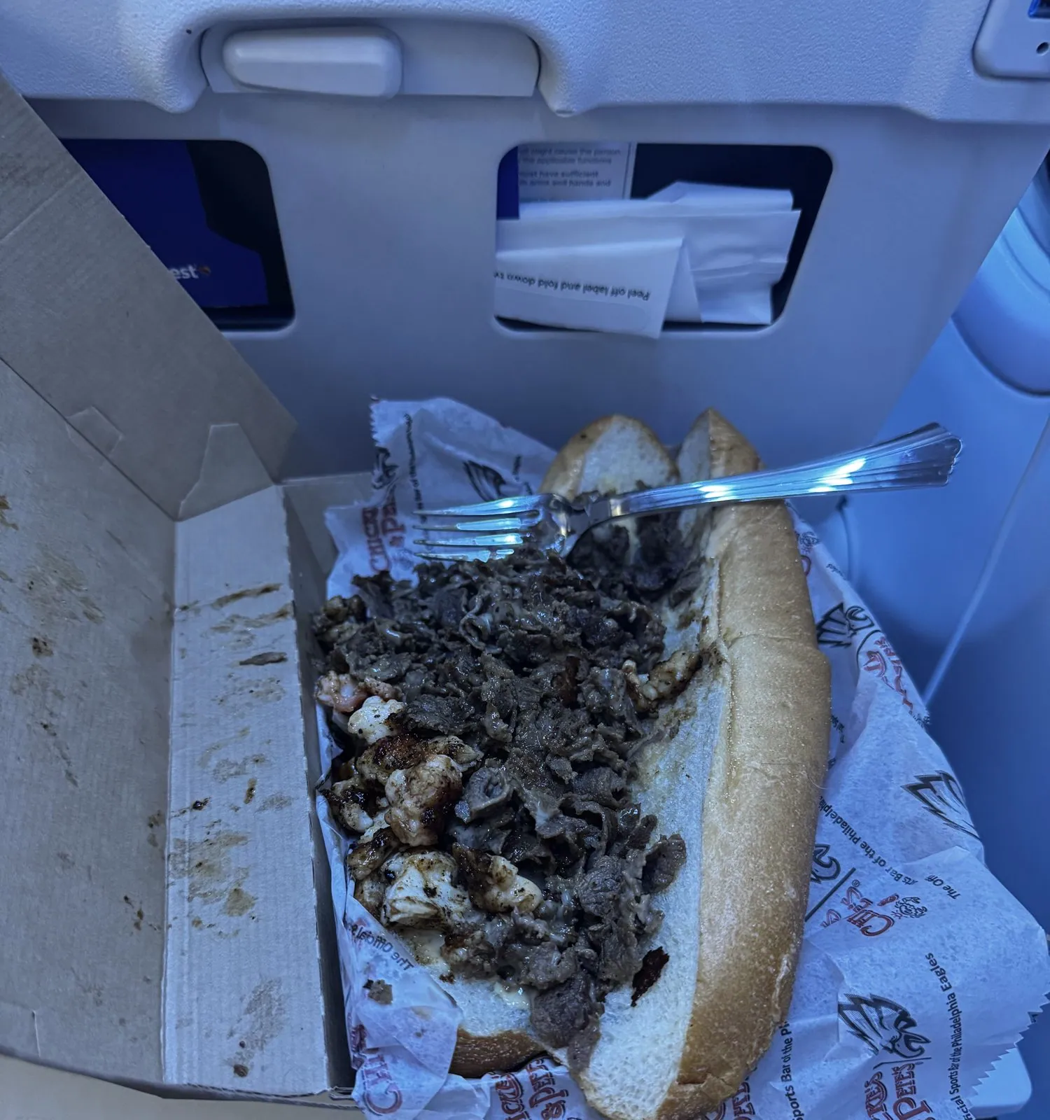
The Philadelphia part of the trip ends the way it began, with food. That evening at PHL we had cheesesteak number two, from Chickie's & Pete's, in a cardboard box and paper printed with Philadelphia Eagles logos: chopped steak and onions spilling out of a soft roll, with a fork stuck in it. It was less photogenic than the Old City one, and it did the job. We ate it off a seat-back tray table, already on board and sure we were about to leave. We were optimistic.
Seven states in a day
The plan for getting back to California was simple: PHL to Chicago, change planes, and land in San Jose at 11 pm. Then a line of thunderstorms rolled through, and the flight sat, and sat. It finally left about six hours late, deep into the night, and by then the Chicago connection was long gone. The replacement went Chicago to Phoenix, then Phoenix to San Jose, landing at 9 the next morning.
Counted from that Sunday morning in Maryland, the last day of the trip went Maryland, Delaware, New Jersey, Pennsylvania, Illinois, Arizona, California: seven states in one day, more than the rest of the weekend managed put together, and most of them seen only from a gate. It is not how I would have chosen to cross the country. But for a weekend about America, it was, in its way, thorough.
Two hundred and fifty
It was a short trip, four days and a few hundred miles, and on paper it was mostly food and fireworks. But the route turned out to be a neat little tour of the country's founding. It started in the city where the Declaration was adopted, and spent the Fourth on a bridge named for the man who wrote the anthem, watching fireworks over the capital. The next day it climbed above a harbor whose oldest ship was already sailing when the country was not yet eighty, then crossed the first state to ratify the Constitution and a bridge named for the father of the Navy, and finally, courtesy of the weather, flew back to California by way of half the country.
Mostly, though, what I'll remember is the view from the Key Bridge: a river, an island, a lit-up Kennedy Center, a small boat holding still in the dark, and the whole sky going purple above them. A country turns two hundred and fifty only once. It was worth being there.
Maps built from the trip's photo timestamps and locations. Photo locations have been removed from the published images. Day maps: map data © OpenStreetMap contributors; each stop is placed where its photo was taken, hotels and home are never marked, and the dashed lines show the order of stops, not the exact roads.
Likes and comments
React with an emoji or leave a comment. Signing in with GitHub is required.