← Misc · December 2022 – January 2023
New Year on the East Coast
The ball drop from a window above Times Square, then three rivers, two more cities and a week of short winter days.
Fly into Newark → New York → train to Philadelphia → train to Washington, DC → fly home
one ball drop, seen from above · three ferry rides on New Year's Day · 102 floors up at One World Observatory · one giant clothespin · the Capitol, the Supreme Court and the White House after dark
Some cities you visit for the sights. New York at New Year's you visit for one sight in particular: a glittering ball sliding down a flagpole above Times Square while a million people count backwards from ten. We had no intention of standing in the street for twelve hours to see it. Instead, through a stroke of planning that still feels like cheating, we watched it from a window high above the square, looking straight down at the confetti.
That was the centerpiece of a week on the East Coast in the dead of winter. It was four days in New York, with fog in Brooklyn, sun on the harbor and a lot of time on ferries, followed by a night in Philadelphia and a night in Washington, with the train in between. As with the other trip posts here, everything is reconstructed from the camera roll, which remembers where and when every photo was taken far better than we do. Where the photos are silent, I've kept quiet too. Where a place has a story, I've added a little of it. Readers of the summer 2024 road trip will recognize some of the scenery; this is the same coast, eighteen months earlier and about sixty degrees colder.
Arrival: a sea of lights
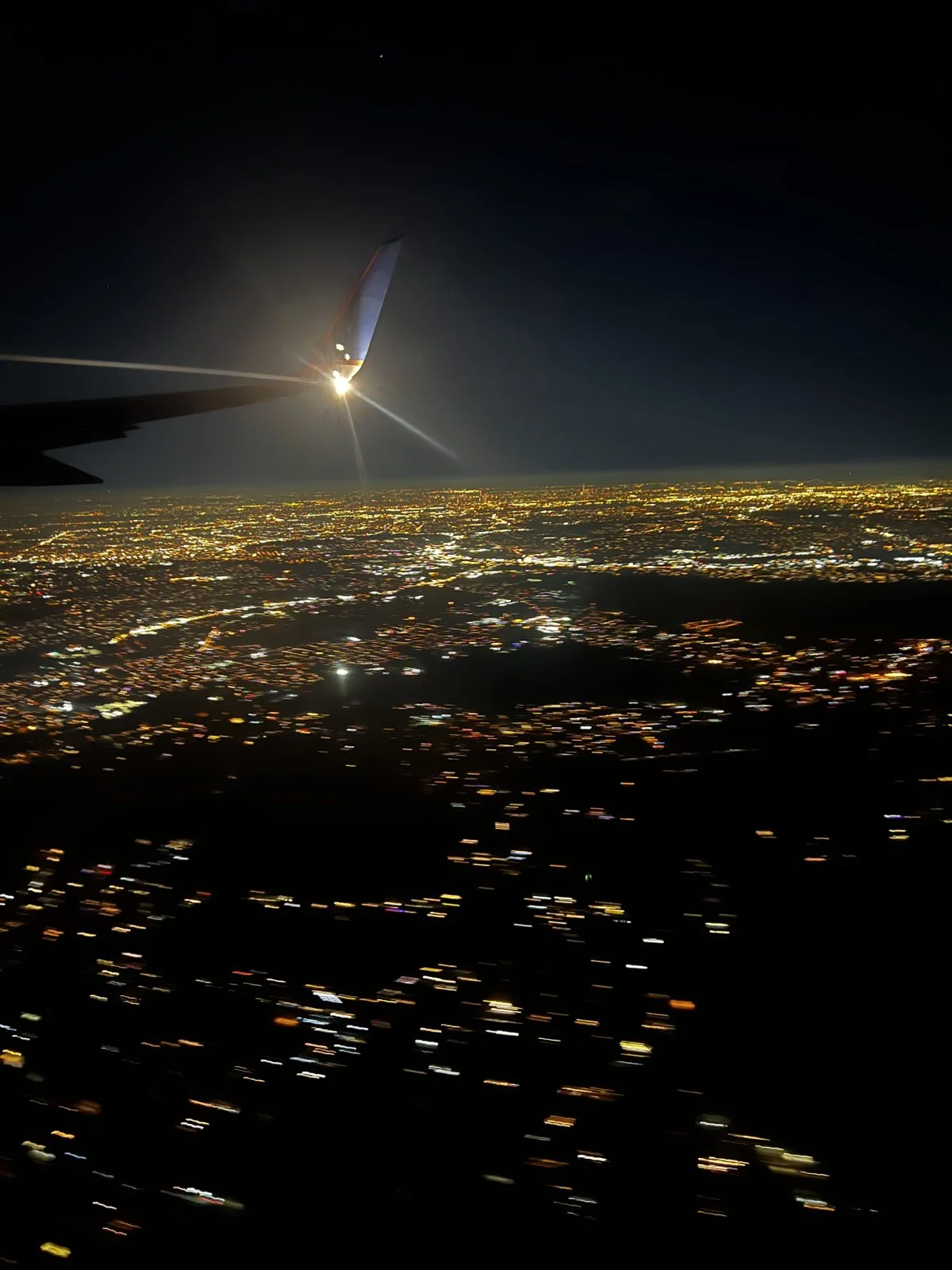
We flew in on the evening of December 29th. By seven o'clock the plane was descending over eastern Pennsylvania and northern New Jersey, and the window filled with that particular view you only get landing in the Northeast at night: no darkness anywhere, just one continuous carpet of orange streetlights, broken by the black ribbons of rivers and the brighter threads of highways, all the way to the horizon. The wingtip light flashed against it every second, like a metronome counting down the last few minutes of the flight. We landed at Newark and took the airport bus across the river into Manhattan.
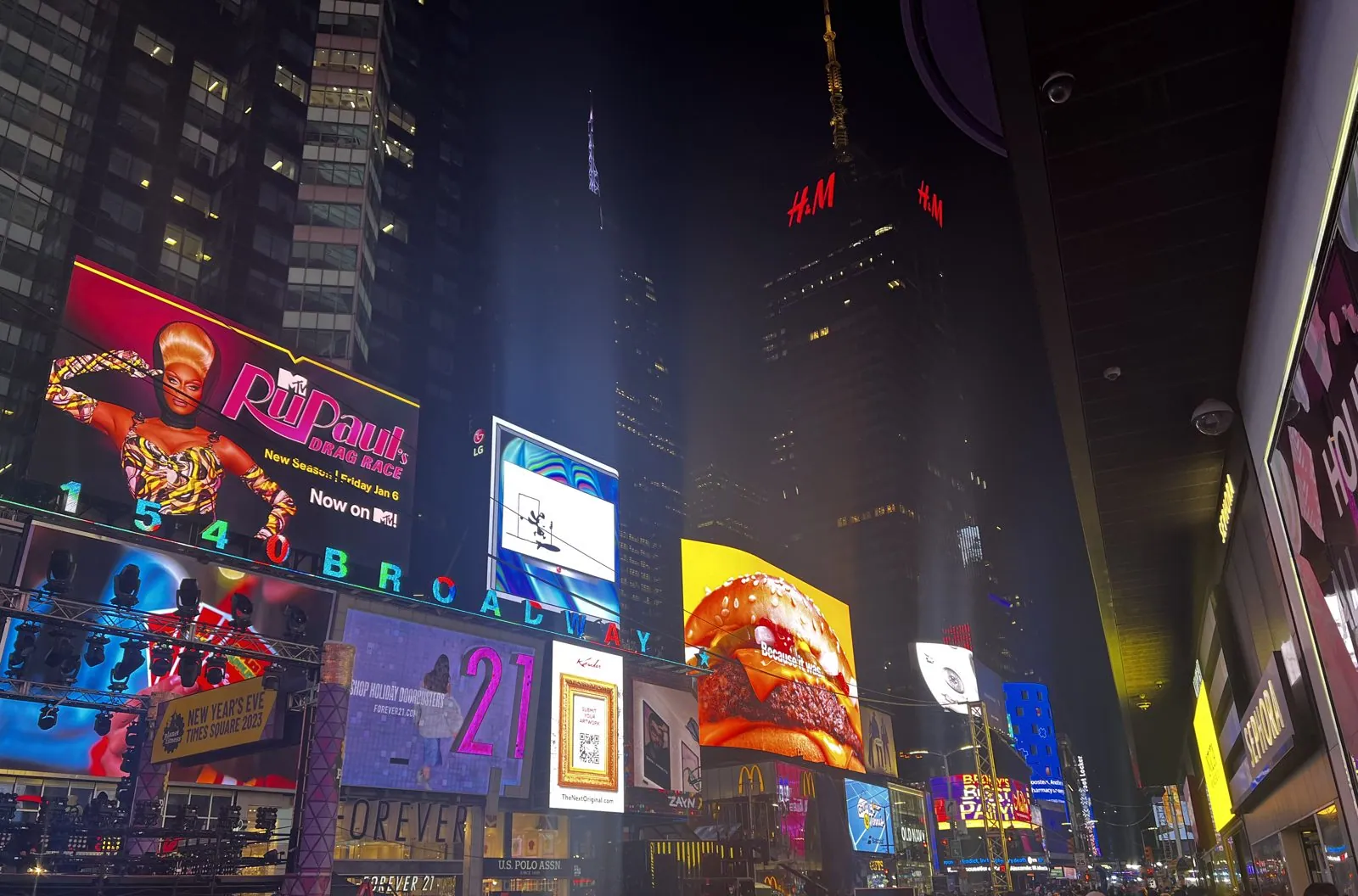
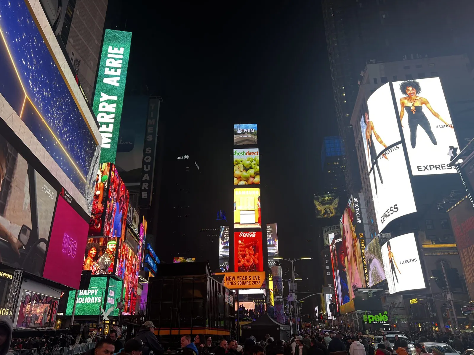
By ten that night we were at the 42nd Street end of Times Square, which hits you all at once. One minute you are on an ordinary Manhattan street; the next you are standing in a canyon of light so bright it casts shadows at ten at night. Every surface is a screen. A drag queen the height of a house advertised a new season on one wall; a cheeseburger the size of a bus glistened on another. Above them the numerals of 1540 Broadway marched across the façade in colored lights. Two days before New Year's Eve, the square was already being rebuilt for the big night: stages going up on scaffolding, metal barricades stacked along the curbs, banners announcing "New Year's Eve Times Square 2023". The crowd was dense and slow and in no hurry at all, which is what a crowd becomes when it has nowhere to go and is already where it wanted to be.
December 30: Midtown on foot
The next afternoon we did what every visitor does in the last week of December: walked Midtown, slowly, in a crowd. A city that is famous for walking fast slows to a shuffle around the holidays, because half of the people on Fifth Avenue are standing still, looking up.
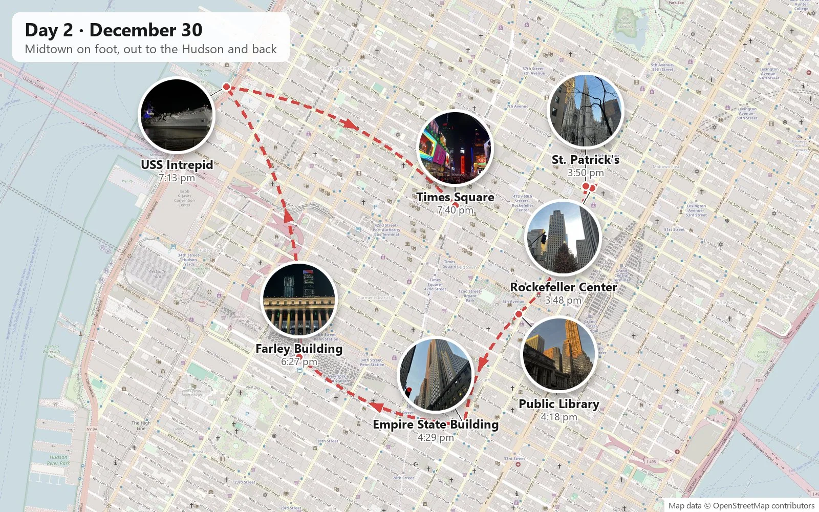
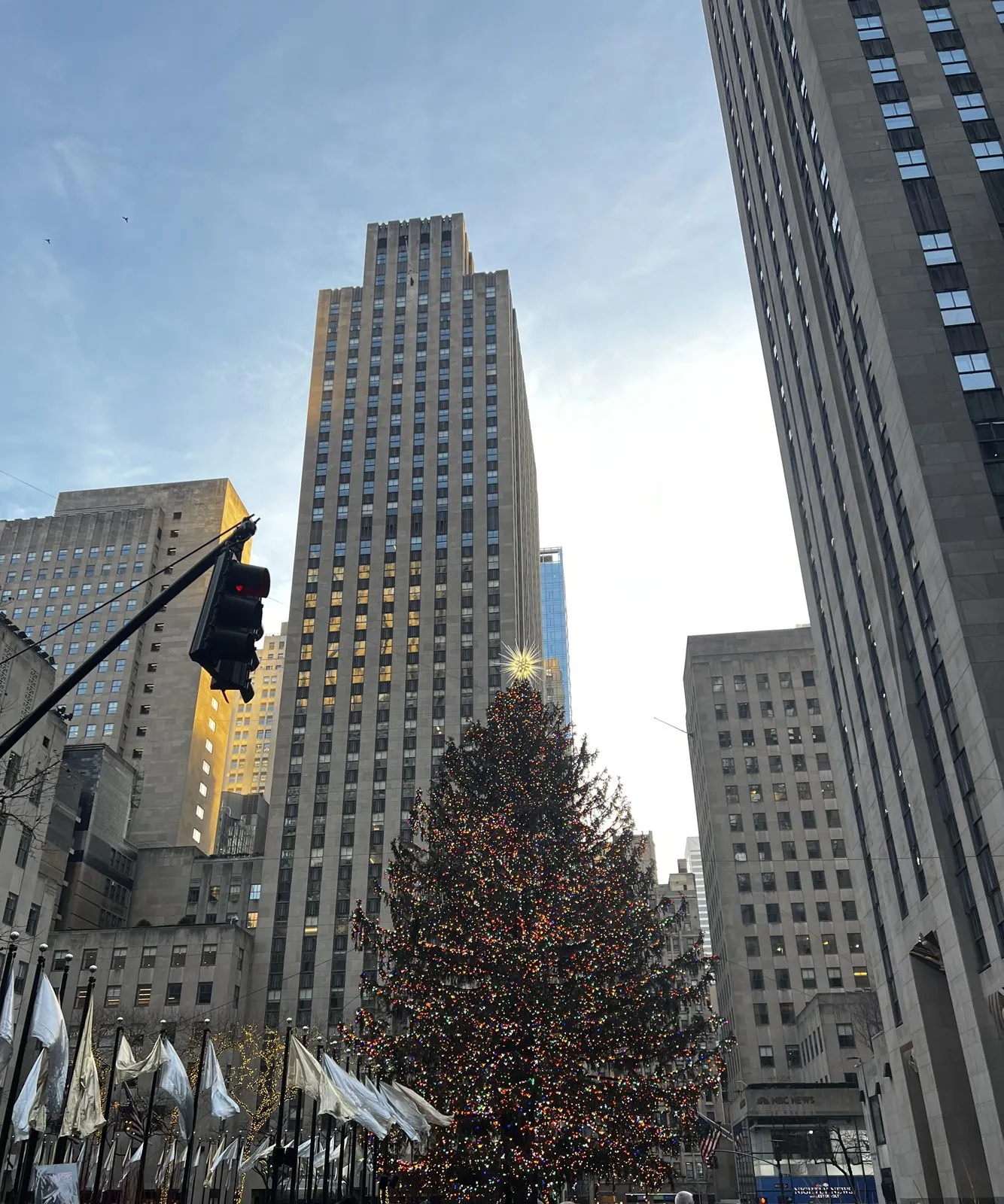
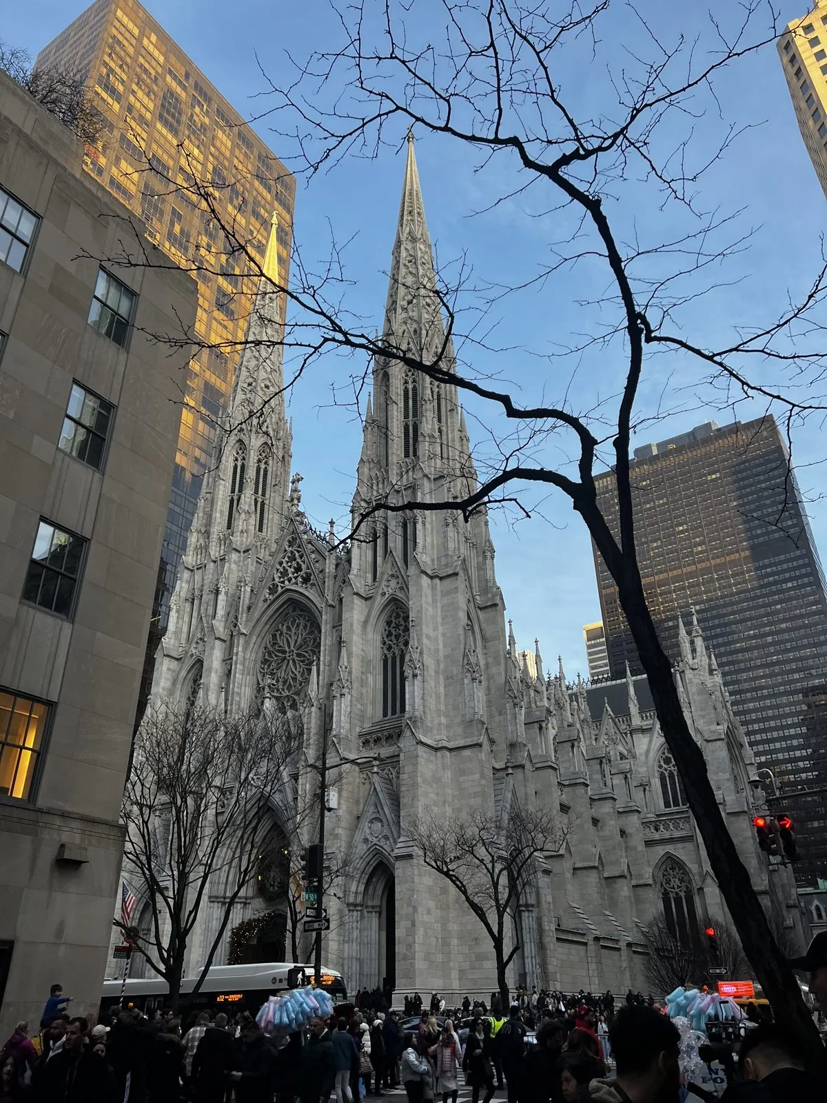
We started at Rockefeller Center at a quarter to four, with the sun already low. The tree was up and lit, a huge Norway spruce strung with tens of thousands of lights and topped with a crystal star, standing beneath the Art Deco slab of 30 Rockefeller Plaza. The tradition goes back to 1931, when construction workers building the complex pooled their money for a small tree on the muddy site; the official version began two years later, and the tree has been the city's Christmas centerpiece ever since. A row of white flags snapped around the rink below. Across Fifth Avenue, St. Patrick's Cathedral raised its twin spires through the bare branches. James Renwick Jr.'s Gothic Revival cathedral opened in 1879, when this stretch of Fifth Avenue was still the edge of town, and the spires were added a few years later. Today it is surrounded by glass and steel towers, and somehow manages to look like the older, calmer sibling of all of them.
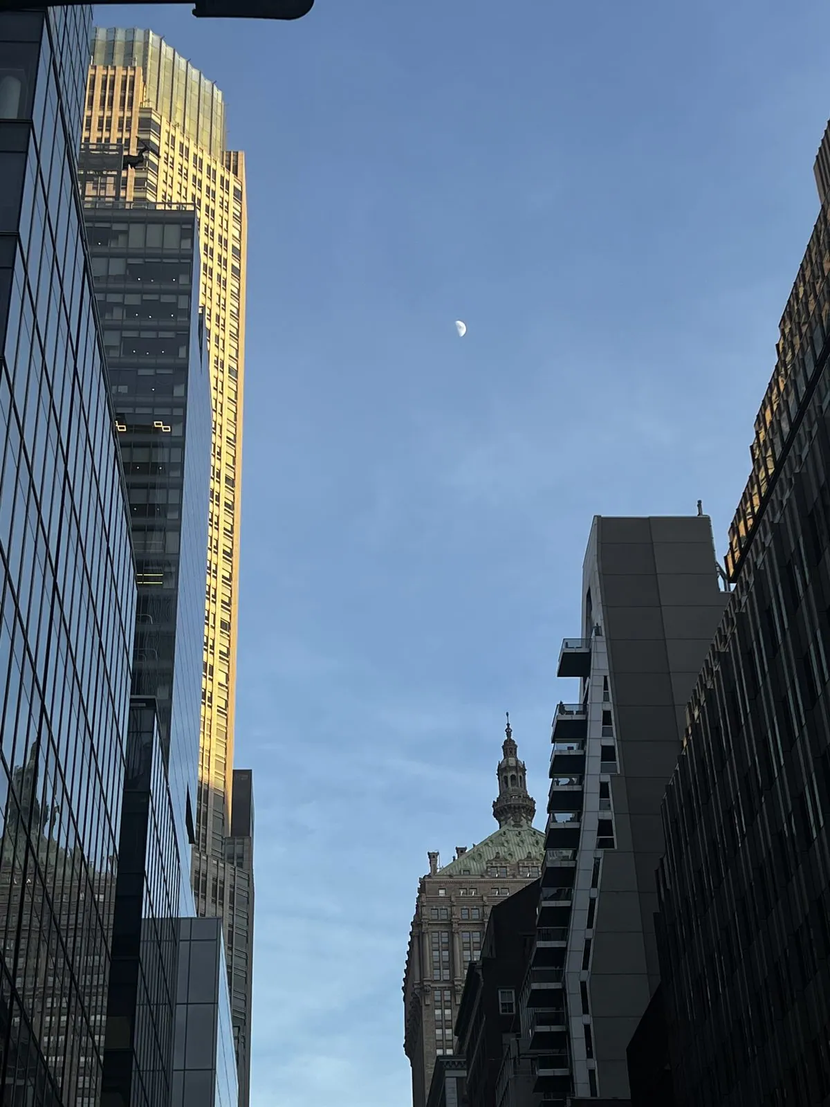
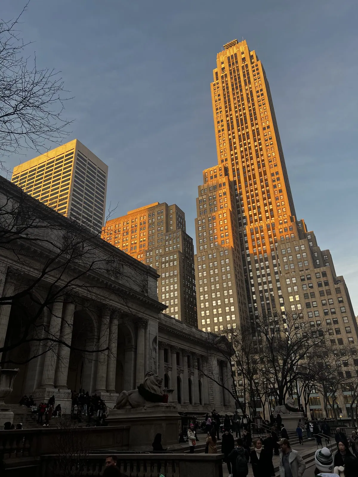
Heading south on Fifth Avenue, the light changed by the minute. In late December the sun sets before five, and for the last half hour it skims in low from the west, along the cross streets. It hits only the tops of the towers, so that the upper floors burn copper and gold while the street below has already gone blue. A pale half-moon was already up between two buildings. At 42nd Street we reached the New York Public Library, the great Beaux-Arts marble building by Carrère and Hastings that opened in 1911, with its two stone lions, Patience and Fortitude, guarding the steps. The steps were crowded with people resting their feet. Behind them, an Art Deco tower caught the last of the sun and glowed like it was lit from inside.
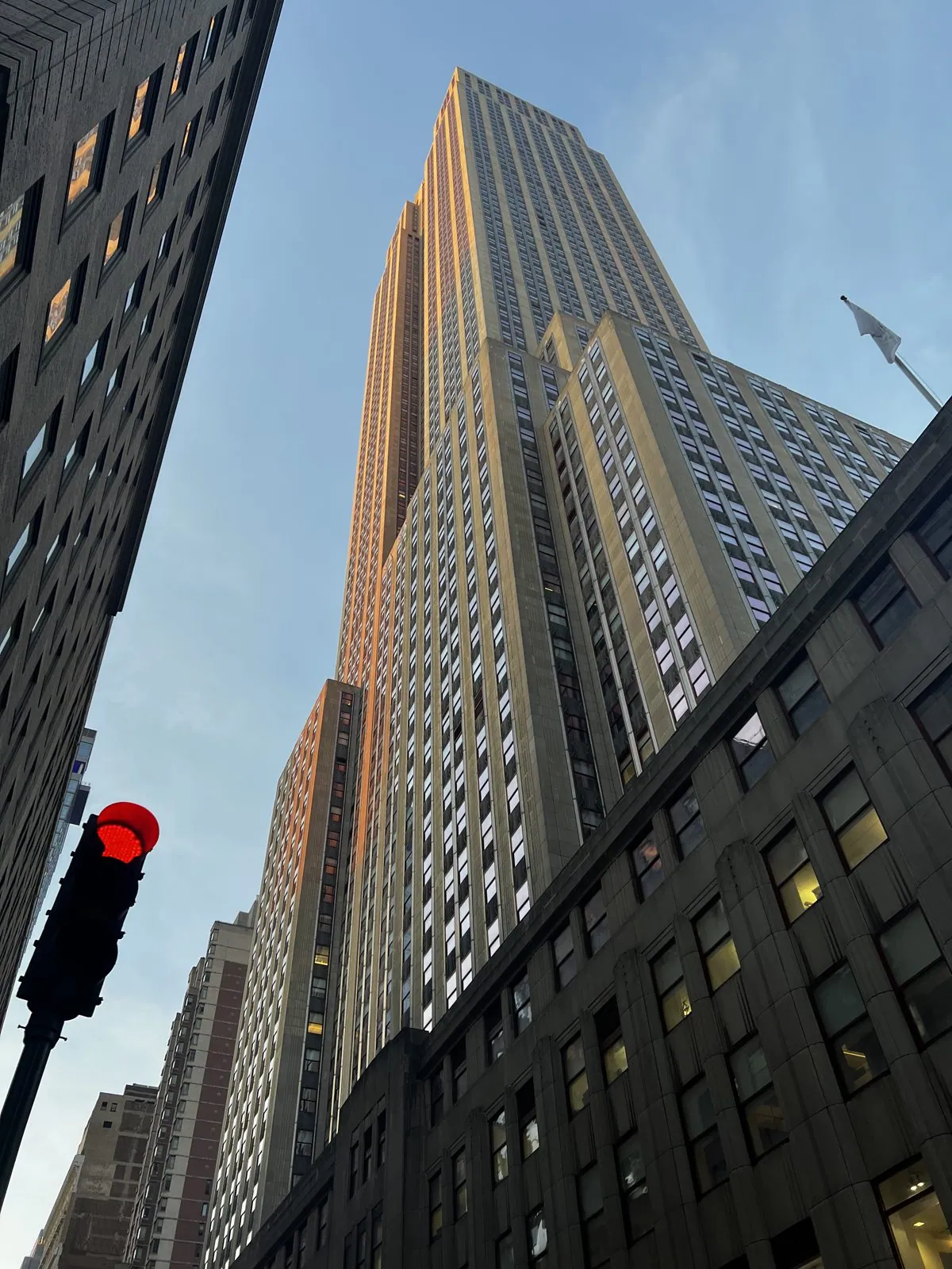
A few blocks further, at 34th Street, the Empire State Building appears the way it usually does when you're actually next to it: not as the elegant needle of the postcards but as a sheer limestone cliff going straight up, too tall to take in at once. It was built in an astonishing thirteen and a half months and opened in 1931, at the bottom of the Depression. For forty years it was the tallest building in the world. From the sidewalk you mainly notice the setbacks, the stepped "wedding cake" profile that New York's 1916 zoning law required so that light could still reach the street.
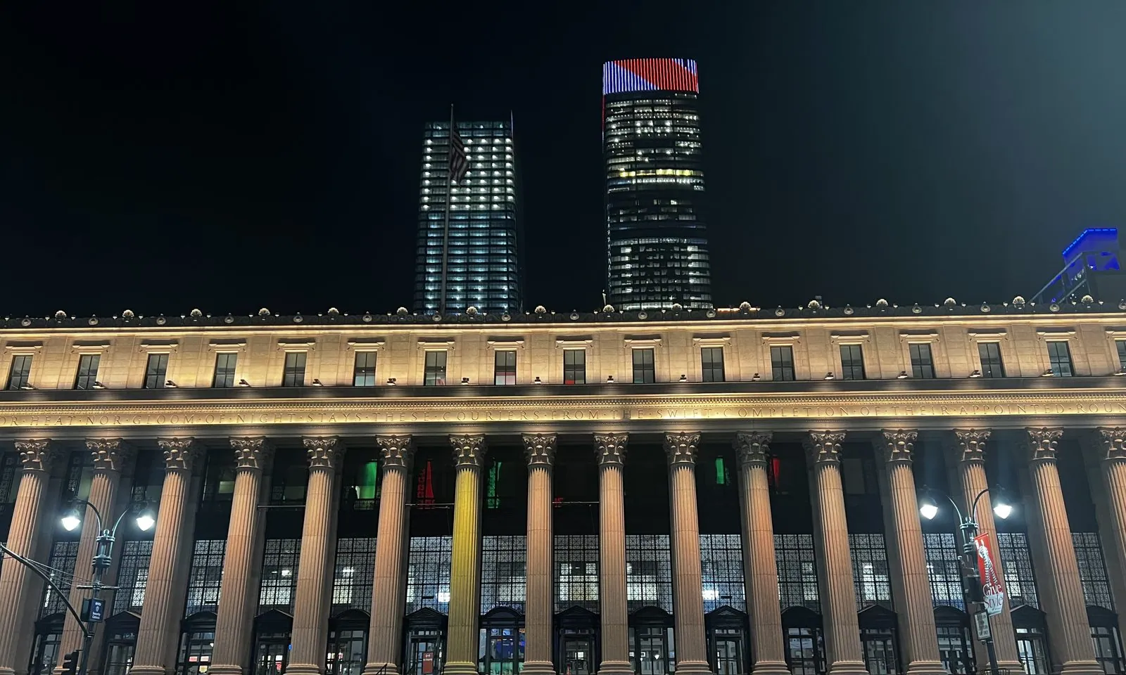
After a quick bite near Herald Square, we walked west in the dark to 8th Avenue and the James A. Farley Building, the city's main post office since 1914. It is a full two blocks of Corinthian columns lit gold, with the old postal motto carved along the frieze: "Neither snow nor rain nor heat nor gloom of night stays these couriers from the swift completion of their appointed rounds." It was designed by McKim, Mead & White to match their Pennsylvania Station across the street. When that station was demolished in 1963, the loss was so widely mourned that it helped start the historic-preservation movement in America. Six decades later, the Farley Building was given a second life as Moynihan Train Hall, so a piece of the grand station finally came back.
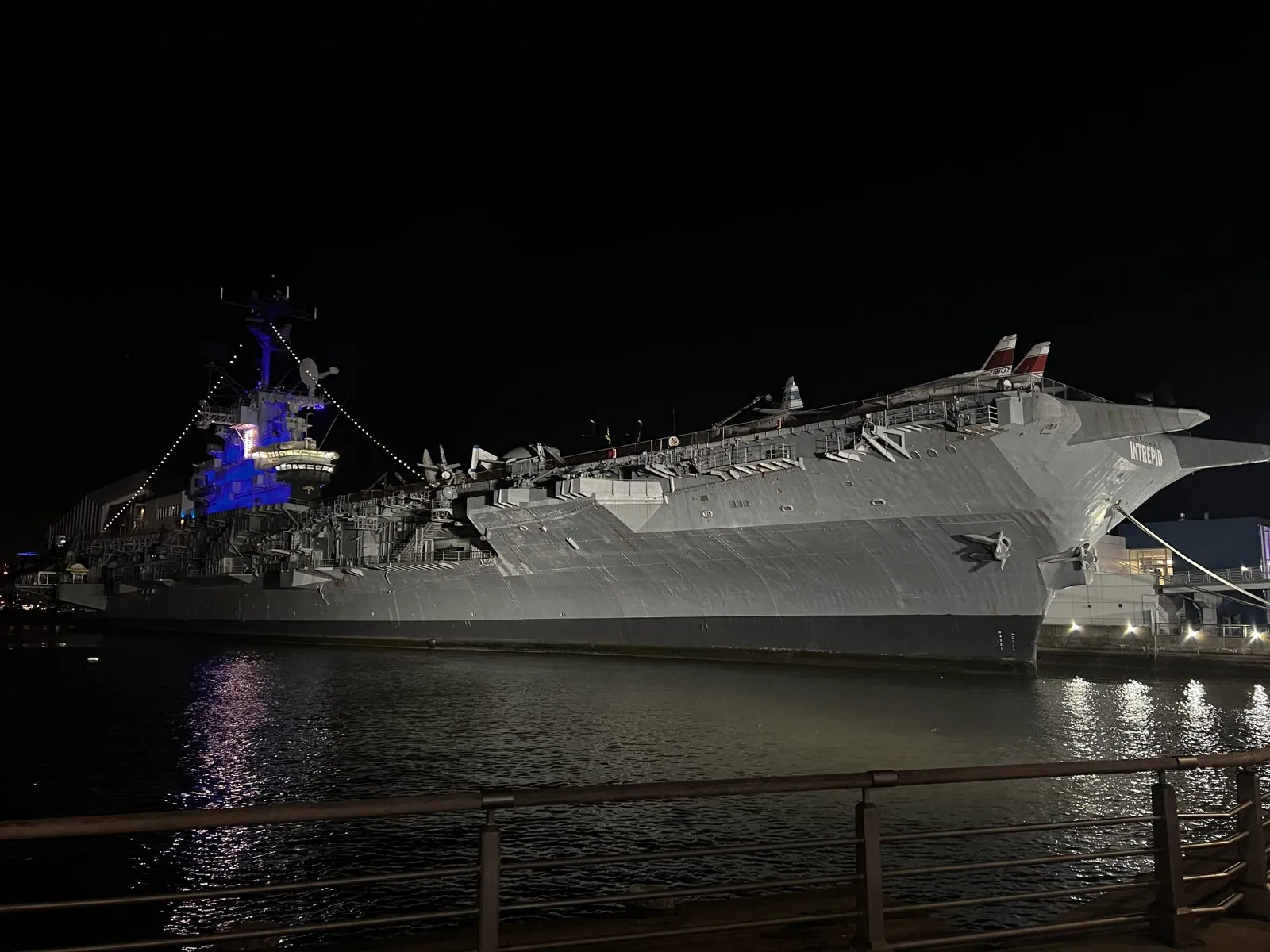
Then we kept going west, past a red-brick church on 42nd Street wrapped in Christmas lights and the neon Circle Line sign at the piers, all the way to the Hudson. The river at night is a different city: wide, black and quiet, with the wind coming straight off the water and the lights of New Jersey strung along the far bank. Moored at Pier 86 is the USS Intrepid, an aircraft carrier commissioned in 1943 that fought in the Pacific, later picked up Mercury and Gemini astronauts after splashdown, and has been a museum since 1982. At night it is lit from below in pale gray and blue, with jets parked on its deck, and the whole enormous hull is mirrored in the water. Seen from the railing, it looks less like a ship than a building that has decided to float.
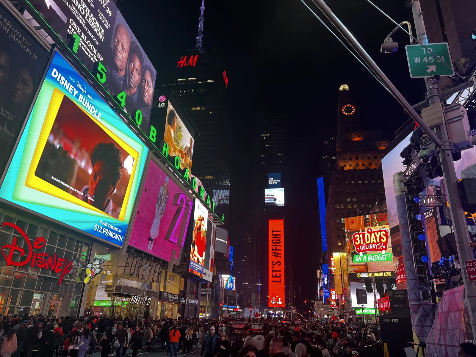
We walked back east along 44th Street into the Theater District, past mounted police officers sitting high above the crowd on their horses, and came out at the north end of Times Square at twenty to eight. The crowd had doubled since the night before. At the far end of the square, above everything, stood the narrow tower of One Times Square, wrapped from top to bottom in screens. That's where the ball would drop in a little over forty-eight hours. It has been dropping there since the New Year of 1908, when the New York Times, the building's original owner, replaced its fireworks with an illuminated ball of iron and wood. The current one is twelve feet across and covered in nearly three thousand Waterford crystal triangles.
December 31: fog, then midnight
New Year's Eve began in a cloud. Rain had come through, and by the afternoon a thick fog had settled over the East River. We took the subway to York Street, in Brooklyn, and walked into Dumbo a little after four. The name stands for "Down Under the Manhattan Bridge Overpass", coined in the 1970s by artists who had moved into the empty warehouses here and hoped an unappealing name would keep developers away. It did not work: the warehouses are now some of the most expensive lofts in the city.
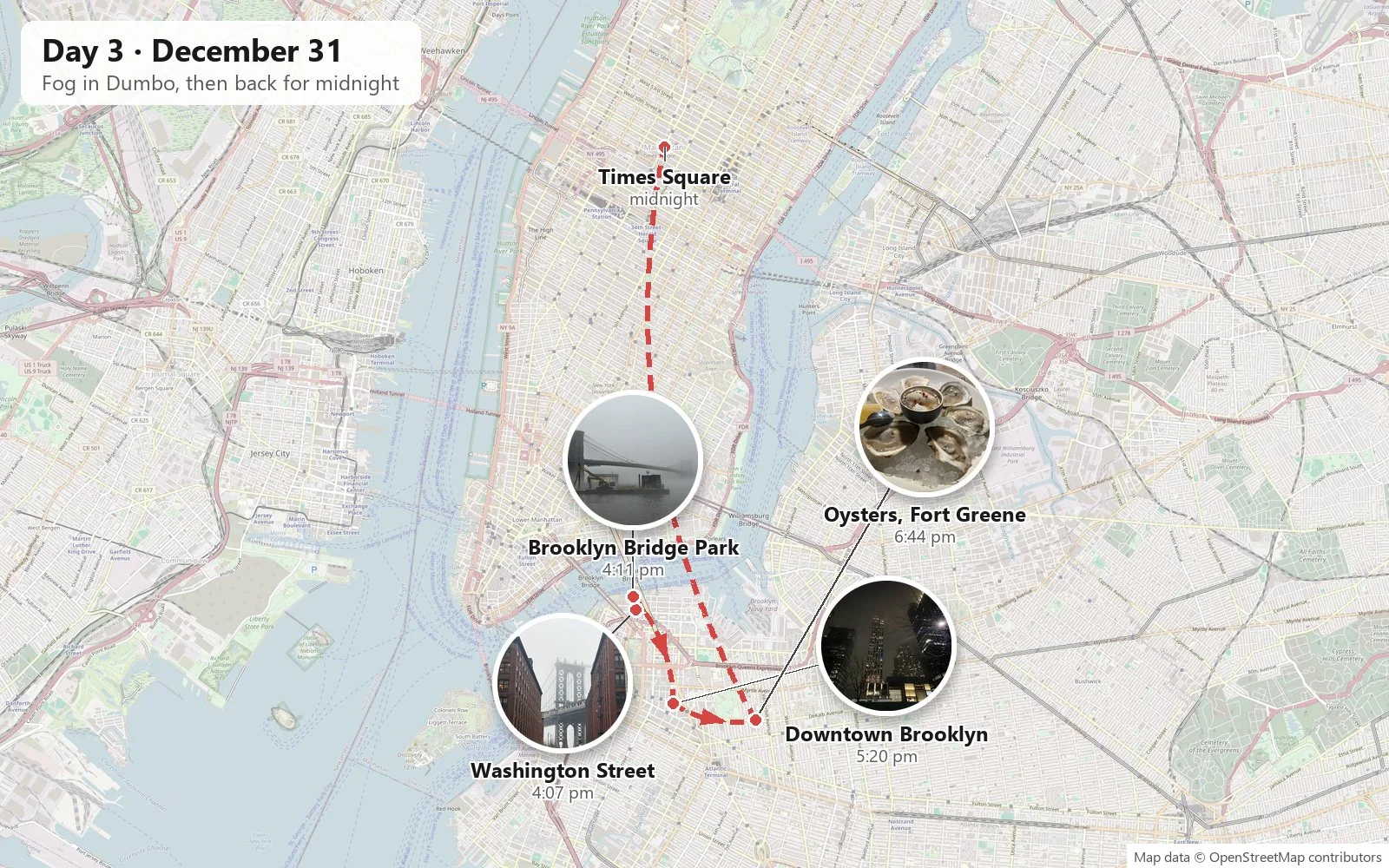
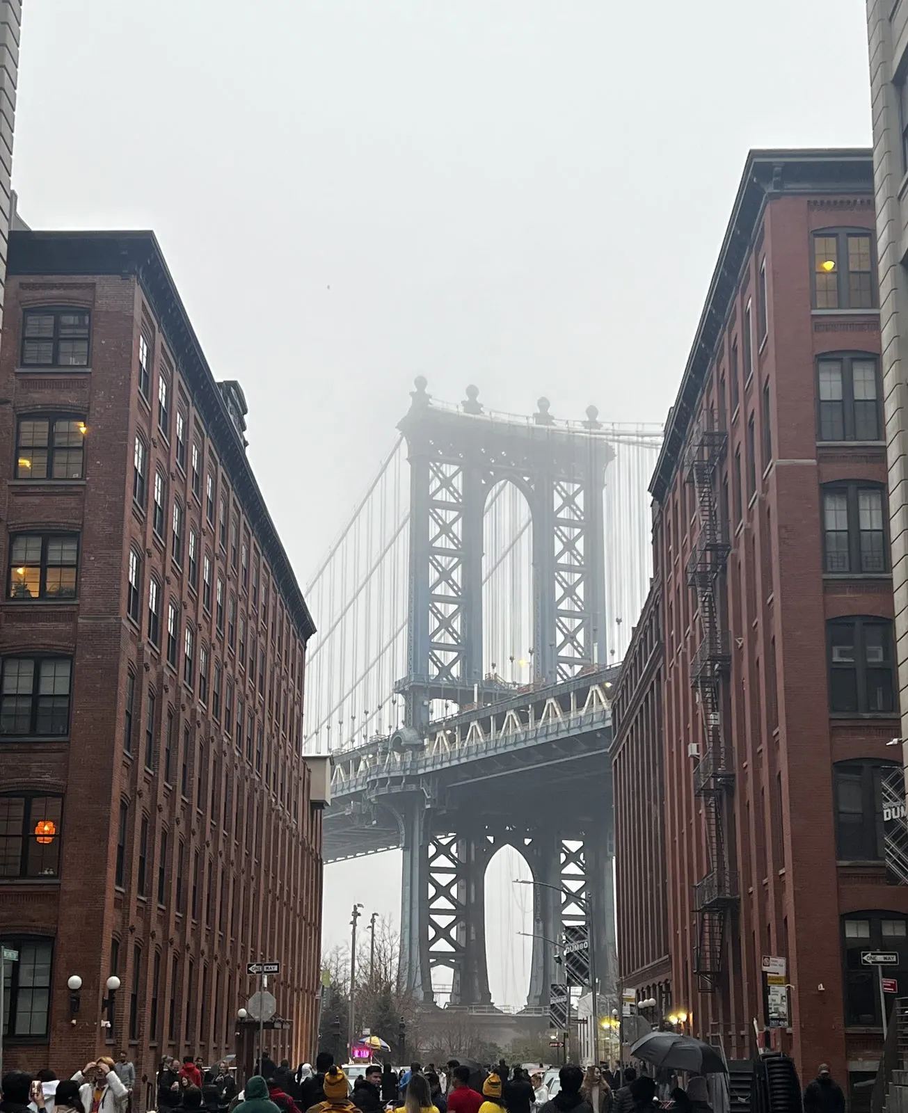
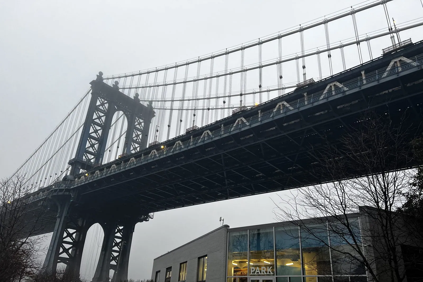
The most famous view in Dumbo is from the corner of Washington and Water Streets. Looking down Washington Street, the cobbles run between two rows of red-brick warehouses, and the Manhattan Bridge fills the gap at the end. On a clear day the Empire State Building is perfectly framed beneath its arch. On this day the fog had taken the Empire State Building, the far tower and the top of the near one, and the bridge seemed to rise out of the street and simply stop in midair. It was, if anything, better. A crowd stood in the middle of the street, umbrellas up, waiting for gaps in the traffic to take the same photo we did. Down by the water, the bridge passed overhead with a low rumble of subway trains, its steel deck vanishing into gray in both directions.
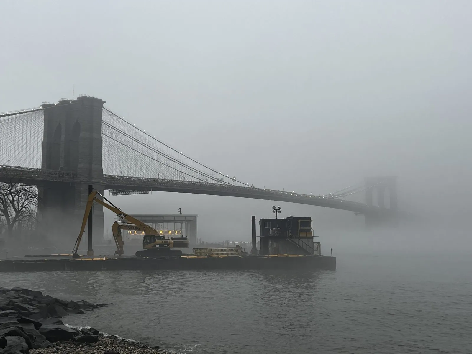
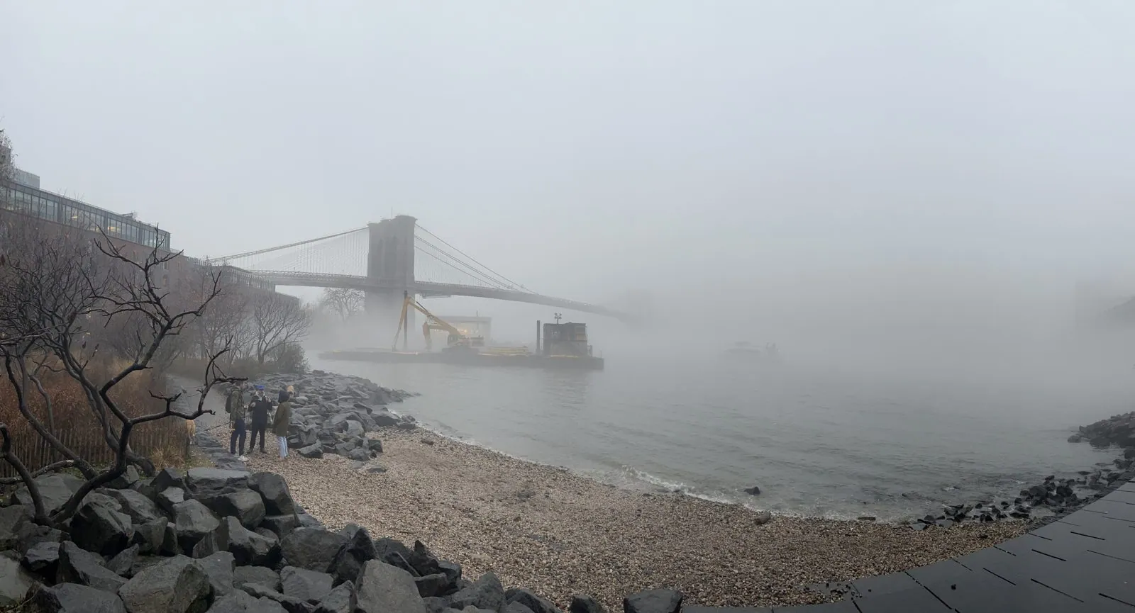
A few minutes along the waterfront, Brooklyn Bridge Park looks out at the Brooklyn Bridge. In the fog it was a ghost of itself. The near tower stood dark and solid, the cables fanned out toward the river, and then the whole thing faded, so that the far tower, on the Manhattan side, was only a faint gray outline. Manhattan itself had disappeared entirely. Where the skyline should have been there was nothing at all, just white. A work barge with a yellow excavator sat in the water below, and the river lapped on the rocks. When the bridge opened in 1883 it was the longest suspension bridge in the world, and its granite towers were among the tallest structures in the city. It took fourteen years to build. John Roebling, who designed it, died of an injury before construction began; his son Washington took over and was crippled by caisson disease, and Washington's wife Emily effectively ran the project for years, relaying his instructions to the engineers.
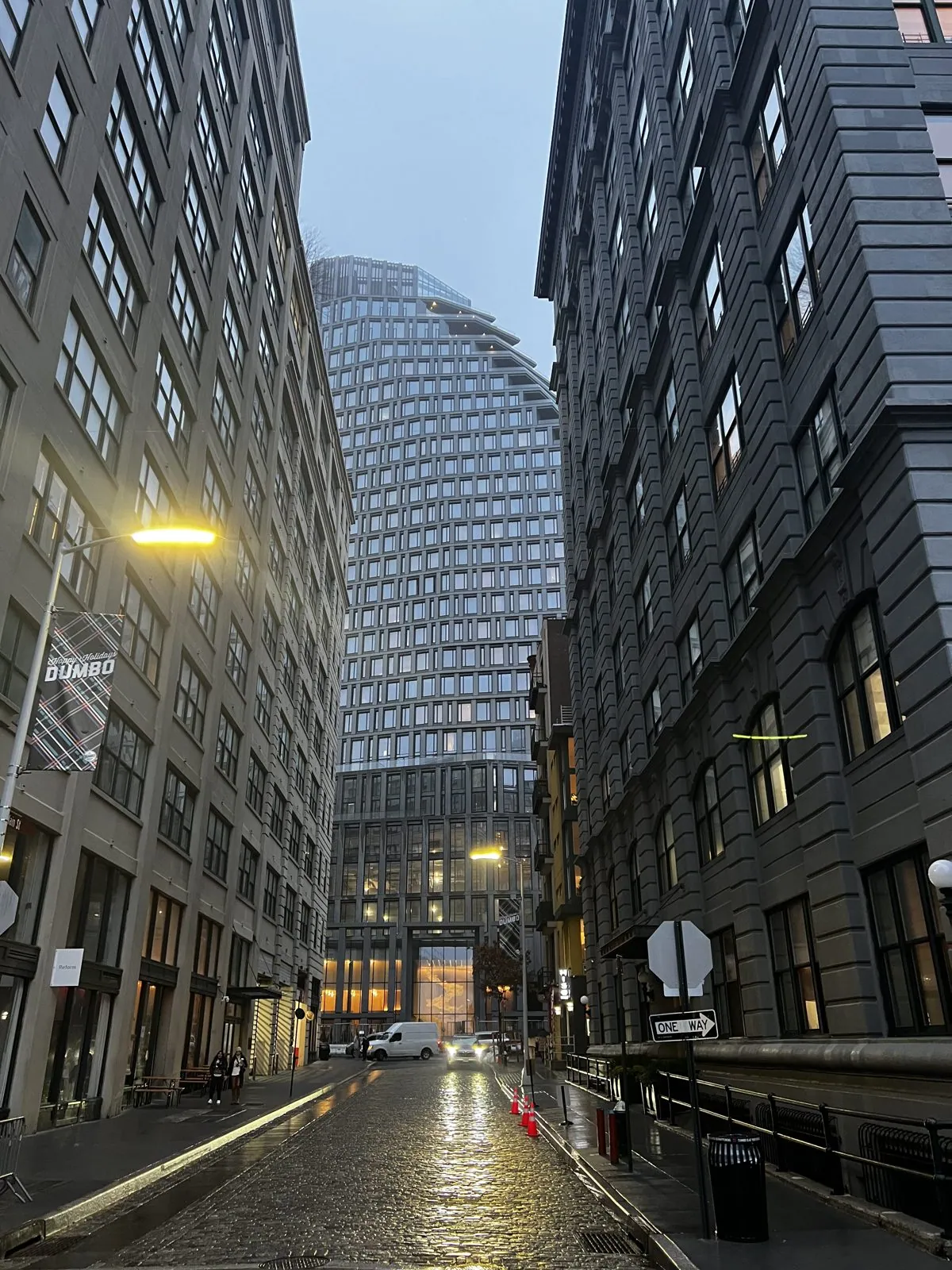
Fog does strange things to sound. The traffic on the bridges becomes a soft, distant hum; the water is louder than you'd expect; voices carry along the path. The little pebble beach under the bridges was gray on gray: dark rocks, pale stones, flat water and a white sky, with a few people standing at the edge looking out at where the city was supposed to be. Back in the streets, the cobblestones shone with rain, the old warehouse windows were starting to glow, and at the end of one narrow block a new glass tower stood with its top lost in the cloud.
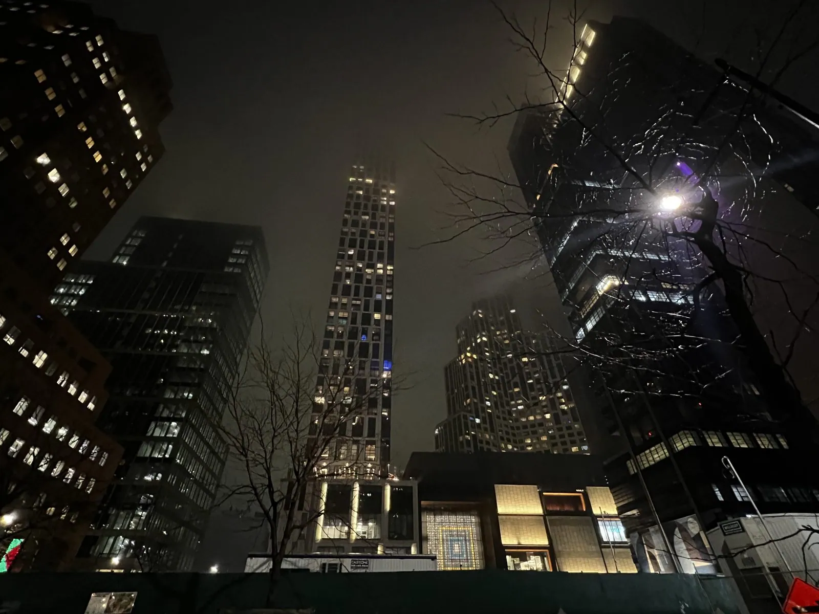
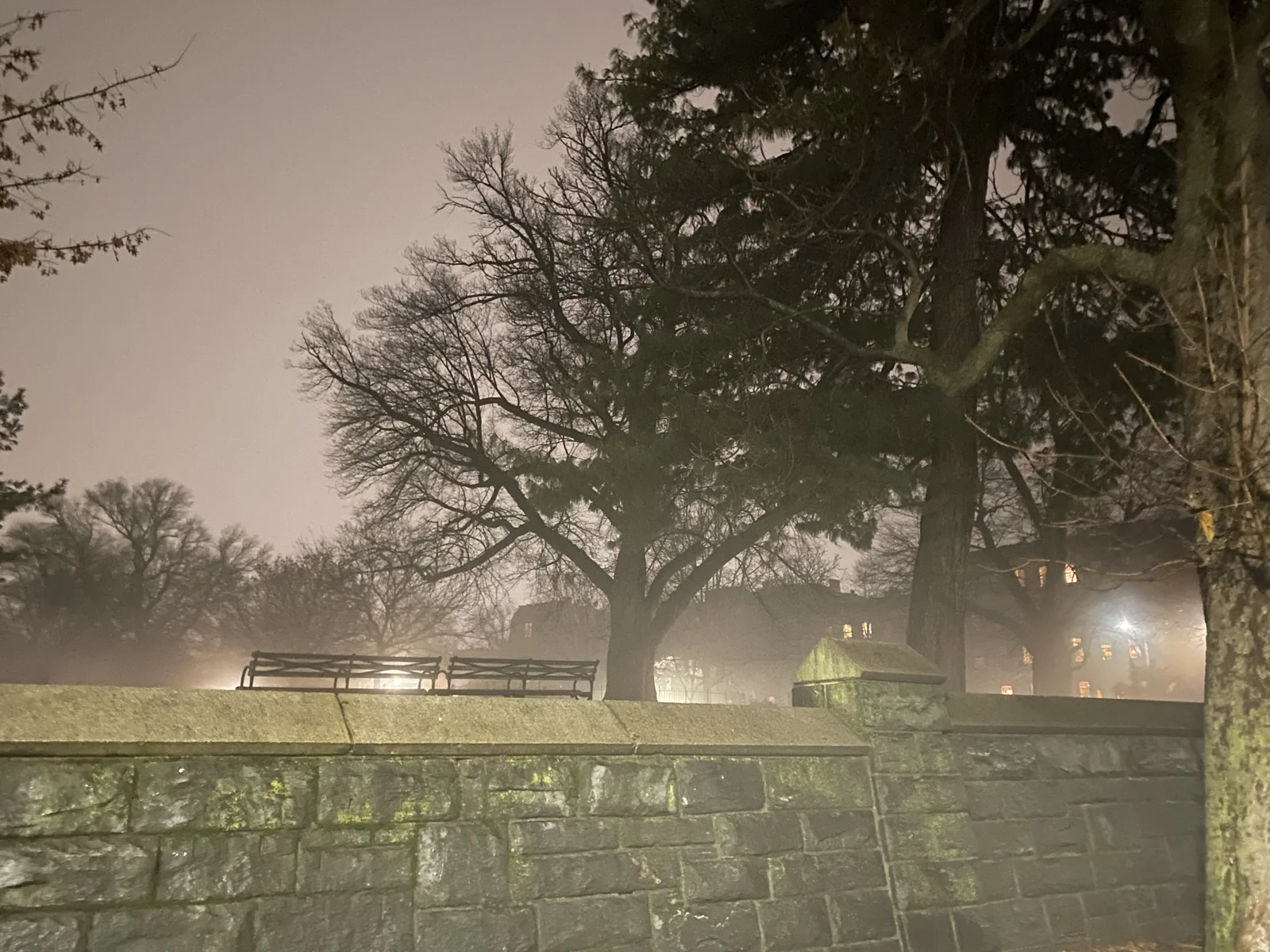
By five the light was gone, and Downtown Brooklyn's new towers rose into the fog with their lit windows smeared into halos. A little after six we walked up through Fort Greene Park in the fog.
Then we sat down nearby for an early New Year's Eve dinner, and the evening's indulgence was a plate of oysters on ice, which feels like the correct way to end a year, especially a year you have spent mostly not eating oysters.

Midnight, from above
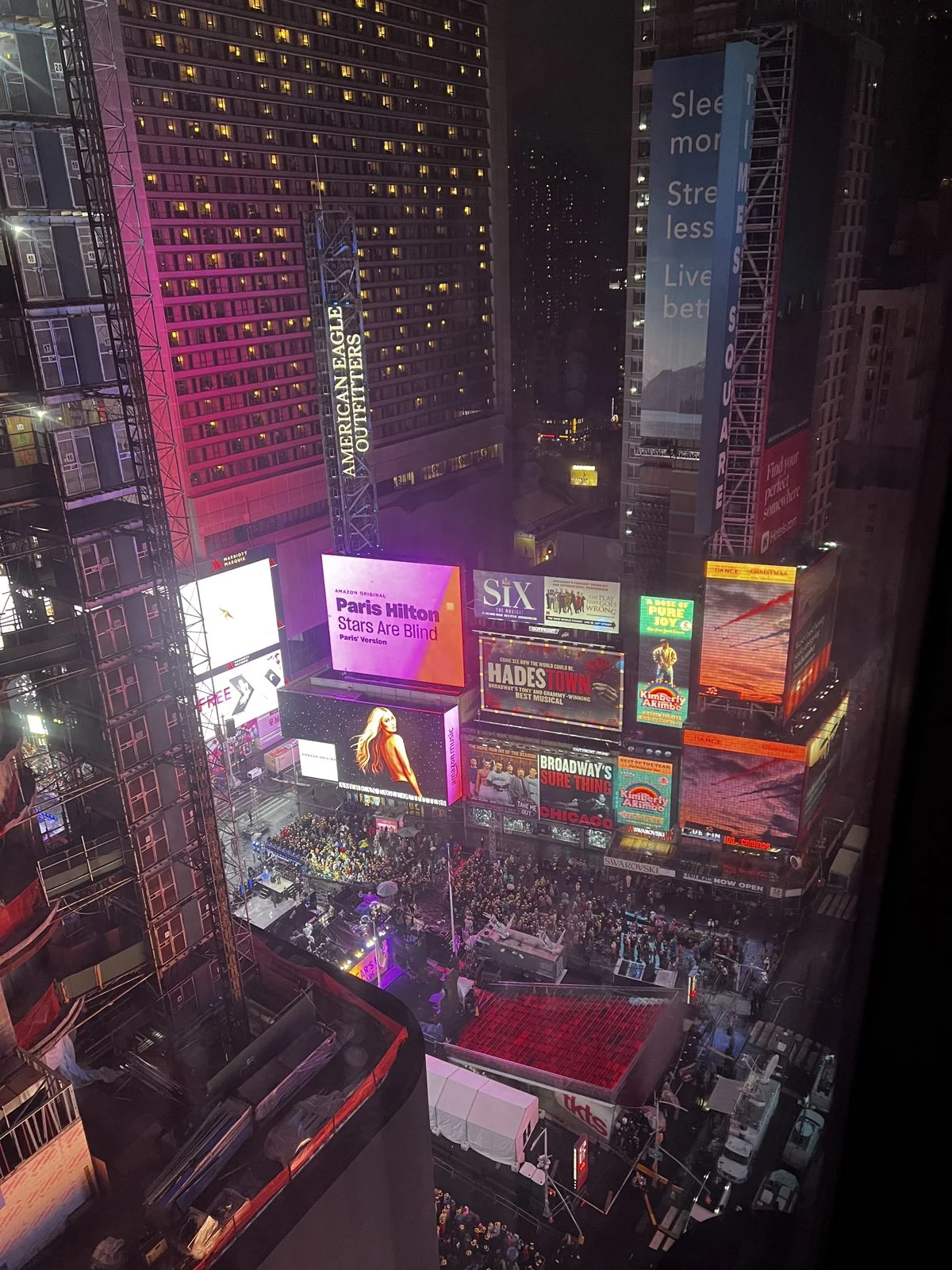
Then we went back to Manhattan, and up. From our window at the Hotel Edison that evening, Times Square looked like a stage set seen from the fly tower. Straight below were the red steps of the TKTS booth in Duffy Square, the pens full of people, the broadcast stage glowing purple and the white roofs of the production tents. The screens were at eye level instead of overhead, and for the first time you could see them as what they are: a wall of rectangles, each fighting to be the brightest. The people in the pens had been there since the afternoon. Once you leave a pen on New Year's Eve there is no getting back in, and there is nowhere to buy food or find a bathroom, which is why watching from upstairs felt like cheating.
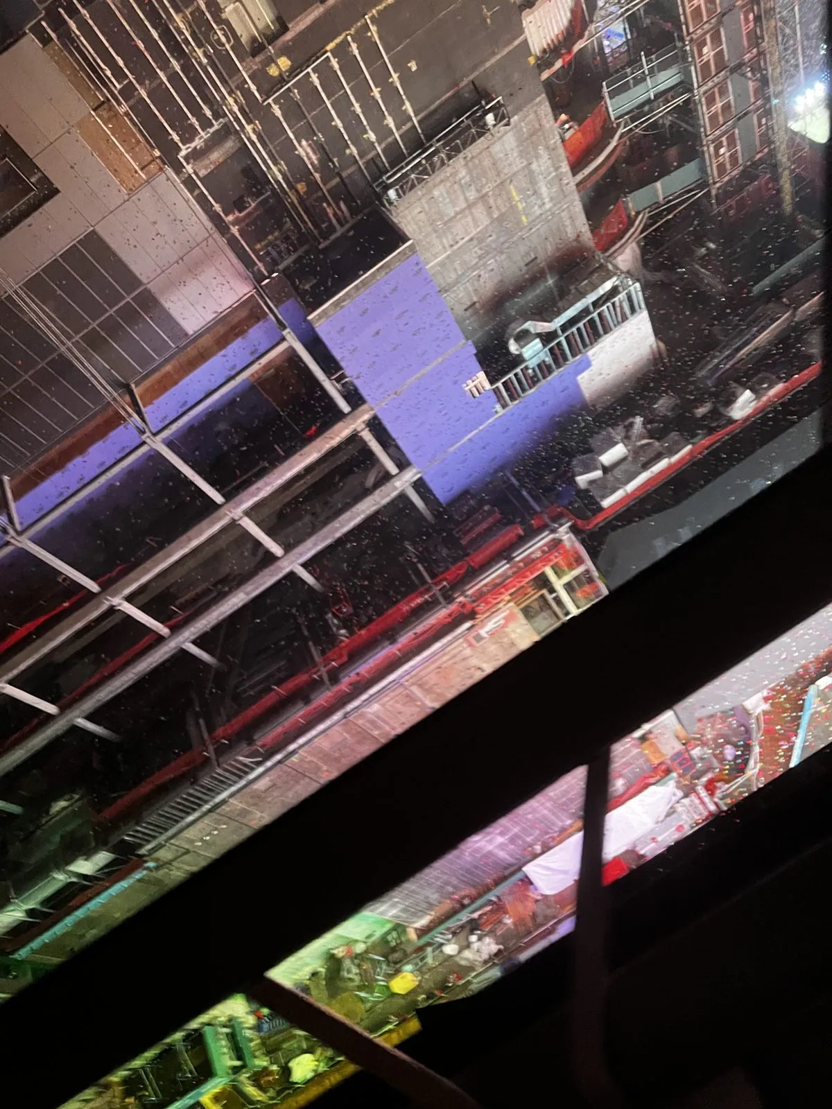
At 11:59 the ball began its descent, sixty seconds down its pole, while the whole square counted down with it. At midnight the confetti went up. It is said to be about three thousand pounds of it, thrown by hand from the rooftops, and from above it looks like the whole square has suddenly been snowed on in color. My one photo of the moment, taken at 12:01 through a window wet with rain, is tilted and blurred, and it is the most accurate photo I own of how midnight felt.
January 1: two rivers and a tower
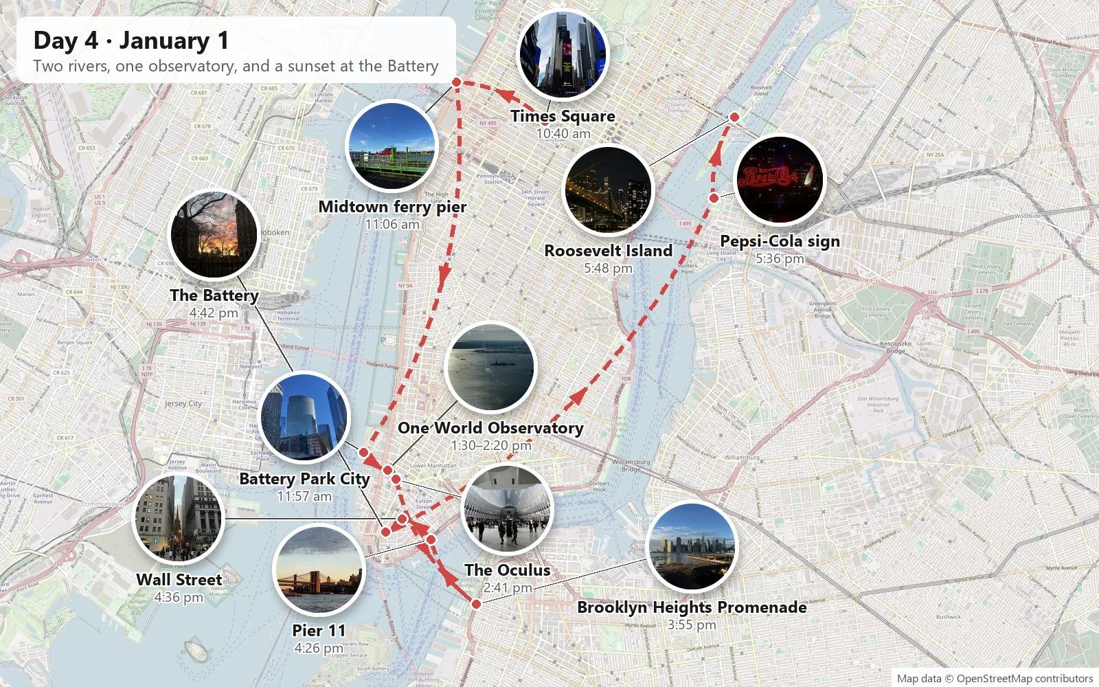
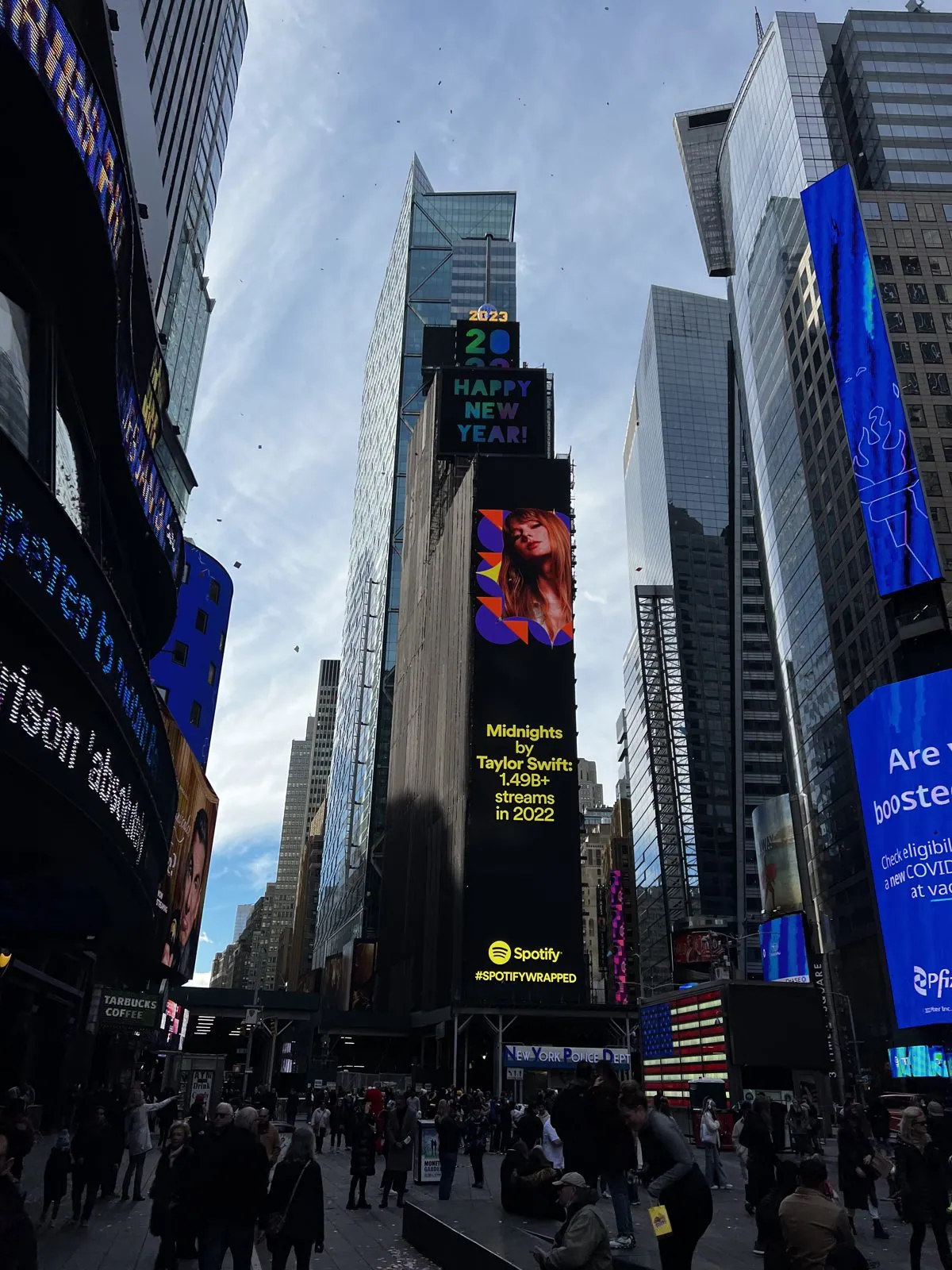
New Year's Day was the opposite of the day before: cold, bright and perfectly clear, the sky a hard, deep blue. Times Square at half past ten in the morning was strewn with confetti and quieter than we'd ever seen it, with a "Happy New Year 2023" sign on the screens and the cleaning crews already at work. We spent the whole day on the water and above it.
Down the Hudson
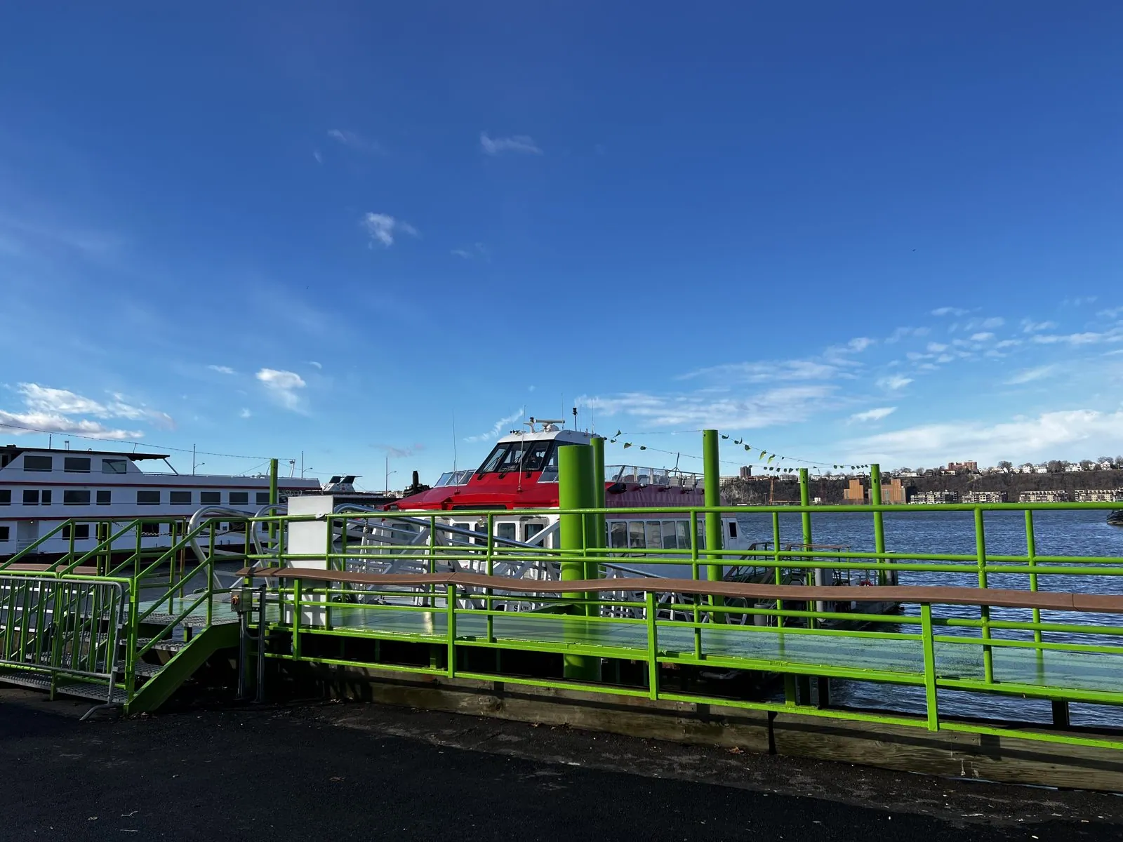
We walked west to the river and caught a ferry from a pier in Midtown, all bright green railings and red-and-white boats, with the cliffs of New Jersey across the water. Taking a ferry down the west side of Manhattan is one of the best tricks in the city: you get the view the sightseeing boats sell, at commuter speed, sitting among people who are mostly not looking out the window.
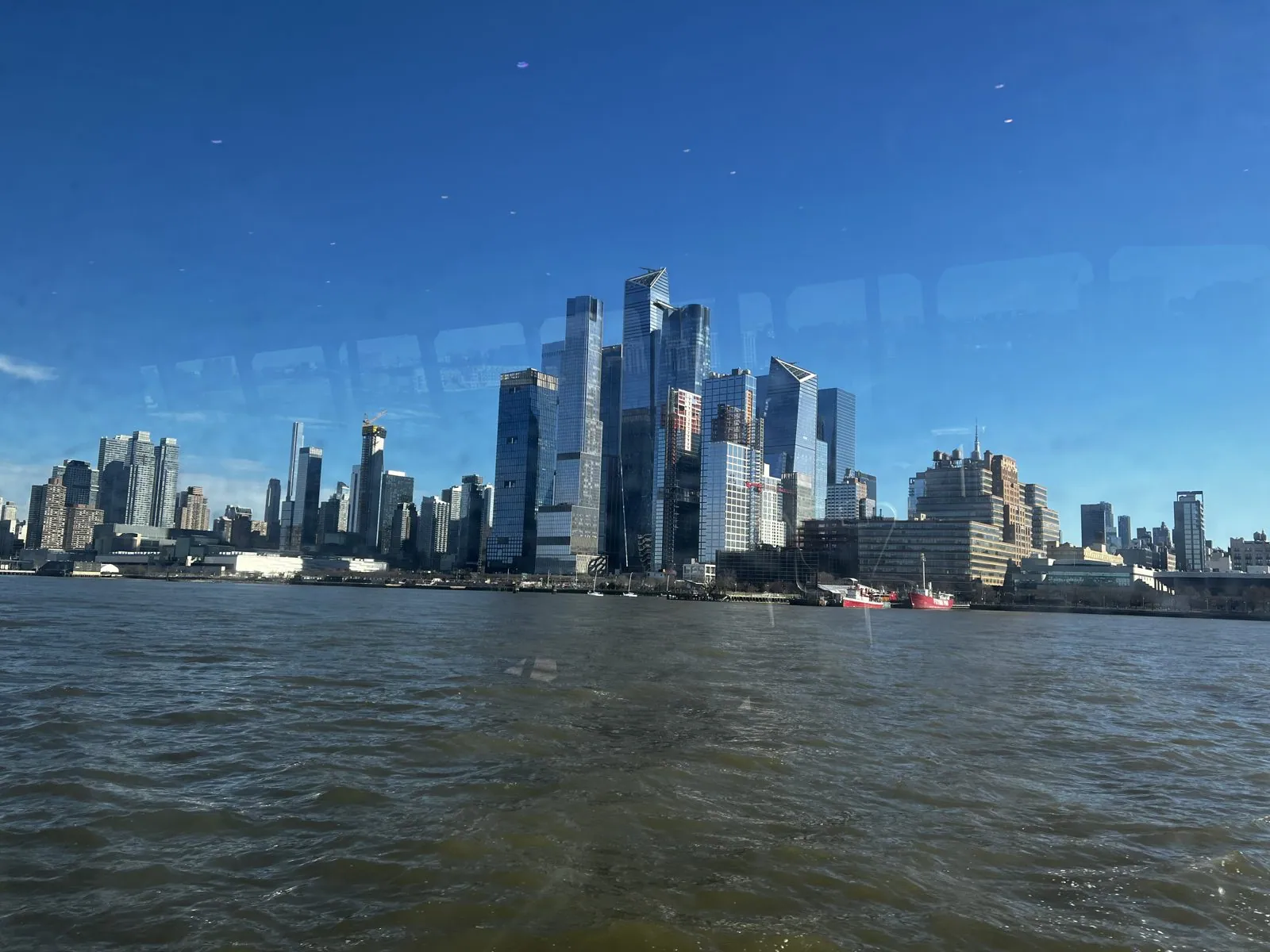
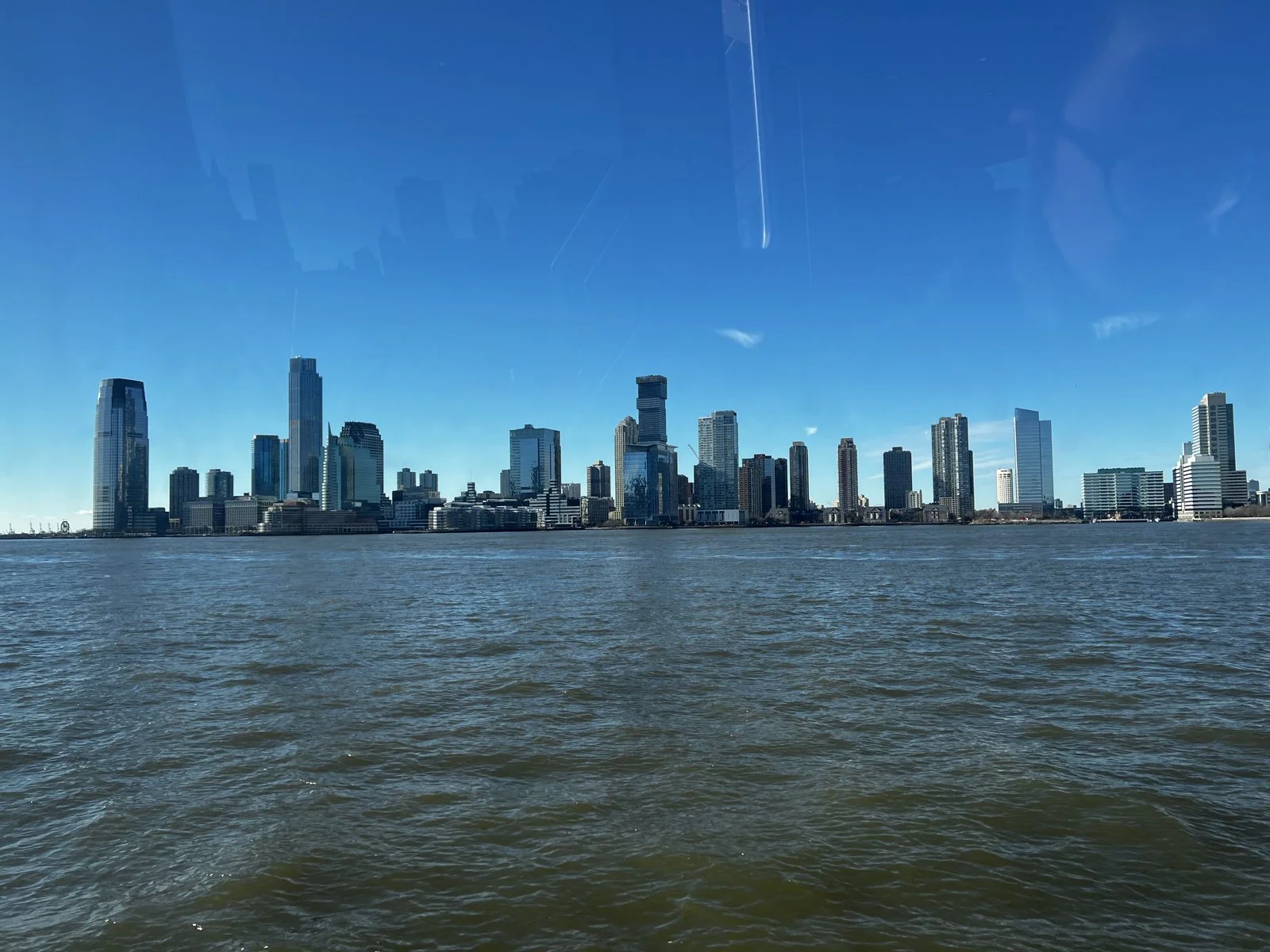
From the water, Hudson Yards looks like a cluster of glass crystals that grew out of the rail yards, which is close to the truth: the whole district is built on a platform over a working train yard. It was the largest private development in American history, and it went up in a decade on a site that had been tracks and parking lots. Across the river, the towers of Jersey City lined up along the shore, a skyline most people only ever see from Manhattan and never think to name. The Hudson was choppy and brown-green, and the winter sun came off it so hard it was difficult to look at.
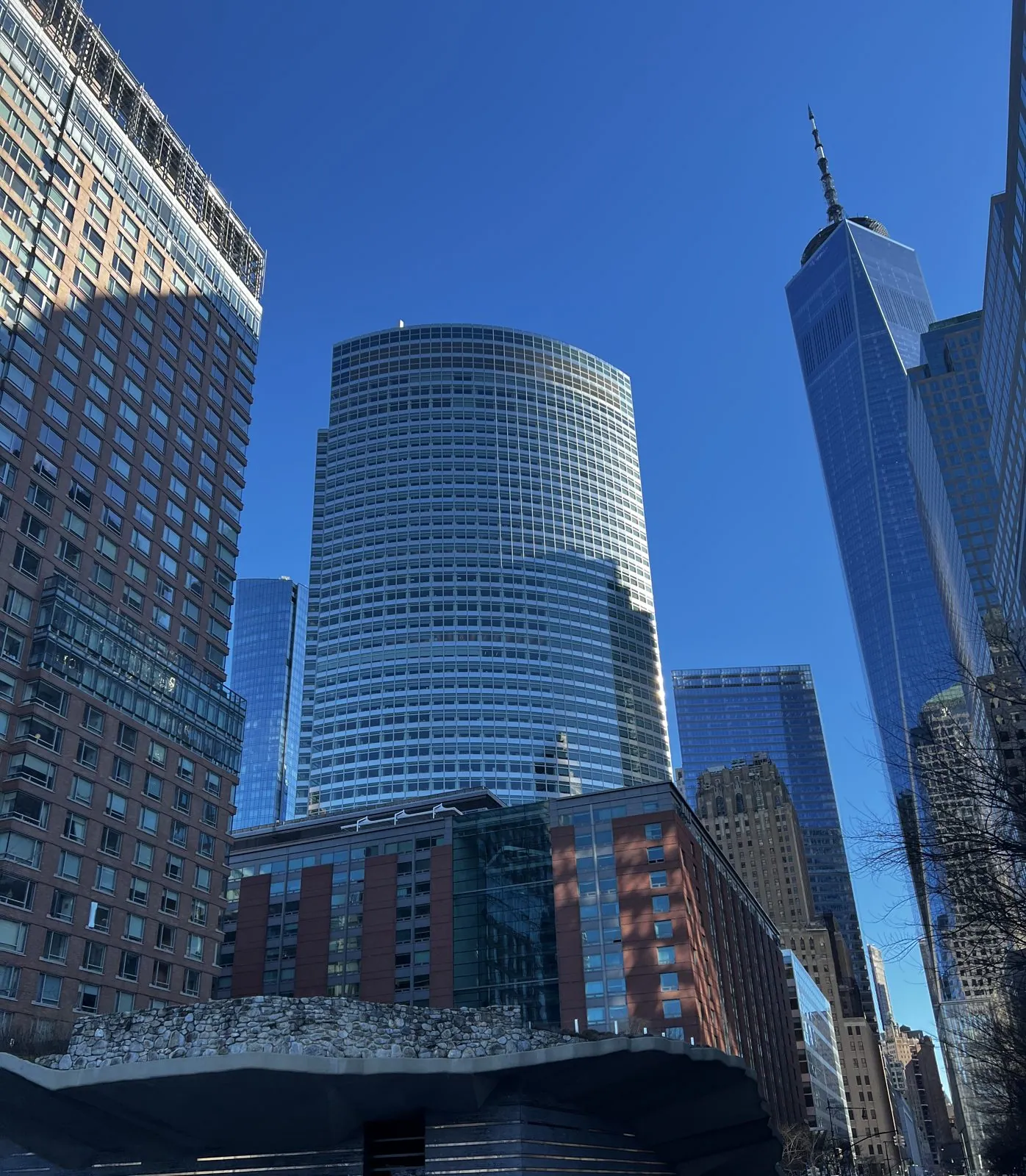
The ferry let us off at Battery Park City, the neighborhood built on landfill from the excavation of the original World Trade Center. Before the 1970s, everything west of West Street here was river. Walking inland, we passed the Irish Hunger Memorial, a half-acre of Irish hillside, complete with a ruined stone cottage brought over from County Mayo, lifted up on a slab of stone and concrete. Behind it rose the gently curved glass of 200 West Street, and beyond that One World Trade Center, which from its base is less a building than a vanishing point. Its height, 1,776 feet to the tip of the spire, is a deliberate nod to the year of the Declaration of Independence. The tower's footprint is a square, and its corners are beveled as it rises, so its cross-section turns into an octagon halfway up and back into a square, rotated 45 degrees, at the top. That is why its edges seem to twist when you look straight up.
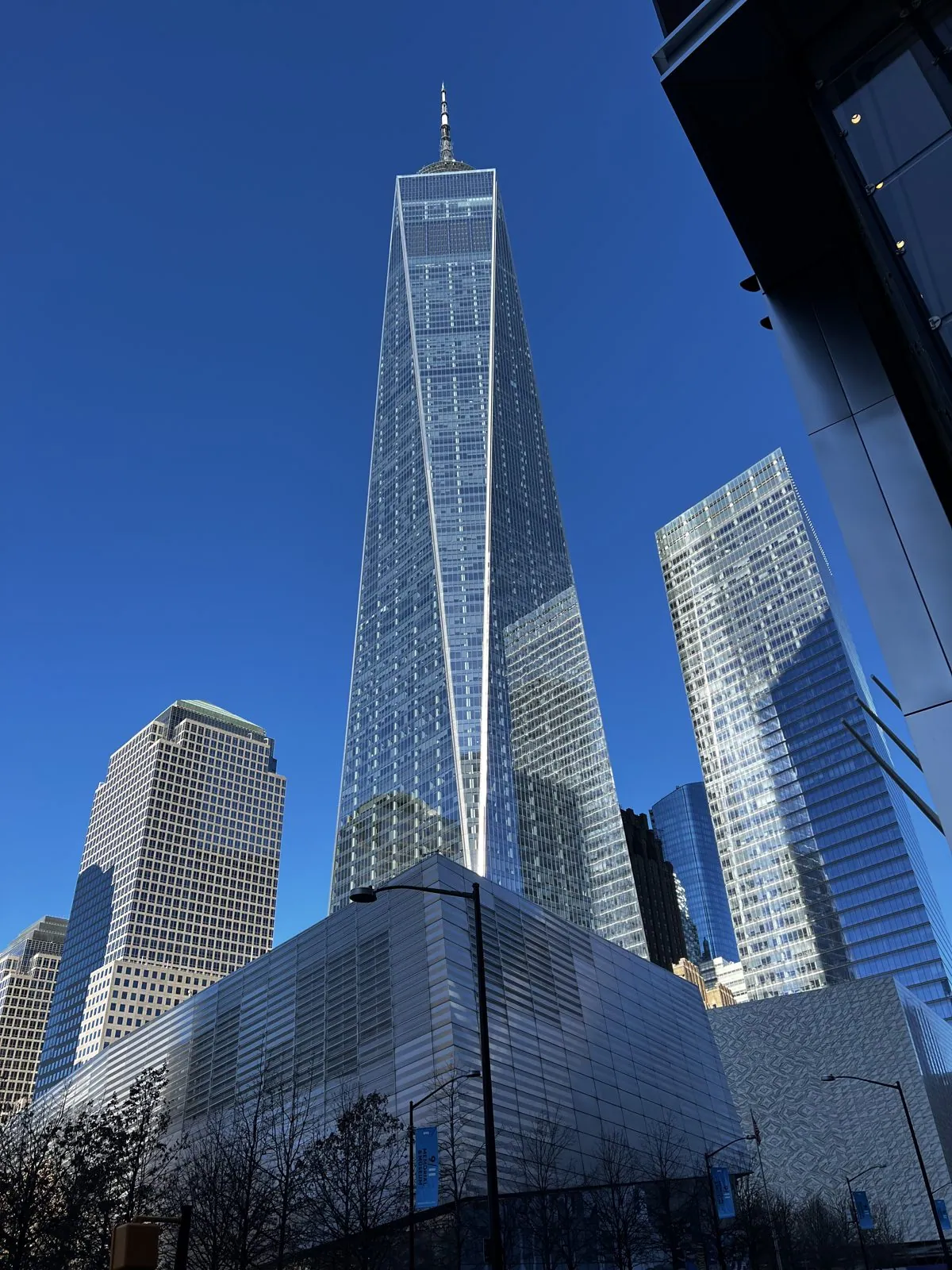
One World Observatory
Before going up, we walked past the 9/11 Memorial pools at the foot of the tower.
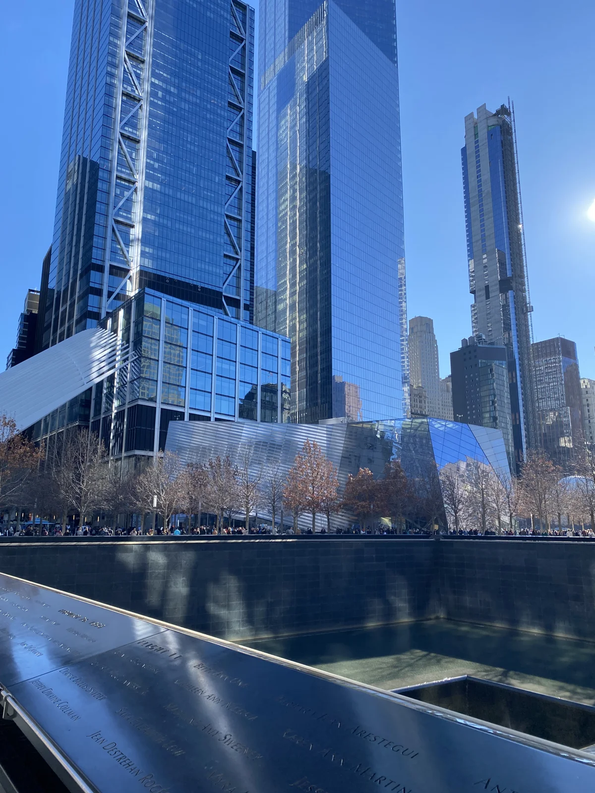
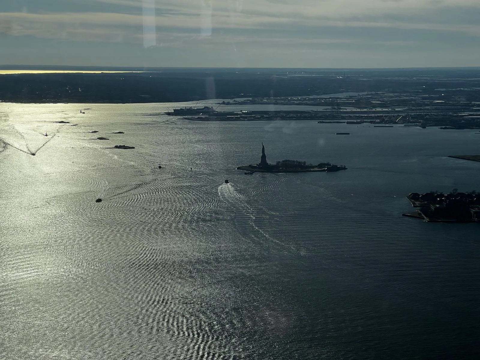
At half past one we went up. The elevators to One World Observatory climb 102 floors in under a minute, and while your ears pop, the walls show a time-lapse of the island below being built, from forest to Dutch village to the present skyline, five hundred years in sixty seconds. The observatory itself is on floors 100 to 102, about 1,250 feet up, and on a day like that the visibility seemed unlimited.
To the south was the best view of the trip. The afternoon sun was low over New Jersey and shining straight at us off the harbor, so the whole of Upper New York Bay turned to beaten silver, rippled by the wakes of ferries. In the middle of it, small and dark and unmistakable, stood the Statue of Liberty on her island, in silhouette, with the ferries' wakes drawing white lines around her. From this height she is tiny, and somehow that makes her more moving, not less.
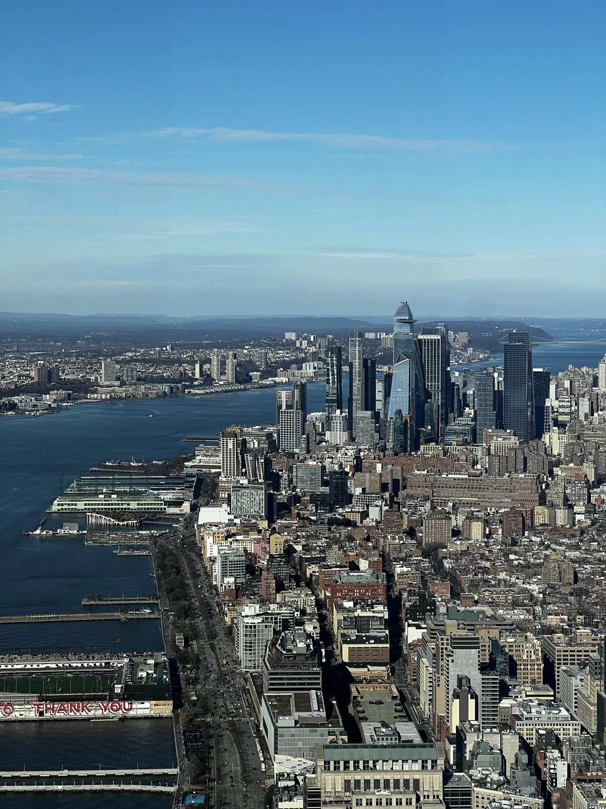
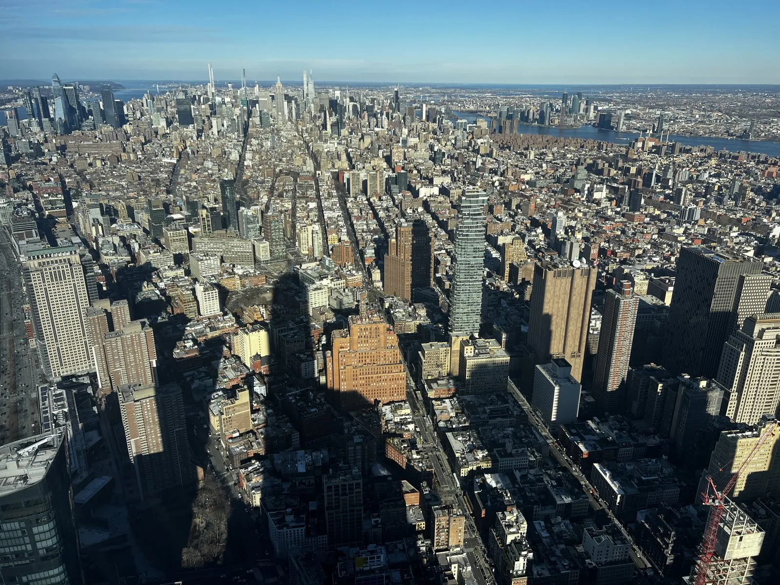
To the north, all of Manhattan lies spread out like a model of itself. The West Side piers reach into the Hudson like the teeth of a comb, the street grid runs up the island in parallel lines, and the tower's own shadow stretches enormously across Tribeca and SoHo, a long dark finger laid across the rooftops. From up here you understand the grid as a single idea: the Commissioners' Plan of 1811 laid out these streets across what was then mostly farmland, two centuries before most of the buildings existed.
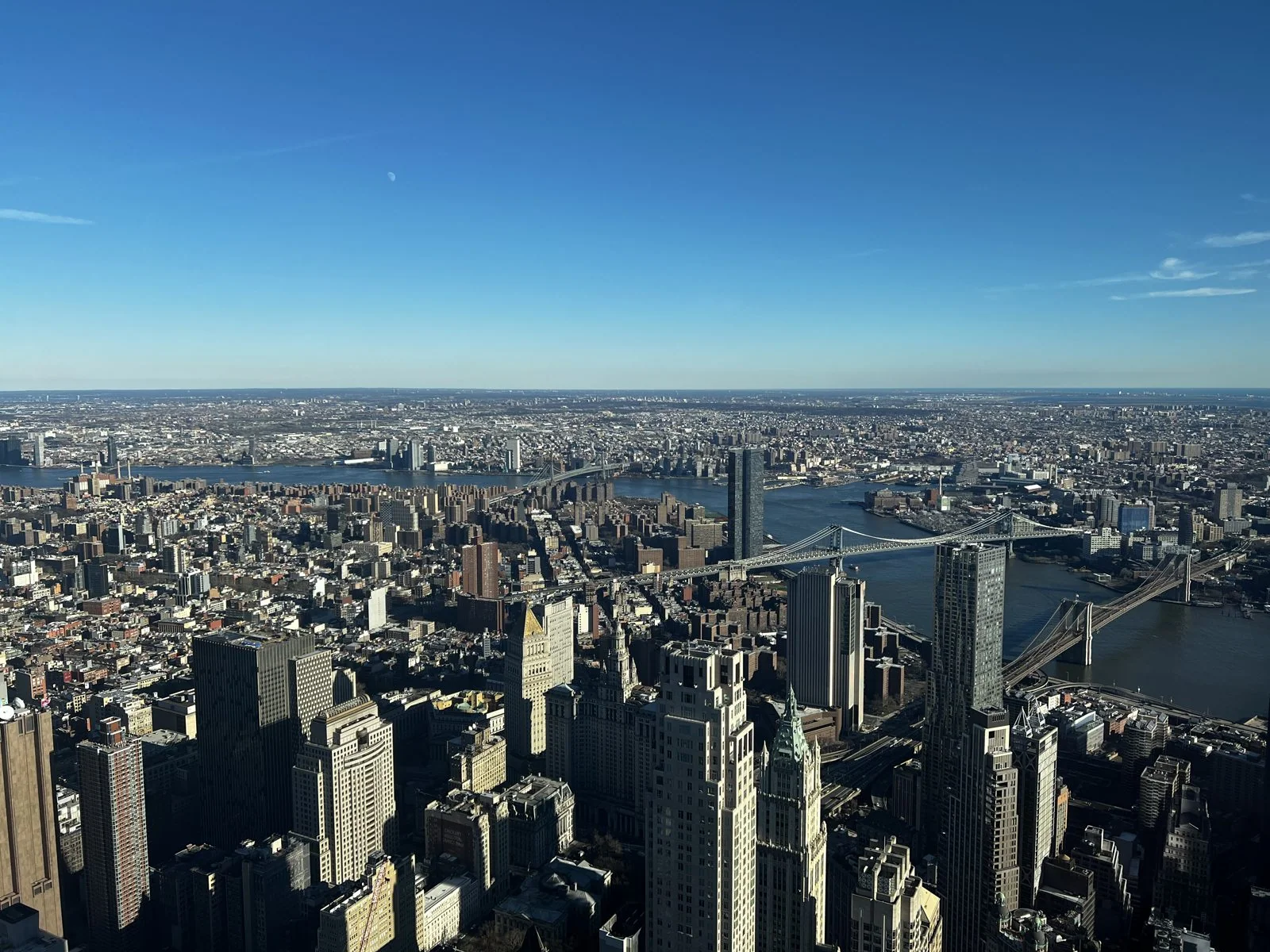
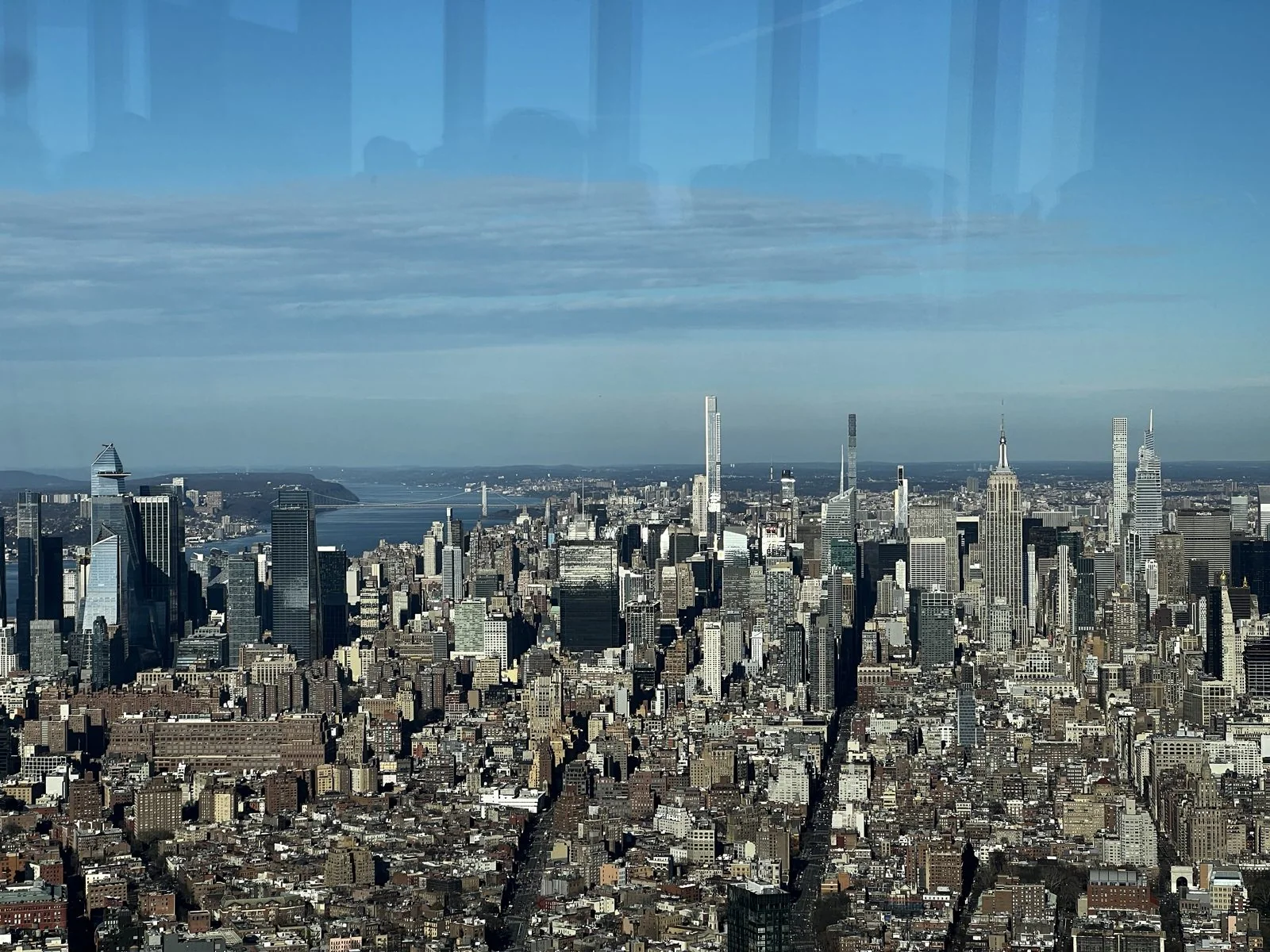
To the east, the Brooklyn and Manhattan bridges crossed the river side by side, the same two bridges that had been swallowed by fog twenty-four hours earlier, now sharp in every cable. The Gothic crown of the Woolworth Building, the tallest in the world when it opened in 1913, stood just below us. And looking up the island, Midtown stood clear on the horizon: the Empire State Building in the middle, and around it the new "pencil" towers along 57th Street, Billionaires' Row, so thin that from this distance they look like toothpicks someone stuck into the skyline.
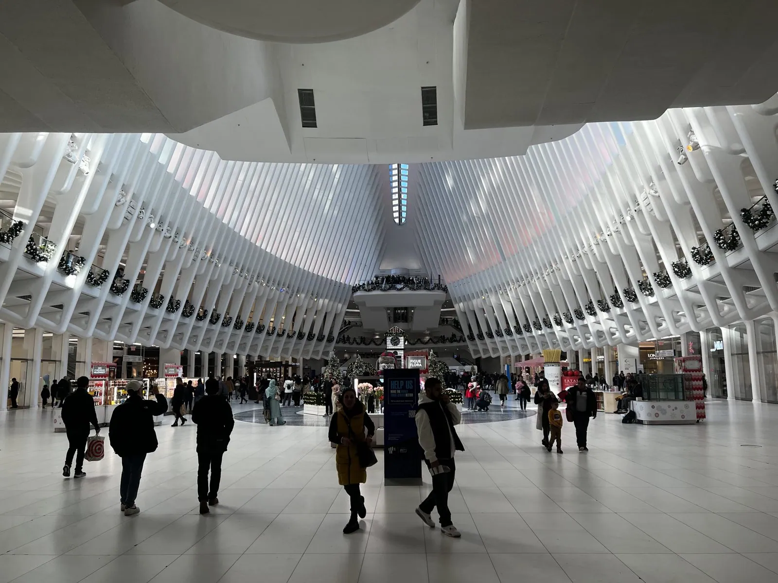
Back on the ground, we cut through the Oculus, the transit hub Santiago Calatrava built over the World Trade Center PATH station, which opened in 2016. Calatrava said the design was inspired by a bird released from a child's hands. Inside, white steel ribs rise on both sides and meet at a long skylight along the spine, so the hall feels like the inside of a whale's ribcage, if the whale were very clean and full of shops. That week the balconies were hung with holiday garlands.
Brooklyn Heights, and the East River at sunset
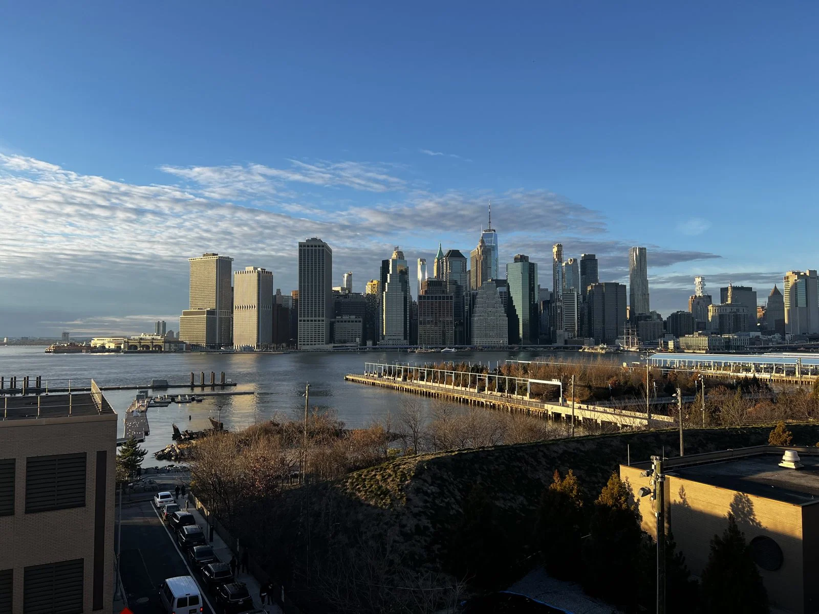
Next we crossed to Brooklyn Heights for pizza, and then walked out onto the Promenade just before four. The Promenade is a third of a mile of benches and railings cantilevered over the Brooklyn-Queens Expressway. It was a compromise of the 1940s: Robert Moses wanted to run the highway straight through the neighborhood, residents fought back, and the result was a stacked deck, with the highway below and a public walk on top. From it, Lower Manhattan's skyline stood across the river in full golden-hour light, every tower a slightly different shade of amber, with One World Trade rising over the middle. The Promenade was crowded with people who had had the same idea. Nobody seemed to mind.
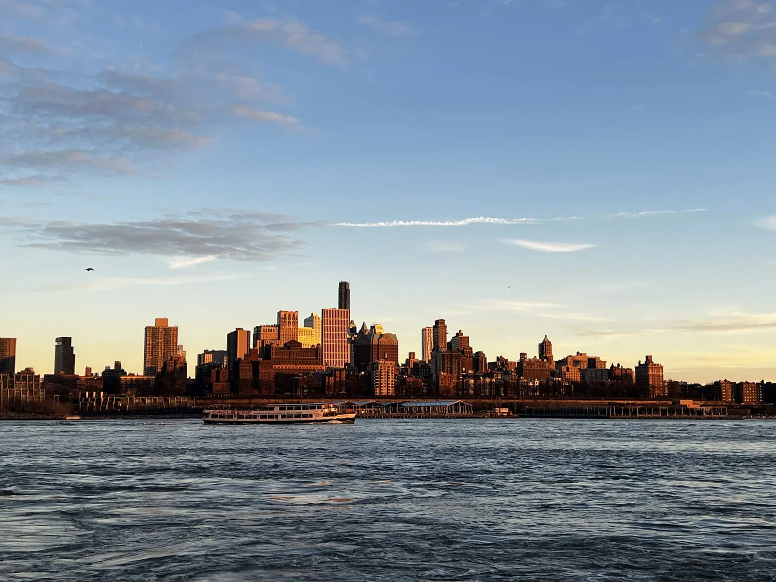
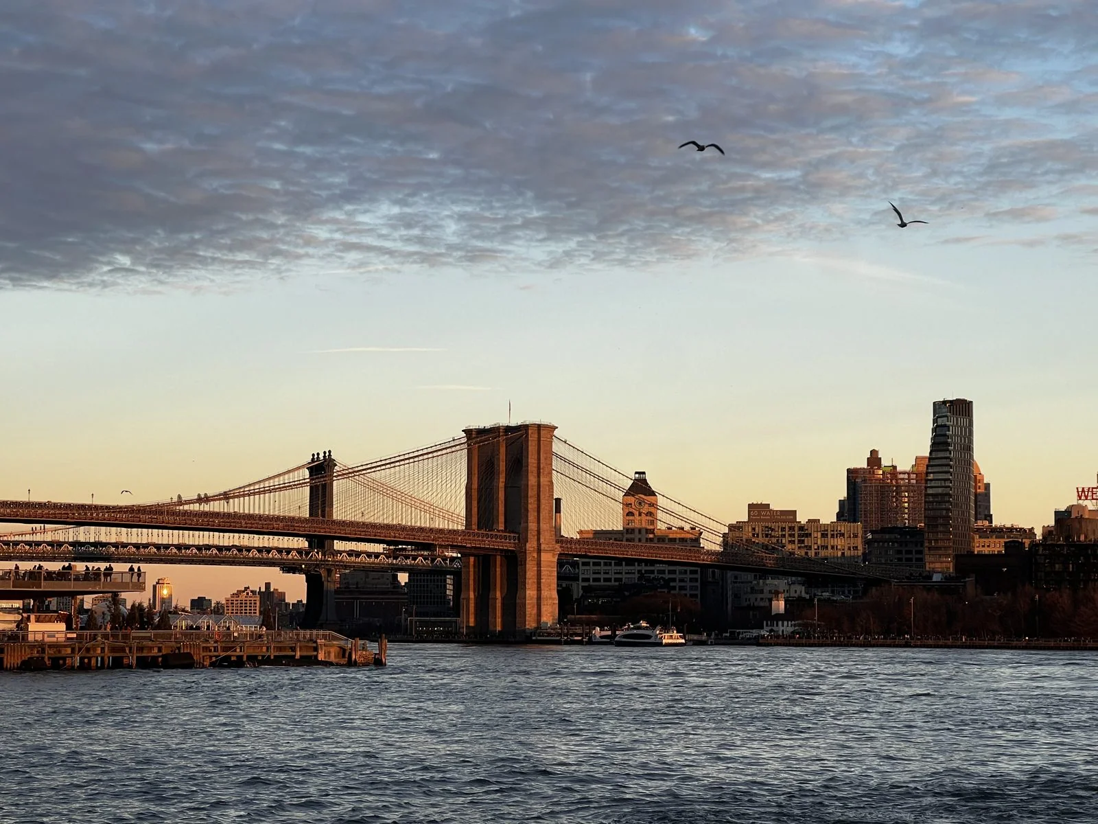
Then came our second ferry of the day, back across the East River to Pier 11 at Wall Street, and we stepped off at exactly the right moment. The sun was setting behind Manhattan, so it lit Brooklyn from the front: the old brick warehouses and apartment towers of the Heights glowed a deep orange, as if they were heated from inside, against a sky that was going pale blue and lilac. Turning the other way, the Brooklyn Bridge stood dark against a sunset sky, with gulls circling overhead. The water was rough and steel-blue, and those ten minutes on the pier were the most beautiful of the trip.
Wall Street and the Battery
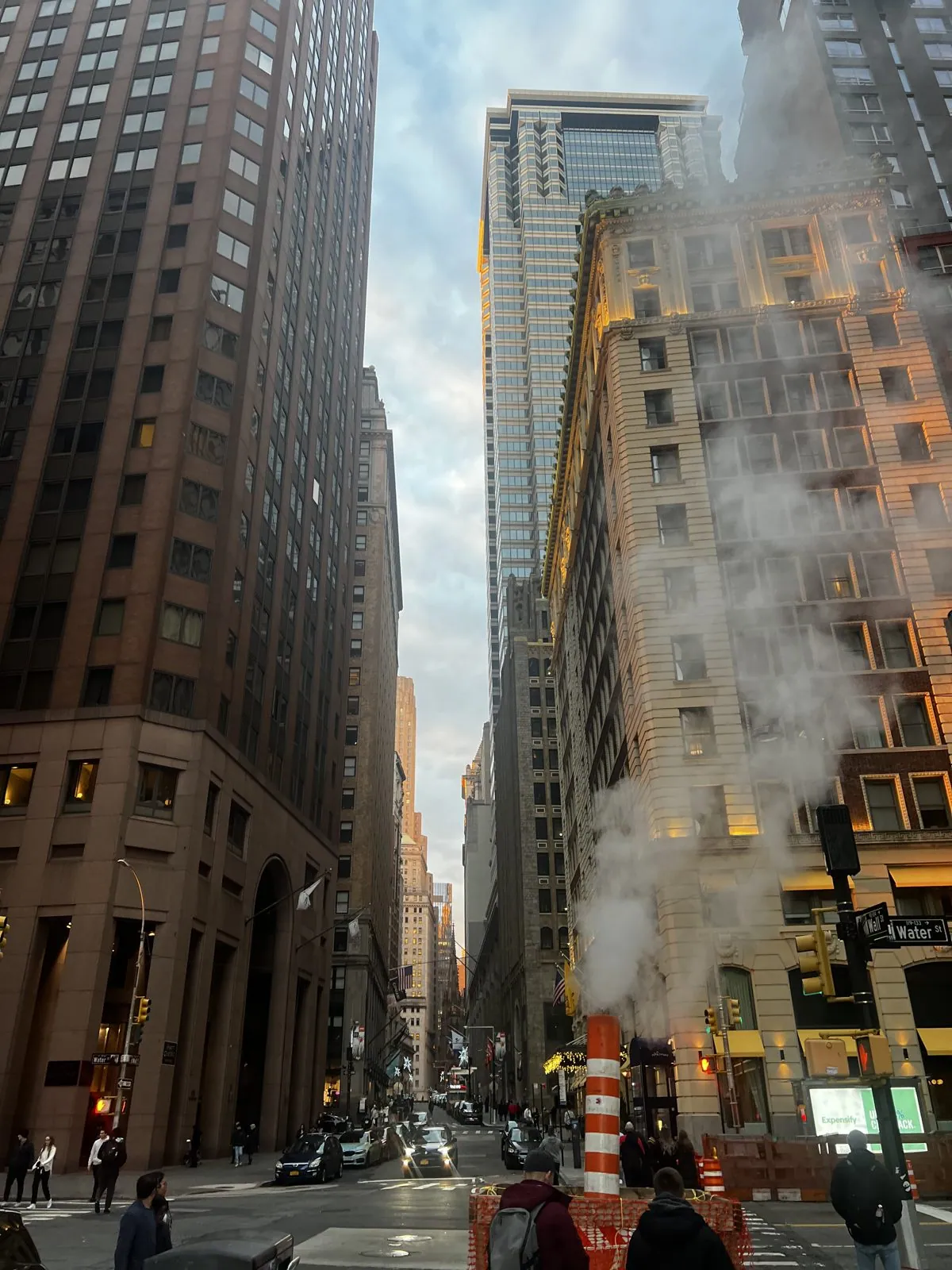
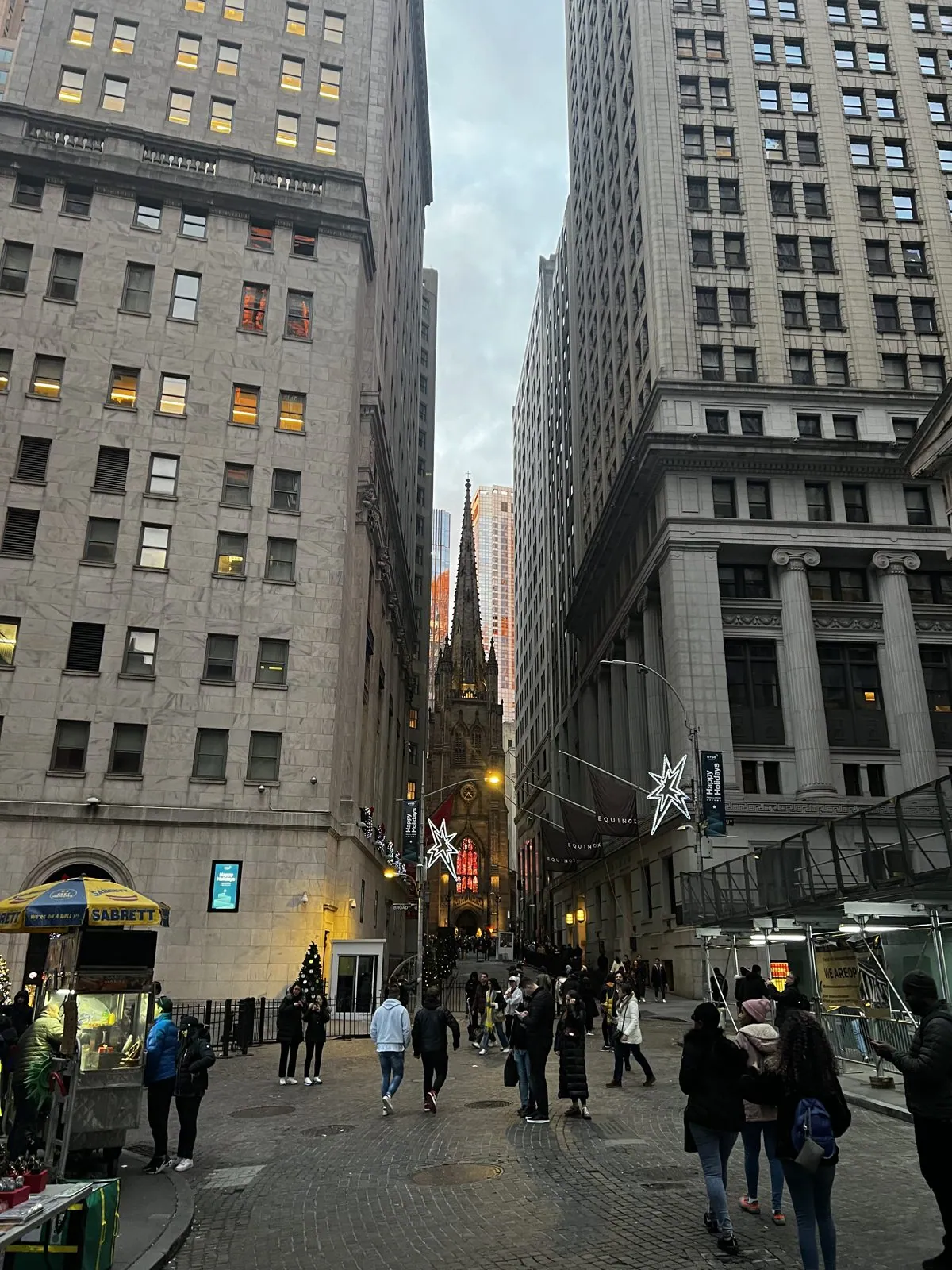
The Financial District on the evening of a public holiday is a canyon with no traffic. We walked up from the pier into streets so narrow and so tall that the sky was a thin strip far overhead, and on one corner a striped orange-and-white stack was venting a column of steam into the cold air. That's Con Edison's steam system, the largest in the country, which has been piping steam under Manhattan since 1882 to heat and cool hundreds of buildings; the striped stacks lift the vapor from the street up above head height. At the end of Wall Street, exactly where it should be, stood the dark Gothic spire of Trinity Church. The current church dates from 1846, when its spire was the tallest point in the city; Alexander Hamilton is buried in its churchyard.
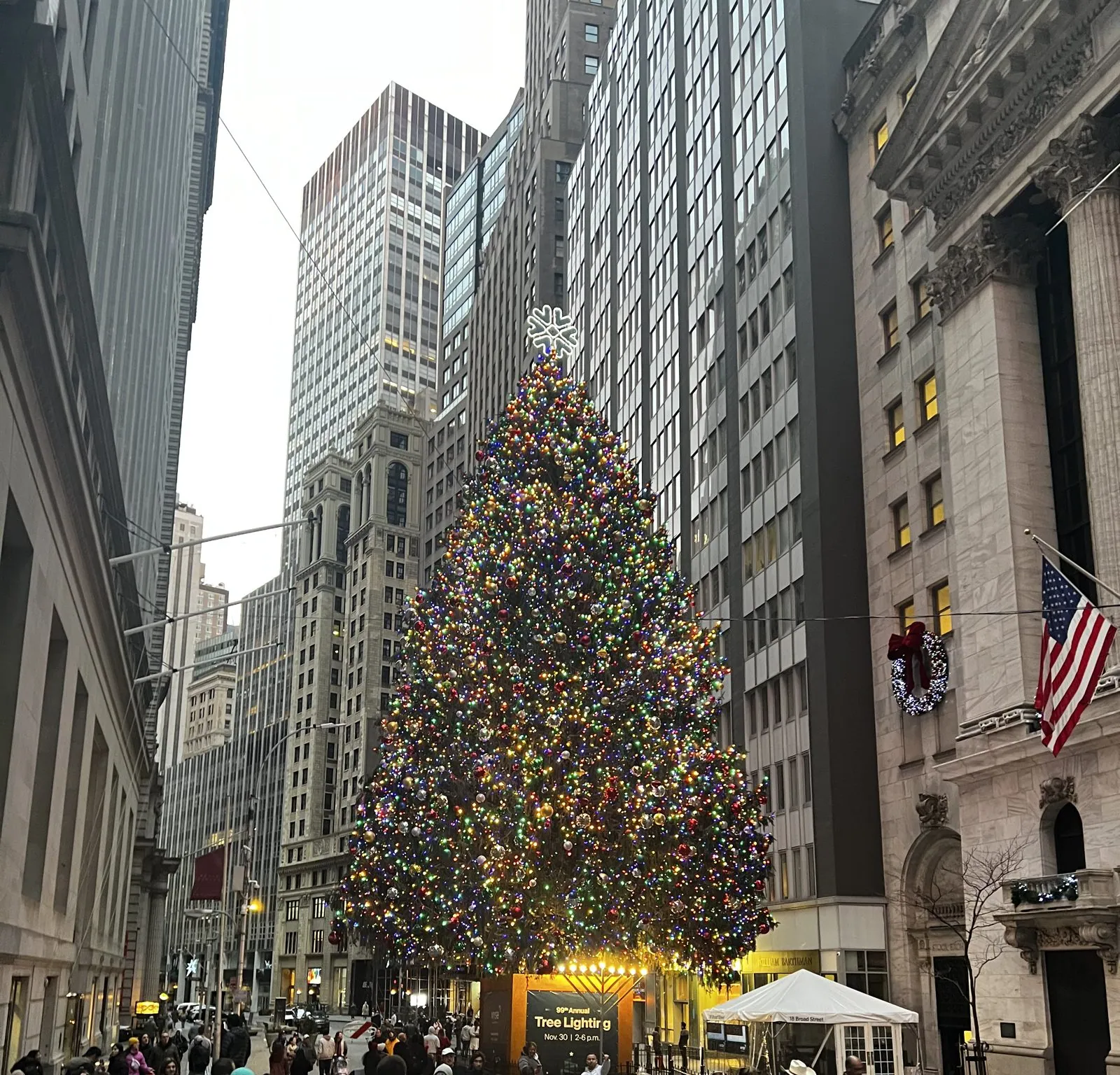
Outside the New York Stock Exchange, with a wreath and an American flag hung on its columned façade, a towering tree lit the street in red, green and gold. The exchange has been putting up a tree on Broad Street for about a century; a sign beside this one advertised the 99th annual lighting. Crowds wandered around it taking photos, which on a normal weekday would be impossible: this is not a street you are usually allowed to stand still in.
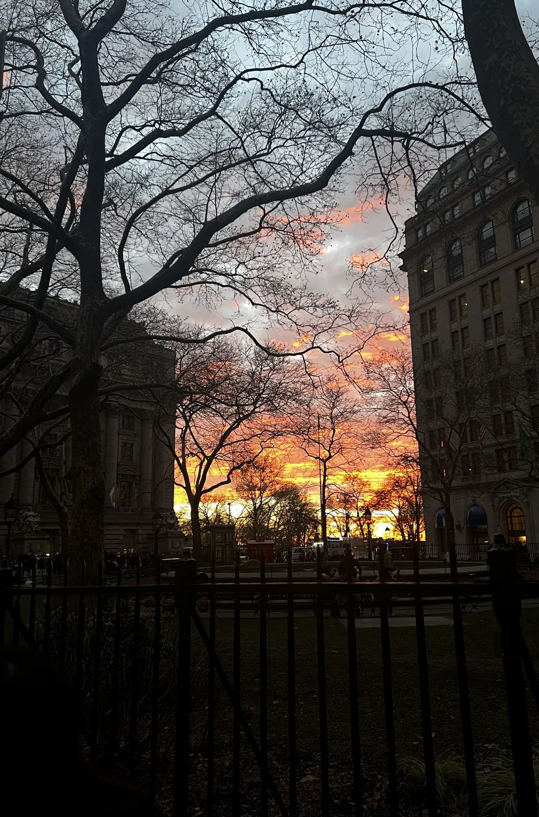
Then we reached the very bottom of the island in time for the end of the sunset. At the edge of the Battery, the western sky behind the bare trees went suddenly, absurdly orange and pink, the color of a stove ring, with the silhouettes of branches black against it and the old stone office buildings around Peter Minuit Plaza catching the glow in their windows. Nearby, the Beaux-Arts Battery Maritime Building, the 1909 terminal for the ferries to Brooklyn, was lit up in gold under a gray sky. It lasted perhaps ten minutes, and then the sky went dark blue and the streetlights took over.
Up the East River to Roosevelt Island
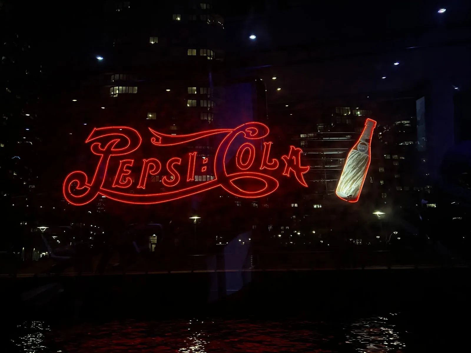
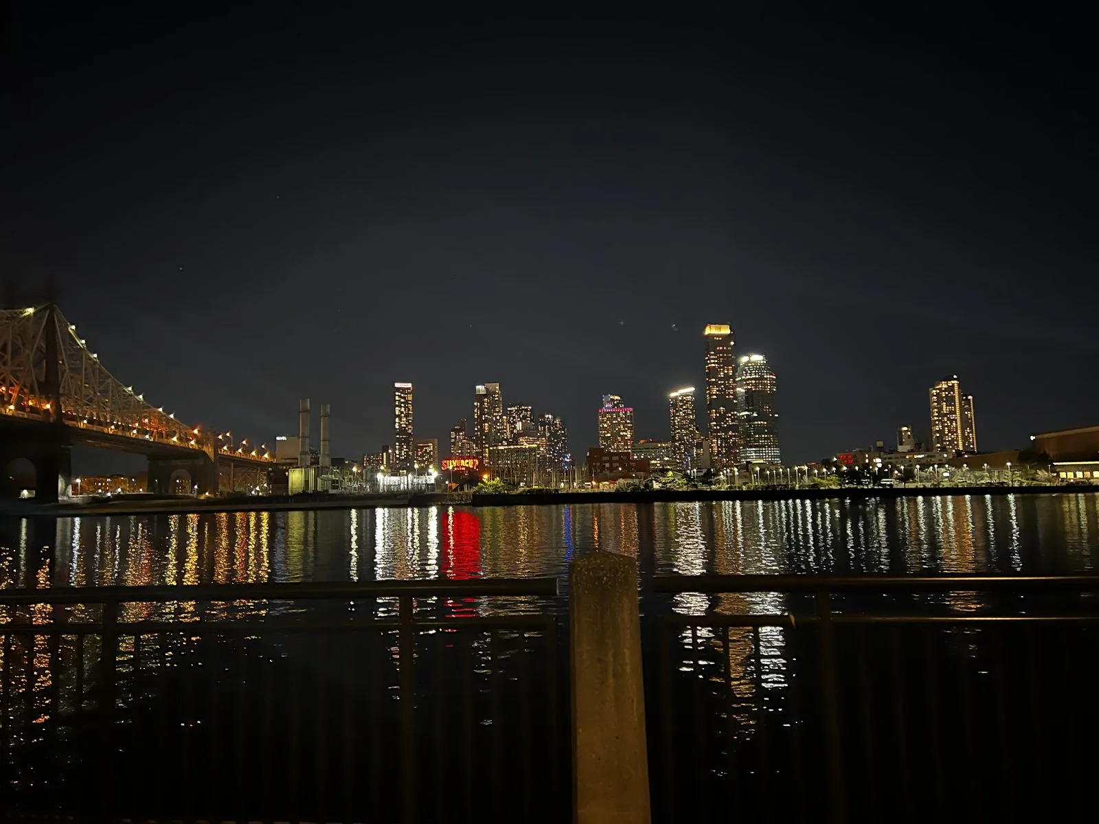
The day's third ferry took us north up the East River in the dark. Somewhere off Long Island City the famous red neon Pepsi-Cola sign slid past the window, a looping script and a tilted bottle glowing over the water. It has stood on the Queens waterfront since 1940, originally on top of a bottling plant; the plant is long gone, replaced by apartment towers, but the sign was declared a city landmark in 2016 and kept where it is.
We got off at Roosevelt Island, the narrow two-mile strip of land in the middle of the East River. For most of the nineteenth century it was Blackwell's Island, the place the city sent people it didn't want to see: a penitentiary, a smallpox hospital and an asylum. Now it is a quiet residential island with its own aerial tram. Right overhead runs the Queensboro Bridge, the great steel cantilever bridge of 1909, famous in song as the 59th Street Bridge. At night it is outlined in lights against the Midtown towers, and while we stood underneath it, a tram cabin slid across the river beside it on its cables, high above the water.
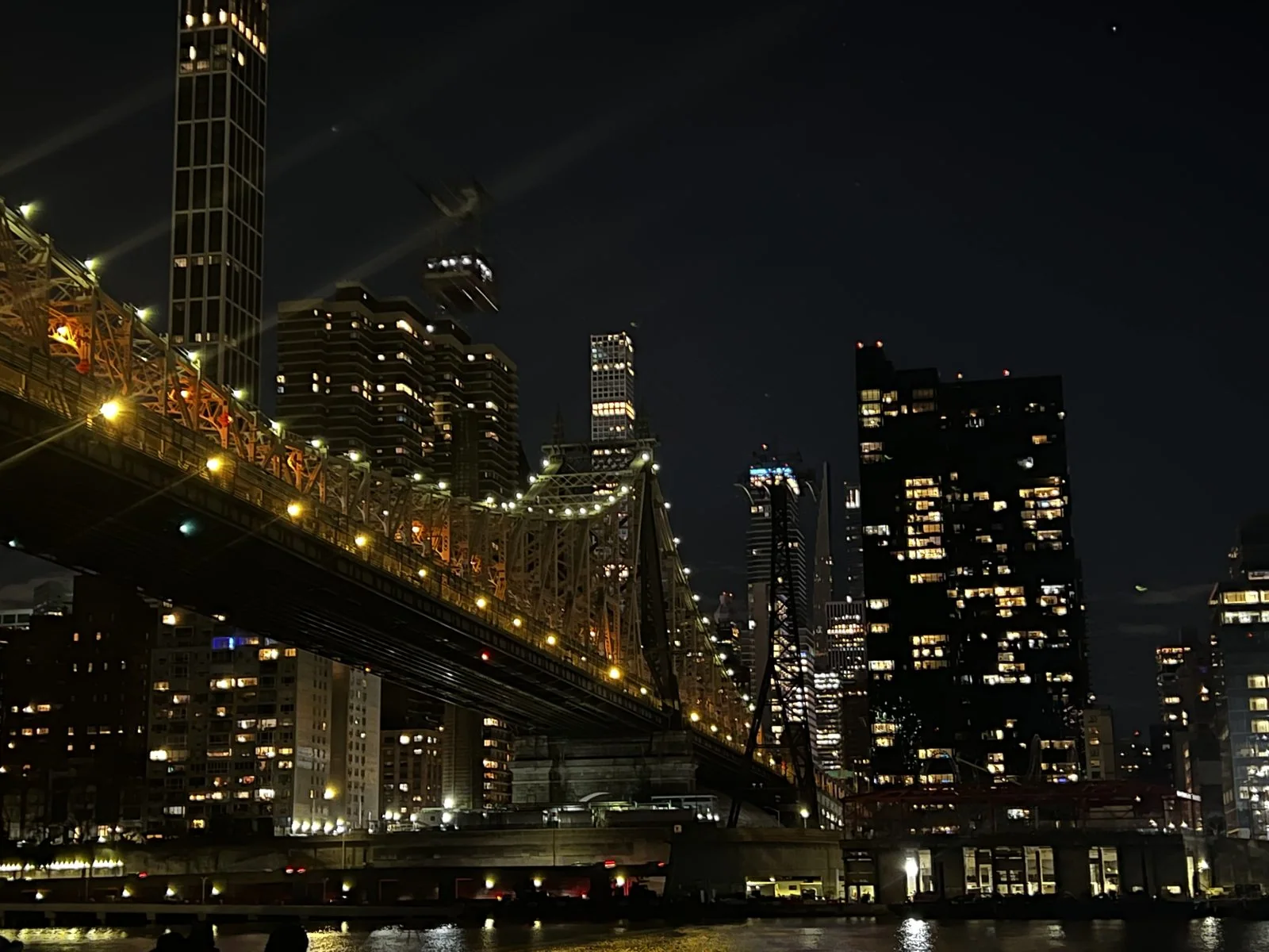
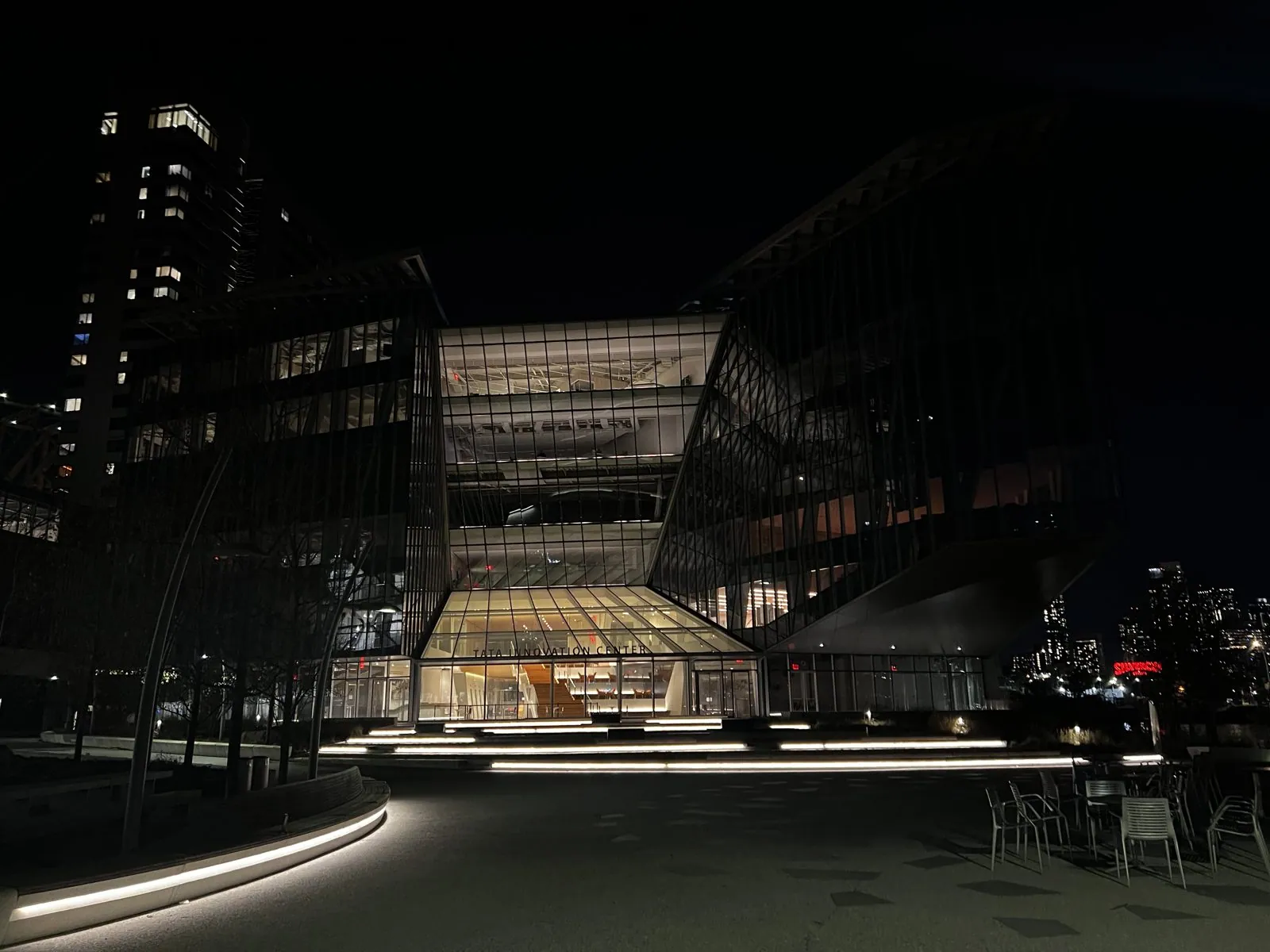
The tram, which opened in 1976, was meant to be temporary until a subway station arrived; the subway took until 1989, but the tram stayed because people loved it. We walked south past its station and onto the campus of Cornell Tech, a graduate school built on the site of an old hospital and opened in 2017, where the angular glass Tata Innovation Center stood lit from within on an empty plaza. From the lawn at the island's edge, Midtown Manhattan spread across the river in a solid wall of lit windows, with the Chrysler Building's crown glittering and the Empire State glowing on top. Facing east instead, the towers of Long Island City threw long colored reflections across the black water.
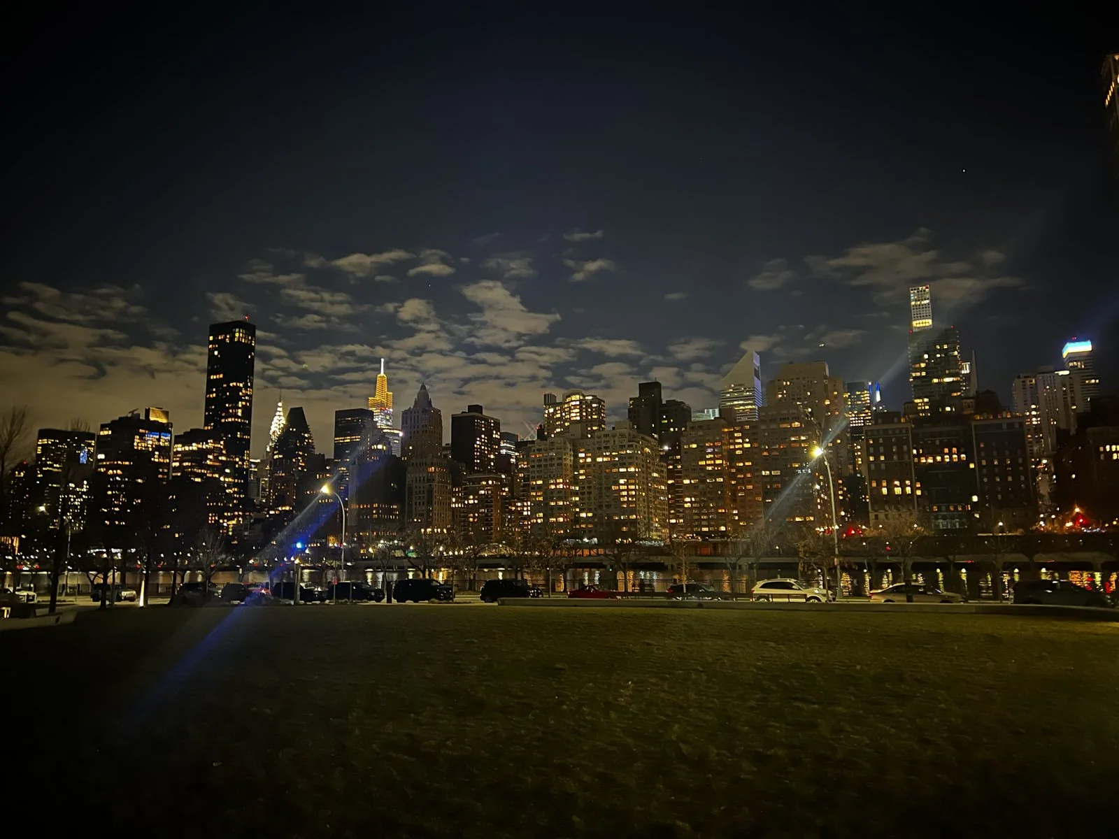
It was six o'clock on New Year's Day, the island was nearly silent, and the only sounds were the traffic humming on the bridge overhead and the river slapping at the seawall. After two days of crowds, it was a strange and lovely place to be. We finished the day with dinner in Flushing, out in Queens.
January 2: Philadelphia
On the second day of the year we took the train to Philadelphia, down the Northeast Corridor, the busy rail line that runs from Boston through New York to Washington. The stretch south of New York was electrified by the Pennsylvania Railroad in the 1930s, and today Amtrak covers it in well under two hours, through the marshes and factory towns of New Jersey. By half past two we were outside 30th Street Station. Philadelphia is only ninety-odd miles from Manhattan, but it feels like a different century of a different country: lower, older, red-brick, built on William Penn's orderly grid between two rivers, and much less interested in impressing you.
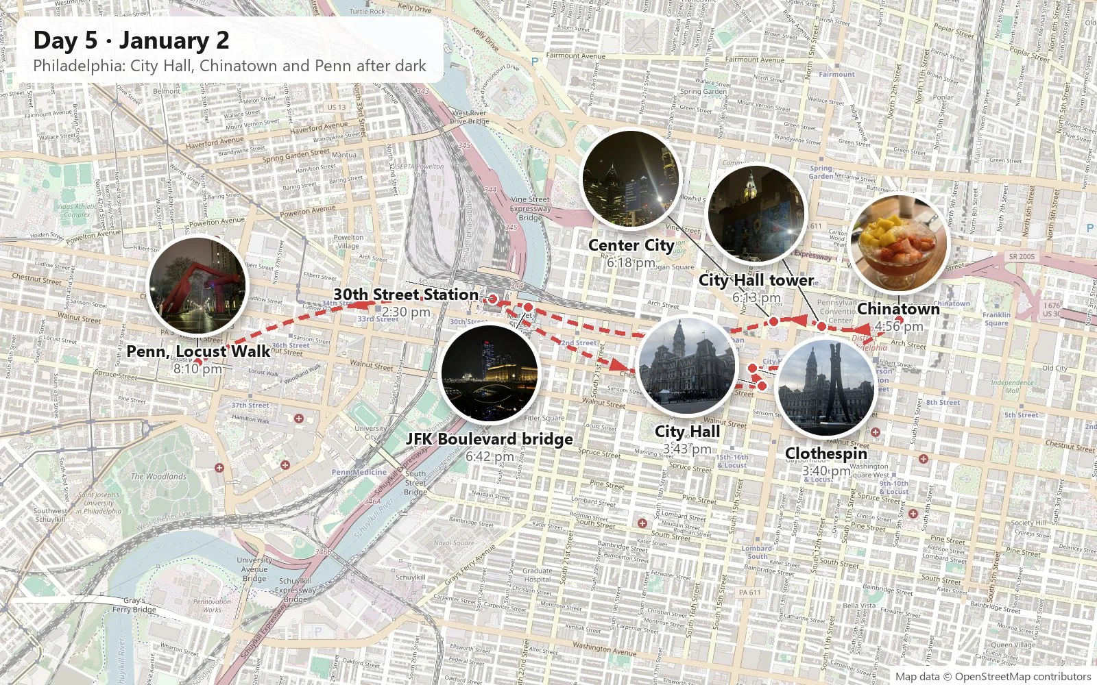
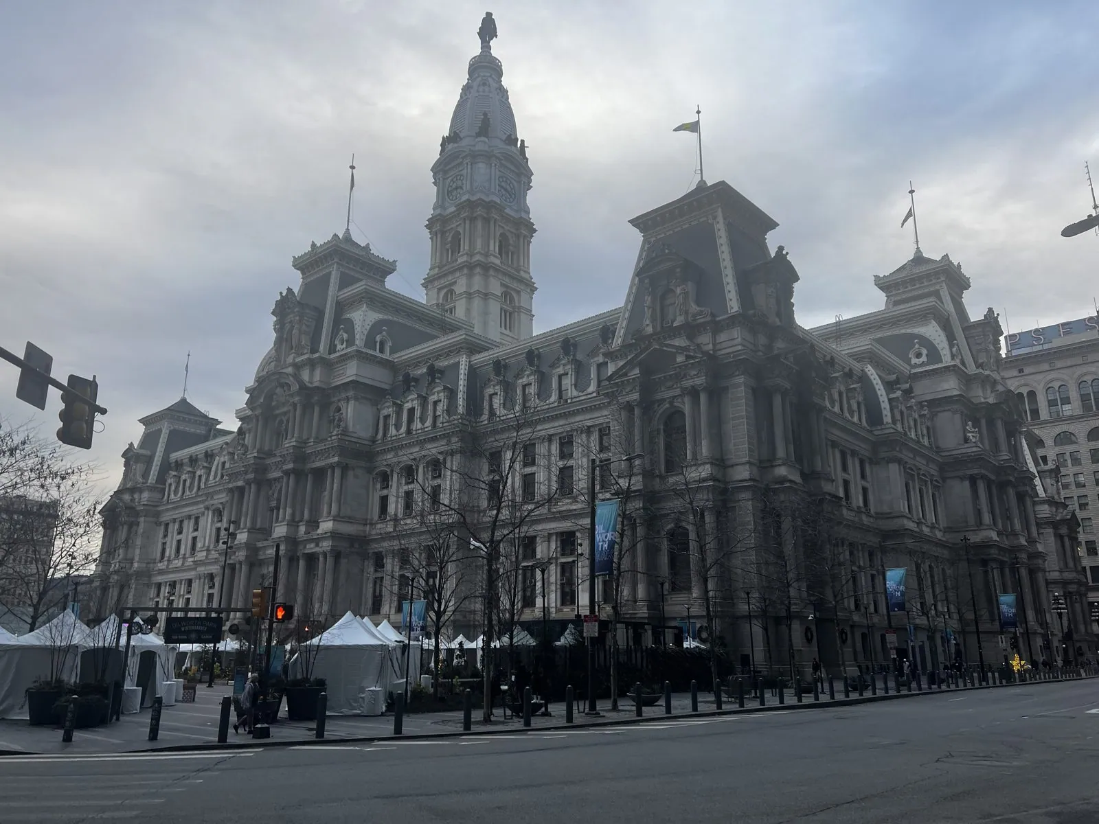
It is impossible to miss City Hall, because it sits in the exact center of Penn's plan, in the middle of the intersection of Broad and Market, and every street seems to lead to it. It is a gigantic Second Empire pile of granite and marble, completed in 1901 after thirty years of building, with a tower of 548 feet. It was the tallest occupied building in the world for a few years, and it is still one of the tallest masonry buildings anywhere. On top stands a 37-foot bronze William Penn by Alexander Milne Calder. For most of the twentieth century, a gentlemen's agreement kept every new building in the city lower than the brim of Penn's hat. It was broken in 1987, and local legend blames the city's sports teams' long championship drought that followed on the "Curse of Billy Penn". The drought ended in 2008, a year after a small Penn figurine was placed on top of the city's new tallest tower.
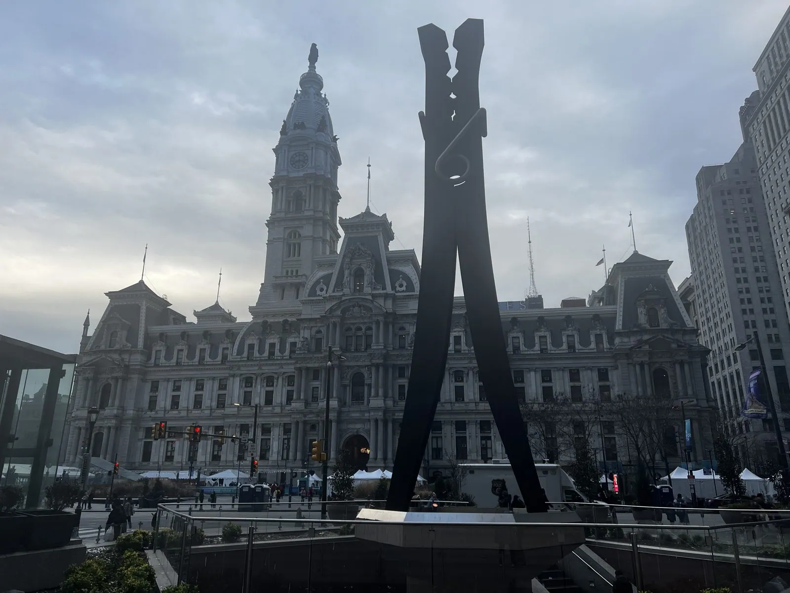
Across the street stands one of the city's best jokes: the Clothespin, a 45-foot steel clothespin by Claes Oldenburg, put up in 1976. If the name sounds familiar from the summer 2024 post, it should: Oldenburg is the same sculptor who put a giant dustpan and broom outside the Denver Art Museum. Seen from the right angle, the Clothespin's two prongs line up beside City Hall's tower and look like they're about to pinch it.
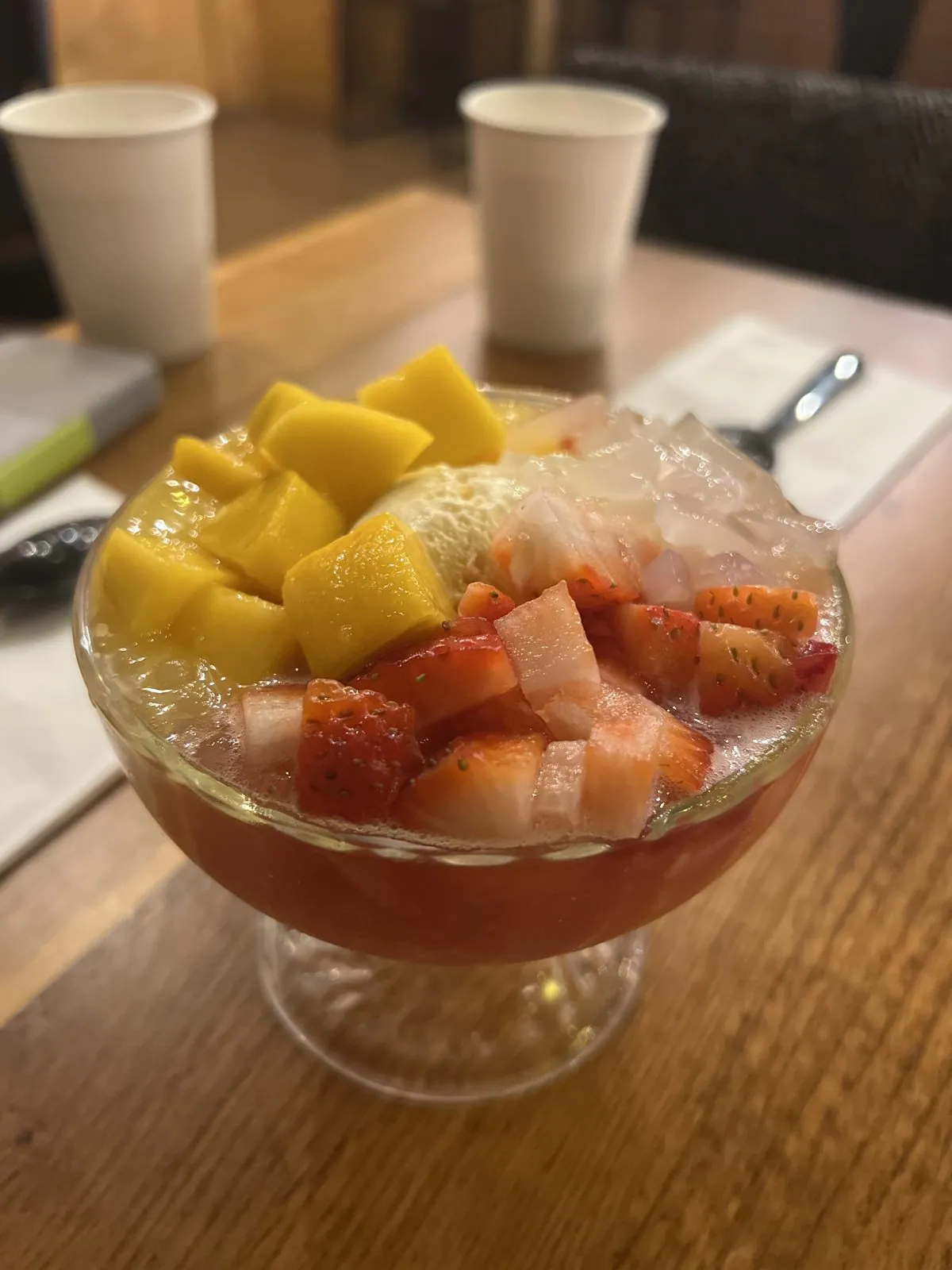
A few blocks northeast is Chinatown. We stopped there before five for a bowl of shaved ice heaped with mango and strawberries, which in January is either a mistake or a statement, and which was delicious either way.
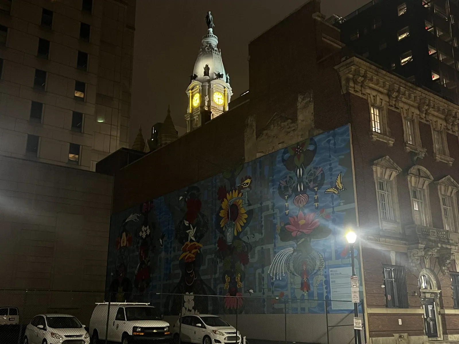
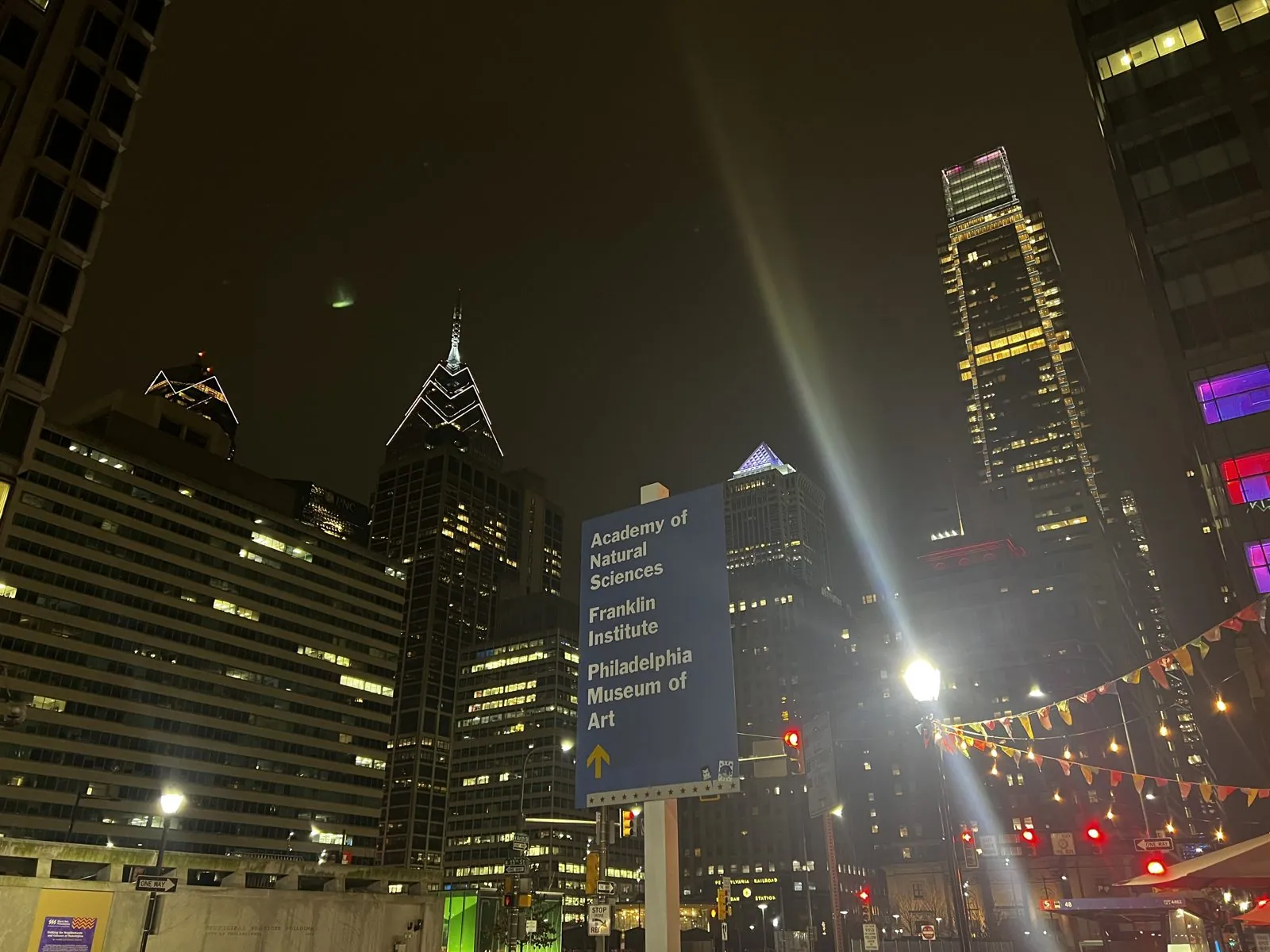
By six it was full dark and the city had changed character. The air was damp and misty, and every streetlight threw long rays of light, so Center City looked like a film set lit for a noir. Above a parking lot on Arch Street, City Hall's tower appeared over a row of old buildings, its clock faces glowing yellow and Penn lit up on top. Below it was a huge mural of flowers and butterflies. Philadelphia has more public murals than any other city in America, thousands of them, most painted through the city's Mural Arts Program, which began in 1984 as an anti-graffiti project. On the next corner, a blue signpost pointed toward the Academy of Natural Sciences, the Franklin Institute and the Philadelphia Museum of Art, all lined up along the Benjamin Franklin Parkway. Above it the towers of Liberty Place rose into the haze, outlined in white lights.
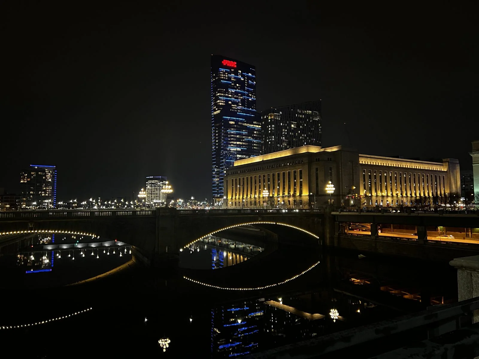
We walked west along John F. Kennedy Boulevard and crossed the Schuylkill River on its bridge. Looking along the river, the stone arches of the next bridge were outlined in strings of white lights, doubled into full circles by their reflections in the black water, and beyond them 30th Street Station's long colonnaded block glowed gold, with the new towers of University City lit up behind. The station opened in 1933, a giant of the railroad age, and it's still one of the busiest stations in the country.
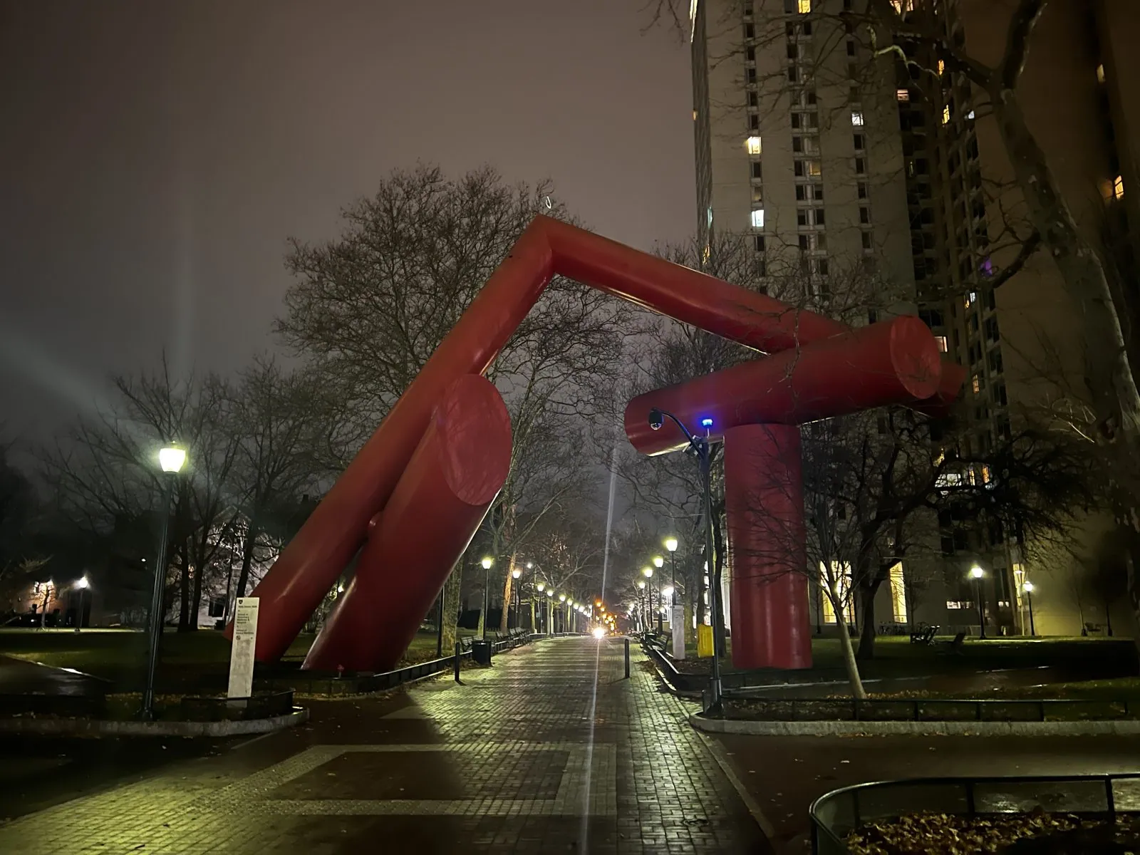
The evening ended on the University of Pennsylvania campus. Locust Walk, the brick path through the middle of campus, was wet with rain and almost deserted during the winter break. Strings of lights hung between the trees like icicles, and old lampposts made pools of yellow on the wet brick. Near the western end of the walk stands Covenant, a big red steel sculpture of tilted cylinders by Alexander Liberman, from 1975. Generations of Penn students have given it a nickname that I'll leave to your imagination. In the mist and lamplight it looked like a huge red creature stepping over the path.
January 3–4: Washington
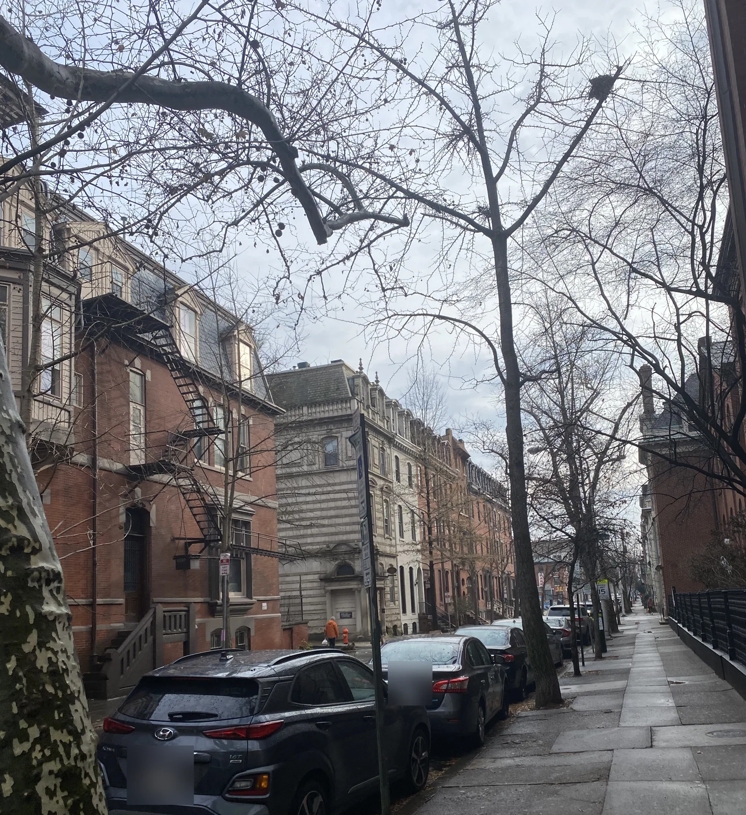
The next day we moved on to Washington, DC, by train again, on the last leg of the Corridor into Union Station. Before leaving Philadelphia we took a last walk through its brick row-house streets in the early afternoon.
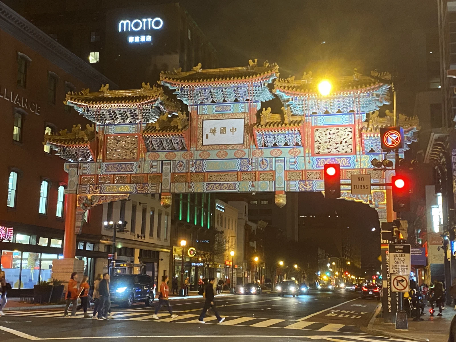
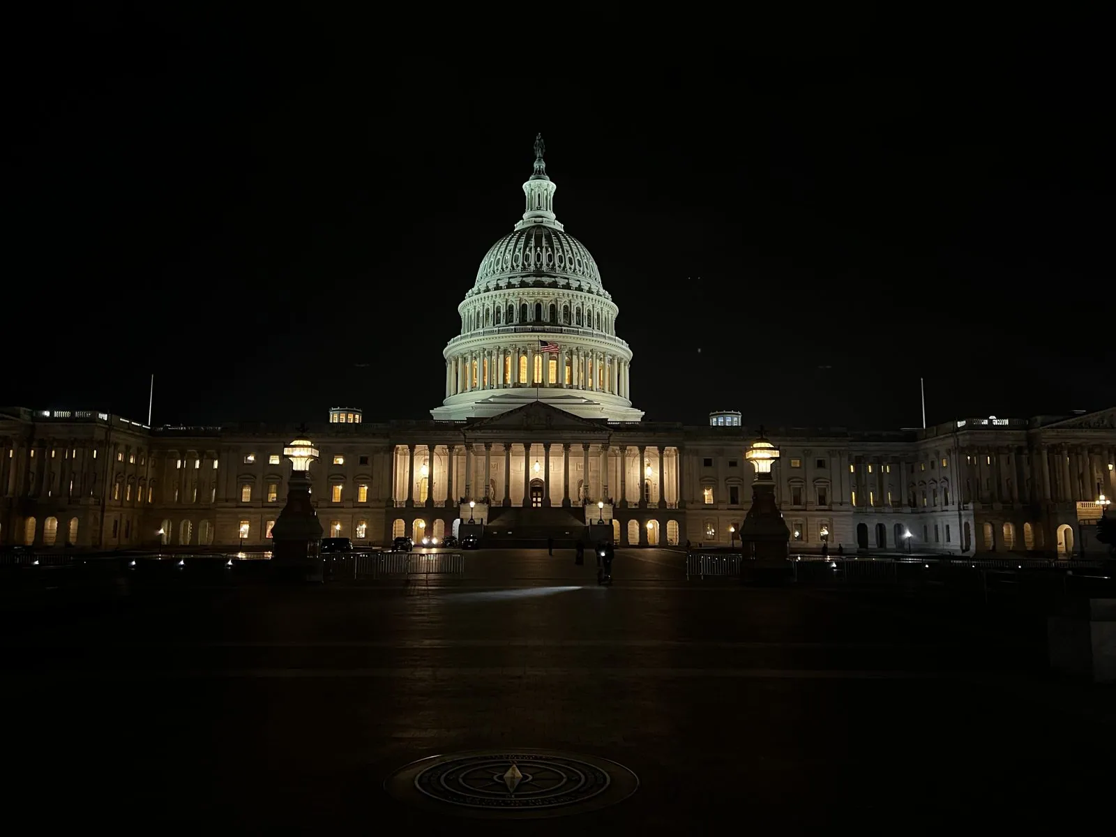
The camera roll skips the ride entirely and picks up again after dark in Washington's Chinatown, under the Friendship Archway, and then at the place every visitor ends up at least once: the United States Capitol, at eight o'clock at night.
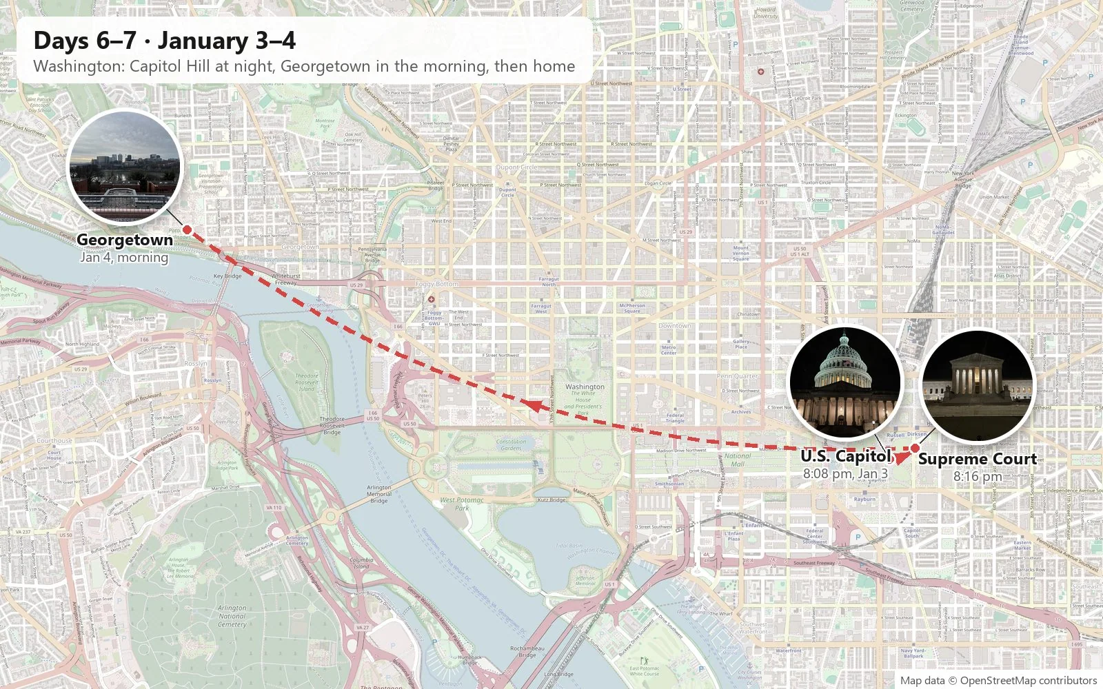
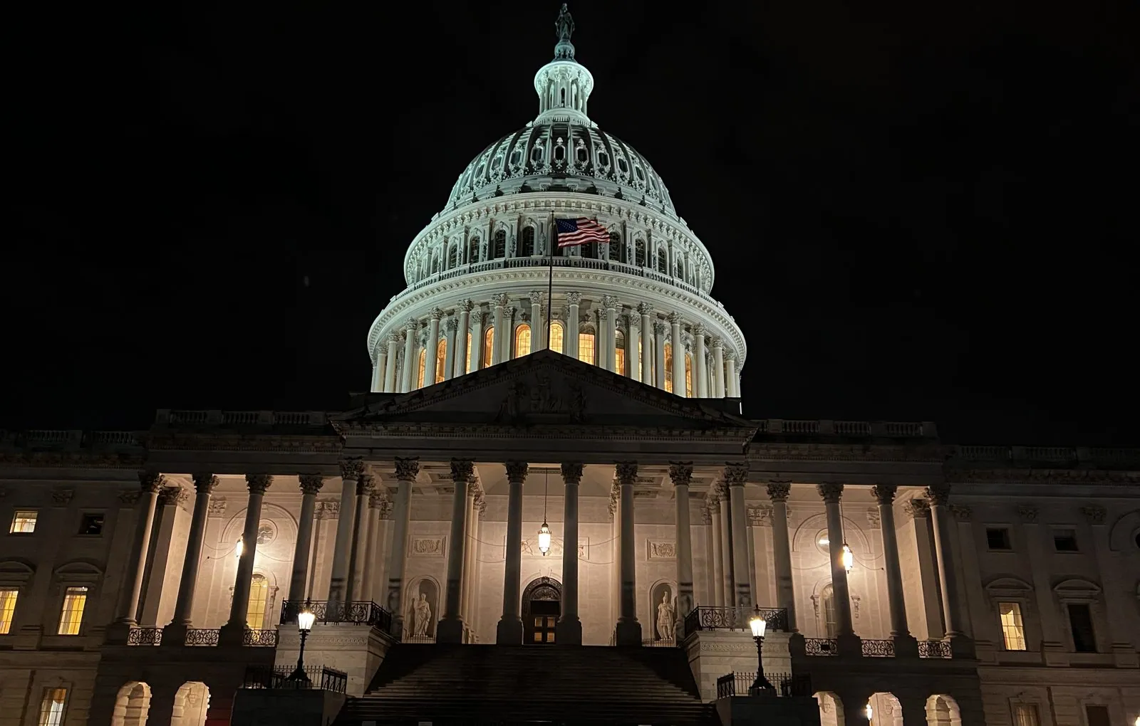
We came at it from the East Front plaza, the side where presidents were inaugurated for a century and a half, until Ronald Reagan moved the ceremony to the West Front in 1981. At night the dome is floodlit a pale green-white against a black sky. It is not stone but cast iron, nearly nine million pounds of it, painted to look like marble. It was built during the Civil War to Thomas U. Walter's design, and Lincoln insisted the work continue through the war as a sign that the Union would go on. The Statue of Freedom was lifted onto the top in 1863. Below the dome, the portico glowed warm behind its columns, the windows of the wings were lit, and the vast plaza in front was almost empty: a few guards, a parked car, the sound of our footsteps.
The building was busier than it looked. January 3rd, 2023 was the first day of the new Congress, and that afternoon the House had gone through three rounds of voting without electing a Speaker. It would take four days and fifteen ballots in the end, the longest such contest since before the Civil War. From the plaza, none of this was visible; the Capitol just stood there, lit and calm.
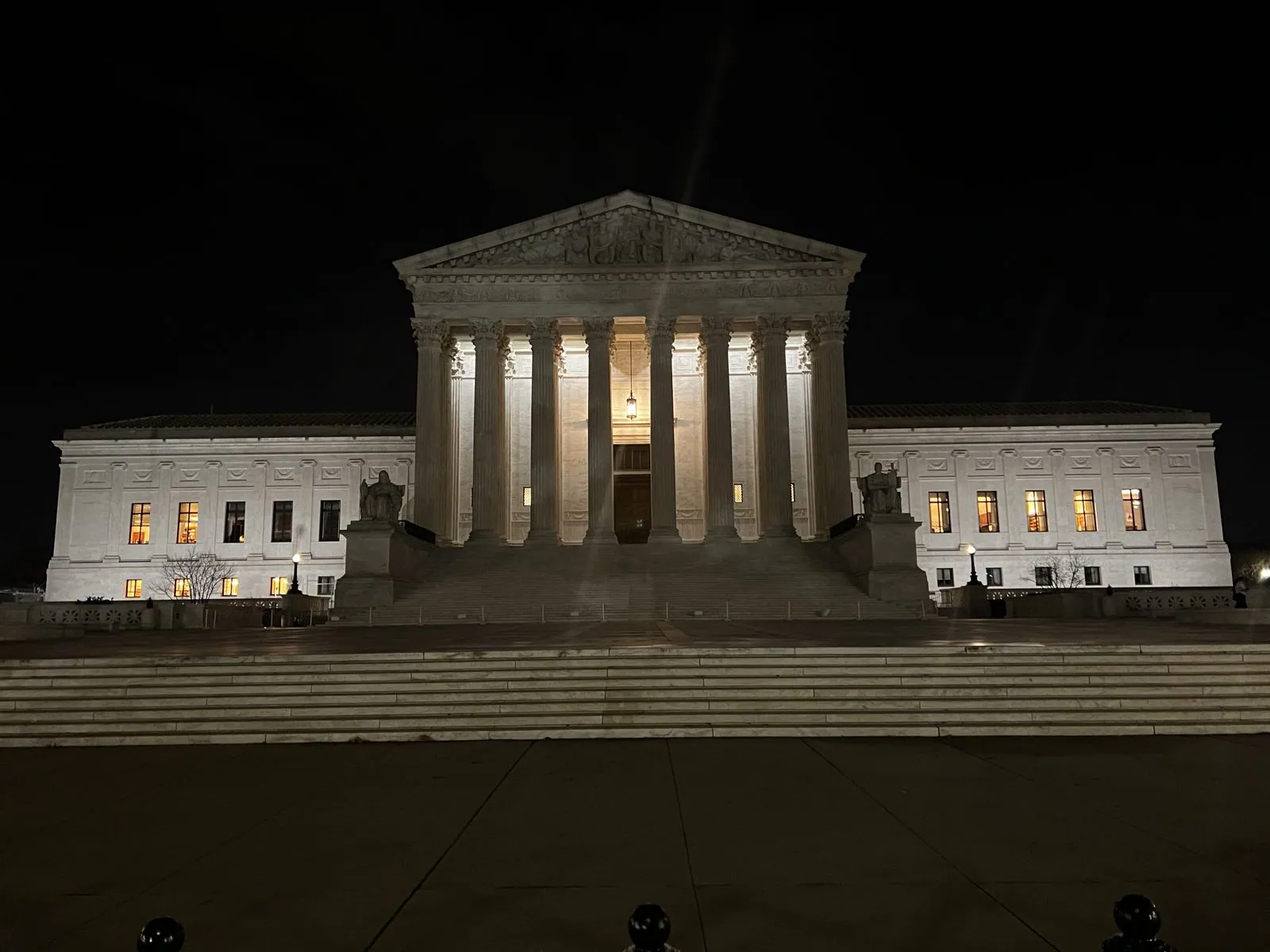
From further back the whole building fits in the frame: the dome in the middle, the Senate and House wings stretching out left and right, a long line of lit windows, and a compass rose set into the dark pavement in the foreground. Directly across First Street stands the Supreme Court. Until 1935 the Court met in borrowed rooms inside the Capitol itself; then Cass Gilbert gave it this white marble temple of its own, with sixteen Corinthian columns and "Equal Justice Under Law" carved above them. At night the portico is lit from within and the marble looks almost translucent. On either side of the steps sit James Earle Fraser's two seated figures, Contemplation of Justice and Authority of Law, looking out into the dark.
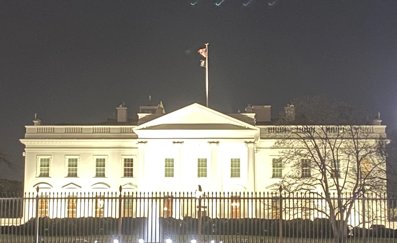
Half an hour later we were on Pennsylvania Avenue in front of the White House, its north side floodlit behind the fence and the lawn, with the flag flying on top.
Georgetown, early
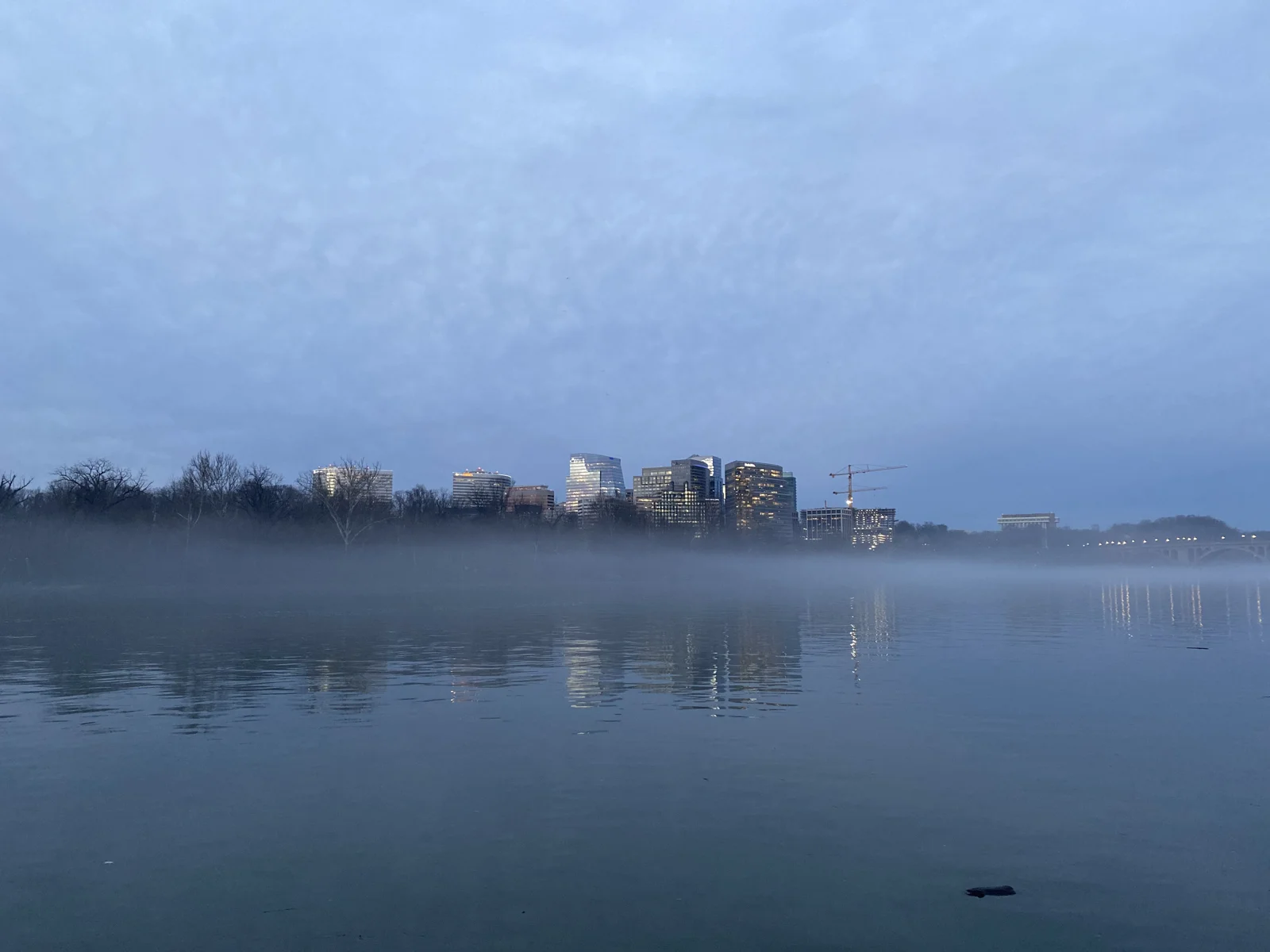
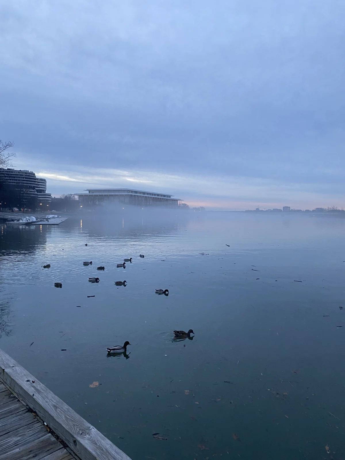
The last morning of the trip, January 4th, began at twenty past seven on the Georgetown waterfront, with fog lying flat on the Potomac and ducks in the shallows.
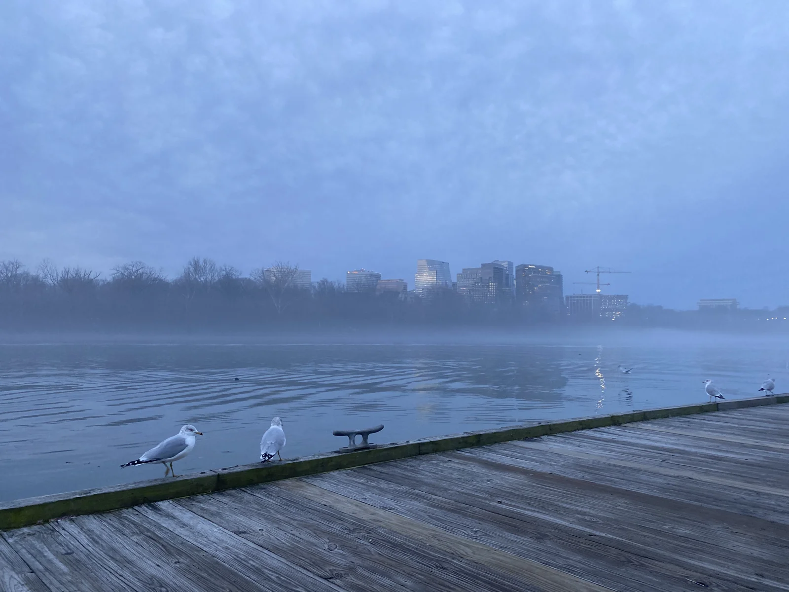
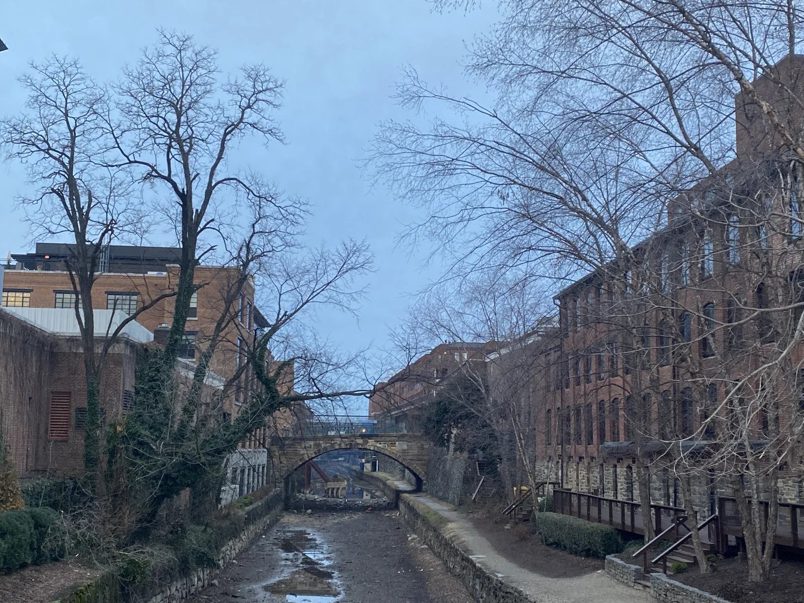
Gulls stood along the wet boardwalk. A few minutes later we were at the old C&O Canal, drained, running under a small stone footbridge between brick warehouses.
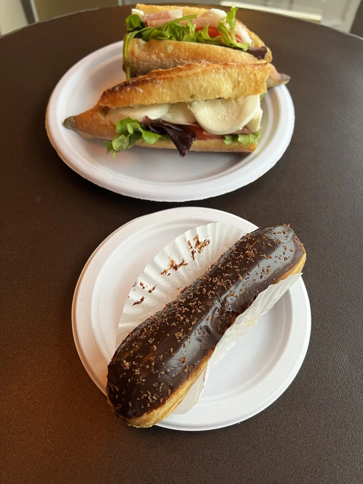
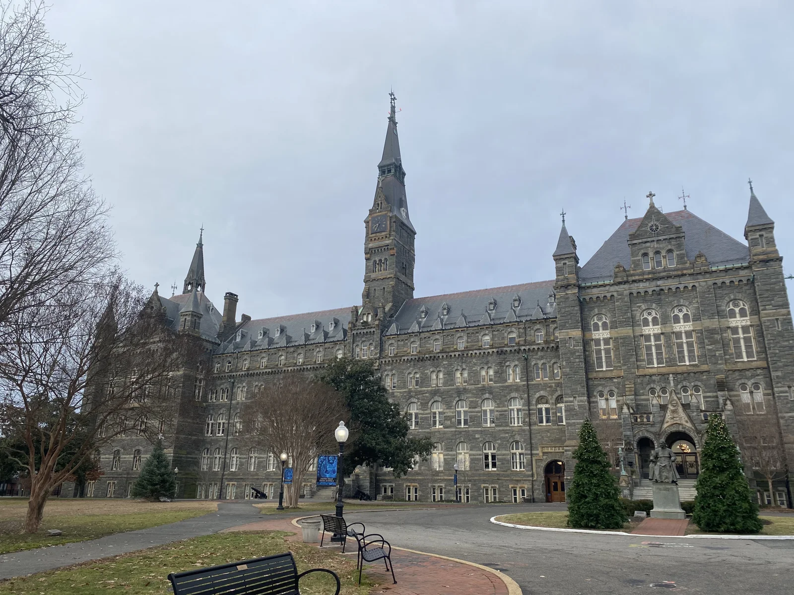
Breakfast was a baguette sandwich and a chocolate éclair at eight. Georgetown is older than Washington itself: it was a tobacco port on the Potomac, founded in 1751, four decades before the federal city was laid out next door, and its steep streets of brick row houses still feel like a separate town. At half past eight we were on the Georgetown University campus, in front of the spire of Healy Hall.
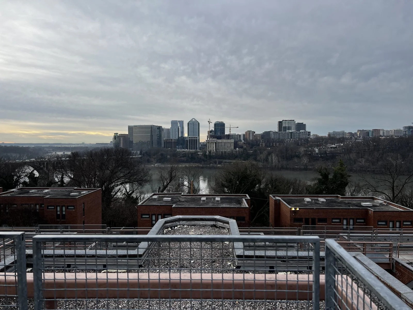
A little before nine we were looking out from a rooftop over the neighborhood toward the river, on a gray morning with a band of pale gold along the horizon. Below were flat brick roofs and bare trees. Beyond them the Potomac ran wide and still, and on the far bank, in Virginia, stood the office towers of Rosslyn, lined up like a second skyline.
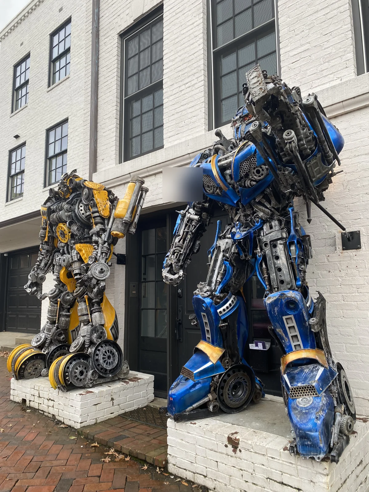
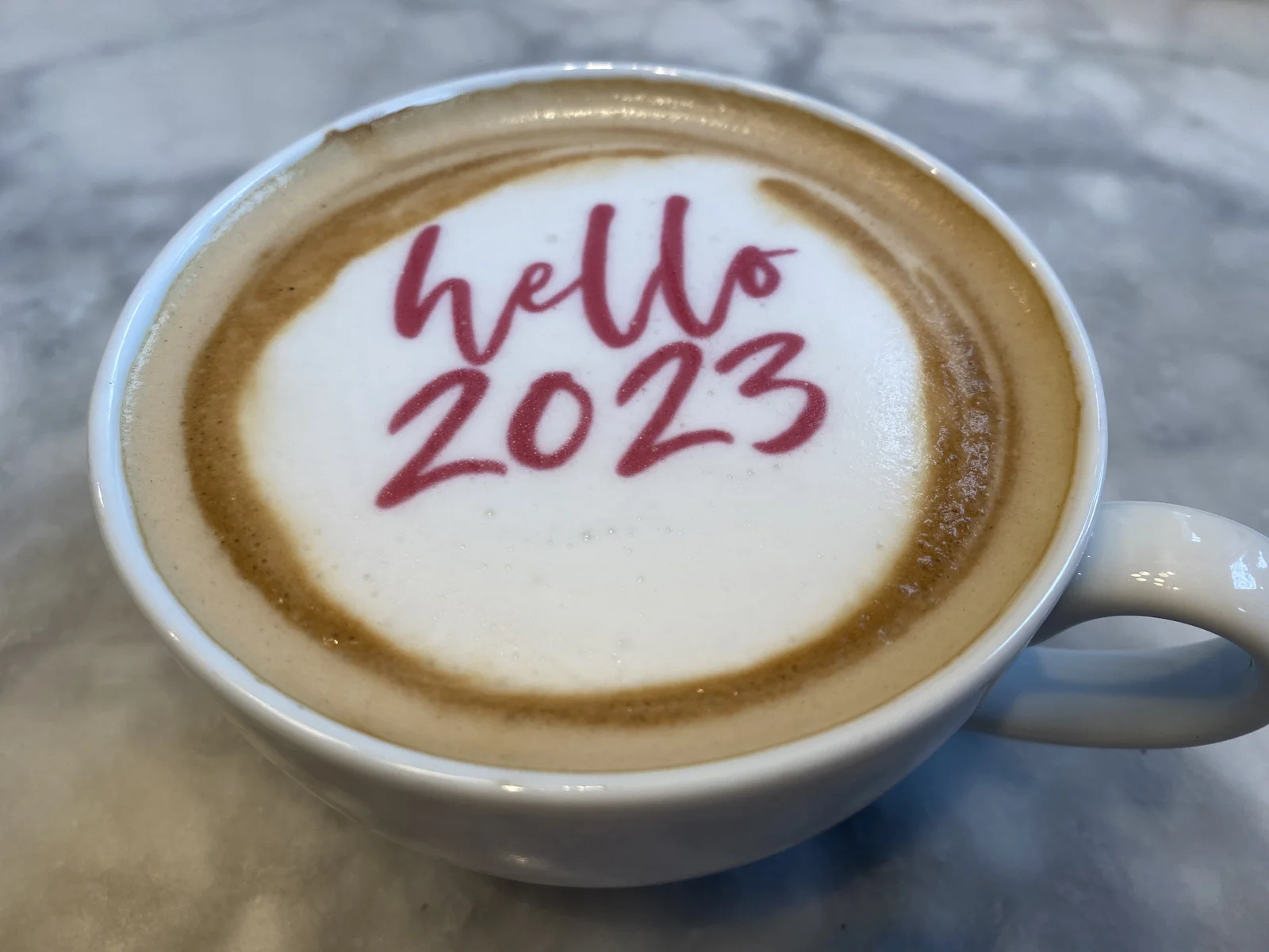
The rooftop wasn't quite the end. At nine we passed two giant scrap-metal Transformers, Bumblebee and Optimus Prime, standing outside a house on Prospect Street, and at twenty past nine the coffee came with "hello 2023" written in the foam. We flew home from DC, but the camera roll doesn't say how the rest of the day went, so I'll leave the trip where the photos do.
Looking back
The odd thing about a winter trip is how much of it happens in the dark. The sun set before five every day, and more than half of these photos were taken by streetlight, neon or floodlight. Yet it rarely felt gloomy. A city in winter turns its lights on early, and the East Coast at the turn of the year was all lights: Christmas trees in the plazas, the billboards of Times Square, a neon sign over the river, a lit dome on a hill.
Looking back, the week had a shape I didn't notice at the time. It started with the loudest place in America at its loudest moment, and it ended on a quiet, misty morning in Georgetown. In between were the fog in Dumbo, which hid everything, and the clear sky over the harbor the next day, which showed everything. And it had a lot of rivers. We spent New Year's Day crossing the Hudson and the East River by ferry, then saw the Schuylkill under lights and the Potomac at dawn. All four of these cities grew up on their rivers, and seen from the water, each one finally makes sense.
As for midnight: we can say we've seen the ball drop, from above, without standing in a pen for twelve hours. From up there, the confetti really does look like snow. Once is probably enough. Then again, that's what everyone says.
Some photos in this post are my wife's.
Maps built from the trip's photo timestamps and locations. Photo locations have been removed from the published images. Day maps: map data © OpenStreetMap contributors; each stop is placed where its photo was taken, hotels and home are never marked, and the dashed lines show the order of stops, not the exact roads.
Likes and comments
React with an emoji or leave a comment. Signing in with GitHub is required.