← Misc · August 2025
Rods in Vancouver
SIGGRAPH 2025, presenting ANIME-Rod, and a strike that kept me in Vancouver an extra day.
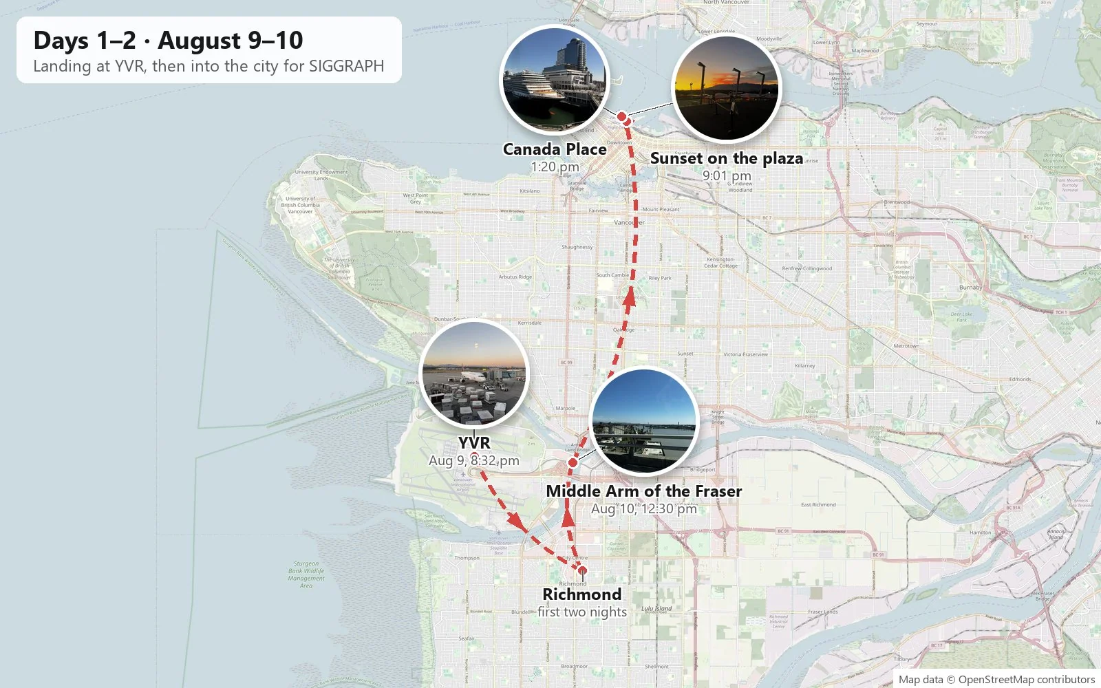
YVR → Richmond → downtown Vancouver (SIGGRAPH 2025, Vancouver Convention Centre) → Yaletown → Richmond → YVR
one paper presented · five days of conference · four beds in three neighborhoods · no rental car, mostly the Canada Line and my feet · one cancelled flight · one sequel
A year ago, on the show floor of SIGGRAPH 2024 in Denver, a booth was already selling the next summer: SIGGRAPH 2025, Vancouver, August 10 to 14. I photographed it at the time. Twelve months later I was in Vancouver with a paper to present. That Denver week was the prologue to a two-week road trip, which is written up here. This one is a sequel, and like most sequels it is shorter, stays in one city, and has more talking in it.
As before, everything below is reconstructed from the camera roll: the time and place stamped on each photo, lined up in order. A conference week is a strange thing to reconstruct that way. The camera mostly records what happens between the sessions: the view out of a window during a coffee break, lunch, a sunset on the way out of the building. The sessions themselves leave almost no trace, apart from one very well documented half hour on Tuesday afternoon. Where the record is thin, I have kept the text thin too.
Days 1–2: Landing, and opening day
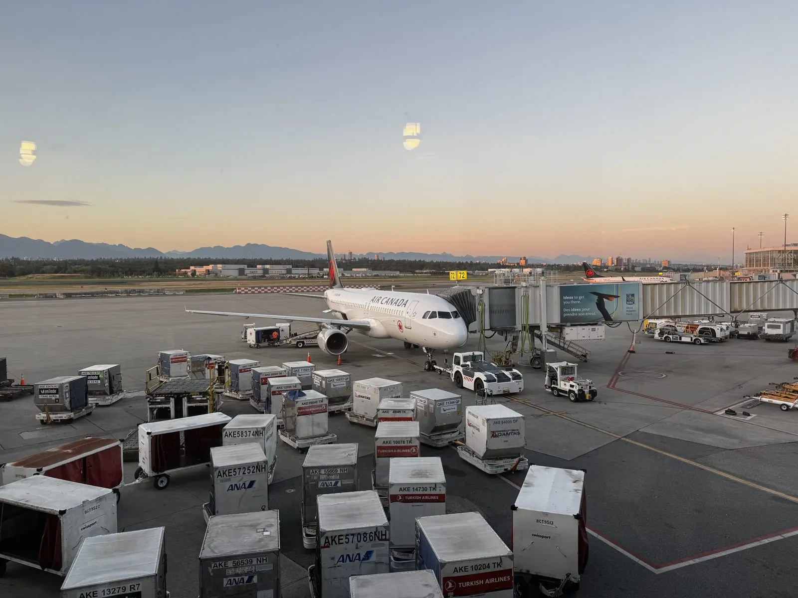
I came in to Vancouver International Airport on the evening of Saturday, August 9th. The first photo of the trip is from a terminal window at 8:32 pm. An Air Canada jet sits nose-in at its gate, the apron in front of it is crowded with baggage carts and cargo containers stenciled with the names of airlines from the other side of the Pacific, and beyond the runways a low, dark line of mountains stands against a peach-colored sky. It is a good first view of the city's geography: flat delta land in front, mountains behind, and the sun going down late, the way it does at 49 degrees north in August.
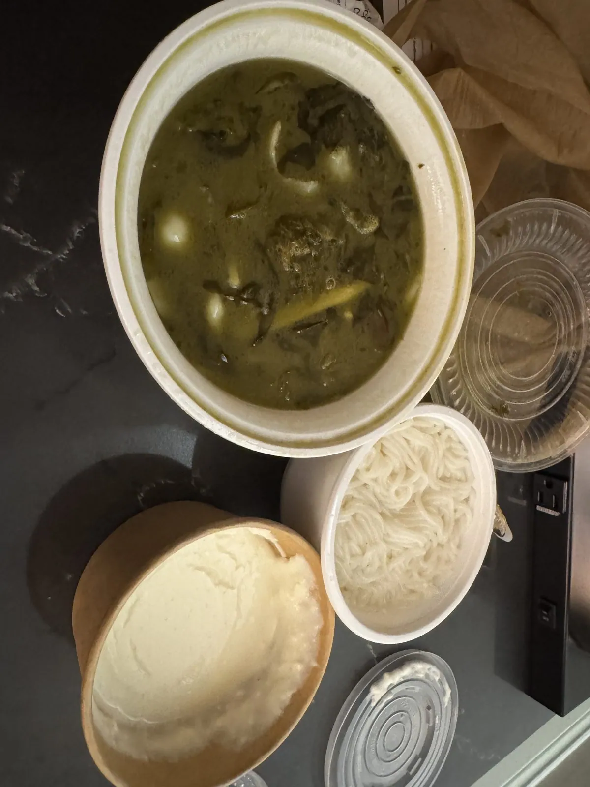
The first night was in Richmond, the city just south of Vancouver that shares Sea Island and the airport with it. Richmond sits on Lulu Island in the delta of the Fraser River, so flat and so close to sea level that it is ringed by dikes. It is also, by reputation and in practice, one of the best places to eat Chinese food in North America: a large share of its residents have roots in Hong Kong, Taiwan and mainland China, and the restaurants along its main roads follow. My first dinner, late that night, came in a paper bowl: a fish soup with pickled mustard greens, a side of rice noodles to drop into it, and a small cup of steamed milk custard for afterwards. After a day of travel it was exactly right.
Into the city
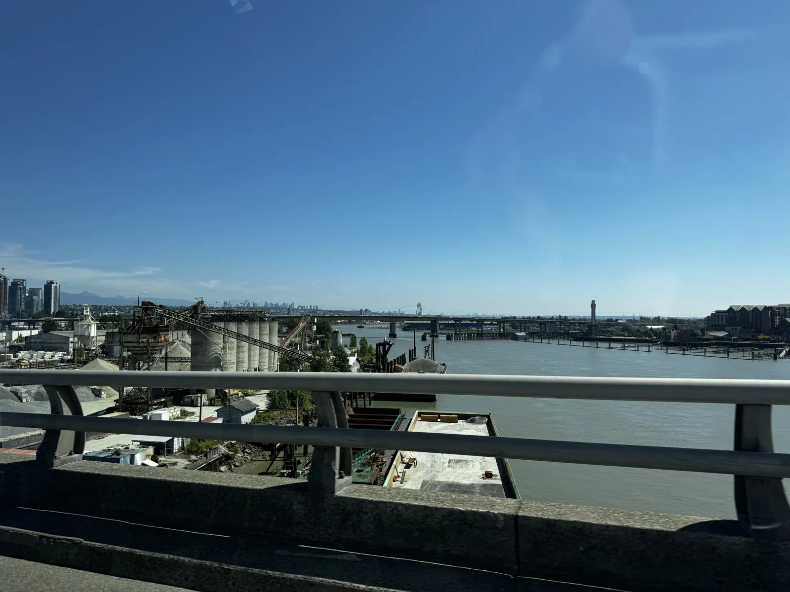
Sunday was opening day. Around half past noon I crossed the Middle Arm of the Fraser, one of the channels the river splits into before it reaches the sea. Under a perfectly clear sky the water was wide and glassy, with gravel docks and silos on its banks and, far off on the horizon, the faint towers of downtown Vancouver. It is a working river: logs, barges and gravel still move along it, and the delta it built is the ground the whole southern half of the metro area stands on.
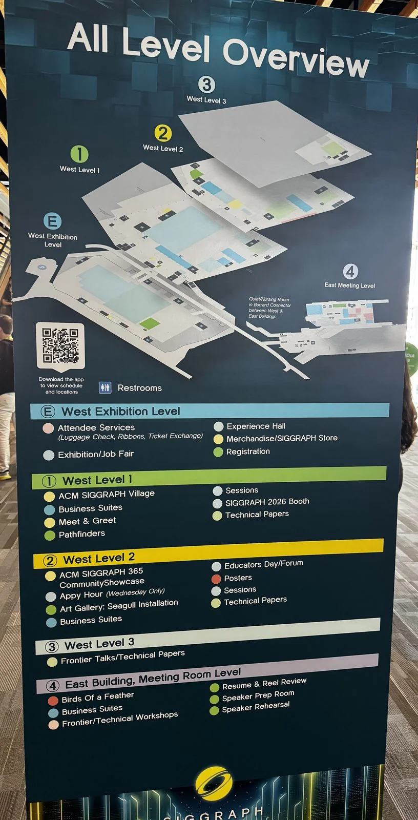
By 1:19 pm I was inside the Vancouver Convention Centre, standing in front of the "All Level Overview": the map that every attendee photographs on day one and consults on every day after. SIGGRAPH has come to Vancouver several times in recent years, and the building is a big part of the reason. Its West Building opened in 2009, is built partly out over the water of Coal Harbour, and is finished inside in long slats of pale wood that run across the ceilings like the ribs of a boat. On top is a living roof of grasses and native plants, about six acres of it, which from the North Shore makes the building look like a piece of meadow that slid down into the harbor.
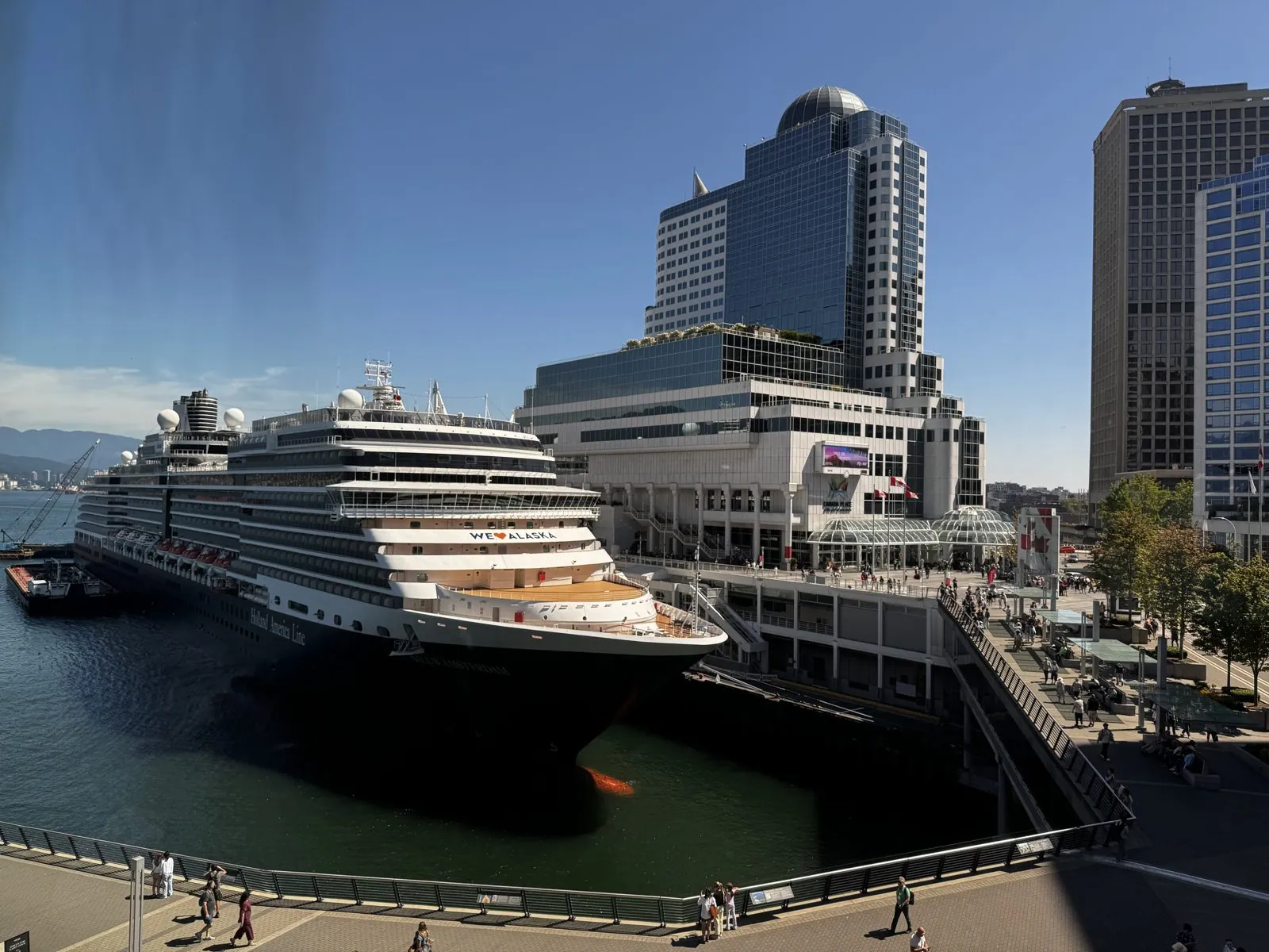
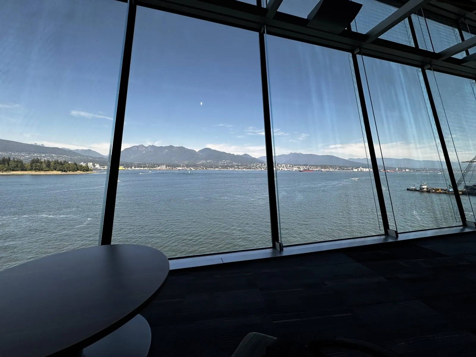
And then there are the windows. The convention centre is wrapped in glass, and almost every corridor ends in a view. A few minutes after the floor map came the first one. On one side, at Canada Place, a Holland America cruise ship lay alongside the pier, "We ♥ Alaska" painted on its bow, with people strolling the promenade deck of the pier below it. Canada Place was built as Canada's pavilion for Expo 86, and its roof of white fabric sails has been the city's postcard ever since; today it is mostly a cruise terminal, the starting point for ships heading up the Inside Passage. On the other side, across Burrard Inlet, the North Shore Mountains rose straight out of the water, with the dark green edge of Stanley Park at the left. It was hard to believe this was the view from a conference hallway.
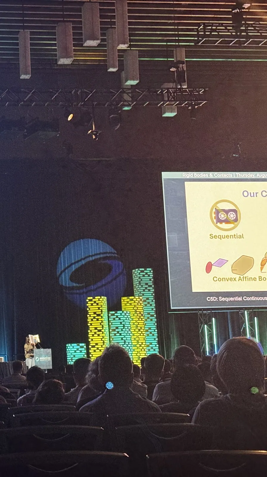
The evening belonged to the big hall and to SIGGRAPH's traditional opening ritual, the Technical Papers Fast Forward, where every paper in the conference gets well under a minute to make its pitch, one after another, for a couple of hours. It is part trailer reel and part endurance sport, and the audience reacts to the jokes like a comedy crowd. The record has a short video at 7:19 pm and a photo at 8:52 pm: a dark auditorium with rows of heads in silhouette, stage lights raking through the haze, a glowing SIGGRAPH logo, a wall of glowing blocks, and on the screen a slide from a paper in a session called "Rigid Bodies & Contacts", which wasn't due to be presented in full until Thursday.
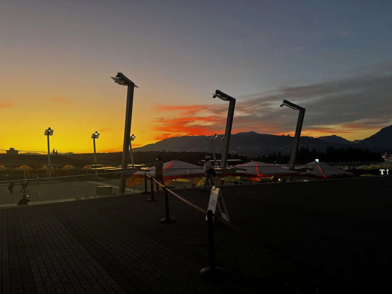
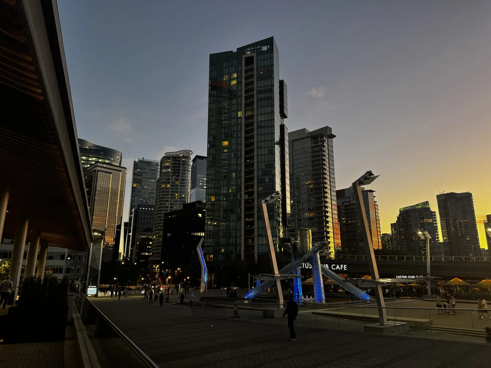
Coming out at nine o'clock, the sky over the North Shore had caught fire. From the plaza outside the West Building, the mountains were a black cutout against a band of orange and red, the tall street lamps of the plaza leaning over the scene like a row of herons. Turn around, and downtown's glass towers stood dark against the last yellow light, with the four white struts of the Olympic Cauldron lit blue beneath them. The cauldron was built for the 2010 Winter Games, which used this building as their media centre, and it still stands on the plaza, its flame lit only on special occasions, like a piece of sculpture waiting for its cue. On the same plaza, Douglas Coupland's Digital Orca, a killer whale built out of black and white blocks, stood against the glow.
Days 3–4: The talk
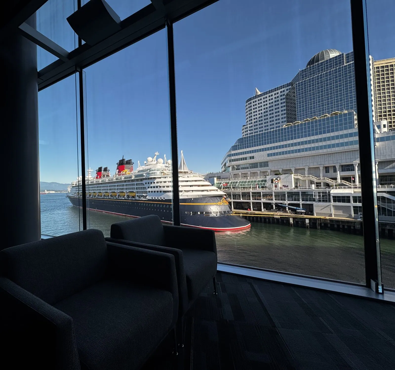
Monday afternoon I sat in the audience at a papers session on cloth and knits: one talk on scheduling cloth simulations across mixed hardware, and one on rendering knitted fabric in real time, yarn by yarn, ending on a knitted teapot. Later, at 4:33, I found a quiet corner of the convention centre with two dark armchairs facing the glass, and outside it a different ship at Canada Place. This one was a Disney liner, black hull, red funnels, gold trim, as if a cartoon had docked. Cruise ships come and go from Canada Place almost daily in summer, and every day of the week the view out of the window had a new one in it.
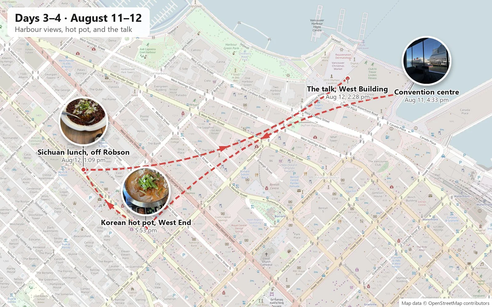
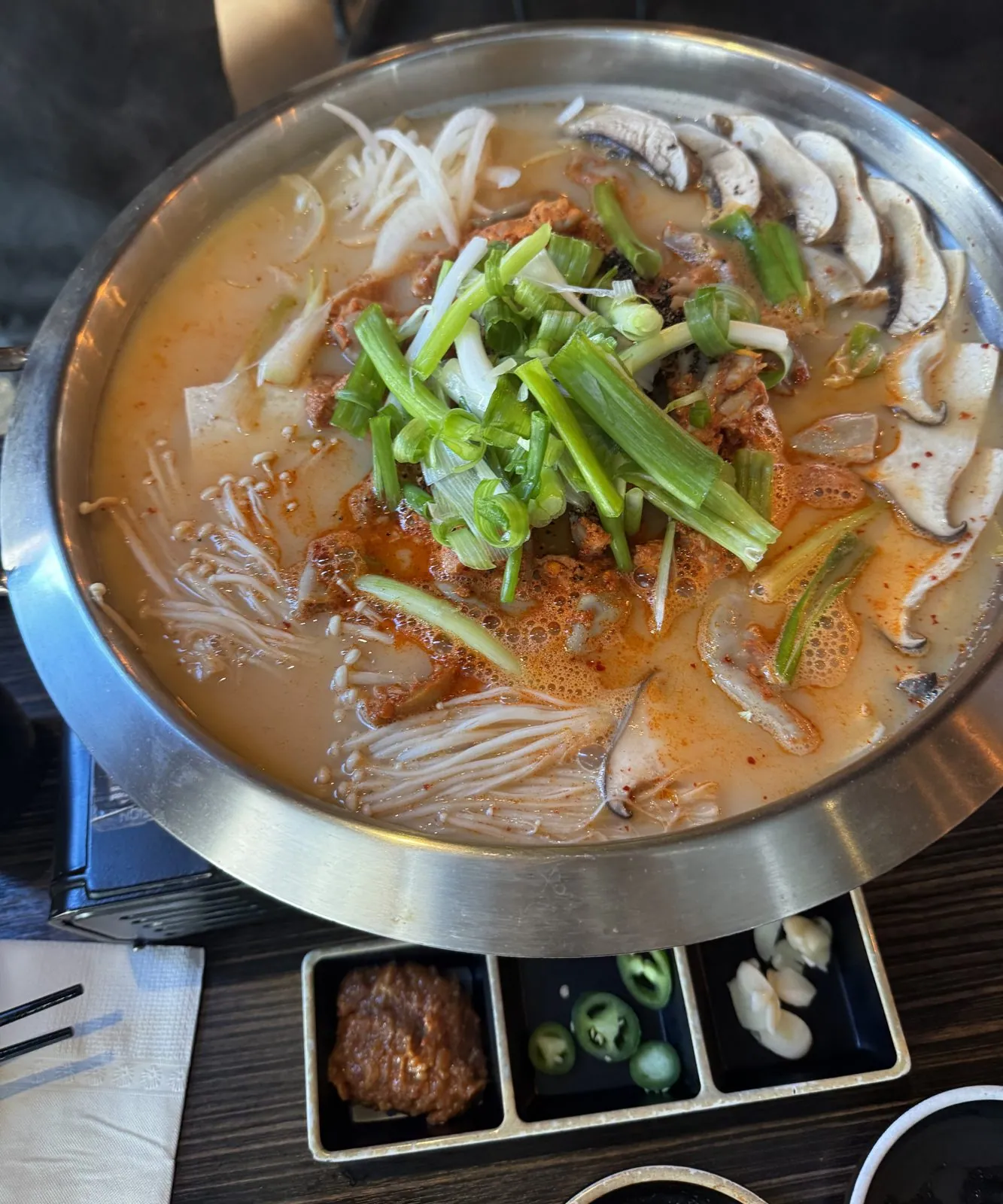
Dinner was a short walk up into the West End, at a Korean place where the centerpiece arrived in a wide steel pan on a burner: a red, milky broth full of enoki and sliced mushrooms, tofu and noodles, heaped with spring onions, with little dishes of chili paste, sliced jalapeño and pickled garlic on the side. Around it the table filled up with banchan, rice in steel bowls, lettuce for wrapping and a hot plate of pork. Downtown Vancouver's Korean and Japanese restaurants are a well-known feature of the streets around Robson, and this one did not let the reputation down.
Tuesday: ANIME-Rod
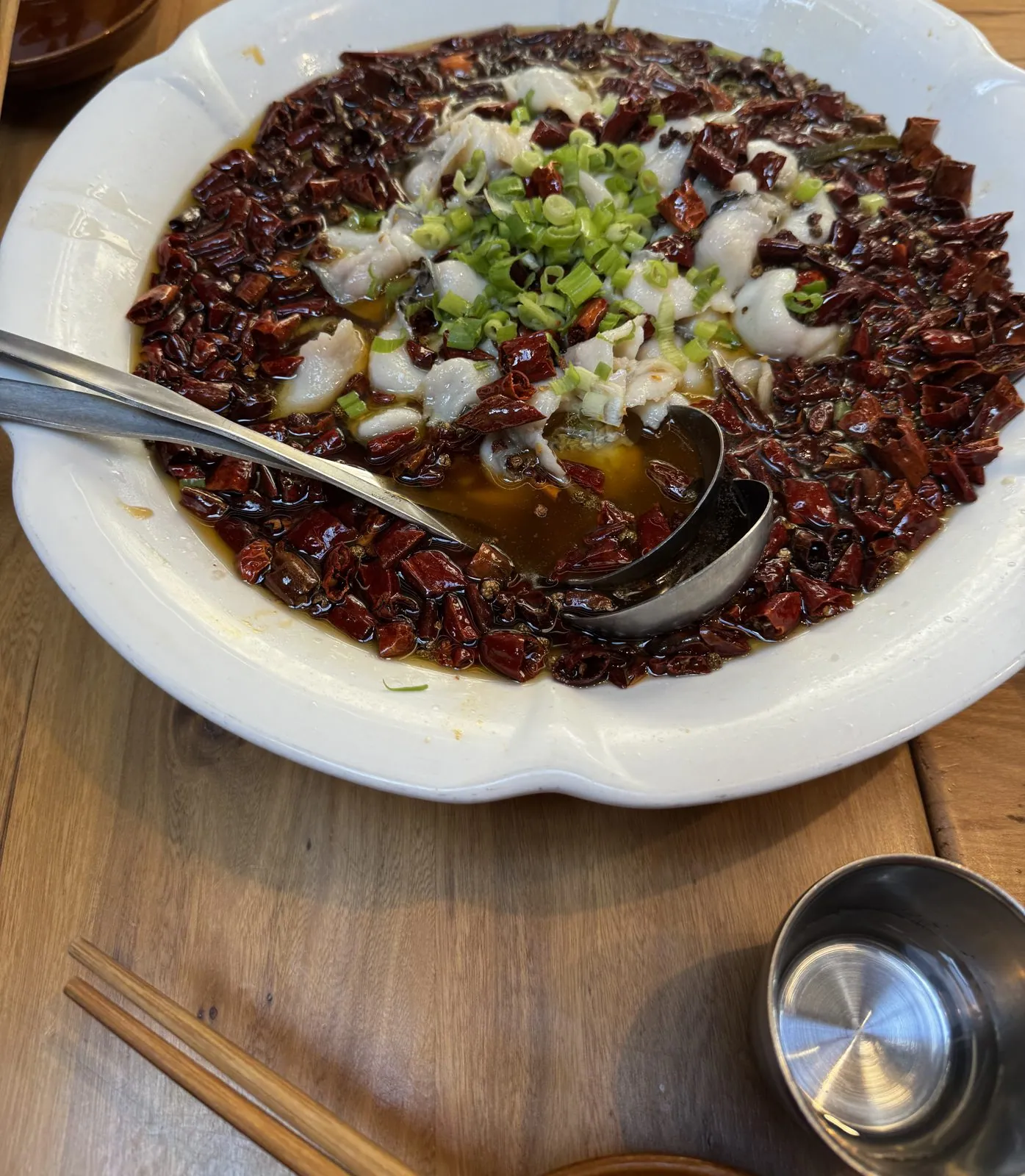
Tuesday was the day. Lunch, a little after one, was Sichuan, a few blocks off Robson Street, with a table of fellow attendees. The photo that survives shows a broad white bowl of fish poached in oil under a landslide of dried chilies and Sichuan peppercorns, with a ladle already in it. It is not, perhaps, the lunch a careful person eats an hour before giving a talk.
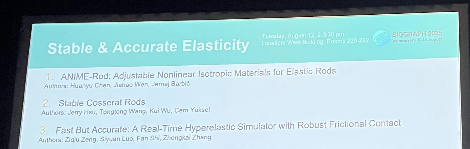
The session was called Stable & Accurate Elasticity: Tuesday, August 12th, 2 to 3:30 pm, West Building, Rooms 220–222. The opening slide listed six papers, and ours was number one, which meant there was no time to settle in by watching anyone else go first. Paper number four on that list was another one from our lab. A SIGGRAPH technical-papers room is a ballroom carved into smaller pieces, with a low stage, a podium with the conference logo, a projector screen in a black frame, and rows of chairs facing it.
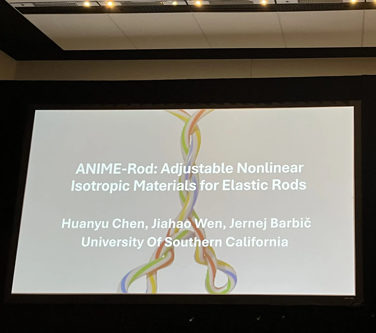
The paper was ANIME-Rod: Adjustable Nonlinear Isotropic Materials for Elastic Rods, by Jiahao Wen, Jernej Barbič and me, from the University of Southern California. The title slide put the name over a pair of braided, rainbow-colored rods twisting around each other, and the photos from the audience start there.
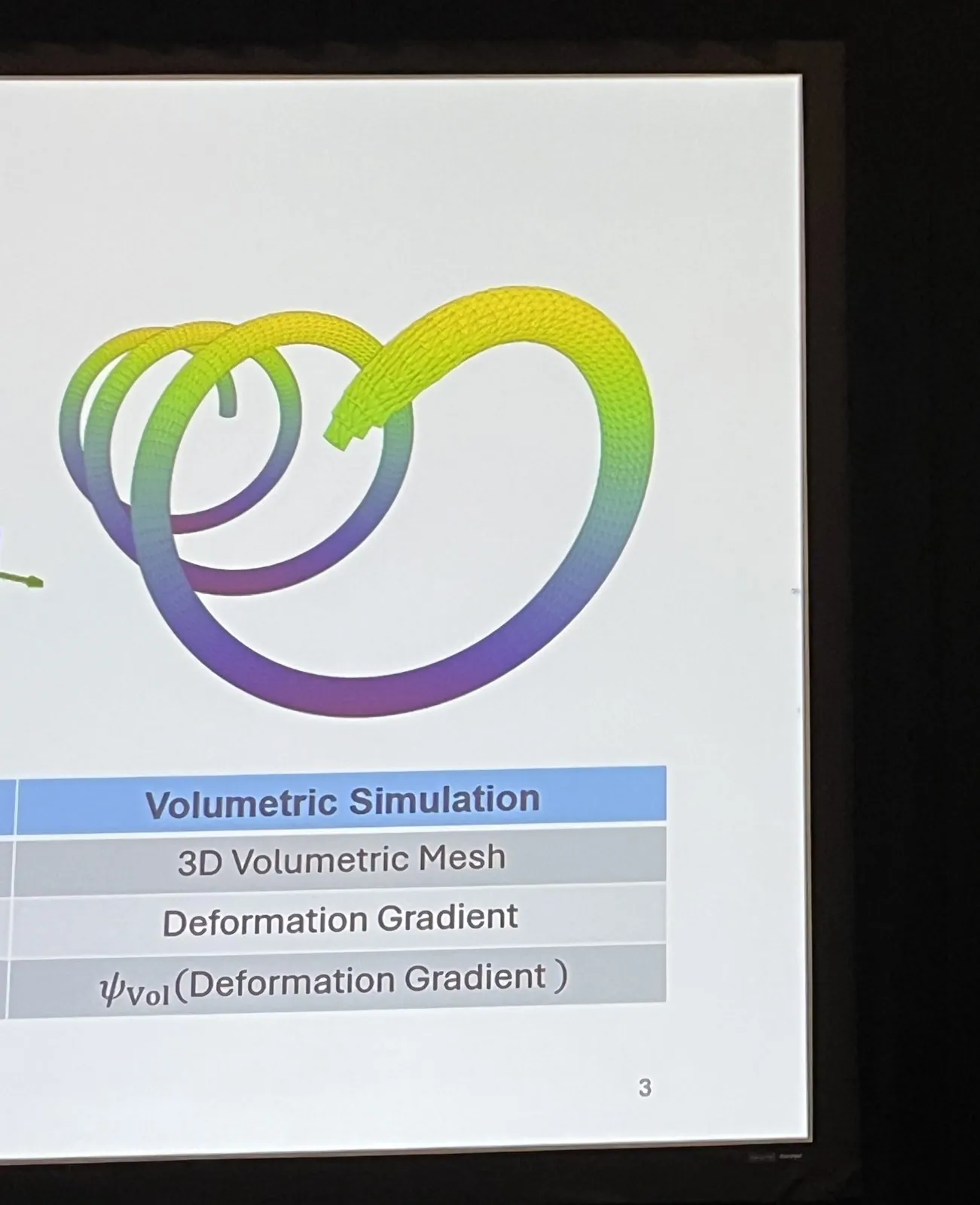
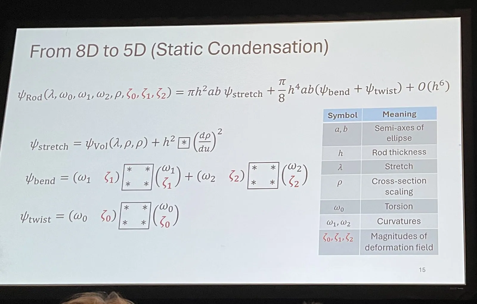
I won't try to give the talk again here, but the slides that were photographed tell its outline well enough. It opens with a volumetric simulation: a coiled, rainbow-shaded rod meshed in 3D, under the chain "3D volumetric mesh, deformation gradient, energy of the deformation gradient". That is the expensive, accurate way to simulate something long and thin. The talk then asks why it is hard for a rod model to match it, and works towards an answer on a slide titled "From 8D to 5D (Static Condensation)", where three of the eight variables, the ones describing how the cross-section deforms, are solved for and folded away, leaving a rod energy in five: stretch, twist, two curvatures and a cross-section scaling.
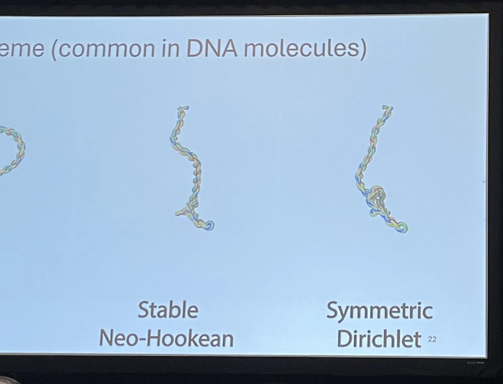
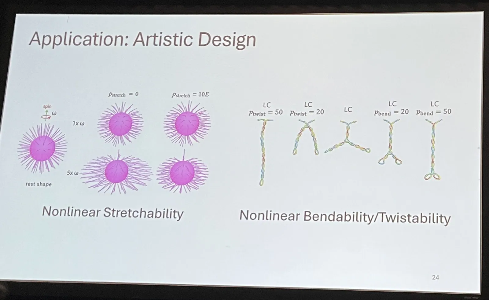
Two of the later slides are the fun ones. One compares two material models on a twisted rod curling into the kind of supercoil that is common in DNA molecules: under "Stable Neo-Hookean" and "Symmetric Dirichlet" the same rod ends up in visibly different shapes. The other is labeled "Application: Artistic Design", and shows what adjustable nonlinearity is for: a spinning ball of spiky magenta strands whose stretch response can be dialed up and down, and a row of little Y-shaped rods that bend and twist differently as their parameters change. Then the session chair stepped up beside the podium with a sheet of paper, and it was time for questions.
There is a particular feeling to walking off that stage. For months a paper is a PDF, a set of reviews, a video and a deadline. For a few minutes in a carpeted room in Vancouver it becomes a thing you say out loud to people who came to hear it, and then it is done, and the next speaker is plugging in a laptop. The camera roll goes quiet for the rest of the afternoon, which seems about right.
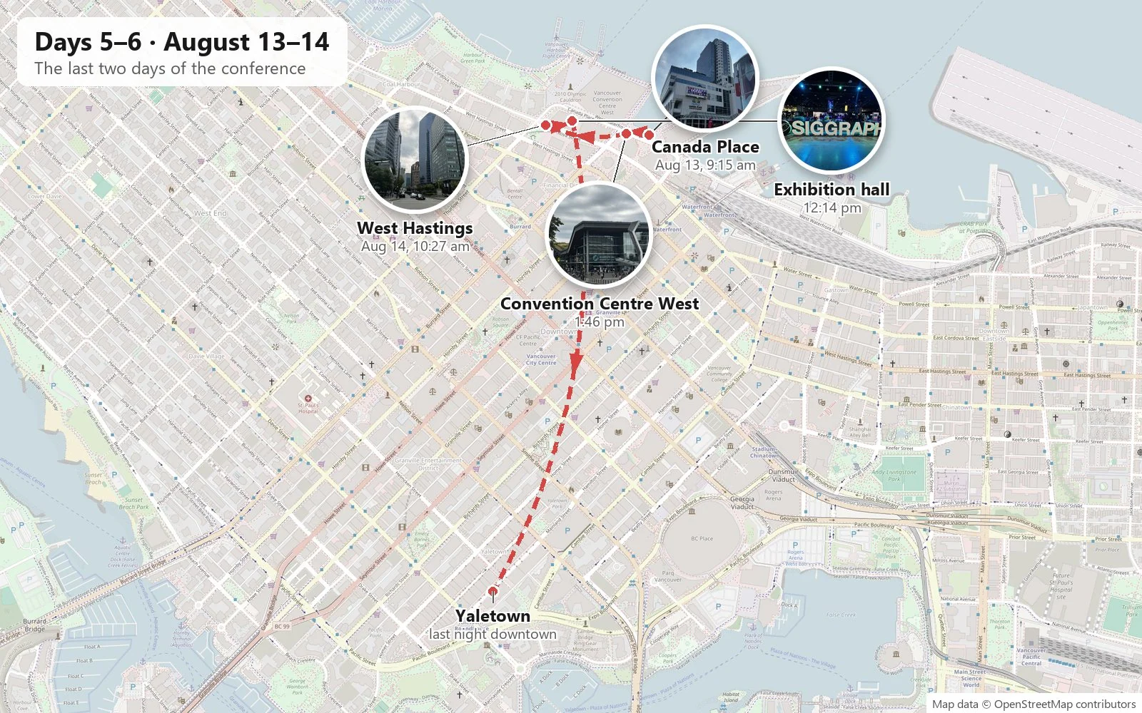
Days 5–6: The rest of the week
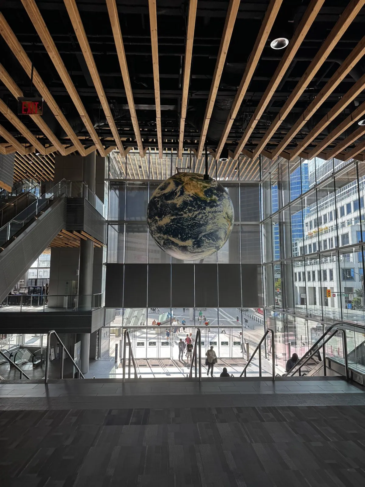
Wednesday began at 9:13 in the morning at the top of a staircase in the West Building's atrium, under the wooden ceiling slats, looking down at a giant globe of the Earth hanging in the middle of the glass hall. Clouds and continents were printed on it at a scale that made it look like a planet seen from orbit, suspended above the escalators and the crowds of badge-wearers coming in for the day. Through the glass behind it, the towers of the financial district rose straight up from the street.
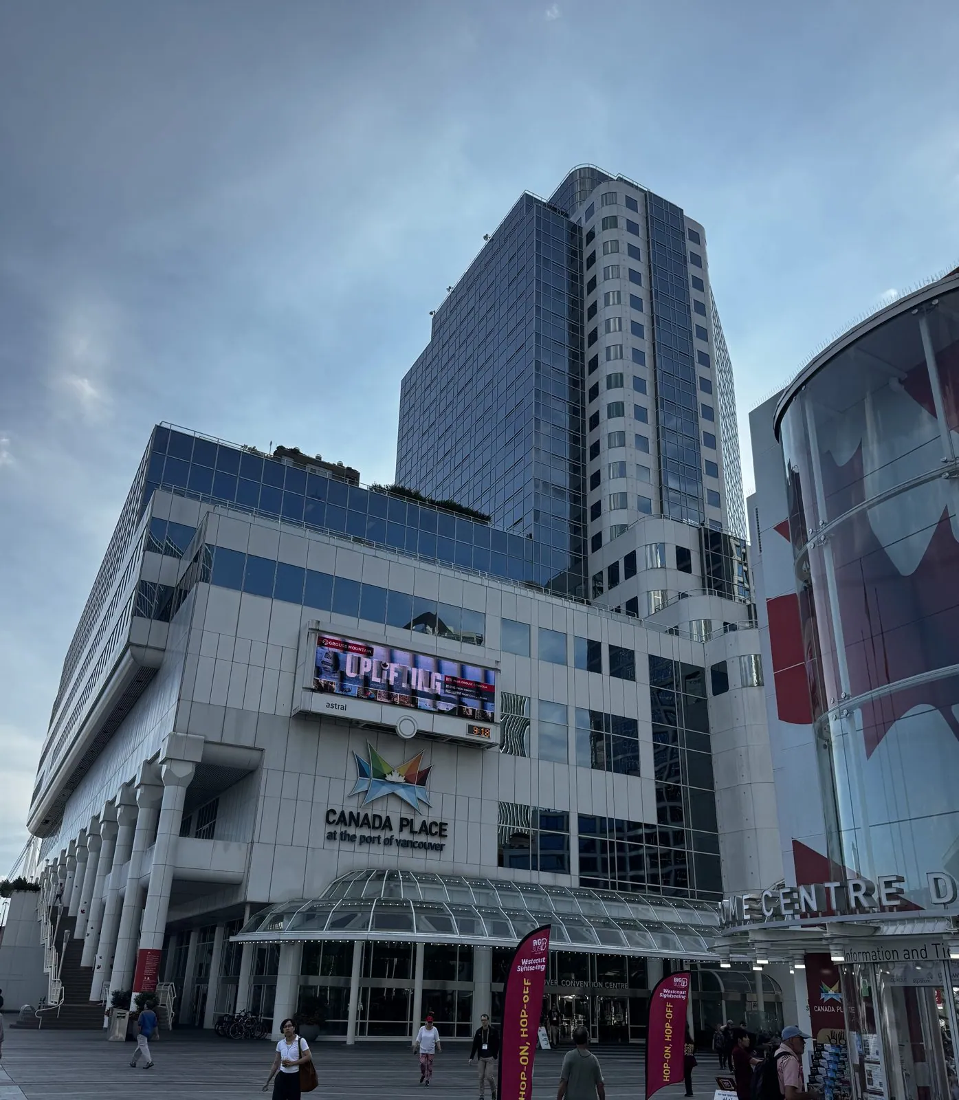
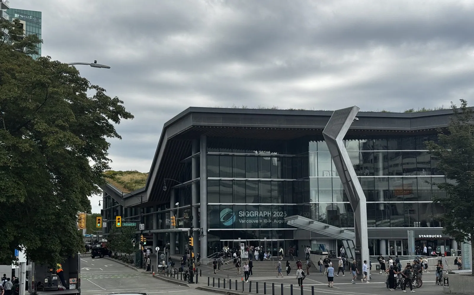
Two minutes later I was outside on the forecourt of Canada Place. From the land side it looks nothing like the postcard: instead of sails, a white wall of terminal and offices, a glass tower above it, a big maple leaf painted on a glass drum, and the red banners of the hop-on, hop-off buses. The sky had turned gray overnight, the first sign of the weather change that would see out the week. That afternoon, from across the street, I took the obligatory exterior of the Convention Centre West with the SIGGRAPH 2025 banner over the entrance: a long, low glass building under a deep overhanging roof, its grass top just visible at the edge, with a steady stream of people crossing the plaza in front.
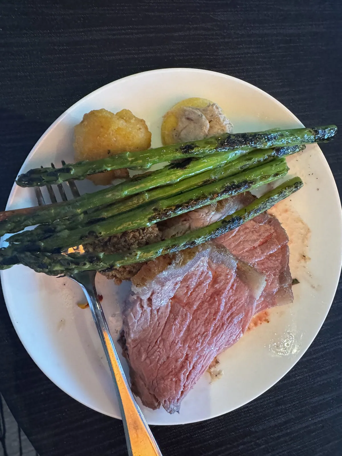
The evening's reception food was better than conference food has any right to be: a slab of prime rib, pink all the way through, with grilled asparagus laid across it like a fence and a couple of roasted potatoes, followed by fruit skewers and sesame balls. These events are really about the conversations, and the food is mostly something to hold, but this time the food was worth a photo.
Thursday: the last day
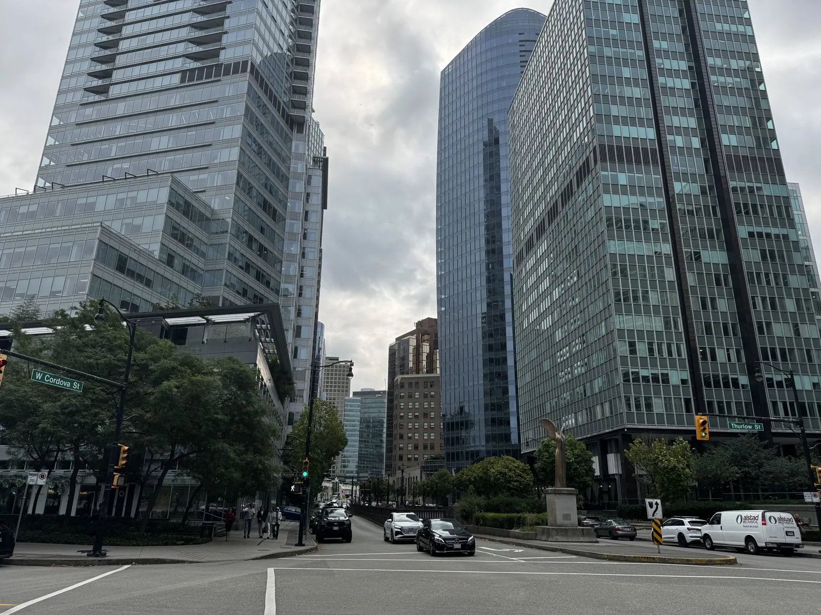
Thursday, August 14th, was the conference's last day and my moving day, from near the convention centre to the Hilton Vancouver Downtown, at the edge of Yaletown, for one more night. The morning was gray and cool, and West Hastings Street had the look Vancouver is famous for under cloud: green-glass towers, dense and glossy, rising behind trees that are still lush in August. A bronze bird with outstretched wings stood on a plinth at the corner of Thurlow Street. A red double-decker sightseeing bus came by with "Vancouver" written across its side, in case anybody had forgotten.
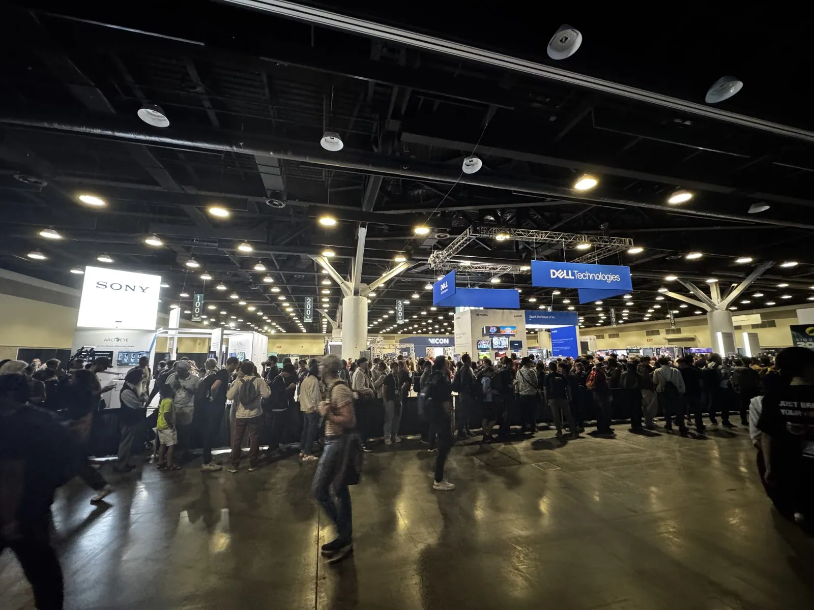
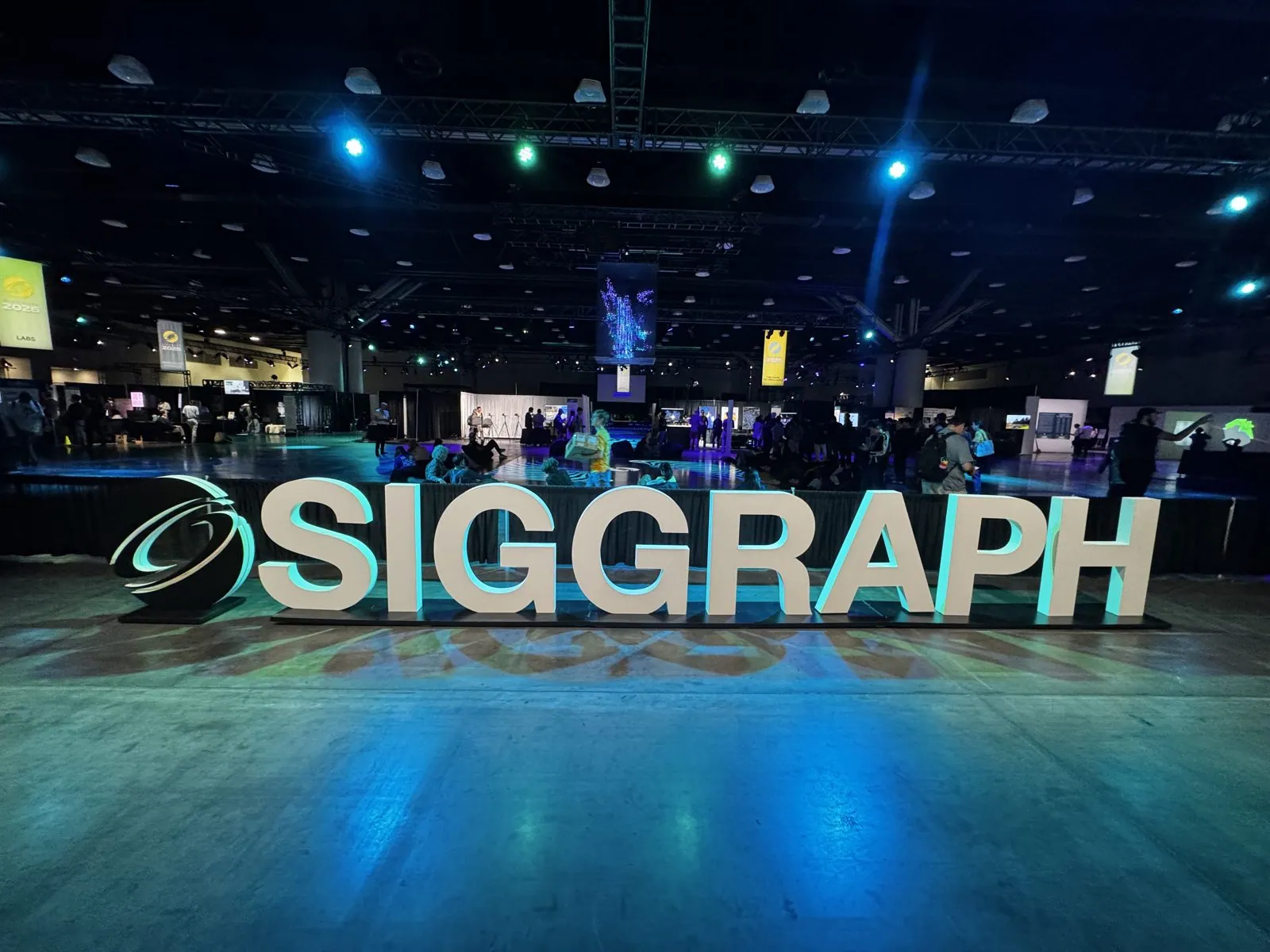
Around noon I made a last pass through the exhibition hall, down in the lower level of the West Building. It is a dark, enormous room lit by rows of downlights, with company booths under hanging banners and a crowd that never thins. Sony and Dell banners hung over two of the biggest stands, and lines of people snaked across the floor in front of them. Near the entrance, the giant illuminated SIGGRAPH letters stood on a floor washed with blue and teal light, the most photographed object in the building. In Denver, a blue bear peered through the window behind them; in Vancouver, it was the letters alone.
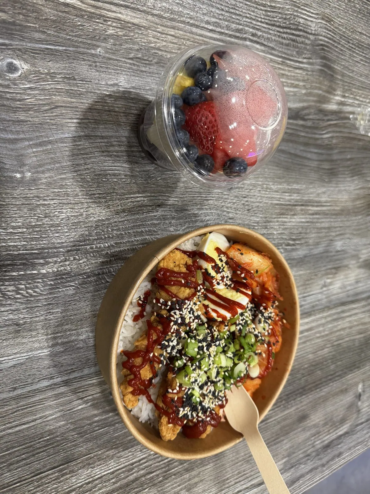
Lunch, eaten near Jack Poole Plaza according to the GPS, was a paper bowl of rice with fried chicken, kimchi, a boiled egg, spring onions, black and white sesame and a zigzag of chili sauce, and a cup of berries and melon. It is the kind of lunch you eat in fifteen minutes between two things you don't want to miss.
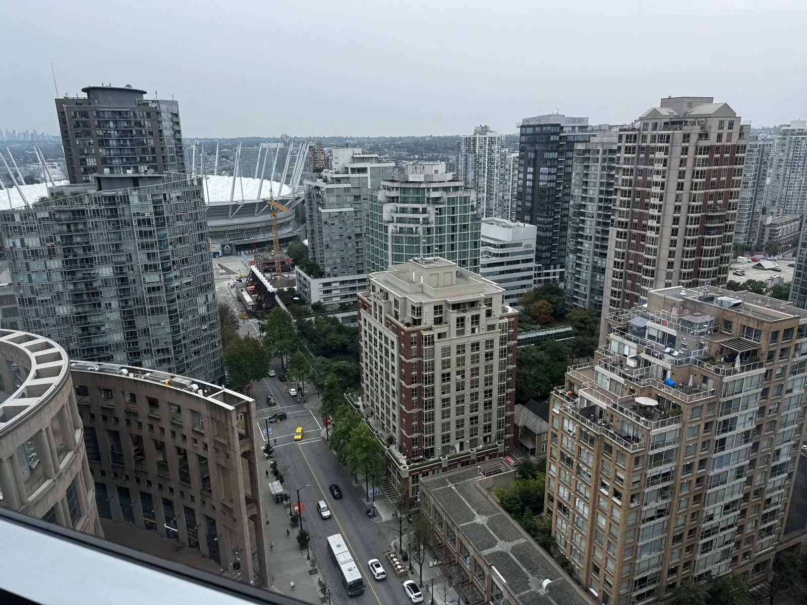
By six I was in Yaletown, high above the south end of downtown. Yaletown was a district of railway yards and brick warehouses a century ago, named for the railway workers who moved here in the 1880s from the town of Yale, up the Fraser Canyon; today it is a forest of glass and concrete residential towers, built mostly since the city hosted Expo 86 on the old rail lands along False Creek. From up there the view takes in a whole history of the city at once: the white, tent-like top of BC Place, the stadium whose cable-supported retractable roof replaced an inflated dome in 2011, and, in the corner, the curved stone wall of the Vancouver Public Library's Central Branch. Moshe Safdie's 1995 library is famous for looking like the Colosseum, and from above you can see why: a great oval arcade wrapped around a rectangular block of books.
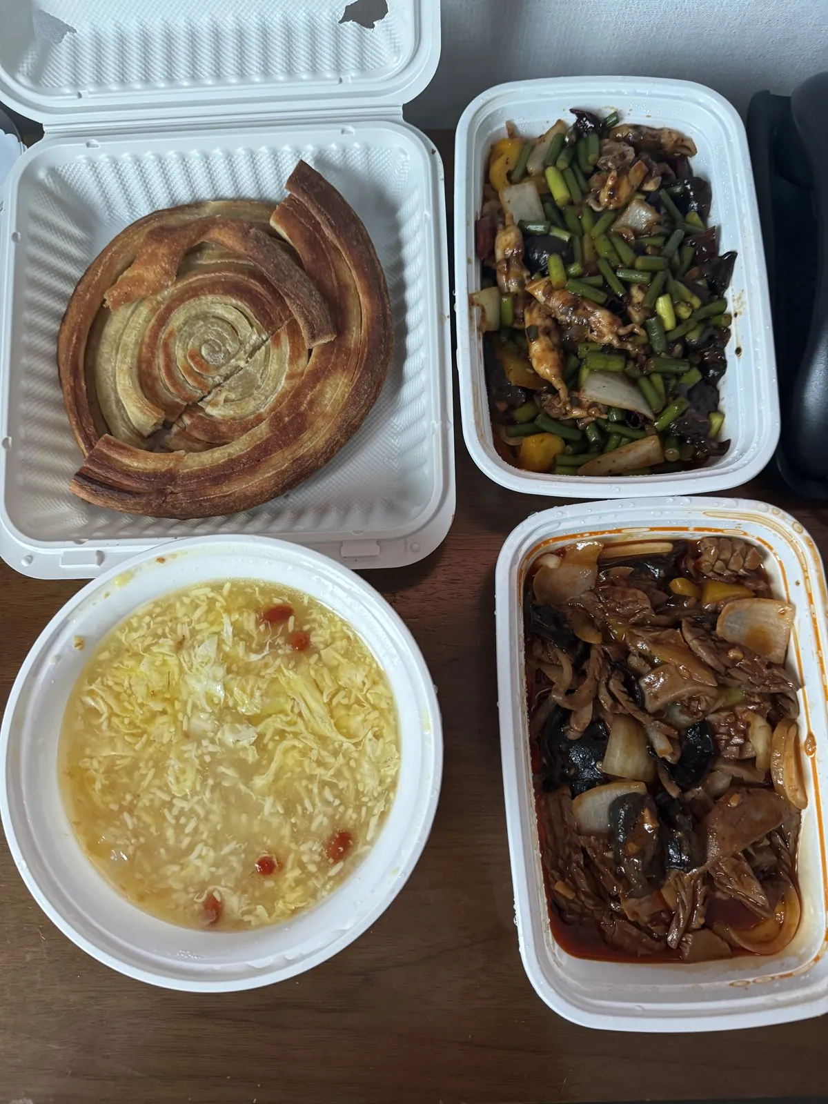
Dinner was Chinese takeout, spread out across a table: a coiled, flaky layered flatbread, a bowl of golden millet congee dotted with goji berries, a stir-fry of garlic scapes with wood ear mushrooms, and a dark, spicy braise. That night it rained, and the last photo of the day is of city lights blurred by water running down the glass. Vancouver had finally produced the weather it is known for, one day before I left downtown.
Days 7–8: A strike, and an extra day in Richmond
Friday, August 15th, was supposed to be the flight home. It wasn't. Air Canada's flight attendants, around ten thousand of them, were heading for their first strike in decades, and the airline had already begun winding down its schedule ahead of the deadline. My flight was one of the ones cancelled. The strike itself began in the early hours of the next morning, and for a few days the country's largest airline was almost entirely on the ground.
So instead of an airport, Friday became a scramble. I needed a bed for the night at short notice, and found one in an Airbnb back in Richmond. A flight was harder. At first there was nothing to book at all, and once seats did appear they cost several times the original fare, because everyone else on every cancelled Air Canada flight was looking at the same screens. Eventually I got a seat on a Delta flight for Saturday: first class, since that was what was left, at a price I'd rather not repeat. Then, early on Saturday morning, a much cheaper flight turned up, still more than double what I'd originally paid, and I switched to it.
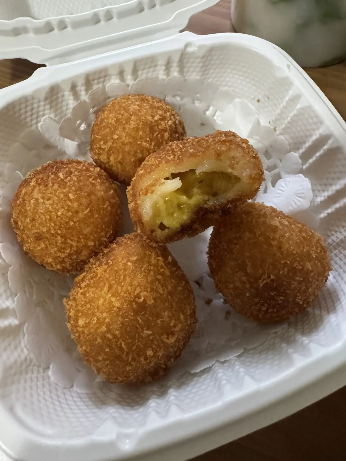
In between, the camera roll records one errand, a new suitcase from an outdoor-gear store, and one dinner. It was Cantonese takeout this time: rice-noodle rolls, slippery and translucent with shrimp showing through, a tub of congee, and a box of deep-fried durian mochi balls. Bite into one and the crisp golden shell gives way to a chewy layer of glutinous rice and then a soft, pale-yellow center of durian, which is as divisive as fruit gets and which, in this form, even skeptics tend to forgive.
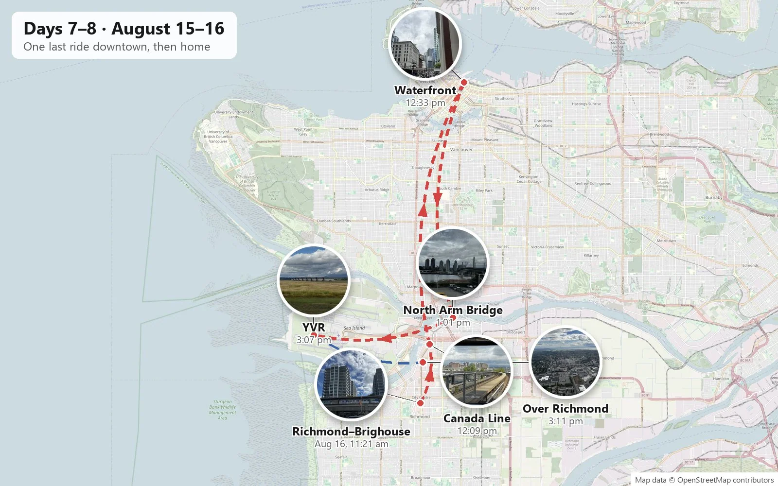
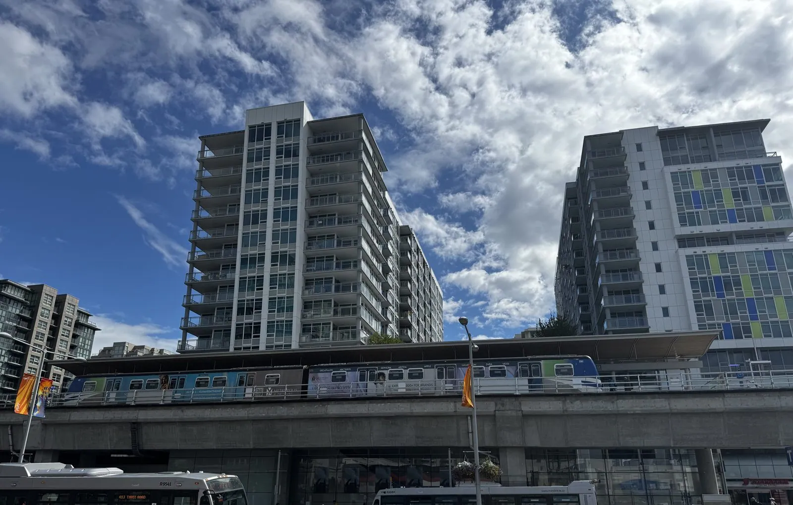
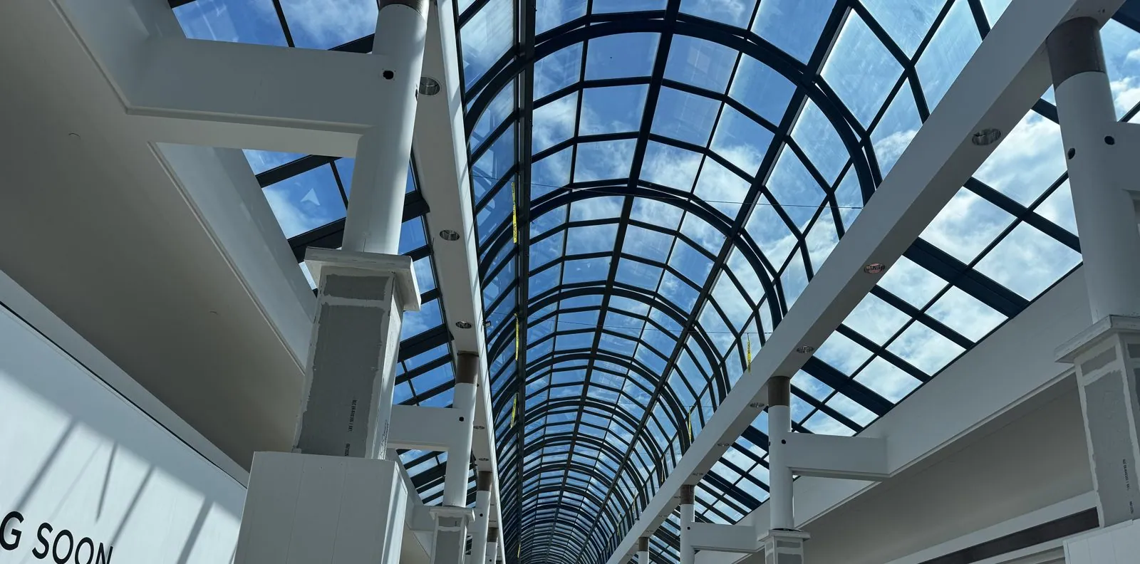
The new flight left in the afternoon, which handed me something I hadn't planned on: a free morning in Richmond, a city I had mostly seen from the train and from takeout boxes. It started at the Richmond–Brighouse terminus of the Canada Line, on No. 3 Road. The sky had cleared into a mass of bright, piled-up clouds, and the guideway ran past on its concrete beam with a two-car train sitting at the station, white residential towers with blue and lime-green panels standing over it. Next to the station is Richmond Centre, the mall whose long glass barrel-vault roof turns the main concourse into something like a greenhouse. There was bubble tea, of course. It was Richmond.
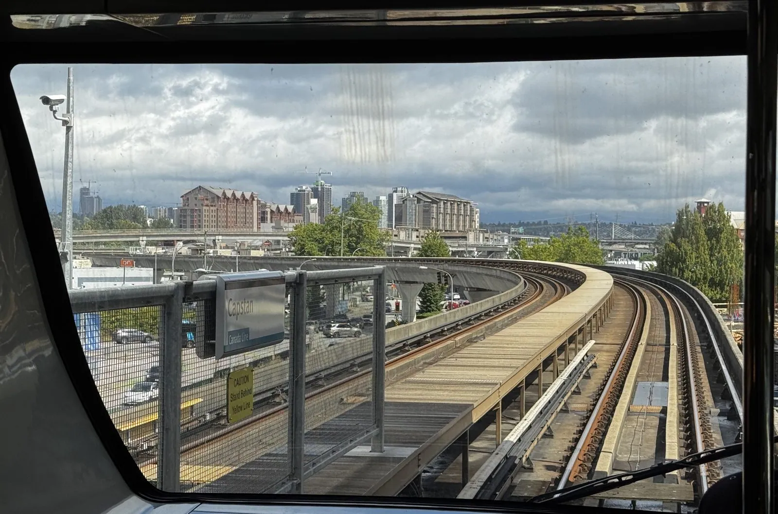
Then came the best seat in Vancouver's transit system. The Canada Line opened in 2009, just ahead of the Winter Olympics, and like the rest of the SkyTrain network it is fully automated, with no driver's cab. That means whoever boards first can stand at the very front and look straight down the track through a big window. The view from there is a roller coaster in slow motion. The guideway swings out ahead in a long curve on its concrete beam, past Capstan station and over the roofs and parking lots of Richmond, toward the river and the city. I stood there and watched it come.
I rode it all the way to the end at Waterfront, half an hour from Richmond, for one last look at downtown. Waterfront Station was built in 1914 by the Canadian Pacific Railway as the western end of the transcontinental line, and its columned front still faces Cordova Street. Today it is the hub where the SkyTrain lines, the SeaBus to North Vancouver and the commuter trains all meet. Standing between its columns you see the city's two eras side by side: a stone office block from the railway age across the street, a curved glass tower beside it, and a tour coach at the curb in front. A few steps along West Cordova, the brick of Gastown begins.
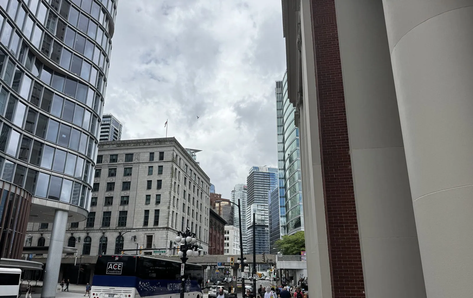
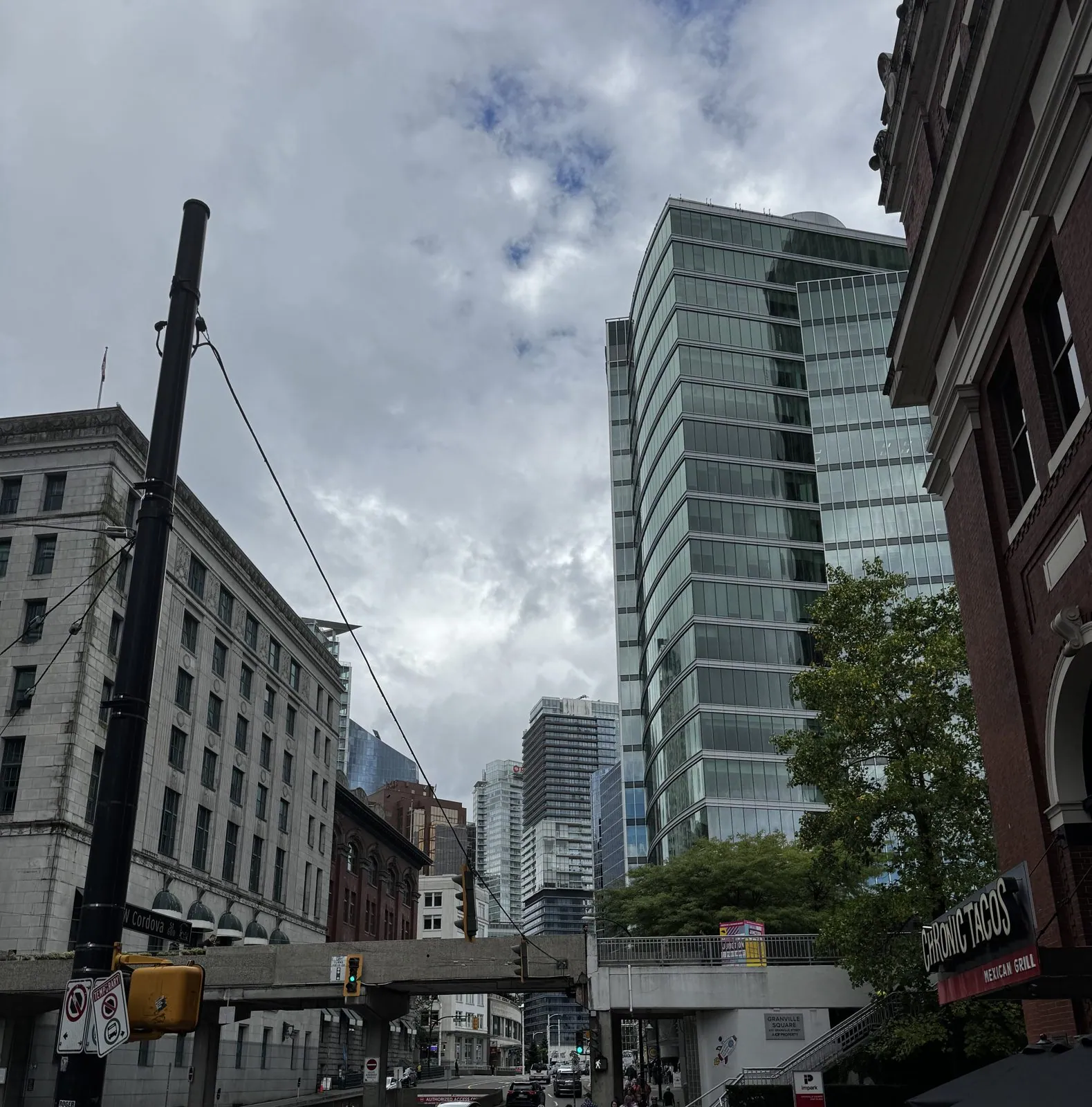
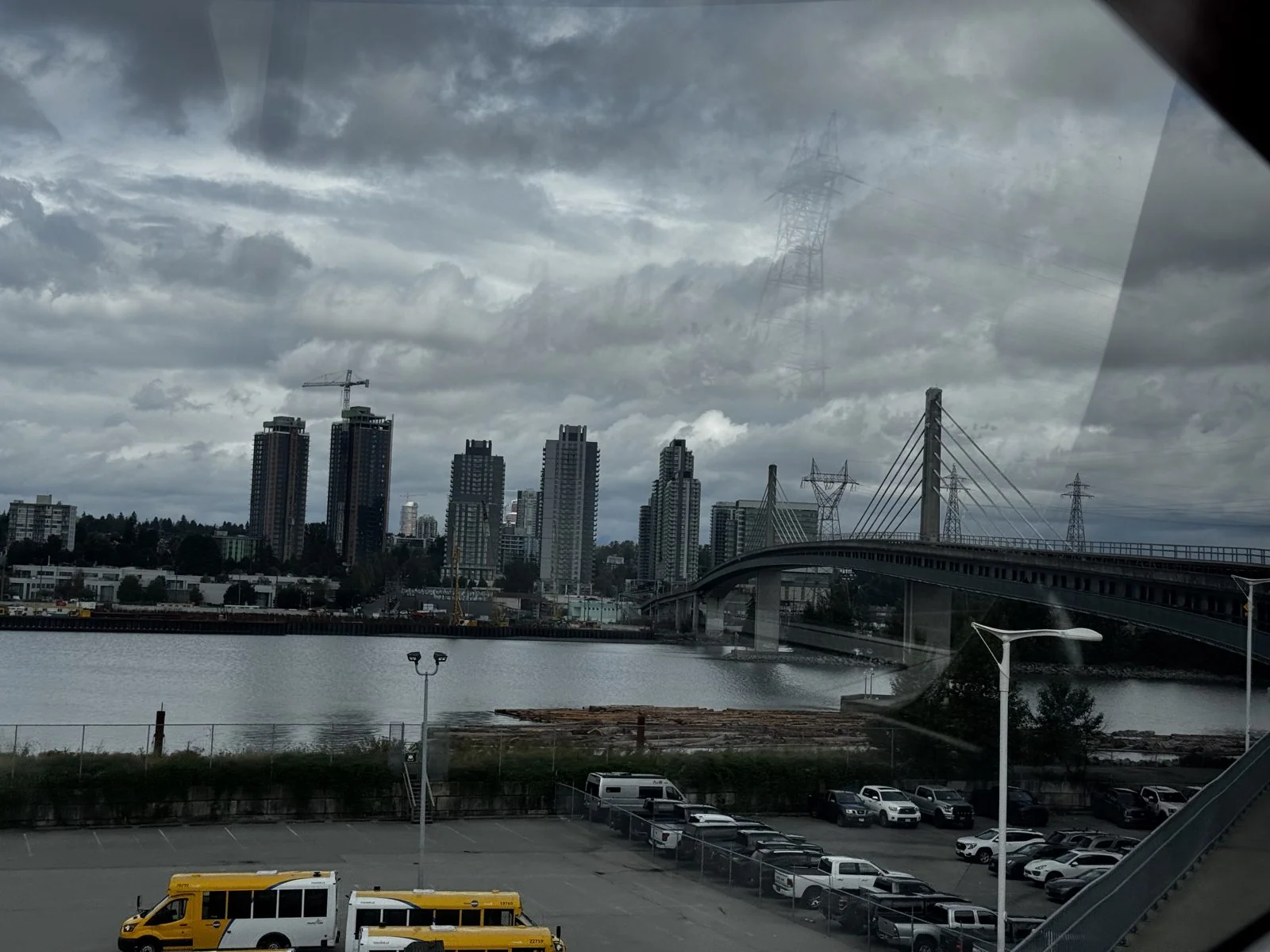
It was a short visit. Three minutes on the street, by the timestamps, and then back underground and south again, a farewell lap rather than an outing. Half an hour later the train was crossing the Fraser's North Arm at Bridgeport. The North Arm Bridge, built for the Canada Line, carries the trains on a single concrete deck hung from short towers, with a walkway for bikes and pedestrians alongside. From the train, under a heavy sky, the new towers of Marpole lined up on the far bank.
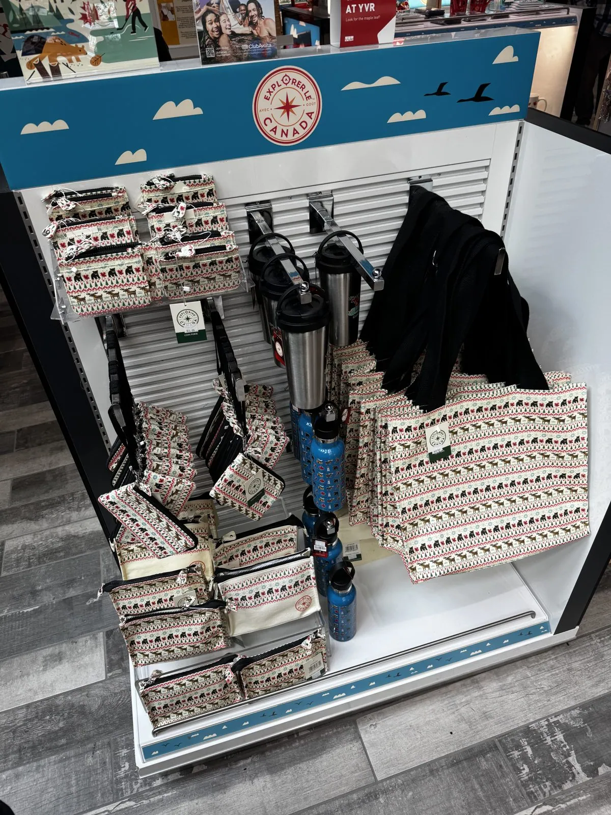
The airport did its usual job of making the city into merchandise. The shops in the departures area were stocked with cream "Vancouver" sweatshirts and an "Explore Canada" display of travel mugs, water bottles and bags printed with rows of little bears and maple leaves.
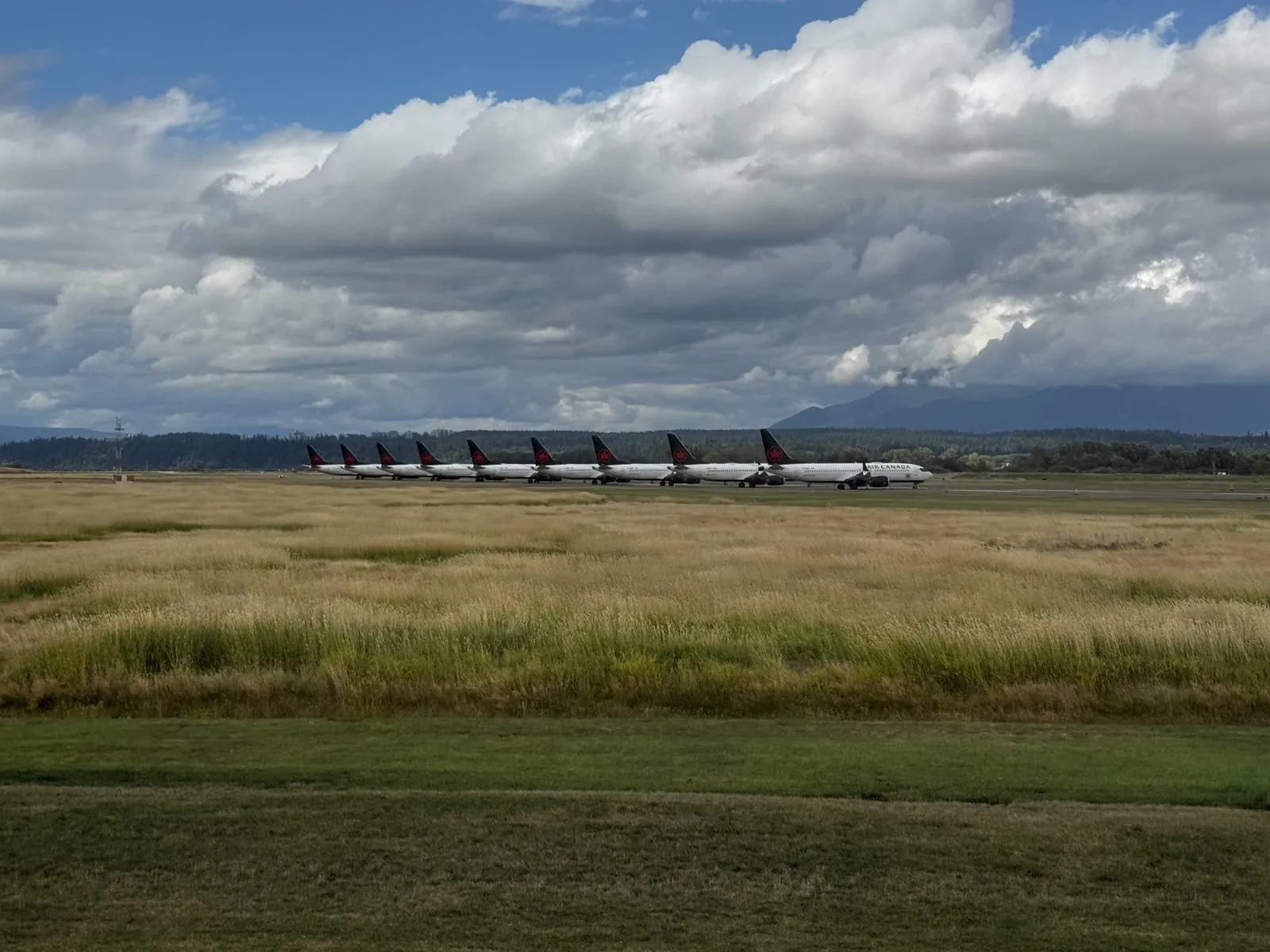
Takeoff was a little after three. Taxiing out, the window showed the strike in a single frame: a long line of Air Canada jets parked nose to tail across a field of tall golden grass, going nowhere, with the mountains behind them under the clouds. Then the plane lifted off eastward over the delta, and below, the Middle Arm of the Fraser curled past new apartment blocks, a bridge and a stretch of empty fields.
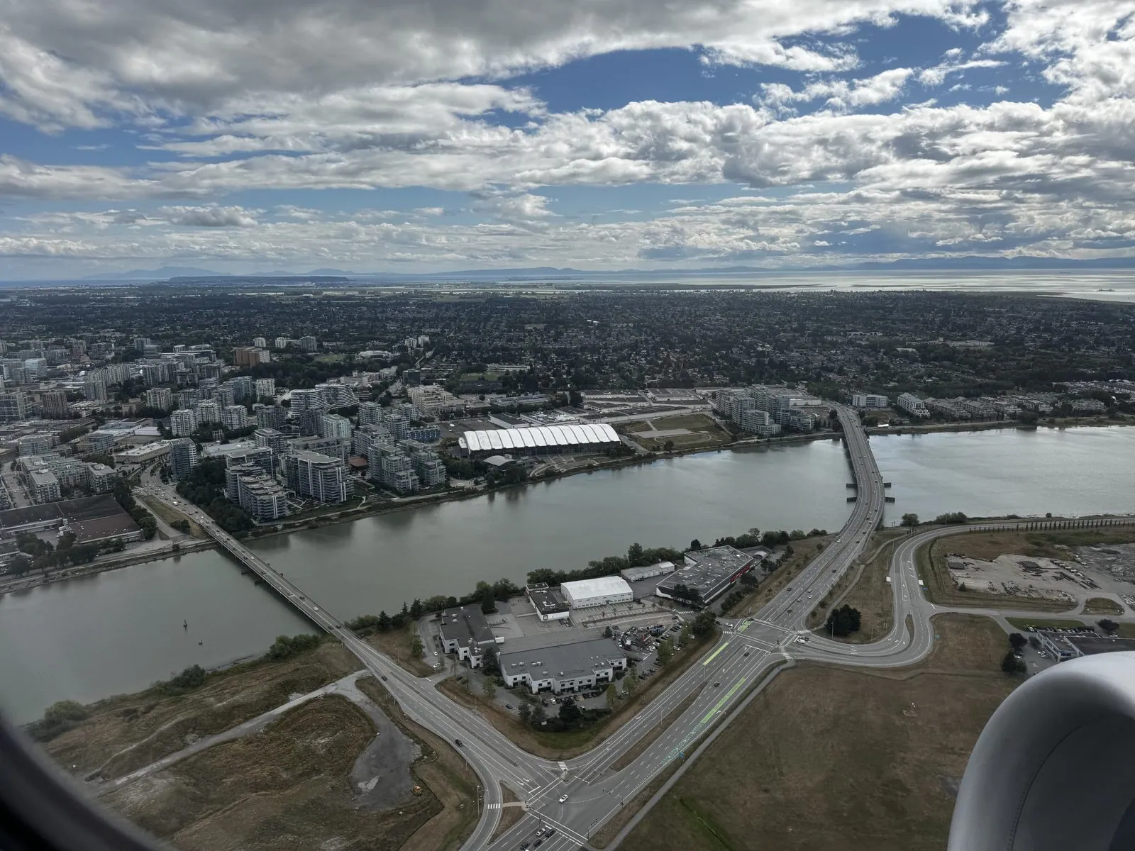
A moment later the whole of central Richmond was laid out like a circuit board, its long straight roads running out toward the water and the islands. Somewhere down there was the station where the morning had started.
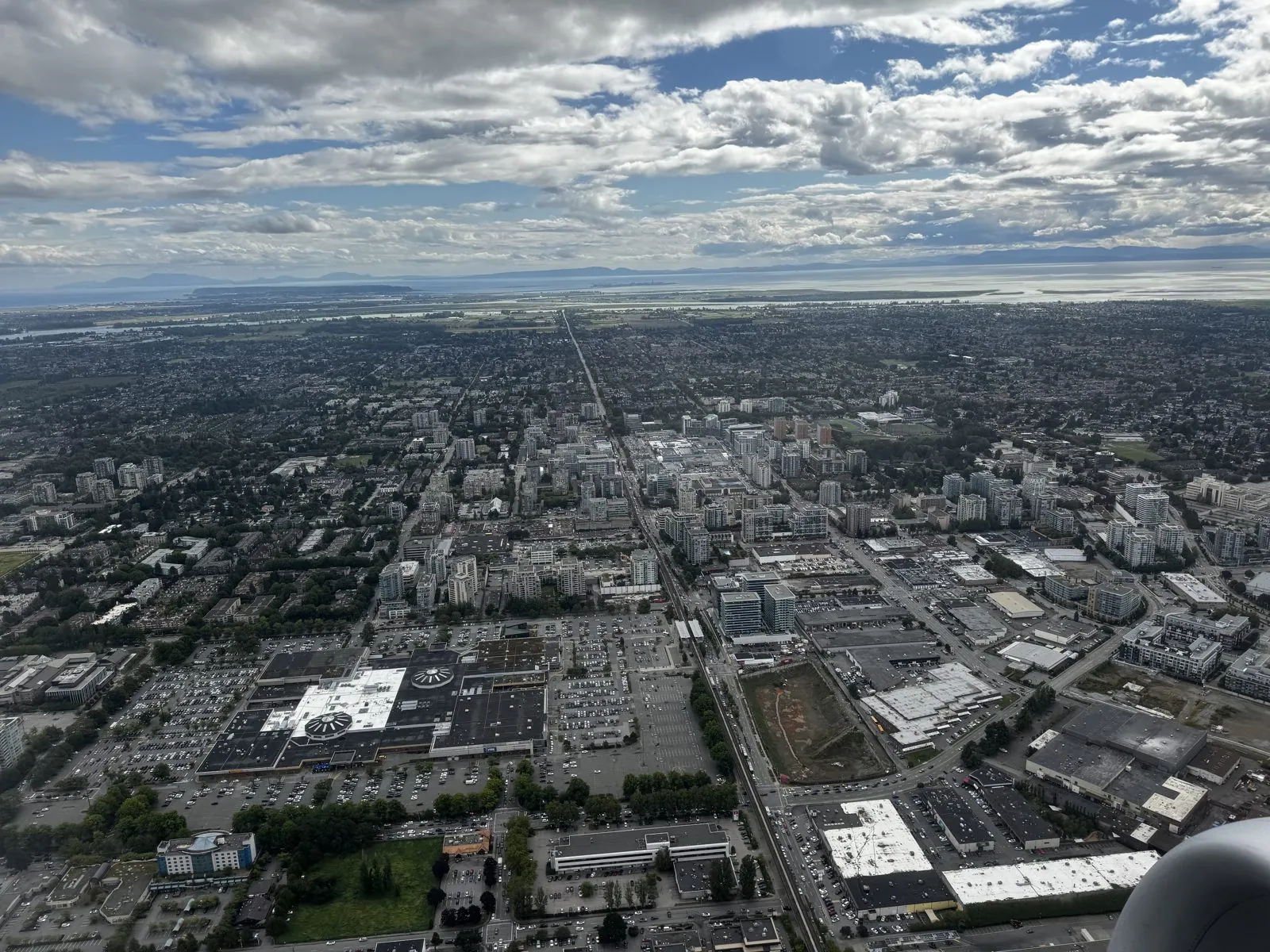
That is where the record ends: an engine cowling, the delta, and the sea shining in the distance, a day later than planned.
A sequel
Put next to last year's trip, this one hardly counts as travel. In 2024, SIGGRAPH was the prologue, and the real story was two weeks of a different city almost every night. In 2025 there was no rental car and no road: one metro area, eight days, one train line, and a conference in the middle.
But the camera roll makes a case for it anyway. A week in one place is a different kind of acquaintance from a city a day. You get to know the view from one set of windows well enough to notice that the ship outside is a different one every afternoon. You see the same mountains under a clear sky, on fire at sunset, and gone behind cloud. You stop checking which train goes where. And you find out that Richmond, which most visitors only see from the airport, is where a lot of the best food is.
The strike didn't feel like a gift at the time. A cancelled flight, a night found at a few hours' notice and a morning spent refreshing fares are nobody's idea of a holiday. But it bought me a morning in Richmond that I would never have had otherwise, one more ride at the front of the train, and a lesson in how quickly a trip home can stop being something you can take for granted. Looking back, I'm glad of it.
And then there is the reason for going. A year earlier I had stood on a show floor in Denver and photographed an ad for this conference. This time the photos that matter most aren't of mountains or ships at all. They are of a projector screen in Rooms 220–222, with a rod twisting on it and a title above our names. Somewhere on a show floor there will be a booth advertising the next one. I'll photograph that too.
Maps built from the trip's photo timestamps and locations. Photo locations have been removed from the published images, and the photos of the talk are of the slides only. Day maps: map data © OpenStreetMap contributors; each stop is placed where its photo was taken, hotels and home are never marked, and the dashed lines show the order of stops, not the exact roads or rail lines.
Likes and comments
React with an emoji or leave a comment. Signing in with GitHub is required.