← Misc · September–October 2023
Fall Colors from Vancouver to Whistler
Four days in British Columbia: the harbour, a bridge over a canyon, the Sea-to-Sky Highway and Whistler in red.
Lunch in Richmond → UBC → Gastown → Canada Place and Coal Harbour → the Vancouver Lookout → hotpot on Robson Street → the Capilano Suspension Bridge → the Sea-to-Sky Highway at sunset → Whistler Village → Green Lake → Stanley Park → Richmond → home
One country, one province · one suspension bridge · one set of Olympic rings · one green lake · one panda in a drink
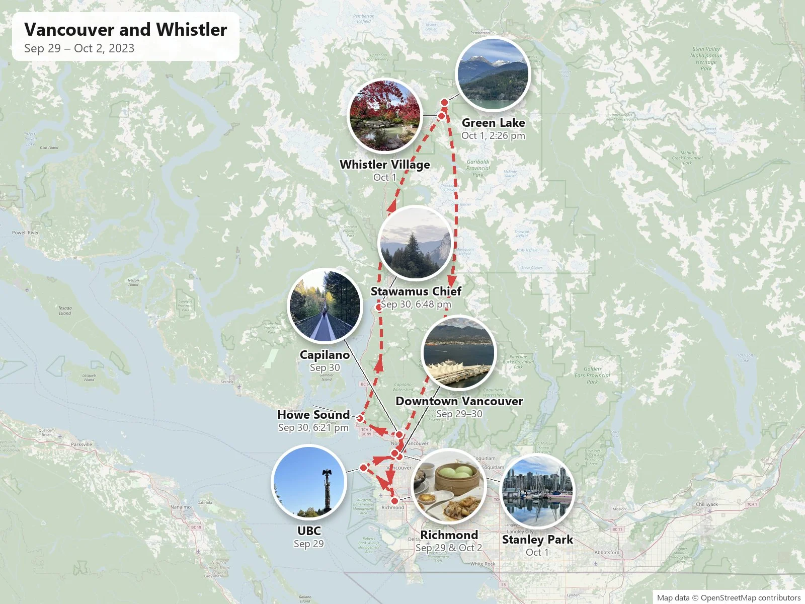
At the end of September 2023 my wife and I spent four days in British Columbia: most of it in Vancouver, one night in Whistler, and a last day in Richmond before the flight home. The two of us were together the whole way. Our two phones have photos from the same places within minutes of each other on every day of the trip, and most of the photos below are hers.
The first photos on my wife's phone are from LAX on the evening of Thursday, September 28th. The first ones on mine are from lunch in Richmond, near Vancouver's airport, the next day. Everything below is put together from the two camera rolls: what was photographed, where, and at what minute.
Day 1: Richmond, UBC and the harbour
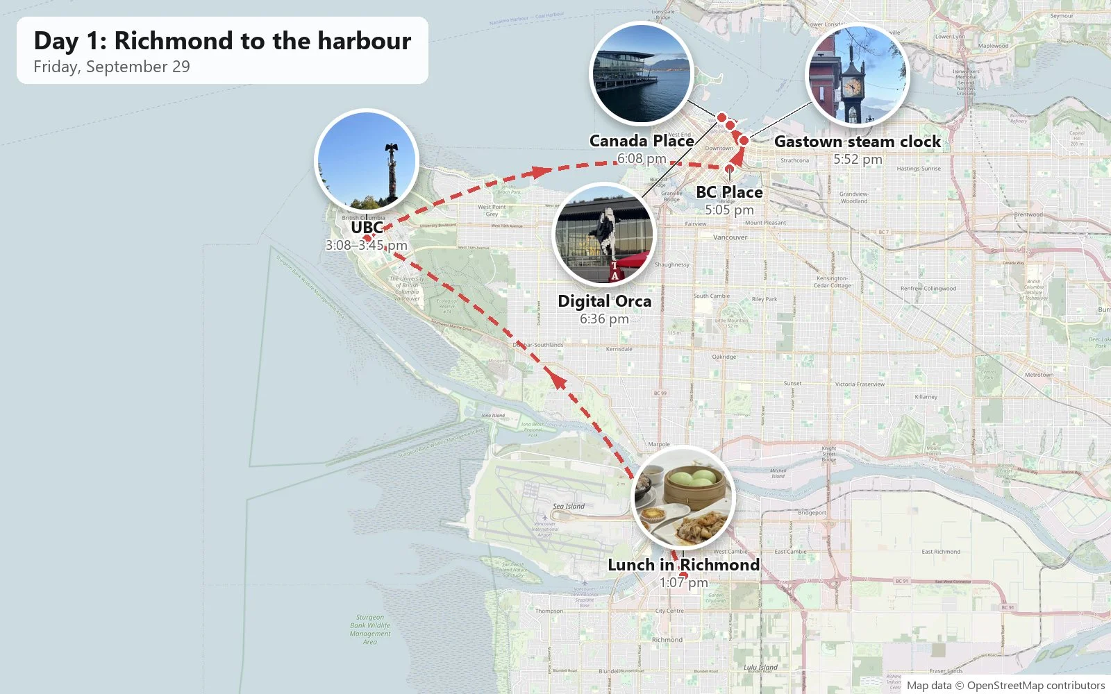
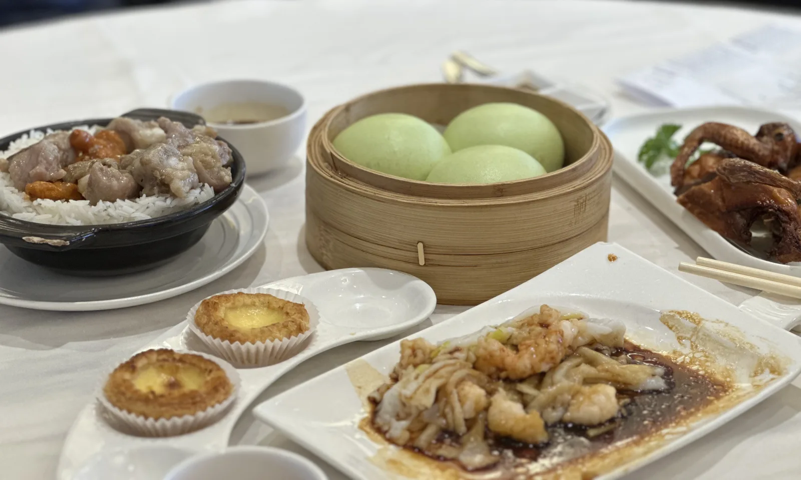
The trip started with dim sum. A little after one o'clock on Friday we were at a table in Richmond with a steamer of pale green buns, egg tarts and a bowl of rice, among other plates. Before we left Richmond we picked up two cups of tea from Lovin Tea.
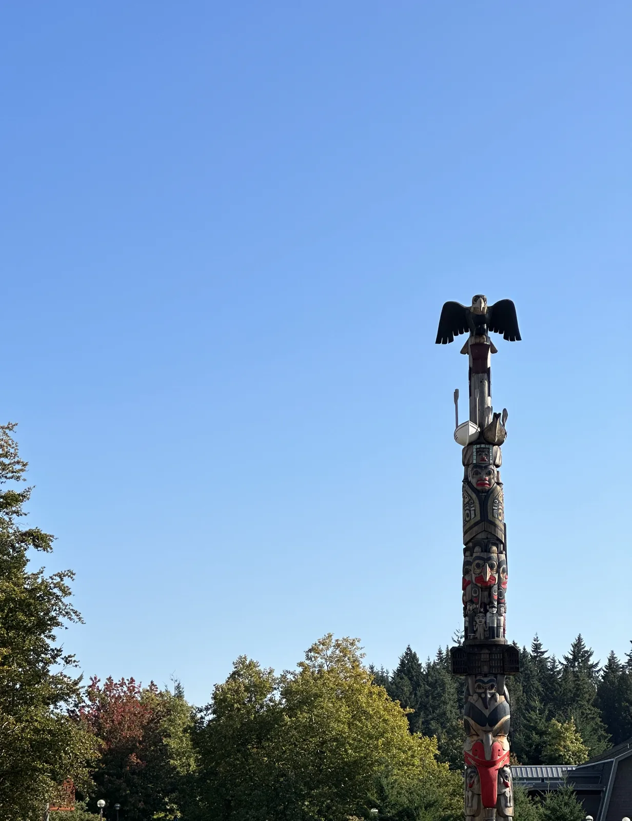
In the afternoon we drove up to the University of British Columbia, at the western tip of the city. The fountain in Martha Piper Plaza, at 3:08 pm, is in my campuses post, so I won't repeat it here. A little later, at 3:45, my wife photographed a tall totem pole on a lawn, with a carved bird at the top spreading its wings against a clear blue sky.
By five we were downtown. Outside BC Place, the stadium with the white cable-supported roof, a long queue of people stretched along the street. From there we walked north to Gastown, where a small crowd stood around the steam clock on the corner. Behind it, down the street, the North Shore mountains were in the sun.
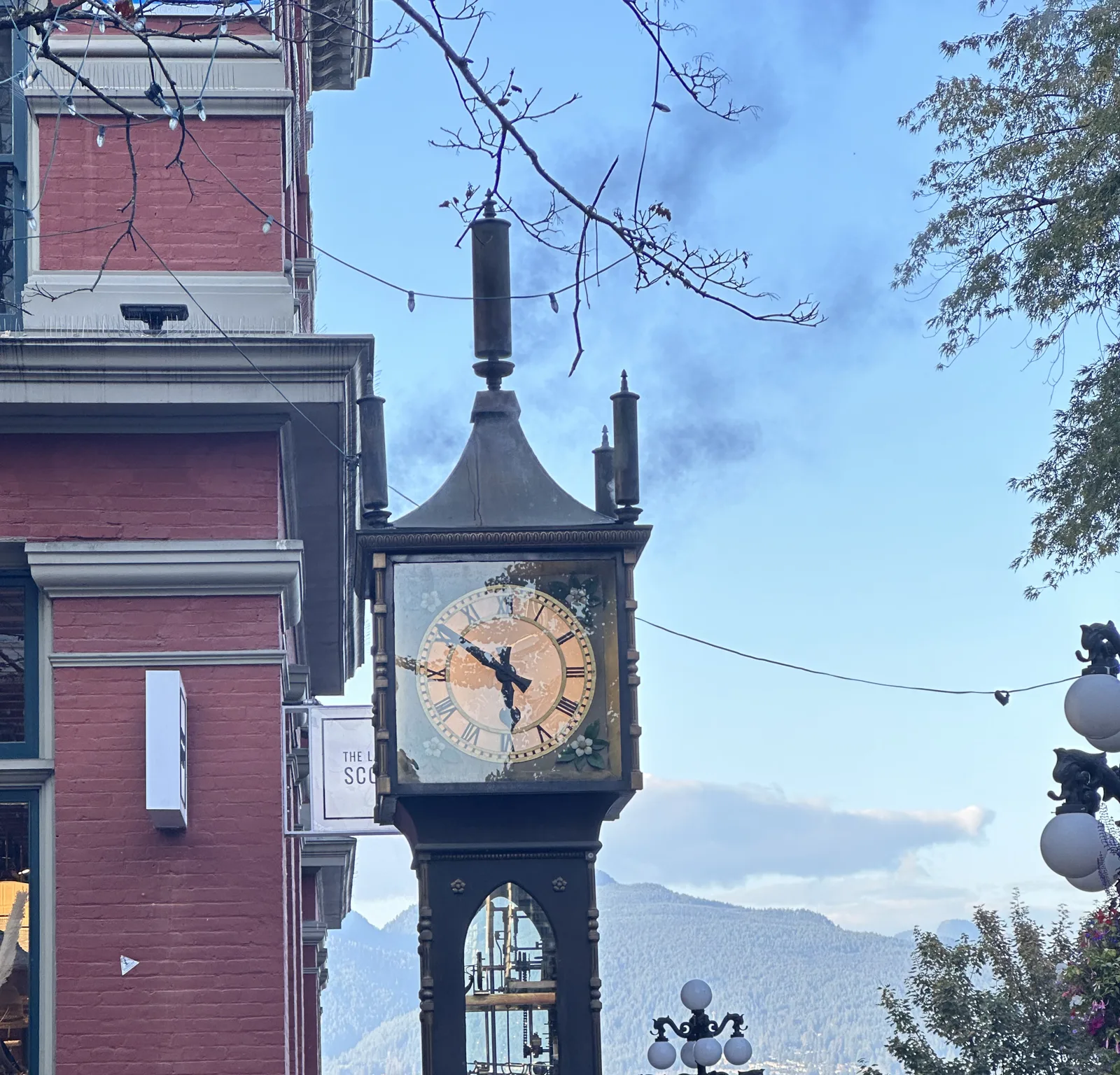
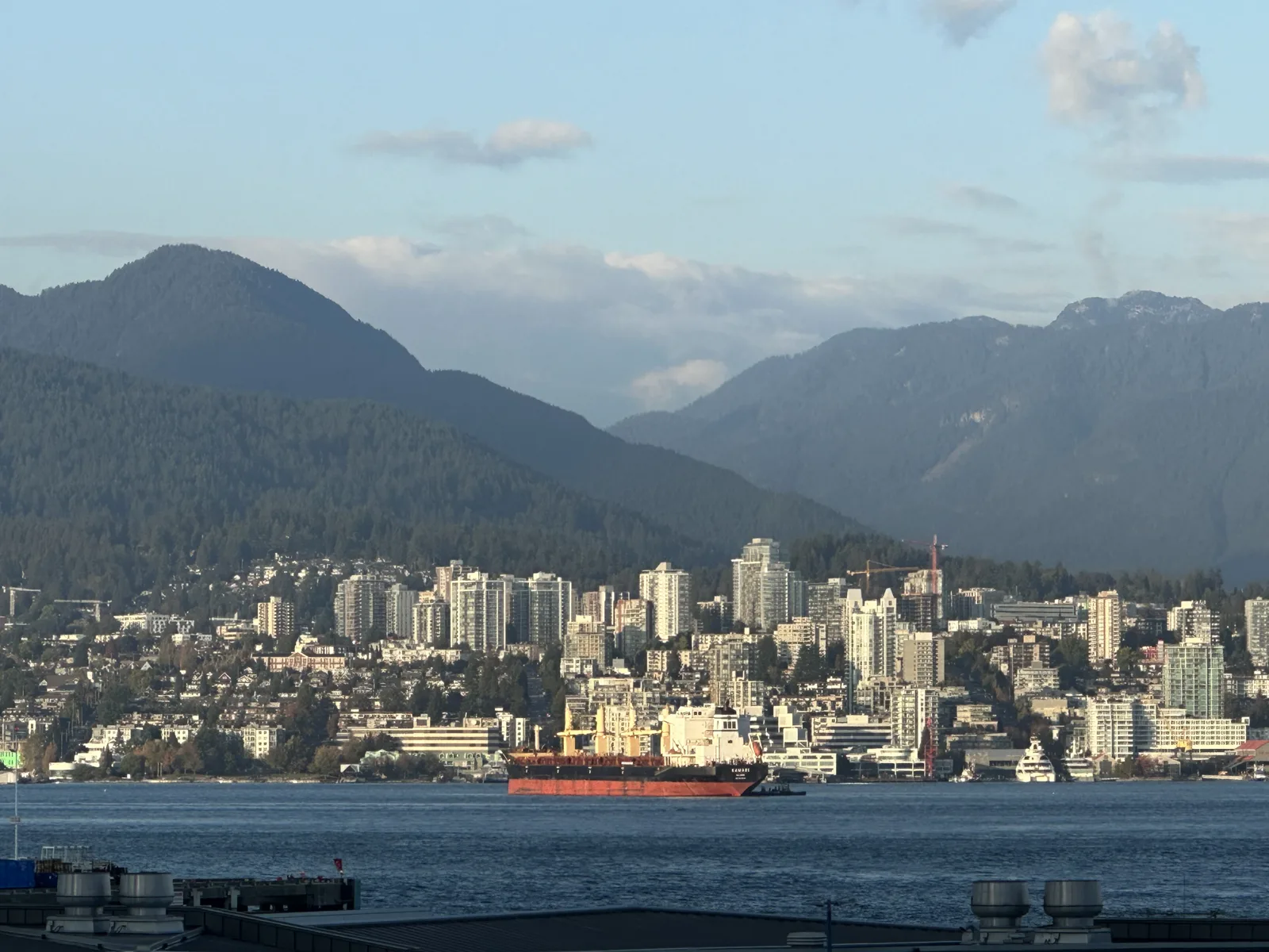
A few minutes later, from near the waterfront, the view opened up across the harbour to North Vancouver: a band of white towers along the shore, a red cargo ship in the water, and the mountains behind, with cloud catching on the tops.
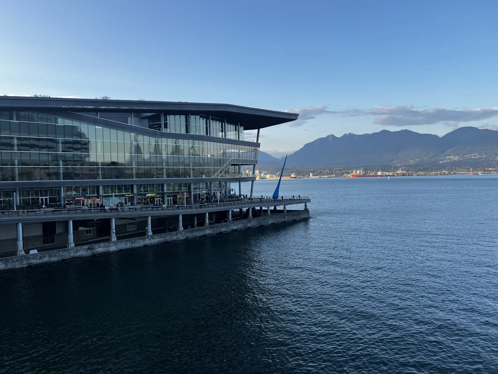
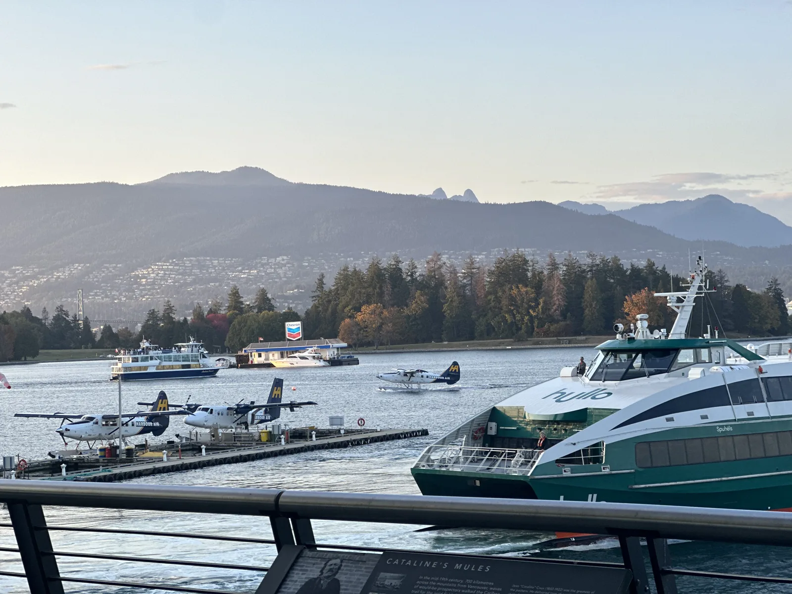
Just after six we reached Canada Place and the glass Vancouver Convention Centre next to it, which sits right on the water. Further along the seawall, floatplanes were tied up at their docks and a green-and-white passenger ferry was beside them.
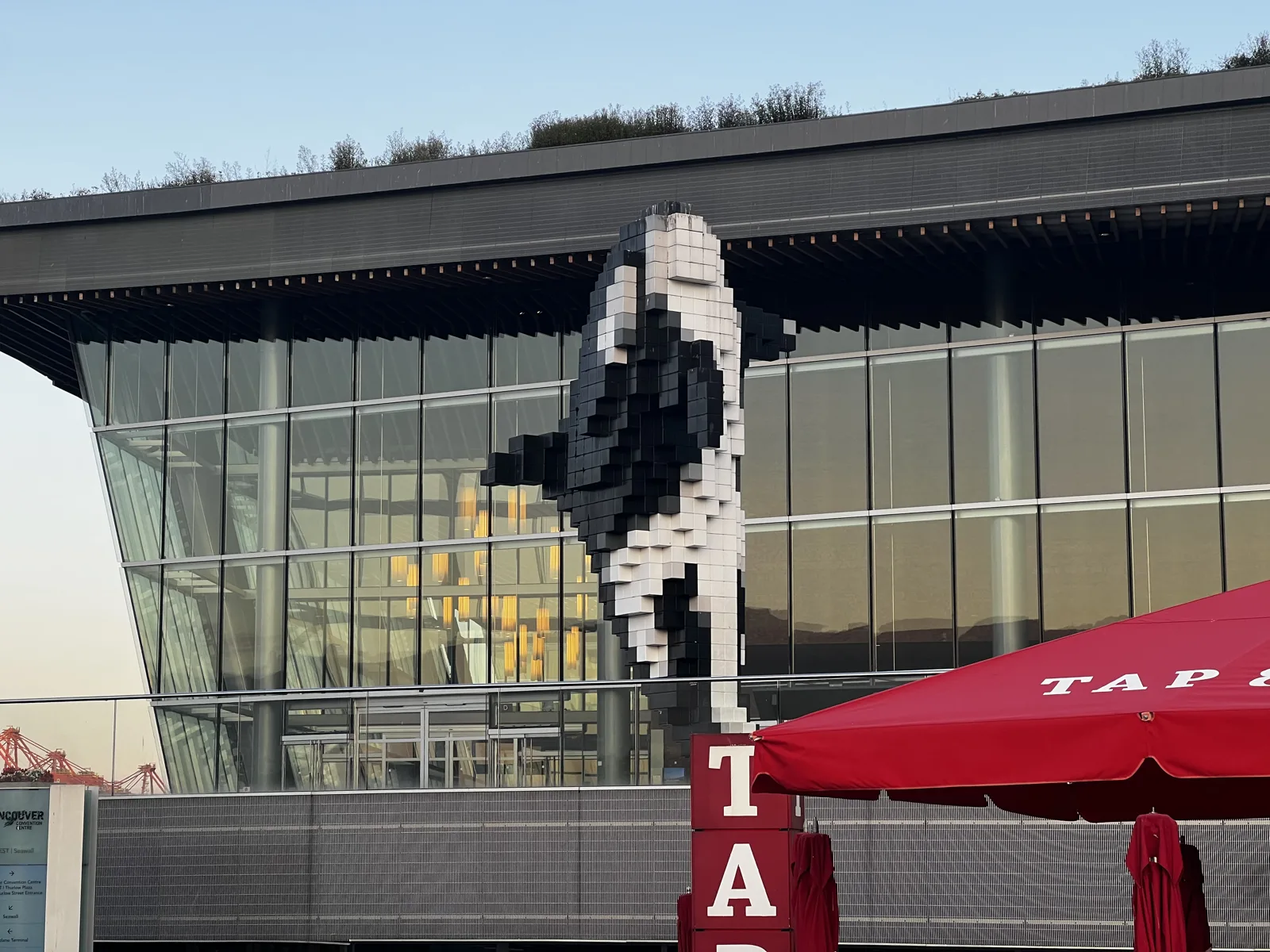
The last stop of the evening was Jack Poole Plaza, beside the convention centre, where Digital Orca stands: a killer whale made of black and white cubes, as if it had been built out of pixels, jumping in front of the glass.
Day 2: The Lookout, hotpot, Capilano and the Sea-to-Sky
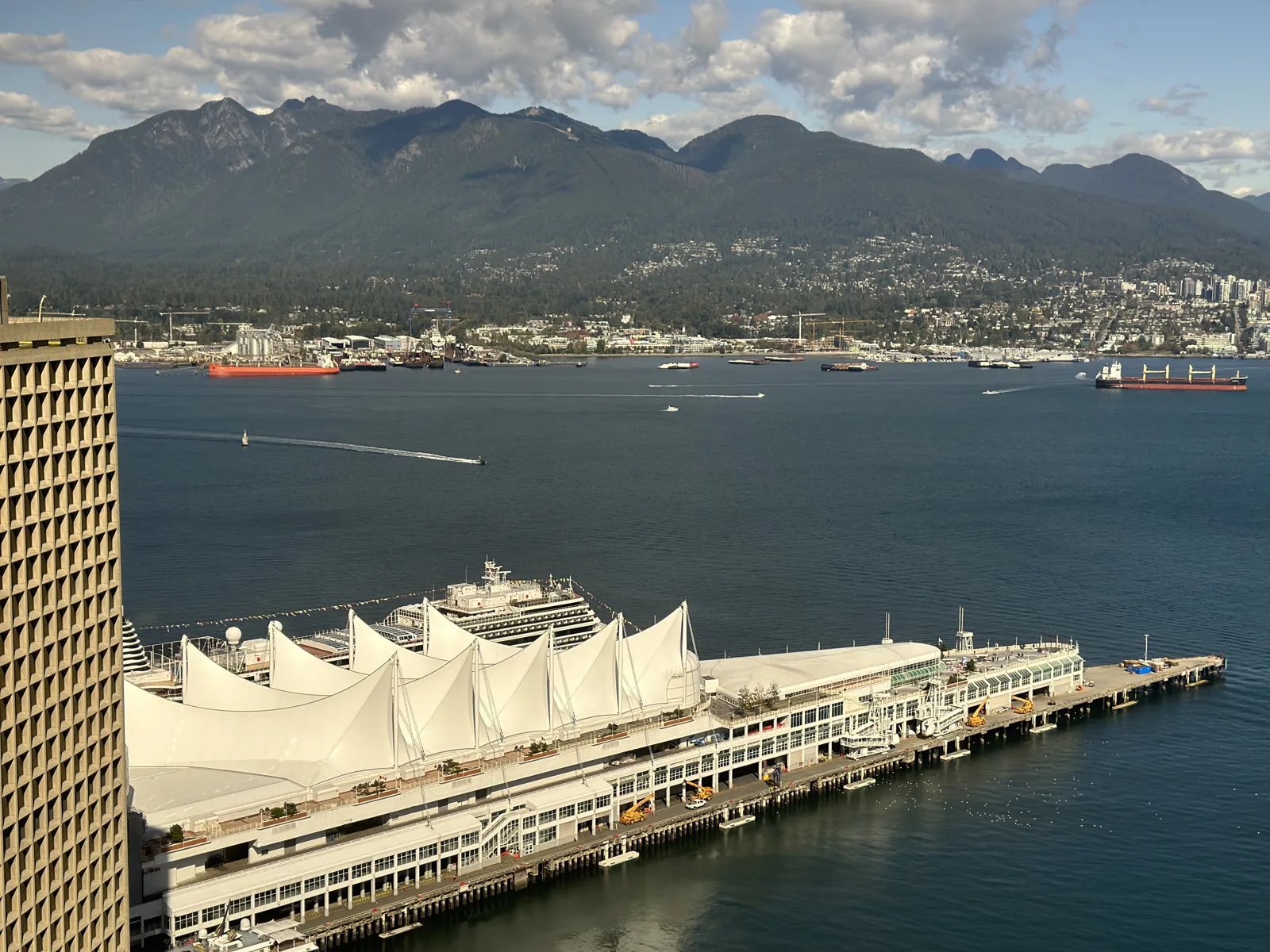
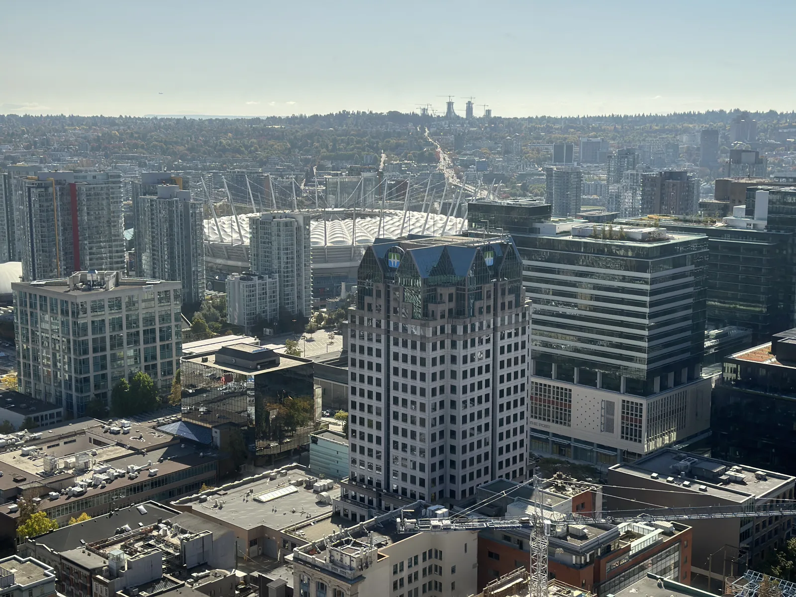
On Saturday we went up the Vancouver Lookout, the observation deck on top of Harbour Centre, a little after one. Two of my photos from up there are in Views from Up High. My wife's are different. Straight down to the north were the white sails of Canada Place on their pier, with the harbour and the North Shore mountains beyond. To the south, the white roof of BC Place, the stadium we had passed the evening before, sat among the towers.
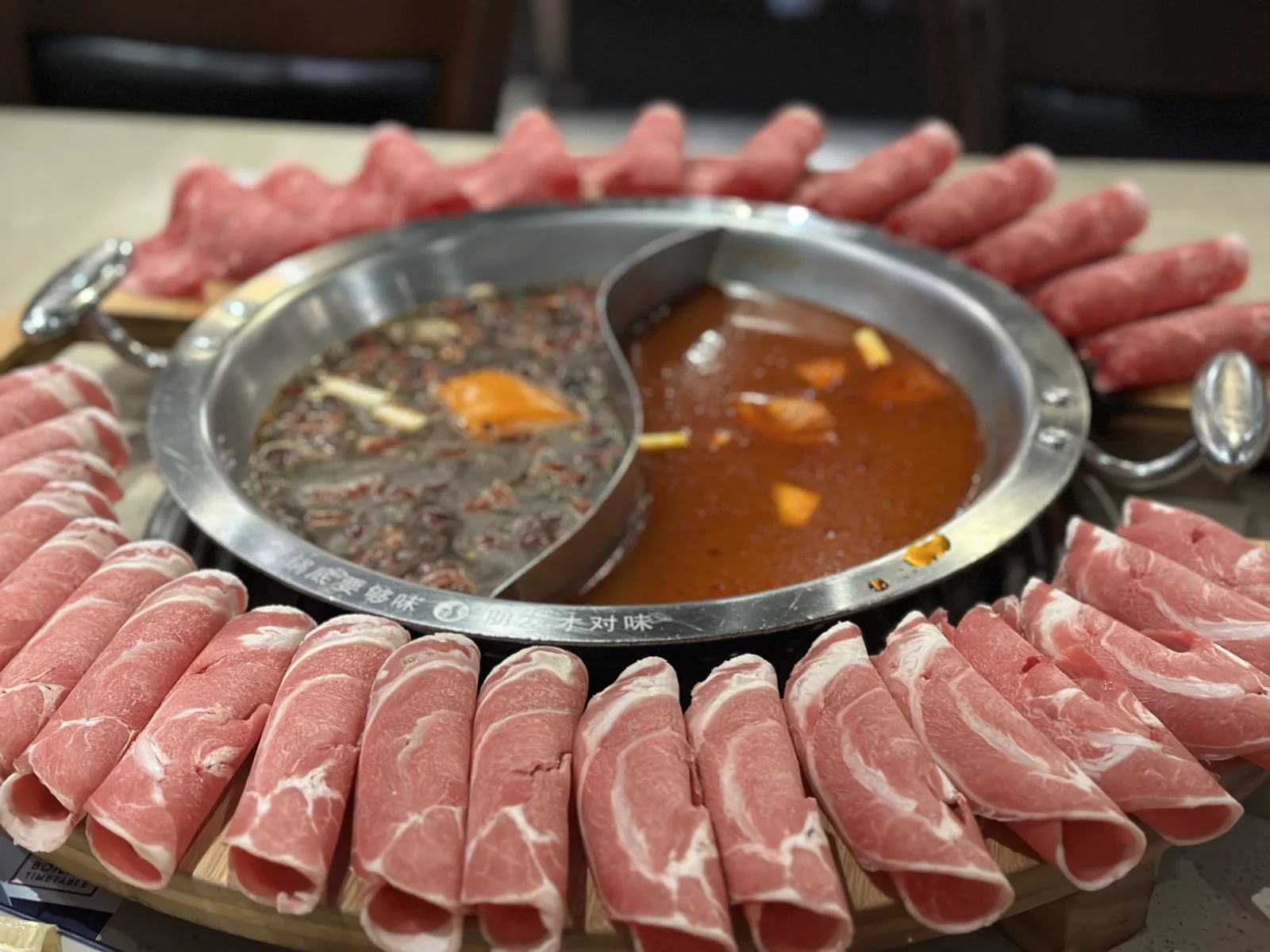
Lunch was hotpot on Robson Street, with a split pot of two broths in the middle of the table and a big ring of thinly sliced meat laid all the way around it.
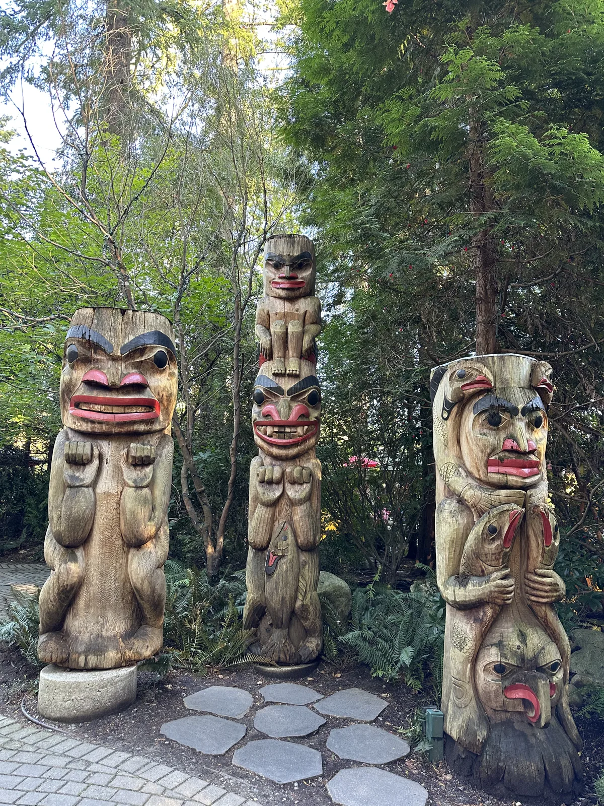
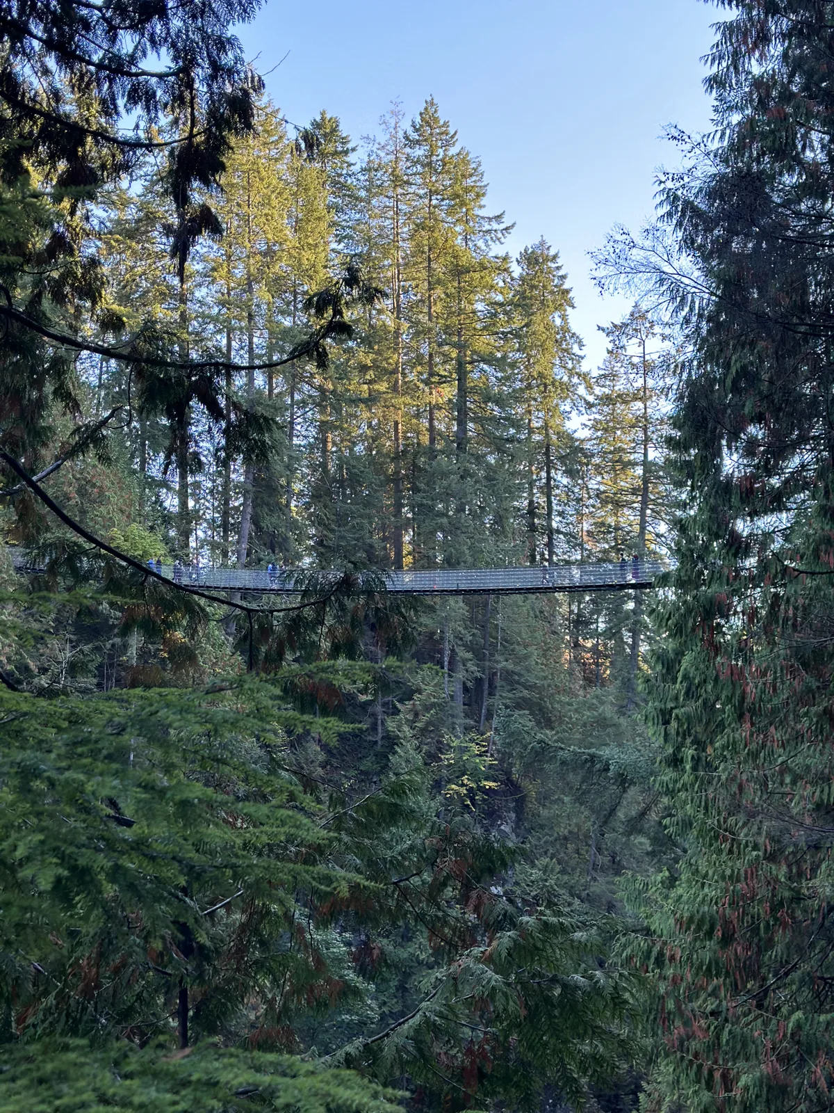
In the afternoon we drove across the Lions Gate Bridge to North Vancouver and the Capilano Suspension Bridge park. Just inside, at 4:36, three carved poles with painted faces stood among the trees. Fifteen minutes later we were on the bridge itself, a long, narrow walkway of cables and wire mesh hung across the Capilano River canyon. It was busy. From the middle, the river ran far below between steep walls of tall evergreens, with a few trees on the slopes turning yellow.
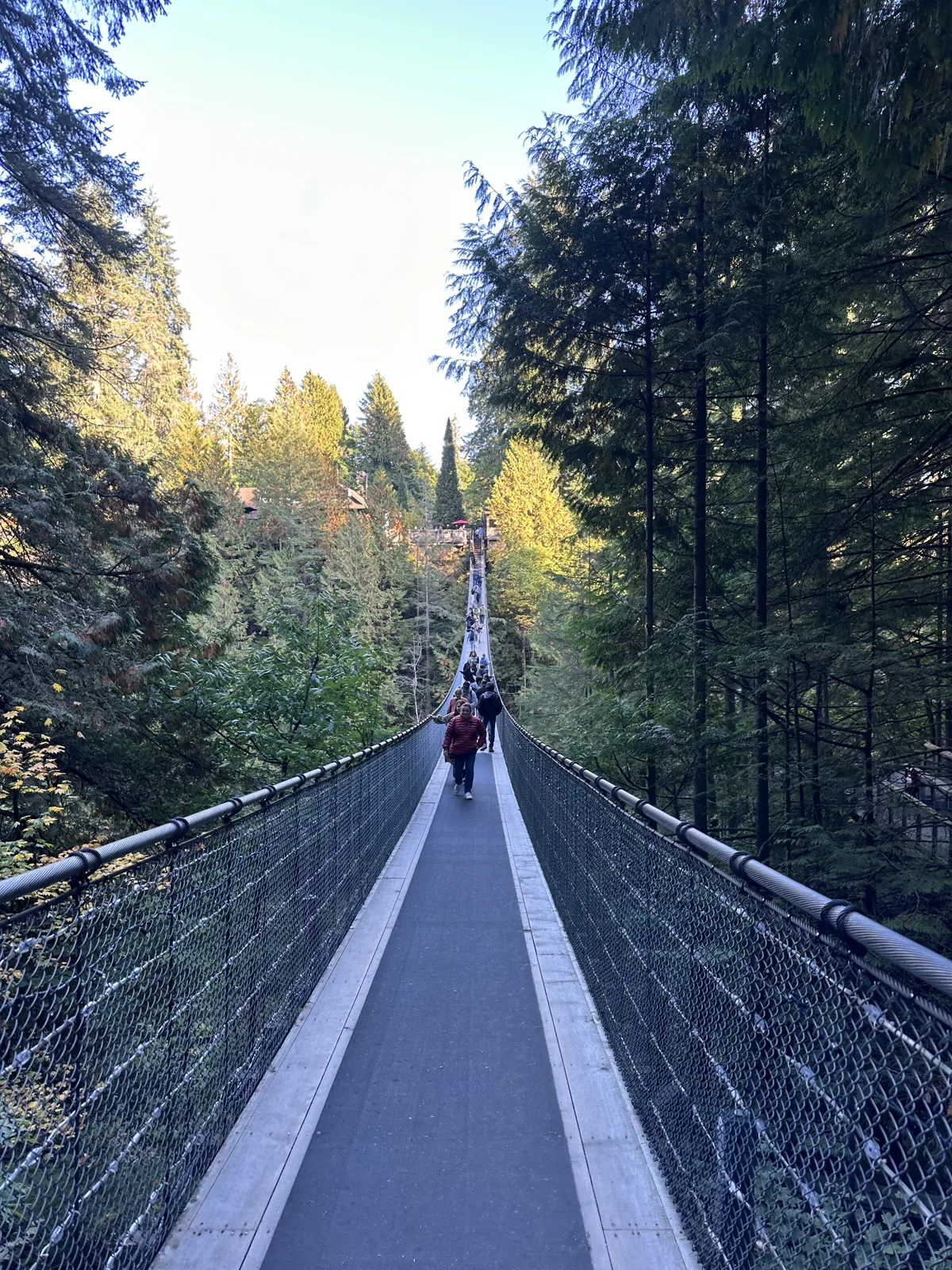
The canyon is deep and narrow, and from the walkway you look over the cable handrail straight down at the river.
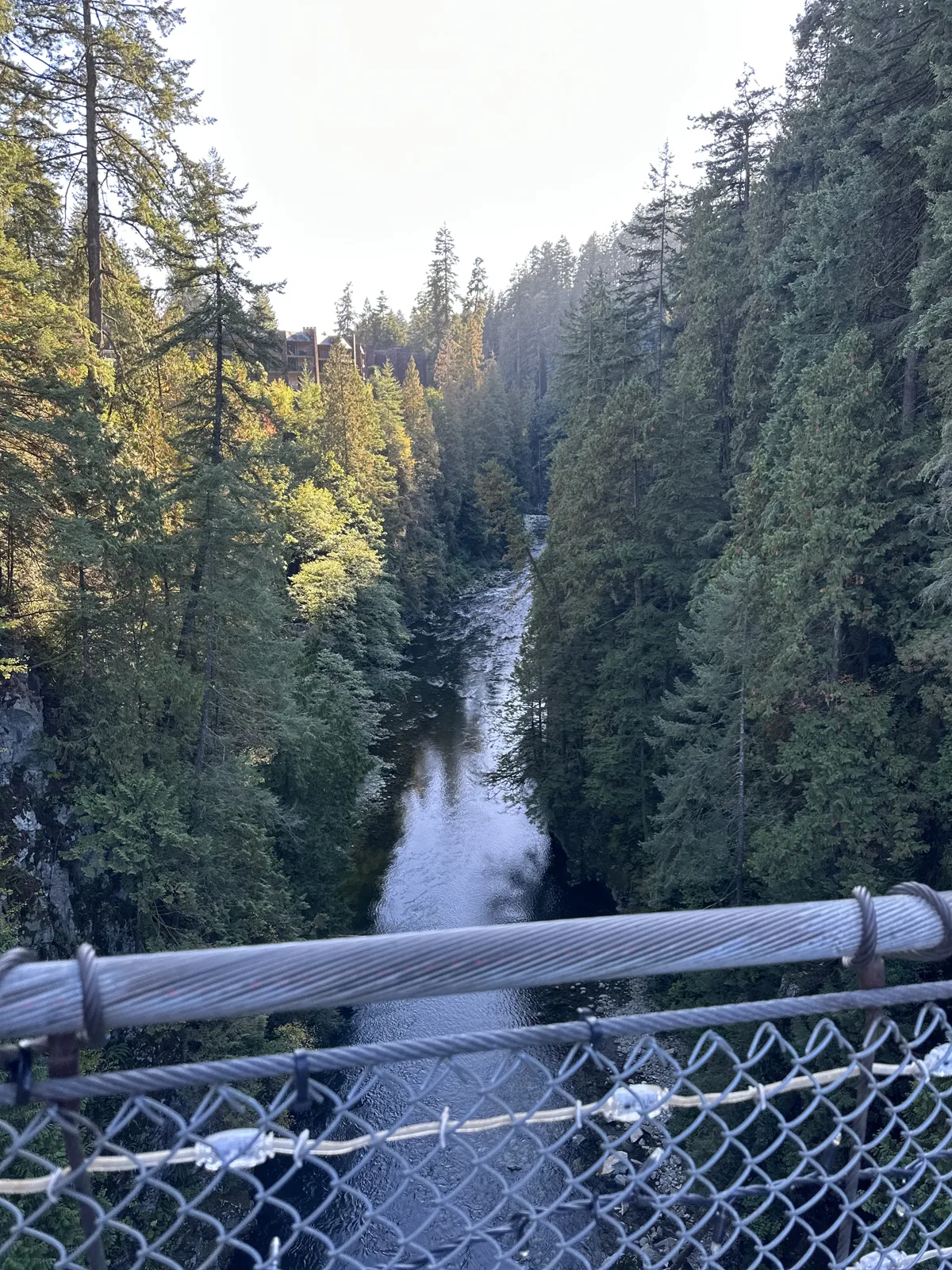
On the far side the paths go on into the forest. At 5:21 a woman was standing by the path with an owl on her arm, and at 5:30 my wife photographed a set of much smaller suspended walkways strung high between the trunks of the trees. At 5:41 I photographed a framed certificate on display: "I survived the world-famous Capilano Suspension Bridge."
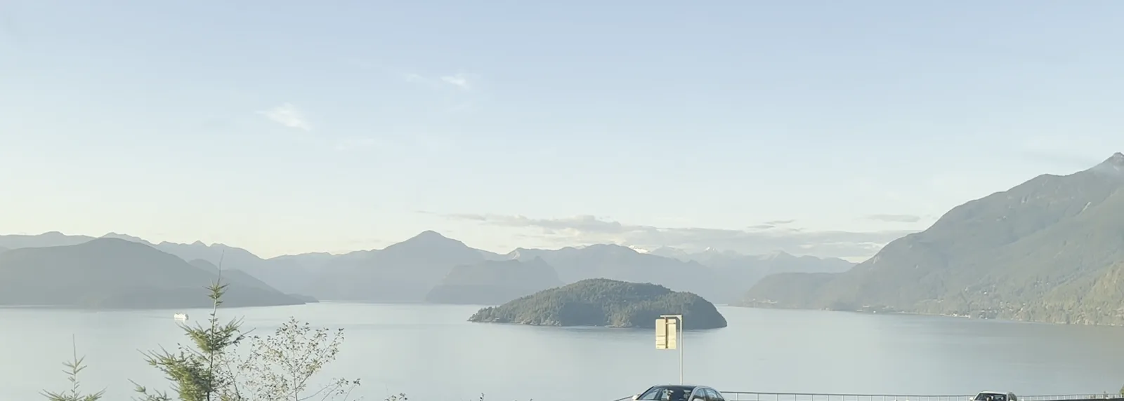
Then we drove north on the Sea-to-Sky Highway to Whistler. My wife filmed short videos from the car, and the frames below come from them. At 6:21 Howe Sound lay below the road, flat and pale, with a small wooded island in the middle.
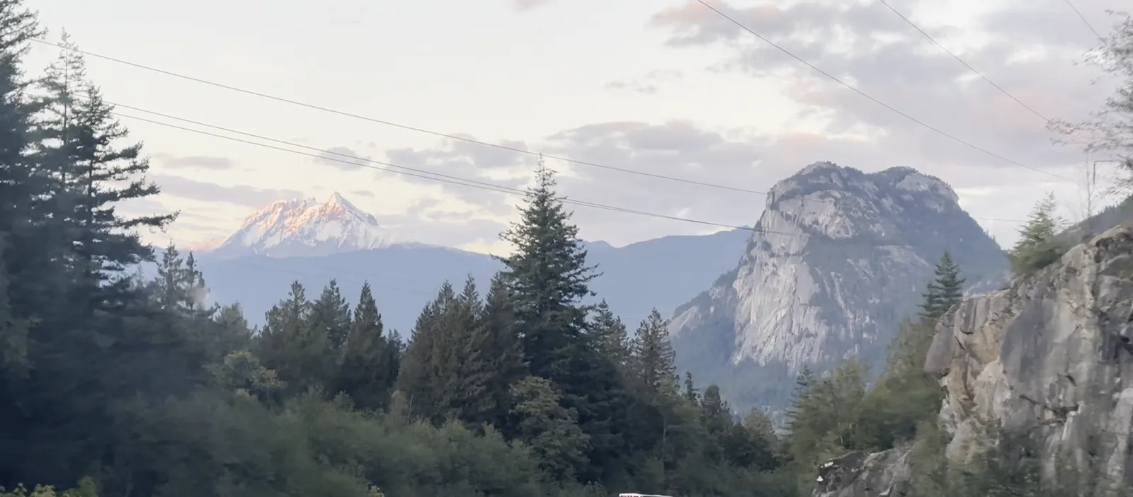
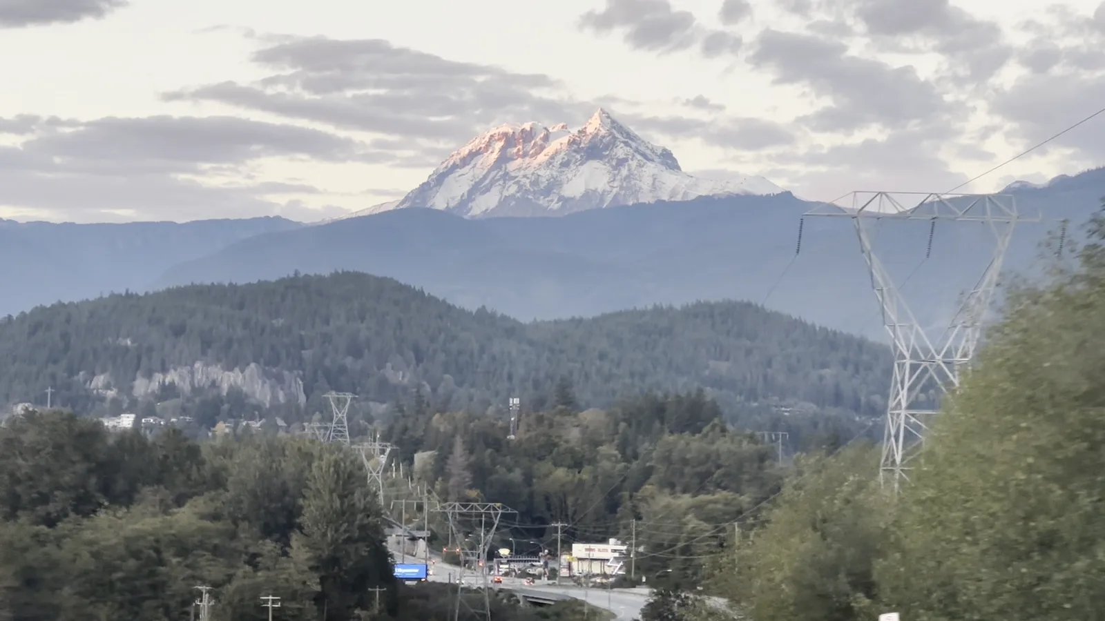
By 6:48 we were near Squamish, and the Stawamus Chief, the great bare rock dome above the town, stood up beside the road. A few minutes later the top of a snow-covered peak ahead had turned pink while everything below it was already in shade.
Our hotel for the night was the Hilton Whistler Resort & Spa, booked two days before. There are no photos of the rest of the drive.
Day 3: Whistler in red, Green Lake, and back to Stanley Park
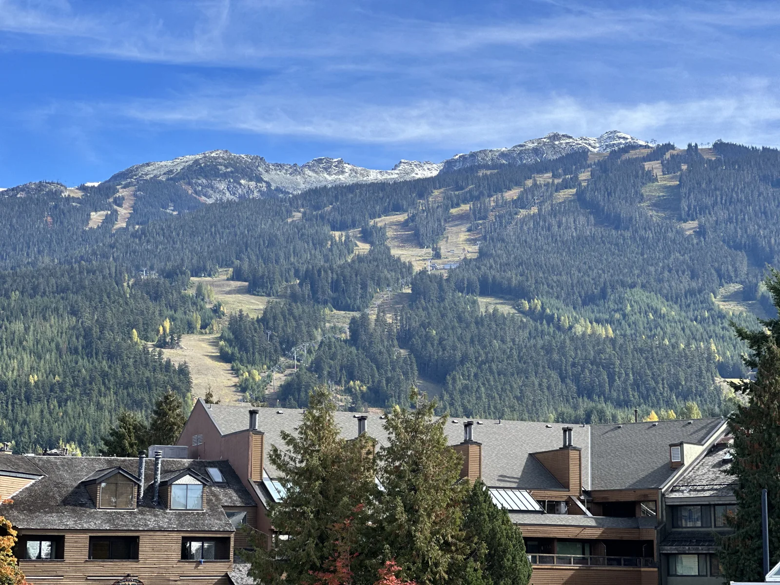
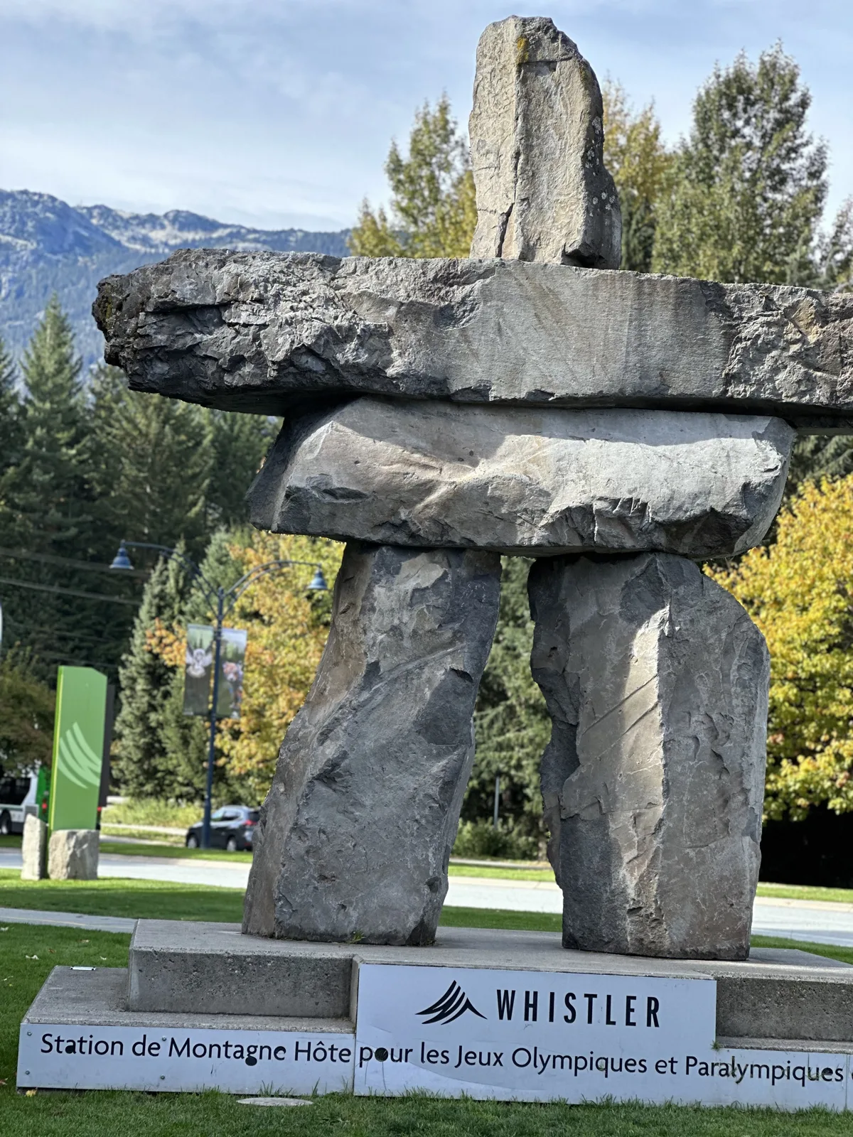
Sunday was the day of fall colors. At 1:20 pm, from near the hotel, Whistler Mountain stood across the valley, green with forest, with the lines of ski runs down its face and a dusting of snow along the top. A few minutes later we passed the stone inukshuk by the road into the village. The sign under it, in French, calls Whistler the host mountain resort of the Olympic and Paralympic Games.
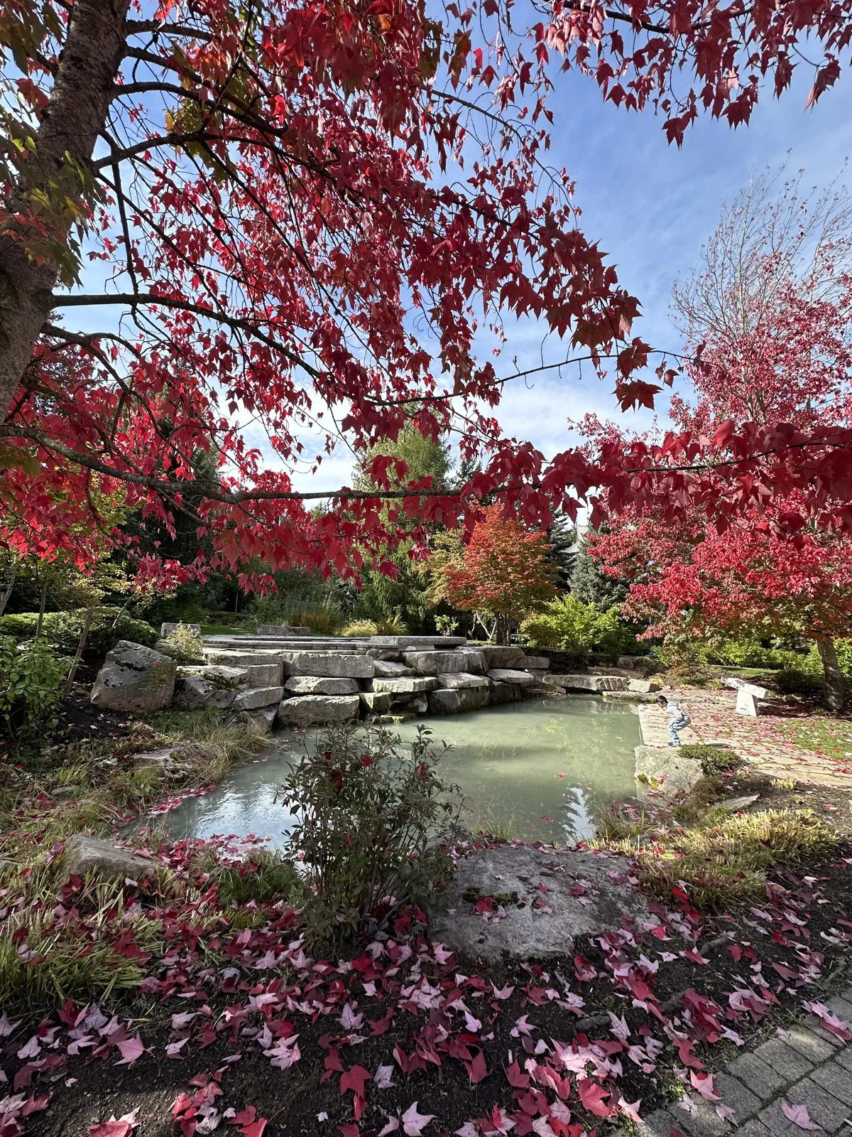
In the village itself, the maples had turned. On the Forest Walk, at 1:28, a small pond sat under trees that were bright red from top to bottom, and the ground around it was covered in fallen red leaves.
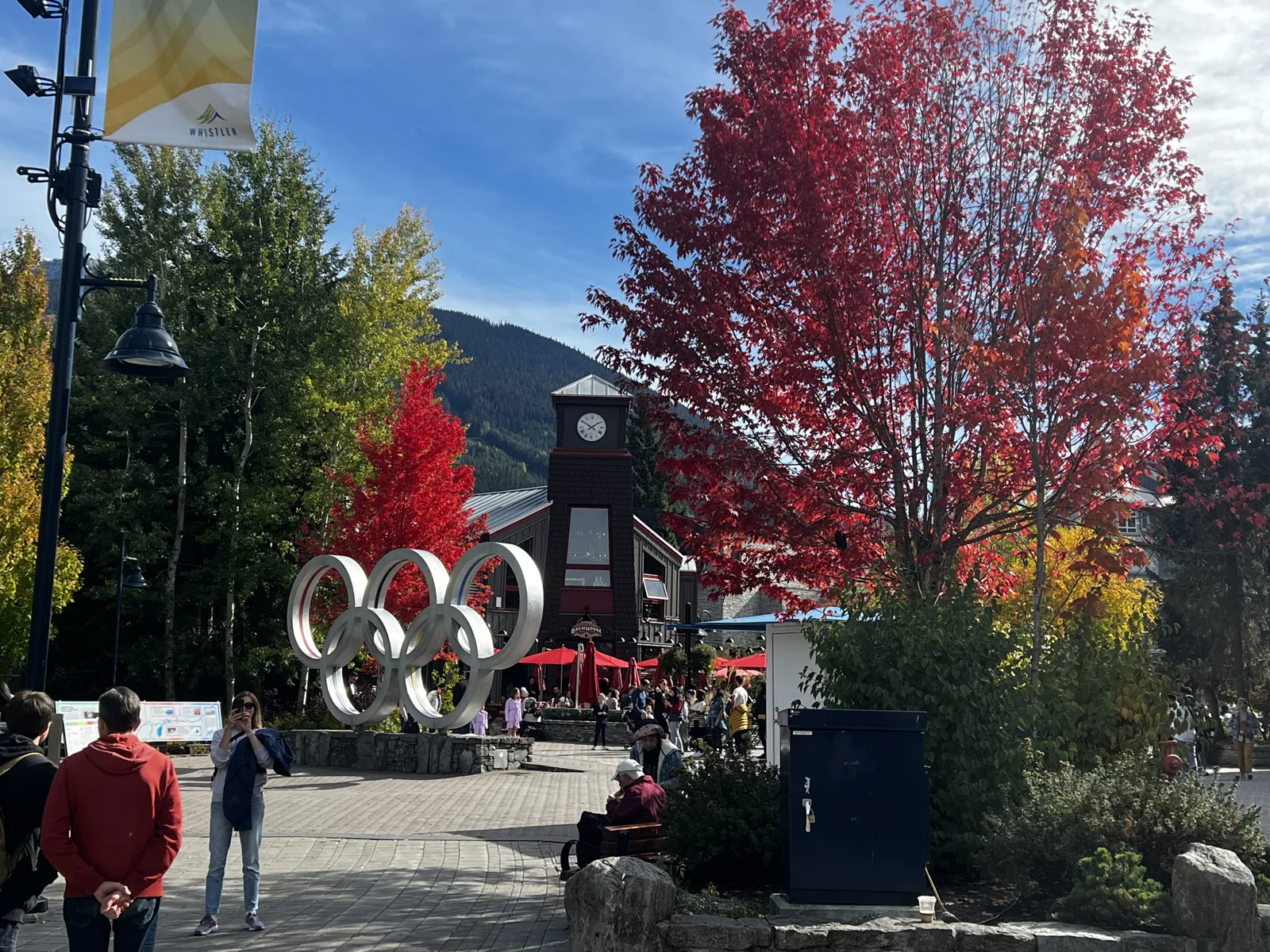
A quarter of an hour later we were in Olympic Plaza, where the Olympic rings stand in front of a clock tower, with a bright red maple beside them. The Village Stroll was busy with people, and the trees along it were red and orange between the dark pines.
At 2:25 we stopped at a pullout on the Sea-to-Sky Highway just north of the village, above Green Lake. The water really is green: a milky jade color under a row of peaks with fresh snow on their tops, and the highway curving along the shore below.
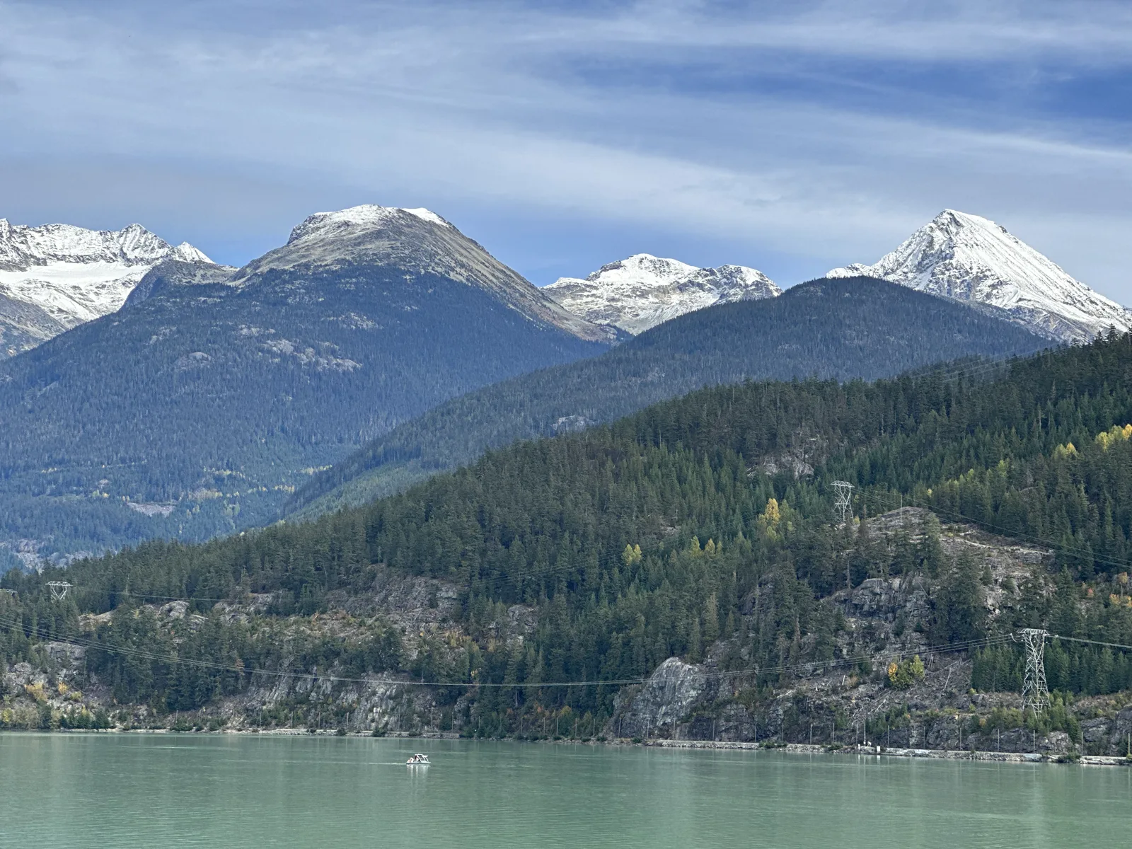
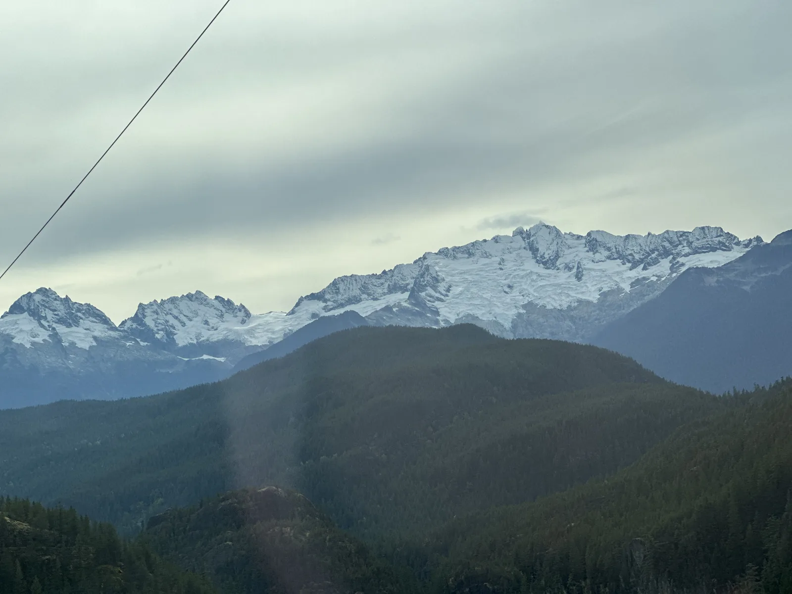
Then it was time to head back south. At 3:10, on the way down, the sky had clouded over, and a long range of snowy peaks stood above the dark forested hills.
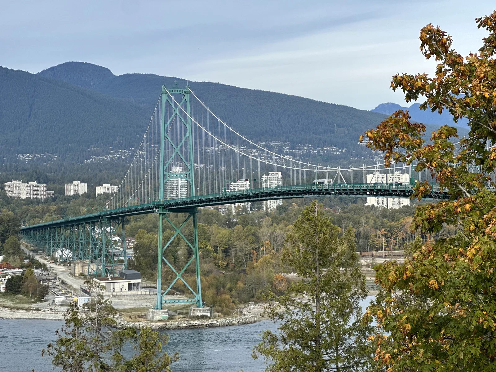
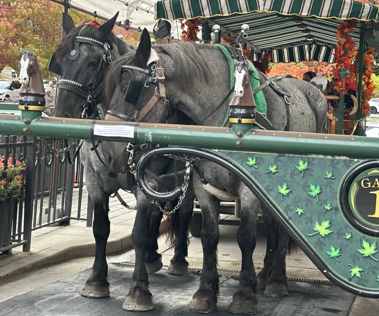
We were back in Vancouver before five, and went to Stanley Park. From Prospect Point at 4:37 the Lions Gate Bridge, the green bridge we had driven across the day before, crossed the water below, with towers and mountains behind it. At 5:05, by the park's Coal Harbour side, two big horses were hitched to a tour carriage decorated with autumn leaves.
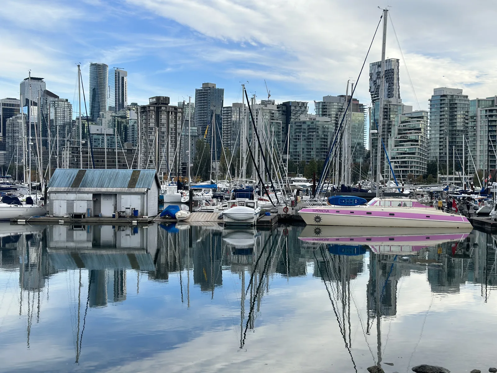
A few steps away, the Coal Harbour marina was perfectly still. The sailboats, the towers of downtown and the streaky clouds were all mirrored in the water.
Day 4: Richmond and home
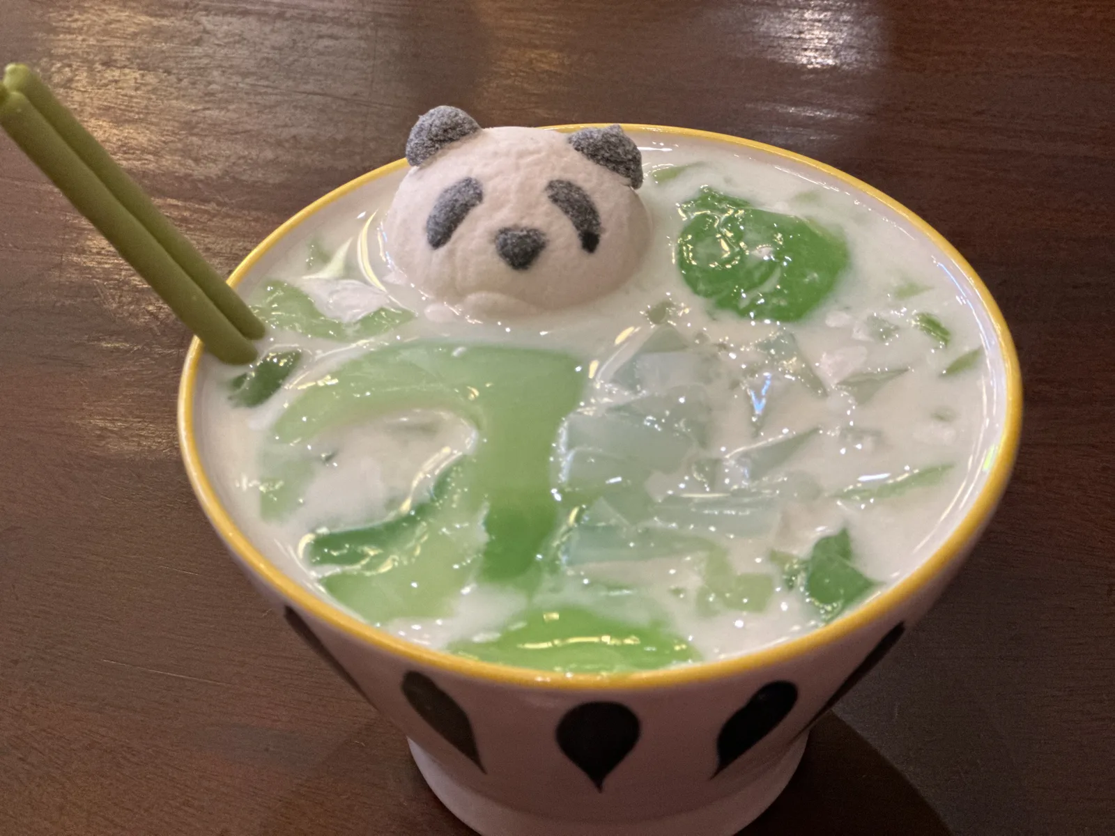
Our flight home on Monday was in the evening, and we spent the middle of the day in Richmond. Lunch, at about one o'clock, was at a Chinese restaurant: a stir-fry of peppers and meat, squares of tofu with toppings, a soup, and a cold drink in a bowl with a small panda face on top.
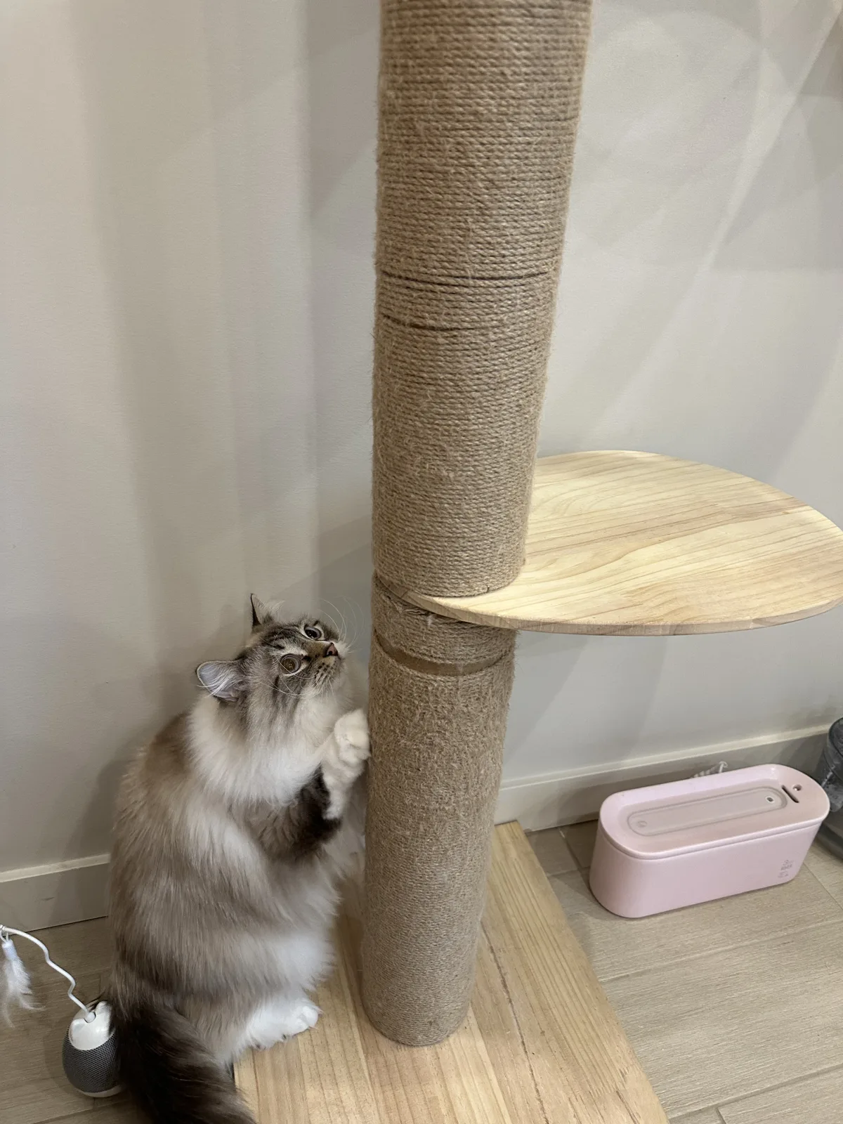
In the afternoon we went to a cat café in Richmond. Most of my wife's photos there are of me holding a large orange cat, which stay in the family album. One of the others shows a long-haired cat stretching up a scratching post.
Our flight left Vancouver at 5:55 that evening and was due at LAX at 8:52. In Whistler the maples had turned red, and there was already snow on the peaks.
Maps built from the trip's photo timestamps and locations. Photo locations have been removed from the published images. Map data © OpenStreetMap contributors; each stop is placed where its photo was taken, hotels and home are never marked, and the dashed lines show the order of stops, not the exact roads.
Some photos in this post are my wife's.
Likes and comments
React with an emoji or leave a comment. Signing in with GitHub is required.