← Misc · 2022–2026
The Bay Area, Again and Again
Seven visits in five years: wine country, the city, and the coast below it.
May 2022: a campus-and-coast loop · May 2023: Memorial Day weekend, Napa and Highway 1 · November 2023: Thanksgiving, Twin Peaks and Treasure Island · November 2025: the end of an Oregon trip · June 2026: a week in the South Bay and a dinner on the Embarcadero · August 2026: the city, then Santa Rosa · August 2026: Santa Cruz and Carmel after Tahoe
one castle winery, visited twice · the same Capitola street, a year apart · the Embarcadero twice in one summer
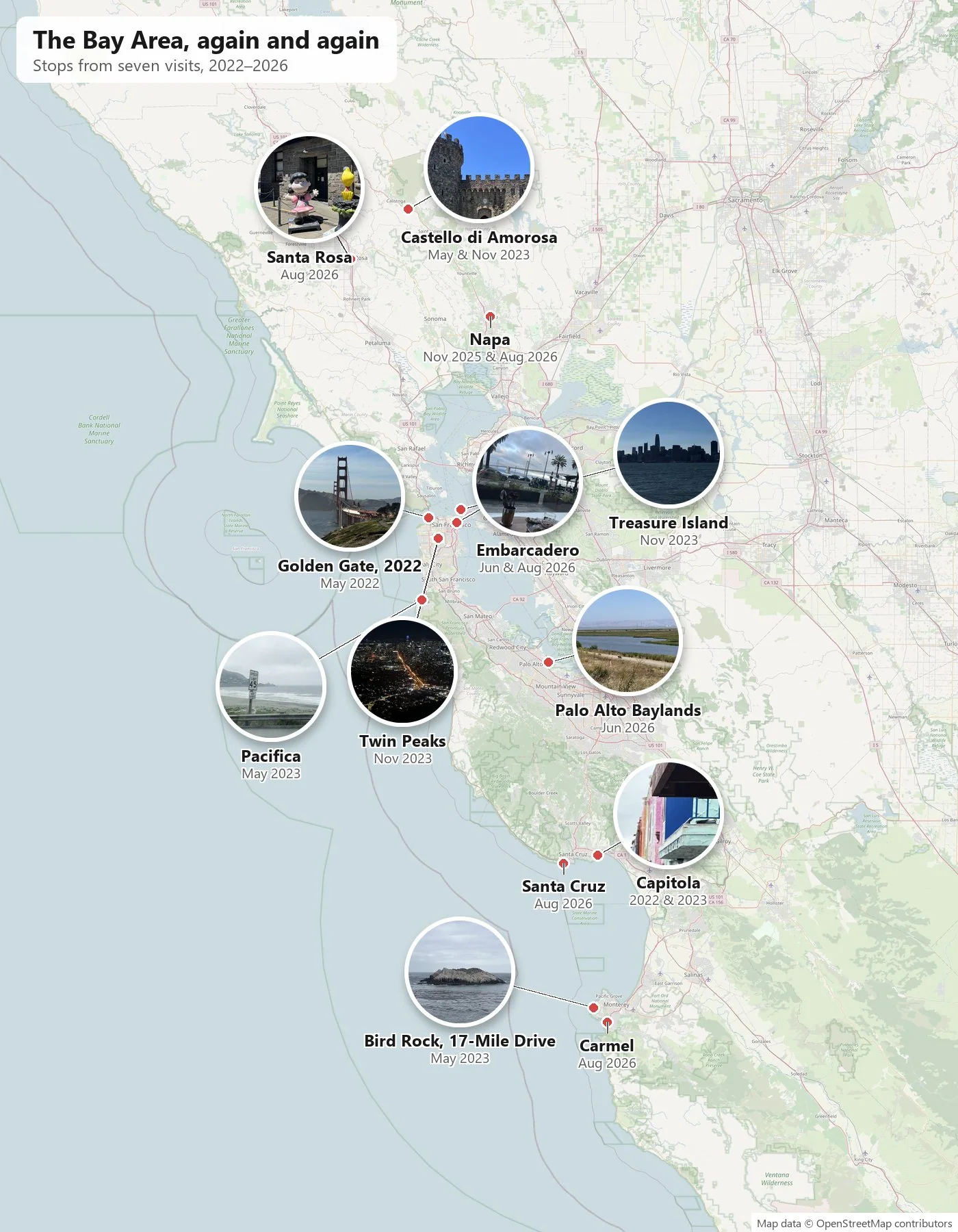
Some places you visit once and tick off. The Bay Area is not one of them for us. We keep coming back, and when I try to explain why, it comes down to three plain reasons. First, it is close to Napa and the rest of wine country, so a weekend in the city can always turn into an afternoon among the vineyards. Second, San Francisco simply has a lot to see, more than any one visit can hold. Third, it sits on the way north. Every drive to Oregon passes through it, and stopping for a night or two is the natural thing to do.
So this page is not one trip. It is seven, lined up in order, from a long loop in May 2022 to a stop on the coast at the end of a Tahoe trip in August 2026. Two of them, a Memorial Day weekend and a Thanksgiving drive, both in 2023, get the full treatment here, and so do two shorter ones from the summer of 2026: a week in June and a weekend in August. The other three have their own posts, so they appear only briefly, with a link. As always, the timeline comes from the camera roll. Where the photos are silent, so am I.
May 2022: the long loop
The first visit was the biggest. In May 2022 we drove up from Southern California and spent a week going round the Bay: Berkeley, San Francisco, Stanford, the Silicon Valley campuses, then Capitola and Highway 1 on the way home. That trip has its own full post, Two Road Trips on a Brand-New License, so here is just one evening from it. On May 18 we walked the Coastal Trail in the Presidio at about seven in the evening, with the Golden Gate Bridge lit from the side and the hills of Marin across the strait.
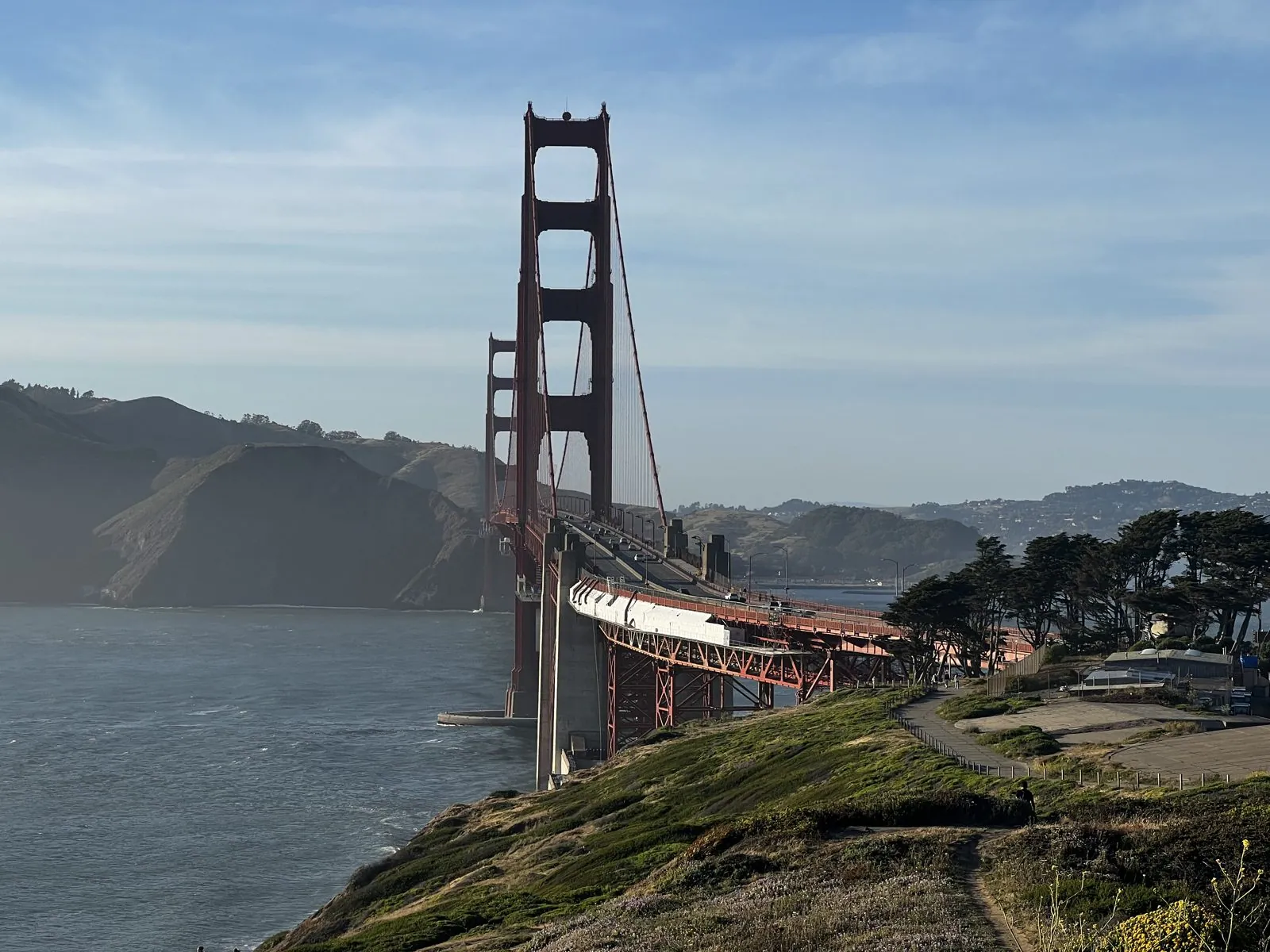
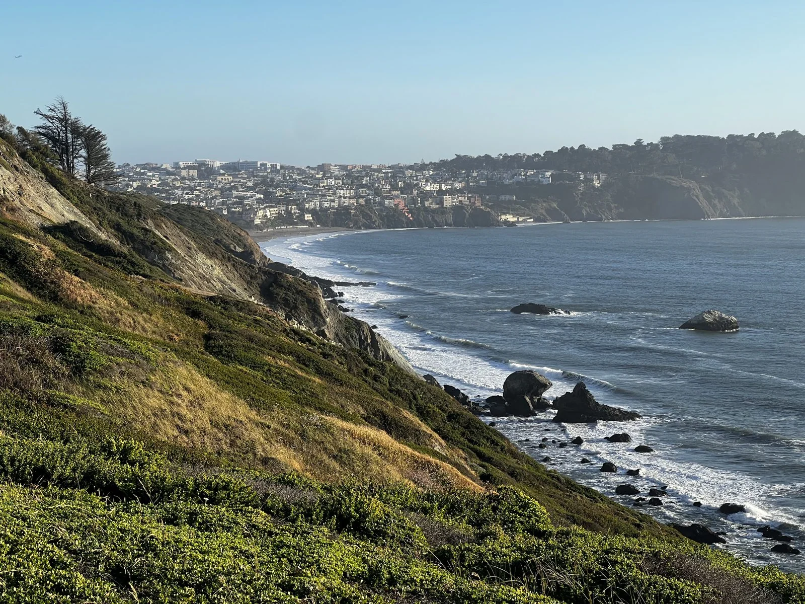
That one evening already shows why the city keeps pulling us back. Turn one way and you have the most photographed bridge in the world. Turn the other, and the same path looks down cliffs covered in ice plant to the open Pacific, with whole neighborhoods stacked on the far headland. A week was not enough to see it all, which is the most honest reason we came back.
Memorial Day weekend, May 2023
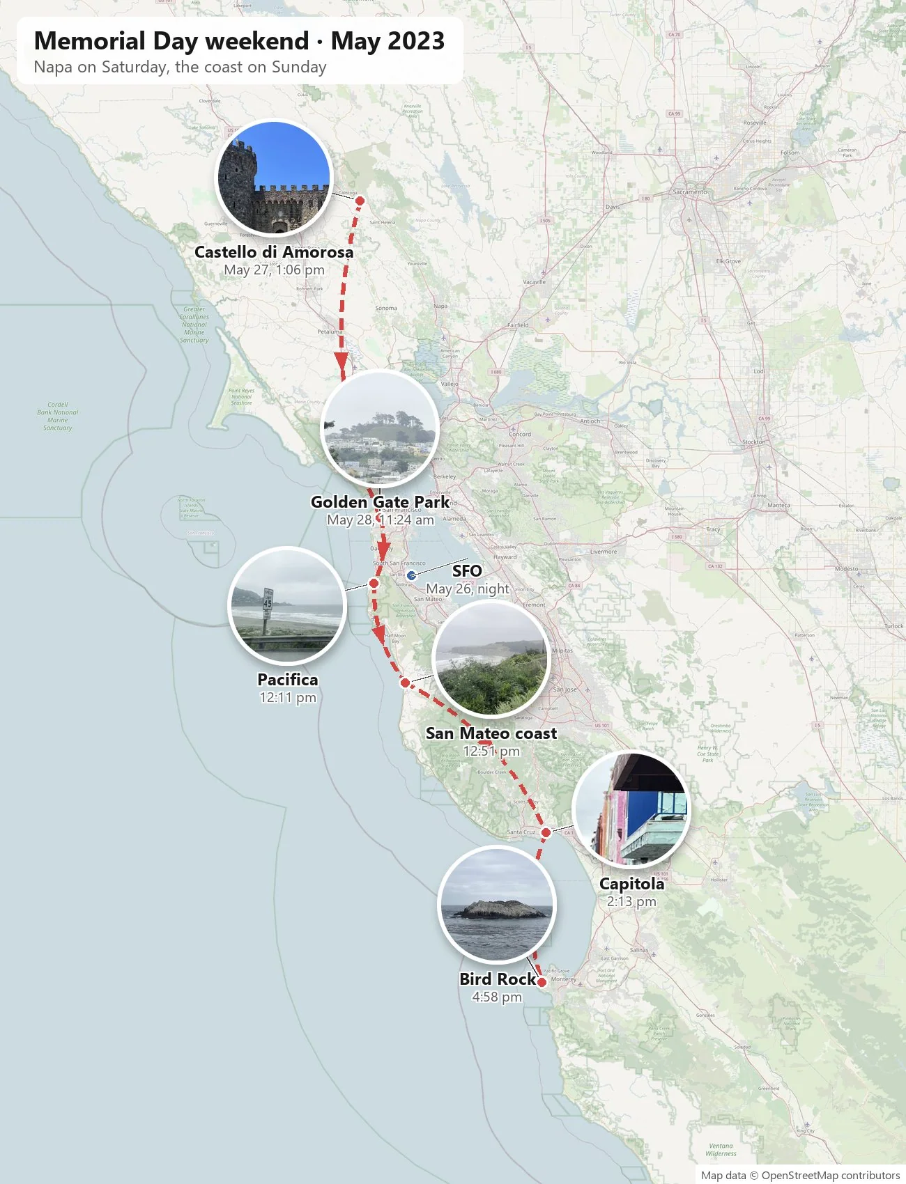
A year later we came back for a long weekend, and this time I flew in, from Seattle. I was spending that summer on an internship in Redmond, Washington, having flown up from LA for it, so San Francisco was a short hop south. My wife drove up from Los Angeles, and we met in San Francisco. We stayed two nights downtown at the Hyatt Regency, by the Embarcadero. The trip is short, three days from Friday night to Sunday night, but it covers a surprising amount of ground. Saturday went to wine country. Sunday started in the city and then ran down the coast, a hundred-odd miles of Highway 1, all the way to Pebble Beach, and home to Los Angeles through Big Sur.
Arriving at dusk
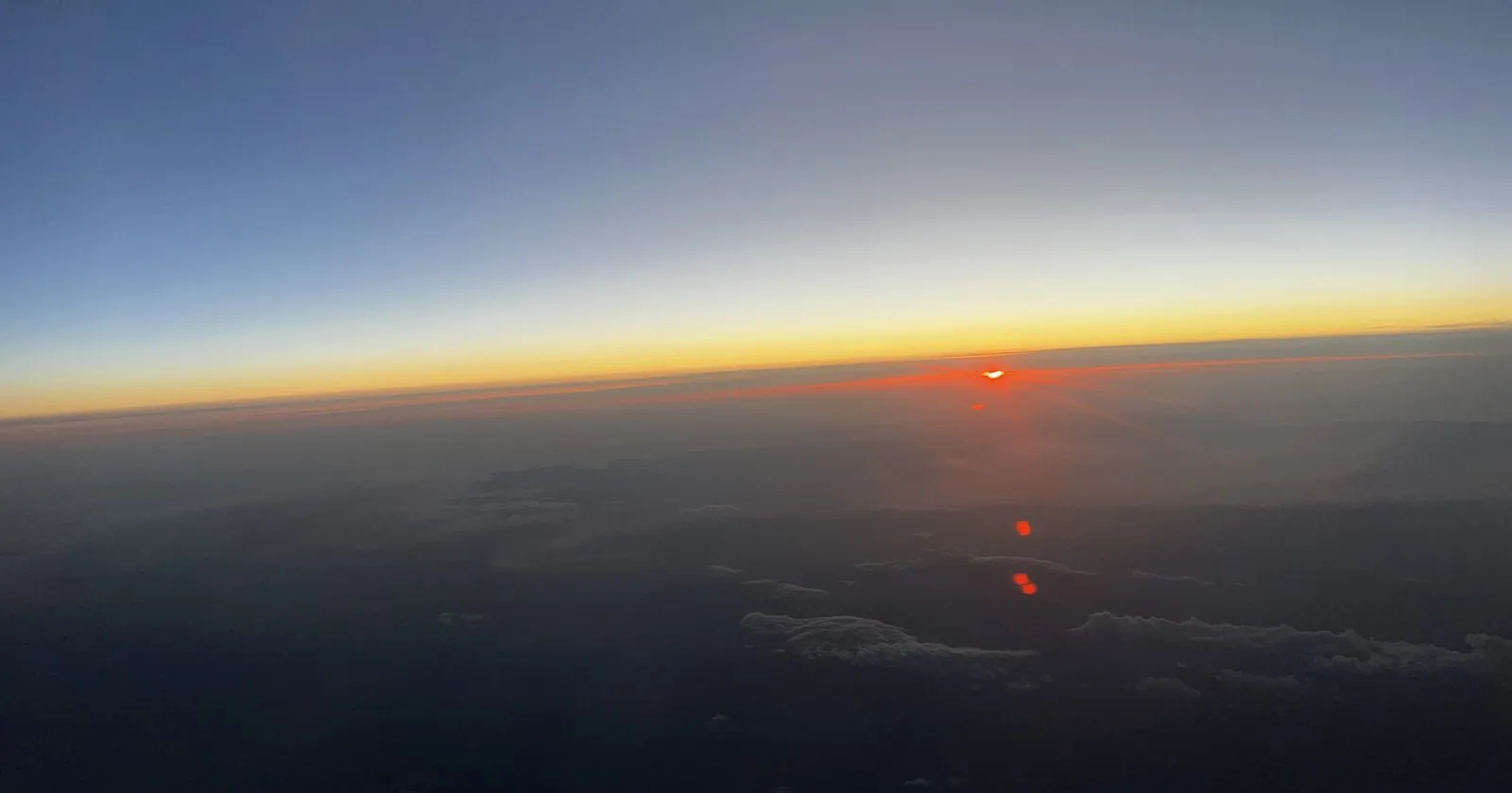
The flight came in from the north. At 8:51 pm the phone put the plane over southern Oregon, at cruising altitude, at the moment the sun went down. Above the clouds, sunset is a different thing. There is no skyline or horizon of hills, just a thin line of orange and red stretched across the whole window, with deep blue above it and a dark floor of cloud below. It lasted a few minutes and then faded to a glow.
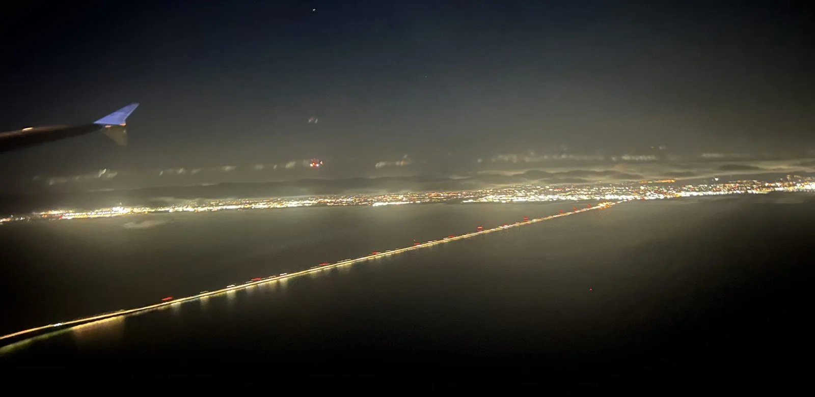
Forty minutes later I was coming down over the Peninsula. The approach into SFO runs low over the southern part of the Bay, and at night it is one of the best views you can get of the region: the shoreline drawn in lights, the San Mateo Bridge to the East Bay as a straight bright line, and the towns of Menlo Park, Foster City and San Mateo fading into one another. The wingtip in the corner of the frame tilted as the plane turned toward the runway.
Castello di Amorosa
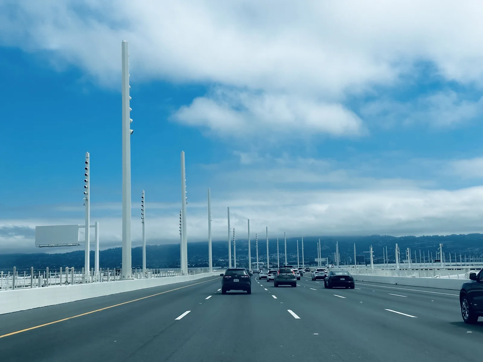
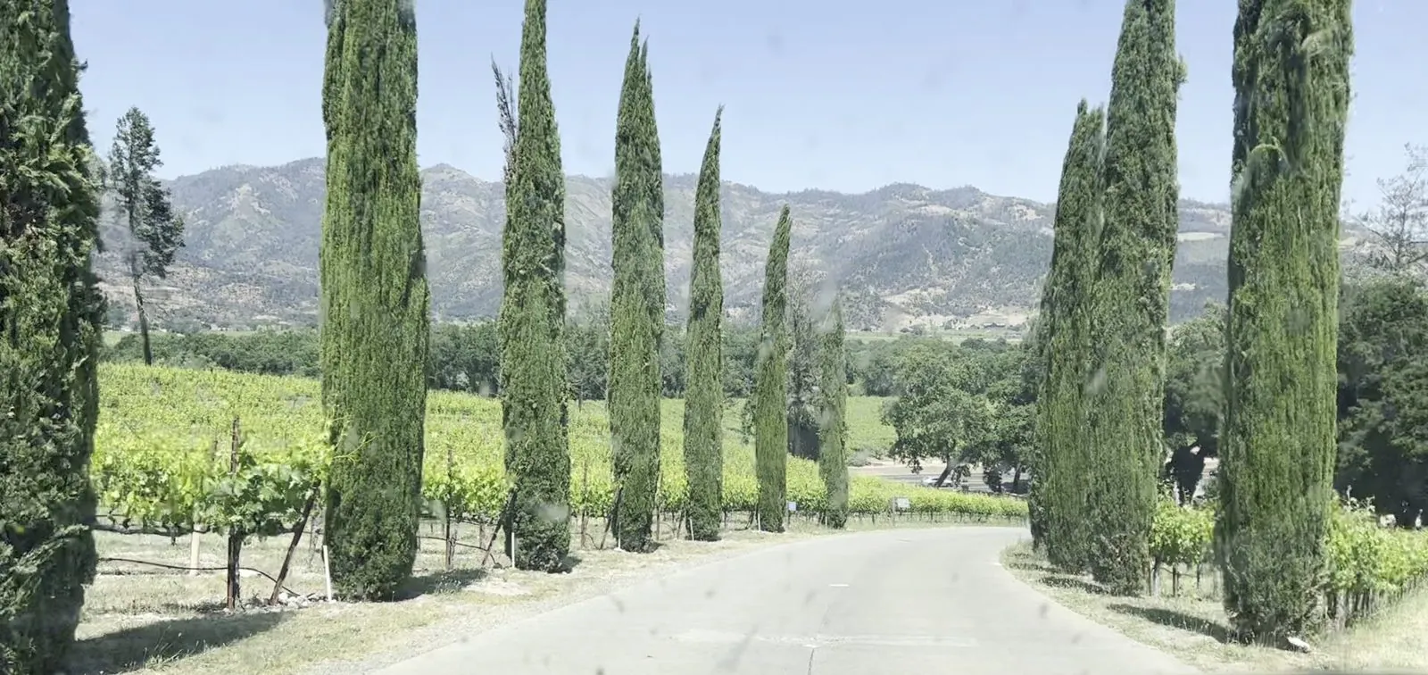
Saturday was for wine country. We left the city over the Bay Bridge a little after eleven, and a little after one in the afternoon we pulled up to Castello di Amorosa, near Calistoga at the top of Napa Valley. The approach sets the tone before you see anything: a lane lined with tall, thin Italian cypresses, with vineyards on both sides and the dry, forested hills of the valley beyond. It looks more like Tuscany than California, which is the point.
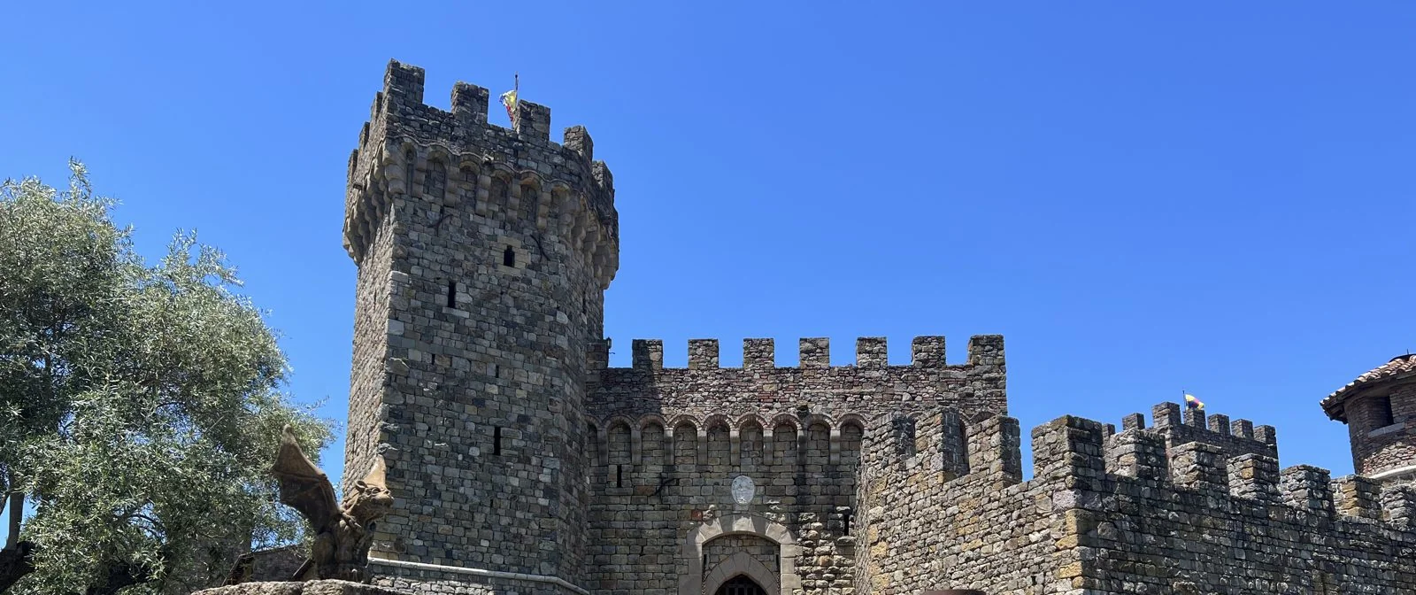
Then the castle itself appears, and it is a real one, at least in the way it was built. Castello di Amorosa is a thirteenth-century-style Tuscan castle that Dario Sattui spent well over a decade building, using old-fashioned methods and hand-cut stone, and it opened as a winery in 2007. It has towers, crenellated walls, a moat with a drawbridge, a great hall and a dungeon, and wine is made and aged inside it. That May afternoon the sky was a hard, cloudless blue, and red roses bloomed in front of the stone gatehouse.
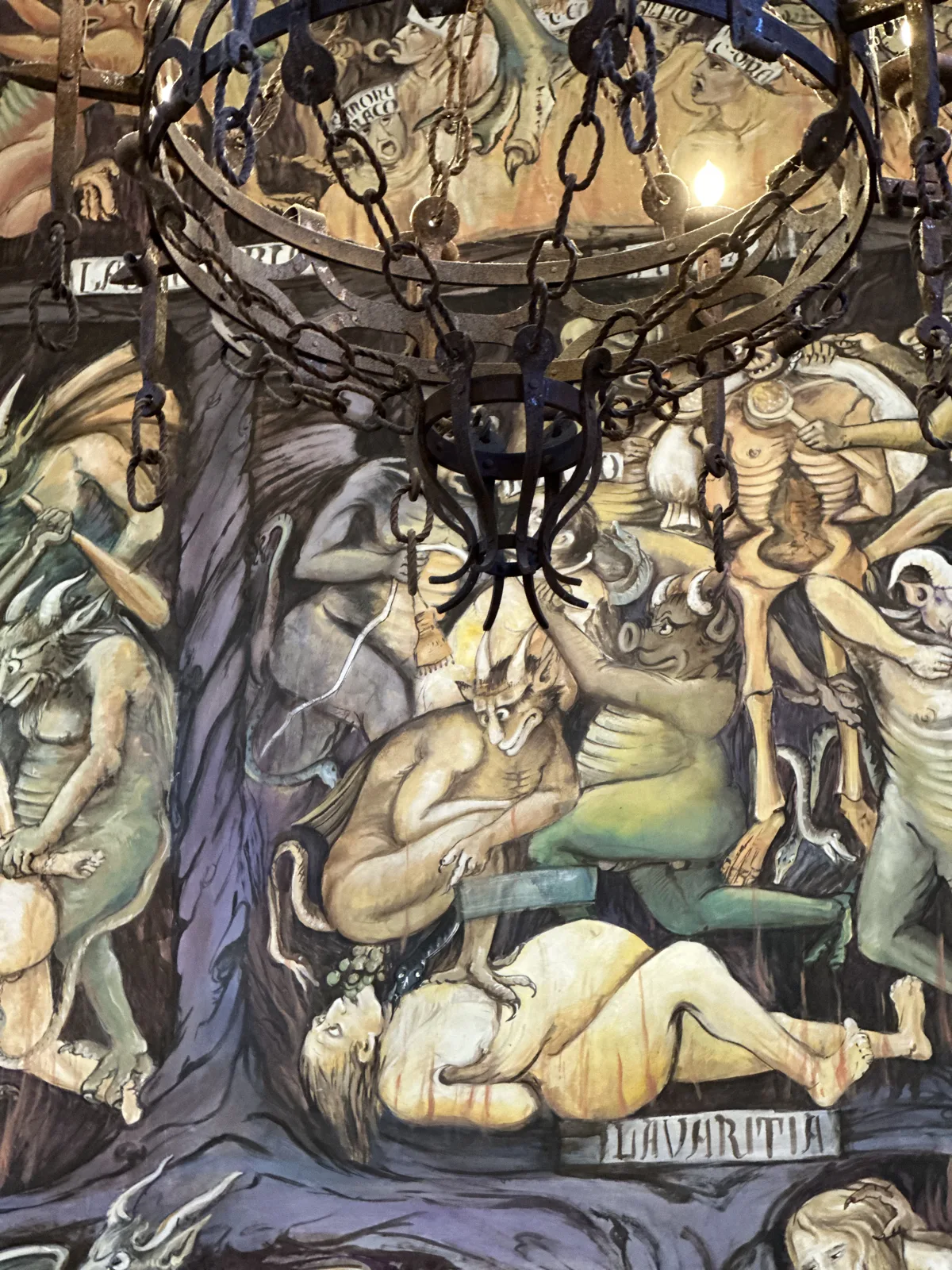
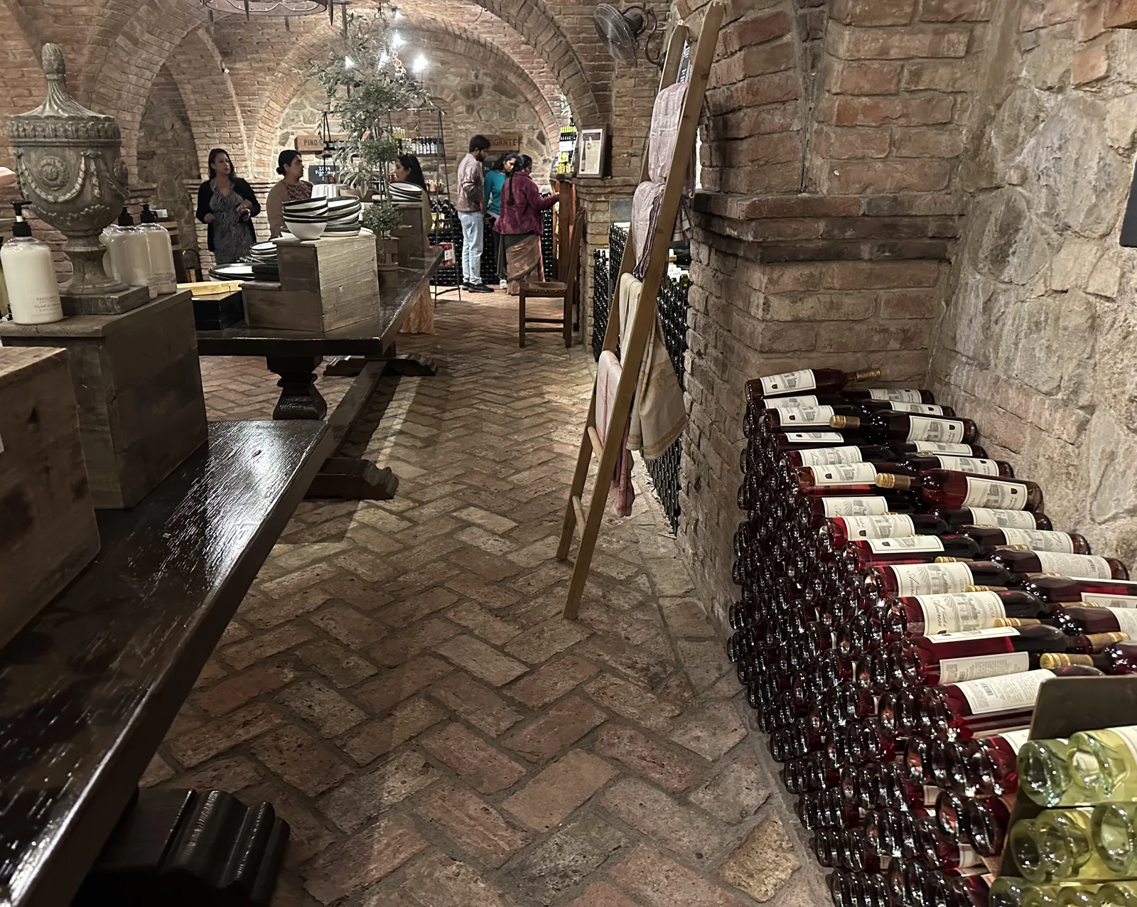
We did a tasting, starting around a quarter past one with a glass of rosé. The castle has brick-vaulted cellars lined with racks of bottles.
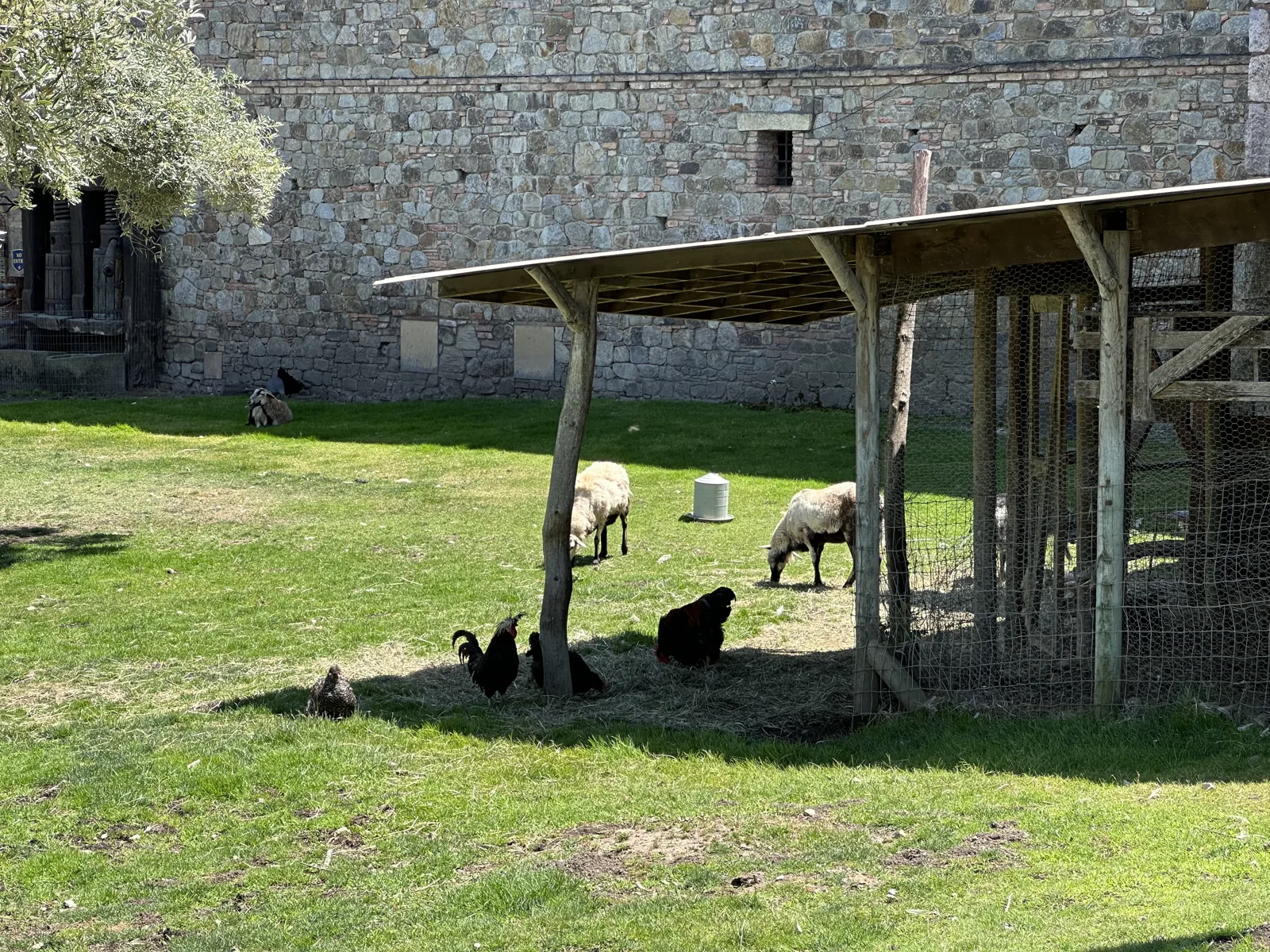
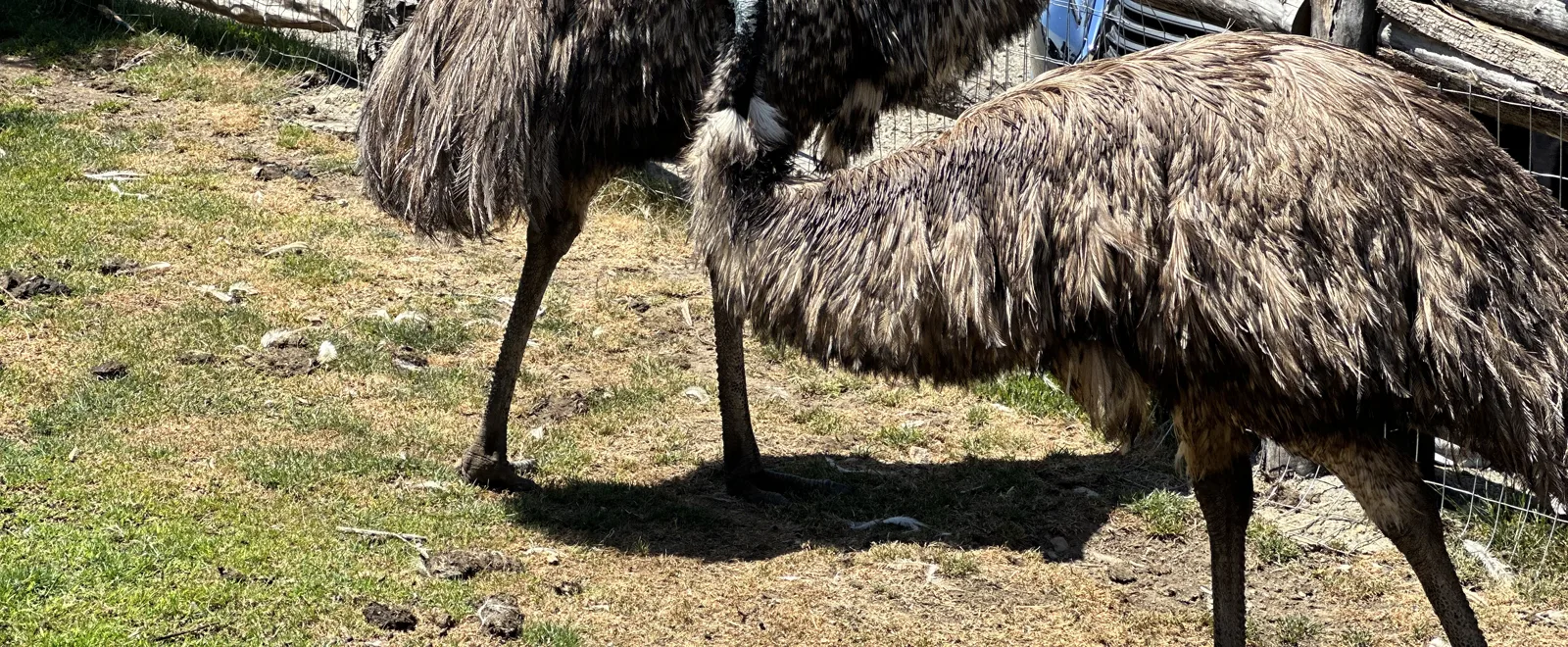
Next to the castle there is a small farm: an olive grove, sheep and black chickens grazing in the shade of a wooden shelter under the stone walls, and, at a fence nearby, two emus.
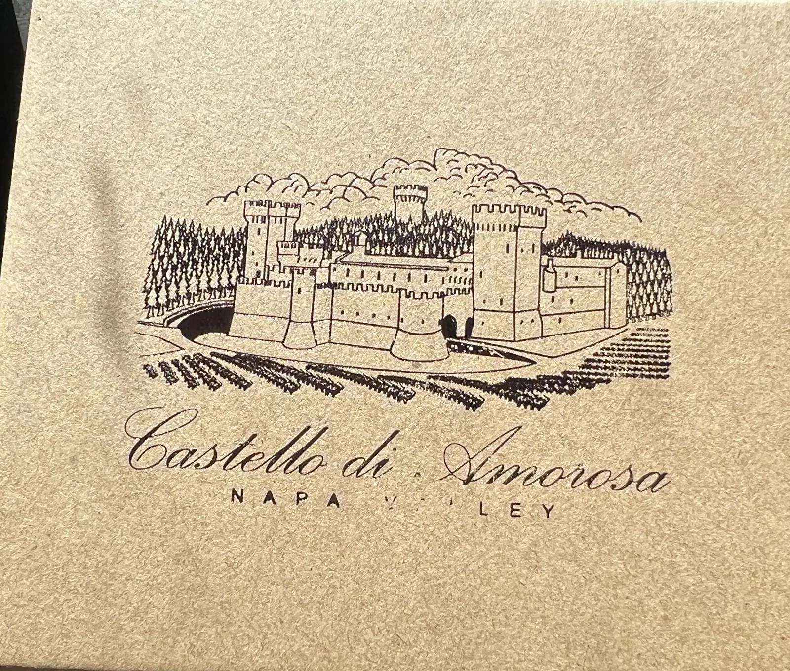
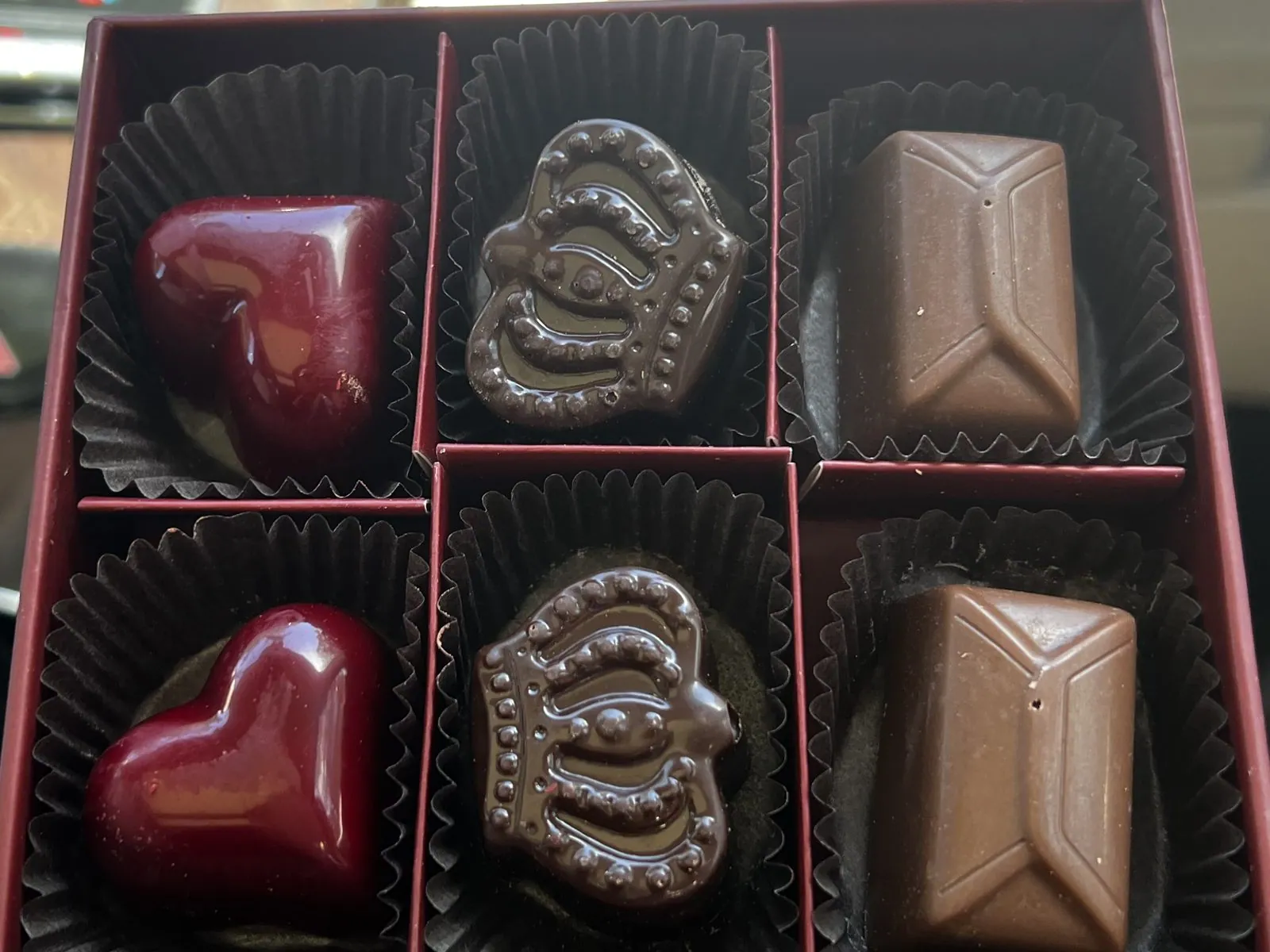
An hour after the tasting began we were back in the car with a small souvenir. It was a kraft-paper box printed with a drawing of the castle and its vineyards, and inside were six chocolates: two glossy red hearts, two crowns and two plain bars. We photographed them on St. Helena Highway. It is a very Napa thing to do. The winery sells you the wine, and the gift shop makes sure you leave with something to eat on the way.
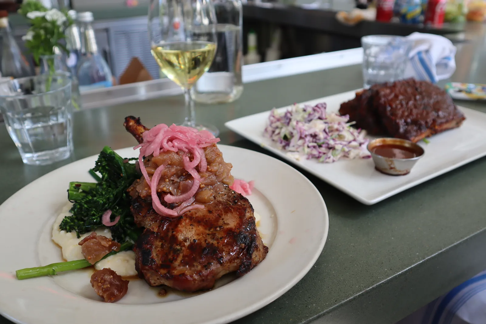
In St. Helena we had a late lunch at Farmstead: a glazed pork chop with pickled onions, ribs with slaw, and a glass of white wine. My last photo of the day was taken there at a quarter to four. We drove back that evening, and nothing else from Saturday made it into my phone. My wife's has one more stop: dinner in Millbrae, south of the city, at 8:24.
Down the coast on Sunday
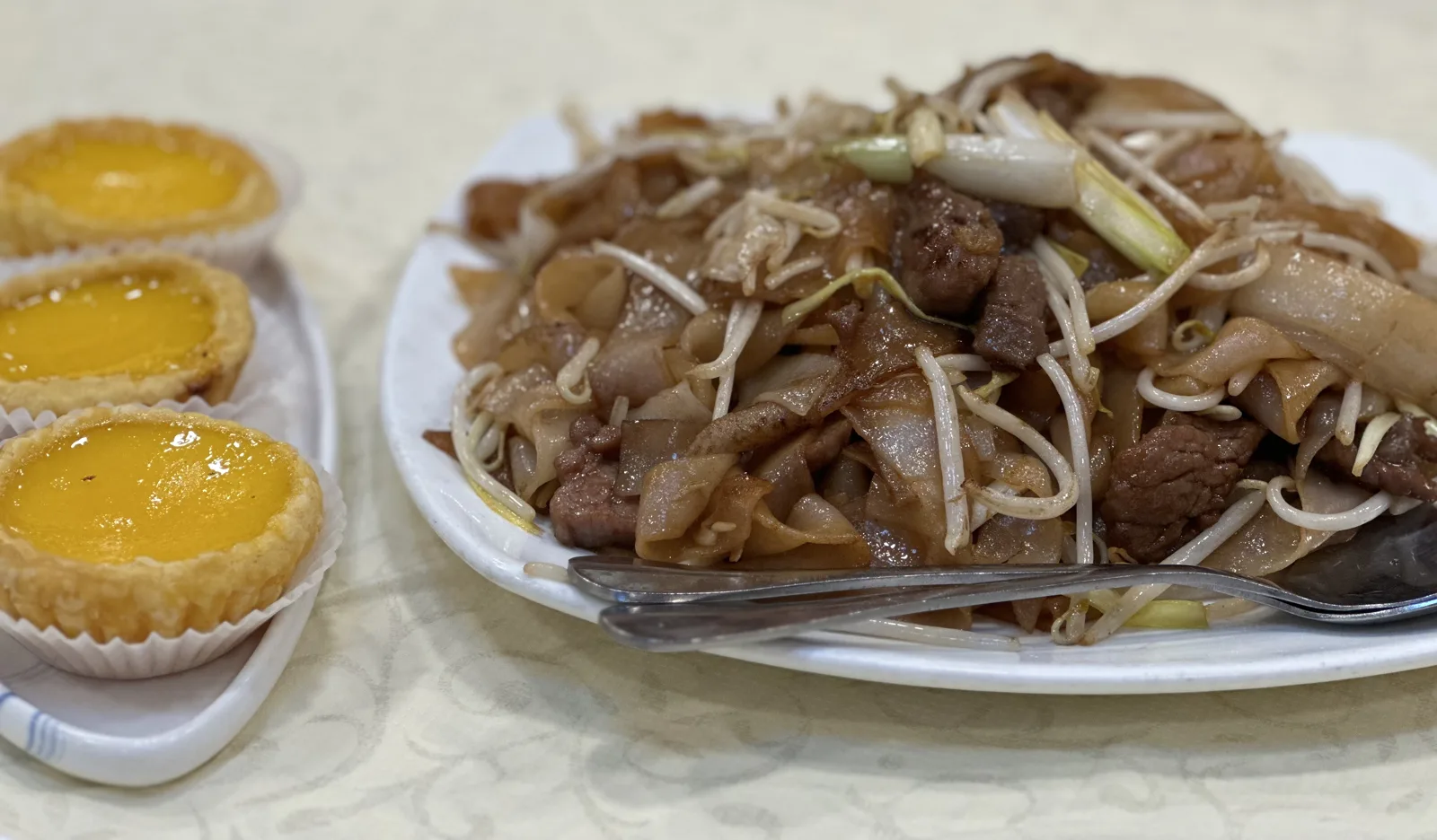
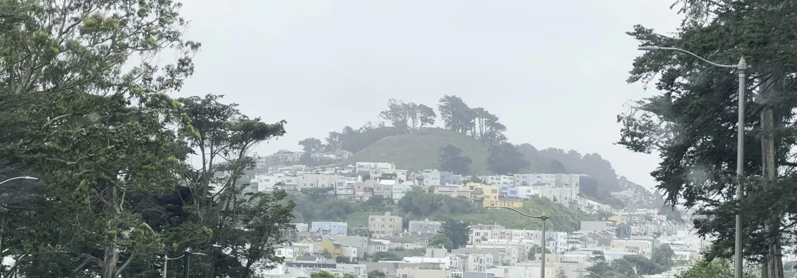
Sunday began on the west side of San Francisco, with beef chow fun and egg tarts for breakfast in the Richmond District, and it began gray. That is normal here in late May. The coast has its famous summer fog season, and in the Sunset District the sky is often a flat white ceiling until midday. We drove through Golden Gate Park on Crossover Drive at 11:24, and in front of us one of the city's steep, wooded hills rose over rows of pale houses, its top lost in mist.
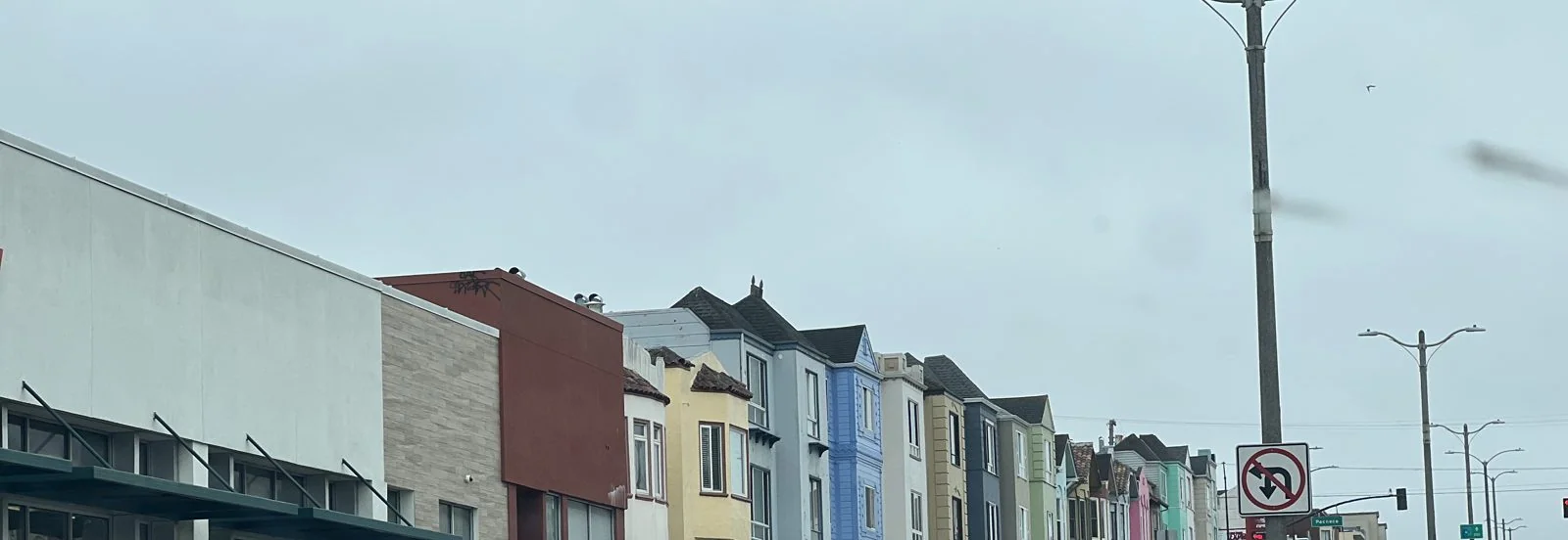
Five minutes later we were on 19th Avenue, which is how most people meet the Sunset District. The houses here were built side by side in the 1930s and 40s, each with a garage on the ground floor and a bay window above. They are all the same shape and almost all different colors: pale blue, cream, mint, yellow, a dark red one at the corner. Under a gray sky they look like a row of paint chips.
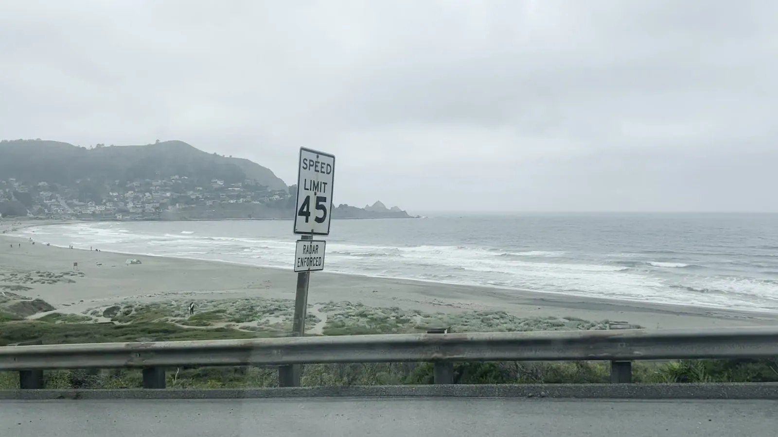
From there we headed south on Highway 1. The road leaves the city at Daly City, climbs past the cliffs and drops into Pacifica, the first real beach town south of San Francisco. At 12:11 we were on the highway above the beach: a long curve of sand, white surf rolling in, a green headland with houses climbing it, and the fog sitting low over all of it. A speed-limit sign stands in the middle of the view, as if to remind you that you are still on a highway.
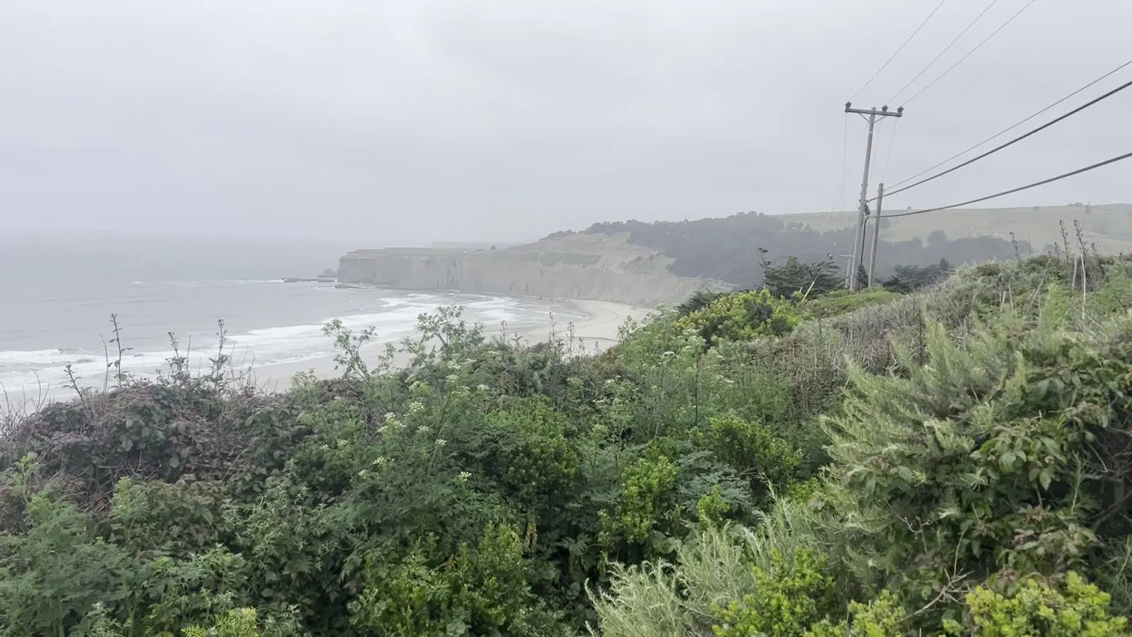
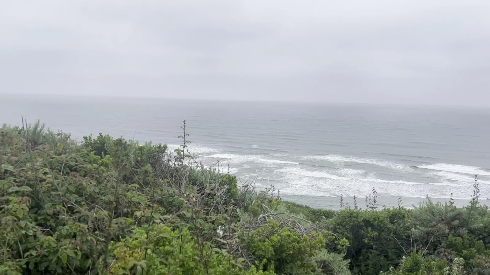
South of Half Moon Bay, the coast empties out. For miles the highway runs along low bluffs with farmland on one side and the ocean on the other, with almost no towns. Forty minutes after Pacifica we pulled off on a bluff north of San Gregorio, most likely just a roadside turnout, nothing with a name. Below us, coastal scrub ran down to the edge, and a beach curved off to a pale cliff in the distance, with the surf coming in in long white lines.
Capitola
By a quarter past two we were in Capitola, just past Santa Cruz. It is one of the oldest seaside resort towns in California, and it has one of the most photographed rows of buildings on the coast: the Venetian Court, built in the 1920s. Its little stucco buildings are painted in candy colors, lavender, mint, tangerine, bright yellow and pink, and their walls are textured like icing. The rows step down toward the beach, and every turn of the path shows a new combination of colors.
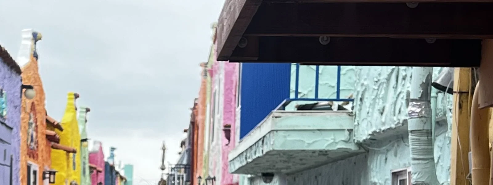
Capitola is also where the two Bay Area trips overlap. A year earlier, on the 2022 loop, we had stopped in the same spot on the way home. That is how this place works for us: the same corners keep turning up, and each time they look a little different. In 2023 they stood under the same flat gray sky as the rest of the coast, which, if anything, made the colors louder.
Bird Rock, 17-Mile Drive
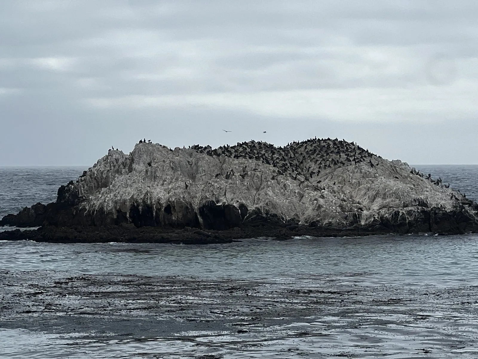
After a short stop in downtown Monterey for ice cream, we reached the last stop, the farthest south. 17-Mile Drive is a private toll road that loops through Pebble Beach and the Del Monte Forest on the Monterey Peninsula, past golf courses, mansions, cypress groves and a string of coastal turnouts. Its most famous sight is the Lone Cypress, a single tree on a granite outcrop that has stood there for more than two centuries. But the stop that held us longest was Bird Rock, at five in the afternoon.
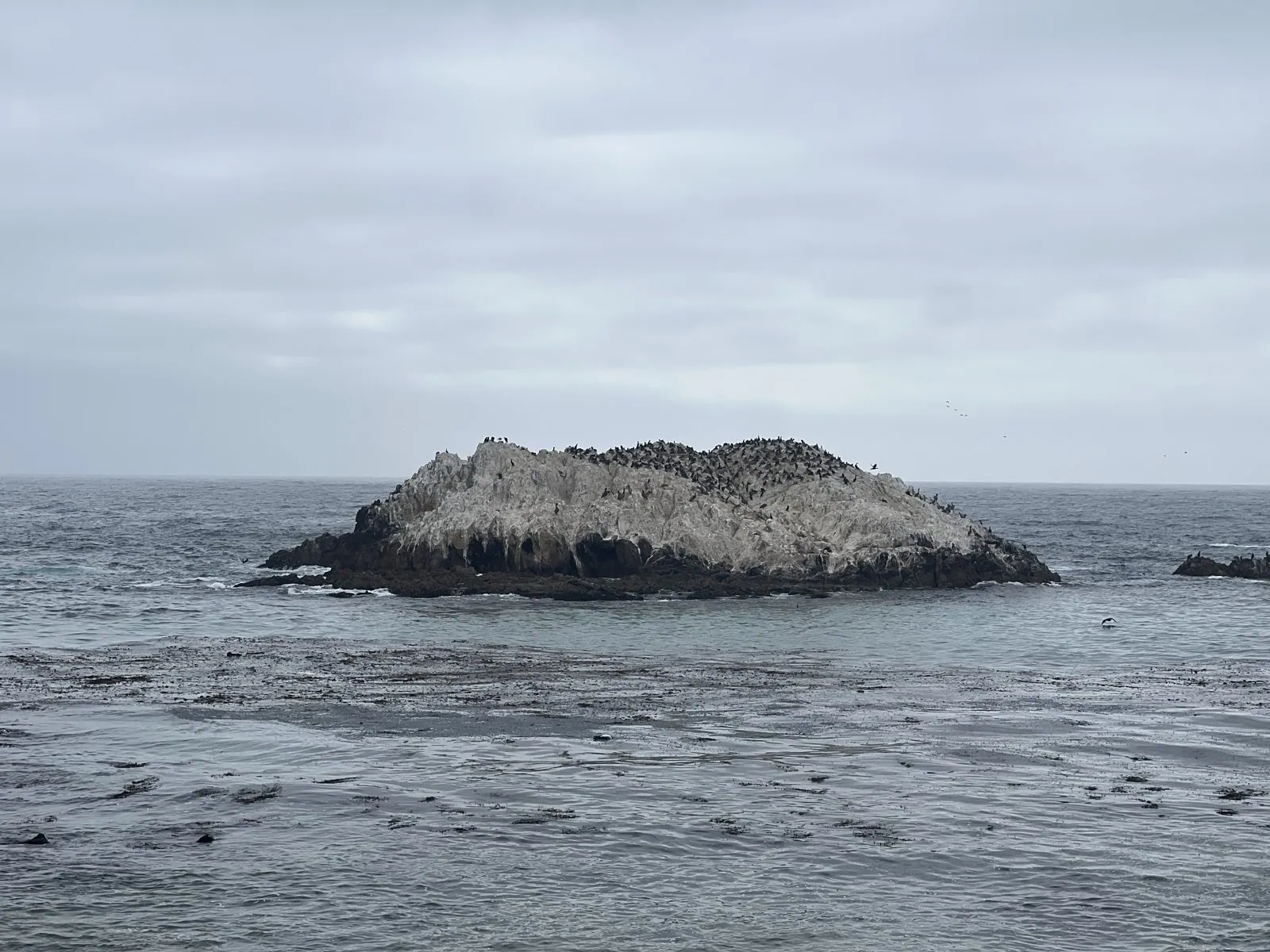
Bird Rock is exactly what it sounds like: a low granite island a short way offshore, painted white by generations of seabirds. From the turnout it looks like a pale lump in the sea. Zoom in and it turns out to be covered with birds, mostly dark cormorants packed shoulder to shoulder along its top, with gulls on the edges. Sea lions and harbor seals haul out on the rock too, and the water around it was full of floating kelp.
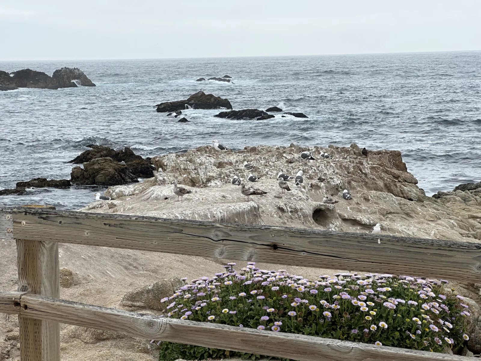
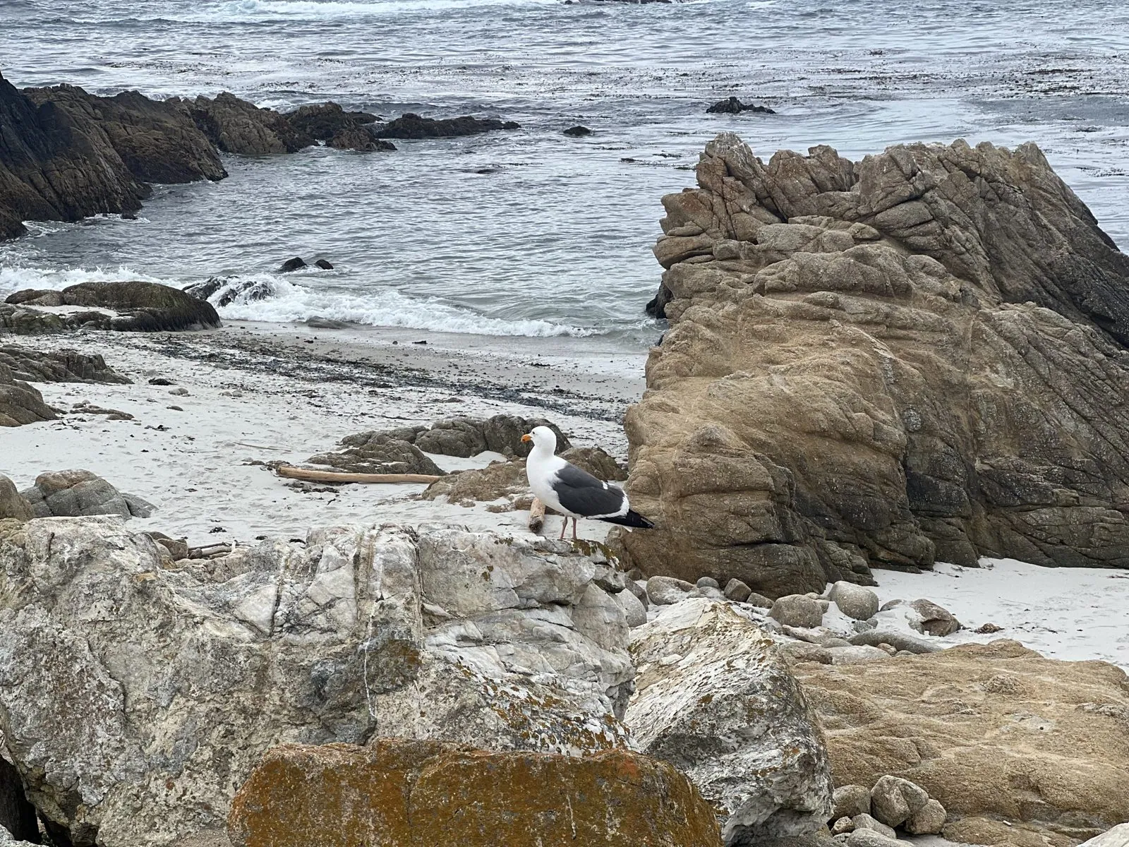
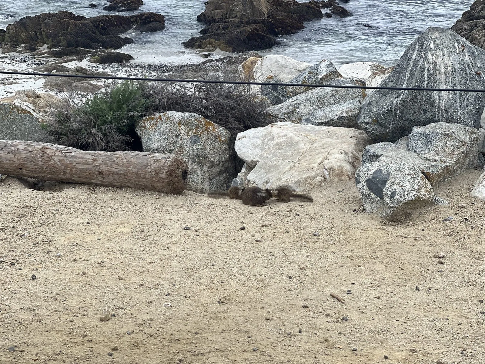
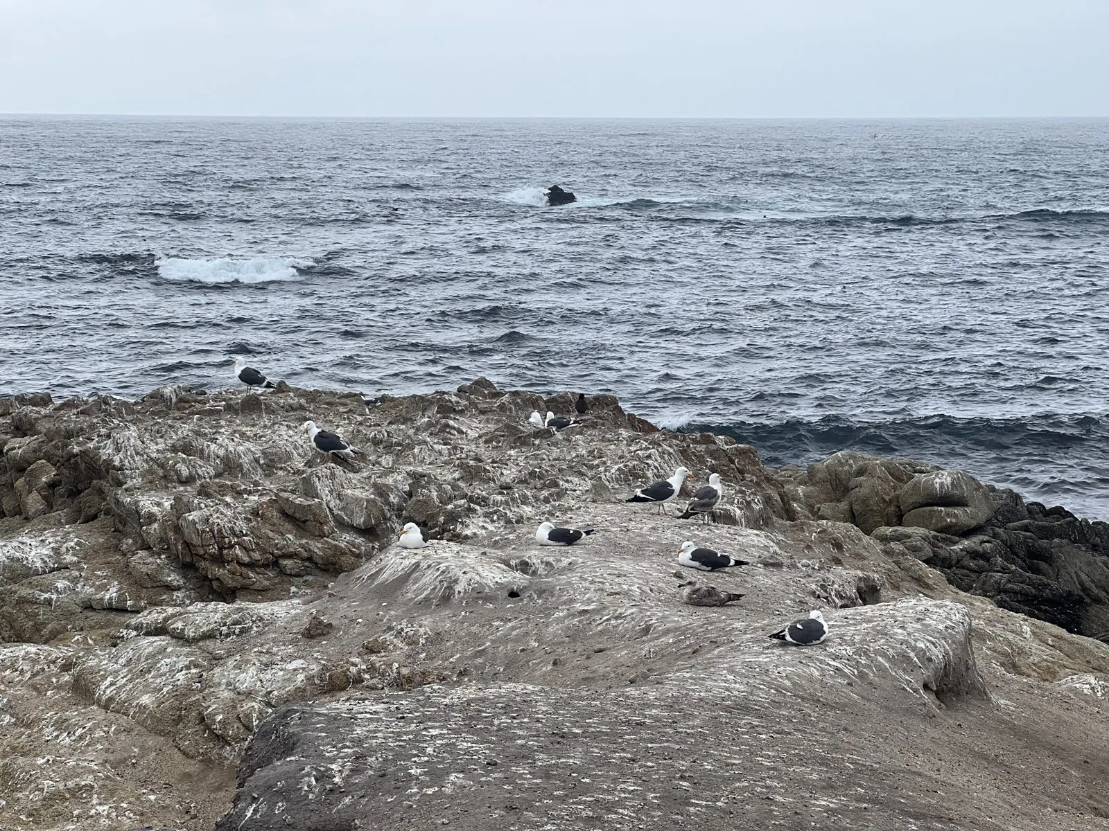
The shore side was just as busy. A western gull stood on a granite boulder above a small white-sand cove, and on a flat outcrop farther along, a dozen more gulls sat facing into the wind, ignoring the surf behind them. Just below the turnout, on a patch of sand between the boulders and a piece of driftwood, a few seals lay in a heap, almost the same color as the sand.
My last photo of the weekend was taken at 5:01 pm: gulls on a flat rock, gray sea, gray sky.
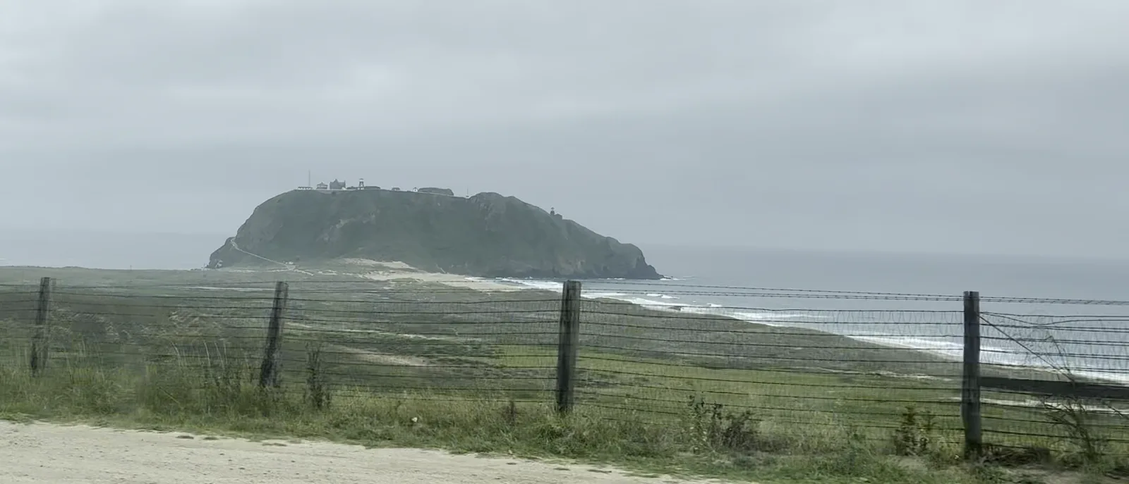
My camera roll stops there. My wife's doesn't: at 5:47 we were on Highway 1 near Bixby Bridge, ten minutes later we passed Point Sur and its lighthouse, and a little after midnight we were back in Los Angeles. The way home was the whole of Big Sur.
Thanksgiving, November 2023
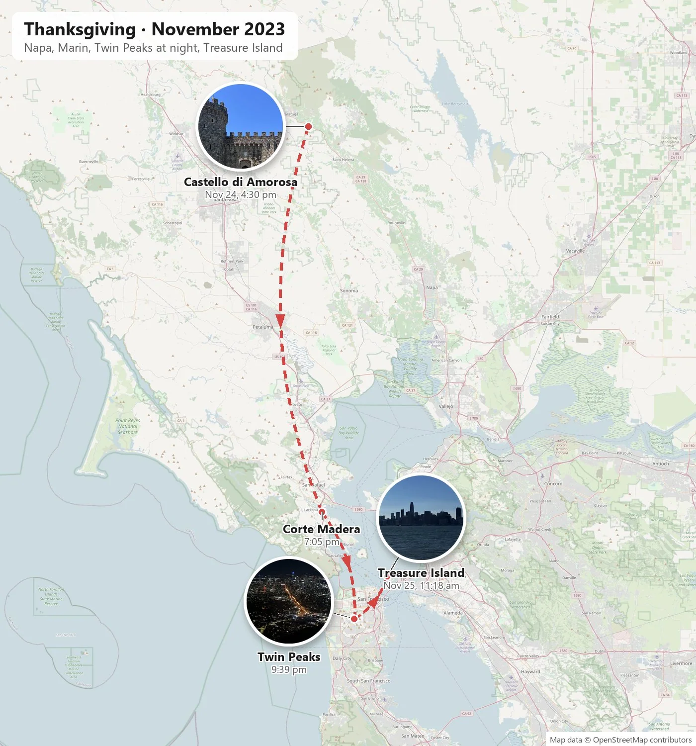
Six months later we were back, this time by car. The plan was simple: drive up from Southern California on Thanksgiving afternoon and spend the long weekend in and around the city. It turned into a trip of very different moments: a sunset on I-5, a second visit to the castle, a night on Twin Peaks, and a blue morning on Treasure Island.
I-5 on Thanksgiving
We left on Thanksgiving Day itself, in the middle of the afternoon. By 4:42 pm we were in the Central Valley near Kettleman City, on the long straight stretch of I-5 where the road runs between flat, dry fields and the low hills of the Coast Range.
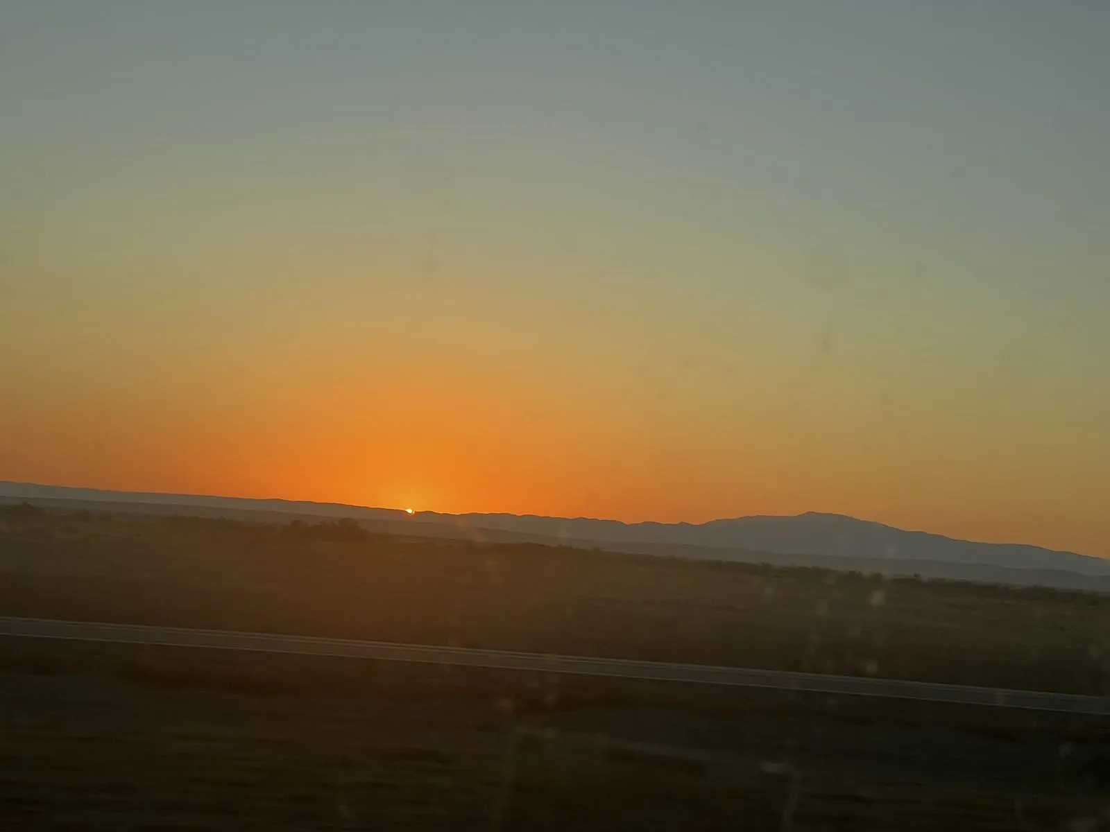
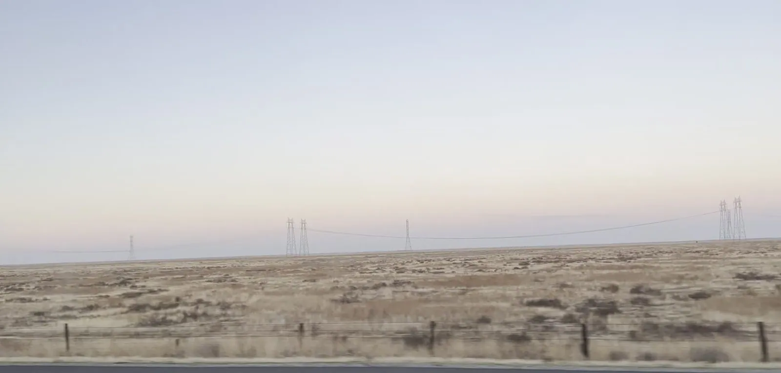
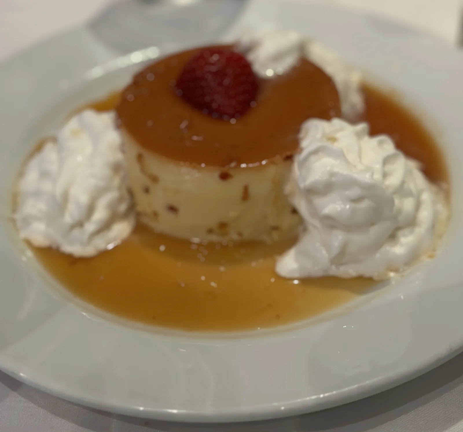
Late November sunsets come early, and this one came exactly as we reached the valley. The sun dropped onto the hills to the west and lit the whole sky orange for a few minutes. Then the land turned the color of straw and the sky went pale pink and lavender, with power lines marching off toward the horizon. After that it was a long drive in the dark. By eight we were in Cupertino, where Thanksgiving dinner was at a Brazilian steakhouse, with grilled meat and a flan to finish.
Back to the castle
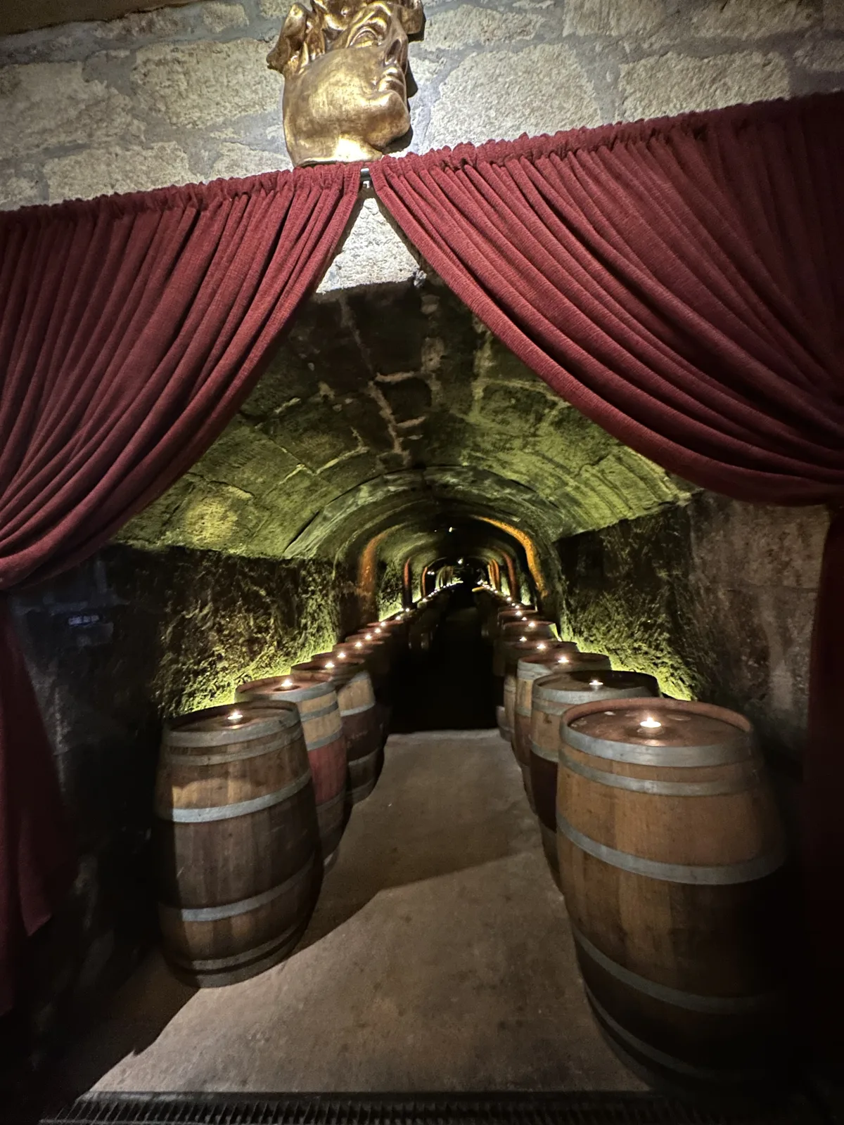
On Friday, the day after Thanksgiving, we went back to Napa: a tasting at Del Dotto, lunch at Farmstead in St. Helena, and then back to Castello di Amorosa. The tasting was in Del Dotto's caves outside the city of Napa, in a tunnel lined with barrels, and the wine came straight out of them.
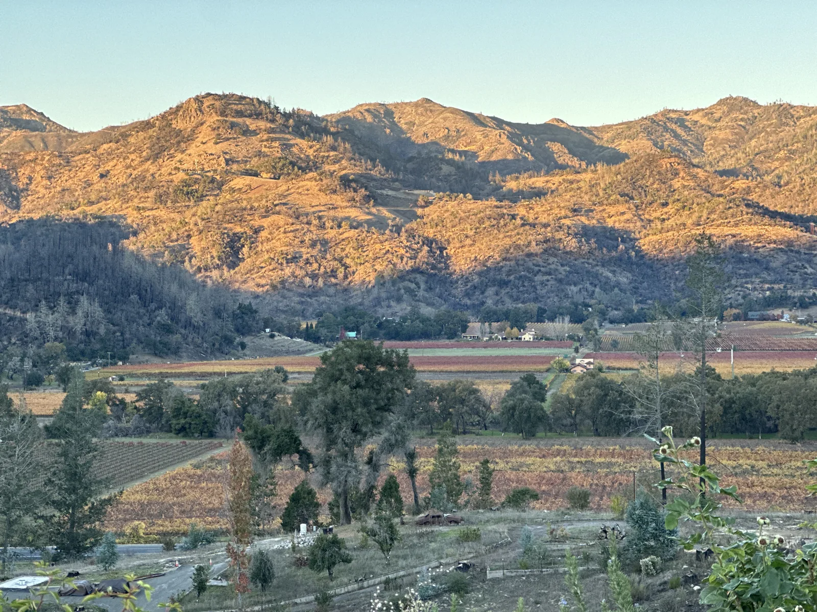
That is the clearest sign of how the castle works for us: it was good enough the first time that we chose it again, six months later, in a different season. My only photo from that afternoon, at 4:30 pm, was taken a few yards from where we had stood in May, and it isn't one worth publishing. The visit itself was. My wife's photo from a minute earlier looks out from the castle over the vineyards to the hills in the last sun.
From Napa we drove south through Marin. At seven in the evening we were in Corte Madera, at the shopping center by the freeway, for a little Black Friday shopping. Then we crossed the Golden Gate Bridge into the city and drove up the hill.
Twin Peaks at night
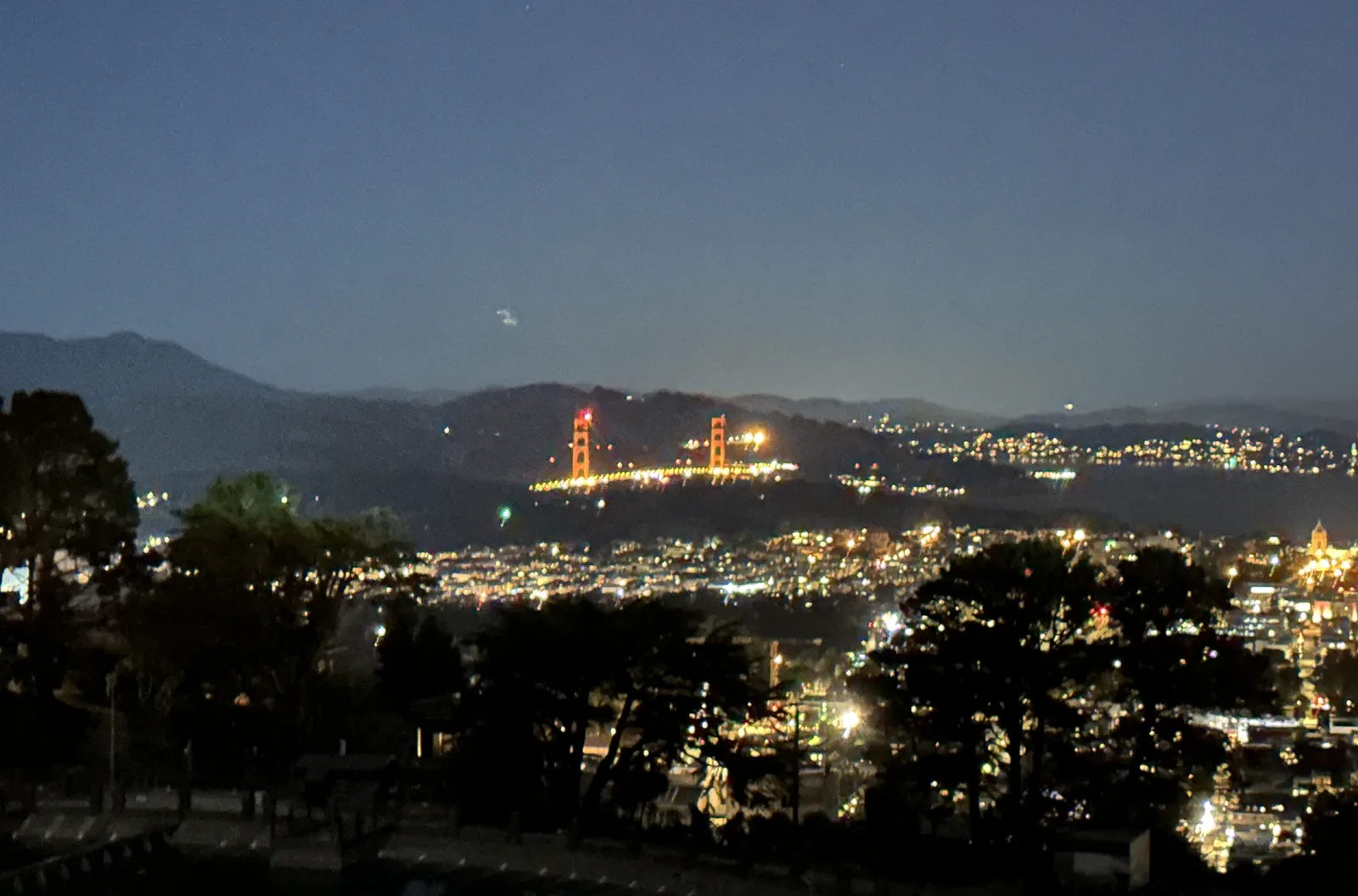
Twin Peaks is the pair of hills near the geographic center of San Francisco, a little over 900 feet high. From the top, the whole eastern half of the city is laid out at your feet. We got there at 9:39 pm. The most striking thing from up there is Market Street. It runs dead straight from the foot of the hill to the Ferry Building on the bay, and at night it is a ribbon of orange streetlights cutting diagonally across the dark grid, aimed straight at downtown.
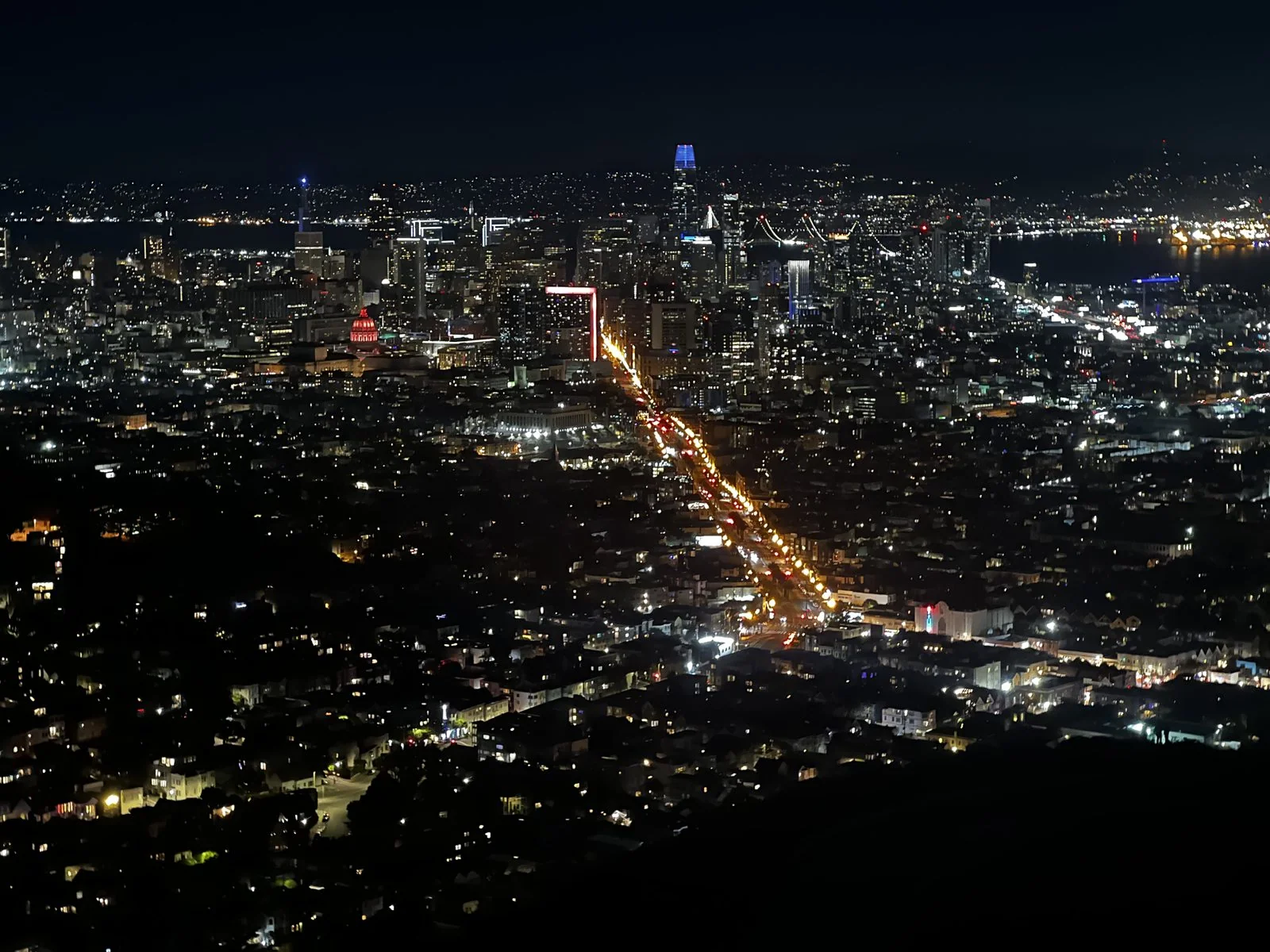
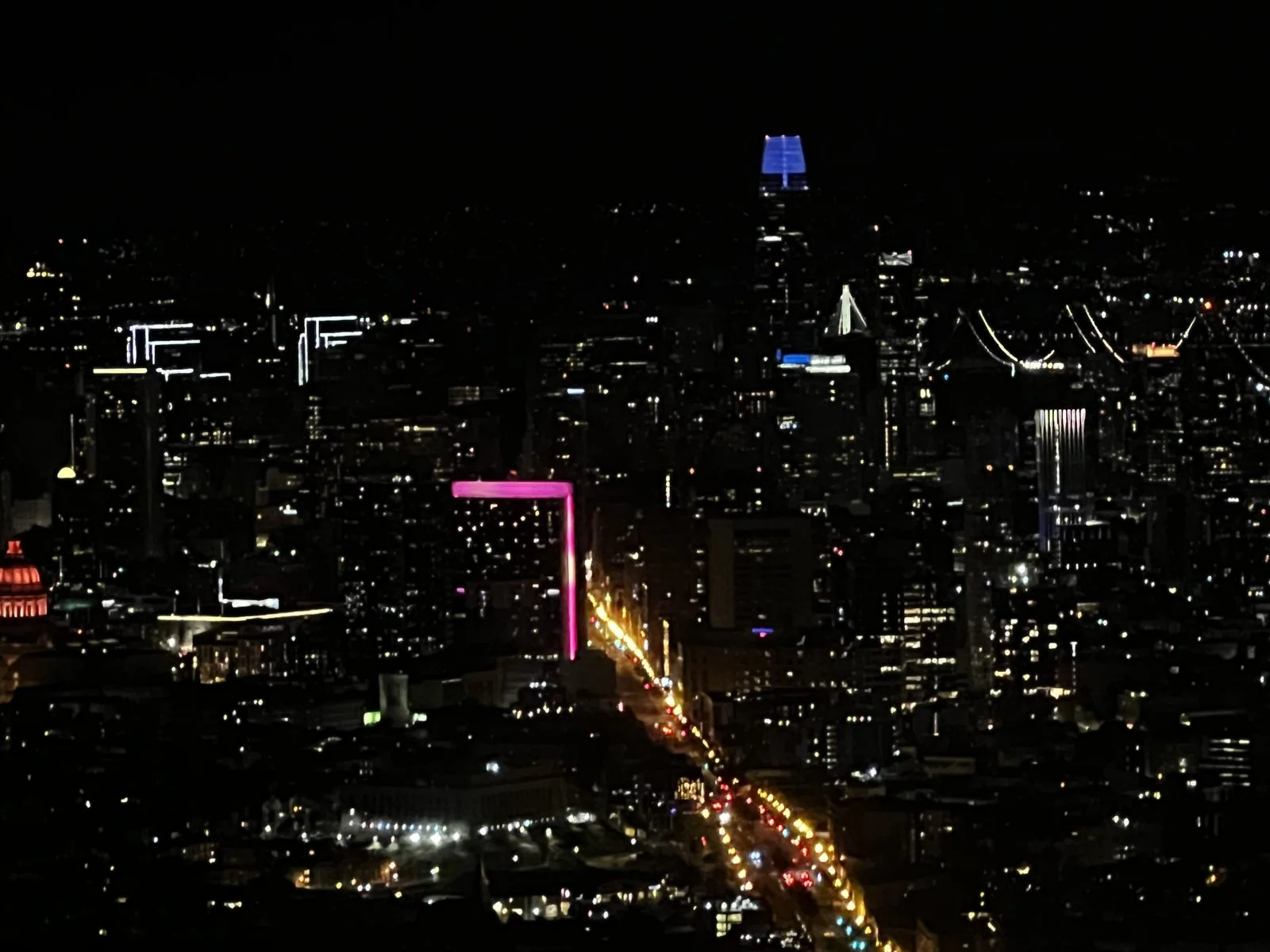
Zoom in and downtown resolves into its landmarks. The tallest, with its crown of lights glowing at the top, is Salesforce Tower, finished in 2018 and the tallest building in the city. Around it are the lit windows of the Financial District, a few neon signs, and the red lights of towers.
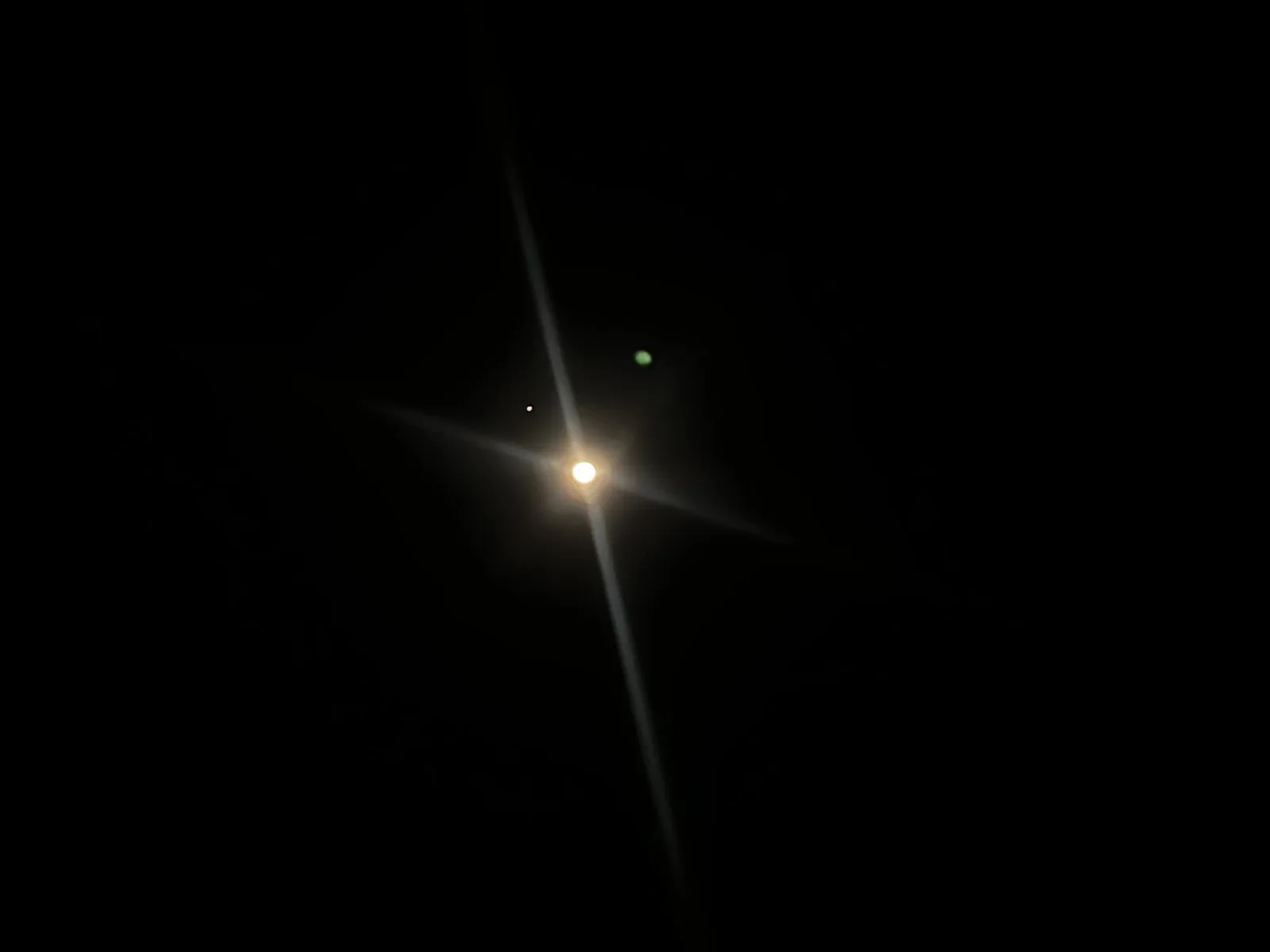
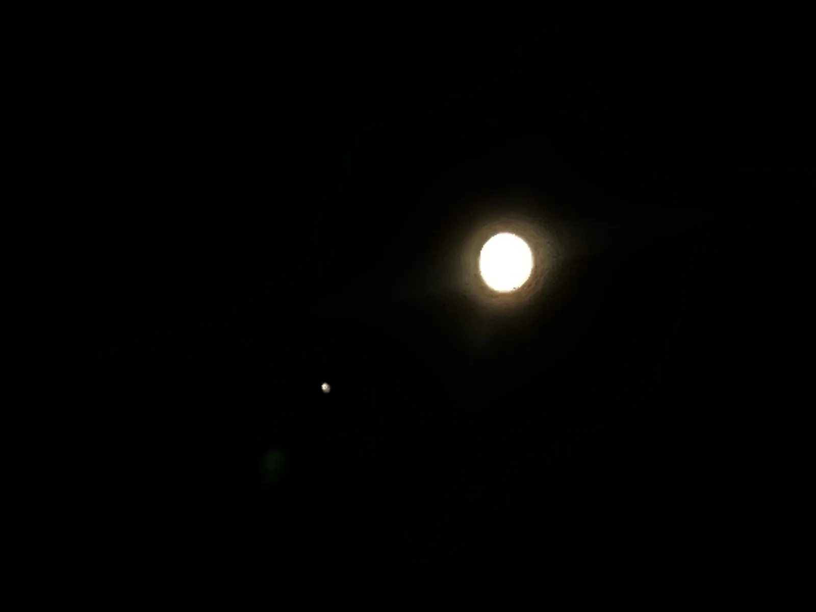
Then we turned around and looked up. A bright moon hung over the city, two or three days short of full, and near it was a single brilliant point of light, far too bright to be a star. Late November 2023 was when the moon passed close to Jupiter, so that is almost certainly what it was. A phone is not built for this, and the photos show it: the planet came out as a starburst, and the moon as an overexposed white disc. We took them anyway.
Turn north and the Golden Gate Bridge shows up as a thin line of gold lights at the far edge of the city.
Treasure Island in the morning
Saturday morning was the opposite of Friday night: cold, clear and very blue. At 11:18 am we were on the shore path of Treasure Island, in the middle of the bay. The island is artificial. It was built from dredged fill in the 1930s to host the 1939 Golden Gate International Exposition, then became a naval base for half a century. Today it is best known for one thing: the view.
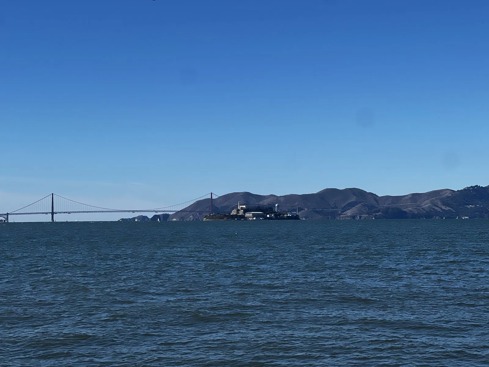
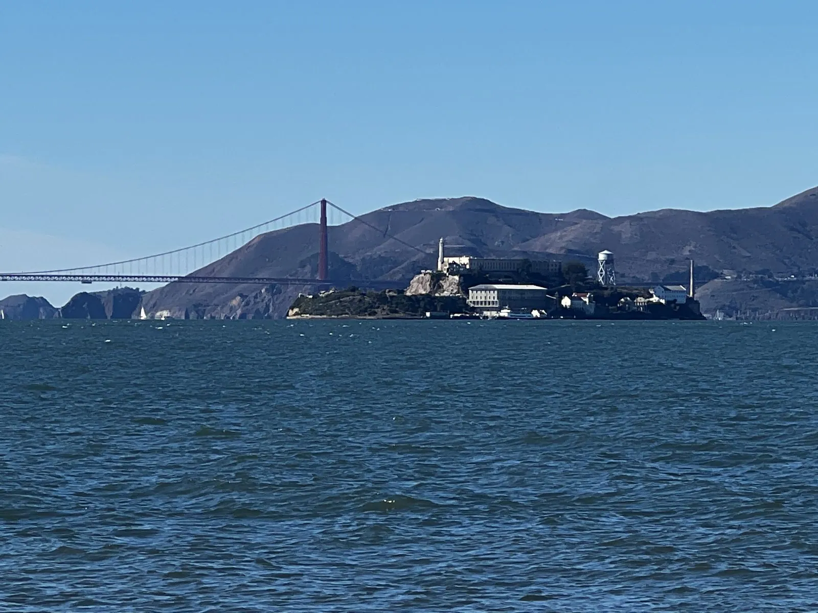
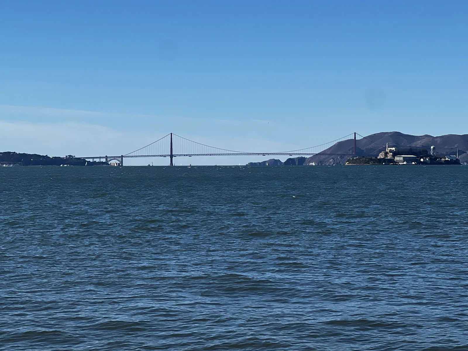
Looking west across the water, the whole mouth of the bay lines up in one frame. The Golden Gate Bridge stretches across the strait, the brown hills of the Marin Headlands rise behind it, and in front sits Alcatraz, the former federal prison, low and pale on its rock. With a long zoom, the cellhouse, the lighthouse and the water tower are all easy to pick out. It was the clearest air of any of our visits.
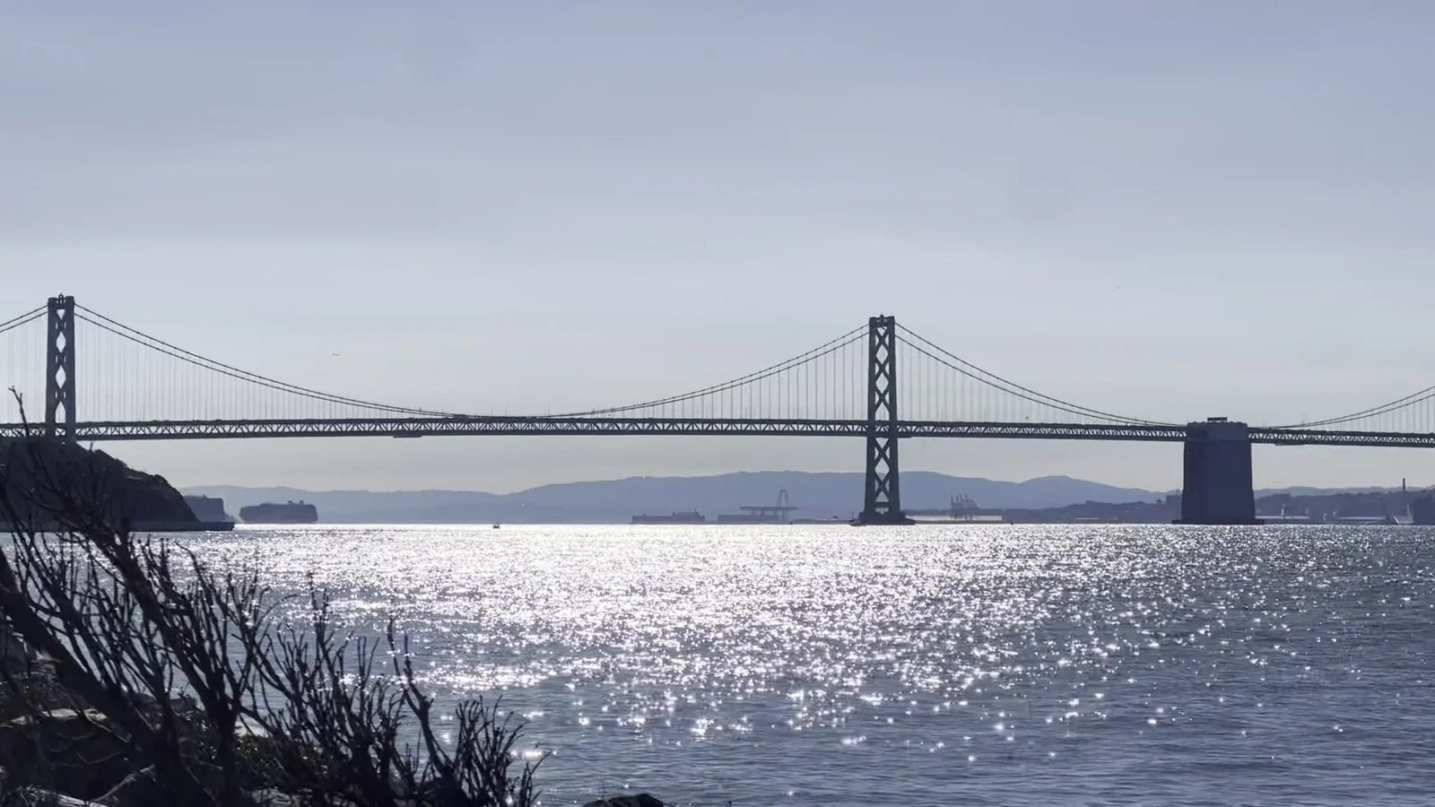
Turn south and the view changes completely. The rocky shore of the island leads the eye across the water to the San Francisco skyline, with the Bay Bridge running off to the left. The bridge opened in 1936, six months before the Golden Gate, and it carries far more traffic. Its western span is a pair of suspension bridges joined in the middle, and from Treasure Island you see it nearly side-on, with the morning sun glittering on the water underneath.
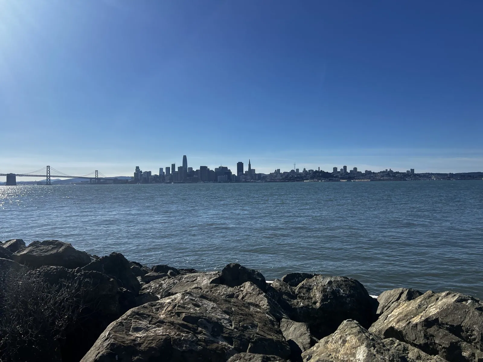
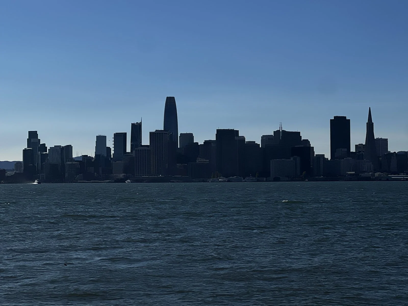
And straight ahead is the skyline. From here downtown is one compact block of towers rising out of the water. Salesforce Tower stands in the middle, rounded at the top. To the right is the white spike of the Transamerica Pyramid, which was the city's signature building for over forty years. In the hard light of late morning the whole skyline was in silhouette. It is the classic postcard view, and on a day like that it is easy to see why.
After that the weekend turned social. There was a long lunch in Millbrae, which is a story that belongs to the people who were at the table, not to this page. In the afternoon we walked the Main Quad at Stanford, which I had first seen in 2022, and by evening we were down in Palo Alto, where dinner was Spanish and where we spent the last night.
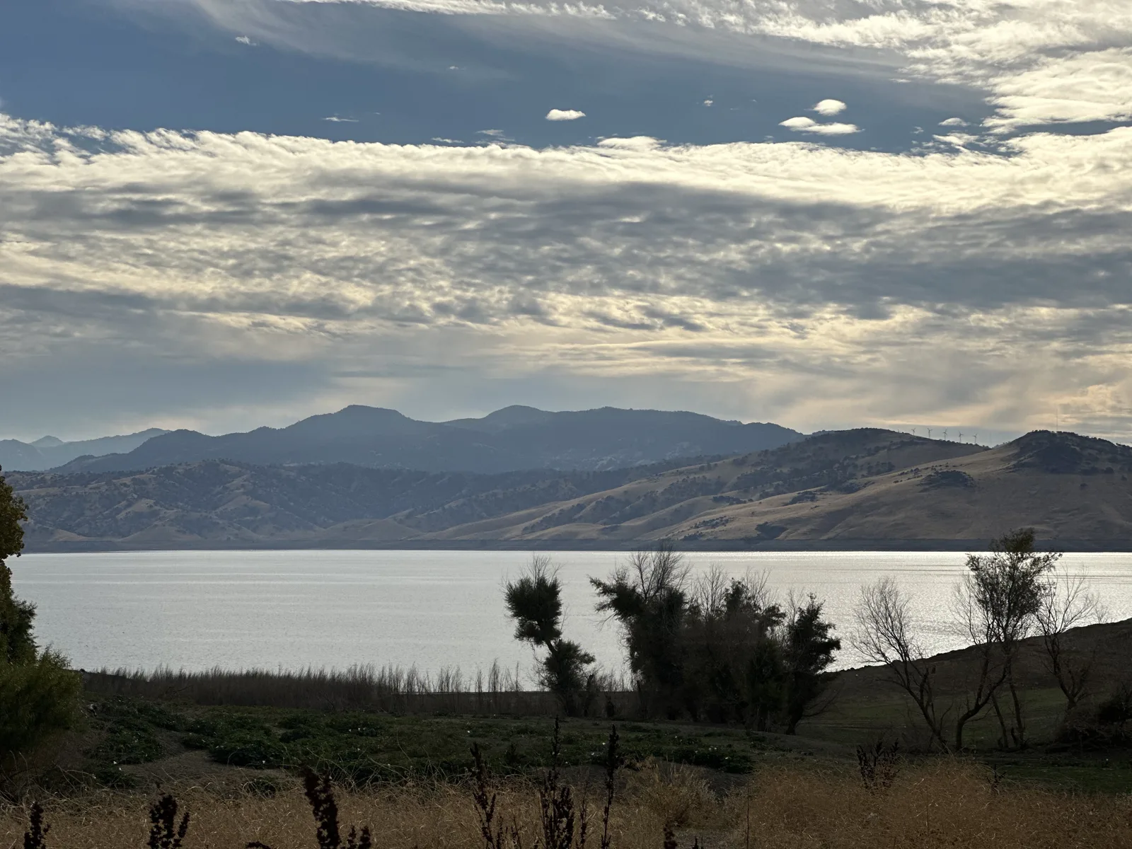
On Sunday, November 26, we stopped at the Computer History Museum in Mountain View, the same museum I had visited on the 2022 loop, and then drove home over Pacheco Pass, past San Luis Reservoir under a sky of long clouds. Somewhere between Twin Peaks and Treasure Island, though, the Bay Area had stopped being a destination and become a habit.
Thanksgiving, again: November 2025
Two years later, Thanksgiving brought us north again. This time the Bay Area was the start and the end of something bigger: a five-day drive up to Crater Lake and Portland and back down the Oregon coast, finishing late at night in Napa. It is told in full in Thanksgiving, the Long Way Round.
A week in June 2026
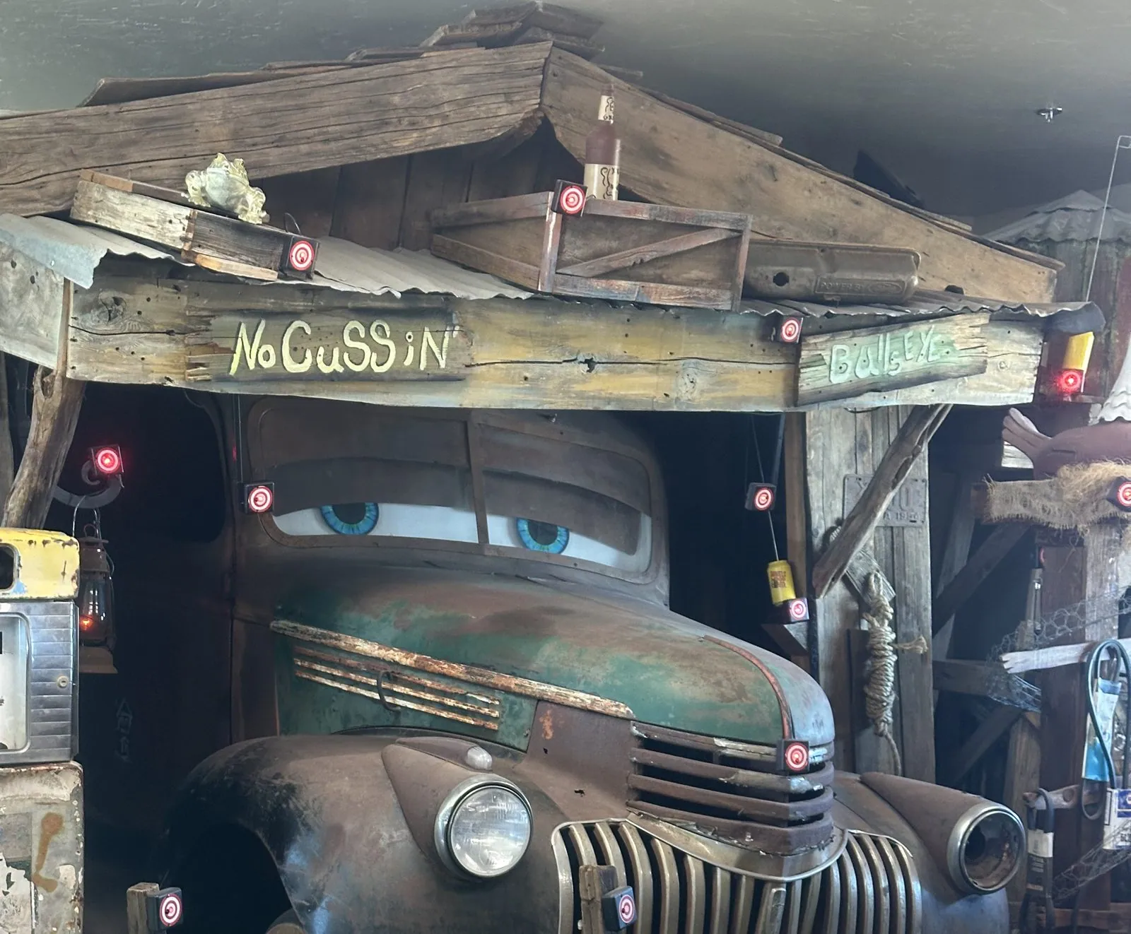
In the summer of 2026 I spent a few months working in Palo Alto, so for once the Bay Area was where I lived rather than a place we visited. For one week, June 14 to 21, my wife came up to stay. She drove up from Southern California on her own, with Wangcai in the back seat. Her camera roll shows one stop on the way, at 5:27 pm in Kettleman City: a roadside shop with an old green pickup parked indoors under a shed roof, given a pair of cartoon eyes and a sign that reads "No Cussin'".
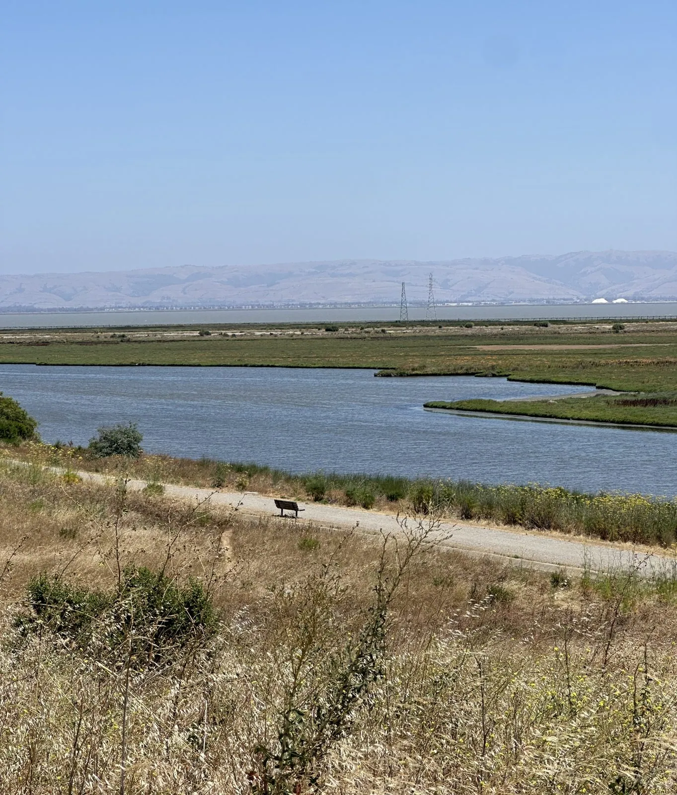
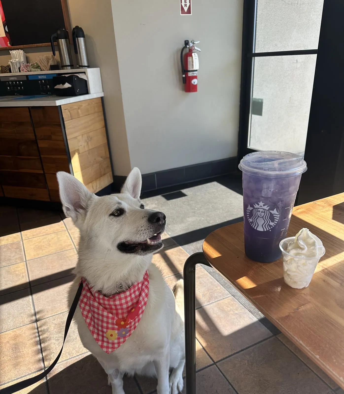
On the weekdays the two of them explored on their own. Monday began at a coffee shop near the Palo Alto Baylands, where Wangcai spent a long time staring out through the glass door. At 12:20 my wife was looking out over the Baylands themselves: dry grass, a gravel path, channels of water winding through the marsh, and the hills of the East Bay on the far side. On Tuesday morning the coffee was at a Starbucks, and Wangcai sat for her portrait in a red-checked bandana.
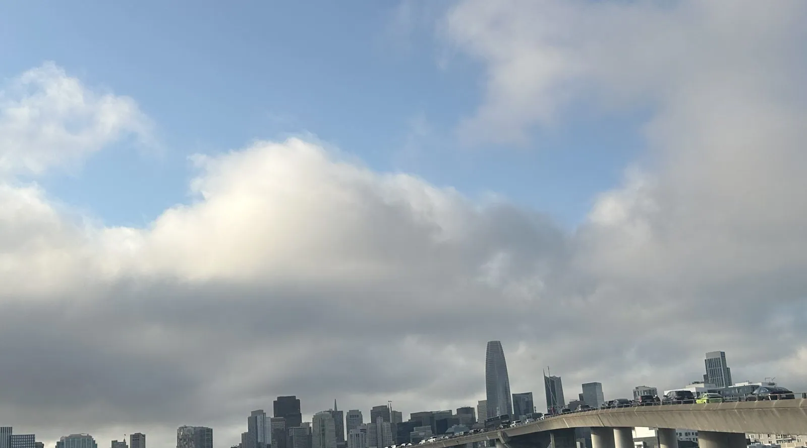
On Thursday evening, June 18, we drove up to San Francisco together for dinner. At 6:48 pm we were on the freeway coming into the city, with Salesforce Tower straight ahead under a sky full of big white clouds.
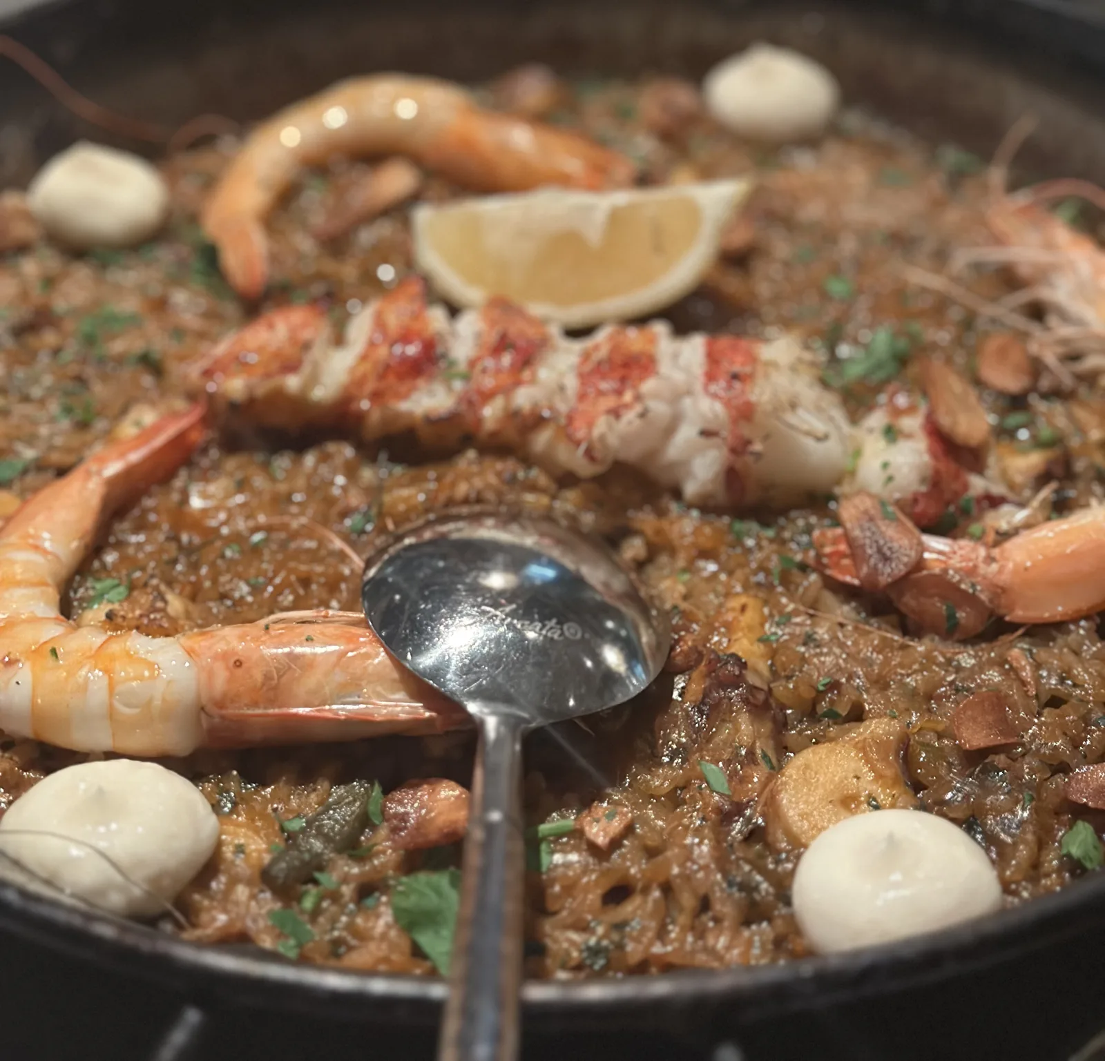
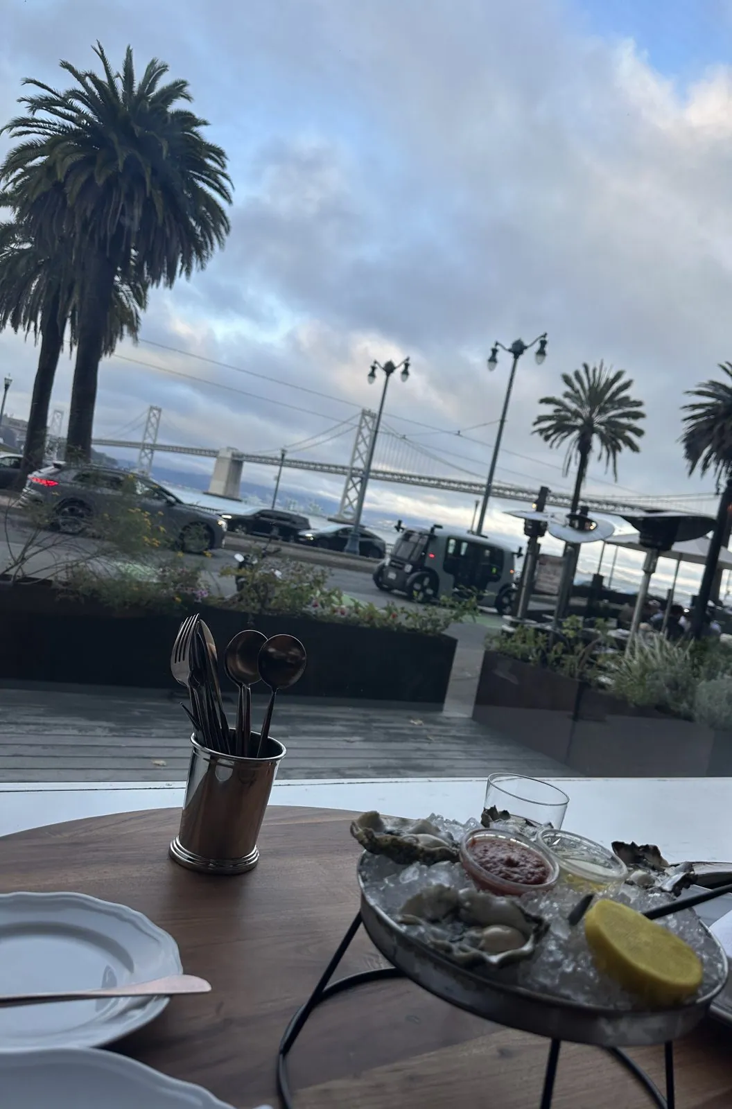
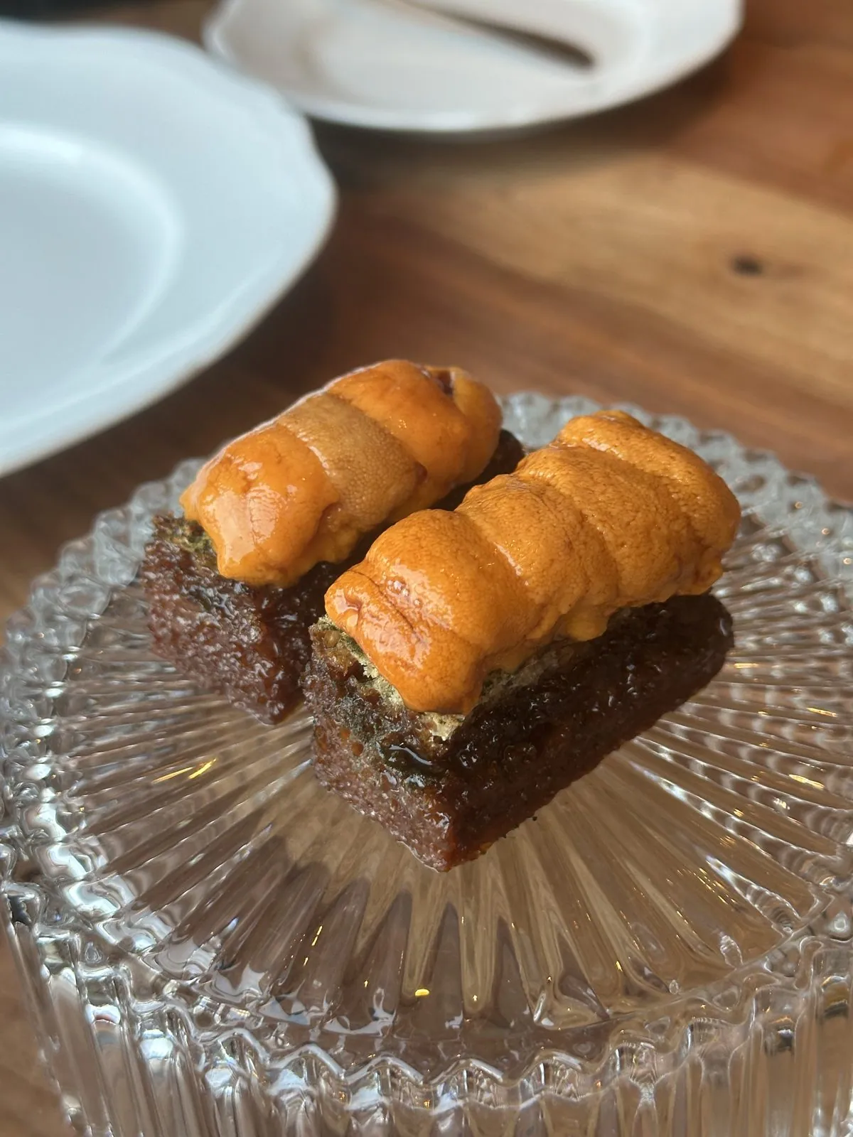
Dinner was at a restaurant on the Embarcadero, at a table by the window. Across the road, past a row of palm trees, the Bay Bridge ran out toward the East Bay. We started with oysters, and later came sea urchin on toast, scallops in their shells and a whole grilled fish. The meal ran from about seven until after nine, and by the end the sky over the bridge had gone dark blue.
On Saturday evening we went out for dinner at Zareen's, and on Sunday, June 21, my wife drove back south.
The city, then Santa Rosa: August 2026
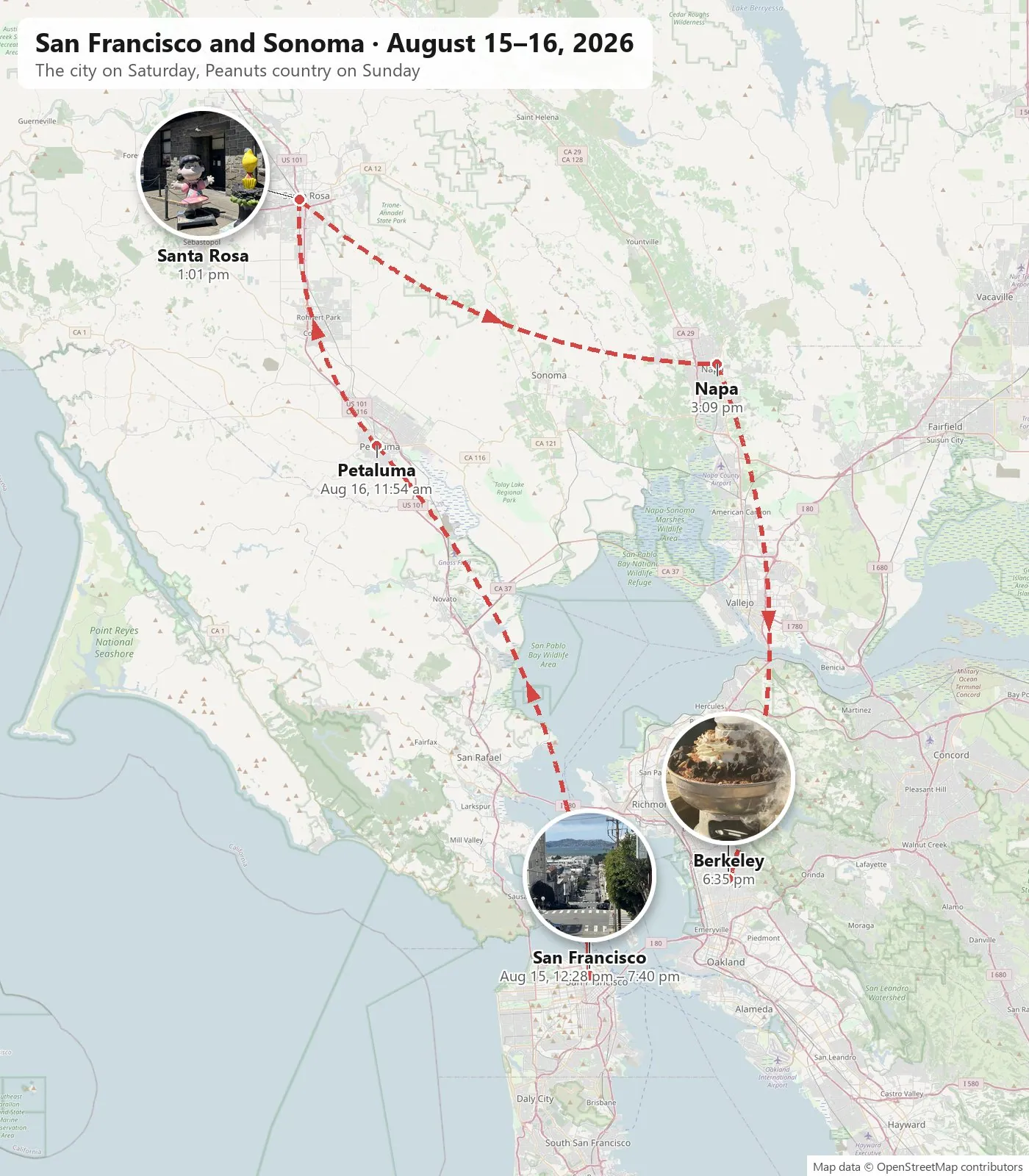
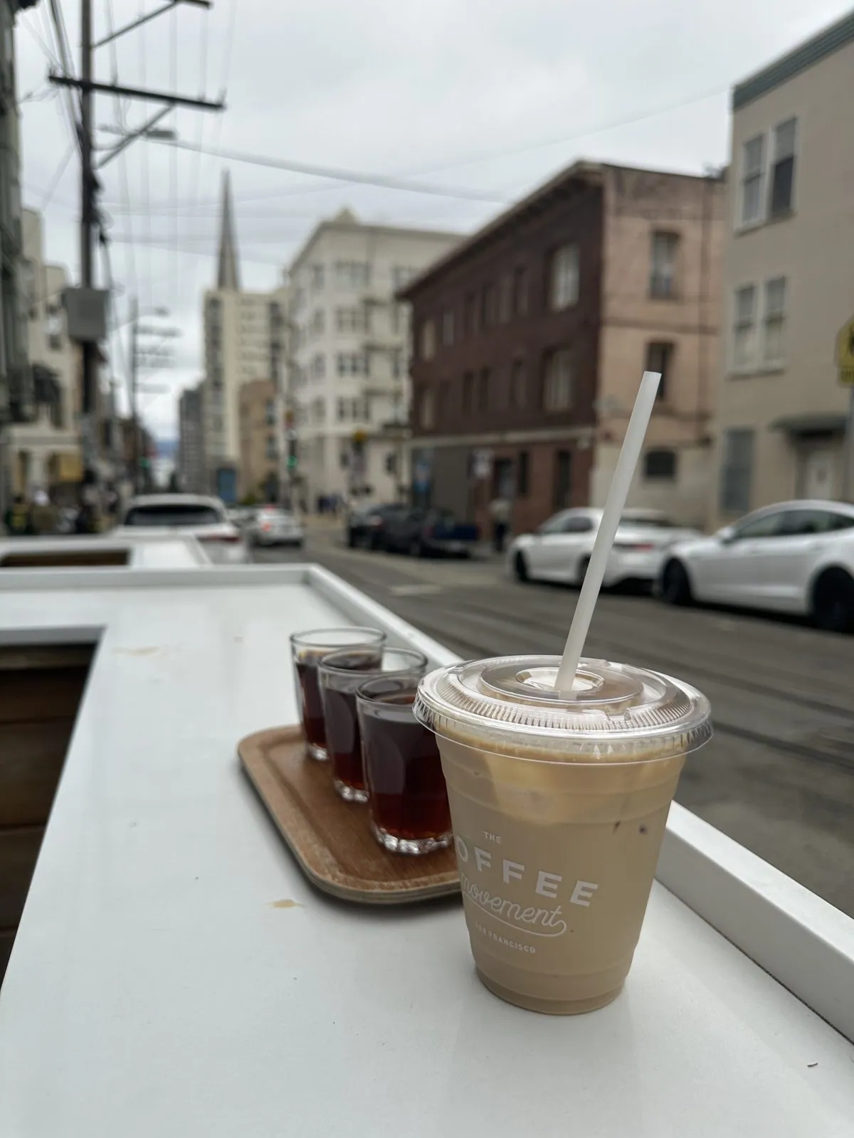
Two months later we spent a weekend in the city and north of it: San Francisco on Saturday, August 15, then Santa Rosa on Sunday, back by way of Napa and Berkeley. Wangcai came too. Saturday started with coffee at The Coffee Movement on Washington Street, at an outdoor counter looking down the hill: a tray of three small glasses and an iced coffee.
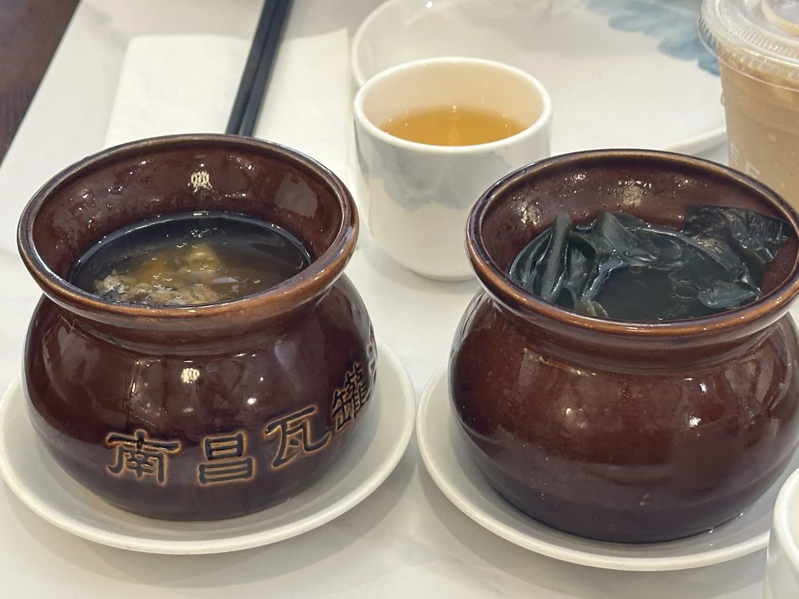
Lunch was a few blocks away in Chinatown, at a Jiangxi restaurant. The soups came in brown clay crocks stamped 南昌瓦罐, Nanchang crock soup, one with meat and one with seaweed. After them came a claypot braise, a stir-fry and a bowl of noodles in a milky broth.
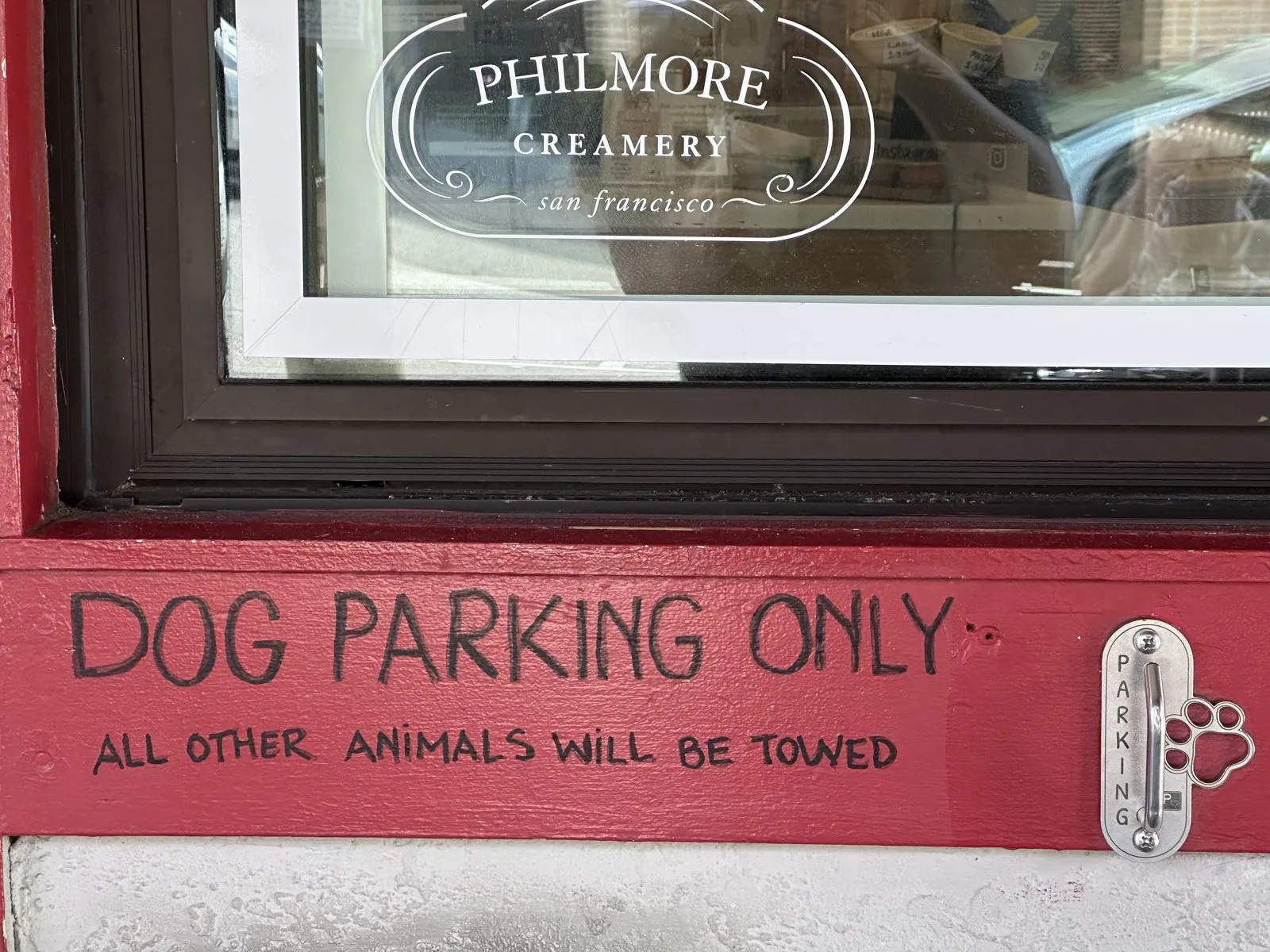
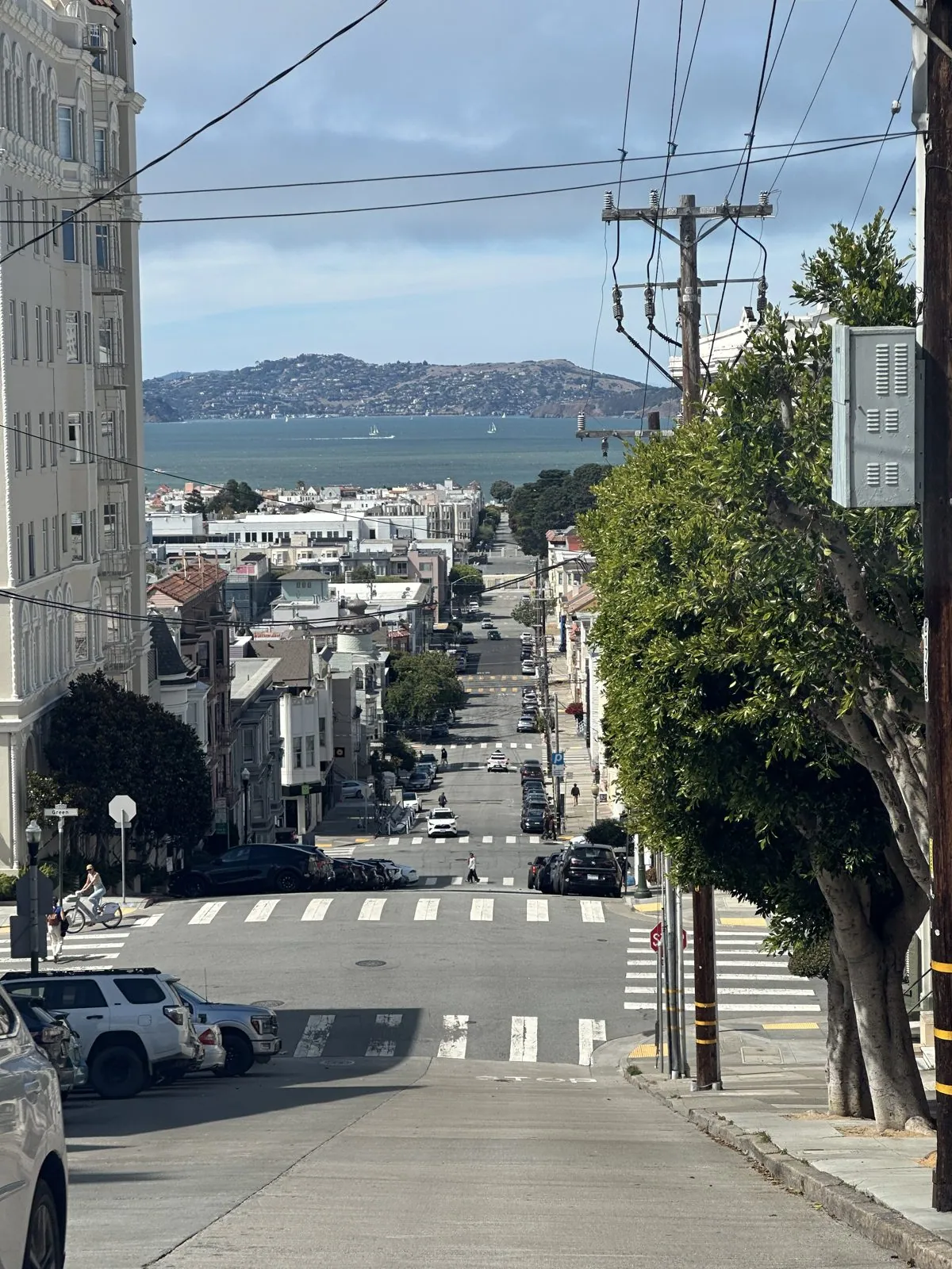
In the afternoon we had ice cream at Philmore Creamery on Fillmore Street, which has a sign under its front window: "Dog parking only. All other animals will be towed." Then we drove north over the hill. Where Fillmore Street crosses the crest of Pacific Heights, the road drops away so steeply that the whole street below, the bay and the hills on the far side line up in one view.
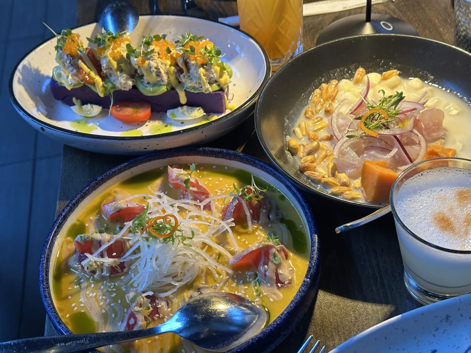
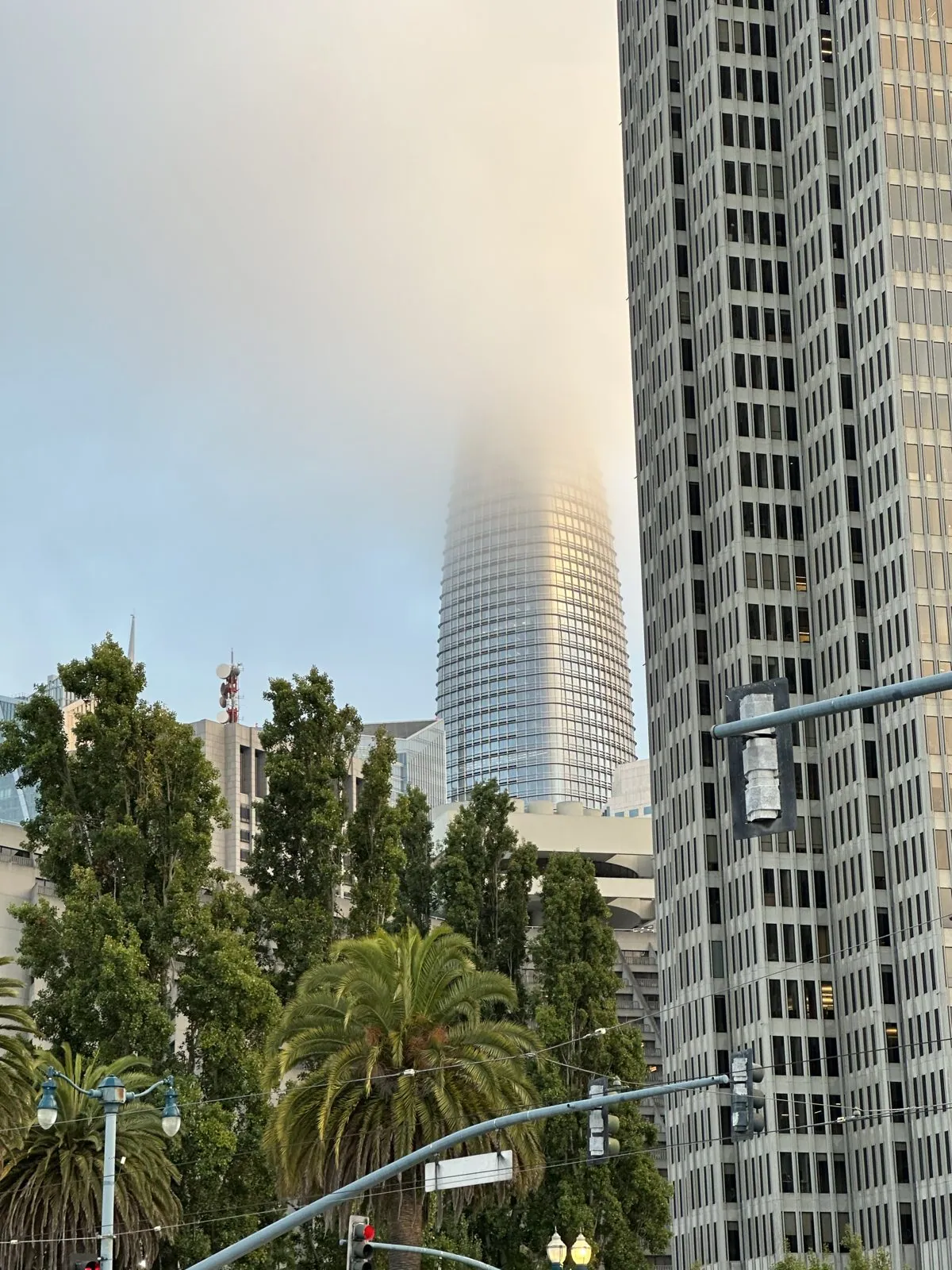
Dinner was Peruvian, at La Mar on the Embarcadero, a short walk up the waterfront from where we had eaten in June. There were pisco sours, two ceviches, a causa of purple potato topped with crab, and later grilled octopus. When we left at 7:40, the fog had come in over downtown, and the top of Salesforce Tower had disappeared into it.
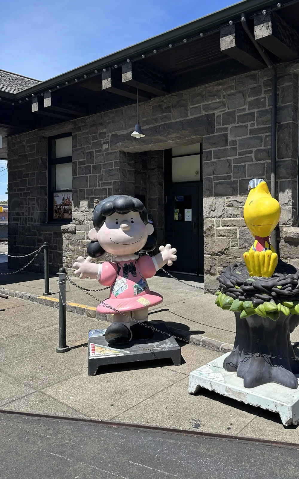
On Sunday we drove north. We were in downtown Petaluma just before noon and in Santa Rosa by one. Santa Rosa was Charles Schulz's home. Outside the old stone railroad depot in Railroad Square, Lucy stood with her arms wide open in a pink dress, next to Woodstock perched on top of his nest.
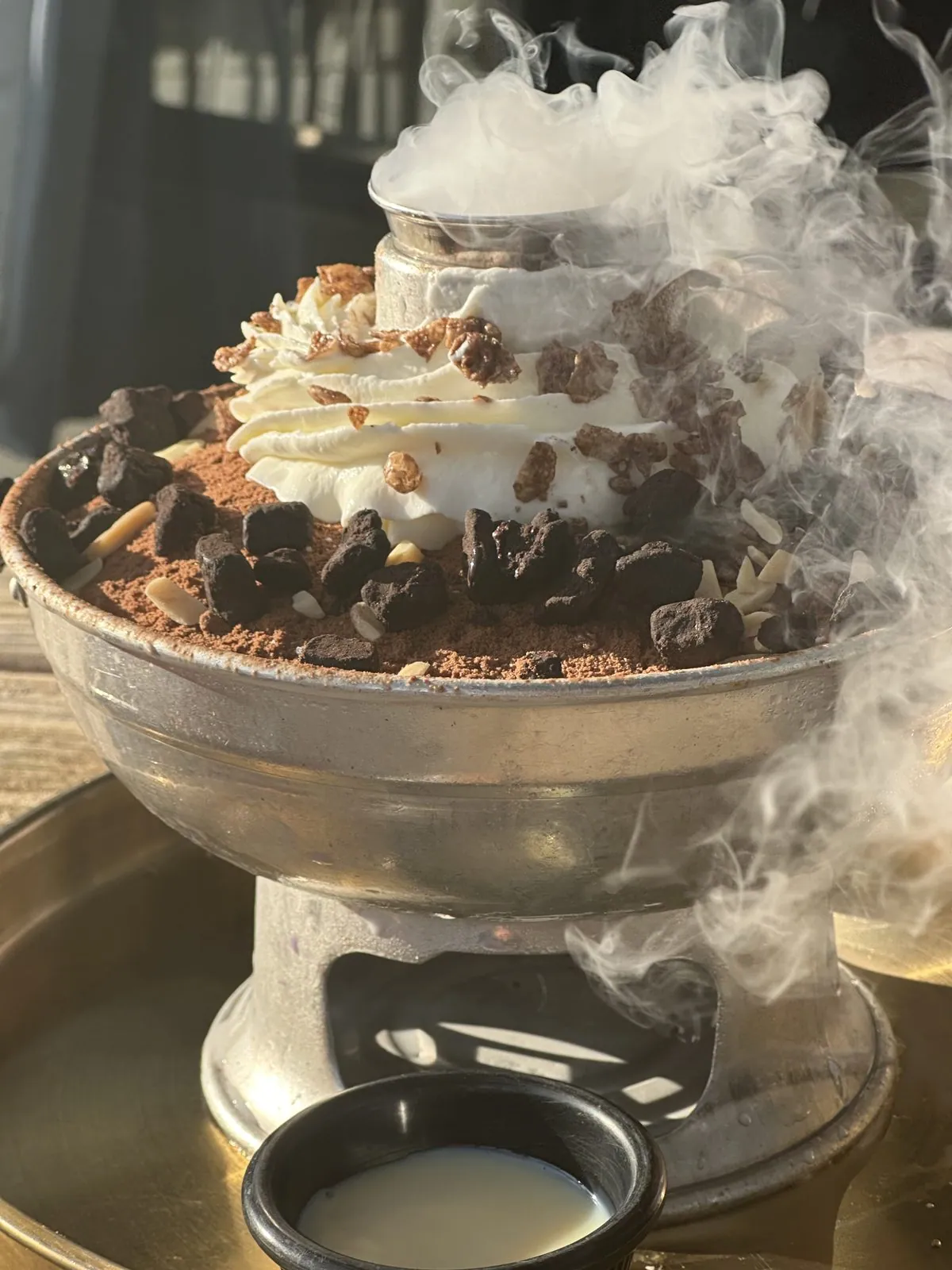
From Santa Rosa we crossed over to Napa for a hot dog at three, and then drove south into the East Bay. In Berkeley, at 6:35, dessert came to the table smoking: a tall bowl of cream and chocolate on a metal stand, with dry-ice fog pouring over its sides, and a slice of crêpe cake next to it. We were back in the South Bay that night.
Santa Cruz and Carmel: August 2026
At the end of the summer, a trip to Sacramento and Lake Tahoe ended by crossing to the coast for Santa Cruz and Carmel-by-the-Sea, a few miles from where we had watched the seals on 17-Mile Drive. That story is in Two Capitols and a Very Clear Lake.
Why we keep coming back
Put the seven visits side by side and a pattern appears. I have arrived by plane at dusk, and we have arrived by car at night. We have seen the Golden Gate from the Presidio cliffs and from the middle of the bay, and the whole city from Twin Peaks, once in the early evening in 2022 and again at night. We have been to the same castle twice, in May and in November, walked the same Capitola street a year apart, and eaten on the Embarcadero twice in one summer. None of these trips was planned as a return visit. They just kept happening, because the Bay Area is on the way to everything we like: wine country to the north, the coast to the south, Oregon beyond.
There is still a long list of things we haven't done. We haven't seen the Lone Cypress properly, crossed to Alcatraz, or spent an unhurried day in Napa without a long drive at either end. That is fine. At this rate we will be back soon.
Maps built from the photos' timestamps and locations. Photo locations have been removed from the published images. Maps: map data © OpenStreetMap contributors; each stop is placed where its photo was taken, places we stayed and home are never marked, and the dashed lines show the order of stops, not the exact roads.
Some photos in this post are my wife's.
Likes and comments
React with an emoji or leave a comment. Signing in with GitHub is required.