← Misc · November–December 2025
Thanksgiving, the Long Way Round
Five days from Southern California up to Portland and back down to Napa, with Wangcai in the back seat.
Southern California → the San Francisco Peninsula → I-5 overnight → Klamath Falls → Crater Lake → Bend → Tamolitch Falls → Mt. Hood → Portland → North Bend → Bandon → the Curry County coast → Napa
Two states · one caldera lake under fresh snow · one hot pot dinner in Bend · Mt. Hood twice in one day · a coastline of sea stacks · one rainbow on the dashboard · one cream-colored dog
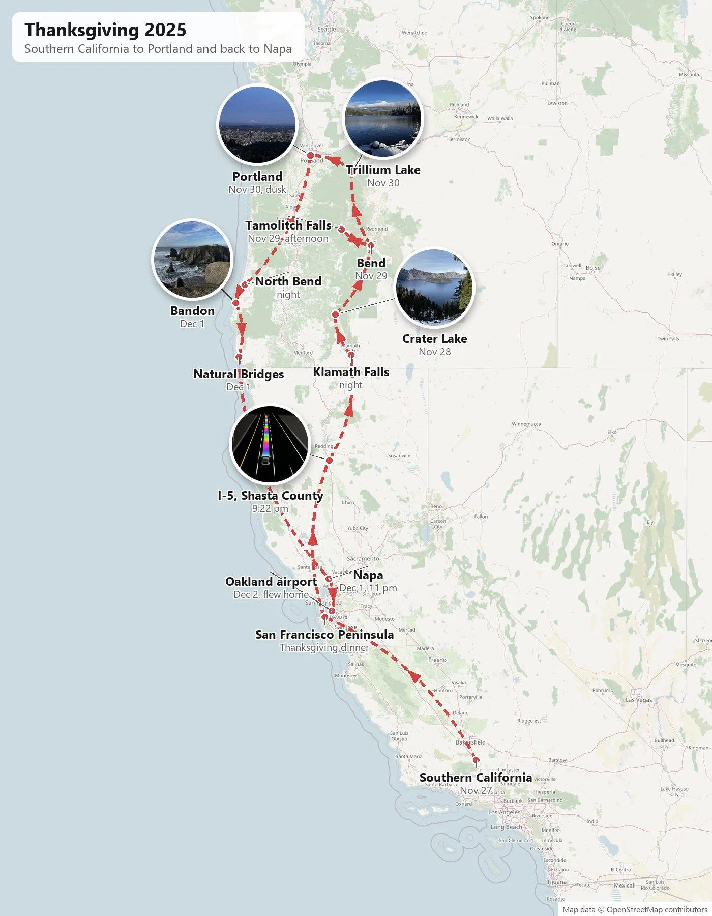
Many of our long weekends end up in the car, and this one was a particularly long one. Thanksgiving gave us four days and a Monday, and we spent them driving from Southern California all the way up to Portland, Oregon, and then most of the way back, as far as Napa. That is the length of California and the length of Oregon, up the inland side and back down the coast. In between came a volcano's crater full of the bluest water in the country, a mountain lake dusted with the season's snow, a city at dusk with a volcano on its horizon, and a morning of sea stacks on the southern Oregon coast.
As with the other trip posts here, everything below is rebuilt from the camera roll, where each photo carries a time and a place. My own album is a small one, under sixty pictures for five days, and it is lopsided. Some hours got a dozen photos, and one whole day got none. My wife's camera roll fills in most of the gaps. Where a place has a story worth knowing, I've added a little of it.
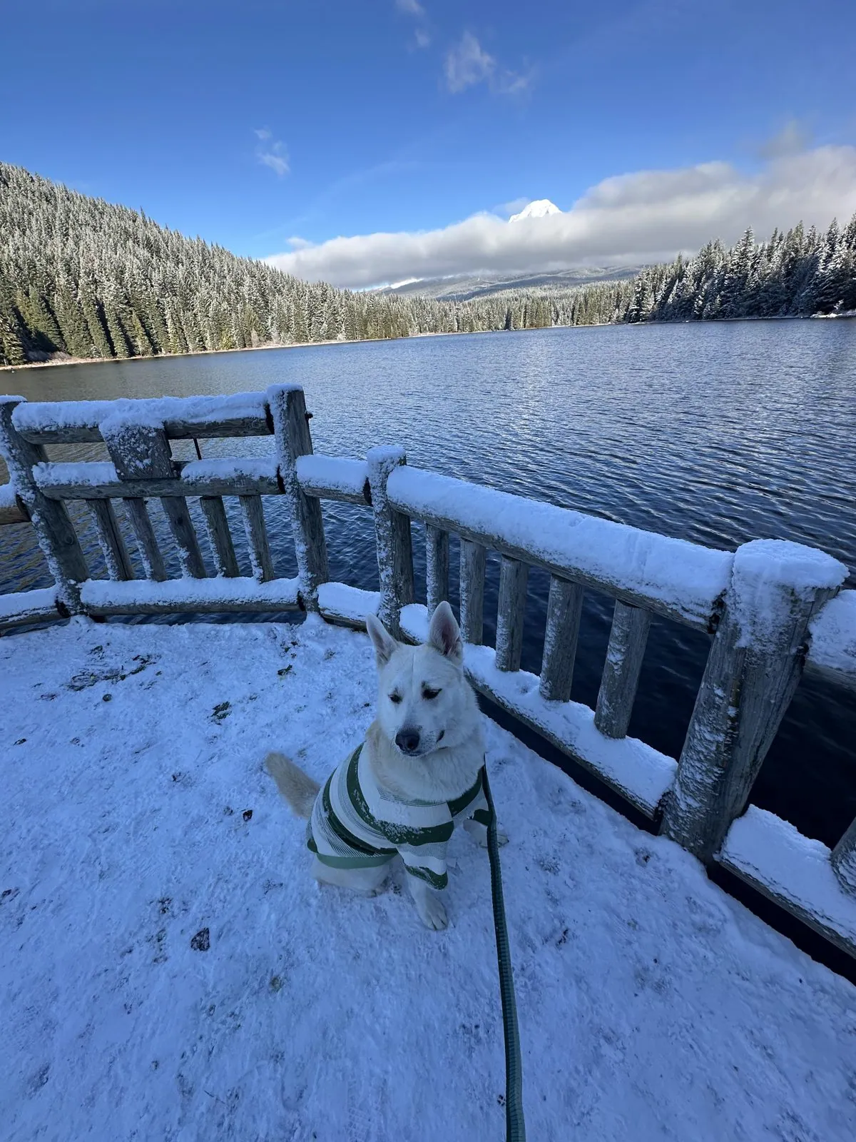
The trip also had a passenger in the back seat: Wangcai, our cream-colored dog, who came home with us in January 2025 and has since become a regular on these drives. She rode the whole loop, there and back. She appears below on the rim of Crater Lake, on the snowy shore of Trillium Lake, at an overlook in Bandon, and again at the very end, asleep, which is the most accurate review of the trip anyone could write.
Day 1: Thanksgiving on I-5
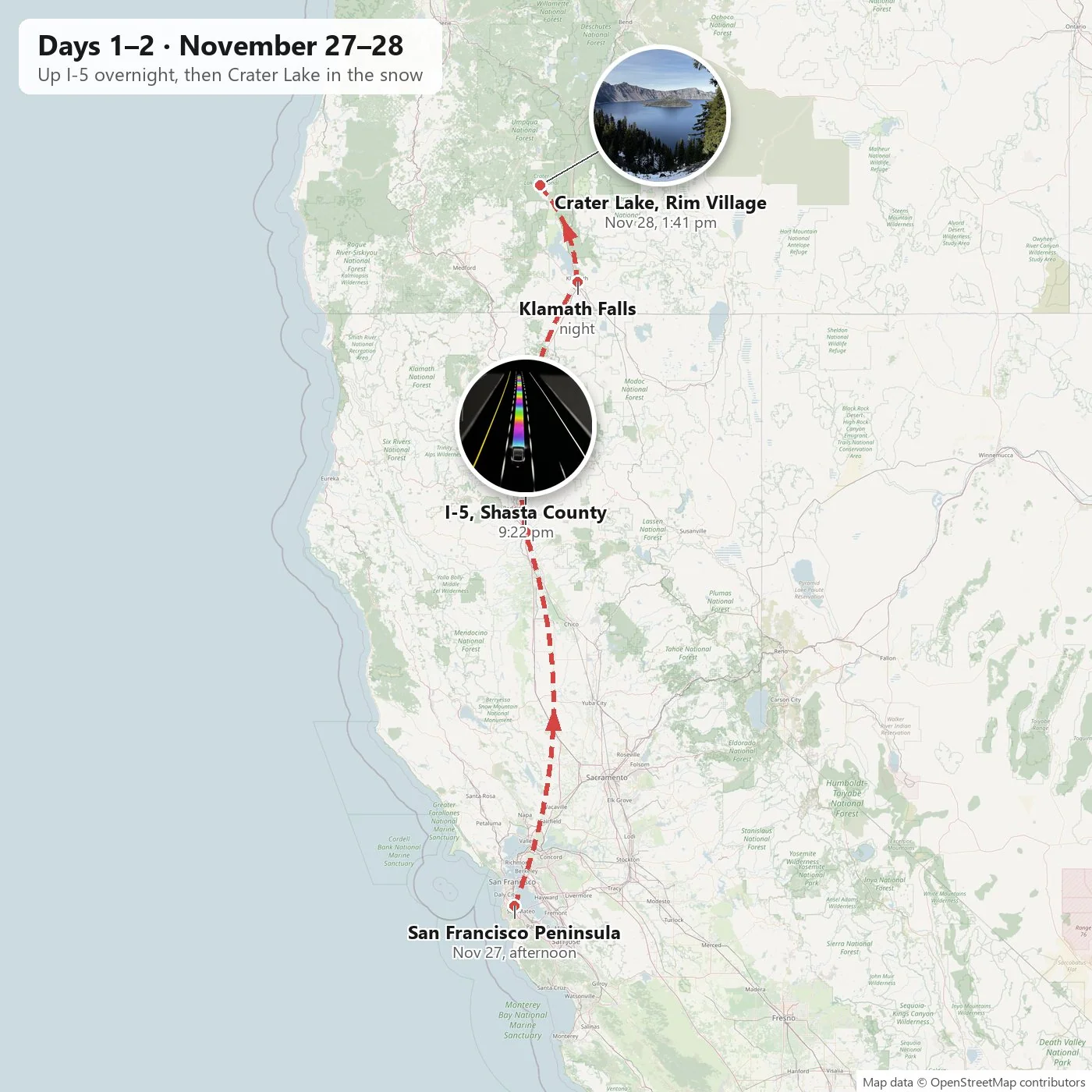
We set out on Thanksgiving Day itself, November 27, and the first leg was the long, flat one. Thanksgiving dinner was in the late afternoon at Hubei Restaurant in Millbrae, on the San Francisco Peninsula, which cooks the food of my hometown, Wuhan, the real thing rather than a version of it. A plate of home on the way out of town is about as good a Thanksgiving as I can think of. Then we turned north. From the Bay Area, I-5 runs for hours up the Sacramento Valley, past orchards and rice fields that are invisible after dark, until the valley narrows at Redding and the road starts to climb toward Mount Shasta and the Oregon line.
A rainbow on the dashboard
The only photos from that stretch were taken just south of Redding, near Cottonwood, at 9:22 at night. They are not of the road but of the car's screen. Tesla hides a few jokes in its software, and one of them is the "Rainbow Road", a nod to the famous final track in Mario Kart: the path the car plans for itself down the lane is drawn not in the usual blue but as a glowing rainbow stripe. On a dark, nearly empty interstate on Thanksgiving night, with nothing outside the windows but the occasional pair of taillights, it was the most colorful thing for a hundred miles.

Stars over the Klamath Basin
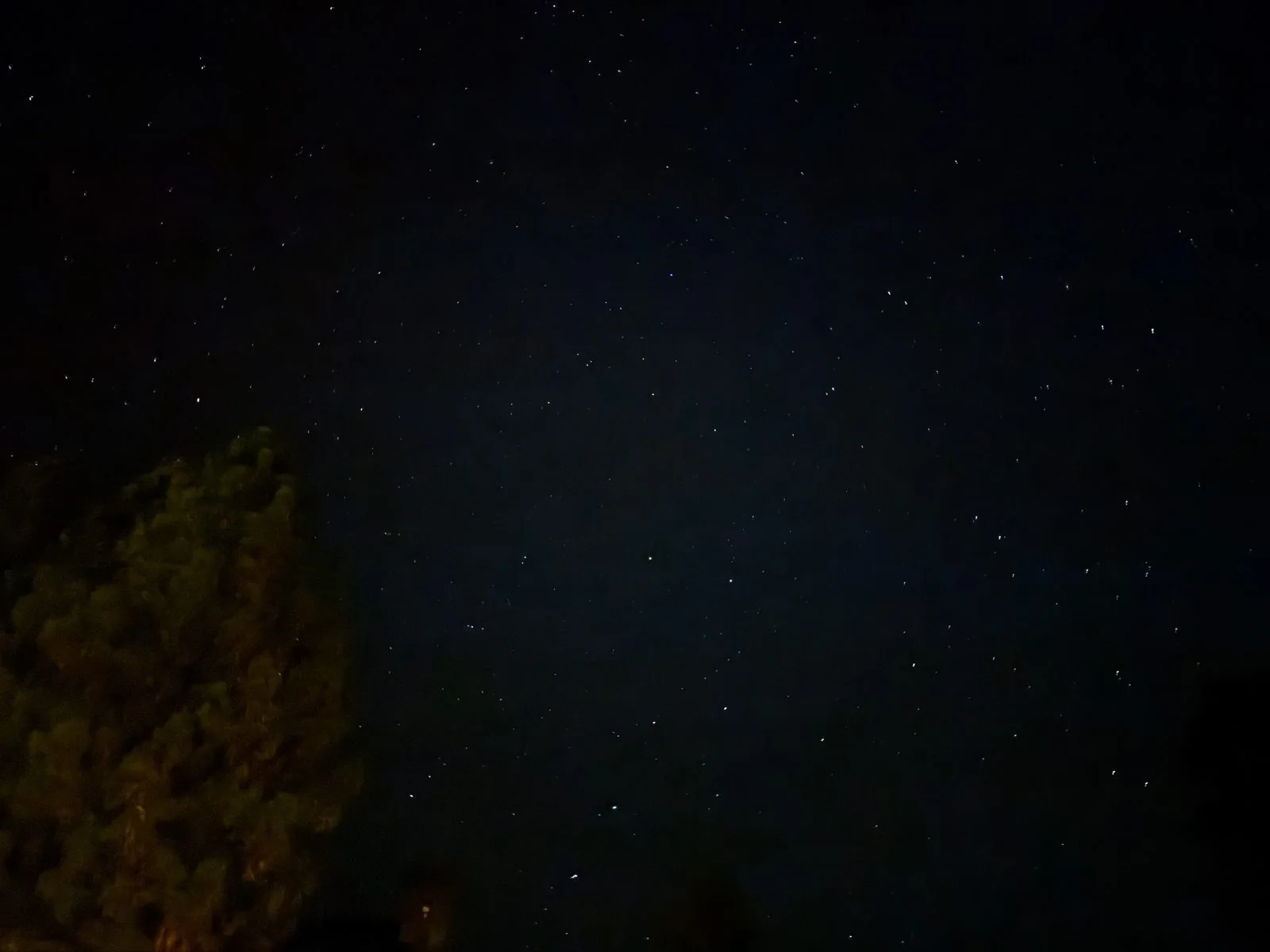
A little after midnight we were across the state line and just outside Klamath Falls, Oregon. The Klamath Basin sits at over four thousand feet on the dry, eastern side of the Cascades, a wide country of marshes, lakes and ranchland with very few lights in it, and on a clear late-November night the sky there is full. Between midnight and one in the morning, the camera roll holds a run of ten photos pointed straight up: black pines at the edge of the frame and stars scattered across the rest. After a long night of interstate, it was a good way to end the day.
Day 2: Crater Lake in the snow
From Klamath Falls it is about an hour north to Crater Lake National Park, and by 1:40 in the afternoon we were standing at the rim. In winter most of the park closes. The road that circles the rim is left to the snow, and the only way in is the south entrance, which is plowed up to Rim Village, at about 7,100 feet. That turns out to be enough. From the promenade at Rim Village, the whole lake opens up below you at once, and there is no warming up to it: one step you are in the trees, and the next you are looking straight down into the crater.
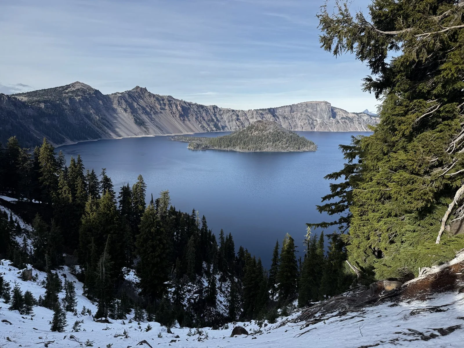
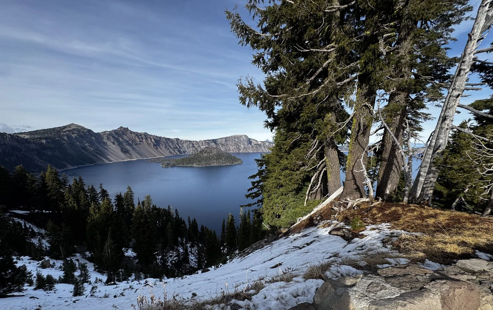
The lake is the remains of a mountain. About 7,700 years ago, a volcano called Mount Mazama erupted so violently that it emptied the chamber beneath it, and the summit collapsed into the hole. Over the centuries that followed, rain and snow filled the bowl. No river flows in and none flows out, which is why the water is so clear and why its blue is unlike any other lake's. It is also the deepest lake in the United States, at 1,943 feet. Out in the water sits Wizard Island, a younger cinder cone that grew up inside the crater after the collapse, its top still dented with a small crater of its own.
The park is one of the snowiest inhabited places in the country, averaging over forty feet a year, and the season was just getting started. A thin, fresh layer covered the slopes below the rim and the rocks along the wall, with dry grass still poking through. The sky was a clean, pale blue, and the far walls of the crater stood out sharp and gray, streaked with the first white of winter. The mountain hemlocks at the edge lean out over the drop as if they were looking too.
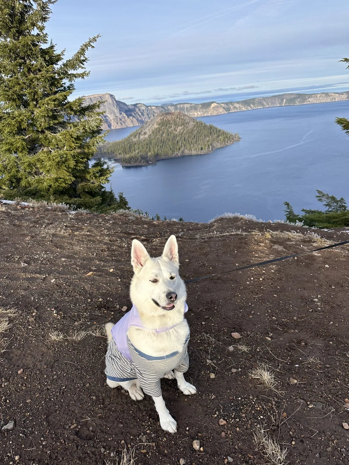
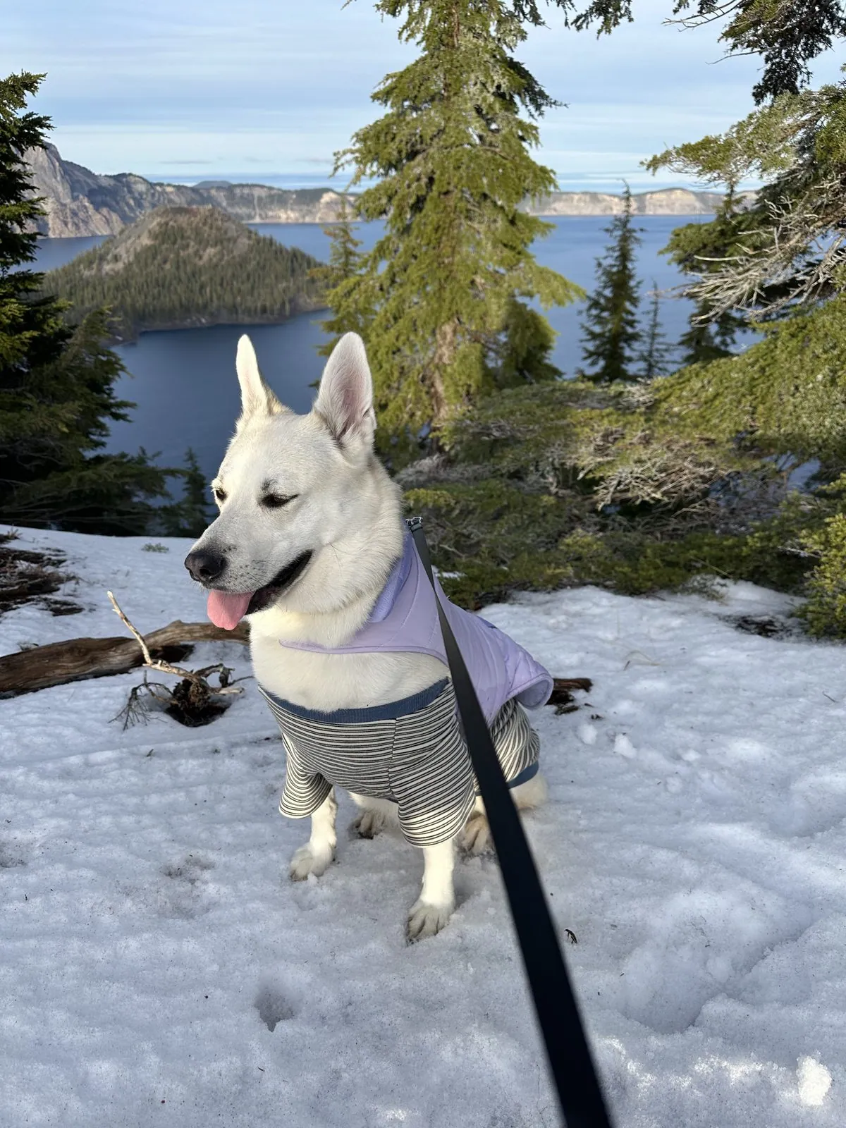
We stayed at the rim for about two hours. West of Rim Village the road around the lake is closed in winter, and Wangcai got to walk down the middle of it, between the snowbanks. From the rim we drove north to Bend, in time for a late dinner in town.
Day 3: Bend, and the Blue Pool
Saturday, the 29th, left no photos on my phone, but my wife's camera roll covers it. We spent it in Bend, the high-desert town on the dry side of the Cascades, where the Deschutes River runs through the middle of town and the ponderosa pines give way to sagebrush a few miles east. In the late morning we wandered a shopping village on the edge of town, with an REI, a Lululemon and a bakery, the kind of slow, aimless browsing that a long drive makes you crave. The REI, that morning, had two llamas in it, in festive harnesses, with a handler among the shoppers.
Then I got a migraine, and the afternoon went on without me. The others drove west into the mountains to Tamolitch Falls, on the McKenzie River, for a hike, while I lay back in the car and waited for it to pass. The name is a little misleading: most of the year there is no waterfall there at all. The McKenzie disappears underground a few miles upstream, into the porous rock of an old lava flow, and comes back up through the bottom of a rock basin, so cold and clear that the pool it fills is an almost unreal turquoise. Everyone calls it the Blue Pool. I have only their word, and my wife's photo, for the color.
The sign at the trailhead gives the hike as 3.9 miles round trip. The trail follows the McKenzie upstream through old mossy forest, and my wife and Wangcai reached the rim of the pool a little after three.
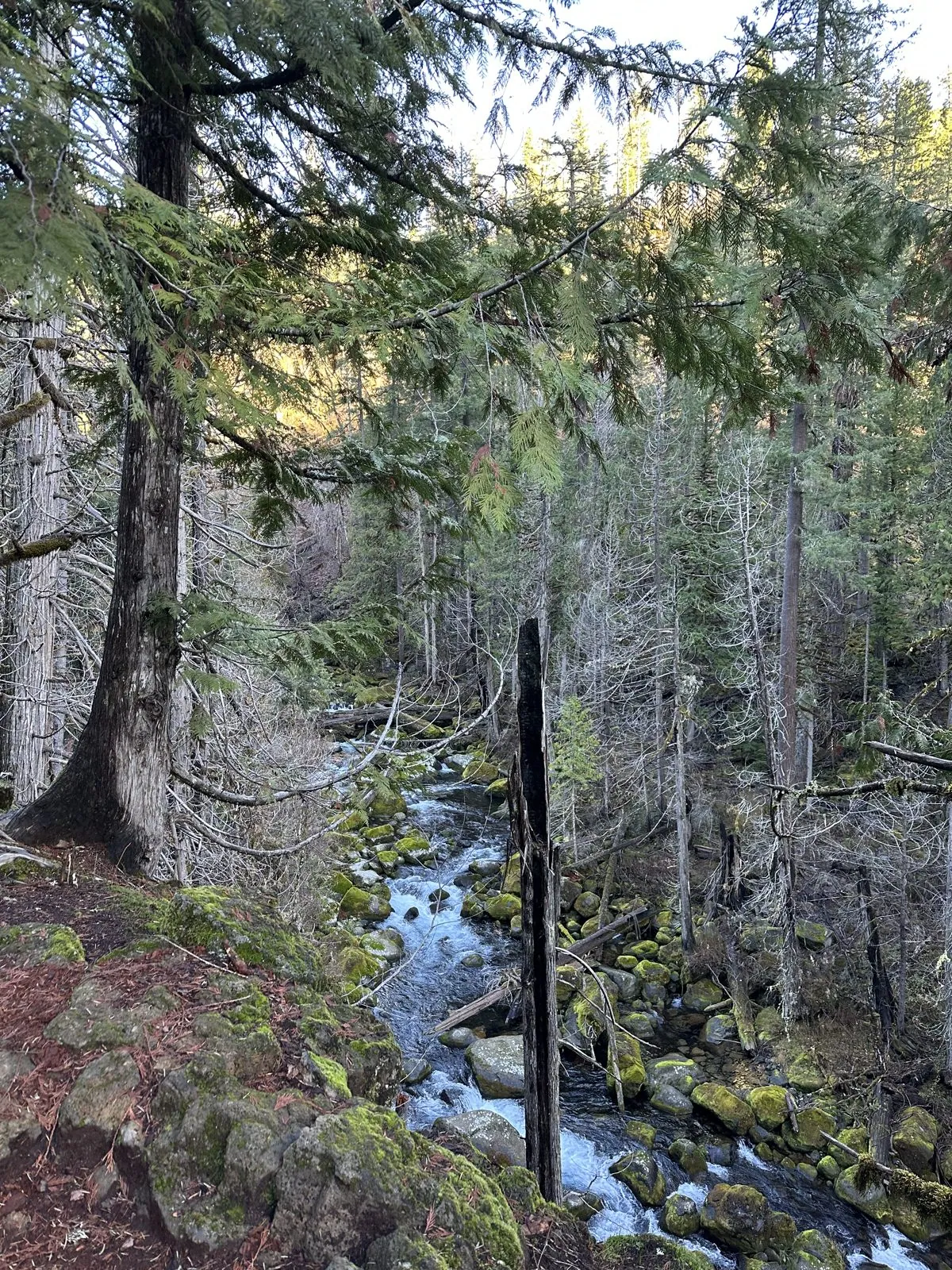
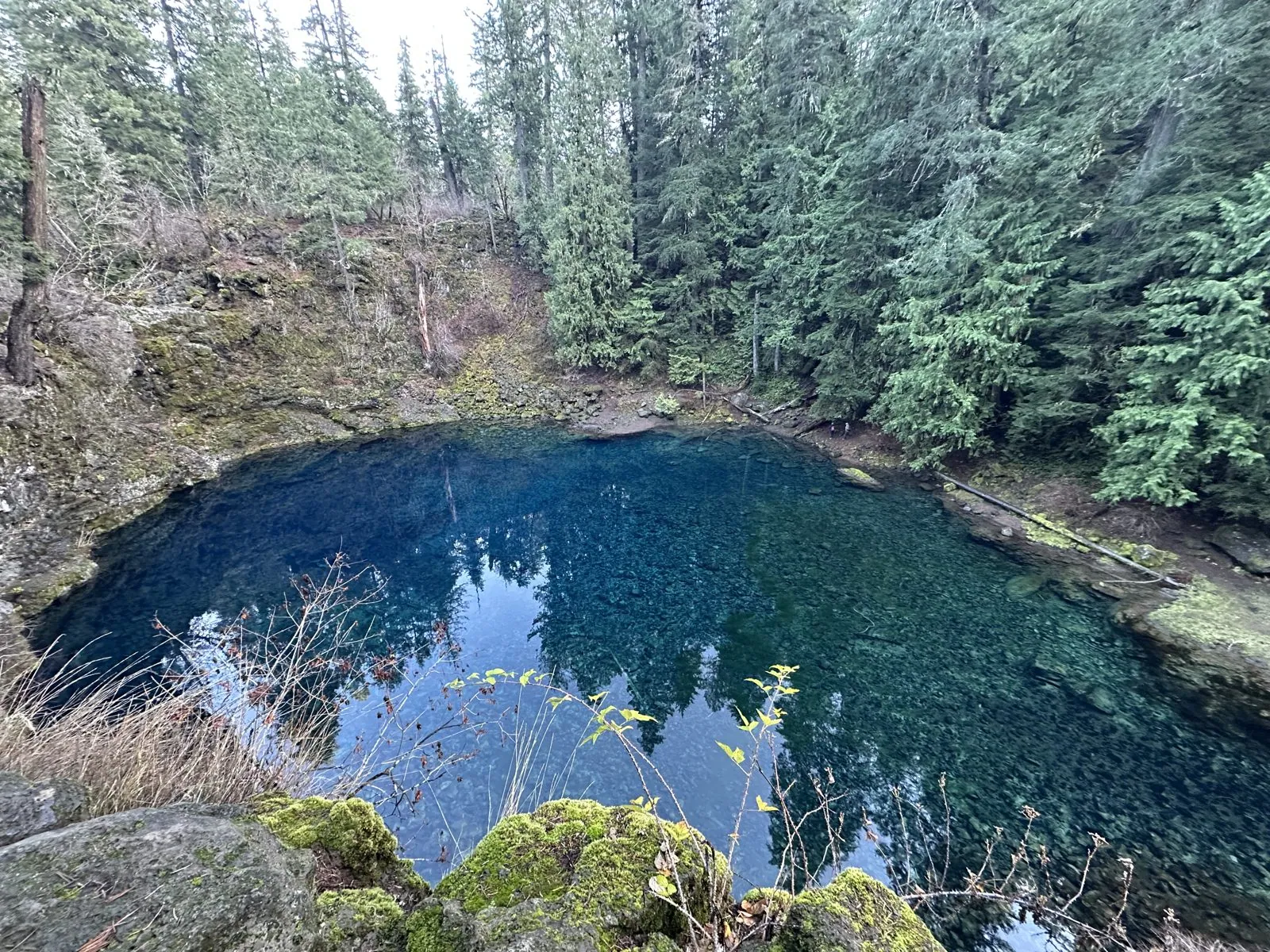
By the time they came back down the trail, my head had cleared. We drove back to Bend for dinner at Sen Hot Pot, which on a cold late-November night in the mountains was exactly right, and then back to the hotel.
Day 4: Mt. Hood and Portland
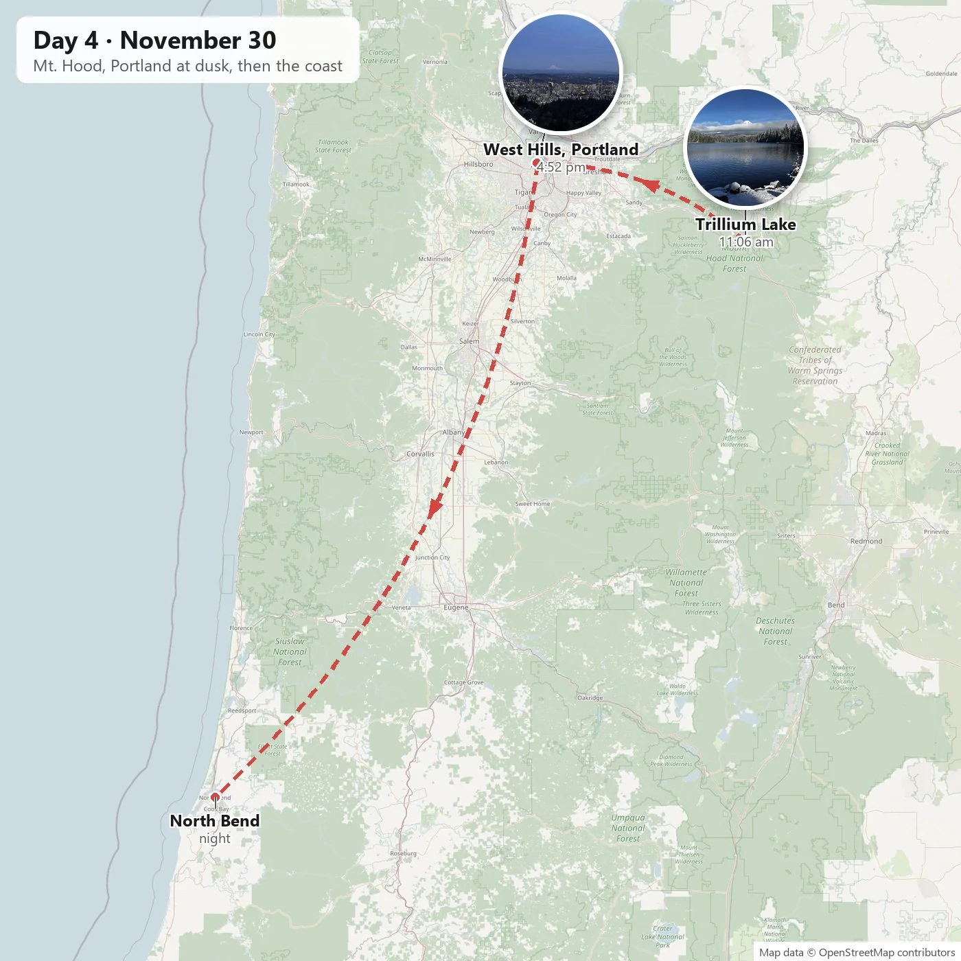
Trillium Lake
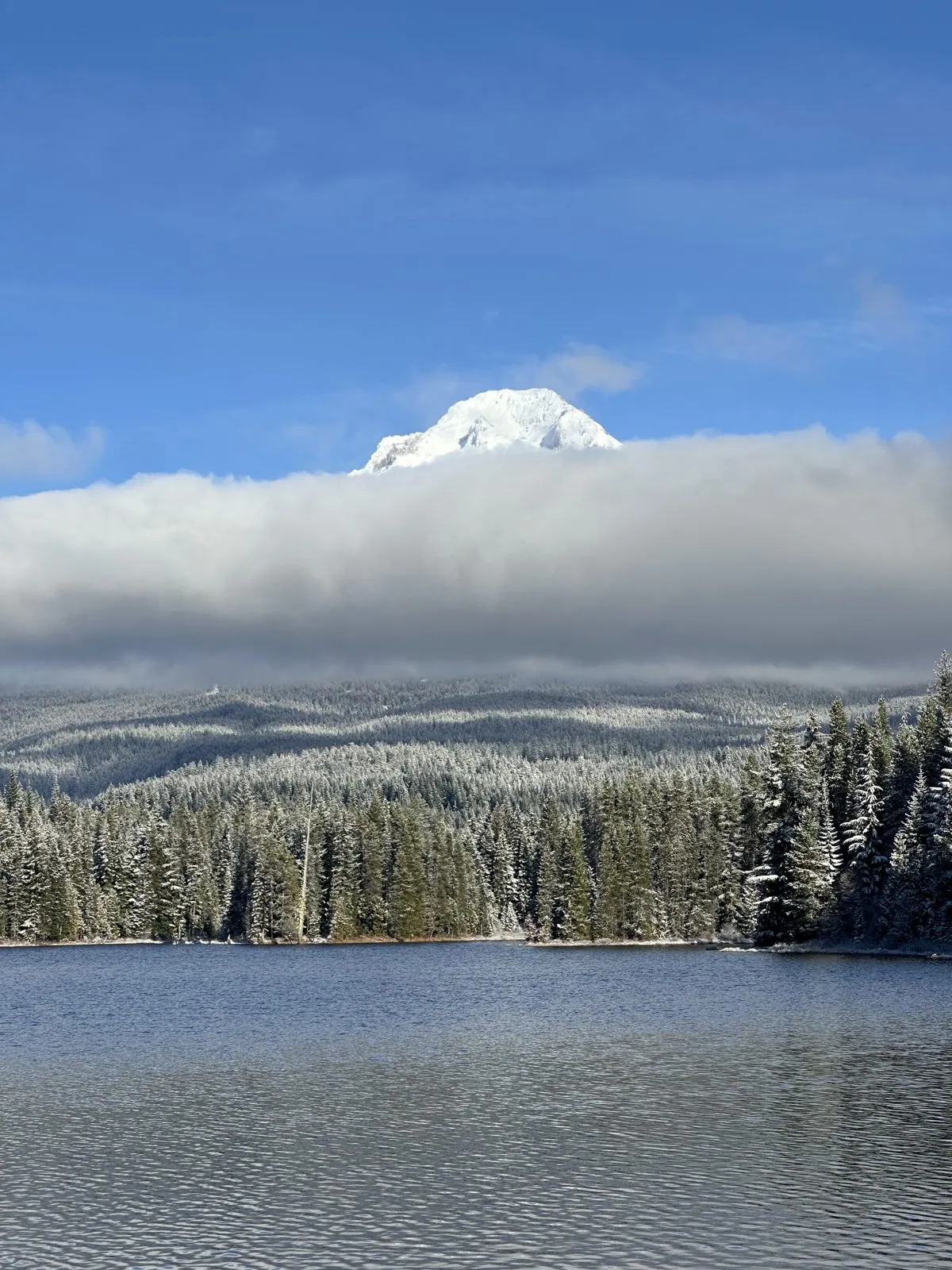
Sunday morning found us at Trillium Lake, on the south side of Mt. Hood. It is a small lake, made in 1960 by damming a creek in a high meadow, and it is famous for one view: the mountain rising straight up over the far shore and reflected, on still days, in the water. It was snowing when we got there, which at this latitude at the end of November is no surprise. The snow was deep enough that we had a hard time getting the car close to the lake to park. Portland, an hour and a half away, sits at about 45.5° north, farther north than Portland, Maine, at about 43.7°; the West Coast's mild weather makes it easy to forget how far up the map you are. By eleven every rock on the shore wore a clean white cap, every fir along the far bank was frosted, and a band of cloud lay across the mountain's flanks so that only the summit showed above it.
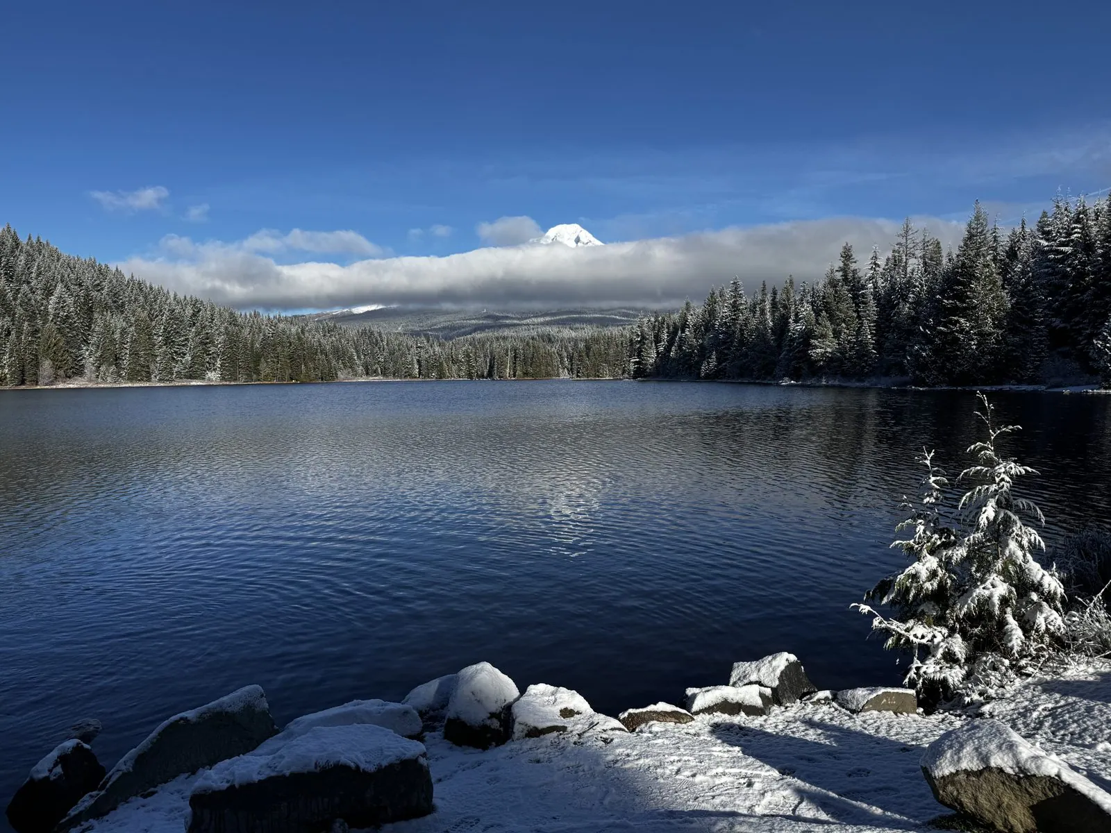
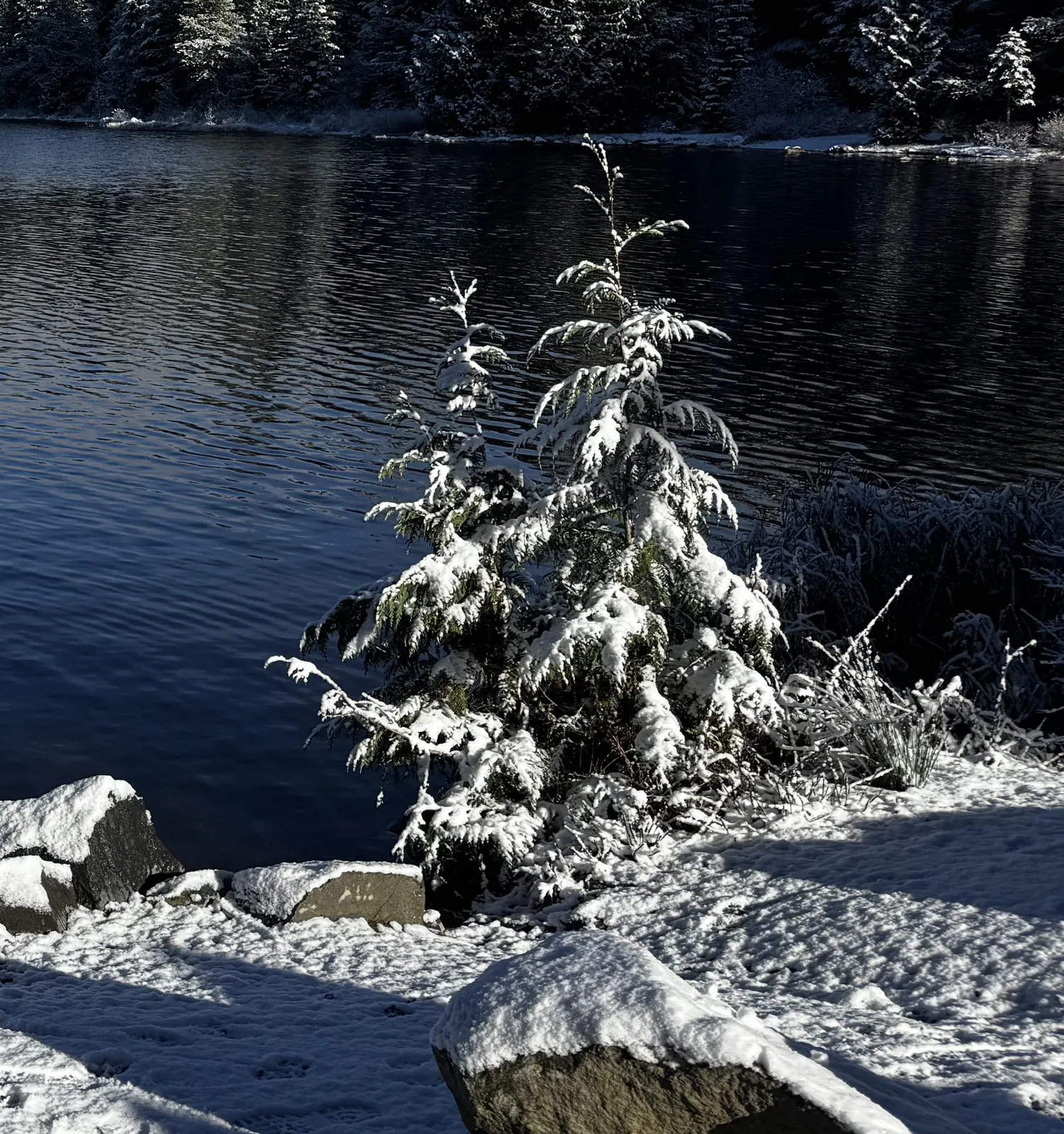
The water was not quite still enough for the famous reflection, a light breeze ruffling it into dark blue ripples, but the morning made up for it in other ways. The light was low and bright, the sky a deep cold blue, and the snow on the shore so new that it still showed every track across it, paw prints included. A young fir right at the water's edge had caught more snow than it could hold and bent under it like a Christmas card. Mt. Hood itself, at 11,249 feet the tallest mountain in Oregon, stayed half hidden all morning, which is what it usually does.
Portland from the West Hills
We spent the early afternoon downtown, lunch, coffee and a little shopping, and by late afternoon we were high in the West Hills, on a road just below Pittock Mansion. The mansion was built in 1914 for Henry Pittock, the publisher of The Oregonian, and he picked the site for this view: about a thousand feet above the city, looking east over downtown, the river and the suburbs to the Cascades beyond. It was 4:51, twenty minutes after sunset, and the light was almost gone from the city.
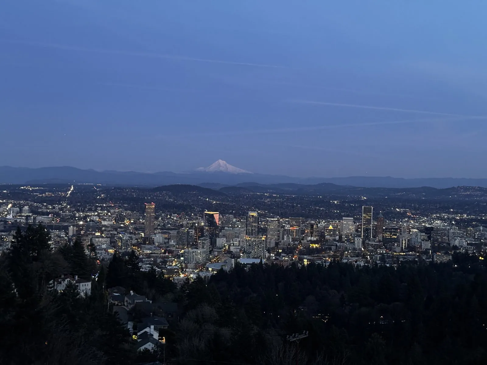
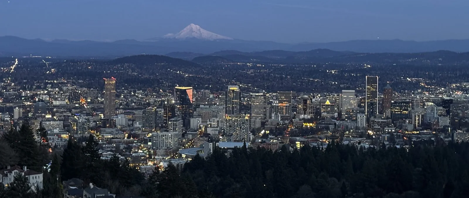
It was not gone from the mountain. Mt. Hood is about fifty miles east of downtown, and from up here it sits exactly on the horizon, a white cone over a line of blue hills. At that hour it was the last thing still catching the sun, glowing a faint pink while the city below turned blue and the office towers lit up one window at a time. That was the second time we had seen the same mountain that day: in the morning from its foot, half buried in cloud, and in the evening from fifty miles away, perfectly clear. Then it was back down into the city, past Powell's Books, for souvenirs and a late burger before we finally turned south, arriving on the coast long after dark.

Day 5: Down the south coast
Morning on Coos Bay
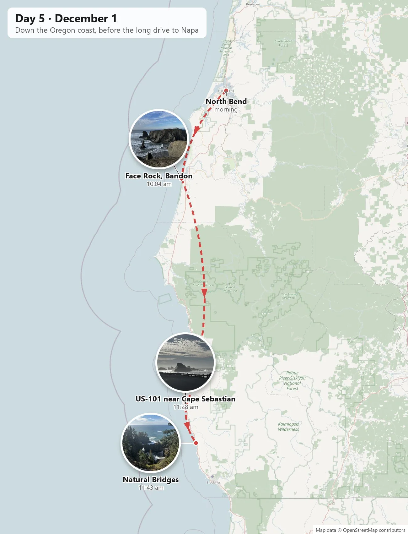
We woke up in North Bend, on Coos Bay, which is the largest deep-water harbor on the coast between San Francisco Bay and Puget Sound, and has been shipping Oregon's timber out to the world for a century and a half. The town sits on a hill above the bay. At ten to eight the sun was just up behind us, and the view west over the rooftops was the whole bay at once: wide tidal water going silver, the low forested ridge of the North Spit beyond it, and, past that, the dunes that run north along this coast for forty miles.
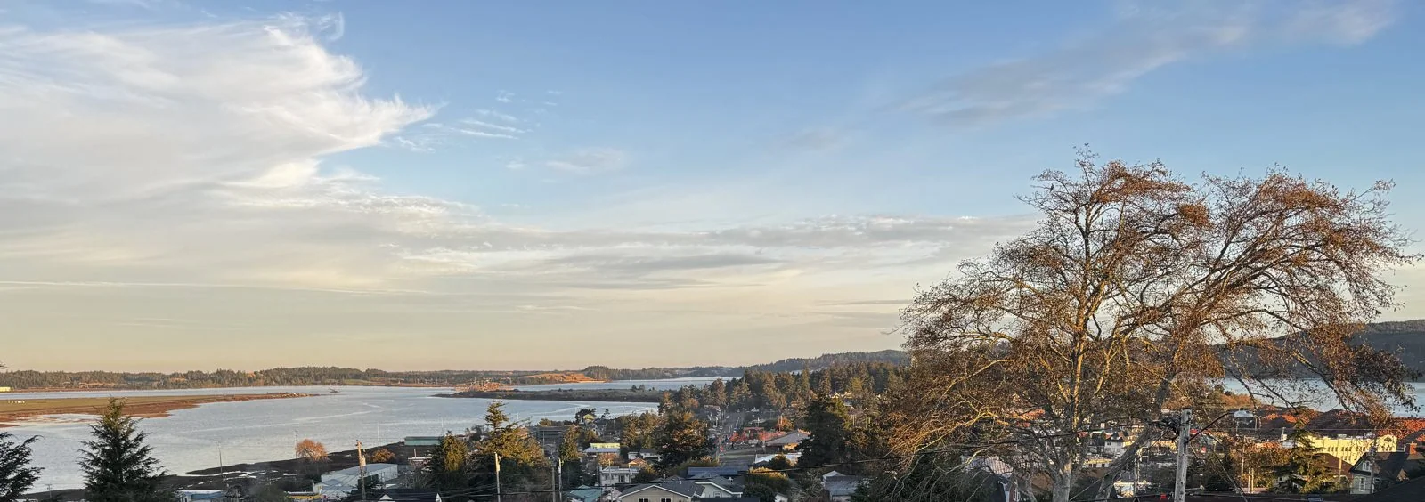
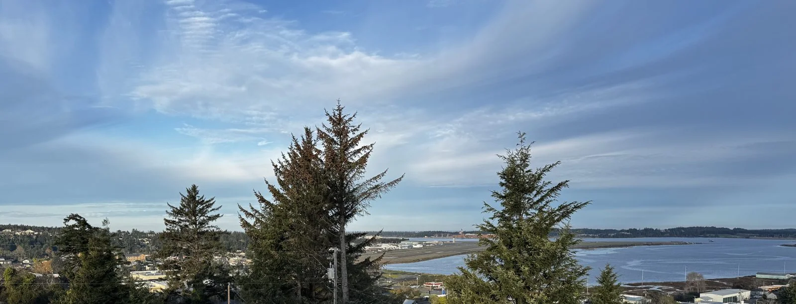
The first light did something lovely to a big bare tree in the foreground, turning every branch gold for a few minutes, while the clouds above stretched across the whole sky in long feathery streaks. Forty minutes later the gold was gone, the bay had turned a cooler blue, and the streaks had become broad brushstrokes. It was a clear December morning on a coast better known for fog, and we had a long way to go.
Face Rock, Bandon
Half an hour south is Bandon, and just outside town, Beach Loop Drive runs along the top of a bluff above one of the most crowded stretches of rock on the Oregon coast. We stopped at the overlook at Face Rock State Scenic Viewpoint a little after ten. The headland is wrapped in gorse, a spiny shrub with bright yellow flowers that blooms here even in December, and below it a long beach of dark sand curves away with sea stacks scattered in the surf, as if someone had emptied a bag of them along the shore.
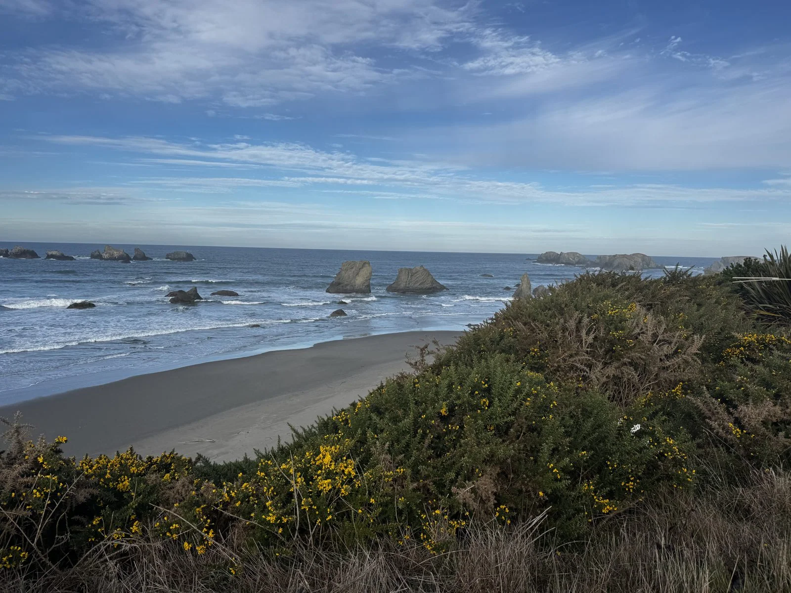
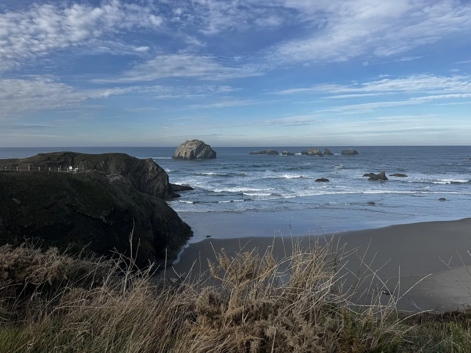
The gorse has a history here. Bandon's founder, an Irishman named George Bennett, is said to have brought it over from home in the 1870s to remind him of Ireland. It loved the climate and took over the coast. It is also full of oil and burns like kindling, and in 1936, when a forest fire reached the gorse around town, almost all of Bandon burned down with it. The town was rebuilt; the gorse came back too, and it is still there, blooming cheerfully along the top of the bluff.
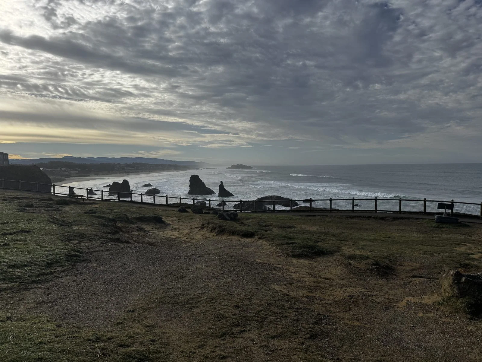
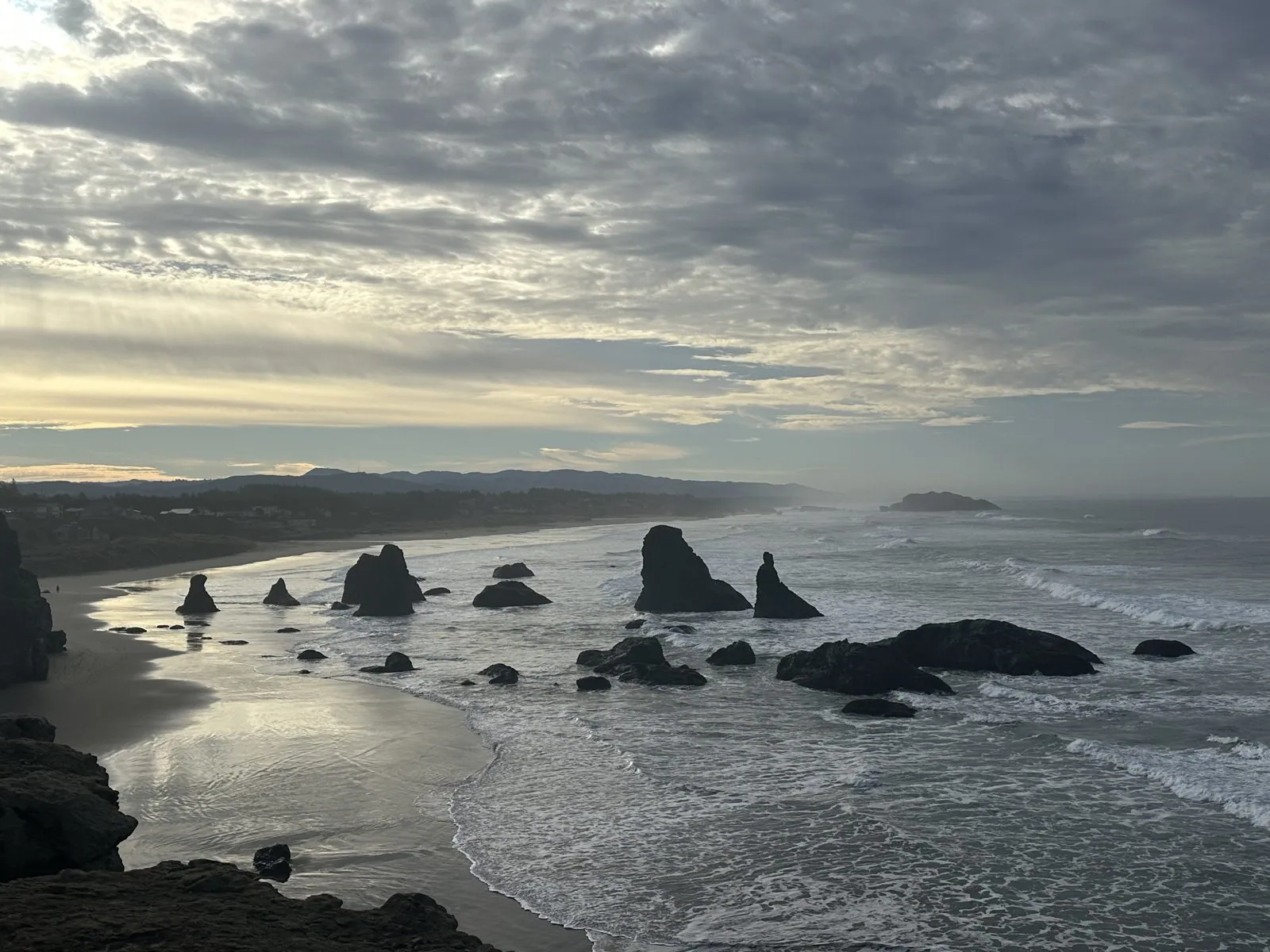
Turn around and the same coast looks completely different. Looking north, into the light, the clouds were a heavy dappled ceiling, the sea was silver, and the rocks along the beach stood up as black silhouettes, one after another, toward the town. The overlook itself is a grassy little park with a wooden fence along the edge and a paved path to the end of the point, and at that hour on a Monday in December we nearly had it to ourselves.
Wangcai, as usual, was more interested in the ground than the view. The point has an interpretive sign about the rock that gives the place its name, and the photo catches her nose-down behind it, reading it from the bottom up. The story on it is a local legend. Face Rock is said to be Ewauna, a chief's daughter who swam out into the sea against her father's warning, was caught by the evil spirit of the ocean and turned to stone. Her face is still out there, turned up to the sky, refusing to look at him, with her cat and kittens scattered on the rocks around her.
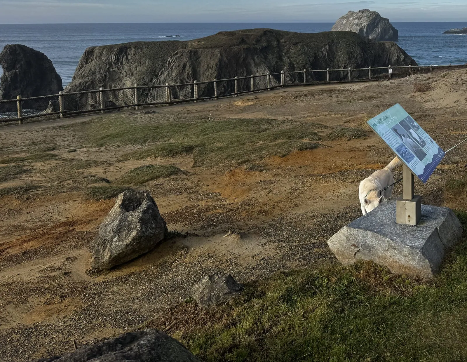
From the end of the point you look straight down on the rocks. A big dark headland stands just offshore with the surf churning through the channel in front of it, and a smaller stack beside it is sharp as a fin. The sea was rough that morning, and each wave broke white around the base of the rocks and ran in long curls of foam across the channel. Further out, a line of smaller stacks sat on the horizon like a breakwater.
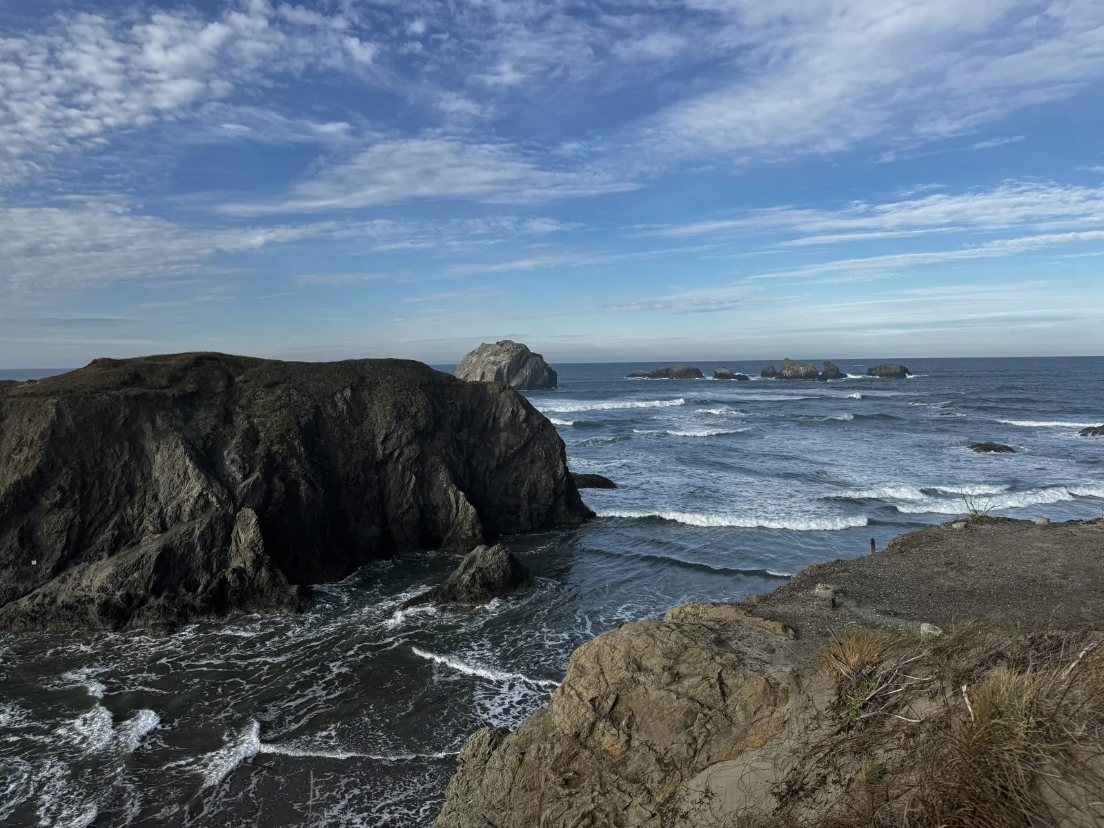
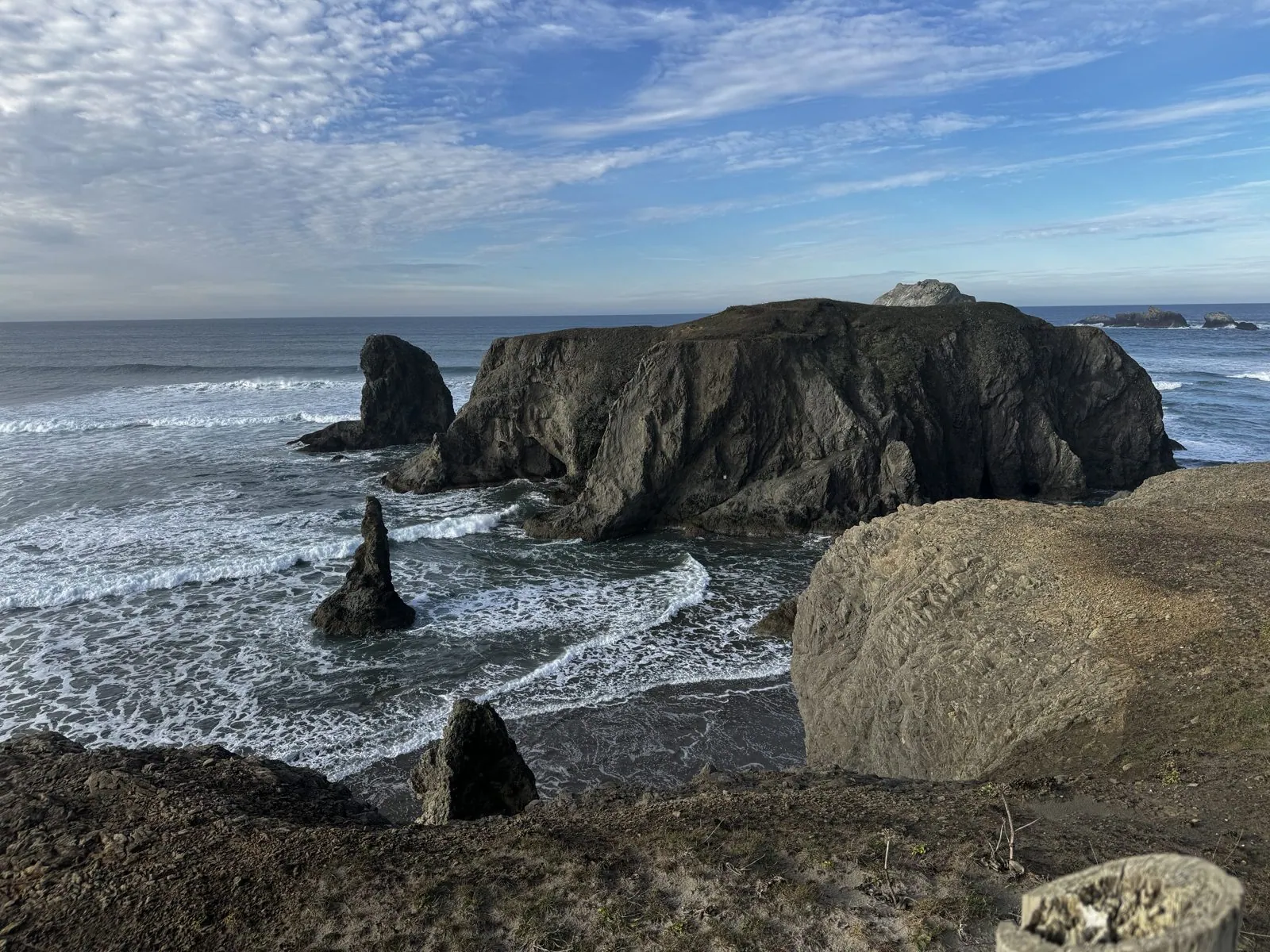
Sea stacks are what a cliff leaves behind. The waves find the weak spots in a headland, carve them into caves, then arches, and when the arch falls, the hard rock on the seaward side is left standing alone in the water. This coast is made of a jumble of hard and soft rock, which is why it erodes so unevenly and why the beaches here are so crowded with stacks. Every one of them is a piece of the shoreline as it used to be, and the surf is still working on all of them.
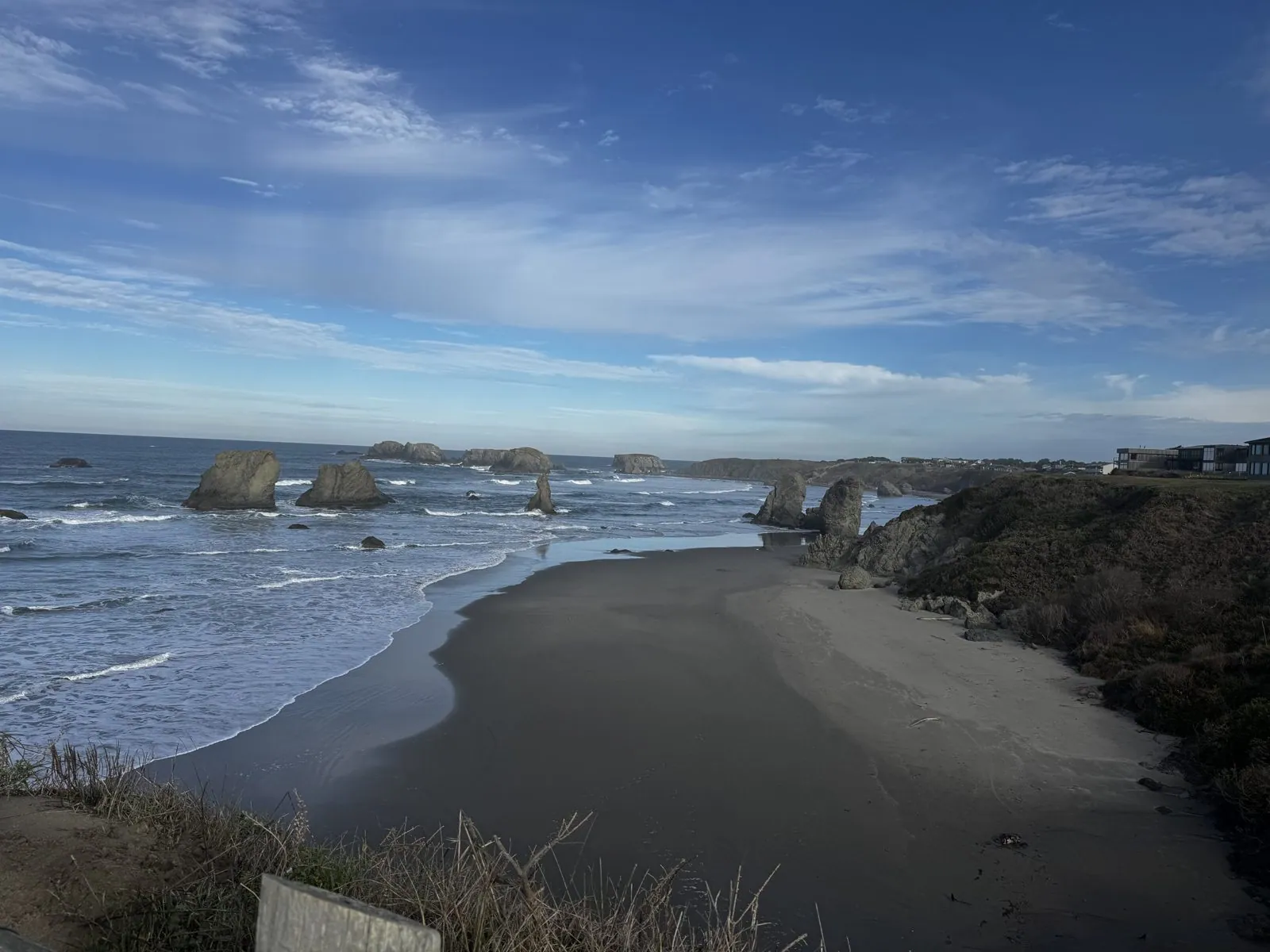
The last photo from the overlook looks north along the beach, empty at ten in the morning on a Monday, with the line of stacks marching away up the shore toward town. It is the kind of beach you would happily spend a day walking. The photos from the overlook span about five minutes, and the next ones were taken an hour and a half down US-101.
The Curry County coast
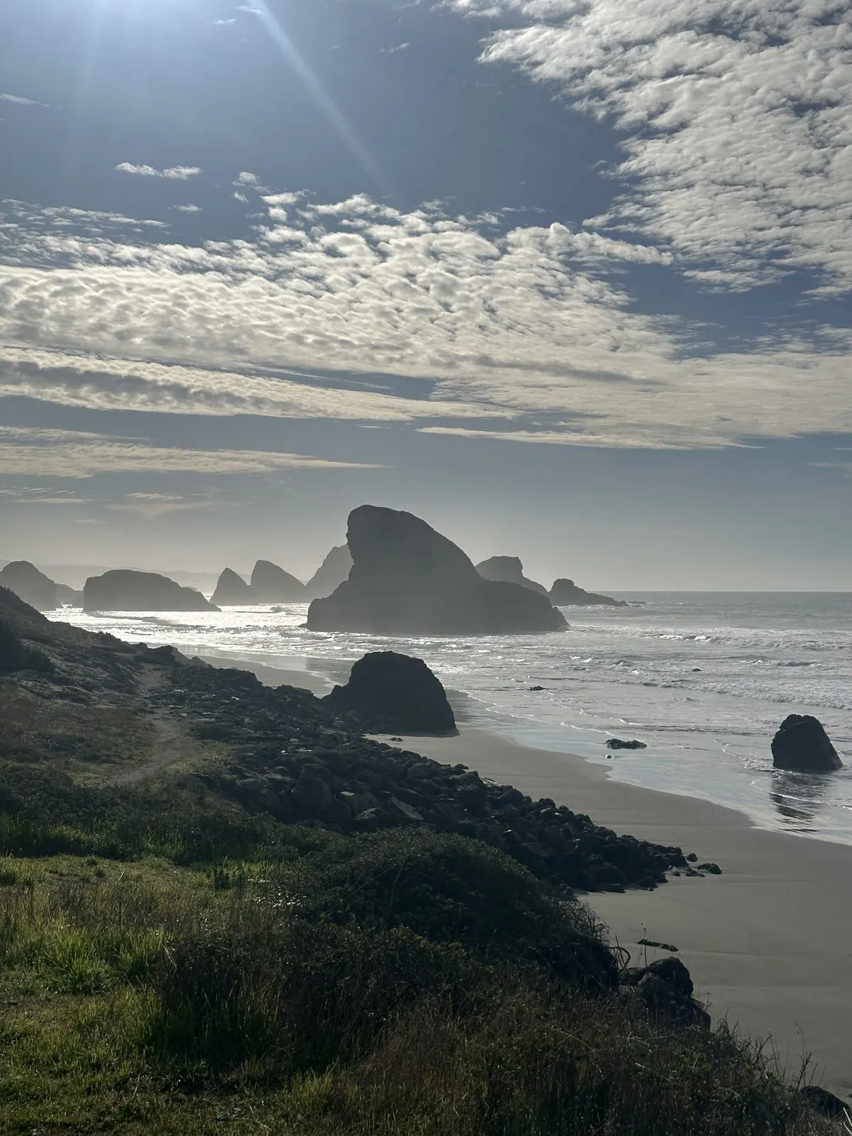
South of Bandon, US-101 swings inland through farmland and forest, and for a while the ocean disappears. It comes back with a vengeance in Curry County, the state's southernmost stretch of coast. Just south of Cape Sebastian, at 11:28, the road drops down near sea level, and the windshield filled with a view that looked unreal: the sun high over the water ahead, the sea burning silver, and a whole procession of sea stacks lined up in silhouette along the shore.
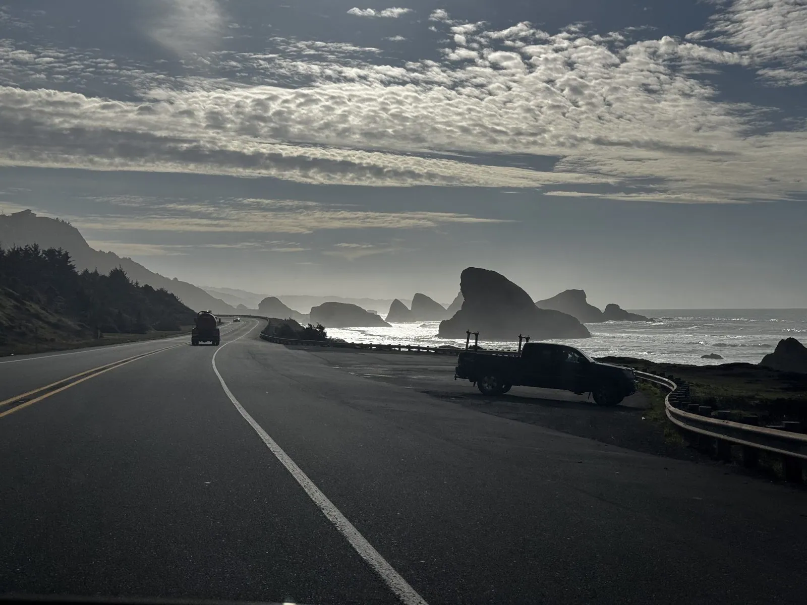
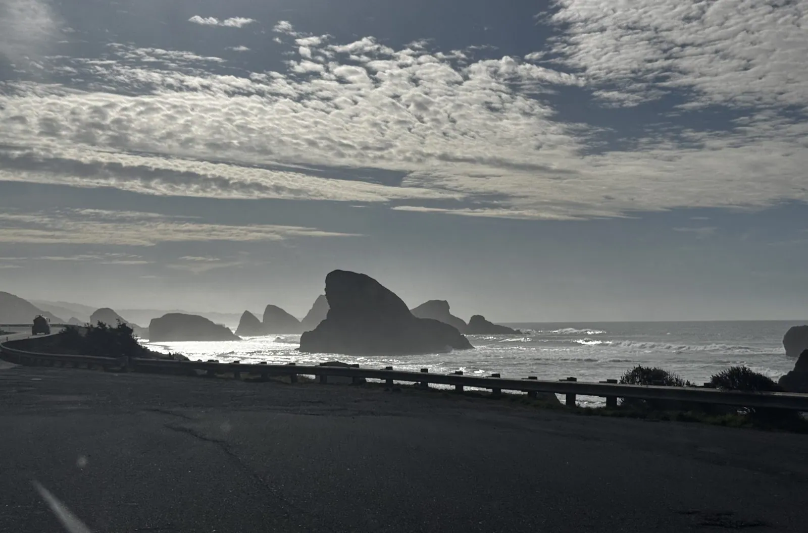
Both photos were taken through the windshield, a few seconds apart, and they look almost like black-and-white pictures: the shapes of the rocks cut out of bright water, the cloud above rippled like sand on a beach. In person the effect was the same. With the sun in front of you, you don't see the color of anything, only shapes and light, and the coast for a few minutes looked like an old engraving of itself.
A minute later we pulled over, and from the grassy slope above the road the same rocks stood in a silver haze.
A few miles further on, the highway enters the Samuel H. Boardman State Scenic Corridor, a twelve-mile strip of forested cliffs, coves and arches named after the first superintendent of Oregon's state parks, who spent decades buying up this coastline so it would stay open to the public. Its most famous stop is Natural Bridges. A short walk from the parking area leads to a railing on the edge of the forest, and below it, down in a cove of dark rock, the ocean pours in and out under a bridge of stone.
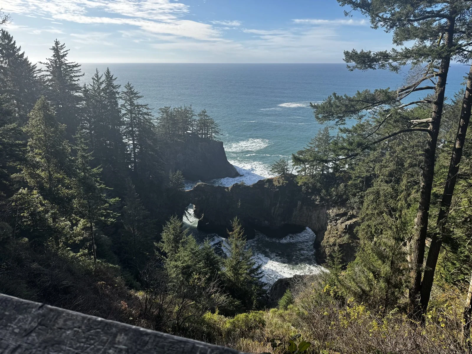
The bridges are what remains of a sea cave whose roof collapsed. The ocean got in, ate out the soft rock, and left the harder roof standing across the gap.
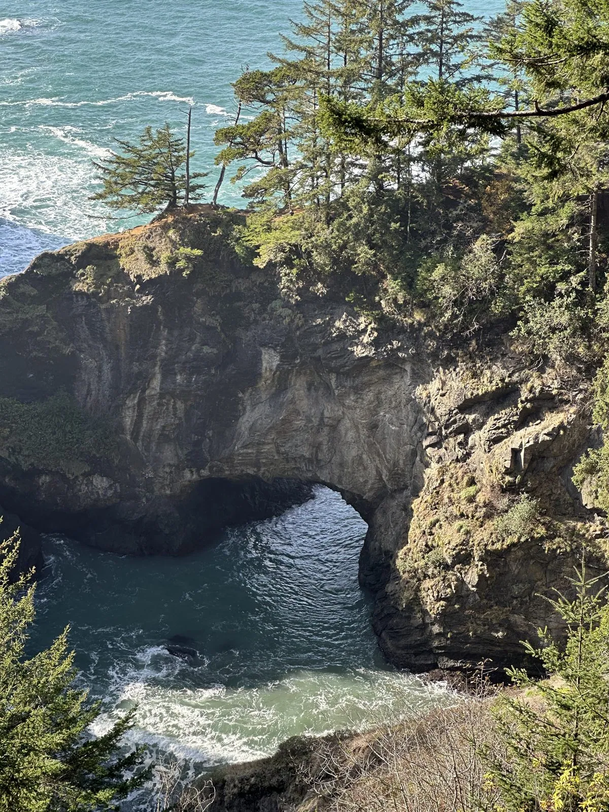
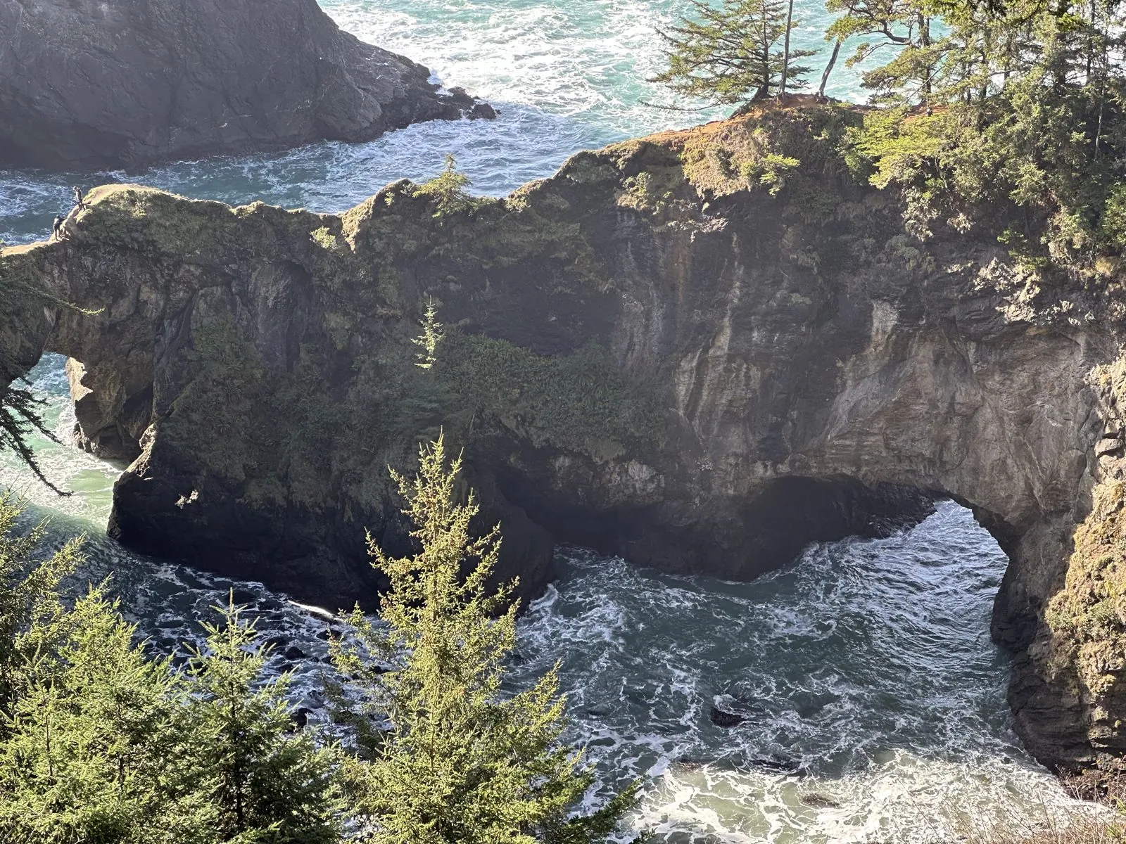
From the railing you look down through tall, wind-bent spruce, the sun coming in sideways through the branches, to white water surging under the arch and draining back out with every wave. Beyond it there is nothing but the Pacific, blue all the way to the horizon. It was the last stop on the Oregon coast, and the last photo until dinner in Napa, nine hours later.
The long drive to Napa
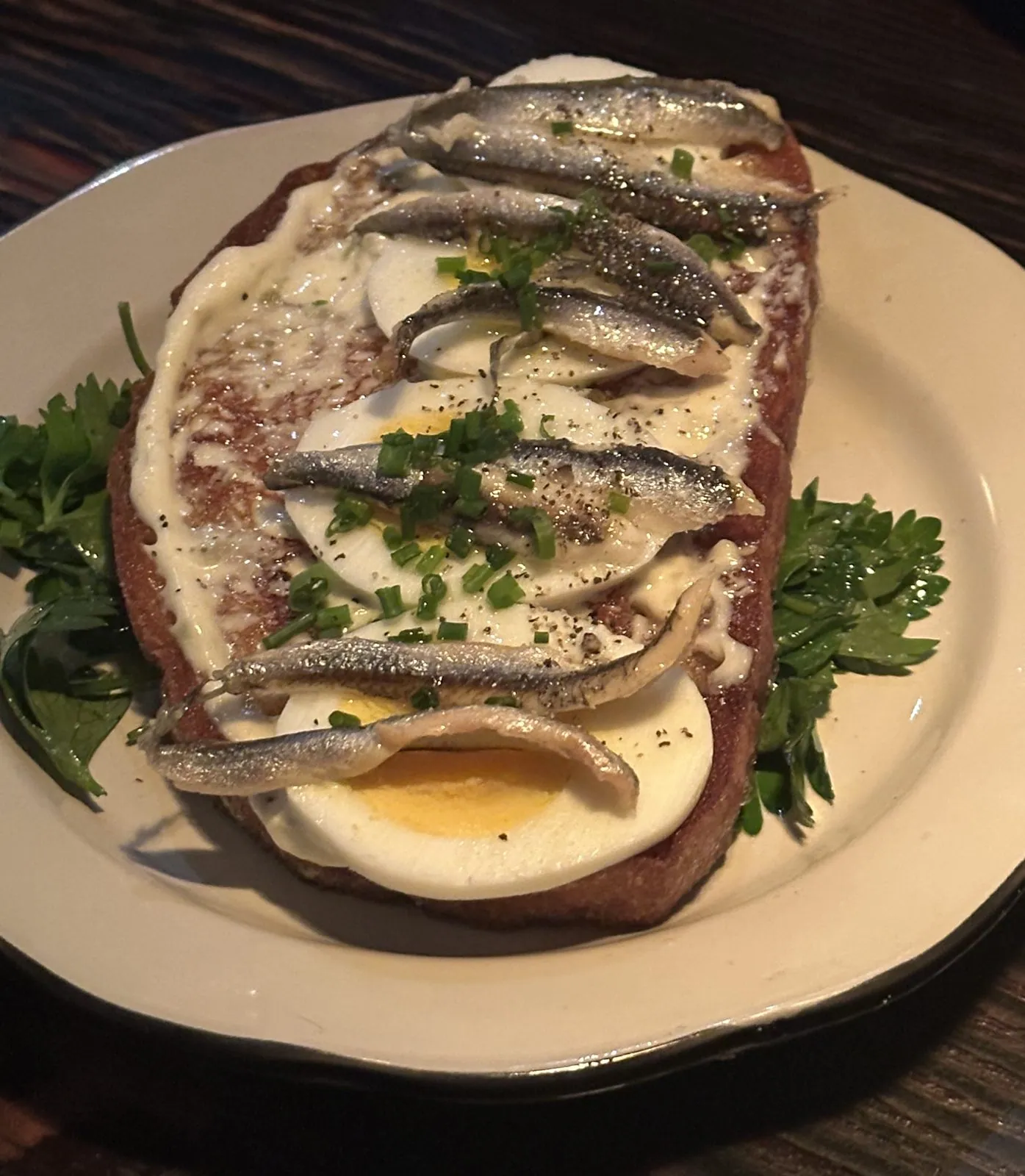
From Natural Bridges, Napa is still well over three hundred miles away, through the far northwest corner of California, and the camera roll says nothing about any of it. We reached Napa in time for a late tapas dinner.
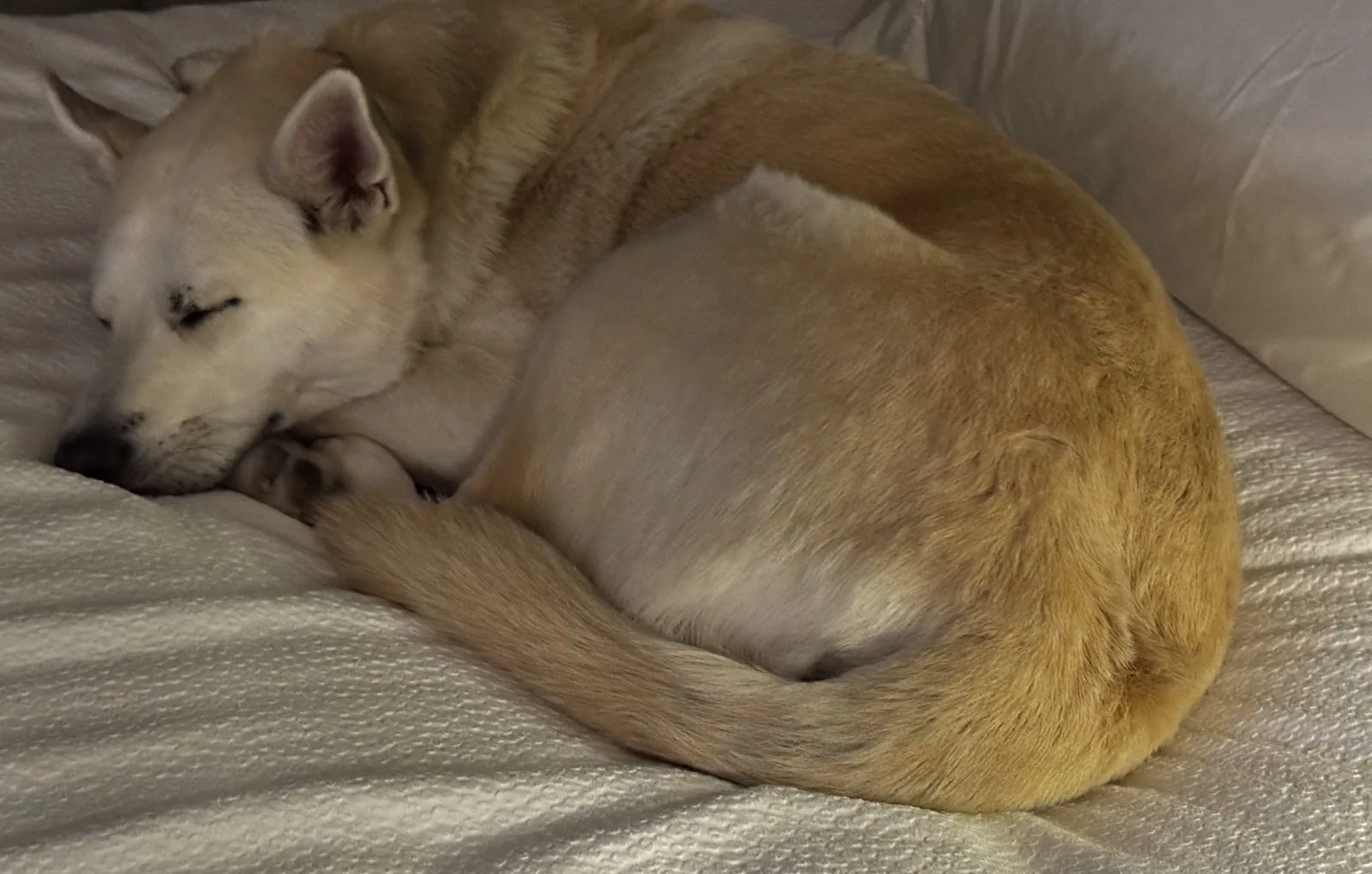
My next photo was taken at ten past eleven that night, after the day's drive from the Oregon coast. It is a picture of Wangcai, who had been in the car for most of the day, curled up into a tight cream-colored ball on the bed with her nose tucked into her paw, fast asleep.
That is where the trip came apart. I had a meeting to get back for, so the next day, December 2, I flew home early from Oakland. The others did the last leg without me: my wife and our friends drove the car, and Wangcai, the rest of the way back to Southern California. So in the end the trip was a loop that I never quite closed. I went up the whole length of California and Oregon, came back down most of it, and finished in an airplane seat. Wangcai, at least, got to see it through to the end.
A lot of road for five days
Looking back over the photos, the striking thing is how much of the West fits into one long weekend if you are willing to sit in a car for it. There was a desert-country night sky in the Klamath Basin and a volcano's crater full of snow-rimmed blue water. Then came a mountain lake in new snow and a city of glass towers at dusk with a volcano on its horizon. A bay at sunrise, a beach crowded with sea stacks and a cove where the ocean runs under a stone bridge filled the last morning. Between each of them was a long stretch of interstate or coast highway, and the photos skip almost all of it.
It is not the way to know any of these places. My camera roll gives Crater Lake two photos and Bandon four minutes. But each of them is now a particular picture rather than a name: the rim in fresh snow on a bright afternoon, Mt. Hood pink over Portland, the silver sea south of Cape Sebastian, a dog sniffing at the foot of a sign about a legend. That is enough to want to go back, more slowly, and with fewer miles in a day.
Maps built from the trip's photo timestamps and locations. Photo locations have been removed from the published images. Day maps: map data © OpenStreetMap contributors; each stop is placed where its photo was taken, places we stayed are shown only by the name of the nearest town and home is never marked, and the dashed lines show the order of stops, not the exact roads.
Some photos in this post are my wife's.
Likes and comments
React with an emoji or leave a comment. Signing in with GitHub is required.