← Misc · August 2026
Two Capitols and a Very Clear Lake
Five slow days at the end of summer: Sacramento, Lake Tahoe, a corner of Nevada and the coast, with Wangcai riding along.
Sacramento → South Lake Tahoe → Stateline → Carson City → Reno → Tahoe City → Sugar Pine Point → Emerald Bay and Fannette Island → Santa Cruz → Carmel-by-the-Sea
Two states, California and Nevada · two state capitols in two days · roughly 530 miles between the first photo and the last · one red pedal boat · one island with a ruined tea house on top · one cream-colored dog in a gingham bandana
This one was meant to be easy. My summer internship was ending, and before the next thing began we wanted a few days that asked nothing of anybody. So we put Wangcai in the back seat and drove a loose loop through Northern California and a corner of Nevada. It started in Sacramento and climbed to Lake Tahoe. It dipped into Carson City and Reno, came back to the lake's West Shore, and then ran all the way down to the Pacific at Santa Cruz and Carmel. Nobody was keeping score, and most of the days in the camera roll don't start until lunchtime.
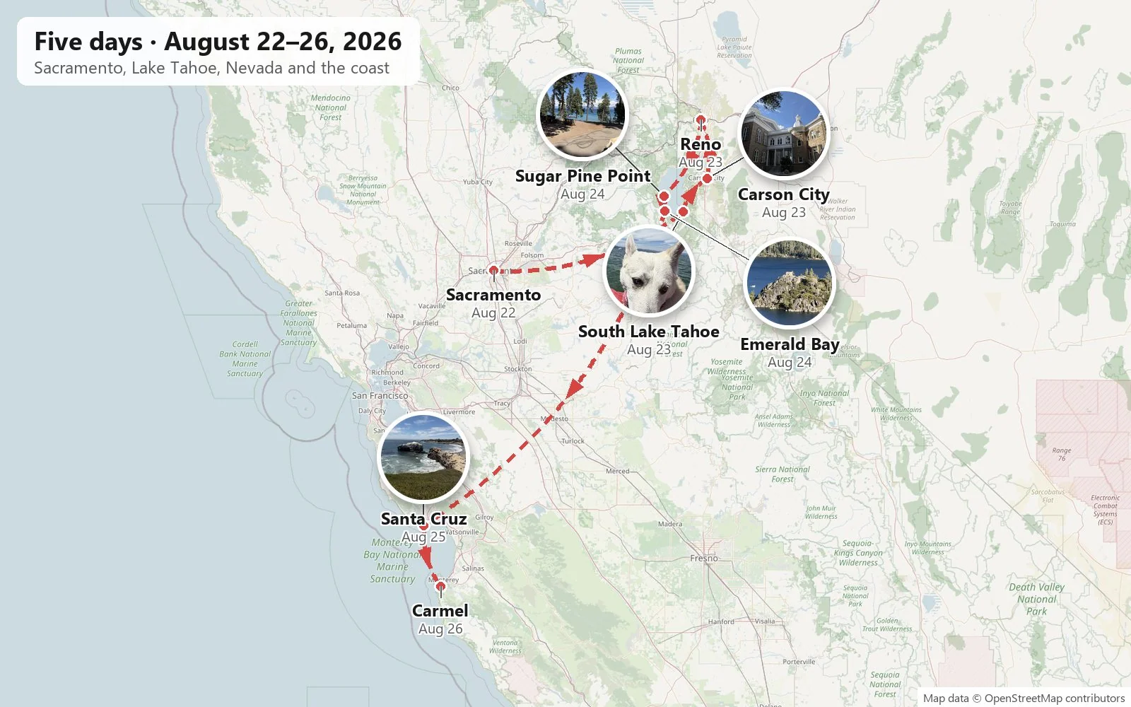
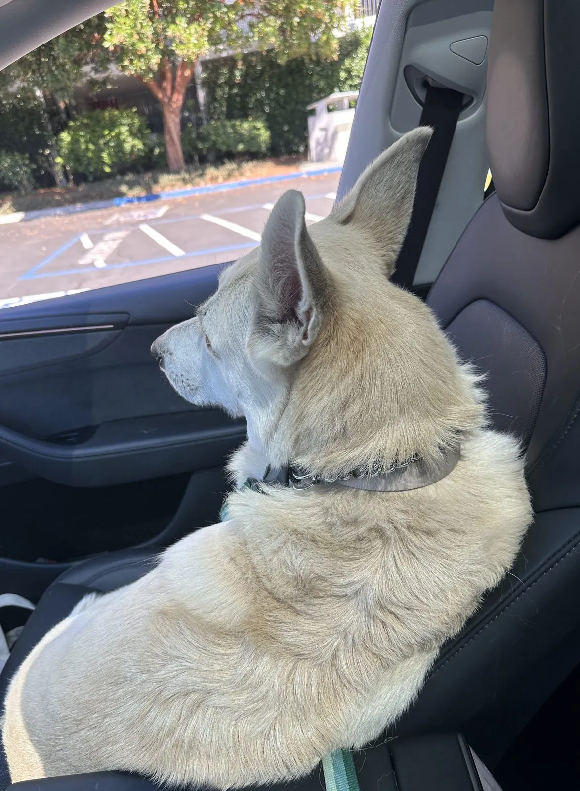
As with the other trips on this page, everything here is reconstructed from the camera roll. A phone keeps a time and a place for every picture, and lined up in order they make an honest, if patchy, diary. Where the photos are silent, I've said so rather than guess. Where a place has a story worth knowing, I've added a little of it. And as with the spring trip, the real protagonist is Wangcai, who came home with us in January 2025 and has been in the back seat of every road trip since. She wore a red gingham bandana for much of this one.
Day 1: Sacramento
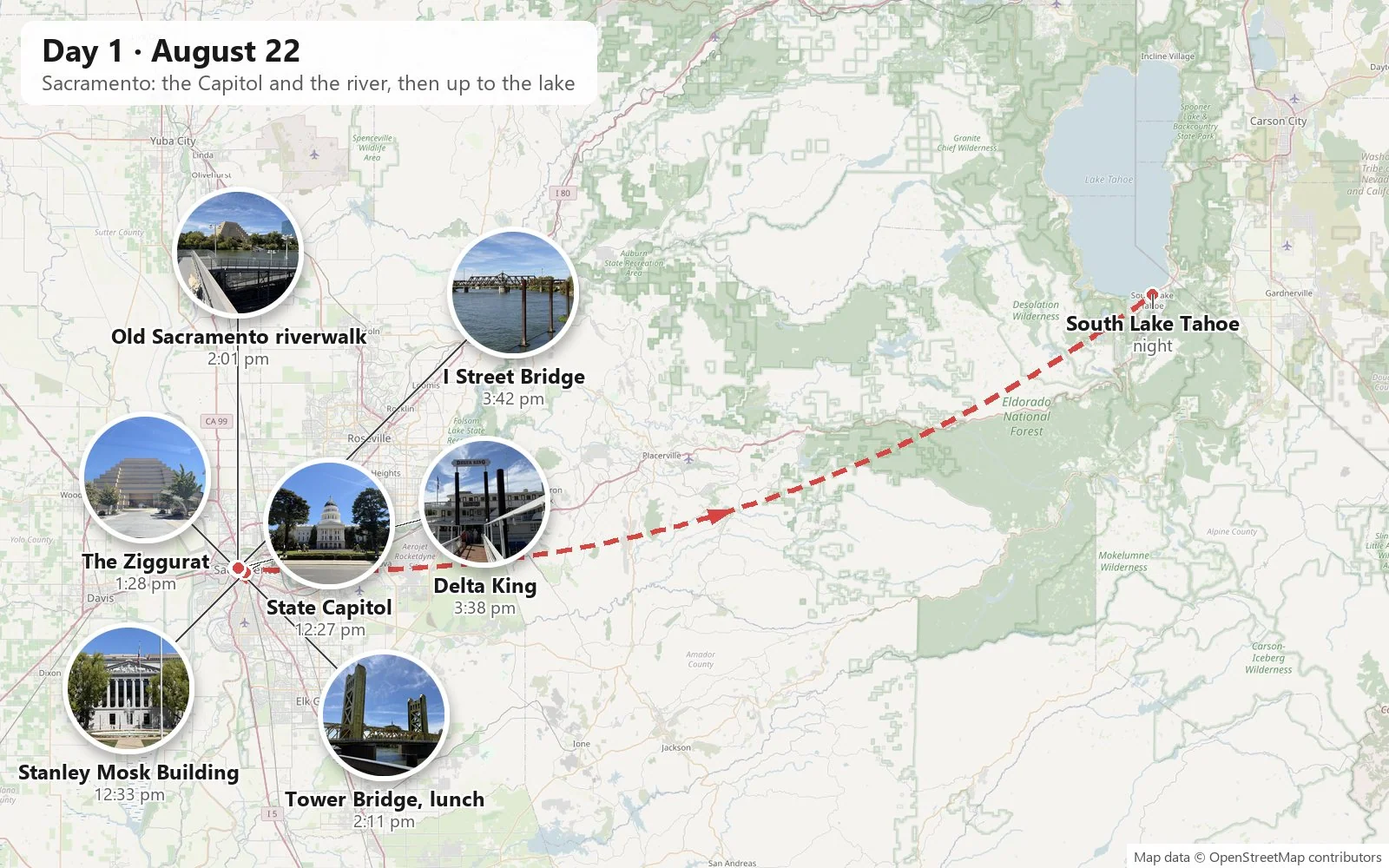
The Capitol and its mall
Sacramento is the kind of state capital people drive past on I-80 on the way to somewhere else. That's a pity, because its center is handsome and very green. We had arrived in Sacramento late on the Friday night and stayed at The Citizen Hotel, so the trip really began with waking up downtown. We started at noon at the California State Capitol, a white neoclassical building finished in 1874. Its dome is a cousin of the one in Washington, lifted on a ring of columns. Around it lies Capitol Park, a forty-acre arboretum of trees planted from all over the world. That Saturday the sky was a flat, cloudless blue, the kind you only get in the Central Valley in late summer, and the dome stood out against it like a wedding cake.
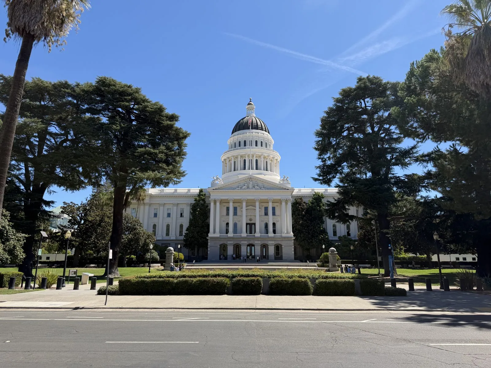
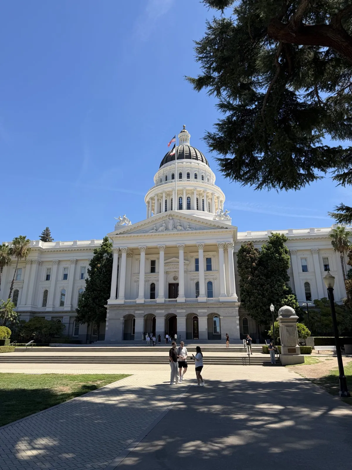
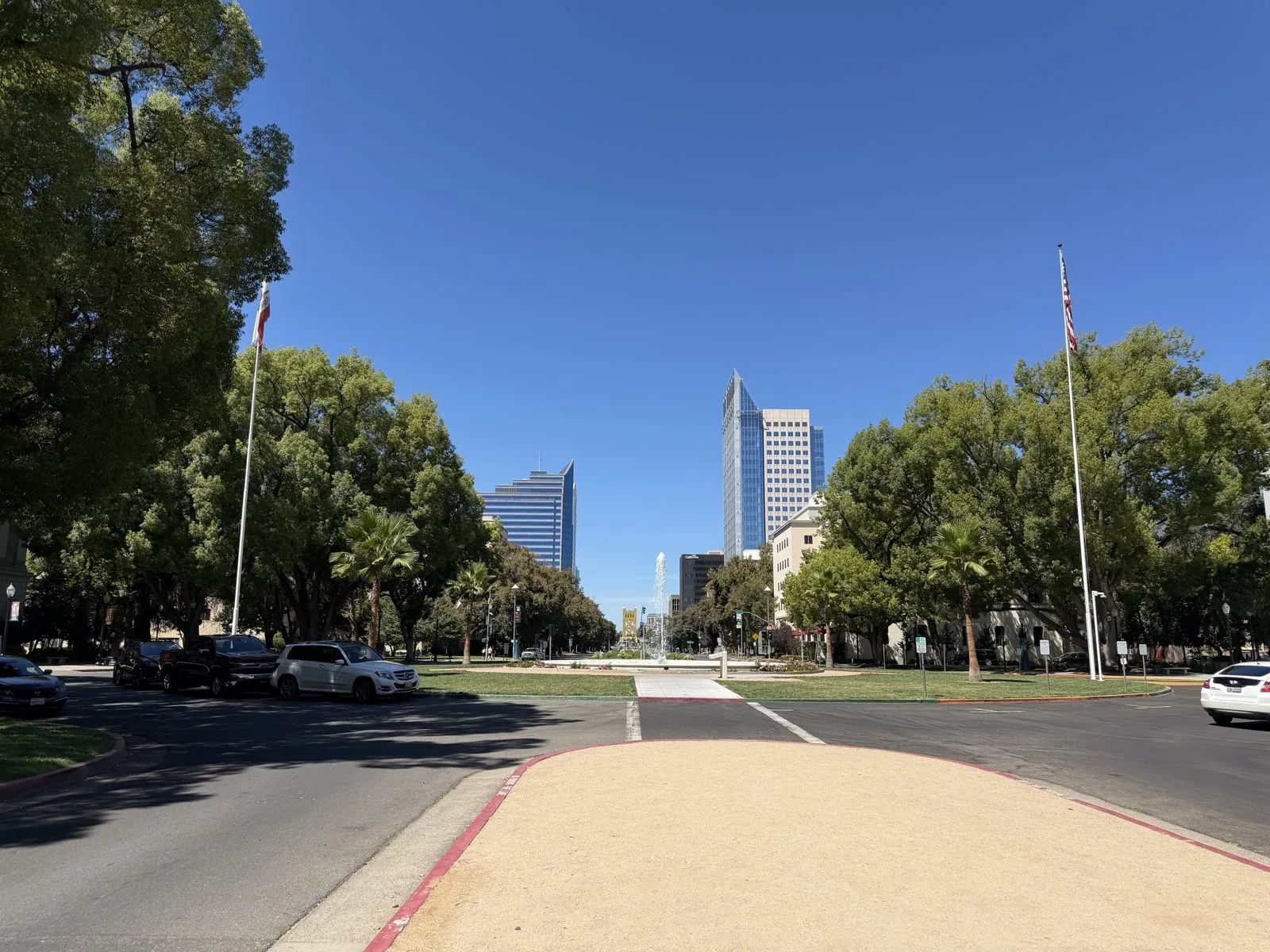
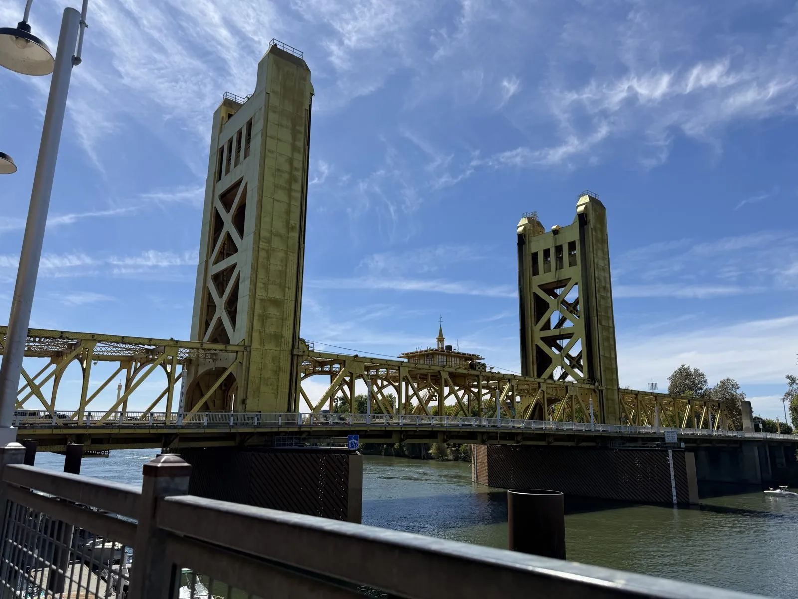
Turn around on the Capitol's west steps and you are looking straight down Capitol Mall, a wide boulevard that runs about a mile, past office towers and lawns, to the river. At the far end, small and gold in the haze, is the Tower Bridge. The axis is deliberate: the seat of government at one end, the Sacramento River at the other. In the Gold Rush that river was the reason the city existed at all, the place where miners stepped off the boats from San Francisco and headed for the hills.
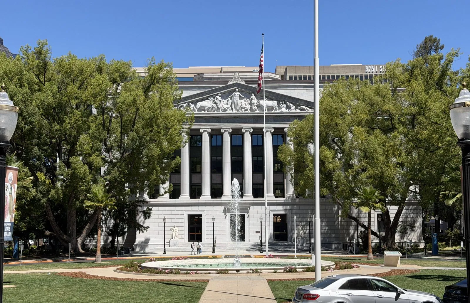
Across the street to the west stands a building that looks as if it should be in Washington, D.C.: the Stanley Mosk Library and Courts Building, finished in 1928, with a row of tall columns, a sculpted pediment and a fountain splashing in a round pool out front. It is home to the California State Library, and it faces the Capitol across the park like a twin built in a different mood. Where the Capitol is all nineteenth-century wedding cake, this is twentieth-century Beaux-Arts, severe and grand.
Across the river and back
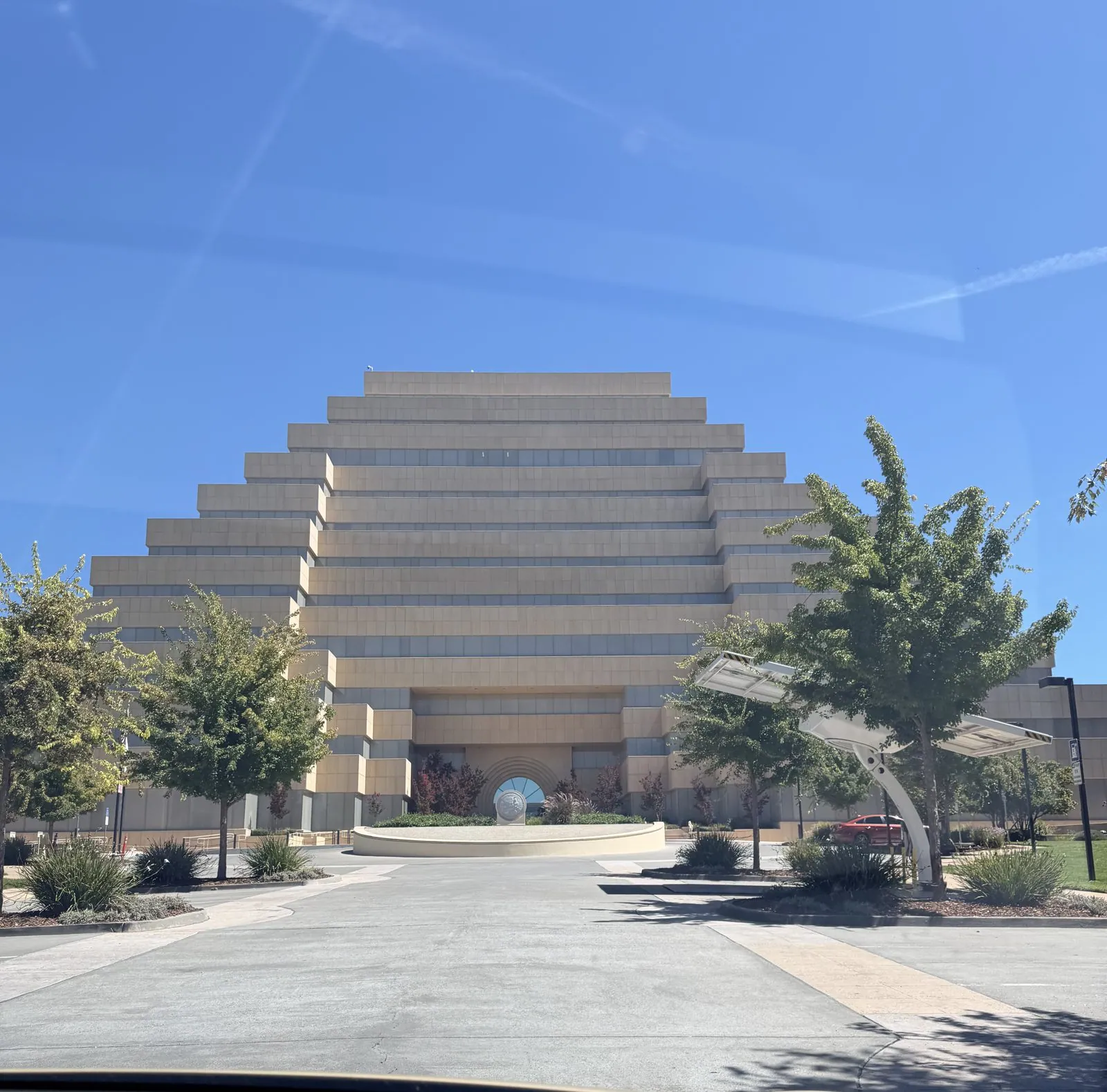
After an hour we got back in the car and drove across the river into West Sacramento, past one building in particular. The Ziggurat is exactly what it sounds like: an eleven-story stepped pyramid in pale stone, built in the late 1990s for a lending company and later taken over by the state as offices. It sits on the riverbank like something from a lost civilization that took up accounting. We photographed it through the windshield and kept going; the circle back over the I Street Bridge took a few minutes.
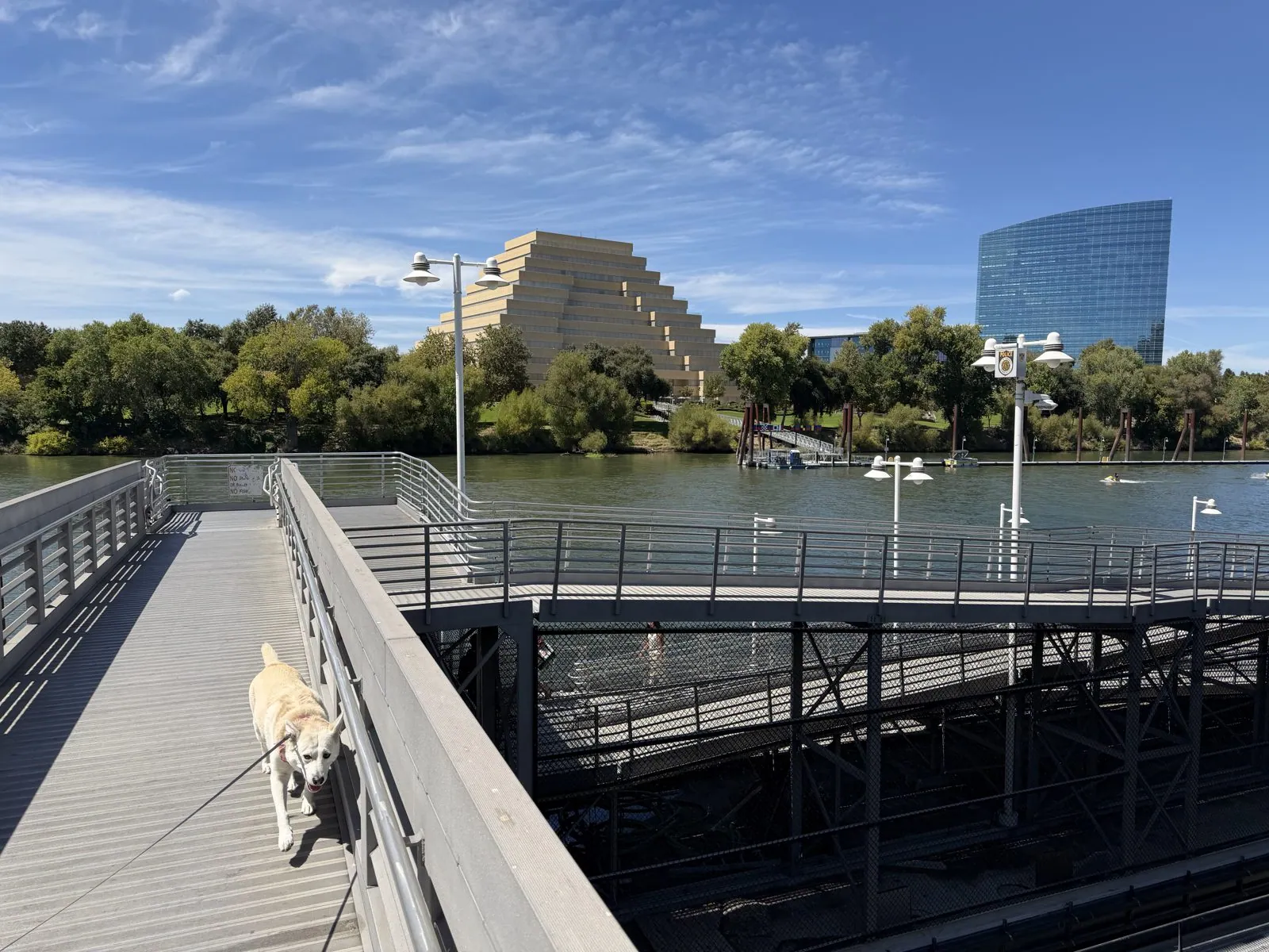
Back on the Sacramento side, we parked and walked the riverfront in Old Sacramento. A long ramp leads down to the docks, and from it you get the Ziggurat again, now across the water, next to a curved blue glass tower. Wangcai led the way down the ramp on her leash, a cream-colored blur against the gray metal grating.
Crab by the Tower Bridge
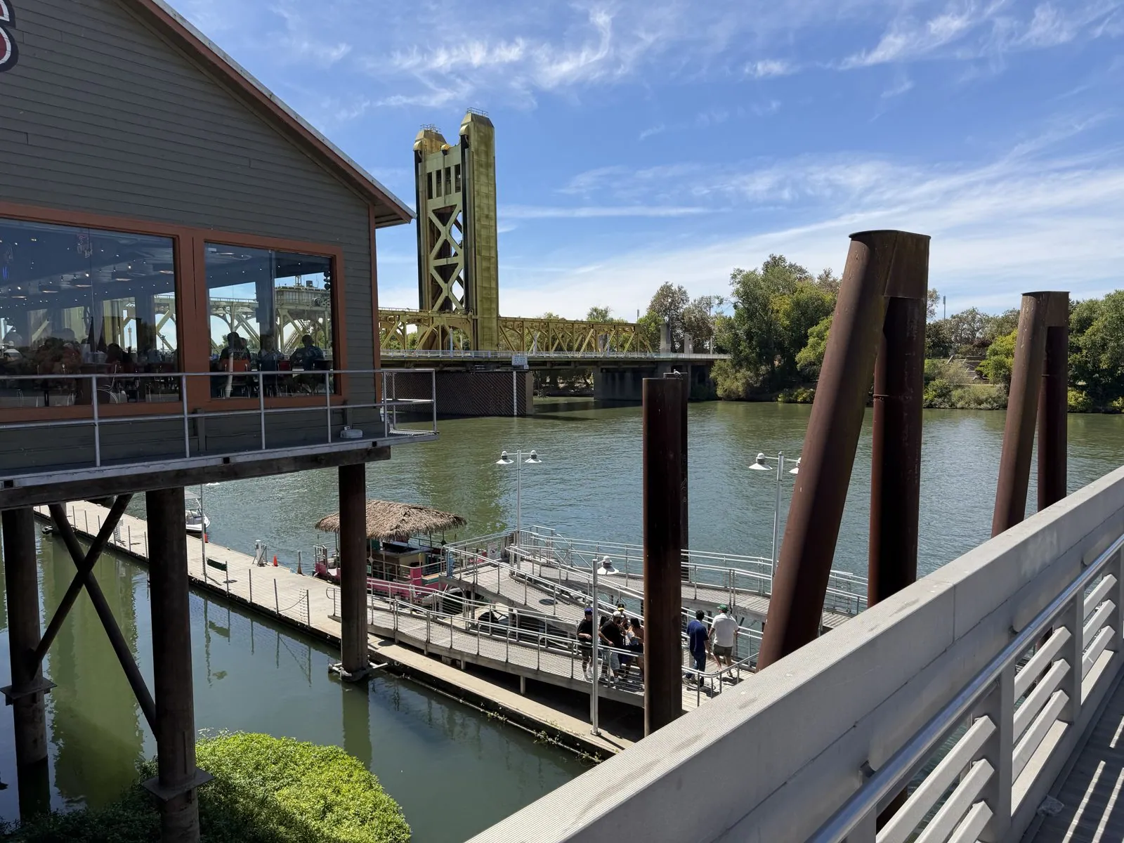
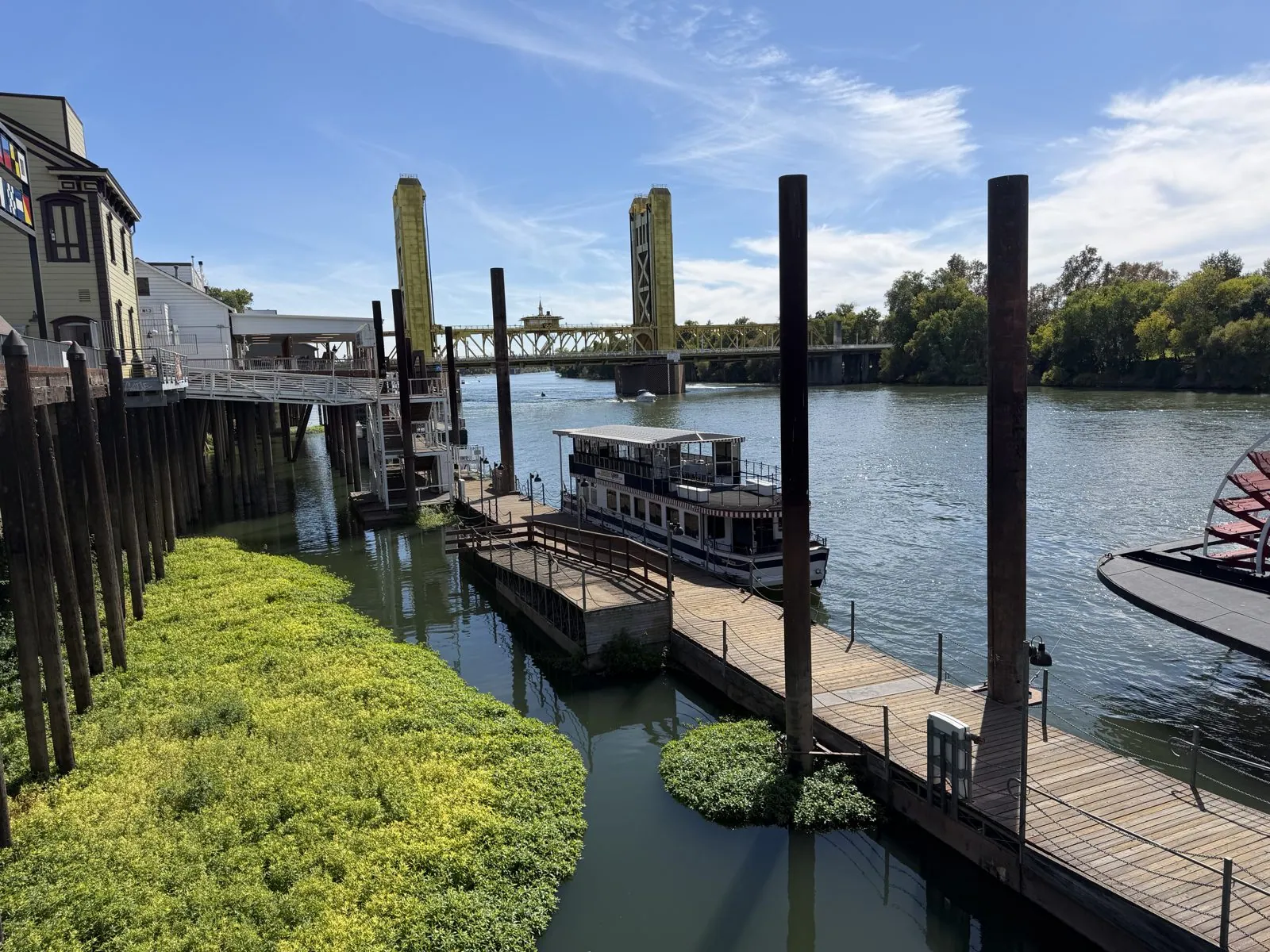
Lunch was late, at two, on the river: a crab restaurant built out over the water on stilts, with the Tower Bridge filling the view. The bridge is a vertical-lift bridge from 1935. Its whole middle span can rise between the two towers to let tall boats through. For decades it was painted a dull silver-green, then in 2002 it was repainted gold, which is the only correct color for a bridge in a Gold Rush town. From the restaurant deck, under a yellow umbrella, it looked close enough to touch.
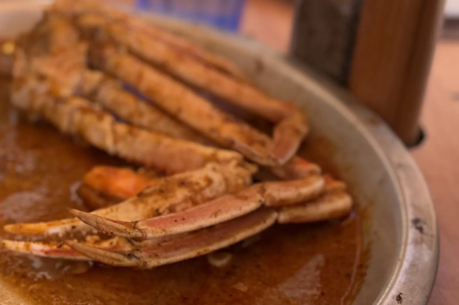
What arrived was a seafood boil in a metal pan: crab legs swimming in a deep orange sauce of butter and spice, with bread for dipping. The camera roll has more than a dozen pictures of this pan, taken over the space of a minute. They record, in sequence, a piece of bread going into the sauce and coming out considerably heavier.
The Delta King and the old bridges
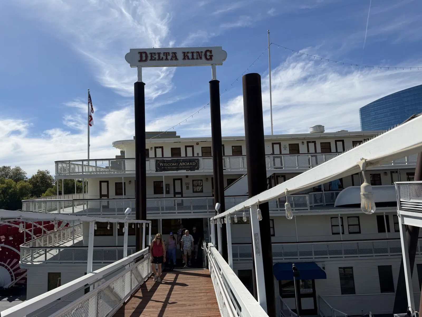
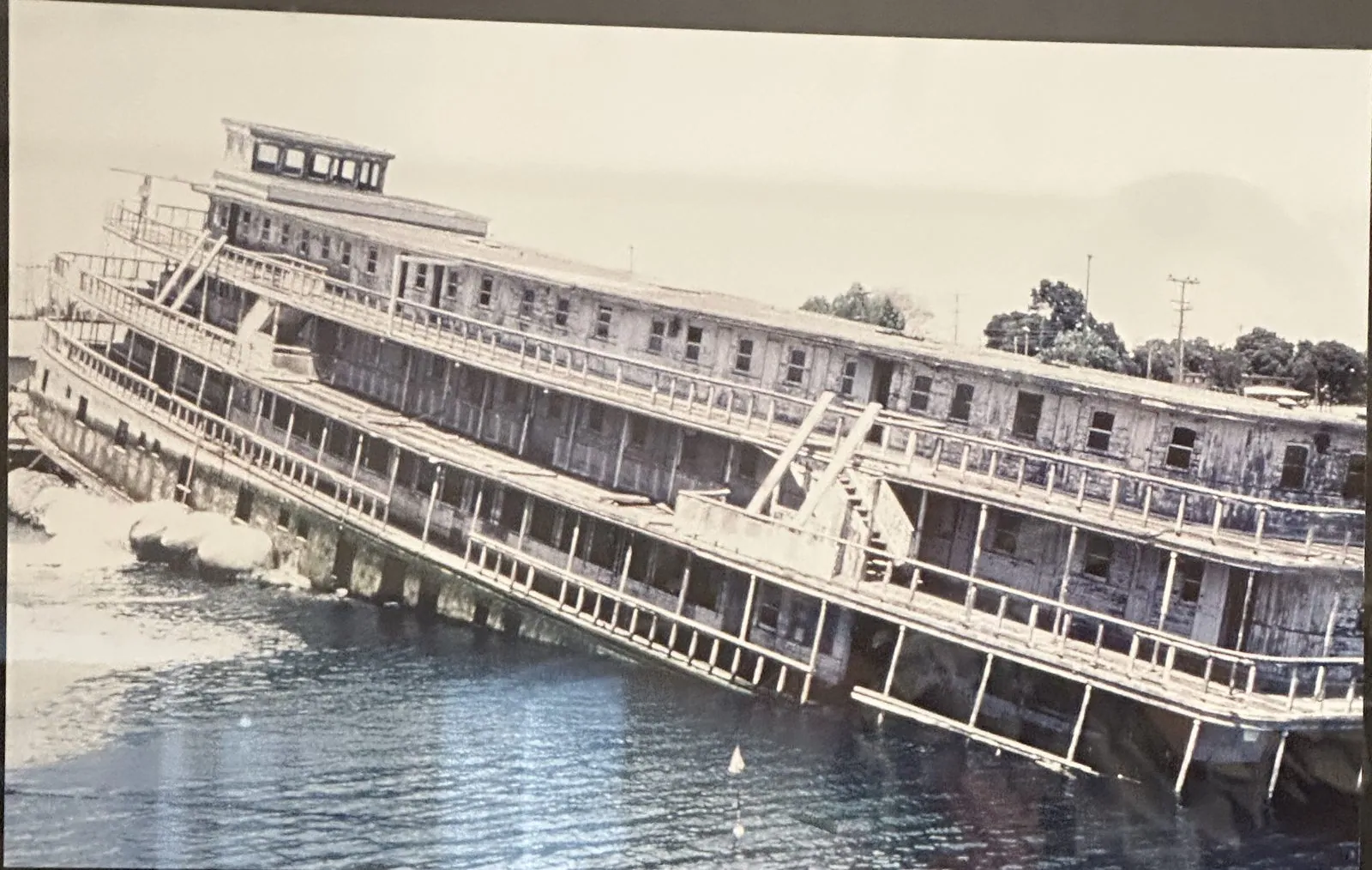
Afterwards we went aboard the Delta King, a big white sternwheeler permanently moored at Old Sacramento. She was built in 1927 and, with her twin the Delta Queen, ran overnight between Sacramento and San Francisco, a ten-hour trip down the river and across the bay. The overnight boats lost out to highways in the 1940s, and the King had a long, rough retirement, including years half-sunk, before she was restored and brought back here. Her paddlewheel is still on the stern, and the gangway still says "Welcome Aboard". Inside, the dining room was laid with white tablecloths, the bar looks out on the I Street Bridge, and a framed photograph shows her in 1984, listing in San Francisco Bay after fifteen months partly under water.
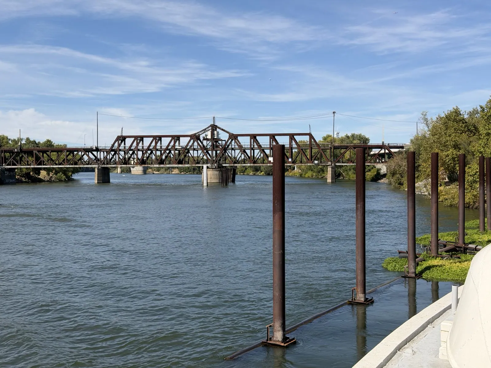
Old Sacramento itself is a few blocks of Gold Rush–era brick and wooden boardwalks. It was the western end of the Pony Express and the starting point of the Central Pacific, the western half of the first transcontinental railroad. From the end of the docks, looking upriver, you can see the I Street Bridge, an old steel truss from 1911 that swings sideways on a pivot to let boats pass, with trains on one deck and cars on the other. It was my last photo of the day, at 3:42 in the afternoon.
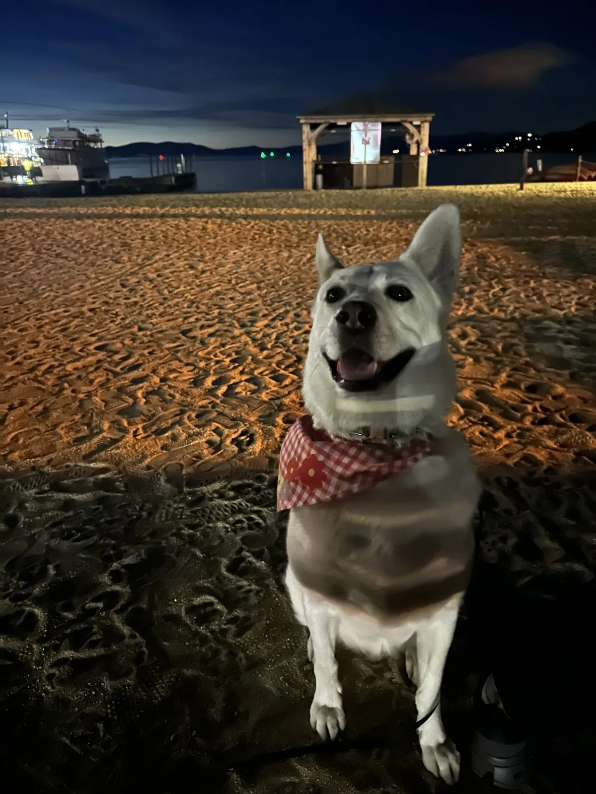
Before we left Old Sacramento there was ice cream from an old-fashioned sweets shop. Then we drove up to South Lake Tahoe, to the Hampton Inn & Suites for the night, and by dark we were on the sand at the Ski Run beach with a takeout dinner.
Day 2: Lake Tahoe, then Nevada
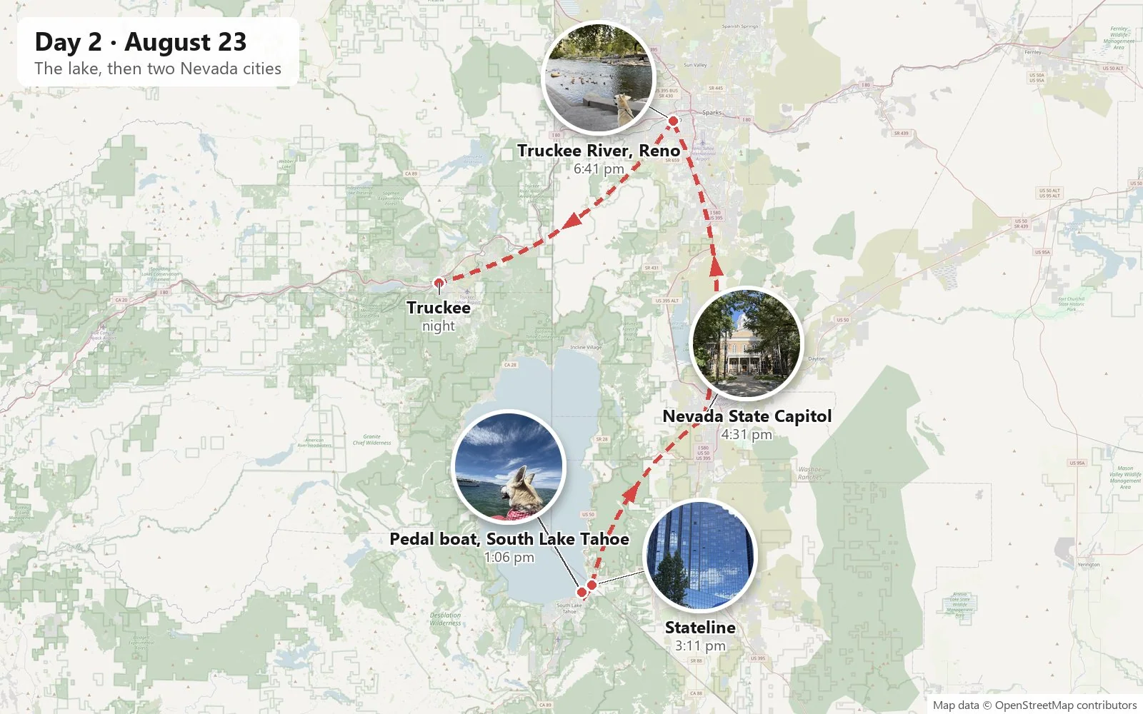
South Lake Tahoe
The drive from Sacramento to Lake Tahoe is one long climb. You leave the valley floor near sea level, wind up through the foothills of Gold Country and the pine forests of the Sierra Nevada, cross a pass above seven thousand feet, and drop down to the lake at about 6,200. We had made that drive the evening before, and by lunchtime on Sunday we were at the marina at the bottom of Ski Run Boulevard in South Lake Tahoe: a sandy beach, rows of rental boats, a lawn with a path along the water, and beyond all of it the lake, with the mountains of the far shore faint and blue.
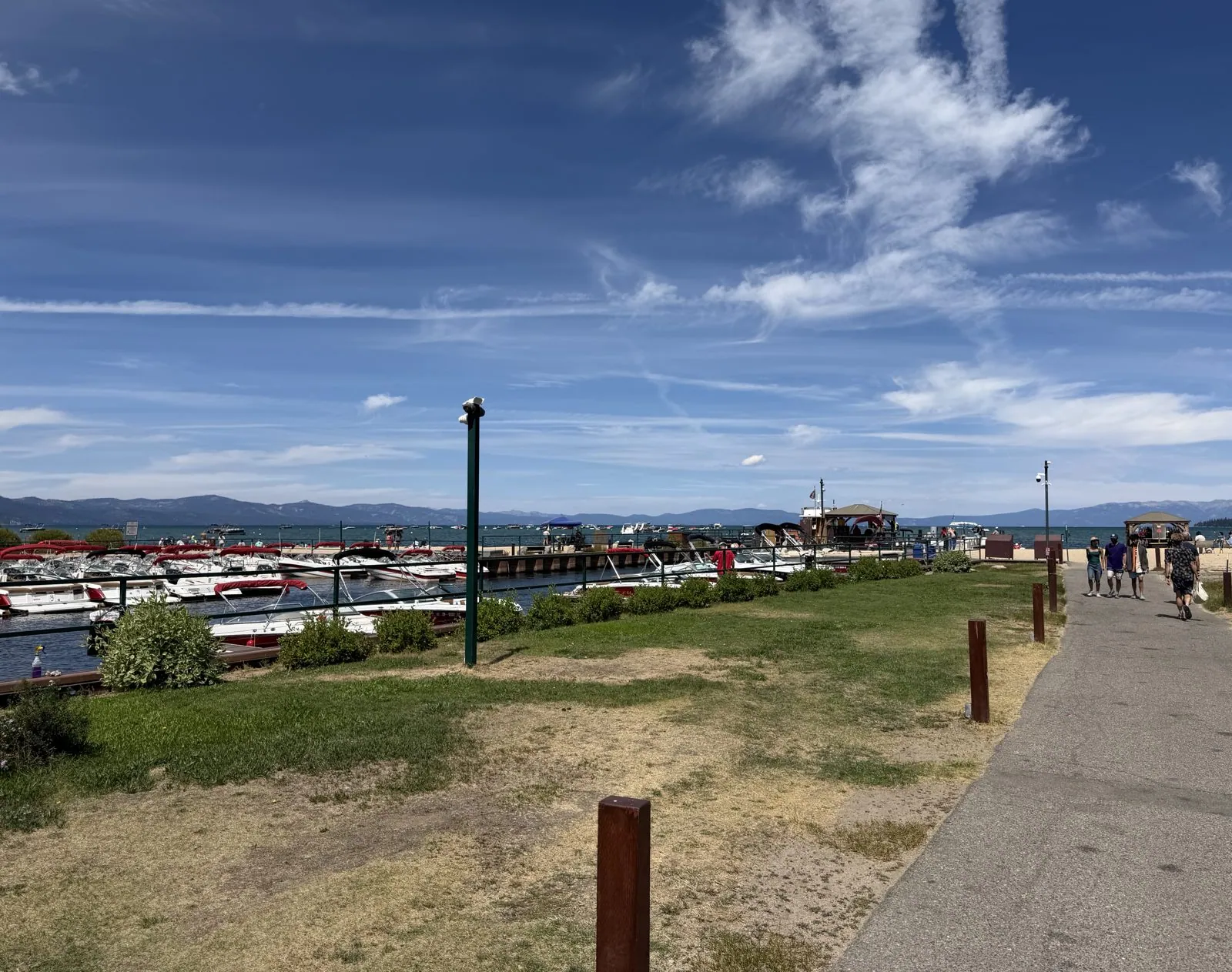
Lake Tahoe is hard to describe by numbers, though the numbers are remarkable. It is twenty-two miles long and sixteen across. It sits on the border of California and Nevada, and it is more than 1,600 feet deep, the second deepest lake in the country after Crater Lake. It holds so much water that, as the local saying goes, if you spread it over California it would cover the state more than a foot deep. Mostly, though, it is blue, a blue that gets darker as the bottom drops away until, a few hundred yards out, it is nearly navy.
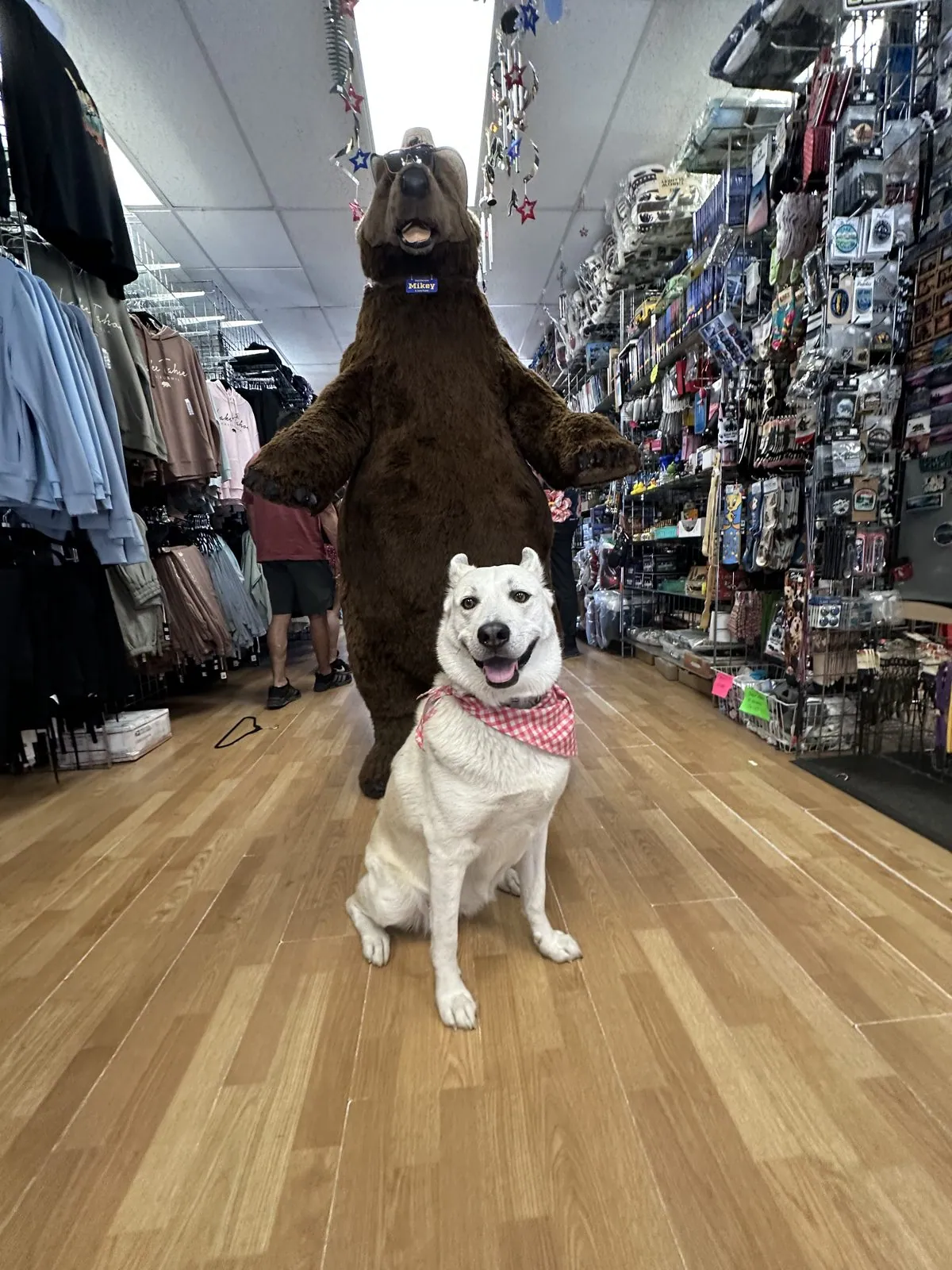
Before the boat we looked into a souvenir shop, where a big brown bear stood upright in the aisle. Wangcai sat down in front of it for her photo.
Wangcai takes the helm
So we rented a red pedal boat and took Wangcai out on it. This, it turns out, was the right decision. She sat up front in her bandana with her ears straight up, facing into the wind like the figurehead on a ship. In every photo from the boat her ears are up, and her nose is pointed at the open water.
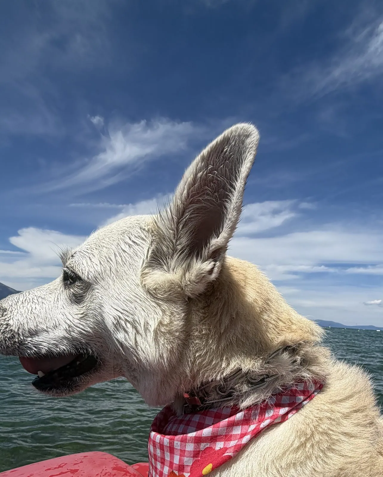
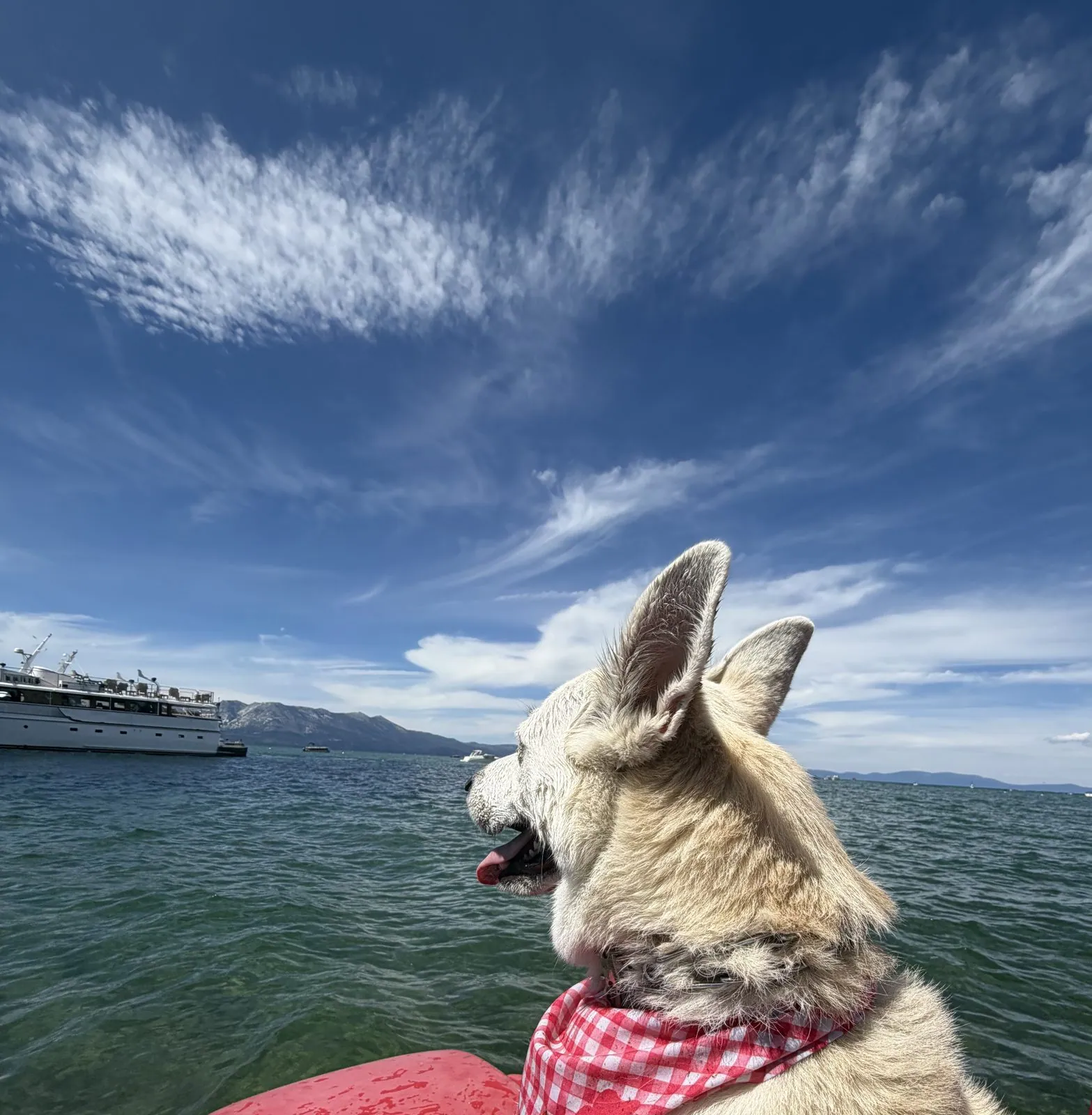
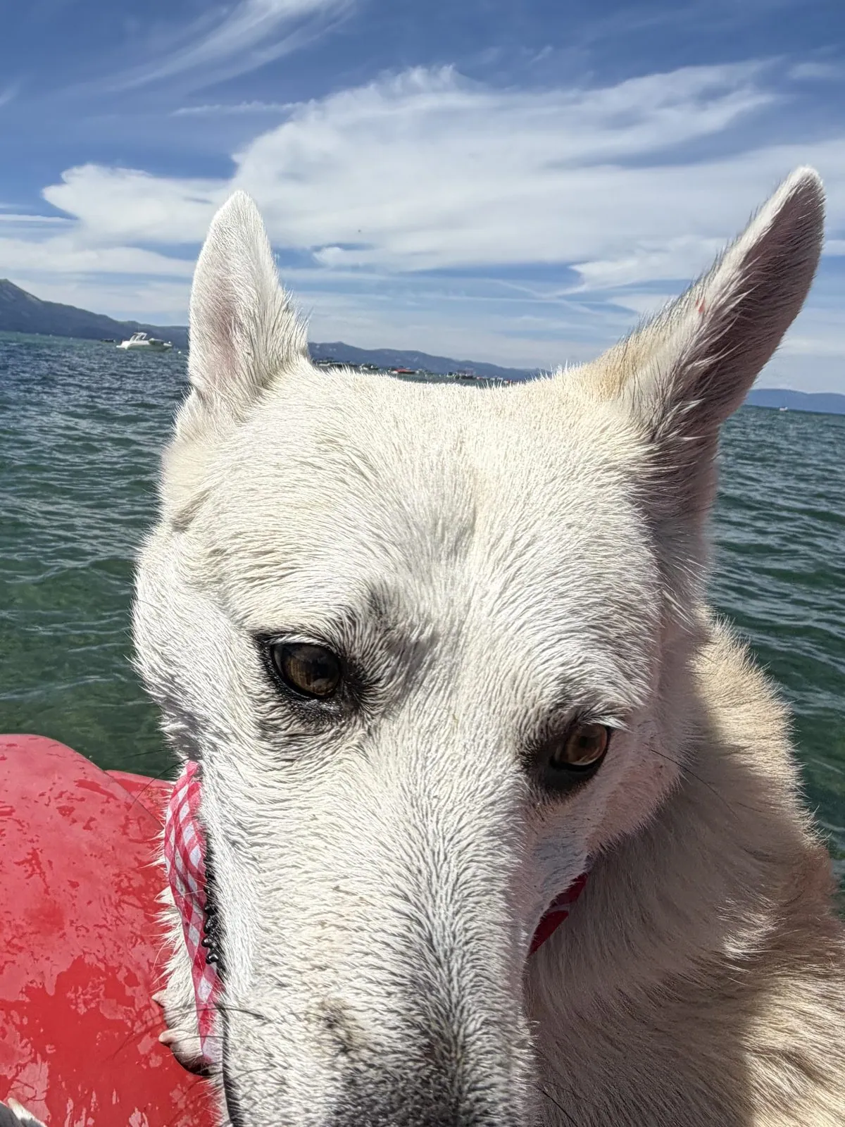
A big white tour boat passed while we were out, a floating hotel compared to our plastic tub, and Wangcai turned her head to watch it. Then she looked straight into the phone, her face a little damp from the spray, with an expression somewhere between patient and unimpressed.
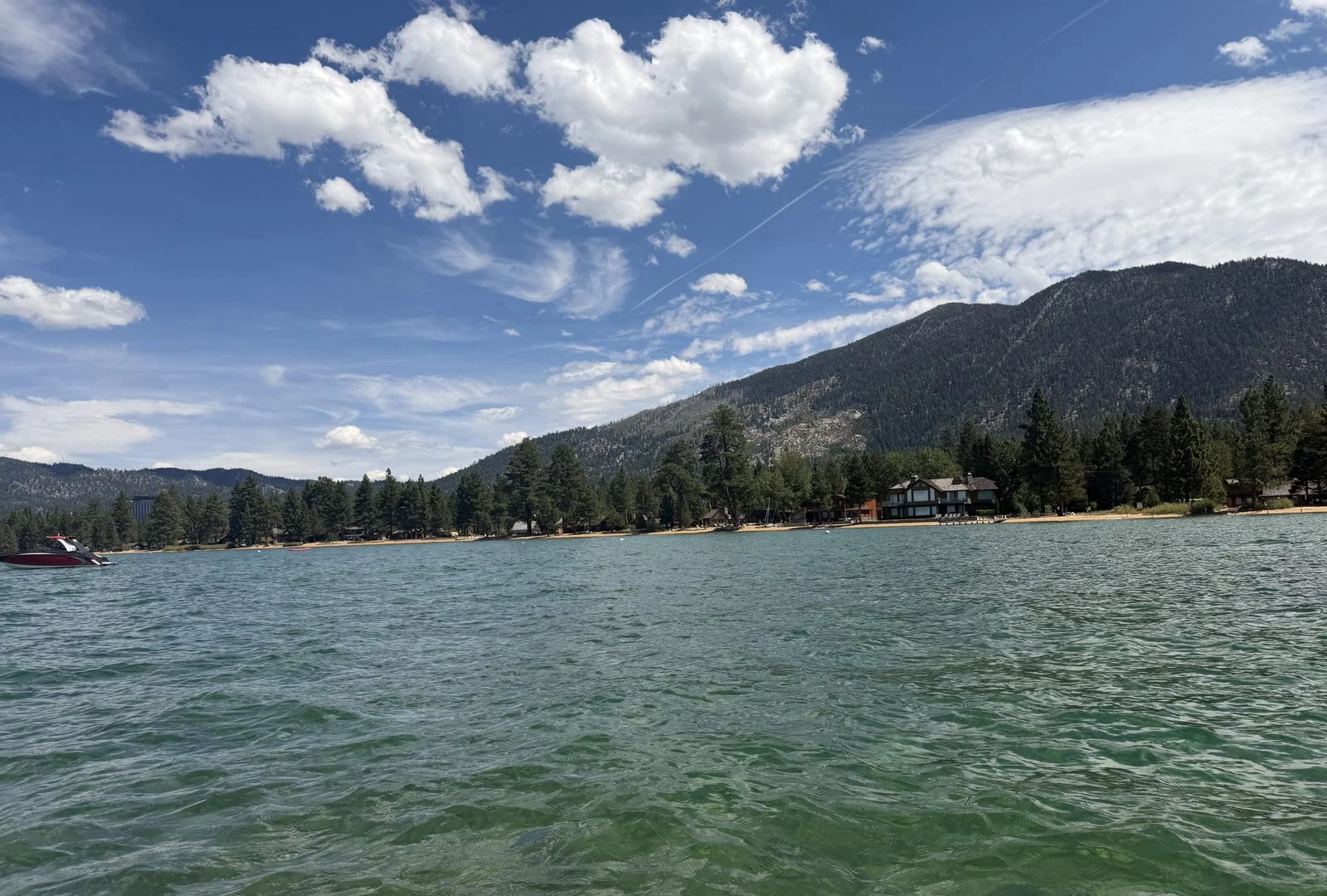
From the water, the shore looks the way Tahoe is supposed to look: a strip of beach, a line of pines, and a mountain rising straight up behind them, with clouds stacked over the top. Near the shore the water was a startling bottle green, and you could see the sandy bottom through it even from a pedal boat. That clarity is Tahoe's real fame. The water is so clear that scientists have measured it for more than half a century by lowering a white disk on a rope and noting the depth at which it disappears.
Stateline
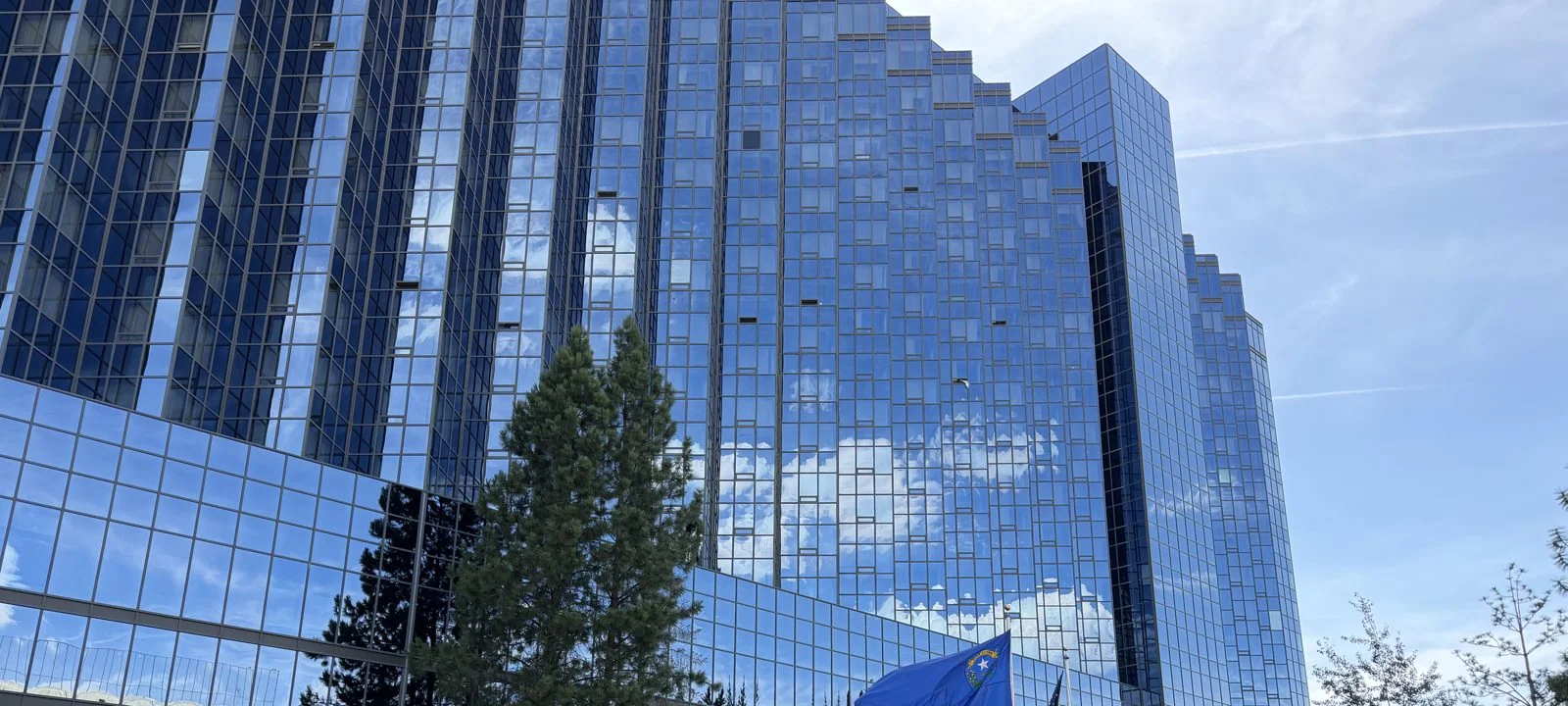
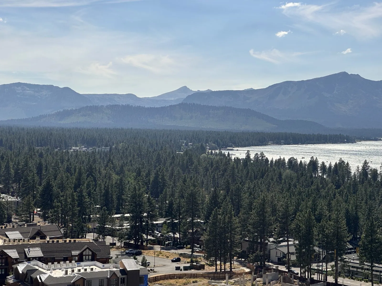
Before crossing into Nevada we stopped for bubble tea, a purple layered drink. A mile up the road, South Lake Tahoe ends and Nevada begins, and you can tell exactly where. On the California side are motels, ski shops and pine trees. Cross the line and suddenly there are high-rise casinos, because gambling is legal on one side and not the other, so the towers crowd right up against the border. The town on the Nevada side is called, with admirable directness, Stateline. We walked the strip for half an hour in the afternoon sun, past glass towers that reflected the sky and the mountains back at themselves. From high up in one of the towers, South Lake Tahoe turns out to be mostly forest, with the lake beyond it.
Carson City
From Stateline the road climbs over the ridge on the east side of the lake and then drops, steeply, into the Carson Valley, out of the pines and into sagebrush. Half an hour later we were in Carson City, Nevada's capital. It is named, indirectly, after Kit Carson, the frontier scout. The Nevada State Capitol is a modest, lovely building from 1871, built of sandstone quarried by inmates at the nearby state prison. On top sits a silver-painted cupola, a nod to the Silver State and the Comstock Lode silver that paid for much of early Nevada.
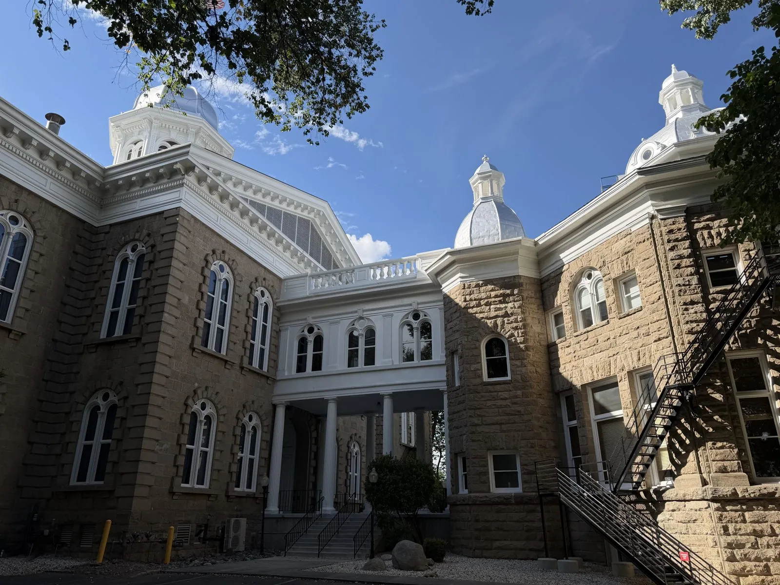
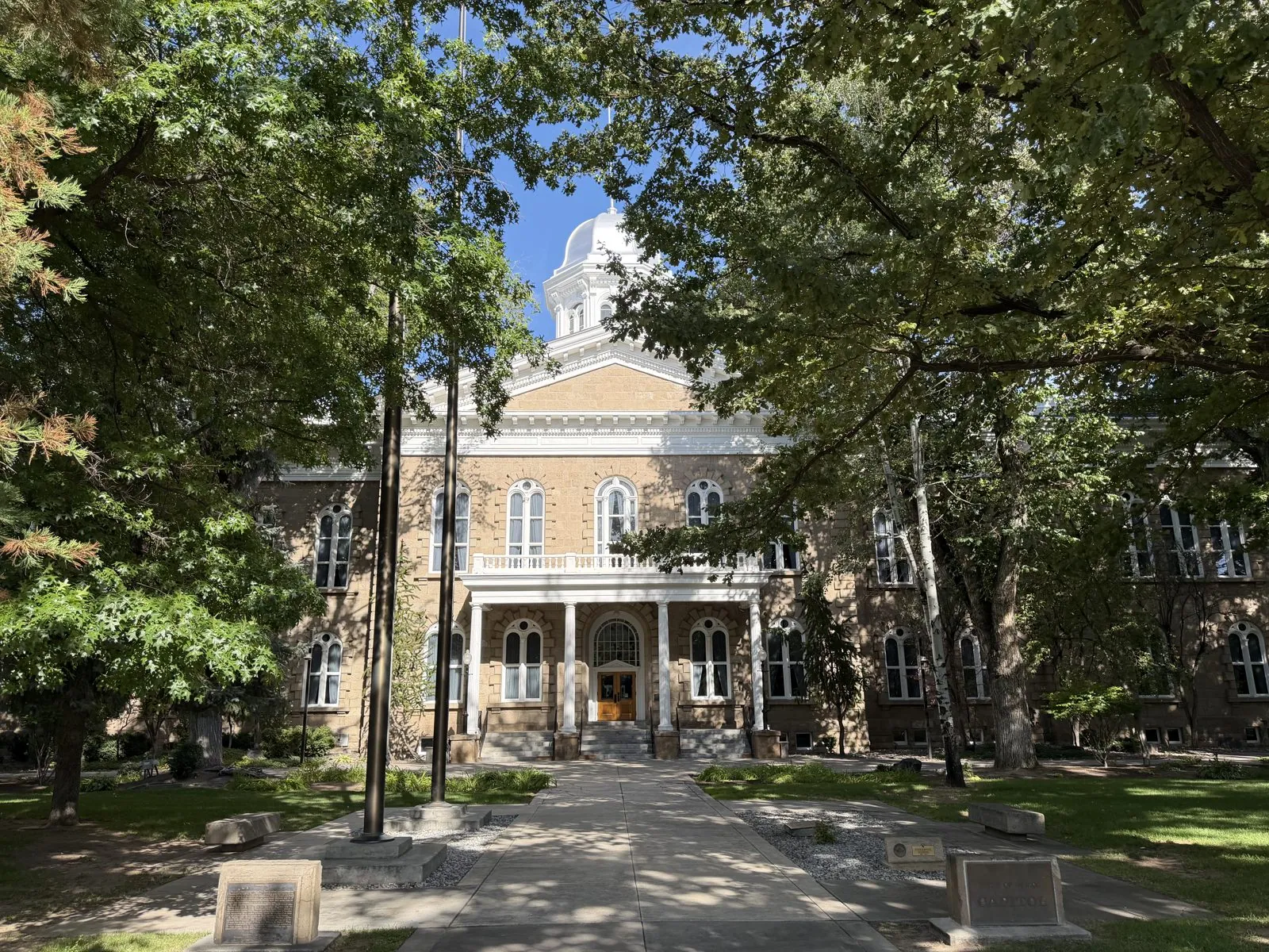
After Sacramento's grandeur, this was a different idea of what a capitol should be. It feels more like a county courthouse in a small town, set in a shady park with old trees and a scattering of plaques. Nevada became a state in 1864, in the middle of the Civil War, which is why "Battle Born" is on its flag. The capitol was built just a few years later, when the whole state had only a few tens of thousands of people.
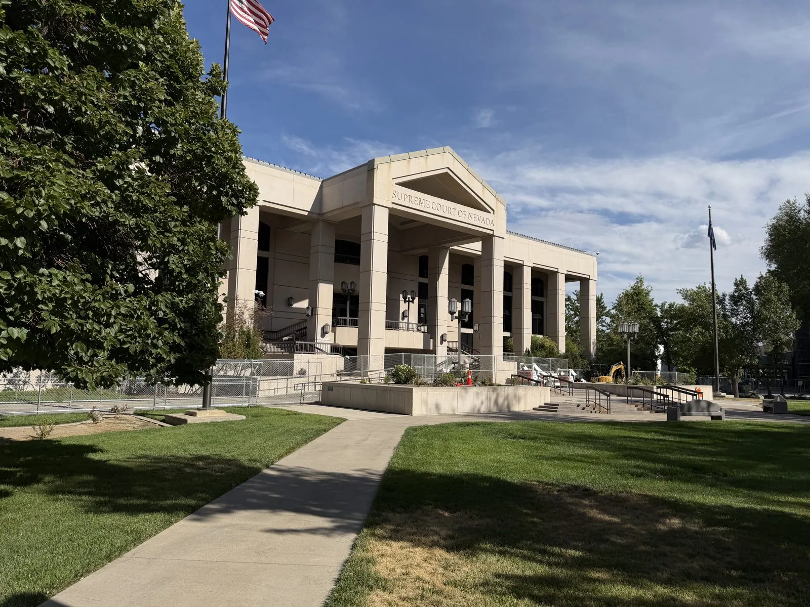
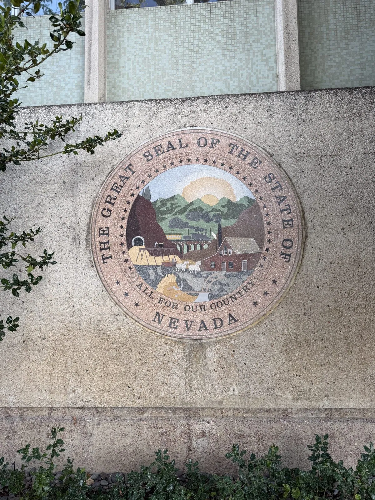
The newer state buildings cluster around the old one. Just south stands the Supreme Court of Nevada, a cream-colored building with a columned portico of its own. On a wall nearby, the Great Seal of the State of Nevada is set into the stone in colored terrazzo. It shows mountains, a rising sun, a quartz mill, a train crossing a trestle and a farmer's wheat, which together sum up how nineteenth-century Nevada made its living. Around the rim runs the state motto, "All for Our Country".
Reno and the Truckee River
By a quarter to seven we were thirty miles north, in Reno, walking along the Truckee River downtown. The Truckee is Lake Tahoe's only outlet. It leaves the lake at Tahoe City, tumbles down through the canyon, runs straight through the middle of Reno and ends in Pyramid Lake out in the desert. So the water rushing past us had been in Lake Tahoe not long before, which felt like a neat way to tie the day together. Wangcai took a different view of the river. It was full of ducks.
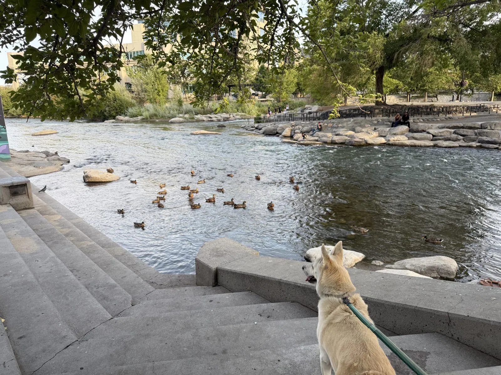
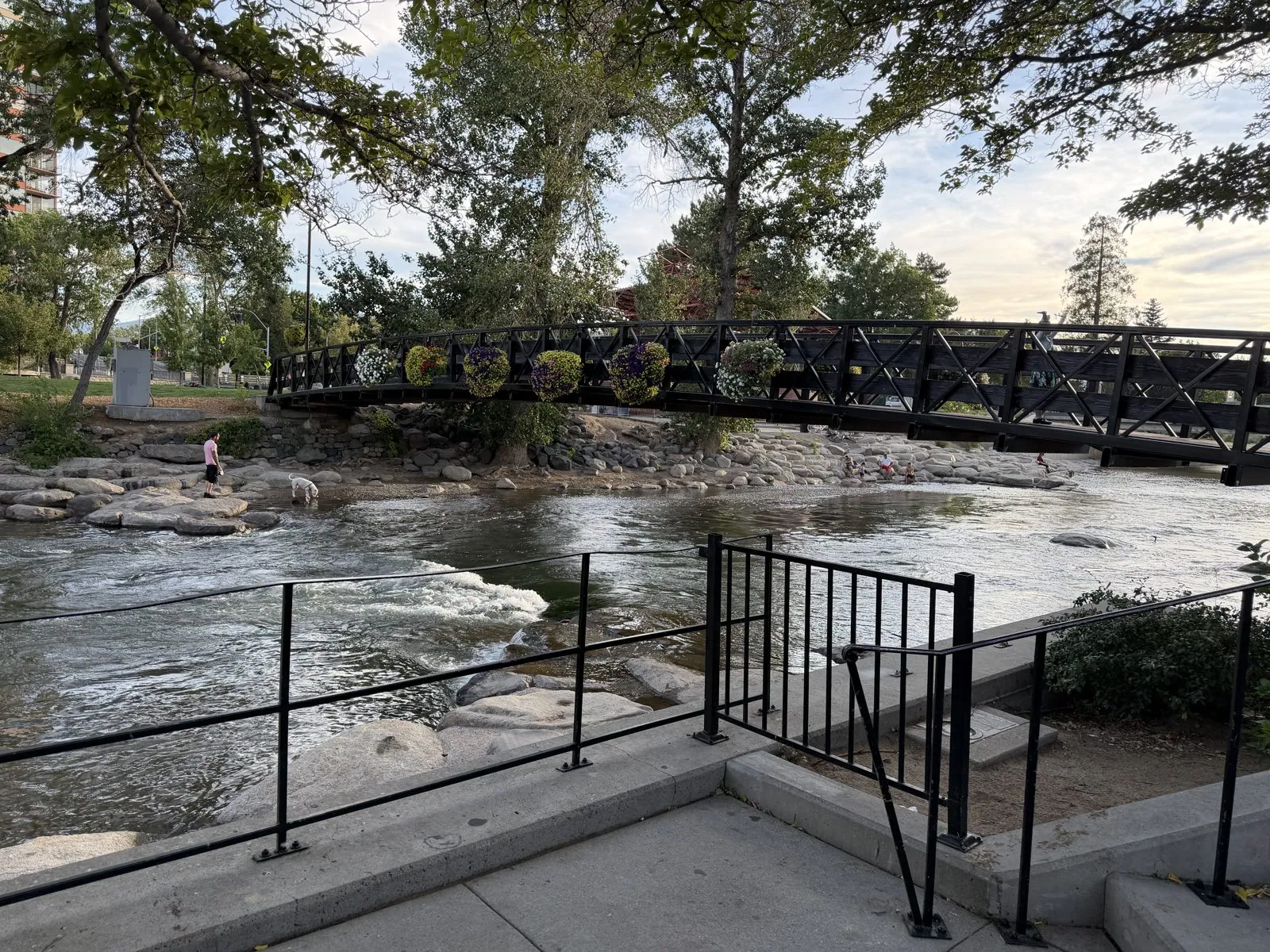
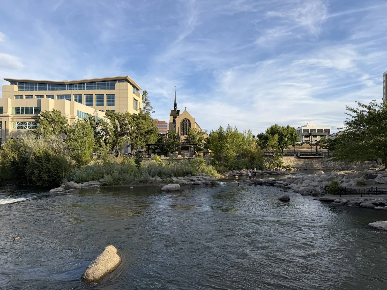
This stretch of river has been rebuilt as a whitewater park. Boulders have been placed to make small rapids and pools, and there are steps down to the water and footbridges across it. On an August evening it is full of people wading and dogs swimming. The light was going gold, and across the river a stone church spire stood against the sky next to a glassy modern office block. Reno is like that: a casino town with a very pleasant river running through it that most visitors never see.
That is where the photos for Sunday stop. For the night we crossed back into California, to the Martis Valley Lodge outside Truckee.
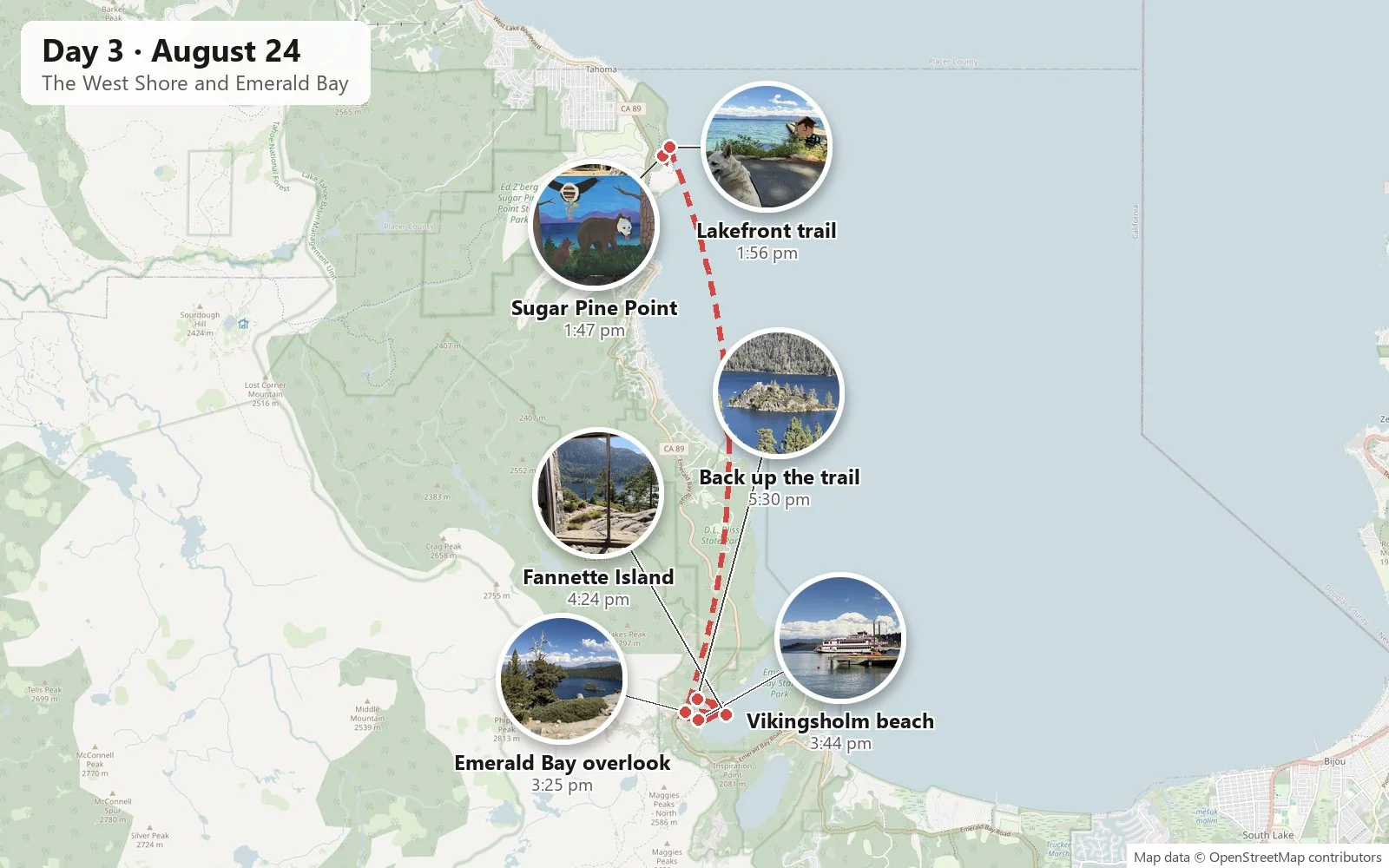
Day 3: The West Shore and Emerald Bay
Tahoe City
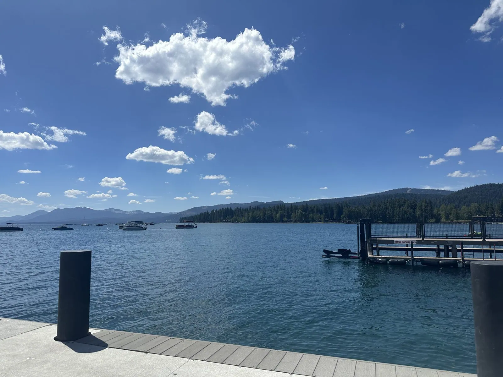
Monday was the day for the lake itself. Coming down from Truckee, we stopped first in Tahoe City, at the lake's north-west corner, for an açaí bowl and a look along the waterfront. This is where the Truckee River leaves the lake, the same river we had watched in Reno the evening before.
Sugar Pine Point
By early afternoon we were at Sugar Pine Point State Park on Tahoe's West Shore, a big stretch of pine forest that runs right down to the water. In 1960 it hosted the cross-country skiing events of the Winter Olympics at nearby Squaw Valley, now Palisades Tahoe. In summer it is quiet: a nature center, picnic tables under enormous trees, and an old lakeside estate from the turn of the century. By the nature center stood a painted board of Tahoe wildlife with holes cut out for faces: a chipmunk, an eagle and a black bear.
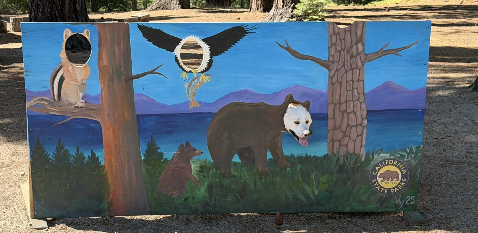
The camera roll contains thirteen photographs of this board, taken in under a minute, and the bear's face changes from one to the next. In several of them it is Wangcai's: white, ears tucked behind the edges of the hole, tongue out. It is clearly the best bear in the park.
From there a lakefront trail runs along the shore under tall pines. It isn't a hike so much as a stroll on a paved path, with benches and picnic tables and glimpses of blue between the trunks. Wangcai led, leaning into her leash and stopping every few yards to smell something important. The pines here are huge, with thick, cracked orange bark, and the light under them comes down in patches.
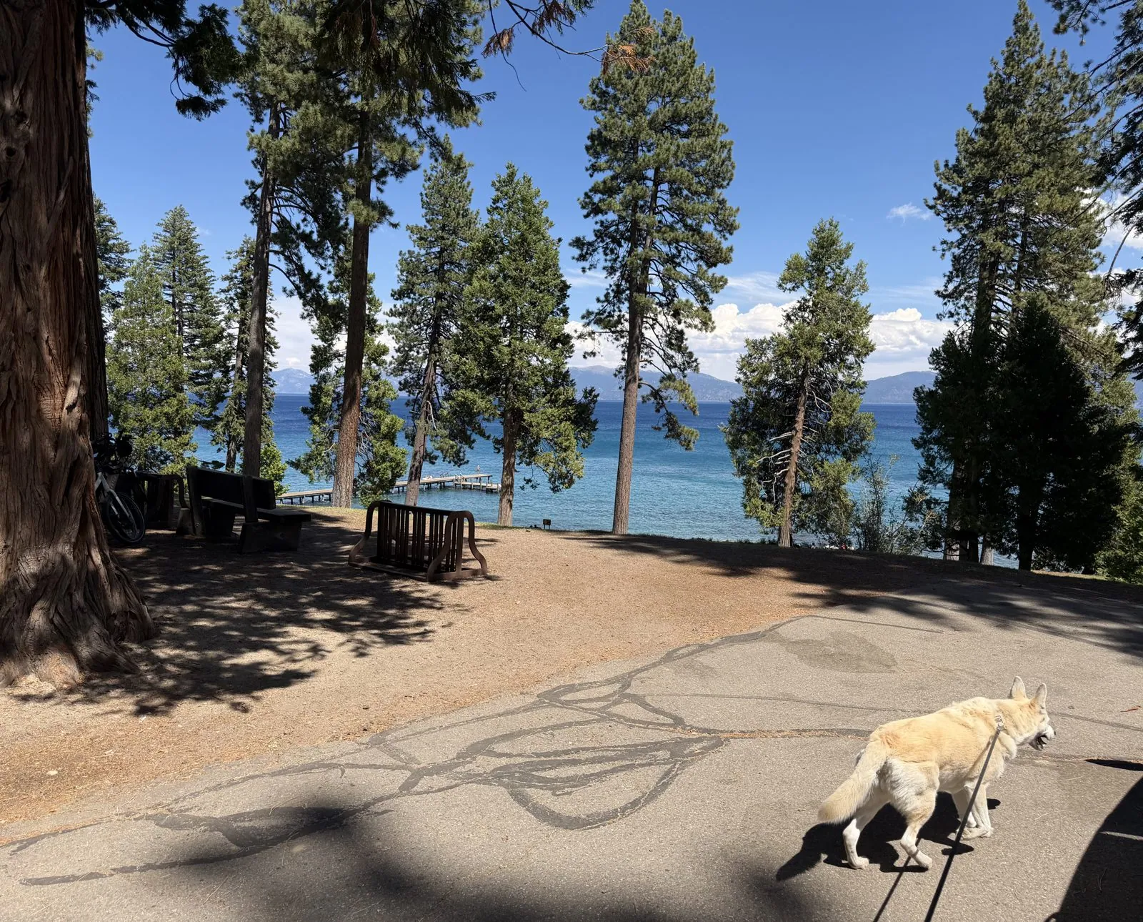
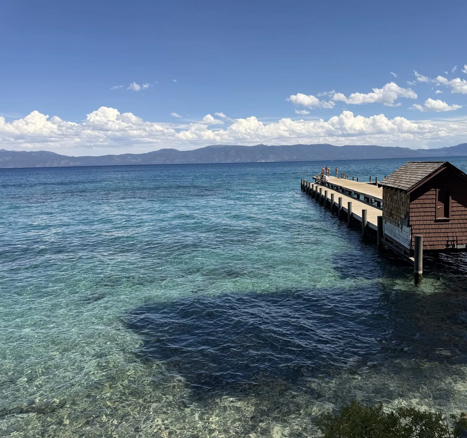
The trail comes out above a long wooden pier with a little brown boathouse halfway along it. The water around the pier is the color people mean when they say "Tahoe blue". Near the shore it is pale turquoise over white sand, then it turns jade over the shallows, then it drops off into deep blue. Wangcai sat on the path for her portrait with the pier behind her, tongue out.
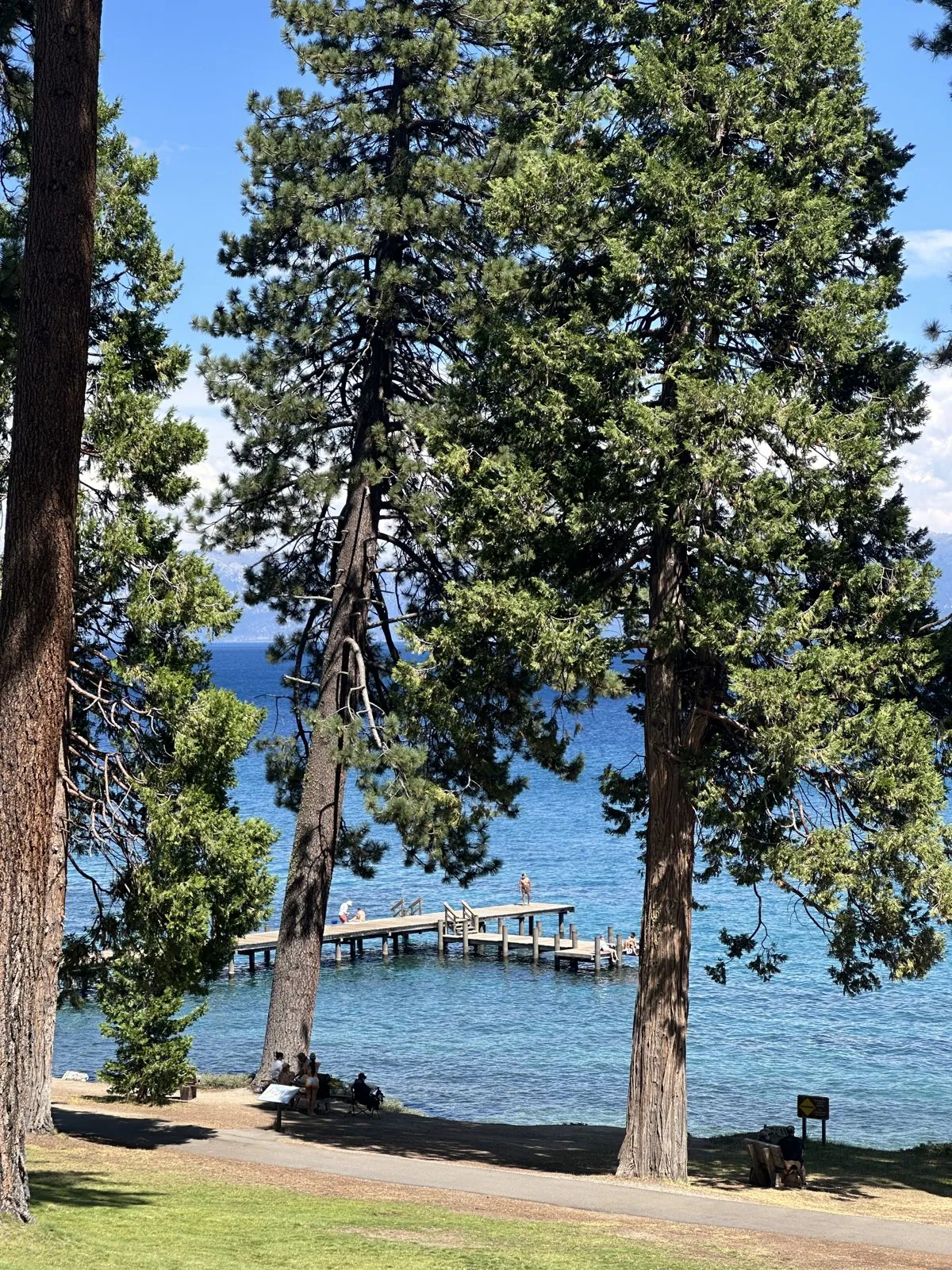
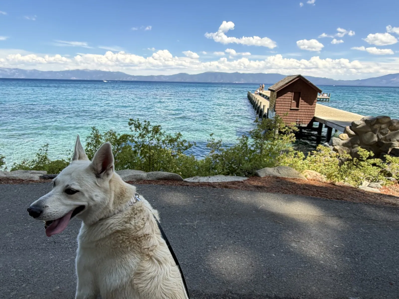
It's worth looking at the water itself for a minute, because it doesn't look like a lake. Looking down from the shore, you can see every rock on the bottom several feet down, as clear as through glass. The shadow of a cloud passing overhead made a dark patch on the lake floor, sharp-edged, as if someone had spilled ink in a swimming pool. The far shore, ten miles away in Nevada, was a crisp line of blue mountains with white cumulus piling up above them.
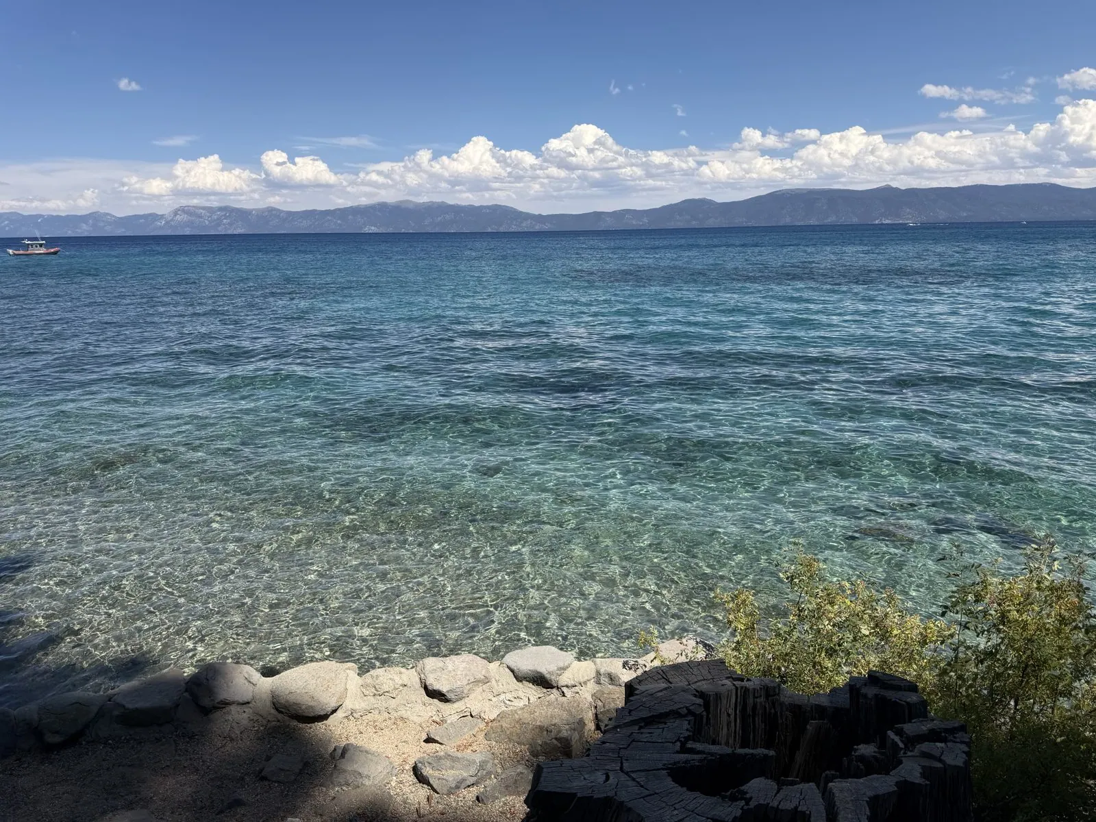
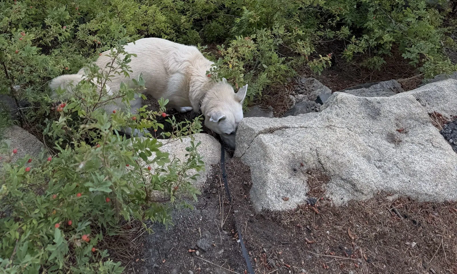
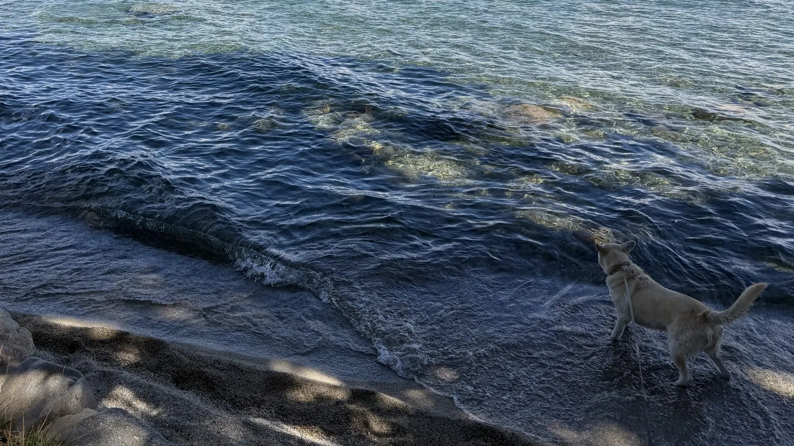
Wangcai found her own way down to the water. She picked her way through the bushes onto the granite boulders at the edge and put her nose right down to the lake, as if she were checking its temperature. A few minutes later, she was wading along the shoreline in the small waves, soaked to the shoulders.
Emerald Bay from above
Fifteen minutes south, the road along the West Shore climbs high above the lake and threads along a narrow ridge with drops on both sides. Below it lies Emerald Bay, the most photographed place on Lake Tahoe. It is a long, narrow inlet carved by a glacier, almost sealed off from the main lake by a moraine at its mouth. In 1969 it was declared a National Natural Landmark. We stopped at the overlook a little after three and walked out onto the bare granite slabs above the bay, where a single bleached snag stands guard. This part of the day was a two-person affair: Wangcai stayed behind in the car, which keeps itself cool for her with the climate running (Tesla calls it Dog Mode), while we went down to the water.
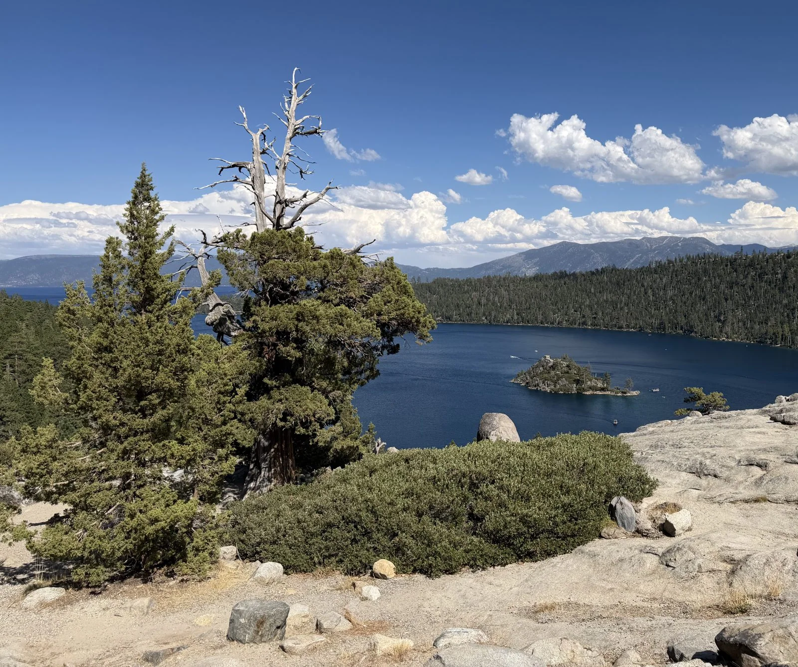
From up here the whole bay is laid out like a model. There are forested slopes on both sides, the narrow mouth to the right opening onto the big lake, and, in the middle, a tiny rocky island with a few pines on it. That is Fannette Island, the only island in all of Lake Tahoe. Hold that thought, because an hour later we would be standing on it.
Down to Vikingsholm
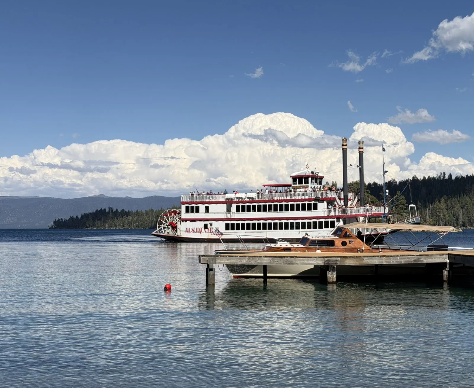
From the road a steep trail drops about a mile down to the head of the bay, to Vikingsholm. It is a Scandinavian-style mansion built in 1929 for Lora Knight, a wealthy philanthropist who wanted a summer home that matched the fjord-like bay. The beach below it is a curve of white sand with a long wooden pier. When we got down there, a big white paddlewheeler, the M.S. Dixie II, was lying in the bay just off the pier. It is one of the tour boats that bring visitors across Lake Tahoe to see Emerald Bay from the water.
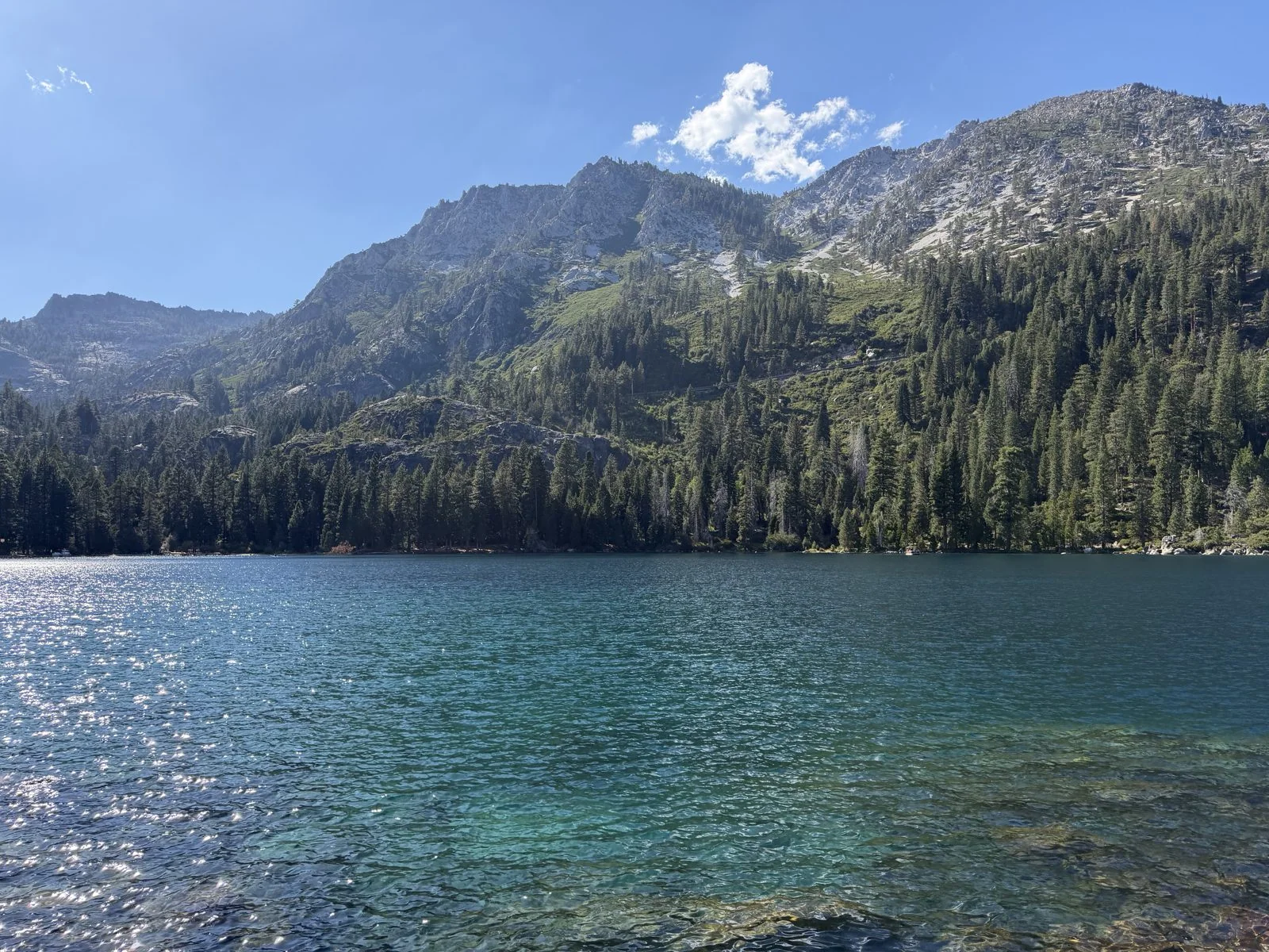
Down at water level the bay lives up to its name. Near shore the water was a clear, glassy green over pale rocks; behind it, the mountains at the head of the bay rose almost straight up, granite and pine, with one cloud parked on top. The GPS for this photo puts it out on the water, off the shore, and that is where we were: from the beach we set out for the island by kayak, a yellow two-person one.
Fannette Island and the tea house
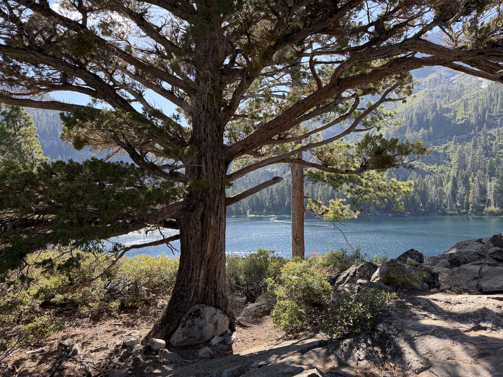
By 4:17 we had pulled the kayak up on the rocks and the photos were coming from the island itself. Fannette Island is a lump of granite about 150 feet high, with a few twisted junipers and pines clinging to it. Lora Knight, the same woman who built Vikingsholm, also built a tiny stone tea house on the summit of the island in 1929. The story goes that she had guests rowed out from the mansion for afternoon tea with the best view on the lake. The trail to the top winds up past an old juniper with a trunk as thick as a barrel.
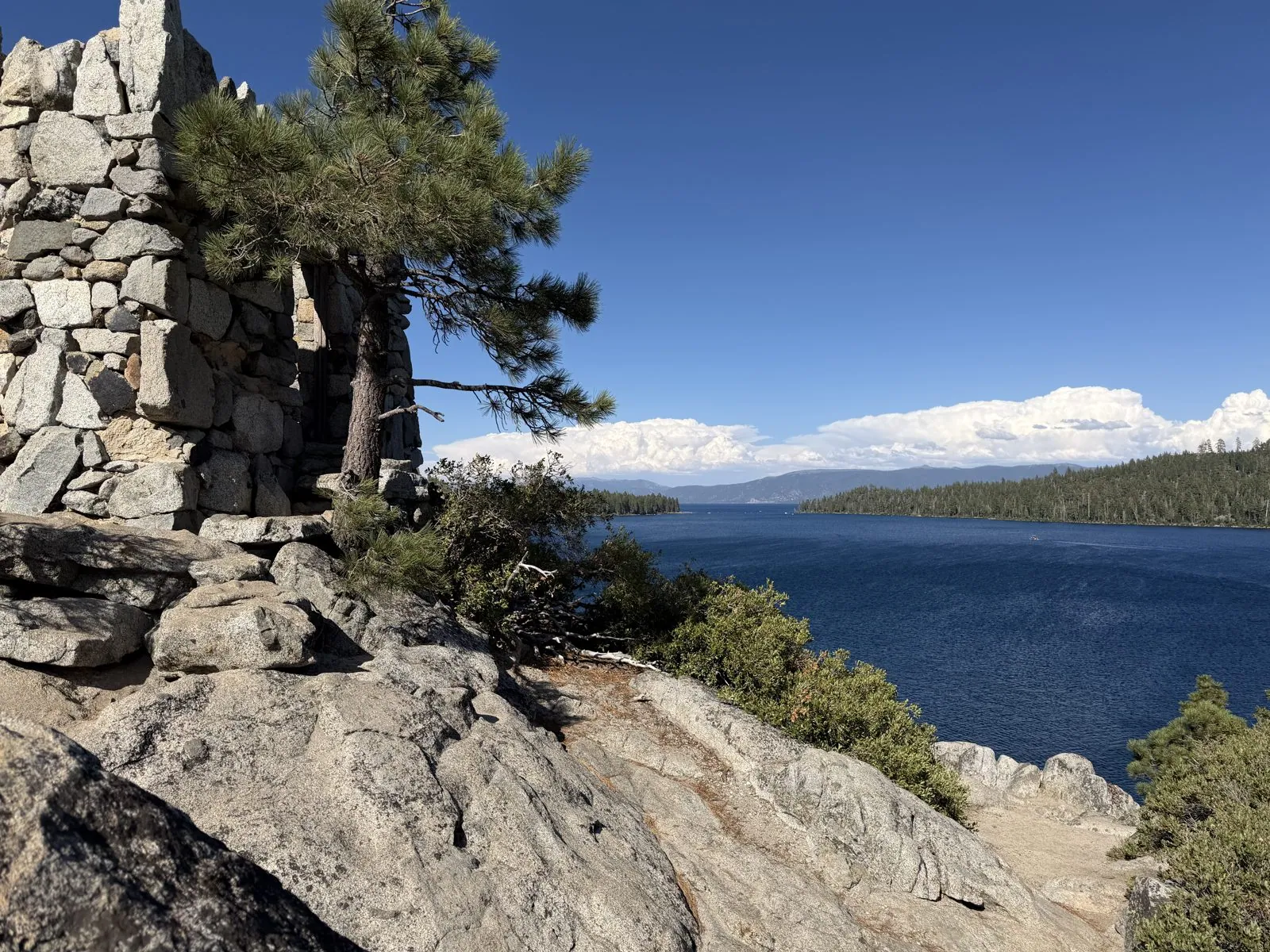
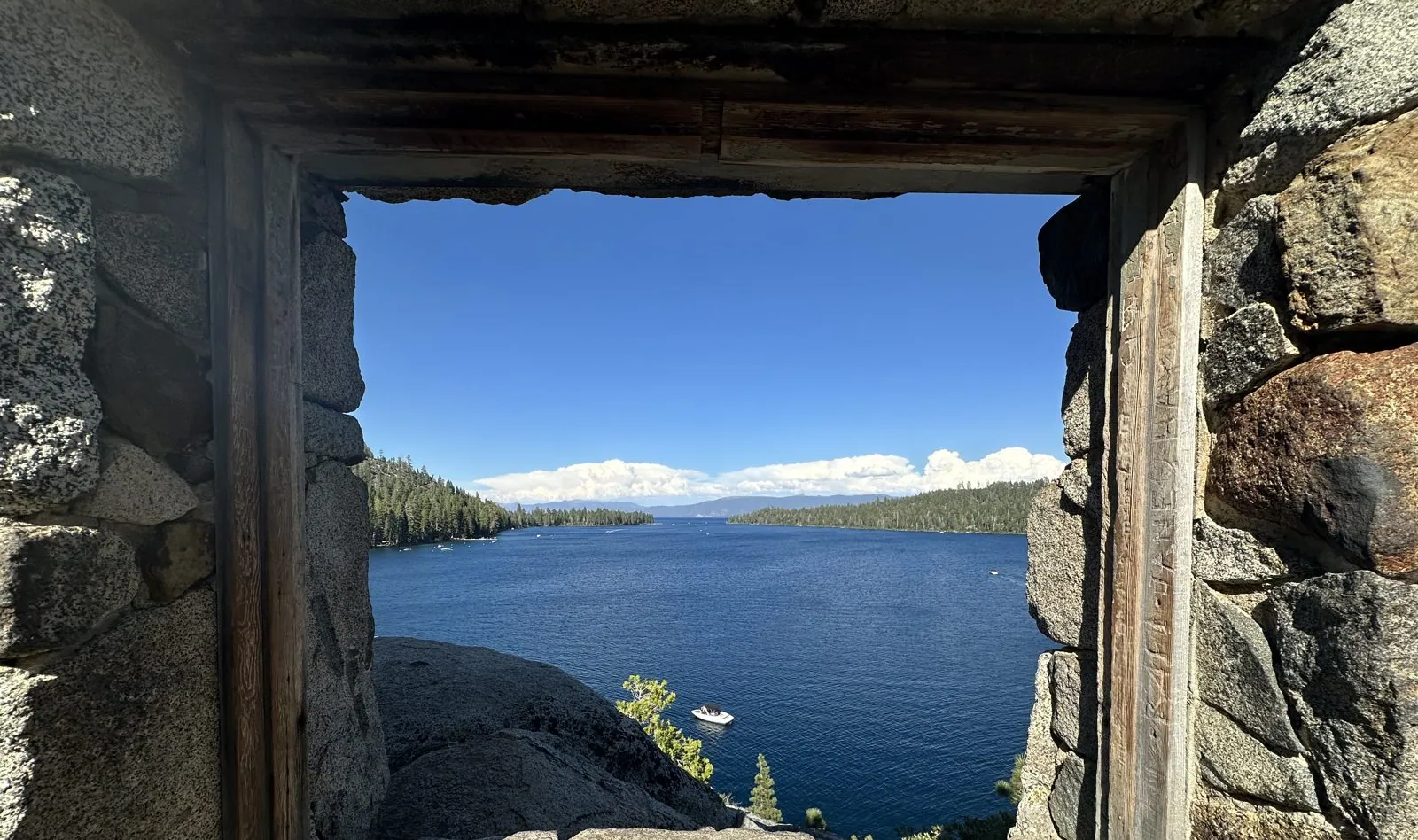
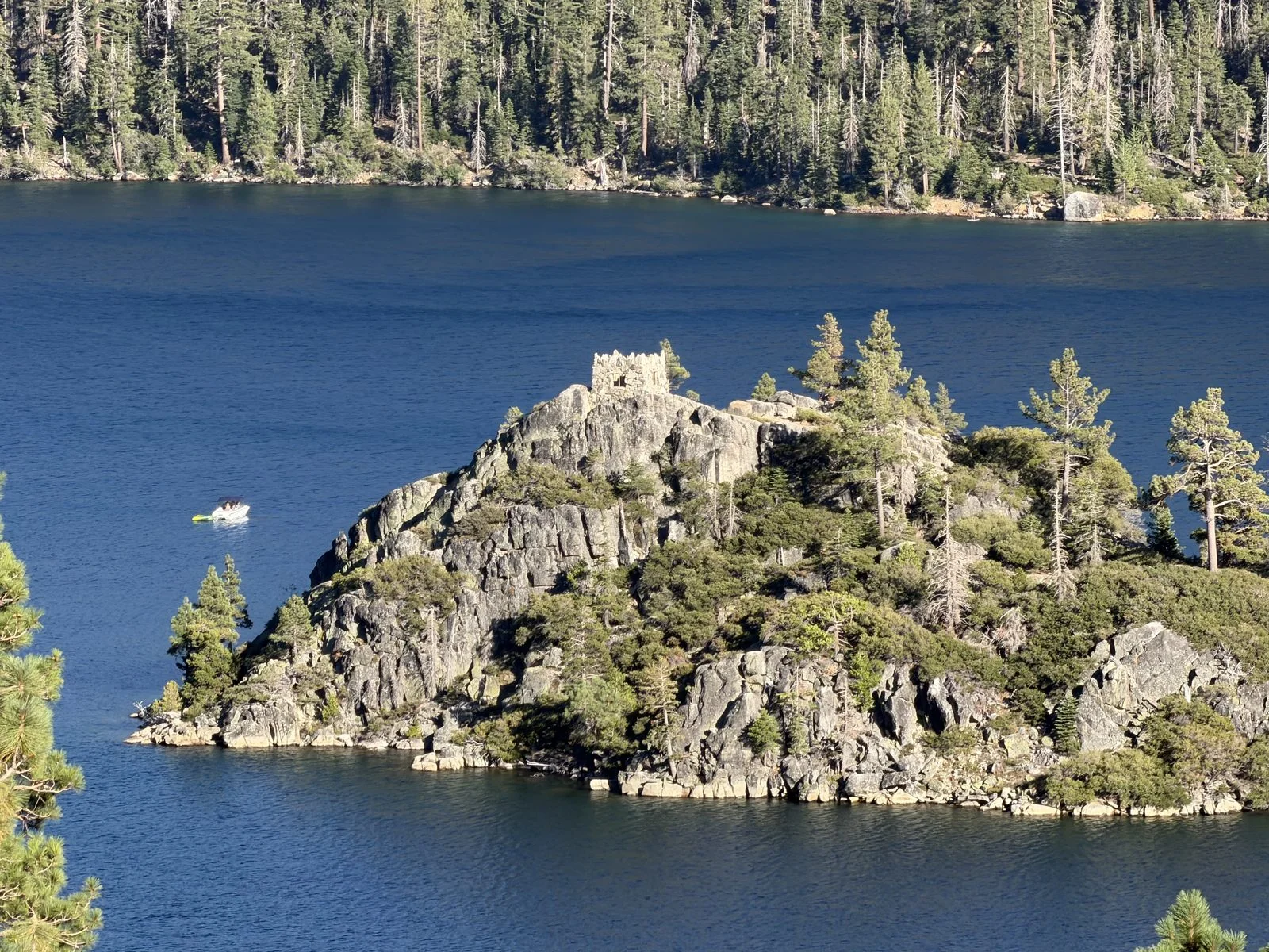
Today the tea house is a roofless ruin, just four rough stone walls the size of a small room. The wooden window frames have survived, though, and they are the reason people make the trip. Each one frames a different piece of the bay: through one, the forested slopes and the far shore; through another, a rectangle of perfect deep blue water with a wall of pines above it.
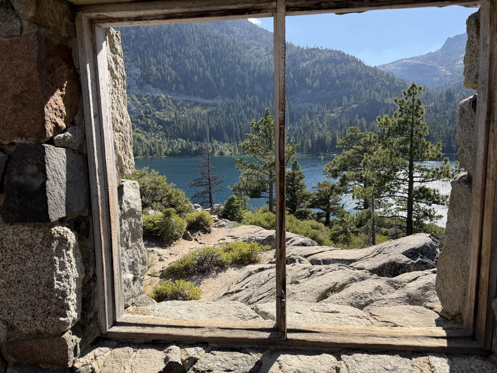
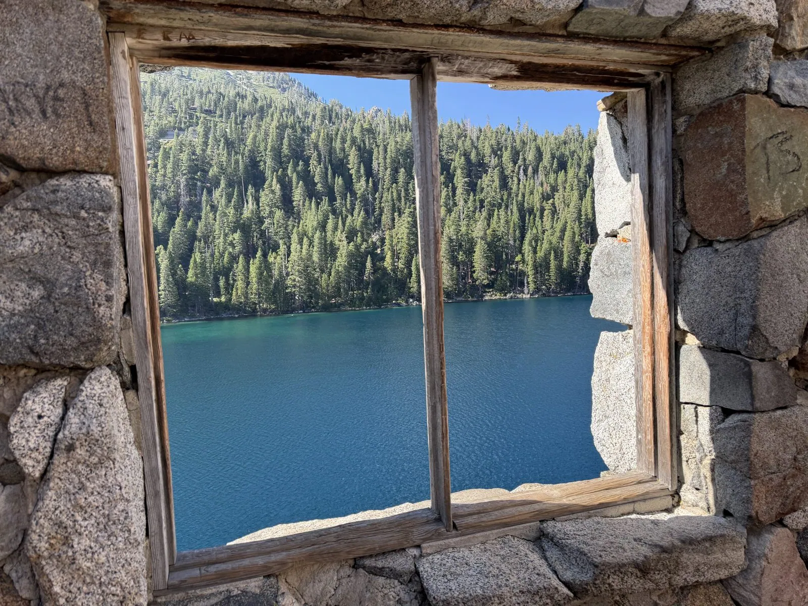
Through a third, the bay runs out between its forested points toward the open lake. It looks less like a view than a set of paintings someone hung on the walls, and it is very hard to stop taking photographs of it.
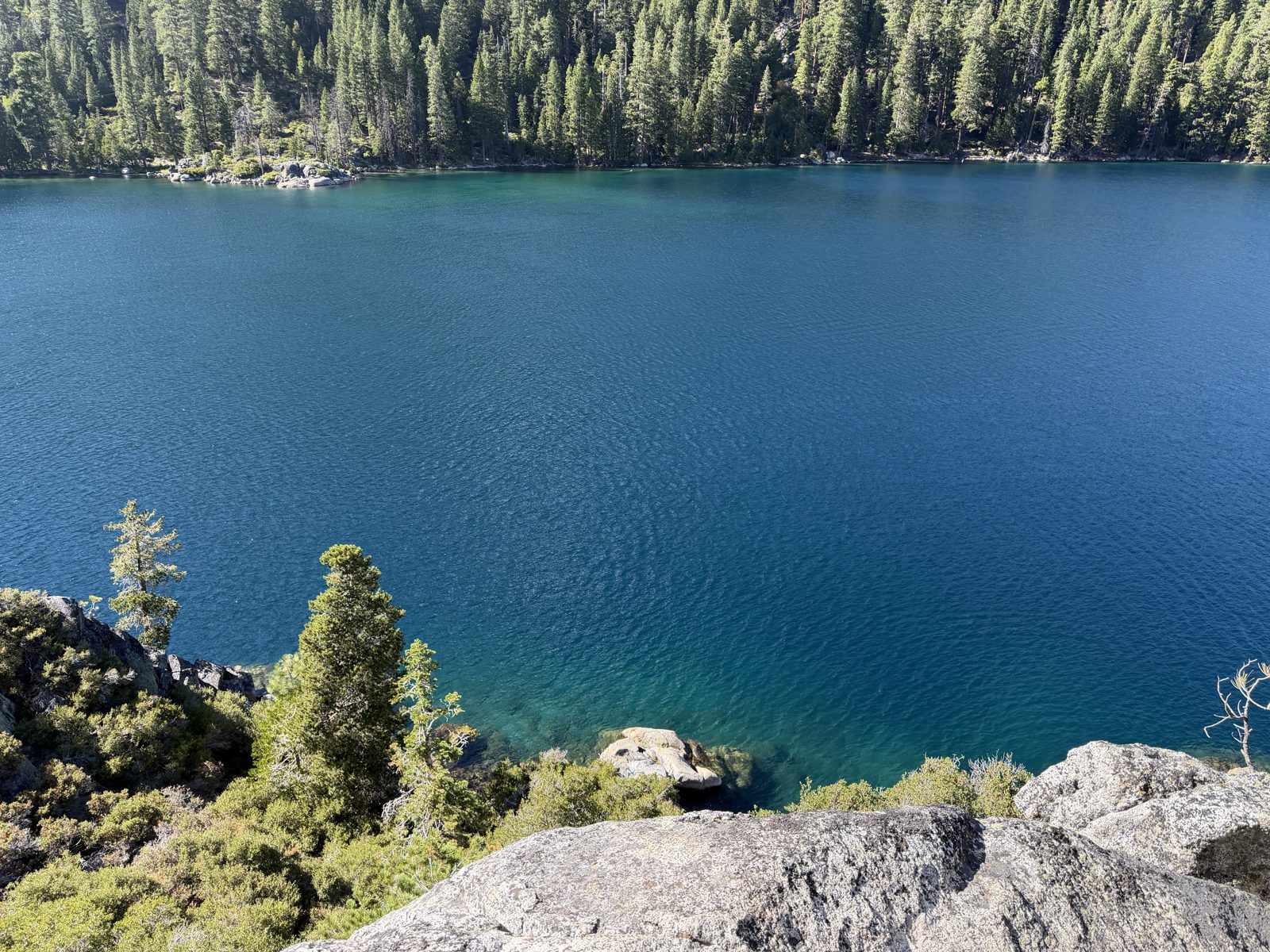
Step outside the walls and you look straight down the island's rocky flank into water that has turned a deep, saturated blue, almost purple in the middle of the bay where it is deepest. The far shore is a solid wall of pine. It was late afternoon, the sun was low enough to warm the granite, and apart from the occasional boat it was very quiet.
One last look from above
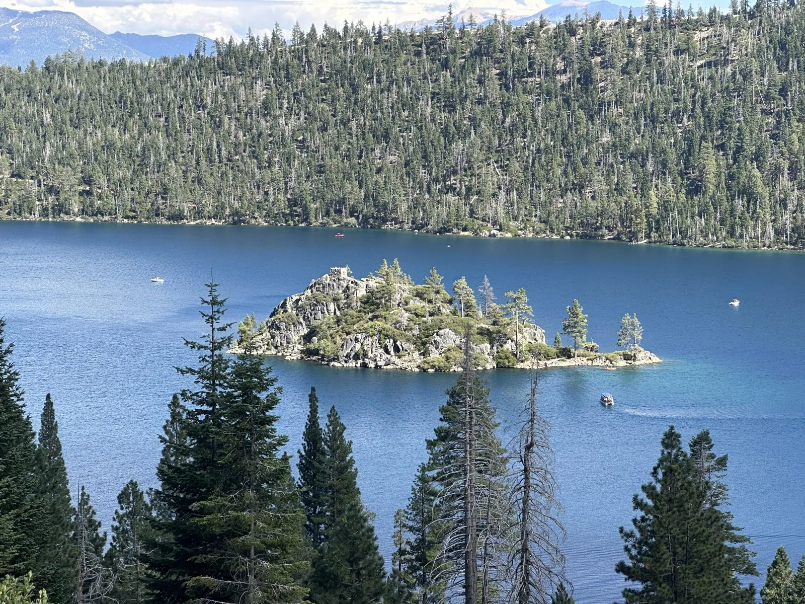
The trail back up from Vikingsholm is the price of the visit: a mile of trail that climbs some five hundred feet, all of it in the afternoon sun. We were back near the top at 5:29. From a spot beside the trail, looking down through the pines, the island we had just stood on looked tiny again, a toy island in a toy bay.
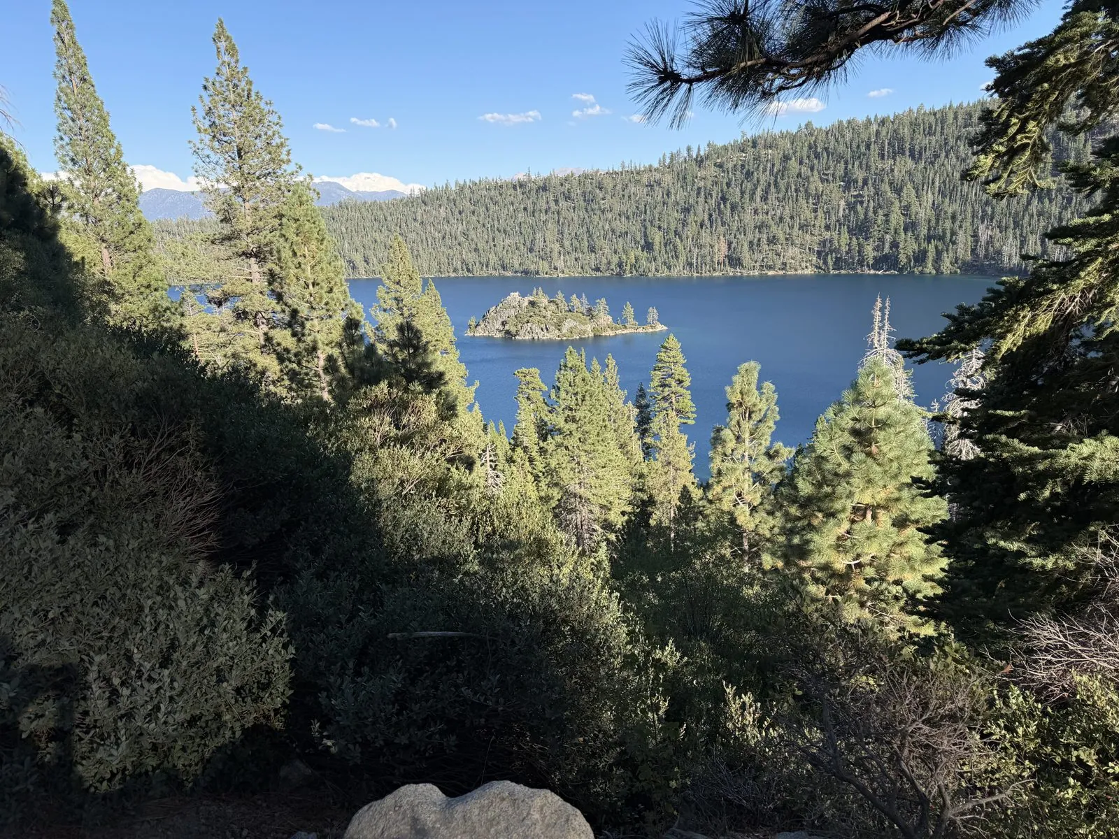
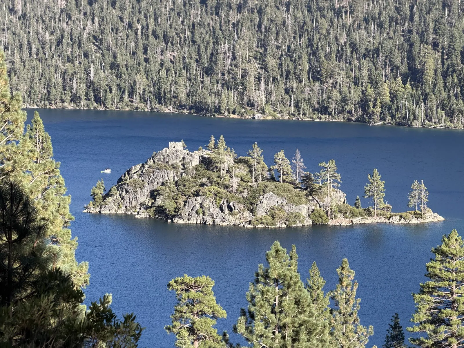
Zoomed in, though, you could see everything we had just walked: the granite shoulders of the island, the junipers and pines on its ridge, and at the very top the small square stub of the tea house, gray against the trees. A single small motorboat was idling in its shadow. It was the last picture of the lake, and the best one.
Days 4 and 5: Santa Cruz and Carmel
The last two days traded the mountains for the sea.
The Chinatown gate
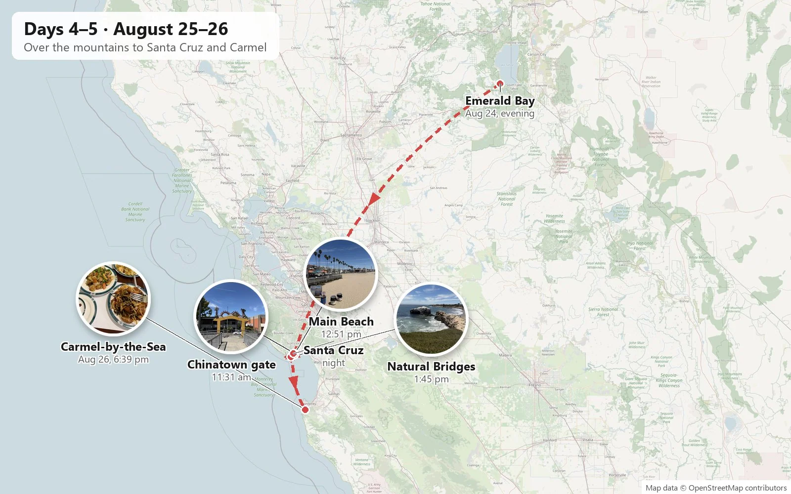
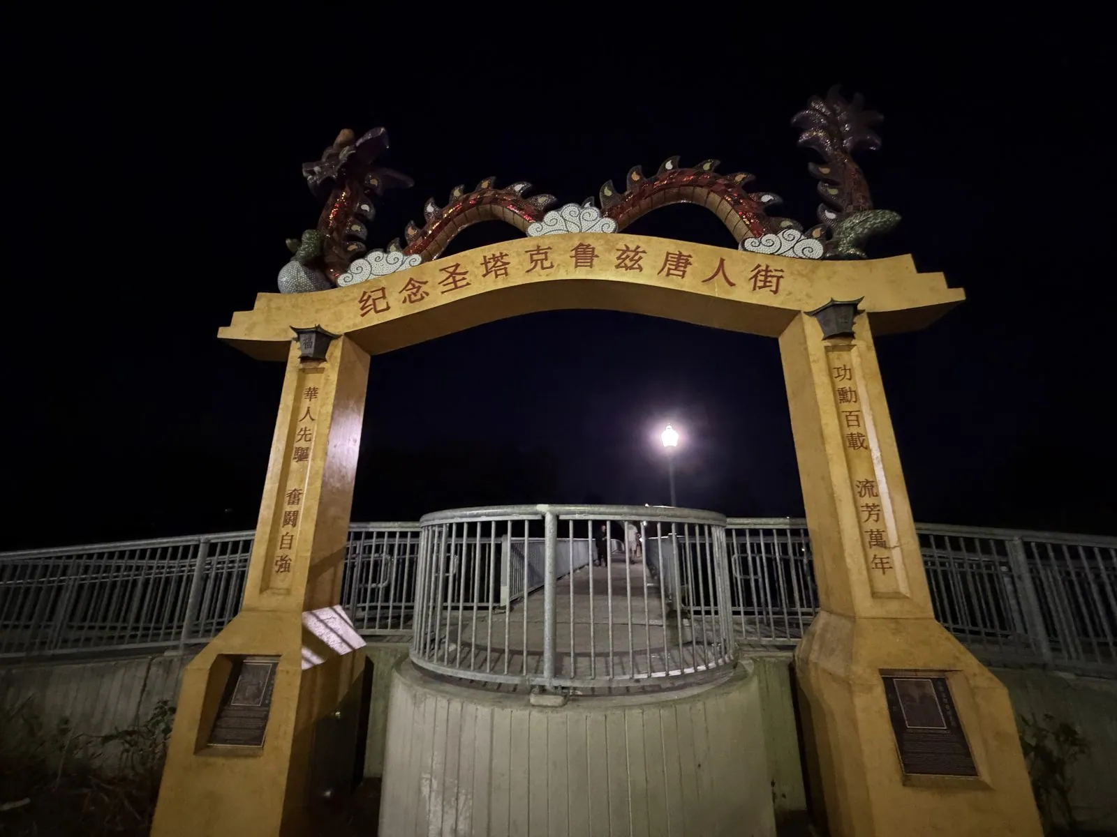
Between Emerald Bay and Santa Cruz lies the whole width of Northern California: down out of the Sierra, across the Central Valley, around the bottom of the Bay Area and over the Santa Cruz Mountains. The camera roll records none of it. We reached the Hotel Paradox in Santa Cruz close to midnight and stayed two nights. The next photo is from 11:31 the following morning, on the riverwalk along the San Lorenzo River in Santa Cruz. It shows a yellow gate topped with two writhing dragons. The inscription across the top reads 纪念圣塔克鲁兹唐人街, "In memory of Santa Cruz Chinatown".
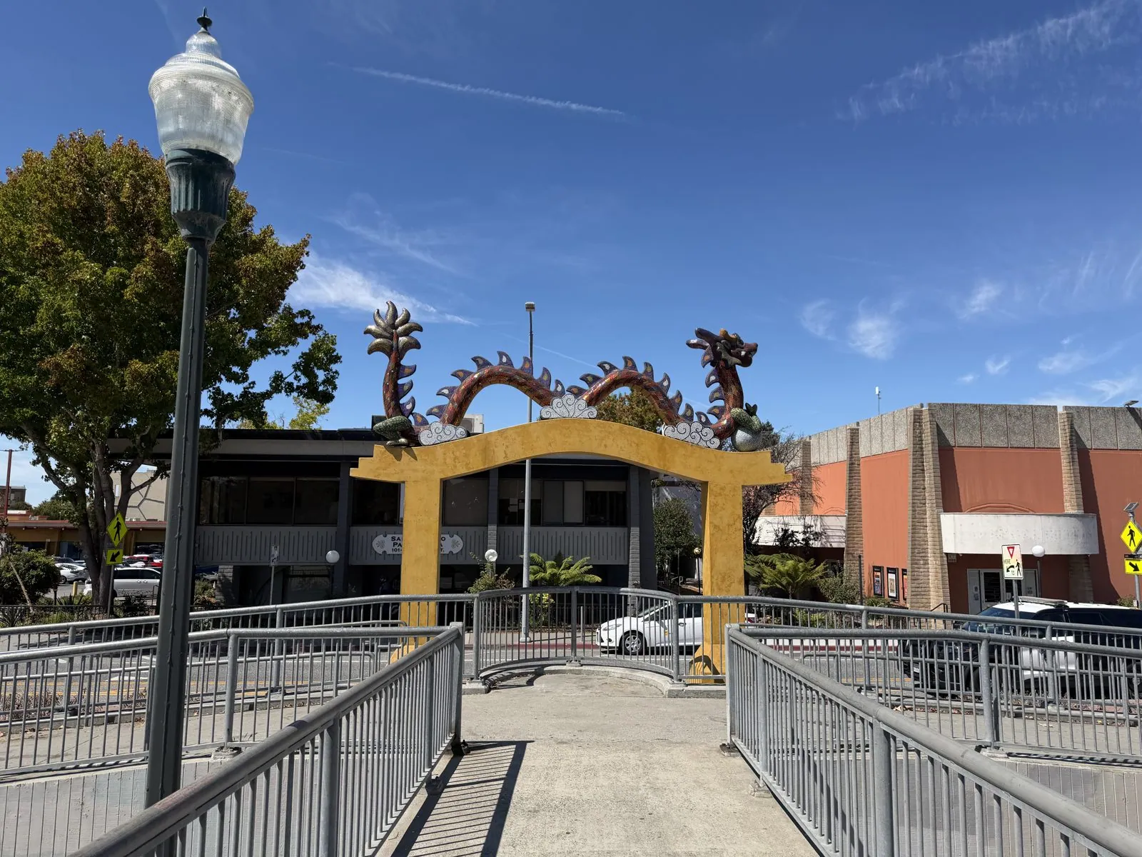
It is a memorial to a neighborhood that no longer exists. Santa Cruz had a series of Chinatowns from the 1860s on, home to Chinese workers who built the railroads and worked the farms and fisheries of the Monterey Bay. The last of them sat on low ground by the river and did not survive the great flood of 1955. Today it is parking lots and shops, and the gate is one of the few signs it was ever here.
The beach and the cliffs
After lunch with Wangcai on a café patio downtown, we went out to the Municipal Wharf, which runs nearly half a mile out into Monterey Bay and has done since 1914. From it you look along Main Beach: a wide, flat crescent of pale sand lined with palms, and behind it the Santa Cruz Beach Boardwalk. That's the seaside amusement park from 1907, the oldest surviving one in California, with its 1924 wooden roller coaster, the Giant Dipper. On a weekday at the end of August the beach was nearly empty.
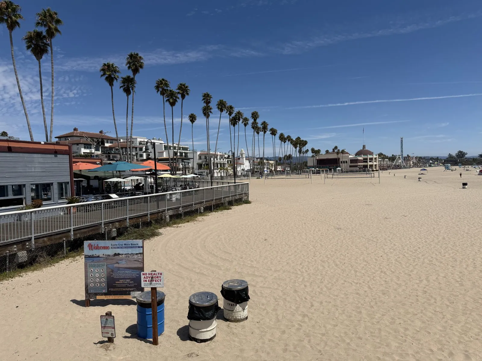
Then we drove west along West Cliff Drive, which follows the top of the sea cliffs out of town, to its western end, at Natural Bridges State Beach. The name is now a little optimistic. There used to be three sandstone arches here; the outer ones collapsed into the sea over the twentieth century, and one is left, its top whitened by the seabirds that stand on it. The surf breaks white around it and runs up onto a small sandy cove.
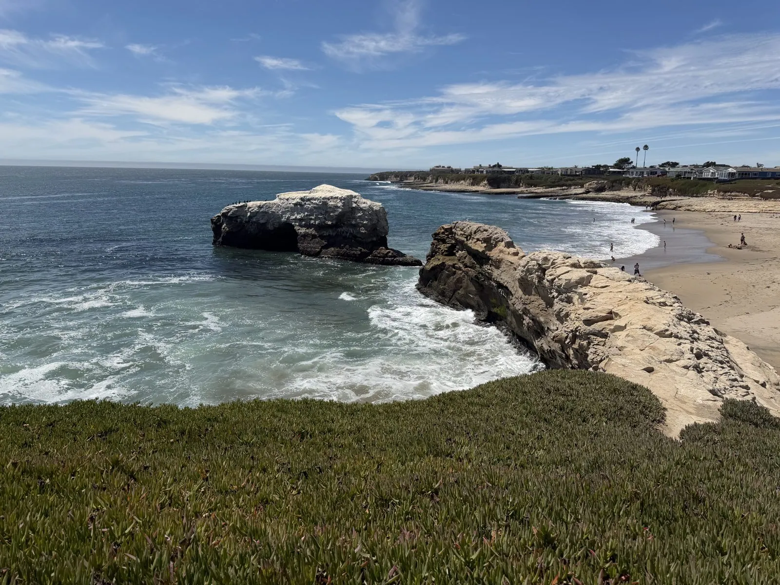
That was the end of the day's photos until night, when we found ourselves back at the riverwalk and the same dragon gate. Lit up from below, with a full-looking moon hanging exactly in the middle of the arch, it looked completely different, more like a stage set than a monument. Then back to the hotel for our second night in Santa Cruz.
The last day
The last day was mostly road. Wangcai slept on the hotel bed that morning, then sat up on the front seat and looked out of the window. Around one we drove up through UC Santa Cruz, on the hill above town, where the road runs through dry grassland with Monterey Bay below. My wife had already been there on her own, with Wangcai, two weeks earlier; that visit is in the campuses post. By evening we were in Carmel-by-the-Sea, forty-five miles down the coast, looking round a shop of soaps and candles before dinner at 6:39. Carmel is the storybook village on the Monterey Peninsula, all cottages and cypress trees. It famously has no street addresses (houses go by names, and residents pick up mail at the post office), and its best-known mayor was Clint Eastwood. It is also, by reputation, one of the most dog-friendly towns in America, which made it the right place to end this trip.
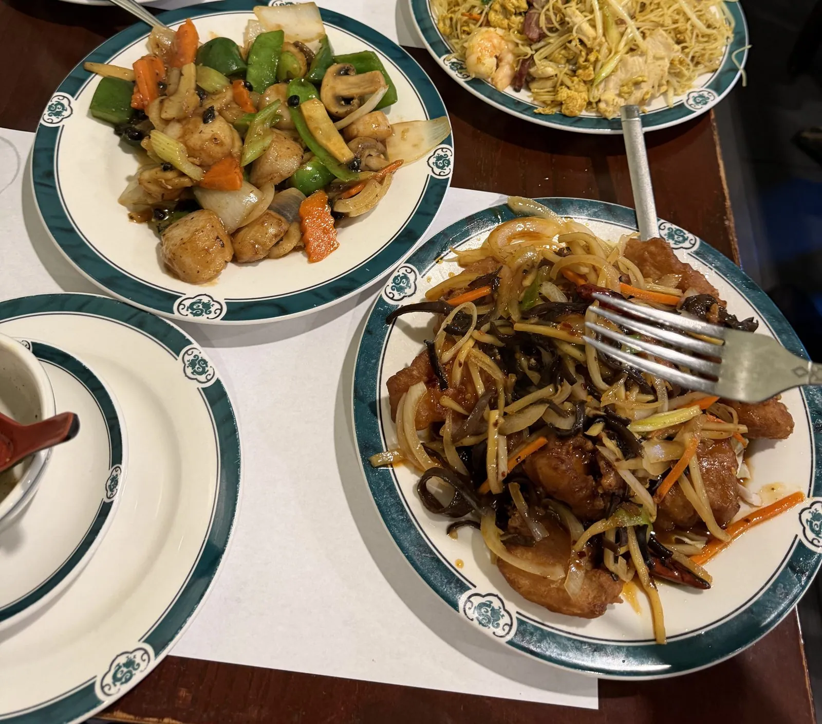
It was Chinese food: scallops stir-fried with peppers and carrots, a plate of noodles, crisp fried fish under a tangle of shredded vegetables, and soup. It was not glamorous, and it was exactly what you want after five days on the road. Then the trip ended the way trips do, with a long drive home down US-101 in the dark, and a plush banana slug, UC Santa Cruz's mascot, riding on the dashboard.
Lake, capitols, coast
Lined up in order, the photos make a strange little set. There are two state capitols a day apart, one a grand white dome with a mile-long mall, the other a sandstone courthouse with a silver hat. There is a river in Sacramento with a golden bridge and another in Reno full of ducks. There is a lake so clear you can see cloud shadows on the bottom, and an island with a tea house that has had no roof for decades. And at the end there is the Pacific, with one arch left standing.
But mostly what the camera roll remembers is a dog. It remembers her on a ramp in Old Sacramento, at the bow of a pedal boat with her ears in the wind, watching ducks in Reno, as a bear at Sugar Pine Point, and wading into Lake Tahoe up to her shoulders. A trip with a dog is slower and more local than a trip without one. You spend more time at the water's edge and less time in museums. For five days at the end of a summer, that was exactly the point.
Maps built from the trip's photo timestamps and locations; driving distance is an estimate of road mileage between the first and last photos. Photo locations have been removed from the published images. Day maps: map data © OpenStreetMap contributors; each stop is placed where its photo was taken, hotels and home are never marked, and the dashed lines show the order of stops, not the exact roads.
Some photos in this post are my wife's.
Likes and comments
React with an emoji or leave a comment. Signing in with GitHub is required.