← Misc · March 2025
An Inverted Pyramid, a Waymo and a City of Vaults
Four days in the Phoenix area: Tempe, Papago Park and Scottsdale, and a morning at Arcosanti.
Lunch in Arcadia → I-10 through the Coachella Valley → the Colorado River at Blythe → the Stack in Phoenix → Tempe Town Lake → downtown Tempe and the ASU campus → the Desert Botanical Garden → Old Town Scottsdale → downtown Phoenix → north on I-17 to Arcosanti → back on I-10 to the Coachella Valley → home
Two states: California and Arizona · one upside-down city hall · a few Waymos · one calico cat · one wall of bells · and Wangcai, two months into life with us
This was a four-day spring trip by car: drive to Phoenix, spend two days walking around Tempe, Phoenix and Scottsdale, and on the way home, stop at Arcosanti, the experimental concrete town in the desert north of the city. It was also a trip with Wangcai, our cream-colored dog, who had come home in January 2025, two months earlier. She came along the whole way, and she shows up in a good number of the photos below.
As with the other posts here, everything is put together from the camera roll: what was photographed, where, and at what minute. My own phone has a few dozen photos from these four days. My wife's has a lot more, especially of Wangcai, so many of the pictures below are hers. Where neither of us took a photo, I don't say much.
Day 1: Across the desert to Tempe
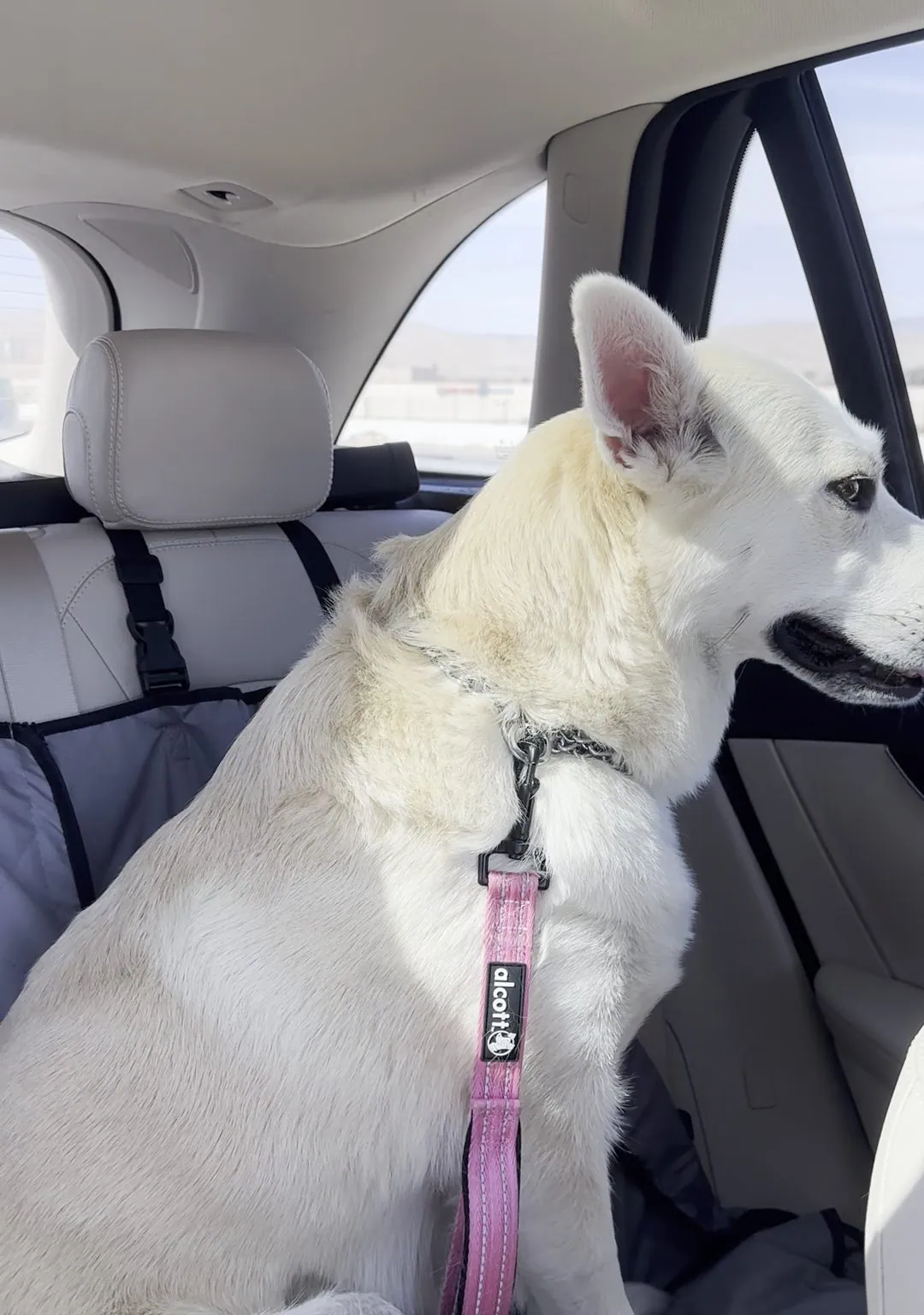
The trip started on Thursday, March 20, with lunch at Arcadia Garden Cafe in Arcadia, in the San Gabriel Valley, a little after 11 in the morning. Then it was I-10 east. By 3 pm we were in the Coachella Valley, and Wangcai was sitting up in the back seat in her harness, watching the desert go by.
At 4:52 my phone took two short videos as we crossed the Colorado River from Blythe into Ehrenberg, which is the California–Arizona line on I-10. Arizona stays on standard time all year, so in March its clocks match California's and nothing changes at the border. The next video, at 6:38, is from the Stack, the big interchange where I-10 meets I-17 west of downtown Phoenix.
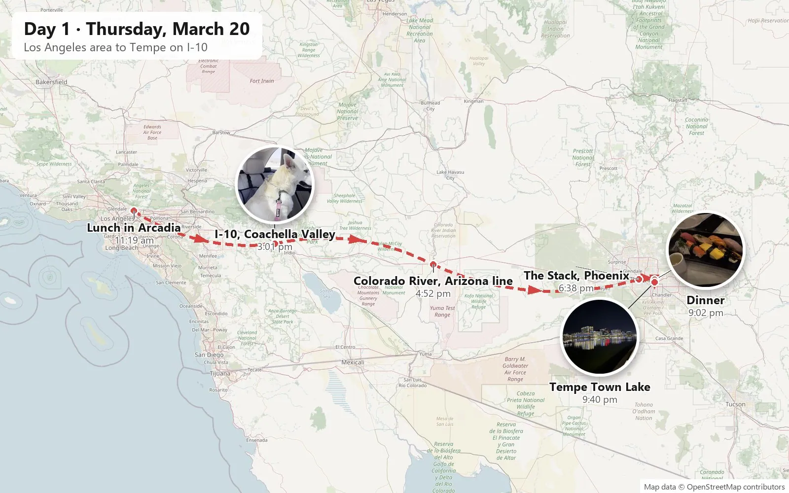
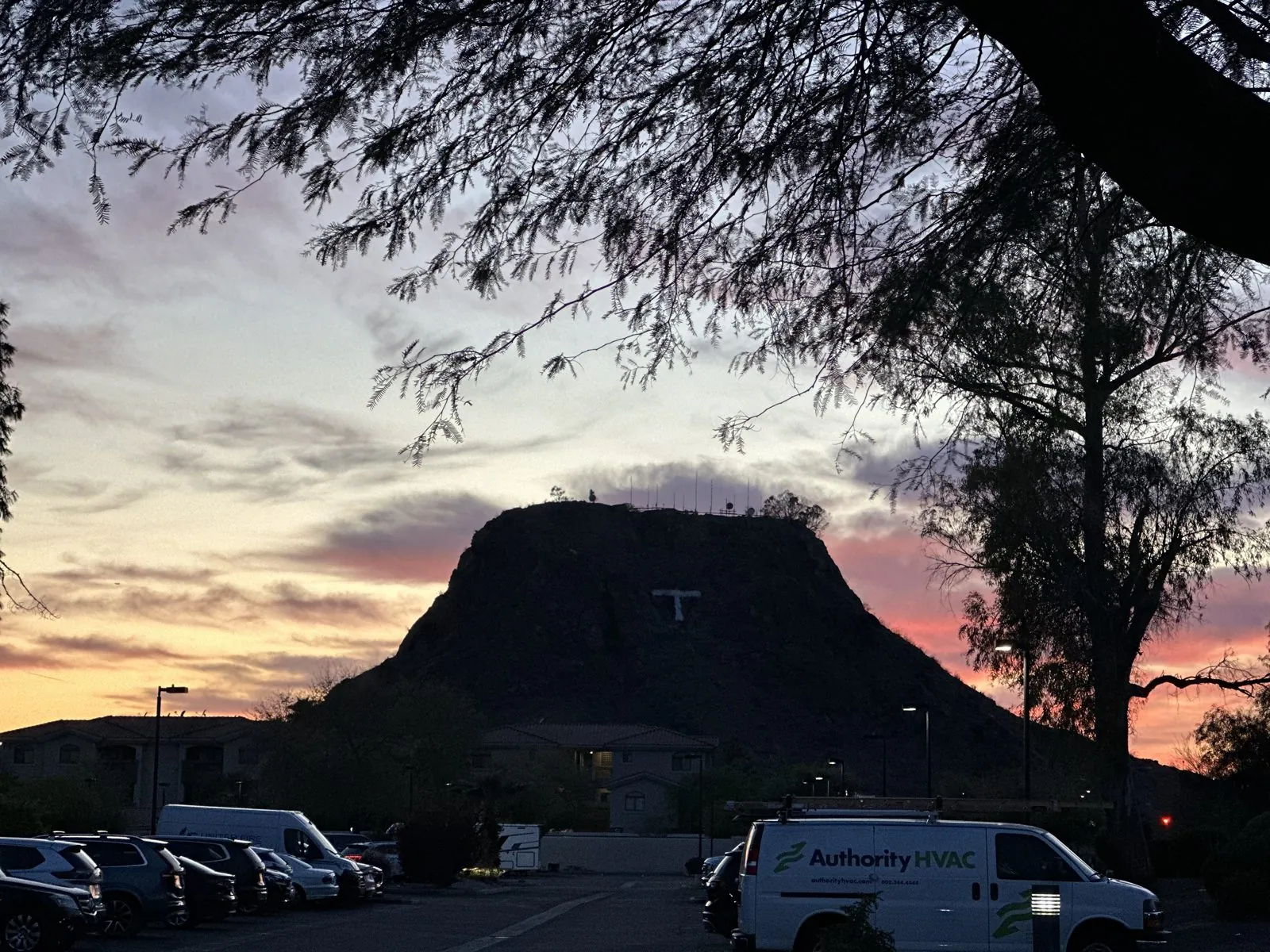
We stayed three nights at the DoubleTree by Hilton Phoenix–Tempe. We got there around sunset. At 6:50 my wife took a photo of a small butte with a white "T" on its side, black against an orange and pink sky.
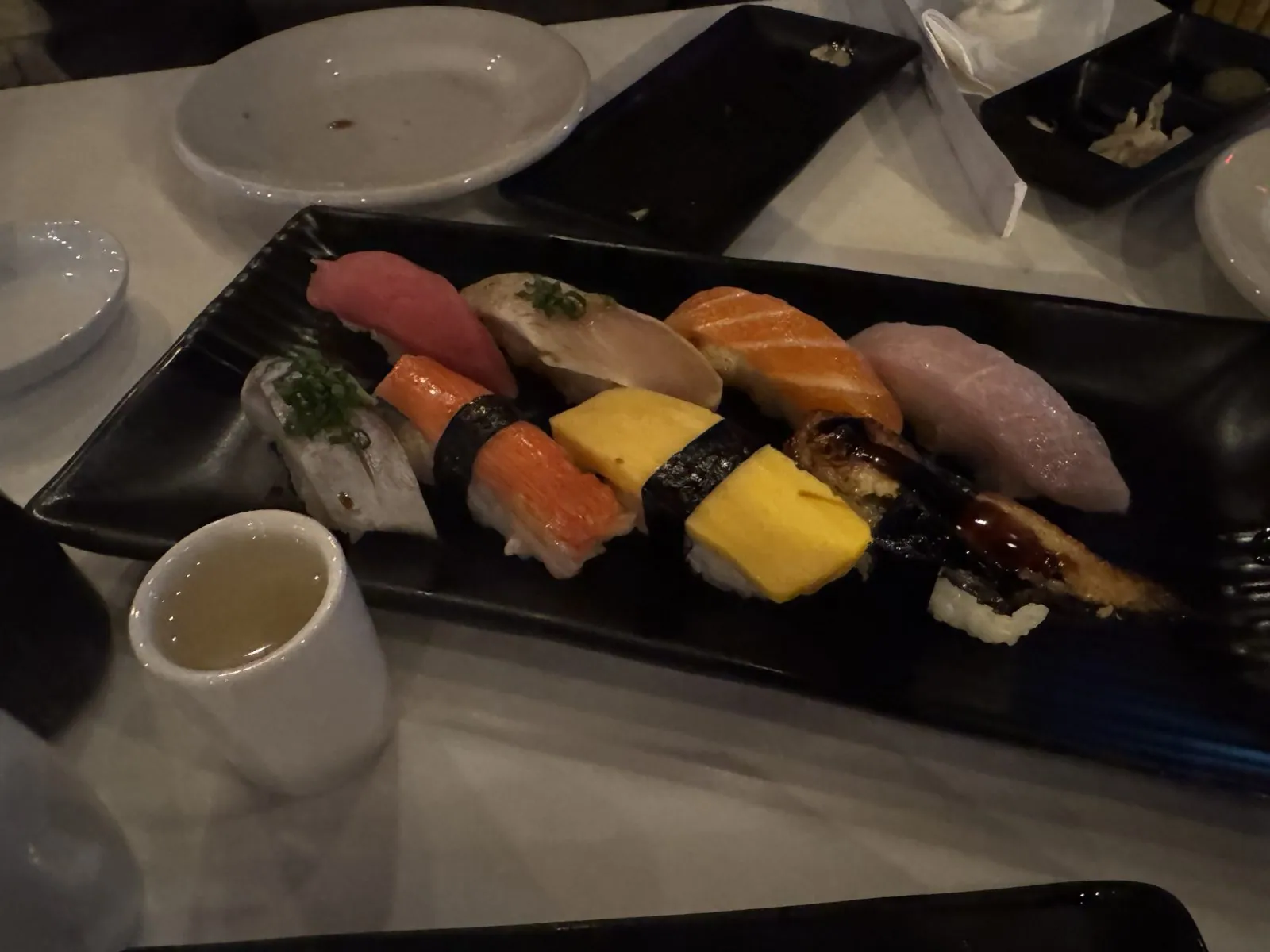
Dinner was late, a little after 9, at a Japanese restaurant on Scottsdale Road: a plate of nigiri (tuna, salmon, tamago, eel and white fish), skewers, rice and miso soup, and a pan of udon.
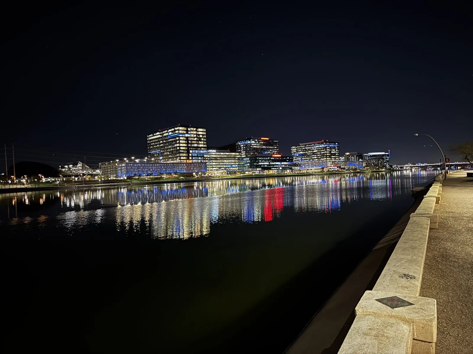
After dinner we went down to Tempe Town Lake, a lake on the Salt River just north of downtown Tempe. At 9:40 the office buildings on the far side were lit up in white, blue and red, and the lights ran across the still water in long stripes. A path runs along the north shore, and we walked a short way on it. That was the end of the first day.
Day 2: Downtown Tempe and the ASU campus
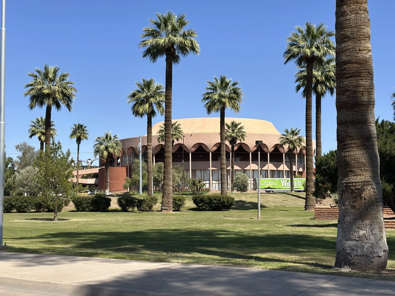
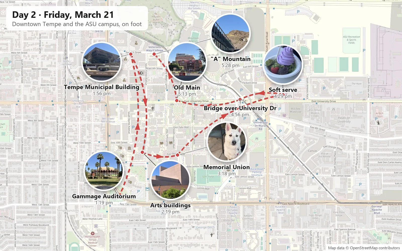
Friday was a walking day. The first photo is from 1:19 in the afternoon, at ASU Gammage, the round, pink auditorium at the south end of the Arizona State campus, behind a row of tall palms. Arizona State's main campus is in Tempe, and the city and the university run into each other. Most of the day went back and forth between them.
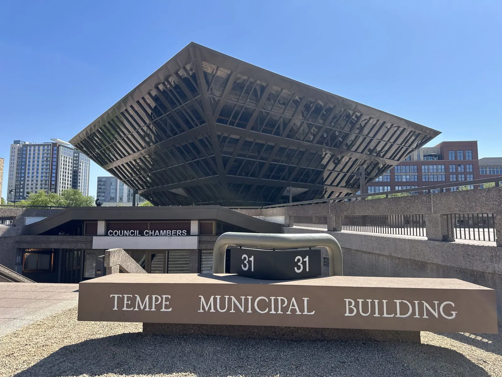
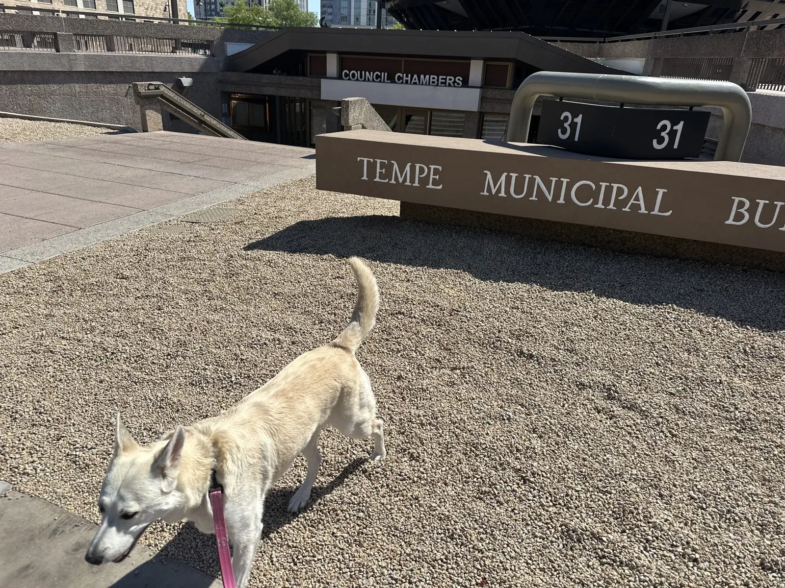
By 1:54 we were at the Tempe Municipal Building, the city hall. It is a pyramid of dark glass and steel set upside down on its point, so each floor is wider than the one below it. Under it, the Council Chambers entrance is half sunk into the ground. Wangcai sniffed the gravel bed in front of the sign.
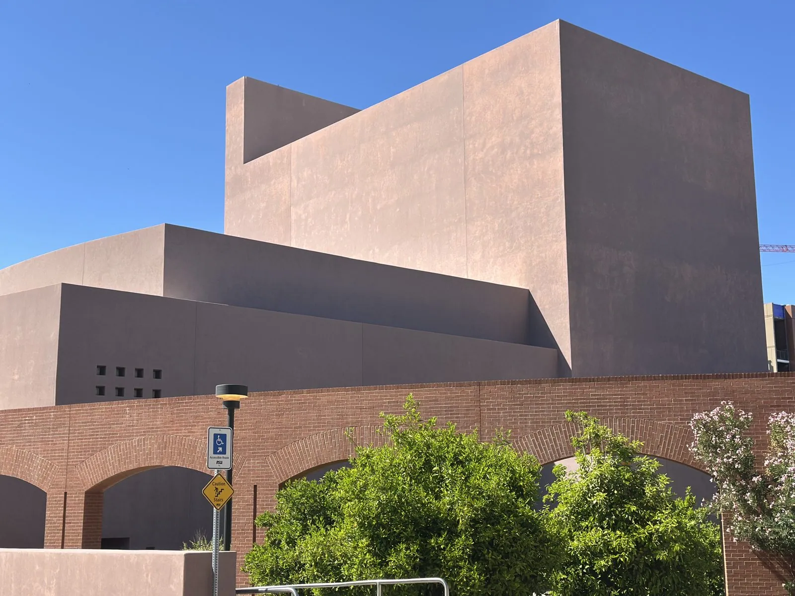
Nearby is Hayden Butte, the rocky hill locally called "A" Mountain for the big gold letter A painted on its side. Then we walked south along Mill Avenue, past a wall of new apartment towers, back toward campus. At 2:19 we were among the arts buildings at the south edge of campus: blocky masses of pink-brown stucco with very few windows, above a base of red brick arches.
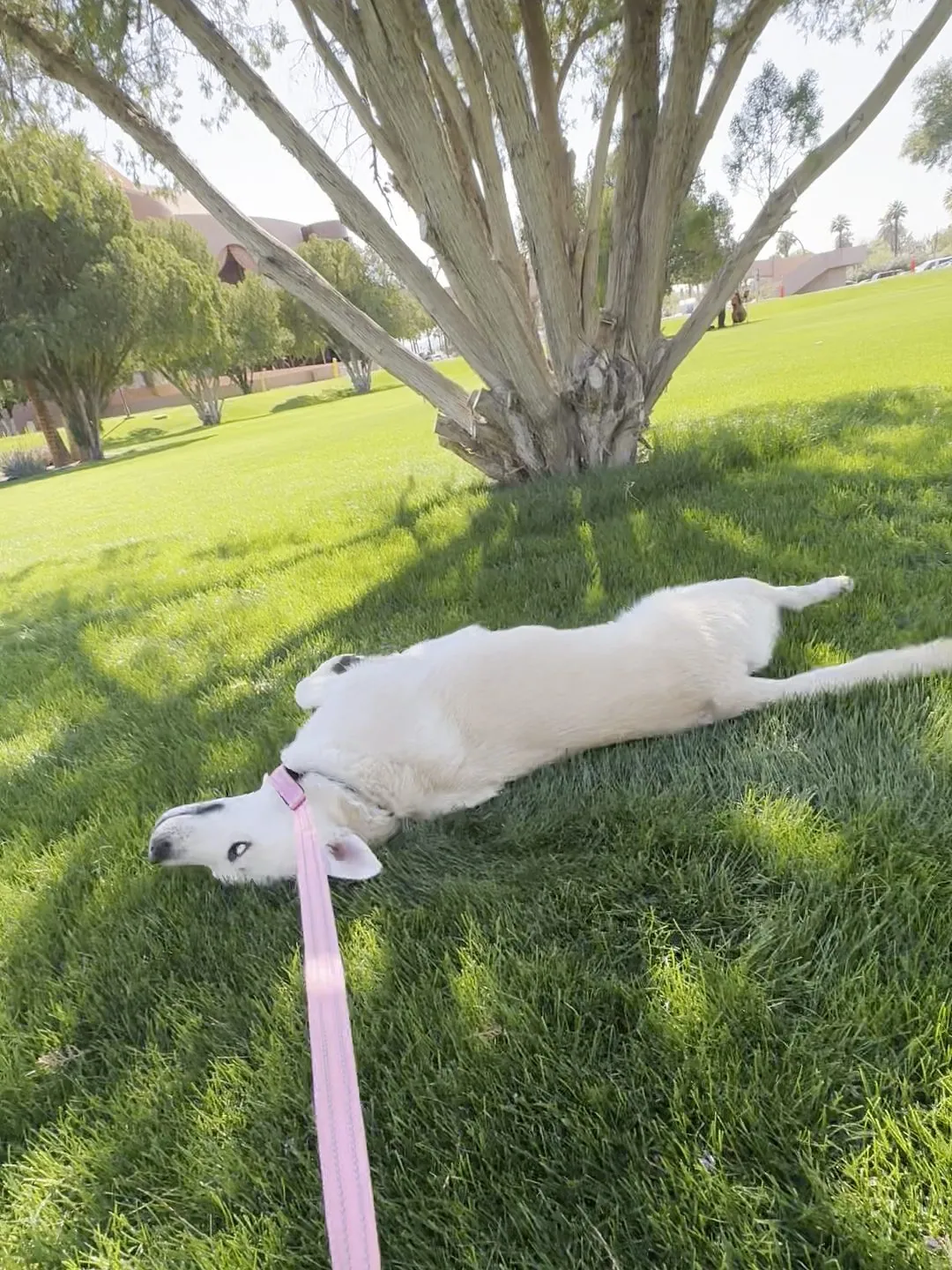
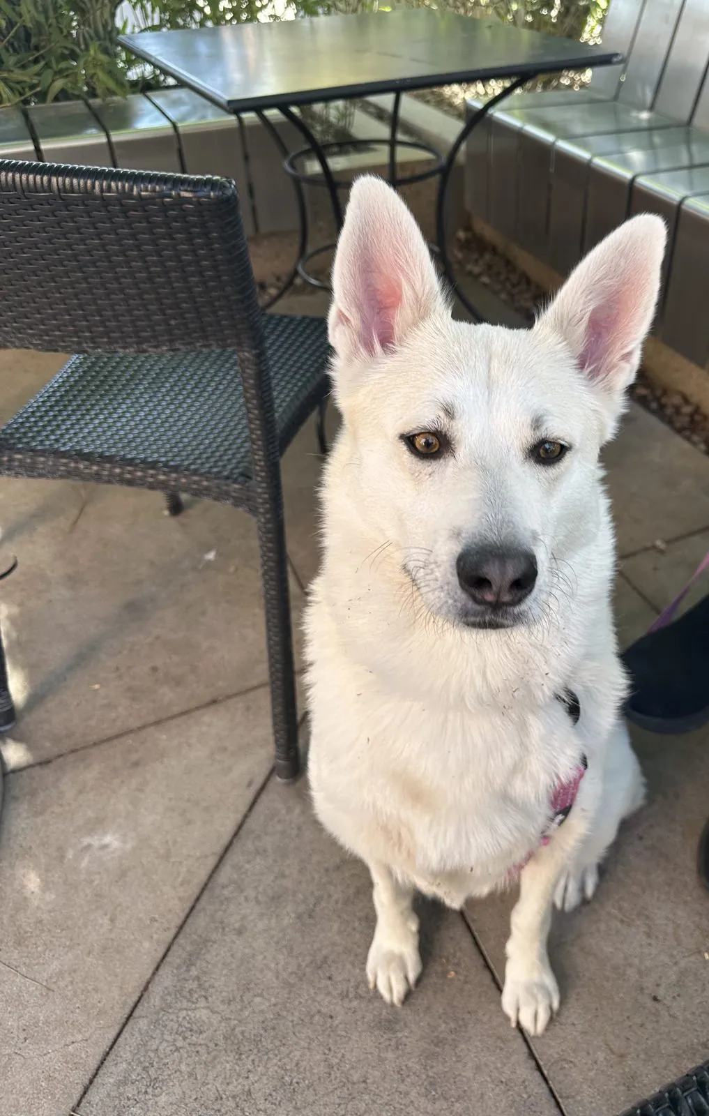
Wangcai got a break on the lawns there. In a short video from 2:47 my wife filmed her lying on her back in the grass under a tree, with her pink leash trailing toward the camera. At 3:18 we sat down on the patio of the Memorial Union, the student union in the middle of campus, and she sat on the patio and looked straight into the camera.
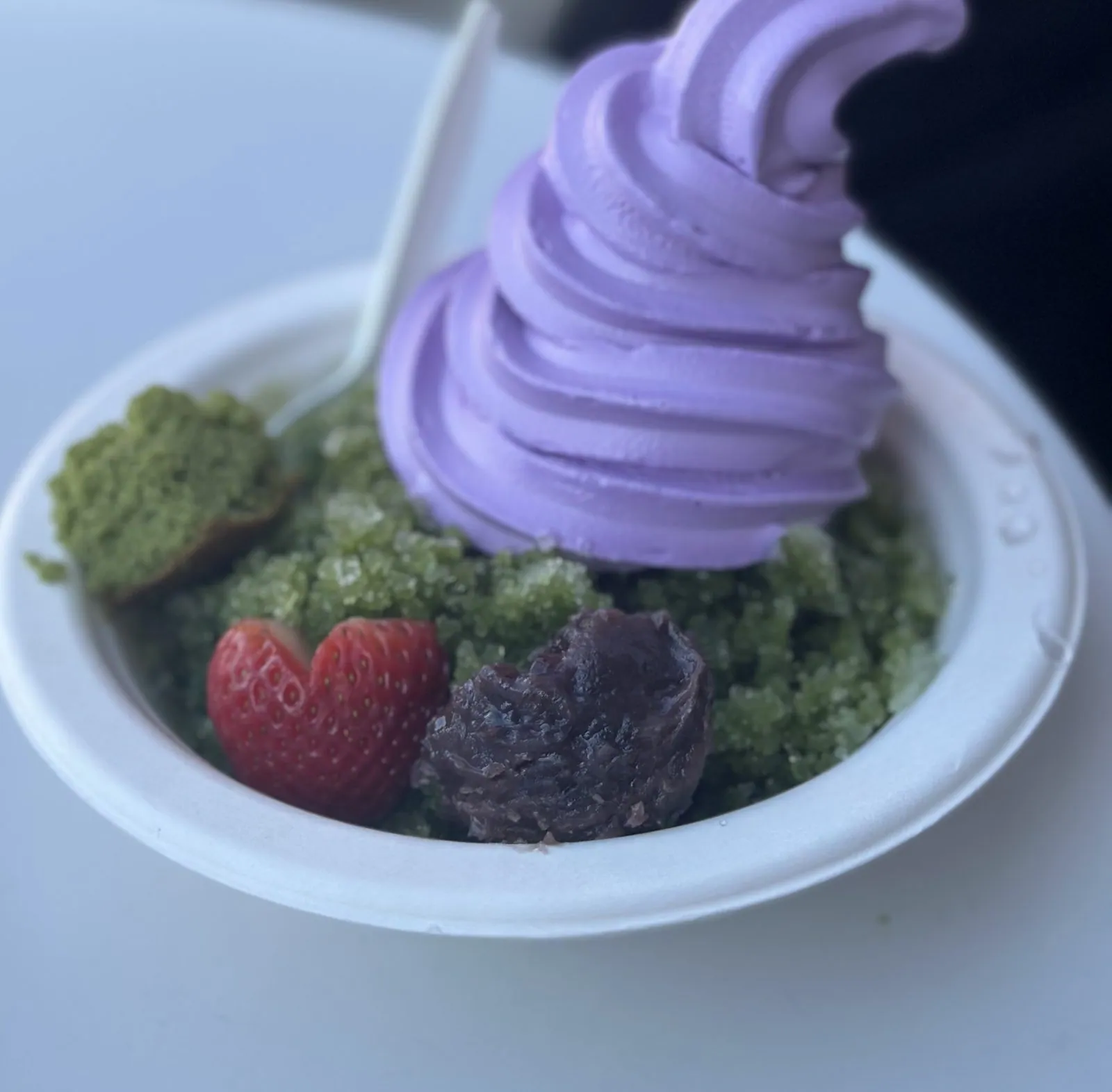
The Memorial Union's ground floor faces a patio with a big "Sun Devils" sign over the food court, and at 3:51 we passed a rack of maroon Sun Devils jackets set out on the sidewalk. Around 4:30 we stopped at Premium Matcha Cafe just east of campus. The photo is of a swirl of purple soft serve, on a green base with a strawberry and a dark scoop of something next to it.
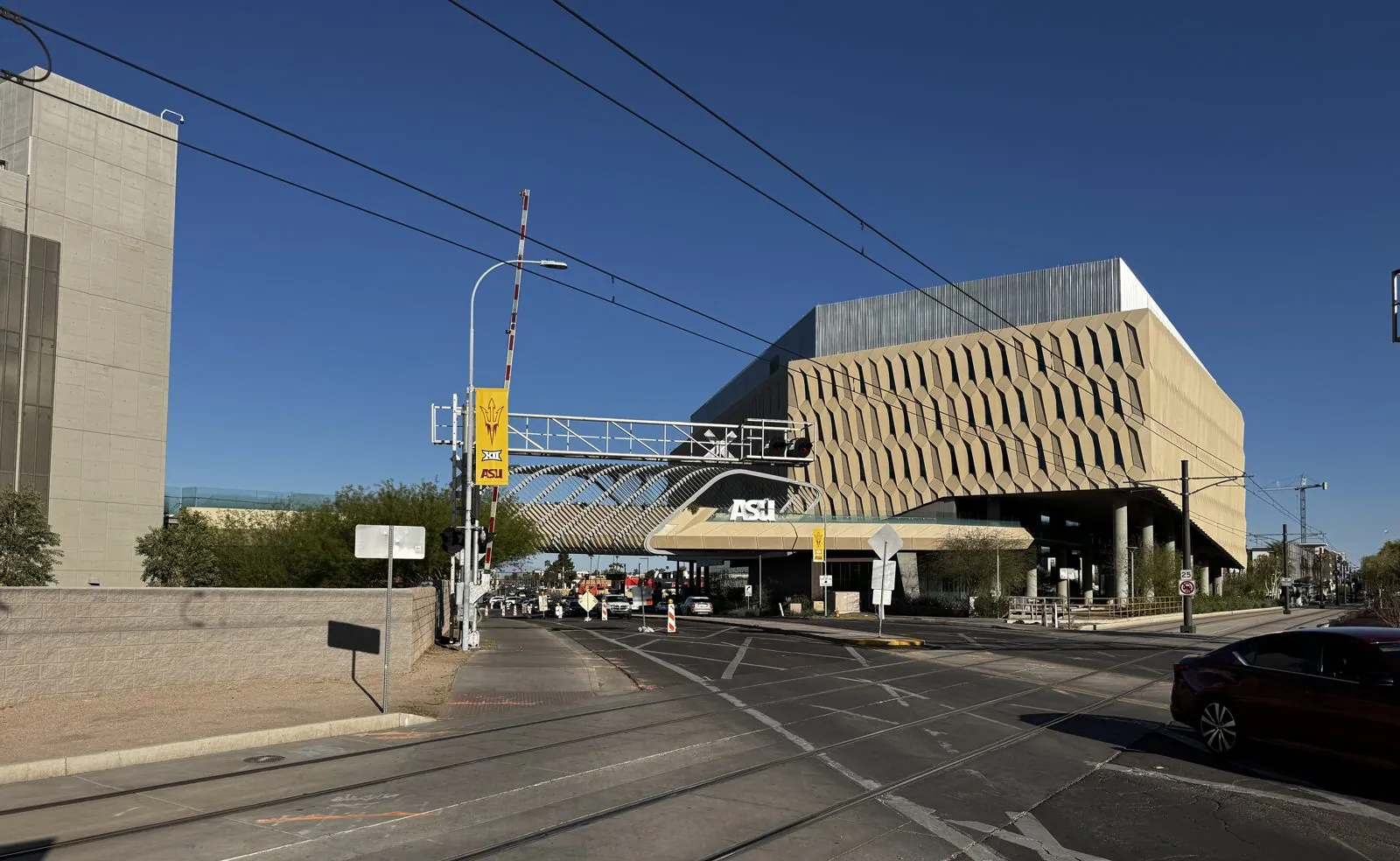
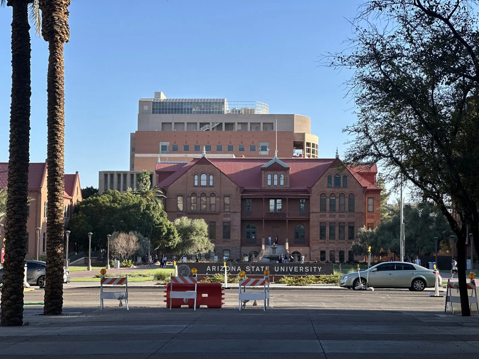
In the last hour of daylight both of our phones were busy again. At 4:56 we were on University Drive, where a bridge with the ASU logo on it carries a building over the street and the light-rail tracks. Just past it stood a tall tower covered in a diagonal lattice. Then, at 5:13, we reached the oldest part of campus: Old Main, a red-brick building with steep gables and a deep porch, behind a long, low sign that says ARIZONA STATE UNIVERSITY. The low sun turned the brick almost orange.
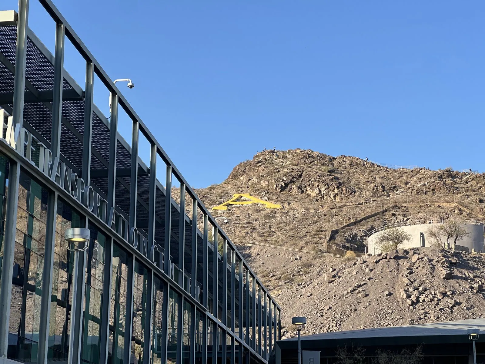
From there we walked back north toward Mill Avenue, and at 5:28 we came out under "A" Mountain again. The low sun lit up the brown rock and the gold A, next to the long glass wall of the Tempe Transportation Center. The last photos of the day, just after 6, are from Tempe Marketplace, a shopping center to the east.
Day 3: Papago Park, Scottsdale and downtown Phoenix
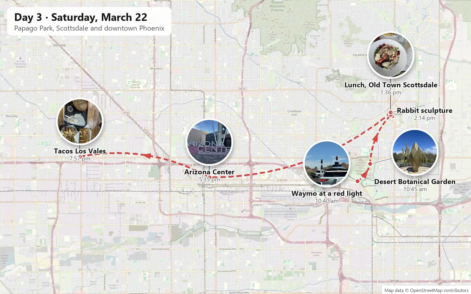
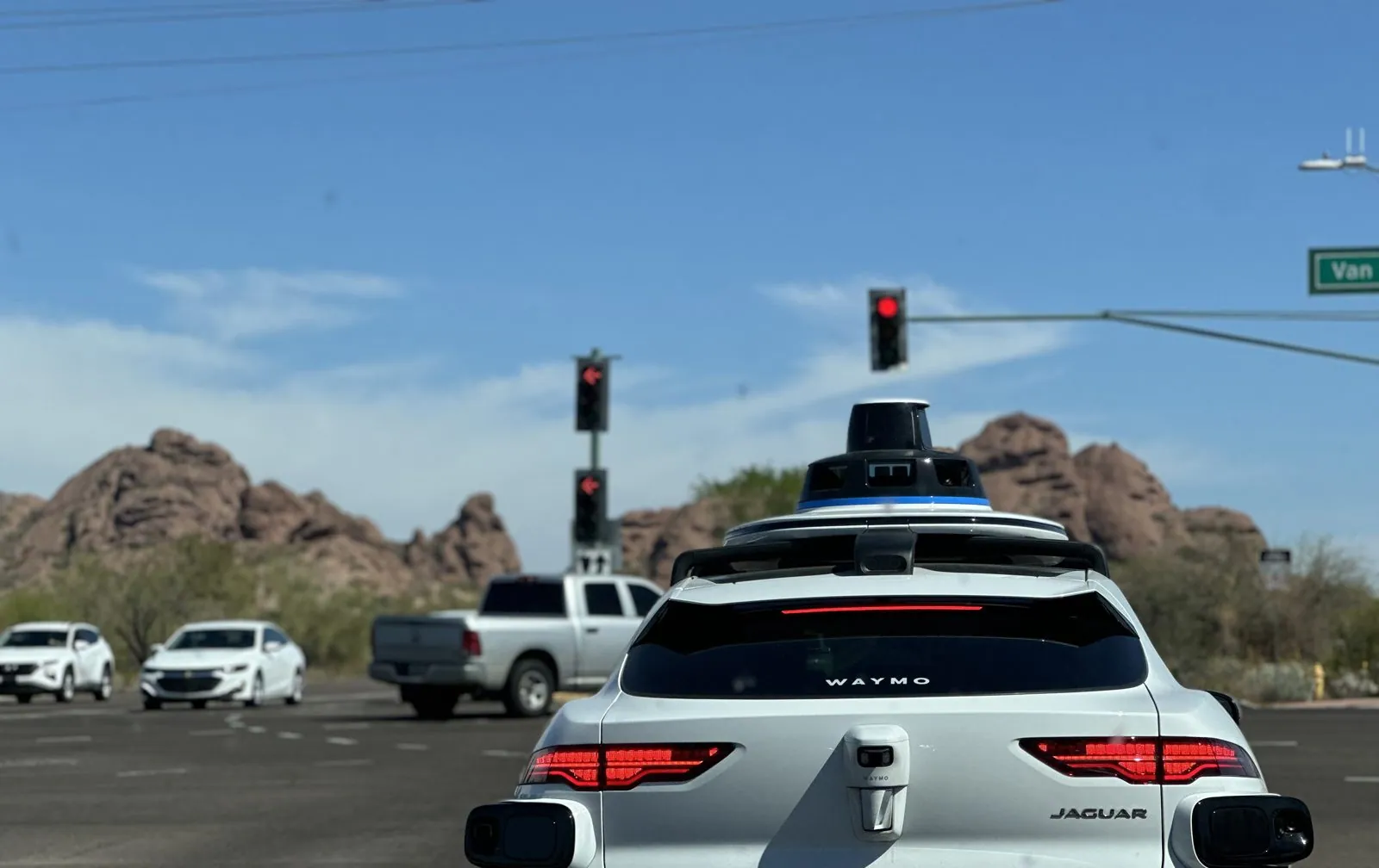
Saturday began at the Desert Botanical Garden in Papago Park, between Tempe and Phoenix. On the way, at 10:40, we pulled up at a red light behind a Waymo, a white Jaguar with a sensor dome on the roof. Two minutes later, on Galvin Parkway, there were two of them in front of us, heading toward the same red rocks.
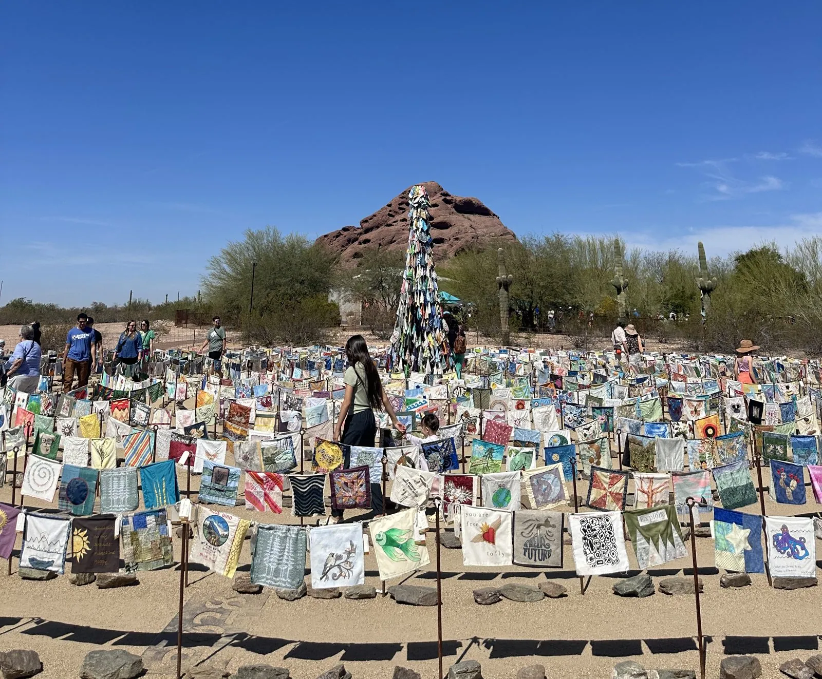
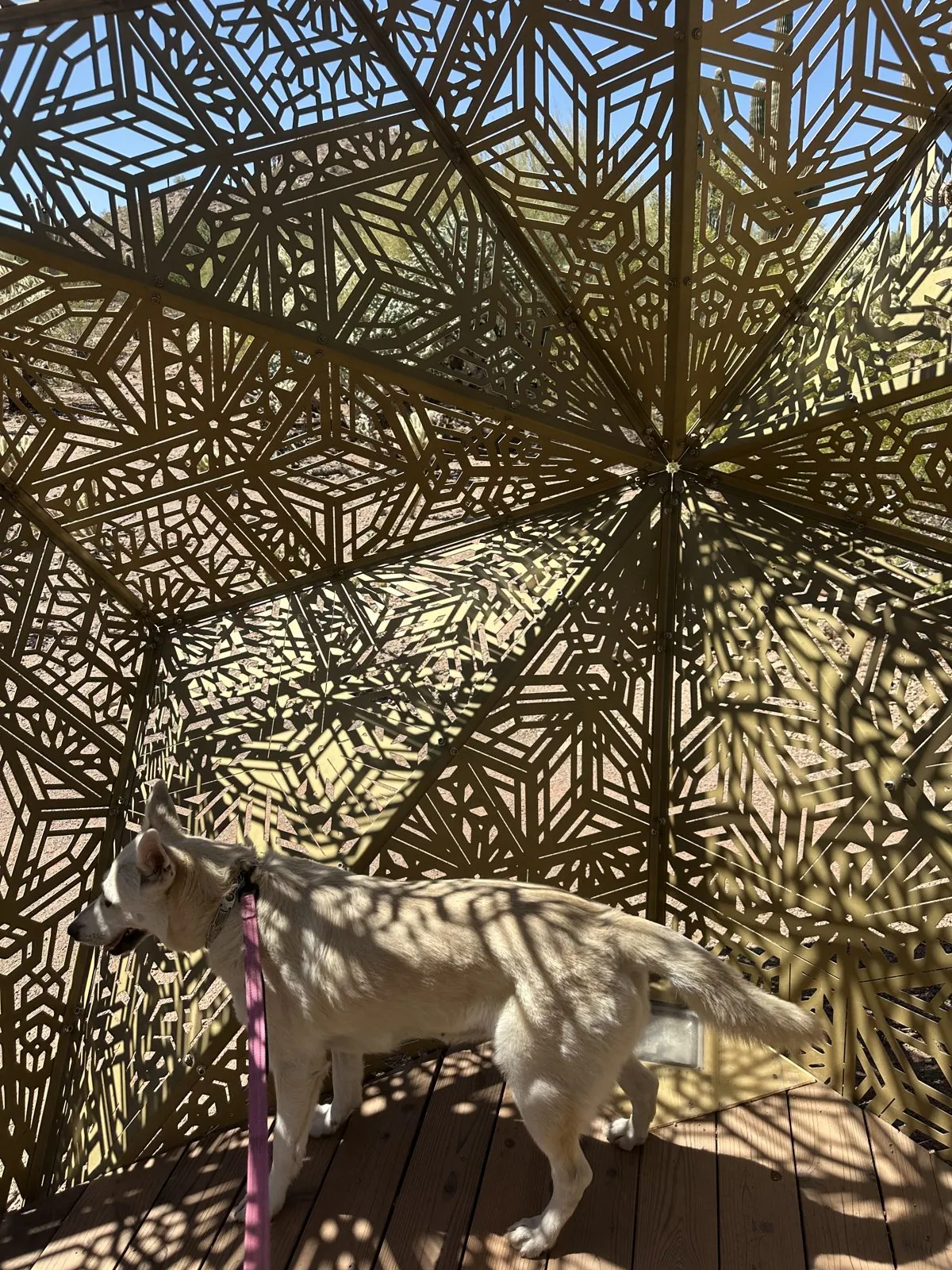
The garden sits at the foot of the Papago Buttes, rounded humps of red sandstone that show up behind many of the photos from the morning. Near the entrance, a field of hundreds of small painted cloth squares had been set out on stakes in rows, around a tall tower made of more of them. Further in, among the saguaros, there were large sculptures in gold-colored metal, cut into lattices of geometric patterns.
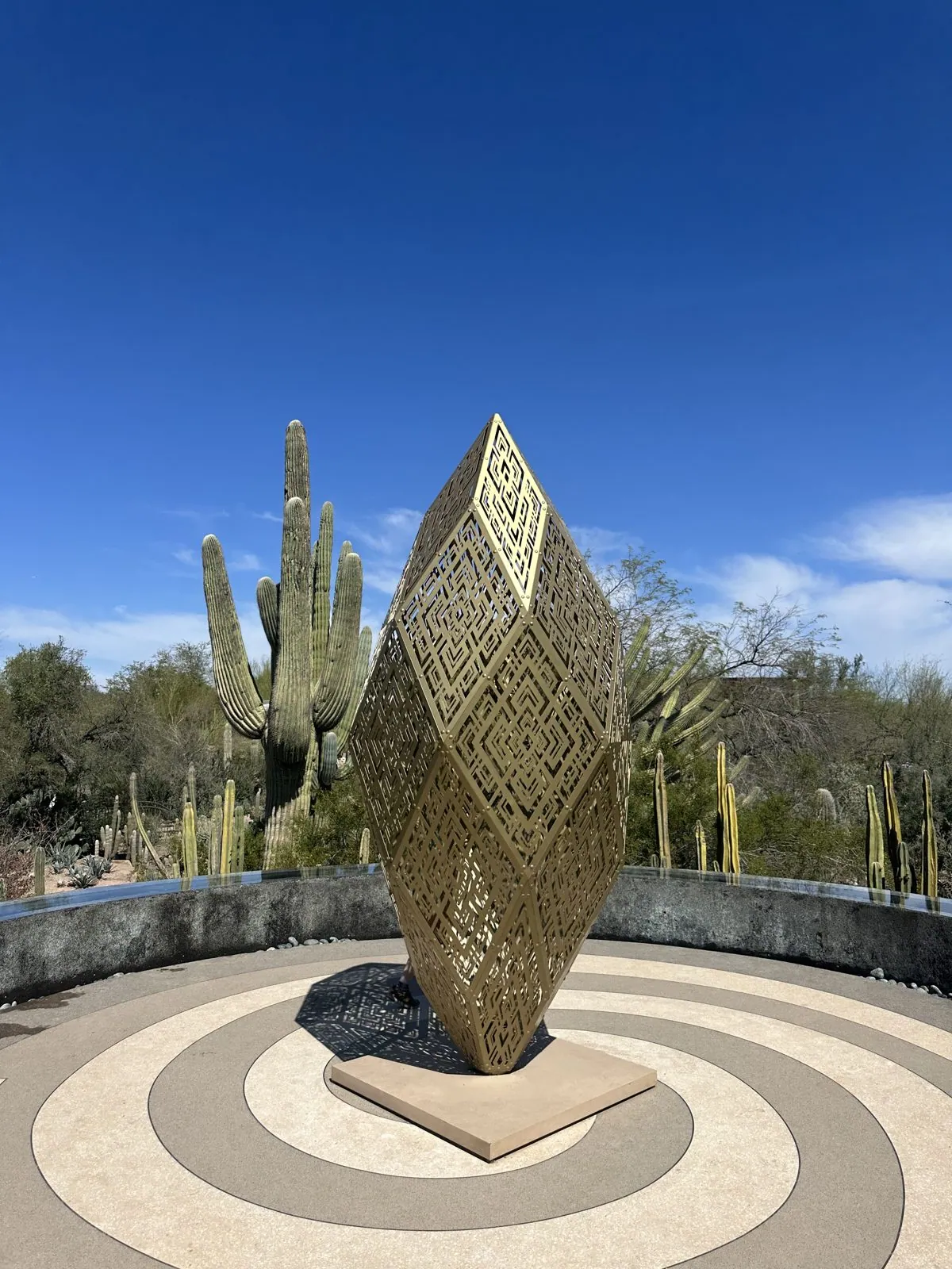
One of them was a tall diamond on a round stone platform. Another was a walk-in pavilion that threw a lace of shadows over the wooden floor and over Wangcai.
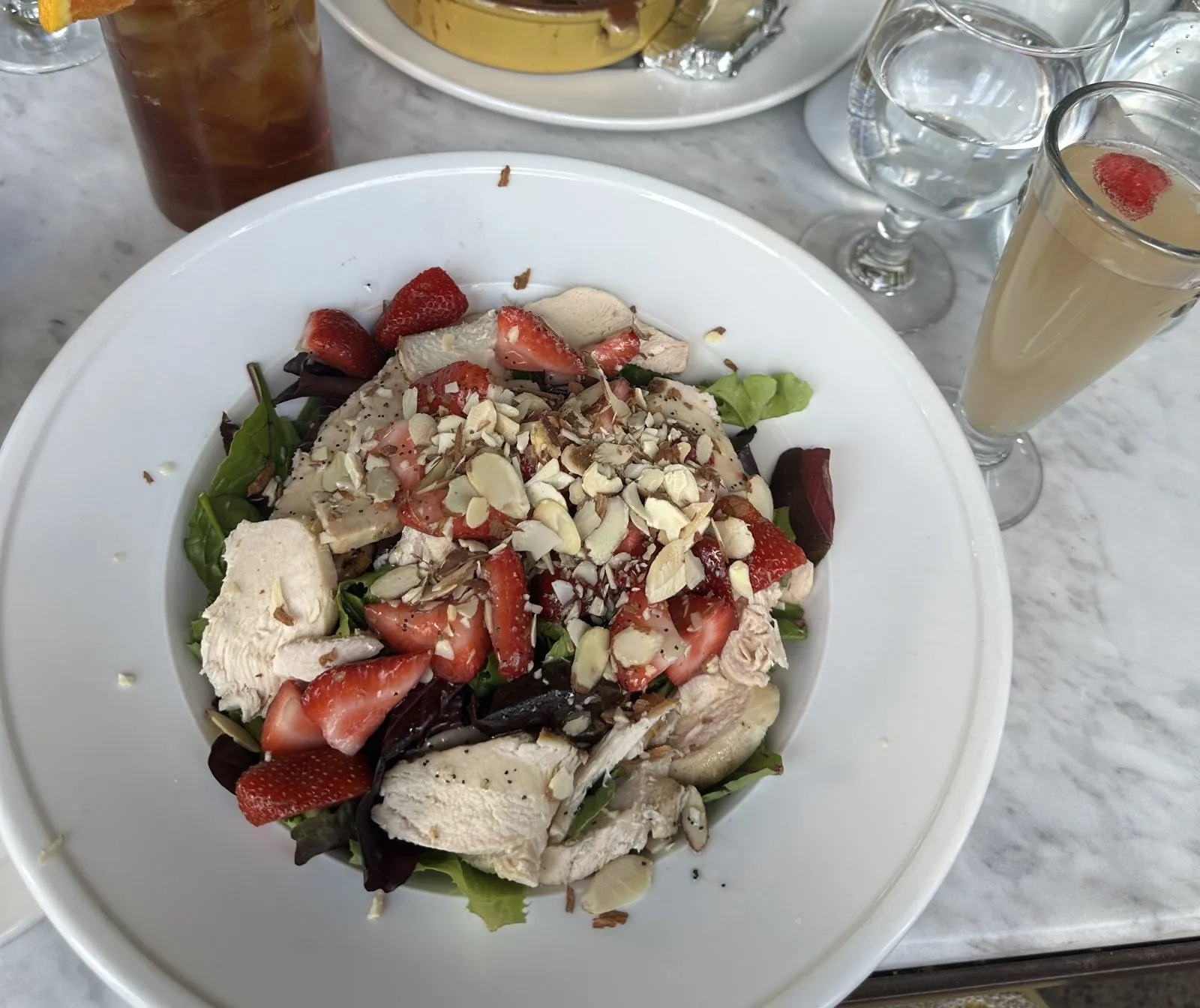
We were in the garden until about 12:20, and the gift shop is in my camera roll too, with shelves of chili crisp, botanical drinks and cactus snacks. By 1 we were in Old Town Scottsdale, at a domed rotunda in the Main Street Arts District. Lunch was at Arcadia Farms Cafe at 1:36: a salad with strawberries, chicken and almonds, and iced tea. After lunch, at 2:14, I photographed a tall, white, geometric rabbit sculpture outside a restaurant.
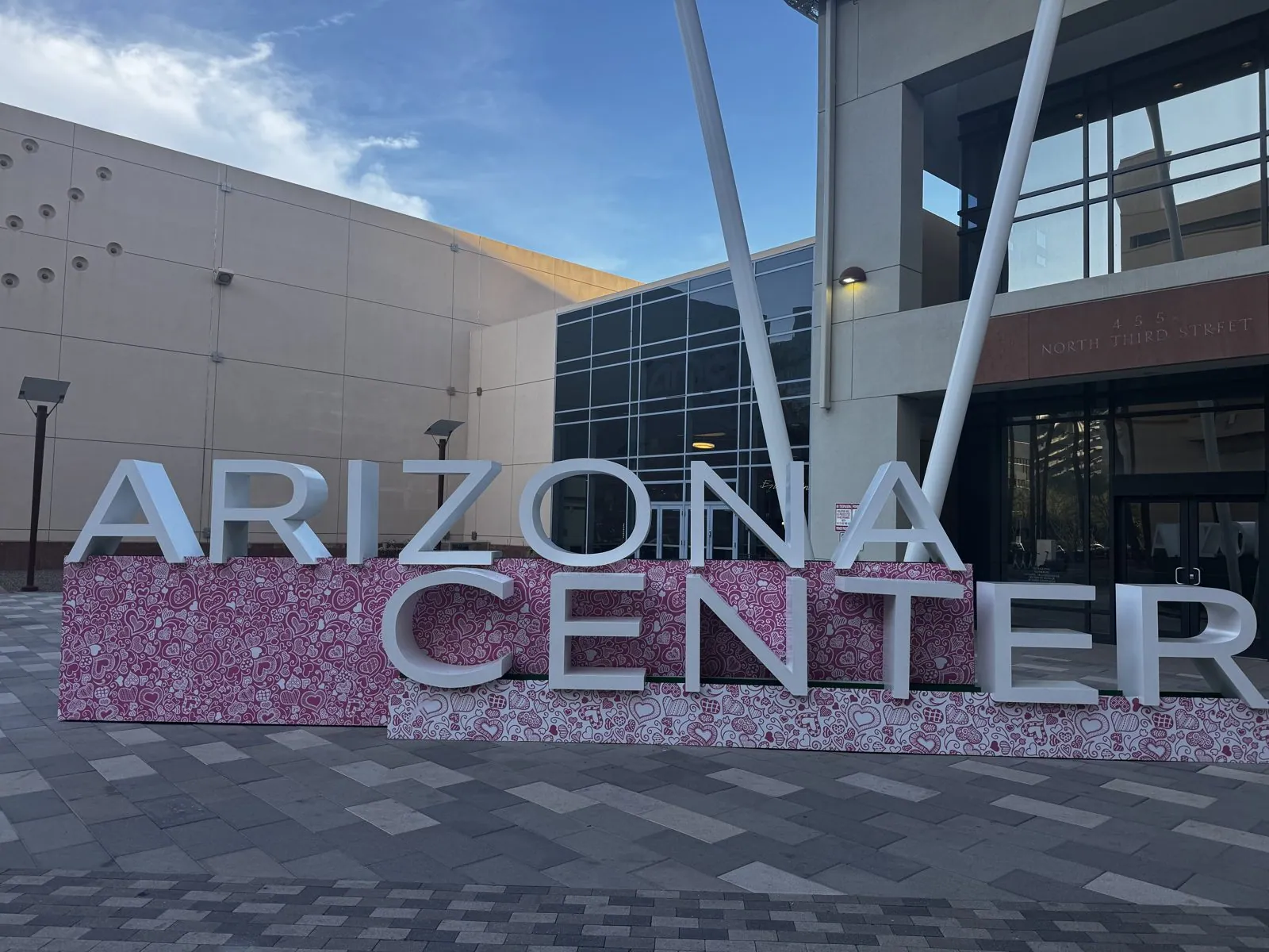
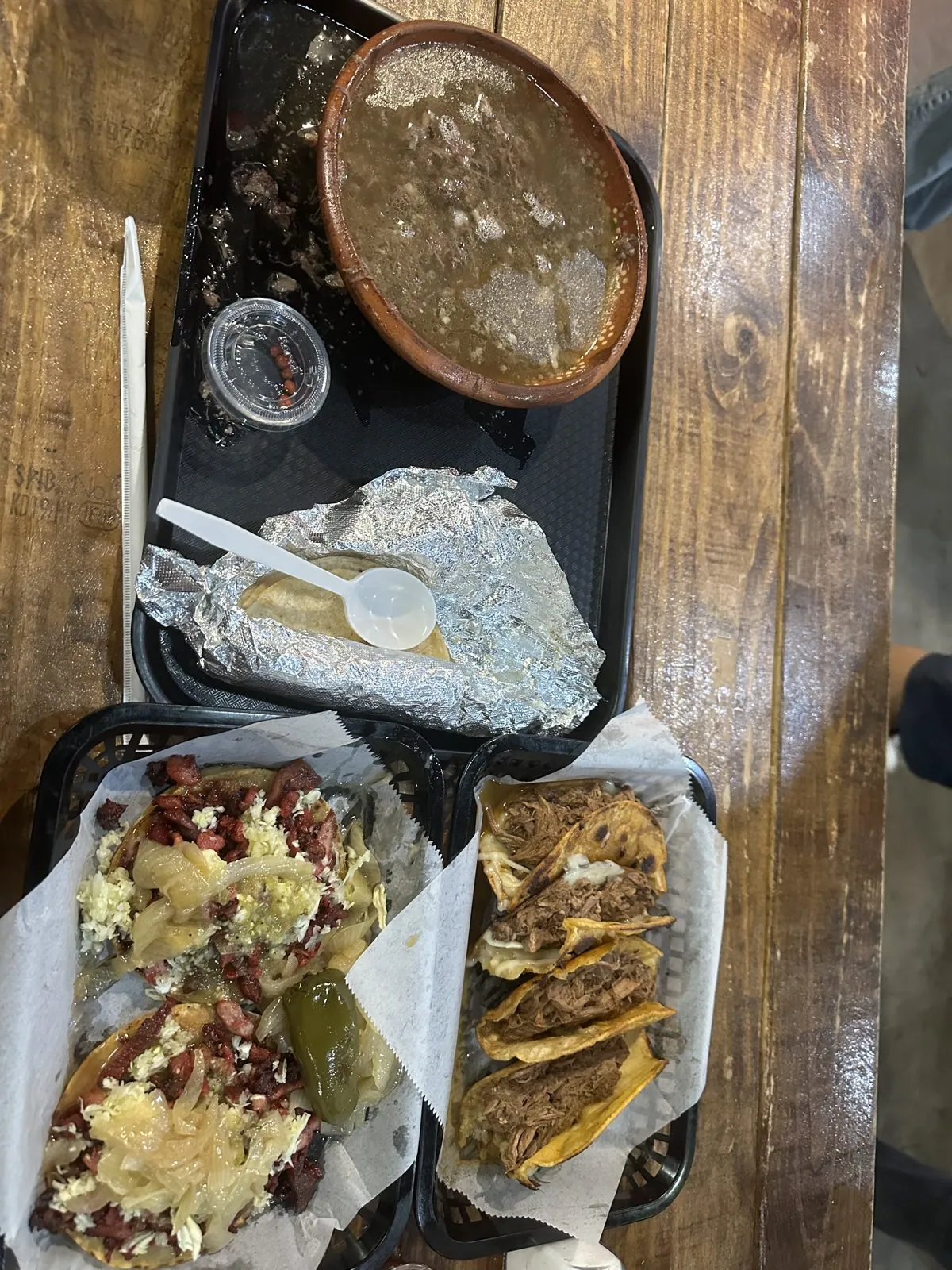
The camera rolls are quiet for most of the afternoon. Both of us photographed the same drink that day: a carton of prickly-pear cactus water. By 5:35 we were in downtown Phoenix, at the Arizona Center, whose big silver letters stand on a base covered in pink glitter. Dinner, just before 8, was at Tacos Los Vales in west Phoenix: a tray of tacos with grilled onions and a roasted pepper, and a bowl of soup on the side.
Day 4: Arcosanti
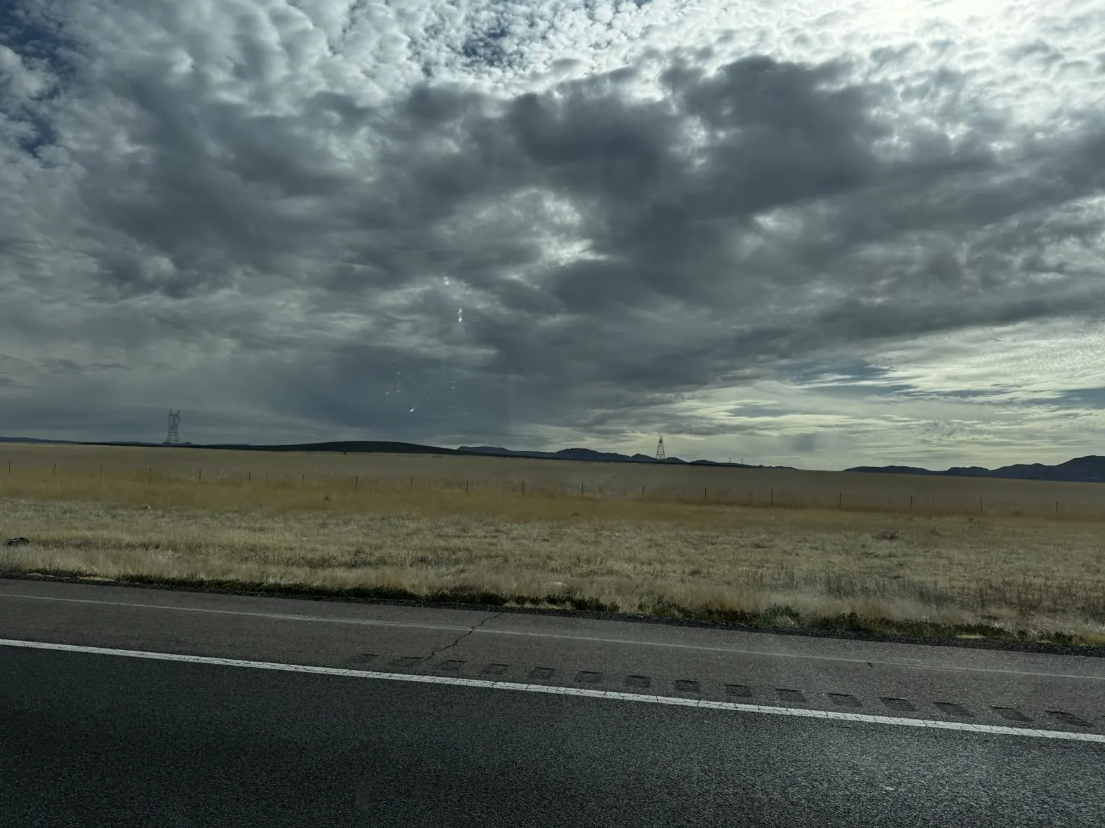
Sunday was the drive home, with one stop on the way. We left Phoenix at about 8:30. At 8:37, on I-10 past Sky Harbor, a plane came in low over the freeway on its way to land. Then we turned north on I-17, the Black Canyon Freeway, and climbed out of the valley through hills covered in saguaros. By 9:20 we were up on the open grassland north of Black Canyon City, under a heavy gray sky.
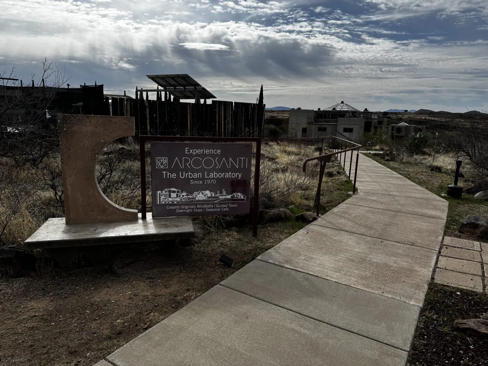
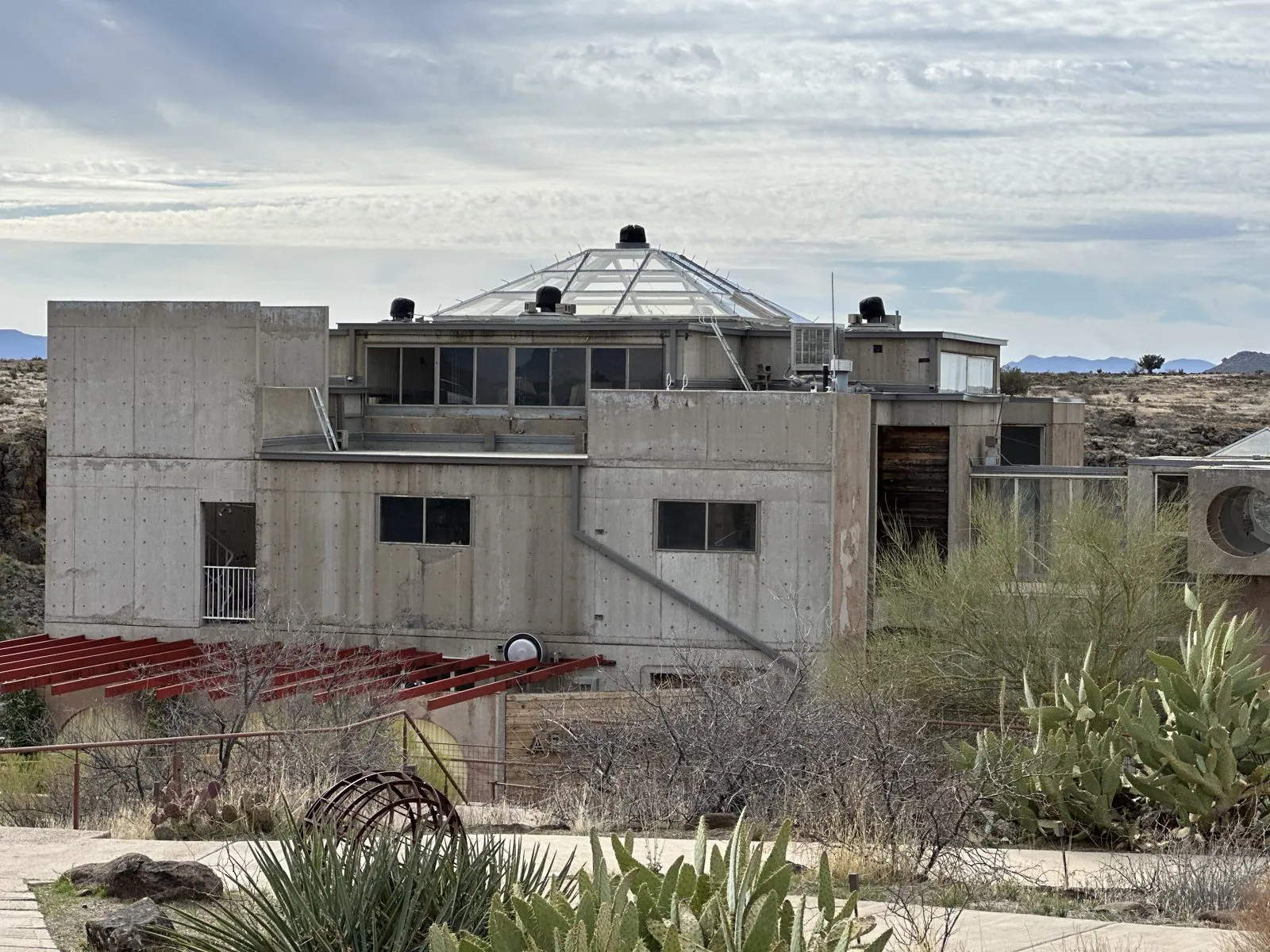
At 9:33 we turned off the highway, and by 9:34 we were at Arcosanti. The sign at the start of the walkway says "Experience Arcosanti · The Urban Laboratory · Since 1970". It is the experimental town that the architect Paolo Soleri started here, on the edge of a canyon. What stands there is a cluster of concrete buildings at the edge of the mesa: blocky towers with big round windows, a dome of glass panels, and stairs and walkways running between them.
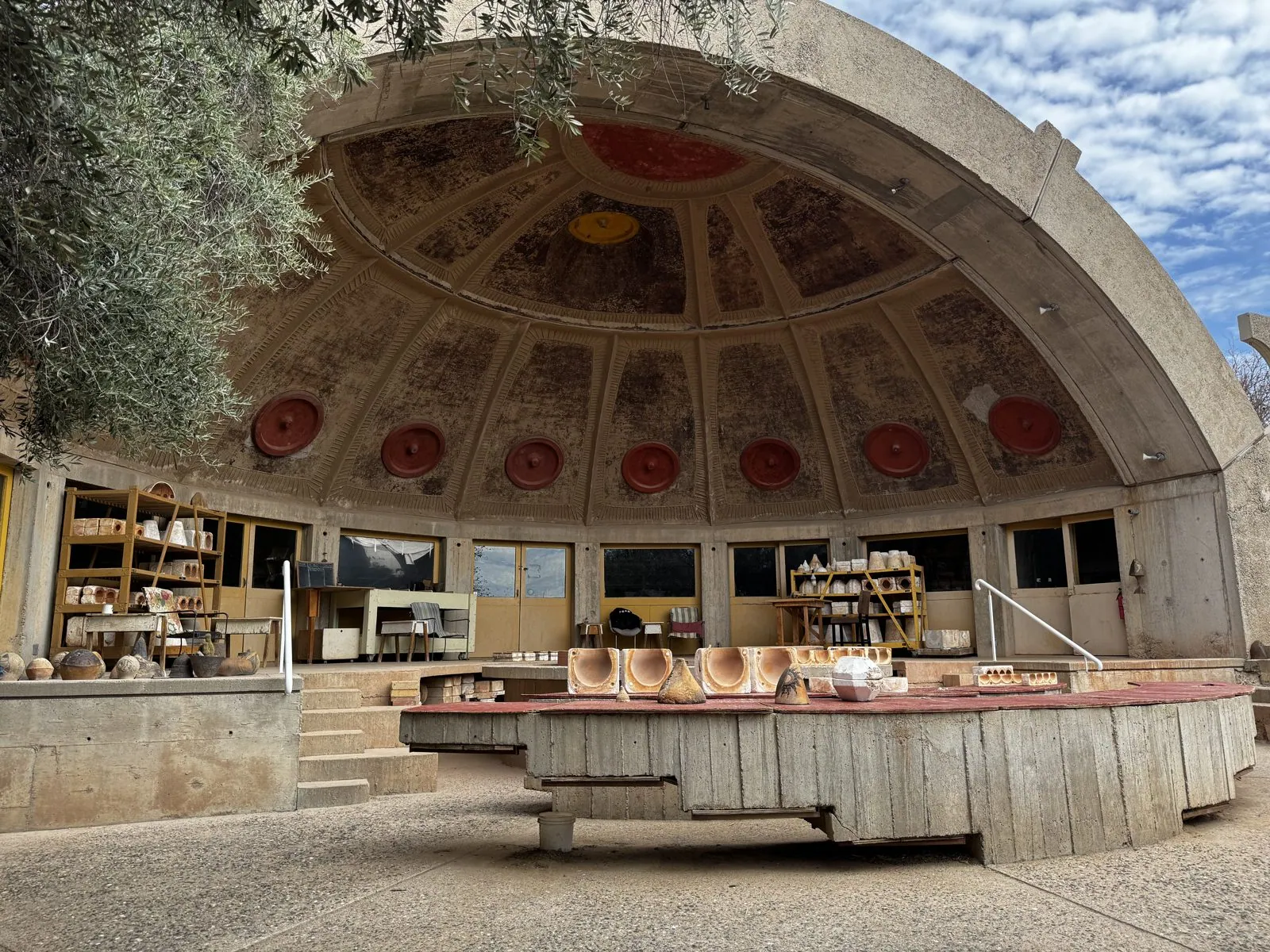
Then there is the apse, a huge concrete quarter-sphere open to the front, like half of a dome cut in two. Its ceiling is cast in a grid of panels with round red medallions, and under it are shelves and work tables. We stood in front of it at 9:53, with an olive tree hanging over the corner of the frame.
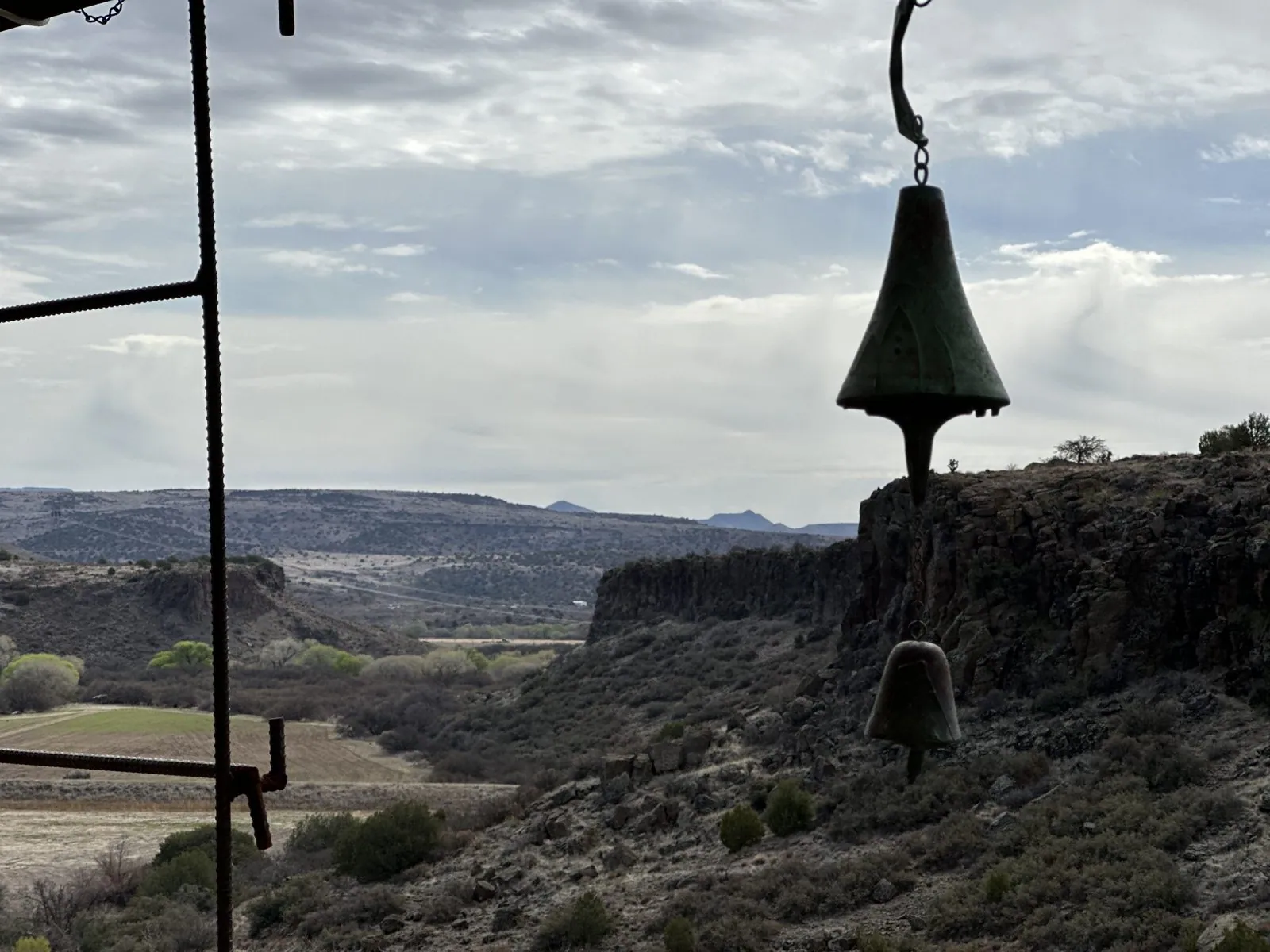
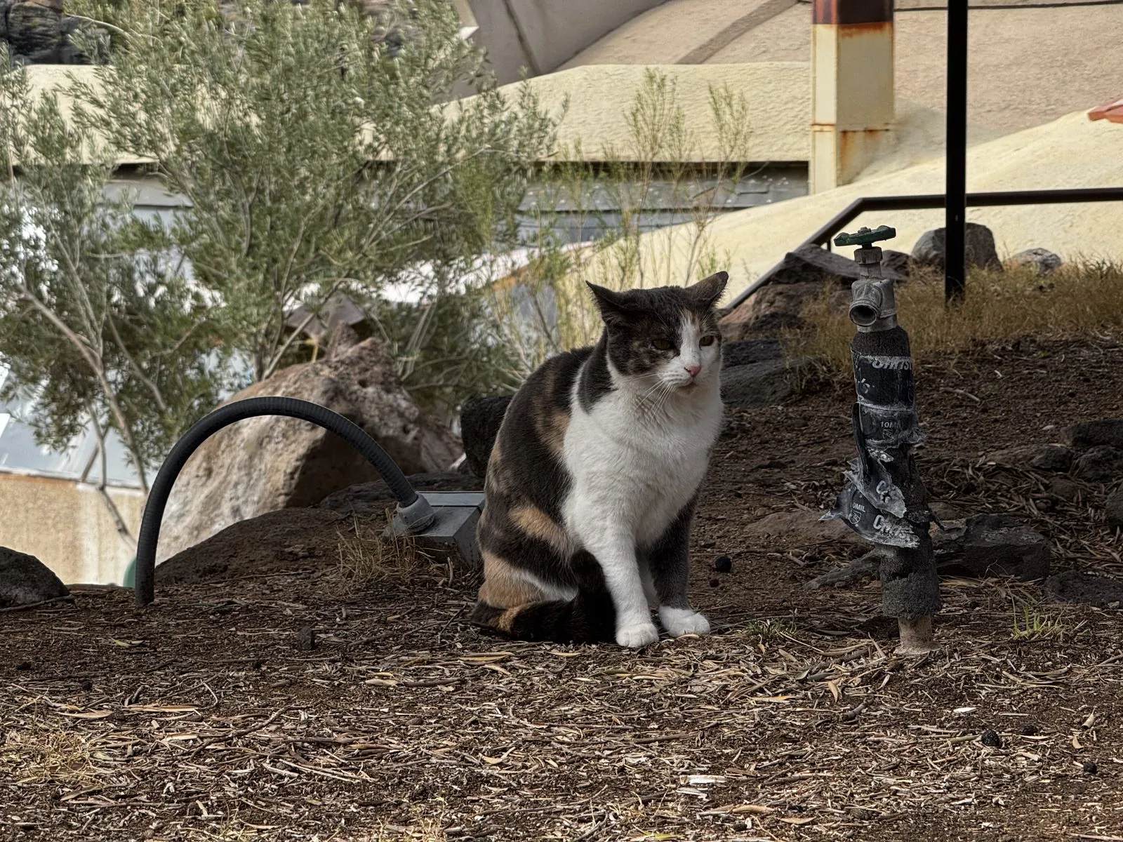
There are bells hanging all over Arcosanti. At 10:10, from a terrace on the canyon side, my wife photographed a dark bell hanging against the view: the canyon below, a long cliff of dark rock, and flat tablelands going off into the distance under the clouds. A few minutes later a calico cat sat in the mulch under an olive tree.
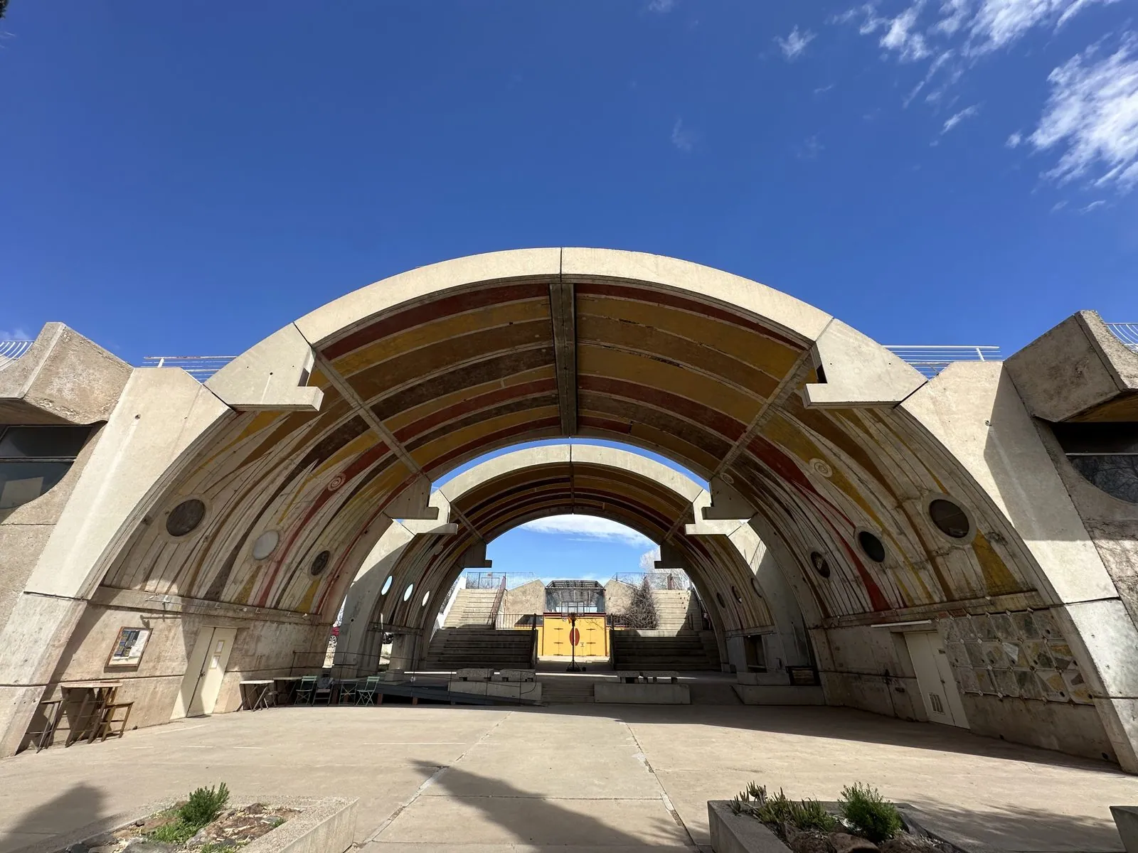
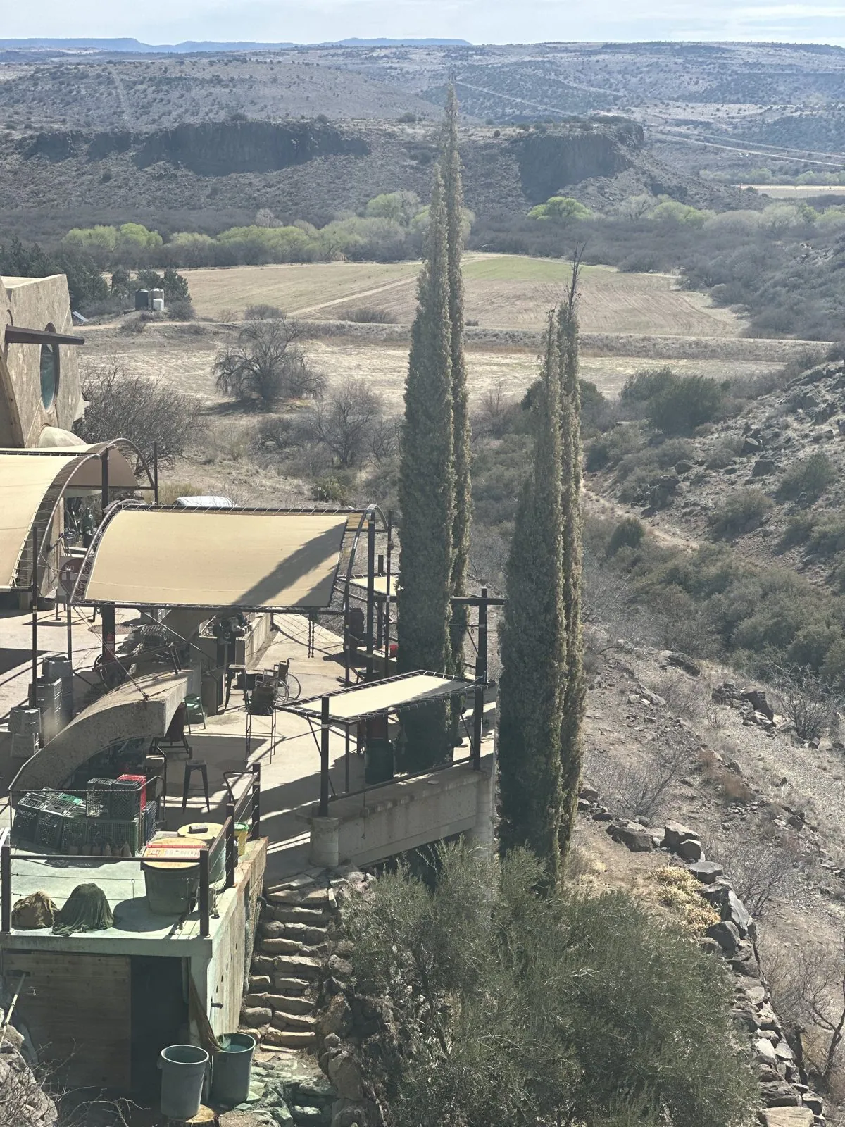
The other big structures are the vaults: two huge concrete arches, one behind the other, painted on their undersides in bands of ochre and red, with a wide paved terrace beneath. Looking through them, you see a row of dark cypresses and olive trees, and beyond that, the sky. Below the terrace, the buildings step down the canyon wall, with tall cypresses rising next to them.
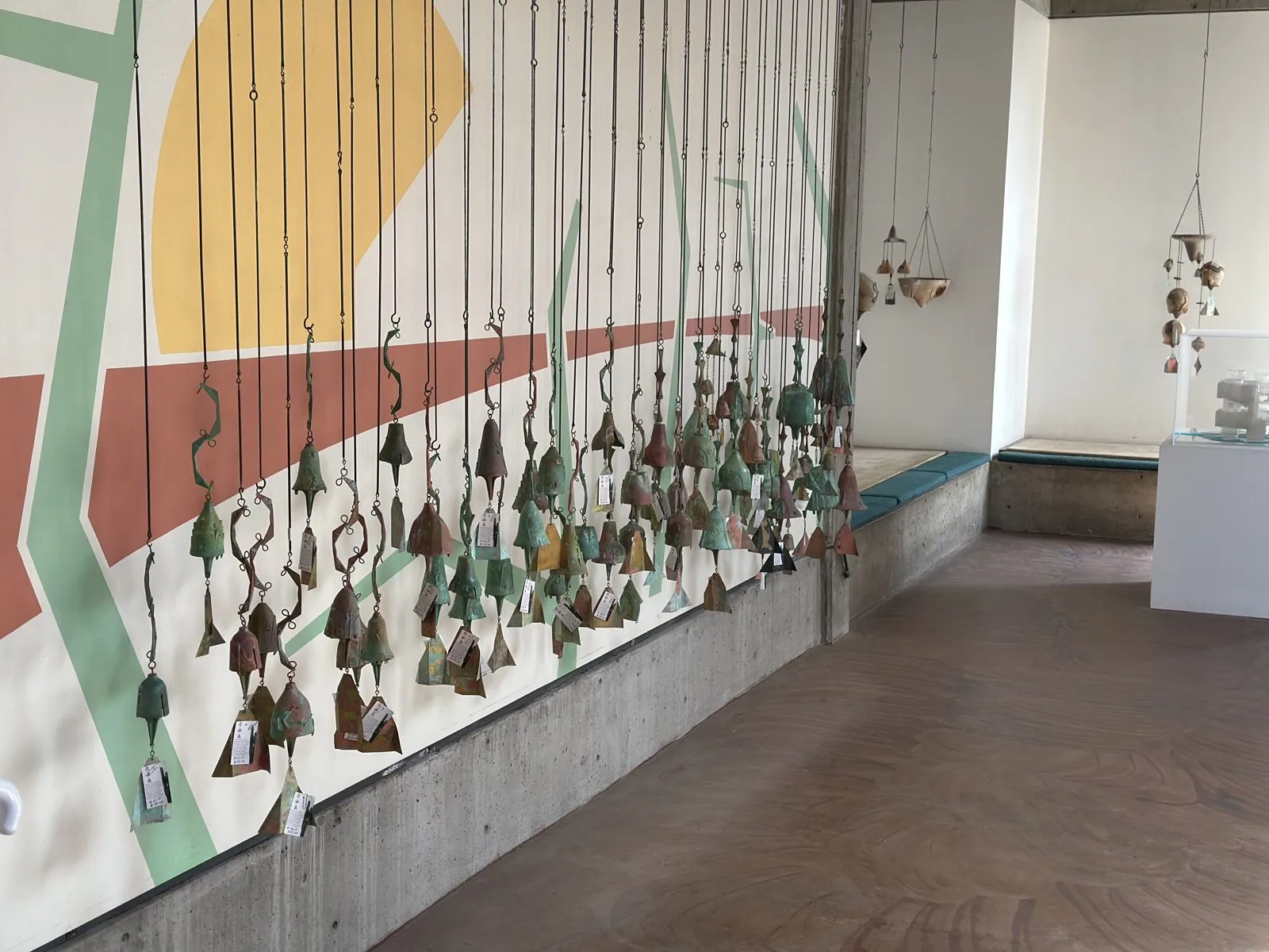
Indoors, in a long gallery, dozens of bells, in bronze and ceramic, hang in rows on chains in front of a painted wall. My wife's last photo there was at 10:48.
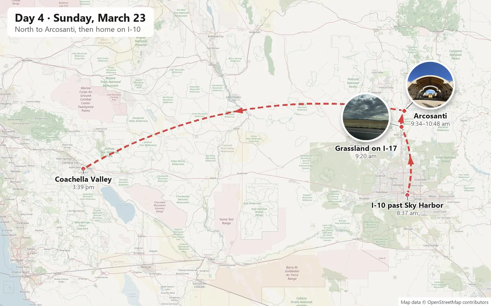
After that it was the long drive home. The next photos are from 3:40 in the afternoon, back in California in the Coachella Valley, where we stopped for Korean barbecue at about 4. Then we drove the rest of the way back to Los Angeles.
Looking back through the photos, the trip comes down to a handful of buildings: a city hall standing on its point, a round pink auditorium among palm trees, an old red-brick hall, and a town of concrete half-domes on the edge of a canyon. In between, Wangcai rolled in the grass and sat for her picture on a lot of different floors.
Maps built from the trip's photo timestamps and locations. Photo locations have been removed from the published images. Day maps: map data © OpenStreetMap contributors; each stop is placed where its photo was taken, hotels and home are never marked, and the dashed lines show the order of stops, not the exact roads.
Some photos in this post are my wife's.
Likes and comments
React with an emoji or leave a comment. Signing in with GitHub is required.