← Misc · January–February 2026
Red Rocks, a Pink Jeep and Teal Arches
A winter weekend in Sedona: Broken Arrow, Chicken Point, and a moon over the red rocks.
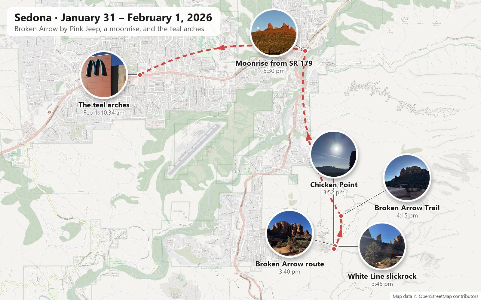
Lunch in West Sedona → Tlaquepaque → Broken Arrow route → White Line slickrock → Chicken Point → back along Broken Arrow → golden hour and moonrise from SR 179 → the teal arches in West Sedona
About ten hours of driving each way from Los Angeles · One Pink Jeep · one moon, a day short of full · one pair of turquoise arches · and Wangcai, the cream-colored member of the crew
This one is short: a single weekend and a few dozen photos. It had no grand purpose. The SIGGRAPH deadline had just passed, and the whole idea was to get away and relax for a couple of days. But Sedona is a place where a few dozen photos go a long way. The town sits in a basin at the foot of the Mogollon Rim in northern Arizona, ringed by buttes, spires and cliffs of sandstone. A thin coating of iron oxide stains the rock red, and the low sun turns it every shade between rust and flame. In winter the air is dry and clear, the sky is a deep, hard blue, and the contrast between the two is almost unreasonable.
As with the other posts here, everything below is reconstructed from the camera roll: what was photographed, where, and at what minute. It is also one of the road trips with Wangcai, our cream-colored dog, who came home in January 2025 and has been riding along ever since. She makes her appearance at the end, under a very unusual sign.
We drove out on the Friday: about ten hours each way from Los Angeles, for a day and a half on the ground. Honestly, a lot of our road trips, this one included, would not have happened without the car's Full Self-Driving (FSD). We have kept it switched on since we got the car in May 2025. It does not drive the trip for you, since someone still has to watch the road the whole way, but it takes enough of the strain out of a ten-hour day behind the wheel that a weekend like this stops sounding unreasonable.
Day 1: Broken Arrow by Pink Jeep
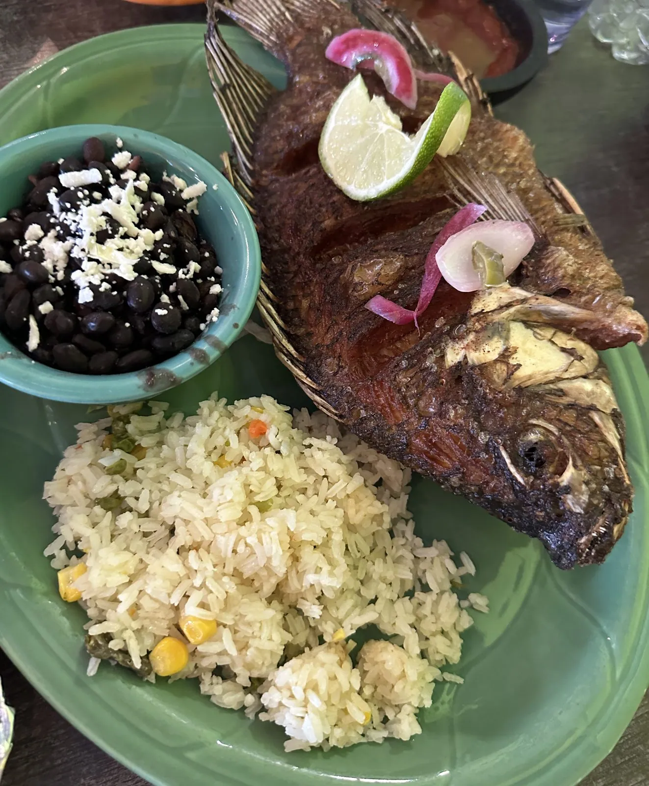
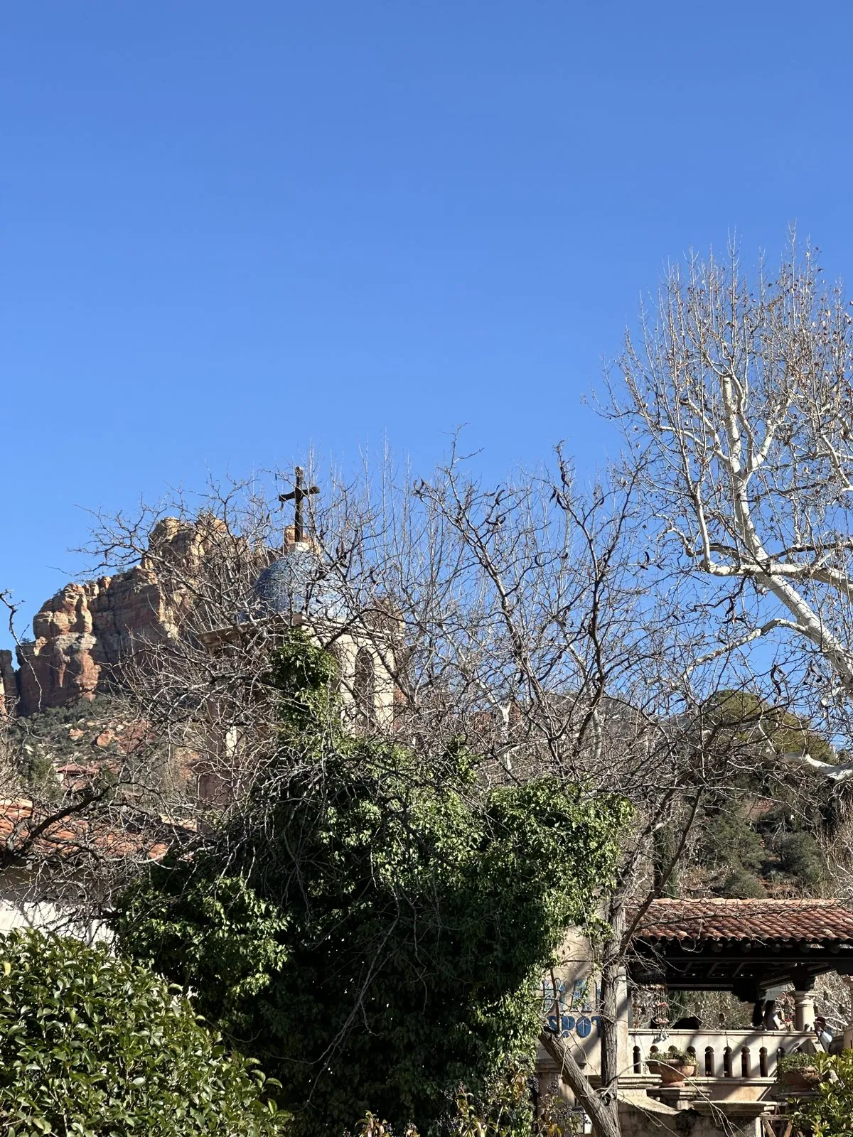
The main event of Saturday was a Pink Jeep tour on the Broken Arrow route, after lunch at Tortas de Fuego in West Sedona: a whole fried fish, a molcajete heaped with grilled shrimp and meat, and fried ice cream. Between lunch and the tour we walked around Tlaquepaque, where the chapel bell tower stands out against the red rock.
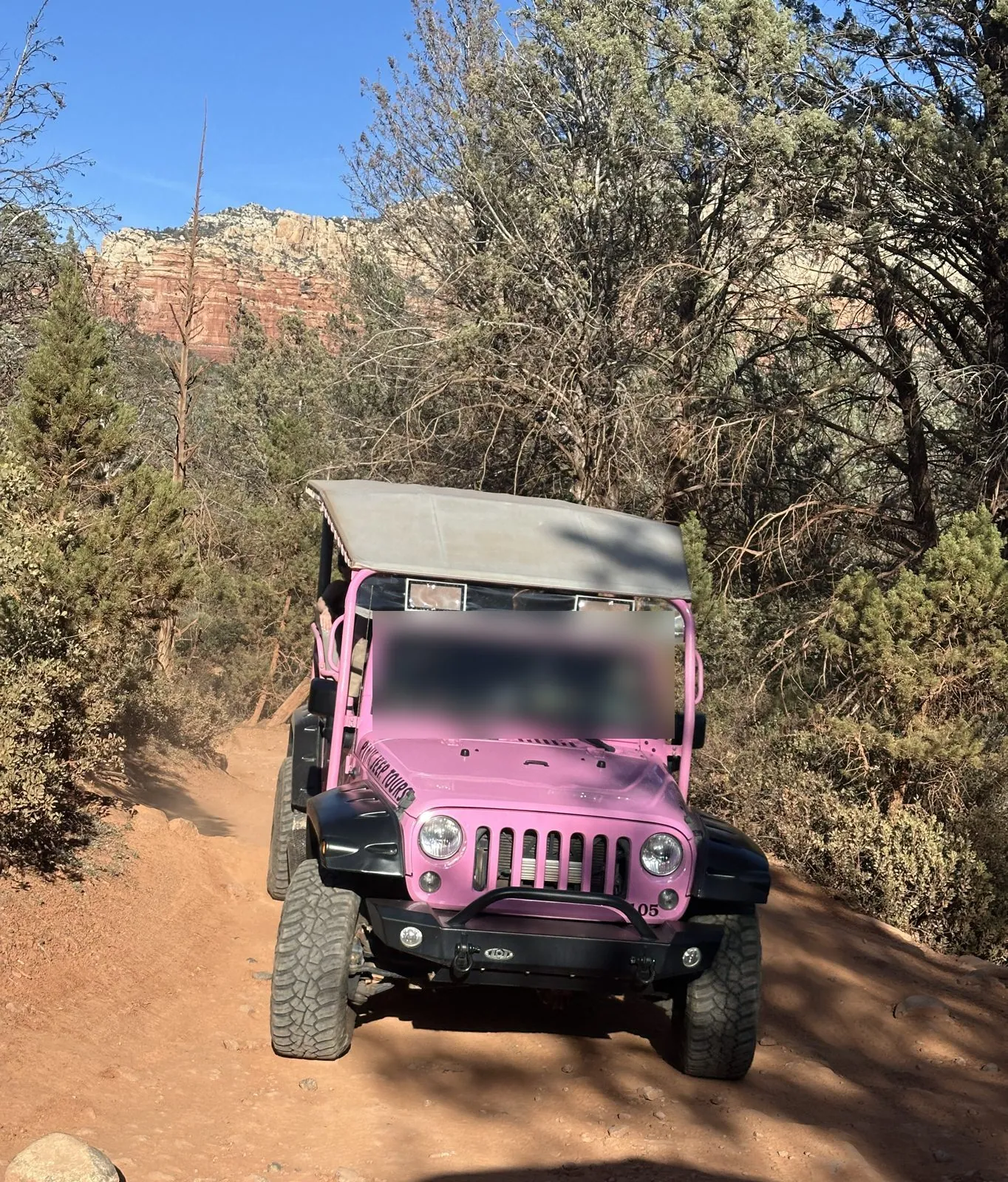
Pink Jeep Tours has been driving visitors into the backcountry around Sedona since 1960, in open-sided Jeeps painted a shade of pink you could see from orbit. Broken Arrow is its signature route: a rough four-wheel-drive track that leaves SR 179 south of town and climbs over bare slabs of sandstone into the rocks. The route takes its name, the story goes, from the 1950 western Broken Arrow, which was filmed in the area. By 3:20 we were riding out along the Broken Arrow track, and at 3:40 my first photos were taken where the dirt road meets the rock.
Wangcai sat this part out. The tour was just our group; she waited in our car with Dog Mode on, the Tesla setting that keeps the cabin climate-controlled while the car is parked.
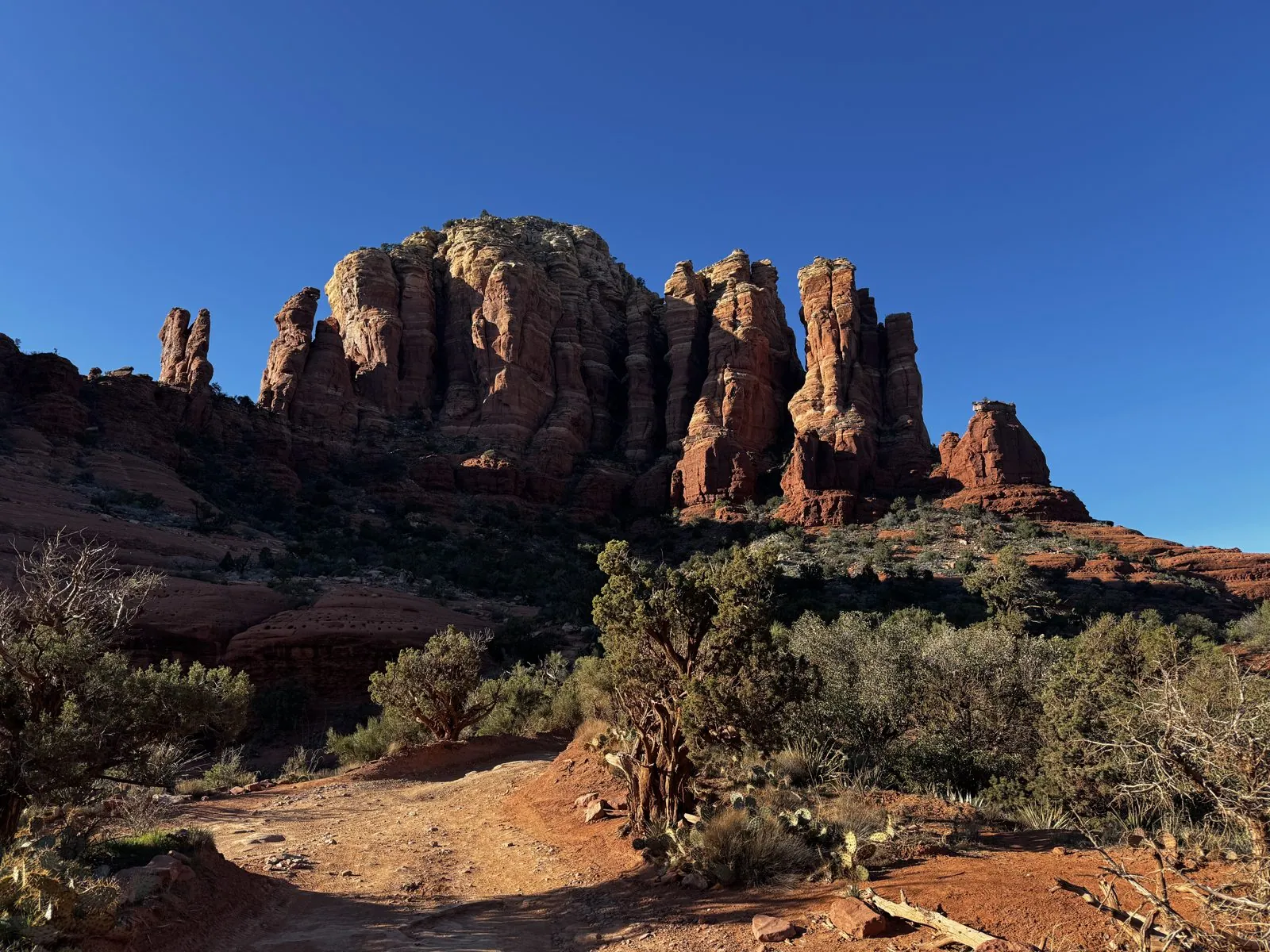
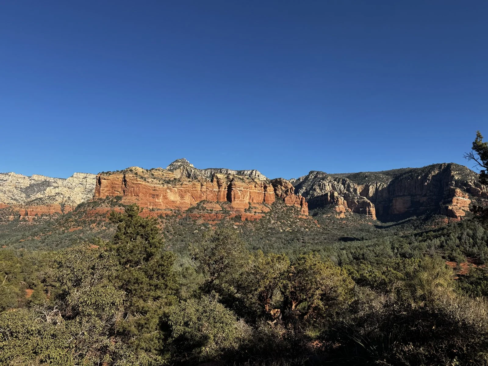
The first stop already had everything Sedona is known for. On one side, a cluster of red towers rose straight out of the juniper, fluted and pillared like a ruined cathedral. On the other, the land fell away into a long valley of green forest, and beyond it ran a wall of cliffs in layers: deep red at the bottom, then orange, then pale cream at the top, where the younger rock caps the older. The light was still high and white, two hours before sunset, and the shadows in the cracks of the towers were almost black.
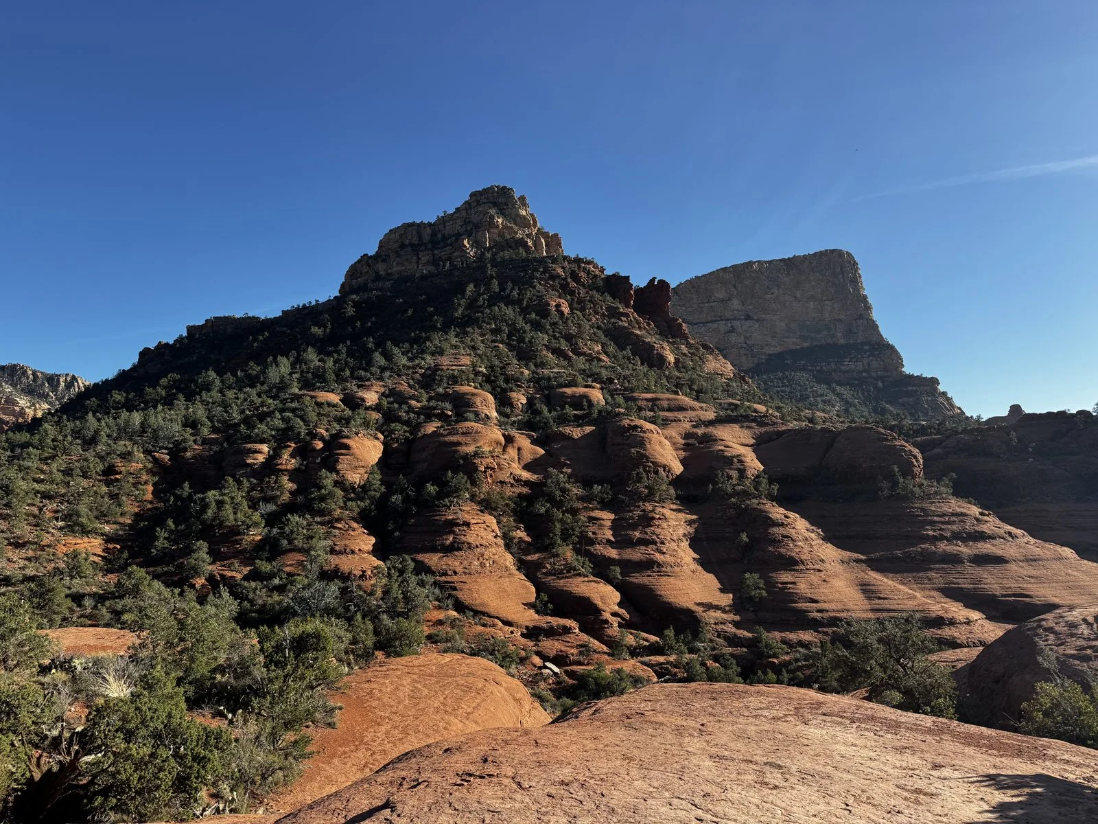
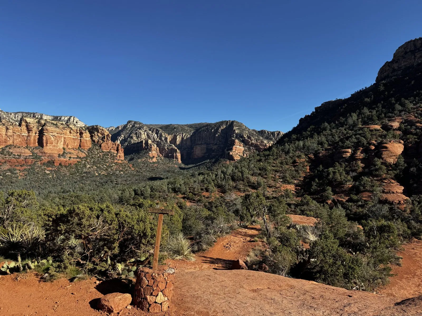
A few steps further on, the ground turns to slickrock, the local name for bare sandstone worn smooth by wind and water. It lies in great rounded ledges, stacked like the layers of a cake that has been left out in the rain, and the vegetation hangs on in the cracks between them. Trail markers here are posts set in little cylinders of stacked stone, because there is nothing to dig into. The Jeeps drive straight up and over these slabs, which is the whole point of the tour: the rock grips the tires far better than it looks like it should.
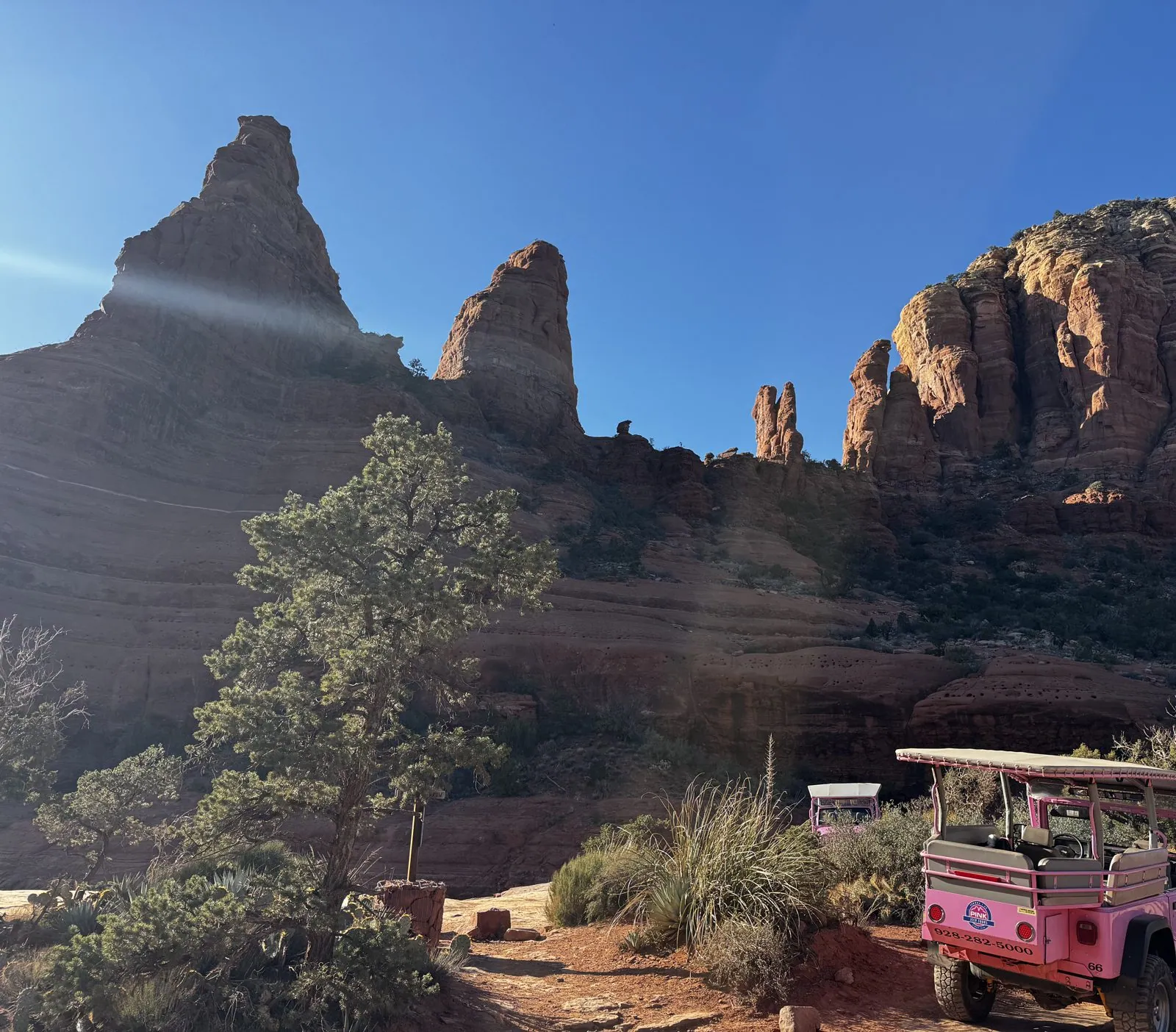
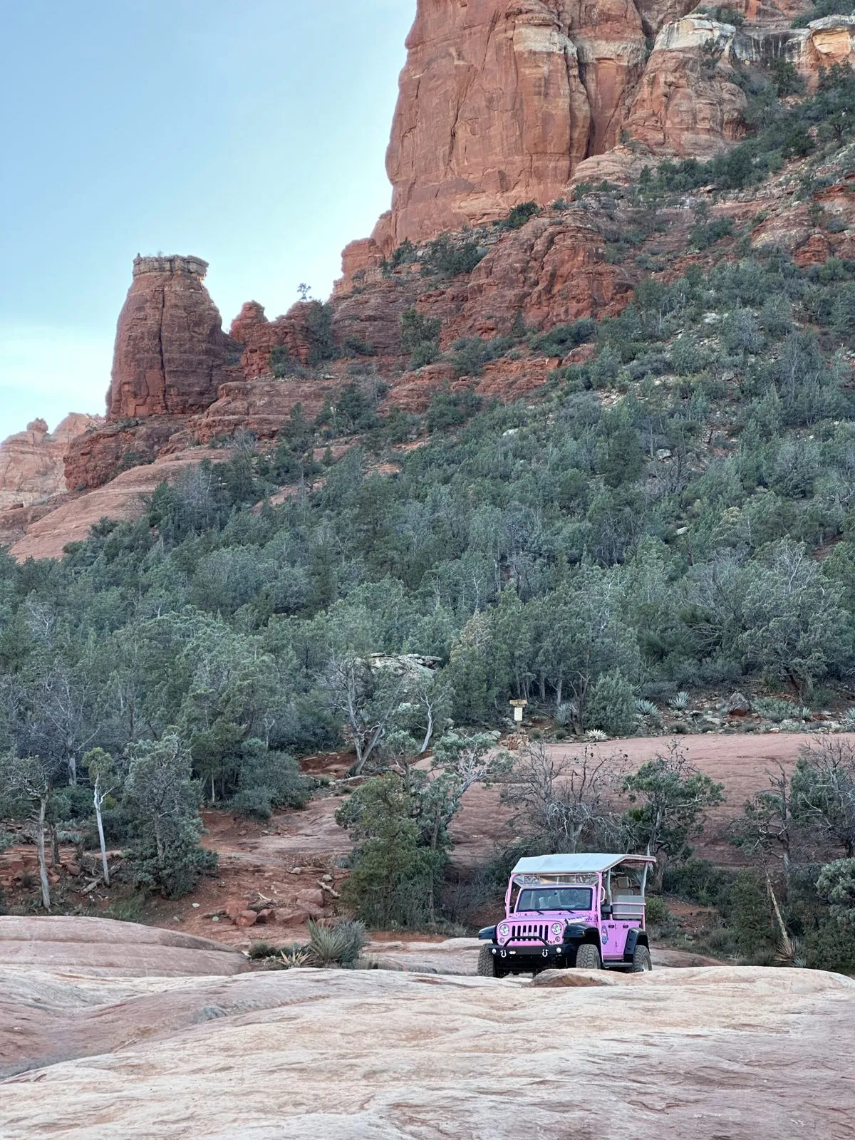
And there it was, parked under the spires: the Jeep itself. It is a Wrangler with its doors and roof replaced by a canopy and rows of bench seats, and the pink is even louder in person than in the brochures. Against the dark red rock and the gray-green junipers it looks like a toy someone has dropped into a landscape painting. Behind it, a second pink Jeep was nosing through the brush.
White Line and the slickrock
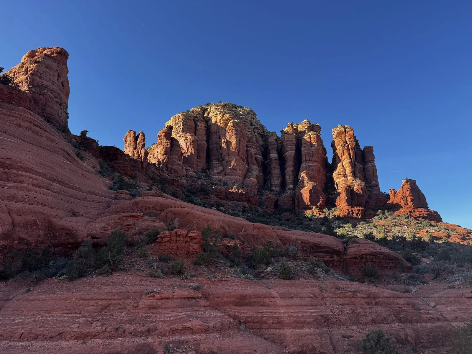
By 3:45 the tour had climbed onto a broad shelf of slickrock that maps label White Line. We were out of the Jeep for about a quarter of an hour, from the White Line shelf to the edge at Chicken Point, and most of the photos from it are of the group in front of the Jeep, which stay in the family album. Between them are a few frames of the rock itself: smooth, salmon-colored stone running down into a shaded gully, and the same cluster of spires from a new angle, now with the sun striking their faces and lighting them orange.
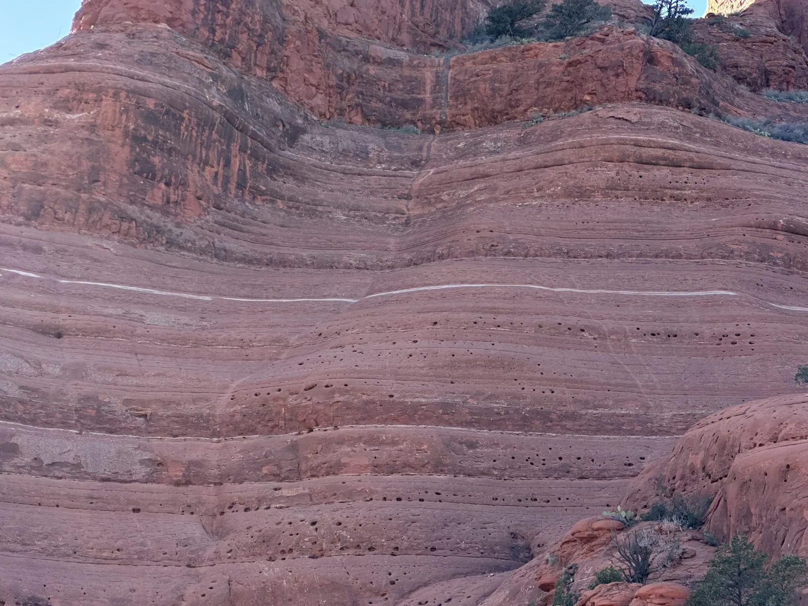
What strikes you about the rock up close is the banding. The towers and the slabs underfoot are striped with thin horizontal layers, some a shade paler, some a shade darker, each one a few inches of sand laid down long ago when this was a coastal plain of dunes and tidal flats. Erosion carves the layers at different speeds, which is why the towers have their ribbed, stacked look and why the slickrock breaks into steps and shelves rather than smooth slopes.
Chicken Point
At 3:50 the Jeep reached Chicken Point, one of the classic stops on the Broken Arrow route. It is a wide, tilted bench of red slickrock at the foot of a sheer cliff, with the whole southern half of the Sedona basin spread out below. Pink Jeeps are not the only vehicles that make it up here: a pair of off-road buggies was parked at the far edge of the rock.
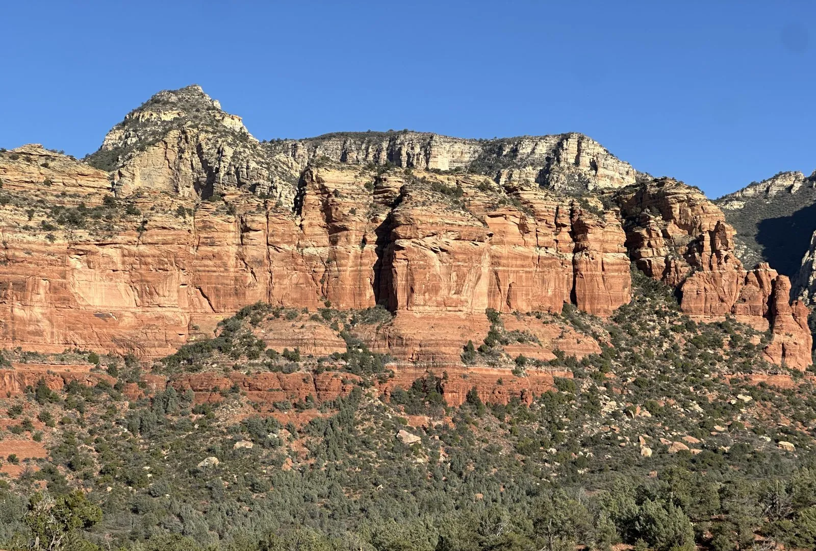
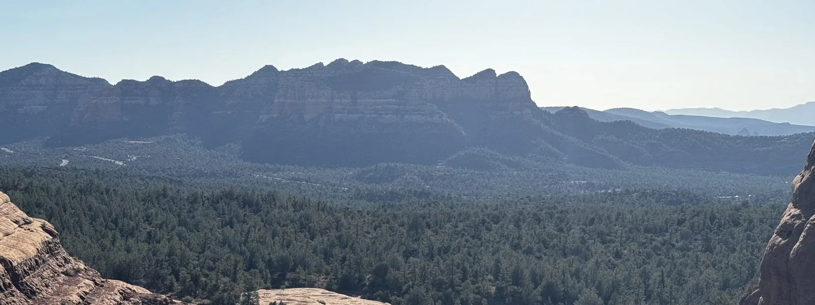
The view from the edge is the reason the tours come here. Below the rock lies a forest of juniper and pinyon so dense it looks like moss, and beyond it, across miles of haze, a long flat-topped mesa runs along the horizon. The air out there was soft and blue with distance, the kind of layered, receding blue that landscape painters use to say "far away". Up close everything was red and sharp; in the distance everything was blue and blurred, and the two halves of the picture hardly seemed to belong to the same afternoon.
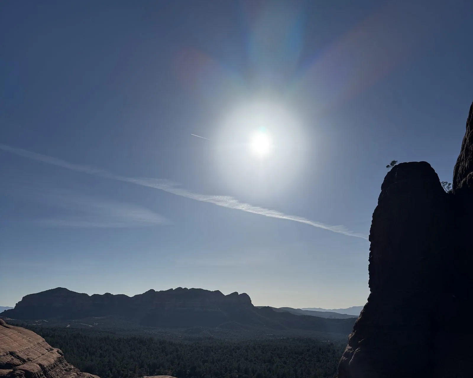
Turn around and the light changes completely. Chicken Point faces the winter sun, and just before four o'clock it hung low over the basin, blazing in a pale sky streaked with a contrail. Next to it, a tall fin of sandstone went fully black against the glare, with only its rim catching light. The mesa on the horizon flattened into a silhouette. Photos taken straight into the sun rarely work, but this one does, because the rock gives it a hard edge to push against.
The way back
By 4:14 the Jeep was heading back north along the Broken Arrow Trail. The sun was dropping behind the rocks now, and the slickrock benches lay in their shadow, cool and gray-pink. From one of them, a red spire rose above a slope of juniper, against a sky that was beginning to pale. And down on the rock below it, tiny, sat a pink Jeep: the best possible scale bar for how big these formations really are.
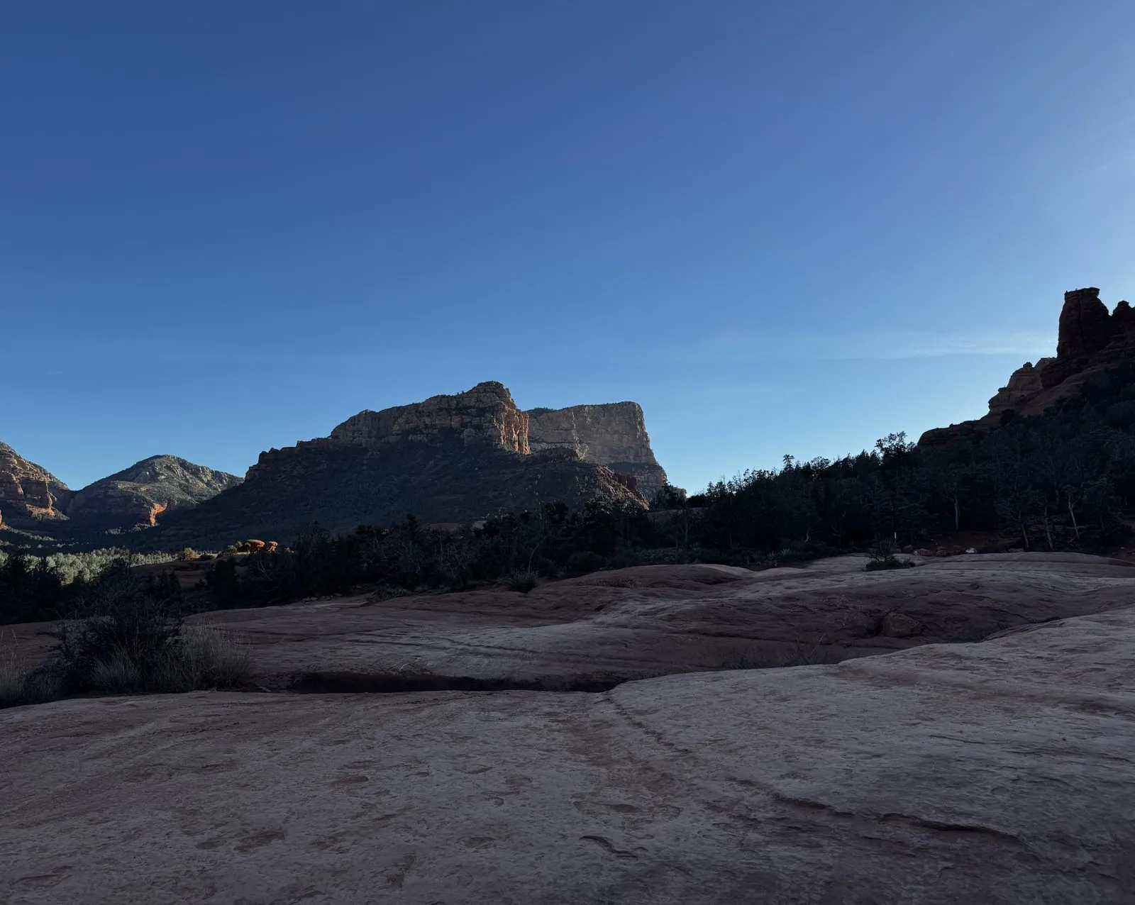
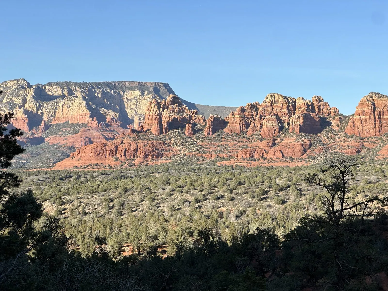
The widest view of the tour came at 4:18. From an opening in the trees, the whole Sedona skyline lay across the middle of the frame, a long row of red buttes and spires with the cream-colored cliffs of the Rim behind them, all of it still in full sun. The foreground, meanwhile, was already in shade, dark pines framing the view like a window. In winter, the light leaves the low ground first and climbs the rocks as the sun goes down.
Golden hour and a moonrise on SR 179
That climb of the light is what Sedona is famous for, and an hour later the photos pick it up again. At 5:29 the camera was on SR 179 near uptown Sedona, by the shops at Hyatt Piñon Pointe, looking across the road and a low wall to the rocks beyond. The valley floor was already in shadow. Only the tops of the buttes were still in the sun, and they had gone from red to a deep, glowing orange.
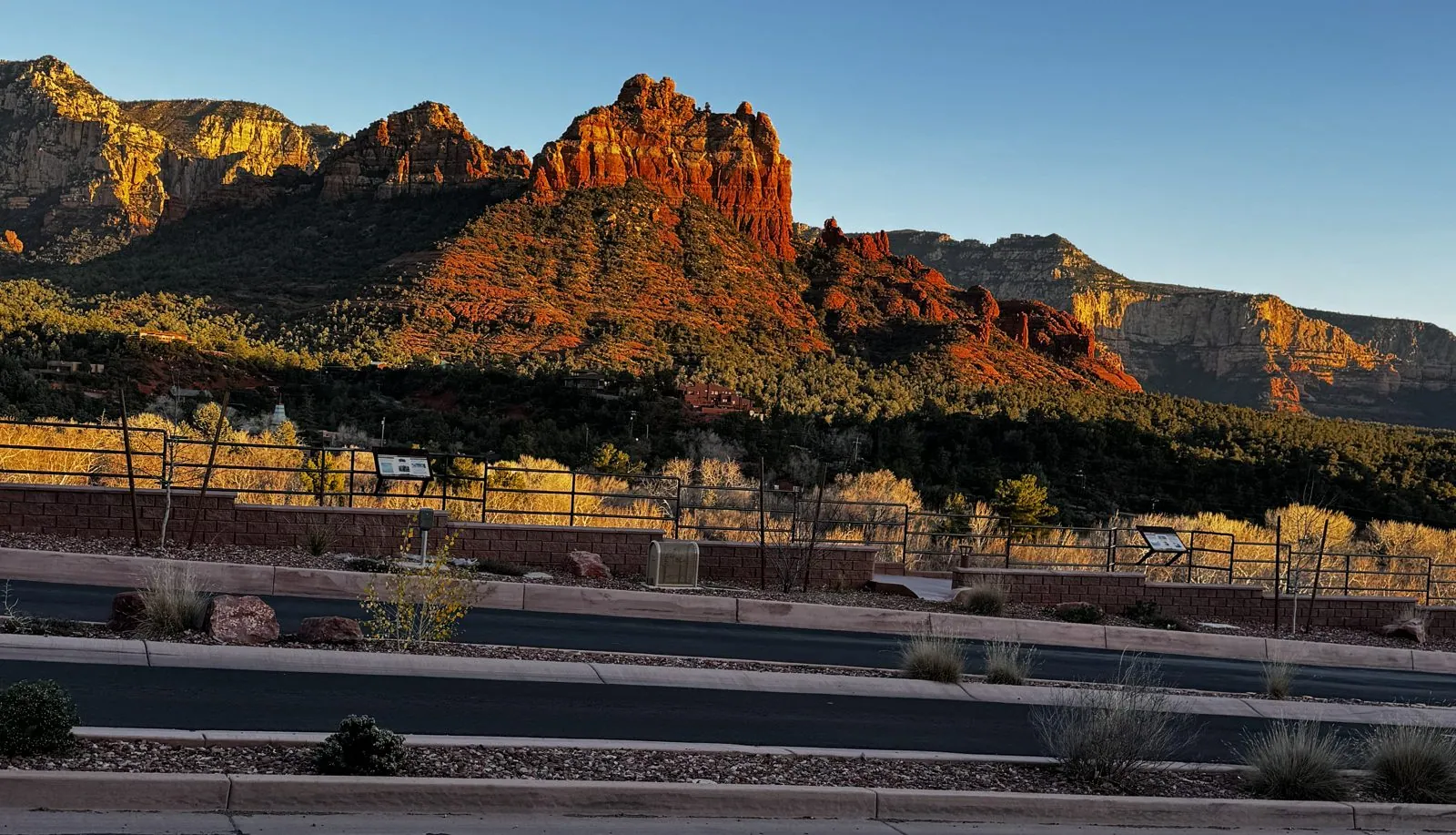
It is a strange sight the first time you see it. The rock seems to be lit from inside, as if it were giving off light rather than reflecting it. Part of that is the color of the sunlight itself, which near sunset has lost most of its blue to the long path through the atmosphere. Part of it is the rock, whose iron-red surface throws that warm light back almost undiluted. And part of it is contrast: the sky behind is cool and blue, the ground below is in shadow, and the rocks sit between them like embers.
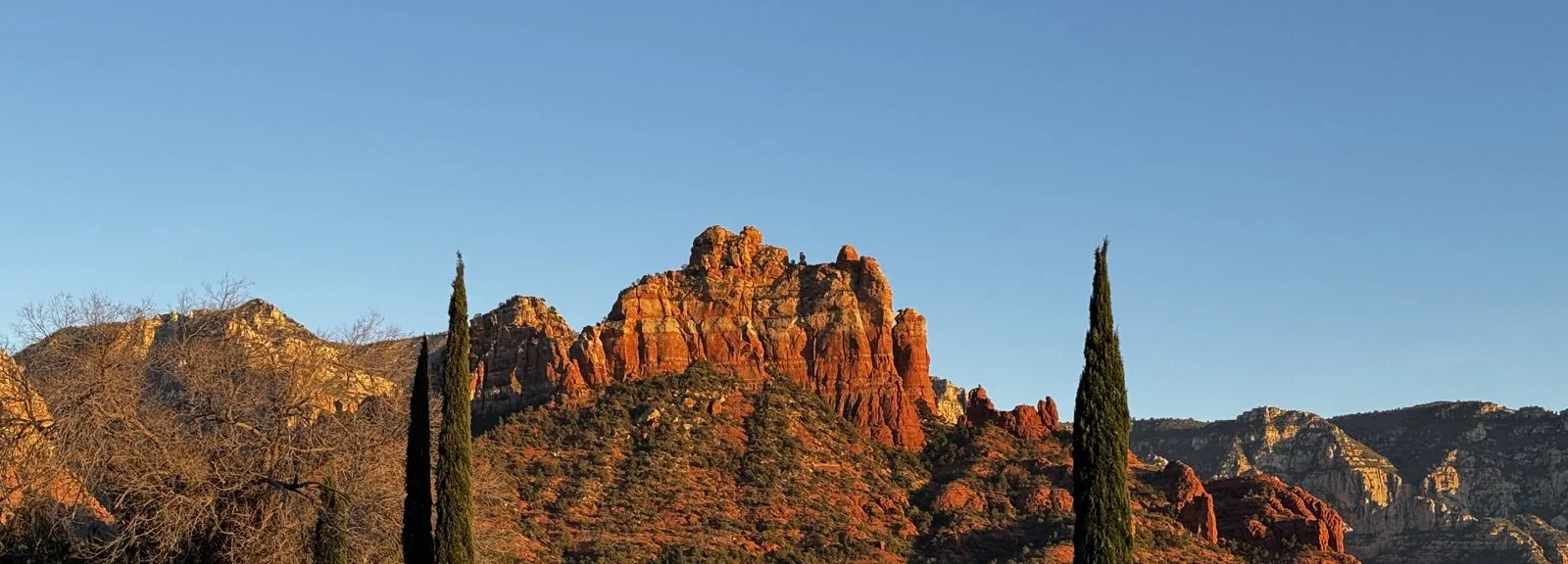
Then the moon came up. On January 31 it was a day short of full: the February full moon fell on the 1st. A nearly full moon rises around sunset, on the opposite side of the sky from the sun, and in Sedona that means it climbs out from behind the eastern rocks just as they catch the last light. At 5:30 it was already clear of the ridge, a pale white disk hanging beside a row of glowing spires (possibly Snoopy Rock).
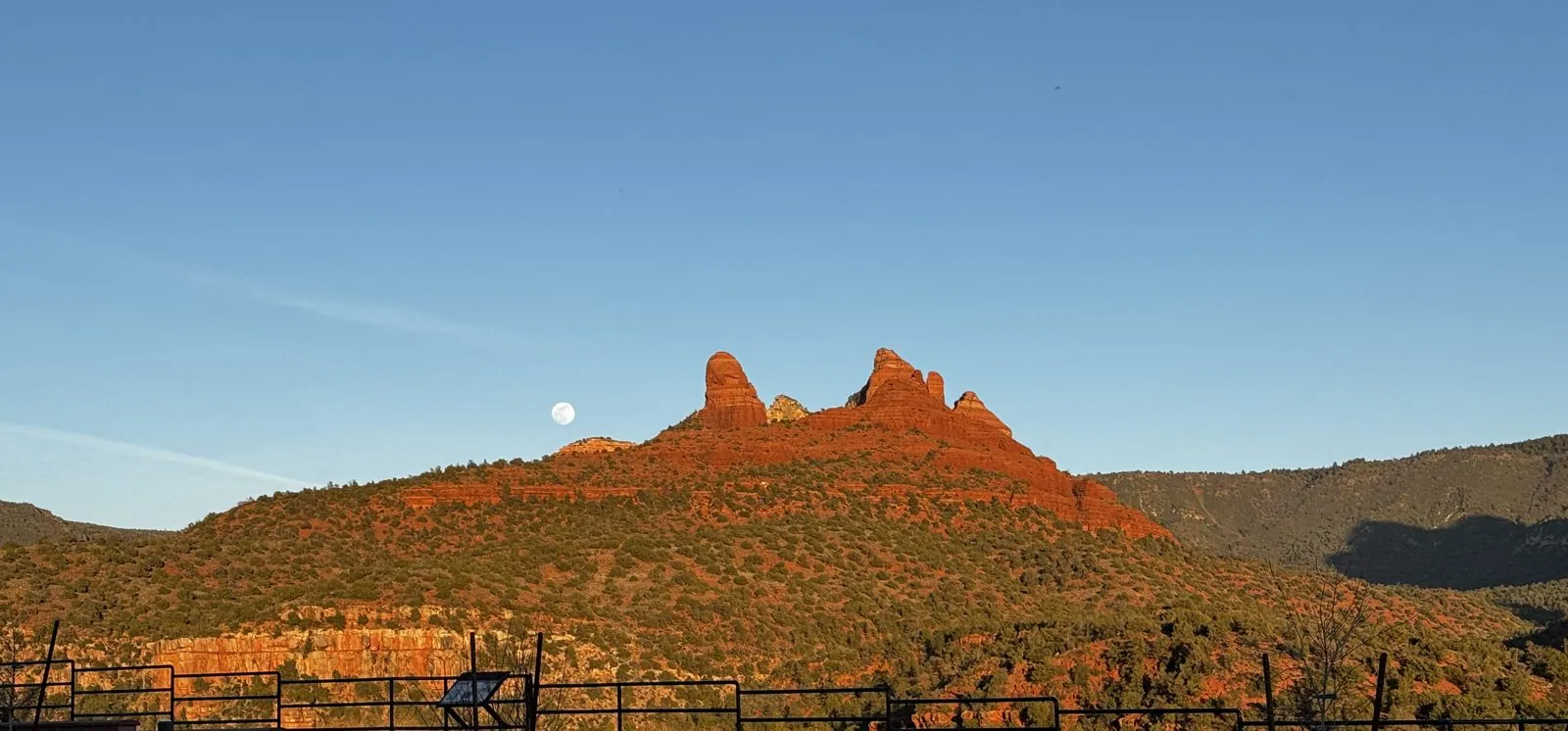
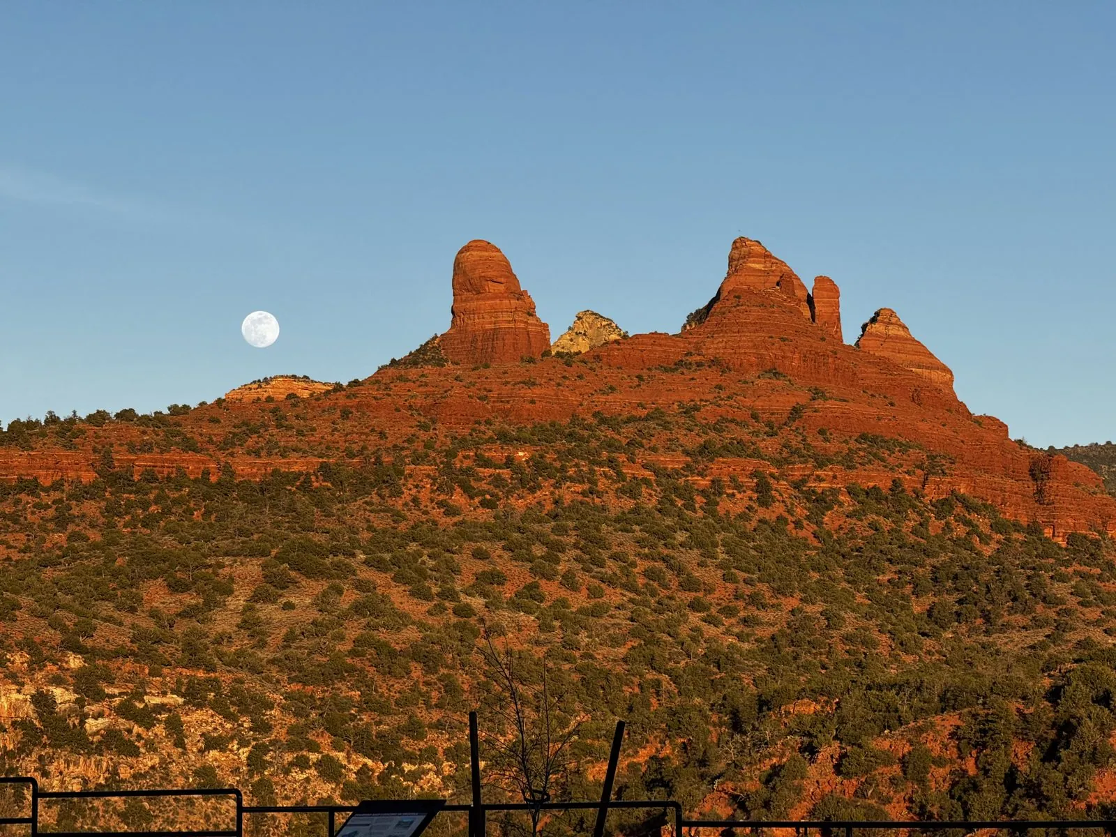
The zoomed-in frame from a minute later is the best photo of the weekend. The spires are lit a burning orange, every ledge and crack picked out by the low sun. The juniper on the slope below is dotted dark green against red soil, and the moon sits off to one side in a flawless blue sky, round and white and a little unreal, like a lamp someone has hung there on purpose. It lasted a few minutes. Then the sun dropped and the color drained out of the rock from the bottom up.
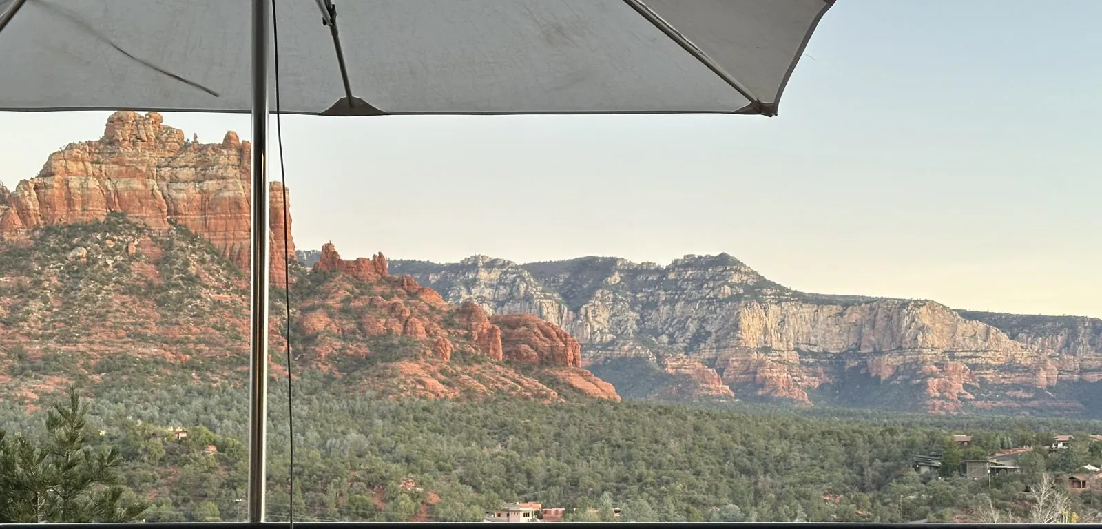
The last frames of the day, at 5:34, were taken a few hundred yards down the road. A red butte was still catching the final light, framed between two tall, dark cypress trees. Below it, in the valley, the evening had already arrived. Around six we had dinner on the terrace at Sound Bites Grill, looking out at the red rocks, and finished with ice cream from the Black Cow Cafe.
Day 2: The teal arches
Sunday morning has exactly one stop in my camera roll, and it is a McDonald's. Not just any McDonald's: the one on SR 89A in West Sedona is famous as the only one in the world whose arches are turquoise instead of gold. When it opened in 1993, the city did not want a bright yellow sign competing with the red rocks. Sedona's design rules keep buildings in earth tones that blend into the landscape, so the company agreed to swap the gold for teal.
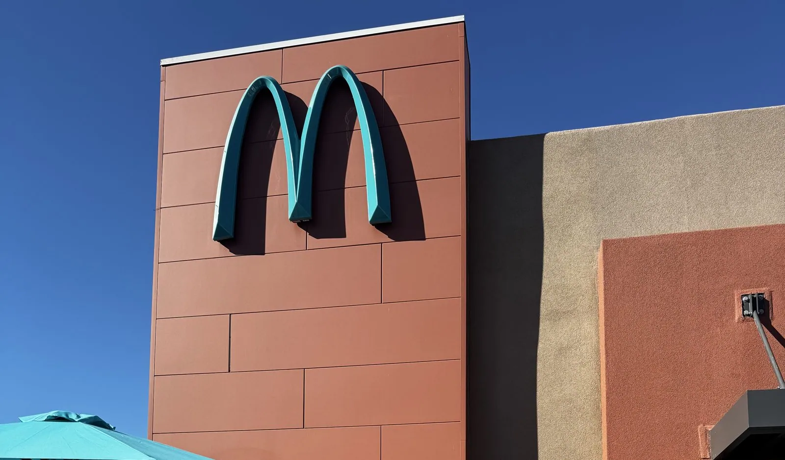
The result is oddly elegant. The arches are mounted on a tall terracotta-red tower that matches the color of the rocks, next to a wall of sand-colored stucco, and the teal picks up the color of the umbrellas on the patio below. Seen against a winter sky, it looks less like a fast-food sign than a piece of Southwestern design. It has turned into a landmark in its own right: plenty of people come here for the photo rather than the food, and the camera roll, tellingly, has no pictures of the food.
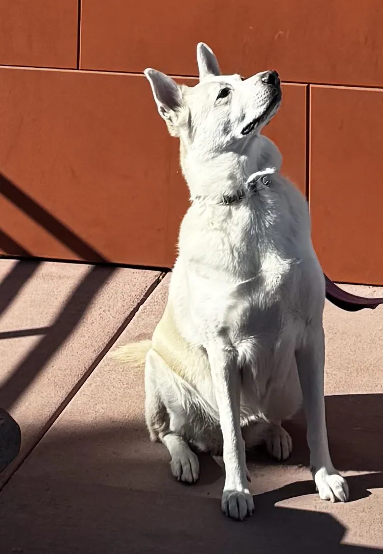
Which brings us to Wangcai. Fifteen photos were taken under the arches in the space of nine seconds, and in every one of them she is sitting on the patio in the sun, her cream coat almost white in the hard Arizona light, framed against the red wall. In some of them she is looking up at something just out of the frame, ears high, with the expression of a dog who suspects there may be food involved.
My photos end there, at 10:34 on Sunday morning. After that came the long drive home to Los Angeles, which is not in the camera roll. As weekends go, it was a small one: one afternoon in the rocks, one moonrise, and one very unusual McDonald's. But it is hard to think of a better way to spend a winter weekend than watching a full moon come up over a ridge of glowing red stone, and then, the next morning, introducing the dog to a pair of turquoise arches.
Map built from the trip's photo timestamps and locations. Photo locations have been removed from the published images. Map data © OpenStreetMap contributors; each stop is placed where its photo was taken, lodging and home are never marked, and the dashed lines show the order of stops, not the exact roads.
Some photos in this post are my wife's.
Likes and comments
React with an emoji or leave a comment. Signing in with GitHub is required.