← Misc · March 2026
Hoodoos, Earthships and Red Rocks
Spring break 2026: a four-day loop through the Southwest and into the Rockies, with Wangcai along for the ride.
The California line at Topock → I-40 across Arizona → the Bisti/De-Na-Zin badlands → Albuquerque → Santa Fe → the Taos Earthships → Pueblo → Denver → Red Rocks → I-70 into the Rockies → Vail → overnight to St. George, Utah → Las Vegas → home
Six states: California, Arizona, New Mexico, Colorado, Utah and Nevada · one badlands at sunset · one off-grid town built from tires · one empty amphitheatre · one very large cream soda · one cream-colored dog
Spring break is less a vacation than a gap in the calendar, and this one was four days long. We spent it the way you spend a gap you don't want to waste: in the car. The plan was a loop, west to east and back again, that would string together four very different places. There was a badlands in northwestern New Mexico, a town of houses made of tires near Taos, a concert venue carved into red sandstone outside Denver, and, on the way home, the glass conservatory at the Bellagio. In between were a great many miles of interstate.
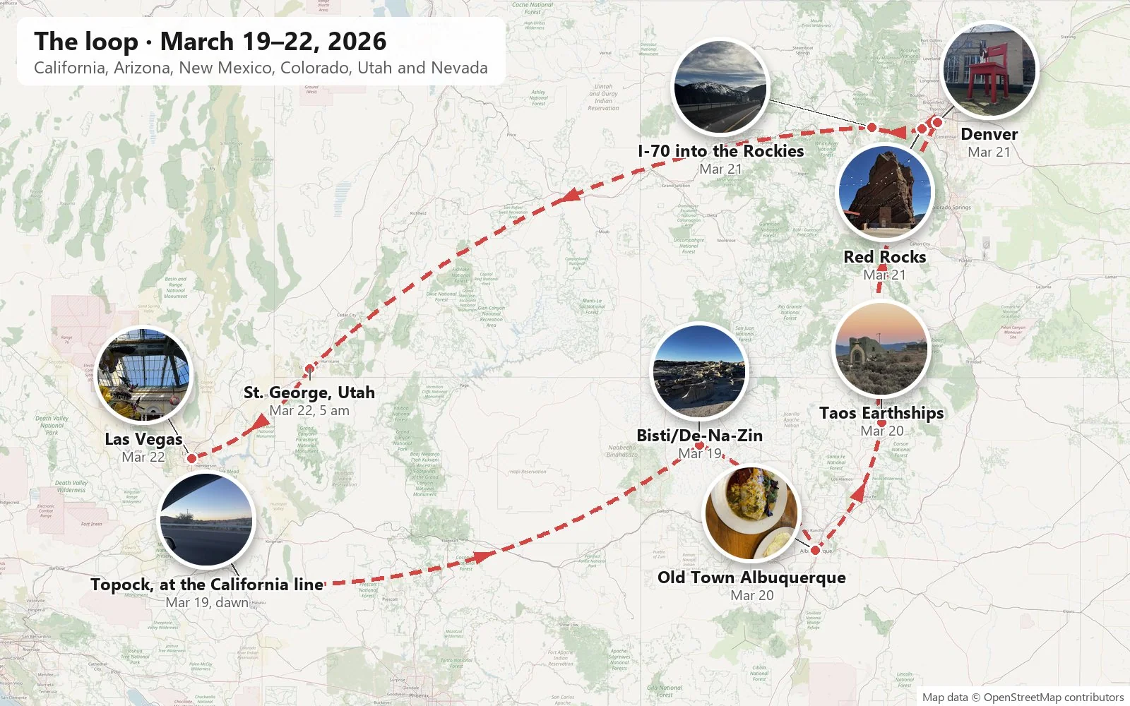
As with the last trip, everything here is reconstructed from the camera roll. A phone keeps a time and a place for every picture, and four days of them turn out to make a decent diary. It is an honest one too: it shows where we stopped to look, and it goes quiet where we just drove. There are some long silences in this one. Where the photos say nothing, so do I.
The loop also had a passenger who doesn't appear in the stats: Wangcai, our cream-colored dog, who came the whole way. Her name means, roughly, "flourishing fortune", and it is about as classic a dog name as there is in Chinese, the equivalent of calling a dog Rover. She does not care about any of that. She has her own section further down, mostly involving dirt.
Day 1: Across Arizona to the badlands
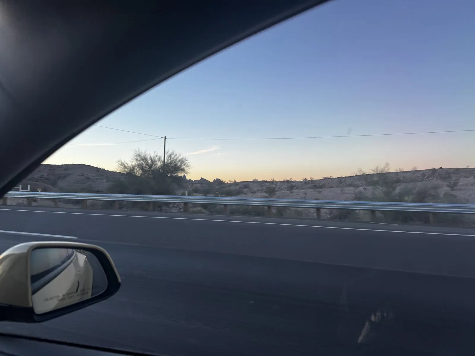
My first photo of the trip was taken at 6:40 in the morning at Topock, where I-40 crosses the Colorado River from California into Arizona. It is a passenger-window shot: the guardrail, a desert shrub, a power line and a sky going from blue to pale peach over low, dark hills, with the side mirror in the corner. Dawn at the state line meant an overnight start: we had left home the night before and slept in the car at a Supercharger station near the California–Arizona line.
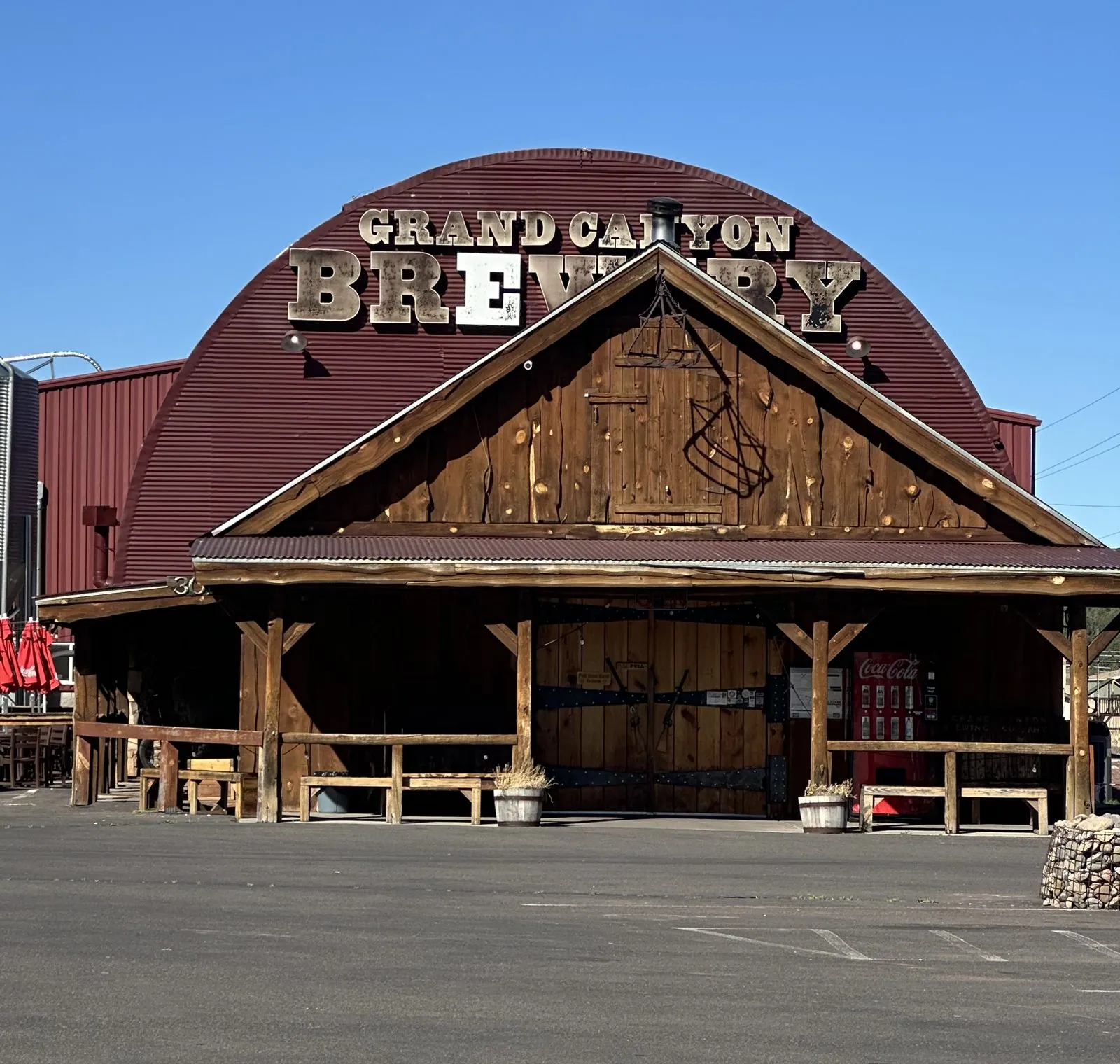
From there it is the better part of a day across Arizona on I-40, the interstate that replaced most of old Route 66. It runs past Kingman and Flagstaff, up onto the high plateau and through the ponderosa forest, and then out across the long, open stretch past the Painted Desert. My own camera didn't record much of it, which is honest: there is a lot of Arizona, and most of it is the same color for a long time. My wife's has a morning stop in Kingman, and a break in Williams outside the Grand Canyon Brewery.
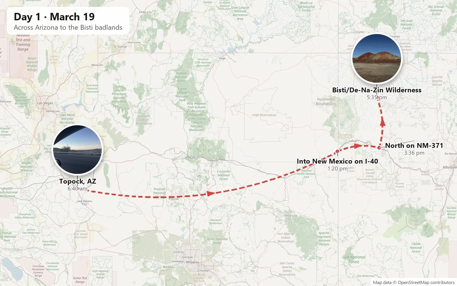
My camera woke up again around 1:20 in the afternoon at Lupton, the last town before New Mexico, with a few short videos out the windshield. Crossing the line costs you an hour: Arizona doesn't observe daylight saving time and New Mexico does, so in March the clock jumps forward the moment you cross. Just past Gallup, at Thoreau, we turned north onto NM-371, a two-lane road that runs straight up across the Navajo Nation toward Farmington, through open rangeland with mesas on the horizon. Then, about an hour later, came a turn onto a county gravel road and a dirt parking lot with nothing else in it but a few cars and an information board.
The Bisti/De-Na-Zin Wilderness
The board said Bisti/De-Na-Zin Wilderness. It is a protected wilderness of about 45,000 acres, run by the Bureau of Land Management, and it is one of the strangest landscapes in the Southwest. The names are Navajo. Bisti comes from a word meaning "among the adobe formations", and De-Na-Zin means "standing cranes", after petroglyphs of cranes found nearby. There is no visitor center, no water, no shade and no marked trail. You park, you pick a direction, and you walk out across a flat, gray, crunchy plain toward whatever looks interesting.
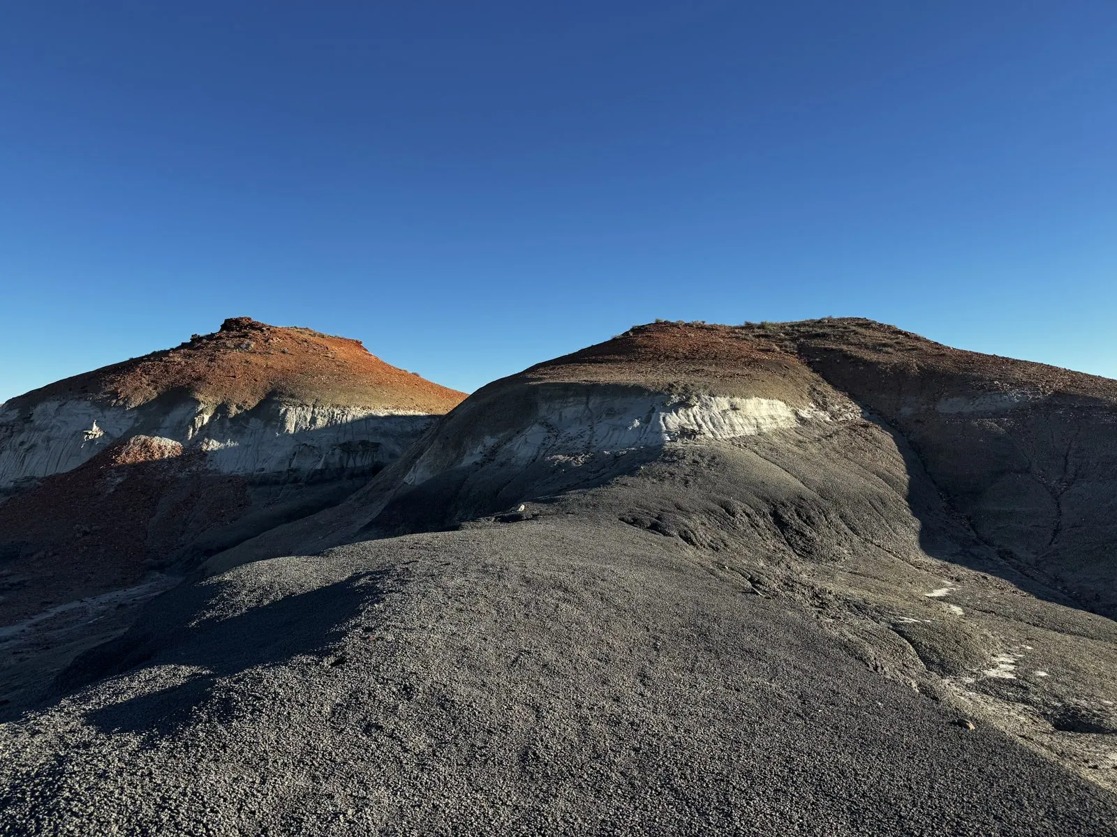
The first interesting thing was color. Half an hour out, a pair of rounded hills rose from the gray flats, their tops a rusty red and their sides streaked with cream and charcoal. The light was already low and warm at 5:30, and the sky above them was the hard, saturated blue of the high desert, a blue that gets deeper the longer you look at it.
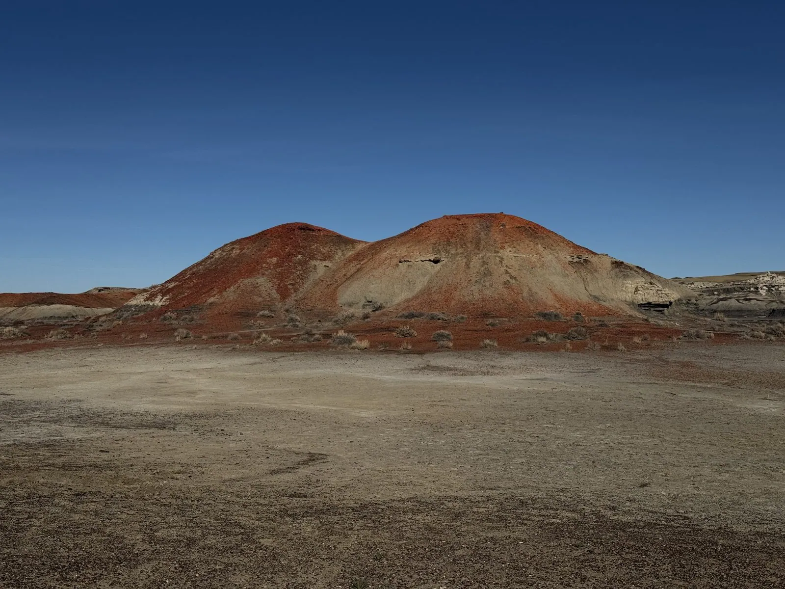
What you are walking on is the floor of a seventy-million-year-old coast. In the Late Cretaceous, this corner of New Mexico sat at the edge of the Western Interior Seaway, a shallow sea that split North America in two. Rivers wound through swamps and floodplains on their way to it, and laid down layer after layer of sand, mud and peat. The sand became sandstone, the mud became shale and mudstone, and the peat became the thin black bands of coal you can see in the hillsides. Dinosaurs lived in those swamps, and their bones still turn up here. Then the whole region was lifted up, and the wind and the occasional violent rain have been taking it apart ever since.
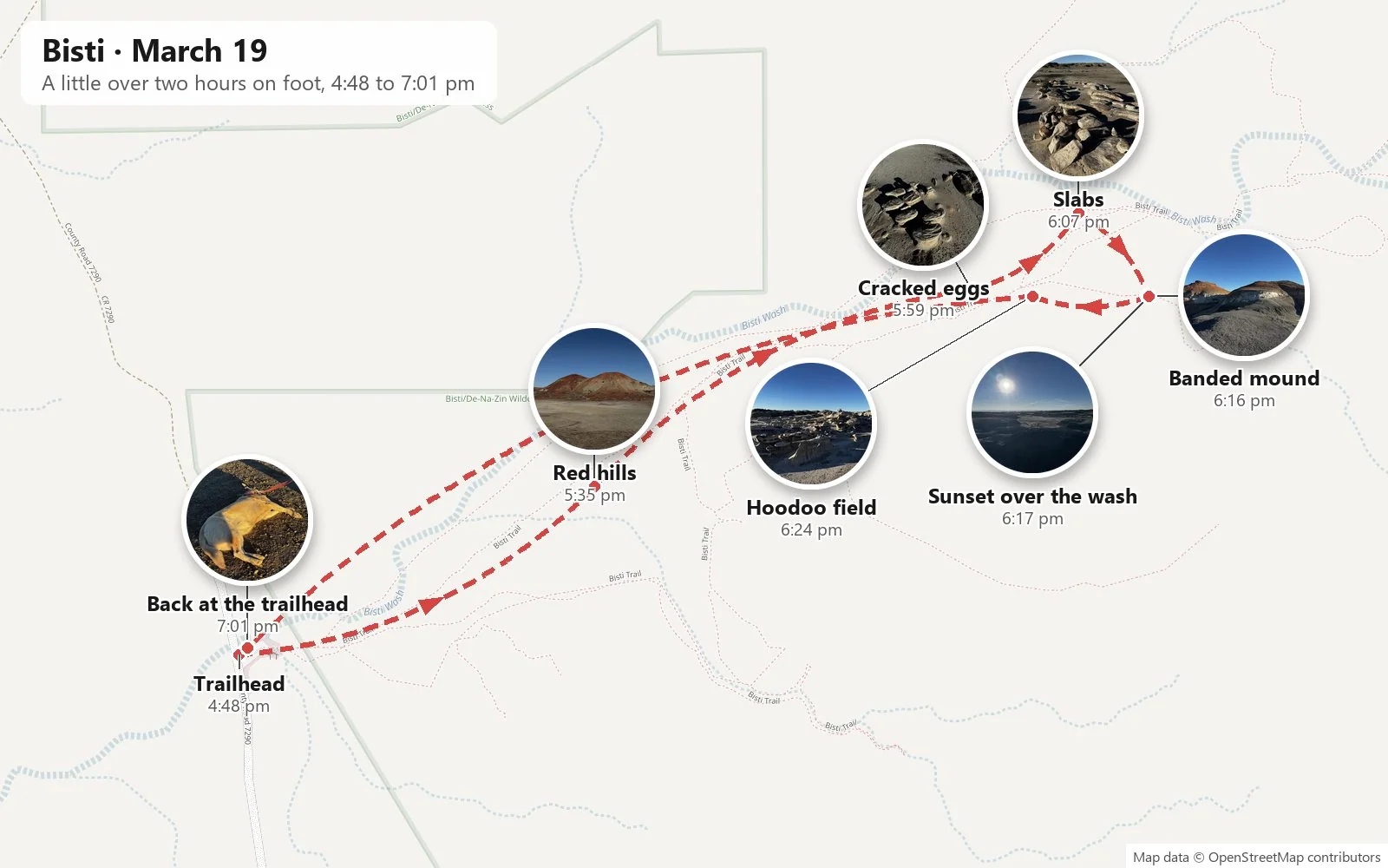
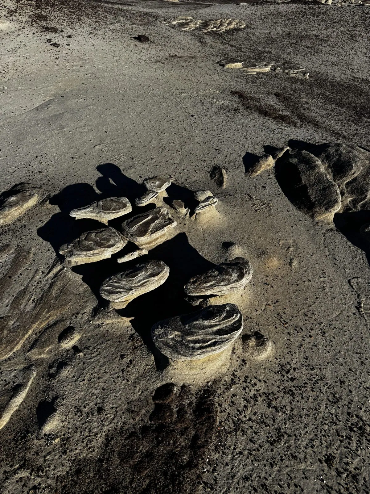
That erosion is what makes Bisti famous, because it doesn't wear everything down evenly. Hard layers resist and soft layers don't, and the result is a landscape of objects. Out along the wash, the ground was scattered with the formations people call the cracked eggs: rounded lumps of harder rock, each with a pattern of fine curving lines, lying in clusters on the gray clay like the shells of something that had hatched and left. A little further on, a whole field of pale stone slabs lay split and stacked, as if a wall had been knocked over and left where it fell.
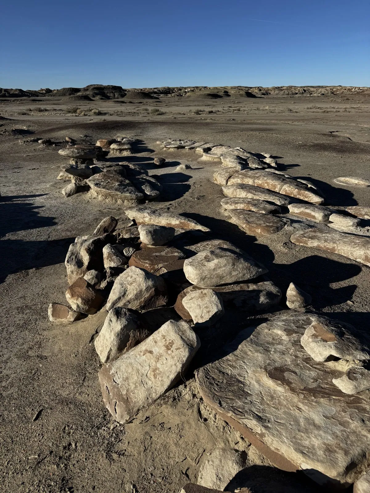
Then came the hoodoos. A hoodoo is a pillar of soft rock wearing a cap of hard rock, like a mushroom or a toadstool. The cap shields the column underneath from rain, while everything around it erodes away. At Bisti they come in every size, from knee-high to taller than a person, and in places they stand in crowds. The best field we found was a jumble of white and cream mushrooms, with wide flat caps balanced on fluted, wind-carved stems. In the late light, every one of them threw a long blue shadow across the sand. It looked like a sculpture garden that nobody had designed, which is exactly what it is.
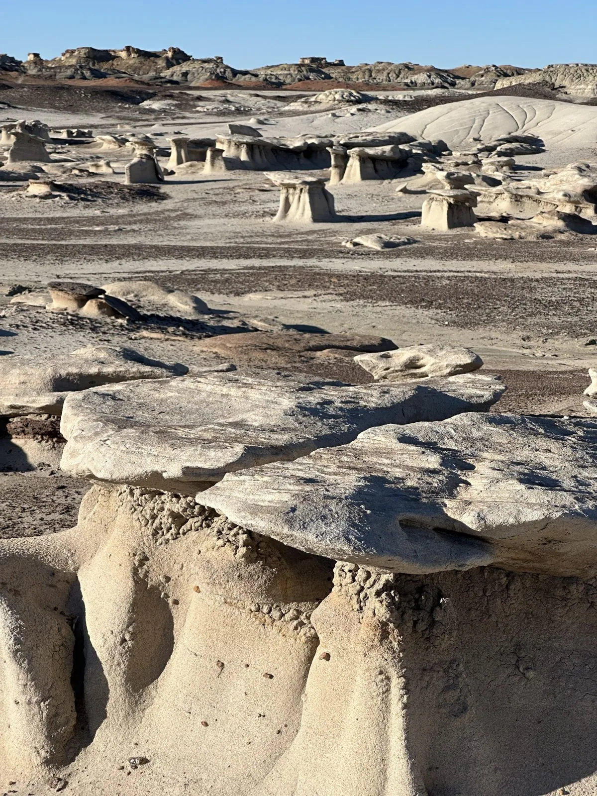
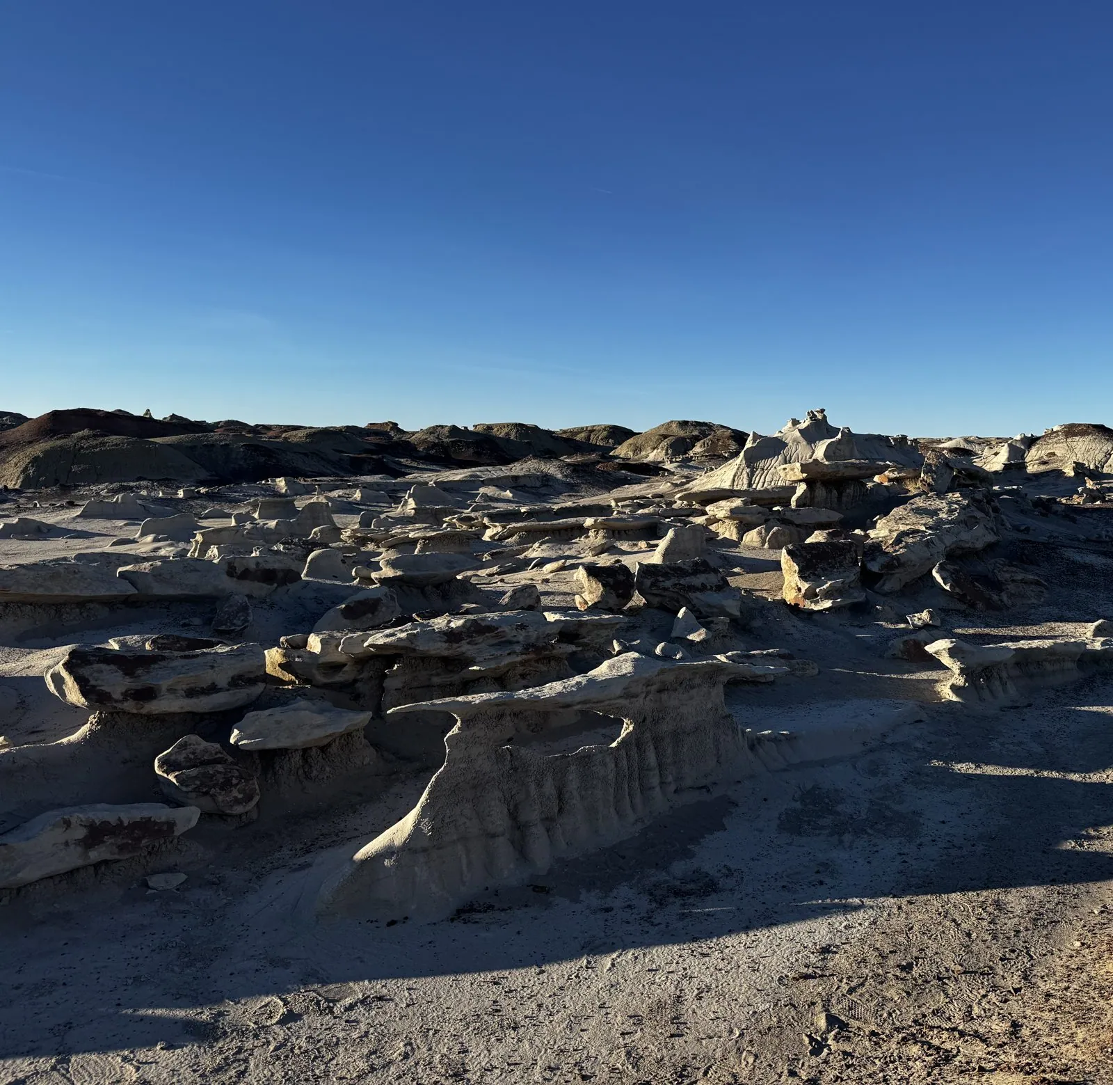
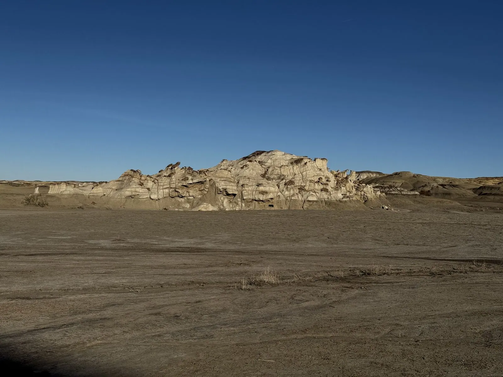
Out there, a long way from the road, there is no traffic, no water and nothing built by people in any direction, and the loudest sound is usually your own boots on the crust of the clay, which is dry and crunchy underfoot. The hills are striped like a cut cake: a cap of rust red, a band of bright white, a thick layer of charcoal-gray clay below. One mound, half in shadow at a quarter past six, showed the whole sequence at once. Further off, a long wall of pale, wind-worn rock stood alone on the plain, like the ruin of a castle.
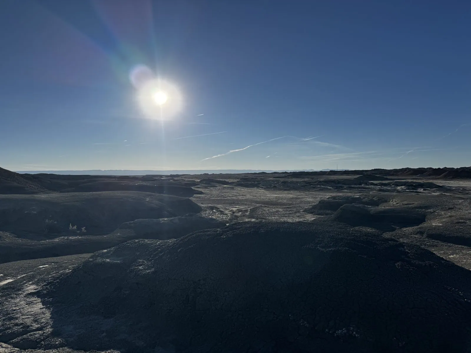
By 6:17 the sun was sliding down toward the western rim, and from the top of a low rise we looked straight into it, across a dark bowl of eroded clay to the flat horizon. There are a dozen photos from that one spot, taken within a minute and a half, and then a few more minutes there with Wangcai. The light came in so flat and low that the badlands went almost black, with just a silver edge on every ridge, and the sun made a white star in a sky streaked with contrails.
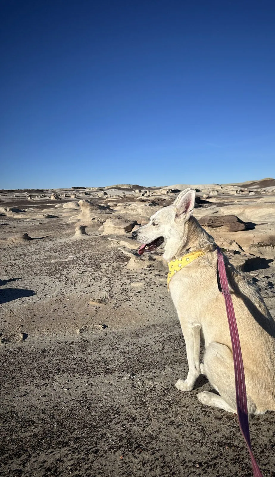
Wangcai discovers the badlands
Wangcai did the whole walk with us, out across the clay and back.
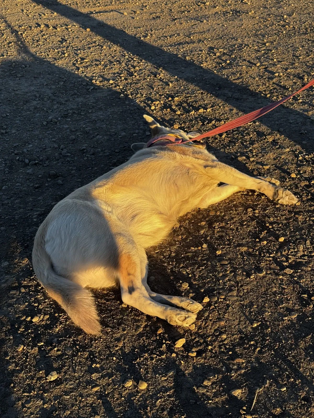
But her real contribution to the geology of the San Juan Basin came at the very end, back at the trailhead, just after seven. The sun was nearly gone, and the last of it came in sideways across the gravel lot, turning everything it touched to gold, including her. She considered the situation, lay down in the dirt, and rolled. Then she rolled again. She stretched out with all four legs pointing at the horizon, upside down, her yellow bandana askew, and gave us the expression of a dog who has found the single best patch of ground in New Mexico. A water bowl stood next to her, ignored.
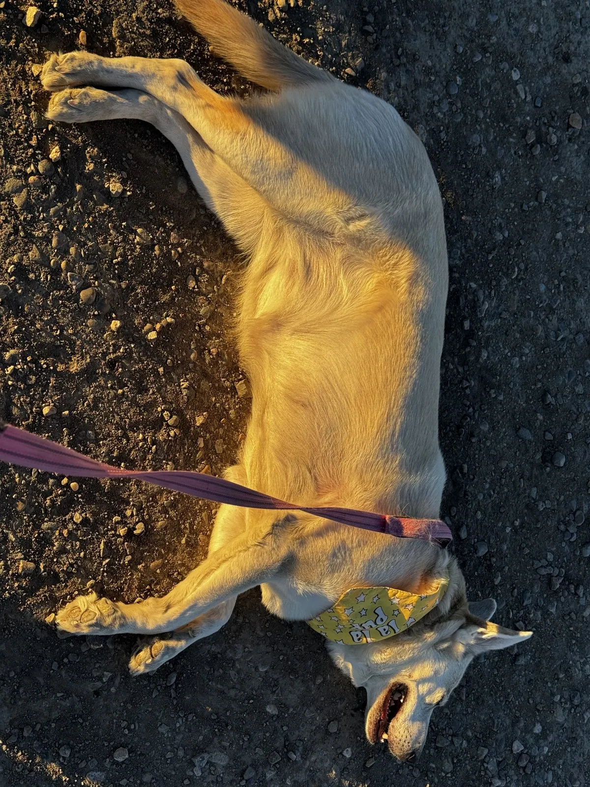
Phase three was stillness: flat out on her side in the last stripe of sunlight, eyes closed, mouth open in what can only be described as a grin, coated in a fine layer of Cretaceous dust.
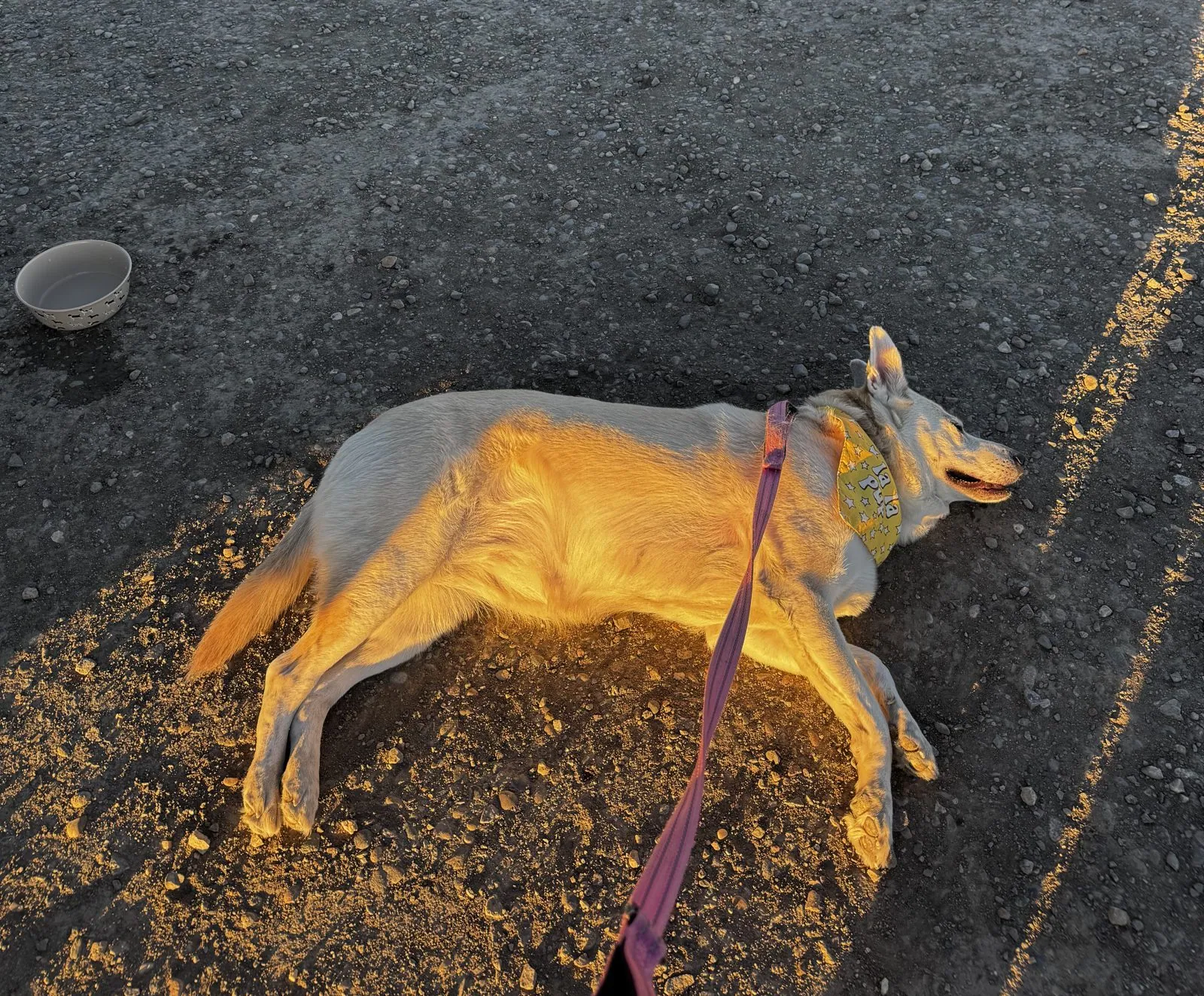
It is hard to say who had the better evening. We had all walked for a little over two hours through one of the most otherworldly places in the country. We came back with photos of hoodoos; she came back and found the one warm patch of gravel that made the whole day worth it. On the evidence of these photos, it was a tie. Then it got dark, the badlands went from gold to gray to nothing, and we drove off into the night, south to Albuquerque, where we slept at the Sheraton Uptown. How much of the San Juan Basin came along on Wangcai's coat isn't in the record.
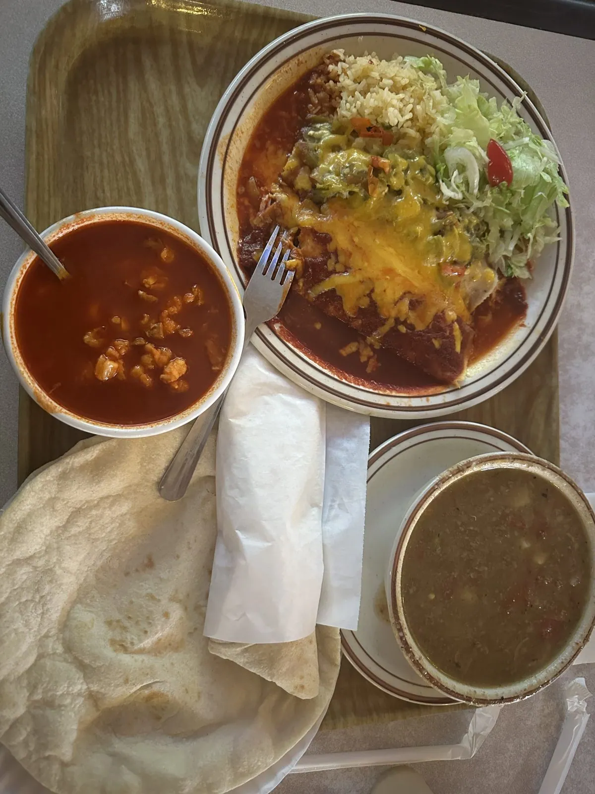
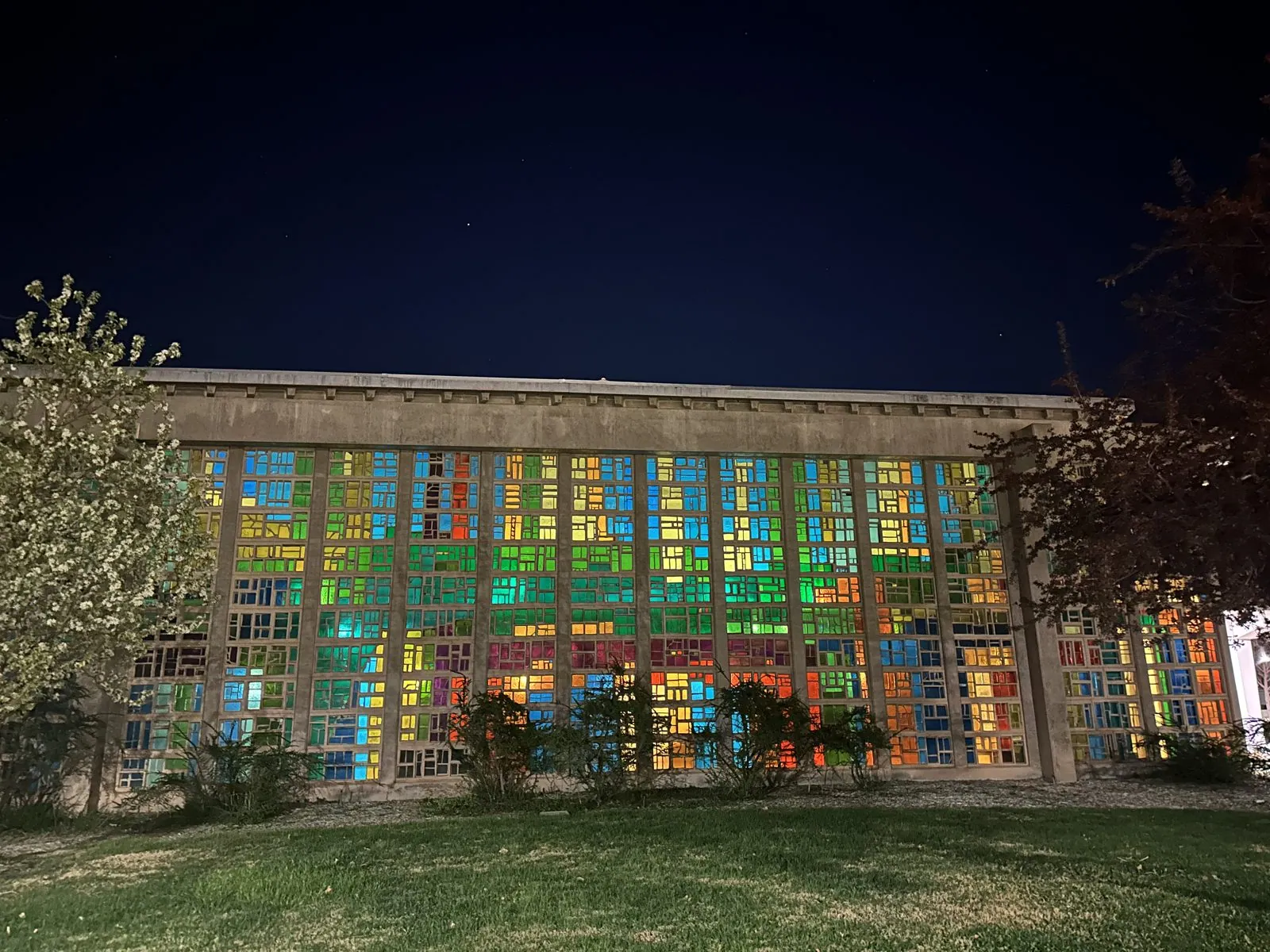
We got there in time for a late dinner at the Frontier, the diner across from the university: an enchilada plate in red chile, a bowl of posole, a bowl of green chile stew and a big flour tortilla. Across the street, a long wall of colored glass was lit from inside.
Day 2: Red or green, then the Earthships
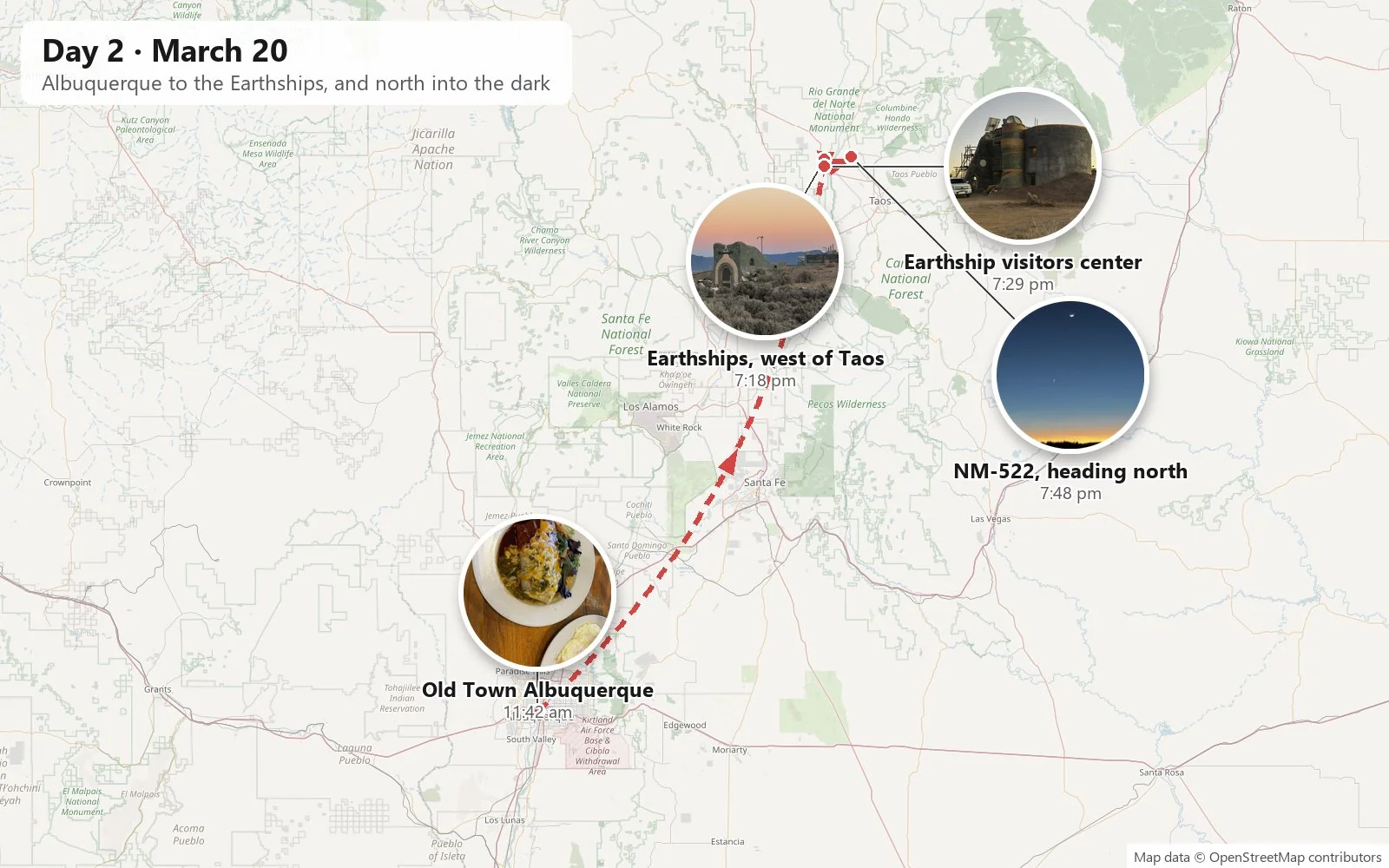
The next photo was taken at 11:42 the following morning, in Albuquerque, on the edge of Old Town. That is the original heart of the city: a plaza and an adobe church founded under Spanish rule in 1706, a full century and a half before most of the American West had towns at all. We were there, at least on the evidence of the camera, for brunch.
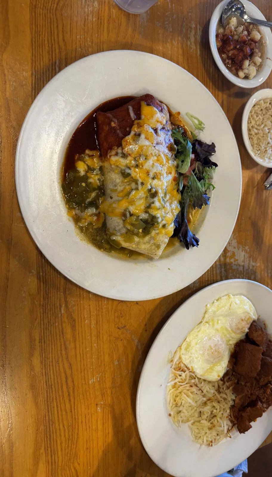
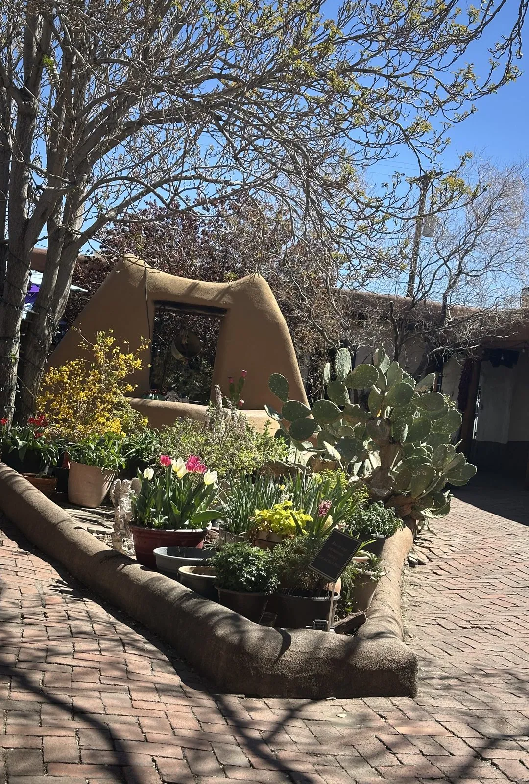
New Mexico has an official state question, adopted by its legislature in 1996: "Red or green?" It refers to chile, which here is not a spice so much as a food group, and it is asked about almost everything on a menu. Red chile is made from ripe pods that are dried and ground; green is roasted from the fresh ones. The correct answer, if you can't decide, is "Christmas", meaning both. Our table came out Christmas: a burrito smothered in dark red chile on one side and green on the other, buried in melted cheese, with a plate of fried eggs and hash browns beside it and small bowls of sides. After brunch, an Old Town courtyard had tulips out among the prickly pear.
The Earthships
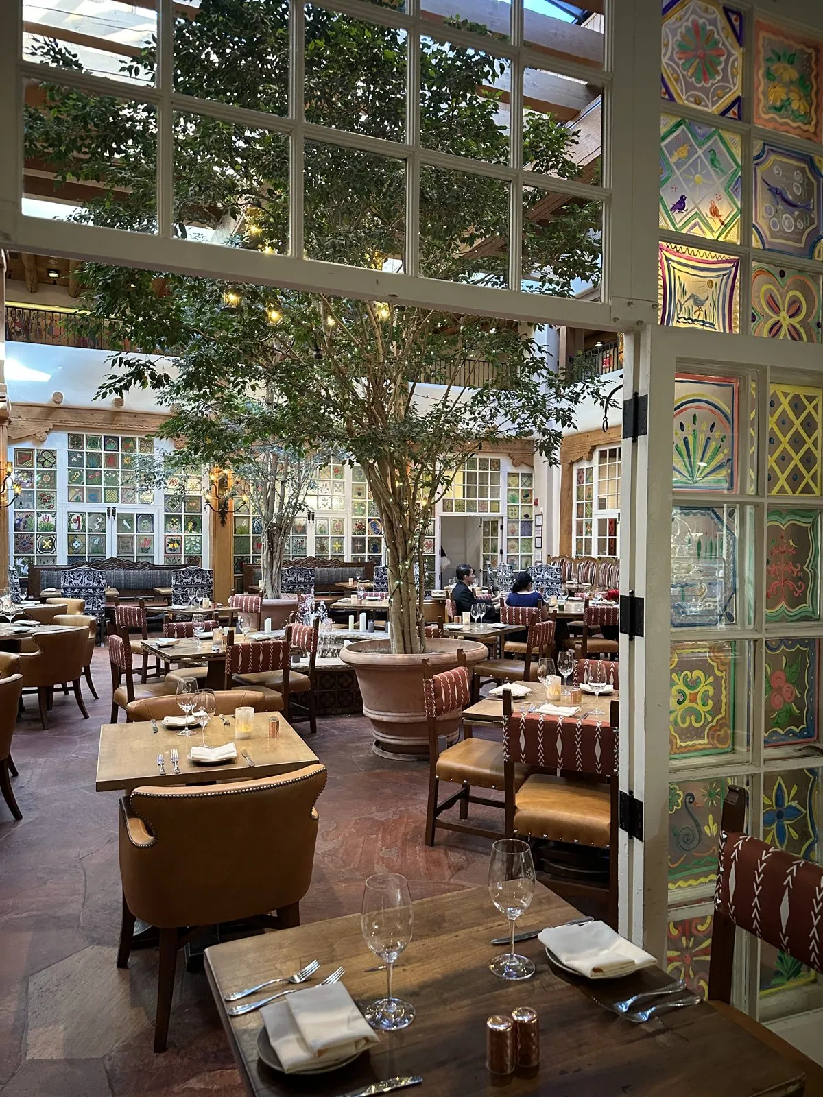
From Albuquerque we drove up to Santa Fe for the afternoon to buy gifts and souvenirs, and I forgot to take a single photo there. Luckily my wife didn't: she caught the dining room at La Fonda on the Plaza, a courtyard roofed with skylights, with trees growing up through it and panes of hand-painted glass.
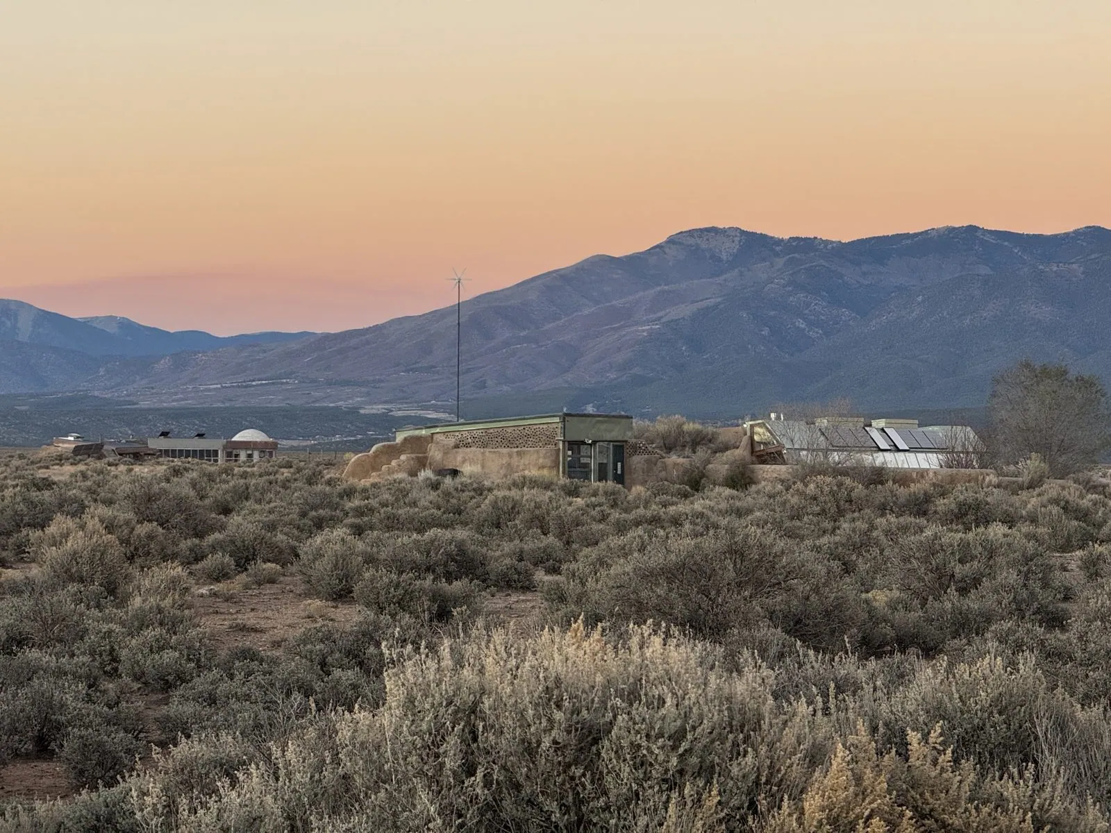
My camera roll picks up again at 7:18 in the evening, on a sagebrush mesa northwest of Taos. To get there you cross the Rio Grande Gorge on US-64, on a steel bridge that hangs about 650 feet above the river. Out on the far side, on a plain that looks too open and empty for anyone to live on, sits one of the oddest neighborhoods in America: the Greater World Earthship Community.
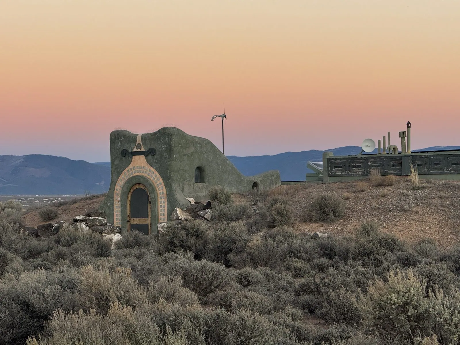
An Earthship is a house designed to need nothing from the outside world. The idea belongs to Michael Reynolds, an architect who started building them in the desert around Taos in the 1970s, out of what other people throw away. Each house heats and cools itself with the sun and its own mass, catches its own water from the roof, makes its own electricity, and treats its own sewage. From a distance, at sunset, they look like something between an adobe pueblo and a moon base: curving earth walls, round towers, green-painted parapets, wind turbines and solar panels, all half-sunk into the ground among the sagebrush, with the Sangre de Cristo Mountains blue behind them.
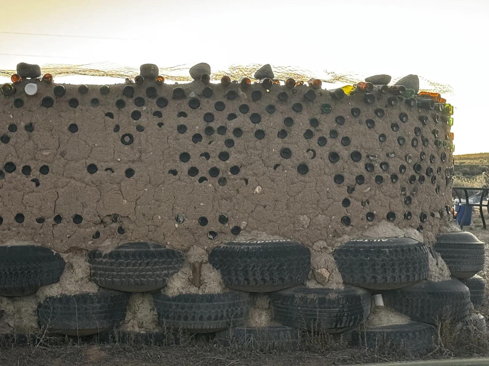
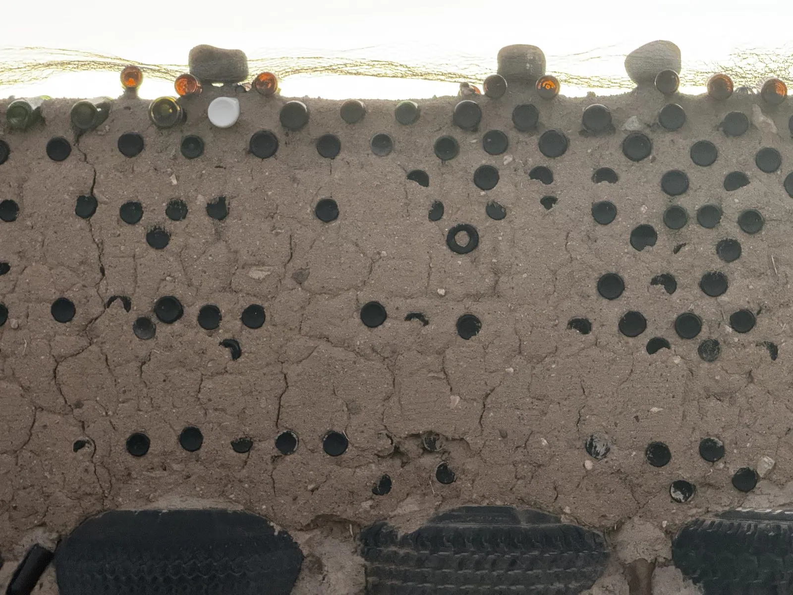
Up close, at the visitors center, you can see how they're made. The heavy outer walls are old car tires, laid like bricks and rammed full of earth with a sledgehammer until each one is as hard as stone and weighs several hundred pounds. Stacked in courses and plastered over with mud, they make walls so massive that they soak up the day's heat and give it back slowly through the cold desert night. The lighter walls are built of glass bottles set in adobe like stones in concrete. From outside you see a polka-dot pattern of dark bottle bases in the cracked mud, and from inside, when the sun is behind them, they glow like stained glass.
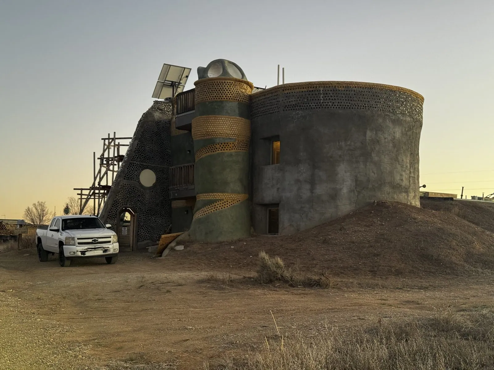
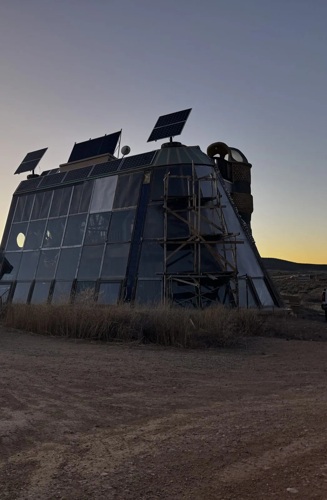
The buildings themselves are part house, part sculpture. One near the visitors center is a stack of drums: a fat concrete cylinder, a slimmer tower wrapped in a spiral of golden bottle-ends, and a sloping wall of bottles behind, with scaffolding still on one side and solar panels angled on top. Another is a long, steep greenhouse of glass, facing south with its back to the north wind, which is the basic Earthship plan. The glass front catches the winter sun, and the earth-bermed back keeps the heat in. As the sky went yellow behind it, it looked like a spacecraft that had landed in the sagebrush and decided to stay.
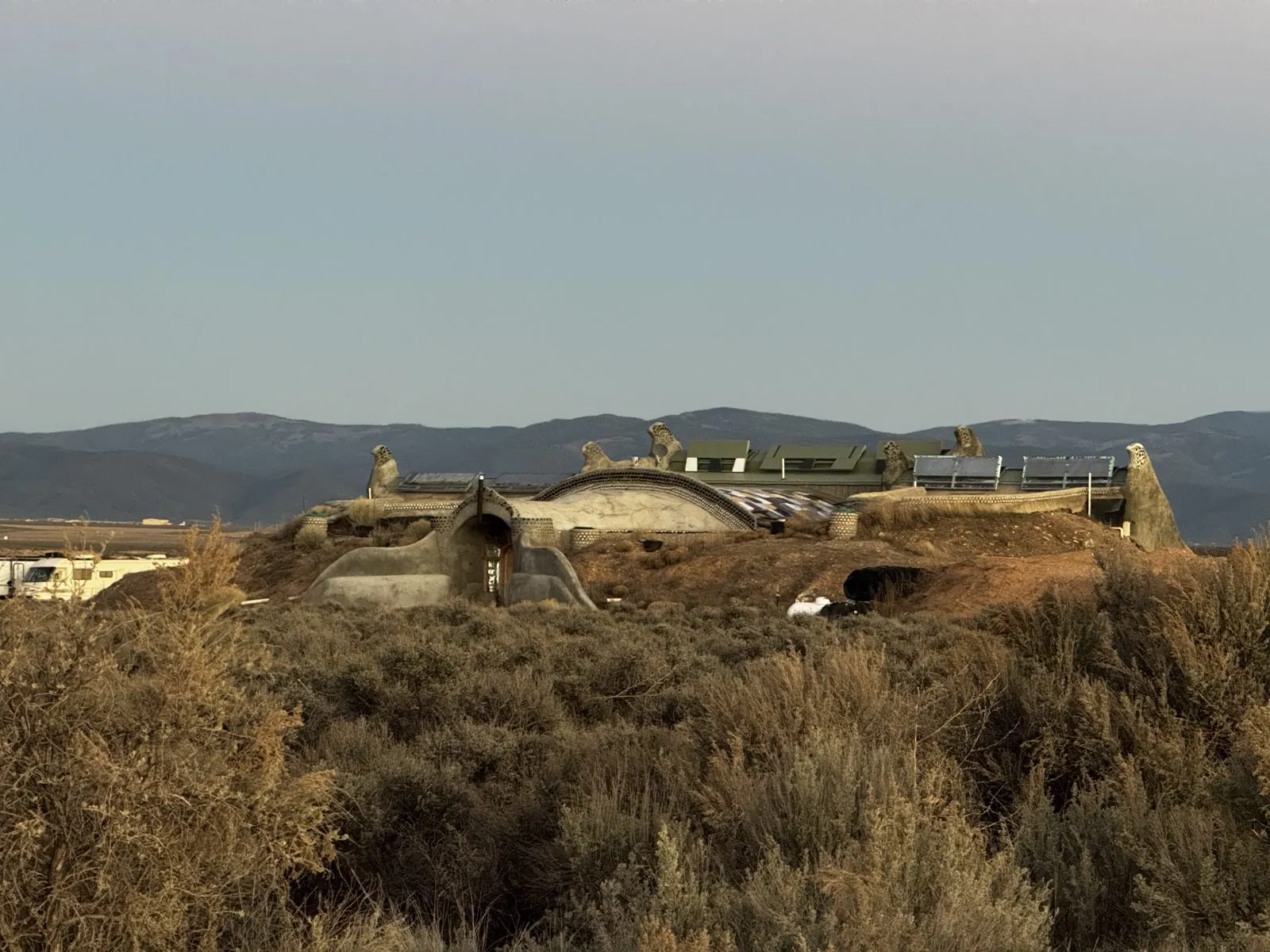
Seen from the road at a distance, the community is mostly roofline: humps of earth, round domes and little sculpted turrets poking out of the brush, with glinting panels between them. People really do live here. These are homes, with trucks parked outside, and some of them are rented to visitors who want to try off-grid life for a night. The sagebrush grows right up to the walls, and in the low light the whole place takes on its color: a dusty sage green, with mountains behind.
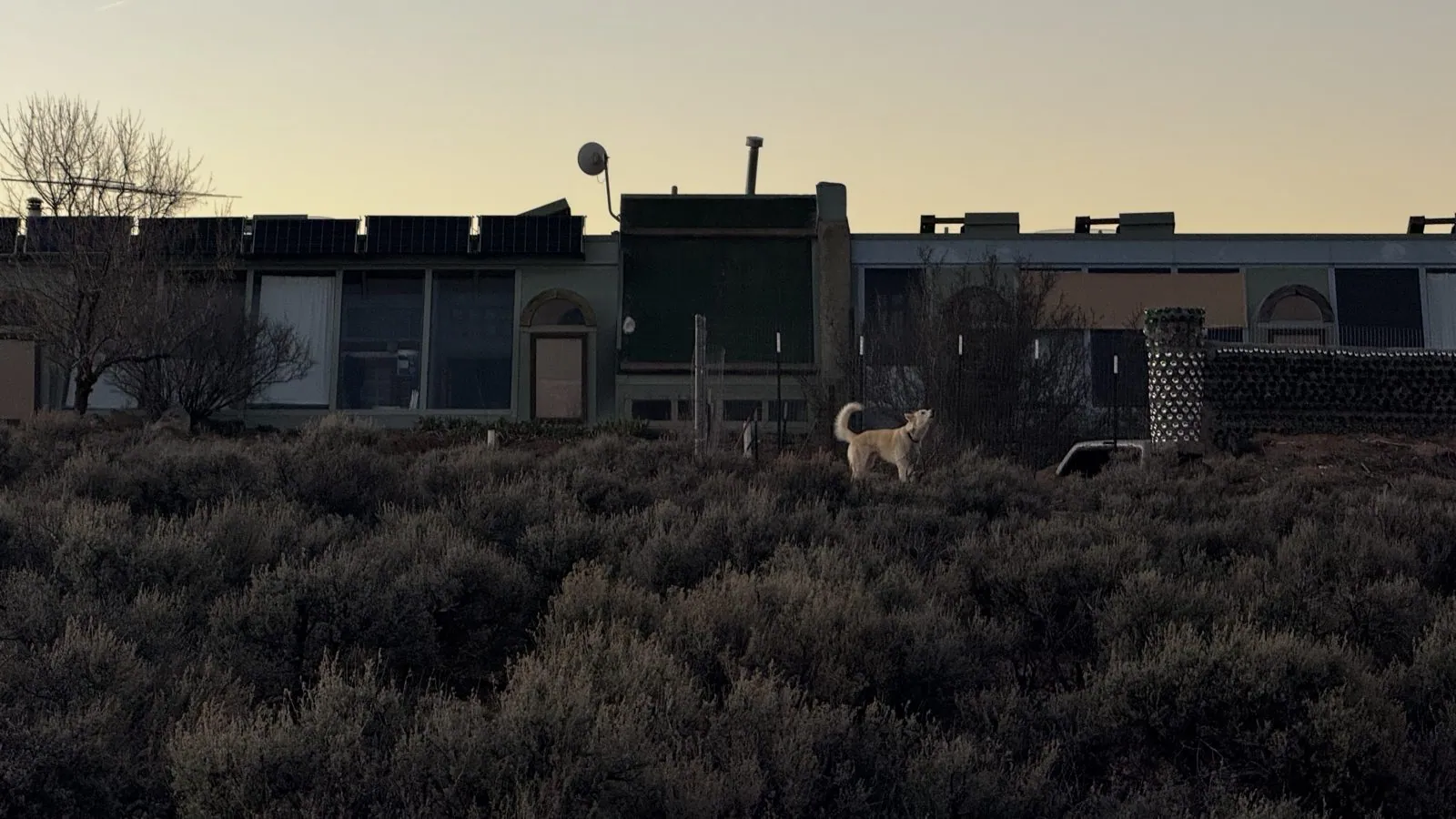
Not every resident was human. Behind a fence in one of the yards, a pale dog stood in the sagebrush with its head thrown back, howling at the evening. It wasn't ours, though it could have passed for a cousin.
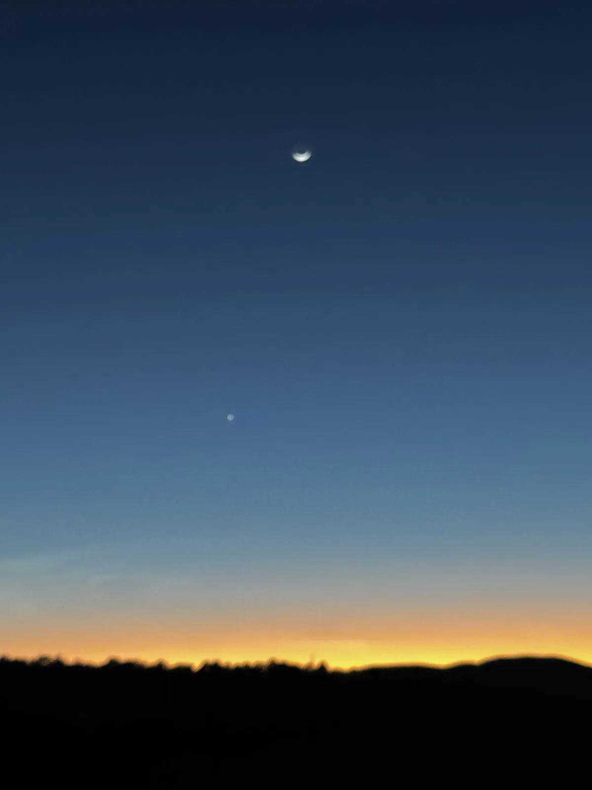
By 7:48 we were back on the road, heading north on NM-522 past Arroyo Hondo toward the Colorado line. The last photo of the day is the sky over the road. A thin crescent moon hung in the deep blue, with a single bright planet below it and a band of orange afterglow along the black edge of the hills. It's the kind of sky you only get far from cities, and a good one to drive into. It was a long way yet: dinner was at a Texas Roadhouse in Pueblo, and we slept in Denver, at The Art Hotel (it's in the hotels post).
Day 3: Denver, Red Rocks and the road west
The next morning we were in Denver, which for me was a return visit. I'd last been here in the summer of 2024 for SIGGRAPH, and had spent an evening walking through the Civic Center and the museum district at sunset. This time we were back at the same corner on a bright March morning, with a sky full of rippled high cloud.
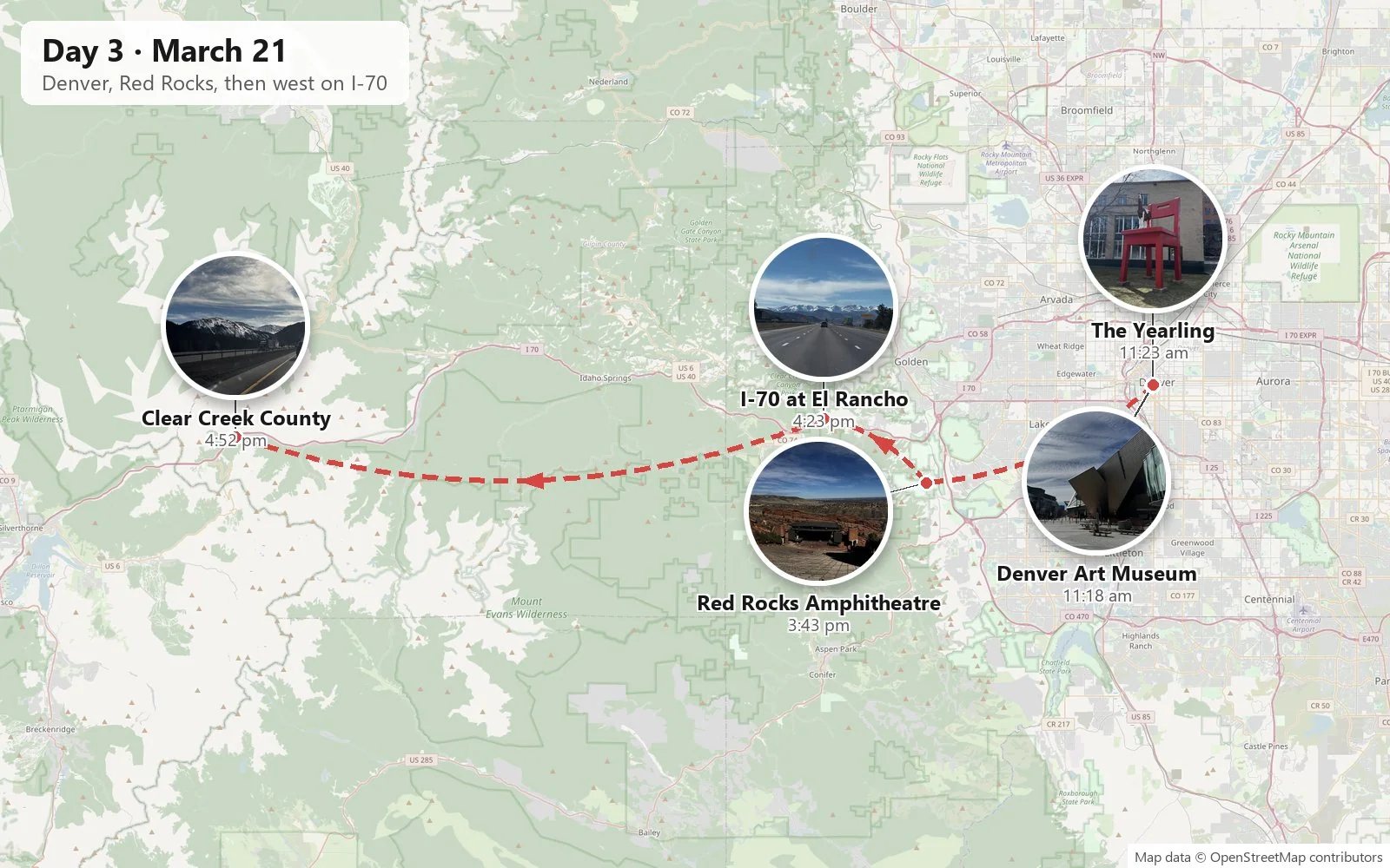
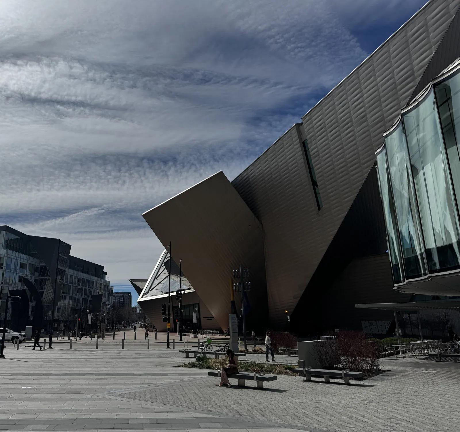
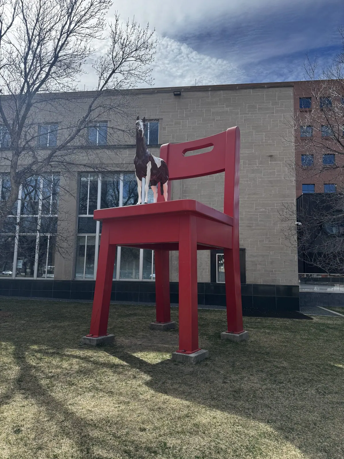
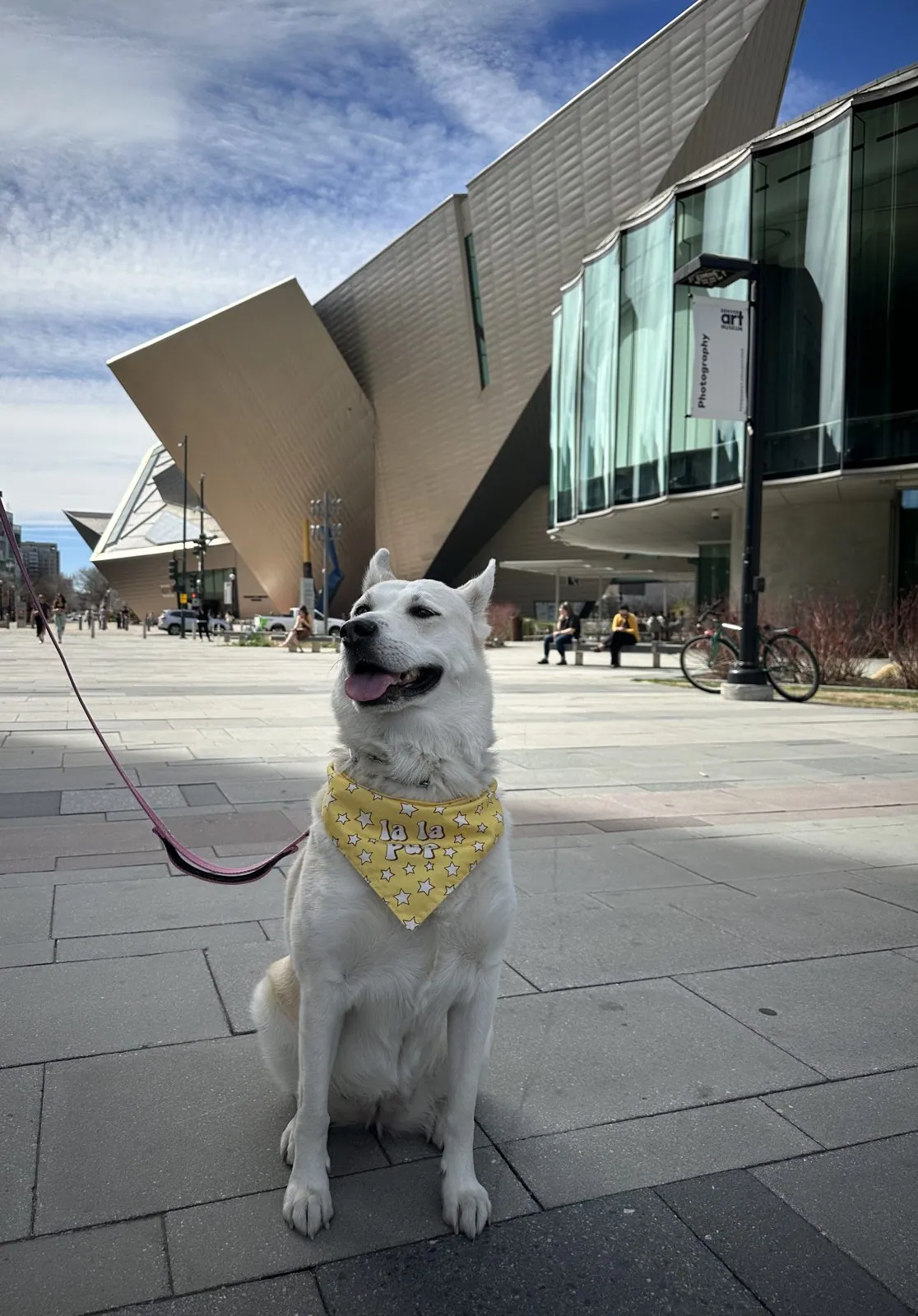
The Denver Art Museum's Hamilton Building was exactly as I remembered it: Daniel Libeskind's titanium shard, all tilted planes and points, leaning out over the plaza as if it were about to take off. Across the way, outside the Central Library, The Yearling was finally out from behind the construction fence that had hidden it two summers ago. Donald Lipski's painted pony stands on top of a red chair about twenty feet tall, and in the bare March trees, with nothing in the way, you could appreciate how absurd and how charming it is.
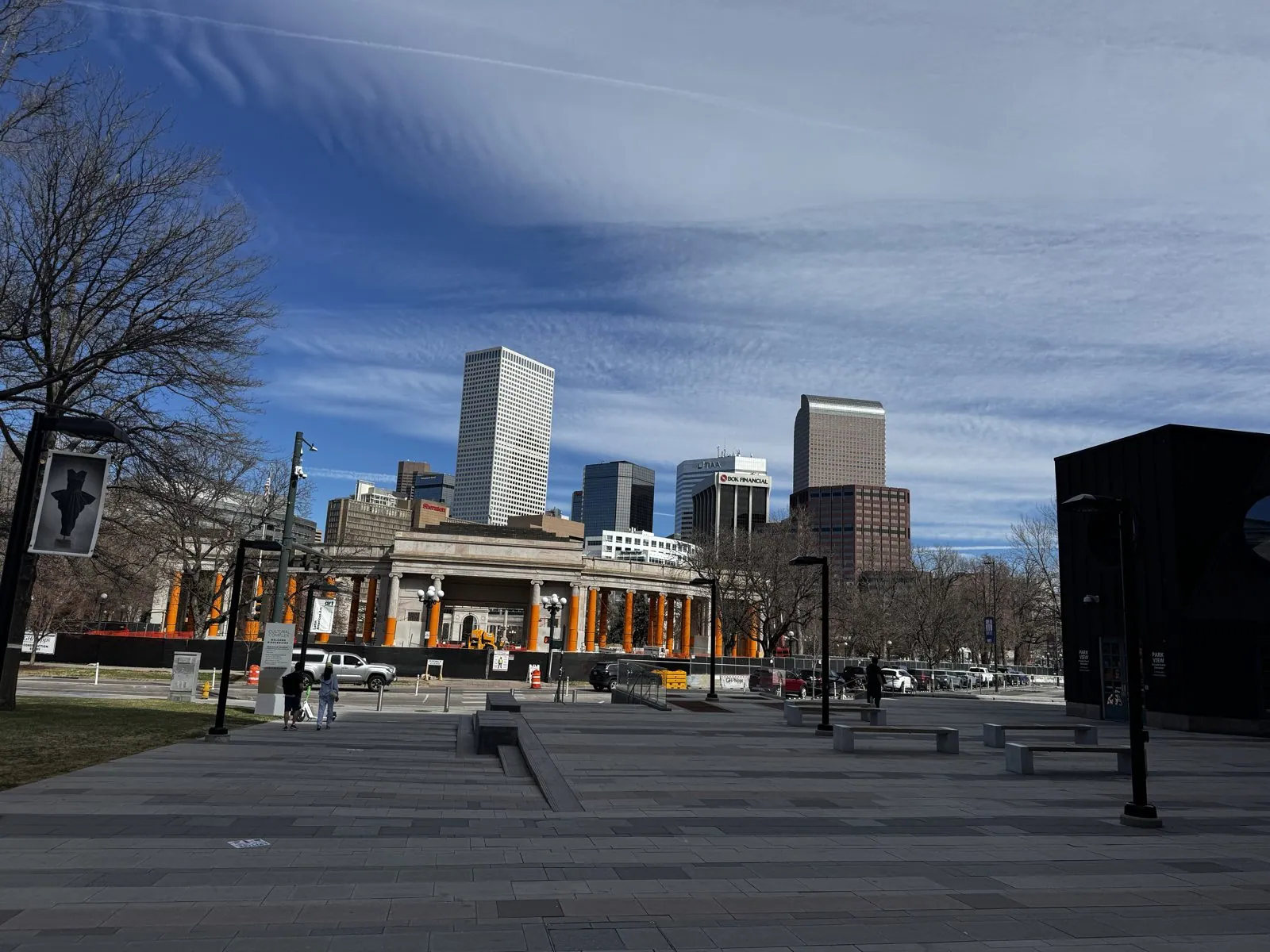
From the museum plaza, the view north runs across Civic Center Park to the downtown towers. Parts of the park were fenced off for work that morning, but the skyline was clean and sharp under the high cloud.
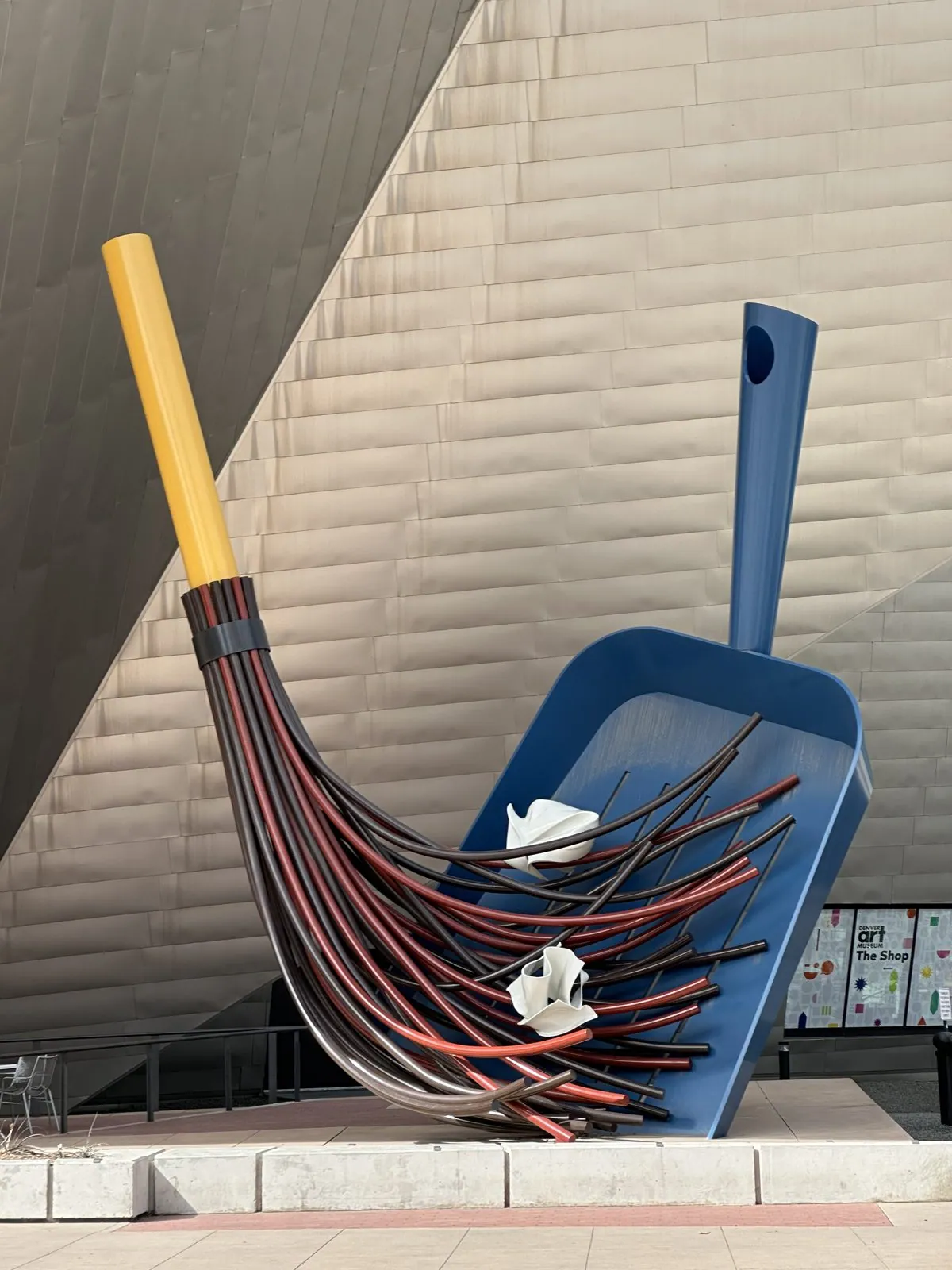
Outside the museum, Claes Oldenburg and Coosje van Bruggen's Big Sweep, a giant broom and dustpan, leans against the Hamilton Building, and Wangcai posed on the plaza in her yellow bandana.
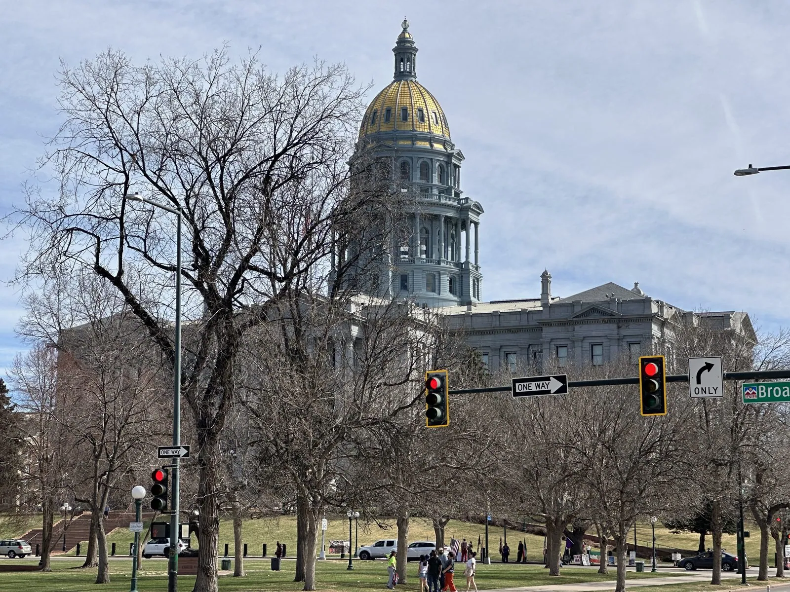
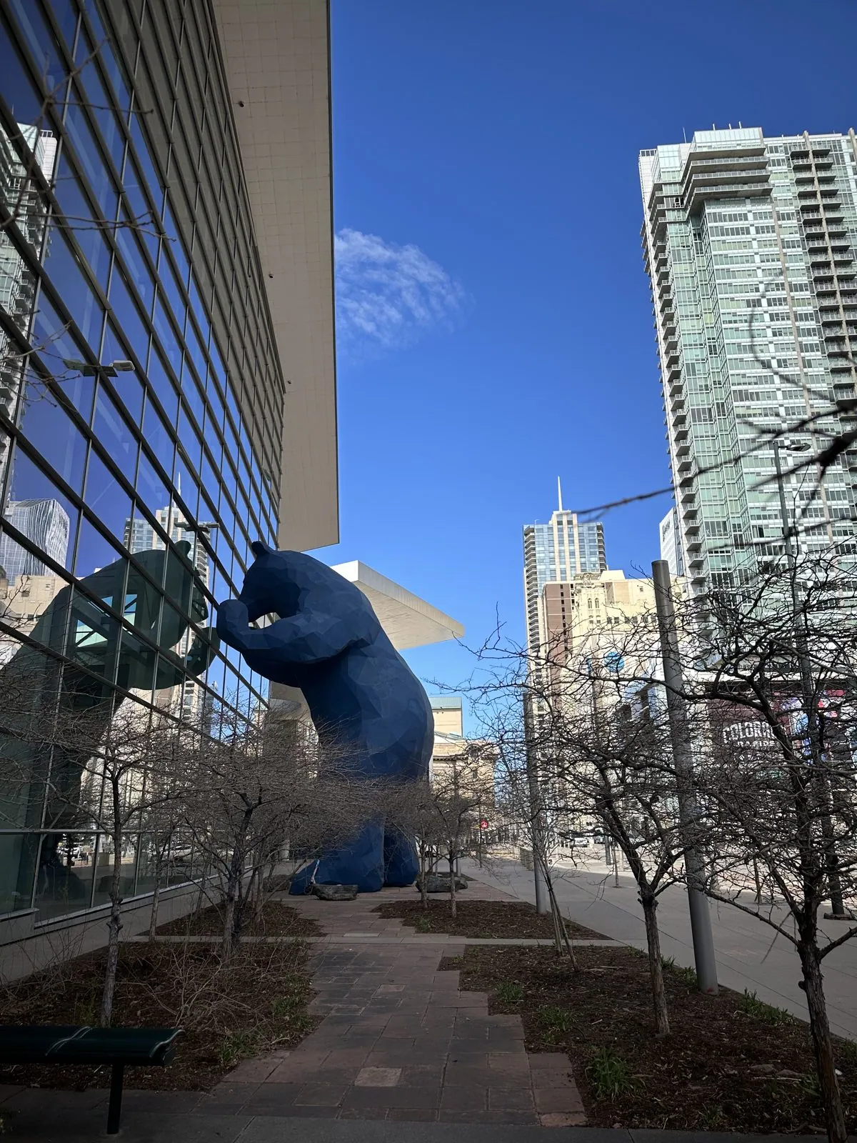
From the museum we walked past the gold dome of the Colorado State Capitol across Civic Center Park, and on to the Convention Center, where a giant blue bear presses its nose to the glass.
The walk ended at Union Station, where the train hall is a row of white canopy arches over the tracks.
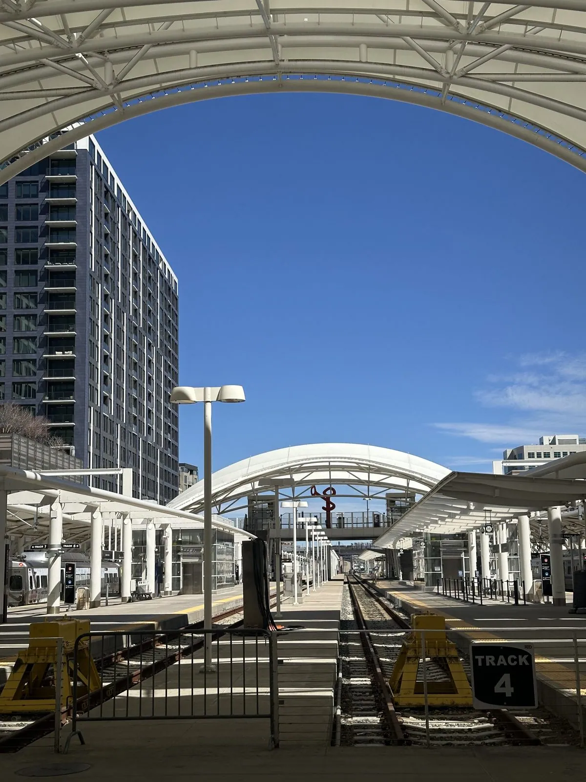
Red Rocks
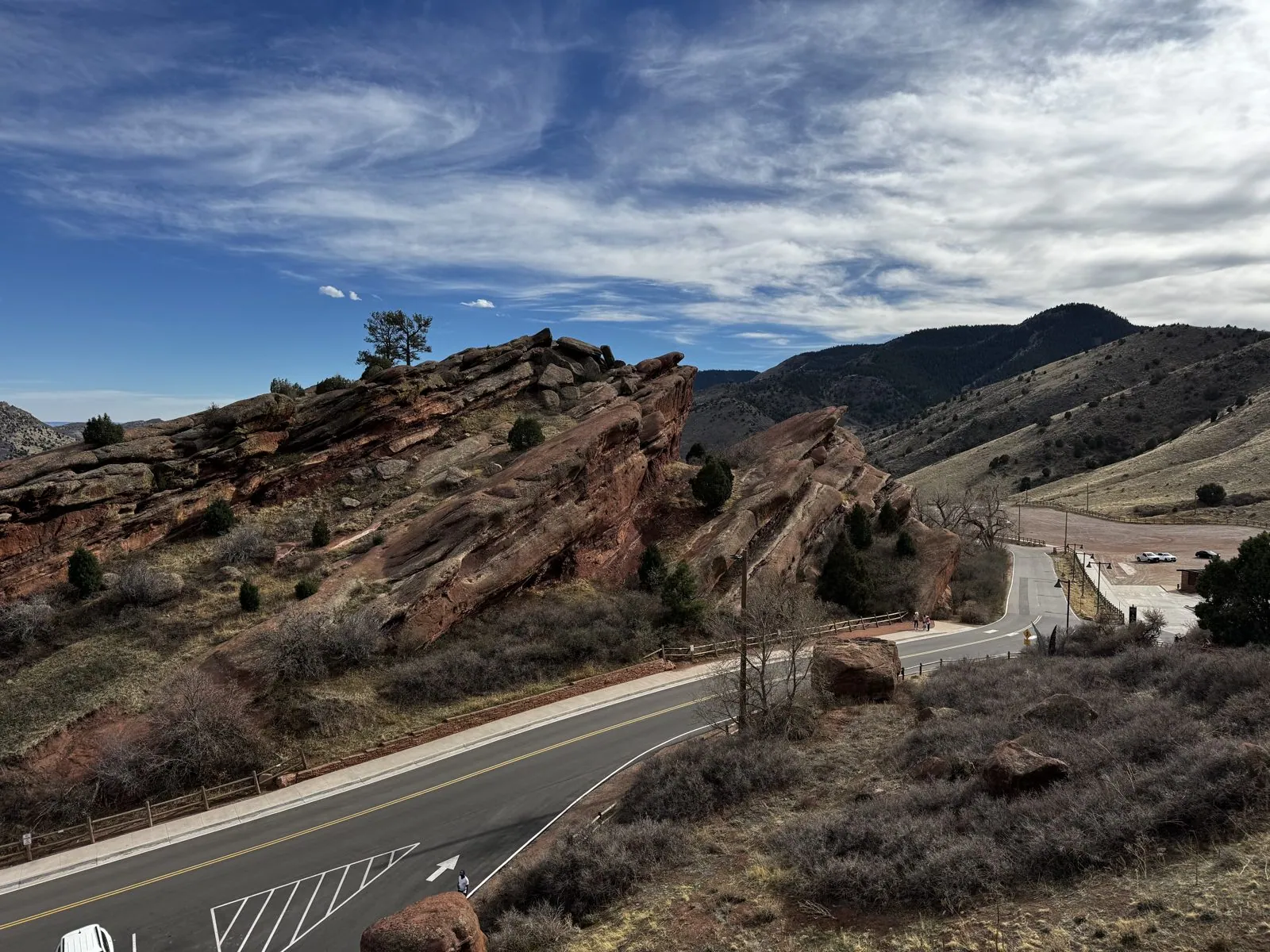
Fifteen miles west of downtown, the Great Plains stop and the Rockies begin, and right at the seam is Red Rocks Park. The rocks are great fins of red sandstone, tilted up out of the earth at a steep angle when the mountains rose. They belong to the Fountain Formation, laid down about three hundred million years ago from the debris of a far older range. It is the same rock that makes the Flatirons above Boulder and Garden of the Gods near Colorado Springs. From the top of the park you look east between the fins, past a cone-shaped hill and a reservoir, to the plains running flat to the horizon.
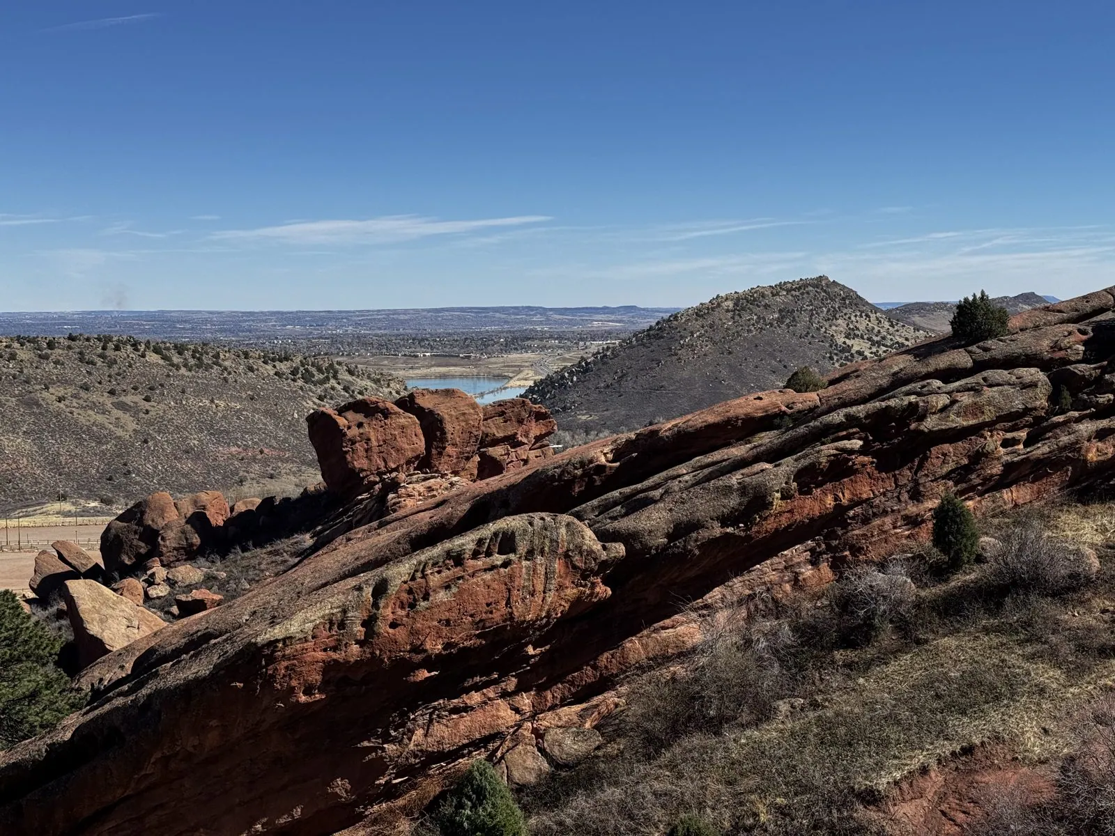
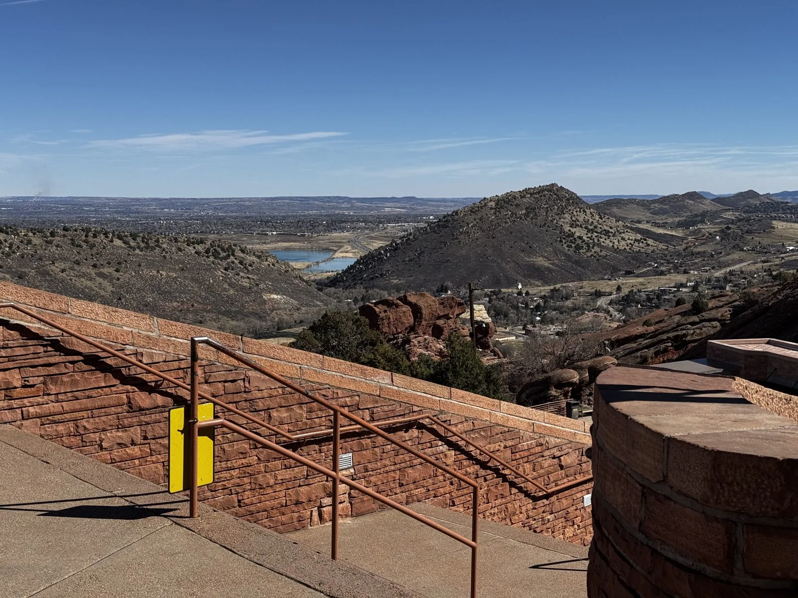
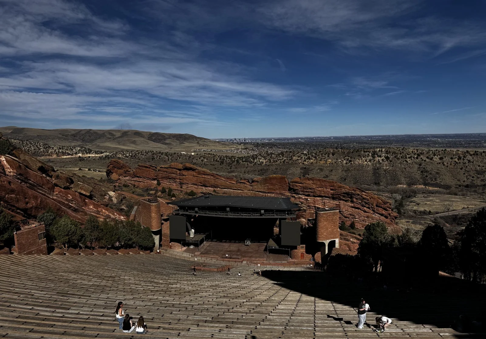
The real reason everyone comes, though, is the amphitheatre. Between two enormous monoliths, Ship Rock and Creation Rock, each about three hundred feet tall, the slope has been shaped into about 9,500 seats looking down at a stage, with the plains and, on a clear day, Denver laid out behind it. It was built in the late 1930s by the Civilian Conservation Corps, the New Deal program that put young men to work on public lands, to a design by the Denver architect Burnham Hoyt, and it opened in 1941. Musicians love it for the acoustics, which the rocks provide for free. The Beatles played here in 1964, and U2 filmed a famous concert here in the rain in 1983.
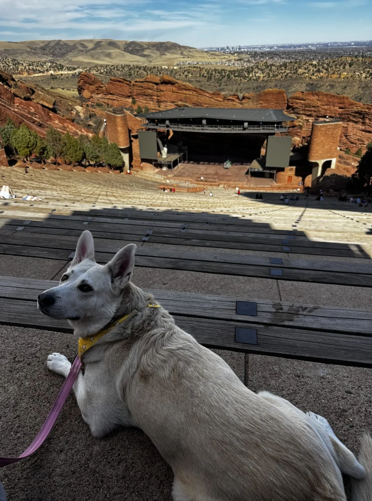
In March there were no concerts, and the bowl was nearly empty. A few people sat scattered across the long wooden benches in the sun, while the afternoon shadow of the rim crept slowly down the rows. It is a huge space, and with no one in it you notice how steep it is, and how the rows sweep in long, curved lines down to the stage like contour lines on a map.
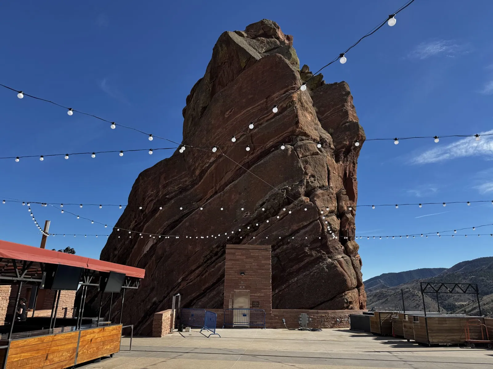
At the top of the seating is a plaza where, on show nights, the crowds buy their drinks and T-shirts. That afternoon the stalls were shuttered, but the strings of bulbs were still there, slung across the plaza and up toward the rock, which rose straight out of the paving, layered and fractured, three hundred feet into a sky streaked with cloud. The bulbs only made it look bigger.
Wangcai, it turns out, makes an excellent concertgoer. Leashed dogs are welcome when there's no show, and she settled onto a concrete step between two benches in the high rows, facing the stage like she was waiting for the opening act. In some of the photos she's watching something off to the side, ears up, with the stage, the red rock walls and the plains spread out behind her. In others she simply lies there in the sun, looking pleased with the acoustics.
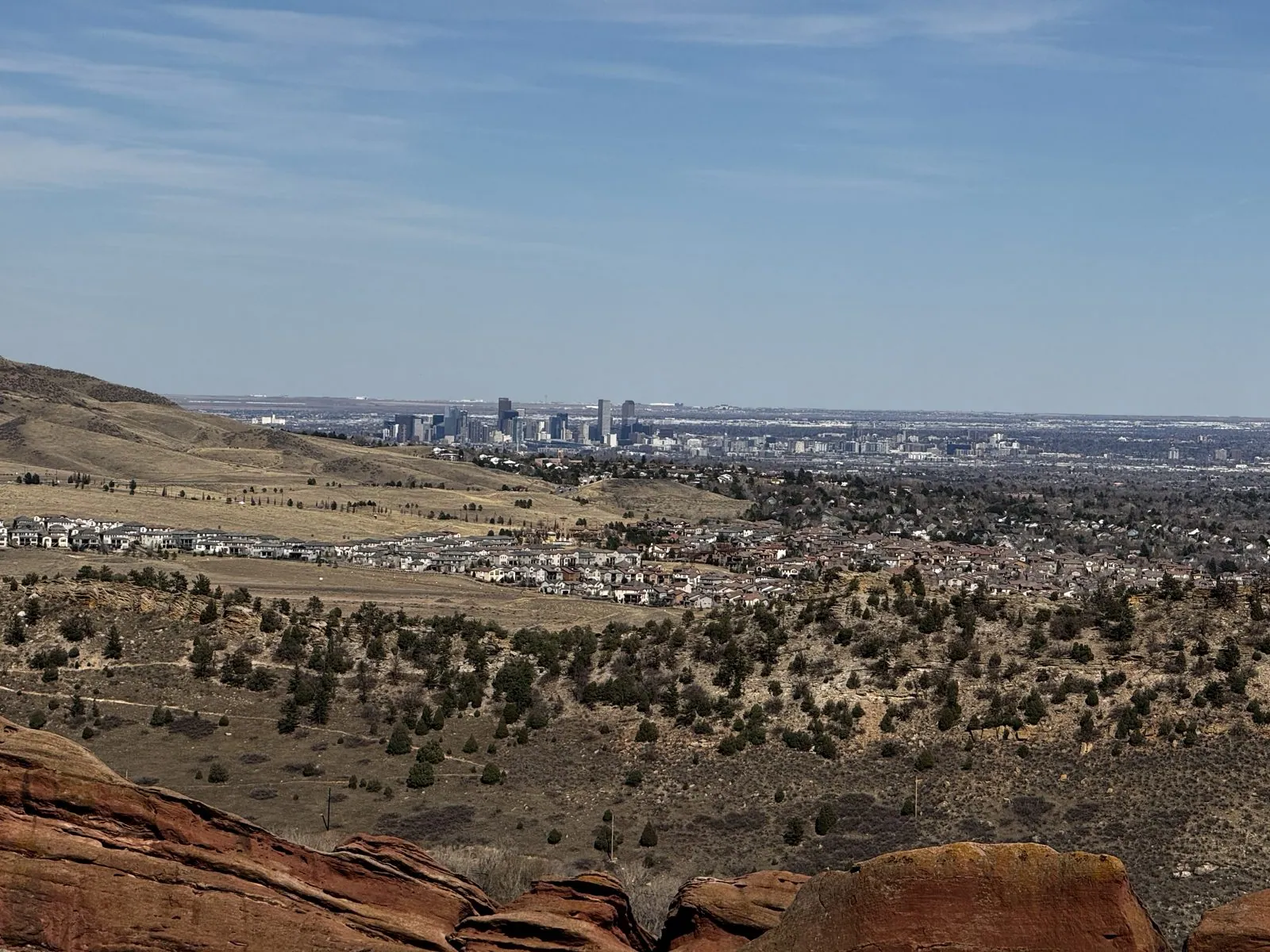
From the top of the park, the view east reaches all the way to Denver. The downtown towers stand in a small, hazy cluster on the horizon, past the foothills and the suburbs, with the red rock in the foreground. Behind us, the road wound back down between the fins toward the parking lots. At four in the afternoon, under a sky of streaming, feathery cloud, we followed it down and out.
I-70 into the Rockies
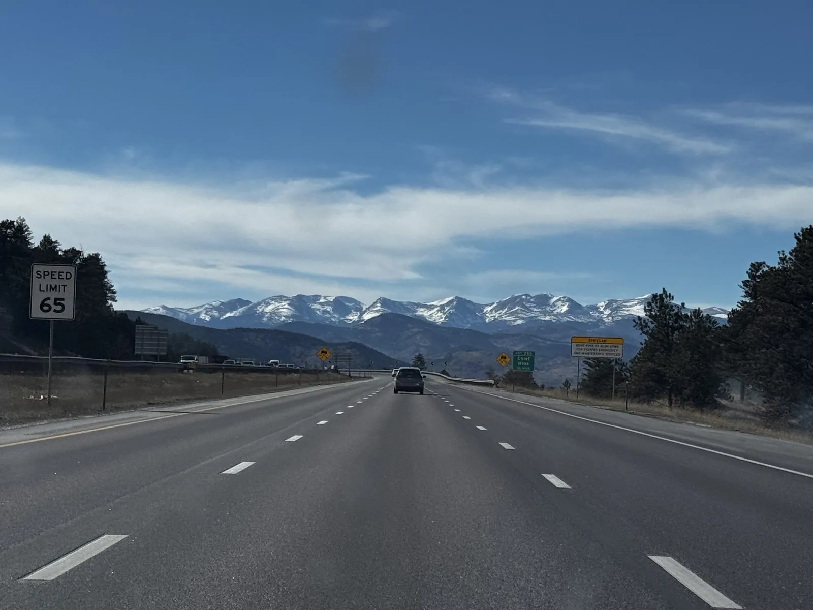
A quarter of an hour later we were on I-70 heading west, and the whole Front Range came into view at once through the windshield: a row of white peaks above the dark, forested foothills, with a 65 mph sign at the side of the road. I-70 through the Colorado mountains is one of the great feats of American highway engineering. It climbs from the plains to more than eleven thousand feet at the Eisenhower Tunnel, the highest point on the entire Interstate system, threading canyons that look far too narrow for a four-lane road.
Half an hour later, past Georgetown and up the valley of Clear Creek near Bakerville, we were in real winter. The slopes on both sides were white, with dark firs standing in the snow and avalanche chutes running straight down the mountainsides. It was spring on the plains, but up here it was still winter, and the road kept climbing toward the tunnel and the ski country beyond.
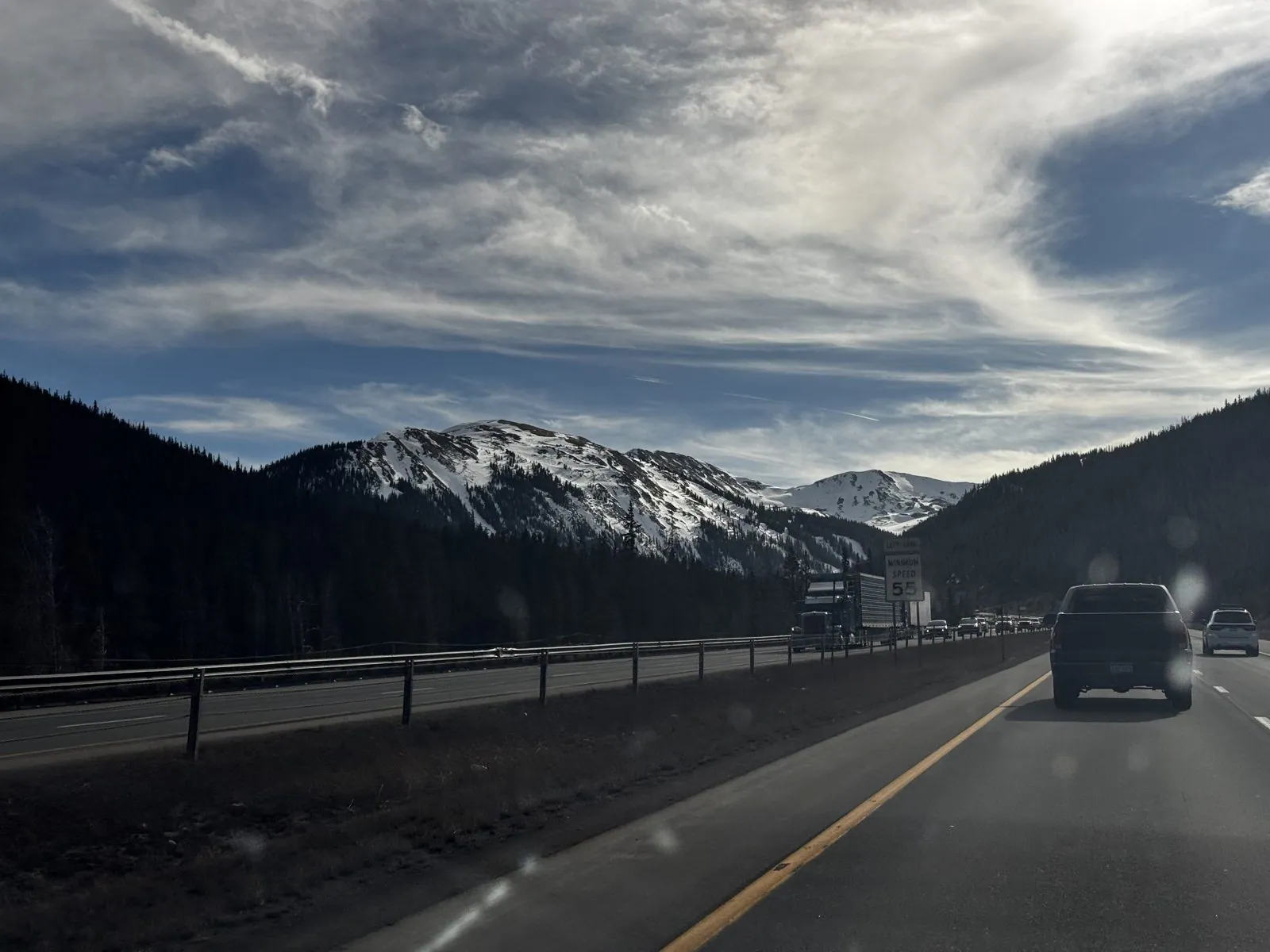
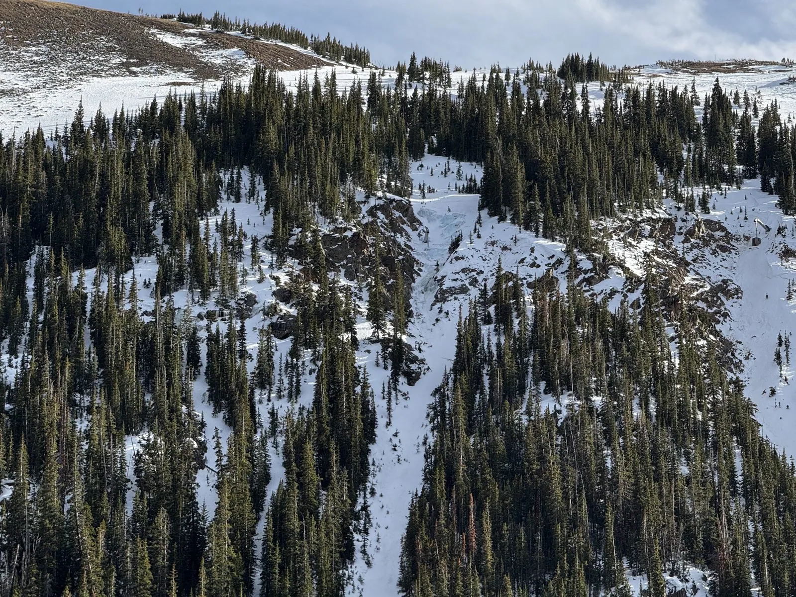
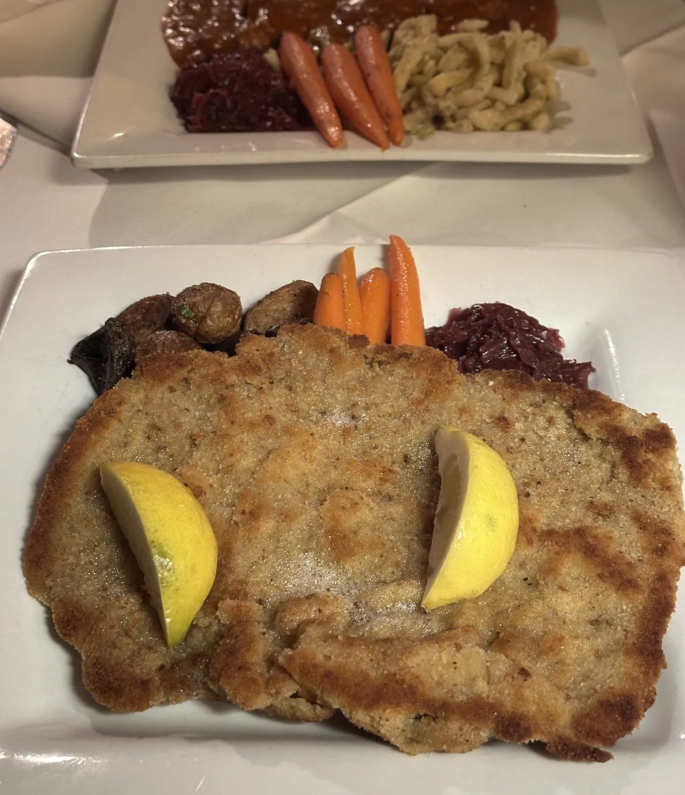
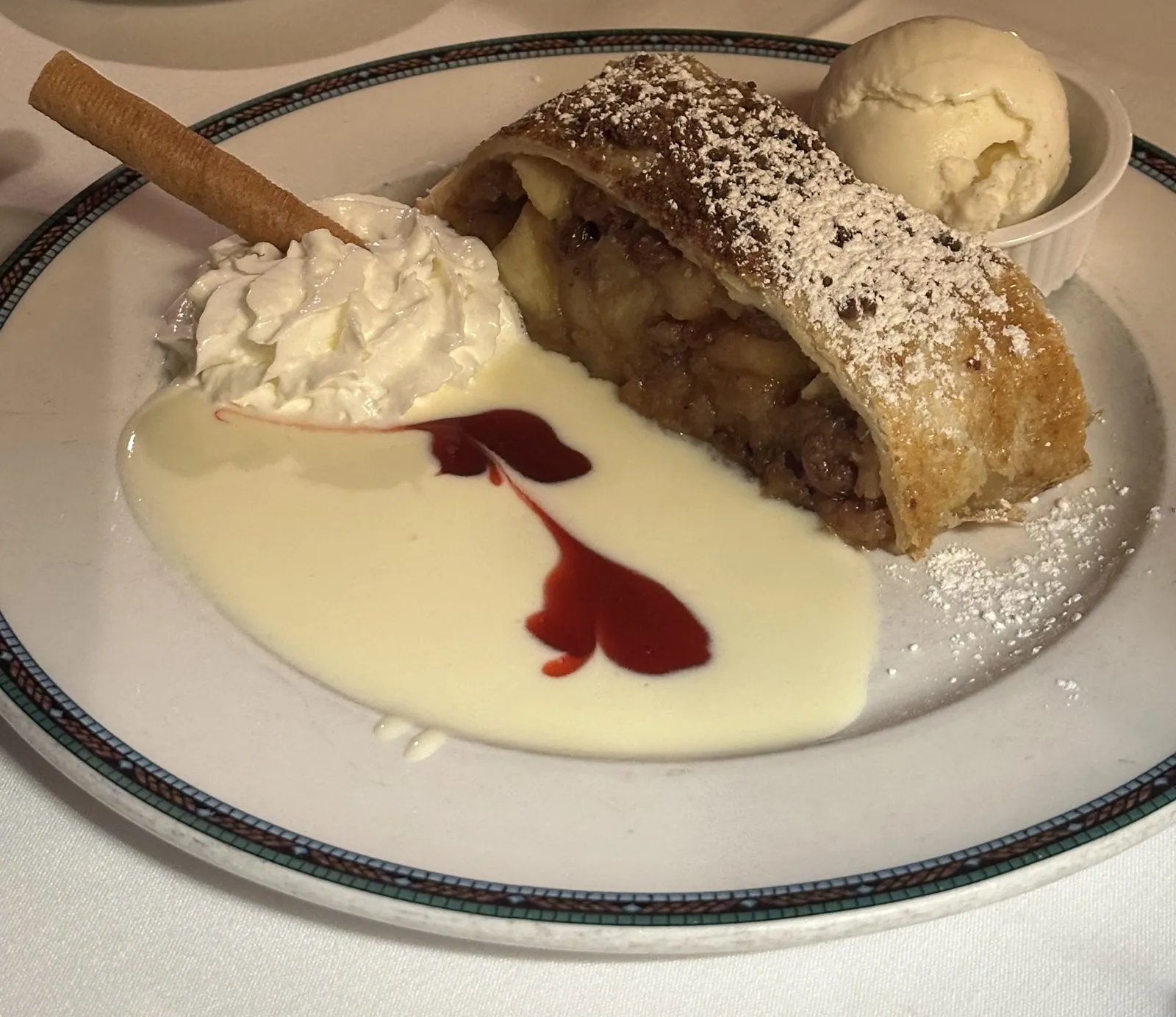
And there my camera roll goes quiet. The photo of that snowy slope, at 4:55 pm, is my last one for almost twenty-two hours, and not because nothing happened. We kept going: over the Divide to Vail, where we had dinner at Pepi's, an Austrian restaurant (Wiener schnitzel with red cabbage, and apple strudel in vanilla sauce), then down the far side of the Rockies, across the whole width of Utah in the dark, and down to St. George in the state's southwest corner, where we pulled in at the Hampton Inn at five in the morning. That is a full night's drive after a full day, and none of it was photographed. I'd love to tell you about it, but the phone was apparently as tired as we were.
Day 4: St. George and Las Vegas
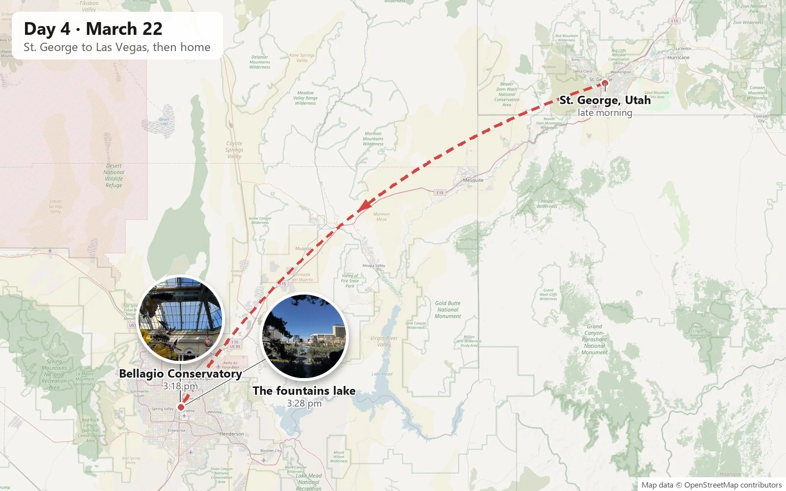
We slept until about eleven, which after a night like that felt like an achievement, checked out, and bought a Swig cream soda of genuinely alarming size for the road. Then it was down I-15 through the Virgin River Gorge and across the corner of Arizona into Nevada. Our car is electric, so Las Vegas was a natural place to stop and recharge it, and while it charged we went to look around.
The record resumes at about half past two on Sunday afternoon on the Las Vegas Strip, with pastries at Caesars Palace, and the contrast with the day before could hardly be sharper. The afternoon before, we had been looking at snow, firs and mountain highway; now we were in the warm desert sun, shoulder to shoulder with what looked like half of Nevada, inside the Bellagio Conservatory next door.
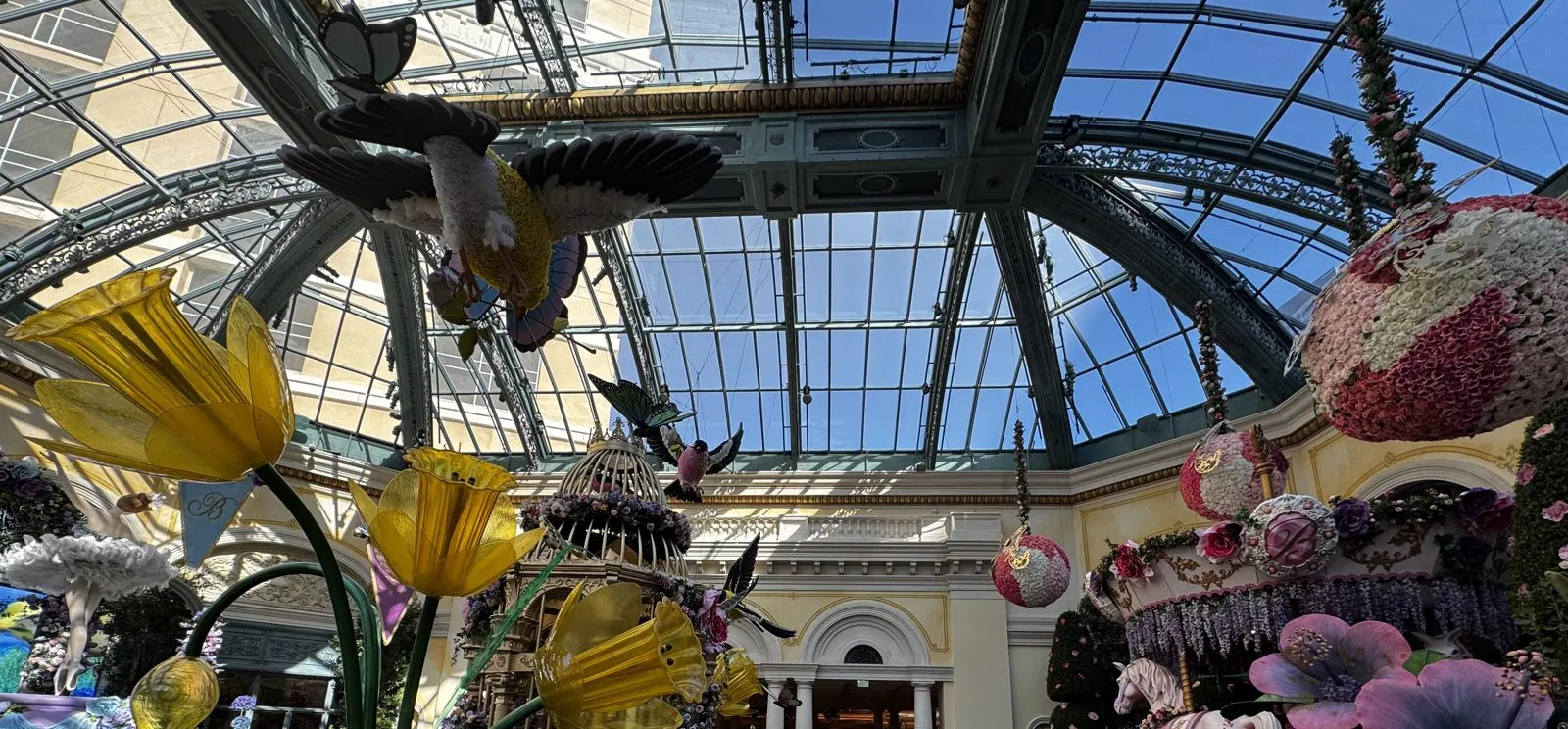
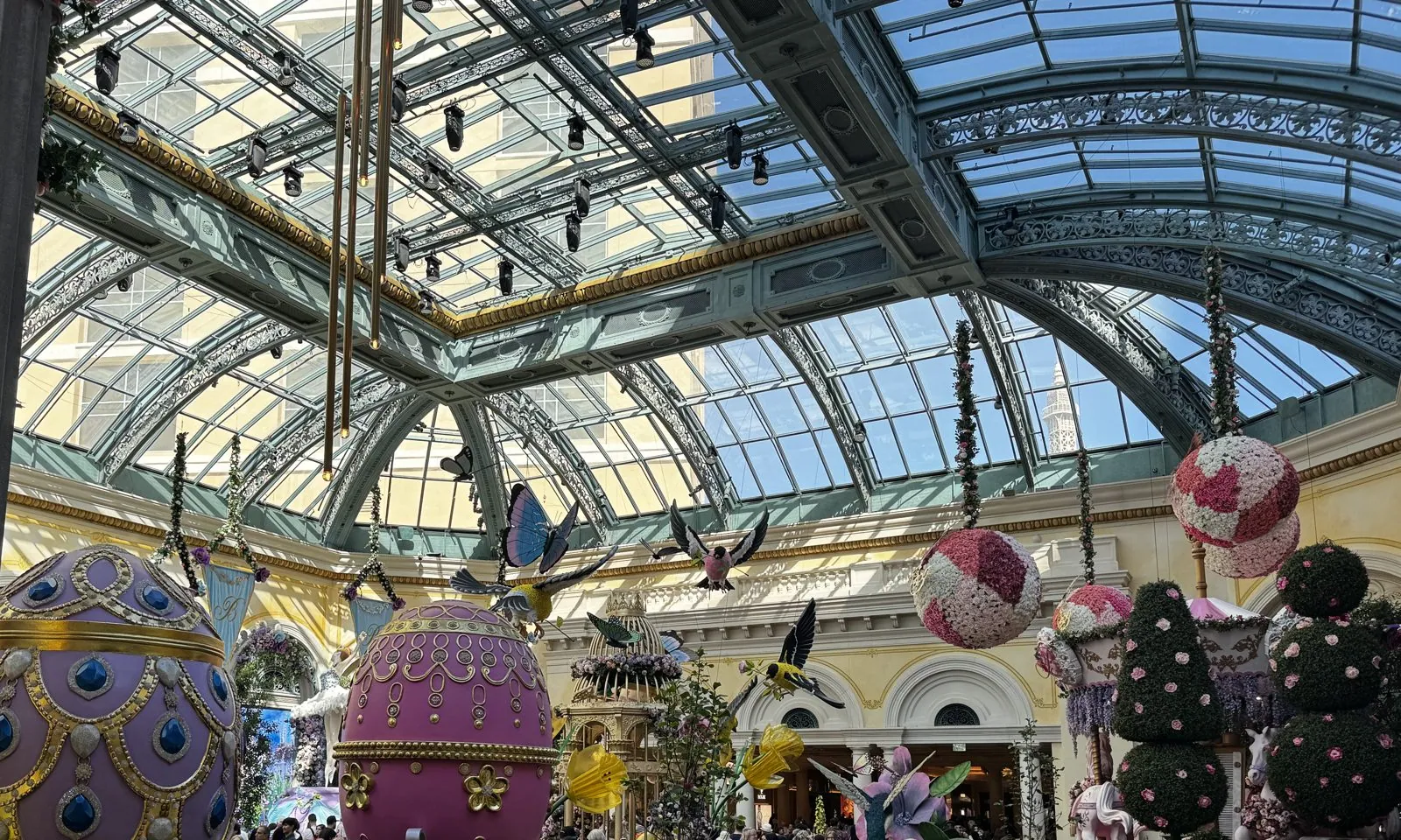
The conservatory is a great glass-roofed hall, with iron arches and a cream-and-gold Beaux-Arts arcade around the edges. It has been there since the Bellagio opened in 1998, and its gardeners replant the whole thing several times a year, for Lunar New Year, spring, summer, autumn and the winter holidays. It is free to walk through, which is why it is always packed. We caught the spring show. Giant yellow tulips on stems taller than a person arched over the paths, beds of real flowers filled the floor, and enormous balls covered in roses hung from the ceiling like ornaments.
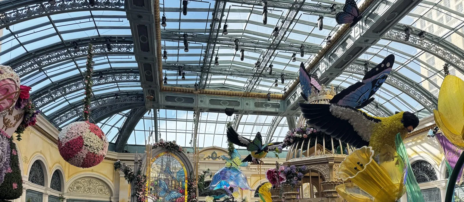
The theme seemed to be birds and eggs. Huge sculpted songbirds, yellow and black like goldfinches, swooped overhead between giant butterflies, and a gilded birdcage stood in the middle of the beds. Two decorated eggs taller than a person, one lilac and one pink and studded with jewels like Fabergé eggs at the wrong scale, stood at the far end among clipped topiary. The noise in the hall was a constant warm roar of voices, and every few seconds someone held up a phone to take exactly the picture we were taking.
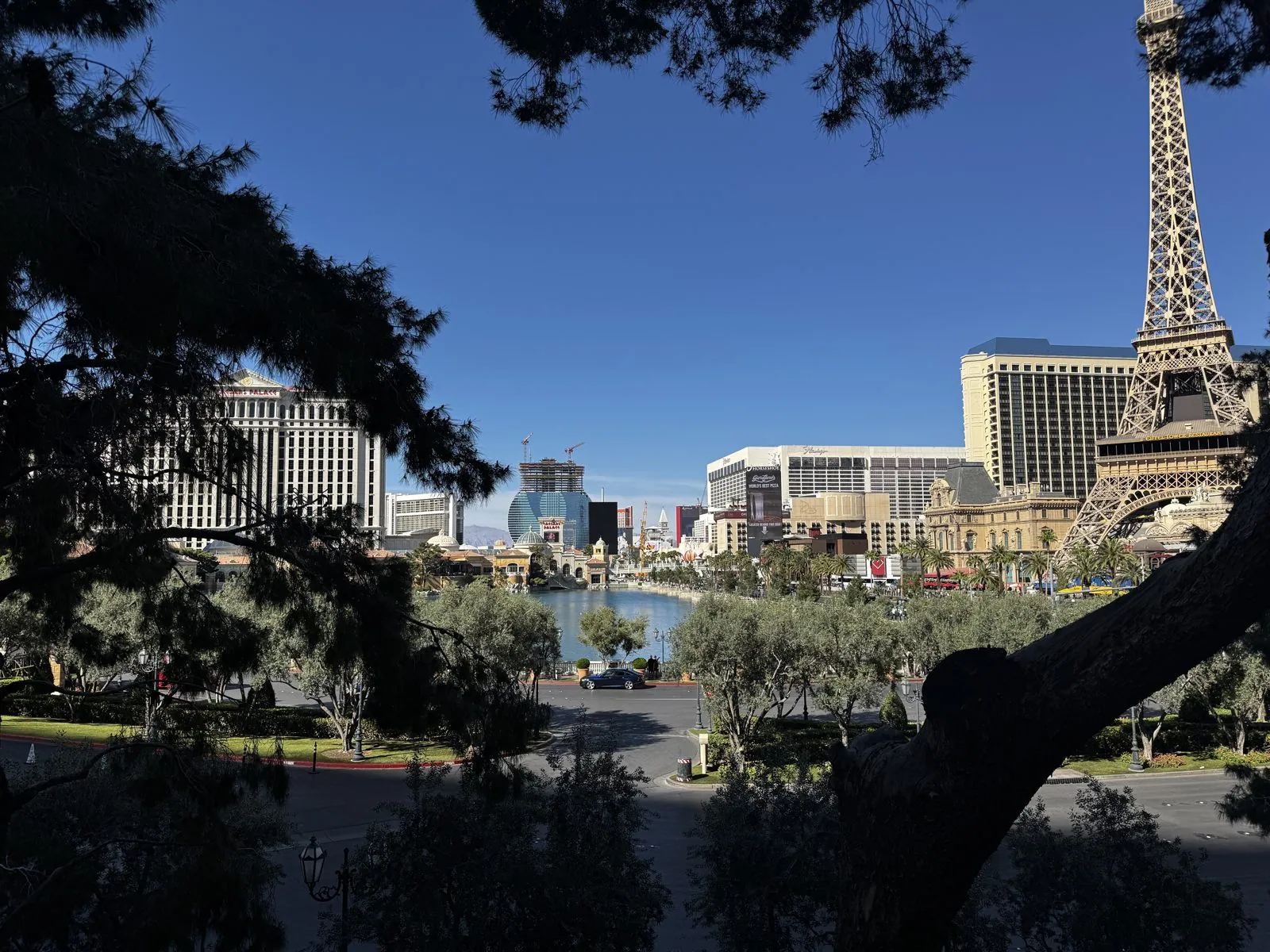
Outside, Bellagio Drive curves down past the lake toward the Strip. Through the pine branches you could see the whole of it at once: the water where the famous fountains dance on schedule, a skyline of casino towers, and on the right, the half-scale Eiffel Tower of Paris Las Vegas, pointing at a perfectly blue desert sky. In the middle, past Caesars Palace, stood the lower half of a giant guitar in blue glass, with two cranes on top: Hard Rock's guitar-shaped hotel, going up where the Mirage used to be. It was 3:28 pm, and it is my last photo of the trip.
We had hot chicken at Hattie B's before leaving, and by about a quarter to six, with the car charged, we were on the drive home to Southern California, which has hardly any photos either.
Four days, four landscapes
Looking back over the camera roll, what strikes me is how little the four big stops have to do with each other. The first was a place the earth made by itself, slowly, out of an ancient swamp: no buildings, no trail, nothing but rock and the evening light. The second was a place people made, deliberately, out of what everyone else threw away, to see whether they could live without the grid. The third was a place where people took something the earth made and shaped it, just enough, into a room for twenty thousand ears. And the fourth was a building that imports the whole idea of spring, by the truckload, into the middle of a desert, and replants it five times a year.
The badlands, an off-grid town, a sandstone concert hall and a glass garden on the Strip: that is a strange sequence for one long weekend, and the driving in between was most of the trip. But the in-between is the point of a loop like this. You see the country change outside the windshield: Mojave scrub, then the high plateau, then sagebrush, then red rock, then snow, then the desert again. Every few hours you get out and stand somewhere you've never been. Four days, well over two thousand miles, and a dog who was happiest of all in a gravel parking lot at sunset. No regrets.
Maps built from the trip's photo timestamps and locations. Photo locations have been removed from the published images. Day maps: map data © OpenStreetMap contributors; each stop is placed where its photo was taken, hotels and home are never marked, and the dashed lines show the order of stops, not the exact roads.
Some photos in this post are my wife's.
Likes and comments
React with an emoji or leave a comment. Signing in with GitHub is required.